


Live Your Best Lives
Alum Cave Trail Reviews
4.8
3 of 103 Best Attractions in Great Smoky Mountains National Park


Reviews

Worth the Effort
The hike to the cave was about 5 miles round trip, with most at a steady upward pace. There's several logs to cross streams, a staircase cut into & through a rock, and finally a huge stone overhang. Extremely scenic hike.

Family friendly hike
If you enjoy mountain stream views thos hike is for you. The incline is very doable in most places, and slightly strenuous in other spots requiring those of us who mat not be in great shape to stop and take a breather before moving on. A wonderful afternoon stroll up to Arch Rock took my husband and 1.5 hours round trip.

Nice hike!
My wife and I did this hike and enjoyed it. We went all the way up to Mt Leconte. I highly recommend. Start early or you'll have trouble getting a parking spot.

Beautiful View (not at the alum cave some place in the trail)
This is my favorite hike in the entire park, but some advice: don't actually bother to hike all the way to the cave itself, because the nicest view is about 20 min before the cave marked with natural carved slabs of rock. Keep hiking until you find a spot with interesting rock formations, take some pictures, and head back down. I Definitely recommend this hike!

Non-hikers must be responsible for the 5 star rating
I don't get it. The trail itself barely meets the level of mediocrity in my opinion. Along the way there is not much to see other than the 2 photo ops at the arch and then the concave cliff. Neither one is all that great. Yes, there's the fantastic Mount LeConte Lodge at the top, but the Rainbow Falls trail and Grotto Falls trail are better routes up to the lodge.

Scenic hike
This is a beautiful trail! All ages could enjoy this, but it does involve an elevation change of 1200 feet, so take your time and be ready to climb. Get there early. We arrived around 9:30 am and had to park almost a mile away from the trail head. Take snacks and drinks to enjoy when you reach the bluff.

Very Nice Trail
This is a great way to spend the day for anyone staying in the Gatlinburg area. The first half of the hike is pretty easy. After you reach the arch, the trail begins to incline a bit more. Visiting the rock shelter is worth the 2 mile walk, but if you keep going you will arrive at the top of Mt Le Conte. Parking in the lot is limited, so get there as early as possible.

A rewarding experience
After visiting Clingman Dome, Cades Cove and Newfound Gap, I had time to pick one hike in GSMNP. This is the one I picked and I was not disappointed. The hike is of moderate difficulty. It passes by and over a number of beautiful streams and goes through a natural rock arch. The 'cave" is really the overhang of a cliff, but it is rather unique. The hike is certainly worth the experience. I was there on a Sunday and it pays to get there early for a good parking spot.

Hike to top
This trail is fairly strenuous, but the reward is worth the effort. Especially is you continue all of the way up the views are breathtaking. It is very busy and the parking area has a tendency to fill up. If you want solitude this isn't the trail your looking for, but is one you should t pass up.

This is breathtaking!
The hike to the Alum was challenging but totally doable. If you still have time and energy, keep hiking to Mt. LeConte. It's a little longer, but beautiful and doable.

Get Here Early, Parking is Limited
I love how this trail has different characters along the path as you hike it and the end point when you reach the cave bluff is amazing. Beautiful views and a nice point to get some chow down and relax. I say come here early because parking is a bit hard to come by

Beautiful Hike Along Stream
Today we hiked to the Alum Cave Bluffs and it was a moderate hike. The trail was well packed and the stream made the hike very cool. The cave bluffs are well worth the hike as you can walk under them. I highly recommend this hike!

WOW! excellent views with different experiences for the first half of the trail to second.
Our family included young adult and teens. We did the 5 mile round trip to Alum Cave while also seeing inspiration point and arch rock along the way. The first half of the trail had a gradual incline to Arch Rock was mostly wooded and following the creek. It had great spots to stop and look at or play in the creek. The second half of the trail became a little steeper but still manageable for families for younger kids and some older hikers. The trail became rockier and inclined more as you get closer to Alum Cave. Inspiration point has beautiful views of the mountains for hikers who stop and look to the left. Many folks were powering through this area and didn't even notice, but our group stopped and sat not he rocks for a bit to enjoy the view before proceeding to Alum Cave. The entire trail all the way to the Alum Cave had steps to help with the incline. Some of our group don't do a lot of exercise and just took their time going up and the return was all downhill so was very easy. I highly recommend this trail.

Great short hike needs more parking.
Wow! You can tell they have spent time upgrading trail, only negative is after 9 you are parking dangerously along hey 441. It’s very crowded trail. I enjoyed every step up. Challenging rather short hike. 2 and a half hours up to Alum Cave and back.

Enjoy a very steep trail.
A lot of beautiful views. Some parts of Alum Cave Trail, to Mt Leconte, is very steep. I enjoy Rainbow Falls to Mt Leconte. Rainbow Falls Trail is not steep comparison to Alum Cave Trail.

Smoky Mountains makes the Fall better..
Beautiful, Peaceful.
Very pleasant in Fall season.
Great get away spot for families, couples, friends etc,.
Loved the view.

Beautiful, Challenging, Rewarding
This is not your average Hike. My Family Trained for 3 months to make this hike. You start at an elevation of 4500 ft and climb to 6593 ft, over a 5.5 mile trail, up. Mt. Loconte Lodge is at the top. They have cabins, but i hear its a lottery to book them. There is food, Fresh well water, and souveniers at the top, if you make it.They sell special t-shirts you can only buy at the top to commemorate your achievement. Gear: Good Hiking shoes, wool socks, i used a walking pole, camera, camel back water packs and protein and carb snacks, and a bear bell, however we did not see any, they usually run. Please dont leave any trash or food behind, brings in the bears. if you can stay the night, its worth it, but expensive. If you hike up and back down like we did, I suggest you start your hike by 7am, Its a little over 11 miles up and back. Keep up with weather reports prior to your hike, storms are not good, which is what happen to us at the top, we had to hustle back down. Going back down can take a toll on your knees, like mine, middle age sucks.It was fun, beautiful, hard, and became a mission to complete. We completed it, and will never forget it, have fun. Alum Trail, best hike.

Enjoyable hike
Hiked to Alum Bluffs in late July with family. Went late afternoon ave parking spaces were opening up from morning hikers leaving. Easy access to trailhead.
2.3 miles with nicely maintained path that is mostly 2 wide and some places 3-4 wide.
Mostly uphill but fairly gradual. Arch is really cool to climb through. Cave bluffs are quite expansive and a nice rest spot. Would have liked to went up to summit of LeConte but kids were pretty tired.

You won't regret it
Hands down a beautiful hike. One of the best in the smoky mountains. The hike is strenuous uphill, but the sheer beauty and breath taking views make it worth it. My five year old made it to the alum bluff cave. Be careful of slippery rocks and do not go near the edge of the trail. Take a camera, good hiking boots, and emerge yourself into the beauty of what Mother Nature has to offer.

Great Trail - definitely stretch before going!
We hiked the 2.3 miles to the cave and back on a Saturday in October, 2022. The trailhead was very busy. We arrived at 1:30 and parked about 1/4 mile from the trailhead.
The trail is beautiful with a lot of lush green vegetation along the trail and creek following the trail about 1/2 way up.
The trail is definitely moderate especially considering it is 99% uphill especially once you reach Arch rock. It took us and my nine year old about an hour and 40 minutes to reach the top.
It has been dry around this area and there were still muddy spots on the trail. So I imagine if you’re going during a time where precipitation has been on average or above average, then you’ll need shoes that you won’t mind getting muddy and/or might even want waterproof shoes. This is not a trail for sandals and flip flops. Wear good hiking shoes or tennis shoes with good tread.
The cave area is filled with a lot of fine dirt and dust. You’ll get filthy. Be prepared. Take more water than you think you’ll need.

Easy, beautiful hike
A group of 5 of us varying in age from early 20's to mid 60's hiked this trail last week, up to the Alum Caves Bluff, which was about 2.5 miles up the trail for a round trip of 5 miles. It is a beautiful trail that follows along a stream with small waterfalls, and has several very cool footbridges to cross. At about 1.5 miles, you reach Arch Rock, a very impressively eroded rock that you can hike through, and eventually you reach Alum Bluff. The 'cave' is really not a cave but a huge rock overhang that is gorgeous. Along the way there are many incredible vistas of the ?Smokies. The trail is very well maintained with few obstacles like tree roots. It includes several series of stairs cut into the rock. It took us about 3 hours to complete at an easy pace. This trail continues on to Mount LeConte which adds about another 2.7 miles to the one way distance.

Go all the way!
Too many people turned around and went back to their cars after seeing the Alum Cave. Keep hiking and get to Mt. Le Conte, then keep going and go to Myrtle Point. We hiked this morning and it was so foggy and beautiful. Took us 6 hours to hike the whole trail, but that included stopping to take pictures, lunch and nosing around the lodge area, approximately 12 miles in all. Pretty great. It was strenuous, but not Yosemite Half Dome strenuous.

Beautiful
This was a beautiful hike. Took my 50 y.o. husband and 46 y.o. self two hours to get to and from the bluffs, and I’m not in great shape. We started at 8am on a Thursday and it was not terribly crowded. By the time we left at 10 it was crowded. Maybe 20% wore masks as they passed. This hike was gorgeous. Multiple tiny falls along the trail. A few log bridges. And you walk right through Arch Rock. I just loved this hike. For those who want to go farther, you can go past the bluffs to the summit of Mount Leconte for about a ten mile hike round-trip. We only went to the Bluffs and back (about five miles) and the view was magnificent. This was not an easy trail by the way - we saw families starting the hike with little kids just as we were finishing. Not sure I would do that lol.

worth to take a walk, at least go to the "Arch Rock"
I see a picture of the steps inside a half cave, that's the iconic picture of the Alum Cave trail, which attracts me to go to hike this trail, that iconic picture is the "Arch rock" which is 1.4 mile from the trail head. I know this trail is very popular, so we went there early, before 9am, although the parking lot (which only has 20-30 space) is full, you can park the car along the road side, so there is still plenty of spots you can park. The trail is moderate, there are some bridge only made with a log, the width is only enough for 1 person. After passing the Arch rock, we continue to walk up to the Alum Cave Bluffs, where is a dried area, most people go to this point, then walk back, but you can continue to go up to the Mt. LeConte if you are physically fit and have enough time. If you plan to to go up to the Mt. LeConte, then you better start the trail earlier as it was 5 mile one-way from trail head to Mt. LeConte, but we only went to the Alum Cave Bluffs which is 2.5 mile one-way from the trail head.

Nice Hike
We arrived late on Friday afternoon and chose this because of reviews and length. It was a nice hike, but nothing outstanding. Definitely better views from other places. Hike was uphill half the way (pretty obvious in the mountains that that will be the situation!) but wasn't too steep.

First hike
I am not a hiker by any means but I read a bunch of comments and figured I would give it a try. For my first hike ever it was great! A little tough on the up hill parts but I made it to the cave in an hour or so. Has amazing views.

Smoky Mountains in one trail
With the improvements taking place on this trail, it is one of the best trails in the smoky mountains. With the 2.3(+/-) mile hike (one way) you get to see nature at its best. It is an easy climb to the Arch Rock. From there it is a steep climb (approx. 2700ft) up to the "cave." If your not up to the steep hike at least go to the Arch Rock; that is a site in itself. Also past the Arch Rock is where you will get the most view of scenery. It is a fun hike. The "cave" is not a cave more like an area that was dug out. Actually, I think it was used as a source of saltpeter for gunpowder during the civil war - I may be wrong. Saltpeter is everywhere and you can smell it. It is depressing to see all the dead trees up there.

Great trail-not too strenuous
I had always avoided this trail because it is not only rated as strenuous but it also has cables. I was thinking they were like Yosemite cables on the Half Dome which are on sheer rock and I surely didn't want to do that. At any rate, we decided to give it a try. We only went as far as the Alum Cave which is about 2.2 miles from the trail head. There have been a lot of improvements made on this trail and there were very few areas with roots and rocks. The cables were like a railing on some steps but were not like hanging on to a cliff. .....not at all scary. I found this trail to be way less strenuous than Chimney Tops which we had done a few days before. If you are in reasonably good shape you shouldn't have any trouble with this trail....it's not too steep and there aren't a lot of steps, The Arch Rock is really cool as is the cave area (it's not really a cave but a tall rock overhang). This is a very popular trail and it's closed Monday through Thursday for maintenance so if you want to get a parking place and you don't want to hike with lots of others on the trail, it is best to go early. We started out at about 8:45 and only passed two others couples and when we arrived at the cave area, we were able to get good photos without any people in them. By the time we had eaten our snacks and had a drink, the place was packed with people and it would have been impossible to get a good photo. I would have liked to continue all the way to the top of Mt. LeConte which is another 2.8 miles but we had company coming so we had to turn back. If you start early, it would be a nice day hike to the top and back. It's also a really pretty trail and you don't have to be constantly looking down for rocks and roots so you can really enjoy the surrounding beauty. We made it up in about 1.5 hours and down in about 45 minutes.

Fun moderate hike on a popular trail
This is a really fun and popular hike to the Alum cave. It’s really just a large overhand so don’t get too excited, but there is a really cool pass through a small cave at one point. The parking is insane, get here early to get a decent spot. I was hoping to continue climbing past the cave all the way up to Mt. Leconte, but I had my 11 month old on my back and that slowed me down enough to not be able to do the hike all the way to the top. Either way, this is a great trail and is only moderate in difficulty because of gaining elevation.

tough but worth it on a clear day
we hiked this trail on the way to leconte lodge. we enjoyed the overlooks though the weather wasn't great. there are a number of cables and stairs; a lot of work has been put into maintaining it. it's well-marked (no blazes but no need for them either). we went up to lodge, shelter, cliff tops, myrtle point. no views at the summit (cairns) but great sunset at cliff tops. the bluffs and the cave/arch rock were cool. worth doing on a clear day. it took us 2.5h up, 2h down.

Gorgeous and different!
The "cave" is huge and majestic feeling! LOVED this trail! There's variety to keep you entertained! Typical running stream, a gorgeous summit, and majestic cave. I would go back for sure!

Wonderful hike!
A beautiful and amazing hike with breathtaking views! Definitely need to be active and in shape but well worth the effort!

We hiked with young kids!
On the foggy Saturday of Memorial Day weekend, my husband (age 72) three grandkids ages 5,8,10 (with little to no hiking experience but LOTS of 2020 backyard trampoline time,) along with myself (age 70), a son of my cousin and his two sons, (ages 5,7) hiked to Mt LeConte (along with many other hikers). Another younger cousin and her 5 year old daughter bowed out a week before after reading ‘scary’ reviews of some children’s experiences. I’m here to add my thoughts about taking kids.
These young third cousins from two families had never met. They bonded instantly over this shared experience and I think (silently) encouraged each other to press on when it was tough. It is rated difficult for a reason. My husband and I were particularly out of breath at the top.( 6500 feet elevation!). One 5 year old led the whole tribe 75% of the time! She lagged only when it was hours past her usual nap time, but rallied well on top.
At no time did we adults fear the drop offs for ourselves or for the kids. The ledges look scarier in pictures than in person. The trail can be wet with frequent water run off areas across or right on the trail, and some of our shoes were pretty wet by the top, but they dried overnight at LeConte Lodge. Wear wool socks. There are frequent steel wire hand- hold railings next to difficult or slippery parts.
We took advice of others and brought sweets: bubble gum, skittles and tootsie pops for incentive. Each kid carried their own water and snacks and sleep outfits. We stopped often. People offered great encouragement to this band of young’ uns which probably helped them too...
It took 5 hrs 25 min to go up, 4 hrs 15 min to come down. Personally I would never have done the round trip in a single day with kids (or by myself.) Plenty of adults did just that though.
We had a sunny glorious sunny Sunday morning and climbed further up to the western view where we were literally above the clouds, viewing the top of Clingman’s Dome before heading back down. That part wasn’t so steep.
We helped create a lasting memory between siblings/ourselves and the grandkids, and helped cousins meet and bond well. The mind directs the body. Each person is different. My husband doesn’t really enjoy hiking but plowed on step by step for the sake of others.
We are so happy we did this. We hope it added to their resilience banks.

Awesome
This is an amazing site to see. Get there early as there are many that come who are generally not equipped to make that type of journey. Absolutely amazing to see.

Awesome hike...
Did this hike midweek during peak season but on a rainy day & avoided the crowds. We passed the trailhead on a beautiful afternoon & it was packed with cars parked on the road so we waited to go back. Even in the rain, it was a picturesque trail winding along the river with small bridges then headed uphill through Arch Rock & up to the cave/bluffs area. We did not go up to farther point. Did not see any wildlife. It took us under 2 hours for round trip 4.4 miles) but we passed other more mature hikers taking their time. Bring water. Despite the fog it was a great hike.

Magnificent! A bit more rugged, but worth it.
This hike was recommended by a number of different people, and we were repeatedly cautioned about how crowded it would be.
Because of its location and ease of access from Gatlinburg and Pigeon Forge, being along the main road through he National Park (NP), it isn't a surprise this is a popular site.
As with all hiking trails within the NP there is limited parking, with a few scattered spots along the road before and after the main parking, requiring patience.
The entire trail is paved and has a mild, nearly continuous, incline throughout. Although considered an easy trail, and not very long (4.6 miles, 10.2 km) round-trip, precautions should be taken for those with cardiac and pulmonary conditions, and even lower extremity issues, because there are no facilities in case of emergencies.
It is also very important to consider this is still a wild environment and not a zoo, with continuous bear activity.
It is recommended to avoid this trail during weekends because it is simply a continuous trail of people and it loses the beauty of the serenity and tranquility around the hiker, and you can't enjoy the sounds of nature.
The trail follows along the stream almost the entire length of the trail, providing for additional beauty of the multiple cascades/cataracts along the way the provide for a peaceful melody of the water in nature.
Along the path there is an arch through which the trail passes with a steep staircase this is a nice bonus along the path to give an additional incentive to keep going.
The "cave" at the "end" of the trail--the trail continues well beyond the falls to Leconte Lodge--is not really a cave but a very large overhang, is nearly always has a moderate number of people resting and enjoying the views.
You will have to practice a large amount of patience, or visit very early in the morning or later in the afternoon, if you want to capture a some incredible images of the mountains and valley. Just remember, those are also the most active times for animals, and there is a good chance of an encounter.
This is not a trail for those not wanting to put in the effort, for those with medical issues because there is no medical services available.
This is definitely a hike for those who wish to enjoy the NP and the splendor of the Smoky Mountains, including the beauty of walking through the forest and along the mountain vistas.
One of the best trails in the NP.

Great trail
This was a great trail! Highly recommend! Make sure you get here early- it gets quite congested. This hike is moderate to strenuous for sure, but the natural rock cave and the view from the bluffs was awesome!

Great Views from the bluffs
We enjoyed this hike. Parking is somewhat of an issue, but there is a brand new lot close by with a rest room. The entire trail is well maintained and offers spectacular views. The bluffs are a good place to have a snack or lunch. We wanted to forge ahead to Mt LeConte, but did not have enough time. Leave early if that is something in your plans.
If visiting the smokies, this is a good trail choice. Wear appropriate hiking shoes.

Challenging hike with dropoffs.
If you like hiking and want a challenge, this is for you! Gives you a great reward when you reach the top of Mt LeConte! The view is wonderful!

Great variety of features on a reltivley short hike.
I love this trail for the variety it offers. It begins by following a stream (Alum Cave Creek and Styx Branch) through heavy forest, then passes up and through a place where I suppose the stream once flowed underground (Arch Rock) before leaving the stream altogether and hiking out along a narrow ridge which offers some tremendous views and then ending up at Alum Cave (really more of a bluff). History lovers can find an extra reason toenjoy the hike as well since the "cave" was minded for raw materials used in the manufacturing of gunpowder during the Civil War.

STUNNING!
I can't say enough about this incredible hike, except that I was unprepared for it! ha! It is just about the most beautiful hike I've ever taken, but the elevation gain is tough. Would've liked to continue on to Mt. LeConte, but we just didn't have the stamina. Maybe next time!

Great hike for all ages (group of 12 ranging in age from 10 to 56)
We were looking for a reasonable length hike that our entire group of 12 ranging in age from 10 to 55 could handle. This hike was perfect and we all loved it. It has interesting features -- passes by the beautiful Alum Cave Creek which has some nice rocks for some great picture taking, Arch Rock and then finally Alum Cave Bluffs. Arch rock is about 1 mile from the start and has a flat log river crossing with wood hand rail and then built in stairs to go through the narrow tunnel of the arch. There is a "hand rail" made from a cable along the stairs to assist with going up the steps. None of this was steep or scary. You then continue to Alum Cave Bluffs which is 2.3 miles from the start (so an additional 1.3 miles). When you get up to the bluff, you're rewarded with some nice views and a cool spot to take a break, eat a snack, and take some great pictures. If you decide to continue to Mount LeConte, it is another 5 miles one way. There is a decent-sized parking lot at the trailhead but it is always a good idea to go early in the summer / touristy months as it is typically overflowing due to the trail being a favorite for overnight stayers at the LeConte Lodge (which is an actual paid lodge with meal service -- can only get in by lottery due to demand and they have to pack all the supplies in via llamas). If the parking lot is full, most people just start parking along the road. It late June it was in the low 50's when we started, so all the women on the hike wore lightweight jackets -- which we of course removed as we got heated up. With the additional exploring my GPS read 4.9 miles and ~2.5 hours by the time we got back to the parking lot (some in our group stopped to take lots of pictures). Since this was such a short hike and relatively close to Clingman's Dome (only another 12 miles away), we went there afterwards which probably added another 2 miles of walking to our day (we had to park on the side of the road, fairly far from the trail head due to the congested parking lot). If you really want to see Clingman's Dome this is a great option. Our group was not blown away by the Dome and said it definitely is not a "must do". Overall, we really enjoyed the Alum Cave hike and rank it up there with Ramsey Cascade and Charlies Bunion.

Great trail
This is a must visit place.
Great trail, awesome views and nice attraction on the road. You don't need to go way to the top, most of the time the top of the mountain is in clouds and there will be no views, but you must check the Alum Cave Bluffs and the Arch Rock.

Loved this hike and would highly recommend it!
We did a couple hikes during our time in the Smokies and the Alum Cave trail was the best. It is about a 5 mile round trip which was perfect for our family with kids. The first part of the hike takes you along this shaded trail along a beautiful stream. At one point on the way back we stopped and let the kids play around the stream jumping from rock to rock. As you climb higher, you start to get awesome views of the surrounding mountains. The uphill hike is a little strenuous but not bad at all. The Alum Caves at the end are neat, but nothing spectacular. Some people continue on to hike the peak of Mt. LeConte but that would have been too much for us.
We loved this hike and would highly recommend it!

Great hike to the bluffs. We are beginners and made it!
My wife and I are hiking beginners and this was our first trail that we have hiked in the Smokies. We are in "average" shape and do not work out.
We hiked to the Bluffs and back, approximately 4.6 miles round trip.
We loved it! There were some spots, particularly after arch rock, that get kind of steep, some with stairs and some without. We took it slow and stopped to catch our breath as needed. The last stretch before the bluffs features a lot of steep steps.
Once we got to the bluffs, we were able to sit on a rock and eat some snacks. Both inspiration point and the bluffs offer incredible views.
We didn't go all the way up to Mt. LeConte because we didn't plan on spending the entire day hiking and it was another 2.5 miles up the mountain.
We arrived at the trailhead at 7:45AM and easily found a parking spot, but it was filling up fast. We got back to our car around 11:15AM and the parking lot was packed. I would suggest getting here at sunrise and starting your hike.

Beautiful views!
This hike had beautiful views! The only thing I wish they had were trail markers so you knew how far you had gone. We didn't make it to the top because we weren't sure how much further we had to go, and we had other things we needed to do that day. It was amazing though, so I definitely recommend this to avid hikers!

Amazing trail to the Arch but beware the slippery cave’s slope at the top!
My husband and I took our almost 2 year old to the Alum Cave Trail because it seemed like a really popular trail for all ages. Little did we know the difficulty from the Arch to the Cave was rather advanced! Very beautiful and not packed even though there was hardly any parking and we had to park 1/4 of a mile away from entrance. It was worth it and our daughter slept the entire way down the mountain. We had rented an Osprey Carrier from the NOK (at the foothills of the mountain in Gatlinburg). Thank God for that too—super great price $20 or $30 for one day, then $10 every day after that. There were no bugs at all; a lot less than we expected or maybe our bug spray really worked! The pictures are worth more than any review! One thing I highly stress is that if you are traveling with children that are too big to carry and you happen to go all the way to the alum cave, do not let them walk around up there. A 12 year old girl tripped on a rock no where near the edge and fell head first down the cliff and was caught by travelers on the stairs going up to the cave. It was the scariest trauma we have ever witnessed, the mom nearly fell going after her. Several bystanders rushed with medical supplies and fixed her up. The girl walked back down the mountain with her parents limping and bandaged knee. Very very slippery slope of dirt and trip/falling hazards.

Highlight of a short weekend trip
Hiking this trail was a highlight of a short weekend trip to Gatlinburg. Only went to the cave bluff and back, but felt it was challenging enough.

Family and friends hike
We enjoyed our snowy hike on Alum cave trail while visiting Gatlinburg with family friends. Because of the unexpected spring snow, it was overcast and we weren’t able to take advantage of long range views. But it was majestic indeed! Kids age 7 and up hiked the route to the ‘cave’ and back with us. Definitely a must do hike!

Great hike
My husband and I completed this hike with our toddler on our backs. We hiked all the way to the top and got to see all kinds of wildlife to include mice, deer, and a bear. We completed the 11 mile round trip in 4 hours and 15 minutes. The trail had great views and some good photo ops. I can’t wait to hike the rest of the trails. I will admit the hike after the bluff is a bit grueling with a toddler on your back, but would be easier for the hiker without a heavy load.

Great Hike!
We started the Alum Cave trail early to Mt. LeConte. As like everyone else has said, trail is very steep. A L O T of stairs-which I was not prepared for. Views made it 110% worth every step.

Visit to LeConte lodge
IMO best trail to get to the lodge. Not terribly strenuous. Trail levels out some after assents so one can have a breather. Some places trail is on bald spots use the hand holds.
Walking stick helps!

Starts easy and then the elevation kicks in but absolutely worth doing!
We did this trail as part of our hike up Mt Le Conte. It starts out very easy as it follows the stream and there are some lovely foot logs (bridges) to negotiate but once you get to Arch Rock (so cool - one of the high points of the hike) then the elevation gain really kicks in until you reach Alum Cave after about 2 miles - you will have earned a breather and the the chance to admire the amazing views before making the trek back down.

Amazing if you go early
This trail was so fun. We did the full trail to the top of Mt Leconte and has so much fun. We got there at about 7 am and the parking lot was filling up already. The trail is easy until the cave. The second half to the summit is very rough and steep, but SO WORTH IT.
As we descended we saw a lot more people. Every 50 yards we had to pause so someone would pass. I think start the trail about 530/6 am and you’ll be done by noon easily and beat most crowds.

Favorite Gatlinburg Trail
The trail was under 5 miles round trip. It was mostly uphill on the way there, including many rock steps. Our group of active teens and adults did it in under 2 hours. I would not recommend for anyone who is not stable on their feet, cannot walk 5 miles easily, or for smaller children who you wouldn't want on a 3 ft wide trail with a big drop off on one side.
The trail runs along a beautiful creek. The heavy rain before we went led to some awesome pics of the kids sitting on branches over the rushing water. As you neared the cave, there were amazing views of the mountains and valley in between. The cave wasn't really a cave, but was an interesting rock formation that was worth seeing. Very glad we did it!

One of My Favorite Smoky Mountain Trails!
Nothing beats the variety this trail has to offer. The views and the walk along the river are peaceful and beautiful. Because it is popular, we always try to get to it early. While I still haven't had the chance to make the hike all the way to the top (we never seem to have the time), the views along the way to the bluffs are worth it. We've done this trail with young kids and teens. It's feasible for all, it just takes more time for some. Someday I plan to finish it to the top of LeConte!

Great hike
This is a popular hike so if you don’t want to hike nose to tail get there early (also if you want a parking spot! Scenic, nice views at the bluffs. We were in our way to Leconte lodge
It is STEEP

One of our favorite hikes!
We arrived around 1:00 on a weekday and parked close by on the road by one of the parking lots. Both lots have access to the trail. We parked by the one with the restrooms. We only hiked to the cave and found the scenery along the creek just beautiful. It wasn't very crowded. Stopped on the way back for a snack and drink from our packs. It took us about 3 hours.

Great family hike
Outstanding hike, great scenery. But very busy. Two teenage boys were impressed, which says a lot. Not horrible grade. Limited parking but able to park on side of road. If you have children, Drop family off then driver moves car is my recommendation so small kids not walking beside road. Restrooms near trailhead.

Winter backpacking trip up to Mt Leconte
As always, this is my favorite trail in the Smokies for hiking and or backpacking. Specacular views.....always. Highly recommend some sort of traction for your shoes as there is often ice. I use Kutula micro spikes. Water source is an easy walk from shelter. Always bring rain gear as a safety measure...even when warm it can be rainy and chilly! Top elevation is over 6400 feet. It can snow from Oct into April so always be prepared.

Beautiful yet hard
5 miles round trip. Our family loved the scenery and the cave. You can continue on but it was very steep and our family couldn’t have done it.

Moderately difficult, but worth it
It takes about 2 hours with moderate trekking skills to get to the Alum Cave Bluff and around an hour to come back.
Please note that this is 2.3 mile mark that I am talking about. If u want to do the summit, it is a total of 5.5 miles, which takes about 4 to 5 hours just to go to the top and 2 hours to come down.
Also, please be aware that you may encounter a bear on the trial. We saw a bear on the trial head around 2 mile mark and thankfully, we were not harmed.
The Alum Cave Bluff is worth the hike. Views just before the cave are awesome and the cave itself is really good.

Perfect for what you want.
Moderate hike. But if you are looking for easy, just go part way. If you want difficult, then go all the way to Matt LeBlanc. This is an incredibly well worn path. There are no markings. You don’t need any.
There are no-flush bathrooms at trailhead. Make sure to go before you go. There are few secluded spots for such necessities on this trail.
Those hawkish looking birds are Peregrine falcons. Pretty cool.

Awesome hike!
This trail stays along the stream for quite a bit. The stairway through the rock was an awesome site. Its one of the most popular hikes so go early to find parking and to beat the crowds. I would definitely recommend.

Moving water all around
We hiked up to arch rock, anout 1.5 miles up and the back, total of about three miles round trip.
Some areas were a bit steep but the path was easy to follow
There were rapids and spill overs (mini falls) all the wat up.
Spectacular viewing.
When you got to arc rock, which was actually more of a cave you could climb up the rock stai case for another spectacular experience.
I will warn you, get there early, before 9am if you want to be able to park.
If you have time (we didn't) continue another mile to the bluffs,

GREAT OUTDOORS!
Absolutely beautiful...hiking, creeks, bridges, wildlife...so serene and peaceful. Not extremely strenuous if you don't want it to be so great for the whole family. If you want to hike hard go to the top, if just a little you don't have to go far to enjoy 100% of the feel.

Beautiful
We hiked to Alum Cave in early June with our 12 and 9 year old. It was a Wednesday at 9:30 and we had to park almost a mile away from the trailhead. We really enjoyed the variety of scenery - streams, bridges, rhododendrons in full bloom, the arch, sweeping views and ending with the cave. We stopped several times along the way for pictures on the way up. Once we reached the “cave” I was leery of the loose dirt and incline so we didn’t venture to much farther along. We really enjoyed the hike.

An experience to remember
Ask at the Sugarlands Visitor Center near Gatlinburg how to get here. Once here, its mostly uphill, at times gruelling, definitely challenging. Well maintained path that leads up to 6,600' Mount Le Conte approx. 5.5 miles from the trailhead. There are spectacular views from this High Top but it'll take you 4.0 hrs + and maybe you're better off enjoying the wonderful views from the paths, ledges and landmarks along the way. It's 1.3 miles to Arch Rock, 2.0 miles to Inspiration Point, 2.2 miles to Alum Cave Bluffs and 2.6 miles to Gracie's Pulpit (last accomplished by 92 year old Gracie McNichol). After the Pulpit, there are many steep sections with cable handrails to help guide you, but it is those sheer drop offs that need your complete attention. My early sunrise start helped me stay cooIer. Wear sturdy shoes. Carry lots of water. I ran out so cheated with some from a clear stream. On my journey I came across narrow bridges, colourful flowers, mushrooms, assortment of tree and some cavorting birds. An experience to remember.

A Favorite Hike
The hike on the Alum Cave Trail was one of our favorites while hiking The Great Smoky Mountain National Park. The elevation change is always a nice welcome challenge but the views from the trail were impressive. Nice to see large areas of rock on the trail and not just all trees. There are some many creeks to pass over it seems like you always have a bridge or log to walk across.
Great day hike with impressive views.

Worth the hike
Alum Cave Trail is worth the hike. Half way to Mt Leconte so a good place to stop awhile or just to go here. If seem to be different that it was in my younger years so we all need to take advantage of sights like this....I picture it as somewhere the Indians could have lived.....with the hugh rock mountains over the area below......

Awesome Hike!
My wife and I have been coming to this area for our whole life and this was the first time either of us had hiked the trail.
I will say it is a moderate trail. Once you get to the stairs going through the cave, the hike becomes a little more strenuous. The elevation begins to pick up from that point.
To make it to the bluff is around 2 miles. From the bluff I believe it is just over 5 miles to LeConte summit. we would love to go to the top, maybe another time!
We began the trail around 8:45 am and made it back to our car almost exactly at 12:00 pm. We did notice on our way back down that the trail had definitely added more hikers.
I would say to get there early (8-9:00 am) if you want a relatively less crowd (earlier if you want less). When we left, there were a ton of cars parked on the side of the road for the hike.
We will definitely come back, hopefully next time we will make it to the very top, possibly stay in the LeConte lodge at the top

Yearly Alum Hikers
We hike to LeConte yearly as a family, via Alum Cave Trail. The new updates are fantastic! This is a moderate hike, in my opinion and we have found that the hike from the trailhead to the bluffs is acceptable for most children. Just be cautious and educated in your adventure!

Beautiful hike to Mt. Leconte
Beautiful hike to Mt. Leconte. Get there early because the trail was packed until we passed the alum cave bluff. From there to the summit of mt. Leconte it was not too bad crowd wise.
Our view at the summit was clouded but it was very cool nonetheless. Also, we spotted a buck near the cliff tops!

Nice Hike!
We took a day hike to Alum Cave and were definitely impressed. The first half of the trail is all river views as you take a gradual climb to the Arch Rock. The Arch is really spectacular and not something you see a lot of on the East Coast.
The second half of the hike is a bit more strenuous, but the views are worth it. The icicles (we were there in December) were neat to see, but the ice was a bit tricky.

A great hike in the mountains!
This was a 6.4 mile round trip hike from where we had to park. Parking was a HUGE issue, and we were there on a Monday at noon. It was a nice hike for us, we aren’t experienced hikers and rarely get to any areas with any elevation. The views are great. Our only regret is not packing a lunch and sitting near the cave for lunch

Delightful trail!
We hiked several trails in the area, and this one was our favorite. Aside from lovely views at several clearings, there were a few bridges over the water and a cool staircase through a small cave. It’s not a long hike and not overly steep at any point on the trail. Hiking along the water almost the entire way was an added bonus to an already delightful trail. It does get busy for parking here, but we went before 11 and had no issues finding a spot.

Moderate skill level - beautiful trail
The hike from the base to the cave took my husband and I about 2.45 hours. It is definitely an incline hike. Along the way, you will see creek beds. And, beautiful views of the mountains. Once you get to the cave (which I wouldn't classify as a true cave) you can sit a bit and enjoy the gorgeous view of the mountains. I felt it was a real work out. But, definitely doable. I am a woman in my 60's and pretty fit. I did use a hiking pole, which I think helps. I would recommend this hike. We thoroughly enjoyed it. I believe it is close to 5 miles round-trip. There are bathrooms at the base of the hike. There are also two parking lots. We arrived about 10:30 on a Monday in August and were able to get a parking spot in the second lot. We noticed many cars park along the road for this hike. To be assured a parking spot on weekends, I am guessing you need to arrive by 9:00. We had first driven to Clingman's Dome Trail (which was getting crowded when we left). Obviously, in August it is a bit hot hiking.

Plenty of Parking after 3 PM
Great hike along the bolder-filled creek. Quiet, with just the water sounds and mini waterfalls every now and then. Sturdy bridges too. The parking lot was jammed at 8 am on a Monday with people parking offsite and walking to trailhead. We came back at 3 PM and there were plenty of spots in the lot. We only went to the cave (2.7 one way) so it worked for us.

Stunning trail if you like streams and rocks!
I would absolutely take this trail to LeConte. I didn’t have the option years ago when I went because of trail maintenance but I hiked to the “cave” today and the trail is stunning.
Hiking to the “cave” isn’t difficult and the scenery is gorgeous. I hiked in the rain part of the time and arrived early and had the trail to myself on the way up. I see why it’s so popular!

Neat hike! Worth it!
We hiked this trail on a Tuesday in August. There were a lot of people on the trail however there were plenty of times where there was no one around us. First you reach the arch at 1.4 miles and then a mile further you reach the cave. I would highly recommend this if you enjoy hiking! We are not seasoned hikers and it was somewhat strenuous but we made it to the top in about an hour. Parking is ridiculous. We drove through on our way to Cherokee at about 9:30 AM and people were already parked on the side of the road because the parking lots were full. We decided to attempt it on our way back which is when we did hike it around 2:30 PM. We had to park on the side of the road a ways down from the trail head. I would recommend you get there early! The hike itself was neat because all the way up to the arch it ran along the river bed. If you are not steady on your feet this is not the hike for you. There were many times where we were hiking over rivers, narrow areas, and narrow cross bridges. While we did question if we were ever going to get to the cave due to how steep it got in the hike it was worth taking the entire trip to get there. I would recommend this trip!

Stunning Views and Diverse Scenery
My husband and I chose this as our first hike while in the Smokies and it was our favorite! We hiked it to Mt. LeConte and although on that particular day it was freezing and foggy at the top it still was an amazing experience! We were lucky enough to have views on the way up as we didn't run into the rain, fog and cold until about 2/3 of the way up. The hike was strenuous but in an exciting way! It was nice to be able to stop along the way and get different views and see different natural formations. Our Creator was seen in all the beauty of this hike!! At the top we were able to get some hot chocolate and a delicious trail bar for some energy for the way back down. We look forward to the day we can return and make this wonderful trek again!

A "Must Do!" Hike
My husband and 4 of his friends hiked to Mt LeConte 3 weeks ago and this trail and he couldn't stop talking about how beautiful it was. So today we hiked half way to Alum Cave and what a special treat! The trail is very well kept, wide enough that traffic is not an issue. Much of the trail borders a picturesque creek with multiple bridges that cross the creek in absolutely gorgeous places. Our hike today was approximately 5 miles round trip and took us about 4 hours. There were places where it was fairly strenuous for me.... but we met a couple on the trail, she is 84 and he is 85, that were a huge inspiration.

Lovely hike in the forest
This trail follows a creek all the way to the arch rock. Unfortunately that's as far as we went this time. There were a lot of reports on Instagram of ice further up so we didn't continue due to being unprepared (And maybe slightly tired from the hike) very nice hike to the arch rock though! It was a little nerve racking walking through the woods because we are more used to busy trails out in the open. But I loved it!

Great trail with amazing views!
We chose this trail because it was recommended to us at the Gatlimburg Welcome Center and we loved it!
It is a medium difficulty trail, going uphill most of the time, but not as hard as Rainbow Falls Trail. Half of the time you will be walking by the river, which makes it specially beautiful.
The views of the mountains from the top are amazing.
It is recommended to go early because it is quite a popular attraction and the parking fills up quickly.

Great hike to Alum Cave
We hiked the trail to Alum Cave Bluff, but not all the way up to LeConte. The first major view point is a huge rock, great for taking pictures. Then there's an inspiration point, where you can have a nice unobstructed view into the distance. A little bit past that is the Alum Cave Bluff. It's a nice place to rest a bit before we turned back. Next time we'd love to stay in LeConte Lodge, but we were too late for that this trip.

Best hike of our trip
We spent 3 days in the Smoky Mountains and this was easily our favorite hike! We hiked Abrams Falls, Grotto Falls, Laurel Falls, Clingmans Dome and Alum Cave. The creek/river you hike alongside most of the way up was really rushing. The 1/2 point at Arch Rock is so cool! Loved walking through Arch Rock. Getting to Alum Cave is work but so worth it. It's massive and the views spectacular. We had a heavy rain overnight so we had the skinniest waterfall (drippings) from the top of Alum Cave when we got there. Not sure it is always like that but pretty cool. If this isn't the best hike you did at the Smoky's, let me know so I can add another one to my list when I come back someday!

Great hike
Great hike my husband and I did around Thanksgiving, 2018. We did the hike up to Alum Cave and back down. You can continue to hike up to LeConte but we were not prepared for an all day hike. Still a great hike up to Alum Cave. Some parts are a bit steep but overall a pretty moderate hike. Take plenty of water and be careful through some of the areas that can be slippery especially if it has just rained.

Fun trail
We enjoyed this trail. Be sure to get an early start to beat the crowds and the heat. The scenery is beautiful. We intended to go to the cave and then turn around. After we’d finished the hike, we realized we’d only gone to the rock arch. Oops!

Short doesn't Equal Eazy
While the Alum Cave Trail is the shortest of the five leading to Mt. LeConte, it is not the easiest. The last 1.5 miles is pretty much knees in nose steps. It is one of the most popular trails to the top since many folks can go up and back same day. There are some lovely vistas along the way.

Beautiful trail and views
This is a moderate hike it gets steeper as you go along. The trail is well taken care off. The rock steps were beautiful. Even if you don't make it to the top you won't be disappointed on the views.

Take It All In
This is a very popular hike in the Smokies. Had to park on the main highway due to crowds. We arrived at 9:30 but I suggest earlier. There were times that we were alone on the trail but not for long.
Hike was moderate. I got tired a couple of times but I am 61. There are steps to help you along the steep sections. Cables are attached to the rocks to help you as well. Wish I was doing this in the spring as the rhododendrons would have been in bloom. Very pretty stream and sounds of rushing water was music to my ears. We went as far as the Cave. Which not actually a cave. Very beautiful scenes.
Recommend very highly.

Super hike!
Most of the hike is next to a creek. Very scenic and not very rocky or root filled. The caves and the views on the way up were astounding. If I only had time for one hike, this would be the one.

Amazing
Beautiful trail! For flatlanders, this is a moderate/difficult trail. Allow four hours for up and back then add thirty minutes for stopping at the bluff/cave for pics! If you only have time for one long hike, this is the one to do! 2/3 if the hike is along the water, last third is in the Forrest along the edge. Many places to stop and take pics! Enjoy this beautiful creation from our Lord!

Tough hike but worth it
Beautiful views along the bluffs and many places along the trail to the summit of Mt. Leconte. Unfortunately the day we hiked the summit was flocked in fog and clouds but we still felt accomplished making it after the tough hike. Plan ahead and take plenty of water and snacks and/or purchase snacks at the lodge. Prepare to have sore legs when you are done too!

Fantastic!
This was by far the favorite trail of Cherry Wonderdog during our weekend in the Smoky Mountains even though dogs weren’t permitted. We went first thing on a Friday morning, arriving just after 8 AM. Already the parking area was filled and the overflow parking extended down the road. (We passed this area on Saturday morning a bit later, and the overflow parking extended nearly a mile!). As one of the rangers at the visitor’s center surmised, Alum Cave has the biggest bang for the buck in terms of archeological, vegetational, and scenic beauty of any trail in the park.
I loved this hike not only because of all the beauty in all directions but because it was easy to navigate, with large open spaces, views deep into the forest, colorful trees and luscious rhododendron everywhere, and numerous bridges to cross. Much of the beginning follows along a mountain river, with plenty of opportunities to touch and taste the cold water. The trail is extremely well maintained, and never did I fear we would get lost or fall through or off any of the paths or bridges leading us to the cave at the top. I also appreciated the even terrain which was far easier on the knees than trails with steps or rocks like those in the White Mountains of New Hampshire.
Alum Cave took us directly through a massive boulder up a staircase with guard railing, then up and over different paths with a variety of gorgeous lookout spots where people were snacking, drinking water, and taking photos in all directions. The foliage was wonderful, and the ‘smoke’ from the smoky mountains made for incredible photography.
Ultimately we reached the Alum Cave at the top, ate one of our Honeycrisp apples, and resumed our two hour trek homeward. Of course, we stopped many times on route again to take more photos now that the lighting changed based on the position of the sun. This was truly a memorable adventure. Highly highly recommended!

Great hike that we would do again
Loved this hike! Started at 7:15 which was nice. Not too crowded. Beautiful hike with lots to offer. Creek and not too much elevation in first mile Then opens up to Mountain View’s. We did the hike to the cave and just enough of a work out and beautiful. Saw people with young kids and wondered if they made it all the way up? We also did laurel falls which was pretty and midnight hole. All nice but this was our favorite!

Good short hike, but not easy
We’ve done this trail many times and highly recommend it. It’sGreat for families with kids and there are some Amazing places to take pics with some Amazing scenery. It’s pretty easy until you hit arch rock and then the intensity pics up. But don’t panic, this hike is well worth the effort

A wonderful adventure!
From the small parking area you enter the trail by a bubbling brook. We saw 2 baby bear cubs and their mama! My grandson held 3 salamanders! The trail is quite tricky as it is eroding in many places and you need to cross a wood beam to get to the cave. The weather was perfect for this hike. It was fun to get to the cave.

Our favorite trail
This is a great trail. You can choose to stop half way up (about 1.4 miles) or keep going to see both geologic features. We stopped halfway because it was approaching darkness. The hike was pretty and runs right next to a creek. It is not too strenuous. We did not see any wildlife aside from birds.

Amazing trail!
This is a moderate 5.0 mile RT trail, with just a little over 1,000 feet of elevation.
The first part of the trail is along a creek.
*At about 1.3 miles you reach Arch Rock and actually go through it, to continue on the trail.
*At about 2.0 miles you will reach Inspiration Point - a great place to stop for a picnic, enjoying the views that span in front of you.
*At 2.2 miles you will reach Alum Cave. It's a trail of moderate difficulty, very doable. Some people go past Alum Cave, to reach the peak. We kept going for a little longer, and it was nice to see the Alum Cave from higher up, but we decided to not keep going since the views seemed to be repeating after that, and the trail got harder.
Great photo opportunities on this trail.
I recommend it!

Great hike in Great Smokies
Received map and info we needed from Sugarland Visitors Center. Weather called for thunderstorms but ranger thought we could make it to cave and back no problem. We appreciated his honesty (and the answer we wanted!)
It was a beautiful hike - very foggy on way up but it started to break (as it started to rain!) and we could see why they were called "the Smokies".
Be prepared! We carried disposable rain ponchos, water, had good shoes and warm clothes.

Breathtaking views!
My wife and five kiddos made this trek on vacation in the area. We are not new to hiking so we were a little nervous with taking our 4-15 yr old children on this trek. To our pleasant surprise the hike makes a steady incline all the way through Arch rock to Alum cave. “Bluff” which proved no match for the determination and endless supply of energy young children possess! They all did an amazing job there and back! Very happy we did this 4.6 mile round trip hike! The views the entire hike were breathtaking! And there are plenty of “pull offs” along the way to stop and rest.

Awesome trail but get here early...Its gets crowded very fast
Located closer to the Gatlinburg entrance, Alumn Cave is one of the most popular trails in the park! Its get very crowded, very fast so it can be super difficult to find parking.
Loved this trail! its a moderate hike to the cave, crossing a series of creeks and bridges but do not fret... it's very well maintained. In my opinion, one of the best trails to get to Mt LeConte. You will find that a lot of people don't make it to the cave as it gets very steep after you cross a few bridges, and a lot less continue onto the Mt LeConte Trail. I would recommend you do this hike early am and go all the way to Mt the Conte ....breathtaking views.

6-9 hours. Worth the Hike
I hike all over the country and this one was unforgettable. I will go into great detail about this hike because there's a lot of information about this hike. We started this hike off at 9am to see the parking lot was already full. LEAVE EARLY. Wasn't bad parking on the side of the road but you don't want additional walking to a trailhead :) The beginning of the trail is about a mile or 2, very rock (ladies no flip-flops) and relatively flat ground next to a river. No waterfalls unfortunately but the Rainbow Falls trail and Gallium trail do feature one but are alittle longer if your interested in that. This trail about 2-3 miles leaves the river side and starts to go uphill. It's alittle less rocky going up so don't be discouraged. You'll know when you hit the Alum Cave which really is a rock cliff. Its halfway to the top (Mt. Le Conte) and a lot of people hang out there and rest. I heard this area is especially hazardous in the winter with overhead ice so Please Take Warning if you do this in winter months. The rest of the hike is still a steady incline and it's really worth it to push because the views along the way are worth it. There's an area on a cliff side with a cable (seen in pics) but really isn't that bad if your afraid of heights. If the path is icy again, be careful I did a lot of research prior to this hike. The wildflowers along the way we're great and at the top you stumble upon the mountain peak cabins. We got there at 11am (somewhat quick pace, most will make it by noon if left at 9) DONT STOP THERE. A lot of hikers think this is the top but it's not. You go up the stairs next to the cabin gift shop and make a left.. Go down this trail and additional half mile, you will see a large pile of rocks THATS the official Le Conte mountain peak.. There's no view here and this is where Everyone got lost... If you continue down that trail it's not the way down, it's Myrtle Point! The best overlook and it's only another half mile! Take my advice and do it! It's a mile from the cabins but is such a rewarding view, I couldn't imagine doing this hike without it. For those that get confused ask the lodge prior to the path how to get to Myrtle Point. We went down the mountain at about 1:30pm and reached the bottom by 4pm at a Very fast decent. We were in a hurry. This hike is really worth it and is the shortest hike to the peak of your interested. If 10 miles to the top seems a bit much, and you want to hike up half way to Alum Cave, I suggest Rainbow falls instead. 👍🏼

Best Day of HIking Ever!!
Alum Cave Trail is great. The trail is in excellent condition, the views are possibly the best in the park. A nice relaxing trail to start then begins a climb to Alum Cave Bluff. Trail maint has added nice steps, handrails and cables where needed. Most of the cables are beyond alum bluff. Ledges aren't really that narrow but due to possible slippery conditions cables are nice. After the bluffs a steady climb to LeConte Lodge begins. Take your time to enjoy the vistas and you'll probably handle the climb with no problem.

A must do!
This was our favorite so far. My husband and I are in our mid-50’s and very active. This is rated “strenuous”. We loved the challenge of elevation gain (1,125) and the Arch Rock and Cave Bluffs were very neat. Many stairs to climb throughout and after a long winding stair climb up - all of a sudden you are at the bluffs. Which was too big to capture in a total photo. Wear hiking boots and bring several water bottles and snacks. It is important to get to the trail head early. (7:30-8am) There are two parking lots and the trailhead is in between. A little hard to see right away.

Just Passing Through to LeConte
This is a beautiful trail. It is the very steepest at Alum Cave. My friends and I were on our way to Mt, LeConte. Going this way is the shortest route to the top. The river is rushing and your feet just keep moving to get to your destination. The trail isn't that hard. It does go up and there are plenty of roots to go over. It is worth it when you see the views on the way up. You can rest in the shade of the cover of the cave. Really, it's just a gigantic rock that hoovers over the top of you and it is called a cave. It is still a fun trip,

Excellent Overnight Hiking Trip
This trail offered just enough challenges for two boys, ages 11 and 8. They were able to experience the whole Smoky Mountain experience. The view was spectacular. The hike was more than they expected!

Wonderful trail with amazing views
We hiked to Alum Cave Bluffs which was 4.6 miles round trip. Not too steep getting to Arch Rock, but becomes much steeper once you pass the rock on the way to the "cave" (which really is just an overhang). But you are rewarded with wonderful views on your journey. We packed a lunch and ate at the cave and were able to accomplish the hike with our 9 and 7 year old. Stop at the river along the way and search for salamanders. I would plan at least 4 hours for the hike and please note the the "cave" floor is very dusty.

Beautiful Hike, Incredible views along the way
We took our 7 and 10 year olds up to Alum Cave. It was not a particularly difficult trail but it does offer some challenging points. The steps under the arc are pretty steep and could be slippery when wet. Incline never got too uncomfortable, some drop-offs on the side were intimidating to look at but never at real risk of falling. Inspiration point was a fantastic view and then Alum Cave is stunning. Definitely worth going, we ended with a little over 5 miles logged stopping at Alum Cave and returning back down to the trailhead. Trail was clear with very little footing challenges.

Very nice trail
We enjoyed the hike to Alum Cave, and the views along the way. it was great day hike, and wasn't overcrowded.

Hike this for Fun but Don't Stop Here, Keep Going
This is one of the must-hike trails in the Gatlinburg area. The trail is a constant climb up and the scenery is amazing! We went on a foggy day but by the time we submitted Mount LeConte, we had a very unique experience with standing in the clouds and having the rain be eye-to-eye with you instead of falling down. The hike to the cave itself isn't as bad as it sounds, but don't stop there! Go all the way to the top and experience what few people have.

Toilets closed- feces everywhere!
My family of 6 visited on December 28th. We did not use the restroom at Sugarlands bc it was totally packed. We figured the trailhead had pit toilets so no worries… well we arrived at noon and the toilets were locked up. It appeared they had been locked for a while because there were piles of feces and toilet paper everywhere you looked behind the bathroom and in every nearby bush. I’m not exaggerating when I say there were probably 20 piles. It’s a real shame the park has not provided a porta potty at minimum. It’s very gross and is inviting a huge amount of littering with wipes and whatnot.
All that said, we made it to the arch rock and it was beautiful.

Terrible, unsafe trail to a terrible view.
Anyone who rates this trail positively has never seen mountains before. The views are terrible past the bluffs, and the summit is nothing but a cairn of rocks surrounded by trees so you can’t even see anything from the top, but even if you could, there’s nothing to see because all the landmarks of the valley are covered by trees. Also, very unsafe. At multiple points on the trail, there are hundred foot drops with no guardrails. Several of the bridges are only half built with only one guardrail and nothing on the other side. They can build multiple lodges on top of the mountain but they don’t want to put up guardrails to make sure people don’t fall to their deaths? Sounds like Tennessee. It’s a steep, unsafe, and difficult hike with no payoff. Save yourself the trouble and just go to one of the waterfalls instead.

Great hike- wonderful trail/ lots of fun!
This is a great hike with great views! Parking is a challenge but this is the perfect hike for a family with physically fit young kids. It’s not too steep and it’s a very Interesting and fun trail!

nice few hour hike...
Went around 11 am, had to park out by the road. Hike wasn't super easy, but a nice challenge, beautiful scenery, good photo opportunities, 1.5 miles to the "cave", could go on if you want but its apparently more of a challenge.

A Trail That Has It All
Step for step, I think Alum Cave Trail is one of the best day hikes I've ever taken in the Smokies. You will walk on gravel, dirt, roots, rocks, cross multiple creeks, slosh thru some mud, see SMNP plants, flowers and vegetation of every type, scramble up rocky trails, duck your head when passing under Arch Rock, climb at least a million-gazillion steps to Alum Cave Bluffs, cling to cables attached to the mountain sides for stability so you don't fall off, cruise thru a Spruce forest, stand in awe at the sight of Mt. LeConte Lodge, and then finally Cliff Tops - the summit! Over 6593 ft. One of the finest views of the Smokies! Two Thumbs way up for this one!

Great gradual hike along a river with a view at the end!
We did this hike moderately in 3 hours. The climb is gradual, with many steps and log bridges to make your way up to the peak. Highlights are waterfall views, and a cave pass.

Nice hike
We only set out to do the 1.5 to arch rock. As usual the parking was already crazy by 8:30am. The hike was easy to arch rock and the climb through the rock was interesting.

One Of The Most Beautiful Trails In The Park!
Alum Cave Trail begins on the Newfound Gap Road 8.6 miles south of the Sugarlands Visitor Center. The trail terminates in 5.0 miles near the top of Mt. LeConte on the Rainbow Falls Trail. The trail has an elevation gain of about 2500 feet. This trail would be considered moderate to strenuous by Smoky Mountain standards. This trail is recommended for 3 seasons. When considering hiking this trail in winter please consider the hazards of icy stretches of trail. This being one of the most popular trails in the park, solitude will not be available. The trail begins level and smooth on a well used trail. The trail will gradually increase in steepness over the first mile, then will continue the same rate of climb for most of the trail. Soon after crossing Styx Branch at mile 1.1 the trail reaches Arch Rock at mile 1.4. At Arch Rock the trail will climb thru a narrow passage thru the rock on hewn out steps. At mile 2.0 reach a viewpoint spur known as Inspiration Point. Just past Inspiration Point you will reach Alum Cave Bluffs at mile 2.3. The bluffs above overhang so far that rain doesn't reach the ground close to the base of the bluffs causing the ground below the bluffs to be very dry and dusty. This is a great resting place or lunch spot. Many hikers will turn around at the bluffs and head back down, so the crowds will be lessened dramatically for the remainder of this hike. Soon after the bluffs the trail will level out and actually have a short downhill run for quarter mile or so. At mile 2.9 the trail begins the uphill push to the top of Mt LeConte. There will be several sections of trail with handholds provided to assist the hiker with icy sections. These are helpful from falling and to assist in icy conditions during winter. Near the top the trail will enter into a beautiful Frasier Fir forest. The last 1/4 mile of Alum Cave Trail will be level before reaching Rainbow Falls Trail. Turning left on Rainbow Falls Trail will take you to Cherokee Orchard in 6.6 miles. 200 yards to the right is the LeConte Lodge.

Woodland trail
This is a nice hike through woodland, initially hugging the bank of the stream and then getting a little steeper as you climb into the hills. The first waypoint is Arch rock which you'll reach in about 45 minutes. You'll pass through the arch on steps carved out of the rock, then it's onward for about another 45 minutes to Alum Cave. Very peaceful and not too challenging.

Challenging Hike, Worth it for the Top Views
My hiking group of 9 people took this trail up to Mt. LeConte, and I found it to be very challenging. We did it last week and it was icy in a lot of spots, and I'm very clumsy on the ice. I would recommend doing this trail in the summer unless you're up for a challenge and aren't afraid of the ice and potentially sliding off the mountain like I am. Round-trip it took us about 8 hours due to the ice and the fact that we were a large group with some non-experienced hikers. I do like a challenge, so I would definitely go on this trail again but during the warmer months as I want to avoid the ice. It's a beautiful trail, and the views from the top are worth it. I'd bring a hydration pack (mine was 2L and I drank it all) and plenty of snacks.

Tough hike but big payoff
Our family of 4 (including 2 kids age 6 and 10) made the about 5 mile route hike out the bluff/cave and back. Once you pass arch rock there hike gets noticeably tougher but our kids are troopers on hikes and the bluff/cave was worth the sweat to get there! By far our favorite hike in the Smokies and we did most of the popular ones (all the waterfallls).
Note/ lots of stairs and steep areas

Hike with friends
Hiked this trail and stayed overnight at the lodge. It is eleven miles round trip. It took about 4 and a half hours to reach the lodge. I have hiked for a few years and would definitely classify this as strenuous. It took us two and a half hours to reach the bottom. We were all tired but the views are worth it.

Felt like uphill all the way, but the rewards are worth it
We arrived at the Alum Cave Trailhead parking lot at 7:00 am on a Sunday. There were 4 parking spaces available in the smaller lot by the restrooms, but there were still plenty of spaces left in the larger parking lot closer to the road and there were many cars parked along the road, presumably overnight hikers who had parked there the previous day. Since it was a very nice weather forecast (sunny and high in low 70s in Gatlinburg), the trail was crowded. But, we found everyone to be very friendly and very polite – letting faster hikers pass, offering encouragement, and keeping a good social distance as much as possible. A few hikers wore masks, but most did not or would pull their masks/gaiters up when passing. We sat down in Alum Cave to enjoy the view and have a snack. After Alum Cave, the number of hikers decreased a bit. We are three women in our early 50s and we are not avid hikers, but are reasonably healthy. We were each carrying packs around 20-25 lbs each. The ascent was tough, but very doable – we took it slow and steady with lots of stops for breath, to let other hikers pass, and to take pictures. Including the snack stop, it took us 5 hours to hike the 5 miles to reach LeConte Lodge, where we were spending the night. We each had one hiking pole, which we highly recommend. The trail is well maintained with lots of wooden steps, steps carved into rock, and cable handrails. But, the 2600 feet of elevation gain on the trail makes it feel like almost all the trail is an ascent – the very end, just before the junction with Rainbow Falls Trail near the lodge is the only area that seems to be flat, which is a welcome relief. There are bridges for the stream crossings. Many areas of the trail were muddy/wet from the rain two days previous and from what we assume are springs. Good hiking shoes/boots are a must, as is a good supply of water. There are many places with breaks in the trees with inspiring views, along with the glimpses of Alum Cave creek and going through Arch Rock as well as Alum Cave itself. Even if you are not staying at the Lodge, there are pit toilets and water pumps available at the Lodge to all hikers. There is also a gift and supply store in the office of the Lodge. Beyond the Lodge, there is another 0.7 mile hike out to Myrtle Point for more views and to see the rock cairn which marks the actual peak of Mount LeConte. And, there is also a 0.3 mile loop to High Tops just beyond the Lodge for more views.

Beautiful, Difficult, Long Trail
This was the highest elevation hike we did while in the SMNP. Pretty difficult with bridge crossings, mud and snow. We didn't make it all the way to the cave but we did over half the hike. Took a couple hours. Not a good hike for children. Beautiful trail and definitely worth visiting for the determined.

Great hike with amazing views
The hike to Alum Cave is around 2.3 miles one-way. It is a beautiful hike. Till the Alum Rock which is around 1.2 or 1.3 miles it is not that hard. After this mark it gets very strenuous with steps and elevation. The views are amazing however. It was worth it.
Takes about 4 hours round trip with no major breaks in between.

Splendid Views of the River
Trail is well marked and well tended. Plenty of other hikers makes you feel safer. The views of the river are amazing. Only hard part of the day was finding a parking spot. Good Luck with that.

Awesome trail
Hiked this trail based on the many 5 star reviews and was definitely not disappointed. The trail starts off on fairly level ground along a beautiful mountain stream then after a mile or so begins to climb quickly. A number of foot bridges, stairs through and around rock formations make for a very enjoyable hike to the bluffs. We turned around at the bluffs which made it a little over 5 miles round trip. Highly recommend this trail.

really cool trail
This trail is very well kept. The cave is worth making the 1.4 mile hike in to see. You should have good hiking shoes, appropriate clothing for the trip, and water to drink. They have steps around the caves, and nice bridges to help get around. Very picture friendly.

Beautiful hike
Did this hike during fall . The view at the top is amazing. Great hike for summer and fall . Lots of streams on the way but the bridges are narrow .

Crowded! Go early!
We hit the trail at 7 am on Saturday. Wow! Gorgeous! The views were spectacular and the weather was perfect. Strenuous hike. Bring lots of water. There was water sources along the trail at this time of year if you have a filter and prefer not to carry lots of water. The trail down was another story. There was so many people that the hike was not enjoyable. I counted about 150 people on the trip back to the car.

Beautiful Trail- Good for an Half-Day Hike
Just beautiful. Bring a light rain jacket and a water bottle. Rain showers typically come through in the afternoons. Wear good solid shoes that are trail proof. I recommend this hike to people in good health. If you are not used to walking a lot, then do not do this trail.

Interesting hike with a lot of ascent
We did this hike to get to LeConte Lodge. There are other equally good hikes in Smoky Ntl Park that are less strenuous, but if going to Mt. LeConte or the Lodge, this is a great choice. It is a long steady ascent but not overwhelming. We made it up in 3 hours with a short lunch break and down the next day in just over 2 hours. If going to the top, continue to Myrtle Point for spectacular panoramic views. Due to the trail conditions and amount of water on the trail, this will be treacherous in freezing temperature. Be aware that the trail is very popular. Therefore, find a parking spot at the trail head can be a challenge. Also, there are lot of folks on the trail -- many of whom do not know trail etiquette about yielding to ascending hikers at narrow trail spots or encouraging younger children not to step in front of other hikers when passing in same or opposite directions.

Alum Cave Trail
I hiked the Alum Cave Trail to the Mt LeConte Lodge on a weekday in July. I was worried about parking so I arrived about 6 am. There were a few open spots in the lot closest to the trail but they were filling up fast. It was still dark at this time so I had to start with a flashlight but it wasn’t bad. It took me about 2 hours and 15 minutes to get to the lodge but I move pretty fast. There were plenty of people on the trail taking their time to get up the mountain and there were also large groups of people running up the mountain so do whatever works best for you. Starting early was great as the weather got cooler the higher I went. After waking around the lodge for a bit I went to the Cliff Tops area which gave a great view of the valley when the clouds parted.
It took about two hours to go down but the trail was much more crowded by this time. Many of the rocks are wet and can be slippery so good shoes are a must. I had a great time on this trail and would recommend it to anyone visiting the Smokies. If you just walk to Arch Rock it is still a fun and scenic hike.

Beautiful trail!
We always do the same hikes while in the Smokies and we decided to try Alum Cave this time. We were not disappointed! Beautiful trail. I loved following alongside the river at the beginning. The trees provide shade and the trail was very cool until we passed Arch rock and were almost to the bluffs. The trail isn't overly difficult but does get rough towards the top where there's a good amount of stairs. I would say anyone with average fitness could get to the bluffs. Great views of the mountains towards the top, especially with the fall colors right now. We came across a snake on the trail. The bluffs are nice to sit and rest for a while, nice place for a picnic!

Beautiful Waterfalls
the trail to the bluff is beautiful with many waterfalls and great photo ops of the babbling stream. The bluff itself was a bit anticlimactic. It was lovely, but not nearly as amazing as the National Park guide lead us to believe. I really enjoyed the hie - it was moderate with a lot of man made steps, but be prepared to hike, not walk.,

This is a top 5 hike for anyone in the Smokies
I only hiked to the Alum Cave Bluffs. This is one of the best hikes in the Smokies. The trail starts going along water, then starts going up. I hit the June wildflowers at the right time. Many great views and sights along the way. The trail is steep but most people should be able to make it to the bluffs.

“If I could only do one….”
There’s quite a number of praise worthy hikes in the Smokies that one could recommend: but when folks ask me “what’s the one hike you’d take if you could only do one”, I quickly recommend Alum Cave Trail. The reason is simple: This trek has it all; a beautiful Creek, dense green foliage, a unique natural formation, and plenty of views.
Starting from the parking lot, you’ll follow the river for about a mile and a half, before reaching Arch Rock; which is a natural worn hole through a huge rock formation, that has steps to get you through to the top. This is one of the most unique natural things one will come across in the eastern US. From here you’ll reach Inspiration Point, where you might catch a glimpse of a nest of falcons on the distant cliff to the left, but honestly, I haven’t seen them my last 3 or 4 hikes. From here, you’ll reach Alum Cave, which is simple a massive overhang, in about another 2/10’s of a mile. Some folks will call it quits here, and return: But those with a little adventure, will head on to summit Mt LeConte, which is about another 3.2 miles. This next section is much more technical, and can even be a little dangerous in the winter(ice on the rocks). But in my opinion, if you have the time, the full hike is a must do. If doing so, you’ll be rewarded with some of the best views in the park, as well as a chance to explore the LeConte Lodge area, which is open seasonally. Note: You can stay the night here, if they’re lucky enough to snag a reservation(they stay booked several months out). You can also refill water here, and purchase a sack lunch or t-shirt as a souvenir(So bring a little cash or a credit card). If you do make it to the top, trek on just a little past the lodge to Myrtle Point; here you’ll find some of the best views imaginable.
If only trekking to Alum Cave, you’ll only need about 2-2.5 hrs to complete. However, a journey to the top will require about 6-9 hrs, depending on your pace and amount of time spent at the top.
This hike overall, is a moderate hike, but shouldn’t be done in flip flops or sandals. I definitely recommend good hiking shoes or boots, or good trail running shoes. Also pack some snacks, and plenty of water: as well as a multi-tool, rain jacket, and bear whistle. Note: The weather up there can range from warm n sunny, to cold n snowing without warning; so be prepared. Also remember, there are NO dogs or other pets allowed on trails in the Smokies.
Almost forgot: To get the most out of this trip, arrive early. Plan to be parked and on the trail by 6:30 or 7am. By doing so, parking is much easier, and you’ll beat a large portion of the crowd(this trail gets some serious traffic as the day goes). Also, by starting up early, you’ll usually get the better views, as tge cloud cover normally thickens as the day goes. All n all, this is probably the best hike in the Smokies, and one that I recommend first….

Great Family Hike
Agree with the positive review. My 9 and 7 year old kids loved the hike along the river stream and were ok with the steeper parts closer to Alum Cave. Glad we arrived early for a parking spot near the trailhead to save a few steps coming and going. We had time for one 2-3 hour hike while visiting the National Park and so glad we came along this trail.

A gorgeous hike, even on rainy days
This is a popular hike for a good reason. It is a beautiful hike up and you can even continue to Mount LeConte. I tried to make it to LeConte but it was foggy as I went higher. I did not want to go all the way up and be unable to see anything. Nevertheless, I was able to get nice views from Alum Cave Trail. The walk along the stream was pleasant. Go early because when I came back to my car there was no parking left. This was a cloudy and rainy day too, so I could only imagine what a sonny day is like. Alum Cave Trail is worth it and it is a moderate hike, in my opinion. If you do not have a lot of hiking experience it could be challenging.

Always a great hike!
Anyone in fair shape can hike to Arch Rock, just under 1.5 miles out with a gradual climb of about 500 feet. Arch Rock was what we chose to hike today, after seeing the crowds out so early in August. We consider Arch Rock a good morning hike. You can be out and back before noon.
Alum Cave itself is a day hike. The trail gets steeper near Alum Cave, which is not a cave, but a beautiful outcropping. Mount LeConte is a more strenuous day hike. We did it once in one day, and would only recommend if you are on the trailhead early, and in good shape.
Bring lots of water, you will need it. Containers can be refilled at Mount LeConte if you hike all the way up. Do NOT drink from the creek, unless you want to regret it later.
All that said, the Arch Rock hike (3 miles round trip) was lovely. The stroll along the river was a great way to get a bit of exercise.
We highly recommend this trail. We have hiked it numerous times over the years. Never gets old. 🙂

Not really that hard
The Alum Cave Trail is not really that hard. The first part of the trail up to Arch Rock is pretty easy, especially now that the trail has been made hiker friendly. Climbing through Arch Rock the trail gets a bit difficult but is not that steep. You may reach Alum Cave before you even know it.

Words can never describe the view!
It's a strenuous hike. Long, steep hike. It tests the limit of everyone! But the view from the top is out of the world!!

WOW
This was our favorite hike during our stay. The trail starts out meandering the river which had many opportunities to stop and look at the beauty of nature (many tiny waterfalls going over the boulders). We got an early start (about 8:30 am), and the small parking areas were packed so we had to park along the road. The trail has a slight incline that was not too difficult. With the early start we had the sun beams coming through the trees and created such wonders. There are three single person bridges along the way. The first is at the Arch where you have man-made steps to get you up. The area of Inspiration Point (a bald area) gives you amazing views of the valley and surrounding mountains. The final push up to the bluff is a set of about 100 steps (depending on your stride length). The sight of the bluff from the stairs as you approach is amazing, but once you get up to the bluff and get yourself acclimated it is simply awe-inspiring!!!! My husband and I found this to be very Zen-like. You can continue your hike from here to Mt. LeConte (which is about another 2 1/2 miles) which we chose not to do on this trip. As we were descending the trail, we past many groups that were just starting to head up, so our advice is to get an early start.

Beautiful hike along creek
The Alum Cave Trail has 3 points of interest:
1) Arch Rock: 1 mi/1.6 km one-way
2) Alum Cave Bluffs: 2.3 mi/3.7 km one-way
3) Monte LeConte: 5 mi/8 km one-way
The trail winds along the Alum Cave Creek to the Arch Rock then climbs up to Peregrine Peak, Alum Cave Bluffs, and finally Monte LeConte. There is a decent-sized parking lot at the trailhead. However, it is often overflowing because this is the favourite trail for overnight stayers at the LeConte Lodge. Many people park on the side of the road, and the NPS does not seem to mind.
We did the hike to the Alum Cave Bluffs on a Tuesday morning around 9am in early May. Since we were early, there were many empty parking spaces at the trailhead. The trail was quite busy already; we encountered 20 overnight stayers at the lodge within 15 min of walking. We're avid hikers and finished the hike in 2 hours. We brought 3 L of water with us and had about 1 L left. On a sunny 55 F/13 C day, we hiked in long sleeves and pants and even wore our windbreakers down by the creek.
The trail was in very good condition, probably the best that we've seen in the park. The most beautiful part of the trail is winding up the Alum Cave Creek to the Arch Rock. Going through the narrow tunnel of the Arch Rock was a highlight. The Alum Cave Bluffs were so so - good views but not as good as Clingmans Dome or Charlies Bunion. If you have limited time, turn around at the Arch Rock.

Long, but worth doing. Every view and aspect of the park in one.
We did this hike with our 4,5 and 7 year old kids. It is long (4.6 miles round trip - to the bluffs) but beautiful and worth it. It was one of the highlights of being in the park for us. In total, it took us about 3 hours or so.
Beautiful views of the streams, then the mountains, then the bluffs. Get their early to make sure you can grab a close parking spot. You will regret any extra steps you have to take.
There is also a bathroom at the beginning of the trail.

Pleasant surprise!
I wasn’t expecting much, figured it would be a nice way to break up the drive on our road trip. It was so much better than that! Photos can’t really capture it well.
There are 3 different distances you can choose. We just hiked to the first point. Sign estimates 1.5 hour RT and it took us right at that incl a stop to rest, not incl our time at the top.
It is *physically* challenging bc it’s all uphill (obviously), but it’s not *technically* challenging, meaning the trail is well defined and maintained with sure footing. There were pregnant ladies, young kids, seniors with and without walking sticks. So it takes some effort, but not extreme.
So the point of interest was better than expected, but so was the hike itself. The path follows the river basically the whole way up, so it looks and sounds beautiful and has lots of access points to play in the river.
A fair amount of parking, bathrooms at the main parking area.
Highly recommend!

Breathaking views, challenging hike, but worth it
Amazing views from the mountain and caves. We did the whole trail to the peak of the mountain in 6 hours, however you can also turn around at the cave. Trail was tough, but not too difficult.

Clear Days Offer Spectacular Views
My brother and I hiked up Alum Cave trail on November 18th, stayed overnight at Leconte Lodge & hiked down on November 19th. Here are some landmarks to look for along the trail. The first mile of the trail presents a gentle grade and follows along side the Skye Branch. At the 1.4 mile mark you will reach Arch Rock where you will navigate a number of stone steps that actually take you under and around the Arch. Next the trail begins to gain elevation as you ascend toward Alum Cave. At around the 2.3 mile mark you will arrive at Alum Cave. Not an actual Cave but bluffs that are about 80 feet high. We took the opportunity to stop here, rest and have a protein bar before starting the 2.7 mile accent to the summit of Mt. Leconte. In another 3/10 of a mile you will see a small rock outcropping known as Gracie’s Pulpit. This marks the halfway point to the Lodge. The final two miles are both the most challenging & rewarding. As you gain elevation you will encounter many stairs to climb as well as several narrow rock ledges with steep drop offs. To help you navigate these there are cable handrails to hang onto. These are difficult in snow but especially if you encounter ice. Your reward is that there are multiple picture taking opportunities. The days we hiked were mostly clear and very cold with some ice at higher elevations. The views were spectacular. As you approach the summit the trail flattens out as you pass through a forest of spruce-fir trees. Here the trail intersects with the Rainbow Falls Trail. From here turn right & its a very short distance to the Lodge (It will be on your left). The actual summit is approximately another 1/2 mile. We hiked to High Top & watched the sunrise on Friday at Cliff Top. Total round trip is 10 miles to the Lodge & 11 miles to the summit of Mt. Leconte. The trail gains 502 feet per mile with a total elevation gain of 2363 feet. This trail is rated strenuous.
FYI…This is one of the most popular trails in the GSMNP and has limited parking. There is a restroom at the trailhead.

Go for the hike not the cave!!!
The hike is pretty easy until your reach the first cave. Then it becomes pretty moderate. There was also bears on the trails according to some hikers below me. I didn't see one but honestly I didn't want to see one on a trail. The second cave is larger and a nice picnic spot. You can continue up to the top of Mt Leconte but that would be another 3 miles on top of the 3 already hiked, so I went back down. A nice hike indeed, though the landmarks are a little disappointing.

Strenuous
There has been a lot of work on the trail and it looks awesome! The hike was strenuous, but so worth it! I recommend everyone give it s go. Slow or fast, it can be done by everyone.

Well worth the climb
This is a strenuous climb which is quite steep in places. The day we hiked up to the cave was raining at times which made the trail a little more slippery.
I’d do it again tomorrow though if I was in the area. Beautiful scenery and many very large trees made for a wonderful climb. Alum cave bluff is very unique and made for a great place to stop for lunch.
We would have loved to climb to the top of Lacont but there was a storm moving in so thought it would be better left till next trip to the area.
If u get a chance to hike this trail, by all means do it👍🏻

Excellent hike. Worth the effort
This is one of the more popular hikes in the park. The parking at the trailhead fills up quick. The hike starts out flat and then quickly starts its climb. Trail is being restored and is closed Monday thru Thursday till November 2016. You cross several log bridges, through a hole in a rock, switchbacks, challenging elevation change and the reward is what is called the caves which is just the cliffs overhanging. Continuing on from the caves you can go to the top of Mt LeConte.

Beautiful trail!
We loved this trail! We hiked the Alum Cave Trail and then continued on to Mt. LeConte. It took us 3 hrs. to hike up--with a few stops for snacks and photos. It took us about 2 hrs and 15 min. coming down. The beginning of the trail is shady and right beside the creek. Lots of beautiful views the higher you climb. We packed a lunch and ate at the lodge at the top. Saw the llamas that pack in supplies. The only negative is the bathrooms.

Great Hike!
We had not hiked this trail since it reopened after some work on the trail. The trail improvements make for a much nicer hike. This is a moderate hike on this trail with a few strenuous areas. This is a must hike of my wife and I when in the area.

Great Trail
Beautiful trail with beautiful scenery and beautiful views at the end. Grows in difficulty the further in you get but so worth it!

We started as family and ended as friends
This hike will test your endurance to the summit. There are some steep points that make you sweat....some points if you look down you fear falling but cant resist because of the scenery.....enjoyed it with my 60 something year old mother and sister. We met a lady hiking alone on her 29th hike up to Summit.....guessing she likes it just as much as you will....just put one foot in front of the other and go for a hike!

Beautiful!!!!
Amazing trails that are very well maintained. My wife and two kids(age 13 and 16) had a great time trekking to the the Alum Cave. My wife and son were extra adventurous and continued the hike up to Mt LeConte. Make sure to bring plenty of water and snacks and be prepared for the change in altitude(if you are used to at or just above sea level). The views are breathtaking.

Beautiful hike, do this if you can!
This was the highlight of our beautiful trip in the Smoky mountains! We finished feeling a great sense of achievement and wonder. No experienced hikers in our group, although we all have some degree of fitness. We didn't make it to LeConte, didn't even mean to (you have to be much more prepared for that), but the Alum Cave Bluffs were breathtaking, the perfect finale of a wonderful experience - before descending back down and taking in all the details we had missed while being too busy catching our breath. The hike (2.3 miles to Alum Cave) was moderately difficult: relatively easy at first, then definitively more challanging, but oh, so rewarding! The entire first portion of the walk (up to Arch Rock) runs along a creek: this is so incredible and soothing, with plenty of photo opportunities. Then, as the trail begins to really wind up, you get to see awe-inspiring views and scenery, impossible to describe, you just have to admire for yourself. The Cave itself is huge and eye-opening, but be careful, the dirt up there is easy to slip on. Not very many flat rocks to sit on to recup and have something to eat, but that's all part of the experience.
The parking lot fills up at around midday, so I suggest you start your hike in the morning, and take your time on this magical trail.

Great Hike on our way to LeConte!
The trail is currently under repairs during the week, but is still in very good shape. It was a nice, not too strenuous hike up to Alum Cave. Something I asked my husband why we had not done years before. We will def do this trail again.

Awesome Trail
The Alum Cave Trail is so great! There were people of all ages on the trail although it is quite steep especially once you get toward the top of the mountain. If you are in good health and relatively fit you will be fine! BEAUTIFUL VIEWS the entire way, this trail will not disappoint! We also went on a rainy day and it was still perfect (also less people, yay)

Wintery Hike
We hiked in January a couple of days after some snow fall. The weather was warming up to low 50s that day. The snow covered trails were not heavily traveled on our way up on a Saturday, around 11:00 a.m., but by the time we came down, it was a muddy mess in some places due to heavy traffic. Parking wasn't an issue getting there, but when we left a couple hours later, both lots were full. The hike is a gradual uphill out and back. We only went to the cave/bluff and not Mt. Le Conte summit. The trail was icy in spots. I made it in regular tennis shoes, but not without a few slips (though, thankfully, I never fell). I would recommend hiking boots. Some people on the trail had those spike shoes which would have been helpful I think. There is a cable to hold onto at various places along the trail. There are also 3 narrow creek crossings that were covered in ice, but I held tight to the rail and took my time and was fine. I heard the icicles might be a safety issue since they melt and fall, but most had already fallen onto the trail. In fact, I think smashed icicles is what we were walking on when we got close to the bluff. I can definitely see how that would be dangerous if they were falling while someone was on the trail.

Strenuous but views are worth it
After leaving the parking lot, this trail is steadily uphill, beginning through lovely woods along a creek, up through a natural arch and then up to Alum Cave, with great views. You can stop there (about 2.5 miles in) or you can keep going to the top of Mt. LeConte (another 2.5 miles). The trail can be quite crowded at the start, but if you continue past Alum Cave, it is much less so and the views get better and better.

Best trail Hike in Smokey mountains
This is a beautiful trail, that is well maintained that is a moderate hike, that offers something for everyone. Hike along the stream for the first approximately 30 minutes with soothing running water and small falls. Mostly shaded walk, that brings you to Arch Rock. This first 45min of hike is relatively easy. Alum cave bluff is next, as the hike becomes a little more challenging. This is a cool overhang of the rock/mountain, and you can reach it within 1.5 hrs. If you hike no further you will be pleased with the hike and the sights you have seen. We continued all the way to Leconte Lodge, and then the additional .7 miles to Myrtle point. Don't miss Myrtle Point, if you have made the entire hike to Leconte Lodge. This was an additional hour to our hike round trip including sitting a taking in the views/ taking pics. We spent 4 hrs hiking to Leconte lodge, 1 hr out/back to Myrtle point, and 3 back down to trailhead. Overall, 8 hr day hike that we enjoyed at a leisurely pace, due to bad knees. This overall hike, was easier than A/P trail to Charlies Bunion, James Edmunds rugged trail in Georgia, and easier than hiking Bright Angel, at Grand Canyon.

Walk along a gorgeous mountain stream
This trail was my husband's favorite trail in all of SMNP. The trail encapsulates everything that makes the Smoky Mountains beautiful which is why I would recommend it. The first mile and a half the trail runs alongside a clear mountain creek, one of the most scenic I have seen anywhere. There are many areas where it is easy to access the creek and just sit on a rock and listen to the rushing water--so peaceful. We only hiked the "flat" part up to and through the Arch, which I would rate as an easy hike. The trail is not paved, but well maintained and you cross a few bridges that are little wider than a log with a rail. The bridges and the arch added some unique features which made the trail more fun and interesting. There is more parking than at most trailheads in the park (a lot and an overflow lot) and the trailhead is easy to find right on the main road through the park (441). But since this trail is understandably extremely popular, you will encounter a lot of other hikers. We arrived on a weekday at noon (after waiting out a rainstorm) and with plenty of turnover in the parking lot, we were fortunate enough to get a good spot. Few people were wearing masks outside, but in our experience everyone was polite. Nobody crowded us, and people stepped to the side to pass, so we felt safe. I want to come back and hike the more challenging portions of the trail all the way up to Mount Leconte.

Difficult hike but MADE IT TO THE TOP!
10/31/25 My husband and I (ages 52 and 48), not in the best shape, but active, decided to take the Alum Cave Trail to the top of Mount LeConte. We got one of the last parking spots at 7:15am and started our hike in the dark. The trail was very rocky and a little wet and climbed elevation very quickly. It took us 30 min. (1.4 miles) to get to Arch Rock. The wooden bridges along the way are super cool and the creek that the trail follows is beautiful! There are A LOT of stairs at Arch Rock - feel the burn! We continued the strenuos hike along the rocky cliffs and admired the beautiful scenery! We made it to the Alum Cave (2.3 miles) in 1 hour. We sat and rested here and ate a snack. We continued on and the further we walked, the colder it got. Randomly my phone would get cell service so we used that time to check elevation, weather, etc. By 9am we were starting to see snow on the trees and the rocky trail was getting more slippery, so I had to hold on to the cable at times. By 9:30 all the water on the trees was ice! People that stayed in the cabins overnight were starting to come down the mountain and warned us of the ice and cold at the top! By 10:10am all the pine trees were ice and the trail was getting slippery. There were icicles hanging off the rocks. We made it to the LeConte Lodge at 10:30am (5 miles). So, after a couple of rests along the way, it took us 3 hours to get to the top. The ground by the lodge was all ice so it was very hard to walk. There was a Pit toilet with toilet paper. The wind was blowing hard and the temperature had to be under 30 degrees. We did not dress for this! The lodge was closed until 12 Noon and the worker said that the llamas would arrive between 11-11:30 with the supplies, but we did not want to wait in the cold for 1 hour so we hiked the 0.2 miles up to the Cliff Top to the "actual" top of Mount LeConte. The trail was pure ice and very dangerous so we had to go very slow. At the top, we went to the right to the rock ledge but because it was so foggy, we couldn't see anything. We decided to head back down the mountain.
It was still very icy and slippery and even the cable was icy and hard to hold on to and it was definitely more muddy coming down. We started to see more people. Our legs were tired, but we powered through! We actually got to see some sun finally! When we got back to the Alum Cave, there were SO many peope sitting there. We didn't stay - we kept going and made it to the bottom. The parking lot was full, with cars parked along the curb making it almost impossible for us to back out our dually pick up truck. There was a line of cars waiting to get a parking spot.
WOW! 10.82 miles in 6 hours 45 minutes (including breaks and walking around at the top). Elevation started at 3830 ft. and at the top was 6593 ft. (2763 ft. climb!) DO IT! What a feeling of accomplishment! But it was HARD! We were VERY sore the next day!

Probably my favorite activity this trip to TN and free!
As usual, many details here. Read on for that or for short and sweet, see SUMMARY at bottom. Great family adventure!
Our kids are 8, 8, and 10. Try as we might, none of the three are too enthusiastic about hiking. After looking at reviews of trails, I wanted to aim for something that might interest everyone, wasn't too difficult nor too long for my kids, and trails that didn't mention a lot of steep drop offs and repeated sightings of bears. This one was tops on my list. I decided if we did this trail, we'd go to Arch Rock and back for a total of 3 miles. If kids (who are quite fit, but act like they can't walk long) melted down or scary creatures were around, we wouldn't be terribly far from the car.
I kept reading reviews about different trails and bears. I am more inclined to want to seek out wildlife (from a safe distance) then avoid it, but some reality shows I've watched with hiking and animal attacks made me rethink hiking at all this trip. I'm not an avid hiker, but I have hiked on and off for years and really enjoy it. So the middle ground here for us was buy bear spray which I never even thought to do before the scary shows. On my last trip, I was out taking pics of bears. I went from that to being afraid to hike....no more shows, right?
We went on a Sunday, arriving around 10:30. I read that it could be crazy busy, arrive at the break of dawn, hoards of people etc... I do usually arrive early when I see reviews like this, but we were just slow to get out that day and all was just fine. You'll see the trail sign on right and first parking lot to left. It was a bit confusing as to where it actually started so I'll try to save you time. First parking lot that does have restrooms was small and full. We already saw cars lined up on road so we didn't even look at 2nd lot. We parked on side of road and simply crossed the street. This was quick, but I'd advise parking in opposite direction so you don't have to cross that road with speeding cars and kids if you can find a spot.
If your back is towards restroom, walk straight and take a right at a path behind parking lot. Walk about 10 feet and there are your signs, map, and trail head. There was no sign in parking lot. We just followed people who looked like they knew what they were doing. Trail was easy to follow from there with no confusing, "Which way should we go?" moments. Would have loved to have seen mile markers or "Congrats you are half way there" (kidding) signs along the way though.
Side note: I can't tell you what a literal breath of fresh air and refreshing it was the first time we stepped out of the car in the park area. Going from repeated mid 90s here and back home, getting a blast of cool fall like air was amazing! I thought we'd be hiking in heat and it be uncomfortable and make us not want to do it, but no. Wonderful! Last time I took a hike when it was super hot out, was in Sedona. I thought going up 6000 feet or whatever would be a break from heat and it wasn't really so this was a pleasant surprise and break from the heat. It made for an even more enjoyable experience.
I would categorize this hike as moderately difficult. It is unpaved. For people with any history of foot, ankle etc injuries I would caution that in the beginning part of the hike you will come across quite a few tree roots and non-ankle friendly surfaces. Wear proper shoes, preferably, hiking boots and just pay attention to the ground. This was the only negative to this trail and it doesn't last long.
As a parent of young children who are very novice hikers, we are mindful of steep drop offs. I honestly wasn't overly concerned on this trail. There are certain areas to be more careful around, but it wasn't like we were feeling the need to be on alert the whole time with them. I lead the hike both ways, the three kids were next, then my husband. That worked very well. I wouldn't let a little kid lead. This way I was able to instruct along the way (i.e. careful here, stay in middle etc.). We did it this exact way in Sedona. Mom came across the rattle snakes first, which I prefer to my kids so I could warn them where not to walk and I am the more seasoned hiker out of our group.
I'll admit, I was a bit tense in the beginning about bears, but that eased as we successfully got further and further. Plus, I enjoyed being distracted by all the great sights and sounds. There was also comfort in numbers. In spite of it being late morning on a sunny Sunday, it wasn't crazy. I got the sense of peace and tranquility, with just enough fellow hikers here and there to know we weren't alone should something happen. It was a good mix. Plus on the way up, fellow hikers were friendly that we were passing. By 1p or so, on the hike back, it did start to get more crowded with less friendly people on our way down.
I have to say 1.4-1.5 miles up to Arch Rock started feeling like 10 miles towards the end. I kept a good steady pace but hit a couple harder, steep sections that started tiring me a bit. Around this time, the kids caught the fussies as well. At one point we considered stopping. My husband asked someone passing by how much further and the guy said 5 mins. Thank goodness we didn't give up because we were greatly rewarded by our goal mark of Arch Rock in around 2 mins further up. Yay!
Along the way, you get to see I think what is referred to a foot bridges or I called them, balance beam bridges. My kids navigated them well and we took it slow. These little balance beams were so cute. You'll run across around 5 other regular bridges and you get creeks, rock formations and tiny, baby waterfalls most of the way up, along with interesting trees, fallen and otherwise. My senses were alive, soaking it up and loving it!
Right before walking through Arch Rock, we took a snack and water break. Snack, plus seeing Arch Rock eliminated most kid fussies at least for a bit. We reached our goal and I think everyone was proud. While it wasn't the goal of the whole trail, this is the first time I've successfully hiked since an ankle and toe injury so it meant a lot to me. Again, wearing hiking boots likely made it successful for me. I recently bought Columbia Boots on Amazon (needed a size up) and they were sturdy and comfortable with no breaking in needed. It also meant a lot to me that this is the best my kids ever have done on a hike AND it was their hardest one! Perhaps we are turning a corner and we'll make them into happy little hikers after all?? I have memories of NH's beautiful Flume Gorge, an easier and faster 3-mile hike with the sounds of literally almost non stop screaming and complaining kids. They have come along way since ages 3 and 6.
We just all sat for a few, took in what free nature was providing us and admired the arch formation, bridge and cool stairs going through it. What kids don't want to walk "through a rock?" Priceless! There is a cable to the left to help steady you up the stairs and it is wide enough in sections that you can walk up, while others walk down. Great pics here and a super friendly fellow hiker who took really good pics of our family right by the front of the arch. Thank you! :)
I will say we were satisfied with that challenge and all the trail had to offer to that point. Once at the top, if you were wanting to continue beyond the staircase of the Alum Cave Trail, it looked very narrow and steep, but I'm not sure how long that lasted. We turned around to complete our 3 miles. As usual, for the many of us with any leg issues, going down was more difficult than going up, but it wasn't a big deal. We just took it much slower and let the kids relax more with all the rocks they delighted in throwing in the creeks. We felt the cold creek water etc. This was my 10 year-old's absolute fav part of the hike...rocks and water. So simple and quintessential "child like." Mom and dad joined in the fun as well. Turn it into a science field trip, what will the leaf boat do, the big rock makes what sound, what rock will skip across the water best? etc. Heck, I even turned it into a basketball (we love playing bball) mixed with bean bag toss game when I came across three water filled rock holes that were in a row, assigned each points and we all got 3 rocks ....10 yo won! Great fun!
I was very coach mom on the way up. Keep going, you can do it, push yourself, so proud etc., but allowed for more just "being" on the way back after reaching the goal. Though rocks got so popular, we would have never gone home so eventually we had to limit rock games to just on bridges so we could move on ;-)
SUMMARY
Did not find it overly busy on a late Sunday summer morning, but did have to park on side of road. Moderate hike with some difficulty navigating big tree roots in beginning. Great sights and sounds and no bug issues until maybe last 1/4 mile back flying in our faces. No bites. We used California Baby Bug Spray and it did great. Wear hiking boots especially if you have had ankle injuries. Most kids 5 and up should be able to handle Arch Rock and back with little breaks along the way.
We are 40 somethings and not nearly as fit as our younger days, but fairly fit and managed this trail with each of us adults having weak ankles from previous injuries. I saw a few very out of shape people and not sure if they could do it, but if they did, then good for them! Took snacks, water, bear spray and son's emergency meds. Checked for ticks after. All good. No bears, no snakes, stayed in middle of trail and not by side brush. Great bridges, creeks and of course, super cool Arch Rock with stairs through the formation. I'd say with our group it was about an hour or so up to Arch Rock. My husband and I alone could have done it in maybe 50 mins and a younger adult or regular exerciser with no injuries, it is doable in 40. We spent about 3.5 hours on the whole thing...fast, steady hike up, water break, longer snack break and leisurely, rock, creek, pic taking time on way back.
Wonderful experience. So glad I didn't let bear attack shows scare me away from going as it was likely my favorite activity the whole vacation. It topped all the others' top 3 favs as well!
Ironically, the only bear I saw on this Smoky Mtn trip was on the way back from the hike, in the car, on an alley just several feet away from the busy Gatlinburg town with many more people walking, shops restaurants etc. Go figure? For those seeking out bears, I read they are often sighted on Laurel Falls Trail. I saw cute cubs years ago on Cade's Cove Trail. Loved it. Just keep in mind babies equal a protective mama bear nearby so keep a very safe distance. I got out by myself (kids in car with husband) took a few pics and got back in car while others lingered longer and closer. Think safety and respecting their "home" and space. Have a great adventure whatever trail(s) you choose. Love Tennessee!

Toddler Trip to Arch Rock
We did a few shorter hikes with our 2 year old and this was definitely one of our favorites! We only did the 1.4 miles to Arch Rock but the hike to that point is not difficult and definitely worth it! Our toddler even hiked most of it without being carried.

Wonderful but at times Intense Hike
My boyfriend and I hiked the alum cave trail during our trip to the Smokies in August 2017. The first mile and a half were relatively easy, it was when the trail began inclining that it became more moderate/intense. The views were incredible!! Breathtaking! Bring water and know that you will lose wifi connection during the hike. Also bring a light snack and plan for about 2-3hrs of hiking to the cave. Once you get to the cave, you can keep going to Mount Leconte, but we were too tired and wanted to get back.

Favorite trail so far!
We visit TN each Summer and try to do a hike or two each year. All four of us agreed that this was our favorite so far. We did the 2.3 mile(1 way) hike to The bluffs at Alum Cave. The various views are beautiful from beginning to end, starting w creek-side greenery and log bridges and ending w rock formations that feel more like your out west. We are not avid hikers, so this was a good challenge for us 40-somethings. It was less strenuous for my teenagers. They LOVED it!

ACT
My wife and i took this hike and did enjoy it, but i give it a 4 because it is not as spectacular as other spots in the park. The hike to Alum Cave is around 2.5 miles, and it is 99.5% uphill. It is a pretty manageable uphill climb, we saw people of all ages and shapes and sizes successfully reaching the cave. Very few (that we observed) continued on to Mount Le Cont. It took us 2 hours to reach the cave and we stayed for a while to enjoy the views and cool off. The good news is that it is 99.5% downhill on the way to the car. Please note that due to some staying over at the lodge on Mount Le Cont the parking area has cars in it at all times of day so expect the lot to be very busy if you do not get there early.

A Little more challenging then you’d expect.
Alum Cave is a beautiful hike! It’s a 5 mile round trip to the cave (if you can call it a cave) and the trail goes further if you want to see the lodge (11 miles total). We did the Alum Cave and turned around. And unless you are a pretty fit person, this 5 mile hike is not something to be taken lightly. It’s 2.5 miles uphill one way. I highly suggest you bring plenty of water and wear good shoes. We didn’t have any problems with bugs and 95% of the hike is under trees so it’s way cooler then town. We got there around 11am and ended back to our car by 3pm.
*Parking is awful in that area. You have to get there real early to get a good spot. But you can park On the road.
*There is a bathroom at entrance to the hike.
*If you bring kids, it is a challenge to walk up the 2.5 miles. Many families with little kids took breaks or had to turn around.
*Save an Off line map of the park on Google Maps so you can use your GPS on your phone. There is NO cell service in the park.

Alum Cave Trail: some unique spots along the way
Trail is only open on Sundays at the moment due to repair work that is being done at this popular Smokies spot. I took this trail all the way to LeConte Lodge. The first hour of hiking is a walk in the park and follows the creek. There are several creek crossings on narrow cement brdges with cable handholds. Up to a certain point, the trail has an easy footbed. Then you get to the arch, and the trail gets steeper and more challenging. Bring water and good hiking shoes. The next view is the "cave" which seems like a massive wall where there was some mining done. Beyond that you see some vistas, and the "eye of the needle" at a distance. It's a natural rock formation. Up, up, up you go, and the foot trail gets rockier as you climb. At the Lodge, you can buy a snack and use the toilet. You can turn around and come back. This hike can be done in one day by seasoned hikers who start early. Not recommended for young kids unless they are gung-ho hikers who can do 10 miles RT.

This is a trail alongside the main road!
It's a very long trail, and the bluff is where all the hikers wait up! But the view is great up there. And there is a tunnel inside of a boulder that has steps.

Great trail
I thought this was a great trail! the streams are amazing and you hike along them for a good length of the lower trail. There are a ton of stairs, so if you have bad knees ….this may not be the trail for you. The view at the top was amazing!

Gorgeous Hike!
Easy, scenic and worth the trek along a meandering river to the bluffs.
Clean and wild and a little bit busy with LOTS of people, so arrive early for the best opportunity to enjoy the trail.

Encompasses all scenery
We loved this trail! The rhododendron are just starting to bloom- stunning. You walk along a river/waterfall the entire way, which is lovely. The first 1/2, about 1.3 Miles, is easy terrain- perfect for all ages. This section has diverse wetland foliage, the river, lots of trees (obviously...). The second half is much steeper, quicker dropffs, harder passes and just not as kid-friendly. The first half I was so bummed we left our kids w grandma- ages 2 & 4. The second 1/2 if the hike- I’m so glad we left them because it’s too steep, slippery and a long hike for them. The views are on the second 1/2. Probably in 3-4 years, my kids will enjoy this hike. As for my husband and I- we loved it!

Great hike to LeConte Lodge
My friend and I did the hike up to LeConte Lodge via the Alum Cave Trail and had a great time - both on the trail and at the Lodge. The trail from the trailhead to the summit of Mt. Leconte (6593') is 5.5 miles and gains almost 3000' of elevation. We did not have reservations at the Lodge so we hiked up in the morning, had lunch at the Lodge, and hiked back the same day. With the extra trails at the top figured in, our round trip was 13 miles. This trail has it all - it follows and crosses a brook at the beginning, you climb a set of stairs through Arch Rock, you pass under Alum "Cave" (a huge overhanging rock that will certainly impress you), and then up along the bluffs for great views on clear days. The trail is more challenging above Alum Cave with steeper inclines and some exposed rock areas. All of the hazardous areas have guy wire hand rails so use caution, watch were you are going, hold onto the wire, and you'll have no trouble. If you are reasonably fit and up for a challenge, you'll enjoy this five star trail to the top of Mt. LeConte. The key to a successful hike is to be prepared. Bring lots of water (at least two liters - you can refill at LeConte Lodge at the top), pack some snacks, bring a rain jacket even on the hottest day as showers can happen quickly and the temperature at the top is often 20 degrees cooler than at the start, and wear appropriate hiking boots. Also, review the GSMNP information on what to do if you see a bear. Bear sightings are not uncommon - there was a bear on the Cliff Top Trail above LeConte Lodge during our hike. We left the trailhead at 8:00am and made it to the top in just under three hours. LeConte Lodge offers a sack lunch for $11 that you can eat in their dining hall even if you aren't staying the night. The hike down goes faster but can be harder on the knees than the climb up. Hiking poles make the trip down safer and easier on the legs. Just leave plenty of time, be prepared, and bring your camera. This challenging hike is one of the very best in the Smokies!

Hiking in Smokies
Out of our group of 4, one is not crazy about hiking so we searched for a relatively short but interesting trail. Alum Cave Trail pretty much fit our desires. It is 4.2 miles roundtrip with a decent, but not terrible incline. Many rocky streams along the way. The highlight is the cave which is more like a bluff hanging over the forest. You traverse steep stairs through the cave to get to the other side which I believe leads you on to the Mt. Leconte trail. It is also mostly shaded.

Overly traveled tourist trail
We arrived at 9:30 to find it swamped with cars and people. The hike up was marred with constant yielding for hikers coming down and the same for the return trip. Every age imaginable enroute with little kids running under foot. The trail is interesting towards the top, making the hike worthwhile but again, simply overtraveled for anyone looking to be alone with nature.

Worth the Hike up the Mountain!
This is not for Everyone, but we loved it!! It was our first stop on our trip because we didn't have anything planned for that day and we a day ahead. Glad we decided to do a day of hiking! Beautiful trail with lots of scenery and Breath taking views. The Arch, Inspiration Pointe and The Alum Cave are as far as we could make it, but there is more past the Cave. It took us 4 plus hours to do it what we did, but we stopped often in the beginning to take pictures. When you think you can't do more... you can. Just keep going!! Bring water and a snack with you!!

Great Hike!!
Such a great hike! We got there at 6:30 on June 30, 2025, found a parking spot at the trailhead but not many were available. Great scenery, trail was in good shape, a good amount of challenge of your fitness junkie to get their fix, but definitely doable for your casual walker. We saw people of all ages, sizes, and fitness levels, but it definitely gets challenging at certain points, especially the last 100 yards where it is a steep incline up stairs.

Beautiful and challenging trail!!
The Alum Cave Trail is one of my favorite trails. It has some challenging areas, such as a narrow and old staircase with little protection on one side, so be aware that it isn't an easy stroll. But the views are well worth it. All along the trail you will see different scenery. Some of the mountainside views are tremendous. At one point there are some beautiful flowers at different times of the year. The end is well worth all the effort! Bring plenty of water!

Most rewarding hike!
My husband, 21 year old daughter and I did the hike. It is relatively strenuous due to the incline and stairs. But the views are awesome! And we made it with minimal problems.

Best Hike for us SMNP!
This was my favorite hike in the park! It was marked moderate but I would also point out we are 65+ and definitely could keep up or do the pace of the 20 and 30 year old on the trail. As with any hike you have to go at your own pace and be mindful of rocks and roots! The scenery along the creek and at higher elevations were beautiful! I would like to give a HUGE SHOUT OUT TO THE TRAIL VOLUNTEERS! We had the chance to chat with two volunteers who love what they do for the safety of others!

Good trail
We went in November 2019. You’ll need less clothes than you think you will. You only need a couple shirts, jacket, pants, boots and underpants. The view is good at the top. It took us about 4 and a half hours round trip with a lot of breaks. It is 4.4 miles total. There is a river along side of you for the first half of the trail. It wasn’t too hard of a trail but it won’t be easy for people out of shape. I would definitely recommend going on this trail over the chimney tops trail, but it’s a bit harder.

Kept saying how beautiful everything is
The climb is moderate but if you are in decent shape this trail is so worth while. Everything around you as you descend to Alum Cave makes you want to stop and take it in. I kept saying to my wife, look how beautiful that is or can you believe how beautiful the view is here? She said everything is beautiful! She was right.
Next time I'd like to continue on the trail all the way to Mt Le Cont.

Great Trail
This is probably the most popular trail so get there early, we got there at 7am and got one of the last parking spots, it was on a Tuesday. It’s basically straight up hill. The arch way in the cave was neat. We stopped at the cave, if you continue up the mountain you will get to the lodge. Would highly recommend, my son was tired and couldn’t go any further. I went to the top another day from the rainbow falls trail, it’s an extra 2 miles than this one so I would recommend this one. As more people get there becomes a pain coming down as most walkways are only big enough for one person at a time so do it early as possible.
Don’t forget your parking pass. I read somewhere people were getting towed. People park crazy as well, took me a while to get out of my spot because a truck parked right behind me (not a real spot
After your down here, head to Clingmans Dome, it’s pretty close by.

Amazing
This was definetly a HIKE! Took us about 3 1/2 hrs to get to the cabins at the top. You can stop at the lodge grab a tshirt andy bar or something sit on the rocking chairs and just take a well deserved respite. They older lady helping us out was amazing. We went on a wednesday and seem the llamas tbey use to bring the food up the moutain. I had my 10 yr old and 15 yr old with us and they loved everything about this hike including the fact you could buy cookies and hot coco at the lodge as a day hiker but only available from around 12-5. They had a water station for water refills. Honestly the last mile and half seemed neverending but was well well worth it in the end. Even if you just do the bottom portion its still an awesome adventure!

Great Trail
This trail has become a family tradition for me. My Dad took me when I was a kid and I just took my 8 year-old last week.
It's a great trail, a bit tough, but very much worth the climb. You see quite a bit of people but it thins out after Cades Cove.
It took my 8 year-old about 6-7 hours roundtrip.
I recommend bringing good hiking shoes ( I use Chacos), a walking stick or two, water, bug spray, sunscreen and snacks.
Make sure you arrive early (before 10) so you can get parking!

Excellent hike along a beautiful creek
We happened across this trailhead when our plan to see Clingmans Dome was spoiled by snow and ice. We lucked out getting a parking spot on a Saturday morning and really enjoyed every bit of this hike. The arch rock was really neat but after that the trail had a significant incline, different than the first section that was fairly flat.

Great low impact hike
This trial follows the creek with nice views and bridges over the water. You have a slight incline most of the way and then as you approach the scenic areas that are some steps and inclines that can be taxing. As you follow the path on up to Laconte everything just gets better and better. When you approach the ridgeline you need to look for the "keyholes" in the rocks. There are 2 natural holes in the ridge that are unique to this hike. Good hike with moderate effort and great views.

Hike along the creek and cascades to Arch Rock
We arrived at the Alum Cave trail head a little after 10am & found NO parking. We had to park at a pull-off a little up the road and walk back to the trail head. This is, no doubt, a popular trail.
We started this trail with the intent to hike to Arch Rock (1.4 miles) and back. Trail starts with a walk across a footbridge that passes over a creek. Most of the trail follows along this creek with several chances to cross over the creek and view cascades along this trail. The path along this trail is mostly dirt, rock and the tree roots. There is an occasional set of steps or a footbridge. There are even neat little stone cutouts where water runs through little channels that you have to step over to continue on the trail. Along the way we did see a few squirrels and an occasional butterfly. We also saw lots of mushrooms.
It probably took us close to an hour to hike to Arch Rock, with an occasional stop to view a cascade or look at the creek. When we arrived at the Arch, we stopped to view the creek and marvel at the arch. After passing through the Arch (steps), we hiked a short ways up the trail. This section of the trail did have cables to hold onto as the trail narrowed and did have a drop beside it. After a short hike beyond the Arch, we decided to head back down to the parking lot. The hike back to the parking lot took us about 45-50 minutes.
Overall, we really enjoyed the trail. I loved that the creek was beside the trail for most of the hike. I enjoyed the cascades and sound of the water. The trail was NOT difficult, but I would not say that it is easy either. Some sections felt steep, while others were pretty flat. There were definitely lots of rock, stones and tree roots to contend with. There are also the channels and footbridges to cross. This would NOT be a good trail strollers or those with mobility issues. There were NOT a lot of benches or places to rest along the way. There were a few places where river rocks beside the creek could potentially provide a resting place & we did see a bench or two next to a footbridges that we used to cross over the creek.
Bottom Line: I would recommend this trail (at least to Arch Rock and back). It is a good trail for families with children who are able to steady themselves along the trail. I would recommend at everyone pack water to drink & possibly a healthy snack for when you return to the parking lot. Wear good walking shoes or sneakers. I would NOT recommend this trail to anyone with breathing difficulties, mobility issues or families who require strollers.

Pretty hike
Really enjoyed this hike! Can be steep- take your time and enjoy all the little streams, Arch rock, inspiration point and certainly alum cave bluffs.

Fantastic hike
This is a fairly moderate hike to the bluffs. The steps at the end are probably the most strenuous part. We saw the eye of the needle from inspiration point!

Awesome hike!
2.5 miles to the Alum cave and worth every step! Beautiful views around every corner, get there early as the parking fills up quickly. Bring water and wear good hiking shoes, the trail gets a little more strenuous after the arch rock.

Must do hike!
We arrived just before noon and parked about 0.3 miles from the trail head. I hiked with my husband and 3 kids ages 12, 15, and 17. We hiked 2.3 miles along the Alum cave trail. The kids loved the many access points to the creek, small waterfalls as well as the steps through the cave. The lush foliage is beautiful and feels as though you are walking through a rainforest. Once we reached Inspiration Point we took a quick break and admired the spectacular view. We were all feeling great and decided to continue to Mount LeConte and ascended to the top for another 2.7 miles. The hike gets noticeably more difficult and steep but quite doable for active families. Once you get closer to the top the views are awe-inspiring and you become level with the clouds. Although we didn’t see any bears they have been known to be throughout the area. Upon reaching the top there will be a sign that shows to the lodges, we stopped there for a quick snack. Be sure to take the 0.2 mile Cliff Top trail. The views are breathtaking. The hike in total ended up being close to 12 miles out and back, taking around 5 hours with many stops for pictures. This was one of our favorite hikes in SMNP and is a definite must do!

The first 2.3 mile portion is awesome
There is reason this is the top rated trail. Up till you get to the stairs it's moderate difficulty. After that point it's definitely difficult, but you have to make it. There's a look out point just before the cave so when you get there know you're almost to there. The cave is pretty unique and you can continue another 2 miles to the top of Mt. Leconte, but we stopped here. Great trail overall. It is very heavily trafficed so parking may be a little ways away. Do this trail!

Beautiful trail that goes up to 5 miles
This trail has all what you need. The view of river cascading water, a beautiful cave and a huge side mountain cliff.
The trail goes to around 5 miles to reach the cliff. Make sure to have water or water filtering bottle and keep a good flashlight on you as it could get pitch dark around sunset even if there is still light out.
You will enjoy hiking that trail a lot

A trail with lots to see
We've done this trail several times and taken groups through. It is a wonderful hike--One of the most popular ones in the Smokies. You will experience cool things like a stone staircase and some outcrops on rocks were you can get some great views. The cave itself is amazing. Take some time to look up the history of alum cave. You will be surprised at all the things it is been used for. Get there early for parking. This one gets crowded.

Always a sight for sore eyes.
I’ve been hiking this trail for two decades, and I feel accomplished every time. If you arrive early, you will see the morning sun shining through the dripping water from the bluff, and it appears to be golden.

Good Workout and Great Views
Alum “Cave” is really just a bluff with a big overhang of rock, but still a really cool place to hike to! The first roughly 1.5 miles will take you over a pretty solid path (a few rock steps and tree roots along the way but nothing strenuous) and up about 550 feet in elevation to “Arch Rock.” The remaining hike to Alum Cave Bluff will get a bit more strenuous as you climb another 580 feet in a little less than a mile. The last 50 feet or so in elevation come as stairs working your way up to the bluff area. There are some ledges and rocks for rest and a terrific view of the surrounding mountains, including the “needle’s eye,” a slit cut through a nearby mountain.
For serious hikers, LeConte Lodge is another strenuous 3.3 miles and 1,623 feet of elevation ahead. That is probably not going to be on my bucket list.
My wife and I (ages 58 and 61, respectively) are reasonably active and in good health, but by no means serious hikers (this was our first “rough trail” at this altitude and difficulty level). We made the trip up in about an hour and a quarter with no rest stops other than letting other hikers pass up or down. The trip back took just over an hour, plus time to stop for a picnic lunch.
Definitely bring water and power snacks, but again, while officially “moderate” in difficulty, if you’re active at all, and have no major physical issues, you’ll do fine on this hike. We saw a number of families with kids, including a man and his son (maybe 9-ish.) returning from an overnight stay at LeConte Lodge. I’m told it is one of the more popular trails in GSMNP, and you may have to park along US 441 rather in the limited railhead parking, but no worries as there’s plenty of room and your car won’t be the only one.

Great hike through the woods
I am not an avid (or even enthusiastic) hiker. However, this trail was recommended to me, and I would pass along that recommendation. I did this hike twice I loved it so much. You're under the trees most of the time. So even in the 90 degree heat, it was more like 75 degrees. It's beautiful and tranquil. It was not crowded either day (4th of July week). I only went as far as Alum Cave, but you can continue to the top another 1 1/2 miles. I would recommend this to anyone looking for something more than a "walk", but nothing too strenuous. Round trip (including sitting in in the cave a bit) is 2- 2 1/2 hours.

Best Hike in the Smokies
This trail is known to be the most hiked trail in the Smokies and for good reason. It follows a river in the beginning, takes you through a naturally formed rock arch and leads you to the Alum Cave Bluffs.
You can decide how far you want to take the trail. If you want to do a full day hike you can take it all the way to the Mount LeConte peak! Hiking to the peak can take between 6 to 10 hours depending on your pace and how frequently you stop. The whole trail is so beautiful it would be hard to not stop frequently.
This area is very popular, so arrive early to get a spot in the parking lot. During our visit many cars had to park along the side of the road.
If you are planning a trip and want to see some video footage of the Alum Cave Trail check out our Alum Cave Trail hiking video on our YT Channel Explorcation. The link is in our bio.
It also includes some more tips for visiting. Happy trip planning!

Great hike - blooming bonus!
What an enjoyable hike! (2 adults / 2 teens) we made it to the "cave" which was a great place to chill before turning around. Steep spots, but lots to look at along the way. We lucked into the late bloom of the rhododendron, so there were large bunches of blooms for a good portion of the trail. I think my husband got tired of me exclaiming how beautiful it was to have a trail lined with the flowers, it was magical. Limited parking - we arrived around 9:00 and parked on the road. We came to the trail from Waynesville and it took about an hour to get there. The trail is close to Gatlinburg, so we popped over there after for a late lunch.

Nice hike
Nice hike- about 5 miles long. Goes through the stream and has some cool Bridges. Can get crowded in the afternoon

Difficult, but worthwhile
The trail begins in the woods by the road. It follows a nice stream most of the way. The trail switchbacks up the hill and just keeps on going up hill. As mountains usually do, it gets steeper and steeper. The stairs on the way up are cool, as are the views once you get out of the trees. Even the path along the stream is cool. Be prepared for going mostly uphill for about an hour+ depending on your speed.

Tough hike to the top, but great trail
Awesome varied trail with a bit of everything. We have hiked in the Rockies and Cascades and every region has it's own topography to appreciate. Are you at 14,000 ft? No. Is it still beautiful? Yes. We hiked to the top with our young teens and it was tough, but fine for reasonably fit people. Hiking poles would be great for the downhill. The trail is ever-changing, rocky, stairs, creeks, open, forested to keep you going. Some of the photos might make you wonder if there are dangerous drop offs, but we never felt alarmed by any of the crossings or narrow trails. Reasonable precaution is sufficient. There are cables along the wall in many places, more for the fact that the rocks are often wet than because there's an alarming drop-off. But it is a nature trail, not an amusement park with seatbelts and tracks, which is part of the joy of the experience. We parked by 8:00 on a weekday and were just outside the lot. However, we saw very few people as we hiked up - many many more on the way back down, especially once we got back past Alum Bluff. Recommend early start to enjoy your own space and avoid heat in the open areas. We tracked about 5 hours of "moving time" going up and down and walking around at the top.

Beautiful hiking trail
This is my favorite hiking trail. You hike a long ways by a beautiful mountain stream surrounded by rhododendrons. If you like to hike or just take a leisurely stroll through the woods, this is definitely a trail to check out.

Challenging, but fun!
This was a great trail, but if you plan to go all the way to the Alum Cave Bluff, then be ready for some strenuous hiking. Some parts are pretty steep and would be a challenge with small children. We took the Alum Cave Bluff Trailhead which crosses the Arch Rock Trail and continues on to Mt. LeConte trail. It was a lot of fun, and we got some great mountain views. One of my favorite things was hiking along (and through the stream) all the way to Arch Rock. I would definitely recommend it. Plan for 3-4 hours of hiking there and back (about 4.6 miles round trip).

Nice Geo feature
Avid hikers have seen these formations before. Yet still worth the quick trip. Go early as hundreds come late.

Amazing trail!
My husband and I hiked this this morning. Beautiful! I am so glad we did not pass this up. Neither of us are in great physical shape but with so many great places to stop and take pictures along the way I never really felt winded. My husband stated that he felt a bit taxed at times but nothing that a little rest didn't help. We only went as far as Alum's Cave, hoping that someday we will make it to the top. Even though there are no waterfalls along this trail it runs along a creek with many nice cascades. The views from the bluff were worth the effort. I would suggest this trail even if you were not able to make it to the bluff or cave based on the beautiful surroundings.

Great Hike and beautiful views
This is a very beautiful trail, well maintained and easy access from the road. The hike itself is not very hard in the lower part of the trail. Intermediate skills but suitable for childrens (Not first timers...) This was an impromptu stop while crossing the park we will make it a point to return and do the trail all the way up to Mt LeConte in our next visit.
Bring water and a good pair of hiking boots will make it easier.

Nice hike for little effort
We snagged the last parking spot at 9.15 , but when we were hiking we did not see a lot of people on the trail unlike Laurel Falls. I did a lot of reading on this hike. Most articles made it sound harder than it was.
Easy hike to Arch Rock and slightly harder to the cave/ bluffs. I am sorry I didn't start out earlier because I would have went the distance to Mt Leconte. No animal sitings.

Nature Hike with spectacular views and sights
We have hiked Alum Cave to Mt. Leconte twice and love this trail. It can be strenuous at places but just pace yourself and enjoy the scenery. Get to trail head early to find a parking spot and enjoy your hike! You can hike up and back in a day if you don't want to spend the night. Staying at Mt. Leconte Lodge is really a treat that everyone should do at least once. Take your camera as there are plenty of photo opportunities.

Good hike, only went to the bluffs
Loved the creek and small waterfalls along the trail. We only went to the bluffs but that still took us some time. We got there around 9 and the parking was already full but we parked on the street right by the trailhead so it was no big deal. There were alot of people on the trail but we were all spaced out quite a bit so it wasn't bad. I would say the hike was moderate. Just take lots of water and take your time and you'll be fine.

August visit - excellent hike. You need to be in-shape for this one!
This is a great hike. This is a challenging hike. Well maintained. Recommend water proof hiking shoes. Be prepared for rugged terrain. Beautiful mountain views on the way up and on the way down! We arrived about 8:30am to the trailhead. Up and back we returned around 3pm.

Gradual by a creek then a moderate climb
Not many parking spaces. Park along the road and walk to the trailhead. The first part of the hike is a mild incline next to a picturesque stream. This takes you up to the Arch Rock (about 1.3 Miles on trail). This is a great place to take pictures, but please don’t impede the traffic. Only one line of people can go through the arch at a time. It is hard to get by people that have backpacks. Sometimes this will result in a traffic jam because people are also trying to stop the line and take pictures. After the Arch you start a moderate climb to the cave. It is not a hard climb. There are some great views of the mountains along the way which are a perfect opportunity to take breaks. There were still Icicles up at the Cave. Excellent hike for adults and children that are used to hiking. I would not suggest for small children after the Arch Rock, because there are some significant drop offs. Careful on the steps up to the cave, they can be slippery.

Best hike in the Smokys
Our favorite hike in the park! First, you hike for about a mile along 2 rivers (plenty of spots to jump on rocks), then you hike through Arch rock, across unique bridges, and quite a bit of elevation. There are some tricky spots with steep drop-offs, so although you don't need to be a pro-hiker, you should be confident and have some stamina. The "cave" (a very large overhang 2+ miles up the trail) is a great place for lunch and to hang out for awhile before heading carefully back down the mountain. This is a popular trail, so arrive early. Many people use this trail to get all the way up to Mt. LaConte lodge.

Beautofil
Very beautiful and interesting trail. Caution as it can be icy and very dangerous in the winter - icicles falling all over at the cave. Would love to do this hike again. As usual, my complaint is that no dogs were allowed. Other than that, great hike with beautiful scenery.

Great Views but Crowded
One of the best ways to get to the top of Mt. LeConte but almost always crowded, especially from Alum Cave Bluff to the bottom. Great views along the way.

Great family trail!
This trail has 3 different lengths of hiking. The 1.4 mike trail is a great trail for kids. Ours ranged from 6-12 and they did great. It says moderate-strenuous but it was pretty easy for them. It definitely gets more difficult after than point though. Great creek for the kids to take shoes off and jump on the rocks! Parking isn’t great but ok area to park alongside the road. Great scenic drive to get there as well!

Hiking
I would highly suggest giving yourself time to reach the bluff, the view is breathtaking. Take water and snacks you will need a brake, coming down is much easier

Best Hike in the Smokies
Outstanding hike. The best hike I did in the Smokey Mountains. The first 2.3 miles is a moderate hike and takes you past a cascading river, Arch Rock, inspiration point and Alum Cave Bluff. The next 3 miles is a strenuous hike but so rewarding with incredible views along the way and especially when you reach the summit of Mount LeConte at Clifftops and at Myrtle’s Point. Mount LeConte Lodge at the summit offers rustic overnight accommodations. Best enjoyed on a day with clear skies. Very popular hike so arrive early at or before sunrise if you want to park at the trailhead parking lot if visiting on a busy day. However, there is also parking along the road nearby.

Amazing!
I almost didn't want to leave this review because it was already pretty busy. If your in the area and you don't do this trail you've missed the best part of the Smoky Mountains. Honestly, I liked this trail better than Dollywood.

GORGEOUS AND PEACEFUL Hiking Trail! Not terribly hard....
This trail is awesome!!! Even though it's rated "moderate" it's definitely doable, even if you aren't in the greatest shape. You see such beautiful nature and it's so peaceful. It's a fairly occupied trail with many hikers but it's not congested. You will see beautiful trees, creeks, streams, an awesome lookout onto mountains and evergreens, and a large rock formation and cave bluffs. (It's not really a cave per say, but HUGE rock bluffs when you get to the top.) It took me and my 10 year old son roughly 4 hours in total round trip. The cave bluffs are incredible and huge and well worth any huffing and puffing. If you were to continue past the bluffs for 2.7 miles you'd be at the top of Mt. LeConte.
Hiking boots/shoes are recommended as well as hiking sticks, which in my opinion are a MUST-have!! There are some steep parts and these are extremely helpful. They're not expensive either. (For novice hikers, you can find a decent pair on Amazon for around $25.) Also bring lots of water and snacks in a backpack.

Great Hike in Great Smoky Mountains
Great trail to experience the Smokies. We started the trail in a heavy mist and as we made our way up across multiple streams, through an arch rock, etc the clouds parted to reveal the terrific mountains around us. We started toward Mt Lecomte but turned around short of this longer goal. Get here early for parking.

Worth the parking woes
Parking is very limited, but if you can snag a spot (anywhere near the trail!) the hike is well worth it. Lots of bridges to cross, and the arch rock is like a secret hideaway.

My favorite trail in smoky
We couldn't find parking near the trailhead, had to park about 1.5 miles away.
The trail is along a creek in the beginning section, it was very pleasant walking along the creek, hearing the water flow and many small water falls. We passed some bridges, a couple of them are narrow with railing on one side, it was very interesting to walk on those bridges, then we arrived the arch. We continued to the cave. The fall colors were beautiful there. We took a break there, then head back.

Wow!
Sooooo this hike is incredible! I work out regularly and will say this hike is challenging but totally worth every step! My favorite hike in the Smokys!

gorgeous
This is a great morning hike if you just go to the bluffs all day if you go further. We did the roughly 5 mile round trip to the bluffs for some incredible views of the back country of the great Smokies , you know away from the road. This is a very popular trail so you need to arrive early or you will put in a extra mile walking from your car to the trailhead. This is a natural surface trail of moderately strenuous difficulty so dress accordingly and bring water. We also took a snack to eat at the bluffs. As a hiker so many times I see people walking these places in flip flops or so often with kids and no water. Please prepare yourself for a hike of this magnitude. The trail starts out along a beautiful mountain stream. It is quite moderate through this area but don't be fooled. After you pass through Arch Rock the trail becomes decidedly more steep and more strenuous as you begin to walk over and along the stone bluffs. At the end is a huge overhang ; the cave so to speak and some outstanding views take a lunch or snack and enjoy some time here you worked hard for this one.

Great trail to Le Conte
We were able to snag a reservation for a night at Le Conte Lodge after Memorial Day last year. I would do it again in a heartbeat. The fact that it was raining all the way up the mountain made the walk down that much sweeter! It's hard to carry on a full conversation uphill anyways! LOL The views at the top are breathtaking and change by the second with all the clouds at sunset and sunrise. Magical!

Overcast Day but Great Hike
This is a great hike and we did not make the bluff. Our crew was getting hangry so we stopped after reaching Arch Rock. My fear was the clouds on the mountain likely would have distracted the view. If it had been clear, I would have made the bluff. Still the hike along the river was good and Arch Rock was a great feature itself. It was amazing how much more water was on the Tennessee side than North Carolina. Still this was a great hike.

Vigorous hike, but too crowded
We wanted to hike the Alum Cave Trail all the way to the Mount Leconte summit for the views and to see the famous inn at the summit. It is a nice hike, steep in some places, and in June 2020 we were fortunate to see beautiful rhododendrons and mountain laurel in bloom. Our bad luck, when we were at the summit the views were fogged in, but in the Smokies you take your chances. Our biggest problem is that because this is one of the most popular trails in the Smokies, it was VERY crowded. Maintaining appropriate distancing during COVID-19 was a challenge. We were glad to have made the climb but, having done it once, we will NEVER do it again and continue to seek out less traveled paths!

Alum cave trail to mt le conte
Very challenging trail, uphill makes it strenuous. Crowds thin out after the bluff at the cave. Nice views throughout hike. A great way to spend the day.

Awesome
Hike was awesome. Unfortunately we didnt make it to the top because of icy conditions just past the cave. Will try again when warmer.

No parking within a mile of trailhead at 9 AM
Beautiful drive to trailhead. Not sure if it was because road was closed the day before or week before Easter but no way to park anywhere near trailhead. Park had closed off a few parking areas as well for no obvious reason making matters worse. After going back and forth, gave up and drove out to Tremont only to find road out there closed (yes could have checked site, although they bury the info on twitter page). Seems like a sign at visitor center with list of road closings would be efficient.

Family trip
We loved this walk along the trail, it was so beautiful to walk beside the river. We walked only to the Arch Rock but that was so great. We will go back to walk up to the bluffs but some of the family members I was with were unable to walk this trail. I loved it.

Moderate trail with spectacular views
Arrive early to the parking area for this trail as it is popular. It is about 8 1/2 miles from the Sugarlands' Visitor Center on US 441. It is moderately difficult and is about 2.7 miles each way. On the way to the cave (overhanging bluff actually), you will pass through Arch Rock at the half-way point. It reminds me of scuba diving through some coral archways as you ascend a spiral though a rock opening. The trail then steepens after Arch Rock making this a moderate trail. Along the way, there are panoramic views. When you arrive at the bluffs, there are some rocks that you can sit on and have your picnic lunch or enjoy a water break. You can continue on up to Mt. Leconte for another 3.3 miles or make the downhill return. Not a hike for preschoolers past Arch Rock.

Great Hike
I would consider this hike a moderate. But so worth it. FYI there is NO cave. You will along the river and great places to sit and listen to water. You will hike rough a small hole in the rock. Great views along off the mountain. We ate lunch at Alum Cave before heading back. Great Hike. You can add an extra mileage by continuing to the top of mountain. We may do this again year. Highly recommend.

Beautiful hike with a great ending
What a beautiful hike-the first part is right along the water. The end of the hike has stairs leading up to the cave-pretty much all uphill. Great views along the way.

Nice views on hike to Alum Cave
This was a nice hike, with good views, along a stream early on. Not challenging technically, but a reasonably challenging hike overall.

A Trail Unlike Any Other
This trail did not disappoint. The view from the bluff was out of this world. Would highly recommend for anyone who is looking for beautiful views from a unique perspective in the park.
A few tips:
This hike has a moderate rating and is an uphill trek most of the way. Expect a workout if you’re a novice hiker.
Bring water for the trek up and food for once you reach the bluff. You’ll want to rest for a bit and refuel for the walk down.
Definitely bring a camera!

Absolutely incredible vistas!
A moderate trail and a bit of a walk to the cliffs, bit don't stop at the gap, go to Inspiration Point to catch some of the best vista views of the park, then make the short hike to the cliff! Stunning.

Could have sworn 2.3 miles was shorter
This is a beautiful trail to hike. Only wish that I had better prepared myself. It was a cool clear day after lunch, when my husband, 15 y.o. son, 11 y.o. son and I hit the trail.
Trail head sign made it seem doable.
I cannot compare to 'before the upgrade' as I never hike this trail before. It was clear of debris , easily marked and only one small area of about 5 feet was a bit muddy.
Scenery was gorgeous- lots of 'take a moment and appreciate the art of nature' opportunities.
Then there was the loud breathing and seemingly audible heart beat- seeing that all this was coming from me- I stepped off the trail and had a little rest sitting on a rock- unfortunately, I had to do this about a dozen times on the way up- note the need to better prepare myself mentioned earlier.
We made it to the arch then went on to the cave-see pix
Had a big smile and normal breathing on the way down.
I'd definitely recommend this to all those interested- take your time, enjoy the scenery, it's not a race plus you can take a rest while you take in nature's art exhibit!!

Beautiful But Busy
This was a beautiful hike! Very busy and very hard to find parking. Restrooms at the trailhead. Many beautiful photo opportunities. Not much wildlife, but a LOT of people. We hiked 5 miles round trip and would have gone longer if we had an earlier start. There are several one way only bridges with only one handrail, and areas with cable rails to hold on to. Would love to get back and hike to Mount LeConte ... next time!

Challenging but amazing views
My family loved this hike. We decided to continue on and hike from Alum cave to the top of Mt Le Conte. It was very challenging in places but the views are top notch. Some scary sections near the top but my eleven year olds did ok. Bring lots of water. Keep in mind the restaurant at the top doesn’t open until noon so if you leave early in the morning it might not be open yet when you reach the top. You can refill water bottles there for your trip back down. We loved this hike.

One of the most beautiful trails in the US
This trail is absolutely beautiful and stunning from start to finish.
The first 1.4 miles is winding and along Alum Creek. It's a pretty easy walk with several bridges crossing the creek. Beautiful and picturesque.
At 1.4 miles you reach Arch Rock which is an awesome geological feature you can walk through.
It's mostly uphill but very well maintained from Arch Rock to the Bluff. A little strenuous but not bad. You can see and feel the ecosystem change as you climb in elevation away from the creek. It got breezy and cooler. Flowers were in full bloom and you could peek at the mountains around you.
The next stop is inspiration point which is a fantastic mountain overlook along the trail. Great spot for a short rest.
About .3 miles and a lot of stairs later is the Alum cave bluff which is a must see geological feature in the Smokies.
We stopped here, had a drink and a snack, and let my son play in the dirt before heading back down the mountain.
This trail is unique because the entire trail is scenic and beautiful. You aren't just hiking to a destination (like a waterfall or some vista hikes) where the trail is kind of boring until the end point.
We aren't used to hiking 5 miles so our legs were sore afterwards...but completely worth the work!

My Favorite Hike in the Smokies
Of all the hikes I have done in the Smokies, I think this one is my favorite. It's not an easy hike but also not overly strenuous and there are many great views as you climb to the top. The trail wasn't extremely crowded when we hiked it and it was a peaceful, satisfying hike. I would absolutely make sure I did this hike if you are coming to the park.

Plan ahead and enjoy this most awesome hike in the smokies - be safe, dont be scared!
I thought I would only make it to the cave or the bluffs (half way up) but I made it all the way to the top of LeConte. I really thought it might just be a bit too scary and a bit too long. I run a lot, but don't have so much opportunity to hike, so leading up to the hike day for a couple weeks, I increased my running mileage so I was running 5-8 miles 3 times a week. In retrospect, I should have run more hills to prepare. I made it ok, in about 2.5 hours on the way up. I just would have liked to be less winded. Additionally, I was concerned about the drop I had read about, and the cables you can hold. I do have a good respect for heights, not an all out fear - and I did fine with that. I attached a couple pictures so you get the idea of the more scary sections of the 2nd half of the trail. Know that any scary section is pretty short, maybe 10-20 feet or so and what is nice is most sections even though there is a big drop off right next to the trail, there is often vegetation growing from way down yonder up to you, so it gives you some sense something is next to you which for me was very calming. If you are from a place with mountains you would likely not be as intimidated as I. I would definitely do this hike again, as long as it was not raining. I don't think I would enjoy any added slippery conditions. When we got up to the top, I was envious of all those who were lucky enough to stay overnight on that beautiful end of July night. It would surely be a moment to remember. We saw all sorts of abilities on the trail, many even older than I, and many with legit hiking sticks, but just as many that looked of average ability wearing tennis shoes instead of hiking boots, so you will surely see all levels heading up there even on the 2nd half of the trail. When we got to the top a fog had rolled in and spoiled our view, but I would still have done it anyway, the views along the way were just that pretty. Loved the level section at the very top, with all the evergreen scent, super pretty. On our day I understand it was one of the busiest days of the summer. We were rarely totally alone, and we definitely could not have stopped to take a pee break without being seen, it is just too hard to get off the trail in most spots as the thicket is somewhat impassible. So, I drank a lot of water and had to wait to the top to use the restroom up there, but it was alright. The walk down was easy, occasionally had to wait for uphill traffic. My advice, start before 9 a.m. if you want a decent parking spot at trail head and a little less foot traffic on the hill. If I did it, you can too. Spent 6 hours on the trail, then got in our cars and saw a bear, great finish to the day! Even if you only make it to the half way point, this is a gorgeous trail to hike.

Favorite hike
Loved this trail! A good work out and the views were amazing. You need to get there by 9 to find a parking spot.

Strenuous But Beautiful Hike
We had a spectacular day, but were exhausted. It is about 5.5 vigorous miles each way from the trailhead to the Lodge. It is 1.4 miles from the parking area to Arch Rock and about 2.3 miles to Alum Cave. Then the fun starts as the incline increases. Take plenty of water. Take plenty of clothing in cool weather. On this day it was in the 40s at the parking lot, but 20s at the lodge. Endless cups of good coffee in the lodge. Awesome experience!!

Fantastic views!
This was our absolute favorite hike. It offered a variety of scenery. We did about 20 miles of hiking in 5 days on a variety of trails and terrain, but the payoff for Alum Cave and Mt Leconte was worth it. This is not for the inexperienced hiker. There are a variety of challenging attributes on this trail, but the vistas and geological features will surely leave you in awe. Once we got to the cave we rested a bit and had a small lunch.

Great hike along a stream
We hiked the Alum cave trail, but only went as far as the arch, about a mile and a half in.
It was a beautiful and relaxing hike along a mountain stream.
Parking was difficult but we got a spot out on the main road.
There are bathrooms at the trailhead.

Good quick hile
If you are only going to the Cave and/or bluffs this is a good quick hike. The Trail is primarily flat with a slow incline as you head toward the bluffs. We made it to the bluffs in under an hour and 15 minutes. The Trail is very wet so be sure to wear proper shoes.

Up for a workout.
We hiked this trail on Sat 2/15/20. It is pretty steep and will work up a good sweat going up. There was a little ice on some rocky areas but it was melting off and where there was ice there was usually places to step around it. We didn’t make it to the top because we didn’t want to spent all day there. We did three miles up and three back. Around 2.5 miles you get to a ridge in the back side of the first mountain and even go down a little until you get to the final mile up which is very steep. It is very crowded up to the cave but the trail has plenty of room.

A true gem!
Easy trail and worth the short hike to see the cave of wonders. Alright truthfully it’s tiny but the water on the way up spanking around with the trail made such a beautiful walk the small cave seemed like a true gem. I also loved the bridges made out of trees!!!

A must hike to experience.
At 70 years old it was a little strenuous but I made it. The views were great and trail was smooth, free of rocks and roots. A pretty hike with trees and stream along the way. I am planning to go again on my way to the top and Mt Conte next year. I can see why this hike is so popular. We had to park along side of the road as the parking area was full at 10 o'clock.

Lovely trail
We started from the trail head at 8.15am to ensure we got a parking space and enjoyed the cool morning September weather. A really well maintained trail that's currently undergoing further work Mon-Thu, so closed on those days. It took us about 1 hour 15 mins to reach the 'cave'. Would recommend hiking shoes/boots as the rocks and roots are slippery in places and would agree with the 'moderate' rating.

Hiking while wearing kids is a go!
Highly unique geological formations make this trail one of the best in the Smoky Moutntains. Get there early at sunrise and enjoy ample parking as well as potential wildlife spottings. This trail pretty much follows a gorgeous creek with high flowing water and several small waterfalls. My husband and I both wore our two kids on backpacks and it wasn’t difficult. You’ll get your fill of exercise going up the mountain, but it’s easier going down. Take lots of water and wear good hiking shoes!

Great trail with great sites
We chose this trail based on recommendations and I am glad we did. This trial is popular so expect it to be crowded in the parking lot and encounter people throughout the hike. We never found it crowded on the trail itself and slower people we always willing to step aside when needed.
We hiked to the bluff and decided based on the time of day and the fact the hike to the top is strenuous to not hike any farther.
The only downside when we hiked is that the area was experiencing a drought so the creeks weren't very vibrant, but sill loved hearing the water flowing while hiking.
There are bathrooms in the parking lot. When we went the parking lots were full so we had to park on the side of the road.

The views were worth the battle with the ice
Newfound Gap Road was closed the first of our time in the Smokies due to snow and ice but there was a break the day before our vacation was over so we decided on the Alum Cave Trail. We arrived around 8:30am and surprised to find a parking spot right next to the trailhead. We layered up and started our hike.
It starts off easy enough along the creek. As we made our along the path, it was more of a stroll than a hike for about 1/2 mile. It then started to get steeper and the snow started to appear. There were a number of small bridges that criss-crossed the creek. About a mile into the hike and as we approached another bridge, Arch Rock came into view. The stairs made of rock go through the arch.
As we continued up, it started to get icy on the path. There were more rocks (actually more like slate) on the path covered with ice. This made the trek slower but passable. There was a section with really large ice cicles on the rocks on the side of the mountain making for another photo op.
About 3/4ths to Alum Cave, there is a great view of Mt. LaConte and around the bend a view of the Eye of he Needle but you have to know where to look or you will miss it. We finally got to a narrow section that offered a cable handrail which was welcomed due to the ice that lead to the last steep set of stairs the “cave”.
It is actually a very large outcropping of rock and not technically a cave but impressive nonetheless. We enjoyed the rest before starting a treacherous return down the mountain. Interestingly, it was not just the ice that was the issue but rather as temperature rose, the path became very muddy and more slippery. Going down on ice and mud made for slow progress plus the number of hikers coming up grew many times.
We finally got back to the car without a scratch but plenty of great memories and photos of the hike.
I gave it 4 out of 5 primarily due to the ice/mud but on a dry path it would be well worth the effort.

Alum Cave Trail
This was a fun moderate level hike! To Alum Cave Trail and back was about 5 miles, or you can keep going to Mount LeConte for a 10 mile round trip hike. We stopped at Alum Cave. There were some gorgeous mountain views along the way. The trail was moderately challenging but well worth it. The area at end of the Alum Cave Trail is good for stopping to eat if you want to pack a lunch.

Great Hike
This was the first hike we did after we arrived. The trail is being renovated and is closed Monday through Thursday. Round trip it was less than 5 miles and took us less than 3 hours including lots of stops for photos and water breaks.

Wonderful scenery and great hike for beginners
Great beginning 4,6 mile hike with our family of 5 (ages 10 and up). There are many flat areas and then some more challenging parts as well. The scenery is great. Went early June and surprised by the coolness of the weather.

Best Part of our Trip
Best trail in the park!! We read all of the reviews and went early. At 7:15 on a Friday the first lot was full so we were in the overflow right next to it. Chilly start but the trail climbs gradually after the first mile so we warmed up quickly. We had heard from a local that there was a momma bear with three cubs in the park this year and we saw her on the trail. She and the cubs crossed about 30 feet in front of us, which was a little close so we backed down trail a little bit to give her some space. Ate our snack at the cave/overhang and then hiked back. I forgot to time it but my guess is just over two hours total. Very doable even though it is rated moderate.

Favorite Hike!
This was our favorite hike in the park! Be warned that parking can be a challenge. We had to park about a mile from the trailhead. It is a steady climb up (about 1,100 feet elevation gain), but the views are lovely. You walk near the stream with cascades and then through a curving cave. When you arrive at the overhang the views are magnificent. There are lots of stairs climbing up to that point, but my husband and I are in our late 50s and had no issues. Just take a break when you need too.
Bring water and snack to enjoy with the view.

Best hike in the park
Our entire family felt this was the best hike in the park and maybe the best hike any of had ever done. Kids loved the log bridges and stream crossings. Many great vistas. We turned around at the cave. Wished we would have had time to make it all the way to the top of Mt LeConte. Make sure to wear waterproof boots because there are two shallow stream crossings and water runs down the trail in spots after a storm. Parking was very full when we were there. Careful parking on the roadway shoulder. We saw a car that had slid down a slope because they parked down the slope too far.

Wonderful Family Time
The trail was renovated this year and you can see the magnificent results! The trail was challenging but worth the extra time and effort. If you go early in the morning or late afternoon, you have a better chance of getting a parking space.

Moderate hiking and beautiful scenery
The hike was good if you are looking for a moderate hike. The reason for the 4 stars are that the location of the hiking trails isn't clear. Mt.Le Conte, which we were looking to hike, was after the alum cave hike and we didn't know it. We drove around looking for the Monte Le Conte sign from the road and only stopped at the alum cave trail because there were a lot of cars there.

Beautiful hike
Beautiful hike but the cave itself was disappointing. The hike itself is moderate the first mile and then it’s uphill.

Must see
The trail is not too difficult to hike. The scene along the trail is good. The cave is fantastic. It's closed from Mon-Thu.

More than worth the effort
Loved this trail! Wish I had started a little early while it was cooler outside! We went with a group of 10 and stayed overnight at LeConte lodge. Make sure to bring plenty of water for the hike!

Much improved
`The last two years of trail work is really paying off in a safer, less strenuous hike. It's less wet and more people are coming

Fun short hike at the Smokies
We hiked Alum cave via Mt. LeConte. The trickling water from above the bluffs offers a different ambience than the usual to this hike. Gorgeous views from the summit

Love it!
One of our favorite hikes in the area. Combine it with Mount Leconte for a great day. Fantastic views!

The best hike
So we recently hiked the Alum trail to and from mt. Laconte lodge/ Myrtle point my oldest will be joining the military this summer and I asked him what he would like to do. He said hike to see the sunrise and so that’s what we did and it was perfect. We loved the trail there was so much to see along the way and it was challenging to add. We can’t wait to go back. We started at 4:30am which was later than we wanted and was able to stand at the cave and look at the stars for a bit before heading on it and it was gorgeous I would highly recommend. These are just a few pics from our hike.

Fun trail!
Did the 11 mile trail and it was great. Great views at the top and the lodge was awesome. Enjoyed the cave portion before going up to Le Conte. Very well maintained trail and the ropes were handy. Was so sore the day after!

Pretty hike
This is a very popular trail, and I can see why. It provides 3 hiking options: easy, moderate, and strenuous.
To Arch Rock: 1.4 miles one way, 550 feet of elevation
To Alum Cave Bluff: 2.3 miles one way, 1136 feet of elevation
To Mount Le Conte: 5.5 miles one way, 2759 feet of elevation
We only did the hike to Arch Rock, which follows a creek most of the way. The trail ascends gently at first, and then more steeply, turning away from the creek towards the end and eventually crossing two narrow wooden bridges with handrails on one side. The trail continues through the Arch as a stone staircase and then heads up towards Alum Cave Bluff; there are some cables to hold onto at this part, but the trail was wide enough that they didn’t seem necessary. Overall a very pretty hike, mostly shady, and accompanied by the sounds of the babbling creek.
There are two parking lots for this hike, and both were full when we arrived at around 11 am on a weekday, so we joined the many other cars parked on the side of the road. There are pit toilets in one of the parking lots.

Hard hike with the most amazing views
We hike often and found this to be the hardest hike we have done. If you go all the way to the summit of Mt Leconte then be prepared to be exhausted when you get back down to the bottom. The lodge at the top was nice but basic. Porta potty and drinking water is available at the top. Sack lunch was expensive but it's great that there are options of getting some food at the top. If you go all the way to the lodge then take the .3 mile trek to cliff tops. The view is stunning!

It's worth it
Well worth the trip. They have done an amazing job updating and upgrading this trail.
It is a tough hike. 5.5 miles uphill.

What a great climb!
We climbed Le Conte via the Alum trail on Thursday, Sept. 19th. The views are amazing, and the trail is well maintained with no graffiti. I did see a few "personal items" littering the trail, which reflects poorly on the disgusting litterbug, not the mountain or the experience. We were at the trailhead at 9:00 am, 4 hours up, spent 1.5 hours at the top, and came down in 3. If you are carrying a few extra lbs or have stressed knees, two trekking poles will be a Godsend on making the hike much more pleasant. Take lots of breaks, catch your breath, enjoy the experience of hiking the third highest mountain in the Smokies.

fun trail!
We enjoyed this trail. It wasn't the toughest we've done, but had some fun rock areas and great views. We did 11.5 miles on this trail. We were confused as the end, as it merged with another trail.
Nice rustic cabins available to camp at the top.

“One of the Best....”
The Alum Cave trail is basically a 2 part trail: The first half, a milder 2.3 mile hike to the Alum Cave overhang; and the 2nd part a strenuous continuation, of the remaining 3.2 miles to the summit of Mt LeConte. The fun begins about 6-7 miles south of Gatlinburg on HWY 441. You’ll see the parking lot on your left... Ok, Let’s get on with the details....
This first part of the trail follows the Alum Cave Creek for about a mile, and then leaves it, just before arriving at Arch Rock. This is one of the most unique hiking situations you will ever encounter. Nature has worn a hole through the softer part of the rock; which requires hikers to navigate under the arch, and using etched steps in the stone, allow them to exit through the hole at the top... It’s one for the books! From here, it’s a short 1/2 mile or so hike to inspiration point. This could be a spot for a quick break, and some photos of various mountains. Off to the left of the trail, one can catch a glance of the eye of the needle(hole in the rock formation) on a distant cliffside. A few years back, there were falcons of some sort, nesting nearby, and could be seen flying in and around this rocky edge. I didn’t see them on my last 2 hikes though... Anyways, from here you will reach the Alum Cave (overhang) in only about short 10 mins. Most folks use this as a resting place, to eat a quick lunch, before heading back down. But then there’s another option...
A better option! This is the fun part: The continuing 3.3 mile trek to the summit of Mt LeConte. This part of the hike is not only a little longer, but also a bit more strenuous. There’s also a few challenges along the way: including using cables fixed into the rocky face of the mountain side, at various stretches, in which to hold onto, as you trek the hillside. Of course, this all gets covered with ice in the off season too(See, some more Fun stuff).... But, given all this extra trouble, it’s worth every step of the hike. The views from the top are breathtaking in nearly every direction. There is no shortage of great spots to take your panoramic pics from up here. Myrtle point, everyone’s favorite viewpoint, is just a short stroll away, offering unbelievable views of the morning sunrise... a must see!
The LeConte Lodge is also up here, in which you can purchase a souvenir T-shirt for your efforts: as well as a sack lunch and drink, for a modest price. Note: the Lodge isn’t open in the winter months. Also, if planning a stay here, you’ll have to make reservations nearly about a year ahead. But you can use their primitive bathrooms, and take all the pics you’d like of the various cabins and more. This is truly one of the coolest places in the Smokies; as it requires an effort to get here: and not everyone is willing to try it. So, to me, that’s reason enough to go....
In conclusion, it’s no wonder Alum Cave trail is one of the most popular in the park: it has it all. There’s a creek, a rock to crawl through, a cave(ok, well a giant 80’ overhang), and some strenuous trekking, if you choose to Rock on to the top. Not to mention, it’s the most popular way to access The Lodge at top of my LeConte... Enough said....
Note: With all hikes in the Smokies, be prepared. Take plenty of water, snacks, a rain shell, a light source, a multi-tool, and a change of socks, along with your good hiking shoes: especially if you’re going all the way. Maybe an extra layer of clothing too; as the weather sets in quick on this mountain. One minute it’s 55 and sunshine, and the next it’s pouring snow like you see on a movie. And chances are, you’ll see a drop or 2 of rain at some point. Oh, and take your cell phone; you’ll actually get some cell coverage on this hike(depending on your carrier).
Also remember, there are no pets allowed on the trails. The wildlife up here doesn’t mix to well with the domestic kind: And, besides, it’s the law...
Anyways, Have a blessed trip...
And Rock to the top!

Well maintained and lots of nice touches
Went on this hike to the cave bluffs in the first week of November. I didn't even plan for this hike as I was way too distracted by all the beautiful fall foliage in the lower elevations and kept wanting to stop at various viewpoints. However, on the drive back down from Newfound Gap (towards Gatlinburg) I saw the signs for the Alum Cave trail. Without much prior research myself and my boyfriend decided we could attempt going to the cave bluffs and back. Was a bit of a muddy hike but still VERY easy. I did NOT expect to see so many built-in steps, man-made bridges, wires to hang onto, etc. Boyfriend said this was the opposite of the “build your own adventure” hikes I usually drag him on. He meant no sketchy-sketch teetering across fallen logs, hanging off a frighteningly tall ledge smaller than my foot, etc. I saw a ton of people outfitted with hiking poles and other fancy gear but if you're only going to the bluffs then literally all you need for this trail is a pair of sneakers with some traction and a backpack with some water and snacks. We brought old trail running shoes to wear inside the park and they were filthy after this hike.

Cool spot
We did this hike to the top of Mount Leconte but I will review the portion to Alum Cave. The first half of the hike is fairly easy, nice views of the stream. Once you reach the rock arch (which is really cool) things get a bit more challenging but not too bad. The views as you get higher are amazing. You will see the eye of the needle about 3/4 of the way to the cave which is pretty cool as well. They are working on the trail so it is closed part of the week but the work they are doing is simply incredible. The cave(not really a cave but a large over hang) is really cool and a good place to have lunch or stay dry if you get caught in the rain like we did. You can continue up to Mount Leconte from here if you wish, although it's a tough hikes I be prepared if you plan to go all the way. You can also go up the trail to inspiration point from here. It's not too much further or too hard. I highly suggest it as the view is truly inspiring. Wear good shoes, brings snacks and water. No water or facilities at the cave.

Wonderful Hike, but tough if you are not in shape
Our hiking club did this trail on a beautiful Saturday during "color season", so it was very crowded...we had to park almost 1/2 mile down the road from the parking lot at the trail head.
The first half of the hike is gently uphill along a creek, and deep in beautiful woods. The second half of the hike moves away from the water, is sunnier, and much steeper. The total hike is 2.3 miles each way, with a 1300 foot elevation gain on the way up....mostly on the second half. There are steps on the steepest parts just before the cave.
Alum Cave itself is a more of an overhang....rocky and dusty with a nice view. We stopped for lunch here, sitting on jagged rocks.
I am 68 and in fairly good shape, but the climb whipped me out.
If you are really intrepid and in good shape, you can keep going another 2.5 miles to the peak of Mount Le Conte....highest mountain besides Clingman's Dome. That would be 10 miles total up and down. There is a cottage at the top which sells food in case you want to spend the night at the top. Most people stop at Alum Cave and made it a day hike.

Appreciated having both of my hiking sticks and get there early
Get there early to enjoy less congestion and ease of parking. This is a great hike for people with a variety physical fitness levels. I am not the most physically fit individual, I do go to the gym and get on the treadmill but not consistently. Most of the hike was fairly easy and amazingly beautiful; however, the last portion is a great elevation gain that forced me to stop and catch my breath a few times. I suggest taking at least one hiking stick but, as for myself, I was certainly proud to have two. There are quite a few steps to climb but the payoff is absolutely worth it. Depending on how swiftly you move, this hike can be done much faster but we took roughly two hours to get to the bluff (2.2 miles) and about an hour to get back down. Not such a pro tip but we did take a snack to enjoy at the bluff while taking in the incredible view.

Nice Hike
We took the alum cave trail to the bluff. It was an easy and peaceful hike. The trail is very popular so finding a parking spot can be a challenge. Someday plan to return and go all the way to the lodge...

Beautiful hike to a cave with views and then a trek to the top of Mount LeConte
I seriously enjoyed this hike. We were originally only planning on making it to the cave, but then the day ended up being perfect weather wise so we hiked all the way to the top. There are stopping points the entire 5 miles up. Starting with walking along the stream, to steps through a rock, Alum cave, vista points as you make your way up and then finally the lodge on top of Mount LeConte. We saw people of all ages doing this hike. I don't think that people realize the elevation and that hiking up a mountain is hard if you are not in shape, especially with the elevation. You definitely need to take into consideration your fitness level. This hike can take you as long as you want, we did it in just under 4 hours. Don't forget your trail etiquette. We came across a lot of very nice hikers and some that needed to learn a little about how to act on the trail.
This trail is NO DOGS ALLOWED! Please follow this, as hikers will say something to you. Also, please don't PRETEND that you have a service dog to get it on the hike. It's frustrating and really does ruin it. I only say this because we came across a couple with a service dog that tried to charge another dog that was told to turn around and then when people walked by he would try and charge them. They actually had to pick the dog up at one point because he got riled up that much. He was not interested in his owners whatsoever. It's was bothersome. There is a place in Gatlinburg that you can board your fur friends for a very small fee. Also pack out what you pack in. LEAVE NO TRACE. This national park is incredibly busy because it's FREE! So keeping is beautiful is up to us. I highly recommend this to any avid hiker, beginner or someone wanting to get into hiking elevation.

A must see in the Smokey Mountains
Gorgeous hike on a beautiful day. Arrived at the trailhead parking lot at 10am on Memorial Day and it was already full but we found a spot quickly. This is a 4.6mile round trip hike that took about 1.5 hours to reach the cave and about an hour back. Moderate level hike especially after Arch Rock. Take your time as there is a lot to see and plenty of places to stop and enjoy the creek and then the gorgeous views. There are many bridges on the trail as it crisscrosses over the creek. Three bridges are wide and four others are narrow with a single handrail so this is a hike for well-behaved kids and pets.

Great hike with great views along the way
It’s a fun hike up with elevation gain but not in the most difficult way. The hike is a little more than five miles long which I think is a good distance to feel accomplished but not so long that you are totally exhausted. There are many rewarding views and it honestly feels like every half mile or so you come upon a picturesque view.
The trail was renovated a few years ago and it shows. There are cables in certain areas, nice wooden steps and well-carved stone steps.
It took us about three and a half hours up and a little over two hours down (with three kids - all experienced hikers - ages 7, 8 and 10).

Just the right amount of challenge with rewarding views!
This hike was a little challenging but I considered it a good workout. Need hiking boots for uneven irregular terrain, nothing too crazy.

Sometimes ice in the cave
Nice hike across several streams. At the end there's an arch like cave and depending on the weather there may be ice in there. Maybe even in the summer!

Strenuous but well worth the effort
This hike is not for everyone but those who are up for it will not be disappointed. I have hiked several trails in the Smokey's and this ranks the best for breathtaking views. Get to the parking lot early and strap up a good set of boots and don't forget your rain coat.

Stunning
Absolutely stunning trail. Perfect for a family with older children. The views are spectacular. Moderate in difficulty

Fit, Don't Quit to Reach the Top
This, by far, is my favorite trail to hike in the Smokey Mountains. As some have already mentioned, you get to chose you level of stress depending on your hiking experience and fitness level. You can chose the somewhat easy to Arch Rock, the more moderate to Alum Cave (really an overhanging rock/dirt cliff), or the STRENUOUS TREK to the top of Mt. Le Counte. Being one who is really into exercise, I chose to hike to the top on Tuesday, 14 May 2019. First, the temps were unusually cool. The temp was in the low 40's when I began and did NOT get much past low 50's when I reached the top. Overall, temps only reached mid/high 60's in the valley the two days I was there. Second, it was WET. It must have been raining a couple of days before I arrived. The trail was wet, the rocks were wet, and the streams were fully rushing with water. Water was even coming down from Alum Cave. To me, these were perfect hiking conditions as I much rather hike in the cooler weather (easier to maintain coolness) instead of the heat. Met some interesting people, took some pics, signed the log at the top, and came back down. Will DEFINITELY hike this trail again. Highly recommended to everyone based on fitness level and hiking experience.

Alum cave trail.
This trail was moderately strenuous and not the best if you're not used to much hiking, but still manageable. The views are spectacular and make the uphill gain and many stairs worth the effort.
Popular Attraction Reviews


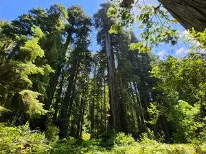
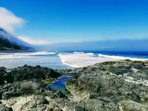


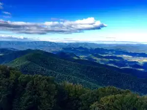


Older Hikers
Spouse and I are in our 60's and we deem this to be an excellent hike for anyone with decent mobility and fitness.
We have been on many National Park trails, and we thought Alum was one of the best maintained popular trails we have experienced. Although there is some significant climbing involved, the condition of the trail, including bridges, stairs, and cable supports were all excellent. Very solid footing going up and down. Use of a hiking pole or staff is still recommended.
We got an early start, and thus had no problem parking in the lot near the trailhead. The only restroom is near the trailhead, so it is a good idea to use it before departing. No untreated water is available.
The flatter early stages of the trail benefit from the beautiful rushing creek, and dense rhododendrons. Eventually, you will ascend out of those. We saw no litter anywhere on this trail. While there isn't much signage on the trail itself, the path is extremely obvious--almost no chance for a wrong turn or to get lost.
The trail section through Arch Rock is very cool and very well done.
The actual Alum "cave" area is interesting, but not breathtaking, the joy of this hike is that the total experience is first-rate. We continued on up the trail a ways past the cave/ledge toward Mt. LeConte, but didn't have enough time that morning to trek all the way to the Lodge.
Coming down Alum is a breeze. There is no rock scrambling, and the steepest sections are all nicely staired and switch-backed, so even my aging knees were happy. No need for serious boots on this trail--we wore trail running shoes and they were perfect.
We did the trail on a weekday morning in sort-of off-season, and I presume things gets much more crowded during more mainstream times, Most of the trail is wide enough for folks to safely pass coming each way, but some of the bridges, and the stairs through Arch rock seem to require single file. Those areas move fast though.
We took about 3 hours on the trail--but we went some beyond Alum, and also took some pictures enroute.
While most ranking schemes have Alum Cave as "moderate" with a pretty notable altitude gain, we think the excellent condition of the trail makes it very doable for older hikers, and certainly for kids too. This trail is worthy of it's tag as one of the top hikes in the Smokies.