
Live Your Best Lives
Bright Angel Trail Reviews
4.8
9 of 78 Best Attractions in Grand Canyon National Park


Reviews

Wonderful hike for all ages. Mostly paved trail that is pretty easy to climb. Breathtaking views all along the trail for everyone to behold. Wheel chairs could make it most of the way. An easy, approachable way to view the Grand Canyon.

Not a long walk but steep at times. Pathway is wide and smooth. Fantastic views of the Canyon. Where the sun is makes a difference on how the canyon will look.

This is the easier of the trails in and out of the canyon. The top is swamped with tourists going down to 1.5 Mile House, 3 Mile House and even all the way to Indian Gardens. Hikers from the bottom have to go over 10 miles from Phantom Ranch up 5,000 feet.

Due to its easy access, Bright Angel is very busy. When you do a full ascent, the lower part is pretty easy but the last view miles require some effort and the amount of people on the trail increases the closer you get to the top.

I hiked about 4 miles in on the trail, and the heat kept me from going further. I headed out around 6:30am to beat the heat and people. That was a good decision. Easy to get down and harder to get up. I missed my hiking poles are points along the way. I can see why this hike is on the list of many hikers. Glad I did a little bit of it!

Went down nearly 2,000 feet to the 3 mile mark. Climb out is a nightmare simply because it is all up hill. Only about 50 degrees, can't imagine it in the summer. Lots of immediate drop offs. Only problem is the people running around like they are nuts.

No matter how far you can make it along this path, give it your best shot! We did the 1.5 mile trek down and made it down in an hour and 20 minutes and then back up it took us an hour and a half, not too bad but we also mostly beat the sun coming over the rim. Plan accordingly and you’ll do just fine and enjoy views that can only be seen on this trail. I wish we’d have planned better to enjoy the full experience of this trail. I hope you do!!!

Bright Angel Trail certainly the most popular trail off the south rim. My wife and I are in our 60’s but in fairly good shape. We hiked down to the 3 mile station in about 2 hours. Enjoyed our packed lunch and great views. The 3 miles back up - well let’s just say we had tired legs and were ready for ice cream at the top. About 3 hours hiking for the 3 miles back. Nice thing about Bright Angel is a fair amount of shade for rest stops. I consumed about 2 liters of water with temperature at top around 70 at 9 AM and temperature at 3 mile point at 80. It is truly a memorable journey for a one day hike.

Loved the Rim to Rim hike. The Bright Angel trail has water in 3 locations on the trail. But just remember that hiking down is easier and you have to hike back up.
Hike very early, the hike will be more enjoyable.

Hiked as far as 2nd tunnel. Trip down and back took 2 hours. I’m 79 with A-Fib so I took my time. We hiked 9:15 to 11:15. Don’t go later as it gets hot once you leave the rim. Bring water, sunscreen and a hat

We hiked the Bright Angel Trail on August 4th, starting at 9 am. We began the trail at Kolb Studio and went to the lower tunnel, a one-mile hike down and a one-mile hike up. The round trip took about two hours. We are in our mid-fifties and walk hills daily at home, but this hike was more challenging. The heat, elevation, and uneven path (rock, pebble, sand, etc.) required that we ensure that each step we took was on solid ground. We were also only wearing basic sneakers. For me, as a short person, 5’3, the depth of many steps required that I turn sideways to step down. The hike up was less complicated to secure footing but more difficult to carry and lift our weight. We took frequent breaks to catch our breath and drink water. As challenging as this short hike was, it was also fun to meet, greet, and cheer on hikers, we met on the trail.
My recommendations are to hike as early as possible and even use walking sticks to help stabilize each step. A Bright Angel Trail chart also lists the elevation change, distance, and round-trip time it takes to do various hikes.
See my other Grand Canyon reviews on hiking the El Tovar Suite/Hotel and renting bikes.

A challenging backpack. We did it on our own and camped at the bottom of the canyon near the river. The views!!! One of the best outdoor experiences of a lifetime. On the way up there was a rainbow below us and someone out of sight playing a flute. Doesn’t get better than that.
Did the trip in the 90’s.

We did this hike the same day we did Kaibob. We only went to the mile and a half mark as we were totally spent from our earlier hike. Very hot day inside the Canyon as we were told temps were around the 110 degree mark. There are water stations along the way, so that's helpful. Kaibob Trail for us was a bit more scenic, so we preferred it over Angel. Hiking down is easy, just don't forget.....you have to hike back up.....which is the hard part. Next time we plan to get down to Indian Garden (4.5 miles), tho several hikers we ran into that got that spot, said the payoff wasn't really worth it. Fun hike!

Nice trail, easy, you can decide when to stop and come back up not sweating too much ahah, not busy in the morning, really nice

My husband and I (mid 50's, pretty good fitness level) hiked down to Indian Gardens. It was thrilling all the way. Coming back up was challenging of course, but that was part of the fun! It was good to have rest rooms at 1.5 and 3.0 miles down. no water was available at those stops (they wait til all risk of freezing is over to turn the water on). At Indian Gardens (4.5 miles down) there is water and restrooms, as well as campgrounds. We turned around here. Not sure we could have gone further--unless we started super early in the morning. Highly recommend! Don't be afraid of this--challenge yourself and you wont regret it! Just bring plenty of H2O :-)

I hiked this as a 51 year old woman in decent shape. I’m not athletic and had to walk slowly going up, but had no problems going to mile and half rest stop and back. It was a unique experience to be hiking below the rim. The trail is very well maintained, but still had ice and snow on some upper parts in mid April. Foot traction and hiking poles were very helpful.

I've hiked Bright Angel multiple times and enjoyed it every time. Go early before the direct sun and heat get too bad. Take plenty of water and wear comfortable shoes. There are rest stops with water and bathrooms 1.5 miles and 3 miles down, so those are good turnaround points for day hikes. Indian Garden is a beautiful spot five miles down, but my favorite section is from there down to the river. Simply beautiful. No better way to experience the canyon than to get below the rim.

Our family of 3 (mom, dad, and tween son) made this hike first thing after the visitor’s center stop. It is simply gorgeous! It is very easy but there are spots where you are close to the edge of a very deep canyon and you need be careful and know that you might want to focus on the other side as you walk or even hold hands with your partner. Great viewing spot at end of trail which is right over the canyon! Ask someone else to take your picture as a selfie is just not the same! This hike is quite short so everyone should do it while at the North Rim. From the viewing spot at the end you can see across the canyon to the South Rim and you feel very small! You are 1000 feet higher and in a much less crowded North Rim than the south! It’s also cooler here than at the South Rim. Highly recommend especially if it’s your only hike here

So breathtaking, was a lot colder than we thought it would be! Thankfully gift shop was used to that and they had some warmer stuff.

I’ve gone down and up on this trail to Phantom Ranch and thereabouts. It’s beautiful and feels like you’re wandering through different “points in geological time” on the way down, especially after about half-way. The best way to take this trail in my opinion is on the way back up. Better to head down from the North Rim or Kaibab to the river. Very gradual ascent with all the switch-backs. It’s tiring, but definitely not the toughest hike you’ll ever do. Incredible views.

My father took me down trail shortly after my mother died in 1981 and it was a significant moment of my life because it felt like such a big deal to climb up and down the Grand Canyon. 36 years latter, I was torturing my 3 kids and wife in the middle of August and now they too have what i want to believe is an unforgettable memory and senses of accomplishment. While its best to be in good shape, if you take your time, stop for water breaks and spend the night at bright angel camp ground, i think any one with determination can do it. On the trial we saw all manner of folks, old, young, good shape and not so good shape but all had good attitudes and its an amazing experience. After recovery, all my kids said they would do again, myself included.

This trail was the highlight of our trip. We hiked down to Plateau Point and back in less than 8 hours. We could have done it much quicker had I prepared myself for the hike. You might be able to go to the 1.5 or 3.0 mile mark and back with little to no training or preparation, but I wouldn’t recommend going past that point if you are not in shape. If you can’t hike 12 miles on flat ground you won’t be able to do it here either.
That being said, regardless of all the pain I was in for the next 3 days, it was worth it. It was so amazing to stand at the rail at Plateau Point and look down at the Colorado River below and the 360 degree views of the Grand Canyon. I would do it again, but I will be ready next time. I would also recommend you have good hiking boots/shoes and trekking poles. Of course bring plenty of water and food/snacks because you are going to need it. Layer your clothing. Temperatures started in the 40s at the top on the South Rim to 60s at Plateau Point back down into the 30s by the time we got back to the top.

Though not difficult, what you go down you HAVE to come back up! We went to 1.5 mile Rest house. It was a beautiful hike, about two hours round trip. We started at 6:30am to beat the direct sun. Well worth it

I saw a review here that said most of this trail is paved and that wheelchairs could use it. FALSE.
This is a dirt trail with a very short paved stretch at the very beginning. The reviewer must have this confused with the Rim Trail, which is paved and goes along the rim.

We started our Hike at the Kaibab trailhead at 6:20 on March 11. Took us 3.5 hours to get to the bridge. Going down was extremely difficult, as you have to watch every step, foot placement was integral.
It was 30 degrees when we started. When we reached the Colorado River it was 80! Followed signs for the Bright Angel Trail, and after about 2 gorgeous miles along the river, we began our assent. Going uphill, I found was much easier. We finished at the Bright Angel Trail head at 3:00.
A couple things to note. I am 58, husband is 67. We are runners, not die hard, but about 20 miles a week.
We were very prepared for our hike. Backpack, 2 qts water (3 refill spots on the way),head lamp, lots of salty snacks, 4 layers on top (yes you get down to the bottom one), trekking poles, knit hat, gloves, t.p., sunscreen, crampons (just in case-we didn't need them), thin wool socks and a small 1st aid kit.
This was a bucket list experience for us. We were mentally ready too! Unbelievable experience is an understatement! There were lots of people on the trail in all shapes and sizes. We met so many great people. We were especially impressed at all the students on spring break from Texas A and M that were extremely polite!
To mention there are 2 bathrooms on the way down, 1 at the Colorado River, and 2 on the way back up. Bring T.P. Just in case.
If this hike is in your future too, please spend a few weeks or months hiking hills at home, u will be happy u did! Have fun!

I heard that only 1% of Grand Canyon visitors go below the rim. I cannot recommend enough doing what you can to go down. It gives such a different perspective. I don't think my trip to the Canyon would have felt like a success without going on a trail down into the Canyon, however....it isn't easy.
First of all, be honest with your ability. Secondly, make a good judgement of conditions and weather.
This hike could get dangerous if you get either of those wrong, depending on the time of year.
If you get those two things right it is incredible. This was the highlight of my 10 day vacation that included many stops in multiple cities.
The trail was snowy and had some ice on it, and my wife and I didn't have traction assistance because we weren't expecting to do it. We only started because we saw others going down with worse shoes than we had, so we decided to start and turn around when we couldn't go further.
We ended up going down to the 3 mile marker and turning around.
We took our time, being super cautious on the ice and snow and taking pictures and having snacks. It took us 6 hours.
The temperature was a little cool, and we had on layers. It got warm at the bottom. Without the layers we would have been freezing on the top, or would have got really sweaty lower down (which would have been a disaster when we got back up to the cold).
We didn't need a lot of water because of the cool temperature, which made our load a lot less.
There are water fill stations, but if it's hot out, you're still going to need a lot of water (multiple litres per person). If it's going to be snowy when you're going, pick up a pair of traction assistance devices, this trail is worth it.

The trail was very accessible and close to the Grand Canyon Village. The trail was more crowded than the Hermit Road Trail. The trail is recommended for people in good shape as there is a large elevation drop as you go down the canyon. There are restrooms on the trail, along with water refill options.

This trail makes me happy ! Mesmerized and surrounded by beauty. Early morning hikes are the best, peaceful & relaxing, a great way to unwind.

We woke up bright and early and were on the trail by 7am. Even though we were staying in the park at Mather campground, we chose to drive our car over near the trailhead. Be warned that the parking nearby was filling up fast even that early. The views you experience as you hike down into the canyon are so different from what you see at the rim. We did the three mile round trip hike to the first water/bathroom area and it took us about 2.5 hours round trip with many stops to enjoy the views and take pics. Our two teens loved the experience. It's a workout and it gets hot, even if you go early. Of course coming back up is much harder so pace yourself and keep track of how far down you go. Pack a lunch and enjoy your time below the rim!

A great trail starting at the south rim and going down in the canyon. Of course it's beautiful, and can be a bit dangerous. So one must plan ahead and bring supplies, not to mention leaving early in the day. The rule is it is easy and faster going down, going back up takes much longer and is much harder.

A storied trail, encounters with Desert Bighorn, sweeping views, and a challenging hike even for those in fit. Love this trail. Take it to Indian Garden, Plateau Point, and to the Colorado.

After hiking the South Kaibab Trail the previous day, we wanted to give Bright Angel a try too. We had been very ambitious with our hiking goals on Kaibab, so we decided to play it more conservatively on this one. We decided that we were only going to go to the 2nd tunnel, which is 1.5 miles round trip. It looked like the trail got a lot tougher from there, so this seemed like a good turnaround point.
This trail was definitely more crowded than what we had experienced on the South Kaibab Trail, but people were good about moving out of the way if they were taking a break. As you would expect, the way down was a lot easier than the way up, so be sure to pace yourself accordingly and bring enough water. The views are spectacular, so be sure to take the time to enjoy the scenery.
Of the two, I preferred South Kaibab over Bright Angel, but both are a great way to experience the canyon.

I did this hike two days ago by myself. I am 30, do not do any kind of excercise and don’t really hike either. Started at the top at 7.30 am, walked very slowly on my way down (hate going downhill). Didn’t really know how far i wanted to go, but then i met this other girl and we decided to make it all the way to Plateu Point. We reached it at around 10.30 so it took 3 hours to get there. We stopped for an early lunch in the area before the trail starts heading down into the Colorado River. The view there is breathtaking!!! She decided to make it all the way down, no way in hell i would have followed her. It looked extremely strenuous and its a long way to go back up.
So at around 11.30 i decided to start hiking back, the first few miles go very fast as its all pretty flat, but once you pass Indian Gardens thats when it starts getting steep and hard. The last 3 miles were not easy and i couldnt feel my legs anymore. Made it back at 2.15.. so around 7 hours all and all, with two good breaks. For some reason it took me less to go back. I must have been super slow going down.
Anyway the hike is totally worth it, though i was in a lot of pain for most of that afternoon and night. As i said i wasnt prepared at all. But the memories and pictures i have are gonna be forever!!
Wouldnt recommend going all the way to the river unless you are fit and willing to walk for hours and hours uphill!!

I have hiked this trail 4 times, and I will say it is VERY physical and the full trail , although beautiful and scenic, is a challenge even for the experienced hikers. It is steep with a lot of elevation gain. The plus on this trail is the restrooms and water available from the rim
at 1 1/2 miles, 3 miles and at Indian Gardens, which is a beautiful place to rest and picnic, after Indian garden, there is no water until you reach Phantom Ranch. As the sign states, “down is optional and up is mandatory “, don’t bite off more than you can do. The last 1 1/2 miles to the rim is over 1,000 feet of elevation gain in itself. Be smart. Dress appropriately, bring water and snacks, know your limits, be safe and enjoy. During the winter months, bring traction devices like crampons for your boots as the trail gets icy and muddy. In my option, although there is no water on it, the South Kaibab trail is far more scenic with more amazing Canyon views than the Bright Angel.

This is a great trail to hike into the canyon! As you hike down, you can see how the canyon changes.. Just don't hike down too far! Take water! No water until Indian Gardens.. which means there isn't any water for the return trip at the rest houses.

We were at the Grand Canyon South Rim in early September 2021. This is a challenging hike, but well worth it. We started the trail in the early afternoon. Although I really wanted to go to the 3-mile point, owing to the time of day and heat, we turned back at the 1.5 mile point. Although it was probably due to the time of day, we noticed that most people turned back there as well. It took about 3 hours round trip, and was much harder going back up.

My husband and I loved the views from this trail but didn't go very far. After about 1/4 of a mile, the trail became ice covered in many spots and we were nervous about falling. At first I felt like a wimp for turning around so soon but we saw a lot of hikers 20 or 30 years younger than us also turning around. I had bought crampons just for this purpose but forgot to pack them in my backpack the morning of this hike. I think they would have helped a lot. I would love to hike this trail again in a little warmer weather.

take the hike - but remember what goes down must eventually come back up! Bring lots of water and some comfy shoes!

World class hike. Hiked to Plateau Point - started 5:30am with headlamps, back up by 11:45. Definitely a workout! Amazing experience

Use a camel back to keep hydrated with water. This is not a stroll that flip flops can be worn. So use your hiking boots. Rangers are along the trail to answer questions.

We spent some hours in the trail, such a great experience. It had snowed the day before so it was all covered by snow.
Best experience ever

Grand Canyon view was spectacular. Not many people so was able to get good views and pictures. Nice gift shop but one of the rest rooms was closed so the one that was open had a line. I would suggest hitting a restroom BEFORE going into the park.

Started out at 5:30 am. Just went to the 1.5 mile marker. It’s a very doable decent. Just remember you have to come back up which was a little more challenging. Take plenty of water and take your time to view the beauty. 1.5 marker has restrooms and water. A little past the 1.5 is a beautiful point to view the canyon before heading back. It took us about 2 hours total. We stopped and took pictures and talked to several people. Highly recommend.

My wife and I hiked down to Indian Gardens with a thought to go to Plateau Point. We left El Tovar around 5am. Unfortunately, we took in the views, sunrise and tranquility for too long and did not get to IG until 9. It was too hot to go further, so we stopped and ate salami and potato chip sandwiches and hung around for an hour. Hike back up is steep, but was not very crowded until the 1.5 mile stop. Then it became more crowded the closer to the rim to the point of being overly crowded. The crowd at the top was ridiculous. Please remember to take plenty of water even if only going a short way below the rim, especially if small kids are involved. Additionally, the elevation gain coming up is great meaning a steep climb to get back up. Again, take this in to account when hiking with small children.

A wonderful nature get away from the buzz of the world. Come prepared for a nice natural hike down the canyon enjoying the rock formations and what mother nature gave us

make sure to have good hiking shoes or sturdy sneakers. Look at the map to see how far you plan to go. Take plenty of water, and give yourself the time to enjoy the trail. It is so worth going into the canyon for such a different perspective.

This was a must do trail. The trail allows you to descend into the Grand Canyon and you never feel unsafe. We did the hike with an 18 month child and 7 year old. It was super beautiful and yet you never felt uncomfortable about the hike. We did not go all the way down to the river but it was really amazing.

This trail goes to bottom of canyon. Recommend for a true experience that you hike at least a little ways down and back. Just remember that it takes longer to come back up. Steep in places. This is a narrow trail with not much more than room to pass in some places. It is not suggested for those with balance issues or afraid of heights, because in most places it is a sheer cliff to the bottom. It was a little out of my comfort zone, but I was proud that I was able to hike some of it. Not recommended for children although I saw some on it that I thought were too young to be out there.

We hiked to the 1.5 mile rest area and then back up. Our fear of heights passed after just a short while because we were focused on getting to the rest area then surviving the hike back up. We all had a sense of accomplishment when we finally made it back. We all had an appreciation for anyone who could make it to the bottom of the canyon and back up.

Bright Angel Trail is the most popular trail into the Grand Canyon, but that doesn't mean it is easy. It is narrow, and steep and difficult. There is water at 1.5 and 3 miles, but going down is easy. It is coming back up which is tough. Don't get yourself in trouble by going down too far.

the trail was very icy at the top, just snow covered and slick lower down. Made it with two boys (10 and 11) to the way point. Remember you have to come back up. Ran into a ranger (working during the shut down God bless him), he was so nice to the boys. Gave them a short talk about the formations, etc, they loved it, he was great.

We hiked down a short way with our kids so they could get down inside the canyon. It’s not too challenging at the top portion although I’m sure it is more so later on. Still it was a bit annoying with a lot of picture takers clogging the narrow and steep path near the top where we were and even someone with a dog on a leash despite the clearly marked sign saying No Dogs.
Maybe try at a time that is less hectic and also make sure you leave enough time to come back up - we saw a lot of people hustling late in the day to beat the sunset.

This area is unparalled in beauty and rich history....all those who have traveled this same trail. Make your reservations early if you want to do any special activities, horses/donkeys rides down to the canyon floor go fast.

Did the hike up from Phantom Ranch this morning. A leisurely 7 hours for our group in their 60’s and early 70’s, but we have hiked before. Vistas were great all the way, did not need too much water in the winter BUT crampons (micro spikes) were much needed for the last 1.5 miles before the rim.

First of all, the distances in reviews, online, and the wooden signs are off. It's more than 1.5 miles between restroom stops so to Plateau Point and back was 13 miles instead of 12. The second rest stop doesn't have water and they turned off the water at the stop closest to the top of the rim by the time were were heading back up. This meant the last 3-4 miles up there was no water. We were saved by our bladder backpacks! We definitely didn't need any cramp-ons because there was only ice at the very top and it didn't cover the entire trail. We did however invest in some very nice hiking boots (Salomon X Ultra 3 Mid GTX) and thick hiking socks which were a life saver. If you're not an avid hiker- wear knee braces and maybe ankle braces. I'm 31 and somewhat active, more weights than cardio, and I could hardly walk the next day my knee was throbbing so bad. My hips were hurting as well. The impact pressure walking down kills knees and hips! Once we got to Indian Garden it was a fairly level hike to Plateau Point (although still longer than the signs say.) We were literally the only ones at the point so we got such amazing views and photos! We also had a pretty bold squirrel come try to get the snacks in our packs even after chasing him off multiple times. We got a late start so we had to seriously speed up the canyon on the way back so we didn't get to take as many breaks as we wish we had so high-energy snacks came in very handy. It took us 7 hours with minimal breaks. We were about 10 minutes away from needing a flashlight so you may bring one just in case. Bring layers and sunscreen because we started out freezing, in the middle were hot in the sun, and finished freezing again so layers helped a lot. Take lots of pics because it's amazing. We even walked right up on a doe while walking to Plateau Point and were able to get close up shots of her.

Hike this trail, which begins right near the Kolb Studio for a different perspective of the Canyon. Get below the rim if you can. We walked about 1/4 to 1/2 mile down and then turned around and hiked back up. You can hike to the bottom here. Go as far as you desire. It is much warmer in the Canyon than at the rim. The temperature rises quickly, so dress in layers. Take water.

regretfully we only had limited time and thus only walked for 3 hours .... but this was stunning. the scenery was breathtaking. we will come back!

This is a challenging trail specially if you are novice hiker. The views are superb, and it is not recommended to hike it down and back in one day. Extra caution is required during or after inclement weather. It can be very dangerous when icy. The temperature swing can be drastic between the rim and the bottom, so plan accordingly. Adequate footwear is recommended and plenty of water and salty snacks. Not suitable for people with mobility restrictions and young children. Enjoy

Don’t be fooled, this is a tough trail. If you are hiking this in the summer, start early and have plenty of water. It really is a great hike, and you will feel great accomplishment when you finish it. But be prepared. We hiked down to the 3 mile mark and came back. Really enjoyed it. Would love to have hiked this trail from the river up to the canyon rim. I think that would be the ideal was to complete this hike. But have fun and take in the beautiful views.

Been there, done it, got it checked off the bucket list, will probably not do it again. Start early. We went all the way to the 3 mile rest house and it really killed my knees on the way down. The views were good but a lot of them were pretty much the same, just different elevations. I don't know how accurate the mile markers are either as my Garmin recorded longer distance. Restrooms and plenty of water at the 1.5 and 3 mile rest houses.

2019년 7월 24일 오전 7시 50분. 벌써부터 햇볕이 따갑다.
이 트레일은 4개 포인트를 갔다 오는 왕복코스로 구성되어 있다.
1코스:Mile and half a resthouse(3mile, 340미터, 2-4시간)
2코스:3Mile resthous(6mile, 645미터, 4-6시간)
3코스:Indian garden(9.2mie, 925미터, 6-9시간)
4코스:Plateau point(12.2mile, 940미터, 8-12시간)
Overnight to the Colorado river(permits required)
오버나잇 코스는 내려갔다 반드시 하루 숙박하고(사전 예약 허가) 다음날 올라온다. 따라서 당일치기로 가장 길고 어려운 코스가 4코스는 Plateau point다.
1,2,3코스에는 각각 음수대와 화장실이 있다. 그러나 4코스에는 그냥 콜로라도 강 협곡에 쳐진 펜스만 있다.
안내서에는 물과 햇볕과 체력이 가장 중요하다고 나와 있다. 특히 햇볕을 피할 그늘이 거의 없다. 완전히 직사광선에 노출되어 있다.
이 트레일은 등산과 달리 내려갔다 올라오는 것이다. 체력을 어떻게 분배해서 트레일을 진행할 지 작전을 짜야 한다.
아빠인 나는 평소에 일주일에 40-50킬로를 달리는 체력을 유지하고 있다. 아들은 얼마 후 군대에 가야하는 그저 젊은 체력만 갖고 있다.
아침 8시인데도 햇볕이 장난이 아니다. 수직으로 약 1천미터의 거리를 지그재그로 절벽을 깎은 좁은 길을 하염없이 내려간다. 1코스부터 3코스까지 그야말로 쉼없이 내려간다. 무릎이 매우 아프다. 이미 3코스까지 2시간 40분을 무작정 내려왔다. 도로 올라갈 일이 엄두가 나지 않는다. 그러나 여기까지 와서 콜로라도강 협곡까지 안 가는 것이 말이 되는가? 아빠는 아들을 말없이 바라본다. 그래, 가요 아빠. 드디어 3시간 반만에 plateau point 펜스에 다다랐다.
펜스 넘어 수 백 미터 아래 콜로라도강 급류가 세차게 흐른다. 급류를 타는 배들이 까마득히 보인다. 저 사람들은 차로 콜로라도강 선착장까지 갔을 것이다. 카약을 타는 사람들이 전혀 부럽지 않다. 아니 부럽다. 이제 3시간 반 동안 내려온 길을 올라가야 한다. 시각은 어느덧 정오가 되었다. 온도는 40도를 훌쩍 넘는다. 햇볕은 강렬하고 피할 그늘은 그 어디에도 없다. 막막하다. 그래도 어디로 도망갈 곳이 없다. 어쨌거나 되돌아 올라가야 한다.
3코스인 인디언캠프까지는 평지라 햇볕과 더운 날씨가 힘들 뿐 갈만하다. 인디언가든 음수대에서 페트병 4개에 물을 가득 채운다. 3리터 정도 된다. 이제 2코스인 3마일 레스트하우스까지 올라간다. 숨이 턱턱 막힌다. 그러나 숨차는 것보다 햇볕을 어쩌지 못한다. 수건으로 머리와 얼굴을 동여매고 긴팔 바람막이 옷을 입는다. 바지도 긴바지다. 15분마다 잠시 쉬면서 물을 마신다. 1시간 정도 걸려 3마일 레스트하우스에 도착한다. 머리와 얼굴과 몸이 타들어가는 듯 하다. 다시 페트병에 물을 가득 채워 베낭을 걸머진다. 1.5마일 레스트하우스를 향해 절벽을 올라간다. 너무 힘들고 덥다. 햇볕은 속절없이 머리와 온몸을 향해 돌진한다. 물을 마시며 머리에 물을 붓는다. 단 몇 분은 열기가 식지만 물이 증발되면 더 뜨거워진다. 1시간 반이 훌쩍 지난다. 기진맥진하여 1.5마일 레스트하우스에 도착한다. 더 이상 올라갈 수 없을 것 같다. 그래도 별 수 없다. 올라가야지. 다시 베낭에 꽉 채운 페트병들을 쑤셔넣고 오르기 시작한다. 까마득히 꼭대기에서 한가롭게 그랜드캐년을 감상하는 사람들이 보이기 시작한다. 10분에 한번씩은 쉬어야 한다. 물을 마시고 머리에 물을 쏟아붓는다. 다 온 것 같은데 끝날 기미가 없다. 어휴. 가벼운 옷차림으로 내려오는 사람들을 만난다. 아마도 1.5마일 레스트하우스를 향하거나 그냥 중간쯤까지 왔다 가는 사람들일 것이다. 신기한 일이 벌어진다. 그 사람들을 만나며 없었던 힘이 나기 시작한다. 그래, 저 사람들은 그저 그만큼 내려왔다 올라가고 나서 그랜드캐년 브라이트 앤젤 트레일을 했다고 얘기하겠지. 아, 그래 우리는 아빠와 아들은 정말 끝까지 가서 콜로라도 강 협곡을 내 눈으로 직접 내려다 본 사람들이야. 마음 속으로 뿌듯한 자부심이 생기며 다리에 다시 힘이 들어간다.
끝나지 않을 것 같았던 오르막길로 결국은 끝이 보인다. 머리가 삶아진 듯이 뜨겁고 다리는 풀렸지만 마지막 계단을 오른다.
오후 3시 45분. 7시간 55분이 걸렸다. 안내서에는 8시간에서 12시간 걸린다고 했는데 승리의 감격이 밀려온다. 뭐 이런 것에 감격하나 하겠지만 그래도 아빠와 아들은 잠시나마 무엇을 해냈다는 뭉클한 감동에 젖어든다.
온몸이 열기로 후끈거리고 소금기로 따끔따끔하다. 시원한 게토레이를 원샷하고 싶다. 그런데 자판기가 보이지 않는다. 셔틀버스를 타고 비지터센터까지 갈 수밖에 없다. 그렇게 20분이 지나서야 이온음료를 몸 속에 쏟아 붓는다. 주인 잘못 만나 고생한 몸에 작으나마 신세를 갚는다.
여기에 내려가며 올라가며 바라보았던 그랜드캐년의 모습과 속살을 적지는 않는다.
다만, 분명한 것은 아빠와 아들은 그랜드캐년을 본 것뿐만 아니라 온몸으로 겪었다. 앞으로 이 느낌과 기억은 살면서 오랫동안 잊혀지지 않을 것 같다.
그랜드캐년에 가시는 분들께 머더스 포인트에서 바라보는 경험뿐만 아니라 우리 부자가 보고 겪었던 그랜드캐년을 꼭 권해드리고 싶다.

We're older so we knew we were not going all the way down. But we took our time, saw a petroglyph that another hiker pointed out only about 100 - 200 ft from the start under the rim, and hiked down to the archway in the trail. About 40 minutes total and returned.

While the Bright Angel Trail is one of a kind, you MUST prepare for the few miles you will be hiking: hat, sun glasses, very good shoes, plenty of time, sun block, water bottle, early in the morning to avoid high heat. The view is spectacular but the PLANNING is a MUST if you want to enjoy at a comfortable pace. The view is spectacular, so don't miss if you can handle the walk. The pictures do not do it justice, but suggest you take your camera/phone anyway. MUST SEE and DO.

Disclaimer: the Bright Angel Trail technically goes for a long distance, but for the average person I would recommend you only go as far as you can...the 1.5 mile or 3.0 mile rest stops are good turnaround points if you wanted to go into the canyon but not hike all the way down to the Colorado River. And unless you already have a reservation to stay overnight at Phantom Ranch at the bottom, definitely do not attempt to hike down far and back in one day.
So since my friend and I couldn't stay at Phantom Ranch, the next best thing we could do was hike down to Plateau Point for a day hike, which takes over 6 miles to get to from the top of the Bright Angel Trailhead at the rim (and the same distance to get back out). I would not recommend the average person do this, as I'm usually pretty fit for hiking and my knees began to hurt in the middle of the hike, which made it a bit harder for me to hike back up....and I was VERY sore for days.
Do your research, assess your fitness level, and make the best decisions on how far down you want to go before turning back around. Remember that it gets much hotter the deeper you go into the canyon, and on average takes you twice as long to hike back out compared to hiking down.
We started at around 6:45am and returned at 5:00pm, and this included breaks and spending about an hour at Plateau Point. It had some incredible views overlooking the Colorado River (you are about 1600 feet above the river), and we were lucky to also have a handful of California Condors flying right above us. We also got a lucky break with the weather, as it was much cooler than usual (high temps at the rim was low 60s, so it was about 75ish degrees down at Plateau Point), with cloudy skies and on and off rain. Keep in mind though that usually for September it will be sunny and warmer, with many parts with no shade from the canyon walls. Bring a hat, sunglasses, lots of sunscreen, a ton of water, some sports drinks to refill on salt and electrolytes, and lots of salty snacks to eat along the way. And make sure you take as many breaks as you need.
Remember that it is optional to hike down, but mandatory to hike back up. If you hike this trail, start as early as possible to beat the heat.

We hiked about a mile or so into the canyon on this trail. Remember that going down is optional, coming up is not and it take twice as long and is twice as hard coming up as it was going down. My wife and I arent in the beat physical shape, not horrible, but not in excellent shape either. It was very doable. We went about a 1/4 of the way down the trail and turned around. Do it. Only 3% of people who visit the canyon go below the rim. The view from below the rim is amazing.

Some interesting touches so if you don't want to go far/long this trail is good - two "tunnels" and plenty of views and switchbacks so you get the real feel. Choose to go to the 1.5 mile resthouse. They say 2.5-3 hours total, and that was about right in our experience - 2 adults and 2 tweens. We went in the afternoon and there was shade for much of it. The way down is not easy, the way out is harder. Pretty steep, but it is all maintained trail. For the amount of hiking we did on Bright Angel we were fine in sneakers, didn't require hiking boots. Too much further and you might want the boots for ankle support and traction. My daughter slipped a little once, but her shoes were very worn/smooth on the bottom. Take WATER! Each person should have their own. Take Backpacks! Each person should have their own. You will need to layer and Dad can't carry everyone's stuff... There is a bathroom at the 1.5 mile point - but it is not going to be the most pleasant experience, just be prepared. Also, this is a popular hike - so it will be crowded and have lots of other hikers on it. If you are looking for tranquility in nature, this is not that experience. For family tourist hikers - it is perfect.

Difficult especially if you are over 65, but possible. The views beyond belief. Feeling of accomplishment to have done it. Once in a lifetime experience.

Well it took us about two and half hour to get up and just an hour to get back down.
Beautiful views, and we recommend this 10 out of 10.

Definitely do this trail over South Kaibab, particularly if you don't have experience hiking much. This trail did not seem as slippery, and it is also easier. There are also rest stations and water stops (not all are available all year), which South Kaibab did not have. There is also a really nice portion of the trail that is relatively flat about 3.5 miles down and a wooded section.
Naively, when we first planned this trip we thought about hiking down to the river and back in a day. We ended up ditching this plan. There is absolutely no way. We ended up stopping four miles down at Indian Garden. That wasn't even halfway to the river! I couldn't believe we'd only gone four miles.
I would not recommend going beyond Indian Garden, and even that will be too far depending on the person. There was a sign to the effect of "going down is optional...going up is mandatory." Bring lots of water and Gatorade...more than you think you'll need. I saw some people walking with one water bottle. This is a really, really bad idea.
Be smart, take it slow, and have fun!

Beautiful, well-kept trail that allows a special vantage point of the canyon and rim. We headed down, not sure how far we'd go knowing that every 100 easy feet forward represented anther 100 tough feet back. I took advantage of those we passed by asking them at what point did they turn around. Just as they're huffing and puffing, sweating bullets and looking like they can keel over at any moment, that's when I would pepper them with questions. Amusing, and I also found you get closer to the truth that way.
For those who are afraid of heights like me, just look down for the first ten minutes. You'll be fine. Eventually, the trail has a semi-gradual slope off to the side, enough that I was actually able to enjoy the view. 3 quarts of water and a nose bleed later, we made it just past the 1.5 mile marker. After getting accosted by rock squirrels at the water spigot, we took in the amazing view of the rim above us. Well worth it.
Heed the warnings though and the best way to do that is to be honest with yourself. There are some shady areas and plenty of encouraging hikers. Just take your time and get below the rim somehow.

Do not be put off by the length of the trail. Most do not complete it, or even come close to. it is a breath taking walk, with an ever changing view of the canyon. As you descend the perspectives change, the colors come alive, and a wide variety of birds encircle above and below you.
Yes, there are water stations, and plenty of opportunities to rest in the shade.

I only Went down to the 1.5Mile Water Stop :/ on account of my water bladder leaking and my first time in the Grand Canyon. Coming up was great as I met a few people at the 1.5Mile rest stop and we encouraged each other for the push thru the Switchbacks! Can't wait to train and plan for the whole hike down to the Canyon Floor and Back :) Bright Angel is very well maintained and there are spots you can get Water, so that is a huge benefit.

So much to see of the Grand canyon, even a day there doesn't do it justice, the views are spectacular and well worth the walks, take drink with you, must not be missed.

Loved the views. Way out to the edge of the canyon where you can see all around. It is a little steep so be prepared.

I hiked the Bright Angel Trail during my visit to Grand Canyon National Park and it ended up being the highlight of my trip.
The trail starts right in Grand Canyon Village, so it’s very easy to find, with clear signage and a well maintained path. I went down to 3 mile resthouse, and that was plenty challenging for a day hike. The views are absolutely stunning the entire way down, you’re literally walking into the canyon, watching the layers of rock rise above you as the rim gets farther away.

Great trail, would definitely go back and do more of it! Definitely don’t let yourself be intimidated by how steep it can get but be aware of your own limitations. At the very least, go in and see the tunnel carved out to make the path. Very beautiful and unique perspective within the canyon!

On this trip, I didn’t go down the trail at all because we only had one day, but I’ve done the first two miles in the past. You need to get a little bit down into the canyon to truly experience it and this is your best option by far.

This hike was beautiful, hot and strenuous! We got down to the 3 mile resthouse in an hour and 40 minutes and had lunch #1 and refilled the water twice before starting back up. The trek back to the rim took another 2.5 hours. We packed a second lunch for the stop at the 1.5 mile resthouse on the hike back up and was so glad we did! Overall, rim to 3mi resthouse back to rim took 4.75 hours.
Make sure you keep drinking water! I saw several people hiking closer to the top with no water at all, bet they felt sick later.

thought this was an easy walk , turned out to be very exciting!! Make sure you have enough water and allow enough time to hike back up. going down the trail you met a lot of tired hikers going back up.

Great, busy trail. Once you are close to 3 mile resthouse, the crowds thin quite a bit. It is busiest I'm the mornings. It's quite a hike to Indian Garden and back but my 7 year old did it. If it's summer, go super early, around 5 am or earlier.

This is a short easy hike with good view into Bright Angel. It is also one of only a few trails that were open due to the excessive late May snow.

The trail had snow on it but was easily walk you do not need spikes except at the top of the south rim. The wind made the venture up and down the canyon very cold. The scenery was extremely beautiful.

Fantastic walk and stunning views but be aware of the high altitude and ensure you pace yourself. I was shocked at the unruly children who were permitted to leave the track and climb all over the rocks with deep drops within metres (I’m surprised the canyon floor is not littered with the bodies of children who’s parents did not sit them down for a “Let’s talk about appropriate behaviour on a dangerous hike” beforehand

This trail is well maintained and very well travelled. It is narrow, steep, and winding and it is also the trail that the mules use so watch out for poop!
Seriously, this trail is beautiful and you don’t have to go very deep into it to be able to appreciate the Canyon from a different angle. They do not recommend attempting to make it down to the riverbed and back within the same day. There is 5,000m of elevation and what goes down, must come up!
Sturdy shoes and trekking poles would be nice but aren’t necessary.
Those who are afraid of heights need not apply as the first step off the trail can be a doozy!

Most people will give this 4 or 5 stars because they're the ones who've lived to tell the tale. But make no mistake, this is seriously tough.
I class myself as a reasonably fit 54 year old who does lots of hiking. Less than a month ago I was walking the highest point in Texas, the Guadulope Peak. But this was a different beast.
Firstly, when you hike a hill or mountain, you're going downhill to finish, with this you're going uphill. Sounds obvious, but don't underestimate the mental challenges of going slow when you desperately want to go quick.
In all it took me 9 hours, 3.5 down, 30 mins rest at the Colorado River, 5.5 back up. I took lots of pictures on the way down and could've done it quicker. There was ice for the first (and last) mile or so. I had no spikes, so took it extra careful. Do not underestimate how slippery this might be with no spikes. Buy some for 20USD or so, I so wish I had. Wearing spikes would've made it safer and quicker, and as I said don't underestimate the mental challenge here.
The heat will start to hit you from halfway down. I guess it ranged between 70 and 80 deg and is relentless, even in early March. Yep, ice at the top, heat at the bottom. In summer it will punish you. It is advised not to do this in one day and I will advise the same. I got away with it in March, definitely would not get away with it in July.
I met others who had gone down the South Kaibab trail and up the Bright Angel. The plus of that is its a little shorter and different scenery. The negative is its steeper and you have no experience of what's to come. I was so glad I knew what was coming in the last mile going up and paced myself accordingly. Sunset was at 6.50pm, I didn't want to be doing it in the dark! It was a huge psychological boost to reach the ice with two hours to spare, I knew it would take over an hour to get through it and could allow myself time to take it very, very slowly.
I got to the top at 6pm.
Relieved, exhausted with a huge grin of satisfaction. Stunning scenery everywhere and memories to last a lifetime.
But think about it. Don't do this on a whim. You will get caught out if you're not fit, or experienced, and if don't plan your food, drink, clothing and rest times. Take care!

This is one of if not the most popular trail that actually goes into the canyon. First time I was there, I was confused to discover it gets hotter as you go deeper. Apparently cold does not sink at the GC. And apparently I was not the only one who didn't realize this. We came across dozens and dozens of people who looked like they were seriously about to die within the top quarter mile of this trail. So I strongly advise staying on the rim if you are not in shape. While it was only about 80 degrees on the rim, it quickly rose above 90 not far below it, and was over 100 down by the river. If you are in shape for it though, this is one of the best hikes in the west.

I was supposed to do the North rim to south rim trek. But after a panic attack (I’m scared of heights) I didn’t go. I was so annoyed and disappointed so a good friend offered to take me to the south rim down the bright angel trail.
Wow! Just wow! It is strap and I had a few scary moments. But just take your time! The rules are that if there is a mule train you get out of the way, generally to the right. Also people coming up have right of way to those going doing, again you move to the right. For me this was scary as this was closer to the edge. When I saw someone coming up I just moved to the edge closest to the wall making sure there was plenty of space. Only one person grumbled but when I explained they were okay.
I’d trained hard, but still found it hard. Poles will help. Took me about 1.5 hours to go down but I kept stopping to take photos of big horned sheep. General rule, however long it takes you to go down, it will take you twice as long to come back up!
October is a great time of year to go, cool enough to do it in a t shirt and not get heat stroke! I’d recommend a 2 litre bladder and plenty of salty peanut butter snacks. It’s 3 mile down and 3 mile up.
Going down is optional, going up is mandatory!!!
Great way to see the canyon though, forever memories

We knew enough about Bright Angel Trail to not go too far as "tourists" and to be considerate to fellow hikers. I feel like most people seemed prepared or aware to not go too far if not adequately prepared. But you do see hikers who have no common sense. The day we visited the trail, there were climbers hiking from Phantom Ranch (amazing!) and many others who seemed to be going purposely (and thoughtfully) to the 1.5 mile marker and back. My son and I went about .75 and back. That day - the shaded sections were icy. We didn't have to deal with temperature changes (like summer), but you still have ice and elevation ... and open ledge. Again, most people seemed to respect their surroundings. But there are others who are all about the photos and not paying any attention to their safety or others. And there are others who are heading down with little children in essentially flip flops. All I could do was warn them that they were about to reach icy conditions on an icy open ledge and might want to at least fasten their little kids Tevas? I am not usually someone who gives out unsolicited advice, but I couldn't not say anything and allow people to get into a potentially dangerous situation. I feel like there are people who end up on this trail out of curiosity more than knowing what the trail is or where it leads. But, it was a great experience if one is smart about it and respects the canyon.

I want to start by saying two things: I am afraid of heights to a point. Not deathly afraid, but enough for it to play into this hike. And my wife is short, only 5’0”. Both of us are in decent shape. No one will confuse us with Ironman athletes but for mid-late 40’s, we’re getting it done.
We had a perfect day, low 50’s when we started out at 7:15am. We had plenty of water and snacks. I’ll break it down by rest stop areas because they are conveniently spaced 1.5 miles apart.
The first stage took us about an hour, mostly because I was walking gingerly because of the heights. It was beautiful and I tried to look down, mostly unsuccessfully. So it’s 8:15am when we hit the first rest area.
After that, I was becoming more comfortable with my surroundings. The weather was warming up and my wife and I began peeling layers. This stage took only 45 minutes and were at 9am. More water and snacks. We brought jerky, trail mix, deli meat, etc.
At this point we are beginning to see signs of leveling off but make no mistake: it’s still a legit hike. We’re eating our trail mix and jerky and downing water as much as we can. Each rest area had bathrooms and water. We reach Indian Gardens by 9:45am. We saw a lot of hikers who were camping there. We aren’t the camping type but it seemed like a cool community. We’re feeling good at this point as we hit the next stage.
People say the hike from Indian Gardens to Plateau Point is flat and by comparison of what you just did, it is. Still, on the way there there is a steady incline. We were still making good time and got there by 10:30am. If you make it to Indian Gardens feeling good, it would be a shame not to continue to Plateau Point. Aside from the sense of accomplishment, it’s amazing to be able to see the Colorado River. Still, I was a little unsteady despite the large wide rocks and the guard rail.
By 10:45, we begin our ascent. The walk back to Indian Gardens is easier with the slight downhill hike. Still, you look up and see the majesty of the Canyon and all you think is, “I have to walk up that?” Another 45 minutes later and we pass through Indian Gardens again. It’s 11:30... and now the fun begins.
From here to the next rest station is deceptively steep. This is where my wife’s height becomes an issue. There are wooden steps to help you but for my wife, they become larger hurdles. At the same time, hiking uphill into the ascent starts getting me a little jittery. Our pace begins to slow. It takes an hour to hit the next rest area. It’s about 12:30. At this rest station, I start feeling a little light headed. I eat some jerky and our rest is longer than the previous stops. We chat up the Park Ranger and other hikers. We share some snacks and receive some hydration packets, which we didn’t bring. I get my bearings and brace ourselves for the uphill slog.
This gets rough. I can see my wife begin to struggle with the steps. While I acclimate to the heights, I’m getting a little tired. This is the first stage where we begin to take pauses along the way. The sun is upon us and even though it probably wasn’t more than 80 degrees out, we’re feeling it. That being said, and I have no idea how this happened, but we reach the last rest area in about an hour, just 15 minutes longer than the descent. It’s now about 2pm.
I know I should eat but I’m just not feeling up to it. I continue to hydrate and those packets are helping. (Thanks random hiker!). We’re off to the final leg. All the reports about the final leg is legit: this is no joke. We were varying between bursts of energy and really slogging it. We were walking for seven minutes and stopping for three or four. Another thing to note: most people hike solely from the rim to that first rest station and back so this last leg is much more crowded. Still, we persisted. We were picking up the pace and when we saw the trailhead and got a burst of energy. We navigated the group of people who just wandered on to the trail and were done. 7 hours, 45 minutes.
Basic takeaways:
1. This is a legit hike and an amazing journey.
2. It is certainly doable but give yourself the day.
3. Yes, the last mile or two are pretty brutal.
4. Snack and water are key.
5. Unless you have a severe case of acrophobia, you can do this.
6. It is certainly a harder for a shorter hiker, but again, you can do it.

This was our 1st time on this trail and it did not disappoint. Just remember that going down is much, much easier and don't go too far. For every hour you walk down, you need about 2 1/2 to get back up unless you're an athlete. So just keep that in mind as you take this trail.

We bailed out without completing the first segment because of icy conditions on the trail. A sign at the beginning warned of this and said krampons recommended. We didn’t take this too seriously because we had seen significant melting of ice and snow in the past 48 hours elsewhere in the park. However, segments of this trail are very shaded. Where melting had occurred, there was sometimes slippery mud. We’ll come back in summer to try again.

I've done a hike to Phantom Rach and back out on the Superbowl weekend for quite a few years. It's always a big day going to the river and back out the same day but it's beautiful and fun. It's great to hike in cooler weather and much safer. There is water at Indian Gardens on the Bright Angel trail which is a plus. There are fewer people in December, January and February which is also a plus. I love the Grand Canyon and even though the Bright Angel trail is one of the most heavily used in the Canyon, it is still a beautiful way to go in or out. There can be snow and ice in the upper parts so some type of crampons are good to have in case you need them. The Bright Angel lodge is near the top of the trail for good food and fluids!

We only went part way- and that's okay. Really pretty trail, not challenging on the way down. Going back up was a little more tiring... but take breaks and look around.

We hiked down 1.5 miles with our 10-year-old with no problem. There was a bathroom there. The next bathroom was at 3 miles, but it would have been too much for him to walk back up. Spectacular views, easy trail, safe.

As many people have stated, the first part of the trail is very crowded. We were lucky in that a low had settled over Utah and made the weather on 60 degrees on the day of our visit. I suspect this trail would be much more exerting during the normal summer weather.

hi1 the bright angel trail is great ita very hot in june...but great for meditation and the fantastic wiews from bright angel.. the widest point in grand canyon.....from john bevegaard.

This is probably one of the most rewarding yet one of the most difficult trails I’ve ever done. Do not underestimate the difficulty of the trail. Of course going down into the canyon is easy and my girlfriend and I are in great shape yet we still struggled on the climb up. We journeyed out to Plateau Point which is what I would recommend if you are doing an out-and-back day trip without camping. It took us close to 8 hours total, including a half hour break at the plateau. The journey down the rim is amazing of course, with unparalleled views.
Obligatory warning: DO NOT UNDERESTIMATE ON WATER! Especially in the winter and spring months when the water pumps are shut off. Also make sure you are prepared for the temperature changes. In early May, we left in the morning at 33 degrees and were at 85 degrees in the canyon by mid-day. We passed a family that was overdressed with no supplies and they had to send rangers down to help them as the kids were overheated. DON’T BE STUPID, GO PREPARED.

I was nervous about going this time of year, but I wasn't going to miss my first chance to see the Grand Canyon. At 80 degrees, it wasn't bad. The trail isn't hard either (at least not the part I did), but since you're starting at the top, remember that you have to come back up. Most people don't go all the way down, and those who do need to have sleeping arrangements booked way in advanced. We spent about 4 hours total.
The trail itself wasn't that hard; it's really the heat and the elevation--I saw kids and a few older folks doing it. I'm moderately fit, and some of those in my group were very out of shape but also found that this was not a difficult trail in the parts that we saw.
There was some shade. You need sunscreen and protective clothing, water, good footwear, and the usual hiking suspects. I bought a portable fan, and that was a hit--my companions kept borrowing mine. I was also happy I had a UV umbrella, which I had never used before. I saw plenty of crevices that could be home to snakes and scorpions, and while it's unlikely that you'll see them, watch where you put your limbs and digits. If you absolutely must explore one of these areas for some reason I can't fathom, check it with your blacklight first; I bought one for $2 from SHEIN because why not. Also, DON'T feed the wildlife! You are not doing them or your fellow travelers any favors.
There are rest stops along the way with relief areas and places to refill your water; we made it down to the second of these. My favorite spot on the trail was just steps after the first relief area, so if you make it that far, it's worth going another few minutes to take some photos there. You should still start as early as you can, though, because not everyone tolerates the heat well. I'd say this is especially true if you plan to go to the bottom; I imagine you would want some time to enjoy the river.
If you don't want to go on the trail, you can get plenty of great views at the trail head. There's a gift shop with a gorgeous terrace and balcony, which was a lovely spot to sit after our hike. There are also restaurants in the Bright Angel Lodge and other nearby hotels, so you can easily have breakfast and/or lunch up there. There are also plenty of lookouts you can drive to, and we did some of those after our hike. Just don't rely on Google, as many of the ones it mentioned were closed when we were there. Overall, I'm very glad I did part of this trail.

Keep in mind that Bright Angel is a very popular trail, so expect crowds. A short trip to the 1 mile resthouse point gives a different view. There is a restroom at the 3 mile point. A sight most miss is because it is common to look out and down but just past the arch/tunnel if you look up to the rim there are Petroglyphs at the edge. Cautionary note: the South Rim is at about 7,000 ft elevation so take your time. Hiking down is easy, hiking out is UPHILL all the way.
And please remember the basic hiking etiquette is uphill hikers have the right of way (they are working harder than downhillers) you will appreciate it when you go uphill.

We started at 6:45am and went to the first observation point which was 1.5 miles down. That was enough for us we finished our hike back to the top at 9:28am.
For sure with the experience and a different look from within the Canyon

We didn't finish this trail but we absolutely loved the part we were able to do! The views were wonderful.

We walked to the 3 mile rest house. We left early in the morning to avoid the heat which we would definitely recommend! We are both young and able bodied and found the trail easy to walk and although sweaty walking back up very do able. There were toilets en route but unfortunately the water taps weren’t working. It was incredible to go into the canyon and see it from a different perspective.

This short trail located in rim behind Lodge is a great place to view sunrise over the canyon. Not too strenuous and it is mostly paved.

The Rim can get so hectic. Just going down into the Canyon a little way can be a much more peaceful experience. This is a heavily traveled trail (by both people and mules) so you will not have it to yourself, but it's a different experience of the canyon from above the rim. Those who are fit can follow this trail to the Colorado River at the bottom of the canyon. Those who are less fit have plenty of shorter options (including just going to the first tunnel and turnng around ---a hike of .2 miles) There are rest spots, restrooms, and water at points along the way.
Remember to only hike in as far as you can get back out!

I won’t start my review with safety warnings because you can find them all over. We only hiked part way down (remember to double your time coming up). I will say this trail is the most crowded so start early in the day. For the most part folks on the trail are polite. We always moved over for those ‘real’ hikers coming from phantom ranch. Didn’t encounter and mules only mule poo poo. Take your water and salty snacks and enjoy looking up from the canyon.

I have hiked this 11 times, and cross Canyon too. It is a spiritual experience and gorgeous. BUT: I have seen too many amateurs not in good shape, new boots, not enough water, think they can do this. Even if you are an experienced hiker, this is one grueling climb, as much psychological as physical. Unless you have trained for this, don’t try it. And don’t think you can trot down to Indian Gardens in sneakers or sandals, and think it will be just as easy going back up. That said, if you have trained, carry enough water and food, you can get hooked on this magnificent hike.

Hiking in the Grand Canyon is always a bucket list activity. We enjoy taking a short hike down the Bright Angel trail

One of the Best hikes ever, done it many times. Loved the views and the difficulty, perfect amount of climbing.

The Bright Angel is a storied trail that is strenuous, but well worth it. It is a challenging hike and we went to the first turnaround 1 1/2 miles down. The views are stupendous!

We hiked to 1.5 mile rest for both sunset and sunrise back to back and it was amazing. Going down is easy but coming back up will put some lactic acid in your quads. Highly recommend taking this semi easy (considering the trip from the rim to the river and back is 14 hours long) hike!

Brilliant trek in Winter. Campsites are basic but convenient & a trek in winter has some unique advantages of minimal crowds and generally lovely weather.

This is a nice way to get down below the rim, even if you are not going to hike down to the canyon floor. You can walk down a ways are get the wonderful view below the rim. The is a nice cave that is not a long walk that will be a treat for everyone.

We took the 1.5 mile option down to the first rest shelter. 1.5 does not sound like a long distance, but it is work. Going down puts some stress on legs and knees. Going up requires good stamina and between the grade and the altitude, it stresses the body. But it is good start if you are not a hard core hiker. Just take lots of water, hat, sunscreen, protein, and take it slow.

This trail was our favorite hike of the canyon. You can go as far as you would like and then turn back. The hike is on a well outlined and cut trail. Wide enough to not worry with people passing. Horses will even go by. Some cook look outs, of course and stone tunnel bridges to go through. This will take you down to the bottom. There is a restroom about 2 miles down. Ranger along the way. Backpack a must with plenty of water. 1 hour down means 2 hours to go back up. That is important to note. Seems easy as you make your way down into the canyon. Slowly enjoying all the sites an being out in the canyon. Coming back up is different. You need to go slowly and it takes time. Enjoy and plan a few hours to do this trip. Some folks start early in the morning and then make their way back up from the Colorado river.

The Bright Angel Trail zig zags down the Grand Canyon on the south rim. There are water and bathroom stops at 1.5 miles, 3 miles, and 4.5 miles. Everyone will tell you that you can't make it to the bottom and back up in 1 day and that it takes twice as long to get back up than to get down. Consequently, we decided to turn around at the 3 mile mark. We actually made it back to the top faster than down. As someone who hikes in the White Mountains and runs regularly, I found this hike very easy and believe it is very doable to make it to the bottom and back to the top in 1 day. Granted, be aware of the weather because it would have been much more difficulty in hotter conditions.

This trail is amazing! Me and my girlfriend walked this trail down to the viewpoint of the Colorado river. It can be a bit difficult but it is definitely worth it!

This trail is short and can be done in 3-4 hours. You can go as far as you want and come back up or do it all.

This was an amazing trail at the Grand Canyon. We went to the first checkpoint which was 1.5 miles down. So 3 miles roundtrip. The trip back up is definitely more difficult. Wear good shoes and bring lots of water. The earlier you start the better.

We took a short trail to Bright Angel Point, incredible views of the main canyon. It's just beautiful !

An amazing, semi-accessible viewpoint that is short stroll from north rim visitors center. The path is paved but maybe a little steep and narrow for some accessible visitors. Breathtaking views and vistas, be sure to walk the trail below the Lodge as well.

One afternoon I took the opportunity while others slept to descend into the canyon. Going down into the canyon is a must! Not sure how far down I went, but at least half way before turning back to get ready for diner. Figure it will take one and a half the time to come back up as it did to go down. Take plenty of water and maybe a snack or tow with you. Travel as lite as possible and you may want some hiking sticks. For me it was a great adventure into the canyon and I wish there was more time to go all the way tot he river. But that would have been an overnight adventure.

Good hiking trip towards the Bottom of the Valley. We only did 15/20 minutes each Way Down and back up again.
This is a fine dirt path that gives a good understanding of how Big the Valley is. I suggest good shors but the top of the Valley has a good path. It is steep but not Extreme as you walk back up.
The path does get hotter and hotter as you walk Down.

It has been my dream to hike the Bright Angel Trail from the South Rim to Phantom Ranch. Twenty years ago while we were in our 50s, my husband and I hiked the Bright Angel Trail to Indian Gardens. Last October we tried the Phantom Ranch lottery and were lucky to get dormitory accommodations. We are active people, but Bright Angel Trail is a challenge! We bought hiking poles and it took us 7 hours and 15 minutes to descend. The views are awesome! We encountered long horned sheep at the top of the trail. In some places we had to go over small streams. The Colorado River was magnificent! Although the Park suggests that it could take you twice as long to ascend than descend, the next day we were back at the Rim in the same amount of time (7 hours 15 minutes). Bottom line is go for your dreams!

We made it almost to the 3-mile rest house before we turned around. Hiked with 3 children aged 8, 11, and 12. We left at 6am before it got too hot. We hiked leisurely and made it back up to the rim mid-morning. Obviously the hike back up is more strenuous than the way down.

We only had a short time before sunset and we wanted to walk down into the Grand Canyon at least a little. The Bright Angel Trail was perfect for this. We are 56 and 54, reasonably fit but not big hikers. We walked down 1/2 mile and then turned around and walked up. This is a very walkable trail. You have to dodge some donkey excrement along the way but even one of us who doesn't like heights was able to walk this trail. The trail is not too skinny, at least for the short part that we walked. Of course, walking up was harder than walking down so keep that in mind then you start out. However, it was an excellent way to see how it would be to hike into the Grand Canyon. If we had more time, we would have gone farther.

Take the recommended cautions seriously. This is not your typical hike. But when you go, be sure to look up on the Canyon wall after the first rock doorway to see the very cool petroglyphs.

Hiked this trail to the first rest point 1.5 miles down. Hiked in late May in the afternoon and the weather was perfect with plenty of shade. I'm 56 and in decent shape so the hike was not too challenging for me. I did notice some older people coming back up who seemed to be struggling. Make sure you're in fairly good condition, bring plenty of water and make a great memory with family or friends.

We took this trail to return from the Grand Canyon and had a wonderful hike back out! We started before dawn and experienced a beautiful sunrise while we took our first break. The temperature that day was 106 and this trail was shaded most of the morning. We hope to do this hike again!

We ventures out along this trail as our knees rattled under the stress of seeing the shear drop offs to our sides. Oh, it's well protected with fencing, but you can easily get off that trail and venture to some really scary yet beautiful views.

I hiked up this trail on a recent rim to rim backpacking trip. Was surprised to see many people clueless about trail etiquette. Taking up a trail 5 people across is rude and dangerous. It can't over shadow the beauty and memorable scenery though and it is the experience of a lifetime just be prepared and follow the posted instructions. If you can't really walk well on flat ground, it is probably not a good idea to try this.

Exceptional walk along the Grand Canyon. Enchanting place that leaves you breathless. Indescribable in words how fascinating it is. A true wonder that offers great emotions. A memory that I will keep for a lifetime.

Bright Angel Trail was a welcome site during our Rim to Rim Backpacking trip. The better people coming down smelled the closer we knew we were to completing!

The Grand Canyon is simply an experience that should not be missed on your itinerary. Whether you want to visit it from the North or South side, the important thing is to have time to visit, listen to it and immerse yourself in its immensity. For this I recommend both to take a couple of days for any excursions (on foot or with a guide) and to stay overnight nearby. An unmissable experience with panoramic views at every point. You won't regret it.

We hired a conservatory ranger to spend the day with us and to teach us about the canyon and to educate us on the Bright Angel trail. Being somewhat scared of heights, it was a challenge but as we descended, I became more familiar with the heights, it was easier, but yes easier going down, a bit harder going backup. We didn't have the time to go to the bottom but you have to take this trail if you are in the area...

Make sure to leave early for this hike if going in the summer. It gets hot with little shade because you are exposed going down into the canyon. But great views and well supported with bathrooms only 1.5 miles down. It does get busy so yet another reason to go early.

Hiked out of the canyon via the Bright Angel trail after spending 2 nights at Phantom Ranch. We hiked down from the North Rim. We started early, just before sunrise. Hiking as the sun rose, and the light changed, enjoying the beautiful stretch along the creek between the Colorado and Indian Gardens, was sublime. It got hotter as I got above this point, but with plenty of water, salty snacks, and taking my time, was able to climb steadily up, enjoying the changing view, and the sound of canyon wrens and swifts echoing off the stone walls. The trail is steep but well maintained with several places to stop, refill water bottles and use pit toilets along the way. Definitely best avoided during the hottest part of the day, however. I hope to be fortunate enough to hike on this trail again someday.

The Bright Angel Trail is located in the Grand Canyon Village on the South Rim just west of the Bright Angel Lodge near the beginning of the West Rim road bus shuttle stop.
The Bright Angel trail is the most popular trail in the South Rim, traveled by many people every year.
As you travel down the Bright Angel Trail, you see the spectacular views that are edged by the red-brown, steep rocks. Long sweeping switchbacks take you to the Mile and A Half Resthouse (1.5 miles). Take a moment to rest, and refill your water bottle (May-October). Pit toilets are just down the trail to the right.
Rim to river hikes in the canyon seem to wind and turn endlessly, and The Bright Angel is no exception, but every turn becomes more and more beautiful as the view is majestic. Zigzag your way down through the Redwall limestone where the Three Mile Resthouse (3 miles) awaits with shade, water (May-October), and pit toilets.
From the Three Mile Resthouse, you pass through a series of switchbacks known as "Jacob's Ladder", you'll approach The Indian Garden, and immediately see the terrain flatten, and cottonwood trees, grass, and shrubs thrive in the presence of water, providing a much needed break from the hot flaring sun.
When you finally reach the ranger station, the campground is not far behind (permit required), where there are pit toilets, water (year round) and shaded benches.
It takes 6-9 hours total (round trip) on average, but remember however long it takes you to hike down, will take you double or possibly triple to climb back up.
Remember over 100 people are rescued from the Canyon (many from this trail) every year, and most are young and fit. In the Summer, the temps soar above 105 (IN THE SHADE) easily, so rest often (15 mins. every hour), drink electrolyte fluid frequently, and snack continuously.
Remember these rules:
Rest Before You're Tired.
Drink Before You're Thirsty.
Eat Before You're Hungry.
If for some reason you feel sick, dizzy, faint, or have headaches, get into the shade and rest and refuel for 30 mins.
The Canyon is beautiful and majestic, and requires a great amount of respect. If you give it that, it will reward you greatly.
Happy Trails!

Observations from a first time hiker to the Grand Canyon:
- Know your fitness level. I am 52, not 25. As an ex college athlete, I am used to being able to push through pretty much any physical activity. But I'm out of shape. My ego told me I could go to the bottom and back. I seriously almost didn't make it out.
- Don't underestimate the challenge of hiking out. The half-way point is Indian Gardens, at 4.6 miles from the rim. Casual hikers should stop here, freshen up and head back. It will still take you 2-3 hours to get to Indian Gardens from the rim, depending on speed. You may feel great arriving here, but remember you've been hiking downhill the entire time. Get ready to step onto a 4.6 mile StairMaster for the return trip!
- Wear layers you can shed. Our hike was at the end of March and it was 38 degrees as we began our descent. By the halfway mark (Indian Gardens) we were down to t-shirts, as we were out of the shadows and hiking in the beautiful sun. You will need your warm clothes again as you ascend back to the top! My son took off with my jacket in his backpack, and it was 40 degrees when I returned. I was freezing!
- Bring plenty of water! I suggest two bottles minimum for each person. There are two resthouses at the 1.5 mile mark, and again at the 3 mile mark as you descend, before reaching Indiana Gardens. Use these resthouses to do just that; rest, refill and go to the bathroom before continuing. And do the same on the way back up! IF you decide to hike to the bottom, there are no other resthouses along the way - so it will be 6.5 miles roundtrip before you'll be able to refill again.
- Wear a hat and sunscreen, and bring lip balm. Even though the temperature may be cool, the high elevation makes it easier to get sunburned than you may think. Be smart, lather up! And the dry air makes for chapped lips, especially if you're sucking wind from the climb back up.
- Get there early. It will be cold, but time will be on your side. The casual hiker can expect about a 5-7 hour round-trip hike if only going to Indian Gardens, the half-way point. It took me 9.5 hours round-trip, with only 3.45 hours getting to the bottom (Colorado River). The last half of my hike back up was excruciating, as I literally had no stamina in my legs. We left at 9AM and I came back out at 6:30PM.
- Take many photos along the way. The path is well groomed and has many places to stop and take breathtaking photos. This is a once-in-a-lifetime experience for many, so make sure to capture it properly.
I don't want to scare anyone away from trying to hike the Bright Angel trail. It's the most popular trail for a reason. But IF I do this again, I will be more than content to stop at Indian Gardens and head back. It's still quite an accomplishment, and you will take many beautiful photos along the way. I strongly discourage trying to go to the bottom and back in the same day, unless you are in peak condition. Most who do spend the night before hiking back.

As background, my family of four is in relatively good shape with lots of day hike experience but nothing overly aggressive. Kids are 10 and 12. We decided to play this one conservatively based on other reviews, hiking only to the 1.5 mile resthouse. The hike was strenuous but manageable. Once to the resthouse, we debated whether to push lower but decided that the views, while stunning, weren’t perhaps variable enough to justify the incremental effort. We decided our short time at the Grand Canyon would be better spent exploring more of the rim. Weather at the end of August was hot (80s and 90s) but not oppressively so,. I would highly recommend leaving as soon after sunrise as possible to beat the worst of the heat. Definitely a great beginners hike to get some experience below the rim.

Trail heads out from behind lodge on the north rim of the Grand Canyon. It is fairly flat and not too difficult. The worst part for flatlanders is the elevation of 8000 feet. Take your time and enjoy the view. The view of the canyon at the end is fantastic.

My sister and I were warned by many that how ever long you hike down into the canyon to plan on it taking twice as long to climb up. So we trained by doing the stairs at Swallow Cliff (stairs). We were well prepared with lots of water (and there are a few water pumps along the trail), healthy snacks and ate a great breakfast before we headed down. It was hot, as to be expected, and very crowded for the first mile or so. Then opened up and we continued to the 3 mile rest stop. That took about 3 hours. However, we made it back up to the top in only 90 minutes. We were tired but very glad that we trained the way we did. It was absolutely majestic and beautiful! I loved how as the sky changed throughout the day it created all different views. I recommend this trail and my advice would be to take the time on your way down to have some short conversations with the other hikers around you (if they want to :) and there are also volunteer guides that are on the trail to help or answer questions. It was a great day! (We drove up from Flagstaff - about 1hr 30min)

We saw lovely views of the North Rim from the South Rim side in the Grand Canyon in an open Hummer with Buck Wild Hummer Tour Company and we had a BLAST!

I went on this hike with my parents who are in their late 50s. We are all at different fitness levels. I am in my late 20s and in relatively good shape - I had no problems (other than the heat) on this hike. My father works out 3x a week and had some trouble with the hike. We live in FL so he found the hike back up difficult due to the incline. My mother does not work out traditionally and she struggled but did better than my dad. My point? It is a tough hike for beginners. Don't go down further than you believe that you can get up. Take your time, plenty of water, and a cooling towel.

My husband has two replacement hips and one knee, so was leary about trying this but he is in great shape and walks a lot so we decided to try for the 1.5 Rest House and we are so glad that we did! It was steep (I use poles which helped) and I was nervous about the height. Most people were good about making way for others but as usual some were not. I had to use my "teacher" voice and yell at a teenager who through a rock near the top - he could have killed someone Yikes! I was nervous about yielding for the Mules but seeing them was a highlight. Bring plenty of water and snacks, obey the trail rules and you will be so glad that you did. We started at 7 am and finished at 9:40 - not bad for two 57 years olds!

the bright angel trail is beautiful. we were tight on time, so we only went a mile downs with our 4 kids ages 10-15 who had no trouble on this trail, but it could definitely be challenging; wear appropriate shoes, take it slowly (the trail goes from shady with snow and ice, to wet and muddy, to completely dry, and alternates between these three), take breaks when needed (the trek up will be tougher than down). hope to go back and make it the whole 3 miles down. also, don't be stupid; if the sign says "don't enter".....don't enter. we were there for 3 days, and i read confirmed reports of 2 deaths, and saw people doing the dumbest things like taking selfies of themselves doing a one-legged yoga pose on the edge and others taking someone else's picture of them doing a handstand near the edge (what and why?!)

We really enjoyed this trail. It was great for all ages. Be sure to hike down only as far as you want to hike back up. It offered great views and a different perspective for looking at the canyon.

The nice part about Bright Angel is that you can go 1.5 miles, 3 miles, or all the way. It is a wide trail that keeps a fairly steady descent / ascent so you know what to expect.

The 2018 review sum up all that is The Bright Angel Trail.
However, do not fail to take enough water as the trip back will tax all of your energies.

It's beautiful, fantastic scenery and great trail, if you're in the US for a while make sure to come here.

A short hike with spectacular views or the canyon. Reds, Greens are beautiful. Trail was easy going down with good footing. Hiking back up is moderate (for me). Spectacular views all along the way.

This was a strenuous, long hike but well worth it. The views are stupendous! You should not attempt this if you've never hiked 14 miles with 25 pounds on your back up 3,000 feet at high elevations and you're not in good cardio shape. I saw people who didn't meet those requirements and they were suffering badly. I was impressed with how many park rangers were along the route and very much appreciated the restroom facilities at 1.5 miles, 3 miles and Indian Garden (even in November there were too many people around to just step off the trail).

I rate the hike a '4' and July a '1'. You are fair warned not to take this hike in hot weather, no matter your experience. It is not recommended that you attempt the full hike in a single day unless you are a strong/experienced hiker.
With that said, we completed the trek in 24 - 27 hours on July 30. Two of us took 3 short (+/-20 min) naps on the trail. Two of us took a propper nap at the 3-mile house. Full disclosure - Sweat, blood, and vomit was left on the return route. Hiking in the heat of the day exhausted us.
We saw many Deer, Mule Deer, Elk, Collared Lizards, and a pink Rattlesnake. We swam in the Colorado River, and cooled off in the creeks.
There are a couple of rest spots with shade and water. The views along the way were spectacular - wildlife, foliage, and rock walls. Trail is well marked. Indian Garden in surprisingly lush.
Fellow hikers were amazing! We were given or offered food, water, and flashlight along the route. We met a young lady from Las Vegas, who was hiking Rim-to-Rim for her 8th time!! She shared wisdom, electrolyte tablets, and encouragement.

OK, so I'm a relatively in-shape 56 year old woman but definitely not a real fitness buff. I do like to hike and so we decided to push ourselves (me pushing myself more, my partner is in better shape than I) and do the Bright Angel Trail all the way to Plateau Point. Seems that Bright Angel Trail is the most popular trail at the Grand Canyon as we found out when we got there. Sign boards at the visitor center are very clear about which are the significant points along the way, how many hours each point should take, how much water and how many sandwiches you ought to bring depending on which point you are aiming for! LOL. So we decided to push ourselves to Plateau Point which was a "3 sandwich" point. It took 3 1/2 hours to get there and 4 1/2 hours back. We only stopped at Plateau Point for about 15 minutes to see the UNBELIEVABLE VIEW out and over the Colorado River. We were anxious to get back before sunset and be very careful about considering this time constraint. The path is very well trodden and easy to follow. Frequent log steps go up and down, but there is no climbing or anything difficult. The only difficulty is the sheer magnitude of the continual ascent going back up!! I huffed and puffed and stopped a lot and rested and drank a lot of water but I made it. Water for refill was supposed to be available at every stopping point, but some were out-of-order and so be attentive to signs about which ones are in service. Am so happy I did that hike, it was a grand accomplishment for me and so worth it. The scenery all along is just amazing of course. I will attach a picture of the sign board at the visitor's center of the stopping points One can go down as far as one wants and then just turn around. Beyond plateau point one could go down to the river but they tell you never to attempt going to the river and back in a day - you should camp down there instead. There is camping at various places and a big site down at Indian Garden which is an hour before Plateau Point. (That being said, we met a woman on the way up who had done it and I didn't think she was going to make it but she did.) For any length hike in and out, an hour to a day, this trail is the one!!

Hiking shoes and hiking poles are a must on this moderate trail. Don't overestimate your ability - we were feeling good reaching the 1.5 mile resthouse, but luckily we did turn around at that point. It takes about 3 times as long to climb back up to the top. We started early - on the trail by 7 am and the hike back up was brutal. Take double the amount of water you think you might need. You can reach the trailhead by private vehicle - there is plenty of parking or by taking a park shuttle.

We bought park passes online and hopped on the shuttle bus from our hotel. We were super stoked to take the bus - parking looked like a pain. It was very busy the day we went. We had a late start (~1030) but made it to Plateau Point and back. It was not recommended to be hiking in the hottest part of the day, but we made sure to drink lots of water and take lots of breaks. There are water refill stations and shady rest areas.
I do recommend being physically fit and to pack lots of water and salty snacks. This trail is not really for beginners if you want to go all the way to Plateau Point. What they say is true: "Going down is optional - going up is not." Follow the advisories. There are guides throughout the trail and they are helpful and knowledgeable. The weather can change extremely quickly. We ended up getting caught in a thunderstorm on the way up. The winds were so strong. We got pelted by rain and hail. There was a torrential river flowing down the path. There are few places to take shelter on the trail.
Absolutely gorgeous views and an amazing hike. So happy to experience this trail.

The trail was kinda difficult but might be due to the heat. The temperature seemed to raise the lower you hiked. The views are beautiful. Plus got to see mules passing by.

Wow! what a view! This was tremendous! We grabbed a bowl of elk chili from the visitor area and then walked down to eat it while watching the sun set. We were able to get a decent spot at Bright angel to watch the sky change colors. We were there for quite a while and it was fantastic!

I set off down the trail scoffing at the rating, but was humbled by the return trip when I learned the difficulty is not so much the condition of the trail as it is the elevation change, and in August, the rising temperature.
Start early and take more water than you think you need. Stop often to listen to the canyon and enjoy the ever changing colors and vistas. Watch for the desert bighorn, and make it a good day to remember.

We Would have like to walk bright angel trail and stay overnigh at the phantom Ranch, but the ranch is always fully booked long in advance. So we only walked part of the trail and came back up. Which was still a fun thing to do and it gave us a taste of what it is like to do all of it. I took mental notes of the most important things: 1) make sure you are physically fit, 2) take a lot of water and some food 3) the weather and temperature make all the difference. On a cool day it is way easier to walk (especially uphill) than when it is warm.

Not a difficult trail except for the 1.5 miles of ice and snow at the top so traction is needed. Winds through the canyon with great views. Several rest rooms and water still at Indian Garden in February. We went to Phantom Ranch down this trail and it was great.

I am not a hiker but this trail is a must! Out of this world views! The uphill is tough. We only hiked to the second tunnel. It took us about 1.75 hours round trip. I never felt too scared but is was exciting. I recommend hiking shoes so you dont slip.

Trail stats at the lodge and is downhill but worth the walk. The view from the point is fabulous. I would highly recommend.

How can you really review Grand Canyon National Park? Views are unbelievable and not really describable to its fullest due. There are many stopping points to vies the canyon and the convenience of the shuttle systems is great to rest up between stops.

We tried the trail for a 100 meters and fell down (luckily at the same spot) on clear ice! Being a narrow trail and us not being prepared for the winter hike or for an expedition down the trail decided to end our jolly little excursion and walk right back up! I've been told its an excellent hike over three days and a must do on my next visit to north america.
The trail itself is well marked and the maps are excellent. Heed the warnings of the locals.

You can read my Ooh Ah point review, but after hiking that in the morning, I decided I'm a glutton for punishment and hiked to the 2nd tunnel in the afternoon with my family. We were running late in the afternoon which will be the excuse I use as to why we only went to the 2nd tunnel instead of the real excuse which is it kicked my out-of-shape rear end considering I already did another hike earlier that day. My family had no problem - just me and my all too frequent stops to catch my breath. But it was truly beautiful. I particularly enjoyed the trail runner who ran past me in both directions (twice!) I would definitely do this again after a couple day's rest and I'm going to have to jack up the incline on the treadmill at home.

For a first timer, there is nothing better than hiking down the Bright Angel Trail. You can travel with a couple of people, a group or alone and feel as awed by the experience and safe. The trail is a bit challenging at the top due to the mule logs, but within a mile or so, the steepness is less significant so you don’t feel that you are walking on elongated steps. Take advantage of every stop for water and rest room. It is simply spectacular!

Our goal was to get to the Indian Garden and then hike back. We took our time hiking into the canyon but we didn't take any breaks (just quick photo ops). It took us exactly two hours to get to the Indian Garden. Once we realized how much better the views would get if we continued on the trail, we decided to hike to Plateau point (which added a little over an hour to our time including a break to shed some layers and add sunscreen). The last part of the hike is entirely flat, so as long as you are okay with adding more steps to your day before having to hike back out of the canyon, going all the way to Plateau Point is well worth it! It provides you with full views of the river and a panoramic view of the canyon. After reading numerous reviews about this trail, we had prepared for the worst. We are in good shape though, so we were surprised at how quickly we finished the hike out. It's definitely challenging, but if you are in decent shape there is really nothing to worry about. All in all we completed our 12 mile round trip in exactly 6 hours.

Although we had read warnings in several travel books and websites not to attempt hiking South Kaibab trail and Bright Angel trail in one day we felt we were in good enough physical condition to do it. We made the 19.5 miles in under 12 hours. This is a strenuous hike. It is breath taking and fascinating but not for the average person. Do your homework and be prepared.

You will be hurting on the way back up, but as a hiker you have to do it. Don't try to go all the way to the river unless you are a sadist. Plateau Point is a good destination (12 mile roundtrip) where you get outstanding views. Winter is great time (temperature wise) for the hike, but bring traction devices (i.e. crampons) for the ice on the first mile of the trail.

The Bright Angel trail is one that is heavily visited because it has fabulous views and is easily accessed from the Village area. You can do the first section, just one or two miles, and feel accomplished. It has a lot of variety, with water and restrooms available. BUT, it is always harder going back uphill, so temper your enthusiasm as it is more strenuous going back. Bring plenty of water and snacks and were good hiking shoes.

We were wearing hiking boots but this trail is in the shade where ice does not melt throughout the day. We got about a half mile down and slipped so much we turned around and went back up. We tried to buy cramp-one but all the shops were out of them except XL. We went to the South Kaibab Trail the next day and we were fine with just our boots. From what we saw of the Bright Angel Trail was beautiful, but check for icy conditions before you go!

We had heard that the national parks get super crowded in the summer. We were pleasantly surprised how quiet the trail was. There were definitely other people but everyone was able to spread out and you could easily get pictures without a bunch of random people in the shot. We started our hike around 8:30 AM which is late if you want to get deep into the canyon. We had an 8 and a 10 year old so we only made it to the 1.5 mile house before we began the hike back up. If you want to go deeper, you really need to start early so you avoid the summer heat.

Trail starts right near all the rim hotels. We went to the 3 mile rest area, so 6 miles round trip. Drop in elevation of 2,000 feet. We loved the views. Trail is super wide and smooth. Pack lunch and lots of water. A “must do” if staying at the Grand Canyon, even if you do a shorter hike.

Walked down to the 1.5 mile resthouse, some lovely views along the way! I personally preferred the South Kaibab Trail although the Bright Angel Trail was easier or less steep/less climbing (comparing the 3 mile return trail of each).

This is the trail where people head out for the four days of serious hiking and camping into the canyon, and even rock climbing. But I just found that if you want to go in a 1/4 mile or a mile, it's OK and well worth it. After several trips to the Grand Canyon over the years I didn't realize that. Even the first 1/3 of a mile is spectacular and you can do it safely in casual clothes and good shoes (although I did pass a group of ladies in Jack Rogers sandals...Yow. )

Everyone should take a little trip down this trail. Get below the rim and experience the true Grand Canyon. Hike down to Indian Gardens and put your toes in the creek..just remember it will usually take you twice as long to hike back up

My son and I hiked a portion of the Bright Angel Trail on our visit to the Grand Canyon. The Trail goes all the way down to the Colorado River. Unless you have serious distance runner fitness, hiking rim to rim (down to the river and back) in one day is very difficult. You would have to start very early and you would be battling to get back up before sunset. We wanted the experience of hiking into the Canyon, but we knew we didn't want to attempt a rim to rim. There are several options. There are two resthouses. The first is a 1.5 mile hike the second is a 3 mile hike. The next stop after the second resthouse is Indian Garden. All of these hikes can be completed in a day. However, do keep in mind that the first half of the hike is downhill and not nearly as physically demanding as the return trip. For example the hike to the first rest house is 1.5 miles. It is not too difficulty, but you have to come back up. Hiking 1.5 miles with an elevation change of about 1,100 feet and at an altitude of 5,700 feet plus is very challenging. Add to this the fact that the grade is around 10% and this is a challenging hike to climb back up. Also keep in mind that the water is not always on at the resthouses. Be sure to bring plenty of water and salty snacks that will replenish your electrolytes. You loose almost twice as much water at 6,000 feet as at Sea Level. On top of that you will be working hard hiking all those miles so you will need water. Also make sure you wear appropriate footwear for hiking. Sandals and flimsy shoes are not a good choice.
Having said all of that. It was a lot of fun. Yes we were tired when we arrived back at the rim, but we got views down in the canyon that are not available up at the rim only. In this case the trek is the goal and all along the way we were rewarded with wonderful views and new experiences of the Canyon. I am so glad we were able to hike Bright Angel. I recommend it if you are fit enough and prepared.

We hiked only a few miles of this trail with a guide from the Grand Canyon Conservancy and highly recommend that as we were able to see/experience so much more than if we were on our own (ancient artwork, fossils, a condor, edible plants along the way, etc.).
The trail is not for those with a fear of heights or out of physical shape. Bring water, sunscreen or long layers, hat, sunglasses, etc. as the weather can also change quickly.

I’m writing this review to tell you that the walk to the first tunnel is very doable even if you are not a “hiker”. I didn’t attempt to go any further.

Loved this trail, it was challenging but very doable and had awesome views all the way down. Thankful for the rest stops with shade and water spaced throughout the trail (approximately every 1.5 miles).

My wife, daughter and daughters friend did this hike two miles in with a guide service and they have been raving and ranting about how spectacular the hike down into the canyon was ever since. They went in two miles and while they found it strenuous they would happily repeat the hike due to the spectacular views.

We completed the hike from the bright angel trailhead out to plateau point (round trip 12 miles). Definitely recommend - it was incredibly scenic and filled with great views. We started at 8:30am and arrived back at the top by 3pm. Every 1.5 miles there is water and bathrooms. There is elevation change so make sure you have plenty of water and salty snacks. Recommend packing a lunch / lots of great places to stop and eat. Remember that for as far as you go down, you have to go back up so plan accordingly. Since it is an out -and-back you can turn around whenever you are ready. Downhill to Indian garden was easy , if a bit rough on the quads. The walk from Indian gardens to plateau point was very flat but we baked in the sun. The view of the Colorado River at the end was definitely worth it. We returned to Indian garden and started our ascent. Luckily the path is mostly shaded but it was still quite a work out! Once we got to the top we grabbed ice cream at bright angel fountain :)

Great views and worth the trip however it is not a trivial work coming back up the trail. Went to 3 mile which was enough for us but shorter and longer options available.

My boys (ages 14 & 16) had no problem hiking to the bottom of the Grand Canyon for our rafting trip. The bright angel trail did however prove somewhat challenging for their 48 year old mom. Be sure to bring a camel back for water and plenty of electrolytes!

Crowded and had an arch. Wide trail. Has switch backs so be prepared to come back up. Bring water and wear hiking footwear.
Views are very beautiful from this trail.

I read somewhere that only 3% of Grand Canyon visitors see the canyon below the rim. Due to time constraints, we only walked down about 1/2 mile but it was so worth it as the view is different seeing the canyon around you. I wish we'd had more time to hike down further. We even passed spots of snow that weren't up at the rim level. Do this early in the morning to avoid crowds.

First off I want to say that I am a geologist, so I may be slightly biased towards my review of the Grand Canyon and all of its geological grandeur.
We spent 2 days in the Grand Canyon, which seemed like just the minimum amount of time to really get to see and appreciate this wonder.
The second of the 2 days we tackled the Bright Angel Trail to Plateau Point. The hike is ~20 km round trip with an elevation change of 945 m (the descent is first, so the ascent at the end makes it a bit more tricky!). We left for the hike at around 6:00am, trying to beat the coming heat - which definitely made the ascent in the afternoon that much harder. However, even though it was a difficult hike the views along the way, and then the feeling of being so small once you are in the heart of the canyon is one of the greatest feelings I have had. Getting a glimpse of the mighty Colorado River that has carved out this geological wonder is something to behold.
The first and last 5 km of the hike were tough as some parts have a decent grade to them and a bit hard on the knees (walking poles recommended). I would also recommend packing lots of salty snacks (if you think you have enough, pack a few more!) especially if you plan to hike in the summer. The amount of salt that you will sweat out needs to be replenished. There are multiple water stations to fill your bottle along the way at 1.5 Mile Resthouse, 3 Mile Resthouse, and Indian Gardens. The hike can be difficult, especially in the summer, so go prepared with lots of snacks, water, and/or Gatorade - balancing your intake of food and water is key.
Overall the hike was amazing, the experience was everything I was expecting and more. I cannot recommend this hike enough whether you are a geologist, outdoor enthusiast, or just straight up lover of adventures!

We booked this trip on Trip Advisor, paid for it and got confirmation. We then booked air based on this trip confirmation. The hiking company informs us that all their guides are booked and do not have a guide for us for day of booking. I call Trip Advisor and agent says it’s not in their control and accept no responsibility and say only thing they can do is give us a refund and if Ben that will take 5-7 days to process. No apology, no remorse for bad experience. Please do not use Trip Advisor, aviator for making this booking.

It is beautiful and is worth to experience walking down the Canyon. With the hot weather, we have decided to return after 30 mins of downhill.

Took this trail up from Tonto Trail after taking South Kaibab down. Did in one day. It was brutal the last 1.5 miles up. We left early but by the time we got to Bright Angel, all of the non hikers were out. No trail etiquette for the most part and very crowded. Get there early. Water stops saved us!

My 12 year old son and I hiked the trail and it was great. When we went it was a little ICY but still great. I recommend everyone go down at least a short distance as it really puts the canyon in perspective.

Great Views! didnt do the whole trail so cant comment on that but definitely worth walking down it some.

Did a one-day Rim-to-Rim hike, starting on the North Rim, and coming back up to the South Rim via the Bright Angel Trail. Because the water supply for the South Rim runs beneath the trail, there are a few places along the trail where water is available. That is a great blessing on a hot day. Though we started at 4 am on the North Side, we were hiking up the south side in the heat of the afternoon. Constantly soaked shirt and hat to stay cool. It is a long, beautiful, rewarding hike. Much more crowded than the North Kaibab trail

Less than 1 % of the visitors to the Grand Canyon from around the world hike down to the river and back in ONE DAY. In case you were not aware, there are signs reminding us IT IS VERY DANGEROUS.
You may be asking yourself now ," well, why is that, I'm an avid hiker " ?
Here are pointers answering you.
1. Past June 1st, the temperature is very difficult to withstand, especially in direct sunlight. Temp rises as you DESCEND.
2. Roughly 15.5 miles ROUND TRIP is more than most people can hike in a day. When you add an est. 4,600 ft of elevation, it weeds out 95 % of doubters quickly.
3. The average person under 6 ft strides about 3 ft per step at about 2 mph. Downhill is roughly 3 mph, but there is constant impediment, loose rock, and occasional built-in steps to navigate.
4. To reach Indian Gardens cabins, fresh water refill and stationary porta potty restrooms ( considered the halfway point ) at 4.5 miles is a very respectable goal.
* CONGRATULATIONS. Now you have to go back UP. That's on average, DOUBLE the time.
5. From Indian Gardens you are on the 2nd half. It passes next to and snaking in and out, a winding rush of water after a while. Without a LIFESTRAW, remember deer and other animals pee in it, making NOT getting really sick a good tip.
6. The trail also includes The Devil's Corkscrew, and aptly named. Standing at a sharp 90 degree turn at the top dissuades most day hikers instantly.
7. Staying on task you descend and eventually see the river at another sharp turn next to restrooms, about 1.5 hours later. There is a very short outcropping of rocks at water's edge and a couple very small sandy beach areas. This has taken you about 5 to 6 hrs.
**This is my advice. Write this down.
A. Take a 3 liter hydration bag of iced water ( NOTHING LESS ), at least 2 / 30 0z bottles of electrolyte / Gatorade, and another of PLAIN WATER you will want to just periodically pour over your head and soak your ( wicking ONLY ) shirt to keep cool
*No sugar. Sugar causes muscle cramps if you don't replace salt-loss and eat HIGH PROTEIN bars only. Keep it at 15 TO 20 grams each for max effect. Cubed pieces of rare steak in a ziplock helps. Trail mix MINUS yogurt clumps ( dairy causes the need to poop too much ).
*MAKE SURE you charge your cell phone completely and do not use it
to plot the trail and steps..... as it runs the battery down. A FULLY CHARGED CELL PHONE WILL SAVE YOUR LIFE. COUNTING STEPS ETC. ETC. WILL NOT.
***GIRLS PAY ATTENTION TO THIS. DO NOT WEAR LYCRA / YOGA STRETCH PANTS OR JEANS. ** No one cares what your butt looks like, and sun-stroke IS NOT cute. YOU WILL SWEAT FAR TOO MUCH. WEAR LOOSE FITTING APPROPRIATE HIKING SHORTS WITH POCKETS FOR ESSENTIALS. DO NOT WEAR COTTON, NOR 100 % POLYESTER
( fake wicking material ) THAT DOES NOT BREATHE.
*** DO NOT wear inappropriate shoes. Sandals, or flat tennis shoes with no tread cause search and rescue to deploy as much as someone with a single bottle of water and an apple.
****TRAIL SHOES WITH DEEP LUGS / TREAD AND SPACE APART IF NOT ANKLE HIKING BOOTS ( WHICH PREVENT A TWISTED OR BROKEN ONE ) ARE REALLY THE ONLY THING YOU SHOULD USE.
So.......
B. If you do what I did 3 days ago.....start at 2 am with a STRONG headlamp ( 300 lumen at least and extra batteries ). There is NO ONE on trail minus the occasional marathon / long distance runners.
*Temperatures mid April thru May.. avg about 50 degrees at night.
*Keep a steady pace and drink water, not the Gatorade ( that's for going back up in the sun and you are sweating twice as much ).
* Take a 15 minute break for rest ( rest /shelter is perfect ).
C. If you practice identical strie ( spacing )....TWO HOURS total to Indian Gardens is perfect.
*Go pee. Get back on trail. Keep the same pace. Eat trail bars while walking & save time.
TWO HOURS LATER...WELCOME TO THE RIVER.
D. HERE'S THE MOST IMPORTANT FACT TO REMEMBER...and it matters MOST. ***The temperature rises at the bottom . It's not 65 now. It's 75 to 80. YOU HAVE TO HIKE ALL UPHILL BACK TO THE RIM IN THE SUN, WITH OCCASIONAL SHADE.
*** Put your toes in the water, take some pics, rest for 45 minutes and eat. GET BACK ON TRAIL. TIME IS EITHER YOUR ENEMY OR FRIEND....DEPENDING ON YOUR STRICT OBSERVANCE OF IT.
#This was my second hike down to the river and back. I am 62 in in 3 months. I had knee surgery 8 months ago.
ROUND TRIP, 10 HOURS.
I reached the rim at NOON exactly, taking short 3 minute breathers about every 250 yards or so....instead of one long break at Indian Gardens. If you do the long pause though, you add twice that time on to your hike.
Yes, 1 % OF GRAND CANYON VISITORS DO THE DOWN / UP...
BECAUSE MOST PEOPLE UNFORTUNATELY, ARE NOT IN SHAPE OR
PROPERLY / INTELLIGENTLY PREPARED.
As the military says " you can never train too much ".
TRAINING increase confidence, versatility, capability, balance, and skillset.
If you hike elevation at home ( 1000 ft to 3000 ) 3 months worth of long
( ten miles or more ) hikes... you should be at 15 to 16 miles capability.
MAKE SURE you go with someone else if it is your first...because YOU ARE YOUR ONLY TRUE HELP in danger if you do not, by being smart and overly prepared.
It is a brutal uphill task, but well worth the finish. The Colorado river at sun-up is breathtaking. Imagine sitting in complete silence, just the sound of water, and the faint whisper of a breeze that beckons very few since expeditioners mapped it in wooden boots.

We won’t lie this hike is certainly strenuous- especially the last 1.5 miles up to to the top of the rim but it was worth every pant and all the sweat.
We hiked the trail out to Plateau Point to get a view of the Colorado from above and it was phenomenal. Be prepared to stop at all the stations along the way to catch your breath and refill water jugs but come prepared with more water than you think you need because the water supply is not always available.
Without a doubt the hike to Plateau Point will be forever in our memories of visiting the Grand Canyon. The view of the look out is like no other view in the park and you could certainly spend hours here enjoying the view of the Colorado River, the visiting Ravens and the cliffs. But remember you have to get back up the trail - it took us double the time spent coming down the trail to get back to the top.
The highlights of the hike for us were looking back up at the South Rim and getting to see all the different stones exploded along the cliffs, The Indian Gardens were in full bloom and felt like we were in a magical utopia and of course the overlook at the end of Plateau Point was spectacular.
Tips:
Wear a knee brace if you have any issues with your knees (the first part of this hike is a steep decline for the first almost 2 miles
Bring water, salty and sweet snacks plus lunch - and EAT even if you don’t feel like it while you are on your way down/at the lookouts because you will NEED the fuel for the hike up to the top.
Wear sunblock even on cold days plus a hat to keep from burning your head/neck.
Set a turn around time before you start - remember getting back up will take almost double what it takes to get down to the bottom. We took 2.5 hrs to get the bottom (stopping for pictures) and it took us 4.5 to get back to the top (with stops to rest and rehydrate.)
We are fellow travelers and have always appreciated when people write reviews about their experiences so we can make informed decisions on what we should do while traveling. If this review provided value for you please hit the helpful button so we know we have been helpful in your journey. To see more photos of places to visit and places to eat follow us on Instagram/Facebook/TripAdvisor @hopalongrving

I hiked this trail from the top of the canyon down to just past the 1.5 mile marker before going back up. Beautiful views but definitely a workout. Best to go in the morning as the heat goes up as you go further down into the canyon. Make sure you bring water and a little snack as back up in case your energy wanes. There is a water filling station, a bathroom at the 1.5 mile marker, and some shady spots along the way to rest briefly, but it is a workout especially for the novice hiker.

Most fabulous trail in the Park for a reason! Not easy and worth every step! Moderate intensity. We encounter a lot of ice! So check the conditions before the hike!

On my last trip to the Grand Canyon we did the Bright Angel Trail to Indian Garden. This is doable in one day if you hike regularly. The trail is very packed towards the top but the crowd thins out as you go down.

Beautiful and challenging trail. Everyone you meet are friendly and supportive. Great vibe! And Four Seasons Guides company are the best one to do it with!

Did this the second day of enjoying the park. Did not go all the way to the bottom. But went to the second water station. This is a very difficult hike, so be prepared if you are going to tackle it. Unbelievably beautiful .

A great way to see the Grand Canyon from different view points. We hiked to the 1.5 mile mark. We took our time. Took breaks on the way up! We completed it in 2.5 hours. Remember it takes you twice as long to get back up. I would consider we are in good shape but not extremely fit. Coming back up is not easy but doable if in good shape. Hat recommended and a lot of water required! You can fill up water at 1.5 mile marker. We were there at the end of June. I recommend going in the early morning and start before 8 am. The canyon gets hotter the further you go down. To hike to the river it will require you to be extremely fit and train prior to attempting. It also takes a long time regardless so plan accordingly.

My husband and I hiked this trail. He has good knees, so he went down about 2-1/2 miles and then back up, total of 3-1/2 hours. My knees don’t do great on descent, so I made it about 1-1/4 miles down the trail before turning around, the climb back up was easier than I expected. It was only in the low 80’s when we did the hike. We left about 9 am. It’s a sandy, gravelly trail, wear good hiking boots or shoes. People wearing cute tennies were slipping and sliding.

Don't feed squirrels down below I had one chew my water hose in half when I wasn't looking. Secure food and packs. Hike only pre noon and after 2 or 3pm. Serious uphill and downhill on Bright Angel.

I awoke early when it was still darkness to hike out a short distance from the Bright Angel Lodge to catch the sunrise. It was beautiful to say the least. Fortunately, after the sun rose I could hear sound from the lodge so as to find my way back.

We went up to plateau point and returned on the same day. It took us 7.5h, ~12 miles out and back, and an elevation gain/loss of 975m. The switchbacks are not as steep as some other trails (e.g. mist trail in Yosemite or Delta lake in Grand teton), so if you take it slow and steady, you can easily do it in a day.
The views are stunning once you cross Indian garden - you are surrounded by the canyons and there are very few people. A lot of people turn around after 3 miles or 1.5 miles. To people thinking of doing this, I recommend Cedar's ridge trail instead - it has much nicer views. In my opinion, you get great views here only after you cross Indian Garden. Otherwise, the views are the same or even better at the many viewpoints on the rim.
We went in Nov. Water was turned off at the 1.5 mile and 3 mile rest houses. But Indian Garden had water available. It was very pleasant to hike in that weather.

Enjoyed our hike on Bright Angel, it was strenuous for us, we are in our early 60’s. It was so worth it, the views are fantastic. On the way back up just need to take breaks to hydrate and enjoy the view. October is a great time to visit, weather was 70-75 and beautiful.

not easy. going up is even more difficult but the views are great and despite the crowds you will enjoy the fact that you did!

This trail is seriously epic! If you wanna see the real Grand Canyon, this is the way to go. The views are absolutely insane, and it feels like you're stepping into another world.
Just a heads-up, though: it's a super tough hike. Going down is no big deal, but climbing back up? That's a whole different story! It's a killer workout. So, for real, bring a ton of water and start super early to beat the heat.
Even with how hard it is, it's totally worth it. It's one of those bucket list adventures you'll never forget. 100% would recommend!

This trail is a great option to explore down into the canyon. The trail is well marked and consisted mainly of switchbacks Houghton down to the bottom. The entire walk to the river is a multi day hike. However you can easily do a day hike down to one of the rest huts at 1 1/2 or 3 miles down. We went down to the 3 mike point which is a good spot for picnic to energize on the hike back up. Honestly going up was easier on the joints than hiking down. Highly recommended.

(This is a review from summer which I'm only just getting around to).
On our first day at the Grand Canyon, we went straight onto the Bright Angel Trail. We had full water packs and were prepared with hats, snacks etc and stopped at 1.5 mile, 3 mile and finally Indian Garden before turning back (we weren't able to start before 9.30 so knew we'd never make it further). Well, this day Indian Garden was showing 110 in the shade, and until the sun got low enough that some of the trail was in shadow I struggled on the way back up. I'm an experienced Alpine hiker, so I'm used to how my body reacts temperature change, altitude change, but we were still caught out with the intensity in the Canyon. We just went more slowly and steadily and came back out just before 6pm.
It really does take twice as long coming back up as it did going down!

Short hike, easier than I expected, views you can only imagine. Take your camera, amazing pictures. Worth the time to walk the trail

Stunning views of the Grand Canyon - Wildlife along the sides and plenty of places to rest and take a pic! Inst heaven!

Easy trail with great views. A little hot so cover up to avoid the hot sun. Some steps and inclines, but not bad.

We did the Bright Angel Trail down to Indian Gardens and it was amazing! It's hard to fully appreciate the Grand Canyon until you hike down into it and see how the landscape changes. Indian Gardens was a beautiful oasis and definitely worth a visit if you can handle the trek.
We started our hike around 9am on a Sunday, and while it was obviously a popular trail, it did not feel too crowded. The further down we went, the less people we saw. By the time we got past the 3 mile rest stop, there were stretches where we would not see anyone at all.
A word of caution, though, this was a tough hike! My husband and I are both pretty active people, but going up this trail might be one of the most difficult physical activities I have done. Totally worth it, though!!

This trail passes by the good food spots and also connects to the hiking trails to the west. A good hike that will give you great views of the east canyon.

The downhill is great! As you hike down, understand you still need to come back up. We went down to the 2.5 mile point. We started a little later than anticipated, which affected the distance we went into the canyon.
The hike back up is rough, take your time, take breaks and get it done.

We only went down to the first rest stop. It was a nice walk down, maybe next time we'll be able to stay long enough to go all the way down.

First of all let me start by saying we are Not hikers. But this trail was perfect for us. We hiked 3 miles down this trail and the views were amazing. The trail is very well maintained and for us we found this trail an easy hike. Bathrooms are about 1.5 miles into the hike. During our visit the temperature was mild and the sun shining. I didn't seem crowded to me so that was a big plus. Overall fantastic, amazing, beautiful place to visit. Can't wait to go back.

Gorgeous views. We only walked about 3/4 of a mile down the trail with our infant in her carrier on me. I can’t wait to go back when she’s bigger and we can take this trail into the canyon. Lots of people were on this trail in the morning about 9 am. Bring water and sunscreen; you’ll need them both.

The hike out to Plateau Point from Indian Garden is SO WORTH IT. The view was the best in the entire park, in my opinion, but it does involve looking basically over a cliff, which some who are afraid of heights might find too daunting. But you can see the Colorado and it's BEAUTIFUL. We did the hike in winter, so the plateau wasn't too hot (only around 70*), but there was some ice on the trail at the top of the rim.

It’s a great trail, totally doable in one day if you didn’t win a camp spot ( like me :( ). Just start earlier and have enough water.

This trail is easy to find and follow. We hiked to the 3 mile marker since it was our first time there and it took about 4 hours (the sign says 4-6 hr round trip to 3 mile marker) but we have been hiking to prepare and we stopped to take pictures and took about 5 breaks. Definitely pace yourself, start early, have plenty of water and food, and wear proper shoes. Hiking poles are also helpful.

Beautiful scenery and made even more enjoyable when you see if from your trusty mule. Wranglers are knowledgeable and make the ride a treat.

The top of the hike is the hardest part, especially if you’re coming up. At the bottom you’ll pass through beautiful stands of trees and it’s absolutely gorgeous.

Hiking down Bright Angel trail as far as Plateau Point (12 miles in total) was the highlight of our 2-week trip in the Arizona/Utah area. I and another experienced hiker managed it there and back in 6 hours taking plenty of time to admire the views that surrounded us. The views down to the Colorado River from Plateau Point were particularly amazing and it was a great place to stop for drinks and food before the long climb back up. At no point did the trail feel dangerous or exposed, so as long as you are reasonably fit and well equipped, this trail is manageable for nearly everyone.

This is a trail that you can ride a mule or walk. It is a long walk, but even a determined 6 yo can handle it, because it is not difficult.

We’re in our early 50’s and hike various trail difficulties regularly and this was by far the most challenging, but a must do. Beautiful views. Start early. We started at 7am and finished at 6:30pm with 45 min lunch at the river and multiple picture stops. We brought 1 gallon electrolyte water and snacks.

If you visit anything in Arizona, you MUST visit the Grand Canyon. Word cannot express the beauty and vastness of the canyon. Many places to stay overnight, good food and hiking. In the summer it is hot but then most of the year it is great weather. Definitely bring lots of film. The pictures are endless.

But I must warn you, it’s not for armchair explorers. The top 8 km are made up of seemingly endless switchbacks. Every step you descend you’ll have to go up later when you’re tired and in the heat of the day. There is no water between Indian Garden and the South Rim until some time in May.
Below Indian Garden, the Devil’s Corkscrew zigs and zags diabolically.
However, once you’ve accepted and prepared for this, if you’re in good enough shape and have brought enough water and other essentials to handle it, this is a simply magnificent exposure to the real canyon and without all the mules to pass as on S. Kaibab!
In the past, I’d only ascended this trail so it didn’t seem as rough and full of smaller ups and downs to rattle you as did S. Kaibab and I assumed incorrectly that it’s smoother because it lacks the commercial mule trains. It turns out, all the erosion barriers make this trail every bit as rough on your joints going down as are the other trails. I just didn’t notice at the slower pace going up.
Make no mistake, it is a demanding trail. However, it is so very rewarding, much more than photos can show.

This is the easiest of the trails,but be careful because there are very few guardrails and the drop off is hundreds of feet straight down.

The highlight of our time in the park! We day-hiked to the 3-mile point (6-mile round trip, 2140 ft. vertical). Since we were descending first, we weren't sure how far we could handle, but this distance turned out to be appropriate for us (a couple in our early 60's). It took a little over 4 hours, including stops to rest and take photos. The path is in good shape, and wide enough that I never felt nervous about the height.

I cannot say enough positive things about our visit to Bright Angel Trailhead at the Grand Canyon National Park. First off, I should mention that we went in February of 2022, and as you know at that time most of the tourists are gone. As you will see, we had the trailhead, and park nearly to ourselves. When we arrived at about 10:30 a.m., it was in the low 30s. But, by noon it was in the upper 40s, and by 1:30 when we left it was in the low 50's. As you can see the sky was perfectly blue and there was no wind.
We are in our late 60's, and had no difficulty hiking down quite a distance on the trail and into the canyon before we turned around and came back up. So, I would recommend not missing this attraction.
If you have the opportunity to visit this beautiful park and the Bright Angel Trailhead as we did, try to visit in the off season, as you will find it much more pleasant for you.

Do NOT underestimate the hike up. As a sign states very accurately 'going down is optional, going up is mandatory' That being said, if you want to completely immerse yourself in the grand canyon, this is the hike to do. You don't truly understand the depth until you start going into the belly and realize just how long it took to go so little. START EARLY, bring water and proper hiking gear, and unless you are physically fit, do not try going down to the colorado river and back in one day. We went down to Indian Gardens, 9 miles rt, starting at 6am and arrived about 8am, hitting about a 1.5 miles every 30 minutes on average with stops for photos. However, the way up took twice as long, about one hour for every 1.5 miles, and by the time we reached the surface at 11:15 am, there was barely any shade left. We were fortunate to have cooler weather for our hike (about 60 degrees at Indian Garden when we were there) but we were still very warm due to the exertion of going up 3,000ft. When we were at Indian Garden, we overheard people asking for directions to the colorado river, which was another 4 miles away, effectively making it a 17ish mile round trip which was far too long to do in a day by the time they arrived. If you're hoping to go down to the river, either spend the night in phantom ranch (which books up far in advance) or leave very early in the morning with headlamps on. We also saw quite a very people in sandals, flip flops, carrying purses and not paying attention to where they were going and what they were doing, and even saw someone need helicopter rescue at Indian Gardens while we were on our ascent. Do not be fooled, this is a hiking trail through and through, and planning ahead for that will save you a lot of agony. Overall, we felt like this was the quintessential experience for hikers wanting to truly experience the grand canyon more than just gawking, but if you're not prepared you will regret it.

Hiked down Bright Angel Trail on January 20, 2019. Went to Phantom Ranch. Packed snow and ice was on the top +/- 2 miles of the trail. Definitely need over-the-shoe traction (Yaktrax) and walking sticks. That was enough for me, and I did not slip. Was my second time hiking round trip to Phantom Ranch (where I spent night) to and from the South Rim. I was much much less sore this time than 4 years ago. Here is what I did differently: Did stair master for 5 minutes 3-times a week for 5 weeks, wore a knee brace, replaced the insoles in my shoes, had a slightly lighter pack, hiked down slower this time, and really used my walking sticks going down. I think that took a lot of pressure off my knees and saved them for the hike back up. GREAT experience, know your own limits, and be careful and smart. As the signs say, "Down is optional, but up is not!".

When you are at Grand Canyon National Park, you have to do a trail. This trail will take you to the lower parts of the Grand Canyon. Be sure to bring enough water, cause you need it when going down - and later when moving up!
A nice trail with enough walking space. Marvelous!!

This trail is smooth crushed rock and dusty. Some holes you will walk through. Water for refills half way down or up. No other rest rooms. Most people are on the trail early in the morning before the heat of the day .. we say condor from this trail

My son and I hiked down the South Kaibab trail, spent the night at the Phantom Ranch and then hiked up the Bright Angel trail the following morning.
The Bright Angel trail is very well maintained, has water midway as well as near the top and has fantastic views along the way. Whether you turn around and see where you came from or whether you are looking up to see how much further it is to the top, you are looking at beautiful natural features of the Grand Canyon.
Since we hiked down the day before, our trip was long. I've read where it takes 12 hours to hike up but we made it in 7.5 hours walking at a normal pace. We did not rest long at Indian Gardens or the 3 Mile or 1.5 Mile water/restroom areas. It was a hot July day so we started at 6:00 AM from Phantom Ranch. Near the top, it was very steep and very hot. We did fine. I would recommend this hike to anyone who wants to experience the Grand Canyon "up close and personal".

This was our first view of the grand canyon and it was breath taking. We stood there for a minute or two and couldn't believe this was real. The depth and rock formations were just amazing. We hiked about and hour down to the toilet building, then back up about an hour if you stop for photos.

The view from the top is gorgeous. This is a severe climb back up so beware of your own capabilities. I’m in really good shape for a 60+ male but even I got winded going back up. Really beautiful though.

This is a great trail with lots of switchbacks. Plenty of great views as well! We stayed in a cabin at Bright angel lodge so it was especially nice to walk right out of our room and onto the trail. Make sure to bring plenty of water! That trip back up hill can get very strenuous. Take your time and enjoy the hike.

Did the 9.2 mile out and back today. Read lots of reviews beforehand. Completed the full hike in 3:51. The hike is uphill for 4.1 miles. We had good weather. After reading reviews, the hike was intimidating. After hiking it, while it was strenuous, I didn’t feel like it was nearly as grueling as many reviewers made out. I consider myself averagely fit.

Started early at 6:30, which I'd recommend, there were very few other hikers and everyone was serious about their hike. It was cold, 28 degrees, so dress in layers, because it warms up quickly. Yes, it's a little scary for novices like me, but you build your convidence quickly.
A nice easy pace down to the 3 mile mark took 1.5 hours, ate our orange and Larabar. Going up is an effort, took brief rests and reached the top at 10am. The last 1/2 mile is the most challenging as it is the steepest. By that time the trail was filled with families, photo seekers.
One of the best experiences of my life!

I've walked the Bright Angel Trail twice. First in 2016 when my husband and I walked down it to join a 4 day rafting trip down at the river. Then again in 2019 when I went with family members and friends and this time we rafted for 4 days first, THEN walked out going up the trail. I must say I enjoyed going down much more than going up. But either way, the views are just awesome. I would do it again in a heartbeat!

This trail is amazing. As you start down you encounter a few people, but the further down you go, there are less and less people. By the time I got down to Plateau Point, it was only me, my backpack, a few deer and birds. Turning back and looking up at my beginning point was awe inspiring. The moon shining brightly during the day above the canon walls. Being one with nature is like nothing else you will experience.

Hard walk. We walked to 3mi station. Down is easy to do, up is heavy in the heat. In total almost 10 km, bring plenty of food and drinks. At the 2 cabins is fortunately a water point. Too bad you only walk the same ridge, so the view of the Grand Canyon is always the same.

this trail is much easier on the knees than the South Kibab trail. No problem walking down or up this past Oct. but only take this on if you are in good physical shape. I was carrying 3 liters of water and ran out with 1.5 miles to go. There are water fill up stations along the way, but check with the Bright Angel Transportation desk or the Back Country Ranger Station before you head out to see what is working unfiltered that day. A small part of the trail is thick sand, but luckily not too much. When you are walking down and see the river it is such a thrill!

We took the hike down to Phantom Ranch with my family of five, two boys ages 10 and 12, along with their Grandma. Going down was not so bad, just make sure to always fill up your water supply at every water stop and a good spot for lunch is Indian gardens as it is halfway down. Another good tip is make sure you have right shoes or boots with toe support as going down is very steep and puts lots of pressure on toes and calves. When you hit the Colorado River you are very close and just have to cross silver Bridge to get to the campground. Took us 6 hours down the 10 miles.
Going back up is another story. I would definitely make sure you have plenty of salty food and electrolytes to get yourself all the way up. The trail is very nice, but very difficult on the last 3 miles as you climb straight up switchbacks! Make sure you have hats, snacks, and water to make sure you are fully prepared to make the climb up. Took us 7 hours back to top rim. It was a amazing and beautiful experience that my family will never forget!

This hike is basically the staple hike of the Grand Canyon. You can go as far down into the canyon as you feel comfortable hiking back up. Just understand that it's pretty tough coming back up. Challenging but rewarding with lots of good views of the canyon. We also saw a couple bighorn sheep during our hike, which was pretty cool.

Absolutely love this trail. The views!! But, here is a warning…two of our 8 family members had trouble with this hike. Had they only gone to the 1.5 mile marker and turned around, it would have been ok. Instead, they went to the 3 mile marker (the one before Indian Garden). And remember, when hiking in a canyon, what goes down must come back up! In the heat, that is extremely difficult. Two other family members made it a little beyond Indian Garden and almost beat the rest of us back up. To be 21 again!

This trail was hard AF. Not knowing going into it, we learned it along the way. I still rated it a 5 because of the incredible views & memories we made during our 5.5 mile hike.

Sandy, rocky path into the Grand Canyon. Park where ever you find a spot and walk to the trail head by the rim path. There are restrooms and water refill area before you take the path down. As others have stated the path down is enjoyable but coming up will take double the amount of time that you thought it would. We did go to the 1.5 mile marker where there is a rest area and well marked point on the trail. Few shady spots along the trail. We didn't use hiking sticks since the ground was mixed of rocks and dirt.
Beautiful scenery walking down, so enjoy the sights, take pictures going down and up. By the first tunnel, you can spot pictographs on the wall to the right as you go down. We saw a big horn sheep resting near tunnel 1. The park rangers with horses were going up from the bottom of the canyon carrying trash from the campers. People and horses all fit on the trail but it was odd walking behind a horse but none of them kicked any of the hikers as we walked behind the resting horses.
We went at the end of April and it was getting warm for the hikes, summer must be much hotter and dangerous. Take water, and rest going up and down. Look at the wonderful canyon and smile with happiness (as you rest going up).

Great trail for beginners like me and my Family. Just don’t over do it so you enjoy yourself on the hike. We chose to hike for 30 minutes and then turn back. Take plenty of water and a snack.

I've hiked this trail several times and done it with mules. Its crowded. There's a lot of mule poop. This is an iconic trail and I keep hiking it, but views are relatively narrow compared to other options like South Kaibab Trail. It can be icy (we quit quickly yesterday as it was too slick). That said, it has water and bathrooms and is right there in Grand Canyon Village. If you have time to take the shuttle (South Kaibab from Visitors Center or Hikers Express from Bright Angel stop (times vary by season, at 8 and 9 right now), do that instead to Ooh Aah point or Cedar Ridge or farther.

The Bright Angel Trail is all downhill from the South Rim. During the summer there are at least three places to get water and rest rooms. There are some beautiful views as you hike down to the Colorado River.

Our goal was to make it to the big restrooms area called 1 1/2 Mile Resthouse with viewing spots and we made it! So much beauty to see. Wonderful spot to have a snack / lunch to refuel for the trek back up. Love walking through the tunnels! We saw many rock squirrels 🐿. They were fun to watch and never bothered us.
We went late March , early April which was perfect weather except the beginning of the trail had some icy spots which was pretty scary. There are NO railings , so if you are someone who is afraid of heights this may not be the trail for you. A lot of it is small and on the edge of cliffs. I felt safer on the South Kaibab Trail but still loved this one too.

Ascended the Bright Angel Trail from the Campground, through the Indian Garden Campground to the Trailhead. This hike requires a lot of effort - I strongly advise those interested in hiking this trail to make sure they are in very good shape and bring several liters of water.

Round trip to gardens of 16k. Took 5 hours but brilliant views. Go early 5 or 6 am as can get busy on the switchbacks. Well maintained path

Only do it in one day, if you are really fit.
Planning my trip to GC, I definitely wanted to hike deep in the canyon and during my research I identified these 2 as doable, checking the tracks I decided to do them together to makle the loop.
I have read many reviews and many different points of view, however I see that in the US nat parks all trails are prepared for general public that are not used to hike. I am usually hiking distances like this journey even with more height difference, so its doable, moreover in November with no heat.
So, I did carry 3 liters and I did drink less than 2 actually. Energy bars and some fruit, that was enough.
I calculated 9 hours, 3 hours to reach the river and 6hrs to get back to the village. Eventually, It took me 3 hours to get to the river and 4 hours to get back to the village. Including time for many pictures and eat&drink.
I just stopped at river to eat (10min), rest of eating and drinking was during the hike, non stop.
Advices:
- Do not make long stops, this will kill you to resume the hike.
- Do not eat much in one time, rather than light bites.
- Drink continuouslly.
- Bring always warm clothes (hat, gloves,coat, extra pair for socks) and external light, just in case.
- Cell fully charged.
- Map/Navi app with the current map "very" updated.
- GPS gadget would be nice to have, with tracks already uploaded, however this trail is very well highlighted during the trail.
- Being fit makes this hike enjoyable. I was planning to spend a whole day in a hiking like this.
- Hiking poles, will help your knees and legs during the journey down to the river and to climb during the ascent.
- Backpack, must be always setup properly, this will remove all weight to your shoulder, back and will be loaded to your hips.

A must do 1 time in your life, i did it for my 50 th birthday, what treat, we started early in the morning and went down all the way to Indian garden and then you have a choice either go down to the Colorado river or keep going on the mesa and have overlook of the river .

We actually hiked down the South Kaibab Trail to the Phantom Ranch, spent the night and then hiked up the Bright Angel. Everywhere you look the views are different and all of them are superb. The trails are never difficult because they are both mule train trails so its basically like walking on a wide sandy sidewalk. But BEWARE......if you're not a hiker keep in mind that going down can be very tough on the knees......then you have to hike up a vertical mile to get out. If you're not in good shape consider hiking down the BA to Indian Gardens (half way to the river and Phantom Ranch) and either hiking directly back up that day or staying a night or two at IG. Reservations are required to stay overnight in the canyon and they have to be made well in advance. PhR has cabins and tent camping. IG has only camping. If you're not up to the hike consider a mule ride down and then up the BA. Well worth it!

Typically what goes up must come down however in this case it’s what goes down must come up 😂. The trail was in great shape. We went down to the mile and half marker. Easy walk early in morning and a little hot going back up however plenty of shady spots to stop for break. Definitely do early before afternoon sun hits it.

We saw Bright Angel Trail going up. The views are amazing and the camaraderie with your fellow hikers is heartwarming. We started at around 11:30am and ended around 8pm. This trail has water every 1.5 miles or so, but those 1.5 miles of switchbacks and elevation change can feel like 3 or more if it's hot and sunny. Prepare because as the signs say: down is optional, up is mandatory.

It was our 3rd time hiking the trail. You really have to be well prepared with food, water (a lot of it) and salt or salty treats. Climbing back up will take you about twice as long as going down.
That said, this is an amazing hike. It definitely is a must do. Do not forget you camera.

We did the 1.5 mile hike down and I wish that we had started earlier and carried more water so that we could have done the 3 mile hike down. The trail is so well maintained and it is breathtaking. The actually had their "road crew" out there working on the trail while we were out. Make sure to take plenty of water. There is a place to refill if you make it to the 1.5 or 3 mile stations.

I have hiked the bright ángel trail in the Grand Canyon twice in my life and down as far as Indian Gardens twice.I never had any problems. It is a long and at times difficult hike down, but you just take your time. There are good springs to get drinkable water too and take energy bars.
It took me 8 hours to get down to Phantom ranch and 11 to get back up. It is hard going from Indian garden up. PACE YOURSELF! use walking sticks and rest at the springs.
DO NOT WEAR HEADPHONES. You need to be listening to your environment as there are rattle snakes (which you NEED to hear in order to avoid them) and lots of cool wildlife. Don't put your hands anywhere you can't see (think spiders). DON'T touch the mule deer...they will beg but they carry ticks. Oh and cut your toenails before you go....it is downhill and your nails get pushed into the front of your shoes.
Stay near the canyon if you can because when you get back up you'll need to crash fast
Have fun.

Hubby set off on this walk early one day in late summer. While we would have enjoyed doing the whole walk, we were travelling with an elderly relative with limited mobility, so that was never going to be an option. Hubby also had a bad cold, so abandoned plans to walk to the three mile marker. That said he enjoyed the walk, the views of the Canyon from inside, the passing mules and other hikers and the stone arches and other artefacts....
Because of the cold, he struggled coming back up from the walk but still considered it a highlight of the trip....

Yes,it is very hard to get down to Bright Angel campground but we did it,first time!The service is amazing! All the rangers are very attentive and helpful. To get out is even harder. Thanks to Brandon Torres and James Thompson my husband found the way back to the camp. They saved his life. The heat does not help so be prepared.

Don't let them scare you. If you're in shape, you can get back up from 1.5 mile marker about as fast as you go down. After getting back up, we wished we had gone down further. Extremely scenic. We got to see some Bighorn sheep so keep your eyes open. Most easily seen by spotting their white butts. Early October was perfect time to be at the Canyon.

This is a nice trail however 3 out of the 3 days we were there we saw people that were a considerable ways away from the top of the rim when it was less than a half an hour before dark.
I think there are many people who assume they can do a quick walk down for half an hour and a half an hour back up to the top but in reality you need about twice amount of the time to come back up the trail to the rim.

Bright Angel Trail is a 4.6 mile dirt trail that has 2985 feet drop, most of the time without any shade, so is wise to conserve energy when going down, because you will surely need it when you start your journey back up. The 3 first miles going down, or the last 3, going up are the steepest, but there's a lot of spaces to sit and rest for a while, and two spots were you can replenish your water container, and even restrooms. The views are breathtaking and unforgettable, I definitely recommend hiking this trail, but prepare yourself accordingly, bringing 2.5 to 3 liters of water, some food, light cloves, good hiking shoes and rested legs. The Park administration does not recommend going up and down on the same day, but it's doable, I've seen children of 8 and many elderly people doing it. Just bear in mind that it takes longer to go up than to go downhill, and calculate around 6h to 7 hours for the hike, which gives you time for rest breaks and lots of pictures. You will love it!

- Trail starts at the Kolb house. You will be sharing the trail with many others and the remains of burros (if you get my drift). Step carefully.
- The first stop on the trail down is a rest stop 1 1/2 miles one way, all down hill. I am in my mid 60s, in decent shape. Figure one hour down and two hours back up. Coming up will test your endurance. The young fly by, the older ones are taking frequent rests.
- The views are spectacular but the views from the rim are equally spectacular. It was a good feeling of accomplishment to finish but if I had to walk the Bright Angel Trail or walk the rim I'd choose the later.

The bright angle trail is one of the hikes down available from the canyon rim to the bottom..it is a scenic experience that is worth doing, even if you only hike to the first level rest stop around 1.5 miles down. Along the trail, we found long horned sheep blocking our path, which was a cool experience. Definitely a must do at the Canyon!

I'll write the review that I wish I had seen when I was researching this activity. I am a 64 year old woman who is in good health, but not in tip-top shape. I am not a couch potato by any means, but I don't participate in any sports or belong to a gym, and I could use to lose 15 pounds. I was worried that I wouldn't be able to complete the hike to the 1.5 mile resthouse and back.
I'm not going to lie to you, it was tough. But do-able. The hike down 1.5 miles was easy, although you really had to watch your step around the snow and ice that remained on the trail. We left at 9:15 am and made it down to the 1.5 mile rest house at 10:15. We stopped for about 10 minutes and then started the hike back up. I kept my pace steady at about 1 - 1.5 miles per house and this was slow enough that it did not raise my heart rate too high, which really made a difference (I wasn't huffing and puffing and trying to catch my breath). It was slow and steady, and I only needed to stop three times (mainly for a drink). We made it to the top at 11:50. There were a few times that I told myself that I didn't need to do this again, but that was during the steepest part of the trail. Once we got to the top I felt like I definitely would do it again. I was proud of myself and so was my patient husband!
It was a beautiful and wonderful hike and seeing the canyon from within was incredible. I couldn't imagine going to the Grand Canyon and just looking at it over a fence. I hope that my review will help someone else like me decide whether or not the hike is within their physical capabilities.

We went down just a little bit due to time constraint. Seemed to be a very long and interesting trail. Good for healthy adults and kids. Very easy to access from the shuttle and the hotel that we stayed in. We will come back to Grand Canyon to try this again.

We did the hike down to plateau point which ends up being around 15-16 miles round trip and a lot of climbing back up. The trail is not technical at all but bring LOTS of water. The water stations are NOT working at the 1.5 and 3 miles stops, so you have to make it to indian gardens to fill back up again

I hiked up the bright Angel trail from Phantom Ranch to the South Rim as part of my North to South Rim hike. I started hiking down 4am from North rim on North Kaibab trail and reached Phantom Ranch at 9am. Took an hour rest and started the Bright Angel trail at 10am. The trail from Phantom Ranch to South Rim is all up hill. I reached Indian Garden around 12:30pm. The temperature at Indian Garden was 118 degree F. Extremely hot in May. I saw folks throwing up due to heat exhaustion on the trail. There are plenty of water stations on the trail but you must carry electrolytes. I end up drinking 12 liters of water for my 26 miles hike from North to South Rim. Most of the water I needed was on the Bright Angel trail hike especially the 3000 ft climb from Indian Gardens to South Rim in about 4.5 miles. I started from Indian Gardens at 3:30pm and reached the South Rim at 6:45pm. The views along the trail are spectacular. What a feeling of accomplishment once you reach South Rim.

Done this stunning trip yesterday. Its a 15+ miles/3,550' G/L. I'm a slow hiker and took my time with frequent stops. It took me 9 hrs. Will be back in two weeks

This is a must do if coming to the South Rim. Gives a new perspective walking into the canyon. Easy to get to thanks tot the shuttle and the path is all set up for walkers. There is an opportunity to go in for a short distance or much longer depending on what you can manage. You need to be prepared though as we were there with temperatures of over 100 - plenty of water and snacks and take it easy. The views are breath taking! Unforgettable hike.

Hiked this trail on January 17th 2021. We were told it was icy at the top but it honestly was not bad at all. No need for spikes. Hiked down to the 3 mile rest house and back up. Took about 4 hours total. Unforgettable views and the perfect challenge on the way back up.

My husband and I are avid hikers, and we were keen to try as much of the Bright Angel Trail during the few hours of daylight we had for a hike in December. The trail is well established, and afternoon shade was consistent throughout. There were a few icy patches at the beginning, but once we reached the mile-and-a-Half house (washroom facilities available), it had warmed up considerably. It is notable that the trail is also shared by mules (watch for their droppings), where they have right of way. Once we reached the 1.5 mi point, we turned around to go back up. The ascent is definitely more challenging, and sufficient time should be planned to be able to do so. The full hike down to the Colorado River is a unique feat and signs are posted not recommending to do the descent and ascent in one day. However, we personally plan to return future during warmer weather to try!

We started the walk down at 5am knowing we'd be returning in the heat of the day. After 2.5hours we reached Indian Gardens, a luscious oasis on the canyon floor. We replenished our water bottles, ate snack and at 9am started off to the rest house about 4 miles back up the trail. The sun rose high in the sky,l shade became less and our pace slowed on the very steep climb up. we found any shade we could to take refuge and rehydrate although this slowed our return.. At the 3 mile rest house we found a little shade, slight breeze, and fresh water for our bottles, had another snack and wet our bandanas and hats and set off for the next resthouse 1.5 miles further up the trail. We found ourselves, along with many others, stopping every few hundred feet under any amount of shade. We drank more water and pushed on to the final resthouse 1.5miles from the rim to drink more water and cool down. By the time we reached the rim 10 hours after starting out we could barely put one foot after the other. So to anyone wanting to go down to the canyon floor I'd say do it, start as early in the day as possible if you go in summer, prepare well, take notice of all the warning signs about the hike, take plenty of water and snacks then enjoy the vistas on the way down, the welcoming Indian Gardens at the bottom and appreciate the friendships you will make on the way back up as you encourage each other to get back to the rim safely. It is definitely worth every step.

We enjoyed the trail but a few thought they could do more than really could. Going down is easy but you have to get back up.

We had a wonderful time hiking this trail after the snow stopped falling! No poles or crampons, just good hiking boots and careful steps.

We started South Rim Bright Angel about 8:30am on a Friday, we did not speed walk and all 4 of us in very good shape(workout 3-5 days/week). We had never been to the Grand Canyon before, WOW, great views. We turned around at Indian Gardens ( bottom). We did not speed, but our pace was steady, at least on the way down. We finished in 6.0 hours, each drank 3L of H2O, walked 31,000 steps, hiked 10 miles and burned 2000 calories. Why go to the Grand Canyon and not hike it!
I recommend this trail, it was well worth the effort!

without a doubt this canyon is a national treasure, its inmensity & size are a sight to behold, my husband and I fell in love with this place

If you are up for a few steep trail portions, this is a short and convenient hike from main lodge.
Incredible vistas.

If you do only 1 thing while at the Grand Canyon, you must at least walk a small part of the Bright Angel Trail.
It's an amazing experience to walk into the Canyon and is it a spectacular view.
Parking in the area is a bit difficult to try to get there as early as possible. Follow signs to the Bright Angel Trailhead and enjoy the view!

You can see a lot from the Rim Trail, but just walk 100 meters down the trail and it's like the world changes. Arches and steps man made and natural, water stations and shade huts that blend into the surroundings like an old movie. Very cool!

We hiked to the 1.5 mile marker. The trail is well maintained and enjoyable. Keep in mind when hiking that returning back up takes twice as much effort as going down, so for the average tourist I would reccommend just doing the 1.5 mile hike and see how that goes. If that's a piece of cake for you, then try a longer hike next time.

Amazing views! Frequent rest areas, but take more water than you think you need! The summer heat will radiate off the canyon's rock walls!

It's well worth hiking below the rim to get a different perspective on the Grand Canyon. Once you start down this trail, it's hard to stop, because there's another amazing view around each corner. The ascent is steep on the way back, but was doable with young kids.

I took a rafting trip down the Colorado River that involved hiking out with a loaded backpack up Bright Angel.
Is it doable? Is it fun? Is it worth it???
Absolutely!! But be prepared and definitely train. I did 6 months of hiking around New England to prepare for this, and I made it up fine, and loved it. The views evolve on the way up, and are spectacular. It was hot, the elevation gain is 4,400 feet, but there are three water stops and that is a huge help.
Take your time, bring electrolytes and have the right gear with you (boots you've broken in, hot weather hiking gear), and stop plenty to rest and take pictures. You'll love it.

We took a group hike down and there was still some snow melting that made parts slippery and muddy. If it is a warm day go early as it can get warm and the hike back up is no joke. BRING WATER. Beautiful views and worth it, but wear good gear and only go as far down as is convenient. Our group did 6 miles round trip but several of us just went in a mile or so and had a great experience.

This 10 mi Trail is amazing. From Phantom Ranch we saw the beaches of the Colorado, the Indian Gardens, several overlooks of the S Rim Trail, deer, the evening mule train headed down and many folks passing us, who were better accustomed to the increasing altitude.
We were thankful for the two pit bathrooms There is at least one shelter. A campsite. Folded Vishnu- marbled looking rocks. A lovely creek. For us, it was icy near the top. But we’ve seen that 2 years in a row in early March. The tunnels carved out of rock in the Trail are really neat. And arriving at the top after a leisurely paced 12 hr day of hiking was fabulous.
I would definitely take this Trail again. But not without training for the exit. Living at sea level gives us a clear disadvantage.
I have many children of all ages and I would not take any of them all the way down to the river. In fact I wouldn’t hike it at all between May and September. The canyon is atleast 20 degrees warmer than the rim and very dry.

Easiest trail to do but don't overestimate your strength or underestimate the weather conditions. We did only small part of the trail but I'm convinced that with right preparation and enough time this is 5/5 like the Grand canyon as a whole is.

we did this one .. unfortunately we only had 90 minutes to go down and back up .. would loved to have had 3 or 4 hours to hike but we had a busy day .... next time...

Absolutely stunning solo hike on Bright Angel Trail. Began before sunset with a headlamp and saw no one for first 15 minutes. But I did what I should not have: pushed myself and did full round trip (20 miles+) from South Rim to Phantom Ranch cantina and back as a day hike. Although I am an experienced hiker this was past the limits of my endurance. Began before 5am at 36ºF, reached over 100ºF by afternoon at the bottom. Although an incredible experience, one of the best of my life I went further than I should have. Last 2 miles were not fun, not safe. For me to end of Plateau and back would have been perfect. Still, everyone has their own personal limits. I was well prepared, properly dressed and well provisioned. Made it back without assistance, and had one of the best experiences of my life.
My advice: Do not skip the trail, but do not push to the end of your endurance as I did. It gets very hot in the afternoon and climbing back out after a long hike can be quite painful.

We wanted to do a hike on the Bright Angel Trail and read reviews about the difficulty. If you are in reasonably good shape (can easily run a 5K) disregard what you read. We are 50 and made it down and out (3 mile round trip) easily (90 minutes) and wished we had done the 6 mile loop. The views were amazing. Start early (6:30 - 7:00) and look out for the wild life!

Bright Angel Trail was awesome. My husband & I walked to the mile & a half rest house. The trail was in good condition. Scenery was beautiful. We got an early start (6:45am). Keep in mind going down is fairly easy as long as you have good shoes. Coming back up takes twice as long. Take a snack to eat & plenty of water. Stop at each area you find shade for a rest on the way back up. The earlier you go, the less crowded the trail. Don’t tackle this if you don’t have the right equipment. You will not have as much fun as we did!😁
Popular Attraction Reviews


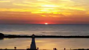

Let me preface this review by saying I think this is a great hike. The warning I give is make sure you know the trail conditions if you’re dead set on hiking the Bright Angel Trail. My intent was to hike 1.5 - 3 miles into the Canyon possibly as far as Indian Garden. When I began the hike, I realized the trail was covered a solid sheet of ice. I tried to descend a short section of the first switch back. I realized quickly that the hazard of slipping and falling off a cliff or injuring myself was too great. I aborted and returned to the top where I saw a sign saying “Crampons Recommended”. Please prepare carefully before doing this hike as many people have died on the trail. On a cold day like this, the Rim Trail provides a good alternative.