
Live Your Best Lives
McCullough Gulch Reviews
4.7
3 of 76 Best Attractions in Breckenridge


Reviews

Being from the flat Midwest, this hike was challenging for our family. While locals treat it like a walk to the store, we found it a true adventure. Not everyone made it to the top, but it was a great place to feel like a hike mountain hiker.

6 of us hiked this trail. The scenery is beautiful. I believe it's rated moderate. 4 of our group was over 60 and from sea level. They all did great. It can get crowded on the weekend, so go during the week or go early.

A good hike that us 2 “seniors” made in 2 hours up. Some key points - watch weather at all times as it can change quickly, take layers as quite cool up at the lake, take hydration and snack and take plenty of great pictures! Trail handled all levels as we saw elementary aged children and then senors older than us - just go at your own pace!

Great hike with flora, fauna, great views and a rewarding view of beautiful falls at the end. Steep at beginning but otherwise meandering and relatively level. Get there early in the day as the road for parking can get a little choked with cars.

McCullough Gulch has beautiful waterfalls and views. It is amazing! It is a difficult climb so make sure you have good hiking boots (tennis shoes or running shoes won't work). It is a good work out.

I was a little worried about doing this. We are both out of shape people who live at sea level so I thought it might be too much.
The trailhead is easy to find. Just drive to the end of McCullough Gulch Road. I'm not sure how the people who had trouble finding it could miss it.
The first half of the way to the falls is on an old mining road. It is a pretty steady climb. Eventually you leave the road and follow a well marked trail to the falls. A few pictures that are posted show what is called a boulder field. The places with rocks are not a challenge at all. It is a very pretty walk through the forest. I enjoyed it a lot.
The falls are very nice. There are several cascades and we enjoyed sitting and watching. We didn't go up to the lake and really enjoyed the walk down!
If you are interested in a quiet walk in the woods, heed the warnings about going early. We started up at 8:30 on a Friday. There were 4 or 5 cars parked and we had a tranquil hike. On the way down though it was much different. Tons of people talking loudly, carrying boom boxes, etc so it was a very different experience. So go early, unless you are one of those loud groups. You loud groups please go late!

McCullough Gulch is a great hike with lots of rewards. Go past the Quandary parking toward the right. You will have at least 0.8 miles to walk on the road to the trailhead. Enjoy the wildflowers and intermediate sights. Definitely keep going to the beautiful lake with amazing views. It's a 'moderate' hike but will get your attention if you're not used to high altitudes.

We are from Florida and we were looking for moderate hikes. This was perfect for us. Beautiful scenery and easy to get to.

This is a great hike. You have to go see the water falls and hike up to the lake. Best hike I have been on.

Moderate climb past lakes, waterfalls, historic cabin, mine hardware, etc. Go as far as you like. Well traveled.

My husband, 11mo. old and myself hiked this trail early fall. We carried baby in a Kelty back carrier. The trail proved a bit more difficult than we expected, and we are both in good condition. (Difficulty may be contributed to altitude change and extra weight on back).
Be aware that this hike is an uphill climb in most of the way, so if you want a leisurely stroll through the woods, this may not be for you.
We hiked to the falls, not the lake, which took us about 2.5 hrs round trip.
I would suggest this trail if you want to be "pushed" a bit, and want to view gorgeous scenery!
The road getting to the trail head continues a few miles, so keep going, and watch for pot holes!

Moderate hike! It was tough for us sea level people, but totally worth the work out for the views. Dog friendly, kid friendly.
It was about a mile and half to the top to see the waterfall. There are plenty of places along the hike to stop and catch your breath and rest. Lots of trees for shade.
Definitely need active clothes and tennis shoes or hiking shoes. Pack water.
Includes:
-walking at an incline
-hiking some rocky areas
-a few stair-like spots
-crossing a couple of small streams on logs.

Relatively easy hike. I went solo in winter and it took me 3 hours, excellent for short hike. Will be back.

So my son was spending the summer in Breckenridge, and we were fortunate to visit him. He found this hike and encouraged us to join him- I was a bit leary, as I haven't really hiked in a while.
The hike is moderate in intensity- about an 800 foot elevation increase and some rockiness- but totally do-able for anyone without joint troubles and in reasonable shape. There are beautiful falls that you can see at different points. My son pushed us to go to the top, where we found a stunning glacial like.
We did this hike in July and I really enjoyed seeing beautiful mountain wildflowers. We also encountered an old mine which evidently a private owner still operates. Pretty cool, though.
This hike was a major part of a perfect vacation day.

Loved this hike! It was about 2 miles in and 2 miles out, and took us about 3 hours to complete, stopping for lots of pictures. I'm not a fan of big drop offs, so the ride to this hiking trail was ROUGH for me, but slow and steady and you get there. We arrived early - around 8:30 or 9 to avoid the larger crowds and ended up getting a close parking spot. You have to park about a third to a half a mile away from the gated entrance to the area and then you have about another quarter of the mile before you reach the actual trail. Some spots on the trail are hard to tell where you are going, but it is almost impossible to get lost. Gorgeous views of the mountains, a waterfall, and a beautiful lake that feeds the falls await you on the glorious hike. I would rate this trail as an easy to moderate hike for people that are active and well due to narrow bridges, uneven rock and some steep inclines. I also highly suggest taking water with you and possibly a snack to eat. Get up early to beat the crowds. There is one part of the trail that was clearly washed out by a rock slide. The trail completely disappears, so you must traverse the rocks to continue on your journey. The beautiful part of this hike is that everywhere you look and go, there is something spectacular to look at. This is a must do for active folks when visiting Breckenridge.
Take home tips:
1. Bring water - I wore my camelback that stored enough H2O for the three of us hiking
2. Wear shoes with a good grip - hiking boots or trail running shoes are best - some areas are smooth and its very easy to fall
3. Go early and avoid the crowds
4. Bring a camera or a GoPro for good pictures

This beautiful hike climbs along a mountain creek up to a glacial lake. The scenery is gorgeous and the trail is usually well marked. The lake is at almost 12,000 feet, so unless you are used to that kind of elevation, plan on stopping frequently to catch your breath on the way up. Make sure and take plenty of water as well. But push on to the top -- it is so worth it. Take a break at the top with the nice little lunch you brought with you -- you'll feel exhilarated once you've rested a moment! And the climb down is much easier.

As said in other reviews this is a good started hike. There are some slippery and muddy spots this time if year but we easily hiked to the lake. If you want a very moderate hike with great scenery this is a good hike . But I have one big warning..many people bring their dogs and they are NOT polite about picking up waste . My son stepped in it and to make a long story short we ended up having to wash him off in the water. It ruined our hike in a way. Careful where you step!!

Long walk to trailhead despite taking two separate shuttles. Most of the hike was very rocky. Trail was NOT well marked, and as a consequence, we did a fair amount of “exploring” without cellular coverage. Someone needs to do a better job of marking the trail!!!

Beautiful trail that is easy to follow. Parts can be steep and snow covered in early summer. Great views of lakes and waterfalls.

Breckenridge has lots of hiking. I wanted a 2-3 hour hike and this was perfect. I stayed downtown/highway 9. To get there you go 8 miles on highway 9 south to turnoff for hike. At the turnoff there were several people parked as this was the trailhead for Quandary Peak. To get to McCullough Gulch trail head you will need to go about another 1.5 miles. This is a gravel road that is not overly wide. You feel high up and there are no guard rails. I was not freaked out and I hate heights but this short drive could make some uneasy. Once parked you will walk about a mile to trailhead on the road. I love this part as much as the rest of the hike since your in the open and can take in the 360 views. The trailhead starts out steep and then you head into thicker trees followed by some rock trails ending at a beautiful waterfall. If you keep going there is a lake. I opted out since I was on a time schedule. The hike took me about 2 and 1/2 hours. Per my Garmin the elevation Min (start) was 10,382 and max was 10,930. I saw plenty families on the trail. It's moderate to difficult in parts. The difficult parts being where the trail is large rocks. Loved this trail and the close proximity to Breck was an added bonus. The only thing I would have done different was to bring a pack for my water bottles.

We did this hike on our first day visiting the area. It had beautiful scenery and was fairly easy to follow the trail. I had to stop frequently since I wasn't yet acclimated to the altitude, but it was worth it. We made it to the little lake above the waterfall, which was lovely with clear water.

I consider myself in decent shape and this hike kicked my butt! My husband who never ever works out thought it was pretty easy. This hike is straight up hill and very rocky where you could easily twist your ankle. I think we would have enjoyed it more with more preparation and knowledge. BRING MOSQUITO SPRAY, a walking stick and plenty of water. The falls are BEAUTIFUL the lake at the top ehhhh

If you have time for one hike in the Breckenridge area this is the one. It is not to extreme and has its challenges but the trip up the waterfalls is awesome. Get there early so you can find a place to park. Make sure you bring lots of water and have fun.

*pay attention to where you park like others said
*dress in layers-we we’re cold before the hike, then hot as we hiked-then cold when the weather changed
*take a small picnic to enjoy while at the lake-it takes so much effort to get there it’s nice to sit and enjoy it.
We are Texan:we were in CO 2 days before the hike. Elevation wasn’t an issue. We took an oxygen can that you can buy at Walmart for $15. It was helpful just to help catch our breath because the hike a good workout.
*My almost 7 year old had the hardest time but still hiked the whole thing. My three boys were like mountain goats. My three girls were way less happy about the length of our hike!
*it hailed on us for about 10 minutes. Quite an adventure: pay attention to the weather!
*we accidentally got off trail. I recommend a hiking app that doesn’t require service. Once the weather came in we were hustling and somehow got off track. That really sucked. The wildlife trails are worn down and can be mistaken for human trails.
THIS WAS OUR FAVORITE HIKE-we did garden of Gods and 7 waterfalls also-the views were just over the top amazing here and it was just super fun for us. Some of the other reviews almost scared us it would be too hard-but it really wasn’t. We took breaks as needed and the weather was perfect (50’s)
My brother lives in Colorado and hikes all the time. He said this is a moderate trail in CO terms. I’d personally say it’s a little more challenging than moderate for non CO people. It took us about 3 hours up and an hour down but that’s with a lot of kids and hail.

The biggest issue is finding the trail head! First our Nav took us to the Lower McCullough Gulch trail head which is still miles away. Our first clue was the tiny parking lot with just a few cars. If you end up there, continue back south on Hwy 9 to Blue Lakes Road. You will be tempted to park at the first trailhead you come to, which is for the 14er Quandry Peak. McCullough Gulch Trailhead is still 2 miles ahead on the dirt road (through the gate.)
We clocked the hike to be about 5 miles round trip. It took us 90 minutes to get to the top and 45 minutes to get down. We had children ages 7 and up and they all did fine. The altitude was a bit of a challenge for our Texas family but we took some breaks and it was great.
It gets steep and rocky in places - a few times we had to use our hands to navigate our way. But I would still consider it a moderate hike. We were breathing heavy and sweating along the way. BRING LOTS OF WATER! There are plenty of places to stop and rest in the shade.
There is no water or bathrooms anywhere along the trail. Wear sunscreen and apply bug spray. There were lots of mosquitoes at the top.
The temperature in July was in the 70s with a pretty even amount of sun and shade. We got there around 11 - the clouds were rolling in when we got down around 1:30.
The views at the top were stunning. Very glad we did it!

We first hiked this on 6/20 and the road in was closed, adding 2 miles to the hike. The road is wide and although uphill for the majority, is not very steep. Snow banks were present on both sides and were somewhat deep in the woods. By the time we reached the trailhead, it was truly beautiful. There were several areas of the trail still covered with deep snow. We didn't have snow shoes and one of us broke through the snow up to the hip. We got to the old mine and decided to stop as it started to snow and the next snow to traverse was around 5' deep.
We then visited on 6/23 and the road was open, eliminating the 2 mile walk in. This time, we drove past the trailhead to the right and enjoyed some beautiful views. A beautiful fox digging for his dinner entertained us for some time. We explored the old mine further up the road. It started to snow so we turned back.

What a beautiful hike. We all enjoyed the hike and the gorgeous waterfall. Definitely a must do. Kids all made it and parents too. Just took our time.

For the time, and quick workout, with rocks, mines, water, lakes, water falls, and interesting trail this has it all. I live here most summers and do this one almost weekly. That Great. Early in summer gets very muddy with run off and hikers. Can be crowds, in summer and weekends. Have Fun!

I hiked this trail with kids aged 6, 10, and 13. We made it up to the waterfall, but sadly did not make it all the way to the end due to fatigue with the kids. The large waterfall was beautiful and definitely worth the hike. The trail is doable for all skill levels, but it can present some trouble for inexperienced hikers or young children, namely the boulder fields can be tough to pass.

Hiking is a must in the mountains especially coming from flat Louisiana. This trek is a bit harder for us but it is so worth it. If you make it to the falls then you can easily see why it is recommended. We made it past the falls to the first lake. The lake is clear and shallow near the path. It is so pretty. There are two more lakes higher up but we ran out of energy. The path to the lake can get steep and hairy at times. We walked through a foot of snow in July to reach it. Hiking boots make it easier. Some people used hiking sticks. We had tennis shoes and slipped along the way. We felt great making it to the top.

Nice hike with beautiful waterfall and lakes. Some of the trail is rocky and difficult but if you take your time it is a rewarding at the end.

My family and I hiked this trail in August and were happy to have reached the summit! Some spots were challenging due to the rain that occurred the night before, but nothing a tree limb walking stick couldn't help out with! Beautiful scenery and perfect picture spots along the trail.

We hiked this on Tuesday late morning. The weather was a balmy 40, the sun was out, and there wasn't another soul on the trail. The altitude was the only thing that slowed us down (that and when our yak traks kept falling off). There wasn't enough snow to actually need the yak traks for the entire climb, but that will end soon. A few tricky spots and we had a bit of difficulty finding the trail near the top, but otherwise it was a beautiful climb.
You'll cross a few streams (over a footbridge or a makeshift footbridge, so you won't get wet), clamber across a couple of boulder fields (just keep your eyes out for the "trail" marker and you'll be fine), and some steep grades. But nothing you can't do with ease if you're in reasonably good shape. We had two flatlanders with us and they did pretty well.
There is a lovely series of waterfalls near the top - make sure you sneak off the trail to take a look (you'll hear them). Yesterday they were just starting to partly freeze over - lovely!
I highly recommend this hike. It was probably a four hour trip (including several stops to recover and reattach the yak traks, take pictures, and catch our collective breath). Enjoy!

The waterfalls are just beautiful on this hike. It is about an hour or so to the top of the falls and uphill but doable. If you can find the trail beyond that (which is not easy), it is much more uphill but worth the view of the large mountain lake and the "bowl" view. I am told that it is another 30 minutes or more from there to an even more beautiful lake but we gave up after about 2 hours to the first lake. It then began to rain and hail (very small hail) and got cold. We should have started earlier. We carry our rain ponchos but it was a little harder getting down on wet rocks than going up. We had to go home so we could not go back another day, but the next time to come to colorado we will do this hike again and try to go earlier to see the further lake. Recommend this but it is not an easy hike unless you are in good shape.

It doesn’t start well - a forest service road. Soon you get to a real trail. Don’t stop at the first sighting of the waterfall. Keep going to the top of the water fall and the small lake above that feeds it. Beautiful scenery.

Our favorite hike during the week. What's not to like...rushing waterfall and alpine lake. Some people only hiked to the waterfall, but recommend going the extra 1/3 mile to the lake. Pretty awesome. There is some rock scrambling so suggest good hiking shoes. We got caught in a hail storm (July) on the way down, but were past the rock scrambling part so all was good.

This hike is just challenging enough to be rewarding, but not so much to be daunting. Part of the hike feels like a scene from a Tolkien adventure, but the summit reveals a beautiful Colorado lake surrounded by mountains. Our whole family loved it!

I know the guides say the elevation gain to the falls is only around 800 feet but it feels like more. However, the falls are worth it. Bring lots of water and good shoes. There are sections of the trila that require good footwork.

Wow! Put this on the "must do" list while in Breckenridge. The views are spectacular. It's a well travelled path through high alpine forest, with breath-taking waterfalls, wildlife, lush green meadows, and granite peaks.... Topped off with a beautiful lake and glaciers at the top. I was sucking air initially, but it got better after the first half mile. Worth the effort from beginning to end!

This trail was amazing. Getting to the top was worth the climb. Go as early as you can to avoid afternoon rains. Breathtaking & just enough challenge for an average hiker.

The area is magnificent. The trail was busy, though. Too many people. At times we were backed up on the trail. Breathtaking timber line and waterfall views from 11,500 ft elevation.

I only did a little portion of the trail since I wasn't completely acclimated to the altitude. Regardless, I did enjoy the hike and wish I could have gone further. The scenery was wonderful and worth the short hike. After the hike I drove Blue Lakes road and that was wonderful with great scenery!

This hike isn't too long and isn't too strenuous, which makes it pretty popular, even during the off-season. It has some nice shading from trees and is easy to get to, even in non-four-wheel-drive vehicles.
Try to get there early to beat the crowds.

Perfect way to spend half a day. A lot of elevation change, but take your time as the falls and lake are worth it! Take water, and bring extra layer as it was quite a bit cooler and breezy at the lake level. Watch carefully and you may see mountain goats!

This trail has amazing views and the waterfall is spectacular. The hike up to the lake is well worth it. We spent several hours here and really enjoyed it.

We hiked up to the beautiful waterfall. It was a very nice hike. There is some scrambling on rocks involved, but it was not too difficult. The views were beautiful and definitely worth the effort. We will definitely hike this trail again next time we are in the Breckenridge area.

My husband & I hiked this gorgeous trail & loved every second!
The waterfall was breathtaking, right along with all the magnificent scenery!
We look forward to bringing our girls back to hike this trail!

This was a nice hike with waterfalls and a lake at the top. Some people have described it as easy, but I think it is more of a moderate hike for an average person - especially if you're visiting from a lower elevation. I thought it was well worth doing.

We took the upper trail leading to the lake. Beautiful scenery and wonderfully fresh air. Our two dogs really enjoyed it. It’s a moderate hike, but if you have knee problems like me it will be much harder. But all in all very worth it. We went about four miles round trip in a couple of hours but we were taking it slow. Definitely go enjoy!

This was my second time to hike McCullough Gulch in two years. A hike to the top of the falls takes you to 11,920 feet elevation, which, for us sea-level dwellers, makes you really aware of the thin air at such an altitude. Take plenty of water and a snack or two and make a day of it. Round trip travel will take between 4 - 5 hours. We had to park a mile or so from the trailhead this time due to park rules, but the walk was good. If you get the chance, go!

This was one of our favorite hikes while visiting the Breckenridge area. We went with a senior, a few adults, a 7, 4, and 2 year old. We all made the trek. It has a few difficult areas, but the rewards and scenery will blow you away.

This hike is not too hard for experienced hikers and those used to high altitudes, but it may be tough for newbies. The trail is pretty well-marked, but it is also rocky and varied enough to keep teens interested. The trail goes through meadows, snow (even in June), mud, forests, and rocky valleys. It is an in-and-back hike, not a round-trip one, and it takes a couple of hours. The waterfalls early on are nice, but the ones at the top (end of the trail) are stunning. We saw plenty of chipmunks and even a porcupine on this hike. There is an old abandoned mine that the Forest Service is in the process of cleaning up. Wear good hiking shoes and carry plenty of water.

A moderate hike for us but a pretty rigorous one for our friends. Our friends were pretty reluctant all the way up but once we got to the glacial lake and saw the mountain goat they were soooo glad we talked them into going. We will go back. We like to have a picnic at the high point of our hike but it was way too cold (Sept. 11th). We want to go back in June when the flowers are out and hopefully it will be warm enough for our picnic. (All our CO hikes have previously been in Aug.)

Beautiful hike, but this time of year you’ve got a 2 mile hike to get to the trail. Go prepared, but not a super bad hike. Beautiful

Absolutely gorgeous hike - a moderate trail, if you are not acclimated to the altitude be prepared to take a couple short breaks and be sure to bring water. I definitely recommend hiking all the way to the lake at the top and be sure to check out the waterfalls. We did this hike on my sister's birthday and she said it was the best birthday ever because this hike was so beautiful. We took pictures, but they do not begin to do it justice!

For average fit people this is a great four to six hour hike. Take a lot of water. Park as close as possible to the gate (that's closed to cars) at the trailhead to keep the hike fun

Start this hike early in the day as you never know when the weather will change! The reward at the top is a beautiful lake and waterfalls! You will hike through pine forests and rocky rubble with awesome views of the gulch and neighboring Quandary Peak.

My family and I loved this hike. You get great views all the way up to the waterfall. It's even better if you continue on past the waterfall and go to the lake. I would suggest bringing lots of water and some snacks to enjoy the scenery at the top. It also can be 10-15 colder by the lake so don't forget your jacket or sweatshirt.

What a beautiful hike! Our family of 5 recently made the hike to the falls. Two of us had some problems with the altitude and had to take it slow. But there are plenty of places to rest along the way. This is a pretty steep hike and there are rocks and roots along the way. But just take it slow and enjoy the scenery. The falls at the end are well worth it.

Beautiful hike with lots of wildflowers, waterfalls and a lake. We did not go to the second higher lake, but really enjoyed the hike through the woods to a little bit of leftover snow. My husband took a quick 40 second swim in the first lake. Loved that it wasn’t very crowded too! Shuttle service from Breck was great!

Great hike with a little bit of everything. I would agree with the Moderate skill rating due to some narrow crossings over streams, medium rocks to traverse, and uneven footing on inclines in spots. Overall we saw children under 5yrs old and folks over 70yrs old along the way. The effort is worth it for the waterfall and lake at the summit! Highly recommend it. Took us 4hrs exactly parking 1/4 mile from the gate to do the hike to the first lake and back including stopping and eating lunch at the waterfall.

We enjoyed the hike. Lots of up hill and rocks near top. The lake and waterfalls were amazing. Take lots of water and pictures.

This trail has it all! We saw streams, trees, wildlife, rocks, mud, snow, and a beautiful waterfall. We hiked this trail with a 6 and 7 year old and a 66 year old. It was enjoyable for all of us. Lots of picture opportunities along the way. I suggest layering and taking lots of water breaks to stay hydrated. The waterfall at the end was simply majestic! A must hike trail in Breckenridge!

We hiked this trail in late July 2015 with two young boys (4.5 and 1). The hike begins as described - quite steep, but it follows a stream and that was enough distraction for our 4 year old. The views of the mountain range, river valley, and stream are amazing. We took our time while on the mining road and then were able to settle into a more steady pace once we hit the single trail. The waterfall loop before the final climb to the lake is worth taking.
We only spent 20 minutes at the lake and we took about 4 hours to complete the hike. As with many popular hikes, there are a number of different paths at certain points throughout the hike - all of the ones that we followed met back up with the "main" trail.
My wife and I are intermediate to advanced hikers with some experience. Make sure to drink a lot of water while on the trail and make sure to look around!

We chose this hike for our family of four (sons 16 and 13). We are all relatively active but not all-stars by any means. The hike is rated moderate but it definitely was moderate to difficult for us. Close to 1000 ft in elevation and many steeper areas, nothing crazy though. We were determined to get to the top and felt a huge sense of accomplishment in doing so! We spent an hour at the top skipping stones in the lake, made a little snowman, took in all the views, etc. There really is no parking at the trailhead (just park along the dirt road) so best to get there early. We were there just after 8am with no problems. Definitely much busier as we were coming back down. We were done by 11:30. Just a warning that the beginning of what you think is the trail is really just an old narrow dirt road that leads to the start of the trail. That old narrow dirt road is steep climbing and seemed to go on awhile but it does get much more scenic when you get up a bit. Once you reach the waterfall, there is still quite a bit of hiking to do. So glad we did this hike - perfect difficulty level and a great sense of accomplishment for us flatlanders. I would recommend to the average family looking for a great hike close to Breckenridge.

We are sea level people and took on this hike on the second day. The rise is less than 900 feet but starts at over 10,000. It is a beautiful hike with many passes and encounters with the snow melt river. It does require some bouldering but the waterfall at the top was well worth it. We didn't have the energy left to make it to the glacial Lake which is supposed to be amazing. Our group of 18 left the under 6's and over 70's about half way up.

My wife and I were in Breckenridge when temps were 0-20 and it snowed daily. Even with 2 foot of snow on the ground, we drove up to McCullough Gulch to do some snow shoeing. We never made it to the end of the trail because snow shoeing is tough, especially when you're not used to the thin mountain air. It doesn't matter that we never made it, the views were great! During heavy snow, the 2 mile drive to the trail head has deep snow so snow shoeing and cross country skiing are both activities to be enjoyed. Next year we're going back and hiking up to Quandry Peak. Cant wait!

100% agree with previous review that you need to go early in the day during the summer. It does get crowded and it does rain in the afternoon. You don't want to be on that trail in the rain, as it is already rather muddy and would be very slippery when wet. Also, lots of lightening in late summer.
This is a great hike, with beautiful vistas, towering old growth trees, many varieties of plants and bushes. The waterfall is not Niagara, but it is very pretty and the alpine lake is pristine! There was some trail maintenance when we were there, but the trail was open and the workers were very friendly!
There is a little rock scramble about half way up, but it is very doable. I'd recommend sturdy shoes, not flip-flops, hiking pole(s) and a full water bottle. Since it is a mountain environment be prepared for a rapid weather change.
Plan on 3-4 hours, depending on how fast you hike. It isn't suitable for small children, unless they are experienced hikers. Even if you don't make it all the way to the lake, it is still a nice hike.

McCullough Gulch is on Mt. Quandary. As you drive along the road to get to the McCullough Gulch trailhead, you will pass the trailhead leading to the summit of Mt. Quandary. Keep driving. The McCullough Gulch trailhead is further up the road. At the beginning of the hike, you will pass a miner's cabin. A miner used to there, but last summer when I was there, it did not appear that anyone is living there anymore. The trail is fairly well-marked most of the way, but can get confusing, especially early in the season, as you move further up the mountain and at times you might come across a tree trunk or something blocking the trail -- again, more likely at the beginning of the season. There is a side trail that takes you over to the base of the lower waterfall before you start your climb to the mountain lake. Not a terribly difficult hike, but it might be challenging to older hikers or young children. At the top are a beautiful mountain lake and waterfalls. One of my favorite all time hikes.

If there is only one hike you do, this is a really good option. It's less than 4 miles to the Alpine lake and has several areas with incredible views. It's still a fairly difficult hike, but something that can be done if you give yourself some time and a lot of water. The elevation is pretty high, so make sure you acclimate to the elevation for a day or two before attempting. I wouldn't suggest taking children or elderly people unless they are fairly experienced hikers in decent shape.
The hike starts at about 11,000' and has a 900' elevation gain. When we wan out of breath, along the way, we took the chance to photograph the stream, wildflowers, and waterfalls.
The terrain varies between dirt roads, rocks and roots, bouldering, and even a little snow pack right before the lake at the end of the trail. I would suggest proper hiking shoes because it changes so often.
Some people we passed on the trail chose to turn around after they reached the best view of the waterfall. I'm glad we continued to the lake which was probably less than 1/2 mile away from the waterfalls. The hike up to lake from the waterfall is a bit steeper than most of the trail leading to the waterfall, but the view of the lake is well worth the effort. The trail is well marked up until the waterfall. From there, the trail isn't well-marked, but the way up is relatively obvious and well-travelled.
There are a few offshoots from the trail that lead to overlooks with amazing views of the gulch, but they aren't necessary since you'll see several spectacular views.
Parking can be interesting, so arrive early and make sure you part facing back out towards the road. This will make it easier to get out after the small parking area is more crowded.

Pleasant hike today up to the falls. Breathtaking scenery (and altitude for someone not acclimated). The highlight of the joke was seeing a group of six mountain goats on the way down.
Only downside is that it gets very crowded in the summer and parking can be difficult. We went on a Thursday morning and had to park 1/2 mile from the actual trailhead. I would recommend getting there as early as possible or come after 2 if the weather is forecast ok.

I gave this an Excellent four years ago, and have revisited it several times since, including today as I write this. It's still a beautiful hike, leading from the trailhead (more on that below) up a steep old jeep road that turns into a hike through the forest and across some rock formations, visiting White Falls, one of the most spectacular waterfalls in this part of the Rockies (yeah, I know that Continental Falls is also pretty good), and ending at a beautiful high mountain lake (really, reservoir, since it has that purpose). The adventurous can continue on up to higher lakes, though there are disagreements about which of several choices constitutes that mysterious "upper lake" beyond the reservoir. If you want to claim to have seen "it", you can hike up that easy ridge to the right of the reservoir, and somewhere shortly after you have reached 12,000' you can peek around a formation and get a glimpse of a small lake that's one of the candidates, and really not very far from the reservoir. I've included a photo of the peek in my pictures from this hike.
The star of the show on this hike is probably White Falls, which once was not on the trail, but had to be seen by bushwhacking toward that loud sound of running water you'd hear on the upper part of the trail. Later, the bushwhacking was replaced by taking a marked side trail, and finally, now, by just staying on the trail that has been rerouted to pass directly by the falls.
Other changes: Not all that many years ago, you could park right at the end of the road, where the trail now heads steeply up near a rushing creek. On a visit a few years ago, the trailhead had been moved back a third of a mile to a gate installed beside the Quandary Tunnel north terminus. I see on this visit that the trailhead has again been moved back another third of a mile, with the road blocked at that point. This means that if you have not been on this trail for some years, you will face a round trip about a mile and a third longer than it once was. But it's a mile and a third on a pretty good, and almost flat, gravel road, that shouldn't add a bunch to the exhaustion factor for this hike. It's still very much worth it.
PS: A time-dependent remark---If you are planning to hike this near the end of July, 2018, do check to see if the trail is open, since there are plans to close it for a few days to replace a bridge.

I definetely recommend this hike. It was about 4 miles total, but teh view of teh waterfall at teh top was wonderful.

For flatlanders from the midwest, you will feel the altitude on this hike. However, just take short 2 minute stops here and there by the water and you should be fine. This 52 year old 30 pounds over weight bum made it. Just pace yourself. The bigger falls and the lake at the end are worth it.

This hike was incredible. There were beautiful sights along the way. It definitely climbs and there are a couple short but technical parts (going up and across larger rocks where no trail is present). The top is so rewarding though.
We took 4 young kids (1 in a backpack. The others are great hikers but did require assistance in a couple parts.) Definitely not a trail for strollers.
To access: this is actually past Breckenridge and right outside of Blue River. There is a few spots to park in a parking lot, but many were parked on the roadside (make sure there's no "no parking" sign". There is a gate to enter the area, and then a walk down a wide dirt road until you reach the actual trailhead. Then you being to ascend the mountain. While we were there on a hot day, much of the trail is within the trees and provide great shade, especially at the bottom part. But definitely wear sunscreen!
Take lots of water and maybe a snack to enjoy at the top when you reach the falls. There are great views all along the way and the pictures of the falls at the top don't do it justice. If you can handle a moderate-to-difficult hike, do not skip this!

A must do, for the area. Go all the way to the lake, it is beautiful. You get above the tree line and the waterfalls are worth the hike!

The falls are beautiful and keep going on up to the glacial lake - gorgeous! The hike can be a little slick when wet - be careful.

McCullough Gulch is one of the most recommended and well traveled hikes around Breckenridge. It is rated "Easy to Moderate" by the Forest Service but, in combination with the elevation, it will be more difficult than most people anticipate. Having said that, I would not discourage anyone who is moderately fit from attempt the hike because the lake and waterfalls are absolutely beautiful. Please respect the private property and mining operation that you will encounter along the way and leave only foot prints when you depart.

"Easy" is relative but, I hike and run regularly but in the Blue Ridge mountains so closer to sea level. This hike was not too challenging for me and the views were great. I did it on a weekday morning and saw very few other hikers. Up at the top it is cold and very windy, so dress in layers!

I went with my family and we loved this hike for the variety of terrain, the waterfalls, vistas, alpine lake, and the abundant wild flowers everywhere! It's not an easy climb but it's not too hard either. We're from Florida, so we took our time because of the altitude, but it was well worth it. Would go again in a heartbeat (pun intended!).

Son and I hiked up to the falls, beautiful day to hike to a great place. We drove up to the top and glad we started there, no need to hike up the road. They have a crew starting on some bridge work so it will be closed later this month. Enjoyed it very much!

Our family visited the falls on our visit to the Brecknridge Area. I advise going fairly early to avoid the rain and when visibility is good. We just had our Toyota Corolla and it did fine on the road. There are some narrow spots and it was a little scary for some of the flatlanders in our group but worth it. We saw several marmot scurrying, around and playing. There were several fishermen at the lower lake that seemed to be having some luck. It is a beautiful view and we'll worth a visit. I am glad we went. Photo ops at this location are abundant. If you have small children be prepared to keep them close. Loose rock and cliffs could be dangerous if you're not careful. We climbed all over without any equipment and if I go again I would take walking/climbing equipment and be more prepared with hiking items. The views are also quite nice from the car and parking lot for those less adventurous.

This hike was pretty tough on the way up to the views but totally worth it once you are there. It takes about three hours total. The waterfalls were beautiful, definitely recommend going if you have the time.

This is a gorgeous hike. The water falls in the early season are stunning, and it's always a delight to get to the alpine lake at the top.
One of the most interesting aspects of this hike is that it starts near what seems to be an old-timers mountain house. The house used to have a slightly scary sign mentioning shooting you if you stepped on premise. However, I noted this weekend that the cabin and old truck are still there, the scary sign is not. Still, it adds an interesting aspect to the start of this beyond-beautiful trail.
I just did this hike in mid-June and given that it had just stopped snowing 3 weeks ago in Breck, no surprise to find snow fields that you needed to pass to get to the lake. Never fear. Take it slow and be smart and it's easy to get to the lake.

My wife and I are 68, reasonably fit and enjoy easy-moderate hikes. We would rate this one moderate to moderate+ because the terrain is often loose rock and the trail is a steady incline from bottom to top. Roundtrip to the lake and back to the car was 5 hours. However, we were intentionally very deliberate, we took lots and lots of pictures, and we spent considerable time at the waterfalls and the lake. 4-5 different times we found spots that were so beautiful and calming we hesitated to leave. From our parking spot, we figured our total hike to be 5.5+ miles.
Being flatlanders from Indiana, elevation (11,100’ up to 11,900’) definitely impacted our climb. It was hard for us to go much more than 100 yards or so without catching our breath or taking a picture. Also, about a mile from the trailhead was a sign warning against parking any closer; however, after we did park we found several cars parked down much closer to the trailhead. That would have saved us 20-30 minutes total walking.
The trail is only 10 miles outside of Breckenridge, but the road is hard packed stone and dirt with many potholes, so you do need to take it easy once you exit off Colorado 9 South.
The hike through the gulch to the waterfalls is gorgeous with a wonderful rock area for photos, snack and rest once you arrive at the foot of the falls. The hike up to the lake is about another 30 minutes (.3 mile) at the same incline, but well worth the effort. Of course, coming down is much simpler and faster, but you do need to mind your step to avoid tripping over a root or rolling your ankle off the side of a rock.

The hike is long and difficult for those not in good shape but it is so worth it, the top is beautiful!!

This was a very nice family hike. Easy access to trail head and the trail is easy to follow and offers great views of waterfalls and a glacier lake.
Recommend you start early, to avoid any early afternoon storms that may surprise you during your hike.

Awesome hike! A little tough in spots - rocky at times. It was rated Easy/Moderate - but one woman ahead of us kept yelling out - this is not easy or moderate! Guess it is all relative. Loved the views - definitely worth the effort.

I love this hike I've been 3 times and every time I've seen mountain goats. The glacier lake at the top is beautiful! It's a must do ;)

Weather kept my wife and I from climbing Quandary peak so we hiked this route instead.
Lots of wildlife and great views. Good for people who are not ready for a 14er.

Nearby Quandary Peak gets all the attention and crowds - but just a little farther -- and the tip off for Atlantic and Pacific Peaks (high 13-ers) is this trailhead and amazing solitude. I actually hiked up the gulch and on to Pacific Peak -- which was a wee bit of a challenge given the piles of scree and the trail finding.
However, lower down, the Gulch is wonderland of flowers, water, ponds and falls! Lower down, the trail is obvious until you leave the lakes -- and then, you are on you own in the alpine! I saw one person (beside myself) all day above the lakes and up to Pacific Peak.
From what I can see, dogs are welcome and there's plenty of water for them at treeline or below.
It's idyllic. When I reached the summit of Pacific Peak, I could see the summit of Quandary swarmed with happy climbers. I get the joy of the 14-er, but the solitude of the M-gulch and Pacific Peak is the old Colorado I still know!

This is a rather difficult hike for young children and those of us over 60. There are a couple of times you wonder where the trail is. If you take your time and rest along the way it makes it more enjoyable because its a steep climb and with the exertion comes altitude sickness. The scenery is wonderful as you get glimpses of a gorgeous mountain stream along the way. You'll hear the falls in the distance but they are still a ways off. Its worth the journey, just know it really isn't an easy hike. Be mindful of the weather as you'll be at tree-line when you finish and you'll want to seek cover in the even of a lightning strike. We came down the hiking trail in the rain and passed a family with small children heading up and wondered about their safety. On a rainy day the trail can be pretty slick. Make sure you have rain gear and warm enough clothing for the top of the mountain.

We hiked this with my family ages 4-45 and was a good trek for all. It started raining at the top, but lots of waterfalls to see there.

My kids were 12 and 15, and they did just fine. Few challenging spots if climbing around rock formations is tough for you. We got as far as the waterfalls, but got a late start so couldn't continue the hike to the alpine lakes, which we wish we would have done. Next time!

We hiked this trail in early August on a weekday with our extended family - 50ish adults and 20 somethings. It was challenging for the older ones and no problem for the younger, but SO worth it! Having a stream nearby for most of the trek up ranks this trail high in my book. When we finally reached the waterfall, it was just beautiful. The remaining trail up to the lake didn't seem as long or hard, and it was definitely worth it for us. I heard there were more lakes beyond, but we were ready to start back down. I rated this a 4 only because for me it wasn't a moderate effort ... but would do a 5 as far as value for the effort.
The road dead-ends at the trailhead, but there's no parking lot, just parking roadside. I'd recommend starting as early as possible. The mosquito population in August was prolific so bring bug spray. There aren't any facilities in the area either. Just the usual outdoor issues. I would not recommend this trail if you're carrying a child, unless you're already quite fit.
In mid-September 2016 we were in the area again and noticed a sign between Breck and Hoosier Pass saying the McCullough Gulch road is closed until 9/30, so check local sources before planning on this one. I'd definitely count it on my "do over" list though!

This was a lovely hike with a decent elevation climb and fantastic views as you climbed and of course at the top where this lovely little hidden lake was. There was still snow at that elevation and it was definitely chilly once you crested the hill to the lake. Layers are a must! We hiked in short sleeves but needed jackets with hoods at the top!

A medium challenging hike, expecially if you are affected by altitude. But what an amazing hike, stunning scenery, waterfalls in multiple locations and if you make it to the top there is a lovely lake.

You can make this hike as difficult as you want. I'm 64, coming from sea level (Florida), so I took things slow. I hiked for a couple hours, made it to a beautiful waterfall and turned back. But there were a number of lakes higher up the trail, although some returning hikers told us there was still a lot of snow on the trail at the higher elevations -- even in late June!
The trail begins at over 9000 ft. Very quickly the trail passes an abandoned mining cabin, where we stopped for photos. All along, you are surrounded by snow-capped peaks. The trail follows a flowing stream in most places.
We hiked on a Saturday morning, and encountered many hikers both coming and going. Unfortunately, we didn't see the mountain goats - probably because we didn't hike high enough.
All in all, one of my favorite hikes in Colorado.

We attempted this hike with a baby and toddler and made it about halfway up. The scenery is beautiful throughout the hike, but it gets progressively rockier and steeper which is why we turned back. The first part of the hike was very wet, so wear good shoes!

This is a great intermediate level hike. The waterfalls are spectacular and when we went we saw a mountain goat which made the hike. This hike is definitely recommended.

This is a beautiful hike w/many water falls and wild flowers along the way. Parking can be a challenge

This is a very difficult hilke. The road is very dangerous. We saw small children crying along the way. Certainly not worth the effort.

Great family hike. We hiked with teens, tweens and a 5 year old, all had a great time. We were breathing heavy after the first 5 min and almost decided not to hike to the waterfalls but boy were we glad we pushed through. After a few more minutes we adjusted to hiking at that altitude and the views were amazing. Next time we will pack a few sandwiches and enjoy them by the falls. We may even go further up to the lake. We heard is is just 20 minutes north of the falls.

I'm a relatively experienced hiker in good physical condition (46 yo male). Went with my 18 yo daughter). This is a moderate hike until you reach the waterfall (1.6 miles I think), but if you go on to the lake (another .3 miles) it is difficult and somewhat confusing. Allow 3 hours total (if going to lake) and don't make the mistake we made of being last ones up, because if you run into a problem, you are stuck there overnight, with no cell phone coverage. Overall a beautiful, scenic hike and well worth it.

My wife and I hiked this trail all the way up to the lake. Still some snow on grind and the lake and waterfalls were full and amazing. About 20 degrees cooler at the lake with the wind coming off the mountain. Hike is up about 900 vertical feet and it was about 4.5 miles round trip from parking to parking.
Views were amazing and plenty of good spots to stop for rest breaks. So many friendly people along the way.
We’re from Texas so the elevation absolutely was challenging. The hike was easy to moderate but the additional elevation change made it moderate to lightly difficult.
Favorite hike I’ve been on in Colorado. Absolutely a must if your nearby!

#1 see below picture. If you google map this place you will end up 2 miles off course.
#2 This isn't an easy hike. The terrain is difficult. Doable with kids but still a workout. 3 hours total for us with athletic kids age 10-ish. There is very little scenery to enjoy along the way. Just head down hiking. We've hiked in CO and SD which were much more scenic. If you've never seen a waterfall it's worth the 90 min hike. Otherwise you can find better. (2nd pictur is higher up and better view than just stopping there). Plus, extra 30 min hike to see lake. It's ok. Clear water but not pretty blue like other places. (See 3rd picture). If you love to hike it is good, but otherwise it's a lot of work for little reward in my opinion.

Glad we got an early start as this is a popular trail up to the waterfalls and a bit farther on, you reach an alpine lake. There were some steep sections and large rocks to scramble over. At the lake, we hiked another 60 feet up to reach 12,000 feet!

A great hike! Had a little trouble finding the trail head, but it was well worth it. Take the detour to the falls, totally worth the extra distance :)

I loved hiking this trail. We went early in the morning, so it wasn't crowded. The trail wasn't too difficult, but I felt like I got a work out in. I loved the diversity of things to see including waterfalls. We hiked up passed the lake and got to see incredible views of the area. In the summer it was covered in wild flowers!

I went up Quandary in the morning and then brought the kids down to hike to the waterfall in the afternoon. Not a lot of wildlife and this isn't all groomed like a national park hike. Kids liked it. Trail still had some spots of snow.

This is a beautiful hike. It is very rocky so be prepared to climb over large bounders. You must make a reservation to park $10…that includes a shuttle to the trailhead. The only complaint I have is the parking lot had 2 portable bathrooms that were overflowing and were disgusting. The garbage dumpster was also overflowing with garbage. Otherwise this would be a 5 star review!

If you are thinking about it, do it!
We hiked McCullough Gulch on the first full day of our vacation in the Breck area this year, July 2014. We live at 695' above sea level and we handled the altitude and elevation gain pretty comfortably. Our family consists of two athletic older teens and two physically active adults. It was a nice workout but the sights and sounds were so stimulating, we hardly noticed. You could probably walk the 2.7 mile round trip in around two hours but we took almost three. We stopped for tons of photos and a few little side trails.
We have had the privilege of taking many nice hikes throughout Colorado over the last twenty years. For a two to three hour hike, this one delivers tremendous variety. If you only have time for one hike during your visit, this is a great choice. Mohawk Lakes would also be a good choice but you have to work a little harder and longer to get to some of the great vistas on Mohawk.
A lot has been written about this hike and for good reason. Trees, streams, waterfalls, wildflowers, wildlife, spectacular views of nearby peaks and an alpine lake at the top. Do this early in your visit and you will quickly be transformed into a Colorado state of mind.
Whether this is your first or 100th hike in the Rocky Mountains, this walk will remind you why you came.
Peace.

We did this hike in June. The weather was perfect. There was still some snow on the ground but we were able to make it to the falls in just over an hour taking it easy. It was well worth it. A bit strenuous if one isn't in the best shape but not technically difficult. Also it was muddy in areas due to snow melt so waterproof hikers made the trip more enjoyable. Go early to find a good spot near the trailhead.

It took four fit folks in their early sixties four hours to do this difficult hike starting at the upper trailhead. There are many areas where one must search for a solid footing on rocky inclines. You must cross two narrow foot bridges. The trail is not well marked at the top and the lake is actually a pond.
We did see beautiful scenery and the peak of the fall colors!

Beautiful hike. Not too difficult, well marked. Beautiful waterfalls. Had picnic lunch by lake. Wonderful day.

Great hike for family. Not a hard trail to hike, although steep at times. The views are amazing. The waterfall is breathtaking.

I read a ton of reviews and had feedback from friends who actually live in CO. about this trail. The altitude definitely adds a level of difficulty. We had a group that ranged in ages from 10 to 70 and we had to stop a few times to catch our breath. It is definitely doable, saw a lot of very young children completing this. It is well documented, bring plenty of water. Weather went from warm to cool, depending on the wind. Definitely bring long sleeves and/or sweatshirt. Start early! There is very lmited parking and you might end up adding some hiking to your hike.

We did a number of hikes while staying in Breckenridge and this was by far our favorite. My husband was carrying a 1.5 year old in a hiking backpack and shortly in, the trail becomes very narrow over large boulders that we almost turned back at. But after a short discussion we decided to press forward. We were glad we did. #1 - always pack layers #2 - always take rain gear...we were all dressed appropriately but at the car, as I was packing the rain jackets in my pack, my husband said there was absolutely no rain in the forecast and the sky looks gorgeous...I almost packed them anyway but after his insistence - left them. As we got to the top to the gorgeous double waterfall - a thunderstorm rolled in - not just driving rain but hail. We were completely drenched as we quickly made the descent...in fact we were walking so quickly (the little one was freaking out with the thunder) we ended up off the trail. Minutes went by before we realized we weren't on the trail and completely disorentied we kept going. Panic was starting to set in when we finally saw someone through the trees (actually the 14 year old did - which he proudly tells in the retelling of our adventure) and were able to climb up back on the trail. Despite all these we were all smiles when we got to the car and as I profusely apologized for us going on a trail that was maybe too much for us - I was told that this was by far the best thing we did during our whole trip.

As previous reviewers state, get there early. The place fills up rather quickly. This is by no stretch an difficult hike but is uphill most of the way. Coupled with the high elevation, if you are a low lander, prepare to be winded. Oh, and take along plenty of water. Hydration is key.
Once you reach the main lake, you can continue on to even higher lakes. We normally pack a lunch and make the most of a day out of it. Keep you eyes peeled as wildlife is a common sight.

This hike has it all - boulder fields, lakes, creeks and waterfalls. If you time it right there will still be snow fields at the top near the lake that you can slide on (put a plastic lawn bag in your back pack for such a purpose). Great for families.

My boyfriend and I hiked it today after finding it on Trip Advisor. It was a great 2:30 hour hike. You must make it too the top to see the lake and the falls at the top!

Beautiful waterfalls, views from the lake. If you don't mind being around alot of people then this hike is fine. If you want solitude, don't go. If you are acclimated to altitude and use to hiking mtn trails, this is a nice short hike, if you're not, it will be more taxing. Lots of wildflowers everywhere, gorgeous.

This was an awesome hike. My husband and I are in relatively good shape for being in our early 50’s. We hiked all the way up to the lake. It was late August and there was still some snow. It was steep and challenging great at times, but if I could do it, just about anyone could. I was a bit afraid at first but so glad I did it.

Not a really long trail, but definitely a workout. Up all the way. Once at the lake there are still more places to walk around. Would go again.

We hiked this trail with our tween daughter because it was rated as "easy" on something my husband read. I wouldn't say that this is an easy hike, by any estimation, but will definitely concede that it was made harder by the fact that we hadn't become fully acclimated to the altitude before hiking. It took a long time for us to get to the top, mainly because we had such a hard time catching our breath! There were tons of other tourists in the same predicament, so we definitely didn't feel bad about our wheezing! All of that being said, the lake at the top is well worth the pain. Had we given ourselves a few more days to acclimate, we probably would have done this with much more ease. Carry a lot of water and possibly some snacks, as it will probably take you longer than you think to get up and back.

My Trip Advisor ratings tend to focus only on really disappointing adventures or superb adventures. I've written reviews about a number of hiking and scenery venues around Summit County. After nine years as part time residents, we had not tried the McCullough Gulch trail. The New Summit Hiker by Mary Ellen Gilliland encouraged us to give it a try and we were not disappointed.
This can be either a long and rigorous hike or a shorter and friendlier hike for families and seniors who drive the two miles up Colorado Route 851 (we also love the Blue Lakes trail on the back side of Quandary mountain from McCullough Gulch on Route 850). The side of the road parking area at the gate clocks in at 10,982 feet. The top of the boulder from which I studied the roaring waterfall measured 11,614 feet - an elevation gain of 650 feet or so. Round trip to the waterfall took us about 3.5 hours and we were very slow as my wife recovers from major hamstring surgery.
The trails around Summit County generally are well maintained but the McCullough Gulch trail looked like an annual Eagle Scout project. There are two short fairly rigorous areas where scree, larger rocks and boulders litter the trail and require careful steps. At other points, large lodgepole logs line the trail and create a flatter, easier to navigate path hospitable to both young kids and some much older folks we encountered on our way. On one particularly steep area of the trail, steps had been constructed for easier passage.
We didn't hike past the waterfall but other visitors reported the wonder of the upper lake that spills over the waterfall on the trail. I'm posting some pictures of the trail grooming and the ultimate prize. This trail affords a perfect start for casual hikers and vacationers. See where rivers are born. Amazing.

We did the hike up McCullough Gulch. It is an easy climb in the sense the trails aren't that difficult but if you are not used to the altitude, then it is very hard to breath. We made a couple stops along the way to catch our breath. Definitely worth the hike though.

My daughter and son-in-law took this hike and came back raving about it as a "must see" trail. They were absolutely correct. This is quintessential Colorado Rockies -- as good or better than you could imagine. Pristine and awesome. I'm definitely hiking this trail again next time I'm in the area.

My husband and I , 67 and 66 years of age took this hike. It was beautiful along many spots with waterfalls and a lake at the top. The hike is very steep in places. Recommend bringing bug spray as there are flies and mosquitoes along some places. The drawback is that one must park far from the actual trailhead so be prepared for a long hike on a road before being on a trail. We definitely benefited from having our hiking poles for this trek!

We didn’t get to the top, but the trail is great. Lots of running water, nice geology, okay vegetation.

I live close to this wonderful path. It is gorgeous and a great day hike. Tourists need to be sure they understand this is an easy hike for locals but NOT flatlanders. It it all uphill and you must take water! Proper shoes are also recommended. You MUST keep your dog on a leash since this is a highly trafficked path and there are many many dogs. Also, clean up after your pooch—and bag and mostly REMOVE dog droppings. This is a great trail so remember to move aside if there are faster hikers behind you.

This is a beautiful hike and great fun for all ages. Gorgeous scenery, some fun scampering up rocks for those who like it and a good challenge for flat landers. Wild fliers were amazing thanks to lots of rain and we did get caught in a typical afternoon quick downpour. Hey folks; wear sturdy shoes to hike and take a jacket unless you know the weather will be perfect. Temperature plummets when it rains.

The trailhead does not have a bathroom - -not even an outhouse!! Other than that, it's a beautiful area!!

We had a great time on this hike, the views were beautiful and the scenery was very nice. We saw a lot of wild life. Definitely would do it again!

This place was great. But drive in as far as you can go because it's a long hike. The waterfall and rock climbing and view was great.

This hike begins at high elevation and continues up along the banks of a mountain stream with great high cliff walls off to the other side. Pretty waterfalls greet you at two spots, and continuing to the top you see the snow-fed mountain lake that feeds them. Great hike on a trail that sometimes goes on bald rock, sometimes through a boulder field, and sometimes through the woods. Tip: Do not park at the turn in immediately off the road, where there is parking for another longer hike, but continue 2 miles along the dirt road until you come to the gate or see cars parked for this second hike. Start earlier in the morning to have the trail more to yourself and avoid afternoon rainstorms which were not unusual during our stay.

Hike is just past the trailhead to Quandry Peak. Moderate hike for most casual hikers as far as length and difficulty, there was some snow towards the top. Views are splendid and the waterfalls are continuous. Lake at the top is gorgeous with clear water that runs into the valley.

Although this hike is only 1.3 miles each way, there is an 800 foot elevation gain over very poor tread. There are no switchbacks so you’re hiking straight up. The road to the trailhead is filled with some impressive potholes so beware. Almost immediately, you’ll pass an abandoned mine which is worth exploring. Walk back on the rail tracks to see the boarded up mine with the threat to shoot trespassers. The loop trail to the falls is worth taking as it gives one a great view. The trail now climbs more steeply and becomes more difficult to follow. As one gets closer to the lake, it’s multiple choice but they all get you there. The lake itself is rather unimpressive compared to other Colorado mountain lakes. However, the setting is magnificent. There are still a few remaining small glaciers on the mountainside. The view is worth the hard work. We didn’t experience any mosquitos although one passes several stagnant ponds. We hiked on a Monday morning and met many hikers. There were 19 vehicles parked along the road when we returned to our car.

We have actually done this hike twice, it is a nice trail by a little stream on the side of Mt. Quandry.

The trail was doable for us (mid 50's crowd) but we thought it was more on the difficult side of moderate. Probably due to the altitude and the rocky terrain. We had heard we should go early because it gets crowded so we got out there about 8:15 a.m. That was a good call because there were lots more people heading up as we were coming down. I'm posting this review mostly to let you know where to park for the trail. The first parking lot you come to is for Quandary Peak. A few feet beyond that you see the signs for McCullough Gulch and a few parking spaces before the gate. Don't stop there! Drive through the gate and past the few cars that might be parked on the side of the road - they are still for Quandary Peak. Drive another 1.5 miles or so and park on the side of the road. People park on both sides of the road. It's not the best road but our minivan made it fine. There are signs right before the entrance to the trail "no parking from here to gate" but you can park anywhere before that. We recommend trekking poles as there are many, many rocks and tree roots and the poles were a big help. We made it to the falls area and the last stretch up to the lake is pretty steep and again the poles were helpful going up and coming down. It was a beautiful hike but we found we had to stop a lot on the way up to catch our breath. It ended up taking us about 3 hours to go up but only 1 hour to come down.

This hike took our group about three hours from start to finish.
The trails are clear and not too strenuous. We saw lots of small animals running around.
The air is so clean and the view at the top is absolutely gorgeous! Though it was the middle of July we were still able to throw a few snowballs when we reached the top, as well!
A great hike to complete when visiting Breckenridge.

Our family of 4 hiked up to the first lake. It was a hard hike and we had to take a lot of breaks, but it was worth it. The waterfalls were awesome and the lake was unbelievable. We even saw a mountain goat on mountain at the lake...

The three main attractions on the McCullough Gulch Trail are two waterfalls, one of them (White Falls) truly spectacular in most years, and Upper Blue Reservoir at the far end of the hike.
Access to the trailhead for a hike up McCullough Gulch is had by finding the standard trailhead for climbing Quandary Peak, driving on past it on the road that will be easily passenger car passable until the last few hundred feet, bearing left at the one place you have to make a decision, and parking when you can see the gate at the road closure. (And be sure to park so that others can get by, on the uphill side of the road. To get out most easily, you will want to turn your vehicle around, which can be done fairly easily if you are careful.)
Right at the gate you will hear some roaring that is coming from a waterfall off the right side of the gate (though the main trail heads uphill off the left side), and it's worth a short side trip to see it. (This will involve getting across a concrete diversion trough, but that's easy if it's dry and you'll see what you need to do.)
After some hiking up the "trail" (really, an old jeep road), you will pass an area on your left that looks a bit like a junkyard with some buildings and a cheery sign warning that trespassers will be shot on sight. That doesn't apply to the trail, which is on forest service property, but I'd suggest not wandering over for a close look at the compound.
Assuming that it hasn't been so dry that White Falls is puny (and in some years that has been the case, though not in 2014), you will hear these falls before you get to them, and there will be some well established, official side trails to get there. Be sure to take one of them, since you won't want to miss one of the more spectacular waterfalls in this part of the Rockies.
At the very top you get to Upper Blue Reservoir, where the trail may or may not end for you depending on how adventurous you are in trailfinding to get around this small body of water. If you watch carefully, you should see some good sized fish swimming around.
And watch the skies. As with any excursion into the high Rockies, afternoon (and occasionally, morning) thunderstorms and their loads of lightning can be dangerous.

We have hiked this before and never grow tired of the views. Strenuous at times, the Falls and Lake make it worth it.

One of the best hikes in this area, rating a 4 just because there's no great waterfall or other truly unique feature, but we had a great time! We had read the reviews and weren't sure we would be able to manage as well as we did. Being from the Midwest, we're still struggling with the altitude, but day 6 is definitely better than the first few! We are in our 50s and in decent shape but pretty adventurous and love to hike. We did really well today, even hiking about 3/4 of the way around the lake, enjoying the uniquely beautiful vegetation along the right side and couldn't resist playing in the snow on the ridht side. It was fairly strenuous in a few places but we Tom our time (about 2 1/2 hrs, not including the hike around the lake.

Well worth the effort! Great scenery, lots of off-trail routes, and a good workout. This was our first hike after arriving in the area and, for lowlanders, it was a good one to get acclimated to the elevation. If you are in the area, this is definitely one to include on the itinerary.

Very nice and technical hike up to some water falls and eventually the alpine lake. It took us about 2 hrs to climb up to the lake. The wind was strong and cold up at the lake so pack accordingly.

We - 3 elementary aged kids + parents - enjoyed this scenic hike which was also a short drive out of Breckenridge. I wouldn't call it "easy" - you have to scramble around some rocks in a few spots; but at the same time it is relatively short to reach the really scenic waterfalls. Watch the weather of course - we got up there in the morning and beat the mid-day rain.

I certainly would not say that this a easy to moderate hike. This being said, we are 70 and our home is at sea level. The dirt road from the parking area to the trailhead is long and steep. The trail is very beautiful but continues climbing over some tricky areas. We made it the water falls, but decided not to go on to lake because the trail became steep and rocky.

So much water and waterfalls along the way to the top of the falls. Then continue past the top of the falls to a pristine, serene mountain lake. Spectacular and a strenuous hike.

This is a fabulous hike. HOWEVER...Early season (beginning of June) it still has quite a bit of snow halfway to the lake. Halfway up the trail (about a mile) you get into dense trees and we had to post hole through snow to make it to the falls. It was worth it, but you can easily get lost and/or hurt. I would suggest this trail in July or later when most of the snow has melted.The trail isn't too hard if your an experienced hiker. Some loose rocks and downed trees are some of the obstacles.

My husband and I did this hike and we are beginners. It is definitely a rugged trail going over rocks and bridges but when you see the falls and the views it is amazing. I highly recommend hiking this while in Breckinridge

This hike is simply great - it has everything you could ask for in a hike - enough elevation to make you think you did some work but not so much that most people and kids can't do it. It has a river, waterfalls, boulders, snow fields, wildflowers and a beautiful mountain lake at the top perfect for a picnic.

This hike was so beautiful. It was very snow packed but we had a blast with our dogs and teens. It is long and uphill so bring proper clothing and water. Path was clear even in the snow.
Will do again when we return!

This was an amazing hike once we figured out where we were going. You will want to drive to the trail-head which is a dirt road but any vehicle should be fine to make it up no problem.
Go to Google Maps and put in the following for directions to the trail head:
McCullough Gulch Trailhead, Summit County, Colorado, United States
You will want to bring plenty of water as it is a steep hike in places but well worth it for the amazing views and crystal clear lake at the top. Pay attention to the trail-head markings (rock piles) as a couple spots are tricky but usually plenty of traffic to follow. It was a blast!

We read about McCullough Gulch hike in a book and decided to do it because of the waterfalls .We had our 11 year old son with us and not used to the altitude and needed a hike that wasn't too strenuous. This was a perfect hike with beautiful views. It was not easy by any means lots of rocky and steep areas but constant beautiful views. Don't stop at the waterfall hike until you reach the alpine lake, it's so worth the extra 20 min or so.

We hiked this on our first trip to Co in 2019 and it is our favorite trail we've done in CO. Great views and actually requires some effort.

Great views and not too hard, but at altitude. Went with a small group and there were lots of other people and difficult to find parking.

First of you need to make a reservation for parking at hikequandry.com
The parking lot shares support with those doing quandary peak.
There is a shuttle during the summer that takes you up a fire road 2 miles near the start of the trail.
We were told it was a moderate hike that meandered through flowers next to streams.
It was actually quite steep with lots of rocks and roots. Pretty scenery, however not for a beginner of those out of shape.

I took us 2 hours to get to the lake--take plenty of water. It is quite rocky most of the way. The hike was hard due to elevation (we are from Texas at sea level). But the waterfalls, flowers and the lake were worth the trip. I had problems enjoying the view since I had to be careful not to twist an ankle on the paths! I got to see most of the beauty on the way back--which took about an hour.

We were visiting Colorado from DC. We have done some pretty regular hiking and were excited for this one in particular. The altitude is no joke. We aren’t in stellar shape but are definitely active and we struggled at first to get adjusted. The views are beautiful and well worth it to the top (about 3 miles round trip.) There is an option for a longer hike if you want, about double the distance. You’ll see the trail on the left as you’re driving through the gravel road.

Very nice moderate hike.
Drive on Colorado 9 South of Breckenridge. Turn about 12 miles out of town onto Blue Lakes Road, watch for sign hard to see. Go past Quandary Peak trailhead. Dirt road at 10 mph to McCullough Gulch trailhead. No facilities. Ages ranged from healthy 70 year Olds to some kids. Was tiring for moderate in shape flat landers getting use to altitude. Goes from 11000 to 12000 feet. Took us 3 hours to lake and back . Hardest part was beginning. We did 4 miles with the short waterfall loop and hiking side of lake. Windy by lake but hike a little further and protrcted. You can go further along lakes and I did not go yo the second waterfall. Wildflowers, waterfalls and alpine lakes. Lots if hikers on a Wednesday.

Beautiful views, quiet lake stop at the top even though there were many people on the trail. It is moderately difficult for the incline and a couple places that I scrambled for just a few steps. The altitude could be an issue if you aren’t acclimated but a great afternoon of exercise and beauty and good company with my husband sister and brother in law.

The hike is a bit steep, but well traveled. You end up at a gorgeous lake at the base of Quandary Peak - one of Colorado's 14ers (mountains over 14,000 feet). There is a beautiful waterfall before you get to the lake.
Remember to take rain gear as it often rains after 1 pm in the high country.
Don't pick the wild flowers - photograph them instead.
The lake is at 12,000 - so there is less oxygen - pace yourself.

We had a great adventure and hike to see the McCullough Gulch falls.. We hiked up after parking at the end of CR 451. While this hike is rated moderate, it starts above 11,000 feet and has a fairly steep grade in places so stopping for breaks may be needed for those from lower elevations. The trail is 2.6 miles round trip with around 800 feet of elevation gain. It is best to hike in the morning as thundershowers are common in the afternoon. For a full on adventure hike Quandry Peak is nearby at (14,265 feet).
Our group was 4 Adults ( 2 age 35 and 2 age 61) and 2 children ( 5 and 10).

My kids and I tried this hike out and LOVED it! Beautiful rocks, cold snow, many waterfalls...everything breathtaking!! The kids were interested at every turn! Pack a lunch and make it to the lake...it's worth it!

Beautiful hike. Would classify as moderate. Some strenuous uphill over rocks and snow still on the ground. CAUTION: There is 1.5 mile walk to the trail head from parking lot which added on to this 6 mile hike. If I had known this I may have picked a different trail.

Directions: Head south on Highway 9 from Breckenridge - you'll pass the "Quandary Peak" sign then a sharp hairpin turn to the right. Shortly after that you'll reach Road 850 (labeled for Quandary Peak trailhead). In about 100 yard you'll see the sign for Road 851 - turn right here. Follow that road to the end, where parking is along the side (i.e. no established trailhead parking lot). My car made it fine, and it has those annoying low-profile tires and sits low to the ground. Just a little dusty. There are no "facilities" at the trailhead.
The hike: The trail follows an old road for about 0.5 miles (really no chance of getting lost here). It then turns into fairly wide single track. There are helpful signs until, well, they're not there anymore. The trail becomes a little unobvious (I know, not a word, but it fits, okay?) shortly after you pass your first close-up view of the waterfall / cascade. We walked up about a 25 foot slab of rock and then the trail mostly became obvious again. Essentially, just go up and to the left towards where you should have figured out the lake is located (it is above the waterfall / cascades). Don't step off a cliff though. I don't want to be responsible for that! The final pitch is relatively steep, but also relatively short.
The views: Wow! You can see Quandary Peak (14er) to the south. You can see down the gulch valley to the east. The lake views to the west are breathtaking (but in a good way, unlike the climb).
Eager beavers: You can extend your hike by following social trails on the north side of the lake. That ridgeline you see to the west? Yeah - there are more lakes up there. About 500 more feet of climbing before it flattens out. Worth the trip. Or not. Up to you. You might get to see a mountain goat up there, though!
Advice: Arrive early. We hiked in late September. Started around 9 am. By the time we were coming down, the trail resembled Breck's mainstreet. While parking isn't limited, it is along the road - so you might get to add some distance to your trip if you come later in the day.

I love this hike, but it gets very crowded. Due to the Quandry trailhead along the same road, getting back to the highway after hiking is a challenge! The scenery is fabulous, but it's very high and I've seen/talked to people attempt this hike their first day or two in the mountains...don't! Save this one for after you are acclimated and you will enjoy it much more! Pretty waterfall and lake, along with mountain views.

We loved this hike. It is challenging though. We hiked to the waterfall that was amazing. We continued up to the lake. The trail to the lake wasn't as clear to us. We scrambled up and found it. We even got to go through some remaining snow, which was neat.

This is a great hike, not too short, not too long, beautiful scenery, lakes, waterfalls. It is also suitable for children. The only downside is that the trail can get a bit crowded, especially on weekends.

Since McCullough is our last name, we had to make this hike! We had 13 people in our group of various abilities so we took it slow and enjoyed all the views. Because of time, we didn't make it all the way to the lake, but we saw the waterfalls and a few mountain goats and breathtaking views.

This hike has it all - wildflowers, waterfalls, boulders and a beautiful mountain lake. A sighting of mountain goats or sheep is also pretty normal. This is the hike we always take visitors to who may only have time to do one.

It was a beautiful hike. It took us longer than the 2-3 hours, but we stopped and had snacks at one point, and at the lake we just explored.
The beginning of the hike follows a mining road. On June 29th, the water was flowing very heavily. There were lots of opportunities to spot the falls. There is an old mining camp along the path.
The next part of the trail was rocky and steep, but there was lots of shades and boulders to take a rest.
You get to a point where there is a sign that says "McCullough Gulch" ahead, and to the left is the falls. We went ahead (instead of to the left) and headed up to the lake. This was the hardest part of the hike. It was very steep and we were climbing over boulders and snow. The view from the top was fantastic. We saw two mountain goats.
On the way down, we stopped at the falls. It was much easier getting down, than getting up!
We used trekking poles and they helped considerably.
We did not take my 8 year old son. He would have done great going to the mining ruins and maybe to the falls- but getting to the top would not have been a fun experience for all of us (unless you think a whining 8 year old is fun).

Parking lot is a half mile from the beginning of the trail. Trail is a moderately difficult ascent for Flatlanders like us. I think the elevation gained at the falls is about 700 feet. Hiking sticks were helpful. The falls were great to see. We had a quick lunch up at the falls before turning back. We had a late start to our hike, starting at noon, and the rain moved in around 1:30, so we didn't continue to the lake. Great trail, but strenuous for beginners like us. But worth it.

This two hour plus hike has some rough spots and it is mostly uphill. But the views of a waterfall and the end point by a tarn make this one of the most popular summer wildflower hikes.

Just hiked up the trail today. Absolutely gorgeous scenery. The hike was challenging in that there were a number of rock scrambles to navigate (towards the top near the waterfall). However, we saw many people hiking up the trail who were able to keep a much quicker pace than we were able to keep. Had hiking poles and boots; some snow still on the ground. We were challenged; definitely a moderate hike for casual hikers.

If you read the reviews prior to Sept 2013 they mostly say it is an easy hike. Due to the floods the trail has changed and is more of a moderate trail, to tricky in places. Beautiful scenery, look all around you, great picture opportunities. We are in our late 50"s and it took approx 1.5 hrs to get to falls with lots of stops for pictures. We didn't have enough time to get to the lake. Use bug spray, lots of mosquitos. Dirt road up is not well maintained, lots of pot holes.

My husband and my first hike in Breckenridge. Drove from Denver Metro on I-70 on Sat, August 9, delayed about 45 minutes than estimated driving time due to the very heavy traffic jam w/out any constructions nor accidents. The trail head was about 15 minutes drive from down town Breckenridge, well signed, easily accessible, even thought McCullough Gulch Rd was dirt road w/ pot holes, the road was wide enough for us to drive safely by our Toyota Camry. No parking lot, no restroom at trailhead. Started hiking around 1:30pm, rain started lightly. felt a little bit chill wearing short sleeved T-shirt, light long sleeved shirt and rain poncho. The temperature sign in downtown Breckenridge indicated 62F. Rain stopped shortly after, but, the trail got muddy and slippery. Felt high altitude at beginning, but, started to feel OK while continuing and enjoyed moderately challenged trail upto the waterfalls loop. Open space available at the waterfalls for taking break. Didn't continue upto the lake due to the weather and returned. Made several short stops and 2 and half hours round hike for us w/out taking a break. When we arrived back at the trailhead around 4pm, suddenly it got dark and started to hail. It happened so quickly and it was a heavy hail storm. Recommended to prepare for sudden weather change and temperature drop, layered clothing, rain gear and water proof hiking shoes and start early.

We went up with a group of 10. Everyone kept saying 45 minutes. It is higher than you think to get to the top. I have M.S. and stopped at half way point. Beautiful vistas at many points on the climb. It's pretty high so you run out of air. I think it is totally worth a try for most people. Make sure you take water and watch out for steep parts of the trail. I never did get a final distance, but my Fit Bit said I climbed 29 stairways to get to 1/2 way point.

If you are staying a few days, better to wait for altitude adjustment. Very strenuous yet children (ages 7, did most & 10, did all) were able to do most of the trek 1st full day. Views are spectacular. Even saw mountain goats this time.

We've hiked up to the falls almost every summer, with kids as young as 4 or 5 able to make it with no trouble - as long as we hike at their pace! (About 60-90 minutes from parking to get to the falls - at the kiddos pace. Another 30-60 to the lake.)

Reading the previous review I expected a lake and waterfall. Not what I would call a waterfall but more like a meandering stream. Never came across a lake either. The only water we saw was labeled Bill's creek. Maybe we went the wrong way? The trail was not exactly marked. There was. A beautiful view of trees and peaks all around so it was worth the trip. Just was expecting waterfall and lake.

The "quintessential" Colorado hike--we went through forests, over boulders, lots of waterfalls and wildflowers, before ending at a beautiful mountain lake. Was a bit strenuous at times but definitely doable. A lot of fun for me, my hubby, my 60+ year old parents, and our 4 kids.

Just as context - I hike often, had acclimatized at 9500+ ft altitudes for several days including doing other 3+mi hikes at 9900+ft right before this trail. So wihle I was ready for some altitude breathlessness , that was not an issue for me. The hike had some majestic views of peaks and (late Sept) had some good fall colors. But not worth it.
The main issues?
- you have to park 0.5mi before the gate (there's a sign saying "no parking from here to gate" and everyone was parking outside that sign), and the trailhead is 0.5mi inside the gate. So basically this adds 1mi *each way* to your hike (making it 2.3mi each way, just to the waterfalls)
- it's a stretch to call this a trail. Even up to the waterfalls, which are at at 1.3mi or so after the trailhead, the trail is barely marked (barely 4-5 "trail" signs in that distance) and most of the time it's just scrambling along a rocky, root-ridden gulch. Often the only indication of a trail is that, well, there's no tree across this path or the rocks are smaller than in the rest of the area. People were taking deadends and retracing their path all the time, the only way to find the path was to ask someone heading back who had done the trail before.
- You will be keeping your eye on the trail so as not to trip on the roots and rocks. So the views won't really matter much.
- beyond the waterfalls and to the "lake" - there's no path. At all. It's basically a scramble up thru trees and mostly through rocky areas. I got lost several times and had to find my way back to other human voices. And the lake, it's a large pond. Sure it's peaceful and the water is pretty and clear, but IMHO not worth the effort and is frankly treacherous. (see my photo)
- Going to the first lake adds about 1mi and another 45mins-1hr to the roundtrip, more if you try a few "paths" before you find the right way up.
My recommendations if you must do this hike - make sure to have sturdy hiking boots, don't do it solo, and return after you sight the waterfalls to your left (before the 1st lake).

After about a half foot of snow, our sedan could not make it all the way to the trailhead, but there was a place to park about 1 mile out. The hike on the road beautiful as well. I'd definitely rate it as moderate when snow covered. Worth the trip!

We battled altitude sickness for a few days before trying this hike, but we were glad to wait and make it to the first lake. We saw mountain goats and beautiful waterfalls. The hike is tough, but if you bring water snacks and take your time, it's definitely worth the few hours!

Worth the heavy breathing. Not being acclimated to the altitude and not in the best of shapes, the hike was challenging at times but well worth it. Absolutely great views and waterfall. We did not make it to lake further up because of impending storm up top.

When traveling here by car don't go all the way to the trail head. Park ahead of that. That was my rookie mistake. One lane road with death on one side and parked cars on by the other. We got there about 11. Pretty busy for a Thursday. Bring lunch. Bring water. Hike at least to the water falls. About two hours. Take lots of breaks. It's all uphill. The trail narrows and provides all the things you would want from a hike in the mountains. Scenic scenic, we took lots of pictures!

This is a fun hike ad doable for many age and experience levels. My 4 and 7 year olds made it up (with many rest stops) and we all had a blast that day!

This was a great hike that we completed in about 3 hours round trip. There are 2 different areas that you can view the waterfalls. We didn't go all the way to the lake (but wish we did!) but what scenery we saw was beautiful! The path was well marked until the second viewing area of the waterfalls. It does get steep at that point but it was no problem for even average hikers. We followed the beaten path and stayed on course with out any issues. It wasn't strenuous physically but because of the altitude it was difficult to catch our breath. There are no bathroom facilities at the trail head and sturdy shoes were helpful. Bring snacks and water and take your time---the views are great!

We only a mile up to where the trail splits and we went down to the left- there is a beautiful clearing back there where you get a fabulous view. My 6 and 2 year olds had no problem with this hike.

It was easy to find the trial head. Once we got past all the cars from the hard core people heading up to the peak. We arrived around 7am but I would suggest a little earlier in order to maximize the cool air and sun rise views. There were very few people on this trial early in the morning but once we were headed down around 9am it began to get congested. It is certainly moderate. But anyone with determination and enough sense to rest when they need to can make it to the lake. The wildflowers in the small meadows along the way are beautiful and the views are spectacular. Take a lot of water and commit to making it to the top. (who cares how long it takes because it's worth it)

We get to hike once a year and this was a great hike to get the legs and lungs ready for longer hikes. The lake is beautiful and well worth the effort getting there.

Great hike for adults or kids. We took our 4 kids hiking with us ages, 16, 13, 13 and 9. They loved it and it was beautiful. Make sure you wear layers as the weather can change quickly. It got cold and rainy on us in July!!!

Don't let the dirt road fool you! You can park along the side and head the the trail head. Follow the trail to the beautiful waterfall! It's a moderate hike. Take water wear good shoes.

This was a great hike! Our girls 8,10, and 12 enjoyed it as well. It took us 1.5 hrs from our car to the lake. We had a snack and messed around at the lake... Including a snowball fight. It was 3 hrs round trip.

What a beautiful hike, with the extra bonus of seeing a moose with a baby just below the waterfalls. If you're from lower altitudes, you may consider this to be 'challenging' but it's all relative in Breckenridge. Just remember that your lungs need to adjust and take your time. The views and scenery were spectacular! I climbed a bit above the lake to officially get to 12,000 feet. Take plenty of water and be prepared to rest to view the scenery while you catch your breath.

My family of five made it to the falls and decided to turn around because of the weather. My kids are between 12-7 and they had little problem making it up the trail which offers all kinds of different terrain and incredible views. We will take off earlier next year to ensure we make it to the lake. Of all the hikes we did during our two weeks in Colorado this was our favorite.

Second time hiking this trail, both in summer. The waterfall and alpine lake at the end are spectacular, and there are numerous wildflower glades along the way. Though there has been significant trail improvement since 2012, it is still treacherous across the boulder fields (manmade trail "fills"). Factoring in the steepness, I would describe the difficulty as moderate plus.
This last time (Sunday morning in August), there were close to two hundred people on the trail, which completely robbed the hike of any enjoyment... much of the trail is wide enough for only a single person, and many families were holding toddlers by the hand on these parts, all of which added 90 minutes or more to the hike time. And they were all yakking constantly!

This hike is rated moderate but at times we struggled. It has everything you need in scenery ... waterfalls, a lake (make it to the top it is worth it!), and alpine forest.

This trail is rated HARD on my All Trails app. Know before you go and plan accordingly. I didn’t complete the hike since my body is still adjusting to the altitude here in BRECK.

Went at noon...parking wasn't horrible but found a space...then started walking. Nice wildflowers, waterfall, beautiful area. Some steep or tougher hiking in spots. Beautiful lake on top but further than we were told. Took us 1 1/2 hrs to get up and 1/2 hr to get down. A good workout though! :)

This is a beautiful, although challenging hike. It is definitely worth hiking to the lake. The views are just beautiful. Be sure that you drive all the way to the parking by the Gulch. It is a winding dirt-like road, so it is a little deceiving and you will see other cars parked for another trail along the side of the road. I also suggest going in the morning and wearing layers.

If you are looking for a moderate hike at over 11,000 feet with beautiful views of a roaring river, cascading waterfalls and peaceful lake, consider the McCullough Gulch trail outside of Breckenridge, CO. Best to start out early because it’s a popular hike and best to complete the hike before afternoon thunderstorms start. The trail does require navigating through uneven terrain, steep sections and rock fields. Our group of 4 (all over 60) managed okay with only minor complaining. Being from the East Coast, we had to take it easy because of the altitude. All-in-all, I’m happy we hiked the trail.

PLEASE READ BEFORE GOING ON THIS HIKE:
1. To start the trail, drive past the sign saying "McCullough gulch trail" until the road ends at a gate that says "road closed". Keep your car parked here and begin walking through the gate down the dirt road until you get to another gate. Some very nice people left walking sticks by this second gate. I highly recommend grabbing one on your way into the trail. The trail will begin to the left hand side up a steep rocky road. It is the highest of the trails available.
2. The trail is very steep maybe for the first mile and it is challenging. Continue following the trail signs through the rocky gorge.
Other than the difficulty we had finding the trail head, it was a great experience and totally worth the hike!
We left around 5pm in late August and made it to the big waterfall and back before sundown.

Great morning hike. Beautiful views. Glad we went early, it was getting crowded on the way down! I would recommend this trail but be sure to adjust to the Altitude first. We were glad we waited for a few days after we arrived to do the hike.

If you are a flat lander, acclimate, acclimate, acclimate or you will be miserable. If you are ready, then it is a fabulous hike, moderate in intensity with spectacular views of Aspen, mountain valleys, waterfalls and a lake. The winds at the lake were significant when we went, could almost knock us off the rock that overlooks the lake. It is quite cool at the lake. The trail is poorly marked in places but moderately travelled so we relied on people descending to find our way up. Would definitely do it again. The parking is PAST the lot that is for the trail head for Quandary Peak and up a gravel road that is easily travelled. There are no facilities except for 2 portable bathrooms in the Quandary Peak. We are from the south where we mark our trails with a simple colored environmentally friendly paint slash on trees. Works for the Appalachian Trail, could work in Colorado as well.

This was an endurance climb for us, took up about 3 1/2 hours. To begin with make sure you take the gravel road all the way to the end to park, don't park at the wrong place. The road is not in great condition so you'll have to take it slow. We downloaded the All Trails app which helped us.
It is a little over an hour to hike to the waterfall and then another 30 minutes to hike up to the lake. We didn't attempt the 2nd lake. We did see some hikers go up higher than the lake to get a better view. We saw some other hikers go across where the lake empties to the waterfall to get to a snow pile.
The trail was rocky and had several tree roots growing across it. We arrived at 8AM and there were six cars parked. When we left at 11:15 there were at least 50 cars there so go early.

McCullough Gulch gets you quickly into some gorgeous backcountry scenery. Try to go on a weekend to avoid the crowds.

After acclimating to the altitude for a day in Denver (5280') and another day in Breckenridge (at 9600'), we went to hike McCullough Gulch, which starts at about 11,000'. We live at sea level, so the two days at altitude before this hike definitely helped. When we wan out of breath, along the way, we took the chance to photograph the stream, wildflowers, and waterfalls.
The terrain varies between dirt roads, rocks and roots, bouldering, and even a little snow pack right before the lake at the end of the trail. (You could go around what was left of the snow in mid-July.) Reviews we had read before this hike described the trail as intermediate and that seemed accurate. Some people we passed on the trail chose to turn around after they reached the best view of the waterfall. I'm glad we continued to the lake. The hike up to lake from the waterfall is a bit steeper than most of the trail leading to the waterfall, but it is not very long (less than 1/2 mile) and the view of the lake is well worth the effort. The trail is well marked up until the waterfall. From there, the trail isn't well-marked, but the way up is relatively obvious and well-travelled.
There were many beautiful views along the way of the stream, waterfalls, and finally the alpine lake at the end of the trial. Slight offshoots from the trail led to overlooks with amazing views of the gulch.

Located on the north side of Quandary Peak this trail begins at 11,000 ft on an old mining road. Immediately the trail ascends a steep grade through wildflowers, a running creek, and boulder fields. As you climb above the tree line the forest gives way to an expansive view of the valley. The White Falls alone is worth the hike.

On our last day in Breckenridge, we decided to do the McCullough Gulch hike. We got started a little later, around lunch. For some reason, the trail app we were using showed this hike as shorter than it actually turned out to be. When we started the hike the weather was nice but as we got farther into the hike, the clouds started rolling in. Coming from sea level, our kids were a little out of breath as we got closer to the 12,000 elevation point. Once at the top, it started lightning and hailing! We were a little freaked out because there is nothing like being on top of a mountain in the lightning and hail and no place to hide. Thank goodness we had our raincoats. However the tiny beads of hail hitting our legs and feet sure stung. We managed to get back down the mountain a LOT quicker than we got up it. Both of our daughters slipped and fell at one point and got scraped up but after we made it back to the car, we had all kinds of laughs about the experience we will never forget. So, I recommend going on this hike in the early morning in hopes to avoid any bad weather. Take plenty of water and be prepared for some hiking on slippery rocks. There are some great spots for photos! Seeing the view of the lake at the top was worth it.

This was a great hike to a very nice waterfall. It is a little difficult to find, but well worth the effort. Be advised, this hike is almost all uphill to the falls, but definately within reach of people not quite used to the altitude.

We hiked to the upper lake on July 9th. A fun hike. Still some snow on the trail. Parking can be difficult. many people and dogs on the trail. The view is worth the hike.

Beautiful hike we all enjoyed. Went up to lake after falls & was well worth effort. Very rocky at times & a bit hard on the knees, but many awesome stopping points. Bring a lunch and enjoy some Colorado !

The waterfalls are the main attraction but the views to the waterfalls are wonderful as well. I recommend getting there as early as possible to beat the crowds. @david.lorenzen on instagram for pictures and videos.

We hiked this trail with our two daughters, aged 8 and 13. We started around 9 am and arrived back to our car around 1:00, which included a half hour lunch stop at the waterfall. Some tips:
1. This trail is rated as Moderate, but please remember that is COLORADO moderate! There were places where we had to crawl over rocks, walk through streams, and the entire trip up to the falls is UP ... little to no elevation breaks. We decided to just take our time, but we also geared up with camelbacks and snacks, so that we could rest whenever we felt we needed to. The girls and I also had hiking poles, which helped on the inclines (both up and down). So if you're going to hike this trail ...
1. wear tennis shoes (we saw people in flip flops and wedges!)
2. bring water (lots of people complaining of thirst)
3. Bring snacks and if the timing is right, something for lunch when you stop at the waterfall (lots of whiny kids who were hungry)
4. Wear a hat and sunscreen
5. If you have little kids (under 5) rethink this trail. On our way down, we say one poor mom carrying her 2 year old, telling him he'd have to walk when it flattened out ... I didn't have the heart to tell her that it didn't flatten out!! For younger kids, try the Iowa Hill Mine Trail or Sawmill Trail.
6. The trailhead is about a half mile from the parking area, so know that you'll have to add at least a mile to your hike just to get to the trailhead and back.
7. Try to start in the morning (before 10) ... we saw 4x as many people on their way up when we were coming back down. The less people at the waterfall or lake when you get there, the better :)

This is a moderate to difficult hike up to an amazing waterfall and lake. We hiked up and around the lake then back down to the waterfall loop. If you take the loop, it goes to an area below the falls, then back to the trail. It's about 2.5miles to the best scenery, so the 1.3mile description on the trailhead is likely just the trail. The unimproved portions are a must. Parking can get a little hairy, but the turnaround is usually clear. I was able to turn around in a Subruban without issue.

This was a perfect afternoon hike for us. We only proceeded as far as the first alpine lake (about 4 miles round trip), but that was just fine for us!! Great variety of terrain, but I would recommend hiking boots because it is pretty rocky.

The views from this trail were spectacular. The people I met along the trail were friendly and encouraged me to continue to the top when I was about tog give up. About 4 miles south of town. The roads were narrow and ice covered.

Read many good reviews of this hike so was excited to do it. However, the direction to get there may have sent me up the wrong route for a completely enjoyable hike. There is an asphalt road that has a large sign for McCollough Gulch but don't be fooled. There is also a sign saying it is private property and there is no access to the trail. After seeing this we parked in the lot just to the south and decided we should take one of the trails just off the lot. Well....though there are many good views and photo opportunities determining where the trail is and where to head next at forks is tough to determine and at times you lose any distinguishing sign of a trail. We never did figure out how to get to the falls and finally ran into a point where we going go further. There were other groups having the same issue. We decide to head back and once we got back I decided to walk up the asphalt road a bit to see if there was a better, way and there was. So, if you are planning to do this hike make sure you leave the lot to the north onto the road and walk about 50 yards to the start of the t,rail which will put you just to the north of the stream.

The was such an amazing experience. The more we drove the more exciting this drive was. We got out of the car and hiked and there was so much to see. The beautiful waterfalls, a bear cave across the falls, elk tracks and so much more. We actually took Senior Pictures for my daughter and family pictures that were lovely. So much better than a studio. We loved it! This is a must do.

We never actually made it to the trail head because the road was closed. We did walk for a bit on the road and enjoyed the views but never made it to the trail head. Not sure how much longer it will be closed.

The hike is beautiful, and the waterfalls are so pretty. The lake at the very top was quite the payoff. Make sure you play in the snow if there's any on the ground (We visited in July 2016 and had a snowball fight). Definitely one of the best hikes I've ever done.

We loved this hike--we have 4 boys ranging from 10-3 and we all were able to complete this hike to the waterfall! It wasn't easy but that made it so much more worth it. Gorgeous views, lots of rocks and water for the kids to play in.
FYI--took us 4 hours to do the 5 mile roundtrip hike :)

We had a great hike to the falls and the lake. Easy to moderate, a few challenging spots over rock beds, but nothing too difficult. After yu turn right onto rte 851, there are tons of cars parked on the side of the dirt road. They are there for Quandry Mtn. Keep Irving another 2 miles or so, till the road dead ends, that is the trail head of McCullough's gulch. It is about 3 hrs round trip, including times to rest and observe the sites. As there R typically thunderstorms in the afternoon, shoul try to go in the morning. We got there around 9am and it was not too crowded. By the time we left aroun 12, there were alot of people there. Recommend going early.

We love this trail because of the reward at the end...the waterfall and the lake are amazing. That said, you need to be prepared for a 1.5 mile hike one way at almost 12k feet. It's not easy and I would suggest not even moderate. Take your time, drink lots of water and rest when you need to. The lake at the top is the prize...going to the upper peaks to get a glimpse of the lake from above is icing on the cake!

I hike this trail often and always enjoy it. The first half of the trail is a seldom used private dirt road. The remaining trail is a path through the woods. As everywhere in the mountains, it is uphill to the destination, but not too steep - is fine for families. The waterfalls is, in my opinion, the best place to stop and spend some time. You can continue up about 3/10 mile to the lake for more fantastic views. Note that it is always windy near the lake so a windbreaker/rain jacket is handy. Almost every time I hike this trail I see mountain goats, so a camera is a good addition.
Try to go in the morning since afternoon weather is unpredictable - often with lightening.
A trail map with distance and elevation gain can be found at: http://fdrd.org/files/3314/0561/2316/McCullough-Gulch.pdf

Beautiful hike. Did it with kids 10 & 8. We went slow to stop and smell the roses (mountain flowers) along the way. Beautiful views at the top with snow still around in mid-July. Clear mountain lake at the top. We saw two mountain goats far away on a peak. I was actively looking for them with binoculars, they are easy to miss unless you search for them. Bring a raincoat as weather can change fast. Wear hiking shoes as it's rocky and when it rains the trail gets muddy. People were doing it in sneakers but their feet were soaked no doubt. We got rained on on the way down but it just added to the experience and made for a bit slower trip down. 2 hours to the top, 1.5 hours down in the rain. We took it slow.

Allow 2 hours to get up the hill (includes a few rest stops and pictures).
When you make it to the lake, cross the lake along the left side, via the rocks. Nice to dip your bare feet in the snow, to cool off achey sore feet:)
I saw a few kids, but not as many compared to other trails! This is a tougher one for them.

This was an awesome hike. I never knew my lungs could work that hard and it wasn't really the hike part it was the altitude. It was very pretty but I took lots of breaks to catch my breath but it helped to enjoy the scenery so it worked out!

Not a bad hike. There are a lot of rocks/boulders and trees to climb through. Once you get close to the first "lake" the trail becomes a little less obvious. It's scenic and quite a few small waterfalls and river beds. I know they have been in a drought for awhile so the lake was smaller than anticipated but that was to be expected! We are flatlanders so it took us longer to hike because we had to keep stopping because of our lack of acclimation to the altitude. It wasn't physically demanding except the lack of oxygen. Definitely some beautiful views!

The hike from the trail-head across from the Lodge by the Blue on Hwy 9 will get you up to Blue Lakes and back after about 9 miles. You can cut that in half by driving up to the upper trail-head. The trail generally follows McCullough Creek as water flows from snow-fed Blue Lakes dowh to the Blue River. Beautiful forest of Spruce, Fir, Aspen and Pine. There is a large area of waterfalls as you near Blue Lakes.

We hiked this amazing trail in July with younger kids (ages 1 and 3 in carriers), teens, and adults. We picked this hike because it is listed as one of the 4 "Best Family Friendly Hikes in Breck" on the Breckenridge website. We did two of the other hikes and they were extremely easy. The website said it was the most strenuous of the 4 family hikes, it was so much more strenuous than the other two it's laughable! Thankfully, we did this hike a few days into our trip so we were acclimated to the altitude. You need to be when you're almost 12,000 feet! To start with, once you see cars parked on the side of the road. Park your car and start walking to the entrance gate where you will eventually find the trail head. If you keep driving thinking there will be a parking lot or another place to park, you'll be the one driving in reverse with a mini van on a one lane road next to a cliff. Save yourself time and stress and just park when you see cars.
The hike is so worth it! I would do it again tomorrow. The views are absolutely amazing! Seriously you feel on top of the world! But it was hard. We took many breaks as a family and went through a lot of water. We enjoyed lunch with a view at the water fall and then headed up to the lake! If you made it to the water fall, I think you can make it to the lake! AMAZING!
Going back to being a "family" hike. While heading up and later coming down there were so many families with younger children. Some parents with kids on their shoulders just beginning or letting the kids walk on their own asking us how much longer....uh a long way. If your child is under the age of 10 and prone to complaining, you are probably not going to make it to the falls and def not the lake. If you have hiking carriers for younger kids, absolutely USE THEM! If we didn't bring ours, we may have made it to the trail head and that's about it. It's a continuous uphill climb. Hard with kids on your back, but doable, even when out of shape.
But overall, AMAZING! :)

Beautiful hike through mountains. Mostly uphill but gradual slope. Wildflowers are lovely and views were spectacular.

By far one of my favorite hikes in the area! Perfect for me, as I am not ready for anything too difficult and this was right in between!

Our family really enjoyed this hike. It was not TOO difficult, but still challenging enough to feel a sense of accomplishment reaching the falls. We went when the weather was questionable (looked like rain) but this worked out to be one of the BEST times to go. VERY little foot traffic, easy parking and nice and cool. I suggest this hike to anyone thinking about it. Kids are 9 and 13 and had no problem with the hike. They really had fun. We kept telling ourselves whenever we were about to run out of gas - "just keep hiking, just keep hiking" Views are beautiful and worth a trip.

We read in some reviews that McCullough Gulch is a good family hike. Not really. We enjoyed the hike. It has some great waterfall and alpine lake scenery. But it is definitely a moderate and sometimes strenuous hike. If you have to carry a child, it would be a bit difficult. Especially if you are not used to the altitude. I am a Colorado native who hikes frequently during the summer months. I don't think I would recommend this to someone with small children from lower altitudes.

If you want to enjoy different nature on the same trail, choose this. Great views, nice forets, rocky trail and waterfalls. We continued past the lake up to a nice alpine plateau with great views. Wish we would have had more time to continue further to the Pacific tarn, the highest lake in the U.S. It was not far away.

Moderately difficult hike but doable with a beautiful ending. We lucked out as it was raining most of the hike so we had the whole gulch to ourselves.

My husband and I are 68, and 67 and thought we were ready for this hike but keep in mind we are "flatlanders". We hike quite a bit on mostly easy to moderate hikes but usually at a much lower elevation. We felt like this was a hard hike mainly because of the elevation, the rocky trail didn't bother us as we are used to that but we had a hard time catching our breath. There aren't many flat places along this trail, mainly an incline the whole way so keep that in mind. We took 4 hours to reach the falls and back down taking our time resting, snacking, and taking lots of photos. We didn't go on to the lake but our adult children (40 years old) and grandkids (10 years old) had no problem. There is a large rock area near the falls to sit, rest, and snack. I ended going up a little further on the trail which makes a Y. I took the left and it took me to the top of the falls which again has a rock area to rest and enjoy the falls. If you take a right that will take you to the lake.
We enjoyed this hike but keep in mind this trail is difficult because of so little flat area on the trail to catch your breath. Waterfalls were wonderful and according to our son the lake is also gorgeous with snow in the middle of June which our grandkids loved.
Take lots of water, we drank a lot more than we are used to. And as has previously been said you can save yourself quite a few steps if you drive past the sign that says no vehicles allowed past here as we saw lots of cars parked near the trailhead.

The best hike I've ever done in Colorado. This is a must see. Put it #1 on your list.
It is a bit tough at times with rocks & altitude but if you can push it the lake at the top is worth it.

My husband and I did this hike after finding it on Trip Advisor. The hike was great! Beautiful scenery! We loved getting to the falls and then making our way up the lake. There was still some snow up by the lake. Very thankful to some of the comments about the location & parking, definitely made it easier for us to find it.

Traveling with another family, we hiked McCullough Gulch in late June. It was a great hike, challenging for all but doable. Our youngest child (8) listed this hike as her favorite part about our recent trip to Breckenridge. Abandoned mines, waterfalls, flowers, and beautiful views - all in a hike just under 3 miles. A must!

Love, love, love this trail. I have done it many times..in the Summer and Winter. Plan ahead and take a picnic. Gorgeous views. Rivers and lakes.

I gave this hike 3 stars even though some say this is the best hike in the Breckenridge area. This is because I am comparing it to the dozens of other trails I have hiked in the mountains. As all mountain hikes are, this trail provides the visitor with great views and an appreciation for the Colorado Rockies. I am recommending it to those visiting the Breckenridge area.
McCullough Gulch Trail lies south of Breckenridge on Highway 9. As you are getting into the switchbacks heading to Hoosier Pass, County Road 850 is on your right, though it is only marked by a street sign saying Blue Lakes Rd and Quandary Pk Trail. After turning onto 850, in 50 yards is County Road 851, McCullough Gulch Rd., is on your right. After 2 miles you will find the area to park along the roadside.
The hike starts on a closed off smooth gravel road, which is nice to stretch your legs. You then follow the old road uphill until you cross a bridge a half mile in from the start. The trail continues on the road and morphs into a trail. After 1.3 miles and an elevation gain of 600 feet (the trail starts at just under 11,000 ft), you come to the twin falls several people have photographed. On my way back down, I saw that many people stop here as the end point. If so, then this is a decent intro hike that most people can do.
Continuing on, you will quickly find the lake that is the source of the falls. However, this quarter mile gains another 300 feet and can be slippery when wet. To get the best views of the lake you need to continue on to the west side of the lake (you approach on the east end). However, this is where things get trickier. The trail is neither well marked nor trodden on as much so it becomes difficult to follow. People have placed cairns to help guide you. Even though I was warned about this, I did lose the main trail a few times, partly because several other people had also made mistakes and their paths were easy to follow (nobody has placed logs across the false forks). When you get to the west side you have excellent views of the lake below. At this point keep looking for the way up. About 0.8 miles from the start of the lake you will have reached a plateau at 12,400 ft. Now you have left everybody behind and can enjoy a half mile stroll that gains only 100 ft to another lake at the base of the peaks.
I wandered around quite a bit up here looking for other lakes, peering over in the valley just to the north (its stream also feeds into the first lake on its north shore), and looking for signs of a mountain goat that people have previously seen. I did find the start of a flooded mine - they did not get too far and only seem to have found iron rock.
Falls round trip – 2.7 miles, 600 feet elevation gain
First Lake round trip – 3.0 miles, 900 feet elevation gain
Second Lake round trip – 5.6 miles (plus wandering), 1500 feet elevation gain

This is a great place for hiking. Some steep places but worth it. The lakes and falls are breathtaking. If you go, wear layers and good hiking shoes.

We live in Florida so the elevation up the the falls was a bit difficult at times. But this was an EXCELLENT hike and so worth the exertion to see it.

Once I figured out to go left at the trail junction and got past the boring road, I really enjoyed the hike. Fun trail through the woods with a waterfall and spectacular lakes, but the mountain goats made it special. Pics and more details at etbtravelphotography.com

We hiked Lower McCullough Gulch Trail on a beautiful Fall day. It was about 2-3 miles and moderately challenging. We were rewarded with beautiful mountain views and pretty foliage - including wonderful yellow Aspens.

My husband and I hiked McCullough Gulch this week and made it to the beautiful lake at the top. Be aware this hike is not a beginner hike as it is has a lot of inclines with rocky terrain. You have to do some climbing over big rocks to get to the lake. It is worth the trip if you have endurance. Take a lot of water as the altitude is a killer for most tourist. Beautiful views at the top so bring your camera.

Just back from the hike. What a wonderful way of spending the day w/ the family. After having hiked several national parks, I would consider this between easy and moderate level, and more on the mild moderate side for people used to living on low altitude area (we are from So. California). Most part of the hike is rocky, so people w/ bad knees beware, especially for the return hike. We loved the variety of scenery offered on this hike - waterfalls, mountain range, & glacial lake. However, make sure you bring your insect/bug repellent, or those mosquitos will eat you alive! We thought the high altitude would be too windy and too cold for them, but we were SOOOOOO wrong. Luckily we came across a very nice couple who were prepared and kindly shared their bug spray with the other hikers. Would definitely recommend this trail. Lastly, there's no toilets available along the trail, and it's about 2.5-3 hr hike, so plan accordingly. ;)

It is a steep hike. Views of the falls and lake were wonderful. A snow storm rolled in and out while we were there. For the shortness of the trail, it has wonderful visual appeal.

Nice trip up to see some waterfalls. Sure seemed longer than described. We went up to park on the road by the gate (don't get confused and park lower down at the place where people park for the Quandry Peak hike) We started about 9:30 and was able to park within 50yds of the gate. I was really surprised at the number of hikers going up after noon...a good way to get caught in the afternoon weather.

This was a great way to spend a half day. We took our 4 year old and 11 year old. My husband carried our 4 year old part of the way up and all the way down (but this was expected and he has done that before). So if you're not in pretty good shape, you probably don't want to take one so young. But older children would do fine. There is some actual climbing so be prepared for that. We took a lunch and ate and took in the views for quite a while when we made it up. It's beautiful and quite a different view with snow still around in places and the beautiful waterfalls. Total we probably spent 3 hours getting up, having lunch and getting back down. We would have taken longer and stopped more coming down but it was raining most of our way down. Take lots of water and snacks to stayed fueled for this one and go early as it does get more crowded and parking becomes more difficult.

The trailhead is at the end of a 2+ mile road that can get scarily packed with cars on a busy day - the earlier the better for this one I think. The trail itself is mostly rock scrambling vs. dirt and there are a few challenging vertical areas - but otherwise it isn't too bad for the less experienced. The falls are very picturesque and are also a good stopping point if you're wearing out. The hike up to the lake is more vertical than earlier and, while it is a nice alpine lake, if you have seen quite a few of them, this one is rather mediocre IMO.

This is a much different hike in the summer and fall because the road takes you up to the actual trailhead. When there been a significant snowfall they close the road and you start at the parking lot by the Quandry trailhead. If you treasure a bit of tranquility on the trail, do this one in the winter or as judgefamily suggested below, start very early in the morning. Due to a long winter, there were still some wild flowers in bloom at the higher elevations. If you are just arriving in the mountains (9500 ft +) or not in very good aerobic condition, I would suggest that you do some easier hikes on day one or two to acclimatize. It will enhance your experience on Mc Cullough.

This is fairly steep, but worth the trip. Good shoes and a hiking stick recommended. In June, in rained, snowed, and was hot and sunny. Wear layers! The waterfall is beautiful, but so is the rest of the hike. The rocky trail is very slippery. The trail is very well marked. Lots of beautiful flowers and we saw a bunny.

This was amazing. Drive to the end and get out and walk. Find the amazing waterfall but be careful it is dangerous. We took Sr pics for my daughter here. We also saw a bear cave across the waterfall. Amazing!

We hiked this trail from parking the car until the waterfall in a little under 3 hours. We went as a large group. We eventually broke off partway because it was already too difficult for my parents (who are not physically fit) and our younger children. The rest of us continued on, including our 6 year-old daughter who led the entire way. Another adult stopped partway up due to difficulty with the altitude. I would recommend waiting to do the hike until you feel aclimated to the altitude. It was a nice hike with plenty of areas where it leveled off - it was definitely not a straight incline the entire time.

Loved this hike so much. It was difficult and pushes your cardio, especially in the beginning. Must be in pretty good shape. The scenery was unmatched. Waterfalls, and then just over the cliff at the end was a beautiful lake. Be sure to push through and see the lake. The trails are a little poorly marked once you get to the top. So, just ask other hikers, as it is heavily traveled, where the lake is located. A few more trail signs would be very helpful. Great memory and again views could not be more spectacular.

Really loved this hike! It was quite a cold day, so there weren't too many people on the trail, and it was rugged enough to make it interesting without killing me (Just arrived in the states the day before so I was feeling very very jet lagged and a bit sick with the sudden altitude!)

This was a difficult hike! BUT it was so worth it! The scenery & views are breathtaking! The hiking terrain gets more difficult the further you go! Combine that with the high elevation, & it is one very serious hike. We are pretty fit "seniors", and we were able to make it to the very top in about two hours. Making it to the waterfall was our first goal! Then we decided to go on to the lake at the top! Much more rugged terrain! That said, we saw all ages on the trail from seniors down to young elementary school aged kids. You MUST have good hiking shoes; no sandals or flip flops. We wore shorts & long sleeves. We had a nice day, but it does get cooler as you go higher up. Coming down took us about an hour. You can make this hike as long or as short as you choose! You just have to decide how far you want to go, how many stops you take to enjoy the surroundings, & how fast you want to go! Again, tough hike, but very worth it!

Be prepared, take water, leave early and enjoy the hike. Depending on your ability this could take several hours. It's not crazy difficult, but if you haven't hiked at altitude, it may be harder than expected.

We decided to hike McCullough Gulch instead of Quandary Peak as we wanted something less strenuous and more relaxed. You can view the north side of Quandary the whole hike. There are a few parts (three parts for me) that caused heavy breathing, but I'm also a flatlander and those parts were over fast. The waterfall was rushing and you will hear the water as you get close. Hike up to the alpine lake; it's worth it! Bring wind gear like another reviewer said if you want to hang around the alpine lake area. I needed a fleece handband and was good to go. On the way down we ate lunch on the rocks by the waterfall.
I suggest going before 10:00AM so you avoid the crowds and possible bad weather. We encountered far more people on our way down that hiking up.

We hiked this path a few years ago and considered going back this year, but time didn't allow. Excellent waterfalls and fun terrain

McCullough Gulch Trail is a trail that Alltrails (my hiking Bible) rates as moderate, but that with 6.2 miles in total, the elevation gain, the trail searching and the rock climbing, should probably have been rated as hard. The trailhead is relatively easy to find, look for the Quandary Peak sign. It's on a dirt road off CO-9 and probably should be driven with a high clearance vehicle, but it's not too far from the main, paved state highway. Parking is plenty, but do expect plenty of cars as well. Much of the trail is thru a coniferous forest but expect high inclines all the way to the top. About halfway you can take a breather by a waterfall and further still, there's a nice lake to stop by. Once you're out of the woods literally, you're nowhere near out of the woods figuratively. It'll be another mile or so, exposed, to your terminus, a lake surrounded by a mountain wall. This last stretch will require you to do quite some rock scrambling and the trail - if there's any at all - will become very unclear to follow. On the way back (this is an out and back trail), we some mountain sheep on a mountain ridge off in the distance. There are plenty of views of nearby Quandary Peak. The trail is popular (hence the cars in the parking lot) but crowds thin out a lot after a while. I guess a lot of people don't make it all the way.

Great hike with beautiful views! We also saw several mountain goats! I would advise hikers to be cafeful and to keep an eye out for the trail - we saw several others get lost.

We only made it about 2 miles in with a 7 and 8 year old and grandparents, but the views are incredible. Best hike to date! (Climb across the cement over the water at the trail head. You won't be disappointed!)

This is a great three hour hike, longer if you take breaks as we did. Gorgeous waterfalls and varied climbs. Definitely wear hiking shoes not sneakers as the paths vary in difficulty. It's described as intermediate and that's fair. The altitude gets you if you're not used to it so take it slow. The view at the top is really worth it and there are wonderful photo ops. We saw small kids wearing crocs and serious campers and lots of dogs. We didn't see much wildlife which was disappointing. One squirrel, two chipmunks and three birds! Wildflowers were still lovely in early September.

Our extended family of 8 did this hike: active grandmother in her 60s, 3 adults and 4 kids (B16, G13, G13, G11). Everyone rates the hike as 5 stars.
The kids love climbing and exploring and challenging themselves. Every time I turned around, they were on another rock or ledge.
We estimate that we walked just under 4 miles on the hike as we took many side paths.
There were many different scenes to enjoy: waterfalls, mountains, and valleys. All the views were easily accessible. We stopped a lot on the way up. Breathtaking views!
We spent easily an hour at the falls themselves: enjoying the view and climbing across the boulders in the waterfalls. Lots of great photo ops.
The hike was rated moderate in difficulty ... Seemed about right. It is a steady uphill climb with a lot of boulders. We did not go beyond the falls to the lake.
Everyone took a half liter bottle of water which everyone finished. The hike is mostly in the sun. We all wore walking / climbing shoes - definitely not a hike for sandals.
Movie of us refilled water bottles from the stream water at the falls. Tasted great and no ill effects afterwards.
One of the most challenging parts of the trip is getting to the trailhead. Searching in the web had the gulch in different locations. We ended up taking 9S out of Breckenridge and then turned on 853 and then 851. Poorly marked signs. The last part (at least a mile) is an uphill dirt road past the trail head for another longer hike. Parking is limited - just along the side of the road. There is no turnaround so just grab a space early.
The hike is quite popular so you will see lots of other people.
It is definitely a "must do" if you are looking for a hike in Breckenridge.

We did this with my son and his wife. Parking can be a bit difficult so drive as far as you can - it saves a long walk. Steady climb and you get to see creeks, ponds, lakes, and waterfalls. Beautiful.

A good vigorous hike with lots of views and lots of interesting water falls and rapids to photograph. Steep climb and it's usually crowded so get there early

Beautiful and stunning. Easier hike for someone as out of shape as me. Views are amazing. My family and friends loved this hike. We will definitely go back.

This had great hiking and the views were super. WE very much enjoyed it and it was easy enough to do with kids.

After reading the reviews for this hike, we were certain that it was something that we wanted to do. Most of the reviews make it seem like a hike that anyone can do, and I suppose that is almost accurate, but do not go into this thinking that it's a piece of cake. I'm sure that experienced hikers in Colorado might consider this "easy to moderate," but for the casual hiker who hasn't been on a trail in a few years, this hike is going to make you sweat -- not to mention make your lungs burn as the altitude starts at about 11,000 feet and approaches 12,000 feet at the end of the 1.3 mile hike. Of course, the waterfalls and running water are beautiful, and the glacial lake at the very top is a sight to behold, but I caution again, if you are out of shape, or not really a hiker, be prepared for a real challenge. Now that about 10 days have passed, I suppose that I am glad that I made the hike, but I certainly wouldn't rush to do it again the next time that I'm in Breck!

Lots of interesting features to stop and enjoy. We took our time since we had only been in Colorado for a day, still trying to acclimate. But there was so much to see that we didn't feel bad stopping along the way. We sat at the top of the waterfall and enjoyed the incredible view along with a local marmot who apparently was enjoying it as well.
Next time would like to go further up to see the lakes.
Highly recommend this hike!!!

I felt like I was Lewis or Clark. Followed beautiful cascading mountain stream. Well-marked and well-travelled trail, so don't worry about getting lost. This is not easy for the recreational hiker, but doable. Easy for the experienced hiker. Wear good hiking boots with grippy soles.

As we turned onto McCullough gulch road we saw cars lined up and assumed it was parking for our hike. We ended up parking in the lot for Quandry Mtn and ended up walking the 2 miles to the trailhead. We still made it to the falls and the 0.3 mi steep uphill to the lake beyond. Our kids (12 & 9) made the hike and only complained a bit ;)
Wish we had gone back for our car when we realized our mistake, but...live and learn. It was a gorgeous hike, but 5.2 mi turned to 9!
Saw many along the path in sandals and without water! Would recommend good hiking shoes/boots and a good amount of water. We packed a snack and ate by the falls.
Definitely check this or if you're in the area and up for a moderately strenuous hike. Saw several young kids on the path which was also surprising. Not sure we would have made it with much younger kids.

One of my favorites I've done in the Rockies yet. Great mountain views & trail winds around rushing river/creek makes for interesting hike up. Great views, waterfall & lake at the top of the mountain. Be careful parking, it's narrow and one lane. Go early!

My family and I really enjoyed this hike! I would say it's for those who can endure a moderate challenge, primarily because of the steep altitude. Definitely worth it, the views were incredible!

Glad we are in pretty good shape as its a good workout! We started around early afternoon and finished it in less than 3 hours. Got caught in the rain, which makes the trip back interesting, so I'd recommend an earlier start! Beauty all around - DO IT!!!

Our hiking trip was only a few miles away from where we are staying, once there park along the road before getting to close. We enjoyed the hike to the gulch with waterfalls as well an additional hike to the lake. Breath taking views along the trail. The hike to the lake was also worth the extra time.

My wife and I did the hike all the way to the lake last week and here are some things to know.
1)Drive all the way to where the barrier is. Tons of people stopped way before the barrier including us and we added an extra .8 each way onto our hike. When we got to the barrier there was two or three parking spots. People, like us just thought there wouldn't be spots so they stopped back at the fork in the road.
2) First part of the trail is an old four wheeler trail and easy to walk on even though its uphill most the time. The next part turns into a skinner trail with lots of walking on rocks and small boulders. You need good shoes. Then you arrive at the waterfall. Worth it very pretty. The next part of the trail is up to the lake. There are several paths and some are much harder than others. Make sure you look for rock cairns and stay to left of each and walk over the snow near the top. We ended up above the lake because we stayed away from the snow and actually hiked more.
3) The lake was beautiful but it was super windy on top. Several people told us to keep on walking past it but we didn't. We regretted that after. Bring lots of water and maybe a jacket or hoodie as well for on top. It was a great hike that was more challenging then people on here have lead you to believe.

My son (11) and I (42) completed this hike today and are so glad we did. We are not experienced hikers and were a little nervous about if we'd be able to get all the way to the lake. We have been in Colorado for about 4 days, so we've had some time to acclimate. There are definitely challenging areas. Fairly early on the trail there is a patch that is very rocky and difficult, but after that it is not as tricky. We made it to the waterfall in about 1.5 hours from the time we left our car, and that was at a leisurely pace with lots of stops to catch our breath. We ate a sandwich and proceeded up to the lake. As others have noted, the trail to the lake is not as easy to find sometimes, but there were a couple of cairns that helped us see which way we needed to go. It is also a bit steep in places, but we made it and were so glad we did! The trip back down was of course much easier. All in all, it took us just over 3.5 hours from car door to car door, and again that is with plenty of breaks, eating a snack, and taking some time to watch the little mice scurry through the rocks. Go for it! You'll be glad you did.

While it says that this is an easy hike, I found it somewhat challenging. It's not a long hike (maybe 2 - 3 hours round trip), it has quick elevation and a lot of smallish rocks to maneuver over. Start out early to avoid the thunder and lightening on top of the mountain. The falls were beautiful, and worth the short diversion on the trail. On top we saw mountain goat which made the whole trek worth the trip. The lake is stunning, and able to be fished. Take hiking poles if you have bad knees. Mohawk Lakes is another great and much-longer hike. This hike was much easier than Mohawk Lakes. Both are beautiful, and a great way to spend the morning/early afternoon. Come prepared with rain gear, water, food, and poles. Enoy!

This is NOT a flatlander's hike to be done in an hour! The terrain is steep and rocky in spite of only about an 800 foot gain in altitude. You will start around 11,000 feet and go to about 11,900. BUT when you reach the first waterfall - then the first lake - then the second lake, you will agree it is worth EVERY STEP!! Bring plenty of water, and pack a lunch to enjoy around the lake. Start early so that you are off the mountain before about 1 o'clock. BTW, the drive up to McCullough Gulch trail head is about 2 miles in on CR 851, so don't stop on the road too soon or you will walk a long way before you actually get to McC Gulch. Turn around a little after the water diversion marker so you are heading downhill. Have fun!!

This hike was the highlight of our trip to Breckenridge. It was not a difficult hike, but we definitely worked up a sweat. The views along the trail were amazing and the gulch itself was beautiful.
Just a heads up, the parking situation at the trailhead is not so great. Basically, there is no parking lot; you have to park along a narrow dirt road and turning around can be difficult. We got there around 9:45am and didn't have trouble getting a spot, though.
Overall, this was an awesome hike.

Daughter in Law carried a 2 yr on her back (25 lb) and I carried the backpack. My daughter in law had no problem climbing to the waterfalls or coming down!! It was a little more effort for me both ways. It took me time getting down -- as I was worried about ankles and knees and such. I admire her ability and patience!! I truly thank her for taking me on this beautiful hike!! Our pictures are wonderful!

Very varied trail - bit of a road march to start but solid elevation gain, good views of lakes, waterfalls and mountains. Hiked to the second lake and only saw one other hiker on the way out. Go early to avoid heat and crowds.

The colors were wonderful for our hike. It was a little cool for us southerners and the effort was more challenging than moderate for our late 50s crowd. We had to take it slow because some of our group hadn't acclimated to the altitude yet but it was a fun outing in spite of the challenges. Probably should have done a little more planning to have a smoother experience.

Waterfalls at the top were worth the climb up. Bring bug repellent and good hiking boots. lots of rock climbing

The access road was closed so that added five miles to the three mile trail to the summit. I believe we were the first one's up to the lake because we passed quite a few people on the way down. The views are amazing and the lake is just stunning. The trail is challenging... if my boyfriend would have said over the next ridge one more time!!! Dog friendly which I love. Old mine on the trail that is interesting to take in. I would do this hike over and over. The aspen's were beautiful but I bet the wildflowers are just awesome. Did I mention the fresh air.....

This hike was much more difficult than I realized. Views from the top are beautiful and well worth it. There was snow on the way to the top. We even had a snowball fight while going up.

This is not a moderate hike, but well worth the exertion! It is rocky terrain, even though most of the hike follows a mining road. We were hiking over boulders, through snow PLUS it is around 11,000 ft. The altitude plus exertion made us glad that we had brought our hiking poles, plenty of water, and a snack to have at the falls. The falls are well worth the hike. Just take your time and rest frequently. This is not a flip flop hike!

We were to climb McCulough Gulch Mountain, but the road were so badly potholed that we did not risk damaging our 12 year old car in the 2 mile trip to the trailhead. Next time we will be in better shape and tackle Quandary Peak- it's easier to get to the trailhead, although it isa much greater challenge.

My fiancé and I had a great hike up the gulch trail. Can be difficult when the snow is melting in May, definitely would do again.

We took my girls, ages 8 and 11, on this hike. The views were amazing. The terrain was difficult, more so than advertised. I think the definition of an easy hike to someone from Colorado is far different than someone from Texas. Nevertheless, this was a great family activity. Just make sure your kids can climb boulders. Bring water and snacks as you'll want to stay at the top for a while to enjoy the unbelievable scenery.
Popular Attraction Reviews


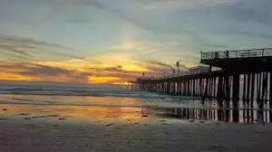
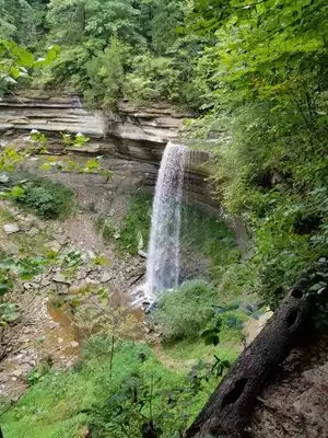
I had never really "hiked" before but my husband researched "trails" (and I use the term lightly!) and came up with this one. We had just arrived in Breckenridge the day before from the low level altitude of Oklahoma so there were times that we needed to catch our breath and let our heart rates settle. I am so glad that I let my husband talk me into hiking shoes because I'm not sure how I would have done without them--they were definitely needed! We hiked up to Twin Falls as well as to the lake. It was absolutely beautiful! I would love to do it again sometime!