


Live Your Best Lives
South Kaibab Trail Reviews
4.9
2 of 78 Best Attractions in Grand Canyon National Park


Reviews

Beautiful views!
The views from this trail are incredible! But unlike Bright Angel, there are no places to get water and very little shade. Would recommend hiking down this trail

Ooh Aah Point!
We just did this trail down to Ooh Aah Point and back. Luckily it was cooler that day (70s) and we started in the evening. I would estimate about 1.5 hours round trip, and not many people on the trail at this time. Fantastic sunset views, would definitely recommend.

Great Hike but Tough
Great hike down and back with my 19 yo grandson, I am 60 and in good shape. Tough and not for the out of shape or unprepared ! I work outdoors is South Texas which helps me in the heat, but it s still brutal ! I think the going down is harder on your body, my Quads felt it for sure, Make sure you have good shoes and trim your toenails to prevent bruised toenails. We both carried 4L of fluids ( Water, Gatorade and Tea), peanuts, Jerky, P & J s, Fruit and Candy. I bet we drank 10 L, Brutal hiking up from Phantom Ranch to Indian Gardens after lunch, but pipe creek is great for stopping and soaking your head and feet! Started at 700 am and finished at Bright Angel Trail Head right before sunset. Spend time at PR and IG to rest, relax, and rehydrate. Enjoy the views and the experience! It s not a race you just have to finish! Well over 100 in the bottom.

Beautiful but difficult hike
My fiancé and I did this hike last week while visiting the South Rim. We are in moderately good physical shape and made it to skeleton point and back without too much difficulty in 5 hours. Be forewarned that is gets quite hot in the canyon. The views are incredible!! We each brought 2.5-3 liters of water and drank pretty much all of it by the end. I would suggest having at least 3 liters of water per person as well as a few trail snacks for electrolytes such as protein bars. The hike back is harder because you're going up the canyon, however we made it back in about the same amount of time as it took us going down.

South Kaibab Trail is awesome
South Kaibab Trail a storied trail that is challenging, but well worth it the effort. This is a strenuous hike and we went to the Ooh-Aah-Point turnaround one mile down. The views are fantastic!

Great views, not as crowded as Bright Angel
This is my second time doing this hike and it's my favorite for big wide views. It takes more effort (shuttles, South Kaibab from visitors center or hikers Express from Bright Angel). However, you will be rewarded with less crowds and more sweeping views. If you do one day hike in south rim, consider this one. Ooh ah point is 0.9 miles and not too steep. It's another 0.5 miles to Cedar Ridge. This section is quite steep! We turned around there, but after walking out on Cedar Ridge. A short hike to Ooh Aah point is a good choice for people not used to hiking and/or small children. Bring lots of water.

Do it atleast once
On 5-Apr-2021, we started hiking down on the South Kaibab trail at 6:15 AM and got back up via Bright Angel trail at 7:30 PM on the same day. Hike down took 4.5 hours and hike up took 8 hours(3 hours from Colorado river to Indian Garden, 1.5 hour of rest at Indian Garden, 3.5 hours from Indian Garden to the top).
Getting to the park:
We stayed in a hotel outside the GC national park at night. We drove approx 7 miles to the park in the morning and parked at Lot D, by the Backcountry Information center. The traffic to the park(AZ-64 N) in the morning was almost non-existent. We arrived at the "Backcountry Information Center" bus stop, which is right across the parking, at around 5:40 AM. There were more than 15 people ahead of us in the line by the time we got there. By 6AM there were close to 50 people in the line, and this was a Monday during a spring break week.
Since one bus wouldn't carry more than 15 people due to COVID restrictions, more buses were arranged to transport all the people to the South Kaibab trailhead. We were in bus#2 and the bus left the stop at 5:56 AM and reached the South Kaibab trailhead at 6:12 AM. The Hikers' Express shuttle was non-stop, it was a very smooth experience.
The hike down:
It was cold and windy when we arrived at the South Kaibab trailhead, we were happy to be carrying jackets. There is a restroom on the trailhead and it seemed crowded. The view from the trailhead into the canyon was so awesome that we felt like spending hours there. But we just took some pictures and started the hike. Soon we realized that the trail is very very steep. It's not really a ramp, but more like a stairwell.
My knees started to hurt by the time we got to the Ooh Aah point, so we had to take many breaks during the hike. The views from the trail were so beautiful that we didn't mind those breaks. Also we wanted to make sure that we conserve energy for our return hike up on Bright Angel trail the same day.
There was no drinking water available on the South Kaibab trail, we were fully prepared for this by carrying a 3 liter water reservoir in our backpacks. There is a place approx 4.5 miles from the trailhead with some non-potable water; aquatabs may be used to treat that water before drinking, however we didn't use it as we had enough water with us. There is a hut-like structure at that spot for resting.
Almost everyone was passing us on the way. Also saw some people with mules hiking up. Most of the mules that we saw were only carrying the luggage.
Further down the hike, when we were approximately 3/4 mile away from bottom there was a trail split, river trail at the left and phantom ranch to the right. We took the phantom ranch trail to get to the bottom. On the way we crossed a bridge and then a tunnel to reach the Colorado river and the silver bridge.
What a relief and joyful moment to be down there! After many mini breaks, we got to the bottom at ~10:45 AM. By the time we got down, we were super tired, knees were sore, the captain toe was swollen & sore, but we were very excited that half of the job was DONE. The views from the bottom of the canyon can't be described in words. We are nature lovers, could have spent a few days at the bottom easily, if we had the permit to camp there.
At the bottom:
While walking we took pictures of all the information boards (about canyon history) so that we can read them later. There are restrooms and many water sources to freshen up and refill the drinking water. Phantom ranch was 1 mile away from the silver bridge. We decided to not go to phantom ranch as we had enough food and drinks. Visiting phantom ranch would have taken us another 1 hour or so. We were kind of short on time since we knew we were slow and we wanted to get to the top before sunset.
We found some shade under one of the information boards and relaxed there for a while, drenched ourselves in cold water. We had some refreshments - cucumber, tomatoes, sprouts and sandwiches to recharge us for our way back.
Right before we started, we ASSUMED that we had enough water left in our water reservoirs so we didn't bother to refill them - big mistake.
Finally we crossed the silver bridge to get to the start of the Bright Angel trail at 11:30AM, even though the ranger told us that this is the worst time to start the hike due to extremely hot weather. Since we wanted to get back up before dark we decided to take a chance.
The hike up:
Silver bridge is the one that connects the Bright Angel trail to the Phantom Ranch. We could see the Colorado river down our feet while going over the bridge, and can be scary for people who are afraid of heights - like us. There was moderate current in the river from left to the right while we were walking towards the Bright Angel trail. What an amazing view!
We were keeping ourselves hydrated by drinking water and juice. Only after hiking up 2 miles did we realize that we were almost out of water - panic moment. It was very hot~100F and getting hotter with almost no shades to rest under. Thankfully, there is a stream on the way that's accessible from the trail and the water on that stream looked very clean. We filled up a couple of disposable water bottles from the stream and used the aquatabs to treat the water and also added the electrolyte to it. Also, there are a couple of points on the trail where we had to cross the stream. Not a bad idea to take a break there and immerse yourself in the cold and refreshing water.
On the way to the Indian Garden, we met only 4-5 groups hiking down and 4-5 groups hiking up. It was a bit surprising as I was expecting more people there. In case you feel you are lost, you might have to wait 15-20 mins before you see someone to make sure you are on the right path. The trail has a pretty good marking so it's hard to get lost there. Some squirrels and lizards on the trail, no other wildlife. There are mountain lions in the park, but we didn't see or hear them. The ranger told us that they have never seen the mountain lions there. Saw some mules on the trail, remember they have the right of way :)
Indian Garden:
We reached Indian Garden at 2:15 PM. We were so relieved to see drinking water sources and some shade to rest. We could see many other hikers like us (18 miles loop hike) taking rest and refilling water. There were other people who were either camping or returning from the Indian Garden. We didn't have the permit to camp there otherwise would have preferred to stay there for a night.
We refilled our reservoirs, drank some water and drenched ourselves in the cold water from the tap. The water can be shut-off any time and there was no water available at 3 miles and 1.5 miles resthouse area. There was a small stream across the street, me and my wife sat under a tree with our feet in the cold water stream. Spent approx 1.5 hours at the Indian Garden before resuming the hike at 3:50 PM. Sun was at its peak, but we didn't feel the heat during the rest of the hike. It was steeper than the way to the Indian Garden, but didn't feel the need to drink much water on the rest of the hike, in fact we had to dump some of the water to reduce the weight.
Next major stopping point was the 3 mile resthouse. We got there in about an hour. The hike from the 3 miles resthouse was very steep. We started to think why we were doing this in the first place. The legs were burning, the thighs were burning, the knees had already given up a long time back. The views were awesome and nature was at its best but it was hard to find any energy within ourselves to enjoy those views. We were averaging approx 45 mins per mile so we had another 2 hours and 15 mins to go.
The emergency situation:
There was another family hiking up close to 200 ft from us, they were ahead of us. One member(John Doe) of that group was going slower than the rest of the group and he kind of ended up hiking up with us for the last 4 miles. His fellow hikers were not even visible to us anymore. He mentioned that he doesn't feel too good and might need to be airlifted. He said he saw the emergency phone at the 3 miles resthouse but he didn't use it, instead he continued to walk with us. He was walking faster than us so it seemed that he was fine although he kept saying that he’s tired. When we were 0.5 miles away from the top, a lady came down on the trail and started talking to him. He told her that he wasn't feeling well. She asked him if she should call rangers and 911 to which he said YES. The lady called rangers and 911. 911 said that they have no way to get on the trail, they can come to the rim and wait there. Similar story with the rangers, they couldn't have gotten there in time. I had never seen a person in such distress in my life before and all I was doing was hoping that he’d be okay. It was approx 7:00 PM now and the sun had already set, we had our children waiting for us in the hotel room so we wanted to get out as soon as possible, but we couldn't leave our John Doe in the condition that he was in. There was literally no one else on the trail. Upon realizing that help was NOT going to arrive, our brave John Doe decided to walk for the rest 0.5 miles. We were worried and relieved at the same time. We resumed our hike and, thankfully, he was able to keep himself together and get back to the top where he met his fellow hikers.
Not over until it's really over:
By the time we reached the top, it was 7:30 PM and it was pitch dark. We had to walk from the Bright Angel trailhead to Lot D where our car was parked. With my and my wife's cell phones completely discharged, we asked various people for directions and in fact asked someone if they could drop us. In the end, it took us another 30 mins to find the directions and walk back to our car. Lesson for us, print the directions and bring them along. Even if we had a battery pack to charge the phone, there was no guarantee that the cellular network would work there.
Happy ending:
Drive back from the GC national park to our hotel was uneventful, not that we were looking forward to any! We got reunited with our kids who were waiting for us for dinner. We ordered take away from Foodie and ate in our hotel room. The legs were sore, the body was sore, the mind was relaxed. We went back to the GC national park the next day at 11 AM. This time, the drive took us more than an hour due to the traffic. We went to the visitor center, Mather point area with kids. Spent a couple of hours there, took some pictures and drove back to our home in California. There is a picture of me with my son that stands out since we had taken a picture at the same spot 14 years ago.
We were done hiking approx 18 miles, approx 5000 ft down and another 5000 ft up, that's like 500 stories - going up and down the world trade center 4 times, with a 10 kg backpack and the thermostat turned to 100F. It feels like a huge accomplishment. We don't know why we did it, but we did it. Hiking is not even our hobby, we have only been hiking for the past 1 year or so in the neighborhood; 5-6 miles on some weekends. We did it against lots of odds: we were supposed to drive on Saturday and hike on Sunday but then the trip got canceled as we had to attend to something else on Saturday. So on Saturday, we canceled our lodge reservation, got our dog back from the dog care and were relaxing at home. Then around 2 PM my wife said, let's re-do the plan and GO. Immediately found another hotel, a pet friendly one since we now had to travel WITH our dog. Luckily, everything fell in place, we drove on Sunday, hiked on Monday and got back on Tuesday! The drive from home to GC was 750 miles ~ 11 hours. While hiking down, I was determined that I'd NEVER do it again. While hiking up, I decided to NOT make any decision whether to hike again or not for a couple of days. Here I am, on Friday and I'm preparing myself to do it again. There is no reason to do it again. There is no reason to NOT do it.
What we did right:
1. Started early - 6:15 AM
2. Slept well the previous night.
3. Carried enough water(3 ltr/person). We bought 3 ltr reservoirs from a store that sells recreational equipment.
4. Carried enough food(sandwiches, sprouts, banana, oranges, cucumbers, tomato, lemons).
5. Carried electrolyte tabs for energy.
6. Carried water treatment tabs. We bought aquatabs from a store that sells recreational equipment.
7. Carried a couple of light weight, disposable water bottles. We filled those with the water from the stream and treated it. That way we didn't have to keep taking our backpack off.
8. Carried head lamps, flash lights with extra batteries. We had to use the head lamps for the last 30 mins of our hike.
9. Carried other drinks, such as juice packs, yogurt etc.
10. Carried hiking sticks.
11. Got good waterproof hiking boots and woolen socks. The shoes that we got were 1 number bigger than the regular size.
12. Carried whistle - we didn't need to use these but you never know.
13. Carried sun hat and sunglasses. Sun hat is a life saver, especially if you are hiking around noon and the temperature is ~100F.
14. Kept eating and drinking even when we were not thirsty or hungry.
15. Took enough breaks. We saw everyone passing us but it wasn't a race.
16. Checked the bus routes on NPS gov website to see which shuttles were in operation and which ones were NOT. There were few routes that were NOT in operation during our visit.
17. Read other information on the website regarding road closures and all, only the south entrance was open during our trip.
18. Read the pet related policies. Pets were NOT allowed below the rim. Was important for us to know this since we have a dog and we were considering taking him with us.
What we didn't do right:
1. We didn't refill the water at the Colorado river.
2. Didn't carry a battery bank to recharge the phone.
3. Didn't carry directions from the Bright Angel trailhead to our car.
4. Didn't apply for the permit for camping at Indian Garden in advance.
5. Didn't take a lot of pics, and yet drained the phone batteries.
6. Didn't practice enough. Next time, I'd practice hiking 15 miles with a 10 Kg backpack before repeating the same hike.
Keep in mind:
1. Same day hike in GC is not a walk in the park. It's like 100 times more difficult than the other 5-6 miles hikes that we do during regular weekends.
2. Visit the Grand Canyon website on NPS gov to get updated information about the park.
3. The hike up was 100 times more strenuous than the hike down.
Looking forward to:
Repeat the same trip in a few months. I'd do the same itinerary. If possible, I will get a permit to camp at Indian Garden for a night.

Strenuous, but Inspiring!
We hiked the trail in August to Ooh Ah Point! Just awesome! Beautiful views and the Grand Canyon is a place that fills you with amazement and beauty all around! We are a 50+ yr old couple in decent condition but not athletes, and it was a hard hike going back up. Our 23 yr old daughter was worn out as well. Take lots of water and breaks, and it’s doable. It’s worth it! We want to go back and hike all the way down. But not sure if we could make it back! Lol

Beautiful views, worth the challenging hike!
Awesome hike with beautiful views! April 30 was great timing - trails were dry and dusty with no ice or mud, and it was a perfect temperature in the morning.
My husband and I hiked to Skeleton Point. Started at 8am and was done around 12:15pm. It was very hot coming back up, so recommend leaving earlier. We didn’t find it too busy, but there were lots of people coming in as we were leaving.
The way down was a calf burner but relatively easy. The way back up was challenging and steep. That said, it’s very doable for anyone active / in decent shape without training. We had regular running shoes and no poles. We took tons of little breaks and a few longer rests at lookouts, and we still finished in 4h10min. We had 1.5L water, 1L of Powerade, 2 granola bars and half a sandwich each, which was perfect to keep us going.

If you only take one hike into the canyon, take this one....
We were only at the park one day so we had time for one hike down into the canyon and this is the one we choose. And we were not disappointed. The views going down are amazing. Top is steep but is not as bad after the first 10 minutes. We are in our late 60's with bad knees so we only went to Ooh Aah Point. Again views are amazing from here. We met a mule train the way down. Be sure to get to the inside if this happens to you. Also take plenty of water, gets hotter as you go down. Steep coming back up, lots of stops for rest. Took us about 2 hours round trip. Worth the effort!
Just a quick word about the shuttle buses, it's the only way to get around the park. We were there in late September so crowds were not as bad as in the summer. But the buses run frequently, we waited 15 min max for any bus. If there are no seats there will be after the next stop. Use the buses and don't fight traffic and parking.

7 spectacular miles to bottom of Canyon
No water available on trail so take plenty. Bathroom stops are adequate.View is breathtaking,every moment worthy of a photo! If you are older( I am over 60) use poles to save your joints on the steps. They are higher than standard (designed for the mules) and there are lots of them

Phantom Ranch Adventure
Hiked and stayed at Phantom Ranch for 2 nights and just got back today 4/5/19. It is an amazing hike with beautiful views. We hiked to ribbon falls, 6.7 miles one way. Trail is easy, but the bridge closest to the falls is broken but can be crossed if you’re up to it.
The Ranch is a great place to stay and all you can eat breakfast, bagged healthy organic lunch, and a huge steak for dinner.

Very nice day hike
We hiked as far as Cedar Ridge (the 1.5 mile point, 1100 vertical feet down). Started about 8:30 am and done by 11:30 am. Just right for a day hike and we got out before it got too hot. Trail was well maintained and quite wide enough to pass mules or people without having to step off the trail. If hiking like we did in June, make sure to take plenty of water.

Wow Wow Wow
I think this is the BIGGEST MUST to do while at The Grand Canyon.
Fair warning:
1) you can't park at the South Kaibab Trail you have to park on the east rim road outside of the Yaki road.
2) soo you basically have to hike to the trail before you even get to the trail.
3) the trail can be narrow at some times and some people on the trail were rude ~ we constantly were moving over onto the wall or edge to let others go on ~ and sometime people behind us took this as ohh your moving over for us and in turn made a scary situation even scarier.
4) no dogs are allowed on this trail but there was many kids and some I believe was too scared and too close to the edge to safe.
5) take your time ~ going down is easy going up "BREATHE"
6) Ooh Ahh Point is were we saw A LOT of people turn around ~ you can continue another mile to the skeleton Point _ but remember what goes down has to come back up and the walk back to the car too.

South Kaibab is a comfortable Nov hike
Not as intimidating as we expected except at the very beginning where there was ice and a young person slipped and fell. Grippers were a good idea this time of year but only for a few minutes. People of all ages were winded coming back up the hill but not so if you took your time. We even stopped for a picnic on the way up and travelers stopped to chat. I enjoyed the view and the chilly temperatures as it was easier to hike and remove layers as needed. We stopped at Cedar Ridge only due to time but gladly could have gone to Skeleton. Entertained by the runners who came from north rim and were headed back.

Great trail
If you have one hike to do at the canyon this is it. 45 minutes and 1.5 miles down and you’re at the top of the red wall at cedar ridge. Clivus toilets there as well. Take lots of water and photos!

Rim to river to rim in 1 day
Took the bus from Yavapai lodge at 4:4am to get to trailhead by 5:15 am to start our trek down south Kaibob. BRING hiking poles!! They are such a great help! And if you don’t like them you can fold them up and put in backpack but we used all the way down and up. Need fantastic hiking boots, no questions about it. My husband and I did this trek down in 2 hours 50 minutes. I am 30, he is 32. We had beautiful weather starting out at 40 degrees but warmed up as we went. I was expecting a harder trail to descent so I was pleasantly surprised. Definitely doable if you are fit or have been training appropriately. Bring water, no rest stops on the way down with toilets or water. Be prepared. Definitely not a good way to ascend the canyon as it’s steep but we did pass hikers ascending it for a challenging hike. Not advised for newbies who are unfamiliar. Dress in layers, bring poles, water, salty snacks, camera, and enjoy the peace and tranquility of Mother Nature. It’s amazing to see the sunrise and feel that you’re the only one that exists on this beautiful planet! (Took us 8 hours round trip). Enjoy and good luck!!

I went until Ooh Aah Point
I love this trail. I went until Ooh Aah Point with my wife and a teen of 13.
You have to be careful but you can do it in a couple of hours.
Some recommendations:
1) Take into account the return demands much more effort than the descent.
2) Take some water with you because there is no water in the road to Ooh Aah Point.
3) Maybe you start the trail with a little cold. It will go away as you go down the trail.

Remember to eat as well as drink while hiking
When you're not used to hiking--a stroll down North Michigan Avenue in Chicago isn't comparable to hiking in Grand Canyon National Park--you are prone to forget the rules of the road. Fortunately, there usually is a park ranger to remind you. Remember to eat as well as drink while hiking, he says. There is no water along this trail, he says. Everyone needs to carry water, he says. A common mistake is not carrying water or not carrying enough water, he says. Good advice for everyone who attempts to hike the South Kaibab Trail. Located on the South Rim, access to the trailhead is by shuttle bus only. No private vehicles are allowed. The trail begins south of Yaki Point on Yaki Point Road. An early morning shuttle bus goes daily to the South Kaibab Trailhead from Bright Angel Lodge shuttle bus stop, the Backcountry Information Center and Grand Canyon Visitor Center. Like a good Boy Scout, be prepared: plan your hike before you start, eat salty snacks and drink water or sports drinks, go slowly, rest often, stay cool. The South Kaibab Trail offers wonderful and spectacular views all along the trail, making it very easy to lose track of how far down you have hiked. In addition, the steepness of the trail is very misleading on the way down. Plan on taking twice as long to hike up as it took to hike down. Cedar Ridge has great views and is an ideal day hike. It also has restrooms. South Kaibab Trail is a maintained dirt trail, steep, well defined with very little shade. Unless you are a professional, do not attempt to hike from the rim to the river and back in one day, especially during the hot summer months. I know I sound like a preacher but park rangers point out that over 250 people are rescued from the canyon each year. Depending on how well prepared you are, your trip can be a vacation or a challenge, a revelation or an ordeal, a great adventure or a trip to the hospital. Gatorade, anyone?

Epic hike to Skeleton Point
Epic hike to Skeleton Point with my daughter. Since shuttle busses aren’t running, we parked legally along the road near the rim between the Visitors Center and the trailhead (personal vehicles can’t park at the trailhead). There are about 15 parking spots that are apparel to the rim trail that were all available when we parked at 6AM. 20 minute easy walk along the rim to get to trailhead.
We had water, snacks, sunscreen. It took us 6 1/2 hours since we stopped multiple times for photos and water/snack breaks. Hike early.

This is the Trail to Hike in the Grand Canyon
We took our 11-year old and 7-year old down this trail to OhhAhh point. They did great and loved it. Magnificent views. If you only have a short time to hike down into the Grand Canyon, this is a great hike for a family.

Beautiful hike - can't beat the views!
This hike has the best views of the canyon. There are multiple stopping points for varying degrees of hikers (ooh Aah Point, Cedar Ridge and Skeleton Point) before you get to the bottom. We caught the 8:30 a.m. bus at the visitor's center and it's only a few minutes ride to the trail head. Make sure you pack water and snacks, the trail is fairly sunny throughout the day. There are bathrooms at the trail head and Cedar Ridge (no water was available in November). We hiked to Skeleton Point (about 3 miles one way) but could have stopped at Cedar Ridge for the same views if you don't feel like hiking that far (and back). The round trip took about 5.5 hours but we took our time taking in the views!

Stunning!!!
Amazing trail down to the canyon floor! Be prepared with a hard hike back up to the top! Can choose your distance to hike down! Hike to Cedar ridge took 3.2hrs return for moderate fitness level ( can take up to 4-5hrs). Take plenty of water and a picnic!

Feature-packed and views for days
I did this hike over Thanksgiving and set off from the beginning of the trail as the sun was rising. There was still ice on the trail but conditions were good. The views are unparalleled and it was a once-in-a-lifetime hike for me. Highly recommend this hike, especially going early.

Beautiful, strenuous hike
The hike down S. Kaibab Trail is both beautiful and strenuous. We are 70, and have done some hiking. But, we weren't prepared for how steep this trail can be. Made it to Ooh Ahh Point, and a little past then decided to go back up. Worth every bit of effort, I would say know your limits and definitely attempt this trail.

The hike is DEFINITELY worth it!
OK - so you HAVE to get up early for this one!!!!!
We are a family of 5 with kids aged 16, 14 &10.
We caught a 5:30am hikers shuttle to the South Kaibab Trailhead, with 4 other (fitting looking) hikers.
Our intention was to hike to Ooh Aah Point and then return, given we had our 10 year old with us but we actually made it to Cedar Ridge.
The Grand Canyon has some amazing views but there is definitely something special about hiking into it.
The trail down is easy going with steps and standard trails but very dusty. You need some grip on your shoes. The views are breathtaking and change as you descend.
Oooh Ahh Point is beautiful and has some fantastic photo opportunities. Similarly, the continued hike to Cedar Ridge has the same wow factor!
The hike back was more of a grind as obviously, it was all uphill!!! Walking poles made a HUGE difference coming back and my dodgy knee was fine. I paced it slowly with my 10 year old and we met the other at the top.
Our essential items were our CamelBaks, sun hats, grippy walking shoes and walking poles (for the 10 & 51 year olds!).
There was a great sense of achievement when we reached the top and we had a massive guilt free brunch afterwards!!
NB: Climbing up, there was a lot more hikers coming down towards us, which wasn't a problem but we were glad we had done this trip early.

Steep climb up
My husband, 9 year old son, and I began the climb down the trail around 8:00am. We were there in an overcast day with temps in the 70s. I would suggest starting earlier if it is a warm day. Walking down the trail is easy enough, but the hike up is a chore. We went half way down to the 2nd stop along the trail which is about 1.5 miles as a park ranger suggested not going further with our son. I am glad we listened to him because climbing up 3 miles from the bottom would not have been fun with the boy. It is a beautiful climb and the views are amazing. Make sure to pack food and lots of water.

Self guided Hike down the Grand Canyon
We went to this trail to experience hiking down the Grand Canyon. We went to ooh aah point which is about 1/4 of the way down. The hike down was easier than going up. It’s very steep at points. We saw some squirrels and ravens along the way. Great afternoon!

Ooh Ahh point!
Hike 0.9 miles down the trail to Ooh Ahh Point. Take plenty of water, start early and take your time coming back up and you will love it.

Get IN the canyon!
A great trail to leave the rim behind .... actually above ...and enter the canyon. Yes it’s a busy popular trail but rewarding with views, fellow hiker comradely and feeling of accomplishment. We went as far as Cedar ridge where there is a rest room but no water. Just take the orange park shuttle for a drop off at the trail head.

Ooh. Aah
Best hike. All 6 of us loved this hike better than Bright Angel. The views were amazing. Bring snacks and water. This trail was a bit sunnier than the Bright Angel. It took 2 hours to the Ooh Aah spot and back. A walking stick was helpful You will be so happy you made this hike. No car access. You must arrive by Orange bus

Can’t miss
If you go to the south rim area it’s hard to miss this trail. Parking was very difficult but once your in the trail you can walk for hours. Splendid awe inspiring views everywhere.

Tough but worth it
We started the day at 3am leaving Sedona. We got to the park at 5:45am, and headed to the shuttle. The orange shuttle took us to the trailhead and we started our decent, with headlamps and flashlights. We are always up for a good challenge and we definitely got one. The trail is steep and we fought the rain and hail but made it to the bottom in a little over 3 hours. We managed to take Bright Angel up but there is no shade or water stops on this hike. It’s very rugged and it’s all just dirt steps (going down is harder than going up). I cannot stress this enough but do not forget this is a wilderness area and you will die if you aren’t prepared with enough food and water. We made it back out 10 hours and 21 minutes after we started. It was fun but we were sore the next day. The Grand Canyon is stunning though and worth the soreness for the chance of a lifetime.

So glad we did this
We had decided to make one long hike instead of a couple of shorter ones. We are so glad we did - the further into the canyon you go, the more rewarding the views. Leave early - it takes about 5 hours to hike to Skeleton Point and back. We would have loved to go further, but had other activities we wanted to do in one day. The hike is intense. Be prepared. Get maps at the information center.

Tremendous!
This can be a challenging hike, especially if one is out of shape. However, even some physical preparation (stair workouts!!) will enable one to be enjoy hiking more than a few yards down the trail. To go even a half mile or so down is rewarding.

Amazing views, but be sure to pay attention to the guidelines
No Grand Canyon visit would be complete without a hike into the canyon itself. After reading the reviews and seeing the photos, I knew we would want to experience this trail.
We are all in decent shape, but definitely not experienced hikers. Also considering the high temperatures of August and the elevation that our bodies are not used too, we knew we didn't want to be too aggressive in our destination for this hike. After reviewing the informative summary provided by the park service, we decided we would go to Cedar Ridge and back (3 miles round trip, with an 1140 ft change in elevation).
There were others on the trail on the day we went, but it was not too crowded, as we started later in the day. The trail is easy to manage, but it is fairly narrow and you have to be careful. Wearing proper hiking footwear is a huge help. The trip down was fun and we made it to Cedar Ridge quicker than expected. After a short rest, we began the hike up, which is definitely more challenging. We found ourselves stopping to catch our breath and hydrate very frequently.
The views on this hike are absolutely spectacular and I am glad we chose to do this hike - a great way to experience one of our country's treasures!

Very nice hike
Hiked down to Ooh Aah point and was a easy hike down and a tougher hike back up .Views were great especially going around the bend .Not as good IMO as the Bright Angel trail though

First time to the Grand Canyon. Walked up to it and hiked in and out! Epic day!
Hiking the Grand Canyon was a life-changing experience. Getting to Phantom Range, the Colorado River, and then out on the same day was challenging. The views and the scale of the Grand Canyon were breathtaking. There is a reason it is one of the world's seven wonders, and it does not disappoint! Make sure you plan your water and energy carefully. Hikers were being rescued by helicopter all day because they underestimated the climb out. The struggle was real but worth it!

South Kaibab Trail
7 mile hike from the South Rim to the bottom of the Grand Canyon. This was a fun hike, but make sure to bring trekking poles as the descent can be hard on your knees.

Going down into the canyon
We got as far as the Ooh Aah point. It's an intens hike. We come back more practised. Better shoes and condition. The Colorado river is one mile deep, and I want to see it!

Hike to Ooh Aah Point
We started this hike around 2:00 pm in July. You have to take the free shuttle bus to South Kaibab Trailhead. This was not the ideal time, but we had alot of water, good shoes and hats. The hike down was quick. We enjoyed the views and the feeling of being below the rim. We hiked slow and steady on the way up, taking quick moments of rest wherever there was some shade. It's challenging but rewarding.
If you have a fear of heights or dropoffs this might not be a hike for you, a member of our group had to turn back.

Must see the Grand Canyon!
We took this hike to Ooh Aah Point-the views are indescribable. My in-laws who are in their late 60s were able to do this hike (with some stops along the way) and my 3 kids ranging from 15-8. If you haven’t been to the Grand Canyon, you must go! The pictures don’t do it justice.

Great Day Hike!
Well worth the effort to gain an even greater appreciation of this incredible canyon. I hiked down to Ooh Ah Point (25 minutes at a steady pace but stopping to take a number of photographs) and then down to Cedar Ridge (another 20 minutes - but worth every bit). I'd highly recommend the extra effort to get down to Cedar Ridge. It opens up onto a narrow ridge that allows for a relaxing lunch (see photo) and an opportunity to enjoy the views without looking over someone's shoulder or interrupting someone's selfie (Ooh Ah Point is a bit of a congested area . . .).
Coming back up was about 30 minutes back up to Ooh Ah Point and then another 45 minutes to the trailhead. I'm 55 and in reasonable shape, but I'm not a full time hiker, so those time estimates are FWIW. Also, please adhere to the water and food recommendations on all the signage at the trailhead and throughout the park.
BTW - after making the hike back up in little over an hour, I really wish I had gone beyond Cedar Ridge to Skeleton Point (or at least as far as another hour of hiking down would have taken me . . .)

Detailed review of South Kaibab trail
We trekked down to Skeleton Point -here’s a bit more detail on how we found it.
We got to the park for 7.30-ish and got the orange bus west bound to Kaibab trailhead for about 8.00am. Restrooms and water at the visitor centre but none at the top of the trailhead so plan ahead. Temp was 48 degrees so cool so we wore lots of layers. We took snacks, a sandwich each and about 1.5 litres of water each which was fine.
We’re mid 50s and done a fair amount of trekking. It’s 3 miles each way. Fairly easy downhill - no scrambling or scree and the trail is really obvious compared to hiking in Europe. Mules went by so you have to squeeze in but again no problems. Cedar breeze is about halfway down and has (horrible) restrooms but no water. Skeleton Point another 1.5 miles on - about 0.75 of steep downhill and then 0.75 of fairly flat round the lower rim. Views amazing all the way. Return journey is obviously tough, first 0.75 mile flattish but then you climb steeply for about 1.25 miles. The last 0.75 to the top are not too bad. All in all took us about 2 hours each way - about 3.5 hours in total walking excluding picnic and photo stops. Very enjoyable and worth it.

Incredible View
The view is beyond belief. It is a wonder of the world. The shuttle buses run on a regular schedule so if you miss one another will be by soon

It's more beautiful than you imagined, even if you have a very vivid imagination, promise!
Hiking in the Grand Canyon was always something I wanted to do, but if I had known how truly astonishing the experience would be, i'd have prioritized it earlier. I can't wait to come back. The hikes are well labelled, the advice provided is accurate, and there is something for everyone, from beginner to hard core.

Grand Canyon's best scenic trail
In August (yes, August) of 2019, my wife and I day-hiked down the South Kaibab Trail to the Tip-Off, then along the Tonto Trail mid-way down the canyon to Indian Garden, then back up the Bright Angel.
As a scenic trail, bright and early in the morning, the South Kaibab is unparalleled. Plenty of casual visitors just take the trail to Ooh-Aah Point, which is a favourite spot to watch the sunrise. If you're a little more adventurous and want to hike into the canyon but not too far, I would suggest taking the South Kaibab down to Cedar Ridge. Unlike Bright Angel Trail, which just goes straight down until you have to go straight back up, South Kaibab to Cedar Ridge takes you down a bit and then out into the canyon. The views are much, much more picturesque. You can see incredible vistas both north and south, and straight down.
If you were more adventurous you could go further to O'Neill Butte, but I personally wouldn't bother going to Skeleton Point if all you're going to do is turn back around and hike out. My feeling was that you don't really see much MORE from Skeleton Point than you did from Cedar Ridge. If you're just casual, admire the view from Cedar Ridge (which also has toilets), have your breakfast or snack, then hike back up. If you got an early start on the hiker's shuttle or one of the first regular buses, then you'll be back at the rim by mid-late morning with a lovely journey into the Grand Canyon to notch on your belt.
But if you're a serious hiker, then you're not only going to Skeleton Point, but beyond it. The switchbacks beneath Skeleton Point offer another suite of my favourite views of the canyon, as you're descending down to the Tonto Plateau. You might, as we did, catch a mule ride on the way back out. Mule rides go down Bright Angel Trail to Phantom Ranch, then back up the South Kaibab. The National Park Service recommends that hikers do the opposite: down South Kaibab, then up Bright Angel. Besides being less picturesque than South Kaibab, Bright Angel also has water piped along it. That is CRITICALLY important for your hike back up, because it IS exhausting.
On that note, no matter how far down the trail you go, make sure you have proper supplies. LISTEN TO WHAT THE NATIONAL PARK SERVICE SAYS. Do your research. The NPS has a ton of information about what to bring, how much water to carry, etc. Proper preparation will make or break your hike. On our way down we ran into this family a couple times who didn't have proper supplies and got a late start for their rim-to-river daytrip. The NPS strongly urges not to do rim-to-river and back as a daytrip. We urged them to not do it and suggested alternatives. They did it anyways. Three days later we ran into them again at the rim. Their daytrip turned into a two night ordeal at Phantom Ranch to recover from electrolyte loss, dehydration, and exhaustion. It could have easily been a lot, LOT worse. So I cannot stress enough to do your research, prepare, and listen to the NPS.
If you do that, then South Kaibab will be one of the most amazing hikes you'll ever do in your life.

Great hike to Ooh Aah Point
The old hiking adage is certainly applicable here: It takes twice as long to go up as it does to go down...and while it's certainly a lot tougher climb back up, the views are ooh-aah worthy. Parts of the trail are a little tough to traverse but not too bad overall, and well worth the effort.

One of our Favorites
We have hiked South Kaibab to Phantom Ranch twice. Each time we have gone down South Kaibab and up Bright Angel. It is spectacular. The trail is rugged and can be steep but the views are amazing. Once you get down the trail a ways, you get a whole different perspective of the canyon. If you have a chance -- hike South Kaibab even if you only go to Ooh Aah Point.

Glad we did this one!
We woke up to snow and weren't sure what the hiking conditions would be but luckily were told it was just muddy and no ice. We did not use any extras just our hiking boots and were fine, just got very muddy. Being pregnant and taking precautions we only went to the Ooh Aah Point and it was breath taking. Going down is easy, getting back up is the hard part as it is ALL up hill and many switchbacks. WORTH IT though, even if you only make it down a bit it is very cool to get down into the canyon opposed to just looking from the top.

Beautiful trail! Hiked to Ooh Aah Point
We hiked only to Ooh Aah Point - family of 4 with a 9yo and 12yo. Trail was very nicely maintained. Wide enough for people to pass. Took us about 45 minutes to get down and 45 minutes to get back up, but the trip back up was challenging and I would not recommend it unless you are in decent shape. Not sure I would attempt with young kids, but I was a nervous Nellie the whole time we were there! haha

Ooh Aah point an easy round trip and worth the views
Busy but not over crowded at least in December. Trail was well graded and designed for mules so good footing. Some with vertigo had issues with steep drop offs but overall an easy hike down to Ooh Aah and back. Views from the lookout were amazing.

Amazing Views Down to Ooh Aah Point
We took a short hike down to Ooh Aah Point. Our hike was only a small fraction of the trail (about 0.9 mile one way), but with amazing views around every corner, we were still able to appreciate the grandeur of the canyon as we made out brief descent.
Having started our hike shortly before 7am, we were able to enjoy the hike before the sun and the crowds were out in full force. As this segment of the trail only took about 2 hours roundtrip (with kids--probably much quicker without), we also had most of the day remaining to enjoy more of the South Rim.
I would love to hike more of South Kaibab in the future, but the 1.8 mile roundtrip to Ooh Aah Point was perfect for a one-day trip to the Canyon.

Hike to skeleton point
We hiked to skeleton point on an unseasonably cool day in early October. Leaving at about 8am allowed us to park on the main road about half a mile up from the trail head. There was no parking allowed at the trail but that may have been because the lot was already full. We took 3 liters of water each and lots of snacks which turned out to be perfect. It was shady on the way down but sun with almost no shade on the way up. With breaks and lunch, it took us about 5 hours to complete. No water is available on the trail and there is only one bathroom at cedar ridge. For an easier (but not easy) hike, stop at cedar ridge. Crowds thinned after ooh aah point. If you do make it the 3 miles to skeleton, go off to the left on the unofficial trail to see views of the river.
This trail goes out into more of the center of the canyon on a ridge so you see more vs bright angel that stays closer to the rim for the same 3 mile in and out walk.
I'd recommend hiking poles (can be rented from the store at the canyon) and real hiking shoes although I saw people with neither. It's mostly sandy and slick in spots.
Trail is ok for kids as long as they listen to instructions to take it slow and stay away from the edge.

Loved the Hike to Ooh Aah Point
This is a terrific hike which is 0.9 miles one way if you only hike to Ooh Aah overlook. The trail begins with a lot of switchbacks and is downhill most of the way. The hike is worth the effort. We completed the hike in less than 2 hours. Take water and wear a hat.

Breathtaking Views
A gorgeous trail to hike. We started around 5:30am and the sunrise on the canyon created views we will never forget. The hike is steep and narrow in some places. We got to the river around 9:00am.
It is better to do this trail in the morning when it's cooler since it does not have much shade and does not have water. If you do plan on going all the way down make sure you have enough water, salts, and sun protection. Plan ahead for this trail, impulsively going too far can get you in trouble.

Great time on Kaibab trail
My wife and I went at the end of March. Fortunately, my wife researched that we would need microspikes. They were definitely worth it as the first 15 minutes of the hike were pretty icy. Great trail, beautiful scenery, nice people, very enjoyable day. We went down to Cedar Ridge. We are in our 50's, made it down in 1:15 and we spent 2 hours coming back up. We could have done it faster but we took most of our pictures on the way back up and we weren't in a hurry as it was so beautiful.

YES! LOVE this trail!
This was my favorite part of the Grand Canyon! We hiked down past Ooh Aah Point to Cedar Ridge. It was a pretty steep downhill but the views were absolutely amazing! In late November, there was a little ice at near the start of the trail, but the further down we hiked and it seemed to disappear. We took our time hiking to Cedar Ridge, stopping to look around and take photos - this took about 1.5 hours. We expected it would take twice as long to climb up, but in the end it took another 1.5 hours which included a few short breaks. The trail was very well maintained and easy to follow. Make sure you wear layers and bring lots of water. You will not regret this one!

Trail with an amazing view
This was a great way to exercise and enjoy God's creation. We only went to Ooh-Aah point. Make sure to bring lots of water and decent shoes for traction. We saw many people with hiking sticks similar to ski poles and ready to hike all day. This is a well traveled trail.

Gorgeous Wide Views of the Grand Canyon
The trail is steep with many switchbacks. Not much shade. We decided to hike to Cedar Ridge which is 1.5 miles from the trailhead and drops 1,200’ in elevation. At Cedar Ridge, there is a restroom. The structure offers some shade to the intense sun.
It was 90 degrees F at the rim and increased as one walks deeper into the canyon. The park service said it was 110 degrees F at the bottom Phantom Ranch.
At a park ranger’s suggestion, we packed 3 liters of water and salty snacks. It was good advice.
We also used hiking poles.
The scenery is amazing. O’Neill Butte (6,071’) is a prominent feature often in view.
The walk up and back to the rim was a physical challenge. Frequent breaks for water and in the limited shade helped.

Do this hike, but be prepared.
Excellent hike for a fit person. Go early, as less prepared hikers start later. Trail gets crowded as the day progresses. We started at 7:30 am and didn’t have so many hikers that it took away from the hike, but was getting crowded by hikes end at 12:00.

Challenging but rewarding
As there is absolutely no way you will get to the bottom of the canyon and back in a day this is a walk that you can do as little or as much as you like.
Stunning views all the way.
It can get busy in places as there are only 2 established paths on the south rim for walking down into the canyon.
I wouldn't attempt any of it if you are not in a fit shape. This is quite challenging walking. Take plenty of water and then take the same amount again!
We went as far as the 2nd point, which took about 1 hour 20 mins and about 2 hours back.
It's hot, it's hard work, it's tiring and a bit dusty/dirty, but very much worth it for the experience and the memories.

Fantastic Hike
Viewing the Grand Canyon from the rim is nice, but getting down into the Canyon takes the experience to a whole different level. My family of five (including kids ages 17 ,15 and 12) hiked the South Kaibab trail down to Cedar Ridge— it took us an hour and 20 minutes on the way down but only an hour to go back up (after a 25 minute rest at Cedar Ridge). Most people say it takes much longer to go back up the canyon, but it didn’t for us in part because we stopped for A LOT of pictures on the way down. We were surprised how quickly we made it back up— we’re relatively fit, but we weren’t trying to set a land speed record and we did stop for several breaks along the way.
We thought the views were best from a couple of the un-named viewpoints just past Ooh Ahh Point, although Ooh Ahh Point was spectacular in its own right. Cedar Ridge views were nice but a bit anti-climatic compared to Ooh Ahh Point.
One last note-my wife doesn’t do well with heights but she was fine on this hike. The trail is wide enough where she didn’t have any problems.

Love this trail to Skeleton Point - 6 Miles round trip
WOW! Our goal was to make it to “Skeleton Point” and we made it! It is 3 miles down with a round trip of 6 miles. We stopped at Ooh Aah Point, Cedar Ridge point (bathrooms) and then Skeleton Point. At Skeleton Point you will go to the left of the sign and you will see the Colorado River! We took our time and took lots of pics, it took us about 5-6 hours. We took a snack / lunch break at the final point and spent time resting up before our ascent. What they say is true, it will take longer getting up then going down.
The views were worth every bit of struggle going back up. There are plenty of switch backs and plenty of pull off areas and / or rocks to sit on to rest. We headed to the trail early about 7-8am and it wasn’t crowded. Most people turn around at Ooh Aah point. You will need water and snacks!
One more thing, if you are afraid of heights - this is probably not the trail for you. A few places there are cliffs on both sides of the trail with no railings or anything.

great day hike to skeleton
We went 3 miles down to Skeleton and 3 miles back up. We stopped to rest at Ooh Ahh but kept going down. We got to see the mules do their thing up and down the trail. It was a great workout especially the cardio going back up. I drank all my water 1.5 liters and was ready for more at the top.. Spectacular views. You can wear supportive tennis shoes and be good. Some had a walking stick, but I didn't use one and did fine. Enjoy this beautiful trail!

AMAZING!
Start early and see the sunrise! I was terrified at the thought of doing this trail. We did hike to Cedar Ridge (3 mile roundtrip) early. I survived, but you will feel exposed. Just be safe. The views were incredible and we had wild sheep on the trail with us.

Stunning views, but very difficult
I just got back from this hike down South kaibab and back up Bright Angel. I really wish we had two nights at Phantom Ranch. I was really sore from the down and legs would have loved a day off. First half mile to mile was icy and snow packed. It was very steep down and windy the day we did it January 21st. Crampons and trekking poles were a must! We are early 50's and in pretty good shape, but live in Oklahoma so don't get opportunity to do a lot of training hikes.

Great trail to get you into the Canyon quickly
Gorgeous trail, but know the the steepness can punish your knees more than the Bright Angel trail. Lots of "steps" so be prepared. No water stops between the Rim and Phantom Ranch, but it's only 7 miles so you can pack enough without carrying too much weight. I like this trail over the Bright Angel because it gets you into the open part of the Canyon much quicker. None of the switchbacks like those found at the beginning of Bright Angel. Enjoy!

Great hike!
The best way to get to know and enjoy the Grand Canyon is to go down the path to the bottom of the Canyon, even if you are just down a section of the trail. I walked down to Cedar Ridge (about 5 km back and forth), and it was simply superb. The Canyon view is great, and when you go down or up you see the most beautiful Canyon sights. Don't forget water, especially on hot days like the day I had.

An Amazing Hike Into the Canyon
This is exactly what we were looking for! An amazing hike with views that will take your breath away. There are a few different points you can hike to on the trail. Be sure to pay attention to the difficulty and distance posted. We decided to go to Skeleton point and while it was strenuous, it was worth it. We made sure to take plenty of water and snacks. The way up is definitely challenging, think 600 flights of steps. It was a great exhaustion once we made it back up to the top, 3.5 hours total.

More beautiful the farther you go
The sad fact of his hike is the farther you go the more beautiful the scenery and the more you have to hike up! We listened to the advice of a park ranger at the petrified forest National park and here’s what we did right:
1. Packed water with our new 2.5 liter water backpacks. I had my new walking sticks and we carried a bunch of salty snacks including honey mustard pretzels and beef jerky. Hiking boots, layers to deal with major change in temp.
2. Arrived at the park around 4:50 and got to the trail head on shuttle by 5:10. Hung out on top to watch the sunrise (although couldn’t see actual sunrise, still pretty)
3. We had agreed that we would plan to hike until about 10 am, turning back using the calculation of it taking twice the time to hike up than down. We were pleasantly surprised to find ourselves at skeleton point by 7:30 and my daughter really pushed to go all the way down. We walked a switchback or two and I did the math—realizing this would be really stupid. We weren’t prepared! So I refused and we’re now glad I did, because it was grueling! Got back at 10:30.
4. Do go just beyond skeleton point to see the Colorado river!
Next time I would plan a year earlier and stay at the bottom. I’d also wear one less layer! 30 in the dry cold wasn’t very cold. And If there was a chance of doing the 12 miles, I would have trained in advance!

To the Ooh Aah point- better perspective on the immensity of the canyon
We hiked this on a sunny weekday in September. The day was breezy and perfect for hiking. Wow!! The parking lot was very busy and empty spots were scant, granted we got there about noon. The busses were easy to navigate and regularly scheduled. We made sure we had water, hats and some coverage for our arms and shoulders and we were very glad to have all. The South Kaibab Trail was busy enough that we were very aware of how fast and slow others were hiking although there were plenty of opportunities for others to pass us and for us to pass others.
The views were fabulous going down into the canyon with the steep walls on one side and the cliff down on the other with striated canyon landscape way across. Going down this trail gave me a better idea of the immensity of this natural monument than just looking at it from above. We walked a few curves past the Ooh Aah Point then decide to turn around because we had been told that it takes twice as long to ascend as descend. This was very accurate. There are some great places to stop and take photos. I found that the actual Ooh Aah Point was crowded (4-6 groups of people gathered to rest and photograph). Once we passed that point, there were a lot fewer people.
If I were to hike this again I would start earlier and go farther.
If you found this review helpful, please press thank below.

Cannot Wait to Return
This hike is so breathtakingly beautiful, it was like a religious experience for me. It was August and we started later than we had planned, so it was HOT. So hot that there was an Extreme Heat Advisory out, and we probably only saw 20 other hikers during out 4 hour hike. I definitely will return and would like to go all the way to the bottom, but we will get an early start. We each had 3L Camelbacks, a sandwich, salty nuts, and granola bars for snacks. For me, hiking up was easier than hiking down. Hiking down on the sandy rock, we slid and lost our footing a few times. A little scary. The views are so incredibly beautiful. Cannot do it justice with words. You have to experience it. Love this trail so much.

Be smart, bring tons of water and know your limitations.
Great trail to hike. Various places to turn around and go back up. No water on the trail. You must bring your own. Do not start your exercise routine here. Remember, when you go down, you have to come up. There are no elevators or cars to bring you up. If a serious hiker, start early to avoid the people who stop in the middle of the trail to take pictures. We did this hike down to the Tipoff and at the advice of a Ranger , took the Tonto trail to the Bright Angel Trail and back up. 15 miles and all day. I do not recommend for most people. The Tonto East and West trail was great.

Great trail
Did the round trip, its a great trail with fantastic views.
Tip: go in the morning when most of the route is in the shade.

Amazing
This trail was wonderful. I hiked it down to the bottom and there are scenic views around every corner. There is no water along the trail ever but I was all set with two nalgenes full. Absolutely amazing.

Not to be missed
We waited until about 5:30 pm to do the 0.9 mile hike down to Ooh Aah Point. The temperature was perfect at this time even in August, following a thunderstorm. They hike down seemed further than a mile and I started to worry that the lookout point was unmarked- don’t worry, you can’t miss it! Breathtaking vista over the canyon in evening light was amazing. We took turns taking family photos with another group that was there at the same time and got some amazing shots. The hike back up was a bit strenuous with a lot of stairs- make sure to bring water and take it easy.

Steep, but we enjoyed it more than Bright Angel Trail.
We hiked down this trail at sunset. Thankfully we gave ourselves enough time and realized that it was smarter to hike back up before the sun actually set. Would not have wanted to hike back up in the dark plus the sunset views were beautiful from the top. It is a challenging hike as the first .7 miles are straight downhill. Be sure to leave yourself enough energy to get back up. Would not want to do this hike in the middle of a hot day.

Maybe better views than the Angel?
Little cloudy when we went, but the views were still spectacular and the clouds floating above and below plus the little Thunder storm made it an adventure to remember. Such an amazing trail.

Awesome hike
We took the South Kaibab Trail to Ooh Aah Point. This was a tough hike but very doable. Lots of stairs so a walking stick would be helpful. There are also a lot of people so be patient as you hike out and back. The views are absolutely worth it though.

Ooh-Ahh Point
We hiked down to Ooh-Ahh point which is about a mile down. The views are great and you definitely get a diiferent prespective of the canyon when looking up and hiking down. We wanted to do more but I had a bad cold which made hiking difficult. Bring water, sun screen and sunglasses.

Wonderful experience
This trail is demanding for anyone not used to hiking. It offers spectacular views of the canyon the pain is well worth the gain.
Best to start before dawn; temperature rises as you descend.

Great trail
GC up close. One of the best experience, though we only hiked till Cedar Ridge but we think it gave us enough experience for a lifetime. Love the view at Ooh Aah point & cedar ridge. It is as good as it looks from the pic! dont miss this trail!!

Excellent Hike - go early!
We hiked with our kids ages 10 and 14 to the Oooh Ahhh point. Going down was actually more difficult than going up for us. It wasn't as scary as I thought it would be regarding the drop offs and heights. We hiked around 8:30 in the morning and the entire round trip took us about 1 hour and 40 minutes. When we got to the Oooh Aaah point, it was a bit disappointing because there were a lot of people camped out there and they were not moving. Some people decided to eat a snack right beside the sign and no one else could get pictures of it. Other than that, it was okay. We loved seeing the elk at the start of the hike too - they were huge!

great views
the park costs $35, if you plan on seeing at least 3 national parks, you can get the annual pass which gives you unlimited access to any national park all year long. we took the south kaibab trail. we walked from the visitor center to the trail head, which is at least 1.5 miles, this can be skipped by taking the shuttle, but it is a very nice walk. the trail is beautiful and not too difficult. the way back up is hard but doable. we went past ooh ahh point to cedar point, then turned around. all this took about 4 hours including the walk to and fro the visitor center. the weather was perfect. in the 50s, needed a jacket on the way down, just long sleeves on the way up! definitely recommend this trail!

Hike of a lifetime !
Details: Began at South Kaibab, descended to River, crossed Black Bridge, followed River trail to Silver Bridge, crossed back over and ascended to rim via the Bright Angel trail. Did not actually go to Phantom Ranch.
Began our hike at 6:06 AM on 4/28. I was quite surprised that there was a few other groups starting out as well. We took our time going down the trail, stopping to take pictures and admire the gorgeous scenery. Hiking down this trail is like being on a alien planet. There were a fair amount of people trying to shove past us to run down, some more polite then others. There are two rest stops with vault toilets on the way down, one is Cedar Ridge and the other is The Tipoff. Made it to the black bridge at 9:24, early, but already getting hot outside. There is a water station that was open that is between the Black and Silver Bridges, so we were able to refill there. I am not sure its open year round, so check before planning your hike. After crossing the Silver Bridge, we sat in the shade for snack time, again just marveling at the mountains and river. Lots of rafts going down and even a few kayaks and paddle boards ! The River trail is short, but flat, so it was a nice break, but from Pipe Creek beach you begin ascending to reach Indian Garden. I have never quite understood or appreciated the meaning of "oasis" until I experienced reaching Indian Garden after trekking in the boiling hot sun. Its a beautiful little area with water, vault bathrooms, and tons of shady picnic spots. Spent a leisure hour eating, relaxing, and preparing for the hike up. The hike up is NOT easy, especially in the sun. The heat and dust really start to dry you out, so we took several breaks along the way, to drink water and eat something salty or a protein snack. We ended up passing several runners we had seen in the beginning of the day, I suppose they did not properly prepare. I would recommend bringing a hat and bandanna that you can drench in water and then wear. There are areas between Indian Gardens and the river trail that depending on the time of year, you cross a stream, and nothing feels better on your noggin then a cool bandanna. Do not underestimate this hike- bring water, food, and be prepared for a challenge. That being said, it has been the most rewarding hike I have accomplished thus far. The perspective it gives you on the canyon is too great for words. It is absolutely stunning up and down, but I really must say the hike down the Kaibab was more scenic in my opinion.
I have included my times below for anyone who may be concerned about going up and down in one day. Take it with a grain of salt, as my pace may be faster or slower then yours ! I would consider myself in above average physical condition, I am not an athlete by any means, but I am very used to backpacking, hiking, and running in the outdoors.
Begin: 6:06 AM
Oh Ah Pt- 6:28
Cedar Ridge - 6:45 to 6:55
Skeleton Pt- 7:29
The Tipoff- 8:10
Cross Black Bridge- 9:24
Crossed Silver Bridge to begin ascent- 10:38
Sat down at Indian Gardens - 1:09 to 2:19 PM
Indian Gardens to 3 mile resthouse - 2:19 to 3:15
3 mile resthouse to 1.5 mile resthouse - 3:15 to 4:16
End at Bright Angel trailhead- 5:26
Total time- 11 hrs and 20 minutes , apprx 20 miles
I do not have the total break time, but a family members GPS said we were active for about 8 hrs 46min, and the rest was breaks.
I hope this helps ! Do the hike if you are confident in your abilities, you will have the experience of a lifetime !

Love this trail
This is the quick way down for. People heading to phantom ranch. It is steep and Beautiful. The first section is very crowded with people just heading to oh ah point but after it gets more quiet. By the time we got to “ the skeleton” we had the trail to ourselves.

A hike of a lifetime!
My husband and I are both senior citizens and hiked this trail. If you are older, I would recommend hiking sticks. They helped a lot. We went down about 3/4 of a mile and then turned around and came back up. We probably could have made it a little further but were nervous about getting back up because it is a very strenuous hike on the return trip. The scenery was outstanding!

Must see
We hiked this trail in December after some snow no while it looked a little sketchy, it was a fantastic hike. Views were better than Bright Angel.
Note that you must take the Orange shuttle to get there.

excellent and varied views
Only went half way down, worth it. Be trail prepared. Harder trail than Bright Angel but easier than Hermits End trail.

Into the canyon
We hiked this trail as a family of 4, ages ranging from 12 to 65. Hiking poles and hiking shoes are a must! This is definitely a moderately challenging trail. The elevation is steep, and the loose rocks and gravel add additional challenges. We made it down to "ooh ahh" point which was incredible and beautiful. You must take the park's shuttle bus service to the trailhead - you cannot drive your own vehicle. Don't overestimate your ability, the climb back up takes 2-3 times longer than the way down!

Great trail ways
The views are exceptional and the trail were very well managed. I would recommend this hike to anyone. Make sure you go all the way to the bottom. As well as go out to the view point at Indian Garden.

Take water and be realistic
It is very warm and you need to pace yourself. THere is NO place to refill your water at the 1.5 mile bathrooms, unlike the Bright Angel Trail. Allow plenty of time to get out. It is a beautiful hike.

Sunrise view point
We started down the trail at 5 am and were at Ooh Aah Point by sunrise at 5:23 am (in May). Nice view of the rising sun and a good spot to sit and have a snack before hiking back to the rim. Bring plenty of water is you plan to hike further down the trail.

Fantastic Hike with Family
This was a challenging hike, but very worth the effort. The views were amazing. Going down is fairly easy. I have bad knees and can see how some might feel it on the way down. The tough part is on the way up. We made it to Cedar Point - about 1.5 miles down. We paced ourselves on the way back. I took my time while kids and hubby forged ahead.
Suggest lots of water and drinks with electrolytes - frequent stops for hydration. Best tip of all is to go early. Most of the trail was shaded early in am. We got to trailhead around 730 am. Took about 2 hours for the round trip hike. But as we ascended to the top we could see the trail exposed to sun most of the way. Hiking in full sun definitely would have changed our experience.
Following the hike we walked about 2.2 miles along the South Rim trail to the visitors center to catch everything we missed.

Brief excursion on the South Kaibab Trail
Very scenic down to Ooh Aah Point which is as far as I hiked. The trail is broad enough for easy passing of slower hikers or people stopping to take photos. Loose sand makes the footing a little dicey in places, so care should be taken. There's a station to fill water bottles at the trailhead. There is no water available on the trail except what you bring with you. Being able to catch the free park shuttle pack to the Visitors Center was welcome after the hike back up to the rim.

Southwest Road Trip
Day 1 in the Grand Canyon, so this was our first descent. We had to give way to a couple of mule trains, but that just gave us a good photo op. The scenery is spectacular as one might expect! Just remember to bring food and plenty of water.

Hiking to Ooh Ahh Point
Beautiful hike. We left in around 8AM from the visitors center, taking the free shuttle up to the trailhead, The shuttle capacity was capped, which was nice, and buses seemed to arrive very regularly. Because we did this hike in the morning, most of the hike was in the shade, which kept the temperature very comfortable. We did stop at Oah Aah Point, which seemed like a very attainable point to reach for anyone that is in relatively good walking health- there was a mix of ages of people along the hike, and the trail was well maintained. Really great views all along the trail- nice to get a slightly different canyon perspective than you get from along the Rim Trail. Only took the two of us about an hour and half to complete the round trip, including ample time at Ooh Aah to take photos and enjoy the view.

BEAUTIFUL!!!
Words can’t even begin to explain how beautiful of a place the Grand Canyon is...we could have spent HOURS here!!

Fantastic
We did it begin of March so the path was still a bit icy and with snow.
I took us 2 hours to go to Skeleton and 2 hours up.
(wa are 50 years old and in good shape)
Quite challenging but really Worth it.
The views are stunning.
Go but be sure of your physical limits.

Perfect taste of the Grand Canyon
What can I say that has not already been said?!? This hike is AMAZING! The built in rock steps reminded me of hiking the Inca Trail @ MP but the view of the canyon was beyond compare. I hiked to Cedar Ridge and back in a little over 2 hours - I was a bit surprised that the return hike wasn't as bad as it looked or I thought it'd be - it took only 15 min longer than the hike down. My guess is 1) I know my limits and am in decent shape 2) I wore great hiking shoes (I saw a woman in clogs and she did not look very happy...rightfully so) 3) I started at 6:30 am and much of the trail is in shade during early morning so avoided the worst heat (and the larger groups) 4) I carried a 3L hydration pack (drank 1.5L) and had an energy bar snack. I took a fall right after Ooh La La and gashed my knee open so next time I might take poles (I'd like to blame the shale but it was 97% me not looking).
Next time I go back, I'm bringing poles and hiking to Skeleton. This was an awesome hike for folk who want to get down into the Canyon a ways, and it was great for that purpose, but in some ways it felt like just a teaser. However, after reading about all the hiker deaths happening these days, it's ALWAYS better to be safe than sorry.

Strenuous, but better views than the Bright Angel Trail
The South Kaibab Trail is shorter (7 miles) than Bright Angel (9.5 miles), but more strenuous, and has more spectacular views. If you're planning to combine the two, it's a 9 or 10 hour hike, and you'll probably want to start on the South Kaibab Trail (those steep steps are easier going down than up). For those looking at spending a little less time on the trail, the 2-mile round-trip hike to Ooh Aah Point takes less than two hours for most, and the view lives up to the name.

Awesome View.
Mind boggling!!! I'm at awe of the view of Grand Canyon NP. It deserves the name The 8th Wonder of the world.
Love the shuttle bus inside the park. Parking is a pain although we were here during off season. Couldn't imagine how it was during peak season? Lol. Get there as early as you can to avoid traffic. There are 2 popular routes (red and orange) depending on which part you want to see first. The most popular is Red (Hopi point is the highlight). Shuttles leave every 15 minutes. Bathroom with flushed toilet is very limited. Mostly at the visitor center. Bring plenty of water, there are some areas that you can refill.
Last, but not least, don't miss the sunset at MATHER point which is walking distance from the shuttle station. You will be amazed.

Worth It!
The Grand Canyon is truly spectacular. We did the Kaibab Trail down to Ooh Aah Point. I will say that for beginner hikers who aren’t used to the altitude: this is plenty! Remember to take plenty of water and some snacks. Go to the restroom before going as there isn’t one along the trail to this point. Hiking poles would have been helpful, especially for the trek back up to the Rim.

Tough and spectacular
Much quieter than Bright Angel and with similarly gorgeous views. Not a trail for first-time canyon hikers. Not much shade, steep, unforgiving ascent and ZERO water available. Most people hike to "OOH AAH" point and after that the trail is fairly empty. Highly recommended, but bring plenty of a water !

10k Ages 9-71
We decided to go big today. We hiked 3 miles down to Skeleton Point. We had ages 9-71 year old! Everyone made it without incident. Round trip was 6 miles in 5 hours. We probably should have stopped at Cedar Point but we challenged ourselves! Great Hike Amazing views! You can do it. Just enjoy the journey not the destination!

One of many to choose from
There is a number of trails in the park. They vary as fas as their length, difficulty are concerned. Note that during Summer they can be HOT and you need a lot of water...
Which one to choose?
Choose the one that fits YOU -- your needs, your interests, your fitness level...
EACH one iwll bring unique, great memories -- this one, as well!

Follow Directions and Enjoy
We had an 11 year old and 14 year old on this trail. We each carried 2-3 Liters of Water, sunglasses, hats, Salty Snacks, Sun clothes, and sunscreen. We started early in the morning and hiked to CedarRidge. We took our time along the way, but did not take too much time. We needed to stay out the sun as much as possible as we were hiking with kids in high temperatures in July. What fun we had. The trail seems like an ancient (probably is) trail that zig zags back an forth into the canyon below. Deeper you go and the views continue to astound. Once we reached CedarRidge we fueled and hydrated and enjoyed the view for about 5 minutes before turning to go back up. Give yourself a good 5 minutes to acclimate to climbing back up. It does wind you and I Zumba 5 days a week! Another trick....keep some skittles, or something that does not melt for when you children say they can’t do anymore...It will give them the last little pop they need to make it a few more turns! Their smiles when we reached the top said it all! Of note....listen to the warnings...I saw people in sandals and with small water bottles. Nature is not to be mocked!

South Kaibob trail to Skeleton Point (stops at Ooh Ahh Point, Cedars Rest)
2 thumbs up.
This trail has the most expansive views of all the hiking trails in Grand Canyon due to the fact that the descent into Grand Canyon follows ridgelines, not side canyons. There is no water on the route so you have to be prepared and I suggest an early start as well to beat heat and crowds. (We were up at 345, shuttle at 420, to trailhead by 445 and started at 5am). You cannot drive to the trailhead. There are restrooms at the start and at Cedar Rest but none at Skeleton Point. We did this out and back 4.7 mile route in 4 hours and 16 minutes with total moving time of 2 hours 25 minutes, and elevation change 2024ft. Stops at Cedar Rest and Skeleton Point. We had numerous stops to take pics along the way. SO AMAZING! You just have to. This is a “reverse hike”, with descent first, then ascent out, so you really need to know your skill level prior to start.
We were a little reticent to go to Skeleton Point given all the cautions by the park rangers. They really hyped this up – hard to exit the Canyon, twice as long to ascend than to descend. Really not so for us, but we did take a lot of pics on the way down – so it was about equal (descent and ascent). I guess they may get non-hikers attempt this. I heard it costs $2000 to be rescued out of the Canyon. They say hiking in is optional, hiking out is mandatory!

Worth the visit
Worth the visit even if you enter the NP from the south entrance.
I came in from Page the east entrance and enjoyed the drive and view sites, this one is well worth the visit.

Not easy but well worth it. Even just a little of the trail.
We decided to do a little hiking and this was the trail we chose. It is steep but has pretty well defined pathways. The views are amazing as you head down. We chose to hike down about 1.5 hours then hike back up. Going down is much much easier than coming up. So don’t go down too far and don’t underestimate how difficult the steepness can be on your way back up. We brought lots of water and energy snacks and we took lots of little rests to get our breathing regular. Hiking poles are a good idea if you have bad ankles or knees. But this trail is totally do-able. We did it with an 8 year old child, and a senior. It was amazing. We saw a bighorn sheep climb the canyon wall 10 feet in front of us. He was quiet and didn’t even take notice of us. Amazing! The trail is great. Worth the time. And next time I would love to go farther. But for us it was just the right amount. Wow the views.

Morning Hike to Skeleton Point and Back
Went during the last week of January, it was chilly. We started off around 830 am and start down the trail. BRING WATER AND A HAT.
The beginning of the trail was a little icy and windy. Also, it goes straight down. The starting point is at the top of the canyon, so heading down is quite easy. The first section I'd just winding routes, until you get to the 1.5 Mile Rest Stop.
The views is beautiful, as you slowly climb down the side, the scenery changes every turn.
Heading to skeleton point took roughly 1.5 hours, and that is constantly stoping for pictures and to take in the scenery.
The path back up is more grueling. The steps get to your knees as you slowly step you way all the up. Be prepare to take 1 hour more than it took climbing down.
Overall, for a day hike, it is fantastic and beautifully shows you the GC to its fullest.

Tough hike down over 5,000 feet in elevation.
My legs and even my back were sore after walking down. The views on this trail were the best as you got different angles walking over or behind the different formations.

Must do hike in GC
We were staying at the Grand Canyon 4 nights. We like to hike and did:
South Kaibab
Bright Angel
Rim Trail
We stopped at the 1 1/2 Mile mark on the South Kaibab but once we returned to top we could have done more. Steep coming back but take a lot of water and go slow. Views are beautiful. Trail is in fantastic shape with wood supports in certain steep areas.

Water availability -- None, never has and never will
My wife and I took the South Kaibab Trail to the Phantom Ranch where you may see a sign in the ranch dining room saying the similar thing about the trail. The trail is well laid out, steep, and views of the canyon are spectacular. I recommend you leave the South Rim as early in the morning as you can manage just to avoid the heat. You need to take water with you, at least a gallon, to stay hydrated. After you cross the bridge over the Colorado River, turn left to head toward the ranch or the Bright Angel Trail to head back up to the South Rim

Hiking with Wildland Trekking
Recently hiked this trail with Wildland Trekking. I highly recommend this company for all your hiking needs. Our guide was knowledge and encouraging. The accommodations and food provided were outstanding. If you’re looking for a guided hike, look no further.

A must do!
We hiked down to the Cedar Ridge point (3 miles return) and it was a wonderful walk! I preferred it to the 3 mile Bright Angel Trail. There were so many amazing views and at the ridge point lovely 360 degree views. There is a pit toilet at the ridge. It was quite windy which created lots of dust swirling around at times.

Must do and amazing
For me this is a must do trail while visiting the Grand Canyon. The views are amazing. The hike is of moderate difficulty but we only hike to OOH AAH point. At the time we went to visit the crowds were minimal and the shuttle service was empty. Most definitely will hike again.

Skeleton Point
Beautiful scenery and I’m so glad we did it. To see the Canyon from below The Rim is spectacular! That said, this trail lived up to its billing. It was difficult for sure. Being from Florida probably didn’t help either. There are no scary points and the trail was very well maintained! It was one of our highlights of our Grand Canyon stay even if we could barely walk the next day lol!!!!!’nn

My 3rd favorite trail; recommended. If you have time, prepare for it and do it!
Do not underestimate the difficultly of this trail. Remember there is NO WATER on this trail so you must bring all you need. But if you plan for it and know your limitations, it will be a wonderful hike. We hit the trail head at 8am wearing layers, hiking boots and backpacks loaded with plenty of water, snacks and lunch. We planned to go down to the 1.5-mile rest house/Cedar Ridge and was able to do it without any problems; it took us ~ 3 hrs total roundtrip. We are in good shape, exercise every day (walk at least 30 mins) and trained for this by hiking the largest hills in our area for 4+ hours on the weekends. We agreed it made all the difference in the world; instead of being miserable hiking we thoroughly enjoyed it. In fact, we wished we had more confidence and had made it down to Skeleton Point but maybe next time.

Spectacular views
This is a wonderful hike with spectacular views that can be as long or short as you are capable of. It's quite steep on the way back as numerous other reviewers point out. We've done some challenging hikes in the past, but many years ago when younger & more fit. So we thought it best to take a guided hike but the one we booked cancelled us, which turned out to best. There is so much info online that tells you everything you need to know about the South Kaibab, including tutorials on how to use poles.. We bought our own (highly recommend) which we've now used on other hikes and water bladders for our backpacks, then lunch & snacks at the village market deli in the south rim. The trail was not too crowded and we turned back after about 1.5 miles. In retrospect we could have gone further but better safe than sorry. If you are prepared with adequate footwear, water and snacks, there is really no need for a guide, just keep in mind the hike back up is a lot more strenuous.

Stunning - not to be missed!
If you are fit & follow the guidelines, this is not to be missed. We visited in July which was very hot, but were determined to hike into the canyon, so followed the guidelines given by the rangers & had a fantastic experience. We started the trail about 5am each equipped with 4litres of water & plenty of snacks. The trip down is breathtaking and we arrived at the ooh aah point for sunrise which was stunning. We took a break here before heading down to cedar ridge. We had breakfast here, enjoying the views & resting before our trip up. The journey down was fine, we are reasonably fit, but not experienced hikers - I have a torn ACL in my knee & I did struggle so I used poles to help, should probably have worn my knee brace. Enjoy the views on the trip down as going back up is hard work & we certainly were more concentrated on the path than the views for much of it. It is much slower going up, you need to take regular breaks & stay hydrated. It was a very sociable journey up with everyone on the trail coming down being very friendly & asking questions. As we started early it meant we completed the hike up in the shade, I would not liked to have done this later in the day as the trail is then in full sun & fear it would have become an experience I would have wanted to end quickly rather than one we are still talking about. Wear hiking boots, bring lots of water & snacks & follow ranger advice on how far you should go in the summer.

Spectacular
First off..regrettable, reading too much information prevents us from going to skeleton point. We made it to Cedar Ridge with no problem. That was 3 days ago. I am 51 and average to good health. I hike a few miles every other weeks so I am not a serious hiker but have no doubt going to skeleton point is very doable. Just rest more coming up. We did Cedar Ridge and back in less then 3 hours including having lunch there and lots of rest for pictures coming up. Having said that, this is an incredible trail with great views. Next time, I am shooting for going down to the river and back in same day. The weather was cold (23 degree) in the morning but warm up to the low 50s in the afternoon. Dressing in layers is highly recommended.

Not easy hike when return
The round-trip distance from South Kaibab Trail head to Ooh Aah Point is 3.2 miles, first down and then up, Ooh first and then Aah, the elevation is about 750ft, (some apps record 975ft), the slope is very steep. This trail is considered the easiest one in the Grand Canyon and should be called taste of Grand Canyon. There are all kinds of people on the trail, male female, young and old. When you arrive at Ooh Aah, the scenery also has Ooh and Aah. It took a lot of effort to climb back to the trailhead, but it was not as difficult as imagined. It took a total of two hours, and another extra hour should get us to reach Cedar Ridge.

Best views of the Canyon while hiking!
Compared to Bright Angel Trail, South Kaibab Trail has a much wider view of the Canyon. There isn't water on the trail so I don't recommend doing the full trail during the summer months, unless you are used to the conditions. You can only get there by Shuttle Bus so there isn't as many hikers on the trail.

Even for this citified couple, Ooh Ahh Point was very do-able
We are not in great shape. But, we could do this! It's a steep trail and due to the altitude, returning is more strenuous than heading out to the point. Vertical gain is about 800-feet. Best not to hike (up) during the middle of the day and below the Rim, there is a lot of exposure and NOT a lot of cover. Bring lots of water, just in case.

MUST DO.
Tough trail but 100% worth it! We only made it to Ohh Ahh Point; very glad we turned around at that point. Way down is “easy” … going back up took us MANY water break stops. Other hikers were friendly and respectful. SO glad we did this hike!

The Best Hike at the Grand Canyon
This trail starts at the rim and ends at Bright Angel Campground. The complete hike can take up to 2 days. The views along Ooh Aah Point (1.5 hours), Cedar Ridge (3 hours), Skeleton Point (5 hours), and the Tip-off Point (9 hours) are incredible. Take lots of water, salty high calorie snacks, first aid kid, whistle, lamp, hiking poles, signal mirror, and layers of clothing.
Note: all times are roundtrip

How the shuttles work - Day trip considerations
This review is to help people planning a day hike down to the river and back. The South Kaibab trail has much better views than the bright angel trail and is 2 miles shorter. However, it doesn't have water stations, and in the summer, that is a huge drawback.
The last two times I've done a day hike to the river and back in the summer, I've gotten heat exhaustion and felt sick. I usually start at 6:00am, take the Kaibab Trail down, and take Bright Angel up.
This year, in effort to not get sick, I decided to start at 4:00am and take Kaibab up and down. This is what I learned:
1) The orange shuttle starts at 4am (in August) from Mather's Point. I made it to the South Kaibab Trailhead at 4:10am. My driver said the Hiker's Express would have picked me up around 4:20 and gotten me to the trailhead at 4:28am.
2) Hiking by head lamp really slowed me down. Usually I make it to the river in a little over two hours. I soon realized that my early start would not be enough to make it down to the river and back out before 9am.
3) Sunrise is amazing.
Conclusion: Day-hiking to the river in back is best in March or April in my experience and isn't going to be much fun in the summer unless you are in great shape. (I'm 36, run about 10 miles a week, and am not considered overweight).

Hiked up from Phantom Ranch in 6 hours - super steep but 3miles shorter than BA
This trail is steep but maintained very well - second time I've hiked up from the bottom of the canyon. Incredible views and good bathroom huts. It took us about 6 hours at a steady pace with temps in the 50's. Only disappointment this time was the people flying their drones illegally 3 miles from the rim.

Great trail with amazing views!
Went .9 miles down to Ooh Aah Point. Challenging switchbacks and narrow trail at points. Went with our 10 year old daughters and was good length trail for them. Challenging but not overwhelming. Great panoramic views of central part of Canyon.

Beautiful views
Very hot and long. Not much shade and NO water, bring all yourself. The views are spectacular. If you go start early to miss most of the heat.

Incredible views!
We tried to hike the Bright Angel Trail but it was too icy and we did not have cramp-ons. An employee told us the South Kaibab Trail was not icy and the trail is more in the sun. In February there was only a little ice but it wasn’t an issue. This trail starts at the top and goes down, all the way to the river if you want to go that far. Remember this because depending on your fitness level, the return trip back up can be tough. We got down to Cedar Ridge (about 1.5 miles) and went out to one of the points and had our sandwiches while soaking in the incredible view. We decided to make this our turn around point knowing we had to climb the 1.5 miles back up! There are bathrooms at Cedar Ridge as well. After making the trek back up it wasn’t as bad as I thought and knew I could have gone a bit more down the trail. I just turned 51 and am in good physical shape. We met a young lady in her 20’s who had hiked all the way down to the Colorado River using the South Kaibab Trail. She started at 8am and we met up with her on the trail going up around 2pm. She said she had gone about 14 miles round trip. This trail is great as you can decide how far you want to go and it’s beautiful! Our 15 year old son said this was the highlight of our Grand Canyon experience.

This blows bright angel trail away
Went down this trail and back up bright angel trail. This one is vastly superior for views and scenary. The bottom half of the trail is absolutely staggeringly beautiful. There is no water on this trail though and it is steep so very hard on the knees. It also gets incredibly hot. Only go down to the bottom and back in a day if you are an extreme elite athlete. For everyone else only go a couple of hours down and then up or go all the way down and camp down the bottom and then come back up bright angel which has lots of shade and water. I found it far harder going down this then up bright angel. But oh it is so worth it. Do not just go up and down bright angel. You are missing a lot if you dont do this. This trail is the Grand Canyon.

TAKE YOUR TIME
Please, please take your time on this trail! Enjoy what you are experiencing! We were passed by so many people that looked like they were in a rush. WHY? On the way back up, we were passed by people grumbling at each other because they were exhausted, but for some reason, never took a break. I hate to tell you this, but there is no trophy waiting for you at the top.
We are in very good shape, and still took out time to enjoy the view, take water/snack breaks, pictures, etc. We stayed in Cedar Ridge and sprawled out on the rock ledge and took in the sun before the climb back up. On the climb up (and yes, it will kick your butt) we again rested, water/snack break etc. and the whole family was still in good spirits the whole climb. TAKE YOUR TIME. (We were dropped off at 11am and boarded again at 3pm, so yeah...4 hours) making sweet positive family memories- not yelling and rushing

Beautiful Views!
This Trail is beautiful, really awesome. The viewpoints are pretty popular in this part of the park so be prepared for some crowds. for the most part people are polite and you'll have plenty of time to take in the awesome views.

Amazing Views
If travelling in summer, leave really early. The bottom is a lot hotter than at the top. Try and reach the ranch by 10 am to avoid most of the heat. There is no shade.

Great hike, spectacular views.
It's worth at least going to Ooh-Aah point, which only took ~40 minutes round trip (hustling, over an hour at a more moderate pace)

Fastest and Most Panoramic of the trails into the Inner Canyon
This trail is the best for going into the canyon in the morning. The reason is that you are exposed to the sun as soon as it is up and when it is hot it gets hot quickly (direct Thermal Exchange). It is the most panoramic canyon trail inside the canyon though. The reason for all of this is that it runs down the top of a ridge until you start into the Inner Canyon, then it drops right down to the Colorado River. I've hiked into the canyon many times on this trail and then out by another trail.
If you are a strong hiker and adapted to the altitude going in by the South Kaibab and out the South Bright Angel trail is a good day hike (22 miles). But AS I SAID IF YOU ARE USED TO THE HIGH ALTITUDE and A STRONG HIKER. Hiking in the Grand Canyon is EXTREME. I remember a female multi-marathoner hiking in the canyon with a male partner. I don't know if they ever found her or not, but her male partner did get out as he realized he had an injury so he hiked out. She wanted to keep going. When she didn't show-up in a timely manner he went to the Park Rangers and reported her missing. I read about this later, ergo she is dead in the canyon somewhere. Also I have found a body in the Canyon who was off the trail, but visible from the Tonto Trail. So take it seriously and you will be rewarded by wonderful memories.

Expansive views of the canyon
We hiked S. Kaibab as part of loop to the river and back via Bright Angel Trail. S. Kaibab offers no water, so be prepared, though it does have a couple restroom stops. Bright Angel is up a side canyon/creek/wash, offering an intimate view of a green space in the canyon. By contrast, S. Kaibab is exposed, offering expansive views of the canyon. The two trails are thus wonderfully complementary, and if you have the fortitude to do both as a loop hike, it makes for a great day hike (ignoring NPS warnings not to do so; if you do so, you must be prepared!). Otherwise, a hike to the Tip Off Point and back is still a strenuous hike but offers a good overview of the river. On any roundtrip on the S. Kaibab, be sure to carry enough water for both directions, realizing that the climb back up is much harder than the hike down, and may be in the heat of the day.

Weekend adventure
Was lucky enough to secure last minute accommodations at Phantom Ranch. Going down South Kaibab is stunning. Monster views, no shade or water so be prepared but relax and enjoy the hike. Have only done this trail going down and always amazed at the views. You will come across other hikers both heading up and down but not like the heavily used Bright Angel. Don’t be in a hurry, take it all in and carry plenty of water and wear appropriate shoes.

Oh, Boy Point
I didn't think I'd make it to Ooh, Aah Point after hiking 8 miles the previous day and 4 miles that day, so I hiked down to the first observation point on the South Kaibab Trail, which I nicknamed, "Oh, Boy Point."

Not to be missed
Do yourself a favor and go early. I was on the 5am hiker shuttle from Bright Angel stop. About 25 minutes later I was at the trailhead with only 5 other hikers. About 20 minutes later I was at Ooh Ah Point and another 10 to Cedar Ridge. Spectacular morning light and wide open views. Extremely well maintained trail. I would have continued to Skeleton Point but was planning to meet my family for breakfast before renting bikes at 9:30 am (see my review of Bright Angel Bikes). Was back up top at before 8am. Please be prepared with plenty of water, first aid kit, snacks, and sun hat (hiking sticks for the uphill returns really help.) Easier than I thought but I’m a hiker and was well prepared. In my opinion, this is the only way to really experience the “grandness” of the Canyon.

I Hiked the Grand Canyon in ONE Day!
On August 8th I started my hike and descent into the Grand Canyon on the South Kaibab trail at 4:30am. It was dark and kind of scary doing this alone. My goal was to hike to the Colorado River, take a rest, and hike back out in one day.
The S Kaibab trail is more ‘serious’ than the Bright Angel trail in the way that there are far fewer rest places, access to water and restrooms.
The distance from the S Kaibab trailhead to the Colorado River is about 6 miles. The distance from the Colorado to the Bright Angel trailhead and the Bright Angel lodge is about 9 miles.
This was the hike I did. At 56 years old it took me 14 hours to hike the 15 miles. It was an intense hike watching the sun come up from 4 miles down into the canyon but it also heated up quick. I couldn’t spend much time in the bottom of the canyon because the longer I stayed the hotter it was getting. I stayed by the Bright Angel campground long enough to rest, fill my water bottles, and soak my feet in the cool water.
The ascent up the Bright Angel trail was incredibly challenging. It was the MOST exhausting thing, both physically and mentally, I’ve ever done. I just finished hiking down the GC a half hour earlier and here I was hiking back out in the intense heat. I got to the Bright Angel lodge at 6:10pm.
After getting out I now had to drive from the Grand Canyon to Flagstaff, and hour and a half drive. I was drained and totally exhausted! When I woke up 12 hours later I didn’t think I was going to be able to walk for a couple days. I had sores and blisters.
Needless to say, I survived and accomplished the #1 thing on my bucket list! I rocked the GC in ONE day! I was proud of myself but I’ll NEVER do that again! Enjoy!

Amazing Views
We hiked this to Phantom Ranch and started at about 4:30 am with headlights. It was steep but watching the sunrise in the canyon was amazing. Be sure to take plenty of water as there is not any on this trail until you get to Bright Angel campground. You will be going downhill and your knees and feet may get sore. The trail was quiet with not many other hikers on it. We only met 2 hikers coming up before the bridge. We did encounter the mules going down with duffel and the mule riders coming up at the bridge along with a few other brave souls. We enjoyed this trail and the awesome sights in the Grand Canyon

Kaibab View Point
Every single turn is a beautiful view of the canyon, camera lens wouldn't be able to caputure what you can see with your eyes.

Be prepared!
This trail goes almost 8 miles down to the River, and should not be attempted by unprepared hikers. There is NO water available anywhere along this route, and the temps climb as you head down. But there are a couple of spots to go that will give you a great little hike without overdoing it - .75 mile to OohAah Point; 1.5 miles to Cedar Ridge. This trail is narrow and steep, wide open in places which offer incredible views but may be too much for anyone afraid of heights!

It's easier walking down!
My son and I hiked down the South Kaibab Trail and spent the evening at Phantom Ranch before hiking up the Bright Angel Trail the next morning.
Hiking the the S. Kaibab was relatively easy as it is downhill the entire way. THERE IS NO WATER so you must carry enough with you. We took 3 liters each and that was plenty. We made it in 4.5 hours taking our time at a steady pace without breaks. It is a beautiful trail with breathtaking views around every turn.
I would recommend hiking down the South Kaibab and back up the Bright Angel, as it has water along the middle and upper trail. It's very hot in July but downhill all the way!

South Kaibab Trail
Absolutely beautiful!!! 8 of us hiked the South to North Rim on August 30, starting on the South Kaibab Trail. The views along the trail are breathtaking! We took a short detour to see the Ribbon Falls and it was worth it. Saw a yellow lizzard along the way, and a buck. There are water stops and toilletes along the way but the next day we heard people that there wasn't water at the Phanthom Ranch. It is better to bring your water that you think you will be drinking during the whole hike or bring water treatment because you will be hiking by a creek for several miles (midway). I carried 2 thermal bottles, each was 24 oz. and I had ice and water in them (mostly ice). I was the only one that had ice water for most of our hike. The people that carried water in the camel back flask and regular plastic bottles, were saying that their water was getting warm, so I suggest carrying your water in thermal bottles. They are not heavy and it is worth having a cold drink along the way, especially when the weather is getting close to 100 F or even over. We started our hike at 4 AM and it took us 14 hours to hike, but we took it easy, took a ton of pictures and enjoyed the sites.

Less crowds and awesome scenic points
We hiked this trail after ranger´s recommendation for less crowds. Even the shuttle take you everywhere in this NP people prefer maybe easier trail. Here you need to be ready for a quick downhill but also steep uphill on the way back. During the hike you will find more then one awesome scenic points!
If you want to do the hike from the top to the bottom it is better to start in the early morning. Take a lot of water with you because on the bottom is the temperature higher then on the top. On the way back take your time with uphill hike and also drink as much water as you can.

Excellent exposure and view
High yield views by taking this relatively short trail (roughly 3 miles one way from rim to Skeleton Point). Bring plenty of water (2-3L pp round trip). Easy to stop and turn around at any point. Ooh Ahh Point and Cedar Ridge are waypoints if you don’t have time or fitness for a 6 mile round trip hike. Hiking trail is in great shape and is wide. Beautiful exposure looking toward the north rim as well as east and west off the ridge once you get down toward Cedar Ridge.

If You want to see more
I'm not a hiker and for me was over the limit. I had to turn back but my family made it. If You want to see more than the parking stops, do it!

Hike to Cedar Ridge with a 10 year old
This hike more than met our expectations for views, ease of access and even privacy. By starting early - with the first bus of the morning, we felt as if we had nature and its ever changing spectacular views to ourselves. Even saw two condors soaring above us. October is a great time - cooler temps for hiking. Just be ready for the hike back up and bring plenty of energy bars and water.

Hiking South Kaibab and Bright Angel trails in one day
We hiked from Grand Canyon South rim to Colorado river and back via South Kaibab and Bright Angel trails with our kids aged 10 and 12 in 10 hours. The total distance is 27 km, elevation change is 1450 m. The descent via South Kaibab trail was much easier than expected, and the views were stunning! Colorado river in March had a striking emerald green colour. We some trail runners along the way near Colorado river. The ascent via Bright Angels trail was more physically demanding mostly due to rapidly rising temperatures and afternoon heat. There are public flushing toilets at Bright Angel campsite and potable water with toilets at Indian Gardens. Great experience overall!

Tough Trail
South Kaibab Trail is steep and rugged. I made it down to Skeleton Pass, but it was a challenge. Remember that going down is easy. It is coming back up which is tough. Wear good shoes, use poles, and bring plenty of water.

Hike to Cedar Point
Hiked to Cedar Point leaving about 4:30. No wait for shuttles late afternoon and temp was decent. Got back to trailhead in under two hours. 53 year old who lives in a place that is flat….very doable. Beautiful hike into the Canyon…more interesting and much less crowded than Bright Angel Trail.
Go past Ooh Ahh Point down to Cedar point, worth the extra hiking. Enjoy!

Amazing views down inside the canyon
Hiked with my cousins who are all adults and is a harder trail but definitely worth the hike. The view was amazing and forever changing the farther down the canyon you hiked. If only get to do one hike while visiting the South Rim of the Grand Canyon this is it.

Best Viewing Trail In the Park - One of the Hardest too
So, if you want to take a hike, and are prepared, and hydrated, this is THE ONE FOR YOU. Four Turn Back points, Ohh Ahh point is the first. Great short hike. Go for Sunrise and she Mother Nature in all her majesty. Cedar Ridge, the Skeleton Point, and finally the longest you should ever go in a day (and then only with at least 4 qts of water and leaving before dawn) is The Tip Off. Be aware, the trail beyond Cedar Ridge is in terrible shape. The hike up will take 3x what the hike down takes, so if you want a 3 hr hike, then go down for 45 minutes. But the VIEWS, oh the Views

Steep but worth it
You will get amazing views in 0.9 miles when you reach Ooh Aah point. At that point, you will be getting about 80% of the views, for 20% of the work. You can continue on to Cedar Ridge at 1.5 miles, or Skeleton Point at 3.0 miles, but you will pay for it on the hike back up to the rim. Restroom at Cedar Ridge, no water.

Rewarding family experience
We hiked the Kaibab trail in July to the second view point of Cedar Ridge which is approx 3 miles roundtrip.
We started right after watching the sunrise and catching the shuttle (between 6:30-7ish) in order to avoid HEAT and crowds... I can't emphasize enough how much I think this helped us!
My husband and I are “40-ish" in ok but not great shape. The kids are aged 8 to 16. They are active and had NO problems traversing the switchbacks and changing elevation! Mom and Dad on the other hand were ready to go back up after getting to the first view point OOH AHH (.7 miles in). Had it not been for the kids, we would have taken our pics and gone back up at that point because we knew going up was harder and we were already tired and a bit nervous about the drop-offs lol!
However, the kids had anticipated going to Cedar Ridge and so we did. Going back up was a breeze for them and do-able for mom and dad with MANY breaks!
I'm glad we did it but I highly recommend
1) Go EARLY in the summer
2) Bring minimum of 1 liter water/person and some salty snacks
3) Take it easy going back up... Allow yourself breaks if needed!

Beautiful ride!
We took this route on the last day of our trip. We drove along the rim road to the point.. A tower here is the highlight of the route, with a few story hike to the top of the tower. The views are magnificent ! Also a great place to watch the sun rise or set.. A must do for your Canyon trip!

Tough trail, amazing views
I hiked down the South Kaibab trail and up the Bright Angel trail in early September. The trail is very well maintained clearly marked throughout, and the footing is good but steep at times. The views are absolutely stunning. It's a tough hike to do in one day, and note that there is no water on the S. Kaibab trail (until you get to the campground at the bottom).

Hiked to Ooh Ahh Point
My 11-year-old son said that this was his favorite hike he's ever done! It was steep, but fun, and had great view at ooh ahh point. We went around 7 am in July, wasn't too hot at that time, but was tiring coming back up.

Completely amazing
A must do if you hike, and even if you don't hike, a short hike from the top will be very rewarding. One of my all time favorite hikes, and I've hiked a lot.

great way to see the inside of the canyon
highly recommend. there are two "check-points" to gauge how you're doing, ooh ahh point (named that for a reason) and cedar ridge (bathroom break). i won't lie, the first part is steep (although not bad until you're looking at it to come back up - but it's manageable). the trail is very well maintained, we found the people to be quite friendly on the trail and the views are wonderful. i much preferred not being surrounded by a zillion people, although on the way up, you catch up to people or they catch up to you. there was a volunteer down at ooh aah point who was quite friendly and helpful. we went early in the morning and found it to be shady. if you're able, go to cedar point...it's a bit of a climb back up but totally worth the effort. the feel of the canyon when you're in it is very different than on the rim. the shuttle takes you right to the trail head. so glad we did it (we were down and up in a couple of hours but i had two very fit people with me. i just went at my own pace and did just fine)

Stunning views and not too crowded
This trail is much less traveled than the Bright Angel Trail. You will need to get a shuttle to the trailhead as there is no public parking there. The trail is moderate in difficulty. The parts that we covered did not require any climbing. Trekking poles are recommended. Take plenty of water and snacks and keep an eye on the weather. We saw big horned sheep and a California Condor. Whatever amount of time you descend, be safe and allow double that going back to the rim.

Just challenging enough to be unique!
Spectacular trail. We parked in the closest turn out for a view point and walked to the trail head about 1/2 mile. There were still a few spots left at ~9:30. The orange shuttle from the visitor center would work also. There is a parking lot at the trailhead but it is only for staff. We hiked in 3.5 miles. there is a rest station at 1.5miles w a bathroom, but no fresh water, so def bring your own! Saw several families w young children who were doing great. Don't miss this!

Very Doable Trail! WORTH IT!
Go potty before you start; bring water and snacks; dress in layers; good shoes a must; camera or phone camera; wear a hat. There are 3 stops on this trail; 1 mile, 1.5 miles, and 3 miles. Do the 1 mile if unable to walk the whole way. I am not 'in shape,' and though it was ok going down, it took almost twice as long to get up. IT WAS WORTH IT! and very doable. I walked slowly up, took water sip breaks, and was SO GLAD I pushed through and walked the mile hike to Ooh Aah point on the SKT. Take your time. The view is wonderful and there are Condor birds nesting nearby. Numerous pictures of ours have them soaring in the background. Enjoy!

Perfect Hike if You Only Have a Day at the Canyon
Although this trail is steep, it is relatively wide and OK for families. There are several vistas along the way so you can pick the spot that is the best stopping point for you. We went to Ooh Aah point and then back up. Make sure to pack plenty of water.

Hot Scenic and Slippery But Preferred Route Down to Phantom Ranch
I hiked the South Kaibab Trail in early June 2018 on a day with record temperatures. I started at 9am and the first mile down to Ooaah Point was mostly shaded by the steep canyon wall--people who had come down earlier were heavily panting while slowly making their way up at his time (about 80F). It was a very steep trail. I think for day hikers, it is very doable to go down to Cedar Ridge if you have enough water (min 2L). I carried 3.5L and hiked down to phantom ranch drinking only 2L, but I don't typically drink much water AND I pre-hydrated at the trailhead by drinking 10oz of V8 and 1L of water.
There is basically no shade after ooah point. There is a pretty lookout in between Cedar and Ooah point a few switchbacks down that is worth visiting. For day hikers, I don't think it's worth going down to skeleton point if not fit. The views are not incredible relative to the effort to hike back up...take in some of bright angel or the rim trail.
Note that sections of the hike can be slippery because of gritty sandstone/sand on rock so easy to slip on the way down. I had hiking poles which were helpful, but not absolutely necessary if you want to go slowly and carefully.
Frankly, by the time I got down to Cedar Ridge, it was over 90F and getting hotter. I stopped a few times to rest at TipOff--where it just got super hot below the rim--my skin felt like it was on fire (apparently it was about 115F that day).
For context, I took almost the same amount of time to go down South Kaibab to Phantom Ranch as I spent hiking up Bright Angel Trail the next day. The general estimated hiking times are accurate--4-6hrs on South Kaibab down and 5-8 up Bright Angel.
South Kaibab Hiking Time: 5hrs with 1.5hrs stopping to enjoy scenery 30min each at Cedar, Tipoff and a spot just below tipoff in shade; average hiking speed about 1.5mile/hr
Bright Angel Hiking Time: 7hrs with 2hr+ gratuitous breaks that were meant to enjoy the views at the rest stops. I hiked up bright angel at about 2-3miles/hr (3 hrs for the 5 miles to Indian Garden and 45min to each of the 3 and 1.5mile rest stops, including mini breaks).
South Kaibab is just harder, especially in the heat. HOWEVER, if you are experienced hikers, it is of moderate difficulty. I hike a couple times a month and am slightly above American's sad average level of fitness and in my 30s.
For comparison--Mt Diablo in Walnut Creek is a good practice hike--exposed and hot. Mitchell Canyon to Bald Peak and Pioneers Gap up to North Peak and then onto Summit will mimic Grand Canyon Hike (albeit with slightly more shade and more difficult terrain given single track trails and the steep inclines/declines as you hug the ridge).
Last note--According to the ranger, 5 people were rescued by helicopter the afternoon I hiked down South Kaibab, including a young woman who hiked down with her boyfriend and fainted/vomited from heatstroke because they only had 2 of those disposable 0.5L water bottles and an elderly man. I don't details for other hikers that required rescuing but I'm sure they were under-prepared and overestimated their capabilities. These particular people were helped by hikers staying at Phantom Ranch--one of which heard the screams for help and hiked up from the river to just below Tipoff and then another guy who ran all the way up to the trailhead to get the man some water and back down--this help is rare and there may not be someone to save you.

Absolutely amazing!
My boyfriend and I hiked the S Kaibab trail down to the Colorado and then came back up to the south rim via Bright Angel in just under 7 hours. It was absolutely amazing! I personally liked the S Kaibab better than Bright Angel...it was steeper but the views are breathtaking and the hike was just more interesting in my opinion. We took a shuttle from Bright Angel Lodge to the trail head at 8:00 and it was 29 degrees out, but by the time we got to the bottom, it was about 70 degrees. I feel like you just can't visit the Grand Canyon without checking this epic trail off of the list. Just don't forget your trekking poles...they are a life-saver on this trail!

Best views ever
The views going down S. Kaibab are phenomenal. We knew there was no water on the trail, and very little shade. The lack of water we were prepared for, but what we didn't expect was the heat. The high for the day at Phantom Ranch was expected to be 89, so we thought it wouldn't get above the low 90s on the trail. Wrong!!! For the last mile the temperature varied between 100 and 120 degrees. Yes, really. My little thermometer that I keep with my pack is accurate, and it hit 120 and stayed there for almost 30 minutes. It was awful. We didn't get dehydrated, but we did get overheated.

Fantastic hike
We did the hike until Cedar Ridge. Downhill it was very easy. After enjoying the views at Cedar Ridge we started our uphill hike. We had to stop a few times because the heat made the hike difficult. So come very early and bring lots of water!

Great hike UP South Kaibab Trail, but LOTS of steps
Hiked up South Kaibab Trail on January 21, 2019. Went to Phantom Ranch. Packed snow and ice was on the top 0.5 miles of the trail. Definitely need over-the-shoe traction (Yaktrax) and walking sticks. That was enough for me, and I did not slip. Was my second time hiking round trip to Phantom Ranch (where I spent night) to and from the South Rim. My legs and joints were much much less sore this time than 4 years ago. Here is what I did differently: Did stair master for 5 minutes 3-times a week for 5 weeks, wore a knee brace, replaced the insoles in my shoes, had a slightly lighter pack, hiked down slower this time, and really used my walking sticks going down. I think that took a lot of pressure off my knees and saved them for the hike back up - which has lots of stairs (in addition to steep upward sloping trail). GREAT experience, know your own limits, and be careful and smart. As the signs say, "Down is optional, but up is not!".

Exhilarating to hike into the canyon!
We hiked down to the second recommended stop which provided a pointed overview into the canyon. The terrain was fascinating and so amazing to be 'in the canyon' - we will definitely come again and explore further.

Incredible Views
How is it possible that every few feet the views got better and better?
Our family of 6 (ages 13-47) began our hike at 5pm in order to avoid the heat of the day (an excellent option if you can't make it to a trailhead by 6am). While it was still a balmy 45 degrees, the intensity of the sun was definitely less extreme. We hiked down to Ooh Aah point within 30min (stopping tonnes to take pics at everything), decided to continue on to Cedar Ridge, spent 1/2 hour down there and then began the trek back up. The first section heading up was a little tedious, and got our hearts pumping, but then the remainder we were able to accomplish without much trouble, stopping every 100 steps for a quick water and breather break. We managed to get up in less than 1 hour. They say to double the length of time it took you to get down for getting up, but we found that not to be true.
We are a relatively fit family who hike moderate mountain trails in Canada so while this was challenging, it was certainly doable.
You really do get amazing views from this trail. If you don't have time or the inclination to go as far as even Cedar Ridge, I think the view from Ooh Aah point is spectacular.

Ohh Ahh Point
We aren’t experienced hikers but this was perfect for us (and our teens). Not too easy and not difficult. Absolutely beautiful views at Ohh Ahh Point which is about a two mile round trip hike.

Excellent trail
It's well worth hiking below the rim to get a different perspective on the Grand Canyon. Once you start down this trail, it's hard to stop, because there's another amazing view around each corner. The ascent is steep on the way back, but was doable with young kids.

Kicked my butt, but I am the dude!
So my wife and I had just recovered from the virus. Our first strenuous physical activity since we got sick. We chose this amazing trail. Everything people say about water and food is correct. There is little if any shade, as we started the trail at 9 AM, so be prepared for sun all day long.
We only went to Cedar Ridge and back but that is still 120 flights of stairs one way I believe based on those that have done the measurement. Cedar Ridge is a great stopping point and there is plenty of space to stretch out and decent restrooms as well.
We still loved it! One hour 10 minutes going down n one hour 45 coming back. It is not for the faint of heart at all. Elderly, infirm, or otherwise so challenged might choose A different option. The hIke’s back up is exceptionally physically challenging. My wife kept looking at me wondering whether I was going to make it! I did.
If you are blessed to be able to do this trail you will be rewarded with amazing vistas and an unforgettable experience!
. I am scared of heights as well as claustrophobic and neither was ever an issue. The photo ops are priceless! Highly recommended based on the above caveats.
The entire experience is very communal with those around us on the trail. This was clearly the highlight of our south rim experience!

Makestic
This trail is phenomenally beautiful with excellent views. The word “majestic” describes it all! The trail is well maintained. I highly recommend it.

AMAZING
Hands down definitely a Must see! The views are breathtaking. It was our favorite so far. You will not be disappointed! Worth every penny.

A great vista pont
This is a great vista point were you can really sense and feel the awesome scenery and view. Worth the stop

Stunning views
We did walk to Ooh Aah Point. Fantastic views were worth of effort. If you are scared of heights, you should think twice before taking this trail.

Awesome trail and views!!
Our first visit to the Grand Canyon and we loved it! We did two hikes; this one and the Bright Angel Trail. We liked this one better but they are both worth doing. We only went down to Ooh Aah Point. It is about a mile down into the canyon but the hard part is coming back up. It's extremely steep. I had to be careful because I kept looking all around at the views and not paying attention to the trail which can be dangerous. :) We are easy to moderate trail hikers. This took us about 2 hours to do. They tell you at the visitors center to count on double the time to come back up as it took to go down and they were correct. On the way back up we stopped often to rest and drank water frequently. It was very tough but definitely doable. We never felt that we couldn't do it. I was very excited when we saw mules coming back up the trail! Very cool to see and they tell you just to stand on the inside of the track out of the way of the mules and let them pass. Highly recommend this trail if you can do it. The views from inside the canyon are just as beautiful as at the top! We went the last week of September and it did not seem too crowded. There were plenty of visitors but it never felt overcrowded and the temps were in the mid-70s which was beautiful.

Great trail.
We had an early morning start. Shuttle dropped us off. Went down to Skeleton point and back. Took our time and enjoyed the views.

Took My Breath Away. All the Way Down Doable
After reading dozens of reviews here especially relative to Bright Angel, I went for it. Went down South Kaibab starting 7am, came up Bright Angel and was back at 2:30 so 7.5 hours. It was an incredible experience. Please note that I took ONE short cut. Near the bottom, you can take River Trail over to Bright Angel, saving I’d guess an hour, and also a final descent of maybe 500 feet. It keeps you on the South side of the canyon, without actually crossing. But you still get close to the river, especially where River Trail meets Bright Angel, right at the western of the two suspension bridges. This was kind of a compromise to going all the way down, which I was a little nervous about due to the ensuing uphill climb as well as the possibility of it reaching dusk before I finished, which I definitely wanted to avoid.
All that said, it was totally doable although quite strenuous. I am 50 and in reasonably good shape. Had to go a little slow on the way back up, with a lot of little stops. Worth every minute. I’m so glad I went down as far as I did rather than cutting over on the Tonto trail, which I almost did!

Tough trail, amazing views
I hiked down the South Kaibab trail and up the Bright Angel trail in early September. The trail is very well maintained clearly marked throughout, and the footing is good but steep at times. The views are absolutely stunning. It's a tough hike to do in one day, and note that there is no water on the South Kaibab trail (until you get to the campground at the bottom).

Incredible hike, not too challenging
Excellent trail, very well-kept paths and unbeatable views. My partner and I went down to Cedar Ridge and back in 2 hours including a half-hour break at the ridge for food and photos. Definitely best to do it in the morning when there’s still shade as it can get very hot. A few points were also very windy. It’s a steep climb back up but not too bad and we had plenty energy left to walk right along the South Rim afterwards. There’s restrooms at the ridge but no water to wash hands/drink or hand sanitizer. Highly recommend!

Incredible experience!
My boyfriend and I hiked down to the Colorado via South Kaibab and back up the Bright Angel. We started our hike around 7am, and made it back up just after 5pm; just under 10 hours. The South Kaibab trail was breathtaking... far more spectacular views than the Bright Angel trail in my opinion. However, I would recommend coming back up the Bright Angel because of the water stop at Indian Gardens; it is a lifesaver! This is a strenuous hike, and they are not kidding about this. Both of us hike regularly and are in good physical shape and this was a challenge; mostly the last mile uphill. It was tougher than any 14er I’ve ever done. But the most incredible adventure for anyone in good physical shape, and outstandingly beautiful!

Unique Views
I felt we would be remiss to come to the Grand Canyon and not go down in the canyon at all. This was a perfect opportunity. I am not a hiker, but was able to do this hike. We went a bit past Ooh Aah Point and didn’t regret it. The views are different as you go and there were so many photo opportunities. Coming back up was challenging, but doable for a non-hiker if you take your time. Take water and maybe snacks. Know that your sneakers will be very dusty and dirty at the end. Don’t touch the squirrels on the trail. Enjoy

Going down is optional, coming up is absolute
we only went down to the first rest stop. but it was worth every step. Take hiking poles! you can rent them at the village in the general store

A great hike, and good way to get a little way down into the canyon
We hiked the South Kaibab trail down to Ooh Aah point (about 90 minutes - 2 hour round trip). It is a little slippery in places, and sometimes reasonably narrow, but never felt unsafe (as a pretty amateur hiker). Going down is ok, up is definitely tough! Make sure you have water and decent footwear- and a camera for the views!

Worth the Ooh's and Aah's
My husband and I decided on hiking the South Kaibab Trail to Ooh Aah Point during our visit to the Grand Canyon. This is a moderate trail, and I would definitely recommend walking sticks for this. The trail has a lot of switchbacks and has fine dirt and pebbles. We saw numerous people slip on the trail. We are not hikers and are not as physically fit as some. Of course going down the trail is much easier than going back up, but if you take your time, it is doable, and is so worth the scenery at the bottom. You can continue past Ooh Aah point, but we decided that we had a long enough journey to the top and decided against continuing down. The best time to hike this is in the morning, which we did, or later in the evening. Throughout the afternoon, this trail get full sun. Even though it may only be a mile, it's a bit of a challenging mile, and you should definitely take water along.

1/2 way between Ooh Ahh point & cedar ridge
We were debating before we arrived as to how far we would go. Read all the reviews and still weren't sure once we started out. We arrived at 7AM and headed down to Ooh Aah point. Nice view from there, although a fairly small viewing area. We decided to go a bit further (still wasnt sure about going all the way down to cedar ridge as we could see cedar ridge from Ooh Aah point). Started going a bit further and about 1/2 way down to cedar ridge there is a beautiful overlook/stop. We stopped there and rested for a bit, enjoyed the scenery and figured the view from here was great and decided to turn back from there. It was a good decision as we got out before it was too hot and still had a nice 2 hour hike. It was perfect for us. Enjoyable but not crazy hard. We were back at the shuttle stop at 9AM. Had a great time and it was an awesome hike. We couldn't believe how many people we saw going down in flip flops, sandals, no water, ladies with purses etc. It is still a hike.....

Stunning vistas
This is a very picturesque trail, but a very tough one. It's steep and rough, and a huge workout. Be very careful to carry enough water and electrolytes, and snacks. It requires good hiking shoes. We chose to go with a supported tour, and were extremely happy with guides, and all the equipment etc, that they provided

Amazing views
Hiked down to the river and back- with spectacular views the whole way down! Would highly recommend going at least to Oo Ah Point for those looking for a shorter trip. Trail can be muddy after rain and gets very steep after The Tip Off (can be a little deceiving walking down first and is a difficult hike back up) but is well worth it, with every section of the trail offering amazing panoramas of the canyon, especially Cedar Ridge.

Beautiful scenery along the way
For potato coach like me the trail emwas ok. Not easy but not too hard. One hour down equal to two hour up. Only went down to Ooh ah point, but it worth the walk. Recommend you to walk down in GC to see different view the canyon offer.

The steep way down the canyon-
We hiked down the South Kiabab trail starting at 6am and were able to watch the sun rise over the canyon. It was amazing! This is the steeper of the south rim trails. I have hiked to the bottom of this twice, but up it only once. If you go all the way to the bottom, the more gradual climbing Bright Angel Trail is much easier going up!
It took us about 3 hours to get to the bottom crossing of the Colorado River, keeping a brisk walking pace.

What a hike!
Hiked down to Skeleton Point. Incredible experience. This is a tough hike back up but so much fun. The views from the rim are great, but you get a completely different experience by hiking into the canyon. Be mindful of how steep the trail is when you start. It is easy to get excited as you start down, but it is something else climbing out.

No water, ever
The most popular trails to the Colorado river from the south rim of the Grand Canyon are the Bright Angel and the S. Kaibab.
The S. Kaibab is the steeper of the two which is why it is my pick for the downhill leg of the hike.
The negative is that the S. Kaibab has no running water, ever. So you need to carry in what you need until you turn around or make it to Phantom Ranch, something less than 1 percent of visitors do.
If you are looking to do the rim to rim hike, the best bet for first timers is the N. Kaibab to Phantom and stay overnight and head up Bright Angel.
If you are hard core (and hate yourself just a little bit) then bomb the north and south Kaibab trails

Better views than Bright Angel
This is the quieter (but not quiet!) Of the two trails, and, I consider, the more attractive one. Good views and turnaround points at Ooh Ah point, Cedar Ridge and Skelton Point.
Mule trains come UP this trail but not down. Best to do it in late spring or autumn/fall.

Down-And-Back In One Day
I'm not recommending that you do this, but my 14-year-old daughter and I (age 48) hiked to the bottom and back in one day on this trail. We had prepared well both physically and equipment-wise, and still it was very hard. I would not trade the memory of the experience for anything. Whether you experience a hundred yards or dip your toes in the river mid-hike, this is a trail well worth taking.

such a beautiful experience
My husband and I ( and three more wonderful people) walked this trail with Jeremy Williams from Four Season Guides. This was an amazing adventure, superbly led by Jeremy whose passion about the place we we exploring is boundless. So professional, an excellent guide, and a humble human, Jeremy contributed to our in-depth acquaintance with South Kaibab Trail. We took Bright Angel Trail to go back to the top. I'm not a hiker, but Jeremy never let any doubt or fear breed inside me, allowing me confidently complete a most spectacular hike.

Incredible views, well maintained trail
We arrived in the afternoon & did a hike down to Ooh Ahh point. We are in decent shape but older & this was a great hike. We had plenty of water & snacks as we had been well informed.
We also rented walking poles from the store which was very helpful.

Amazing Canyon Views
We hiked the South Kaibab Trail to the bottom of the canyon. We took the hiker’s express bus and got to the trail at 7am. It took us 3 1/2 hours to get to the bottom. This trial is 7.5 miles to the phantom ranch and it feels like you are running down hill. My son is 14 and daughter is 11 and both had no problems. The views down into the canyon are just amazing.
The key thing to remember is that there is no water on this trail. I brought 3 liters and my kids 2 liters each and we were fine. We also brought lots of granola bars and trail mix which we stopped and ate about two thirds of the way down. Get going early and enjoy the views.

Hiking with All Star Grand Canyon Tour
We had been to the grand canyon rim tour with All Star Grand Canyon tours. We also wanted to go for the beginners hike. But thanks to their personnel Nick, who advised us that the beginners hike would be lapping in with the rim tour. He suggested us to take up the intermediate hike to the south Kaibab trail. That was great of him. Our guide Aaron took us on this amazing trail. He had been awesome and encouraging that the whole hike seemed so simple. He also suggested the zigzag walking technique which made climb back to the rim effortless!! The picnic lunch at flat place beyond Cedar point needs no adjective. The view from this hike is amazing. It is a must to take up this if one ever plans to visit the grand canyon. And there is no better person than Aaron and no better tour operator than All Star.

Some of the best views
Excellent trail. We did South Kaibab + Tonto + Bright Angel and it was moderatly challenging but very doable as a day hike. The views from South Kaibab are possibly even better than the ones from Bright Angel and the descent is not very steep. A very pleasant and extremely beatiful hike down. The Tonto trail is less exciting (still very beatiful... you are in the canyon after all) but with the added bonus of solitude. We didn't encounter anyone there. Back on Bright Angel it gets crowded again and you can start the ascent. We didn't find the ascent very difficult, certainly a lot easier compared to the Grandview trail. All in all a fantastic hike.

Great Trail!
Great trail with great views. We were there during Covid so a lot of stuff was shut down but we could still catch a shuttle that took us to the trail. The path was very well done and it was a very comfortable walk down. Could be challenging coming back up depending on your party. I definitely recommend this trail!

Wow - what a hike!
This hike is no joke and should be taken seriously, but what a hike! The scenery is incredible. The trail is well maintained, but be careful - there is no water along the way. You need to fill up at the trailhead. It does get steeper as you head down and I would not recommend when it's too hot as there is little to no shade. That said, if you're in good enough shape and you're prepared (water, hiking shoes, etc.) it's well worth the effort. Just be careful.

Loved this view and hike
The view from the top was our first view of the Grand Canyon (beautiful)! We then walked down to Ooh Aah Point which has great views and we loved the switchback path down. Recommend this trail and know it goes much farther than we made it down to.

Amazing and challenging hike
We hiked from the trailhead down to Skeleton Point and then back up--about 6 miles round trip. Even though we started at 6:30 am, it got really hot on the way back up. We are a fit family but all of us found it to be a pretty rigorous hike but we enjoyed it immensely. We hired a guide through Wildland Trekking and could not have been happier. He was excellent.

Awesome Views!
I started this hike with the intention of only getting to Ooh Aah Point and then returning back. Since I traveled in September 2019, the Park Rangers suggested for hiking not to take place between the hours of 10AM - 4PM due to hot weather.
I took the 5AM shuttle and started this trail shortly after. I thought I would be the only crazy hiker on the shuttle but I was wrong. There were several of us. Luckily I was prepared and had flashlight to assist since it was still dark on the trail. I just wanted to catch the sunrise at Ooh Aah Point. I arrived earlier than expected and continued on down to Cedar Ridge. I truly enjoyed the way down and the views I got to experience at sunrise. I stayed at Cedar Ridge enough time to enjoy the views and have a break. There were hardly any people since it was still early in the morning and most of the ones I had started had continued on down past Cedar Ridge.
I returned back to the trailhead which was a good decision since going up was a bit more complicated. There is hardly any shade on the way up and the hot weather was not helpful. I kept bumping into people that were barely going down and they thought it was a bit of a struggle. The going down part is the best, in my opinion. Overall I was back at the trailhead by 8:30AM. By all means, I am not an avid hiker or very athletic. I just took my time and stopped to take breaks when needed.
The breathtaking views and sunrise were all worth it that I would definitely do this hike again. Loved it.

Awesome
Looks to be very busy early morning. There are some save spots where you can pass slower moving parties. The further you descent, the quieter and more comfy it gets. Views are great and you feel so small.

Great trail and views!
The best Grand Canyon hike we did. Incredible views and we paced ourselves which helped. We went down to Cedar Ridge and back which is 3 miles roundtrip. If you only have time for one trail I suggest this one. Start early because there isn't much shade once it gets about noonish. Wear good shoes and bring lots of water.

Highly Recommend!
We chose to hike the South Kaibab Trail to Skeleton Point and back. Most websites and hikers say that Skeleton Point is the farthest you should go in order to make it back up all in one day. However, after having it done it, we probably could have gone an hour or so further and been just fine. The biggest thing to know about this hike is that it is opposite what a normal hike is like. Normally the first leg of the hike is hard, because you are hiking up to the top of a mountain. Then the hike back down is easy because it is all downhill. This hike, since you are going down into the canyon, is the opposite. The first leg of the hike is easy. It is all downhill and on average it takes about 2 hours. The way back however, is 3 times as hard!! You have to hike all the way back up and it is tiring!!! It usually takes double the amount of time to get back up the canyon as it does to get down. On average it takes most people 4 hours to get back up. So, the entire hike with stopping time can take anywhere from 6-8 hours. That being said, if you are someone who likes to hike and are in good physical shape, you can probably do it in 4 hours total. It took us about 1 hour 23 minutes to hike down into the canyon. We stopped a few times on the way down for pictures and a few water breaks.
Once we got to Skeleton Point, we enjoyed lunch with a view for about 45 minutes (this is not included on our time down or back up). The hike back, though it was difficult, only took us 1 hour and 32 minutes. That being said, it was very hot and our philosophy was to just book it back up and not prolong our suffering! So we were moving quick and we tried not to stop other than for drinks of water! So, it is possible to do it quicker and depending on your pace and the time you started, you may be able to go further than Skeleton Point.

Rim to River to Rim
We did the round trip in one day, started at South Kaibab to Phantom Ranch to Bright Angel. We went to the backcountry information center the day prior to talk to the rangers (who are required to advise you not to do it) and go over the current conditions & availability of water- which does change. It is a wonderful hike, but very challenging & best to start as early as possible. We began at 530am and summited at 5pm with lots of breaks to enjoy the beautiful views. The buses leave on time for each of the stops, so be ready and waiting. The ranger advised us to park at Backcountry Information Center which is a short walk or bus ride from Bright Angel trailhead. The hiker bus runs every hour, and drops you at the South Kaibab Trailhead(no cars allowed). Hiking poles are very handy for this hike and it is very easy to follow. The mules go on both trails (figuratively and literally) we had three groups pass by. We did have moments of solitude and but also encountered fellow hikers, there are many wanderers at the top of Bright Angel on short hikes too. If you haven't done long strenuous hikes, this is not the one to try. However, if you are a seasoned hiker, it is doable...your calves may hate you, but it is possible :)

Tough but worth the spectacular view
I hiked to Ooh Aah point in early September. I started down at 10 AM and reached the lookout point in 20 minutes. The temps had not reached 80 degrees yet and the trail was mostly shaded. It took me just under 1 hour to hike back up. The temperature was rising and the shade was reduced. Don't underestimate the altitude, the heat or the need for water. I am 53 years old and have bad knees. It was a great hike

Great hike, Great Views, plan ahead!!!
My wife and I hiked this trail and loved every second of it. With the help of a ranger we decided to hike to skeleton point. We were forewarned that the hike back up is much more strenuous than the hike down, and it held true. It was downright EASY going DOWN the trail, but the 3 miles back up was very challenging. Don't miss this trail, but start with a plan in mind, and take plenty of snacks and water!

Strenuous hike
We took the shuttle bus from the visitor center (which just started running again the day we made the hike) to the trail head entrance. Plenty of people were parked on the side of the road for the hike, but they had to walk another 1/2 mile or so to get to trail. We hiked to skeleton point, which is 6 miles round trip. What an awesome strenuous hike in 110 degree temps. Super fun with great views. We actually hiked for about 2 minutes past skeleton to get a glimpse of the Colorado River. I would suggest walking those extra couple minutes. We only brought 2 bottles of water, a beer, and an pack of ice (which we turned into another bottle when it melted). This was NOT nearly enough with the heat this particular day! Do NOT make the same mistake we did, and bring plenty of water; there are no filling stations on this hike!! We had to ration the last part of the hike, which was not fun. There are bathroom facilities at Cedar Ridge which is at about the 2 mike mark. Took us about 4.5 hours and we stopped for lunch and a beer, and a ton of pics along the way. Great hike!!

Out of this world hike, challenging, heat and rewarding
Rim to river; hike in South Kaibab Trail, hike out Bright Angel Trail.
I've done this hike alone before, in winter time, so I had some prior experience. This time I did it with my wife. We chose to hike down on the South Kaibab trail. We boarded the Hiker Express shuttle at Bright Angle Lodge at 5 AM. We began the hike down the canyon at 5:45 AM , which later turned out to be too late. Our goal for the day was Bright Angel Campground. On the way down we were met with one after another overwhelming dramatic views and great photo opportunities. The first hour of the hike was nice and shady. As soon we were exposed to the sun the heat turned up and the pace down. We hiked about an hour between every rest or until we found a shady spot. Because of the heat and many tall steps it took us too long to finish the hike; which got us extremely exposed to the hot midday sun. Instead of max 5 hours it took us 7 hours to reach Bright Angle Campground. When we arrived at the campground we have each sipped 1 gallon of water. Advice to other hikers, start the hike before sunrise, do not underestimate the hot midday sun. After we had put up our camp and had a little nap, we went to The Phantom Ranch and had a delicious cold lemonade at the canteen. We turned in early and gazed at the stars before we fell asleep.
Due the hard learn lesson from the day before we took to the ranger's advice and started the hike out at 6 AM. The goal of the day was Indian Garden on Bright Angel trail. The first 2.5 mi is shady and has barely non elevation. When we reached Devil's Corkscrew, the only really steep part of the trail towards Indian Garden, it really paid of that we started early. On Devil's Corkscrew you are again exposed to the sun. After Devil's Corkscrew the trail runs along Garden Creek; it's like entering an oasis. You walk under the shadow of the trees and everything becomes lush and damp. After 3.5 hours of hiking we reached Indian Garden where we camped for the night. Next morning, we again started early, this time at 5 AM, which also paid off when we reached the sunny part of the trail. This is the steepest part of Bright Angel Trail with 3000 feet of elevation gain spread out on 4,5 mi. When we reached the rim, after 4 hours of hiking, we felt indescribable joyous and went directly to the restaurant to buy a celebration beer. On this time of the year the trails is only crowded on the top part of Bright Angle Trail. If it wasn't for the heat(105 F in the inner canyon) this is a good time of the year if you want the trail almost by yourself.

Great alternative to the crowded Bright Angel Trail
The lack of a parking lot at the trailhead makes this trail much less traveled than the crowded Bright Angel Trail. We parked at the next overlook and walked to the trailhead. I think this trail offers better views that are more diverse than Bright Angel. It is steeper, but not so much that it's an issue.
Be aware there's no water or restrooms available along this trail.

Awesome hike, a bit tricky
Key thing to keep in mind for this hike is it's the reverse of what the regular hikes are as you usually hike up a mountain then descend (i.e. it takes more effort and time at the beginning then the end is easier and faster), it's the total opposite and can get deceiving in Grand Canyon especially that you start at 7,000 ft above sea level so you can get tired easily. Make sure to bring lots of water and plan your time accordingly. Amazing views though

Hike to Ooh Aah Point
Visited the South Rim on a beautiful 50 degree December day. Hiked down South Kaibab Trail 1 mile to Ooh Aah Point. Beautiful lookout!
Hiking down took only about 20 minutes and about 40 minutes to hike out. Its not an easy hike back out, but just go slow and you will make it!
You cannot access South Kaibab by car. You can be shuttled in by the Orange shuttle from the visitor center. There is also a small parking lot just off the main road where you can park and walk in. It was about a .8 mile easy walk. That is what we chose to do.
It was amazing to see the canyon from below the rim. Highly recommend trying it - just make sure you are prepared. We passed so many people that had no plan, no water, asking a lot of questions they should have known the answer to before they started on the hike.
This little hike inspired me to hike down to the bottom of the rim for an overnight trip in a couple years #bucketlist

South Kaibob Trail 4.5 mo pregnant
We hiked this at approx 0830, down to OOh Ahh Point in runners. We had about a 20 min break at the point, and then made our way back up. We got to the trailhead at approx 1000 after the 1.8 mile round trip. It was the best move to do this in the morning when the sun was not directly on the trail as it curves inwards and the sun is still in the east. I wouldn't start much later than 0900. Being 4.5 mo pregnant, we adjusted our goal from Cedar Ridge and brought a small pack with 3 L water, trailmix, a couple bananas and some chips. I get a bit funny with heights and I didn't have any trouble, we had the trail mostly to ourselves which is another benefit of starting early. on the way up there was alot mroe ppl and also mules use it. Start early! So glad we did it :)

Highlight of the Grand Canyon!
We hiked down to Cedar Ridge and back. It was about 3 miles round trip and took us (with our 11 year old) about 3.5 hours. This was a highlight of our trip! The views were extraordinary. Everyone on the trail was friendly… however, it got busy. We were on the trail by about 8am. A lot of people seemed to be getting started at 11am.
Bring more water than you think you need and just take the shuttle… parking was scarce and the shuttle is really convenient.

An Adventure
We did this backwards to the usual due to a large boulder that had to be jack hammered of the Kaibab trail. We went down Bright Angel and up the South Kaibab. It is steep but not really difficult in February. We had rain, ice pellets, 50 mile an hour gusts and fished up with 4 inches of snow at the top. Still a blast as we were prepared with clothing and micro spikes. Everyone on the trail super nice so we had a lot of fun in spite of the Everst like conditions.

BEAUTIFUL VIEWS - ONE OF THE FIRST STOPS
This was one of our first stops in the park so it was mesmerizing to finally see the Grand Canyon - so many ways to walk around and see more.

Delightful
One of the most beautiful trails in the park. Well maintained, easy to follow and gorgeous views. I highly recommend. Just remember it’s exposed to the sun and there’s no water sources so be prepared.

Experience of a lifetime
We did the Cedar Ridge trail. Amazing experience. We did this hike in October. The weather was perfect. Only wish I had would have been to get here earlier and do the whole hike. Definitely bring plenty of water!! 3L bladder is highly recommend.

Just WOW
Provides a completely different perspective than the Rim Hike. This is a very well maintained trail but you still need to have shoes with good traction. My family (8 &12yrs) including grandparents hiked around 1.3 miles. We started at 8am and completed within 2hrs which is fairly slow but we took lots of rest and photo breaks. The return trip was easier than we expected as we felt we had better footing ascending than descending.
To me, a trip to the Grand Canyon is not complete without a hike on this trail. Not as easy as the Angel trail but it was more rewarding (in our opinion).

Best views in the Grand Canyon
We've done a fair amount of hiking below the rim of the Grand Canyon and the best views by far are from the SKT. Beware of going too far unless your knees are in good shape. Its a long way back up......a vertical mile from the river to the rim........and emergency mule or helicopter rides are extremely expensive. Just a "short" wall on a day trip down to Cedar Ridge and back is fantastic. We went in spring. Avoid the heat of the day, especially in summer. Ice on the trail is frequent in winter so plan accordingly.

Awesome views!
My husband and I just did this trail in May and it was absolutely a wonderful trail. I made the mistake of doing this without sticks, 6 weeks out of a walking boot so my poor husband ended up being my sticks but we made it through. Definitely worth the hike for the views. Go early as it gets busy the later it gets in the day. We made it down and back 1 hour 10 min down and 1 hour 15 min up, a lot of people say its a lot longer coming back up but I actually timed it mainly because I was curious how bad it would be. Granted going down was harder on me due to a previous ankle injury I had to take it a lot slower than most.

If you only have one day….
Great trail to give you a feel of trekking through the canyon. We went to Cedar Ridge point, (1.5 miles) and returned to the top-Only had one day at the canyon. Well maintained trail other than the occasional mule droppings. Hike up was tough, but worth it. Don’t forget to take in your surroundings as you walk!

Not bad for a 63 year old
After reading the reviews my husband and I hiked to Ooh Aah Point. We are in fair shape and do a lot of walking but don’t do much hiking. I felt we were pretty prepared; we took 2 liters of water each, salty snacks, hats and sunscreen. I have a fear of heights I was trying to overcome so for me to complete this was a personal triumph. I was a little unnerved on the way down due to the loose sand but the further I hiked the more I was taken in by the breathtaking beauty around me and got over being nervous. I will say the hike back up took twice as long and I had to stop several times to catch my breath. Just pace yourself. It took us an hour and 40 minutes to make the 2 mile round trip. If I could do it over I would start much earlier in the day. We left around 1:30 and were in the sun for over half the hike. Pictures don’t do it justice.

Hiked to Ooh Aah Point
We hiked this trail into the canyon to Ooh Aah Point and back up. It’s just a mile or so each way, and I recommend this if you’re not a super experienced hiker and want to hike into the canyon. Everyone says to make sure you bring water with you, and I do recommend that. The sun is hot here, and there isn’t a lot of shade, especially in mid-afternoon when we went. There are no water sources on this trail. We really enjoyed the hike and being surrounded by the beautiful landscapes along the way.

2.8 mile round trip to Cedar Ridge.
The first part is down these wonderful curving trails, that run back on themselves. You hug the walls in first part. And then the trail opens up and it is as if you have stepped out in space. There are no walls on either side of you--just the immensity of the canyon all around. . I felt like I could fly into the canyon. The views were so compelling. But I had to focus on my footing.
We were there in October so it was a perfect temperature. Earlier, and it may have had ice and would require crampons. Later, it would be getting hot and would require more water.
We spent about four hours total, one hour and a half going down and about two hours coming back up. We really paced ourselves going back up and took lots of breaks. We hike but not typical on trails this steep.The trailhead elevation is at 7,200 feet and Cedar Ridge is at about 6,500, so there is an elevation change.

Great views
I headed down the trail right after dawn and it was the perfect time to go. Not hot at all, and the changing colors of the sunrise on the rocks was fantastic as I headed into the canyon.
There are a lot of options with this hike. I didn't have much time, so I only went down to Ooh Aah Point and back. That was definitely enough to get a feeling of being in the canyon, and the views were great on the way in, but if you have the time the pictures I saw from Cedar Ridge looked great. I'm a uniquely cautious hiker on a descent as I am pretty clumsy and have a tendency to fall when hiking down, so I'm the weird person for whom the hike took the same amount of time heading down into the canyon as heading back up to the rim. Overall 30 minutes each way, but I'd plan for a little more to be safe.

Beautiful, but difficult for me to Ooh Ah Point
My family hiked to Ooh Ah Point and we loved it. But I say that with the shameful admission that I'm not in great shape. A sloth is my spirit animal which is ironic because I love to hike. My family descends from mountain goats however and for my husband and teens, it was a cake walk. I will add that if you have knee issues, you should bring poles. I don't have that problem, but I could feel my knees after the descent due to gravity and the extra M&M pounds that I'm always trying to shed. But I'd do it again and it's well worth it. In fact, I hike later that afternoon as well. For timing purposes, it probably took me about 1.5 hours (my family clearly finished well before I did).

Awesome
We are in our 60's and we hiked part of this trail. We took it slow and steady. We saw parts of the canyon from the trail that we would not have from the rim walk only. There were places along the trail we could stop and rest. It's a must if you are capable.

beautiful
the 7.5 mile hike down to the river is a wonderful experience if you are prepared for the hot and dry environment. It took us 5 hours at a relaxed pace with several stops at the few shady spots along the way, starting at 8 am in mid-June. The downhill hike is moderately strenuous to experienced adults but good hat, shoes, water supply and food are a necessity. I saw several people along the way who were not having fun due to inadequate preparation. plan to stay overnight at the bottom is you go all the way.

Must do experience at Grand Canyon, at least to Ooh Aah point
We hiked this trial to Ooh Aah point only, which is doable for anyone with reasonable stamina and if you are not seriously overweight. We (2 adults and a 12 and 10 year old) are good hikers, and we took 50 minutes to hike down from the shuttle bus stop to Ooh Aah point, which has stunning views over the canyon. The hike down itself also has great views, and the switchbacks are spectacular.
Hiking back up took us 90 minutes, a bit challenging but nice exercise and very doable. All in all a great experience at the Grand Canyon NP.

Memories of a lifetime
Only had time to take the trail down to the Cedar Ridge landing. It was nothing short of remarkable. Needed the time and the effort to really appreciate the scale and size of the Canyon. Don't just pull a Chevy Chase! Take the time to HIKE a part of it! But beware: even though the markings of this part of the trail make it seem intermediate or "use caution", the path can really take it out of you on the way back up! DEFINITELY carry water, snacks, a spray bottle, sunscreen and the recommended day pack!

Must do during visit in GC
We visited GC at the beginning of September 2018. Although we go hiking regularly, we first visited the visitor center before doing our first hike in GC. They recommended us not to go further then Skeleton Point on the South Kaibab Trail due to the heat.
The next day we started our hike at roughly 7 am. First remark: I would recommend starting earlier, especially in the summer. After around 1,5 hours we arrived at Skeleton Point. As it was not too hot at that time and we are in good shape, we decided to go further to Tip Off. This took us more or less another hour (we decreased the walking speed to enjoy the environment more). Thus, in total we needed 2,5 hours from the trailhead to Tip Off. This includes a longer photo session at Ooh Aah Point and in general lots of picture breaks. However, an untrained hiker will probably take longer.
After spending 30 minutes at Tip Off we decided to head back. For the way up it took us ~ 2 hours and 50 minutes. What is to take into account here is that we took way less picture breaks and in general we tried to rest not too much due to the increasing heat.
This brings me to the next point. Take into account that (especially in the summer) it can get really hot in the canyon. Although in general it was not too hot that day (for GC), we could really feel it when we walked up. My girlfriend needed a break at some point because she had problems due to the heat. Thus, please inform yourself about the weather and start early in the morning, in particular if you want to do the trail down to the ranch and back (via e.g. Bright Angel trail). If the forecast indicates it will get too hot in the canyon, you should postpone it.
The day after that we did Bright Angel up until Indian Garden. Both my girlfriend and I preferred the South Kaibab Trail (until Tip Off). The main reason for this is that it offers more different kind of views of the canyon. In Bright Angel you mainly have one kind of view going down (although this view is still nice), whereas in South Kaibab this is a bit more diverse. On the other hand, there are no water refilling stations on the South Kaibab trail.
To sum it up: If you are physically able to hike a bit, you should definitely do at least a part of the South Kaibab trail. It is worth the effort and provides new kind of insights compared to just the view from the top viewpoints. If you need to choose between South Kaibab and Bright Angel, I would recommend rather doing South Kaibab.

Best hiking views are found on South Kaibab Trail
My wife and I have made several Rim-to-rim-to rim hikes! The beautiful sunrises we have witnessed a the views of the Colorado River and the cliffs while hiking this trail, are best captured in person...not on a digital image (picture)!
Grab a gallon of water and make a hike to OOH AAH point for a sunrise then hike back to the South Rim...the memory of a lifetime!

Great Views!
Used this on our descent to the river over a three-night backpack. Yes, it's a bit well used, but not like the freeway we call the Bright Angel Trail.
Access to the trail is limited; you'll need to take a GC bus or hitch a ride. I did see cars parked nearby, but I think that's frowned upon.
The views are great. No question. Most of it is steep, but there are a few flat-ish areas that are nice photo opportunities.
Finally, there's no water and little for amenities. I think I counted 2 pit toilets en route. But that's part of why it's less crowded, I think.

Stenuous But Amazing Experience
This was an incredible experience although really strenuous for this middle aged guy in only moderate shape. I took an empty shuttle from the Visitor Center shortly after sunrise on a 27 F morning to the trailhead. Pretty cool as I didn't see another soul on the trail during the first 30 minutes and even after that only encountered 15-20 other hikers on my way down to Tip Off Point. Temperature quickly warmed and I was shedding my layers after only 1 hour on the trail. High temp at the Rim was 42 F that day and it was comfortable in the 60s in the Canyon. Actually walked about 10 min past Tip Off for a spectacular view of the Colorado River. You are close enough to hear the rushing of the river at this point. It took me about 3 hours to hike to just past Tip Off with plenty of time spent taking photos. Probably could have made it in under 2.5 hrs without stopping. As it was still just 10am in the morning, I was so tempted to hike all the way down to the Phantom Ranch but this was another 2000 ft descent. More importantly, this would have made for a 5000 ft ascent. I would never have made it back up. I was exhausted during the final hour of the hike having to stop for a breather every 1-2 minutes. With that said, I did make the climb back to the Rim in 4.5 hrs. Many more people were encountered on the hike back up especially between Cedar Ridge and the trailhead. Even got to see the mule train passing by which was pretty cool. The best part of the hike was the stretch between Cedar Ridge and Skeleton Point. Even though it was cool to see the Colorado River, unless you are hiking all the way down to the Phantom Ranch, I'm not sure if hiking beyond Skeleton Point to Tip Off is worth the extra effort. This section is made up of very steep steps and multiple switch backs. Really exhausting coming back up. Next time I will plan well in advance and try to stay in the canyon overnight allowing me to hike down one day and out the next. This is the only sane way to do this.

Ooh Aah Indeed!
We did sunrise at Ooh Aah point; it is a MUST!... Life is worth living for moments like this one. Not too many people either (it was my family + one couple there) so you can enjoy the moment of silence and solitude

Highly recommend! - Up to Cedar's ridge
We hiked up to Cedar's ridge. It was 3 miles out and back, took us about 2h45 min with lots of photo stops and rest breaks. The views are absolutely gorgeous - much nicer than the 3 mile out and back hike on the Bright Angel trail. Highly recommend this to anyone looking for shorter hikes in the canyon.

Kaibab trail
The shuttle is the best way currently to get to this trail system. Make sure you wear a mask or you cannot board the bus.

Scenic Hike
The trail is well maintained and has excellent views. We hiked to Ooh Aah Point and felt it was an easy to moderate hike. Bring plenty of water and a camera.

Ooh Aah Point
We decided to do the shorter hike to Ooh Aah point. It was so fun going below the rim and seeing the views from inside the canyon.

Amazing!
While hiking along the south Kaibab Trail to Yaki Point, i came across 4 really huge mule deer just hanging out alog the trail.

Rim to river and back: a great trek but you have to be fit AND prepared
Me, my wife and her cousin did the one-day South Rim to river and back in one day. It all went splendidly but we're quite fit and had prepared and trained extensively. I'd advise that people really think twice (or more) before attempting this, because as well travelled as this route is, you're really on your own to get yourself back, and you really could get hurt. But for us, who really almost overprepareed (is there really such a thing), it was a wonderful experience. The only iffy moments being the scary thunder and lightning.
So I'm 50, quite fit from twice weekly pick up soccer games and having run two half marathons in the past year with fairly decent (sub 2hr) times. Not a super athlete, but probably in the top 20% for my age. My wife is the super athlete, a certified fitness trainer and a full marathoner with Boston and NY notches in her belt, and who often places or wins her age group.
We visited the South Rim two years ago on a day trip from Vegas and resolved we'd be back to hike down. This year, with a trip to Phoenix we decided to do it, but couldn't get a spot at Phantom or a campsite so decided to take a shot at a one-day down and out. From all the research, I could see that this was potentially risky. But figured with moderate October temperatures, with our fitness, and with preparation it was doable.
So in the month before the trip we did three long hikes in the mountain trails north of Vancouver BC, Canada. Including a 3km mountain stair climb called the Grouse Grind, a 9-hour forest with with a bit of elevation, and a 8-hr hike on Cypress Mountain from the top, down then up, to closely approximate the canyon. We also equipped ourselves with good gear and snakes from MEC (the Canadian REI): 3L hydration packs, hiking poles,headlamps, good boots (I wanted lots of support because I've twisted my ankles a few times years ago and felt that was a risk for me....my wife, also a trail runner, felt safe on that count and wore light trail shoes).
The cousin, age 34, hadn't prepared other than a couple of runs in the weeks before, and we were helping her get equipped right up until the night before.
So on hike day with rim temperatures predicted in the teens (celsius) -- perfect -- we rose before 5am in our Tusayan motel, drove to the village, and caught the first (6am) hikers express to South Kaibab, hitting the trail down a little after 630. The first mile or so, during sunrise, was absolutely breathtaking and we stopped a fair bit for photos and to just take it all in. After Cedar Ridge we started booking it, especially after storm clouds started rolling into the Canyon and we got pelted with a good hour's dump of rain, hail(!) and some pretty close and scary lightning.
We reached the Colorado River around 9:30 and Phantom Ranch at 10:00 (so 3.5 hrs). Took a 40minute break for snacks and a hot coffee (what a nice friendly guy running the canteen) then started the route back, the standard Bright Angel Trail return. By now the weather was sunny and warm and we found the hike to Indian Garden comfortable and beautiful (though our cousin was now starting to feel it, we could see). Another short break at the Gardens (20m) and then we were ready to tackle the oft mentioned Wall.
Again, not as bad as I'd feared. The thin air at elevation from our sea-level home and practice ground wasn't at all a factor. And I really didn't feel so bad at all. (I hurt and sweated way more during my Grouse Grind stair hikes back home). But I think a big factor was that the temperature was pretty much perfect. If it had been hot, or even warm, instead of the cool day we enjoyed, I'd have had a harder time.
But we cruised back out around 3:30pm, 9 hours total (including a full hour stopped for breaks and a fair number of stops for photos, videos, and looking around at the glorious scenes). Way better than the 10-12 hours I was estimating we'd do based on other accounts, and our own training hikes.
Mind you, our cousin really stuggled the last hour or so. I gave her my poles for the Wall climb, which she really appreciated. And all three of us were hobbling around pretty stiffly that night and the next day. But my wife and I at least didn't hurt nearly as much as we expected (though she had a pretty bad headache the day after, possibly from dehydration). So all was great and we look forward to other epic hikes in the future (Camino Santiago?)
BTW: Food and hydration wise, I went through 3 of the 4.25 litres of water I had on me, including about 250ml of electrolyte solution. Add to that an apple, a banana, two Cliff bars and a small bag of trail mix.
All told, a glorious and memorable experience (what a magical, awesome place!) and a great physical challenge. Definitely not for everyone, but certainly doable if your very fit, equipped and prepared.

Wonderful trail inside the canyon
Unbelievable views, well maintained trail with shady parts where you can rest. If you are doing a day hike I don't recommend going past Skeleton as it is a steep trail. If you are going to do only one hike in Grand Canyon then this is it but you must be in a relatively good shape. Start early, stay on the trail, do not do anything foolish and you will be absolutely safe on this trail. This was one of the highlights of our trip to Grand Canyon.

Best trail down to the river
If you’re going into the heart of the canyon, this is the best trail down. Very scenic, beautiful vistas, magnificent views not as contained as other areas. Lots of fun optional side trails as well. In bad weather there have been rock slides on the upper half. All-in-all, a must hike. Love hiking down here, and up Bright Angel. This is a tough trail back up, due to the grade and exposure to the sun.

Hikers paradise
We had a party of 11 hikers. We started down at 9 am and gathered half way down for lunch break and photos together. Exciting, exhilarating, breath taking at times, an achievement to surpass. Beautiful sights and so much fun but challenging as there was no turning bavk. Stayed two nights at Phantom Ranch and headed back up Bright Angel trail early the third day.

Crowded and nothing special
Parents with 3 yos take this trail. Find a remote trail and hike that and avoid the crowds. Easy downhill up. Steep uphill climb but not as hard as zion.

One of our favorite hikes!
We took the 6:00am hikers shuttle from Bright Angel Lodge to South Kaibab trailhead. The bus was so full after the second stop that they didn’t even have any room for hikers at the third stop. We saw an elk when we got off the shuttle. Many people on this shuttle appeared to have plans beyond Skeleton Point (maybe Phantom Ranch or the other rim). It was very crowded at the beginning of the hike. My husband and I were trying to take a relaxing, slower pace and we were getting passed by runners and people who seemed to be trying to make it to Ooo Ahh Point for sunrise. Our plan was to hike to Skeleton Point and back for the 6 mile round trip. We stopped for lots of pictures and a bathroom break at Cedar Ridge. It took us about an hour and 50 minutes to make the 3 miles down. At Skeleton Point we went to the left and were able to see the Colorado River and admire the views. After Cedar Ridge the crowds really cleared out and we had that 1.5 miles almost to ourselves. People were either way beyond us or turning around at Cedar Ridge. The hike back up was tough, but it was not as bad as we were expecting. Maybe we over prepared, but we had plenty of water, snacks and took very frequent breaks to catch our breath. It only took us 2:45 to get back up with quite a lot of breaks. All told we got in the trail at 6:30 and were back up by 11:30. One of our favorite hikes we’ve done! Some tips- bring lots of water, snacks, hiking poles, plan for an early start so you are back before noon if at all possible, and know your limitations before you head out.

Incredible views but tough on the knees
This trail has incredible views - more exposed than Bright Angel but worth the sore knees if you're hiking this one down to the river. It's been several years since I last hiked it before last week, do it was nice to see there is now a shelter for some shade at the Tip Off. Might have to try the hike up some day. Take plenty of water and start early.

Ohh Ahh
Amazing views. We only hiked to Ohh Ahh Point. I used hiking poles. It was easier hiking down :) We were lucky, no ice when we were hiking!

Amazing hike!
We hiked down to Skeleton point, with 2 pre-teen kids. There was no ice at the top when we started at around 9:30am, and we made it downtown to Skeleton Point in under 2 hours, and back up in another three, with a few snack and photo stops along the way. We hiked in tennis shoes and without hiking poles, and that worked due to the weather being in the 50s. When we arrived back at the top, the trail was a lot busier than when we started, especially from Ooh Aah Point towards the top. I'd recommend starting earlier in the day, and wearing lots of layers, as it was cooler ehen we started out, then got much warmer as we were going back up. It's an amazing hike!

Amazon Day
We walked down South Kibab trail down to Phatom Ranch and back up Bright Angel Trail. This by far was the absolute best time of year to go. Snow at the top, a bit of ice but cool weather for a beautiful hike.
I would recommend this day hike, amazing.

Great decent into the canyon
We took this trail down into the canyon to phantom ranch. No water available and little shade, start early! You are descending into a hotter place as the day progresses so plan accordingly. The wind feels like a hairdryer! Footing was solid and trail well maintained. Tunnel at the end was awesome and trail was well maintained. Lots of geologic features as you go through all the different layers of rock down to the granite and schist.

Get off the Rim
My wife and I hiked from the visitor center to ooh-ahh point, and back to the South Kaibab Trail head. From there, we took the bus back to the visitor center.
We started a bit late in the afternoon. Did not want to be on the trail after sunset.
You really get a different perspective being by hiking down a bit. Unless this is just too much for you from a physical point-of-view, I think a short hike down the canyon is a must.
My wife and I are in our mid-50s, but are pretty active. Neither of us had any trouble with the hike. In fact, we went back up without stopping, as the sun was setting.
The maintenance of the trail is fantastic. I have done some volunteer trail work in the past, and the condition of the trail was superb. Having done this type of work, I could see that someone spent a lot of time maintaining this trail. No worries about the trail being too narrow,
It was cool, and we both had light jackets. Do not do this anytime of the year without any water. There is a spigot to fill your bottle at the trail head, but absolutely no water on the trail.
We did see some mule poop on the trail, but it was not a big deal, as long as you watch your step.

Magical experience!
This was truly a perfect experience! We walked this trail down to the Oh Ah viewpoint! It was a tough walk, but the excellent view was definitely worth it. Our for kids (9, 12, 16 and 18) had no problem to walk this trail. I highly recommend it!

Hike down in dark, sunrise at OOH AAH point, 500' down, excellent !
We put in at this trailhead almost an hour before sunrise in complete darkness using our red headlamps. The trail is narrow, rocky, steep without any guardrails.
It took us a while to get to Ooh Aah point since we had mostly 60-70year olds on the hike.
However, when we got to the point the view was amazing even with the overcast that prevented us from getting a spectacular Grand Canyon photo.
The hike back up was difficult for most of the group -500-600 foot vertical over 1/2 mile.
The best - seeing the pack mules going down the same trail loaded with supplies for the hotel on the canyon floor.

Maybe better than the Bright Angel
It’s tougher especially for the first 15 minutes as there are a lot of steps as well as mule pooh but we liked the views better and it’s more wooded. The track is again wide and well maintained. We got as far as the mid point between Ooh Aah and Cedar’s Ridge where there is a great vantage point of around 180 degrees. After then the track becomes very steep to the restroom at Cedar’s Ridge and we couldn’t see the point of enduring the tough ascent back up. We are 70 yo and had no problem with this hike which took us 1.75 hours return

Great Day Hike
My husband and I, both in our 20s, chose this as a day hike. We were short on time (limited to just a morning) so we hiked down to Cedar Ridge and back (3 miles). We started in the morning around 8:30 and we were out by lunch. It is a steep hike back up so be sure to allow more time for the hike up than the hike down. Even if you cannot do the whole trail I highly recommend making it to Ooh Ahh point. (Just beware the switchbacks on the hike back up). The only downside of this trail is that it is also the mule trail. Poop lined the trail the whole way and of course smelled on occasion. (just use the beautiful views to distract you) Getting into the canyon is a whole new experience than being on the rim. The views were breathtaking! Be sure to pack plenty of water and wear sunscreen. We started the hike in the shade, but we had sun the entire hike back up!

awesome hike!
got to the ooh aah point and kept going on to cedar rapids. stopped there, ate lunch and enjoyed views. there was a mule excursion when we got down there and bathrooms were available. hike up had its challenges, but were able to hoof it back up from cedar in under an hour.

Enjoy the view!
We did not realize how steep this hike was. We went down to Cedar Ridge, and it took about 2 hours round trip. Coming down, we thought it wouldn’t be too bad because we were in the shade when we started, but coming back up was very rough and we almost ran out of water. Wear good shoes/boots, and don’t push yourself. That being said, the views were very worth it.

Amazing Experience
There are no parking spots at trailhead, so we took shuttle from visit center. We hiked all the way to Skeleton Point. At the sign of Skeleton, turn left and you can see Colorado River clearly. This trail is strenuous and very steep at some points. At Cedar Ridge, we took a break and had snacks. Truly enjoyed the hiking.

Beautiful hike
Have hiked this ten times. Going down So. Kaibab and back up Bright Angel, is how most people hike the Canyon. NOT FOR BEGINNERS! Take enough water, food, rest. Don’t decode to break in your new hiking boots. Down is easy. It’s back up that is hard. South Kaibab doesn’t have the amenities that Bright Angel does.

adventure we will never forget
if you wanna REALLY see the Grand Canyon, this is a hike you should do. Being in decent physical shape is probably a good idea, though. Our plan was going roundtrip to Skeleton Point and we are so glad we did not stop before getting there. We started at 7:30am and finished approx 1pm (5.5 hours), so be prepared for a long day. It started getting pretty warm, so I suggest starting earlier or not hiking as far. We consider ourselves to be in pretty good shape and we didn't "push" ourselves, but it can be tiring. DEFINITELY bring plenty of liquids and food items. We each drank almost 70 oz. of water & Gatorade, while also eating trail/protein bars, apples & oranges.

Grueling hike but worth it!
Despite being spring break, there was no traffic at the park entrance at 9am, plenty of parking spots at the visitor center and the shuttle bus was fairly empty. You have to take the shuttle to the trailhead. There are a few spots at the lookout, but buses run every 8 minutes so not really worth the extra hike you'll have to do to the trailhead. I decided to hike all the way to skeleton point. I thought the hike down from the start of the trailhead to cedar point was slightly challenging because it's pretty steep. The wind was also very strong - one hiker's hat flew away! I thought the hike from cedar point to skeleton point was easier and a lot less windy. Saw a few mule trains go by as well. Once you get to skeleton point, turn left and you'll see the Colorado River. It took me about 1.5 hours to hike all the way down, with multiple photo stops and snacks. Hiking up was no joke. It took me an hour more. Don't underestimate the ascent: take breaks when necessary and drink plenty of water. Trail wasn't as busy as I'd thought it would be, but when I was hiking up I saw a lot more people hiking down. Caught the first shuttle and there were barely anyone on it. Overall great experience with breathtaking views!

Short hike
Got up with the sunrise. Hiked down to Cedar Ridge and back. Just right, shade most of the way. wide open view of the Canyon. Took 3.5 hours.

Expansive and beautiful views
If you are going to just go down a couple of miles and turnaround, this is the trail to do it. The views are amazing at both Ooh Aah Point and Skeleton Point, both of which are not that far from the top (a few miles). This trail has almost no shade though so be prepared especially in the summer months.

Tough but Amazing
Tough hike down and back up, but some of the views were spectacular. After this hike, you'll feel accomplished.

Best Must Do Trail at South Rim!!
We went down to The Tipoff, 4.5 miles one way and 3,300 feet down; and then back up to the trail head. It took 5 and a half hours including a 25 minute lunch break and lots of photo stops. Great wide open views. Very very steep on the first mile and from Skeleton Point to The Tipoff, no shade after the first mile, and especially hot on the way back. Need at least 2 liters of water for the trip. Worth it!!

For the canyon experience just do it.
Most people who take this trail just go part way down. Likely 600 to 1000 feet down ( the canyon is a mile deep ). The switchbacks at the top of the canyon wall were icy, snowy and muddy in spots in March so many had on hiking boots, crampons and walking sticks. I did not have crampons but I wore good hikers. We are glad we dressed in layers as the temps rise as you go lower into the canyon plus it was a bit of a workout too... Bring water and snacks too. We also met some hardy souls along the trail who had camped overnight in the canyon even in March.

A good trail to take part way down into the canyon
We went down only to Oh Ah point to check out the views from there. A nice wide trail. It is steep going back up, but pick your distance and only go down as far as you are comfortable.

Ooh Aah Point a Must
Had limited time and made the descent/ascent in less than two hours. Trail is manageable and easy to moderate. The views from Ooh Aah Point were phenomenal.

Go down to Skeleton Point to be right in the middle of the canyon
Make sure you have good hiking shoes with traction devices and poles, especially in winter. When going up, take your time, breathe and admire the scenery. It is around 3 hour hike going back up but it is definitely worth it.

We are Southerners, but we made it
We are fairly experienced hikers (ie, hiked 12 miles in Sedona yesterday). However, we were not prepared for the ice. We saw a few brave people go without crampons, so we followed suit....bad idea!!! If you go this time of year, stop at the general store and buy a pair for $20. We took an hour to traverse 0.5mi or less of ice (with one hard fall and one switchback that I slid down). Once we passed the ice it was smooth sailing. We went to Ooh Aah Point. It was amazing. Probably could have made it to Cedar Ridge, but we were scared of the ice on the way back. We were slower than most, but in Louisiana we don’t see this. Lots of helpful fellow hikers on the way. Fortunately we had no trouble coming up.
Oh did I mention that the Grand Canyon will move your soul with its vast beauty

Rigorous but stunning
We went down to Skeleton Point and back up. Absolutely worth it. Make sure you take lots of water and snacks. You should be in decent shape to do this activity

Incredible
This hike to Skeleton Point on South Kaibab trail was amazing. The views were incredible and it was an unforgettable experience. This is the best trail in the south rim.

So Happy We Decided on This Trail
My 15 year old daughter and I hiked down to Cedar Ridge on August 12th, starting at 6:30 in the morning and getting back up to the rim around 9:30. There was a decent amount of shade at that time but also some bright sun. We spent probably 20 minutes at Ohh Ahh Point, having snacks and taking pictures and spent about 30 minutes down at Cedar Ridge doing the same. This trail is steeper than the Bright Angel Trail but well worth it as the views at Cedar Ridge were amazing. We debated on which one to hike and are so glad that we decided on the South Kaibab Trail! You can take this to the bottom of the canyon too but we were just looking to hike a couple hours. Make sure you wear good hiking shoes, bring sweet and salty snacks, and bring plenty of water. We even saw people using hiking poles which I am sure helped with the uphill climb. I am in good shape and was still out of breath at times trying to hike back up. The views down the trail made this hike so enjoyable, it was beautiful. We didn't run into that big of a crowd on the way down or the way back up. I think early morning is the best time to do this hike, especially in August when it gets so hot in the canyon mid day.

Great views along the trail, long hike up on the way back
We went in mid March and started early. We chose to drive to a small parking lot along the main road and walk the quarter mile to the trailhead, wasn't too bad. The other option is to take the shuttle and we just didn't want to wait around for that.
We arrived at the trailhead 30 minutes after sunrise. Plenty of people had already started the climb down, some even were heading up. The top of the trail was very icy, and we definitely slipped a couple times. We didn't have traction devices on our hiking boots because the park ranger we talked to said they weren't needed. After the first part, the ice dissipated and we could walk safely down the trail.
Going down isn't hard and we made it to Ooh Aah Point rather fast (stopping frequently for photos along the way). We continued further on the trail past Ooh Aah Point for a little ways stopped before Cedar Ridge. Hiking the way back up was the most challenging part. We aren't the most physically fit, but we took it slow and had plenty of water and we made it back to the top in an hour. It helped that it wasn't the peak of summer, so the temps were really comfortable.
Get started early, bring snacks and water, good hiking shoes and a camera!

What a hike! Bring lots of water
Take the quick bus ride from the visitors center on the Kaibab/Rim route. Very limited parking at the trailhead. Trust me, take the bus. Great photo opportunities along the entire trail, especially at Ooh-Aah Point and Cedar Ridge. Cedar Ridge is a great place to stop, use the bathroom and have lunch.
Going down is easy. Keep the kids away from the ledges. Coming up, is a bit more difficult. From Cedar Ridge to Ooh-Aah Point, the hike can be tough. But from OAP to the trailhead, it’s pretty easy.
Bring water, sunscreen and clothes that you don’t mind getting dirty.

Excellent Starting Point
This was our starting point of the trip from the visitor's center. One of the free bus stops here. There is a small cafe and gift shop with restrooms here. The trail was a great start to our adventure. First views of the canyon were spectacular. Walking trails and hiking paths suited for everyone. Incredible look-out points for pictures and taking in all the beauty. Highly recommend. If you are very limited on time, then this would be the spot to head to and explore as much and as far as possible.

Beautiful views, challenging return trip
We hiked from the trail head at South Kaibob to Cedar Ridge and back. We started at about 8 am. We took the shuttle to the trailhead which was easy from the South Rim visitor’s center. The hike itself was shaded for the first part on the way down, once we hit Ooh Aah Point, the shade was gone. Beautiful viewpoints along the trail. It was very busy through Ooh Aah Point, then there were less people. There are bathrooms at Cedar Ridge (1.5 miles in). At that point we turned around. The way back up was fairly steep, it was quite hot, and took us twice as long. Our kids gave this hike a 10/10!

Better of the two main trails!
One of the two superhighways into the Canyon, the other being the Bright Angel Trail, this path runs along a ridge offering stunning views. And views are much better here! Bright Angel path goes in the narrow canyon and you only get views when you're very much down, so to get the most of it you have to do the whole trail to the camp by the river. South Kaibab Trail is superior in term of views - it opens very quickly and you are surrounded by the open views for the whole time. We trekked until the Skeleton Point where we had lunch and then went back up. It's a great trek with fantastic views while keeping the elevation gain at the minimum. Trail to Skeleton point is nearly 5km one way, descending 622m. Now, we did it early May and weather was not hot. During the summer, you will need much more water to bring along; it can get very hot and the trail offers little shade. There is no water on the trail - keep in mind; this is why it is a less popular trail. And one toilet mid-way to Skeleton point at Ridge view. Pack good protein bars, some salty snacks, energy drinks and water - and enjoy fab views. We passed several rangers who look after visitors, they asked how much water we have and far we are going to. Take their advice seriously - they do know canyon like no one else.

Hike with 3 year old
I just wanted to add my review for anyone wondering if this is possible with a small child. We went on a cloudy day as far as Ooh Aah Point and we were fine. We held our little boy's hand tight the whole way down, kept him on the inside and took turns for one of us to watch him while the other looked out at views when we stopped. In terms of being physically able he was fine (with rest stops, snacks and water, just like the adults!). It took us just under 2hrs round trip including stops

Skeleton Point - Moderate difficulty for folks in decent shape
This was a great hike with amazing views. Definitely would recommend!
We managed to complete a round trip from skeleton point in around 3.5 hours, going at a moderate pace. We’re a couple in our mid-twenties who are in fairly good shape (we live active lifestyles but are by no means athletes).
We did this hike without much gear. We saw many folks with hiking poles and quality hiking shoes, but we managed with our running shoes and a small backpack with water and snacks. I’m sure hiking poles would have made the downhill trek a bit easier on your knees, but we were fine without them.
The trail can be somewhat steep at times, but it is very wide and is well maintained so it is difficult to lose your footing.
If you’re in your in good physical health I’d say that making it to Skeleton Point is a moderate 4 hour hike. We debated going to Tipping Point but we were running low on water so we decided to turn around.

Dont underestimate this trail
Absolutely gorgeous with great views. There are several turn around points. We chose Cedar Ridge, which is 3 miles round trip. Bring your own water and give yourself plenty of time. The way back up is no easy task. No bathrooms or water when we went so be prepared. Definitely worth it!!

Great hike!
Went the week of Thanksgiving 2018, great hike! Started early and saw sunrise at Yaki point then walked a shortcut to get the this trail head. Went with our almost 8 year old, 11 and 12 year olds. Not a technically difficult hike and worth the effort! Went to Skeleton Point, enjoyed the views and went back. Would recommend!!!

WOW!
If your legs are in decent shape, do this trail to Ooh Aah point! It lives up to the name. We went early (8:00) and with the shade at that part of the day, we barely drank a liter of water each. Plus, not much of a crowd. We did have to wait for a group or two to move from Ooh Aah point to get our picture there, but ended up sitting close to the point to have a snack. Watch out for brazen squirrels! Lots of people like to sit and snack there, and the wildlife know it. Also, don't let small kids out of your sight, there are plenty of deadly drop offs on the trail and at Ooh Aah point.
Tip: Allow 2-2 1/2 hours roundtrip from Trailhead to Ooh Aah point.

Winter trip
Could not hike ice covered, would need to have spiked shoes to even think about trying only for the winter prepared hikers

Below the rim
This was our first walk below the rim and it was excellent. We only went as far as Ooh-ahh point and we enjoyed it and the views. Easy going down but harder up! Great photos.

Start early if you're going to the bottom
Wonderful trail down to the Colorado in the bottom of the Grand Canyon. Amazing views as much is along a ridge. Start early to avoid the heat and take plenty of water as you won't find any on the trail.
Popular Attraction Reviews


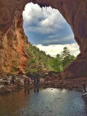


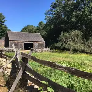
Hikers love it
If you love to hike, you will love this famous trail, lots of challenges but managable. My Russians friends did the hike, they absolutely enjoy it