Cangshan - Jade Belt Cloud Tour Road
苍山 - 玉带云游路

After taking the Cangshan Cableway from Dali Ancient City to Zhonghe Temple, you'll see a bluestone path running across the back of the temple. This is the Cangshan Jade Belt Cloud Tour Road. The road is 2 meters wide and about 18 kilometers long.
The Jade Belt Cloud Tour Road starts from Malong Peak in Cangshan Mountain in the south, passes through Longxi, Yuju Peak, Luyuxi, Longquan Peak, Zhongxi, Zhonghe Peak, Taoxi, Guanyin Peak, Meixi, and ends at Yingle Peak.
Jade Belt Cloud Tour Road is a tour route designed for walkers, because only by walking can you appreciate the picturesque beauty of Cangshan Mountain.
Introduction
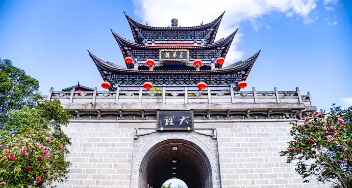
Attraction Location: On Cangshan Mountain (苍山), west of Dali Ancient Town (大理古城), Dali, Yunnan Province, China
History: The Jade Belt Cloud Path (玉带云游路) is a famous scenic hiking route built in the 1990s along the midsection of Cangshan Mountain. It connects several peaks, streams, and temples, and was designed to allow visitors to enjoy panoramic views of Erhai Lake (洱海) and Dali Ancient Town while preserving the natural ecology of Cangshan.
Architecture: The path is a stone-paved and wooden-plank walkway about 18 kilometers long, sitting at an elevation of around 2,500–2,900 meters above sea level. It features small pavilions, lookout platforms, and connecting trails leading to cable car stations.
Cultural Value: The path passes by historical temples and streams that are tied to Bai (白族) culture and mythology. Locals often regard Cangshan as a sacred mountain protecting Dali, and walking the Jade Belt Cloud Path is seen as both a cultural and spiritual experience.
Other Information: The name “Jade Belt” comes from the way the cloud-covered trail resembles a jade belt wrapping around the mountain. It is one of the most popular eco-tourism routes in Dali.
Visiting Information
Opening Hours: 08:00–17:30 (cable cars and ticketing services)
Ticket Price:
Cangshan Scenic Area Entrance Fee: CNY 40
Cangshan Cable Car (Zhonghe Cableway 中和索道): CNY 35 one-way / CNY 60 round-trip
Cangshan Cable Car (Gantong Cableway 感通索道): CNY 50 one-way / CNY 80 round-tripBest Photo Spots: Viewing platforms overlooking Erhai Lake, waterfalls along Qingbi Stream (清碧溪), pavilions at high elevation, sunrise and cloud-sea photography points.
Time Reference: 3–5 hours for a one-way hike with photo stops; 6–8 hours if walking most of the entire Jade Belt Path.
Where to Sleep (Nearby Hotels & Stays)
- Luxury:
Hilton Dali Resort & Spa (大理希尔顿度假酒店)
Dali Mountain & Lake View Resort (大理山海景度假酒店) - Mid-range:
The One Resort Dali (大理一号院)
Dali Yunxi Boutique Hotel (大理云栖精品客栈) - Budget & Boutique:
Dali Old Town Lakeside Inn (大理古城湖畔客栈)
Cangshan Hiking Guesthouse (苍山徒步客栈)
What & Where to Eat
- Must-Try Dishes:
Crossing-the-Bridge Rice Noodles (过桥米线)
Bai Three-Course Tea (白族三道茶)
Erhai Grilled Fish (洱海烤鱼)
Rushan (乳扇, grilled milk fan cheese)
Bai-Style Cured Ham (白族火腿) - Famous Spots:
Cangshan Cable Car Upper Station Tea House (苍山索道上站茶馆)
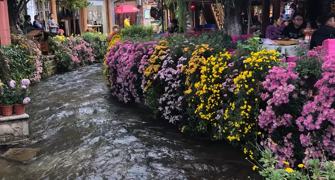
Dali Ancient Town restaurants like Duan Family Restaurant (段家饭店)
Bai Courtyard Food Street (白族院子美食街)
What Souvenirs to Buy
- Bai Tie-dye Fabric (白族扎染布)
Bai-style Silver Jewelry (白族银饰)
Local Herbal Tea (苍山草本茶)
Packed Rushan Cheese (乳扇干)
Pu’er Tea (普洱茶)
Transportation
- From Dali Ancient Town (大理古城): Walk or take a short taxi (10–15 min) to Cangshan Scenic Area South or North Gate.
You can choose to take the Zhonghe Cableway (中和索道) or Gantong Cableway (感通索道) up to the Jade Belt Path. - From Dali Railway Station (大理站): About 18 km, 40 minutes by taxi or local bus to Dali Ancient Town, then transfer by taxi or walking to the cableway station.
- From Dali Airport (大理机场): About 30 km, 1 hour by taxi.
Nearby Attractions
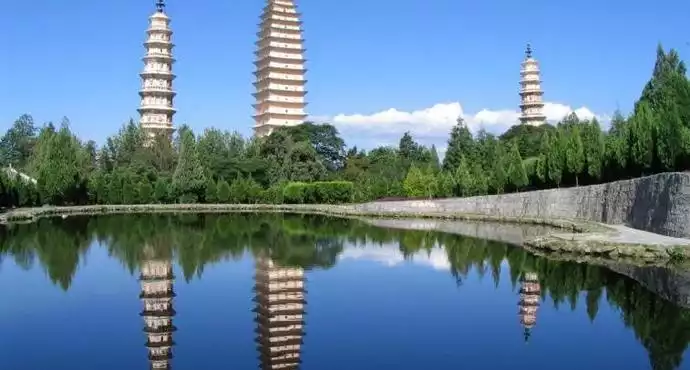
- Chongsheng Three Pagodas (崇圣三塔) – 1.5 km, 20 minutes walking from Cangshan South Gate.
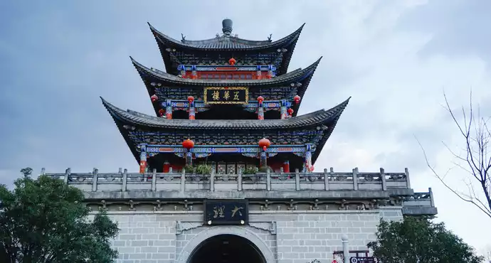
- Dali Ancient Town (大理古城) – 1 km from Zhonghe Cableway entrance, 10 minutes walking.
- Cangshan Qingbi Stream (苍山清碧溪) – within 1 km along the Jade Belt Path, easy hiking access.
Tips for Visitors
- The altitude is around 2,500–3,000 m; walk slowly to avoid altitude sickness.
- Wear hiking shoes; the path is long with uneven stone and wooden walkways.
- Bring water and snacks; few shops along the path.
- Best season is April–June (flowers bloom) and September–November (clear skies).
- Check cable car operation schedules before going; sometimes they close due to weather.
- Clouds and fog can change rapidly; photography is best in the morning.
Recommended itineraries
- Half-Day Route:
Dali Ancient Town (大理古城) → walk/taxi to Zhonghe Cableway (中和索道, 10 min) → take cable car up to Jade Belt Path (玉带云游路) → hike 3–4 km along the path for panoramic Erhai views → return via cable car to Dali Ancient Town. - 1-Day Route:
D1: Morning: Dali Ancient Town → Zhonghe Cableway → Jade Belt Cloud Path hike (3–5 hrs).
Afternoon: Visit Qingbi Stream (清碧溪) and return by cable car.
Evening: Explore Dali Ancient Town food street.
Transport: walking + cable car + taxi return. - 2-Day Route:
D1: Dali Ancient Town → Cangshan Jade Belt Cloud Path (玉带云游路) via Gantong Cableway (感通索道). Hike and photography along the path → stay overnight at a mountain-view boutique inn.
D2: Morning: Visit Chongsheng Three Pagodas (崇圣三塔, 15 min walk from Cangshan South Gate).
Afternoon: Cycle around Erhai Lake (洱海环湖骑行) starting from Dali Old Town.
Transport: taxi/walking between attractions, bike rental for Erhai Lake.
User Reviews

This road is the middle road connecting the three cable cars. It is also a hiking road with good scenery.


I walked this road once before, she and I went together, but we never went there again.

The Jade Belt Cloud Tour Road is very long and it takes half a day to walk.

A good place for hiking. The scenery is beautiful. It is halfway up Cangshan Mountain. If you often insist on hiking on this road, you should be praised because it takes a long time to climb from the foot of Cangshan Mountain to here.

Majestic and spectacular, overlooking Erhai Lake, with dense foliage and strong ultraviolet rays

The Jade Belt Cloud Travel Road, as the guidebooks claim, is perfect for hiking. Along the way, you can enjoy the scenery of Cangshan Mountain. The Cangshan scenic area is vast, with numerous warning signs prohibiting visitors from trespassing in undeveloped areas. While both the Gantong Cableway and the Ximatan Cableway can reach the Jade Belt Cloud Travel Road, unfortunately, the scenic area lacks adequate signage indicating the drop from the cableway exit to the Jade Belt Cloud Travel Road. After disembarking from the Gantong Cableway, we had to climb a long flight of stairs to reach the Jade Belt Cloud Travel Road. Later, when we chose to descend from the Ximatan Cableway, we had to climb another long flight of stairs to reach the cableway entrance. This was a significant effort and we nearly missed the last cable car.


A trail on Cangshan Mountain with a great view!


It's 4.5 kilometers from Gantong to Qilongnu Pool, and you have to climb up a mountain road to get from Qilongnu Pool to Qilongnu Cable Car Station. It's very tiring.

The Jade Belt Cloud Road is said to be 18 kilometers long and entirely flat. The section from Qingbi Creek to the Seven Dragon Girls Pool Station is 4.5 kilometers long. The flatness of the road made it easy, but its length took us over two hours. By 3:00 p.m., the mountain air was noticeably cooler. My classmate, Lu, had somehow found out that the Ximatan cable car closes at 4:00 p.m. and began to urge me to hurry.
Finally, we reached an open platform. A sign indicated that steps led down to the Seven Dragon Maidens Pool, where we'd take the cable car up. It was almost four o'clock, and I thought we'd triumphed. I rushed up the steps to see how far the cable car was and whether I still had time to visit the Seven Dragon Maidens Pool. But after climbing one steep flight of stairs after another, I was exhausted and panting, but there was no sign of the cable car. I asked a guy descending the mountain how far it was, and he hesitantly replied, "Not too far."
I sensed the situation was dire. Then I heard classmate Lu yelling my name from below. I had no choice but to go down and meet them, telling them the road ahead was long and uncertain. By then, more tourists were arriving, probably heading for the cable car. Men, women, young and old were all gasping for breath, looking at us with sympathy, carrying a three-year-old child.
By this time, we were on the Huashan Trail. I carried Pipi up and started climbing. After two sections, I felt exhausted and crouched down to catch my breath. After a short rest, I felt refreshed and continued climbing, wondering if this was altitude sickness. By then, Lu and I were both exhausted. We wanted Pipi to climb on his own, but he seemed a little scared in the mountains and refused. In a fit of rage, Lu hit Pipi, and Pipi burst into tears. A young man nearby couldn't stand it anymore and offered to hold Pipi. But Pipi got angry and refused to be held by a stranger.
I had to ask a nearby tourist to talk to the cable car staff about closing the cable car. Then, holding Pipi in my arms, I continued climbing, finally completing the two kilometers of steep mountain path. It was already past four o'clock, and Lu and I were drenched in sweat. The staff hurriedly crammed us into a cable car already occupied by four people. I guess the cable car closed at 4:30, or perhaps it was originally scheduled for 4 o'clock, but because some tourists hadn't arrived yet, it closed later.


The Jade Belt Road below the Qingbi Creek Observation Deck offers great views every time you walk a distance.
The scenery along Yudai Road is beautiful.


Jade Belt Cloud Travel Road is an 18-kilometer-long trail on the waist of Cangshan Mountain, connecting scenic spots such as Qingbi Creek, Seven Women Pool, Phoenix Eye Cave, and Zhonghe Temple. Although the distance is long, it is almost flat, like a belt of Cangshan Mountain, with deep trees and gentle breezes, making it easy to walk.


The stairs connecting the cable cars at both ends of Yudai Road are extremely steep. It took about ten minutes to climb from Gantong and nearly forty minutes from Ximatan. When climbing stairs at high altitude, it's important to take your time, maintain a steady pace, regulate your breathing, and avoid overeating.
The sunny side of Yudai Road overlooks the ancient town and Erhai Lake, and the scenery is beautiful and worth a walk. There are stalls selling baked French fries, sausages, and corn near the cable car stations on both sides, and the price should not exceed ten yuan.


Jade Belt Road is a hiking trail that winds along the hillside of Cangshan Mountain. It's about 7-8 kilometers long, so a full day is essential to fully explore it. It's a showcase for diverse flora, with numerous small, unknown flowers. In spring, the vibrant colors of the flowers blanket the mountain, a truly captivating sight.

It is recommended to plan the route carefully before going. The scenery of Erhai Lake is particularly beautiful when overlooking it from the road.

The road is a bit slippery when it rains and the scenery is boring. The attractions are far apart and there is no need to walk.

The Jade Belt Road is indeed flat, but after walking four or five kilometers, it is still a bit tiring. There are one or two places on the Jade Belt Road where you can overlook Erhai Lake and the ancient city of Dali.


If it hadn't rained, the scenery would have been stunning, but unfortunately the weather wasn't good.

Exit Qingbi Creek and return to the Gantong Cableway exit. Turn right to reach Yudai Yunyou Road. The initial climb takes about 10 minutes. It's not long, but the high altitude left everyone breathless. Someone even spotted wild Panax notoginseng flowers along the roadside. Yunyou Road is much more friendly, a straight path with a slight uphill climb at best. As we walked along Yunyou Road, thick fog gradually rose and a gentle rain fell, adding a touch of coolness to the hike. Because the distance was long and it was already noon, we only walked halfway along Yudai Yunyou Road before retracing our steps and preparing to descend.


I thought the Jade Belt Road would be a very physically demanding journey, but I didn't expect it to be a long flat road around the mountain. The entire road was level, with no slopes at all.

It turns out this Jade Belt Cloud Road is a bluestone path. It's very flat, with expansive views and stunning scenery, making it easy to walk. The signage isn't clear and precise, though, and there are constant warnings about falling rocks, so I walked a little faster. When I was walking alone, there weren't many other tourists around. After a few students and couples crossed, I was left alone, navigating the deep mountains. Although I felt a little nervous, the beautiful scenery was enough to distract me from everything else.

An 18-kilometer hiking route that runs along the hillside of Cangshan Mountain. This Cloud Road is the most beautiful route in Cangshan Mountain. Although it is a mountain road, it feels like walking on flat ground. You can see Cangshan Mountain up close and Erhai Lake in the distance. Because the route is long, most tourists only walk a short distance or go directly down the mountain, so it is very quiet and leisurely. I like to be equally good at hiking and climbing. I am very comfortable walking for 3 and a half hours with stops and starts, and I don’t feel tired.


It took us over three hours to walk from Qingbi Creek on the Gantong Cableway along the Jade Belt Cloud Travel Road to the Seven Dragon Maiden Pool. Looking back, my biggest mistake was naively thinking I could complete the entire Jade Belt Road. I really don't recommend treating the entire route as a trip to Cangshan. After all, the scenery along the route isn't particularly impressive, and the restrooms are incredibly far away.

The Yunyou Jade Belt Road runs north-south through Cangshan Mountain, a scenic thoroughfare midway. There are almost no steps, so there's no need to worry about climbing. We took the Zhonghe Cableway up and down the main cableway, which is about 7-8 kilometers. We only met a dozen or so other people along the way. The scenery was nice, and since there was no climbing or descending, it wasn't too tiring.


Jade Belt Road is a man-made plank road built along the middle section of Cangshan Mountain. Accessible by cable car or horseback, it offers effortless views of the mountain. The 17-kilometer road spans the eastern side of Cangshan Mountain and requires a full day to fully explore.


Actually, it's just walking, hahahaha, but it feels great to walk at such a high altitude. Looking at those people who took the cable car up next to me, and then thinking about the fact that I climbed up by myself, I feel proud, hahahaha

The road stretching for N kilometers on Cangshan Mountain is much wider than you can imagine. It is so great that our ancestors paved such a road. The air in the mountains is naturally good. You can enjoy the beautiful scenery of Cangshan Mountain while walking. In some places, you can overlook Erhai Lake.

Unfortunately, I didn't finish the walk because the ropeway had operating hours... I really wanted to finish it~~~~~

This road connects various mountains—I can't remember exactly how many it connects. Halfway up the mountain, there are sometimes cliffs right next to each other, and many of the roads are carved out. I always remind everyone to be careful to avoid rockfall. The mountain walk, especially around the valleys and the Grand Canyon, is quite spectacular. I often run into foreigners. Occasionally, you can see Erhai Lake, but most of the way is obscured by trees, making the view difficult. The entire road is quite long and connects three cable cars.
The mountains are green and the water is beautiful, there are also water lilies and green rocks. It is beautiful~~~ You can imagine how happy the people living here are.

It's a very long road with only a few rest pavilions along the way. The toilet is near the Seven Dragon Girls Pool. There is a guard before entering and you need to register basic information. It is recommended to bring plenty of water and dry food if you walk.


It is about 18 kilometers long and runs through the back of Zhonghe Temple. From south to north, it passes through the Seven Dragon Girls Pool, Zhonghe Temple, Jade Pool, Yellow Dragon Cave and other scenic spots.


We bought round-trip tickets for the Ximatan Cableway halfway, then took the sightseeing bus (30 yuan each way) down to Yudai Road and headed south. The trees on either side were too tall, or there were falling rocks that required quick navigation. After 2km, we impulsively decided to walk to the Gantong Cableway. There were only two places from which to get a good view of Dali. Overall, Yudai Road wasn't ideal for taking photos.


I think the Jade Belt Cloud Tour is the most fun part of Cangshan. It would be even better if they could develop a camping area. I'd love to stay on Cangshan Mountain and watch the stars, but I also know the biggest concern for scenic areas is forest fires. If this person were there, it would be a potential hazard. The mountaintop is expensive, the air is thin, and the UV rays are strong. Food is also expensive, and there's nothing much to see, just a few puddles.


It's a physical test, it's tiring, but the air is pretty good, it's okay

It's a physical test, it's tiring, but the air is pretty good, it's okay

I took a taxi to the cable car station. As a poor person, I saw the 200+ yuan cable car ticket price and realized I couldn't afford it. So I paid the 40 yuan entrance fee and took the trail up the mountain. The trail was entirely stone steps, and quite a few people were climbing it, so I guess I wasn't the only one. The trail continued to Yudai Yunyou Road, a 3-kilometer climb that took 1.5 hours.
The Jade Belt Cloud Travel Road is a bluestone path built halfway up the mountain. Built over 20 years ago, it's so named because, during periods of fog, visitors walk through the mist. The foot of Cangshan Mountain is about 2,000 meters above sea level, the Jade Belt Cloud Travel Road is 2,600 meters, and the summit peak is over 4,100 meters.
You'll sweat a lot while climbing, but as soon as you stop, you'll feel cold again. A little sun will warm you up, but if you walk along this shady road, you'll be freezing cold again. It's such a magical place, so you need to wear thick clothes, preferably quick-drying ones underneath.
We walked south along the Jade Belt Road, passing Jiangjunyan, Qilongnuchi, and Qingbixi Grand Canyon, all the way to the Gantong Temple Trail. Because we didn't want to go back, we walked for more than ten kilometers until dusk.
The Jade Belt Road is flat and easy to walk, and you can also learn about geology from the signs along the way. Climbing a mountain is not very interesting, the purpose is to be able to see the distance. Unfortunately, the scenery on the Jade Belt Road is very limited. After a day, I still feel unsatisfied. If you want to see Erhai Lake, you still have to climb to the top for the best view.


Yudai Road is very quiet and suitable for relaxing. You can chat while walking and stop to take a look at the good places to view Erhai Lake. It is very pleasant.


The 16.2-kilometer-long stone path runs from Xiaocen Peak in the north to Shengying Peak in the south, passing through six peaks and five streams. A full day's walk will reveal all the sights of Cangshan.

On the Jade Belt Cloud Tour, I truly experienced the feeling of walking through the forest, passing through the secluded valley, wading through the green stream, listening to the birds singing, and enjoying the mountain scenery.
Walking here and there, the green forests alternately light and dark. Sometimes the clouds hang low above the mountaintops, while other times the scenery below is crystal clear: villages, ancient towns, pastoral scenery, and the beautiful Erhai Lake shimmering in the light! It can be said that the Jade Belt Cloud Traveling Road is the best way to enter and understand Cangshan Mountain. Designed specifically for walkers, the Jade Belt Cloud Traveling Road is the only way to appreciate the picturesque beauty deep within Cangshan Mountain.

You have to choose the right season. If you choose it right, it will be picturesque. If you choose it wrong, it will be just ordinary.

The scenery of Yudai Yunyou Road is pretty good! ! ! !

This is a small trail with stunning natural scenery. On the day we visited, a section of the trail was icy and slippery, making it easy to slip. The entire trail is 4.5 kilometers long and leads all the way to the Ximatan Cableway. The scenery along the way is breathtaking, and with few tourists, it's a very pleasant journey through Cangshan.


After taking the Cangshan Cableway from Dali Ancient City to Zhonghe Temple, you can see a bluestone road leading from Zhonghe Temple to the Jade Belt Cloud Travel Road.
Running horizontally behind, this is the Cangshan Jade Belt Cloud Travel Road. Many women are intrigued by the origin of the poetic name. Anyone familiar with Dali's natural and cultural heritage will know that Dali's cloudscape is a unique natural wonder between Cangshan Mountain and Erhai Lake. The most famous of these, due to their legends, are the "Waiting Husband Cloud" and the "Jade Belt Cloud." The Jade Belt Cloud phenomenon appears in late summer and early autumn. Every morning, a long, white cloud, like a ribbon, lingers on the mountainside of Cangshan Mountain's Nineteen Peaks, creating a breathtaking spectacle. Local folklore tells of a fairy who secretly descended to earth to admire the beauty of the human world, leaving behind a ribbon between Cangshan Mountain and Erhai Lake.

Yudai Yunyou Road is a road on the top of Cangshan Mountain. You can take the cable car up to

This scenic spot on Cangshan Mountain is accessible via the Gantong Cableway, which costs 80 yuan for the Gantong cableway and 40 yuan for the Cangshan Mountain entrance fee. From the Gantong Cableway, you can walk along the Jade Belt Cloud Travel Road to the middle station of the main cableway. Alternatively, you can continue walking to the small cableway and take the small cableway down the mountain, or simply walk. The Jade Belt Cloud Travel Road is a flat path midway up Cangshan Mountain, with minimal ups and downs, making it a leisurely hike. If you walk briskly, the journey from the Gantong Cableway to the middle station should take over an hour. There are small shops near the middle station, but no shops along the way, so bring water and snacks. Near the middle station is the Seven Dragon Maidens Pool, a scenic spot with clear water and a tinge of blue. It's worth a visit along the way.


Jade Belt Yunyou Road, also known as the Jade Belt Road, is a scenic trail located midway up Cangshan Mountain. It gets its name from its resemblance to a belt wrapped around the mountain's waist. The road stretches approximately 16 kilometers, starting from Taoxi River at Xiaocen Peak in the north and ending near Qingbi Creek at Shengying Peak in the south. It offers panoramic views of the Dali Basin and Erhai Lake.

Jade Belt Road is located halfway up Cangshan Mountain, facing Erhai Lake. There are pine trees along the way and the scenery is nice. Especially since there are few people, it is very quiet.


The scenery of Yudai Yunyou Road is pretty good, but I think it’s too tiring to walk there, and the scenery is not beautiful enough to make me forget the pain in my feet.

Don't even think about hiking the 10-plus kilometer Jade Belt Cloud Trail unless you're a hiking enthusiast. Cangshan Mountain is best viewed from a distance; it's quite boring inside. While you can enjoy the breathtaking beauty of Cangshan Mountain's snow in winter, it's incredibly cold.

We went up from the Gantong Cableway, walked the 11.5-kilometer Jade Belt Cloud Road, and then hiked down the mountain back to the town.

On the hillside of Cangshan Mountain, the middle of the road is paved with bluestone slabs, and the roadside is made of stone strips with drainage ditches, connecting all the scenic spots.

I walked the 18 kilometers of Cangshan Jade Belt Road alone. It was quiet. The further I walked, the less people there were. On the top of Cangshan Mountain, the Jade Belt Road, overlooking Dali and Erhai Lake in the distance, gave me a feeling of being away from the world. I really liked it.

Walking along the Jade Belt Road, you can only see Erhai Lake from a distance. The Jade Belt Road is very flat and easy to walk on.


The roads along Cangshan Mountain are all flat and not tiring to walk on.

It is a walking trail on the hillside of Cangshan Mountain. The scenery is very nice. You can go there to see it if you don't take the cable car to the top of the mountain.

Maybe it was late in the afternoon, so there were few people on the Jade Belt Tour and it seemed particularly quiet. The road was not wide and was lined with towering trees on both sides, making it very comfortable to walk on. The road is very long and can lead to many scenic spots in Cangshan.

The whole road is like this! It is flat, with almost no ups and downs, running from south to north on the hillside of Cangshan Mountain!
Walking on the Jade Belt Cloud Travel Road, I really experienced the feeling of walking through the forest, passing through the valley, wading through the green stream, listening to the birds singing, and enjoying the mountain scenery.
Walking here and there, the green forests alternately light and dark. Sometimes the clouds hang low above the mountaintops, while other times the scenery below is crystal clear: villages, ancient towns, pastoral scenery, and the beautiful Erhai Lake shimmering in the light! It can be said that the Jade Belt Cloud Traveling Road is the best way to enter and understand Cangshan Mountain. Designed specifically for walkers, the Jade Belt Cloud Traveling Road is the only way to appreciate the picturesque beauty deep within Cangshan Mountain.


It is a scenic trail located halfway up Cangshan Mountain.
It is about 16 kilometers long and overlooks the Dali Basin and Erhai Lake with a wide view.

We carefully walked along the Jade Belt Road. The scenery on the mountain was great, especially overlooking Erhai Lake. We took a lot of photos.

After taking the cable car up the mountain, the road is flat all the way, overlooking Erhai Lake. The sky is clear after the rain and the scenery is superb.

The trail is easy to walk on and there aren't many people on the road, so you can get a good look at Erhai Lake from a different angle. The route is long, so it's best to bring water and snacks.

The day's tour has come to an end. I feel that the Jade Belt Road in Cangshan is very beautiful and worth a visit. It's just a matter of time, so it's a pity that I didn't complete the whole journey.

Hiking the entire 18-kilometer Yunyou Road is the most economical and fastest way to visit Cangshan Mountain. From Yunyou Road, you can overlook Erhai Lake, and the view is best in the evening.

The terminus of the Gantong Cableway is Yudai Yunyou Road, halfway up the Cangshan Mountain. We probably came too early. Apart from a family of three, we didn't see anyone else. It was so quiet.

Walking along the Jade Belt Road, you can enjoy both mountain and sea views. In rainy and foggy weather, a layer of mist will float on the Jade Belt Road.

It is a winding and rugged stone road around the mountain, which is not difficult to walk on. Along the way, there are birds singing, flowers blooming, gurgling water and fresh air.

The Cangshan Cloud Path, also known as the Jade Belt Cloud Path, is located midway up Cangshan Mountain at an altitude of 2,600 meters. It stretches 16.2 kilometers from Xiaocen Peak in the north to Shengying Peak in the south, passing six peaks and five streams. The entire path is 2-2.5 meters wide, paved with bluestone slabs in the middle and paved with cobblestones on both sides. It's a very easy walk, with no ups or downs. Key attractions along the way include Gantong Temple, Seven Dragon Maidens Pool, Longyan Cave, Fengyan Cave, and Zhonghe Temple. Later, I heard from the hostel staff that if it rains in the morning, clouds gather in the valley, and walking on the Cloud Belt Path feels like walking through the clouds. Unfortunately, we didn't have the chance to experience this.

The Jade Belt Cloud Road, with Erhai Lake hanging in the distance like a turquoise ribbon, is so blue that it rivals Yamdrok Lake, the sacred lake of Tibet! The entire ancient city is in full view, and with the cotton-like clouds, walking on this road will make you feel like humming a little tune, and your mood will be relaxed!
The entire Yudai Road is more than 11 kilometers long.


Jade Belt Road is a long, flat, and relatively wide stone road. If it doesn't rain, it's very pleasant to walk on. I heard that the Seven Fairies Pool behind Jade Belt Road is still under construction, so after walking a few kilometers on Jade Belt Road, I started to turn back and follow the signs down the mountain.

The Jade Belt Cloud Road is long and winding, and there is basically no particularly steep road. However, people who do not exercise regularly may find it difficult to walk such a long section of road. In addition, there are many mosquitoes on the road, so toilet water is essential.

Going up from the Grand Canyon is the Jade Belt Tourist Road. I think that’s the name. Anyway, it’s a very literary name, but it’s a very long white road that leads to the filming location of Demi-Gods and Semi-Devils.

A streak of white clouds perpetually surrounds the center of Cangshan Mountain, also known as the Jade Belt Cloud. In the 1990s, a tourist trail, the "Jade Belt Road," was built in this area, connecting Qingbi Creek to Zhonghe Peak. The scenic views along the way are breathtakingly beautiful, with lakes and mountains shrouding the area.

Arriving at the Jade Belt Cloud Tour Road, which is considered a tourist attraction, the road is densely forested and the air is fresh. For those who escape from the big city, it is also a good place to hike, breathe oxygen, and cleanse the lungs. However, the scenery is nothing special.

If you have the energy, you must walk the Jade Belt Cloud Road from beginning to end. It is truly beautiful like a fairyland.


In April 2019, we took guests from Jiangxi who were staying at Yuanwuwei Hotel to have an in-depth tour of Cangshan Mountain, which included the Jade Belt Cloud Tour Road.
Jade Belt Route: The Cangshan Jade Belt Route begins in the south at Malong Peak, passes through Longxi, Yuju Peak, Luyuxi, Longquan Peak, Zhongxi, Zhonghe Peak, Taoxi, Guanyin Peak, and Meixi, and ends at Yingle Peak. The southernmost point of the Jade Belt Route is from the Gantong Cableway up to the Cangshan Grand Canyon, and ends in Taoxi in the north, at an altitude of approximately 2,600 meters.
Jade Belt Cloud Route: Cangshan Grand Canyon (there's a road junction leading downhill to the Gantong Temple parking lot) → Cangshan metamorphic rocks → Stone sausage structures → Cangshan Global Geopark rest area → Yunnan pine → Winter melon → Cardamine azalea → Armand pine → Mylonite → Diverse schist → Foliation - directional structures in metamorphic rocks → Schist → Restrooms → Longxi River → Seven Dragon Maidens Pool Scenic Area → Cangshan Global Geopark Rest Pavilion → Cangshan Global Geopark Rest Pavilion → Crane Spreading Wings → → Cangshan Global Geopark Rest Pavilion → Erhai Rock Island → Cangshan Guardian Spirit → Dragon and Phoenix Eye Caves (there's a road junction leading downhill to the Tianlongbabu Movie Studio) → Zhongxi River → Schist → Restrooms → Ping'an Gate → Zhonghe Temple (there's a road junction leading downhill to Yinxian Road) → Cangshan Global Geopark Rest Pavilion → Taoxi River, etc. This is the Cangshan Jade Belt Cloud Route. (For more information about hiking the Jade Belt Cloud Route, please follow my other post.) The road is 2 meters wide and about 18 kilometers long. It was completed in early 1992.
Tips for visiting the Jade Belt Cloud Road: From Cangshan Grand Canyon, hike north along the Jade Belt Cloud Road for about 4.5 kilometers to reach the Seven Dragon Maidens Pool Scenic Area. This section of the Jade Belt Cloud Road takes about 70 minutes, and you can enjoy the beautiful scenery along the way. It's recommended to hike along the regular, safe route and avoid taking the side roads that lead to the Cangshan Mountains, as they are very unsafe. The entire Jade Belt Cloud Road is approximately 18 kilometers long, and this hike only covered a quarter of it. It's said that the most beautiful scenery is in the latter part. I'm looking forward to hiking the entire route next time.
For details, you can also refer to my travel notes in April 2019, "Dali Cangshan In-depth Tour, 123 Route Most Complete Guide"