Heroes of the World—Hubei
Preface
4228 rivers flowing all year round
(Best viewed in landscape mode)

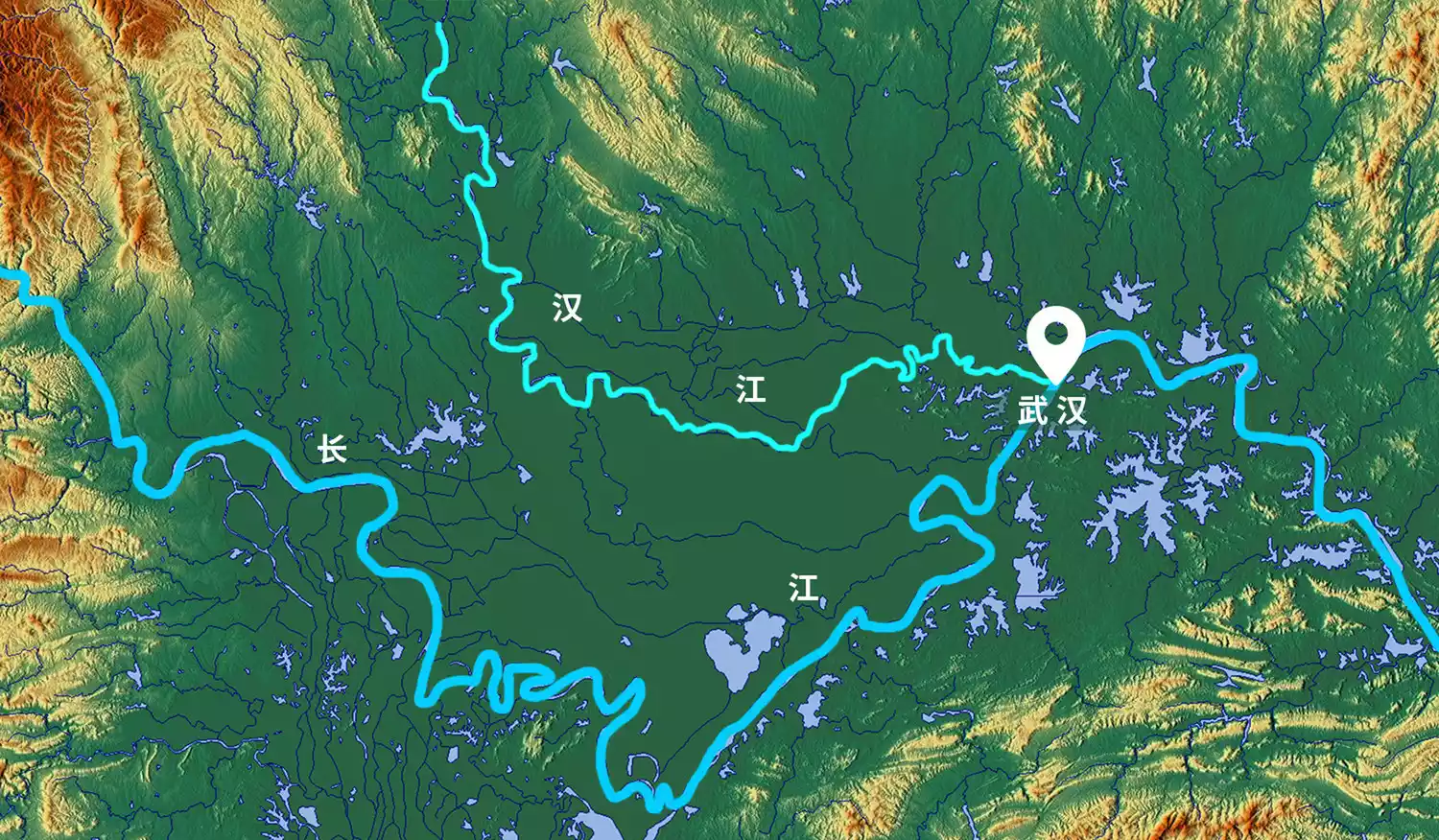
The Yangtze River flows through Hubei Province for 1,041 kilometers.
755 lakes, vast and vast like pearls
 Wuhan East Lake: One of the largest urban lakes in China, six times the size of Hangzhou West Lake
It is one of the provinces with the highest concentration of rivers and lakes in China.
One-tenth of the province's land is covered by water, earning it the nickname "Province of a Thousand Lakes."
 △ Hubei Province has rich river and lake resources
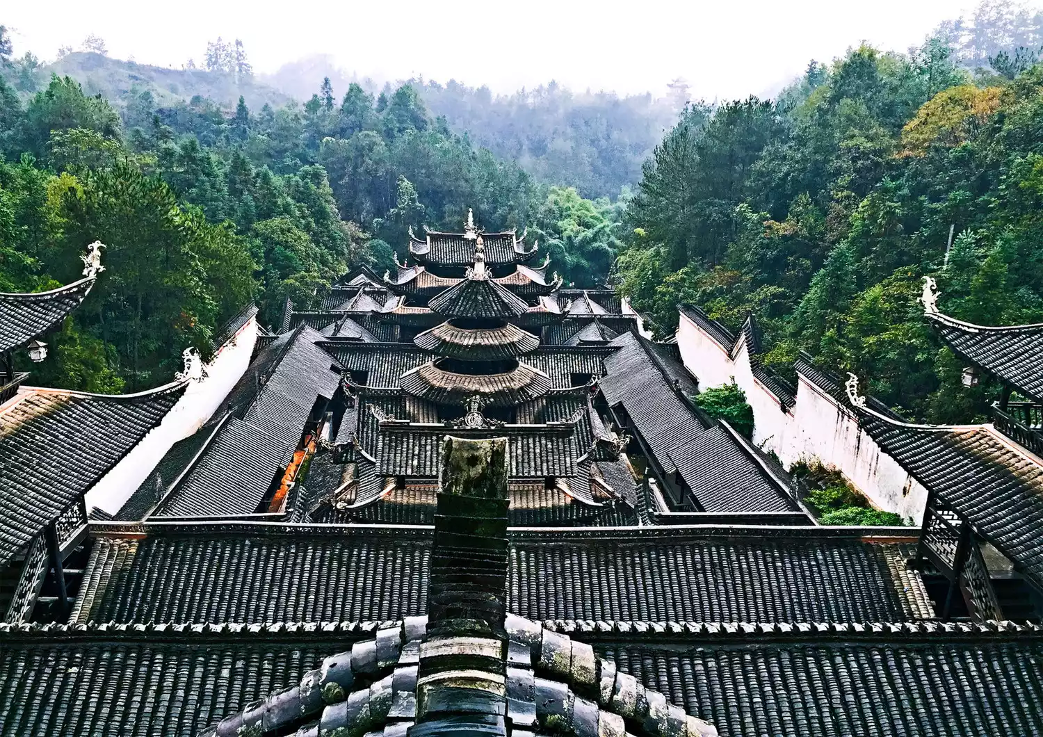
More than 5,000 archaeological tombs of Chu culture connect the past and present
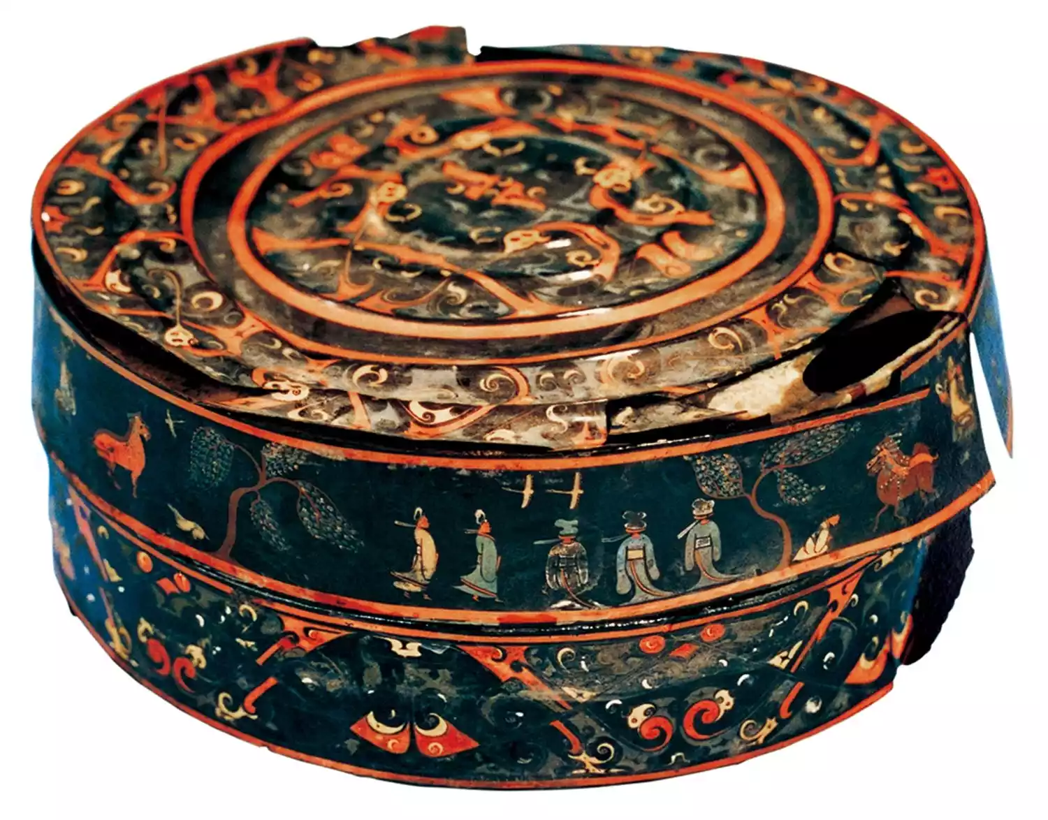 A round box with a painted figure and carriage: This box was probably a container for cosmetics. It was unearthed from Tomb No. 2 at Baoshan, Jingmen City, Hubei Province, and is now in the collection of the Hubei Provincial Museum.
3000 years of flourishing Jingchu civilization
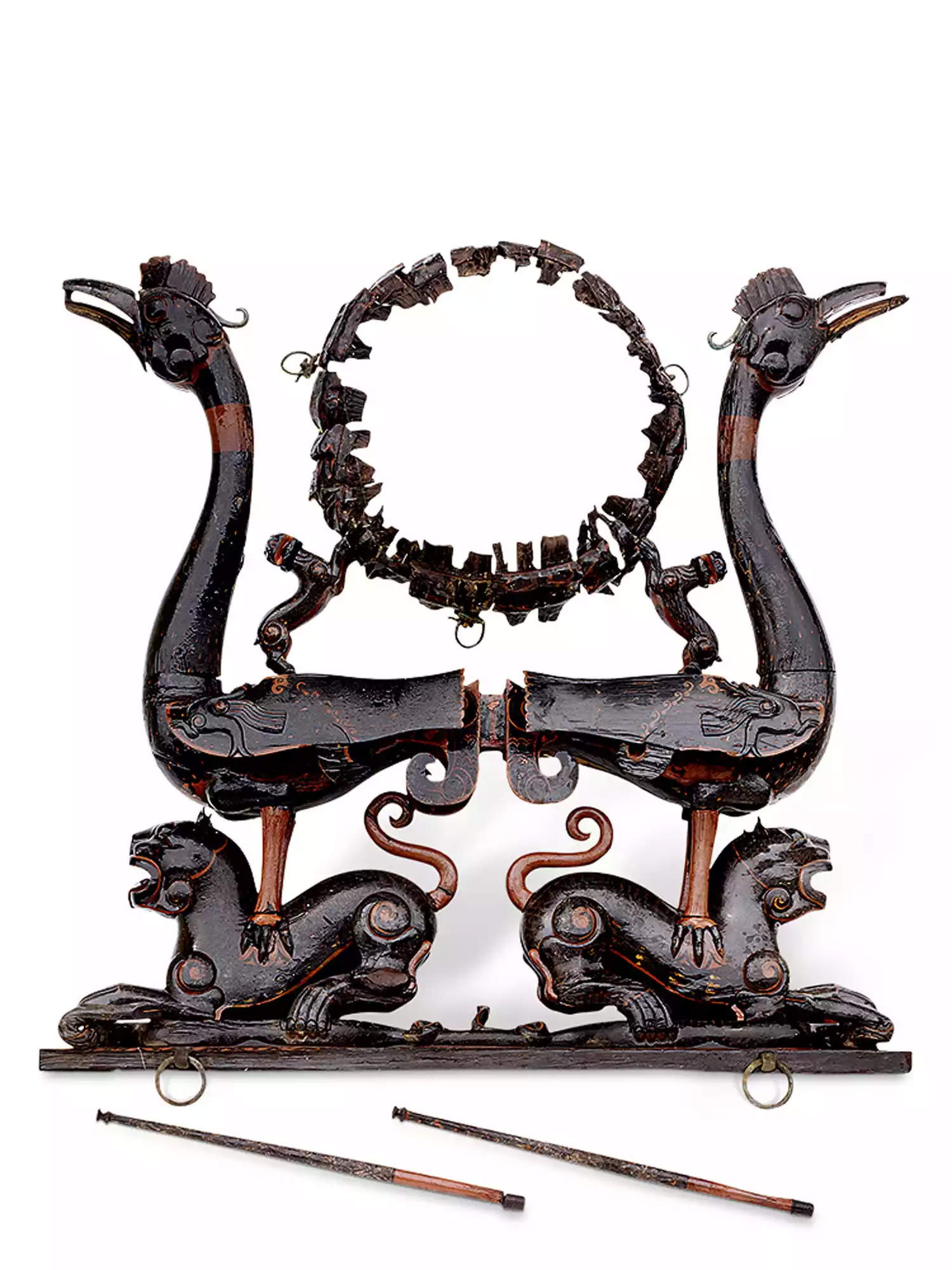 Lacquered wood tiger-mounted bird drum stand: unearthed from Tomb No. 2, Jiuliandun, Zaoyang City, Hubei Province, a percussion instrument, now in the collection of Jingzhou Museum
It is the place where the Yellow River Basin civilization and the Yangtze River Basin civilization blend together, and the core of Jingchu civilization, known as the "Jingchu Land".
△ Satellite image of the Jianghan Plain: Yangtze River on the left, Han River on the right
It is Hubei
In recent years
With the rapid development of its capital city, Wuhan, Hubei has frequently appeared in people's vision. When talking about Yunnan, people would say "South of the Colorful Clouds" and when talking about Sichuan, people would say "Land of Abundance". But when it comes to Hubei, which is neither south nor north, east nor west, it is often difficult to describe it.
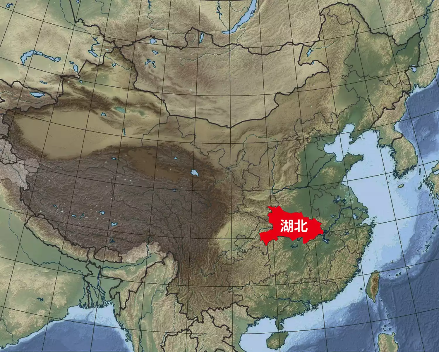 △Hubei Province's geographical location in China
What kind of province is Hubei?
From the perspective of China-TravelNote, Hubei is a place of heroes. For thousands of years, rivers have flowed down, shaping Hubei and also a place of heroes.
(Best viewed in landscape mode)
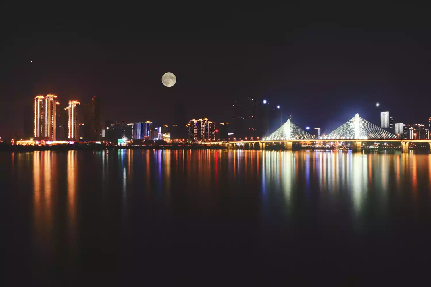
 △Wuhan Yuexiu Fortune Center
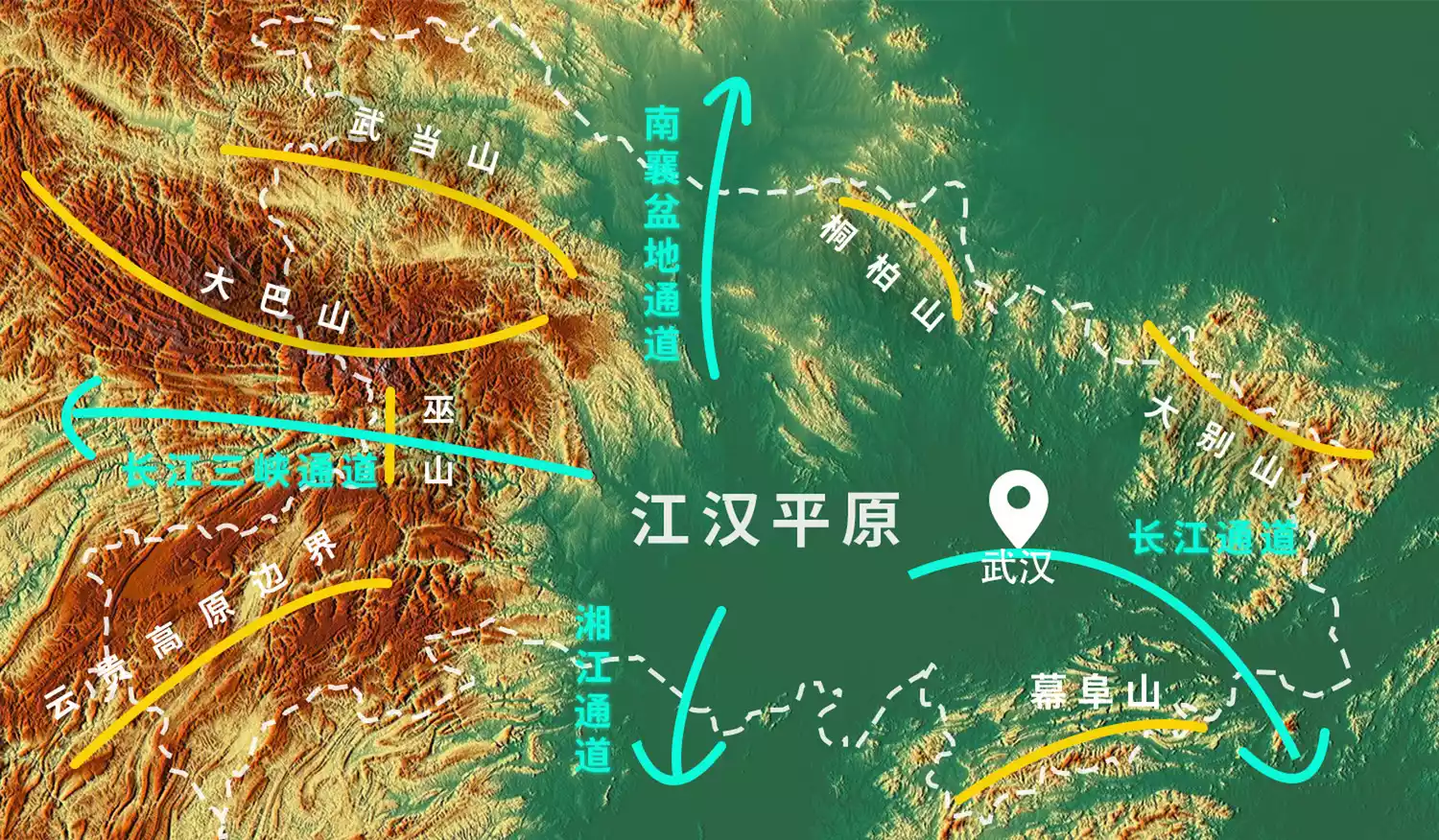
-Shaping mountains and rivers-
mountain building
Hundreds of millions of years ago, the South China Plate began to dive towards the North China Plate, generating violent movements within the Earth's crust. The two plates gradually merged, and the Central Orogenic Belt began to emerge, encompassing the Qinling Mountains, Daba Mountains, Wudang Mountains, Dabie Mountains, and Tongbai Mountains. The Qinling Mountains and the Huai River dividing north and south China have become fundamental geographical knowledge.
 △Qinling Mountains: the westernmost mountain range of the Central Orogenic Belt
The arc-shaped Daba Mountains insert into the northwest of Hubei Province, forming the present-day Shennongjia Forest Area.
 △Shennongding Sea of Clouds: Shennongding is 3106.2 meters above sea level, the highest peak in Daba Mountain and the highest point in Central China.
Here are distributed China's unique and precious animals - golden monkeys

△Shennongjia golden monkey: a rare and endangered species under national first-class protection
On Wudang Mountain, the Wudang Sect founded by Zhang Sanfeng has become an indispensable part of martial arts culture.
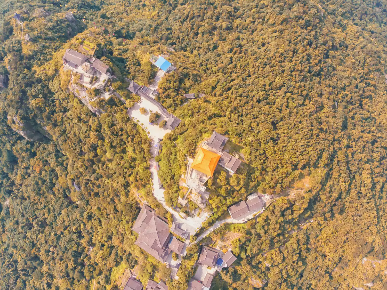 △Wudang Mountain: China's Taoist Holy Land
The Dabie Mountains are well-known because of the "Liu-Deng Army"'s thousand-mile advance into the Dabie Mountains.
(Best viewed in landscape mode)
 △ Dabie Mountains: the watershed between the Yangtze River and the Huai River
Subsequently, under the drastic transformation of the Himalayan orogeny, the central orogenic belt with a relative drop of 1,000 to 2,000 meters rose comprehensively, forming an encirclement from west to east in the northern part of Hubei Province.
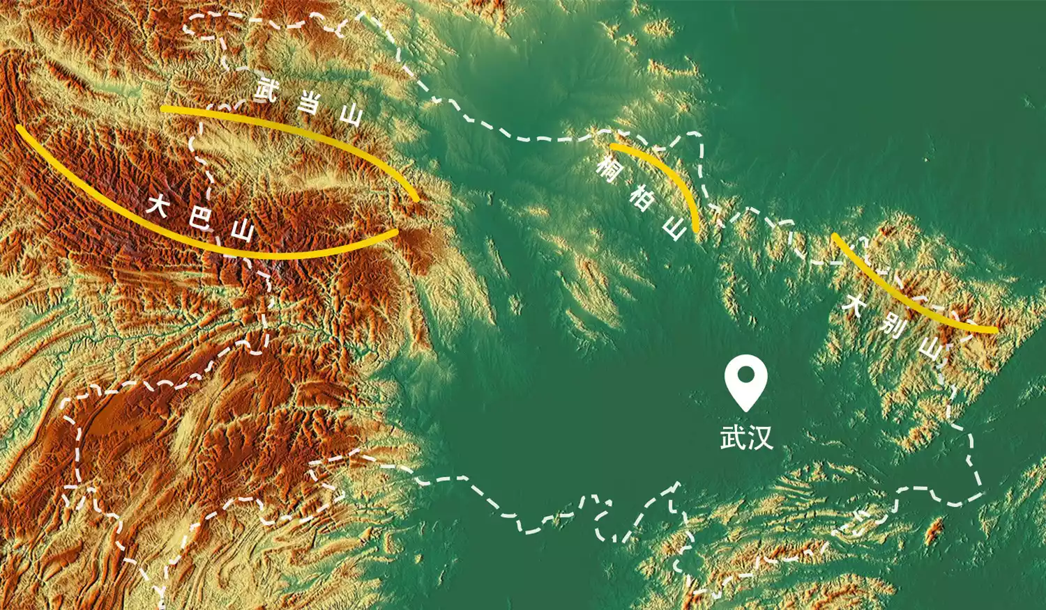 △Mountains in northern Hubei Province
At the same time, changes are also taking place in southern Hubei Province. The northeastern edge of the Yunnan-Guizhou Plateau is approaching the southwestern part of Hubei Province, creating the densely forested landform features of the Enshi area.
The river cuts through the mountains, causing gullies and valleys to crisscross the forests.
The valleys were eroded by rainwater for a long time, eventually forming karst landforms.
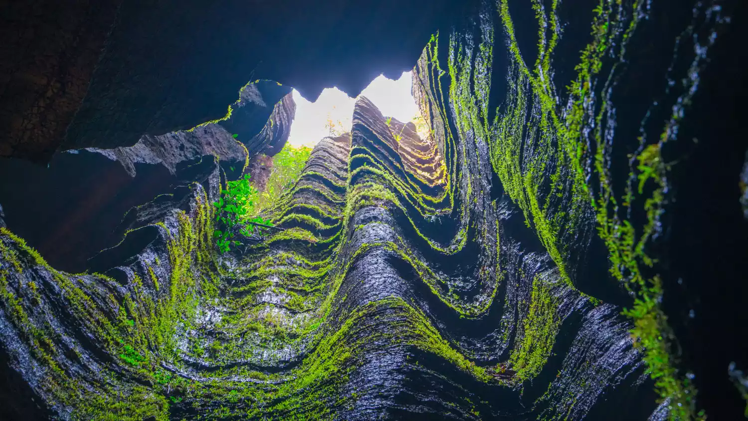 △ Suobuya Stone Forest: Located in Taiyanghe Township, Enshi City, Hubei Province, it is a karst landform
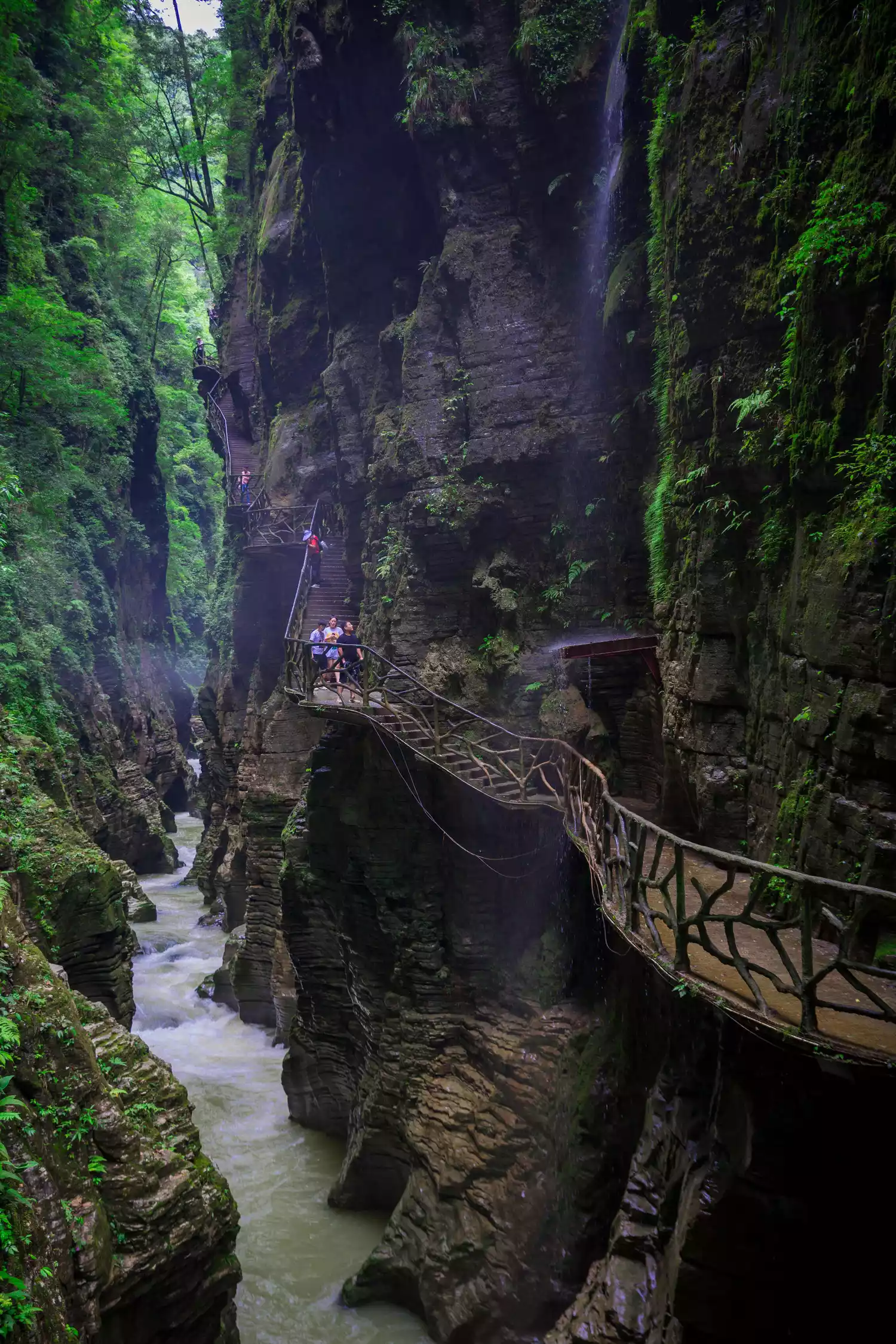
The huge drop between the deep valley and the mountain top creates a vertical cliff, forcing vegetation to grow on the mountain.
There are also independent stone pillars that are over 150 meters high, with a minimum diameter of only 4 meters.
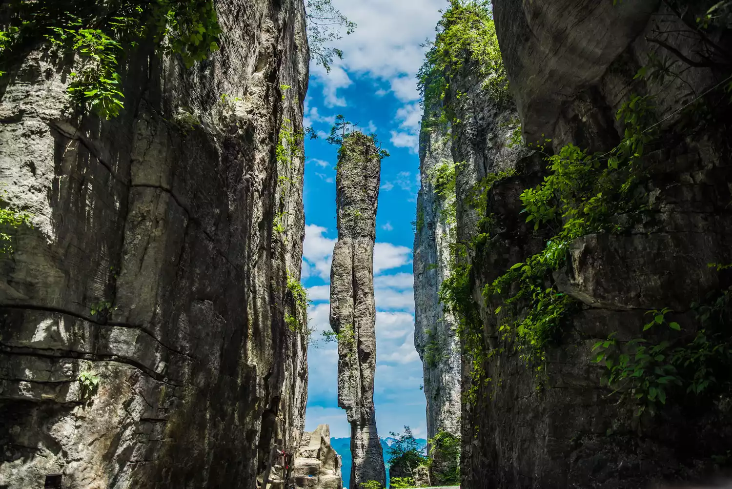 △ A stone pillar with an incense stick: located in Enshi Grand Canyon
In the southeastern part of Hubei Province, Mufu Mountain rises from the ground, becoming a natural barrier between Hubei and the southeastern region, and a Hubei province section surrounded by mountains was born.
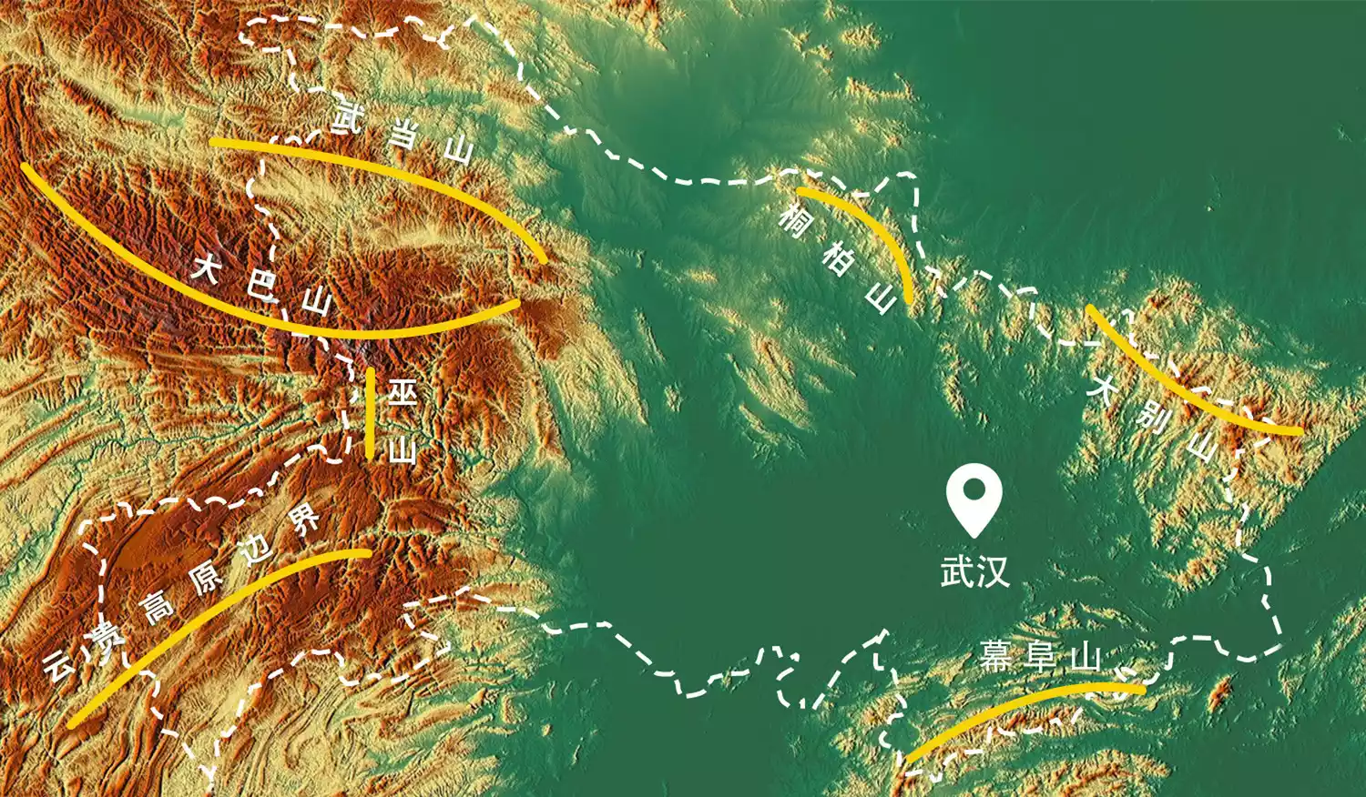 △Mountains around Hubei Province
water production
God is fair. He would not create such a lifeless area, and the mountains would develop complex water systems.
At the southern foot of the Qinling Mountains, the mountain water systems converged and many small streams flowed out from the Funiu Mountains, and thus the Han River came into being.
(Best viewed in landscape mode)
 △Han River: The largest tributary of the Yangtze River, originating from the southern foot of the Qinling Mountains
The mountains at the junction of Henan and Hubei were cut apart by the Han River basin system, forming the Nanxiang Basin, and the passage to the Central Plains was opened.
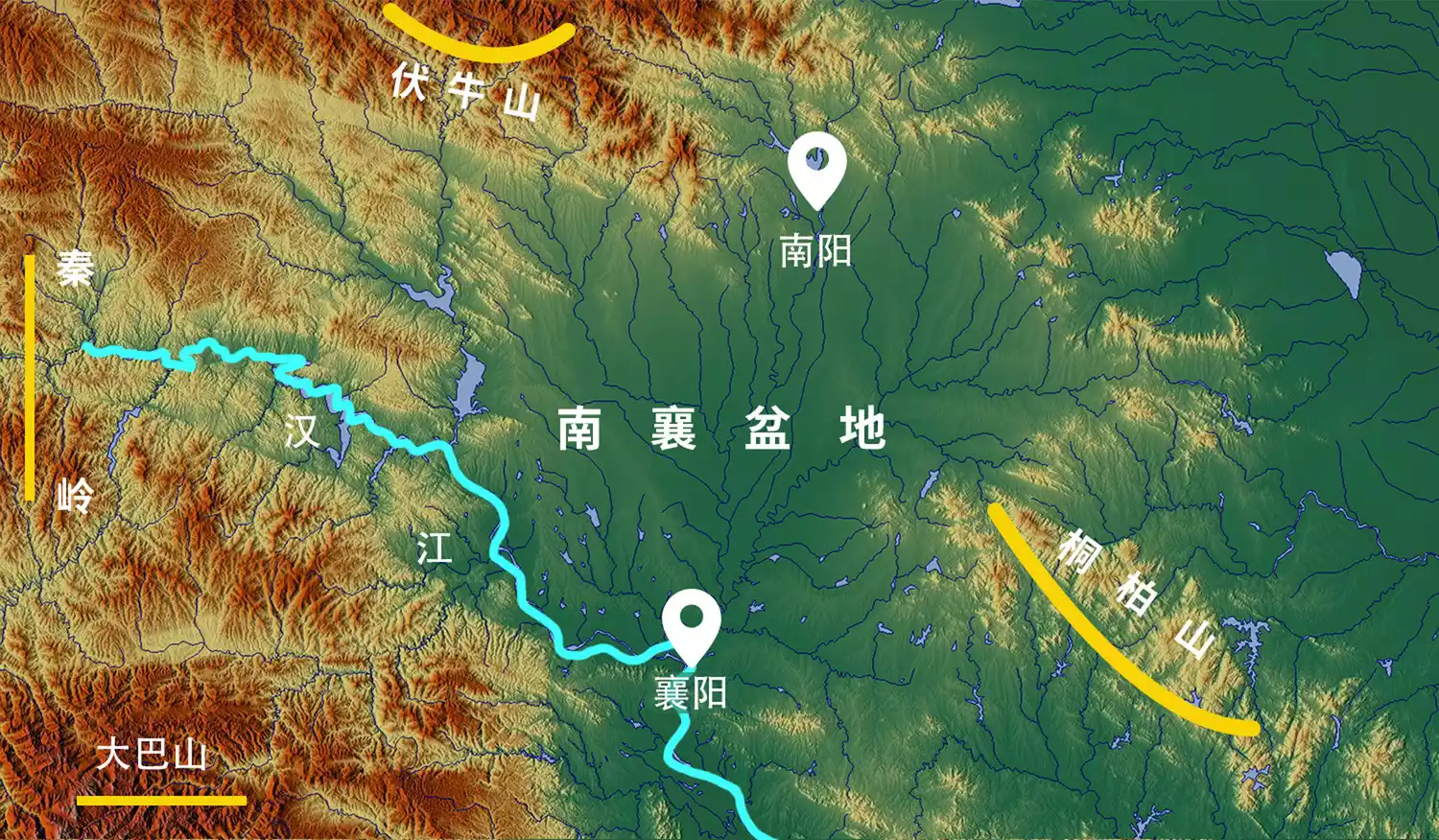 △Nanxiang Basin: Nan refers to Nanyang, Henan, and Xiang refers to Xiangyang, Hubei
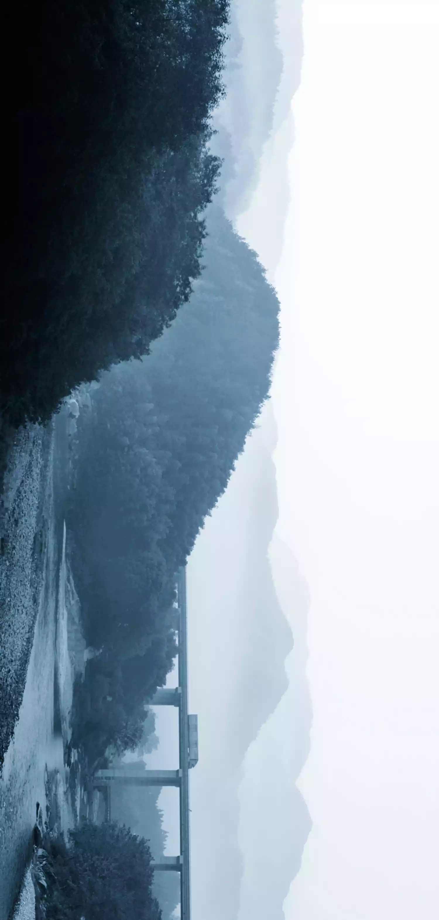
If the Han River is God's predestined destination for Hubei, then the Yangtze River must be a gift to heroes. At the foot of the Geladandong Snow Peak at an altitude of 6,621 meters on the Qinghai-Tibet Plateau, the Yangtze River gathers hundreds of tributaries and rushes for more than 4,000 kilometers to the western border of Hubei Province, tearing open the nodular zone between the Daba Mountains and the northwestern end of the Yunnan-Guizhou Plateau, and breaking into Hubei from the Three Gorges, making Hubei the only way for the Sichuan-Chongqing region to go east.
 △Three Gorges scenery
There is a huge vertical drop between the canyon and the mountain peak, the mountain is covered with dense forests, and the river valley is quiet and deep.
 △Three Gorges scenery
All this does not end there. After flowing 1,041 kilometers in Hubei Province, the Yangtze River opens up the valley between the Dabie Mountains and the Mufu Mountains, becoming an excellent channel for Hubei Province to go east.
(Best viewed in landscape mode)
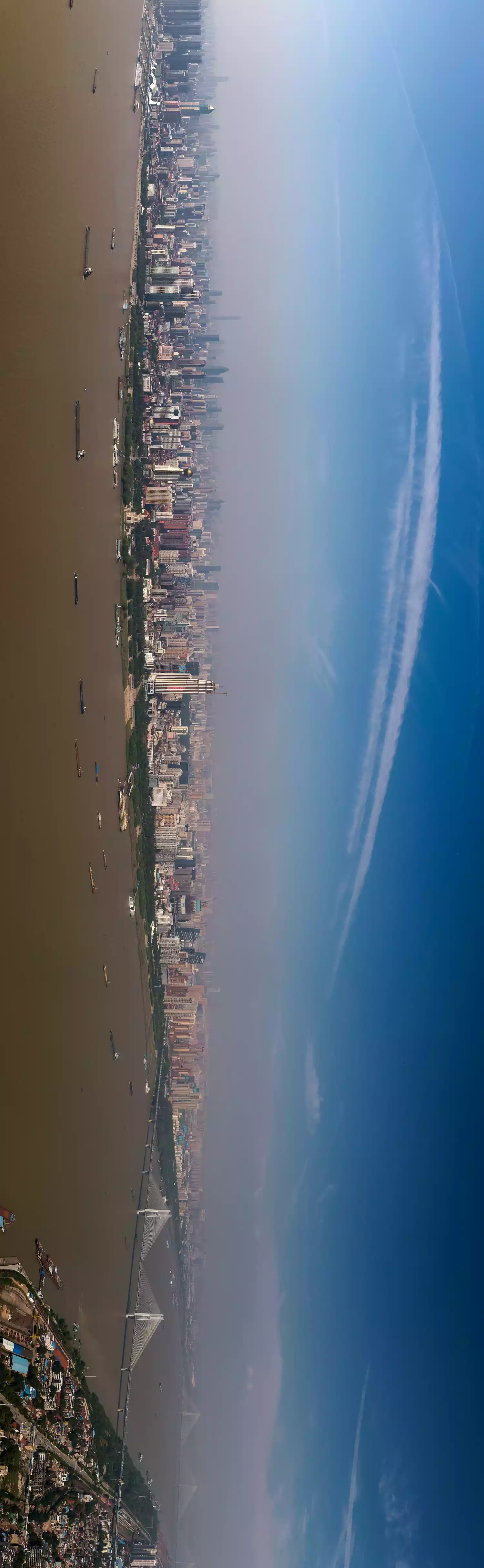 △The Yangtze River in Wuhan: This is the most convenient waterway for entering and exiting Hubei from the east
The two major rivers, the Han River and the Yangtze River, open up the east, north and west directions for Hubei Province.
Building Hubei
It is surrounded by mountains and has a vast plain in the middle. The Han River, Yangtze River and mountain streams flow into it. This is the best geographical condition for the formation of a large lake group.
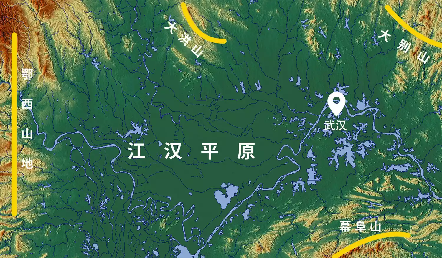 △Water resources and surrounding terrain in the Jianghan Plain
Mozi recorded in "Gongshu": "There is Yunmeng in Jing, which is full of rhinoceroses, wild beasts, elks and deer." Due to the abundant water supply from the Yangtze River and the Han River, and the complex water systems of the surrounding mountains, the "Yunmeng" area is dotted with lakes, lush water and grass, and a wide variety of animals. The King of Chu often hunted here, and people today often call this area "Yunmengze".

△Wuhan East Lake: The once large Yunmengze lake group has now disintegrated into lakes of varying sizes scattered across the Jianghan Plain
While the Yangtze River and the Han River supplied water, a large amount of silt was carried into the Yunmeng Lake. As the silt deposited, the area of the Yunmeng Lake continued to shrink. During the Tang and Song dynasties, it disintegrated into a group of small lakes. With the increase in population in the Yangtze River Basin, the lake-like Yunmeng Lake was reclaimed as farmland on a large scale. The ancient Yunmeng Lake became today's Jianghan Plain.
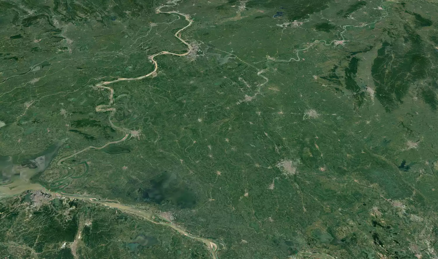
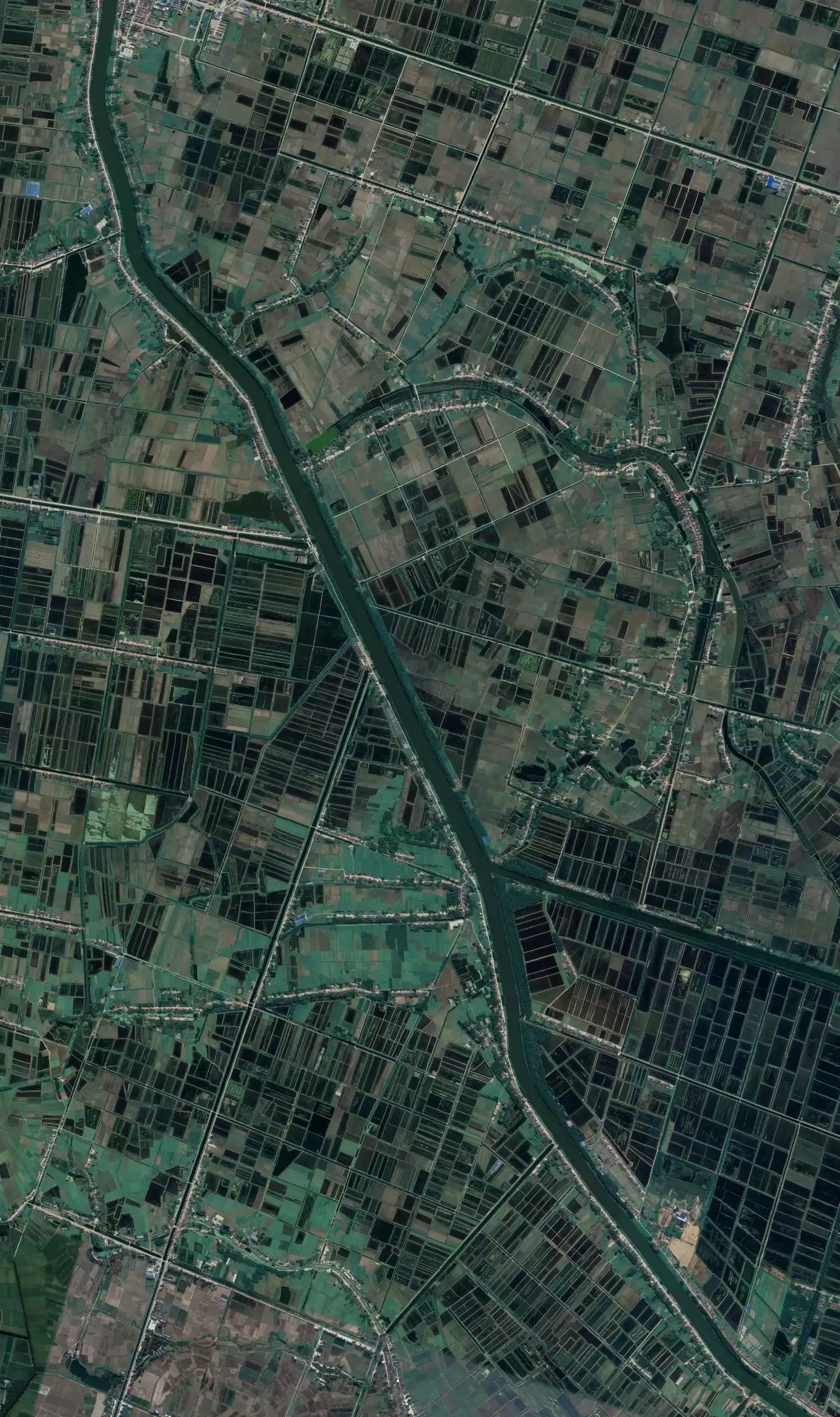 △ Satellite image of the Jianghan Plain
Dongting Lake, the pearl of Yunmengze, together with the Xiangjiang River system, becomes the waterway for Hubei to enter the Guangdong and Guangxi regions to the south.
 △Xiangjiang River: The water system of Hunan Province is the most convenient waterway for the two lakes region to enter the Guangdong and Guangxi regions.
At this point, the Hubei region, which has been connected to the east, south, west and north, has become the core of the central China region, waiting for its owner to appear.
 △Geographical structure of Hubei Province
-Heroes appear-
900,000 years ago, descendants of the Sanmiao lived in much of present-day Hubei, Hunan, and Jiangxi. The Central Plains tribes called them the Nanman (Southern Barbarians). The "Book of Rites: Wangzhi" records: "The southerners were called barbarians, with carved patterns and cross-cutting patterns, and some did not eat cooked food." It was these so-called Nanman (Southern Barbarians) who forged the ancient civilization of the middle Yangtze River and formed a complete cultural chain in the Chu region.
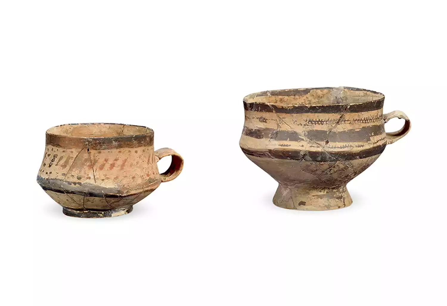
Painted pottery cup: unearthed from Tomb No. 42 of Jinluojia, Macheng City, Hubei Province, now in the collection of Hubei Provincial Museum
In 1600 BC, the Shang Dynasty destroyed the Xia Dynasty, and the power struggle among the tribes in the Central Plains was fierce. Some ethnic groups migrated south into the Nanxiang Basin.
In 1046 BC, King Wu defeated King Zhou, establishing the Zhou Dynasty. The Xiong clan was granted fiefdom for their assistance in the conquest. "Records of the Grand Historian: The Family of Chu" records: "He selected a diligent descendant of both civil and military talents and granted Xiong Yi the title of the Chu Man." Thus, the fierce and resilient spirit of the Chu barbarians intertwined with the innovative agricultural practices of the Central Plains.
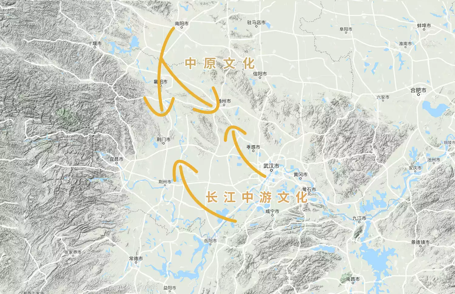
△The collision between the Central Plains culture and the middle reaches of the Yangtze River
At the foot of Mount Qishan, the princes gathered and the Zhou emperor swore an oath of blood with the princes. The Zhou was the ancestral alliance, with the barbarians as the queen. The king of Chu was assigned to guard the fire. The history of Chu called it "the humiliation of guarding the fire". After the pain, the Chu people ushered in the creation of the world.
The Zuo Zhuan records that the king of Chu "opened up the Jingshan Mountains, paving the way with great difficulty." Layers of terraced fields began to gather near the neighboring tribes. (Best viewed in landscape mode)
 △ Western Hubei Mountains and Terraces
The raging fire unleashed by the Chu people caused great unrest in the Zhou Dynasty, eventually escalating into military suppression. This move set the Chu State on a path of expansion, conquering the Yong State in the west, the Yangyue State in the east, and the E State in the south. Scattered tribal states in the surrounding areas submitted to its rule, combining the righteousness of the Central Plains with the hegemony of the Jingchu realm. The King of Chu declared, "I am a barbarian, and I do not deserve the title of Chinese." Subsequently, the Chu State was crowned king, and Jingchu reached its peak of prosperity.
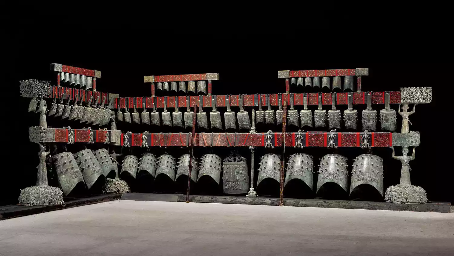 △ Chime bells of Zenghou Yi: The inscription on the bells records that when King Hui of Chu learned of the death of Zenghou Yi, he specially made chime bells for sacrifice in 433 BC. They were unearthed from the tomb of Zenghou Yi in Suizhou, Hubei Province, and are now in the collection of Hubei Provincial Museum.
The Zenghouyi chime bells represent the highest achievement of the pre-Qin ritual and music civilization and bronze casting technology.
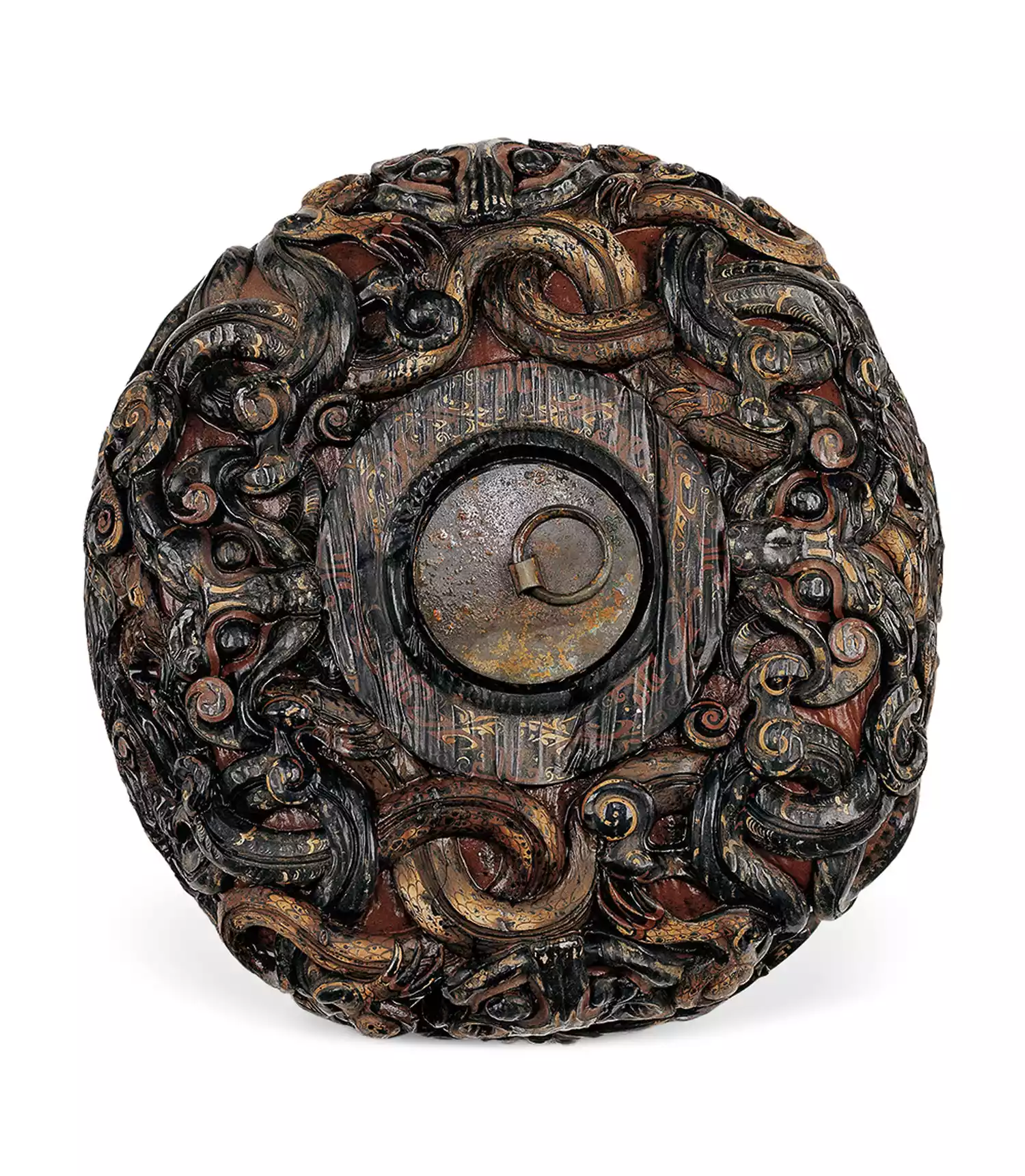
Lacquered wooden round box lid: unearthed from Tomb No. 1, Jiuliandun, Zaoyang City, Hubei Province, now in the Hubei Provincial Museum
The lacquer trees in Enshi area provided a source of raw lacquer for the land of Jingchu. Lacquerware made of wood spread in the Chu State. It was cheaper than bronze, stronger than pottery, and light and portable.
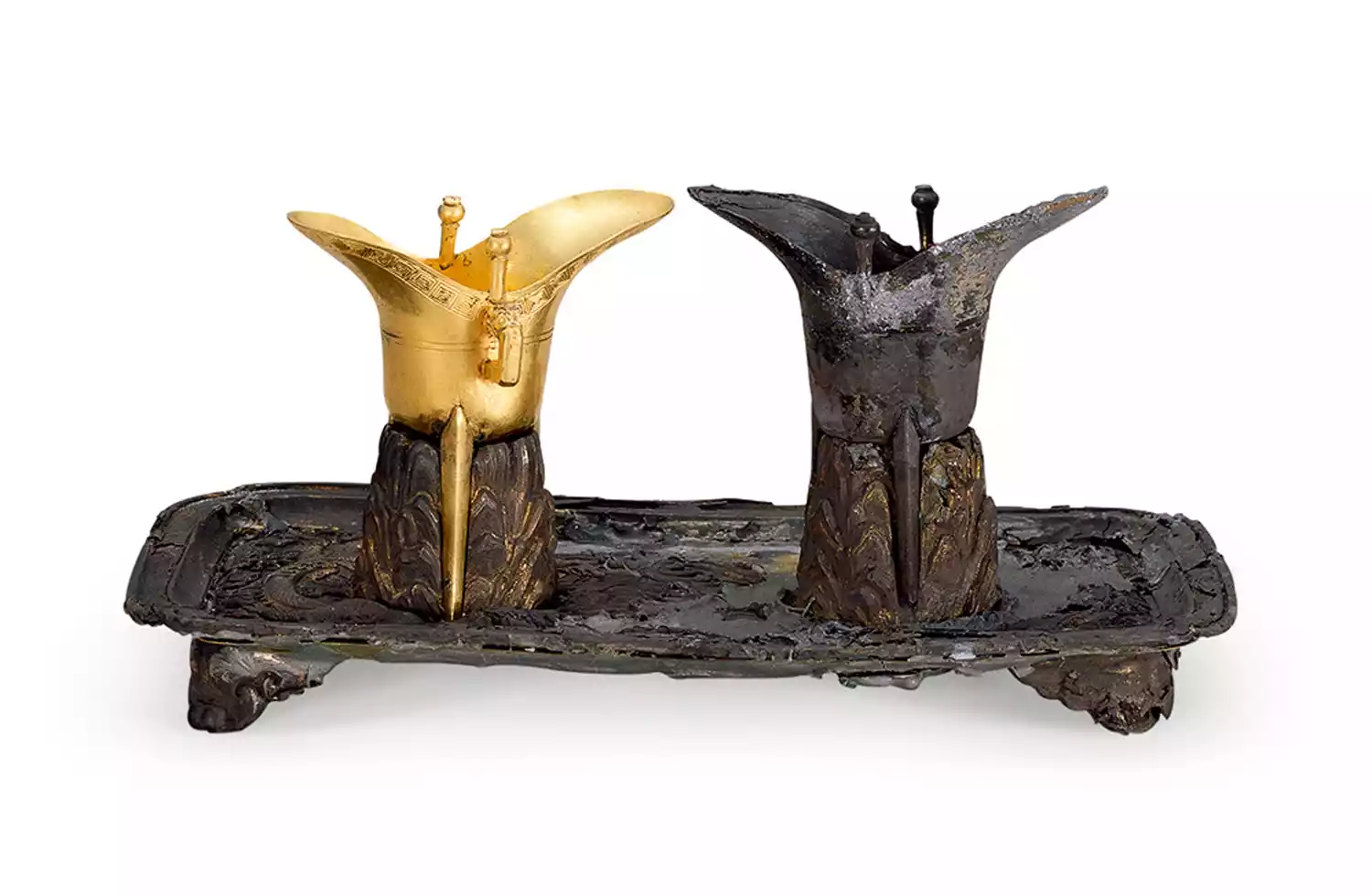
△Gold goblet, silver goblet and gilded silver tray: now in the collection of Hubei Provincial Museum
In today's Enshi area of Hubei Province, the Chu people and the Ba people infiltrated each other, forming a cultural custom that was similar to Ba but not Ba, similar to Chu but not Chu. Today, the descendants of the Ba people live here.
Tujia
The Tujia people have reclaimed farmland in the flatter parts of the mountains, and the houses, farmland and mountains are integrated into one.
 △Enshi mountains and farmland
In order to build houses on steep mountain slopes, stilt houses have become the biggest feature of Tujia architecture.
 △Tujia stilt houses: Similar to the traditional stilt houses of the Miao, Zhuang and Buyi ethnic groups
The ancient legend of the Ba people is now brought to the stage and performed in a naturally formed cave.
 △Tujia performance at Tenglong Cave in Lichuan, Enshi
 △ Enshi Ancient Tusi City: The Tusi system is a political management system in which the central feudal dynasty implemented a central government-affiliated and autonomous power system for minority areas.
In 223 BC, the State of Chu was destroyed. However, the spirit of justice and dominance of Jingchu has been integrated into the souls of the people of Jingchu, becoming an important part of Chinese culture, waiting for the next opportunity to shine.
-A gathering of great forces-
"The Yangtze River rolls eastward, its waves wash away all heroes." If we discuss Chinese history from the perspective of the Jianghu, the Three Kingdoms can be regarded as a typical Jianghu era in Chinese history, where great events gathered and heroes emerged in large numbers. China's "Romance of the Three Kingdoms" novel and Japan's "Romance of the Three Kingdoms" series of games have become popular Three Kingdoms works in today's era.
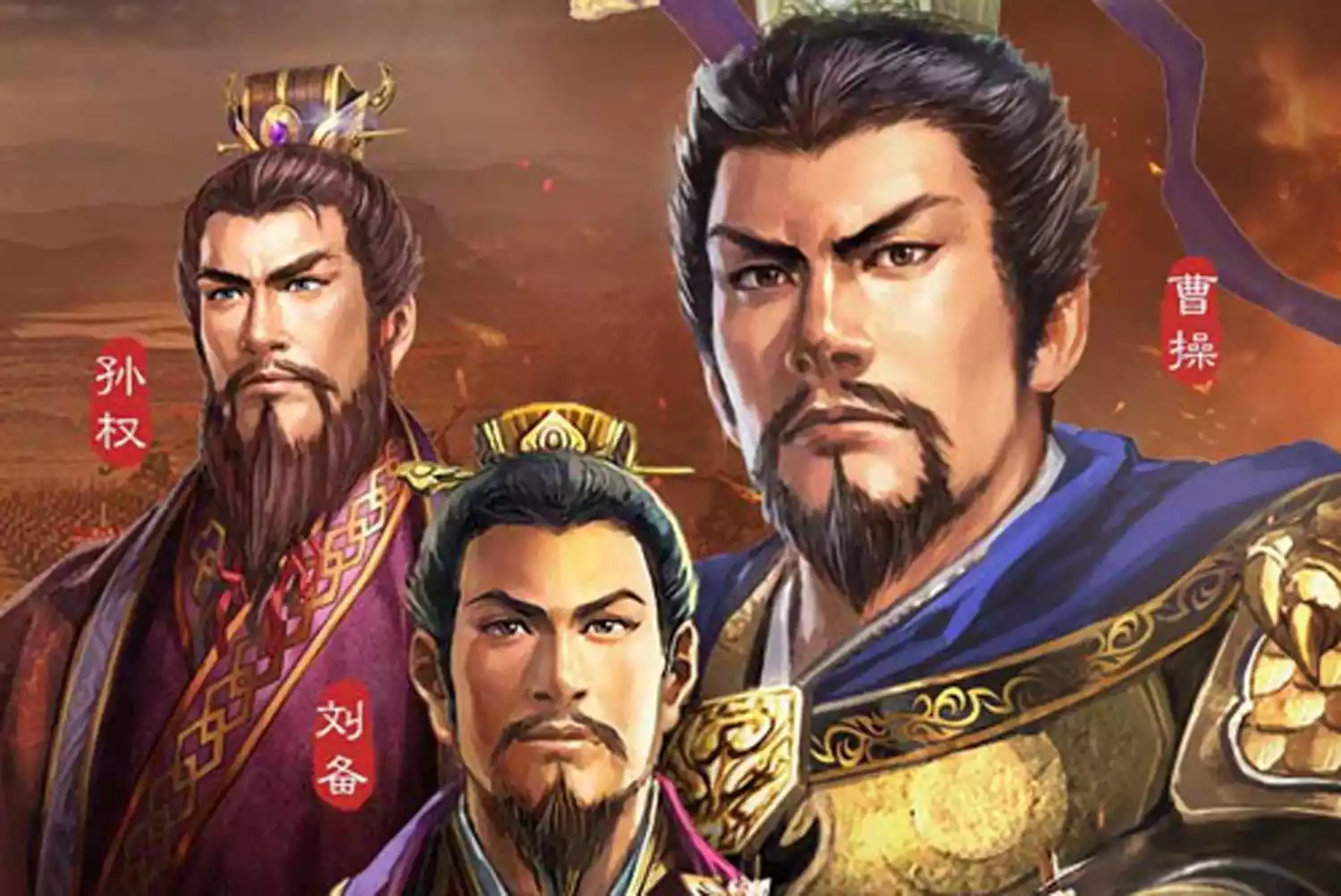 △Japanese "Romance of the Three Kingdoms" game character poster: As of 2020, 14 main works in the "Romance of the Three Kingdoms" series of games have been released.
The Three Kingdoms era began, flourished, and ended in Jingzhou, a region roughly equivalent to the entirety of present-day Hubei and Hunan provinces. In 208 AD, Cao Cao, who had largely controlled the north, led his army south to Jingzhou, marking the beginning of the Battle of Red Cliffs. Ultimately, the allied forces of Sun and Liu defeated Cao Cao's forces, establishing the foundation for the Three Kingdoms period. From then on, ancient Jingzhou was divided into three parts.
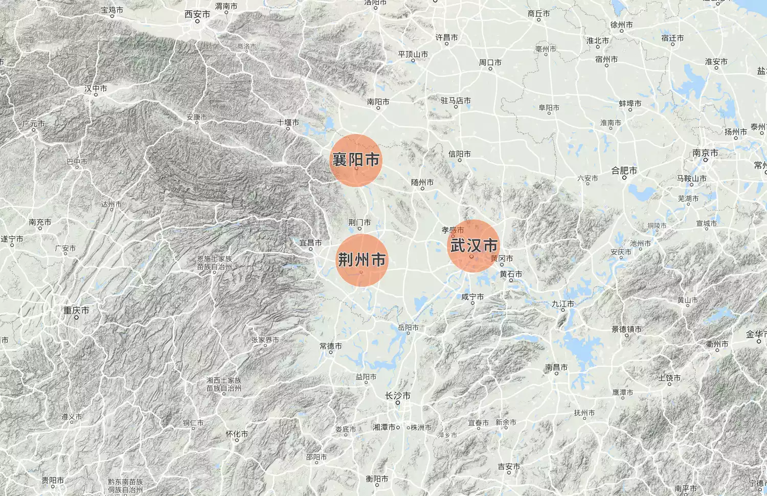 △ Jingzhou was divided into three parts: Cao Cao, Liu Bei, and Sun Quan occupied the strategic locations centered on present-day Xiangyang, Jingzhou, and Wuhan respectively.
Cao Cao controlled the northern part of Jingzhou, centered on present-day Xiangyang, and blocked the golden passage from the Central Plains to the Yangtze River Basin. Liu Bei occupied the southern part of Jingzhou, centered on present-day Jingzhou, and controlled the transportation hub to Guangdong, Guangxi and Hunan in the south. Sun Quan was stationed in the southeastern part of Jingzhou, centered on present-day Wuhan, and firmly grasped the throat leading to southeastern China. The prototype of the triangular geographical plate of Hubei Province with present-day Xiangyang, Jingzhou and Wuhan was formed. The land of Jingchu became the center of mediation for the Three Kingdoms, with the three kingdoms coming and going and competing for supremacy. The three cities of "Xiang, Jingzhou and Wu" became more and more dazzling in subsequent history.
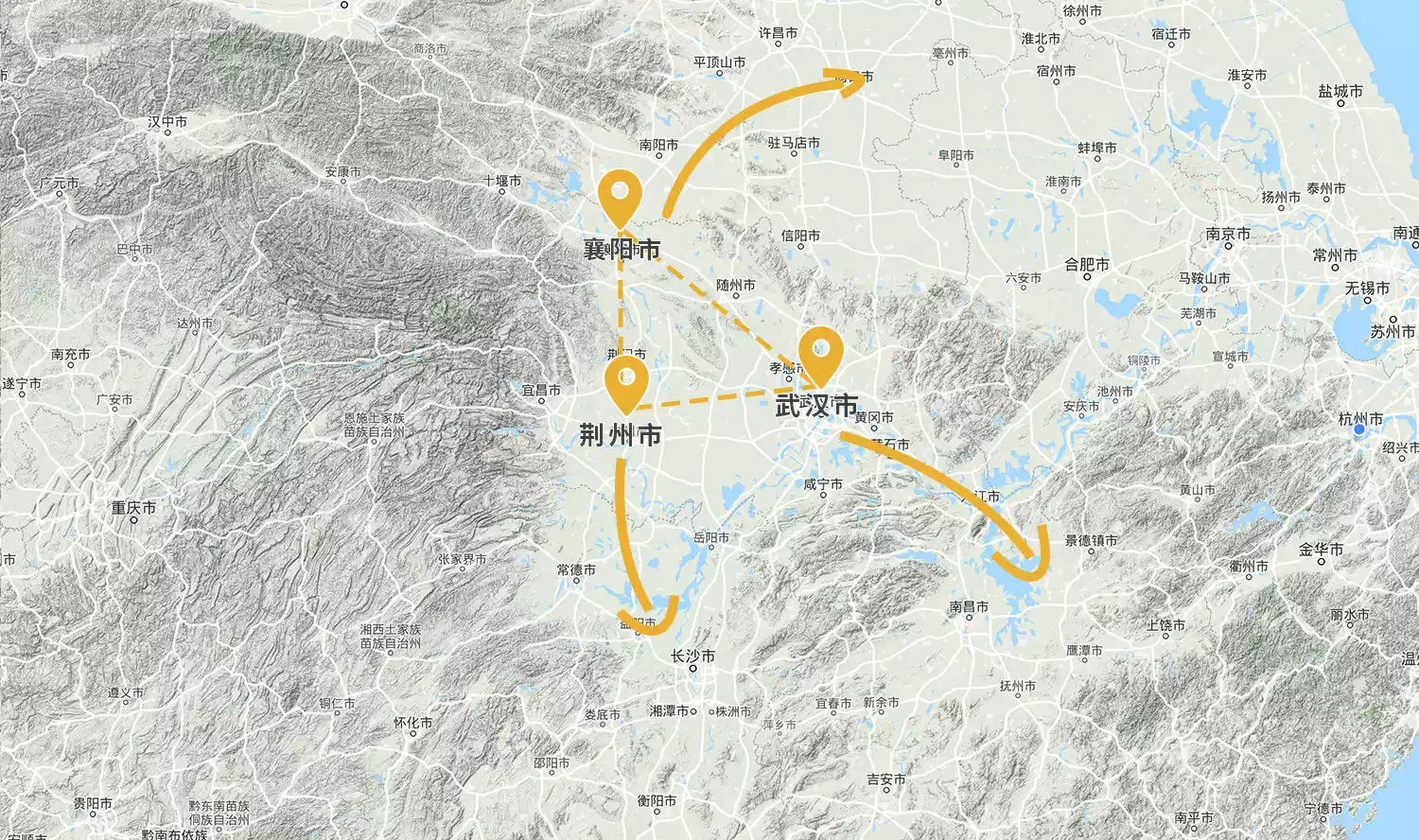 △The strategic significance of Xiangyang, Jingzhou and Wuhan
Mr. Jin Yong used a novel to let people all over the country know about Xiangyang. In 1267 AD, the Mongolian army attacked Xiangyang.
In order to destroy the Southern Song Dynasty, the Battle of Xiangyang lasted for 6 years and resulted in heavy losses on both sides. Within a few years after the fall of Xiangyang, the Southern Song Dynasty regime that controlled southern China was declared defeated.
 △ Xiangyang Tangcheng Film and Television Base: Film and television works such as "The Rise of Phoenixes" and "The Legend of the Demon Cat" were filmed here
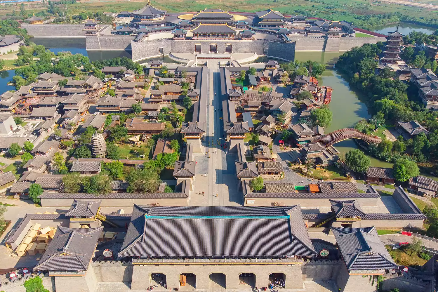
Jingzhou, once the capital of Chu, saw its status rise throughout the Three Kingdoms period, and "Jing" and "Chu" became synonymous with the same place.
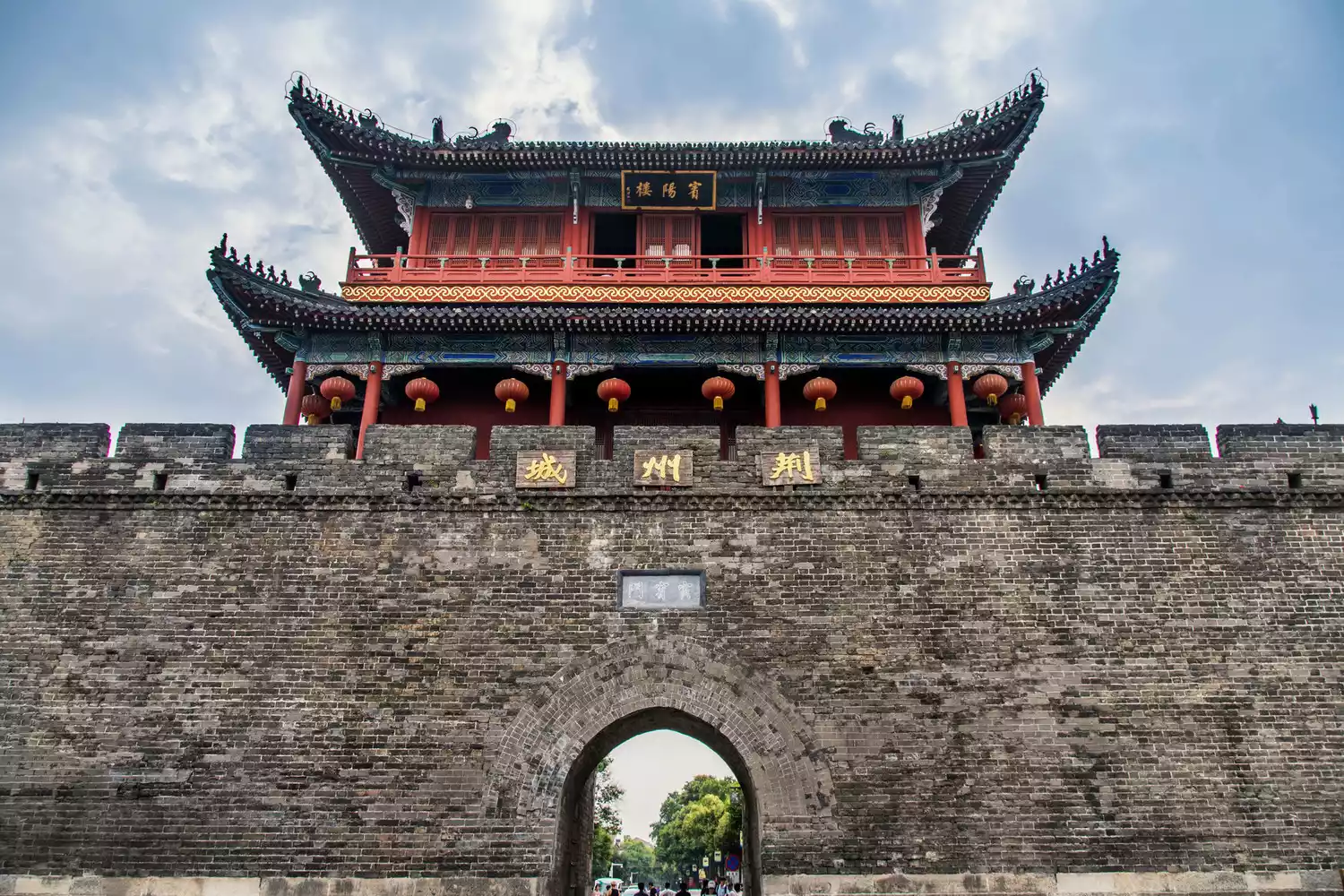 △Jingzhou City
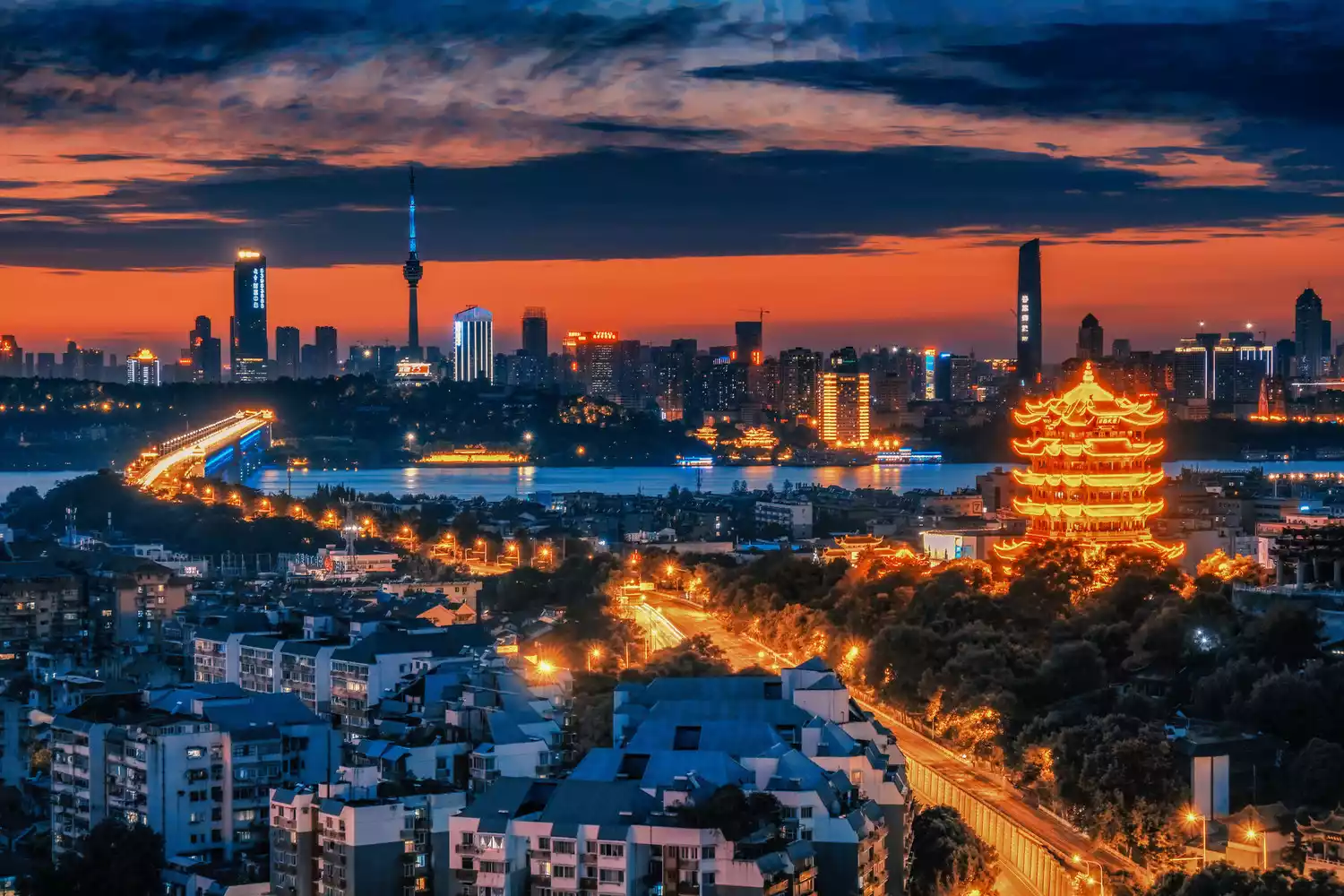
The watchtower built for military purposes by the Sun Wu regime during the Three Kingdoms period has become a world-famous scenic spot praised by scholars and poets - the Yellow Crane Tower. "The ancients have gone away on the yellow crane, leaving only the Yellow Crane Tower here", "The old friend bid farewell to the Yellow Crane Tower and went to Yangzhou in the fireworks of March"... Li Bai, Yue Fei, Cui Hao, Bai Juyi, Liu Yuxi... The Yellow Crane Tower has become a household name in textbooks.
 △Yellow Crane Tower and Wuhan City
In 219 AD, Shu Han lost Jingzhou, breaking the parity of power among the Three Kingdoms. Ultimately, the Three Kingdoms were united under the Jin Dynasty. From that point on, Hubei Province's geographical structure was formed between Xiangyang, Jingzhou, and Wuhan, establishing its core position in Central China. As the saying goes, "In terms of the entire country, Xiangyang is the most important," "In terms of the southeast, Wuchang is the most important," and "In terms of Huguang, Jingzhou is the most important."
-Turning the tide-
In the late Qing Dynasty, invaders coveted the unique water transportation conditions of the Yangtze River and the Han River, and Hankou was forced to open up as a trading port. In 1861, the first ship flying a foreign flag docked at the Hankou wharf. Hankou was opened as a port, and shipping companies from the United States, Britain and other countries began to operate shipping operations with Hankou as the center. Goods from Sichuan, Chongqing, Hunan, Guizhou, Shaanxi, Henan and other places were sold to the world from Hankou via the Maritime Silk Road.
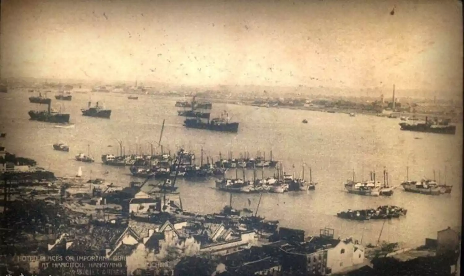
△Hankou Wharf in the late Qing Dynasty
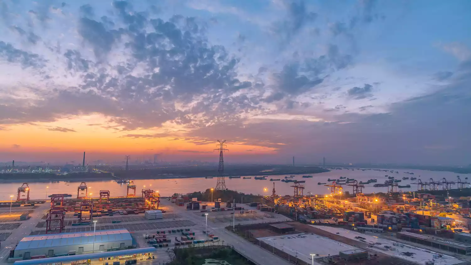
By the end of the Qing Dynasty, the three towns of Wuhan had trade relations with 18 countries, and the highest re-export foreign trade volume reached 200 million taels of silver. The three towns of Wuhan were successively connected with inland waterway routes, Yangtze River routes, and ocean routes, and were known as the four major ports in China at that time together with Tianjin, Shanghai, and Guangzhou.
 △The terminal of Wuhan Port
The busy docks spawned a new kind of dock culture, with hot dry noodles being a prime example. These soup-free noodles are perfect for eating while walking. Today, hot dry noodles have become a signature Hubei delicacy, and eating them while walking has become a defining characteristic of Hubei society. Only those who walk fast and eat steadily are considered true Hubei people.

△ Hot dry noodles
The deformed aggressive economy could not allow Hankou to develop steadily. In 1889, Zhang Zhidong took over as the Governor-General of Huguang in Hankou and began to fully exploit the Daye Iron Mine. Subsequently, the Hanyang Iron Works was built and put into production. A few years later, the Hanyang Iron Works, Daye Iron Mine and Pingxiang Coal Mine were combined into Asia's largest steel joint venture - Hanyeping Company. Its steel output accounted for more than 90% of the Qing government's annual steel output. Hanyang Arsenal, Hubei Spinning Bureau, Silk Reeling Bureau and Hemp Processing Bureau were established one after another. A powerful industrial city began to emerge in inland China.
(Best viewed in landscape mode)

Wuhan Iron and Steel Group Plant: Construction began in 1995 and is currently ranked fourth in the global steel industry.
In 1906, the Lu-Han Railway, stretching from Marco Polo Bridge in Beijing in the north to Hankou in Hubei in the south, was completed and opened to traffic, connecting the two major political and economic centers of the north and south. It was later renamed the Jing-Han Railway and eventually became part of the Jing-Guang Railway. During Zhang Zhidong's 18 years as governor of Hubei, the three towns of Wuhan underwent a remarkable transformation.

△Hankou Railway Station
"The ancient sages rectified the world and created it from the Jianghan River"
"Today's transportation system is so convenient that you don't even notice the distance between Asia and Europe."
This heroic couplet by Zhang Zhidong is still hanging above the gate of Yellow Crane Tower Park.
△Night view of Yellow Crane Tower
With the opening of the port and the implementation of the new policy in Hubei, the emerging class has a strong desire to break free from the shackles of feudalism. Decay and rebirth are competing in this city, and the calm sky is broken by a violent storm.
On October 10, 1911, the Wuchang Uprising broke out. Back in 208 BC, Xiang Yu and Liu Bang, the Chu people, overthrew China's first feudal dynasty. 2,200 years later, it was the Chu people who sounded the death knell for China's last feudal dynasty.
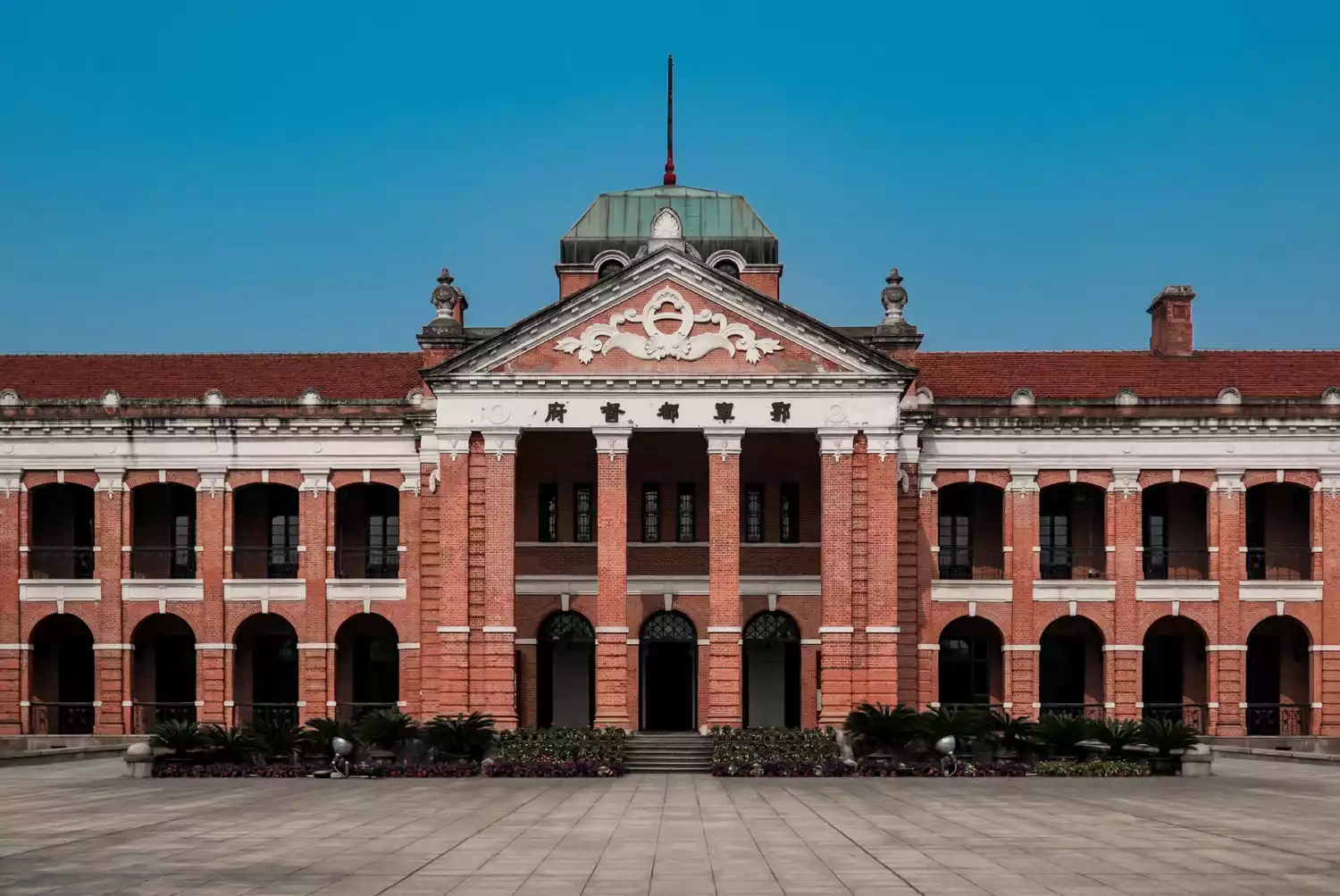 △The former site of the Wuchang Uprising Government
Huang'an County, a small town just 80 kilometers from Wuhan, produced two presidents, 223 generals, and 140,000 heroic men and women during the revolutionary period. Their contributions and sacrifices are unparalleled throughout the nation. To honor the revolutionary struggles of the Huang'an people, Huang'an County was renamed Hong'an County.
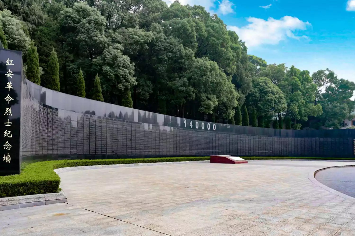 △Hong'an Revolutionary Memorial Wall: The names of revolutionary martyrs are engraved on the wall
In 1949, the three towns of Wuhan were liberated, and Wuchang, Hanyang, and Hankou were merged into Wuhan, which marked the beginning of the city of Wuhan. This earth-shaking process changed the course of Chinese history.
 △Wuhan Parrot Island Yangtze River Bridge
- Ready to go -
By the founding of the People's Republic of China, Wuhan's excellent geographical conditions were readily apparent, and the country immediately designated it as a key city for development. On October 15, 1957, the Wuhan Yangtze River Bridge opened to traffic. This was China's first dual-use highway and rail bridge across the Yangtze River, truly earning its title as "the first bridge over the Yangtze River," a landmark achievement spanning the north and south, transforming a natural barrier into a thoroughfare.
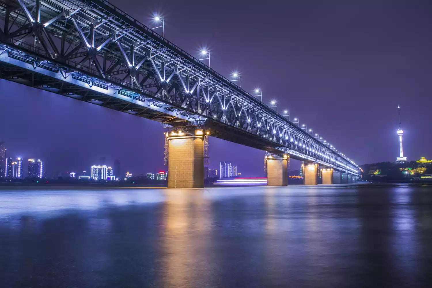 Wuhan Yangtze River Bridge: The main bridge is 1,156 meters long. The upper deck is a two-way four-lane urban main road, and the lower deck is a double-track railway.
Since then, Wuhan has embarked on a frenzied road of bridge construction, including the Second Wuhan Yangtze River Bridge, the Junshan Yangtze River Bridge, and the Tianxingzhou Yangtze River Bridge.
Bridges span the Yangtze River, Han River, and countless tributaries. "Design City" has become Wuhan's business card, and bridge design and construction are particularly outstanding.
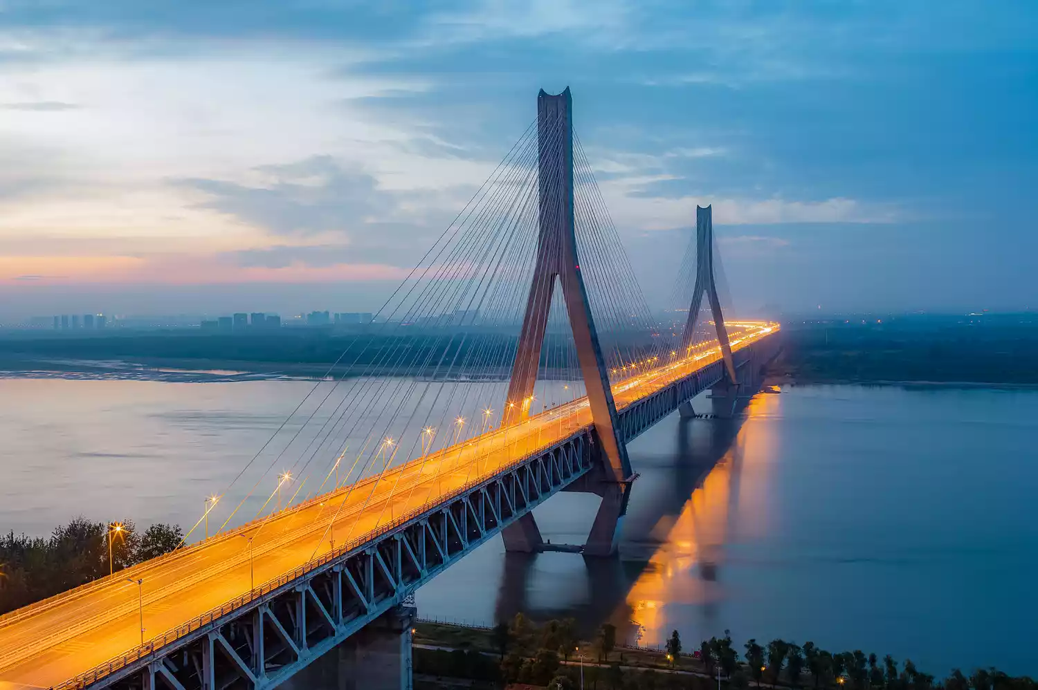
Wuhan Tianxingzhou Yangtze River Bridge: The bridge is 4,657.1 meters long and 27 meters wide. The upper deck is a six-lane highway in both directions, and the lower deck is a four-lane railway in both directions.
 Wuhan Yangtze River Second Bridge: The main bridge is 1,876.1 meters long and has a six-lane, two-way urban expressway.
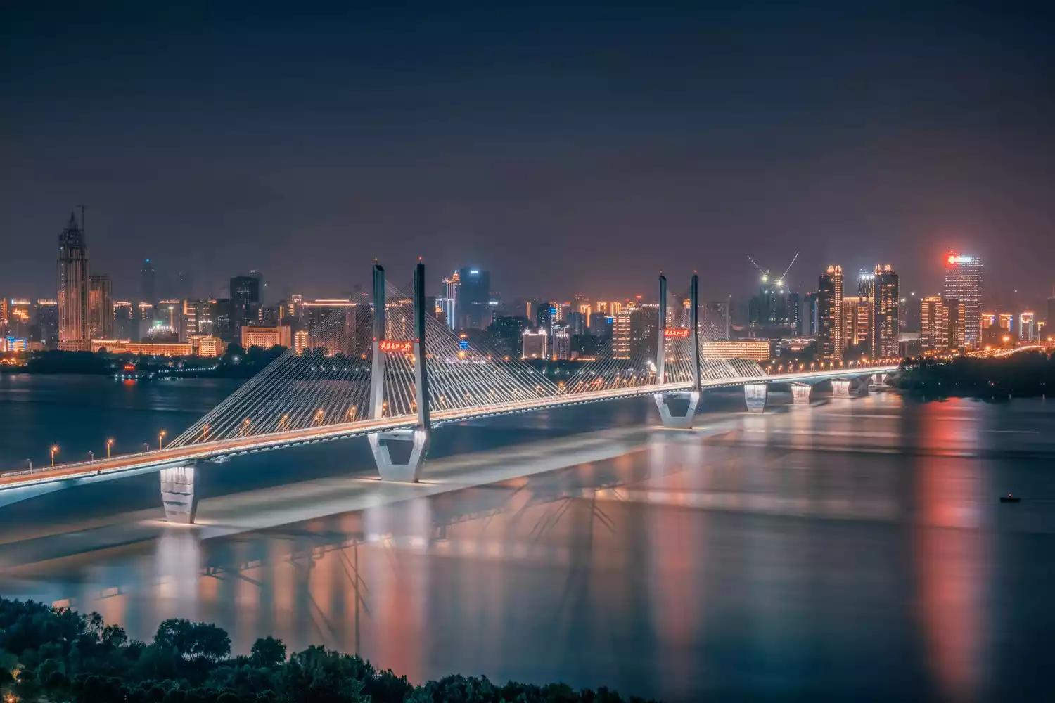
 △Wuhan Yingwuzhou Yangtze River Bridge: The main bridge is 2,100 meters long and the bridge deck is a two-way eight-lane urban expressway
After the three towns of Wuhan were connected internally, Hubei began to build a national transportation network with Wuhan as the center.
railway
With Wuhan as the center, it reaches Henan and Beijing in the north, Shaanxi and Chongqing in the west, Zhejiang and Shanghai in the east, and Hunan and Guangdong in the south. It only takes 4 or 5 hours to travel across most of China. People from all over the country pass through here to go to their distant places.
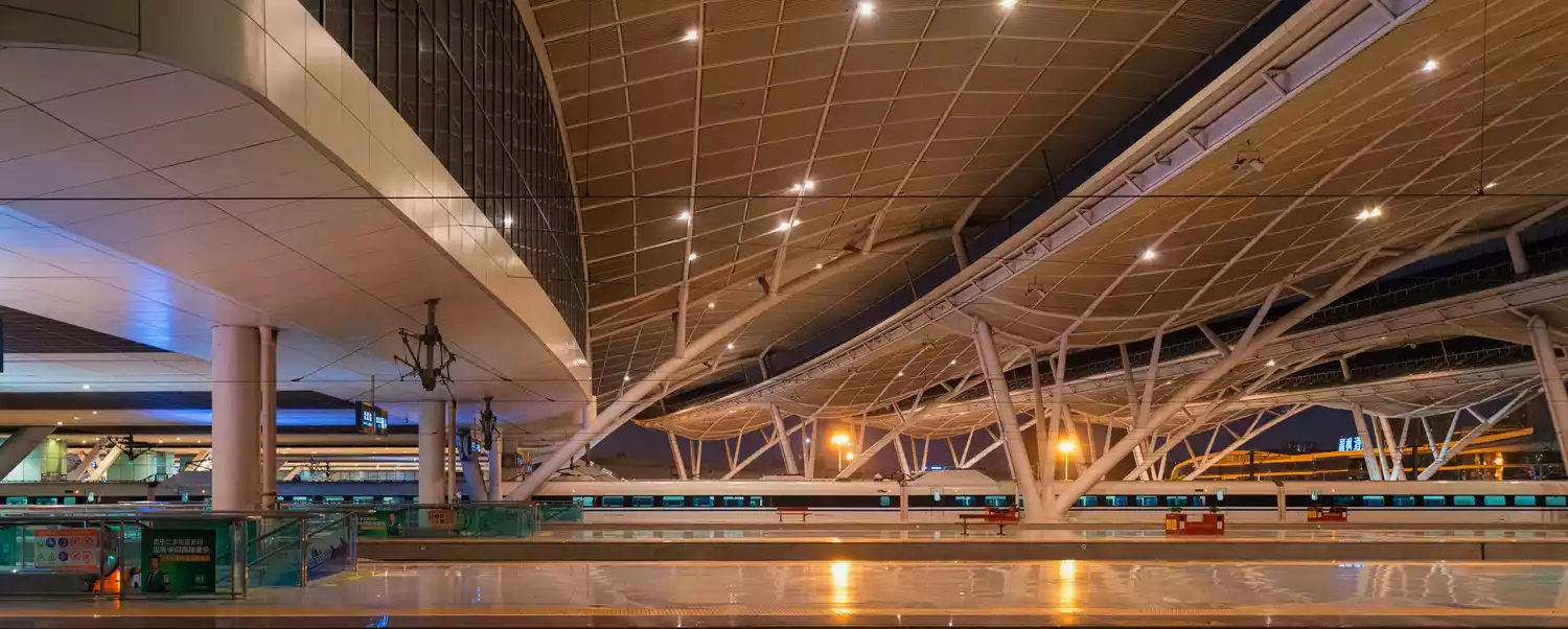 Wuhan Station
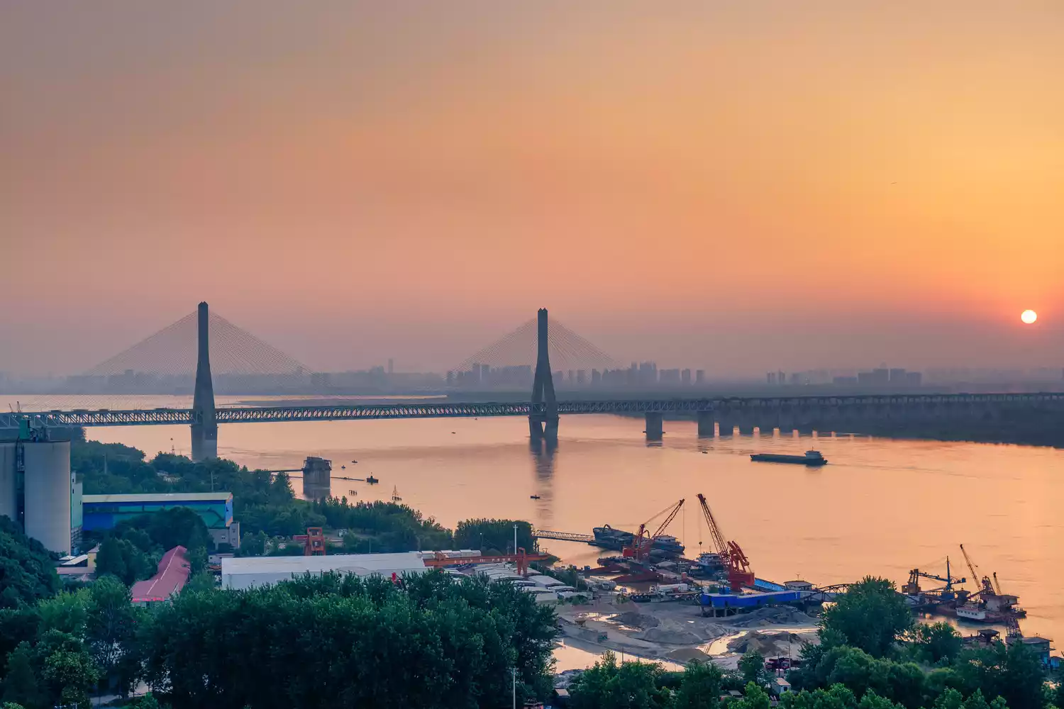
water transport
Ten thousand-ton ocean-going vessels enter Wuhan directly from the Yangtze River estuary. Combined with the inland river routes centered on Wuhan, China's inland products embark on a journey to the world from the port of Wuhan.
aviation
Wuhan Tianhe International Airport, a comprehensive hub airport in central China and the largest aircraft maintenance base, has 170 domestic and international routes, with flights to most parts of China within 2 to 3 hours.
On January 1, 2019, a 144-hour transit visa-free policy was implemented for 53 countries around the world.
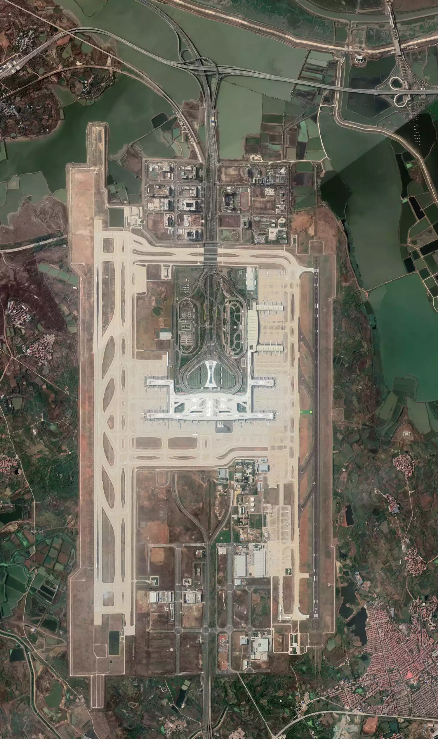 △Wuhan Tianhe International Airport: one of China's busiest civil airports
From bridges to railways, from water transport to aviation, Hubei has opened up its meridians from the inside out. In 2018, its passenger volume accounted for nearly 6% of the country, creating an upgraded version of the "Nine Provinces Thoroughfare" by sea, land and air.
(Best viewed in landscape mode)
 Wuhan
Wuhan
Hubei Province currently boasts 145 institutions of higher learning, including 68 undergraduate programs. Wuhan boasts the largest number of university students globally. As the "Province of a Thousand Lakes," most universities are situated near water, creating tranquil and comfortable environments. Wuhan University, embodying the essence of cherry blossoms, youth, and romance, has become a renowned institution in both the academic and tourism sectors.
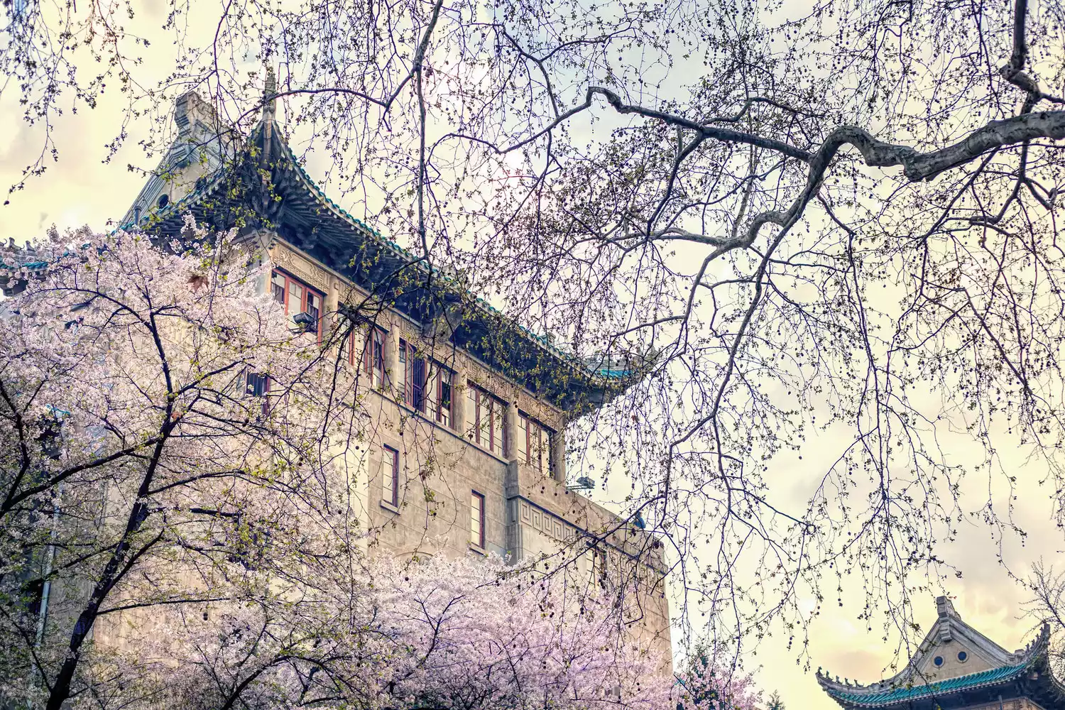 △Wuhan University
With a well-developed transportation network and strong educational resources, Hubei Province's development is visible to the naked eye. In 2019, the province's GDP ranked 7th in the country and its growth rate ranked 8th in the country, making it a core region driving the development of central China.
In 2018, the State Council explicitly required that Wuhan be the center to lead the development of the urban agglomeration in the middle reaches of the Yangtze River. The integrated development of the "Central Triangle" region became a national strategy, and Hubei and Wuhan once again ushered in the strongest opportunity for development.
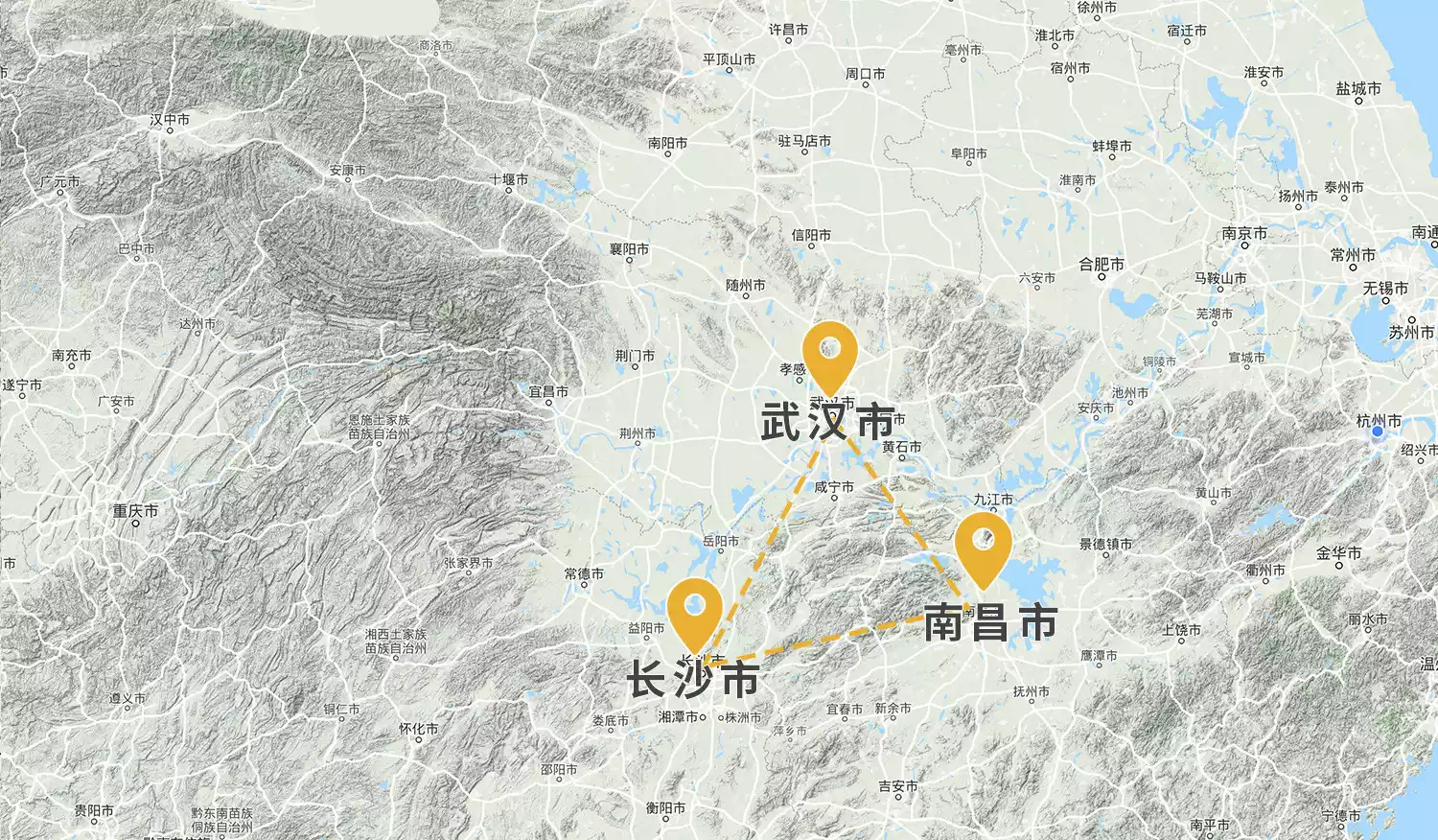 △The Central China Triangle Urban Cluster headed by Wuhan
In January 2020, the infectious disease of novel coronavirus pneumonia broke out in Wuhan, and the entire Hubei region immediately became a severely affected area.
 △Wuhan after the outbreak
Hubei residents have suddenly become the focus of online public opinion, but few realize: from the "humiliation of Shou Liao" to the "Kingdom of Chu," from the "Three Kingdoms" to the "core of central China," from "invasion by foreign powers" to "turning the tide of events," for thousands of years, the people of Jingchu have relied on their ancestors' "barbarian arrogance" and "Central Plains righteousness" to overcome difficulties and reach this day. In this land of rivers and lakes, hardship is only a stepping stone for heroes, and there is more than just one city waiting to rise.
Salute to the warriors who are fighting
Commemorating the lives that have passed away