Mysterious Cultural and Religious Land: Unveiling the Secrets of the Border of Sichuan, Qinghai, and Tibet
Preface
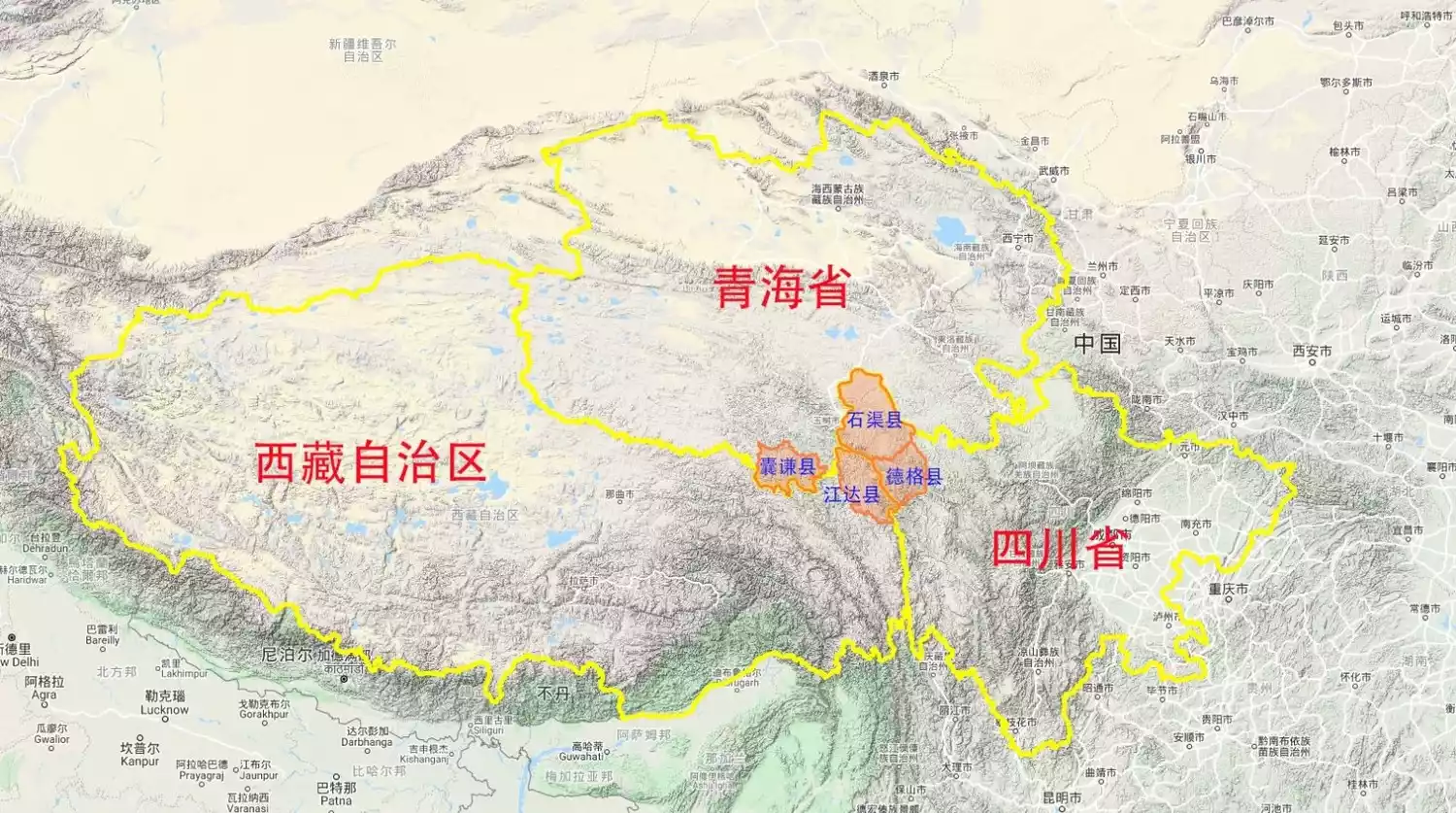
The intersection of three provinces
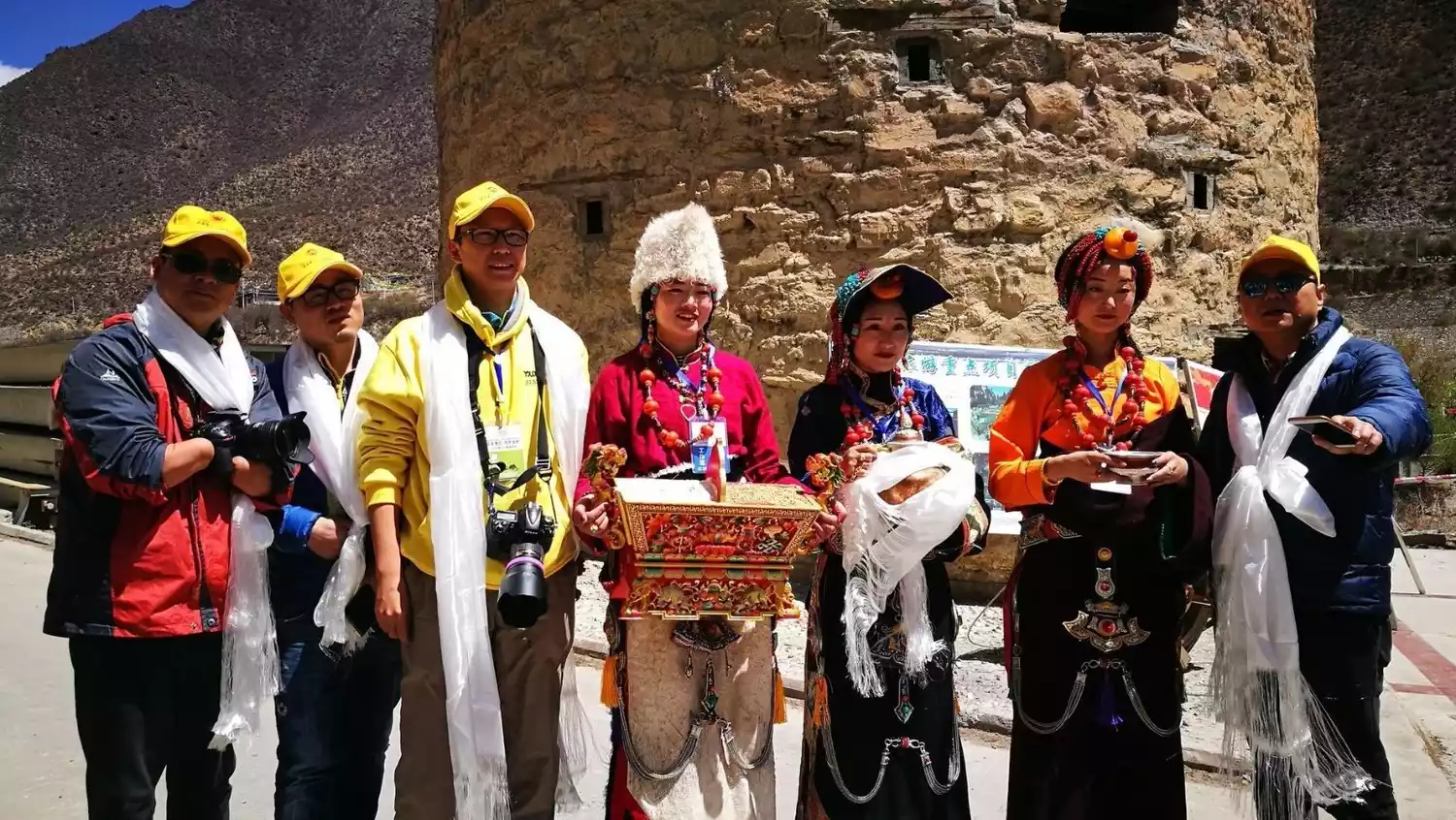
As the Sichuan-Tibet Highway and the Qinghai-Tibet Highway become increasingly popular, a very small secret place has unexpectedly been left at the junction of Tibet, Qinghai and Sichuan.
This area, located in the northern part of the Great Hengduan Mountains, connects the Jinsha River and Yalong River basins. The rugged terrain makes transportation less accessible and at the same time rejects large numbers of tourists. As a result, the most traditional and ancient Tibetan cultural landscape has been preserved.
Here, I will take Derge County and Shiqu County in Sichuan Province, Jiangda County in Tibet Autonomous Region, and Nangqian County in Qinghai Province as examples to introduce to you this extremely niche yet wonderful area.
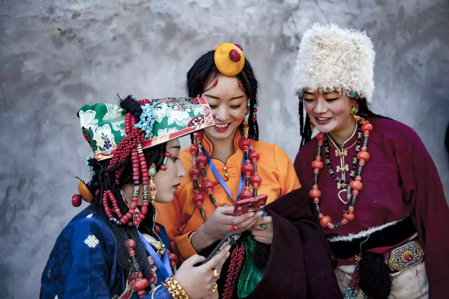
Compared to the bustling internet-famous attractions of northwest Sichuan, the sparsely visited intersection of three provinces has perfectly preserved the original cultural landscape of the Kham Tibetan region. While offering equally stunning natural scenery, this area showcases a wealth of Tibetan Buddhist landscapes and the unique customs of the region.
Here, every traveler eager to explore will never be disappointed with the stunning Magmani Stone Scripture Wall, the wood carving town of Bologuzhe, the historic Derge Scripture Printing House, and the towering Queer Mountain.
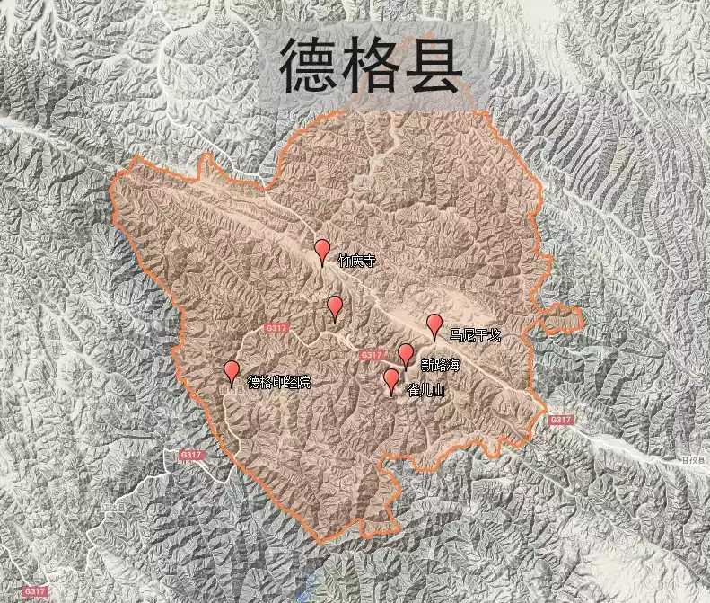
Shiqu County
Shiqucheck the details
Shiqu County lies at the southeastern edge of the Qinghai-Tibet Plateau, at the junction of Sichuan, Qinghai, and Tibet. With grassland comprising approximately 90% of its area, it is known as "Sichuan Province's leading livestock-producing county." To the northeast lies the Bayankala Mountains, and to the southwest lies the northern section of the Shaluli Mountains. In this grassland, "surrounded by two mountains and crisscrossed by two rivers," the river basins have not only created magnificent natural wonders but also nurtured the rich history and culture of this snowy plateau. Yak culture and highland barley culture each possess unique characteristics, yet they intertwine. Tibetan Buddhism has a long and continuing history here. The vast expanses of natural grassland, livestock products, wetlands, and nationally protected species such as white-lipped deer, Tibetan antelope, and black-necked cranes are all natural gifts to Shiqu.
Recommended months: Spring and autumn are the best
6229 recommendations, 4228 visits
Shiqu was originally the territory of the Derge Tusi. Vastness and desolation are the defining characteristics of this land. As the county with the highest average altitude in Sichuan Province and the farthest from Chengdu, it remains unattainable even for the Khampa people.
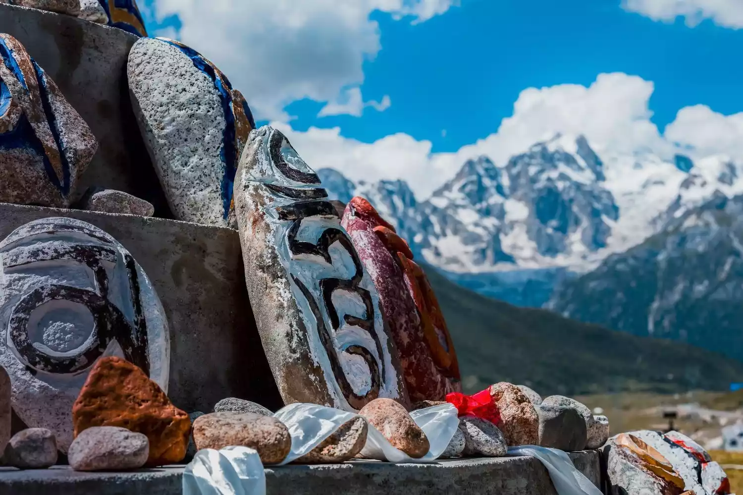
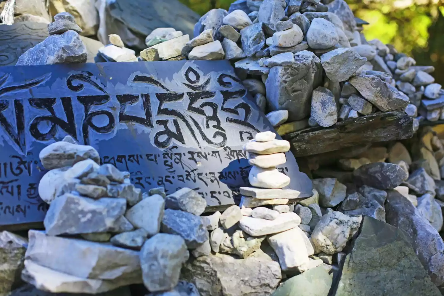
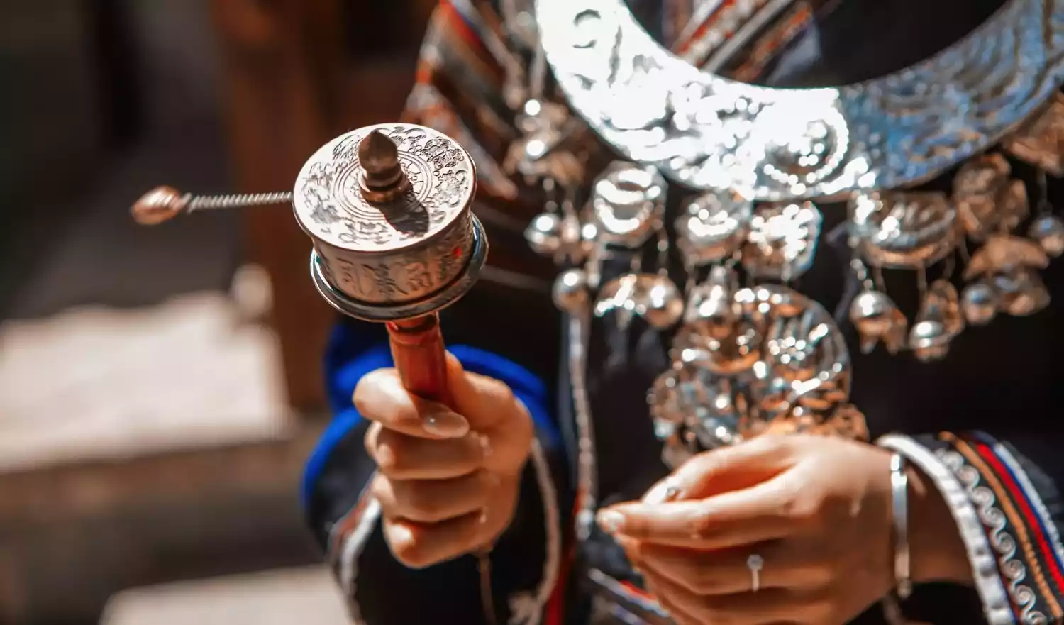
Precisely because it is out of reach, the Tibetan customs of Shiqu are unique. The Mani piles that can be seen everywhere in Tibet are built extremely majestically in Shiqu. After hundreds of years of wind and sun, they look like abandoned palaces, appearing extremely pious and mysterious.
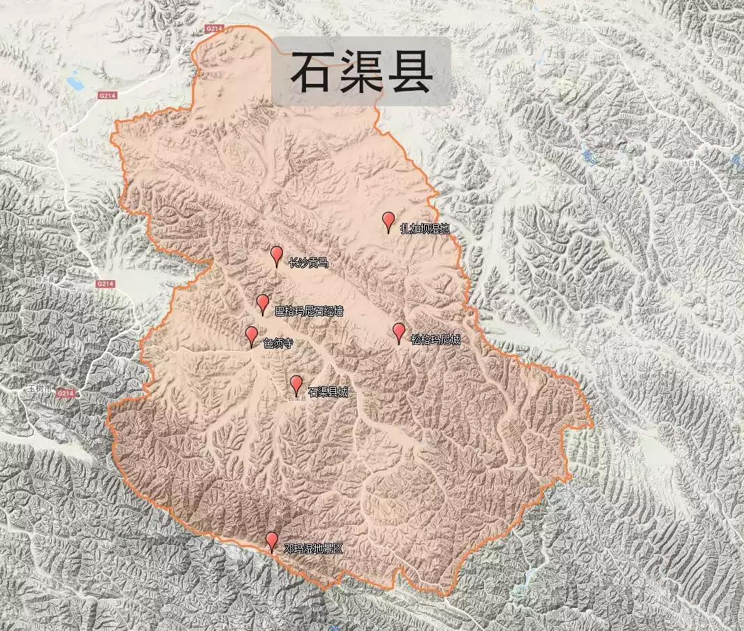
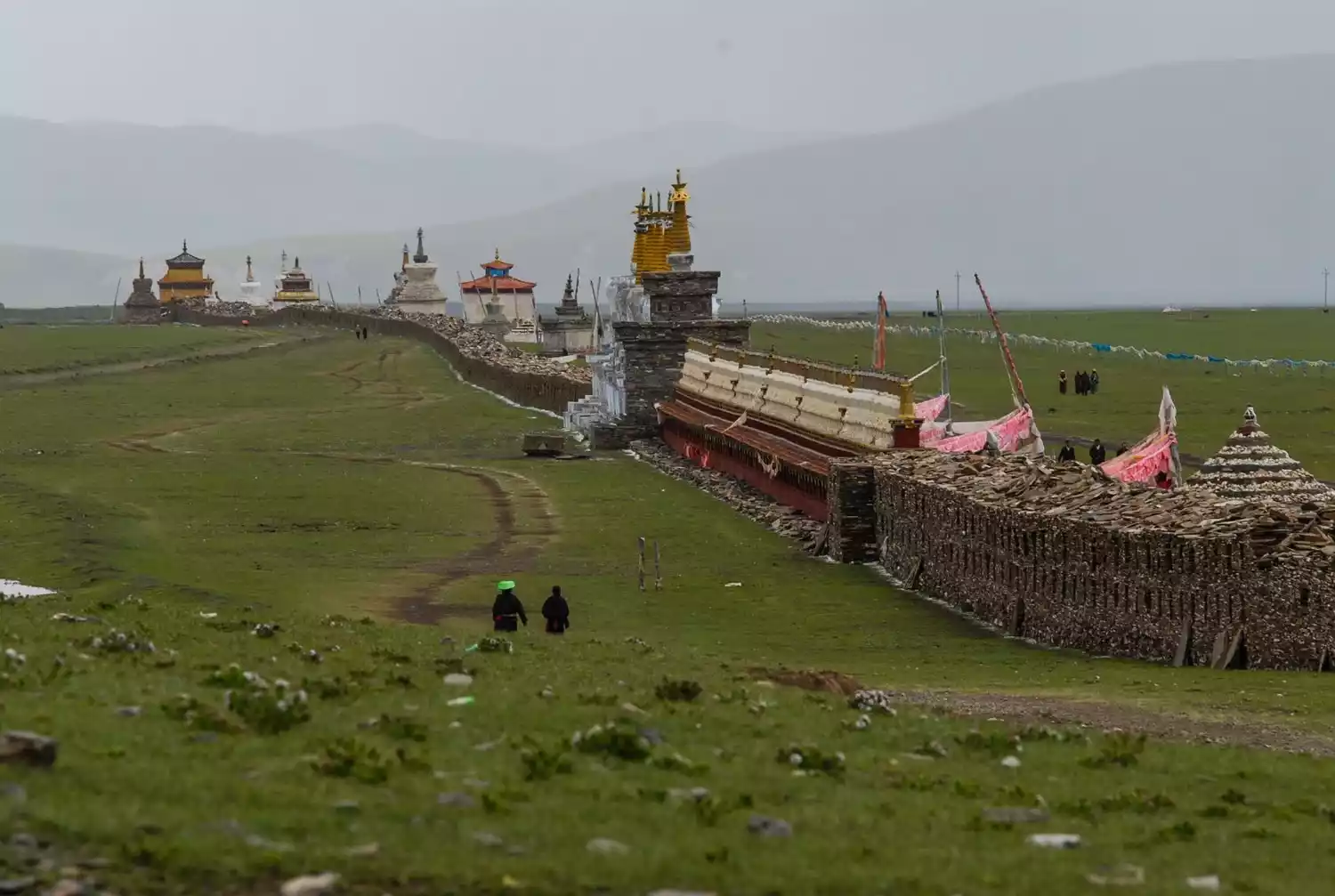
Magmani Stone Sutra Wall
The Magmani Stone Sutra Wall, located approximately 40 kilometers from Shiqu County, is the world's longest Mani Wall. Standing for over 300 years, it resembles a Great Wall of faith built on the grasslands. Reaching approximately 3 meters at its highest point, it measures 2-3 meters wide and is 1.6 kilometers long, constructed entirely of Mani stone slabs. Pagodas are connected at regular intervals, and numerous "windows" of varying sizes line the walls, each housing one or more stone Buddha statues, some painted and some in their original colors.
Songkmani City
When countless Mani stones are piled together, they become countless Mani piles on the grassland. In Shiqu, there is one of the most magnificent Mani piles in the history of Tibet - Songge Mani Stone Sutra City, which is located in Ari Zha Township, about 130 kilometers away from Shiqu County. It is a square stone city, about 10 meters high and 100 meters long. It is made entirely of pieces of Mani stones randomly stacked together. It is one of the relics preserved in the territory of King Gesar.
Changsha Gongma National Nature Reserve
Changsha Gongma National Nature Reserve is an alpine swamp wetland and wildlife type nature reserve.
The reserve boasts a well-preserved wetland peat ecosystem, rare in China, covering 275,972 hectares. The reserve is home to 236 known species of wild vertebrates, including 26 mammals, 203 birds, two reptiles, and five amphibians. It also boasts nine first-class nationally protected wildlife, one second-class nationally protected wildlife, and 11 other key protected wildlife species.
Derge County
Dergecheck the details
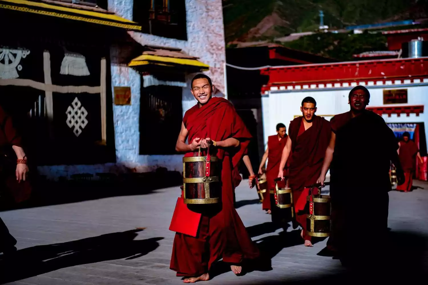
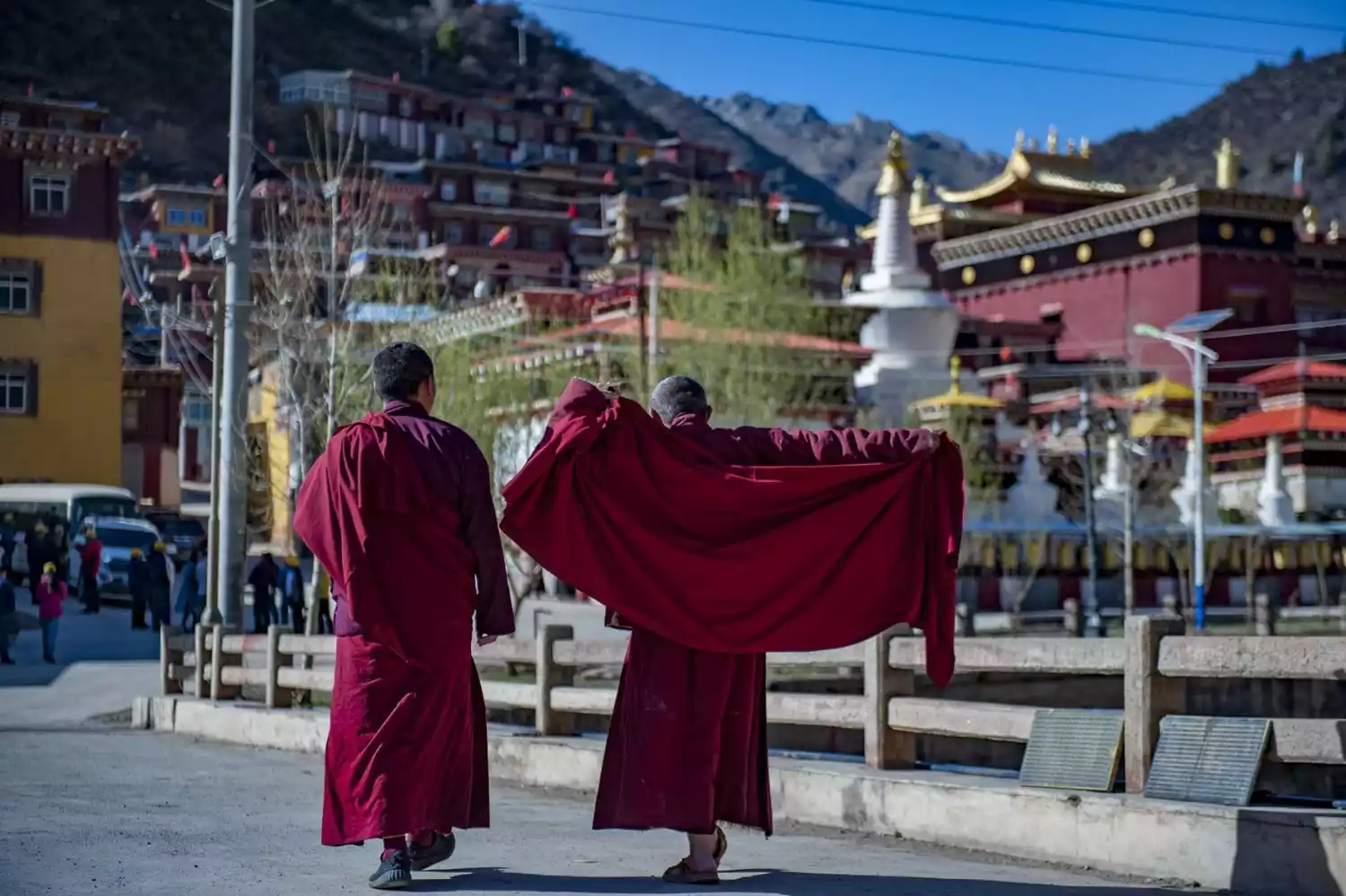
Derge County, with its seat at Gengqing Town, is located in the northwest of Garze Tibetan Autonomous Prefecture, Sichuan Province. Hidden here is a centuries-old Buddhist printing house. Far from the hustle and bustle of the city, the area boasts a simple folk customs. The vast grasslands, nestled between mountains and rivers, create captivating scenery. Entering Derge County, the fluttering prayer flags and the sight of monks in auburn attire create the feeling of being transported to a Buddhist paradise. The five major Tibetan Buddhist sects each flourish here, each establishing a Buddhist academy to promote their respective traditions.
Recommended months: Spring and autumn are the best
5552 recommendations, 4477 visits
Compared to the lesser-known Shiqu County, Derge County boasts a more prominent presence in Tibetan culture. Home to the Derge Sutra Printing House, one of the three largest Tibetan Buddhist sutra printing houses, the Ashu Grassland, where King Gesar roamed, the Queer Mountain, known as the most dangerous mountain in Sichuan and Tibet, and Maisu Township, a paradise known for its handicrafts... This small town, nestled between mountains, rivers, and culture, promises to delight adventurous travelers.
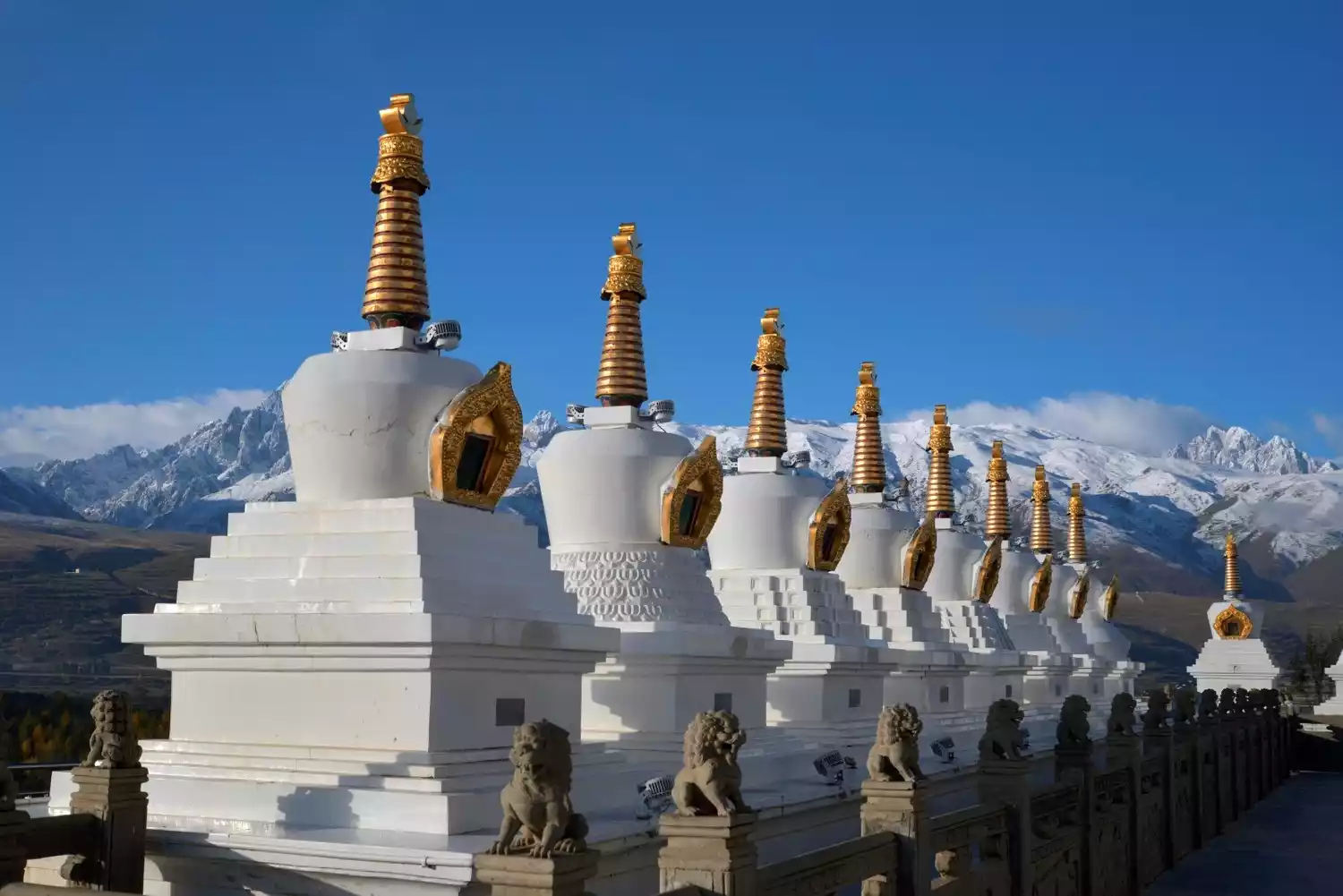
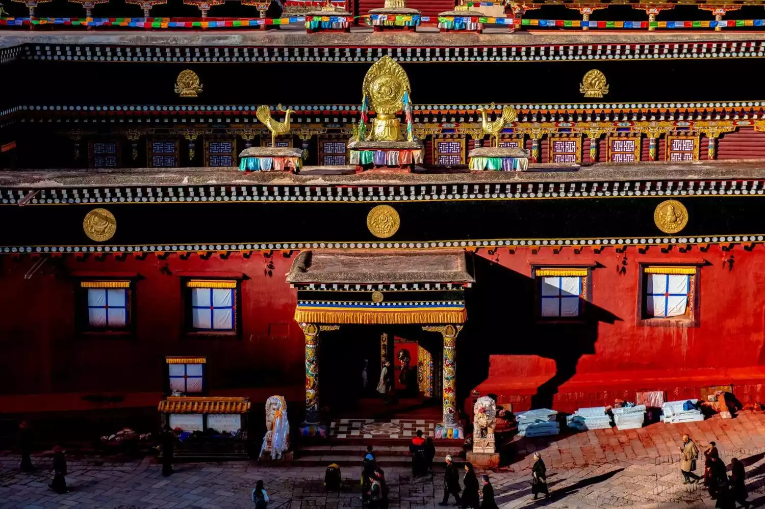
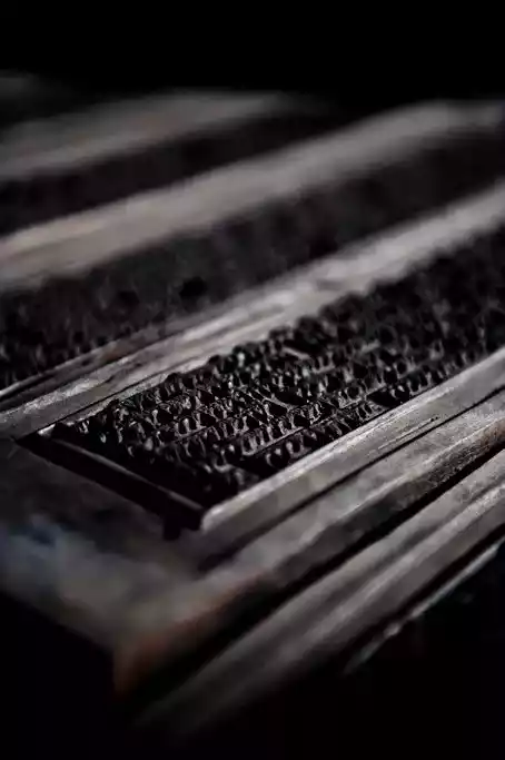
Derge Sutra Printing House
The Derge Sutra Printing House, also known as the "Derge Auspicious Wisdom Hall", has a history of more than 260 years. The printing house has a unique structure, towering red walls, swaying green trees, and is quiet and magnificent.
Exquisite architectural style, unique humanities. In this not very spacious Zen temple, most of the space is used to store heavy sutra blocks, as well as a large number of printed sutras and the paper needed for printing.
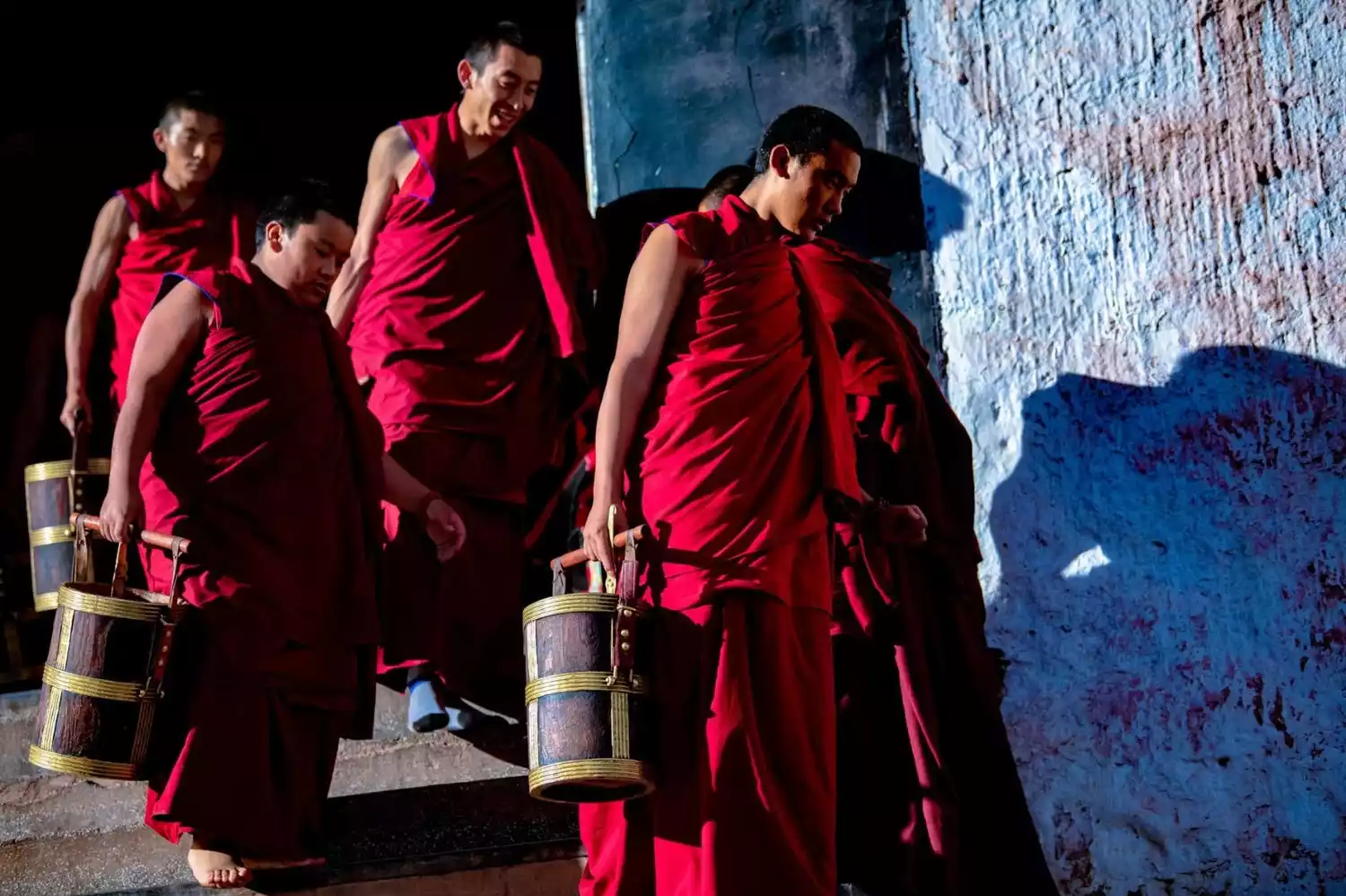
Here you can also see scripture printers using woodblock printing technology to make scriptures. The ancient tradition of hand printing is still preserved here, continuing the century-old immortal legend.
Queer Mountain
Located in the northern part of the Shaluli Mountains in the Hengduan Mountains, Que'er Mountain boasts a peak at 6,168 meters, making it the fourth highest peak in the region. Among the snow-capped peaks above 6,000 meters in the Hengduan Mountains, Que'er Mountain is a favorite among mountaineering enthusiasts.
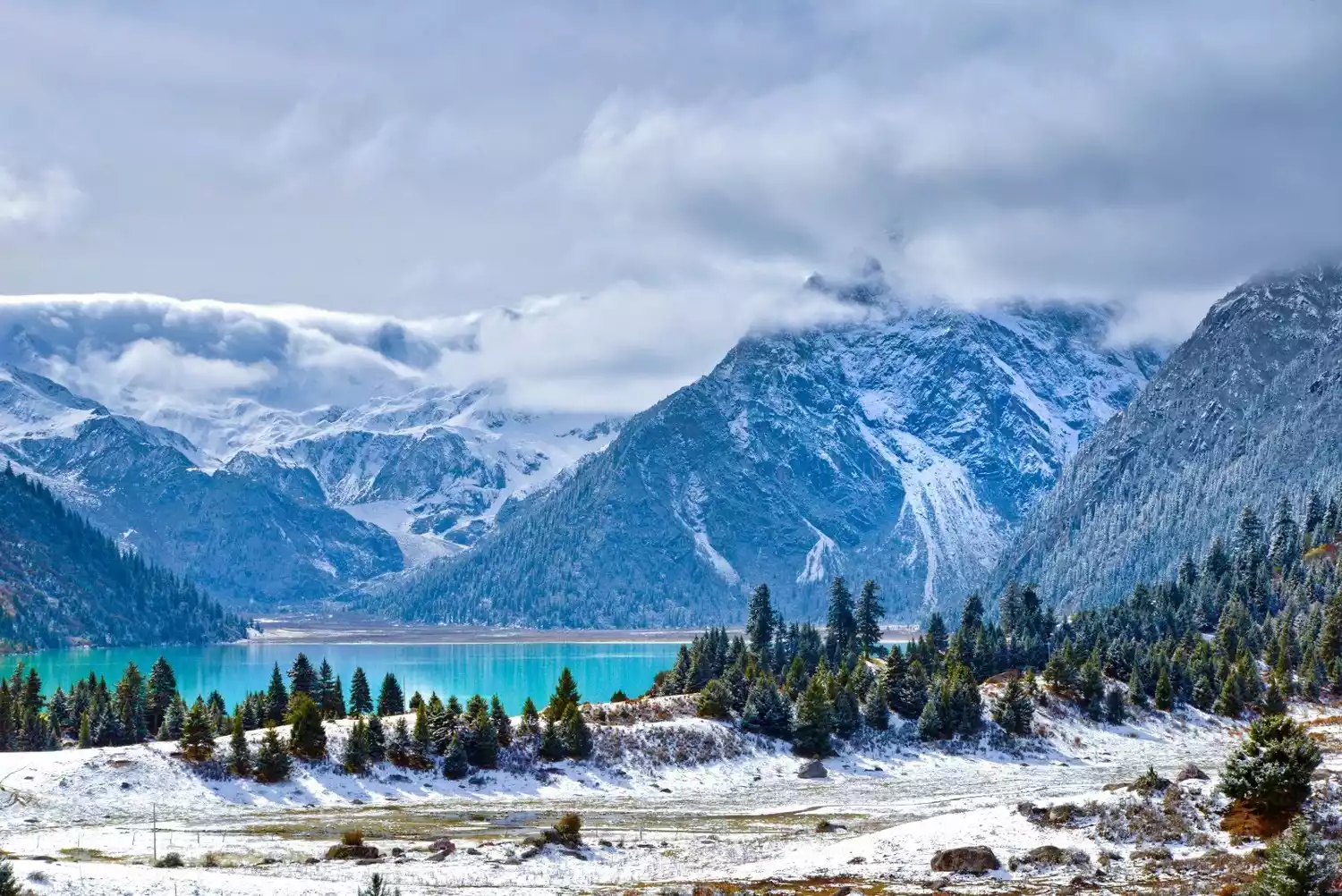
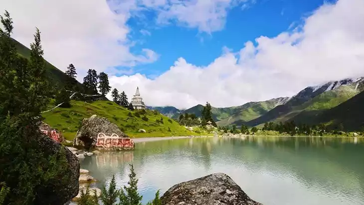
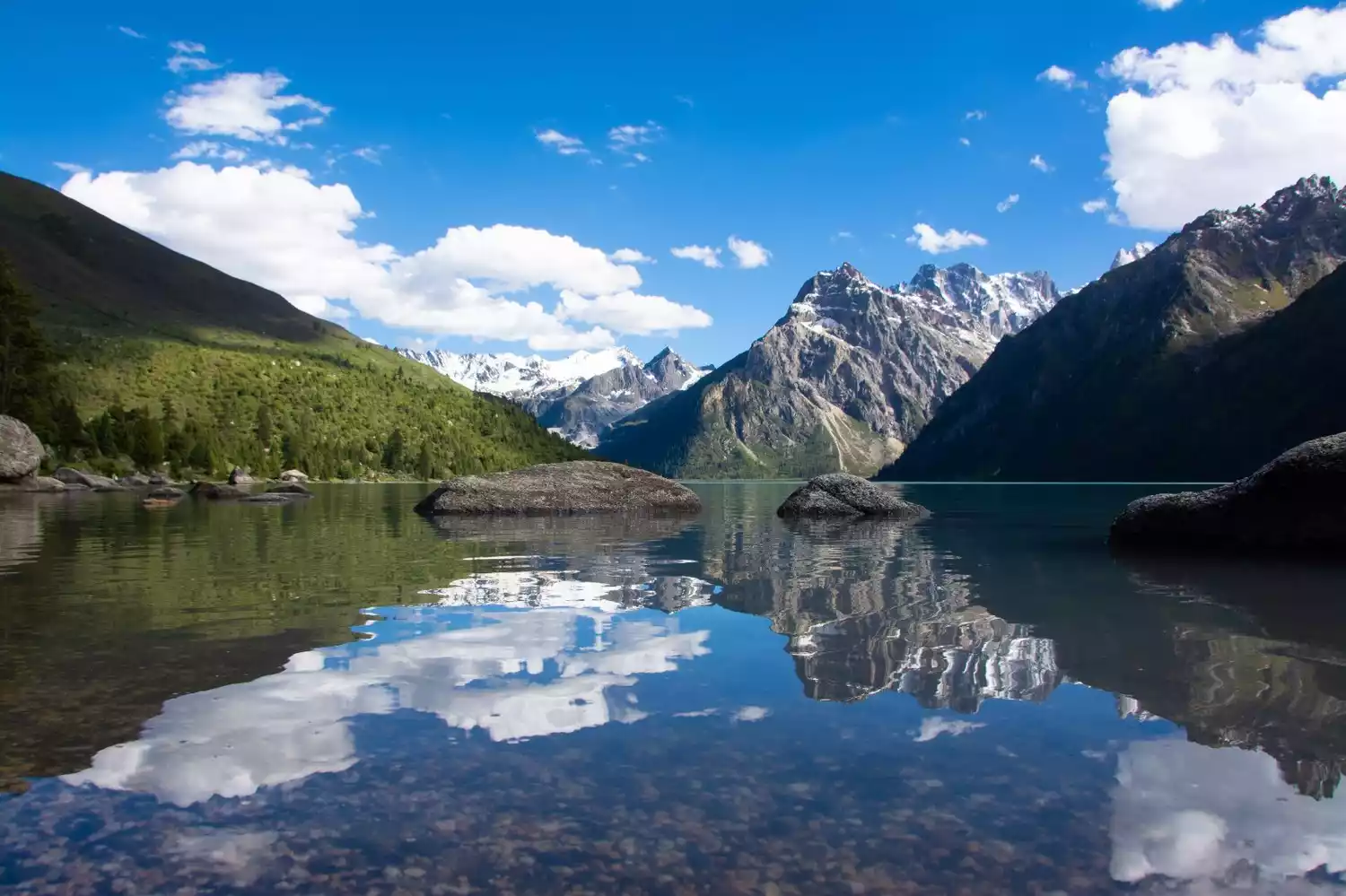
New Road Sea
Xinlu Lake, at the foot of Que'er Mountain, is the largest glacial lake in Sichuan above 4,000 meters. The majestic Que'er Mountain is reflected in Xinlu Lake, creating a unique sense of holiness between the water and the sky.
The ecology here is pristine and intact. The large, crystal-clear glaciers cascade down from the granular snow basin at an altitude of 5,000 meters to the lakeside grasslands, creating a truly spectacular sight.
Manigango
Everyone who comes to Manigango will inevitably sigh "time flies". As an important border trade town since ancient times, it has gathered a large number of horse caravans and merchants, and there are also many explorers visiting.
Manigango means "prayer place" in Tibetan, and you can see Tibetans everywhere, spinning prayer wheels. But the best way to experience the locals' piety is during the annual dance festival. Held in early August on a hill near the town, it begins with a long line of lamas slowly marching down the distant hills, seemingly arriving from the horizon.
Nangqian County
Nangqiancheck the details
Nangqian County, located in Yushu Prefecture, Qinghai Province, borders Haixi Mongol and Tibetan Autonomous Prefecture to the north and Golog Tibetan Autonomous Prefecture to the east. Its longest east-west distance is 157.5 kilometers, and its widest north-south distance is 130.5 kilometers. Its total area is 12,741 square kilometers. In 2013, Nangqian County had a total population of 130,000, including ethnic minorities such as Tibetan, Han, Hui, and Tu.
5596 recommendations, 4614 visits
Nangqian, once the economic and cultural center of Yushu, also boasts a wealth of religious and cultural attractions from the Tibetan region. Within this relatively small county, 108 temples of varying sizes and styles are scattered throughout.
In addition to having the largest number of temples in Qinghai Province, Nangqian is also famous for its unique and beautiful topography. In the area centered on the county seat, the quiet pastoral scenery is slowly replaced by spectacular snow-capped mountains, snow-capped mountains, hot springs, and endless surprises.
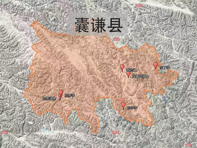
Baizha Salt Field
About 45 kilometers south of Nangqian County, you'll reach the Baizagu Salt Field, Nangqian County's most representative salt field, producing the highest-quality salt. Covering approximately 50 mu (approximately 1,000 hectares), the salt pans are arranged like a chessboard at the foot of the mountain.
The salt field still maintains its original manual collective operation mode. Villagers regularly bring salt springs into special salt drying pits, wait for the water to evaporate naturally, and then collect the salt grains in the pits.
Naijama Sacred Mountain
The sacred mountain Naijiama, with an altitude of 3,640 meters, is not outstanding on the Qinghai-Tibet Plateau with its high mountains and forests, but it has occupied a place because of its unique cultural temperament. In Tibetan, it is called "the leader of a hundred sacred mountains."
Nagyama Sacred Mountain is a sacred mountain with symbolic meaning recorded by Guru Padmasambhava in the hymn of the twenty-five sacred mountains. According to the Terma Dharma, Guru Padmasambhava meditated here for three months and subdued the big-horned bull demon.
Gar Monastery
Built halfway up the mountain, the Gar Monastery, also known as the "Gar Palace" by the locals, is the largest monastery of the White Tibetan Buddhist sect. Looking up at the Gar Monastery from the bottom of the valley, you'll see a temple rising from the towering rocky mountains, like a holy lotus blooming on the peak of this plateau.
Gar Monastery has two temples, the upper and lower, and the main religious activities are all in the upper temple. The Dharma wheel in the fourth large scripture hall is said to have been brought to Purung Monastery in Bomi area by Princess Wencheng when she entered Tibet, and then transferred here.
If time permits, you can stay overnight in Gar Monastery. The sunlight shining into the temple in the morning adds a touch of charm.
Dana Hot Springs
Less than 3 kilometers from Nada Temple, on an open lawn, lies Dana Hot Spring.
The hot springs are made up of seven natural stone pits, each about one meter deep and capable of accommodating only one person. Unlike the beautiful pools found in cities, these are wild springs nestled in rock and muddy ground, nestled against snow-capped mountains and crowned by lush greenery. The experience is truly unique.
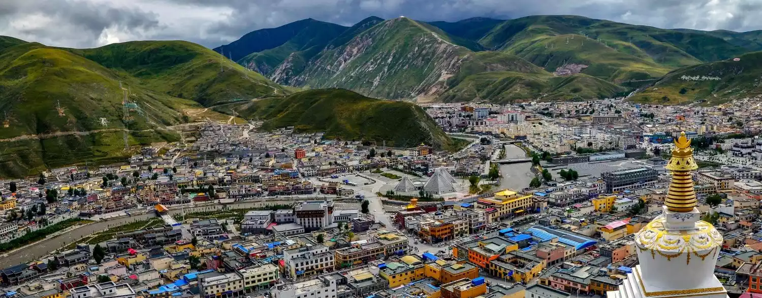
Jiangda
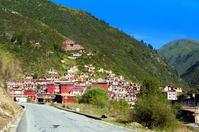
Jiangda Countycheck the details
Jiangda County, located in the eastern part of the Tibet Autonomous Region, sits within the Hengduan Mountains, with an average elevation of 3,650 meters. It boasts diverse mountainous landscapes and abundant water resources. It sits at the junction of Sichuan, Qinghai, and Tibet, and serves as the gateway to eastern Tibet. The world-renowned Sichuan-Tibet Highway, National Highway 317, passes through Jiangda County. Jiangda County was also the first stop in the liberation of Tibet. The 18th Army Ferry crossing on the Jinsha River in Jiangda County is a memorable revolutionary site, weathering decades of wind and rain, yet still retains a relatively intact historical scene and the achievements of our ancestors.
Recommended months: July-September
6701 recommendations, 4639 visits
The "Jiang" in Jiangda refers to Jiangpu Temple, and "Da" means the mouth of a ravine, referring to the ravine at Jiangpu Temple. Previously translated as Jiangda, this was the river crossing point where the 18th Army liberated Qamdo. Jiangda Town, the county seat, is located at an altitude of 3,680 meters. The county seat is 223 kilometers from Qamdo, 1,170 kilometers from Lhasa, and 1,070 kilometers from Chengdu. National Highway 317, the Sichuan-Tibet North Line, runs through the county for 143 kilometers.
Pologuzhe woodcut
The Pologuze woodblock printing, which originated in 1676, is the ancestor of Tibetan woodblock printing. It has played a huge role and far-reaching influence in the development of Tibetan culture, especially the inheritance of Buddhism.
The woodcarving craftsmen here were numerous and highly skilled. There were over 150 skilled artists in the Polo area who could independently carve sutra blocks. The sutra blocks currently housed in the Derge sutra printing house are primarily masterpieces of the artists in the Polo Guze area.
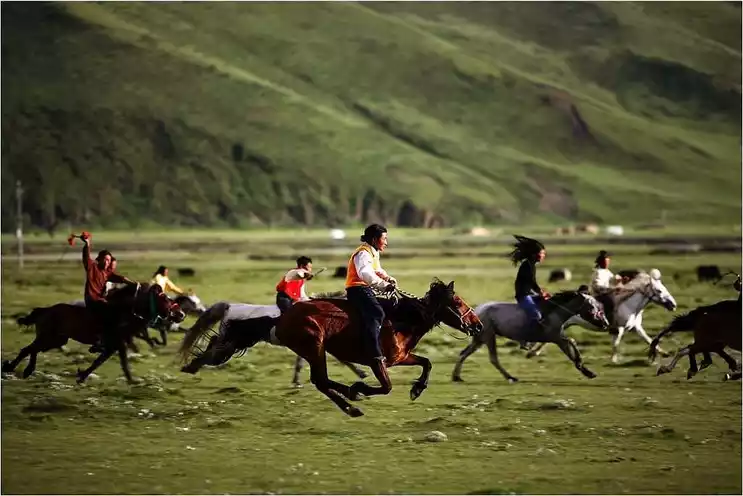
Ziga Grassland
Ziga Grassland, one of Qamdo's major pastoral areas, lies approximately 60 kilometers northwest of Jiangda County, at an altitude of 3,900 to 4,700 meters. The vast expanse of Ziga Grassland, with its breathtaking blue skies, white clouds, green grass, and wildflowers, is a typical highland pasture.
Every year on the 15th day of the seventh month of the Tibetan calendar, the famous Horse Racing Festival is held here in eastern Tibet. Nomads from all over the country dress in colorful clothes, bring highland barley wine and yogurt, and ride their horses from all directions to the racetrack to celebrate the festival.
Gangtuo Folk Village
Gangtuo Folk Village is the first folk village entering Tibet from National Highway 317. It is located on the bank of Jinsha River, 85 kilometers away from Jiangda County. Gangtuo is known as the first ancient village in eastern Tibet.
The dwellings of Gangtuo Folk Village are distinctive. They are well-pole-style buildings, facing west and east, with logs as the overall frame, mud and stone walls, and roofs made of birch bark or hard-strung wooden strips, covered with "Aga soil" (yellow mud). The interiors are entirely constructed of wood and have two stories: the first is rectangular, the second is L-shaped or circular. Prayer flags are mounted on the roofs, and exposed areas such as doors and windows are dyed with specially made or homemade colored clay. The walls are white, with red accents on the stained glass windows.
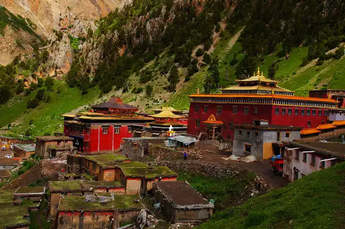
Wala Temple
Wala Monastery is the first major monastery to be built in Tibet from Sichuan, and the largest in Jiangda County, known as the "Eastern Gate of Tibet." Strangely, the valley where it lies is home to only the tiny Wala Village, a village with a tiny population. Walking out of the valley, you can't see any signs of human life, as if a fox spirit from the novel "Strange Stories from a Chinese Studio" has materialized in the valley.
There is a "Five Sciences Buddhist College" here that emphasizes both learning and practice. It inherits Buddhism and promotes the teachings through practical actions. It is also the largest Buddhist college of the Sakya tradition in the country. Groups of lamas in crimson robes come and go, making people feel as if they have come to a red world.
Guobubaizong
Gobubaizong is a collection of villages, grasslands, forests and sacred mountains. From a distance, the sacred mountain looks like a human heart and is said to be the heart of the three sacred mountains in Tibet.
The sacred mountain of Guobubaizong has beautiful scenery, with century-old pines and cypresses, exotic flowers and plants, and large lawns forming various wonders. It is a tourist area that integrates natural scenery and religious culture.
Conclusion
The border region of Sichuan, Qinghai, and Tibet, a place often overlooked by travelers, has preserved the cultural landscape of Tibet intact. It may not be an ideal leisure travel destination, but it is definitely a paradise for cultural lovers.