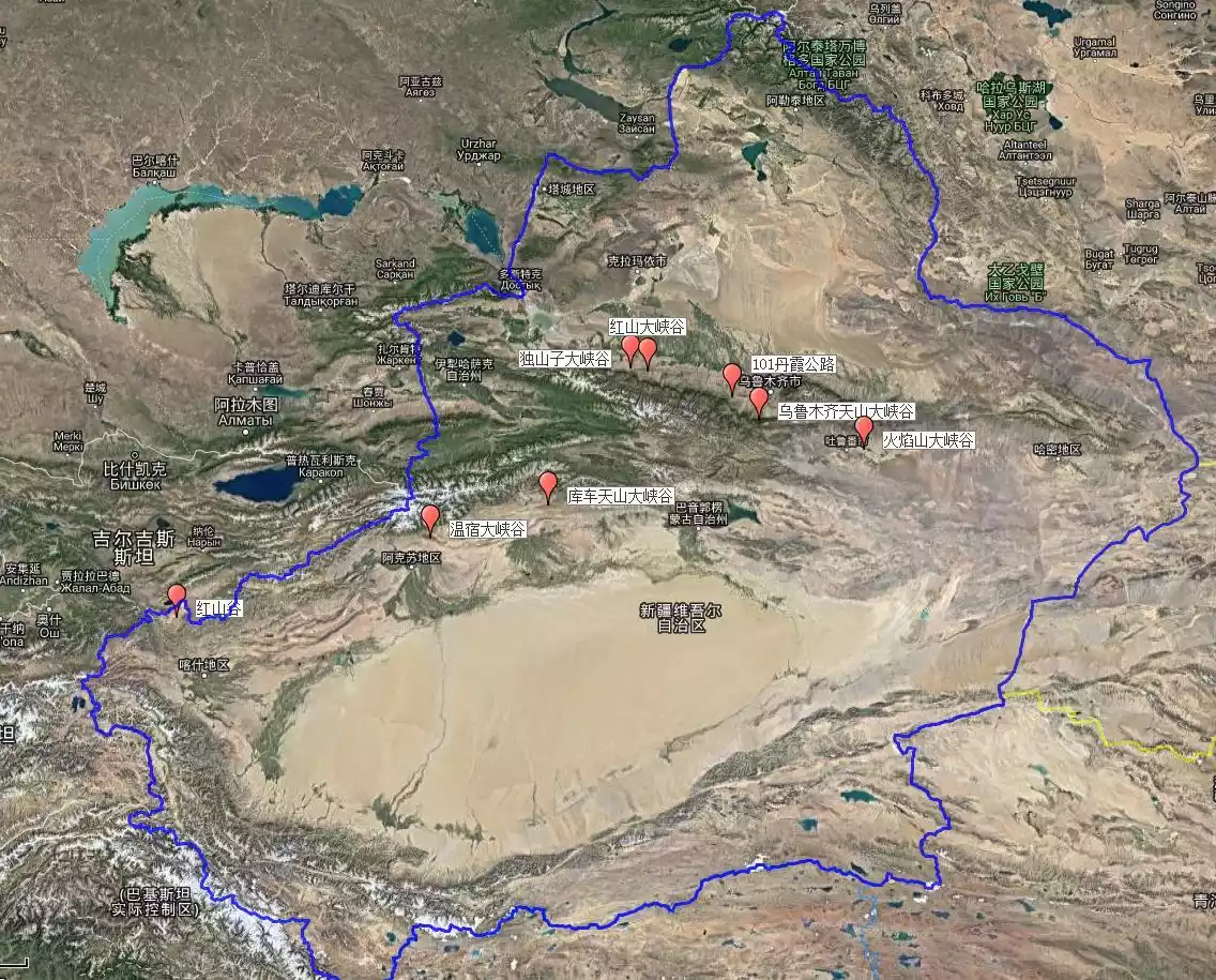
Xinjiang Grand Canyon Summary: Hongshan, Dushanzi, Kuche, take you to play in Xinjiang Grand Canyon
Preface
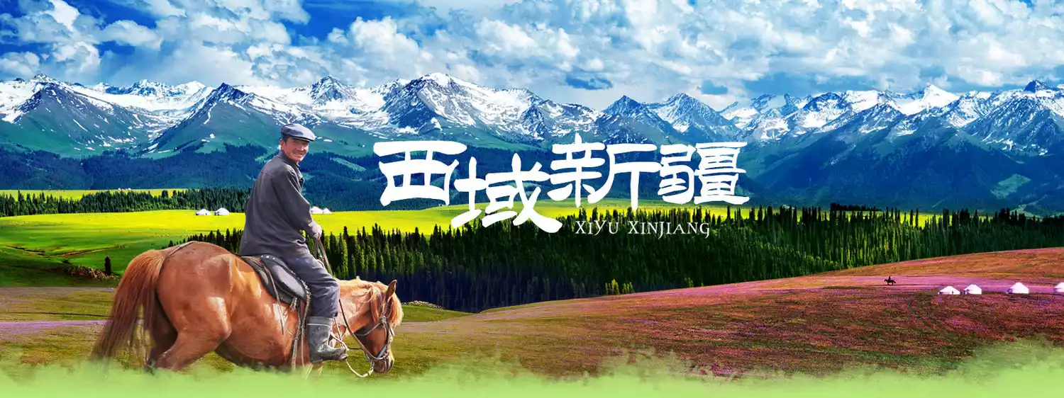
Located in China's far northwest, Xinjiang boasts a vast territory of 1.6 million square kilometers, accounting for one-sixth of the country's total land area. Its unique topography, defined by "three mountain ranges sandwiched between two basins," is shaped by the Altai Mountains in the north, the Tianshan Mountains in the middle, and the Altun and Kunlun Mountains in the south, creating a diverse landscape. Snow-capped mountains, forests, wetlands, grasslands, lakes, rivers, deserts, Gobi deserts, canyons, and Danxia glaciers abound.
Xinjiang's Tianshan Mountains are known for their abundance of grand canyons. North and south of the Tianshan Mountains, there are several famous canyons, including the Hongshan Grand Canyon, the Dushanzi Grand Canyon, the Wensu Grand Canyon, and the Huoyanshan Grand Canyon. Any one of these can create stunning filmmaking moments.
Mapping@Flying
Today, I will introduce to you some of the most famous canyons in Xinjiang, which is also a holy place for photography enthusiasts and off-road self-driving tours.
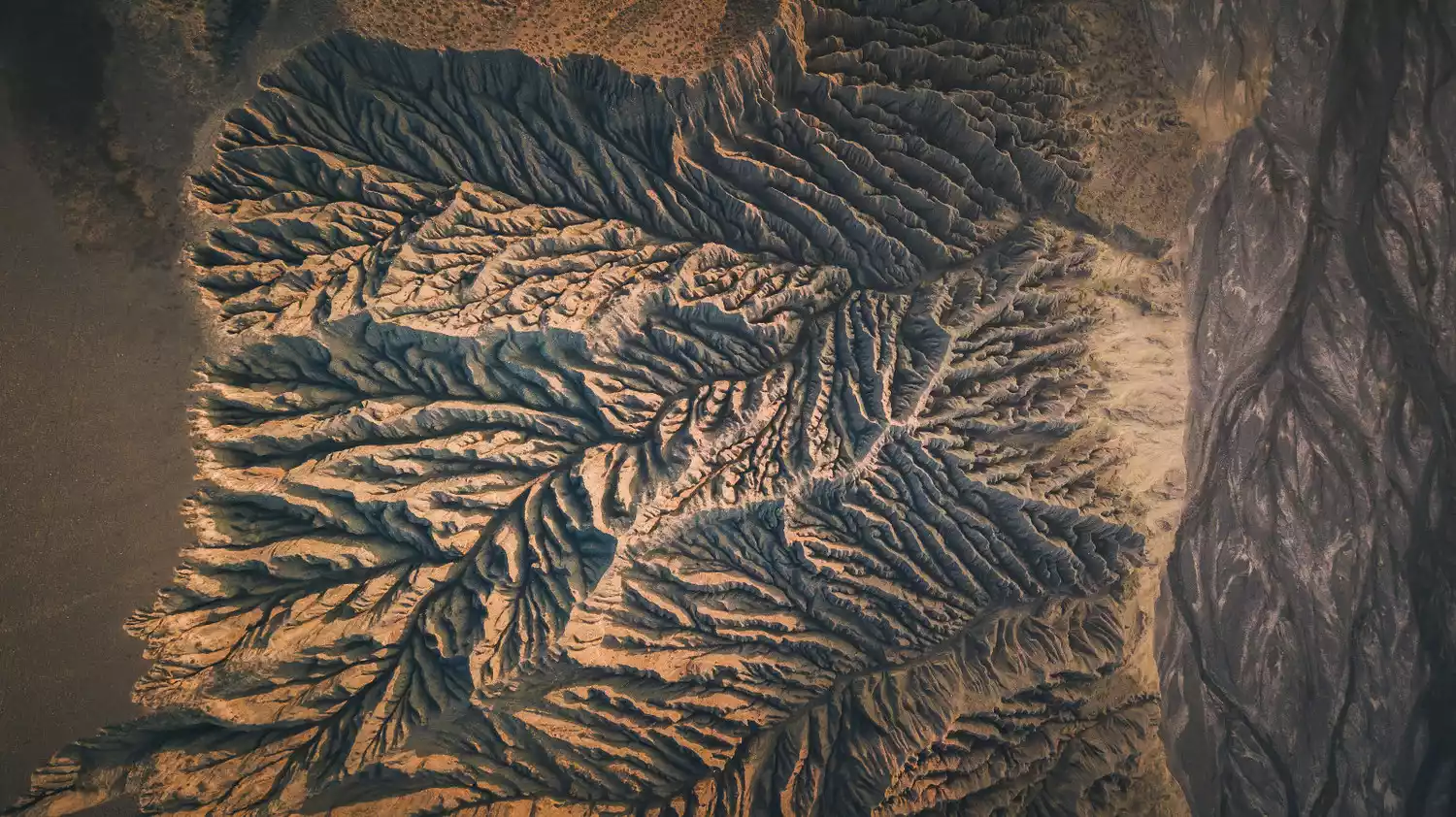
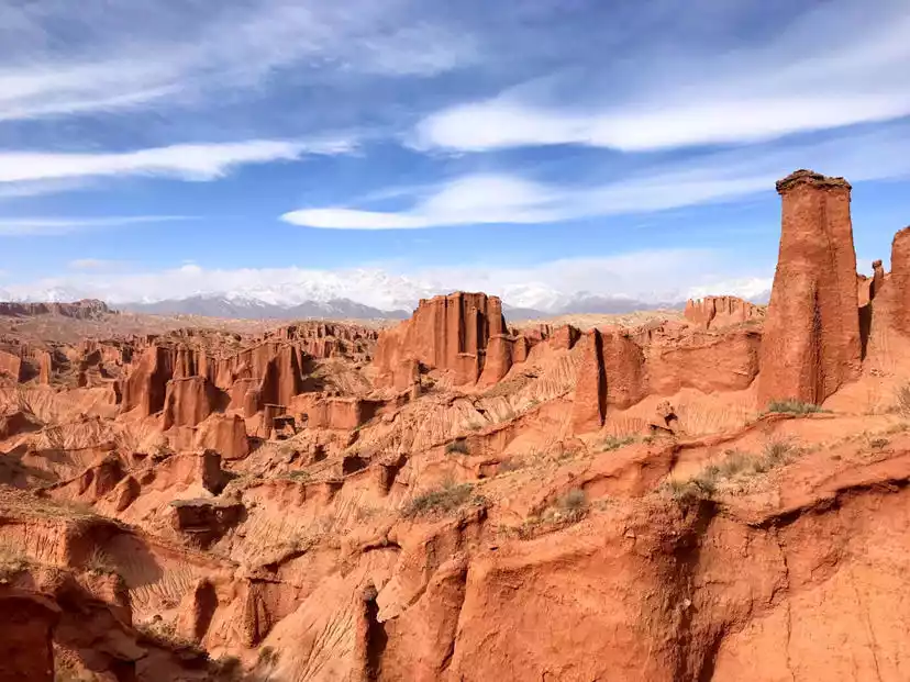
★Hongshan Grand Canyon★
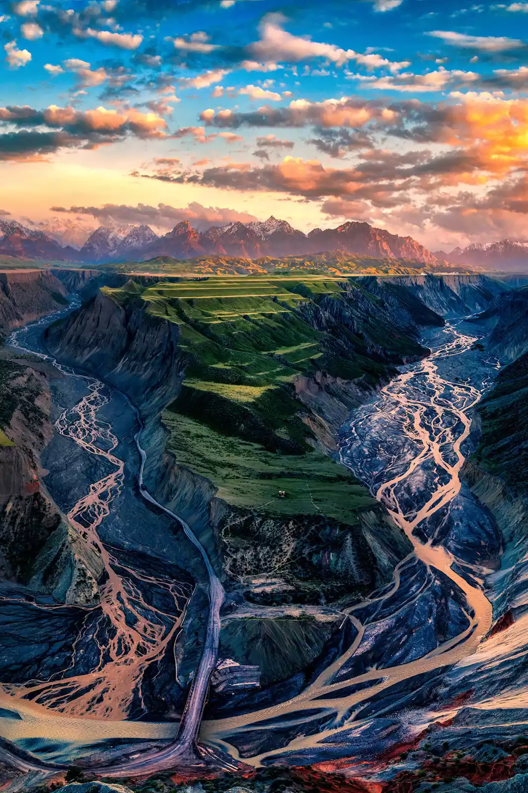
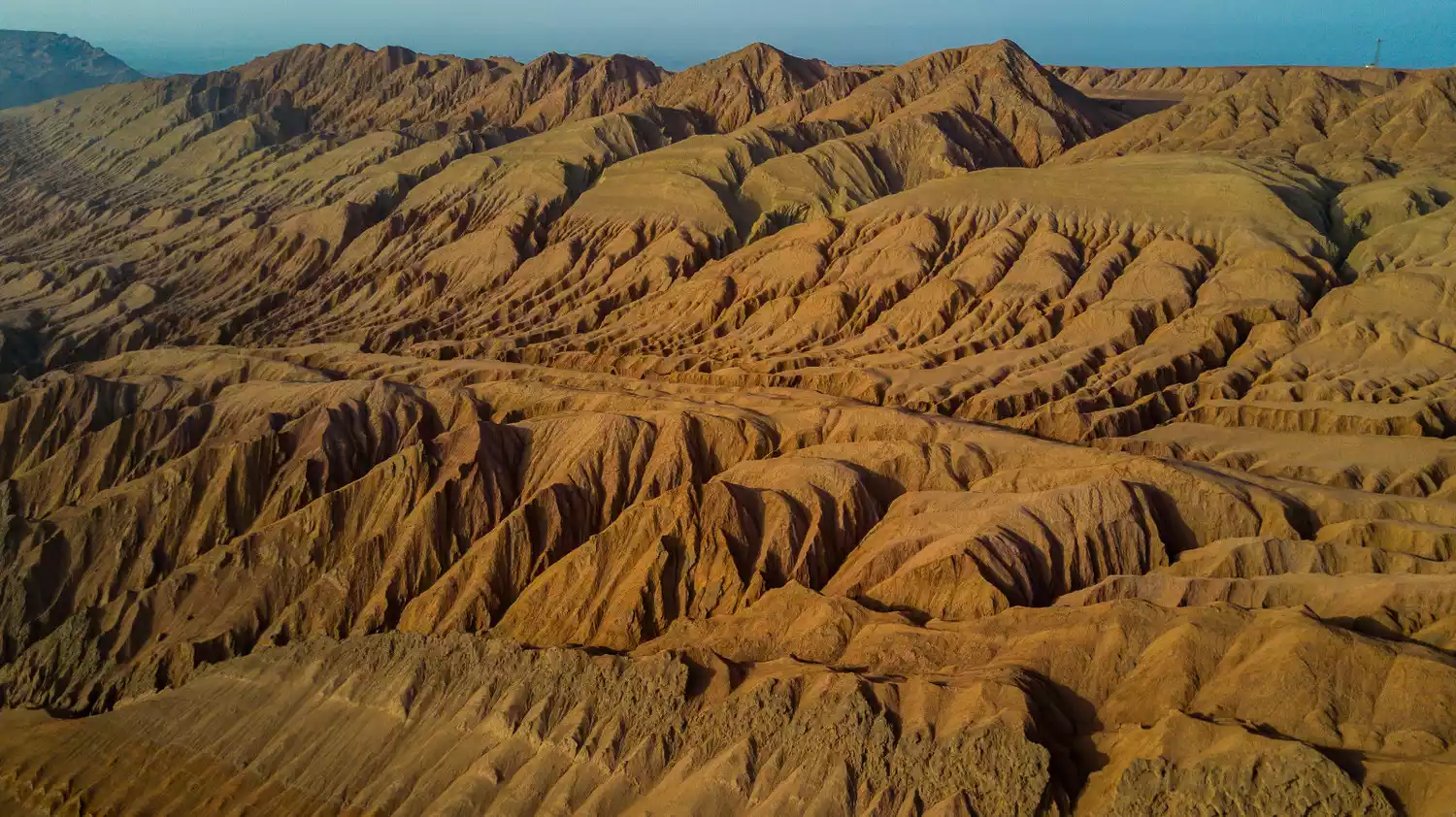
The Hongshan Grand Canyon, also known as the Anjihai Grand Canyon, is located on the northern slope of the Tianshan Mountains west of Anjihai Town, Shawan County. It originates from the Tianshan Mountains and is a wonder created by the magic of nature. However, at present, only a very small number of geologists, photographers and outdoor enthusiasts have paid attention to it.
Across the endless grasslands, a 230-meter-deep rift suddenly appears (I measured the depth using a drone). This spectacular canyon, formed by the relentless erosion of meltwater from the Tianshan glaciers, features a crisscross of gullies stretching from the rim to the valley floor. The rich mineral deposits in the soil give the mountain a reddish-brown and grayish-brown hue, earning it the name Hongshan Grand Canyon.
Tips:
Hongshan Grand Canyon is still an original ecological canyon. It is not a scenic spot and is free of charge. However, there are no basic safety facilities. You must pay attention to safety and it is best to keep a safe distance of more than 2 meters from the canyon.
You should go to Hongshan Grand Canyon early in the afternoon because you need to shoot from a direct sunlight angle. The canyon is quite deep and if you go too late, the shadow of the mountain will go in and the effect will be worse.
Hongshan Grand Canyon is 60km away from the nearest city of Kuitun. It is not easy to find by car and it is expensive to rent a car. It is best to share a car with a group or join a tour group.
In June 2019, a landslide occurred on the edge of the Hongshan Grand Canyon. It has been closed and no one is allowed to enter. Only some local cars know how to go up from the side road.
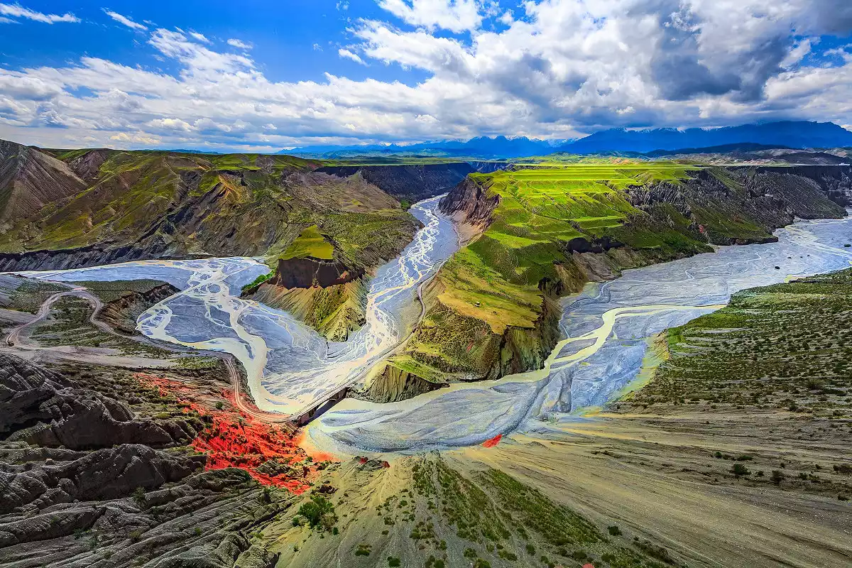
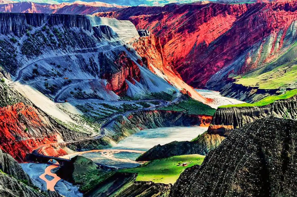
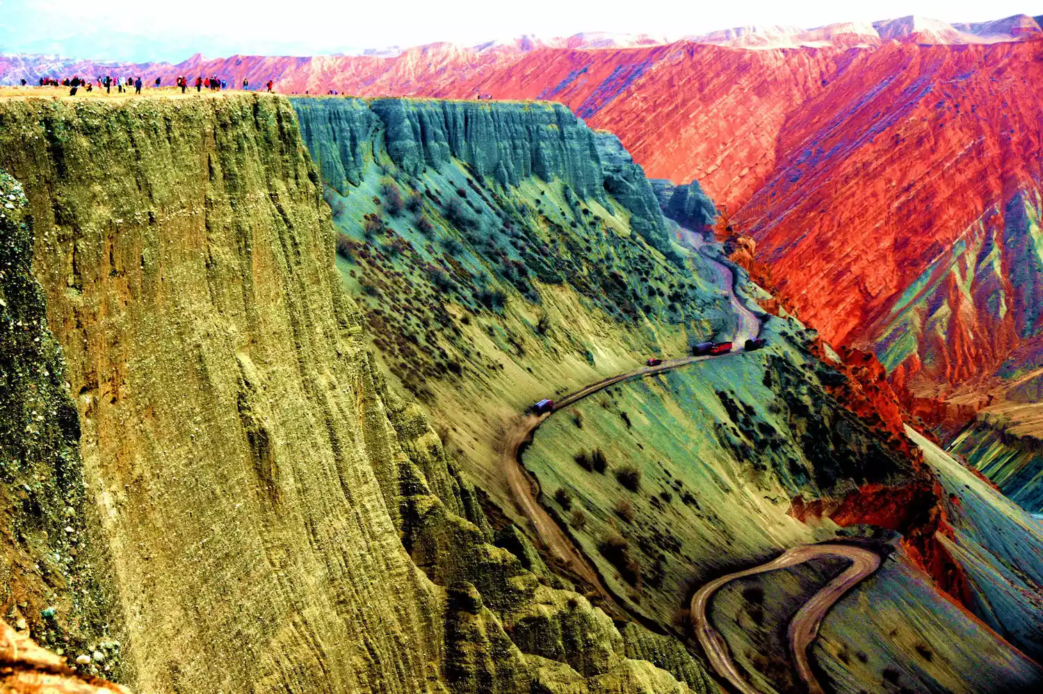
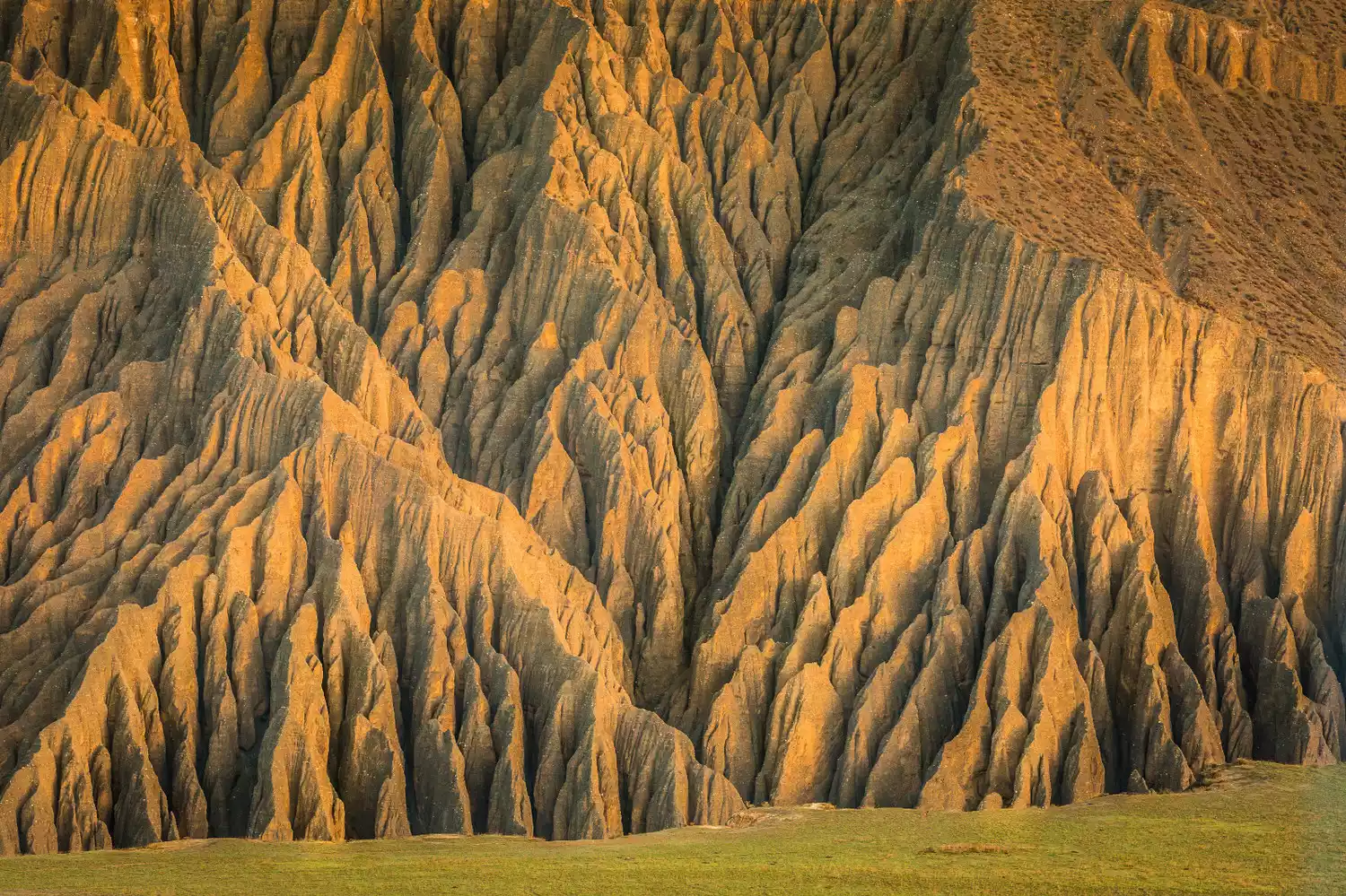
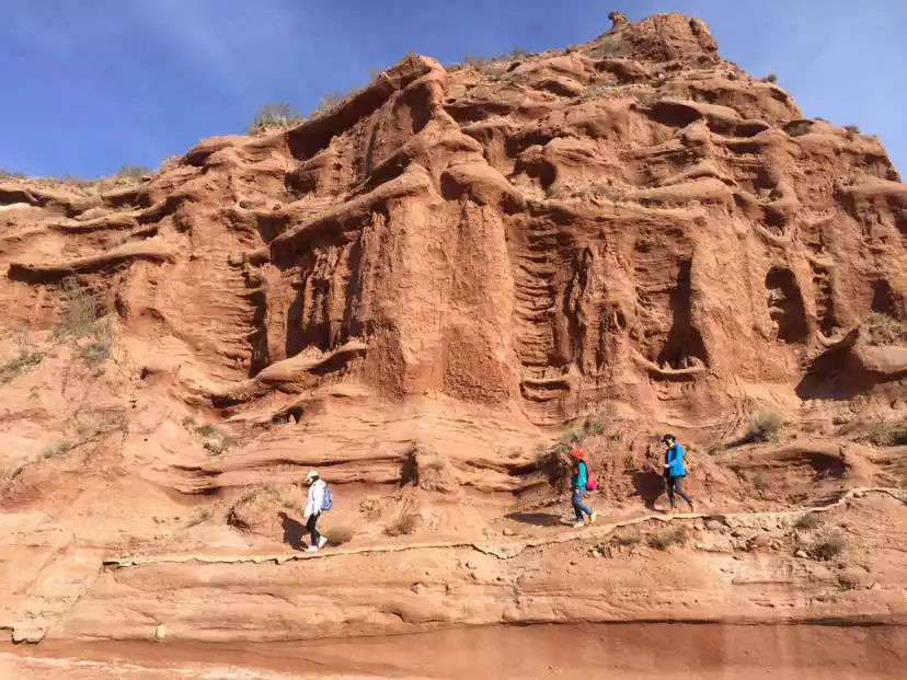
★Dushanzi Grand Canyon★
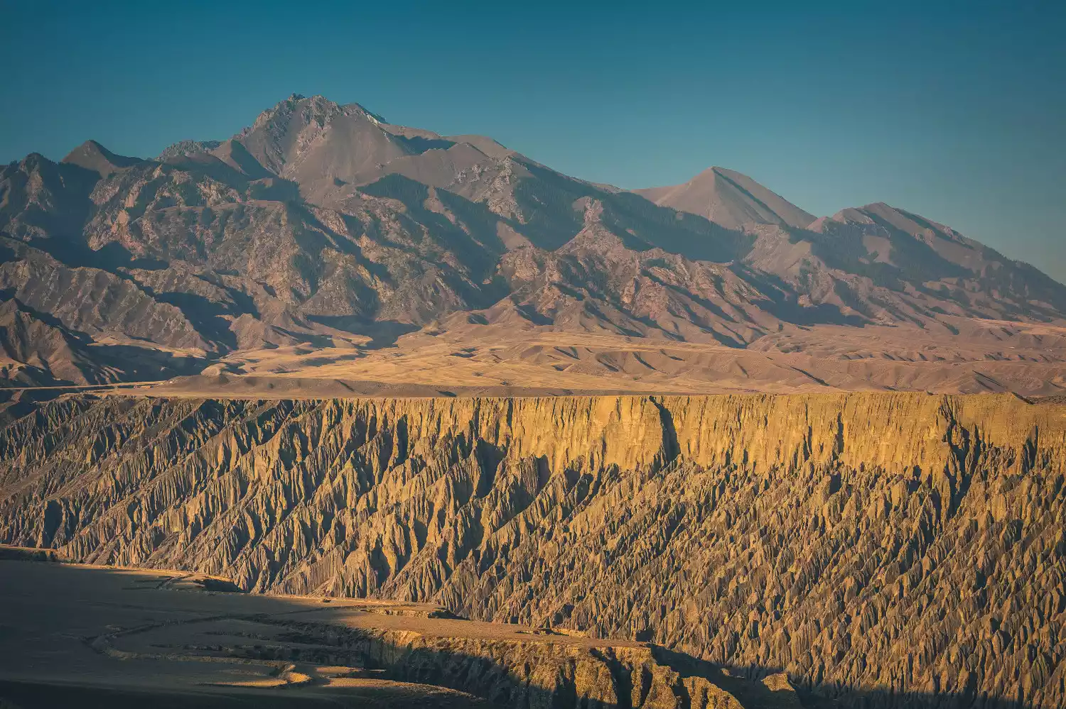
The Dushanzi Grand Canyon, also known as the Kuitun Grand Canyon, lies on the northern side of the Tianshan Mountains. Snowwater from the Tianshan Mountains flows through this vast, deep impact gorge. Fertile grasslands dominate the upper reaches of the canyon, while the erosion of rain and snow has shaped the cliffs on either side into a spectacular jagged rock formation. At the bottom of the canyon, the Tianshan snowwater still flows, making it a must-see for photography enthusiasts. This is a rare attraction exclusively developed by China-TravelNote and is sure to astound you.
Tips:
Dushanzi Grand Canyon is also a pristine canyon. It has now become a scenic spot with a fee. Please pay attention to safety when taking photos. It is best to keep a safe distance of more than 2 meters from the canyon.
You should go to Dushanzi Grand Canyon early in the morning because you need to shoot from a direct sunlight angle. When the sun comes out in the morning, the sunlight hitting the cliff will create a very layered contrast. There are also the Tianshan Snow Mountain in the distance.
Dushanzi Grand Canyon is 60km away from the nearest city of Kuitun. It is not easy to find it by car and it is also expensive to rent a car. It is best to share a car or join a tour group.
The canyon is majestic, so photography is mainly done with medium and long focal lengths. If you get closer, you can use wide angles to take some local shots, and aerial photography is also possible.
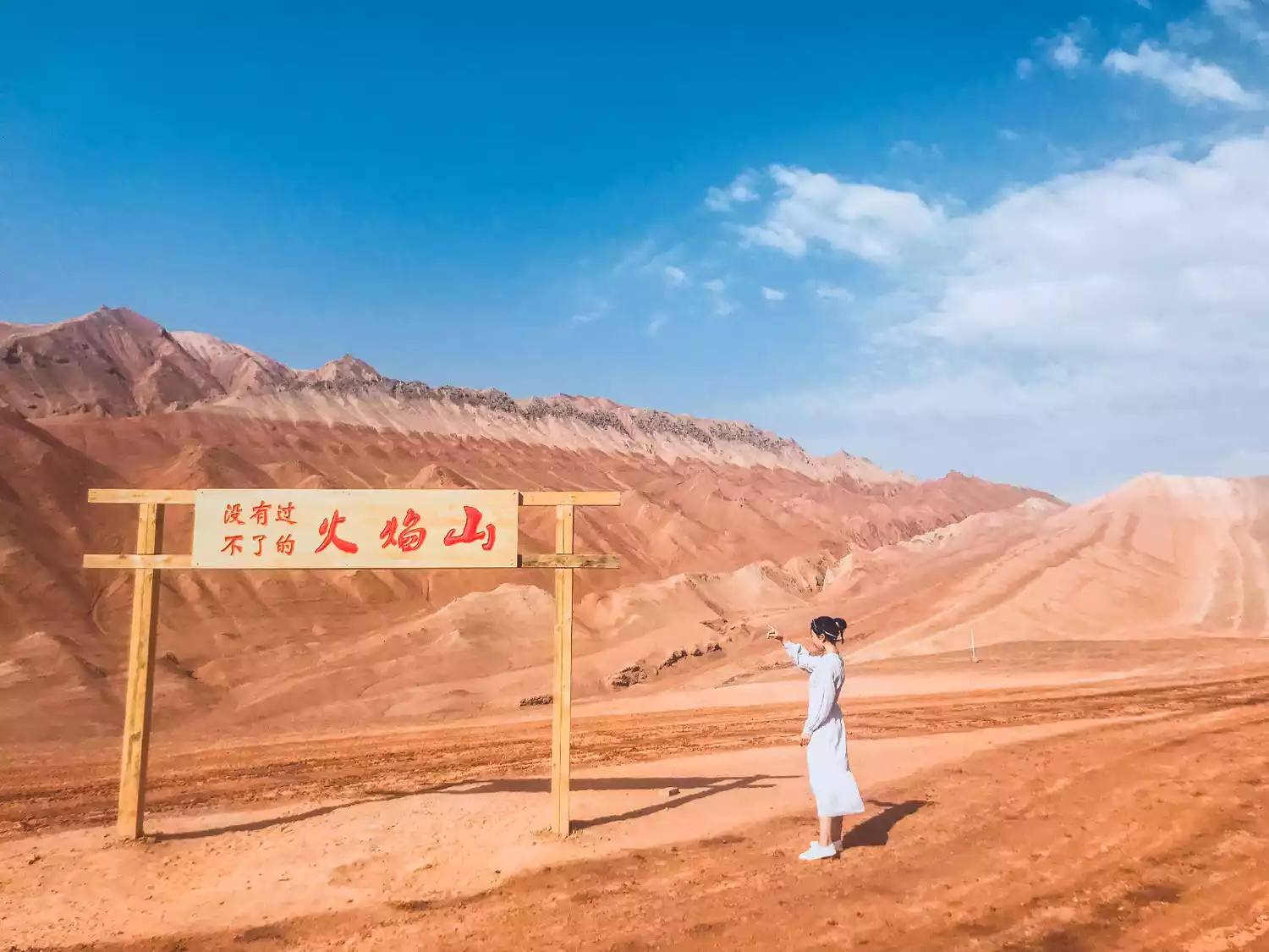
★Flaming Mountain Grand Canyon★
The Huoyan Mountains, located in the northern part of the Turpan Basin, stretch over 100 kilometers. The Classic of Mountains and Seas refers to them as "Flame Mountains," and in Uyghur, they are called "Kiziltak," meaning "Red Mountain." "Turpan" means "lowest place" in Uyghur. It is a sunken basin formed between the Bogda and Kuruktag ranges of the Tianshan Mountains. The climate is extremely arid, with high temperatures year-round, especially in the northern part of the basin. In the scorching summer, the surface temperature can reach 80°C, enough to roast an egg.
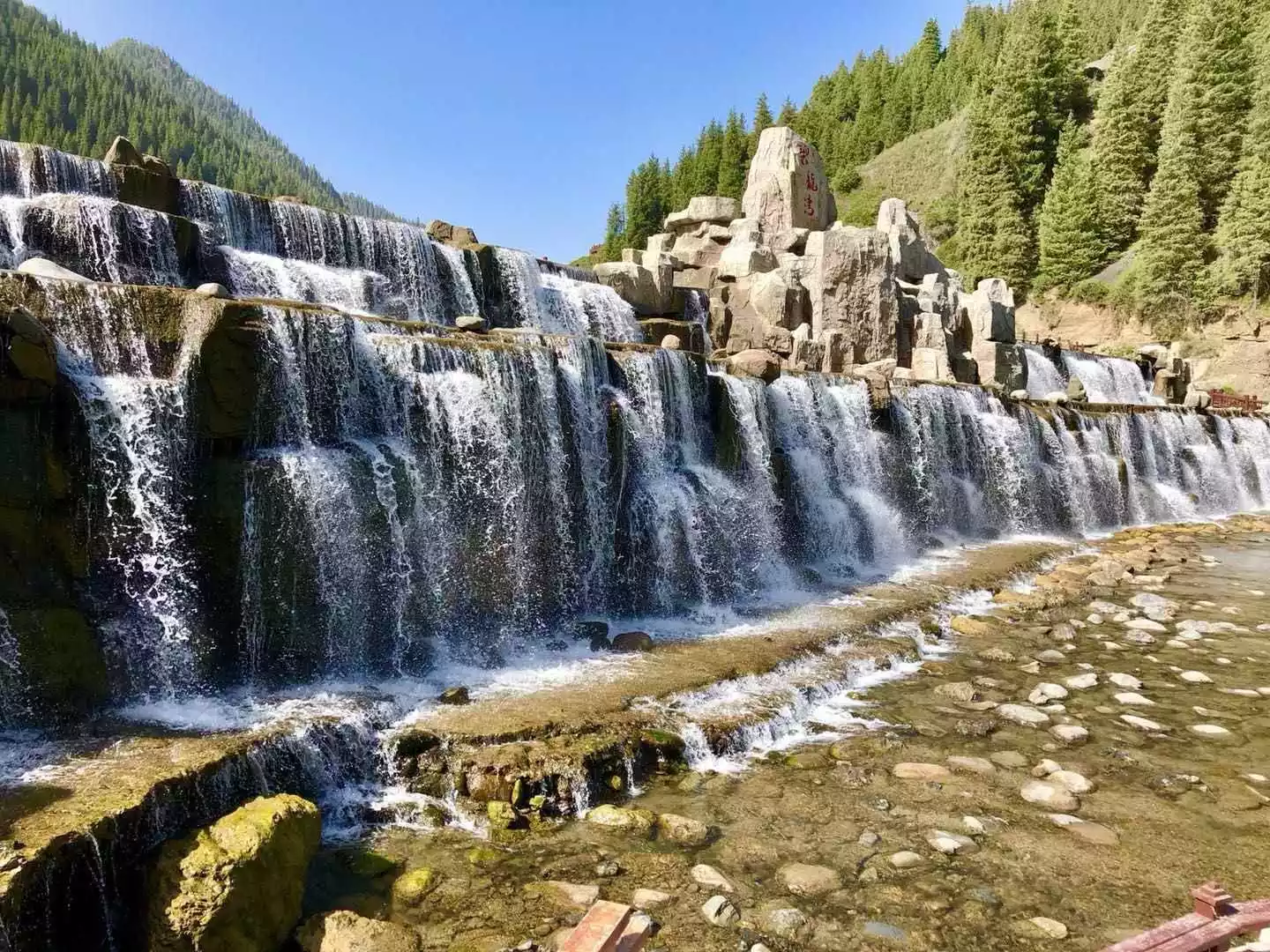
The Flaming Mountains are awash with ravines, winding and majestic, with no vegetation growing anywhere. The Grand Canyon is the largest of these ravines. Here, you can admire the Flaming Mountains up close and climb to admire the vibrant Danxia landforms. Grapevines shade the valley floor, and the famous Karez wells flow through here, irrigating the oasis within the canyon. This provides a striking contrast to the blazing heat of the Flaming Mountains.
Tips:
1. There are many conventional scenic spots in Huoyan Mountain, many of which are inaccessible. Here in the Huoyan Mountain Grand Canyon, you can hike directly to the Huoyan Mountain and overlook the colorful Danxia landforms of the Huoyan Mountain Grand Canyon and Huoyan Mountain from the air.
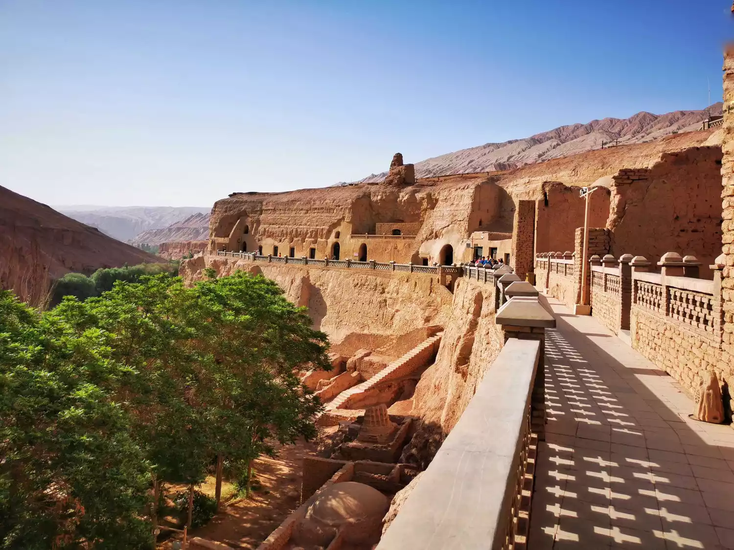
2. There is no fixed parking lot at the Flaming Mountain Grand Canyon. You usually park at the Bezeklik Thousand Buddha Caves and go up the mountain to visit the historic Thousand Buddha Caves murals.
3. The temperature at Huoyan Mountain is high, so it is recommended to visit in the morning or evening to avoid direct sunlight.
4. The Wensu Grand Canyon is quite large, making it ideal for aerial photography.
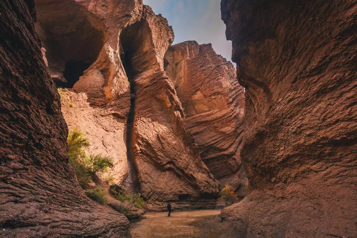
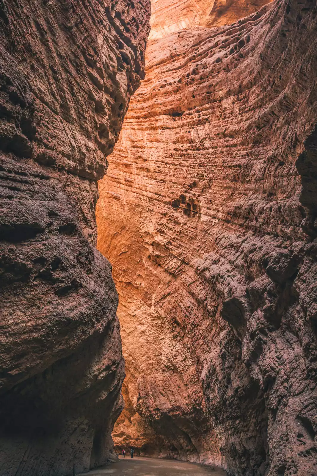
★Kuqa Tianshan Grand Canyon★
The mysterious Kuqa Tianshan Grand Canyon, a canyon on the southern side of the Tianshan Mountains, was formed from reddish-brown rock through eons of wind and rain erosion. Its winding paths lead to secluded caves and hidden gems, with peaks reaching the sky. The light filtering down from the canyon's summit creates a rich play of light and shadow, enough to captivate any photographer. It's known as the "Antelope Valley of Xinjiang."

Tips:
1. The light is strongest at noon, and can penetrate deep into the canyon. This is the best time to shoot. The canyon is relatively tall, so wide-angle shooting is preferred.
2. The tour route is at the bottom of the Grand Canyon. If it rains or is windy, the scenic area will be closed to avoid accidents caused by falling rocks.
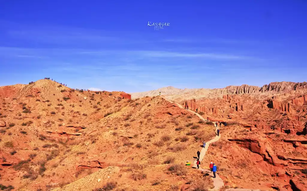
★Wensu Grand Canyon★
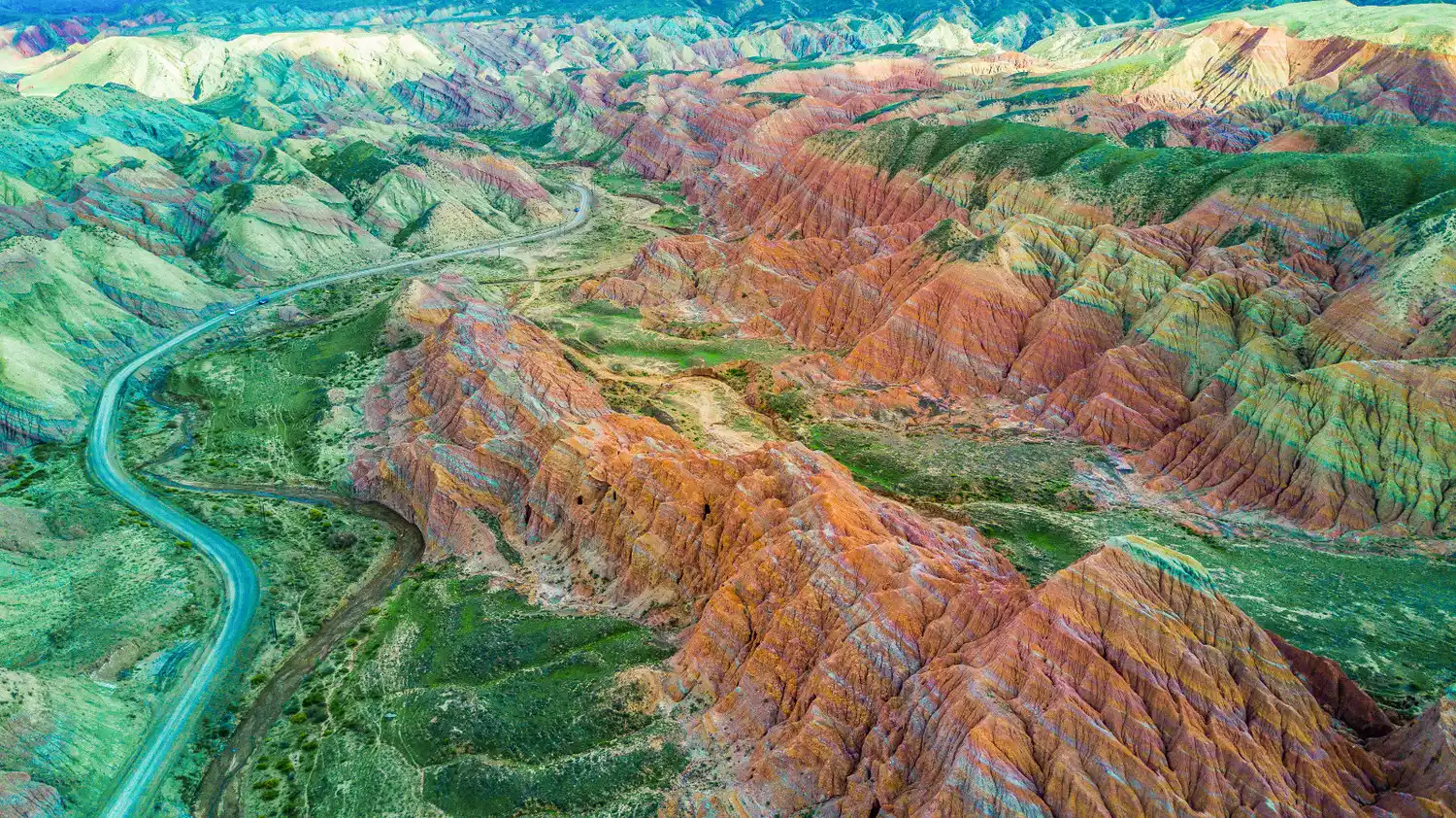
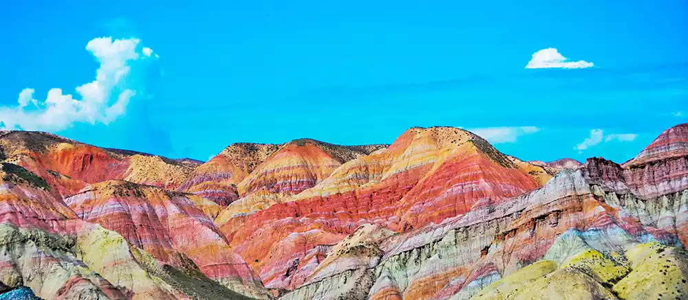
The Wensu Tuomur Grand Canyon, also known as the Tomur Peak Magical Grand Canyon, boasts unique salt rock karst, Danxia, yardang, and sub-yardang landforms. It was once a necessary passage to the North and South Tianshan Mountains, along the Muzhat Ancient Road.
The canyon's rock formations are clearly defined, with folds formed by compression and erosion over millions of years, creating a unique landscape of towering cliffs, towering peaks, and jagged, bizarre, and vibrant colors. Wander through the spectacular canyon, marvel at the wonders of nature, and ascend to a vantage point overlooking the city of mountains. On clear days, you can even see Tomur Peak, the highest peak in the Tianshan Mountains.
{/tips}
1. The roads in the Grand Canyon are very primitive, with no cement pavement. You need to take a local minibus or off-road vehicle to enter.
2. There is a short hike in the scenic area, which is not very strenuous. You can overlook the Grand Canyon and admire the Tuomur Peak in the distance.
{/tips}
★101 Danxia Highway★
The 101 Danxia Highway, also known as the National Defense Highway, is a section of the Tianshan Mountains highway built in the 1960s to prepare for war and famine and prevent a Soviet attack. The scenic route, with distinct layers of scenery along both sides, is an excellent route for photography, exploration, hiking, and painting.
Although it is not called a canyon, the Danxia landforms on both sides of Highway 101 are sometimes stacked and sometimes tightly arranged. The grasslands, Danxia, and blue lakes are distributed, which is better than the canyon scenery.
{/tips}
Highway 101 starts from Urumqi's Sulfur Valley in the east and ends at Kuitun's Lujiaowan in the west. It is 400 kilometers long and takes two days to drive. You can choose one of the highlights to cross.
The 101 Danxia Highway is in poor condition and is rarely known. Currently, it can only be accessed by off-road vehicle.
{/tips}
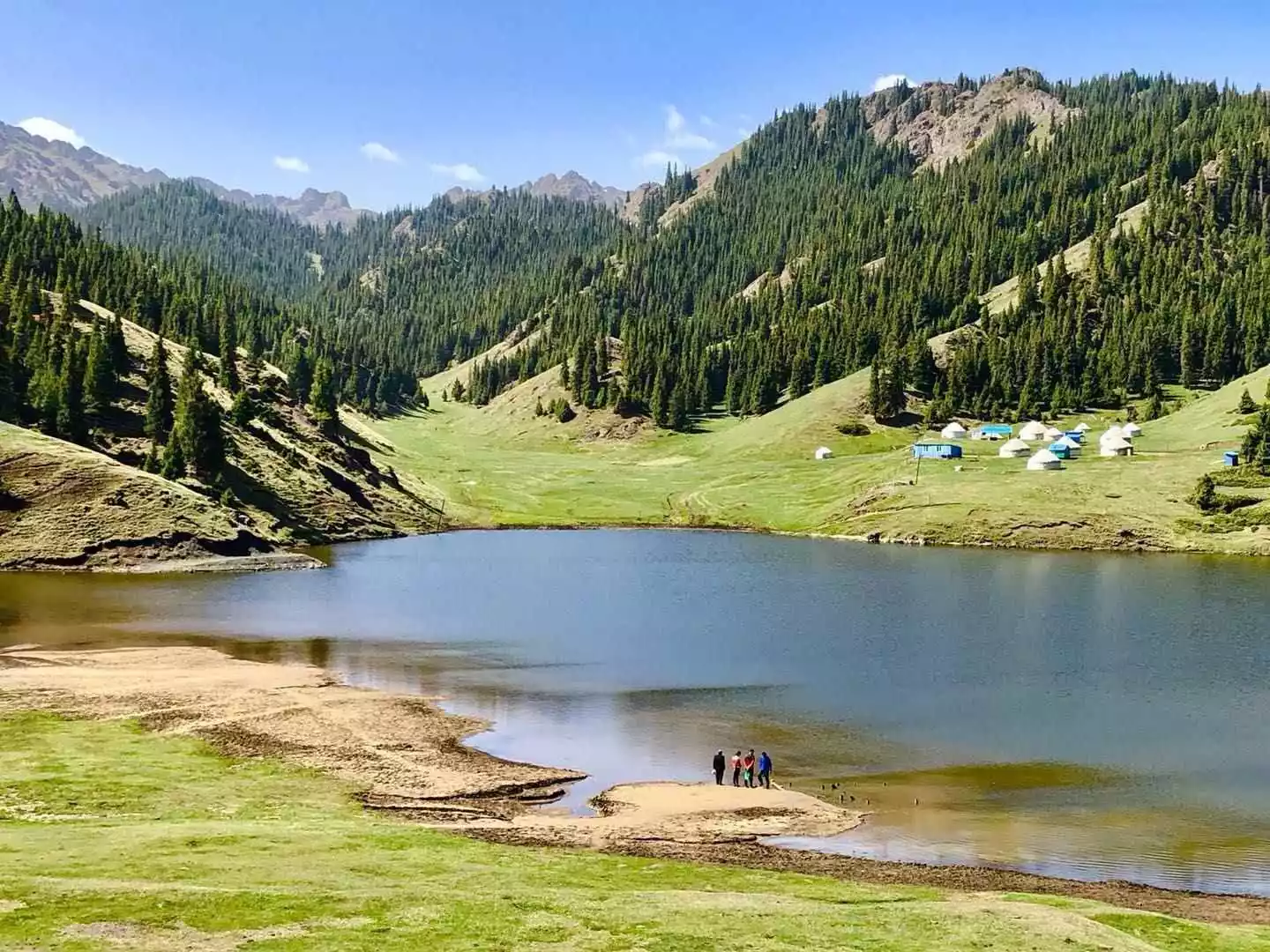
★Urumqi Tianshan Grand Canyon★
The Urumqi Tianshan Grand Canyon, also known as the Kezilya Grand Canyon, is located 48 kilometers from Urumqi County in the Xinjiang Uyghur Autonomous Region. Surrounded by mountains on three sides, with an average elevation of 2,020 meters, it
boasts the most intact and scenically valuable pristine snow spruce forest on the northern slopes of the Tianshan Mountains. A National AAAAA-level scenic spot and National Forest Park, the canyon is a popular destination for its unique pines, grotesque rocks, and sea of clouds. As a living museum of nomadic culture that predates agricultural civilization, it holds immense value for tourism, scientific exploration, and historical and cultural exploration. The canyon is home to numerous Kazakh herders' yurts, offering a wide variety of local specialties, including mutton, offering a truly relaxing experience amidst the natural beauty of the mountains and waters.
Tips:
Tianshan Grand Canyon Scenic Area was commercially developed earlier and is a scenic area that prefers traditional tourism.
There are relatively few shuttle buses within the scenic area, especially when going to Swan Lake, the journey is long and you need to wait for a long time
The scenic spot is named Tianshan Grand Canyon, and many people mistake it for the Tianshan Grand Canyon in Kuche. The landscapes of the two are completely different.
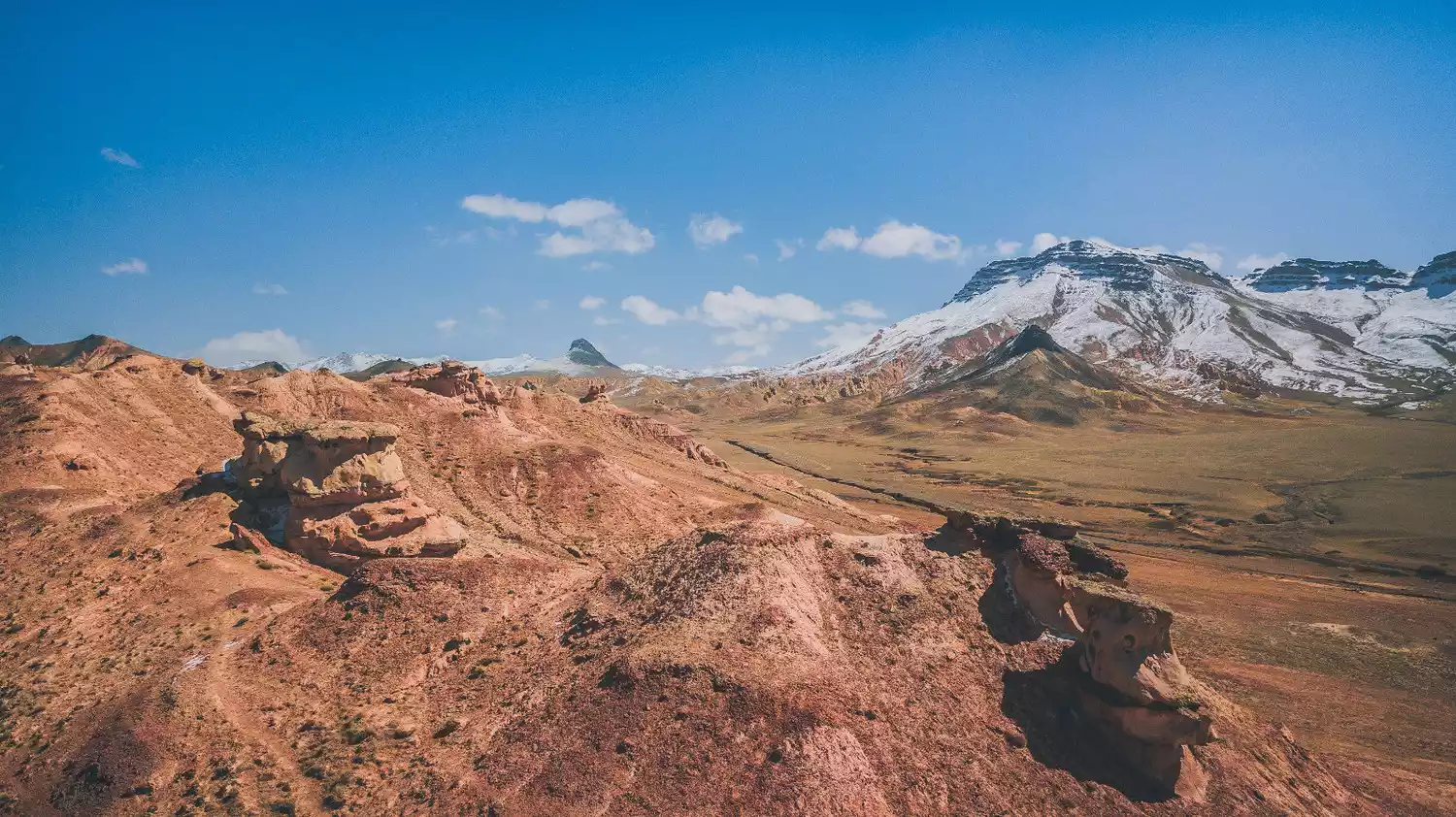
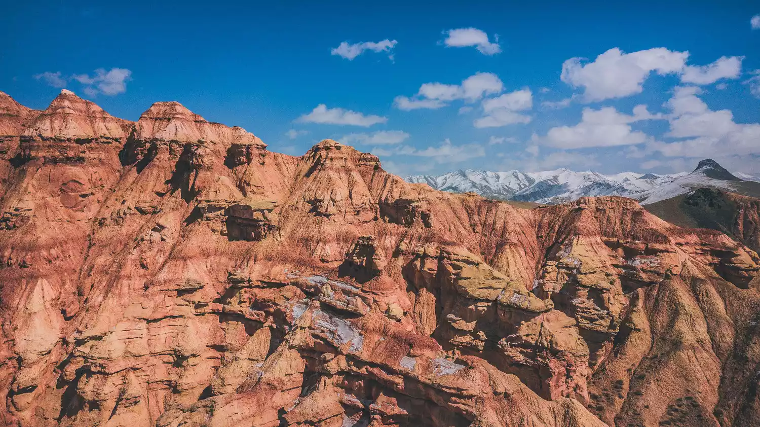
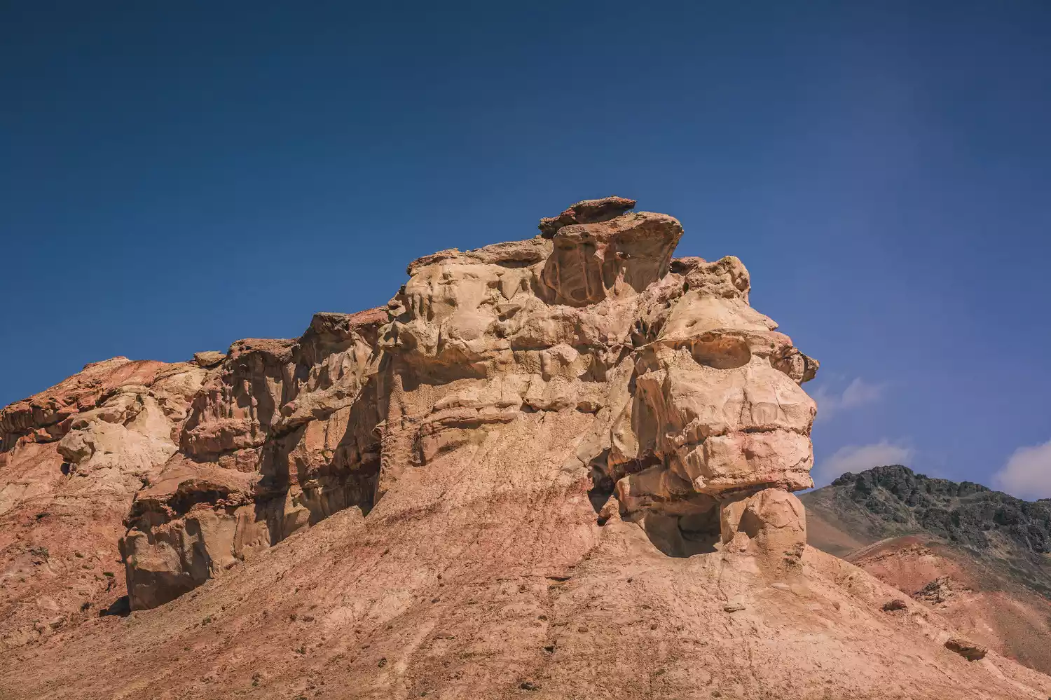
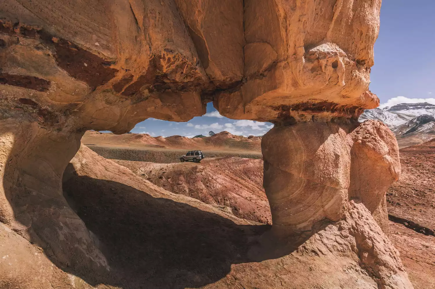
★Red Valley★
The Red Valley, located on the border between China and Kyrgyzstan, features a wondrous blend of Danxia landforms, snow-capped mountains, and grasslands, shaped by weathering into a diverse array of forms. These include "Skull Mountain," which resembles a skull, "Hat Mountain," shaped like a magic hat, and various red weathered rocks. Off-road vehicles can navigate this terrain, allowing visitors to explore the Danxia Valley, ascend to its summit, and marvel at the wonders of nature.
Tips:
Hongshan Valley is a border area and requires a border pass from Kezhou, which has many restrictions.
Red Valley requires driving a wild road. It is one of the earliest routes developed by China-TravelNote. It is recommended not to drive there blindly. It is more reliable to follow a local experienced driver.
Xinjiang Route Special
Xinjiang's magical geographical features have given birth to a rich canyon landscape. China-TravelNote has been committed to developing the most beautiful routes and the latest ways to play.
Welcome to check out Xinjiang special topic to learn more routes