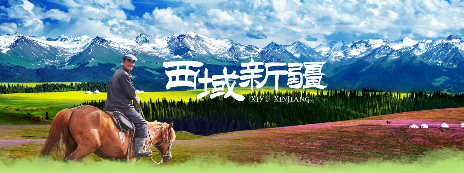
Xinjiang Yizhao Highway travel guide, a scenic highway comparable to the Duku Highway after opening to traffic
Preface
Xiaoduku-Yizhao Highway
In Xinjiang, there is a highway that is only open to traffic for four months a year. Although it is not as well-known as the famous Duku Highway, it has the same scenic beauty as the Duku Highway. It is winding and steep, with beautiful scenery that can be fully enjoyed in one day. This is the Yizhao Highway.
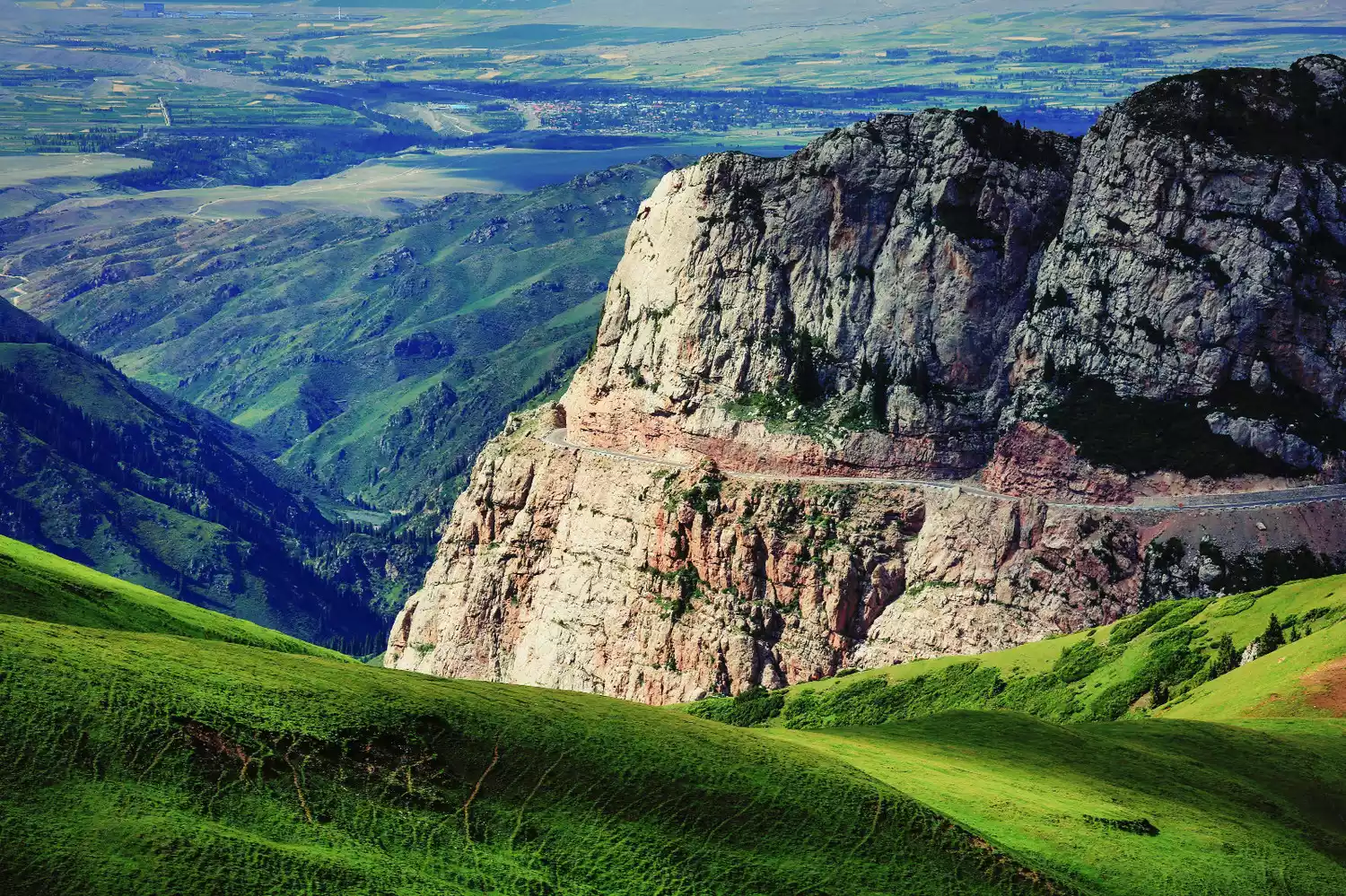
Image from: Photography Network - Solo Dance on the Needle
Map: Xuanzi
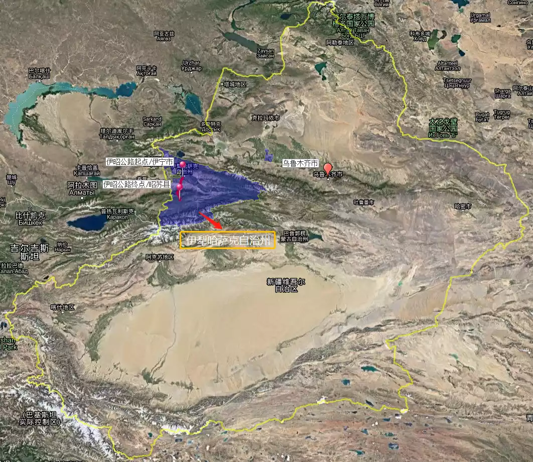
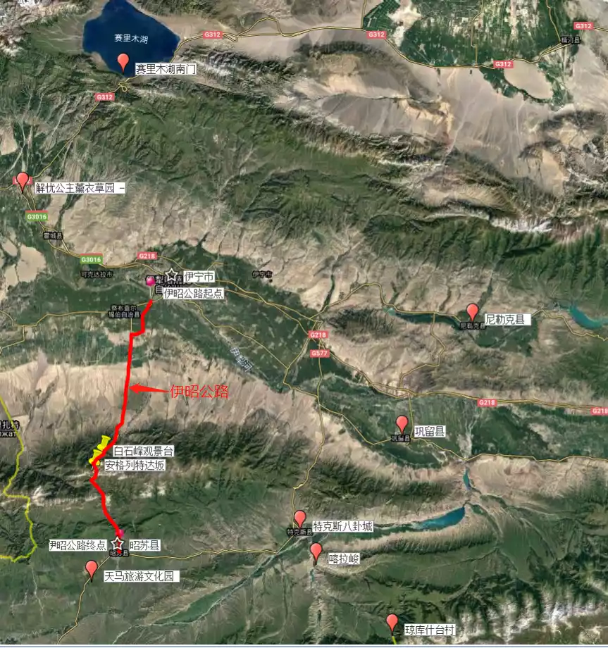
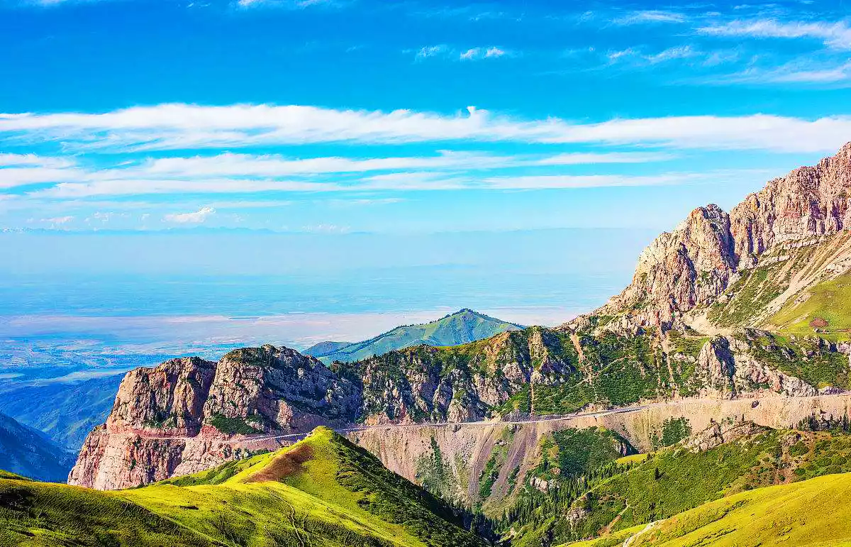
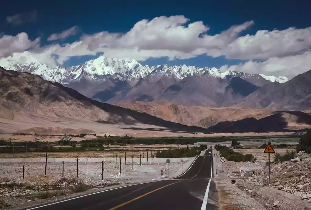
The Yizhao Highway, part of the ancient Silk Road's "Gongyue Road," passes through Yining, Chabuchaer County, and Zhaosu, covering a total of 150 kilometers. Along the way, it crosses the Anglete Pass (approximately 3,100 meters above sea level) on the Wusun Mountains, primarily a winding mountain road. The road is steep, with many turns and steep paths, flanked by cliffs and deep ravines. Driving on the Yizhao Highway feels like traveling above the clouds. On the Yizhao Highway, you'll experience the meaning of "seeing four seasons in one day, and experiencing a different sky every ten miles."
Map: Xuanzi
Originally, to get from Yining to Zhaosu, one had to go around Tekes. After the construction of the Yining-Zhaosu Highway, Yining can go directly to Zhaosu, saving 70 kilometers!
Not only that, the vertical distribution spectrum along the Yizhao Highway includes high mountains, meadows, snow-capped peaks, fir forests, Gobi Desert, and sea of flowers. If you are lucky enough to arrive in midsummer, the rape flowers will bloom all over the mountains and fields, and the beauty of the Zhaosu Plateau will continue.
Traffic precautions
1. Opening hours: Open to traffic only from June to October each year.
2. Traffic control: Only vehicles with 7 seats or less are allowed to pass.
3. The Yizhao Highway has many bends and steep roads with complex road conditions, so it is best to use an off-road vehicle and an experienced driver.
4. As there are no street lights on mountain roads, the critical period for the Yizhao Highway is from 22:00 to 7:00 Beijing time every day, and no vehicles are allowed to pass during this period.
Scenery along the Yizhao Highway
Angelet Pass
At an altitude of about 3,000 meters, there are vast mountain pastures. As far as the eye can see, the distant mountains are connected, and the vast mountains are covered with dense forests. In the near distance, the grasslands are interspersed with forested valleys, cattle and sheep are everywhere, and yurts are dotted among them, creating a pastoral scenery.
Standing on the Daban Pass, you can overlook the panoramic view of Qiongbola Forest Park to the north. In summer, there is still snow on the Daban Pass. The mountain walls on both sides are steep, and driving on the mountain walls is particularly thrilling if it is your first time to walk on this mountain road.
(The picture is from the Internet and cannot be traced. If it infringes, it will be deleted)
White Rock Peak Observation Deck
Baishi Peak, located south of Chabuchaer County, is composed of Carboniferous limestone, giving it a grayish-white appearance from a distance, hence the name. It's the steepest section of the route, surrounded by steep cliffs on all sides, with the northern slope being the steepest. The summit is relatively open. The parking area at the observation deck isn't very spacious, but the view is excellent, offering a panoramic view of the Wusu Mountains and forests.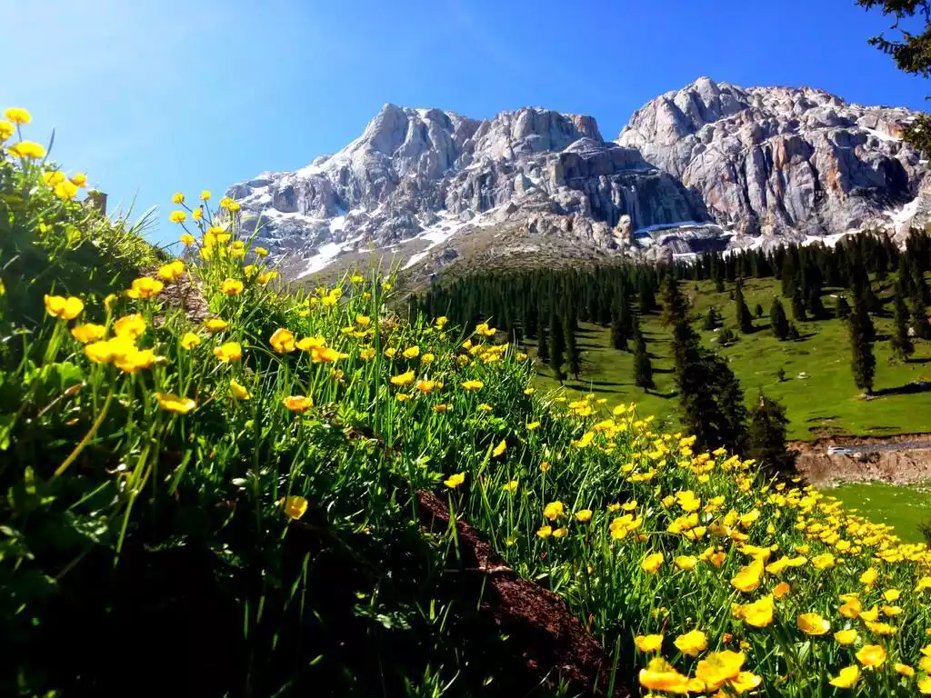
Image from: Mobei Youyou-Northern Mountain Goat
Wusun Mountain
The western side of the Wusun Mountains transitions from low hills at 1,100 meters to high and mid-mountains at 3,000 meters. The terrain is complex, home to abundant virgin forests and numerous rare plants and animals. Parts of this area have been designated as national parks. In Kazakh, this area is called "Jeledsay," meaning "where the cool breeze blows."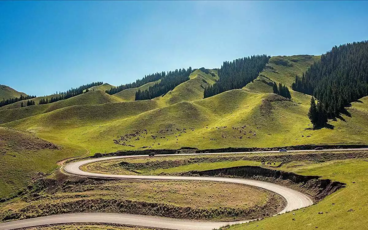
(The picture is from the Internet and cannot be traced. If it infringes, it will be deleted)
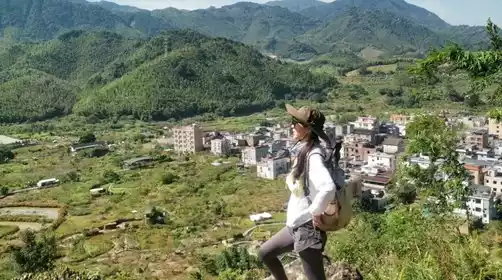
Chabuchaer County
Chabuchaer Xibe Autonomous County, the only Xibe autonomous county in China, is home to 20,000 Xibe people. It is the county where Xibe culture is most fully preserved, concentrated, and representative. The Xibe are an ancient ethnic group with a rich history among my country's ethnic minorities, renowned for their bravery.
After migrating to Xinjiang, they fought bravely, quelled civil unrest, resisted foreign aggression, and made contributions to defending the border. The Xibe people are good at archery and were once called the "Arrow Tribe". Today, archery has become one of their sports.
(The picture is from the Internet and cannot be traced. If it infringes, it will be deleted)
Self-driving? Or chartering a car?
With the development of the automobile industry and the improvement of economic conditions, more and more people are driving themselves, and many people dream of taking a self-driving trip to Xinjiang.
However, Xinjiang is really not suitable for self-driving!
First of all, the distance is long. Driving more than 400 kilometers a day is not something every driver can handle. After driving, you will not have the energy to play.
Secondly, if you are not familiar with the road conditions, there are mobile speed cameras and many speed limits, it is easy to drive the wrong way. Some drivers have lost more than 30 points on a single trip, which is not worth it.
Finally, the road conditions in Xinjiang are complicated, with many winding mountain roads, especially the Yizhao Highway and the Duku Highway. These mountain roads have many climbs, sharp bends, and sometimes cross the snow line, which is very unsafe for many drivers.
Image from: Leading Cavalry
If you need to charter a car and a driver in Xinjiang, you can also choose China-TravelNote's charter service, where a local reliable driver will take you around Xinjiang.
Starting point and end point of Yizhao Highway
Yining
The prefecture-level administrative capital of Ili Autonomous Prefecture, located in the northwestern border of Xinjiang, China, lies in the center of the Ili River Valley Basin. It was selected by Southern People Weekly as one of China's ten most livable small and medium-sized cities.
Yining Transportation
Transportation is convenient. Airplanes, trains, and passenger transport are all readily available. The airport offers numerous direct flights. The railway station is the largest on the Jingyihuo Railway Line and the second-largest in Xinjiang after its completion. There are also several large passenger terminals in the city.
Yining Food
Han Street (Xinhua East Road): "There are no Han people on Han Street," yet it's bustling with traffic and thriving commerce. It offers authentic Xinjiang flavor and is a gathering place for the elderly Ili people, who often call it "Daqiao" or "Daqiao Banzi."
Kazanqi Folk Tourism Area
The Kazanqi Folk Customs Tourism Area in Yining City is the only large-scale, pristine cultural tourist area in northern Xinjiang that focuses on Uyghur customs. It serves as a showcase for Ili's urban image and a vivid reflection of its ethnic customs. It encompasses the rich Uyghur culture of southern Xinjiang while retaining the unique folkways and customs of northern Xinjiang, creating a cheerful, vibrant, yet solemn experience.
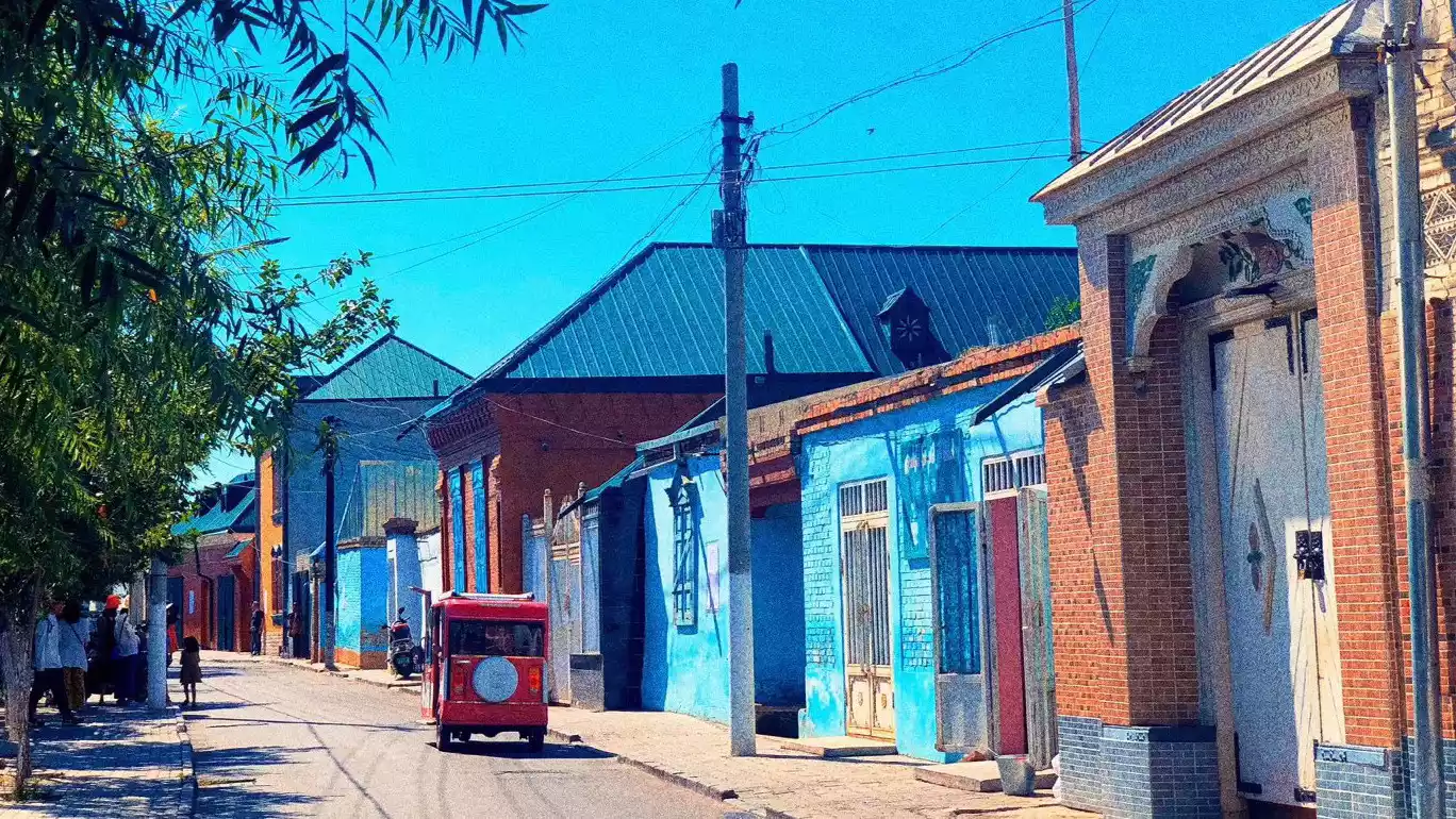
Image from: Team Leader Zhenmei
Tips:
Opening hours: Open all year round
Ticket price: If you only want to stroll around the Folk Custom Park, it is free. However, if you want to visit ethnic minority families, eat free fruit and ice cream, and ride a horse carriage, you will need to pay a 150 yuan attraction fee.
Sayram Lake
Xinjiang's highest, largest and most beautiful alpine lake is also the last place visited by the warm and humid air currents from the Atlantic Ocean, so it is called "the last tear of the Atlantic Ocean."
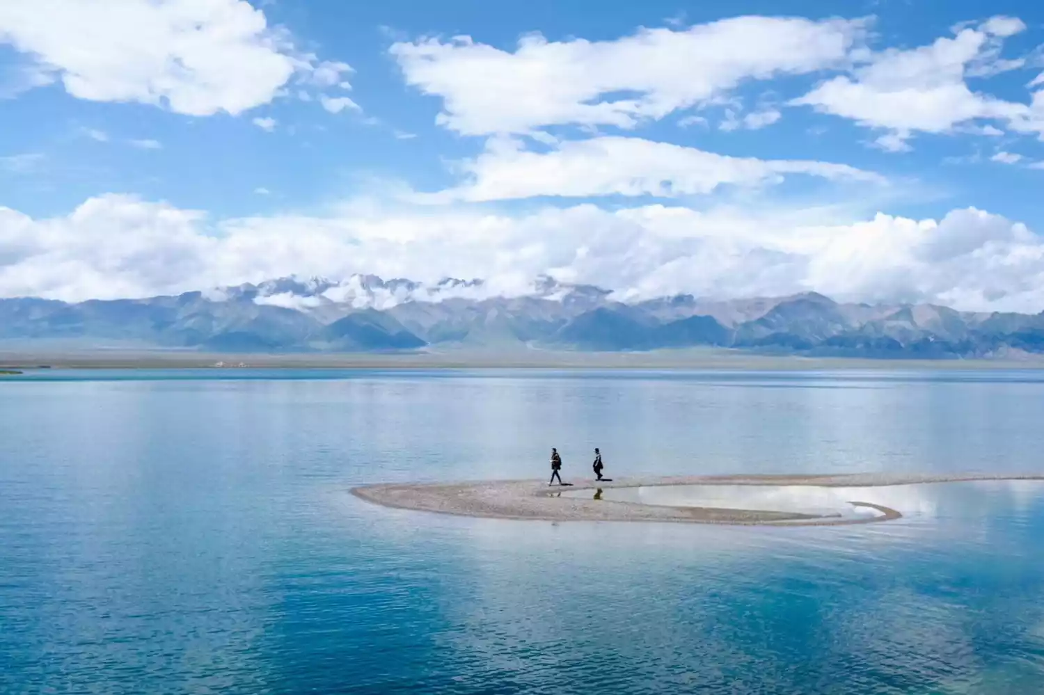
Image from: China-TravelNote Tour Leader
Detailed guide to Sayram Lake: https://www.youxiake.com/gonglue/view?id=4233
★ Zhaosu ★
Zhaosu County, home to the ancient Wusun Kingdom during the Han Dynasty, is home to the world-famous Ferghana horses. Five horse breeds are now native to Zhaosu County: Ili, English Thoroughbred, Kyrgyz, Ardennes, and German Warmblood, with over 60,000 Ili horses in the county.
Zhaosu Transportation
Zhaosu's long-distance bus station offers direct connections to Gongliu, Tekes, Urumqi, Yining, and Xinyuan. The airport is under construction in 2019.
Zhaosu Western Region Tianma Cultural Park
It is currently the best and most standardized international grassland ecological racecourse in Xinjiang, and a popular destination for tourists from both within and outside Xinjiang to enjoy grassland sightseeing, experience folk customs, and ride horses. Tianma Cultural Park is an ideal venue for professional equestrian sports, training, and competitions, and is also an ideal choice for experiencing equine culture and relaxing vacations.
Tips:
Tianma Cultural Park ticket price: 40 yuan/person
Scenic area opening hours: 09:00-17:00
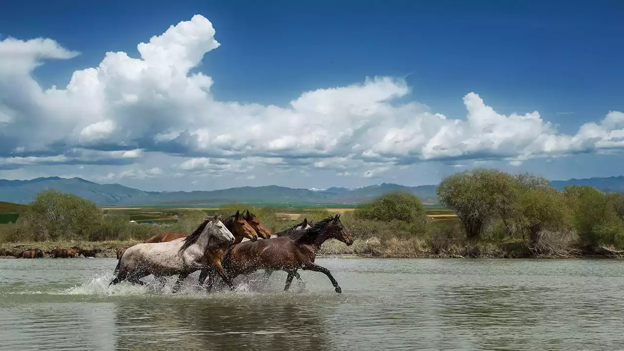
Image from: Photographer Lao Bing Bu You
Shatta Trail
The Xiata Ancient Road is a dangerous and strategic route on the ancient Silk Road. Due to the complex terrain, high mountains, rapids and glaciers in the canyon, crossing this canyon is very dangerous and challenging. It is called the "Xuanzang Road" in the outdoor community. It is 120 kilometers long and is a shortcut from Yili to southern Xinjiang.
Adult tickets are 60 yuan and zone tickets are 40 yuan.
Image from: China-TravelNote Tour Leader
Flower sea and countryside
Because Zhaosu grassland has a vast terrain and the climate is more suitable for growing crops such as rapeseed and sunflower, the endless sunflowers, rapeseed flowers and sage have become a beautiful scenery in Zhaosu.
From mid-June to late July, rapeseed flowers and perilla are more abundant
There are more sunflowers from mid-July to mid-August
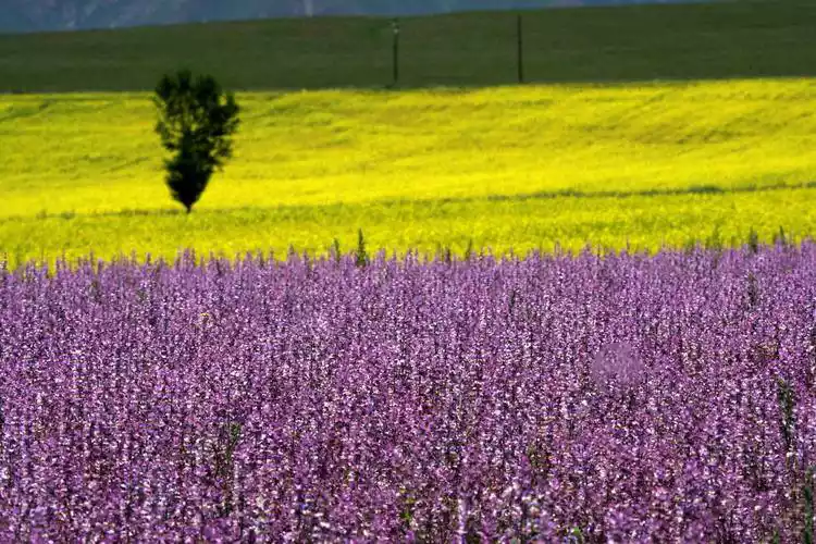
Image from: Yuyang
Other highways in Xinjiang
Duku Highway
The Duku Highway, the 561-kilometer section of National Highway 217 from Dushanzi to Kuche, was selected by China National Geographic as the "Scenic Avenue Running Through the Spine of the Tianshan Mountains" because more than half of its route traverses towering mountains and traverses deep valleys, connecting numerous ethnic minority communities.
The Duku Highway has a special terrain with many sharp turns and steep slopes. More than 280 kilometers of the highway are above 2,000 meters above sea level. Affected by natural factors such as winter snowfall and ice in the Tianshan Mountains, it is only open for five months a year. From the end of September to May of the following year, winter traffic control will be implemented for up to seven months.
Duku North Section: Dushanzi-Qiorma-Nalati, about 250km
Traffic time: early June to late September and early October, with many restrictions and detours required
Vehicle restrictions: Passenger cars with 7 seats or less are allowed
Middle section of Duku: Narat-Bayinbuluke, about 60 km
Opening time: late May to early June to early October, the probability of road closure is relatively low
Vehicle restrictions: Currently, large buses are allowed to pass
Duku South Section: Bayinbuluke-Kuqa, about 250km
Traffic time: early June to mid-to-late October, with almost no traffic restrictions during this period
Vehicle restrictions: From Bayinbuluke to Kuqa: Passenger vehicles with 7 seats or less are allowed.
From Kuqa to Bayinbuluke: Passenger vehicles with 19 seats or less are allowed.

Image source: Vieira
Tarim Desert Highway
It is the world's longest highway built through a shifting desert. There are four Tarim Desert Highways: Luntai County to Minfeng County (522 kilometers), Aral City to Hotan City (424 kilometers), Aral City to Tazhong Town, Qiemo County (136 kilometers), and Yuli County to Qiemo County (333 kilometers).
The desert road section features a pavement structure composed, from top to bottom, of asphalt, asphalt concrete, graded gravel, natural sand, geotextile, and aeolian sand base. For travelers eager to cross the Tarim Desert, the Tarim Desert Highway undoubtedly offers the best conditions. A self-driving journey through the entire desert takes approximately five hours, offering stunning views of the desert landscape and millennia-old poplar trees along the way.
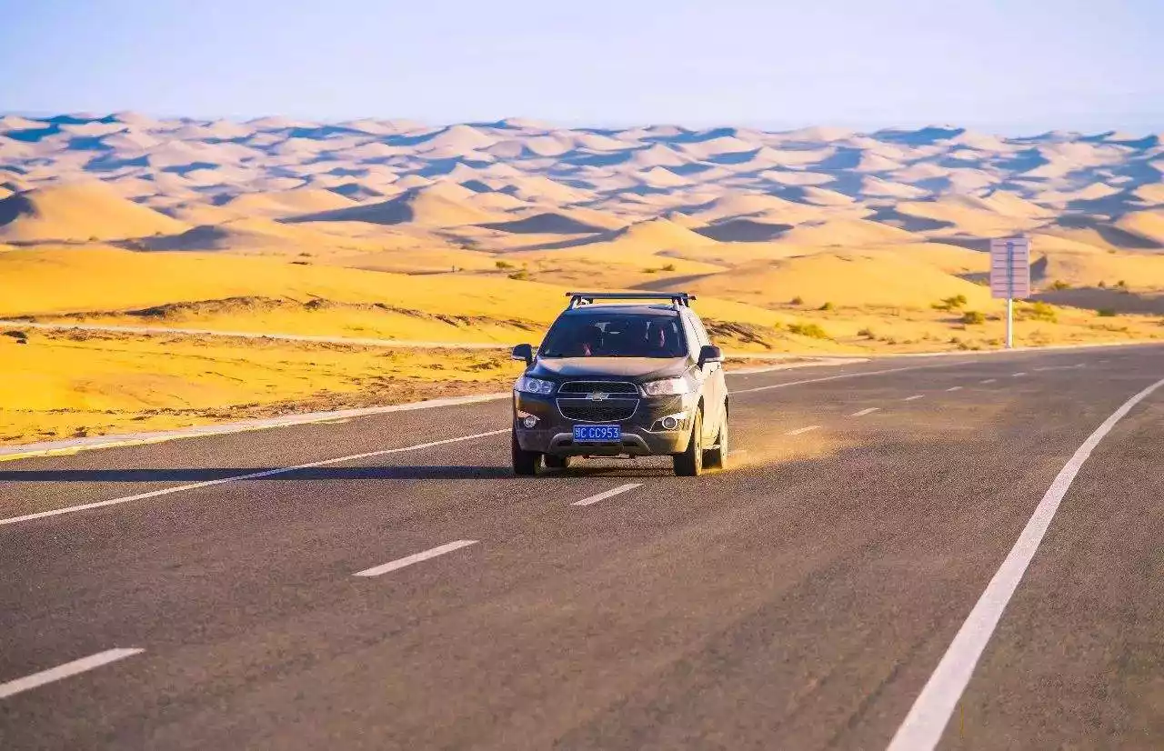
Image from: China Geography Chinese website
Depart from Korla | 9 days and 8 nights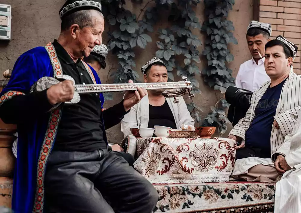
Western Regions and Southern Xinjiang | Culture + Desert + Pamir Scenery, 9-Day Panorama of Southern Xinjiang
¥7280 from 2509 people have registered Register nowKarakoram Highway
The Karakoram Highway, also known as the China-Pakistan Friendship Highway or the Pamir Highway, begins in Kashgar, Xinjiang, China, and traverses the Karakoram Mountains, the Hindu Kush Mountains, and the western section of the Pamir Plateau. The highway's lowest elevation in China is 1,154 meters, while its highest elevation is 4,733 meters. It has been designated one of the "Ten Most Dangerous Roads in the World."
(The picture is from the Internet and cannot be traced. If it infringes, it will be deleted)
Travel Tips
clothing
Xinjiang experiences significant temperature swings between day and night, and strong ultraviolet rays. Therefore, consider windproof, sunscreen, and warmth when choosing clothing. In addition to a summer T-shirt, bring a sun-protective jacket or sun-protective clothing, as well as a windbreaker or fleece jacket for sunrise and sunset activities. The weather on the Yizhao Highway can be highly variable, so pack clothing for all seasons.
shoe
Footwear is crucial when traveling to Xinjiang. While walking isn't a big deal, the temperature fluctuates greatly, so it's best to bring sneakers or outdoor shoes. Waterproof is best. Avoid sandals, high heels, or slippers; comfortable shoes will make the journey much easier.
For photography tours, outdoor shoes are essential. At sunrise and sunset, the grass is covered in dew, and sometimes you'll need to wade through water or shoot near water, so waterproof shoes are essential.
Also, bring a pair of slippers for use at the hotel; your own shoes will be more comfortable.
Skin care products
Essential skin care products include sunscreen or spray, lip cream, hand cream, and hydrating lotion; Xinjiang's climate is very dry, so beauty-conscious tourists can also bring a hydrating mask. Of course, sunglasses and a sun hat are absolutely not to be forgotten.
photographic equipment
It would be a shame to not capture Xinjiang's stunning scenery with a camera. So, be sure to bring a camera, whether it's a compact or DSLR. Standard rooms in hotels throughout the trip are all equipped with charging points, and the yurts also have outlets, but they're limited, so we recommend bringing a small power strip.
Photography tours should definitely bring their own gear: a full-frame camera, three lenses (wide-angle 16-35mm, mid-focus 24-70mm, telephoto 70-200mm), a tripod, a gradient filter, a neutral density filter, a shutter cable, a charger, and memory cards. Flights are prohibited in some areas of Xinjiang, such as Baihaba and Kashgar, so those traveling by plane must be aware of these restrictions to avoid unnecessary trouble.
other
1. Rain gear (it's best to bring a waterproof jacket).
2. A small luggage bag (camera bag) is ideal.
3. Personal toiletries.
4. A thermos (the water in Xinjiang is quite hard, so it's best to drink boiled water at first).
5. Common medications for colds, stomach problems, etc.
Conclusion
On the Yizhao Highway, you'll encounter rocky cliffs and bottomless ravines. You'll also stumble across alpine meadows covered in seas of flowers. The Yizhao Highway is a road you must travel.