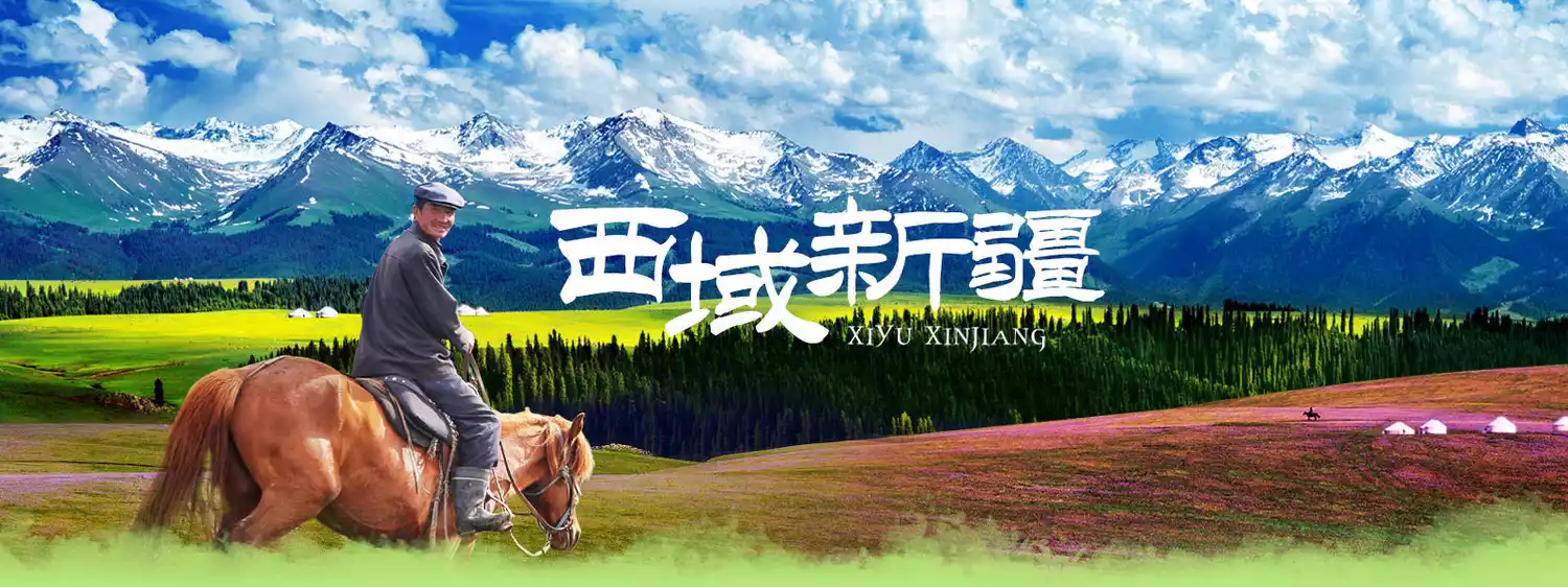
A guide to Xinjiang's secret Tacheng: traverse the millennium pastoral path, explore the border grasslands, and delve into the Gobi Desert
Preface
When Homo sapiens chose to leave Africa, "exploration" was destined to be written into human genes. The desire to explore the unknown has always tempted restless souls. But are there any places that can be called "unknown secrets" today?
Xinjiang boasts just such a place. Imagine galloping through the vast Gobi Desert, discovering the "Dragon Ridge Valley," a landscape even more bizarre than Devil City; venturing deep into the border grasslands, traversing ancient pastoral trails and encountering the migration of cattle and sheep; walking along the Danxia Highway, the "Tianshan Gallery," to explore the eons-old mud volcanoes; or perhaps hiking the ancient "Mengkede" trail, traversing the Tianshan Mountains on foot.
These unknown secret places are all in Tacheng, Xinjiang.

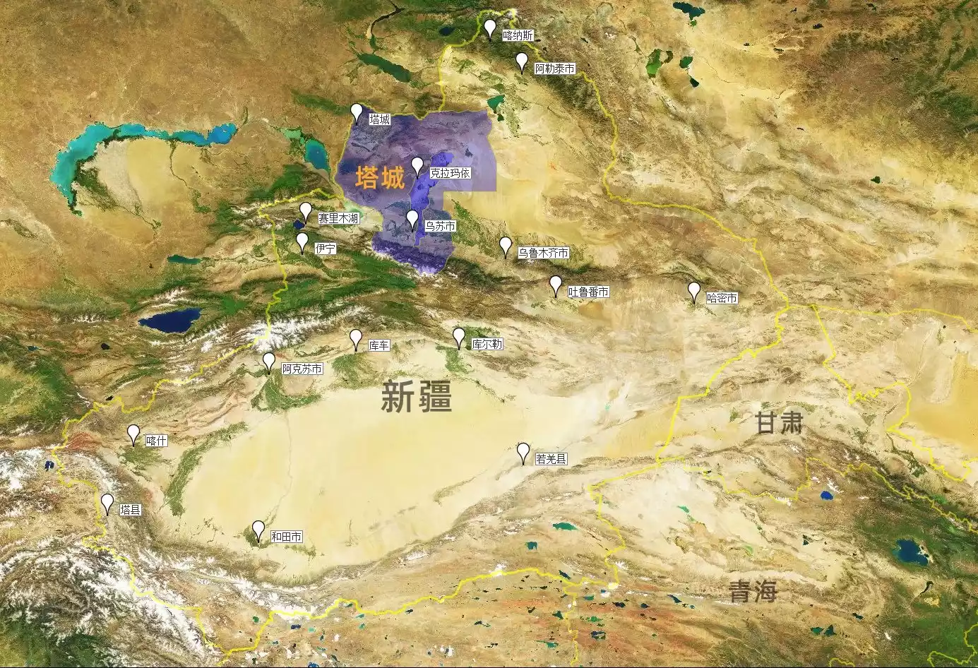
Tacheng, Xinjiang
"Where is Tacheng? What is its relationship with Ta County?"
Probably many people who hear about "Xinjiang Tacheng" for the first time will ask this question.
Graphics by @Fier
Tacheng, Xinjiang, is located in northern Xinjiang, on China's northwestern border, bordering Kazakhstan. It's over 2,000 kilometers away from Tashkurgan County (Taxian County) in Kashgar, southern Xinjiang. Specifically, the recently erupted Hongshan Grand Canyon (also known as the Anjihai Grand Canyon) is located in Tacheng; Wusu City, the birthplace of the "deadly Wusu" (a type of alcoholic beverage), is also in Tacheng; even the oil city of Karamay lies within Tacheng's borders.
Graphics by @Fier
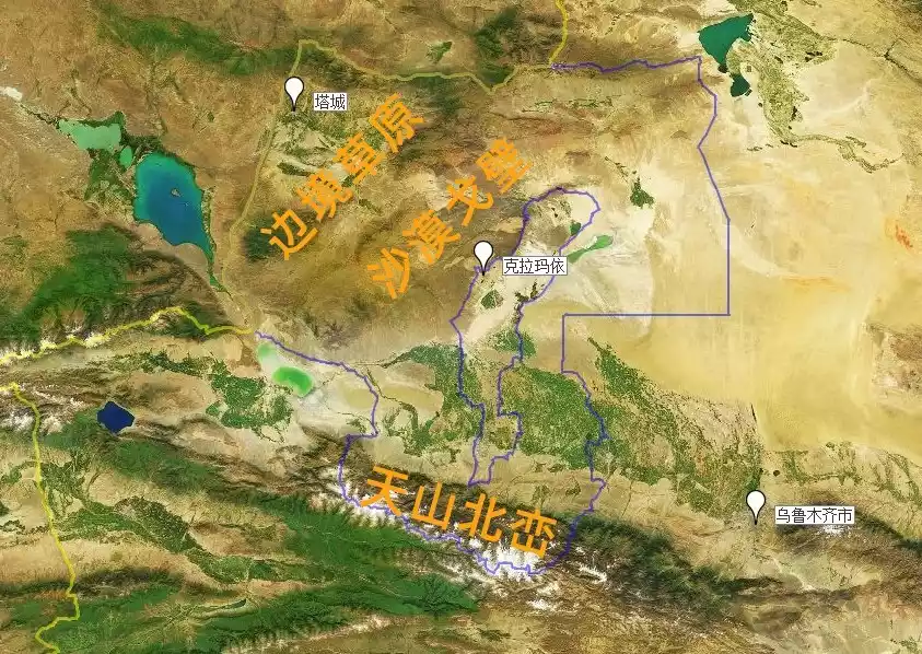
Although Tacheng is not well-known, it almost condenses the terrain of the entire Xinjiang.
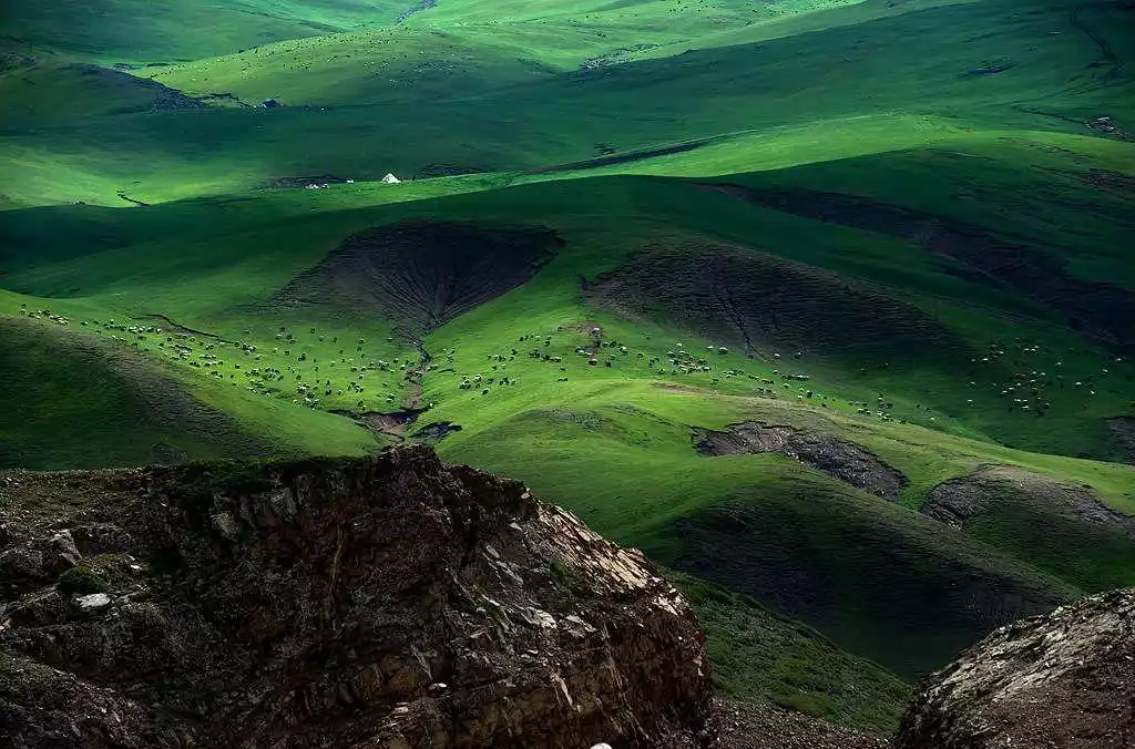
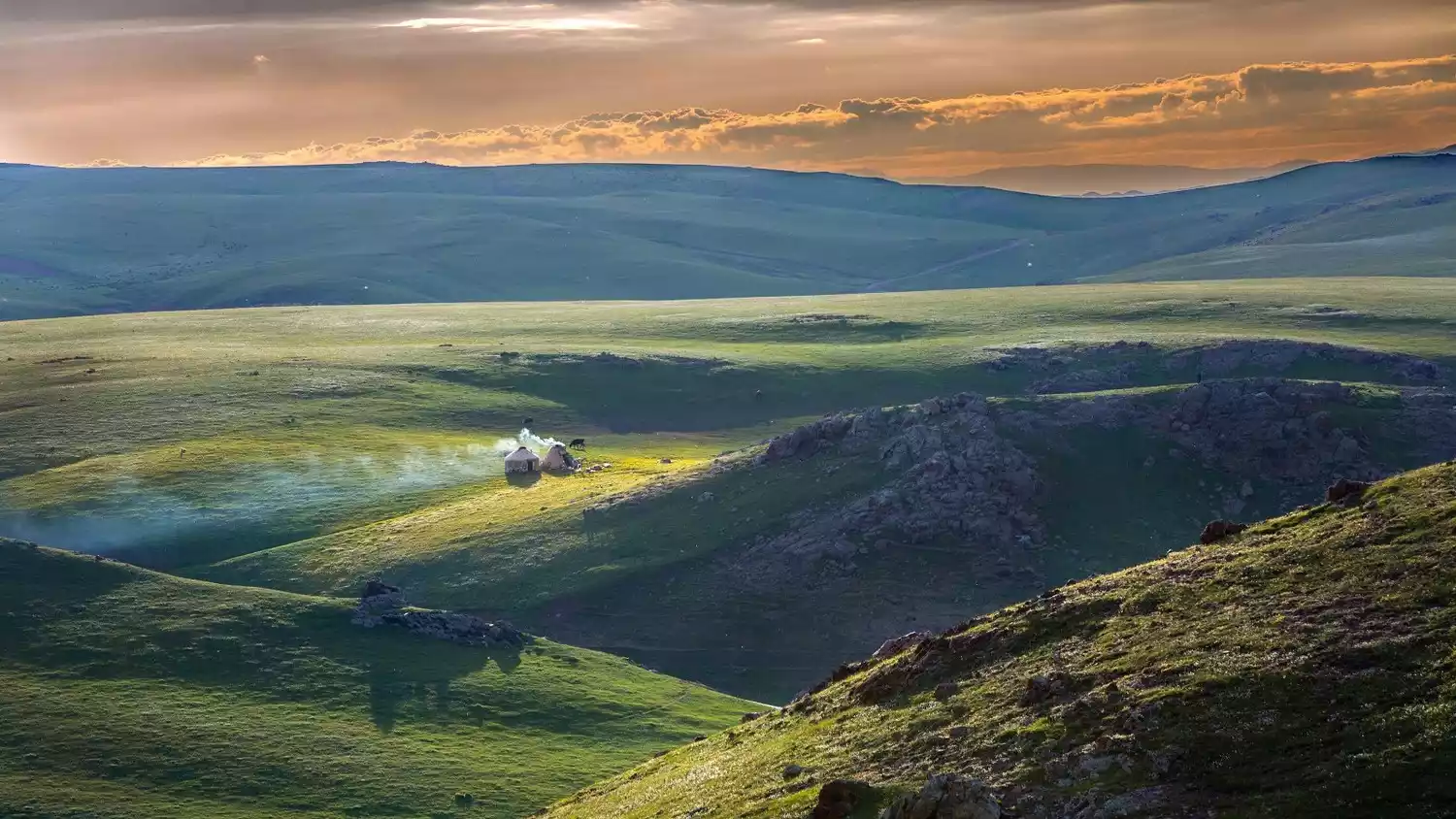
The northern part of the region is comprised of the western Junggar Mountains, a series of discontinuous alpine steppes; the southern part is the forested hills of the northern Tianshan Mountains; and the central and eastern parts comprise the vast desert Gobi of the Junggar Basin. The region boasts a rich landscape of meadows, lakes, snow-capped mountains, Danxia glaciers, deserts, and canyons.
This mysterious border area of Tacheng also hides many rarely visited natural landscapes and beautiful scenery full of pristine ecological temptations, attracting countless restless souls to come and explore!
Central [vast Gobi, uninhabited area]
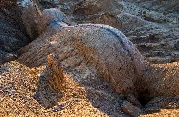
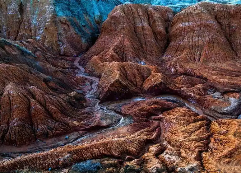
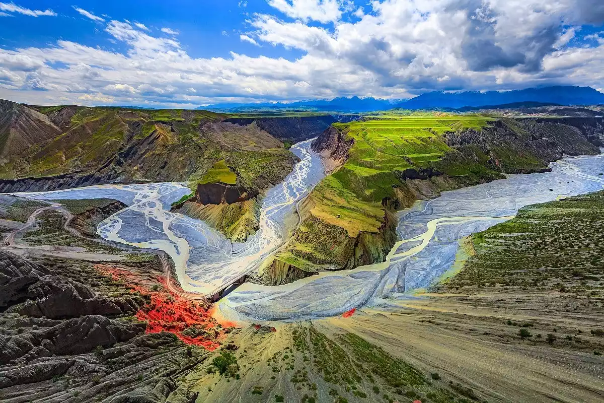
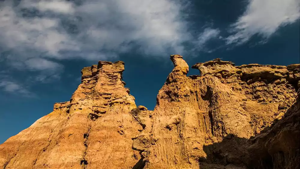
Secret Dragon Ridge Valley
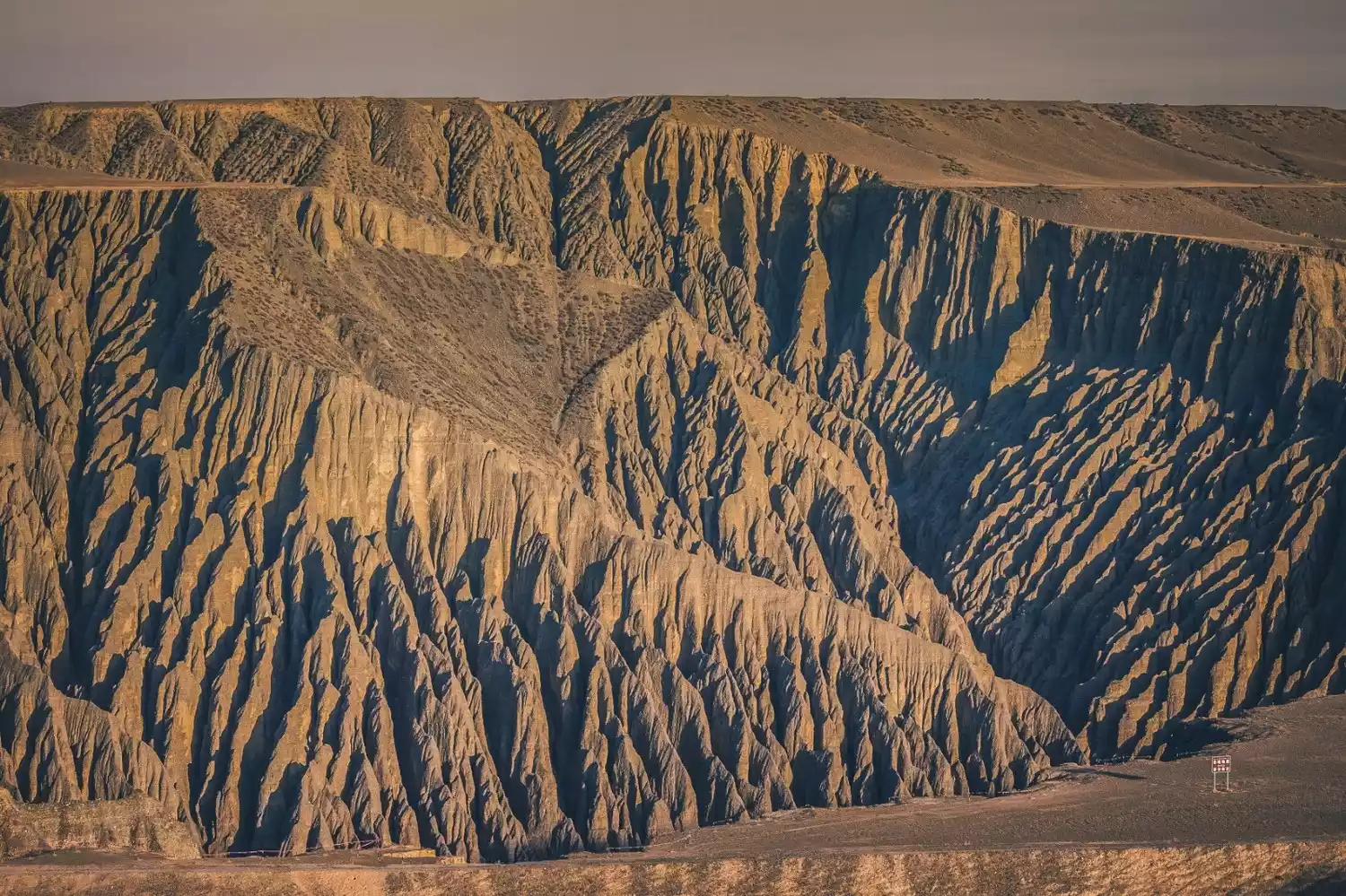
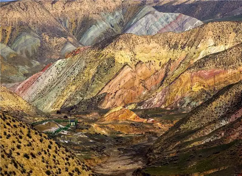
The Junggar Basin is dotted with numerous Yardang landforms, exemplified by the Urho Ghost City and Qitai Ghost City. However, just 50 kilometers northwest of Urho Ghost City, within the boundaries of Tacheng Prefecture and Bukesaier County, lies a lesser-known and unique landform: the Dragon Back Valley.
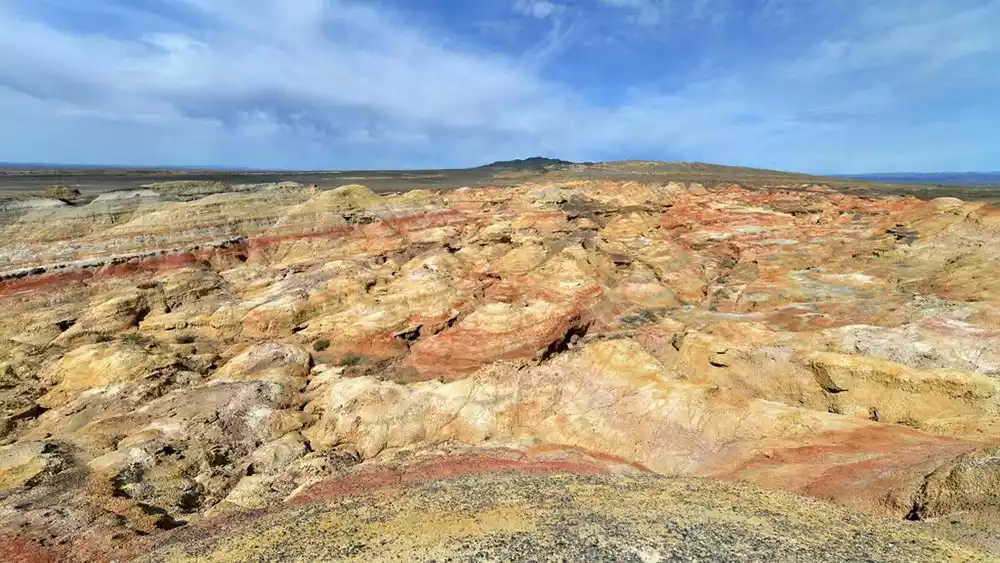
Millions of years of geological evolution, coupled with intermittent water erosion and wind erosion, have formed red sandstone ridges that run parallel to the prevailing winds, alternating in their arrangement. These winding, hundreds of miles long ridges are breathtaking. From a distance, they resemble dragons soaring beneath the earth, with only their backs visible above the vast landscape. National Geographic magazine described the Dragon Back Valley as a "strange dragon" rising from the Junggar Basin. While it resembles a yardang, experts believe it's an even more bizarre desert landscape.
Tips:
There is a road from Provincial Highway S318 to Longji Valley, but it does not reach Karamay. You can only take an off-road vehicle through the Gobi Desert, about 40 km away.
There are no supply points or gas stations on the road.
Northern [Border Grasslands, Millennium Pastoral Road]
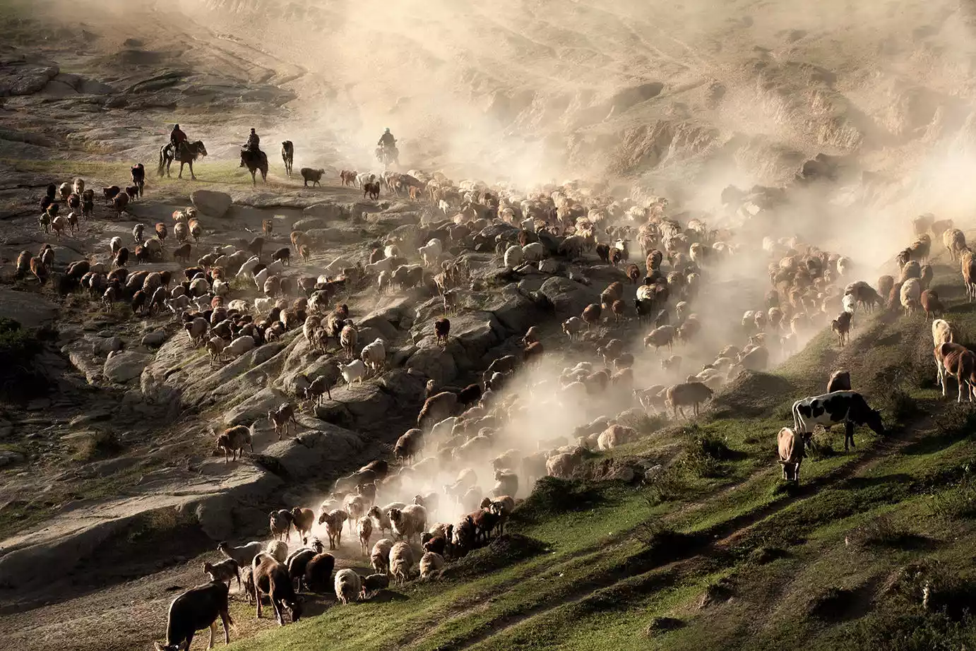
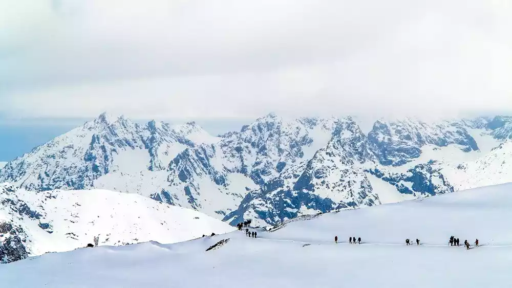
Mengbulak Grassland
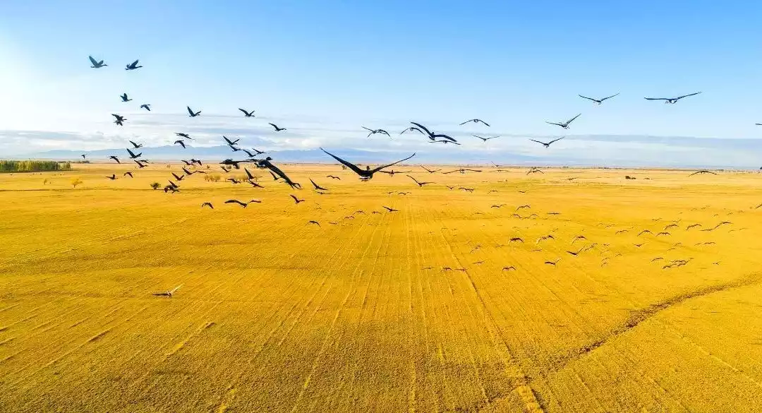
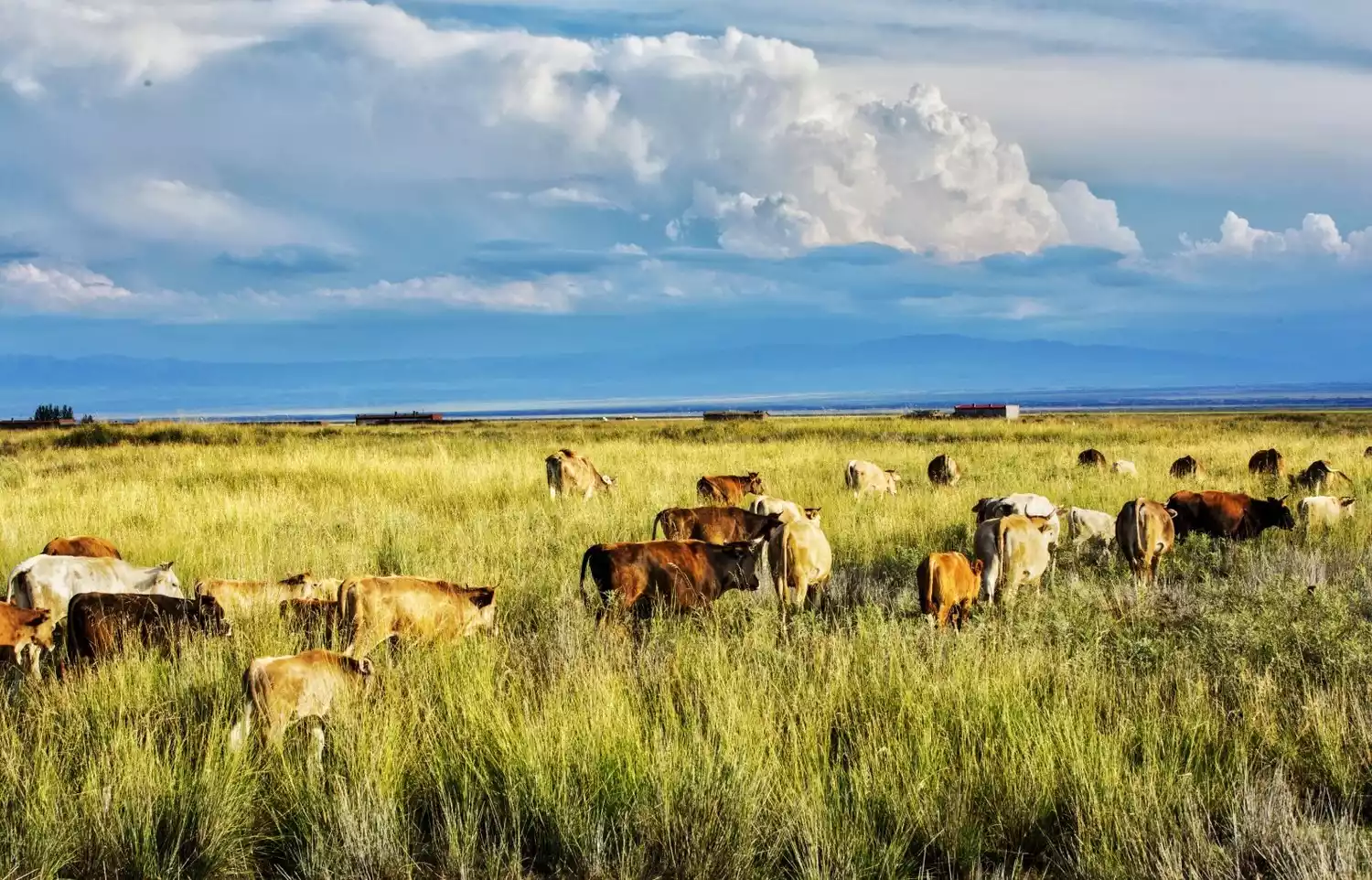
The Mengbulak Grassland is located in Tuomin County, at an altitude of 2,700 meters in the central Wuerkhaxia Mountains. Mengbulak means "a place of a thousand springs" in the Kazakh language. The area is densely packed with springs, whose clear water nourishes the fertile soil and herds of cattle and sheep, making it an excellent summer pasture. Every summer, herders migrate over a million head of livestock here, creating a spectacular spectacle of clouds of dust rising from the narrow, steep pastoral roads.
The gravel road formed by the herdsmen's transition has become the only access to the Mengbulak Grassland. The off-road route through Mengbulak also follows this thousand-year-old pastoral path. Along the way, the grasslands are vast, dotted with yurts, and the cattle and sheep are thriving. As the altitude climbs, the road becomes increasingly rugged, with some sections only wide enough for one vehicle. In the distance, peaks and valleys appear, flanked by forests of bizarre rock formations, making the off-roading experience thrilling and exciting.
Tips:
The temperature in the mountains is relatively low, only around 15°C even in summer, and the top of the mountain is often covered with snow;
The road to Mengbulak is very primitive and can only be accessed by off-road vehicles. It is often blocked by mountain torrents, heavy snow and other conditions, and it is not always possible to pass through.
There are no supply points or gas stations in the mountains, and the winding mountain road consumes more fuel. If you stay overnight, you need to bring your own food, tents, etc.
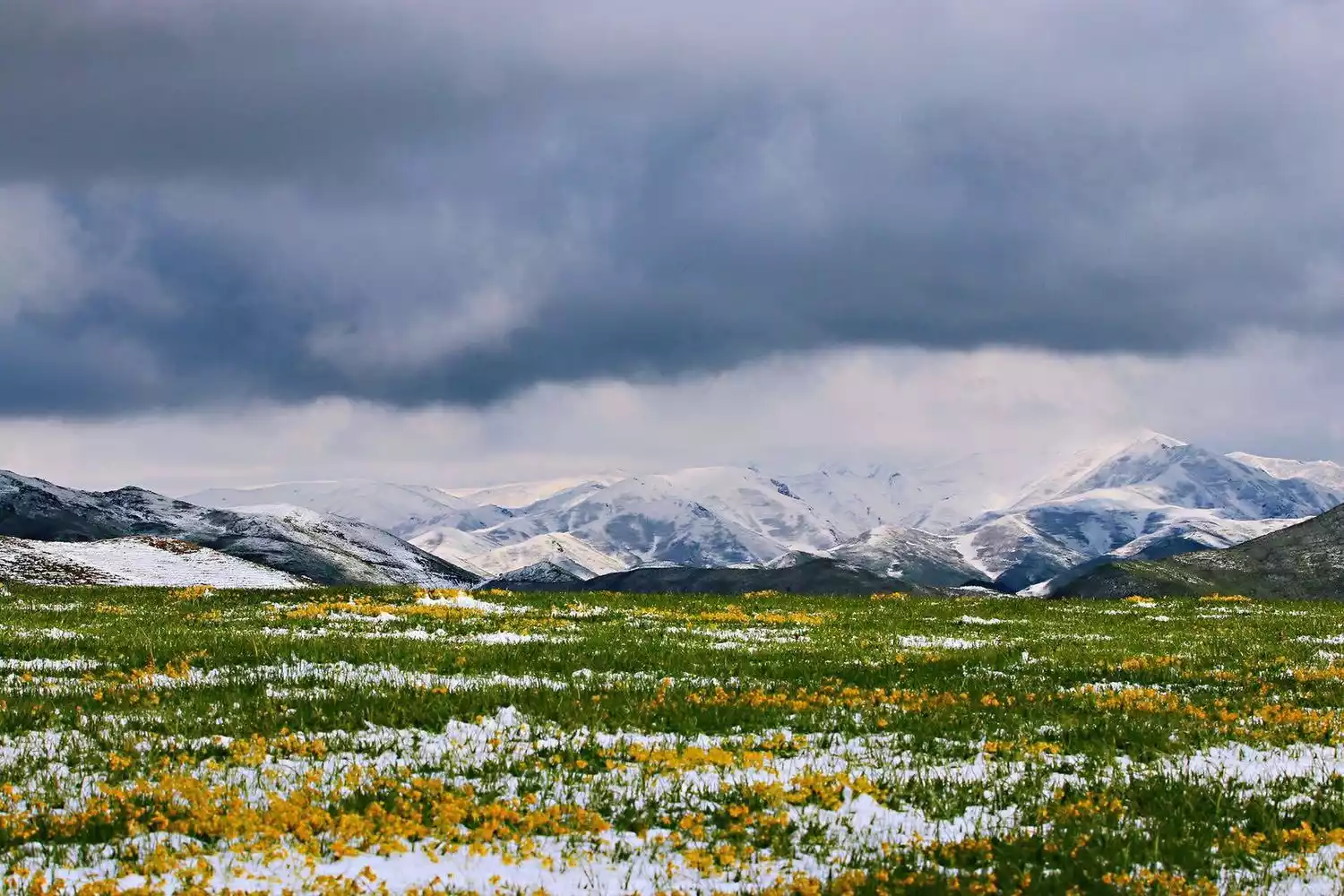
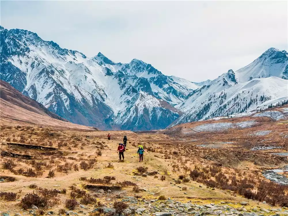
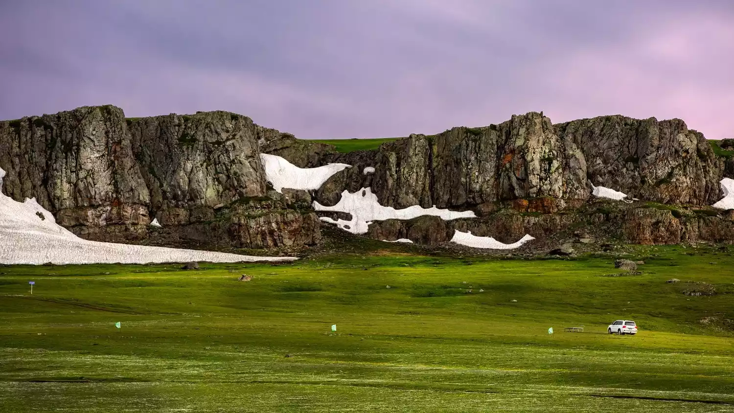
Mount Baluk, Taste River Valley
The Baluruk Mountains, a northern remnant of the Western Tianshan Mountains, stretch from east to west south of Yumin County. Kongtapukan Mountain, its highest peak at 3,252 meters, is perennially covered with snow. Melting snow forms the Tashiti River, nourishing the Turgaliao Grassland and the Peony Valley on the western slopes of the Baluruk Mountains. In May, when mountain blossoms are in full bloom, the annual Yumin Mountain Flower Festival will also begin in the Baluruk Mountains.
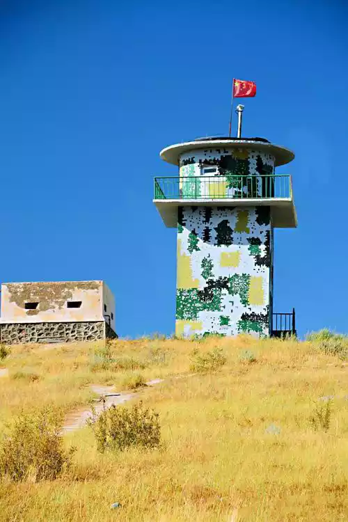
Xiaobaiyang Outpost
Balruk Mountain is also the birthplace of the famous military song "Little Poplar". The prototype of the song, "Little Poplar Outpost", is at the end of the mountain.
In the early 1980s, Chen Fusen, a soldier at the outpost and the mother of a soldier, gave him ten poplar saplings to take back to the outpost and plant. She urged him to take root in the frontier like the poplars and defend the border. Today, the camouflaged outpost tower still stands on the China-Kazakhstan border. The "little poplar" has grown into a towering tree. Mighty border guards patrol with their rifles strapped to their backs, and the five-star red flag flutters high atop the tower.
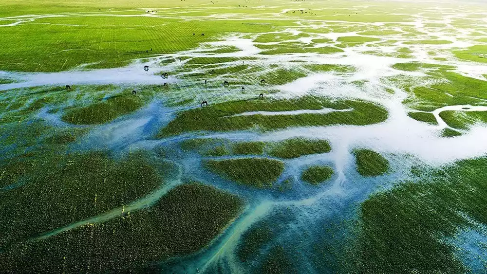
Kurustai Wetland Grassland
The Kurustai Wetland Grassland, located 25 kilometers from Yumin County, is my country's second-largest inland plain grassland. Rich groundwater resources, supplemented by external water sources, create a seasonal wetland covering approximately 600,000 mu (approximately 1,000 acres) from March to June each year. The area boasts lush aquatic plants, dense reeds, chirping birds, and lush fish, creating a picturesque landscape.
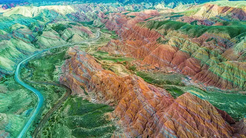
Southern [Tianshan North Ridge, Danxia Highway]
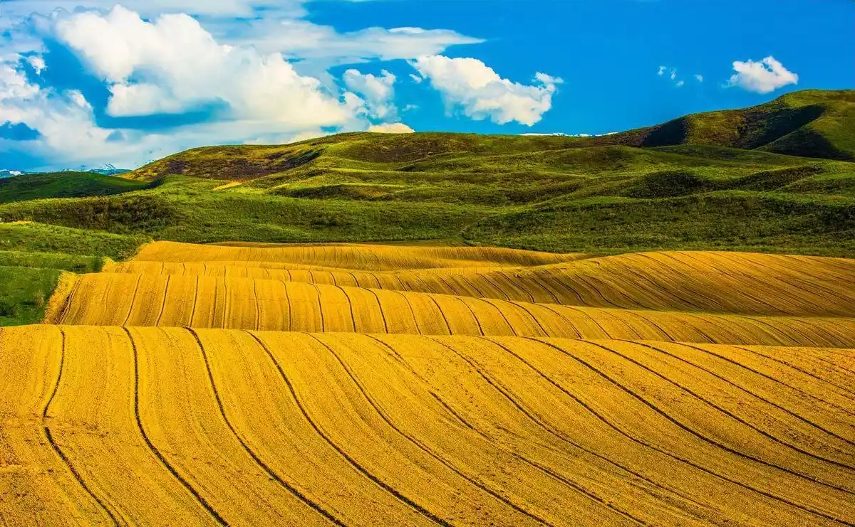
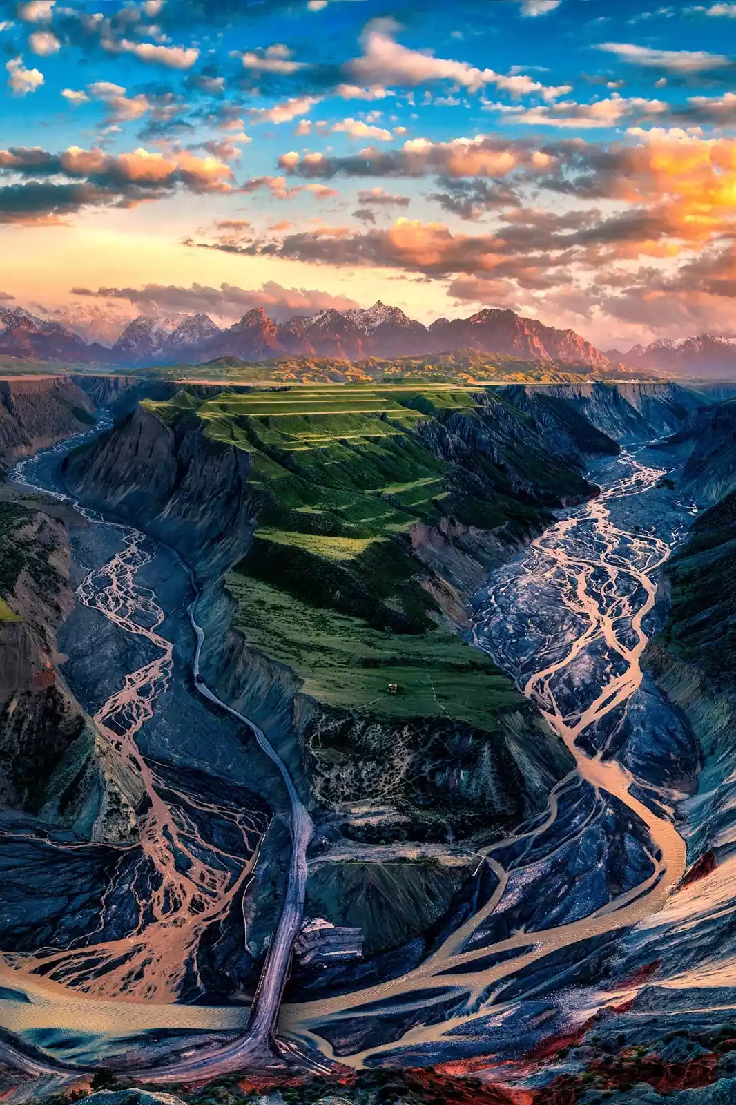
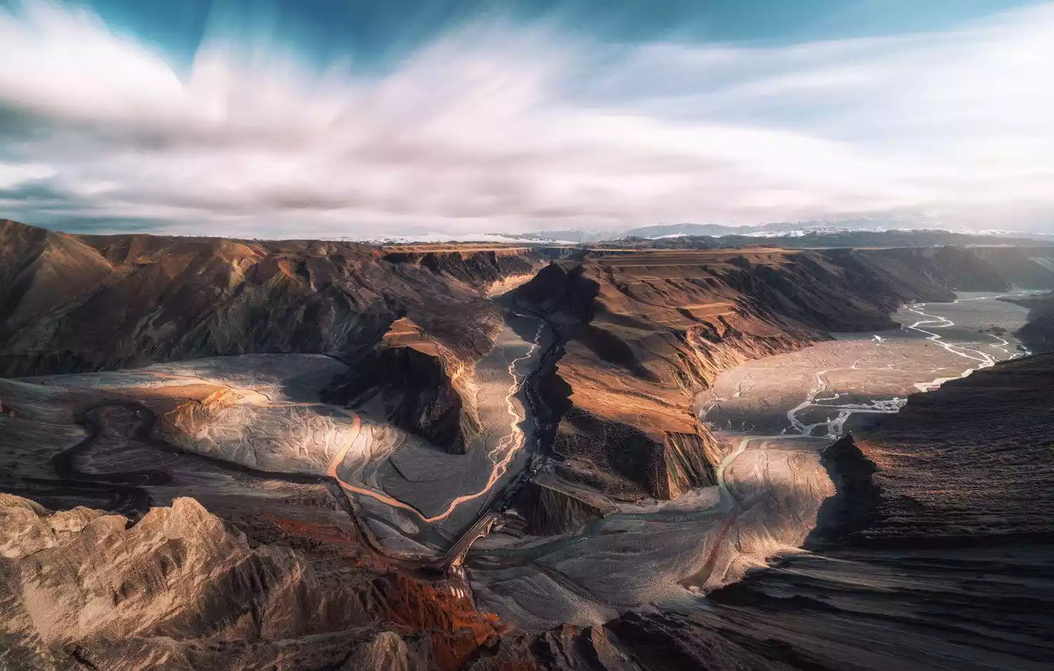
Red Mountain Grand Canyon
Hongshan Grand Canyon, also known as Anjihai Grand Canyon, is located west of Anjihai Town, Shawan County, Wusu City, Tacheng Prefecture. Formed over time by the Anjihai River, originating in the Tianshan Mountains, this vast alluvial fan canyon resembles a vibrant abstract painting, stretching across the vast grasslands.
Tips:
The canyon is quite deep, and the light at the bottom of the valley is insufficient at sunrise and sunset, resulting in poor photography. It is recommended to go there in the afternoon when there is sufficient light.
Hongshan Grand Canyon is 60km away from the nearest city of Kuitun. It is not easy to find by car and it is expensive to rent a car. It is recommended to share a car or join a tour group.
The Hongshan Grand Canyon was closed for construction into a scenic area in early 2019 and no one is allowed to enter. Only some local cars know how to go up from the side roads.
Anjihai pepper drying yard
Anjihai Town, 40 kilometers away from the Hongshan Grand Canyon, is known as the "Hometown of Chili Peppers." Every year from late September to early October, during the pepper harvest season, the town transforms into a sea of fiery red. The chili drying fields stretching for dozens of kilometers are blanketed in a vast expanse of red, creating a breathtaking sight from a bird's-eye view.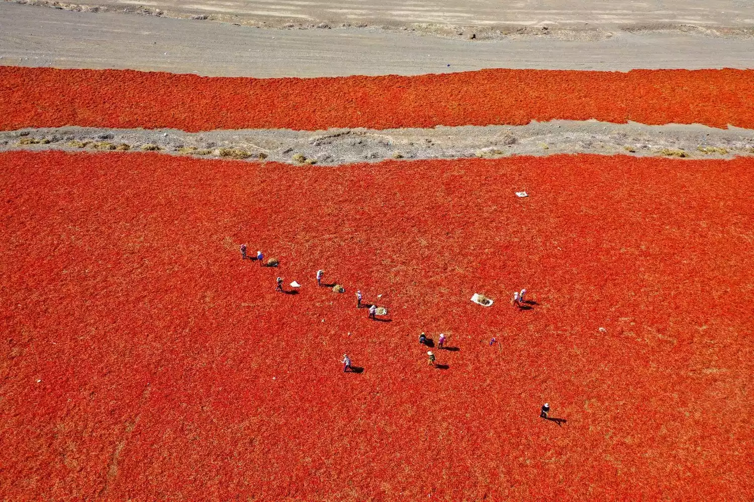
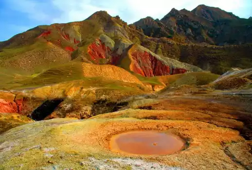
Wusu volcanic mud
The Wusu Mud Volcanoes are located west of Wusu Foshan National Forest Park, within a National Geological Heritage Reserve. Currently the largest mud volcano cluster in China, with approximately 40 active vents still erupting, a rare sight worldwide.
Swirling mud erupts intermittently along fault fissures, bubbling like boiling water, the earth's pulse beating. Over time, the blue-gray and reddish-brown eruption material accumulates, forming vibrantly colored hills and gullies around the crater.
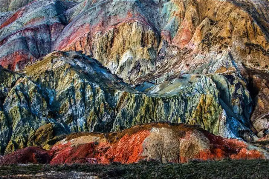
The mountains on the southwest side of the Wusuni volcanic group are known as the "Chinese Painting Mountains" because of their rugged mountains and peculiar shapes. The yellow, black, red and green mountain walls are like a vivid and three-dimensional giant landscape painting, which is quite spectacular.
Mengkede Ancient Trail
At about 625 kilometers on the Duku Highway, there is an ancient passage that crosses the Tianshan Mountains and leads to the "Hundred Miles Gallery" Tangbula National Forest Park. This is the Mengkede Ancient Trail, one of the top ten hiking routes in Xinjiang.
The total length is about 70 kilometers, passing through the "Heavenly Lake" Ulan Sadek Lake. Although it is rugged, it is not dangerous. For thousands of years, the Mengkede Ancient Road has been silent in the beautiful Tianshan Mountains, accompanying the Duku Highway, but hidden. Few people know that there is such a beautiful place on the Duku Highway.
Tacheng Folk Customs
Despite its border location, Tacheng boasts convenient transportation. Downtown Tacheng is 580 kilometers from Urumqi, connected by a highway. Tacheng Airport also offers numerous flights within and beyond Xinjiang.
Tacheng was once an important passage from China to Central Asia on the northern route of the ancient Silk Road. The influence of the long-standing grassland culture and the fusion of Asian and European cultures have created Tacheng's rich and diverse cultural customs today.
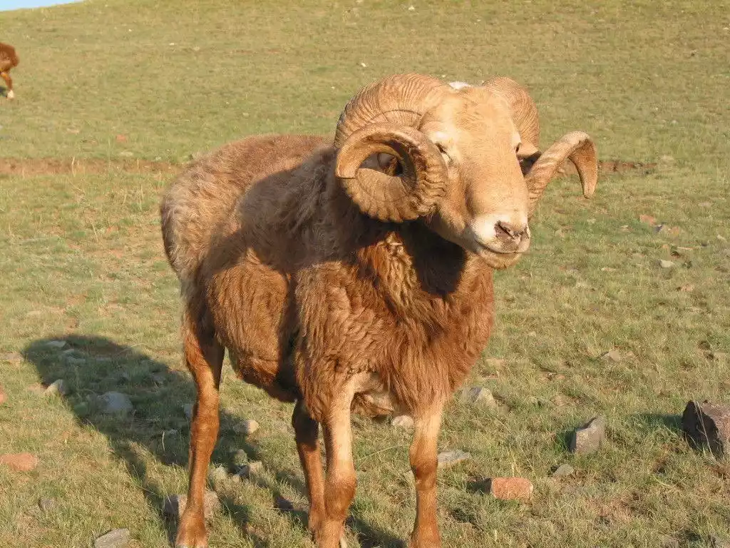
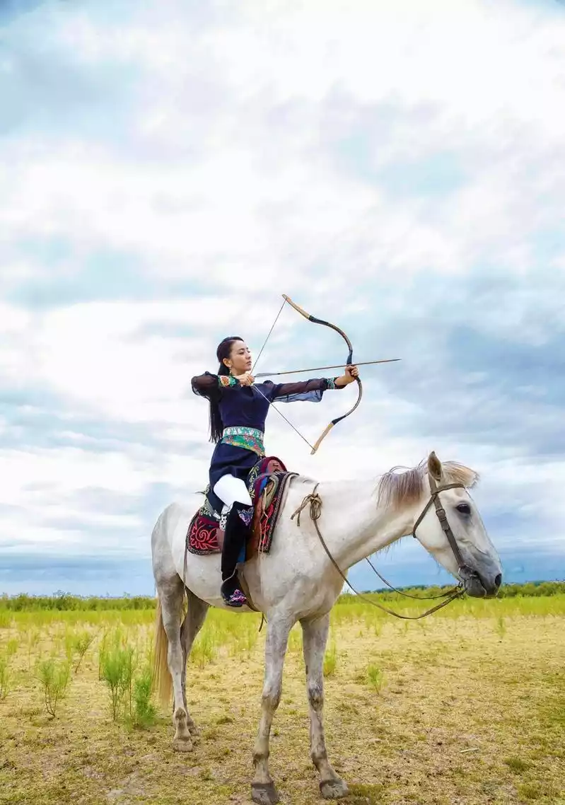
In Tacheng, you can not only enjoy the plump, Kazakh specialty of Bashbai lamb, but also find Russian-style pastries and ice cream everywhere in the streets and alleys. During festivals, the Kazakhs hold grand Aken singing and girl-chasing ceremonies; the Tatas sing traditional folk songs; and the Xibes hold archery competitions...
8-day Tacheng Crossing
Exclusively designed by China-TravelNote, this all-off-road adventure takes you through Tacheng. Take the wildest roads, delve into desolate, uninhabited areas, discover hidden gems, explore the customs of the borderlands, and become the ultimate in social media!
Itinerary
Day 1: Various locations - Urumqi (assembly and registration day)
On the gathering day, participants will arrange their own activities in Urumqi city.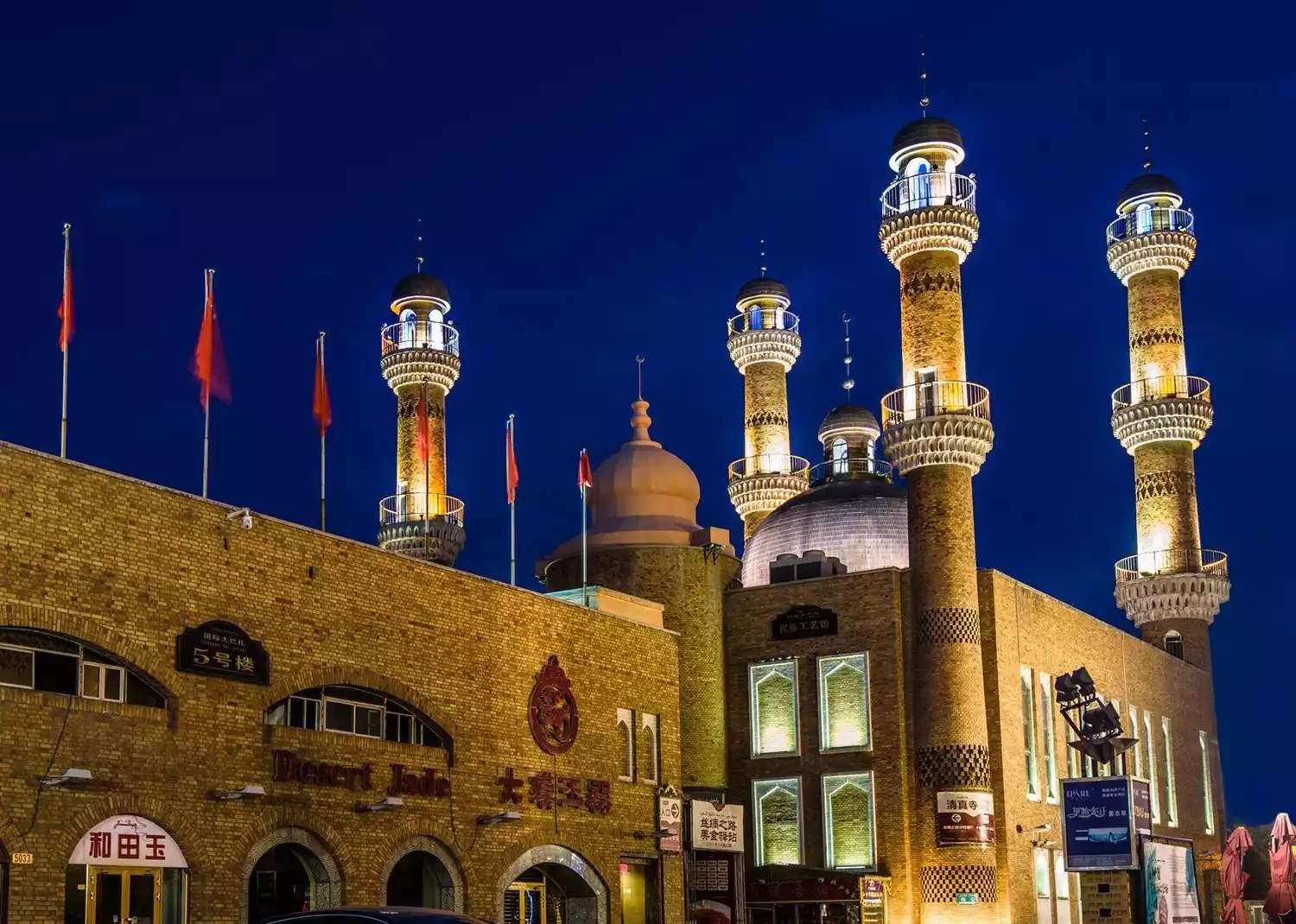
Day 2: Urumqi - 101 Danxia Highway - Hongshan Grand Canyon - Kuitun
Departing from Urumqi, we will drive onto the 101 Danxia Highway, known as the "Tianshan Northern Range Scenic Gallery," and head to the spectacular Hongshan Grand Canyon. After enjoying the scenery, we will arrive in Kuitun City for a rest.
Day 3: Kuitun - Dushanzi Grand Canyon - Wusu Foshan National Forest Park - Wusu Mud Volcanoes - Alashankou Port
We'll pass through the Dushanzi Grand Canyon, a fissure in the Tianshan Mountains, the Daifuseng Scenic Area of Wusu Foshan National Forest Park, and along the towering northern ridge of the Tianshan Mountains, explore the magical Wusu Mud Volcanoes. Tonight, we'll stay in Alashankou City, near the Alashankou Port, the largest land port in northwest my country.
★Day 4: Alashankou - Border No Man's Land - Xiaobaiyang Post - Baluk Mountain
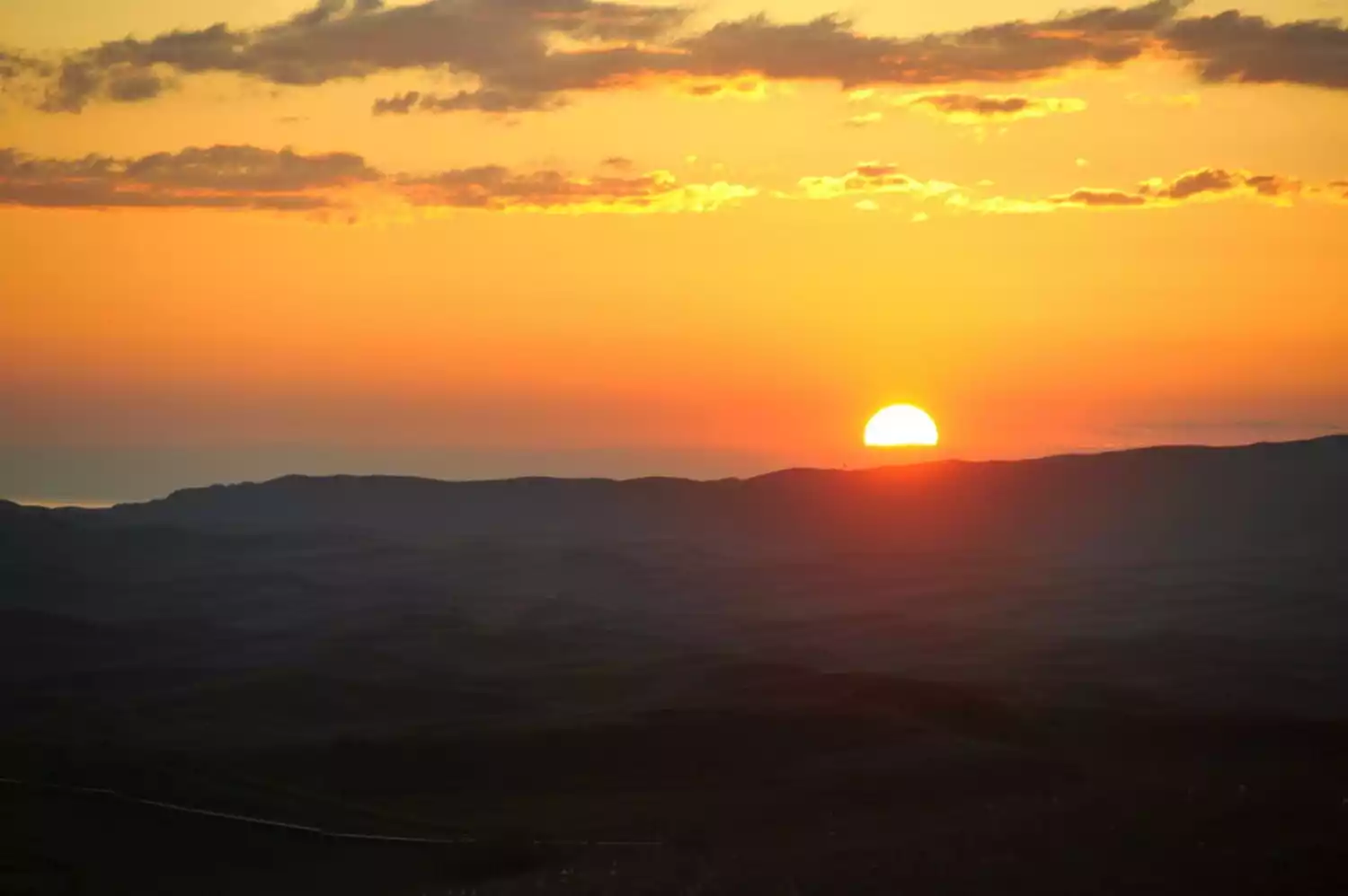
We'll enter the border region, crossing uninhabited areas, and head to the Little Poplar Outpost on the Baluk Mountains. We'll then check into the Tast Valley Resort, where we'll enjoy the sunset and photograph the starry sky.
Day 5: Mount Baluk - Kurustai Wetland Grassland - Tacheng City - Emin County
Rise early to admire the sunrise over the Baluk Mountain Grasslands, then continue north to Tacheng City. Passing the vast and lofty Turga Liao Grassland and the picturesque Akqiao Pasture, we'll cross the boundless Kurustai Wetland Grassland. Arrive in Emin County for the evening and check in.
Day 6: Emin County - Mengbulak Grassland - Emin County
Today we will travel north and south through the Mengbulak Grassland, follow the thousand-year-old pastoral path, and complete a challenging alpine off-road route.
Day 7: Emin County - Longji Valley - Baiyang River Grand Canyon - Karamay
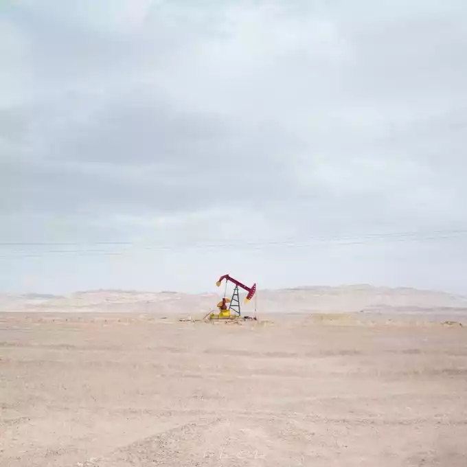
Leaving Emin County, we'll drive deep into the uninhabited area to explore the secret Dragon Back Valley! We'll cross the vast Gobi Desert, passing the Baiyang River Reservoir and the Baiyang River Grand Canyon. Along the way, we'll see the Baili Oilfield and countless oil wells. Arrive in Karamay for the night and stay overnight.
★Day 8: Karamay-Urumqi (★Event end day)
After breakfast, return directly to Urumqi and arrive in Urumqi around 1:30 pm.
Conclusion
Xinjiang is China's largest province in terms of land area, but most of it is still an unknown land covered by Gobi and desert.
Welcome to check out Xinjiang special topic to learn more routes