Where are China's most breathtaking volcanic wonders? Check out China's 10 most breathtaking volcanic clusters!
Preface
Volcanoes - the most mysterious landscape on earth. The more dangerous they are, the more fascinating they are. Humans fear their astonishing destructive power, but are also fascinated by their hellish scenery.
China is a volcanic country with a wide range of Cenozoic volcanic rocks, mainly distributed in two belts: one in the northeast and the other on the Qinghai-Tibet Plateau. Furthermore, the country's volcanoes are not so dormant. Wudalianchi, Changbai Mountain, Taiwan, Tengchong, and the western Kunlun Mountains have all experienced volcanic eruptions over the past 400 years. Changbai Mountain has been recorded to have erupted at least three times. Unique landforms such as volcanic cones can be found in these areas.
The mysterious volcanic landscape has not disappeared from this beautiful land of China. In many places in China, we can enjoy the wonders of volcanoes.
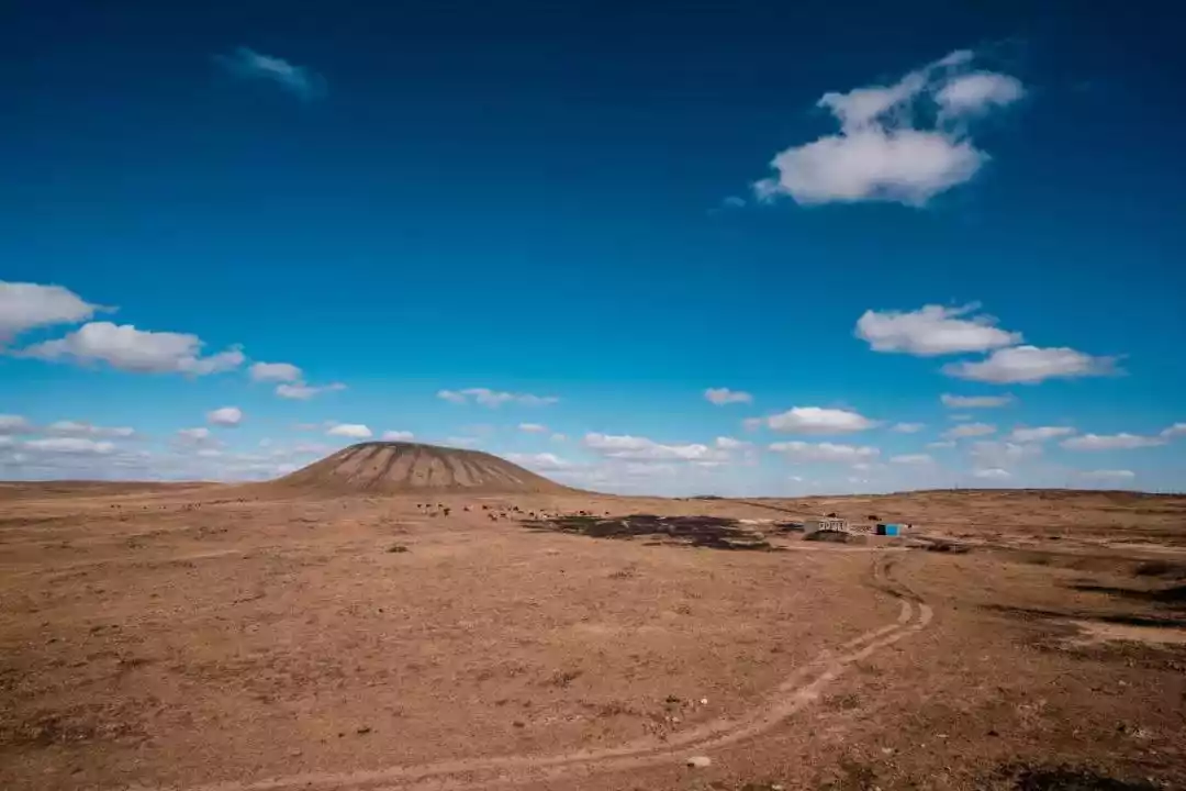
01 Ulan Hada Volcano Group in Inner Mongolia
The last eruption was less than 1,000 years ago.
Most volcanoes in China are either hidden beneath forests or eroded beyond recognition. The Ulan Hada volcanic group, however, is a unique gem among volcanoes. Over 30 volcanoes here are scattered like pearls across the grasslands, their flat terrain showcasing their perfect shapes. The Ulan Hada volcanic group is China's only grassland volcano and the closest volcanic group to Beijing.
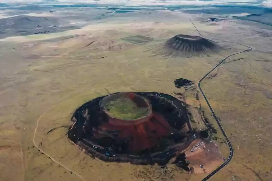
They are the only volcanic group discovered on the southern edge of the Inner Mongolia Plateau that have erupted in the Holocene (10,000 years ago). These volcanoes are very young, and their volcanic forms have not been weathered and eroded for a long time, so their shapes are well preserved.
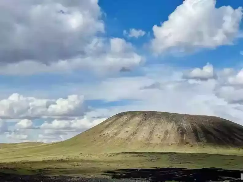
The four volcanoes of Beiliandanlu, Zhongliandanlu, Nanliandanlu, and Beijianshan have relatively intact cones. The lava flows are exposed, and unique geological landscapes such as fumaroles, rope-like lava, and crusted lava, formed during the lava flow, are preserved.
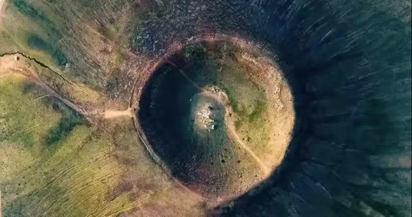
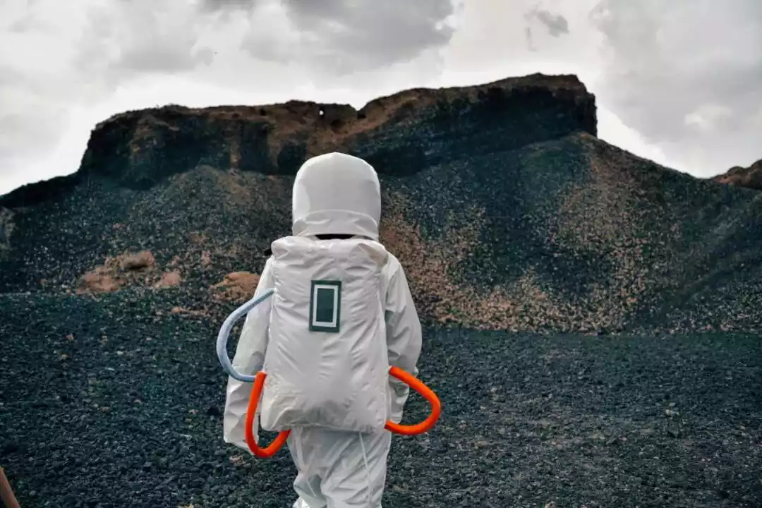
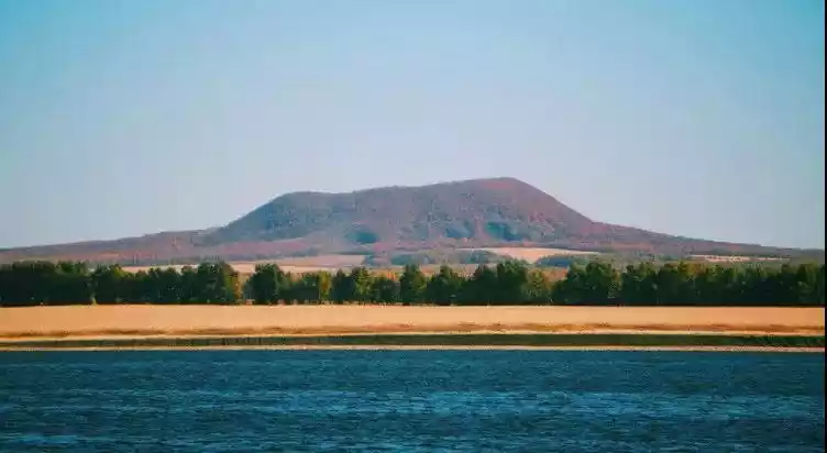
From above, the towering volcano resembles Laozi's alchemy furnace. Halfway up the mountain, a black mine, reminiscent of Iceland's black sand beaches, is a place where you can put on a spacesuit and take portraits, feeling like you've been transported to the moon.

The Middle Alchemy Furnace is the most complete volcano in form. The 360° viewing angle is great, and the aerial photography is particularly stunning.
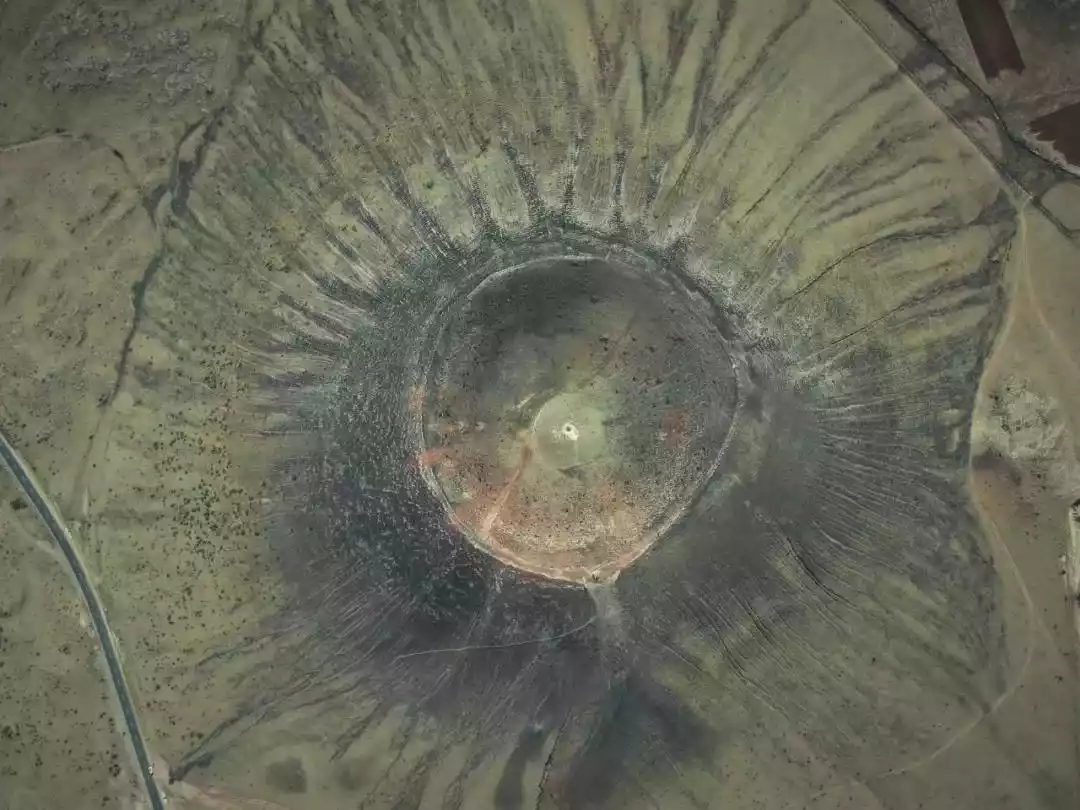
In Mongolian, "Ulan" means "red" and "Hada" means "mountain." These dark red volcanic cones, with radial wedge-shaped fissures, give the illusion of an erupting volcano. If you want to admire the most typical volcanic cone shape, you must go to Ulan Hada.
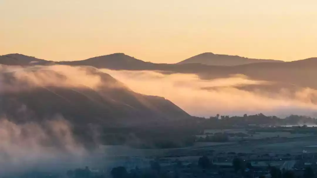
02 Arxan Volcano Group, Inner Mongolia
The last eruption was about 1900 years ago
The Arxan-Chaihe volcanic cluster, nestled deep within the dense forests of the Greater Khingan Range, boasts diverse geological landscapes, including sky ponds, ground ponds, and lava canyons, each revealing its own unique secrets.
Above picture @photo.net
The most captivating aspect of the Arxan volcanic cluster isn't the volcanic cones themselves, but the numerous lakes they have created. These lakes are captivating, some nestling peacefully above the cones, others mysterious underground. Shrouded by Arxan's dense forests, they resemble crystal-clear mirrors waiting to be discovered.
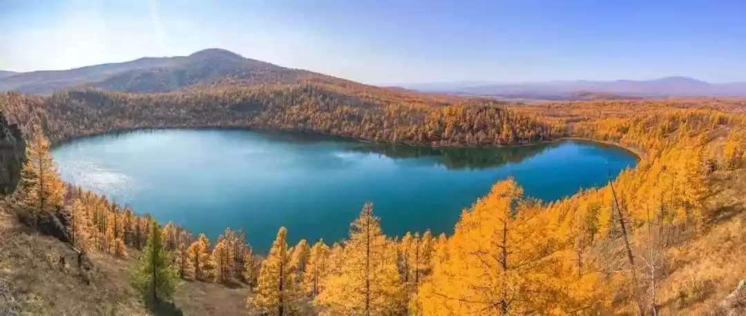
Volcanic eruptions form craters, and water brings life to craters. Water accumulates and forms lakes, which is how celestial and earthly lakes are formed. The Chaihe volcanic cluster, with its diverse volcanic lake types, is known to be clustered together, such as the Moon Lake, the Concentric Lake, and the Camelback Ridge Lake.
Tuofengling Tianchi in autumn
Picture @Photo.net
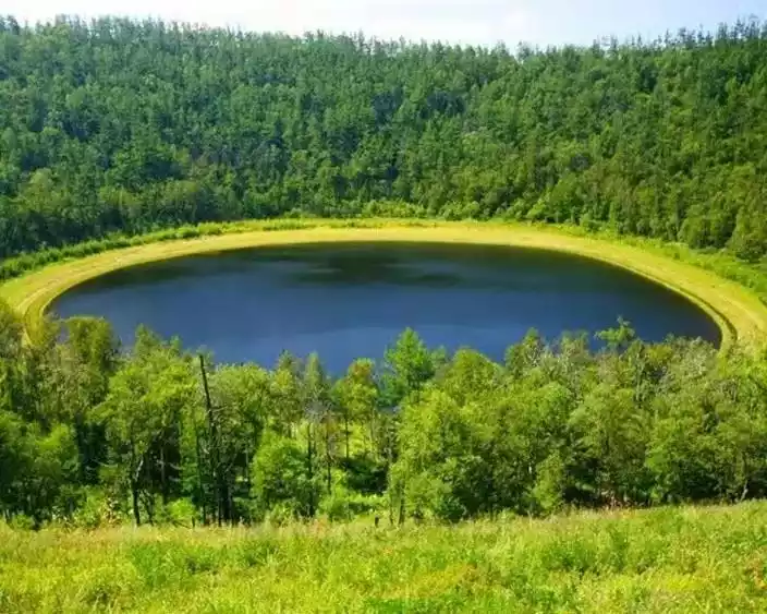
Moon Lake was originally called "Ji'erguo Mountain Lake," as Ji'erguo Mountain forms the watershed of the Greater Khingan Range. The lake's shape resembles a full moon, hence the name. The lakes in Arxan are generally nearly circular because volcanic eruptions create vertical channels, evenly distributing the material ejected, which tends to form nearly circular craters.
03Jilin Changbai Mountain Volcano Group
The last eruption was in 1903 (doubtful)
The Changbaishan volcanoes, located in eastern Jilin Province on the Sino-North Korean border, are the best-preserved Cenozoic polygenetic composite volcanoes in my country. The cones were formed by the accumulation of multiple magmatic eruptions, with the corresponding magma composition evolving from basalts during the shield-building phase to trachytes and alkali flows during the cone-building and explosive eruption phases.
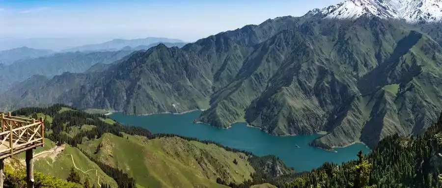
The Changbaishan volcanic area is primarily composed of three large calderas and a series of smaller cinder cones. Tianchi Volcano, the main peak of the Changbaishan range, is named after the beautiful crater lake "Tianchi" formed by water accumulation within the crater. The highest peak, Paektu Peak (named Jiangjun Peak in North Korea), stands at 2,749.2 meters above sea level.
Deposits from the explosive eruption of Tianchi volcano in Changbai Mountain
Picture @Photo.net
Changbai Mountain, known as the "No. 1 Mountain in Northeast China", has mysterious and fantastic natural landscapes. Its main peak, Changbai Mountain, is named after the white pumice and snow. It is known as "Thousands of years of snow and tens of thousands of years of pine, leading straight to the No. 1 peak in the world."

Changbai Mountain Tianchi is a sacred place in Changbai Mountain. It is not only the largest volcanic lake in China, but also the deepest alpine lake in the world.
Picture @Photo.net
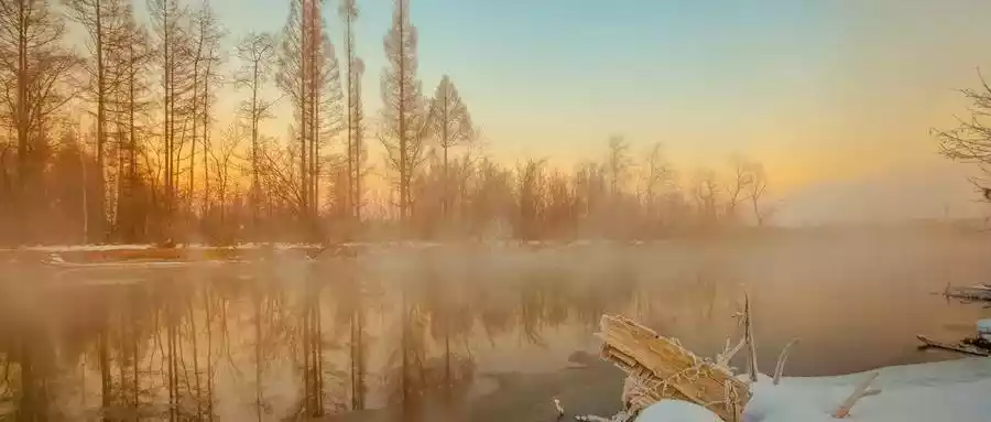
Although the Changbai Mountain volcano is dormant, its active geothermal system produces abundant hot springs. The Changbai Mountain Demon Realm is located in Erdaobaihe Town, where the Nitou River flows through. Even in temperatures exceeding -10 degrees Celsius, the branches lining the river are covered in rime, and the river here never freezes, instead steaming with warmth.
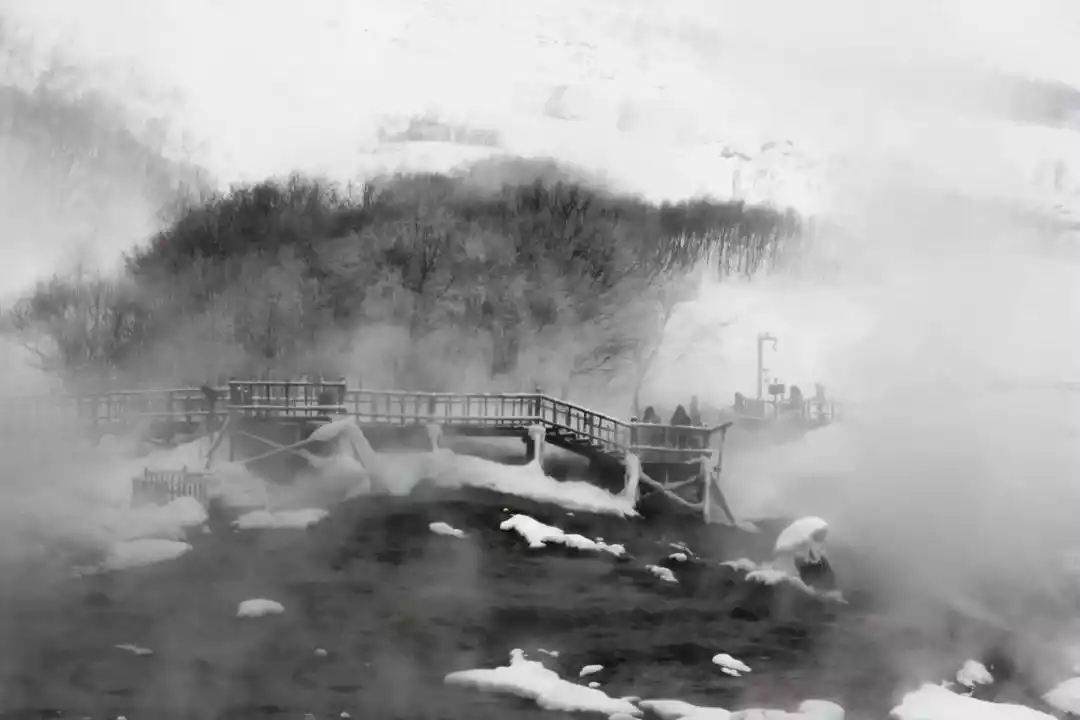
Julong Spring boasts the largest volume, widest distribution, and highest temperature of any of the hot springs in Changbai Mountain, earning it the title of Changbai Mountain's top spring. The spring's water, containing hydrogen sulfide, zinc, and other trace elements, can dispel cold, alleviate fatigue, promote blood circulation, and accelerate metabolism.
Changbai Mountain is the volcano with the greatest potential threat in China. Judging from its current geological conditions and the global geological environment, there are also factors that may cause the Changbai Mountain volcano to erupt again.
04 Wudalianchi Volcano Group in Heilongjiang
The last eruption occurred between 1719 and 1721.
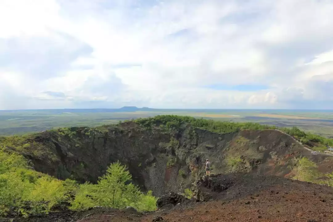
Wudalianchi Volcano is located in the upper reaches of the Baihe River, a tributary of the Nemur River, in the north of Wudalianchi City, Heihe City, Heilongjiang Province, China. There are five lakes with waves reflecting each other and pools connected to each other, which are known as the Wudalianchi.
Wudalianchi is a precious legacy left to humanity by Quaternary volcanic activity. Fourteen volcanic bodies and a series of volcanic mineral springs form a unique volcanic landscape characterized by picturesque mountains, secluded waters, unique springs, and grotesque rocks.
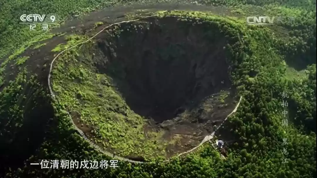
Among them, Laoheishan is one of China's youngest volcanoes. Its last eruption was just over 200 years ago, witnessed by a Qing Dynasty general stationed on the border, who recorded it and reported it to the then Emperor Kangxi. This is one of the few volcanic eruptions in China's historical record.
Above picture @photo.net
The picture below is @"Aerial China"
Mount Nangglaqiu, the highest of the fourteen volcanoes in Wudalianchi, stands at 596.9 meters above sea level. Beyond its typical conical shield shape, the Tianchi Lake formed within its crater also lends it a unique charm.
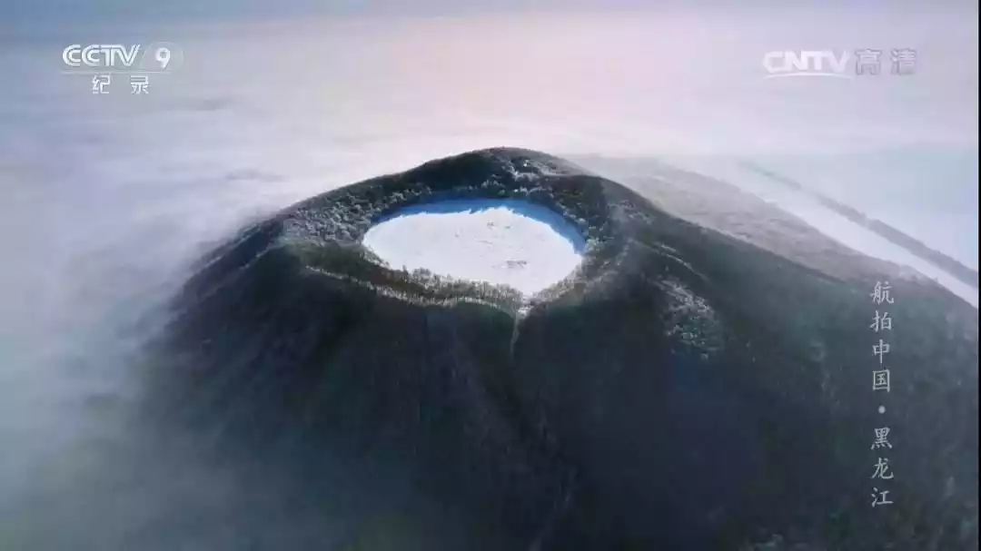
Photo @ "Aerial China"
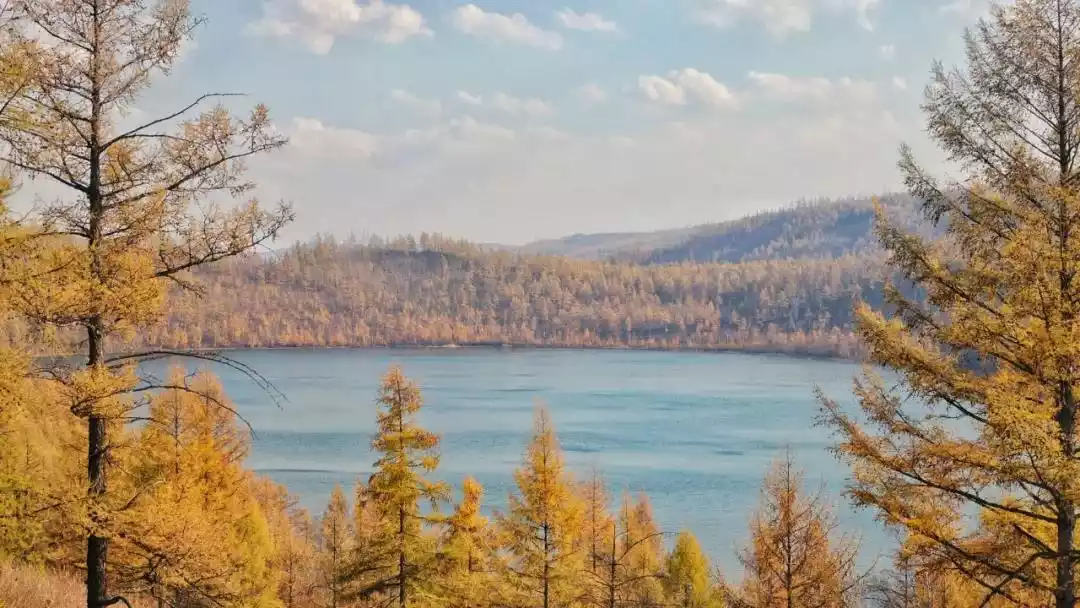
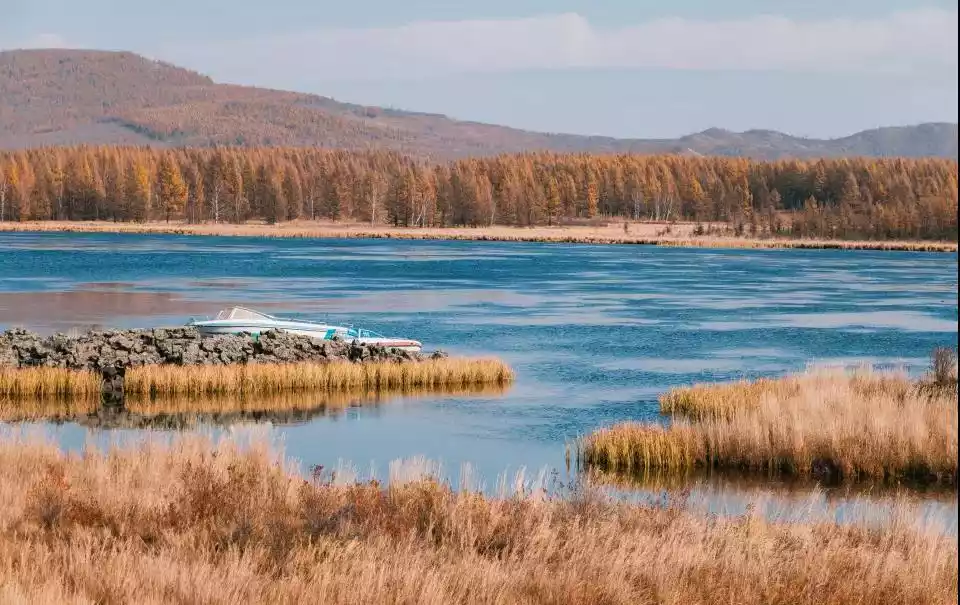
05 Heilongjiang Jingpo Lake Volcanic Group
The last eruption was about 1,000 years ago
The Jingpo Lake Holocene volcanic area is located at the junction of Heilongjiang and Jilin provinces in Northeast my country, deep in the mountains at an altitude of 1,000 meters on the east side of the main ridge of the Zhangguangcai Mountains, approximately 90 kilometers from Mudanjiang City. Lava flows from volcanic eruptions blocked the Mudanjiang River, forming Jingpo Lake, my country's largest volcanic barrier lake, comparable to Lake Geneva.
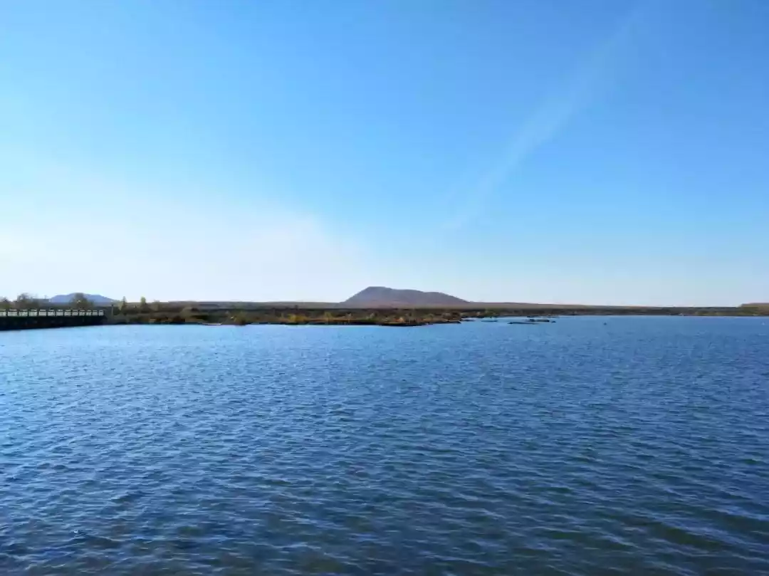
Picture @Photo.net
As a national 5A-level tourist attraction, Jingpo Lake was approved by UNESCO as a World Geopark in 2006 for its unique natural geological landscapes such as volcanic geological relics, water landscapes, canyon wetlands, as well as cultural landscapes such as the Bohai Kingdom ruins.
Picture @Photo.net
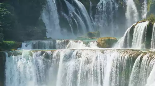
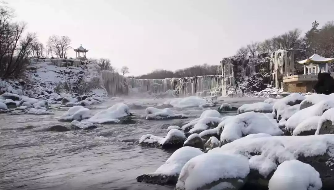
The most captivating attraction at Jingpo Lake is the Diaoshuilou Waterfall. In winter, ice and flowing water coexist, creating a breathtaking display of both movement and stillness. During the rainy season or flood season, the waterfall cascades in two or more cascading streams, totaling over 200 meters in width.
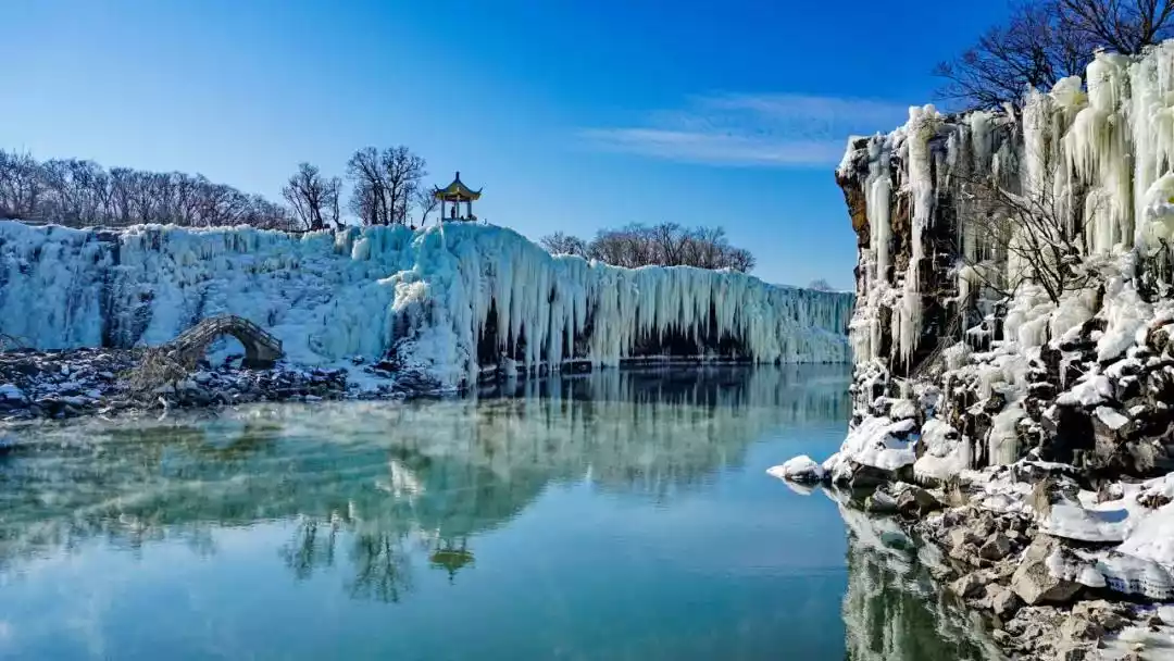
Picture @Photo.net
06 Ashikule Volcano Group in Xinjiang
The last eruption was in 1951 (doubtful)
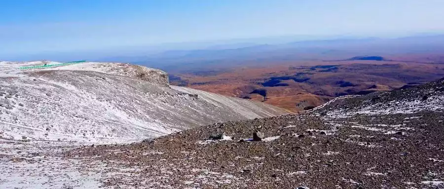
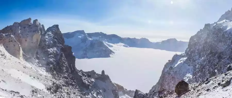
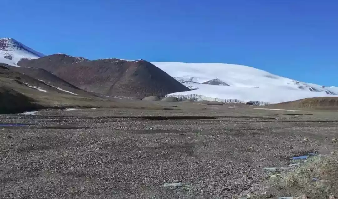
The Ashikule Volcanic Group is located approximately 120 kilometers south of Yutian County, Xinjiang, on the northwestern edge of the Qinghai-Tibet Plateau and in the southeastern part of the Ashikule Basin in the Kunlun Mountains. With volcanic rocks averaging over 4,600 meters above sea level, it is one of the highest active volcanic areas in my country and the most likely to erupt.
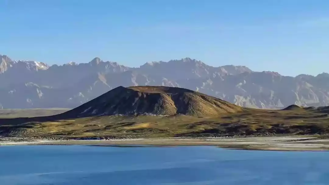
According to a report in Xinjiang Daily on July 5, 1951, "A volcanic eruption occurred at 9:50 a.m. on May 27 in the area of Kunlun Daban Xigou, south of Subashi in Yutian County." However, because there was no lava flow, some scholars have questioned whether it was an eruption. However, the only volcano that can challenge the statement that "there has been no volcanic eruption in China for nearly a hundred years" is the Ashikule volcano.
07Kartimir Volcano Group
The last eruption was about 1,500 years ago
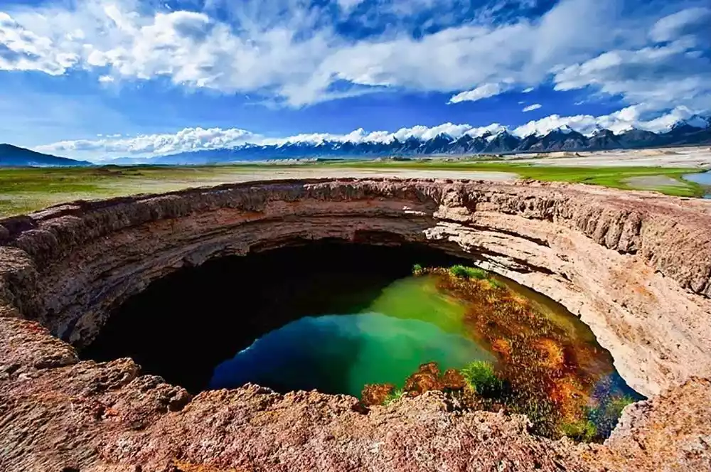
A cluster of volcanoes lies dormant on the Pamir Plateau. The Kartiemi Volcano, also known as the Muji Volcanoes, is known as the "Eye of the Pamirs." Formed 1,500 years ago, it boasts a classic crater landscape and boasts the highest crater in Xinjiang.
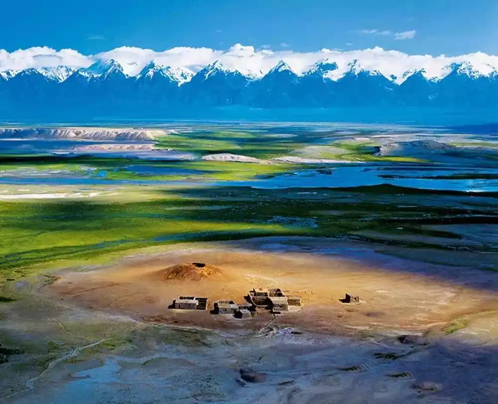
The Kartimir volcanic group, located in my country's westernmost border region, bordering Kyrgyzstan and Tajikistan, is known as China's "Westernmost Village." Hidden deep within Xinjiang, its beautiful scenery captivates everyone who visits.
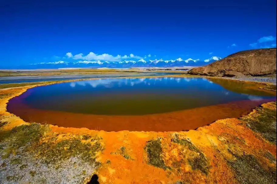
There are more than a dozen colorful springs here, scattered at different heights and in various shapes, as well as rare plateau wetlands, abandoned gem mines, clear glacial lakes, bottomless ice caves, sweet glacier snow water... It can be said that the original appearance of nature has been preserved.
08 Tengchong Volcanoes in Yunnan
The last eruption was in 1609 (doubtful)
"Tengchong Prefecture, where nine out of ten mountains are headless" perfectly describes Tengchong's unique geography. Located at the intersection of the Eurasian and Indian tectonic plates, Tengchong experiences active crustal movement, resulting in frequent earthquakes and volcanic eruptions. After the eruptions cease, the karst cools, creating the magnificent spectacle of numerous "headless" volcanoes, large and small.
Dome volcanoes, truncated cone volcanoes, shield volcanoes, and low-lying Marr-type volcanoes are gathered in the Tengchong volcanic area, making the Tengchong volcanic area famous for its numerous volcanoes, wide area, and various eruption types.
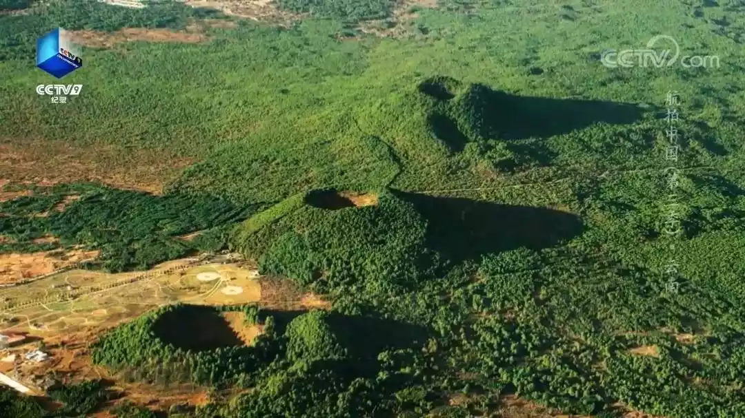
Photo @ "Aerial China"
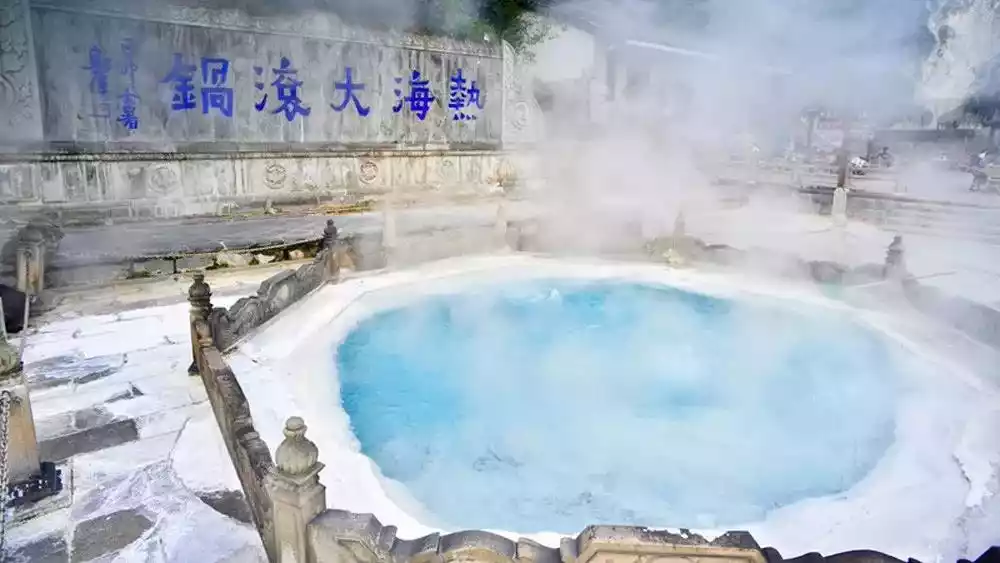
The abundance of 99 volcanoes and 88 hot springs also creates a wealth of geothermal resources. The hot springs in the hot sea, with water temperatures reaching 90°C year-round, allow for instant food preparation. The dish, served on skewers with eggs, one of Yunnan's eighteen unique wonders, offers a unique flavor.
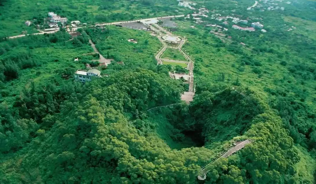
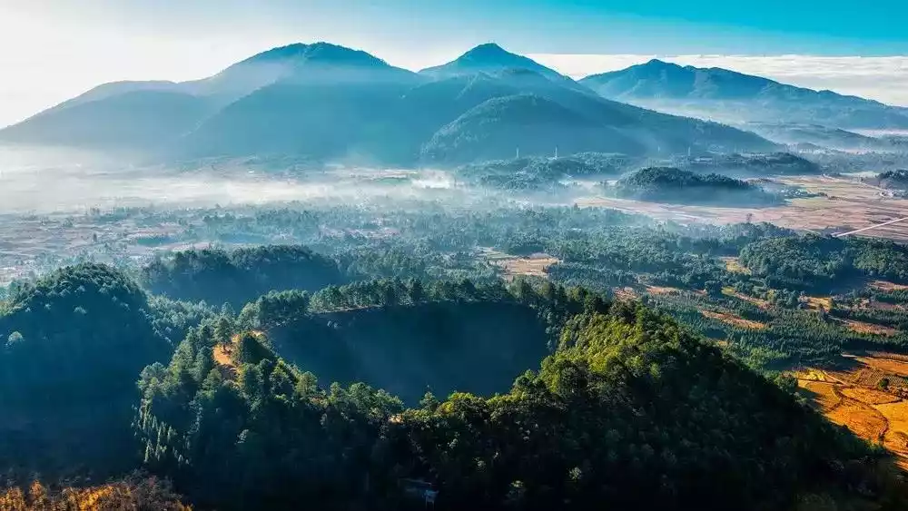
09 Hainan Qiongbei Volcanic Group
The last eruption was about 4,000 years ago
The Qiongbei Volcanic Cluster refers to a group of volcanoes active since the Cenozoic era in northern Hainan Island. They cover approximately 12% of Hainan Island's total area and are primarily distributed across eight locations, totaling approximately 4,159.79 km. The diverse and comprehensive range of volcanic types in Qiongbei is rare both domestically and internationally.
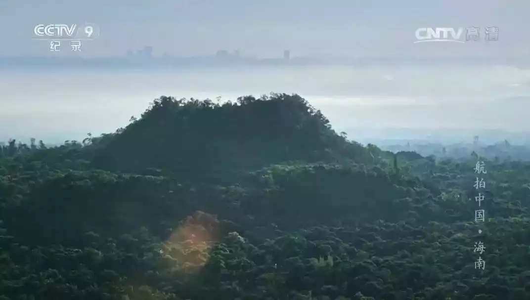
Photo @ "Aerial China"
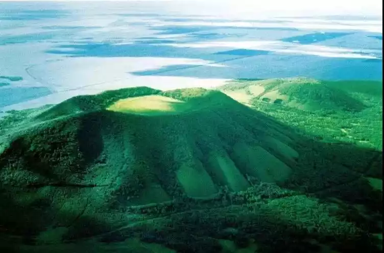
The Leihuling-Ma'anling volcano is only about 15 kilometers away from Haikou, Hainan's political, economic, and cultural center, making it a typical urban volcano and attracting much attention.
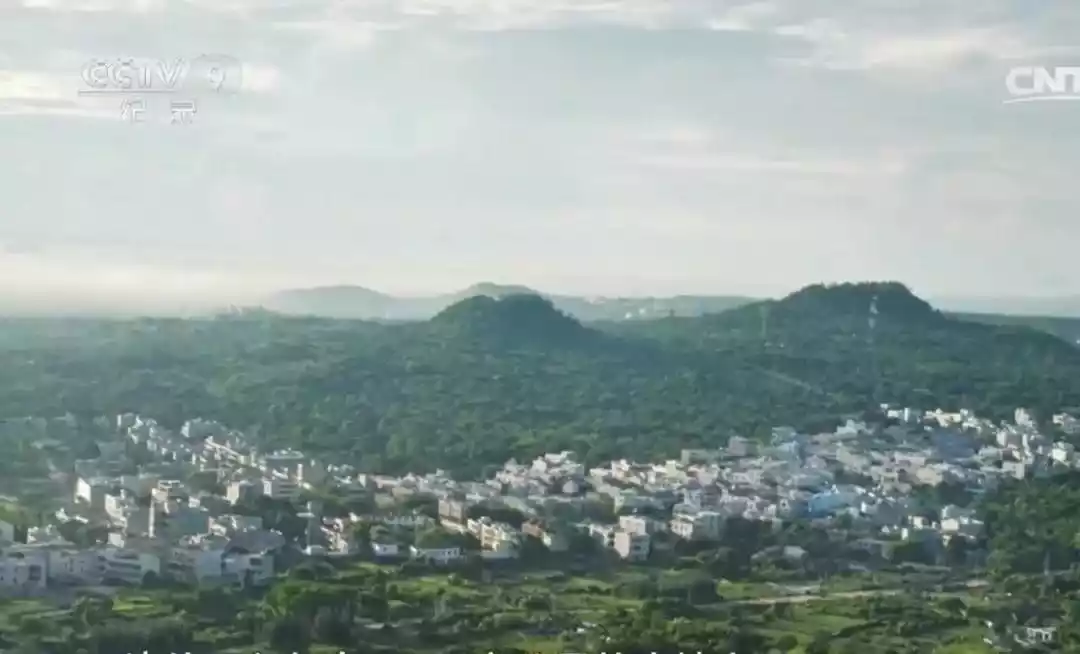
Photo @ "Aerial China"
At the Leiqiong Haikou Volcanic Group World Geopark, you can go deep into the bottom of the volcanic crater to see the miracle of nature, and overlook the Qiongzhou Strait from the commanding heights. It is a natural geological museum.
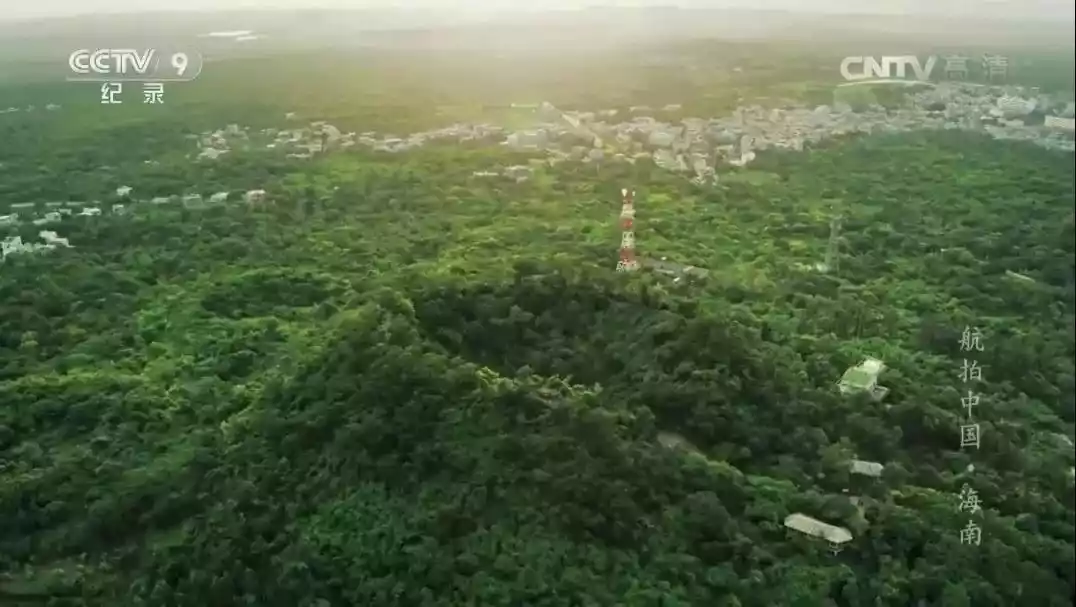
Photo @ "Aerial China"
10 Datong Volcano Group in Shanxi
The last eruption was about 100,000 to 60,000 to 70,000 years ago
The Datong volcanic group, a typical relic of Quaternary crustal movement, is the only volcanic group developed on the Loess Plateau. Now dormant for thousands of years, only sunrises and sunsets, the romantic stars, and the rolling clouds and vibrant life remain.
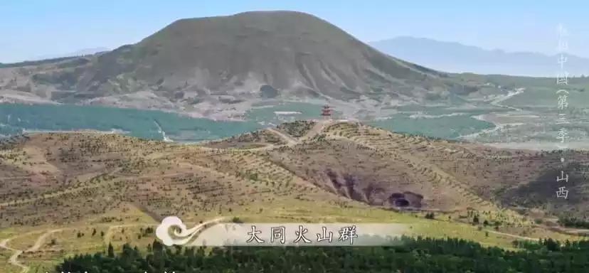
Photo @ "Aerial China"
Unlike the volcanic groups introduced above, Datong volcanoes have never been active in human history. The people of Datong and volcanoes have coexisted harmoniously for thousands of years.
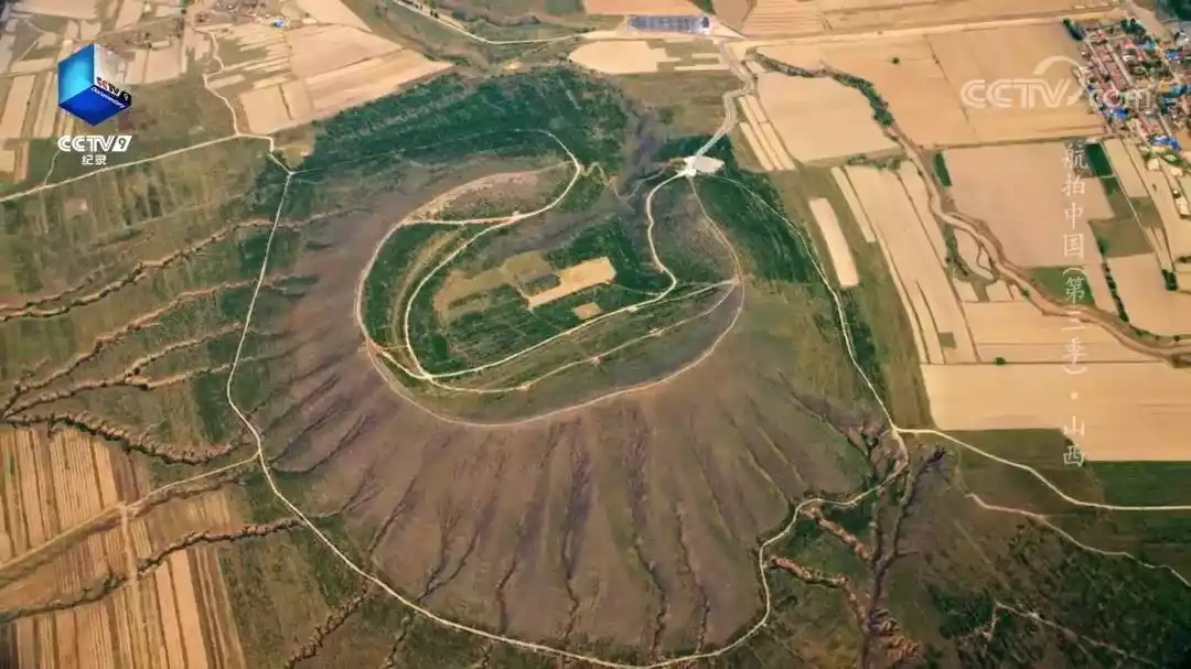
Photo @ "Aerial China"
Conclusion
The beauty of volcanoes lies in their mystery. Even extinct volcanoes, dormant for tens of thousands of years, can suddenly erupt, creating a breathtaking spectacle. Volcanic eruptions can bring rich mineral resources or destroy entire cities. Perhaps because the secrets of volcanoes have never been known, humans have a deep curiosity about them, and curiosity is the driving force behind all exploration.