Tibet Travel | Retracing the Ancient Tea-Horse Road (Lhasa-Chamdo Section): An Incomplete Guide!
Preface
Everyone has a Tibet in their heart, just as everyone has a Hamlet in their heart. Some are fascinated by the towering Mount Everest, some yearn for the sacred and majestic Mount Kailash, some love the holy and tranquil Lake Manasarovar, and some travel to the beautiful and stunning Lake Namtso...
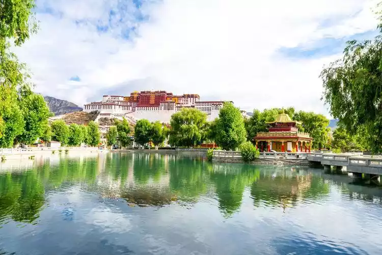
My deepest yearning for Tibet stems from Zheng Jun's poem "Return to Lhasa." To me, Tibet is the place closest to the sun, the place closest to heaven. It's the snow-capped mountains, the verdant grasses, the beautiful lama temples. It's the snow lotus on the Tanggula Mountains, the majestic Potala Palace, and the surging Yarlung Zangbo River.
Located in southwestern China, Tibet, with an average altitude of over 4,000 meters, is the world's largest and highest plateau, known as one of the "Three Poles" along with Antarctica and the North Pole. It boasts both unique snowy scenery and the charm of southeastern Tibet, reminiscent of southern China.
Life's ultimate questions are: Where do I come from? Where am I going? When traveling to Tibet, there's no need to worry about the season; each season offers unique scenery. And there's no need to dwell on where you're going; every place offers a unique view.
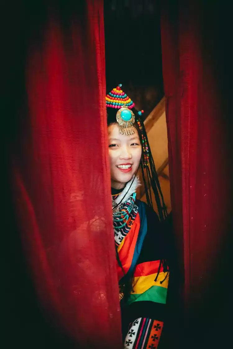
You and I are both Zhuobu, happily traveling through Tibet. It would be wonderful to summarize our journey westward under a single theme! Hence, this article, "Traveling in Tibet: Retracing the Ancient Tea-Horse Road, Lhasa-Chamdo Section, An Incomplete Guide." Zhuobu is a Tibetan word meaning good friends, brothers and sisters. Coming to Tibet is like a family reunion, a gathering of good friends, brothers and sisters. Even if we may not speak the same language, our innocent smiles never lie. Let's light a bonfire and dance the joyful Guozhuang dance, amidst the sacred mountains and holy waters.
【About the itinerary】
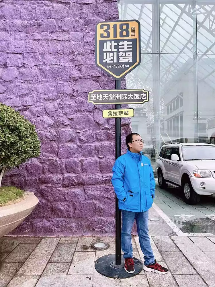
DAY 1 Sanya - Lhasa - Barkhor Street: InterContinental Lhasa Paradise
DAY 2 Lhasa - Basongcuo - Nyingchi Overnight: Nyingchi
DAY 3 Nyingchi - Niyang River Scenic Area - Benri Sacred Mountain - Yarlung Zangbo Grand Canyon - Suosong Village: Tibetan Homestay
DAY 4 Suosong Village - Lulang Town - Tongmai Bridge - Guxiang Lake - Ranwu Lake Accommodation: Zichen Boyue Hotel
DAY 5 Ranwu Lake - Midui Glacier - Nujiang River 72 Turns Overnight: Changdu Yuexi Hotel
DAY 6 Dongda Mountain Pass - Gola Village - Yanjing Millennium Ancient Salt Fields Accommodation: Qamdo Jinshi Mangkang Impression International Hotel
DAY 7 Lawu Mountain - Bangda Grassland - Qamdo Accommodation: Qamdo Tongtai Hotel
DAY 8 Return
【Practical Guide】
About altitude sickness
Altitude sickness depends on individual fitness. Some people get dizzy and dizzy as soon as they reach 2,000 meters, while others can still run freely at 5,000 meters. If you're traveling from a lower altitude area to the higher altitudes of Tibet, the first thing you need to do is overcome altitude sickness. Avoid alcohol, ice cream, or showers, though hot foot soaks are still acceptable. Altitude sickness requires some acclimatization, so it's helpful to have some anti-altitude medication, such as erythrosine erythema and high-altitude redness, on hand. Keep some portable oxygen tanks handy for emergencies.
About the weather
Tibet, a land of snow, boasts relatively low temperatures even in summer. Before traveling to Tibet, be sure to check the local weather forecast and pack warm clothing. Rainfall is common in Tibet during the summer, so rain gear is essential. While sunny, the sun shines brightly, but UV rays are also strong, so take precautions against the sun. A sun hat, parasol, and sunscreen are essential.
About taking photos and dressing
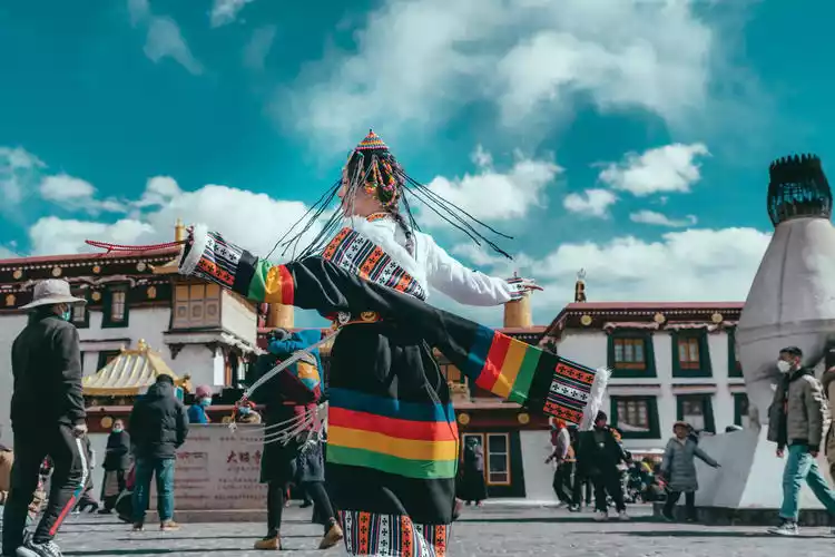
What to wear is a matter of personal preference; however you choose, the more beautiful your photos will be. But if you happen to be wearing Tibetan clothing, it will undoubtedly enhance your trip. Bring whatever you can, including cameras, DSLR cameras, action cameras, and drones; having more equipment adds a touch of excitement. Just a reminder: flying is prohibited in the Lhasa area, so don't try to fly a drone there.
About “asking for money”
Everyone who should know this understands it, but I still have to say it again - hold out: ID card (including driver's license and various documents used for discounts), hand: mobile phone, ask: keys, money: wallet and a small amount of cash.
【About transportation】
Rumor has it that there's a common disdain system among travelers in Tibet: hikers look down on cyclists, cyclists look down on drivers, drivers look down on train riders, and train riders look down on plane riders...
In my opinion, there's no such thing as one looking down on the other. Everyone has their own joys and their own views. Regardless of the method, walking, passing, and seeing, leaving a lasting impression, and arriving and returning safely are the truest tribute to travel. Traveling in Tibet requires careful consideration of both time and budget. Personally, I prefer self-driving, letting my imagination wander freely, stopping and circling, observing and photographing the scenery I like. Just thinking about it makes me happy.
Accommodation and food
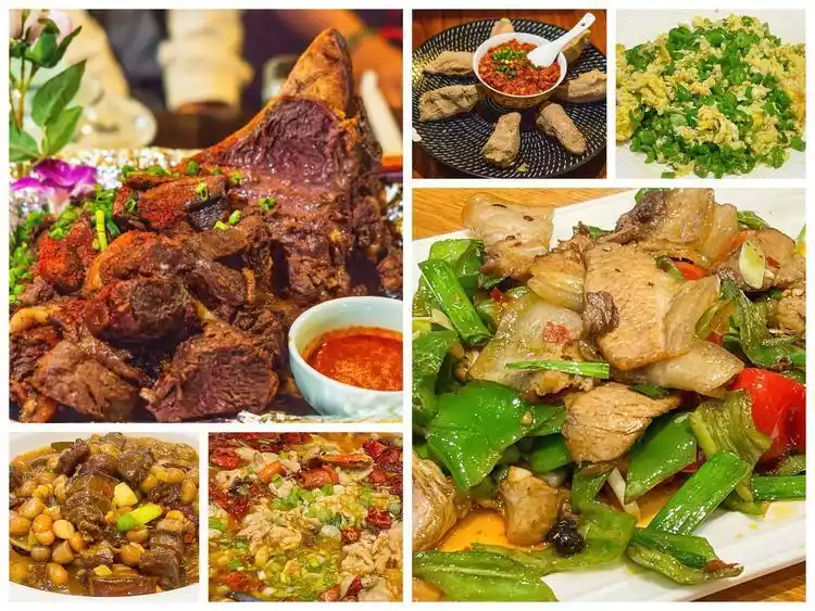
To be honest, when traveling in Tibet, the food and accommodation along Route 318 are quite comfortable.
Whether it is a star hotel or a homestay, whether it is a Tibetan restaurant or a Sichuan restaurant, you can really stay where you want and eat whatever you want. Just plan your route and choose how much you want to spend according to your preferences.

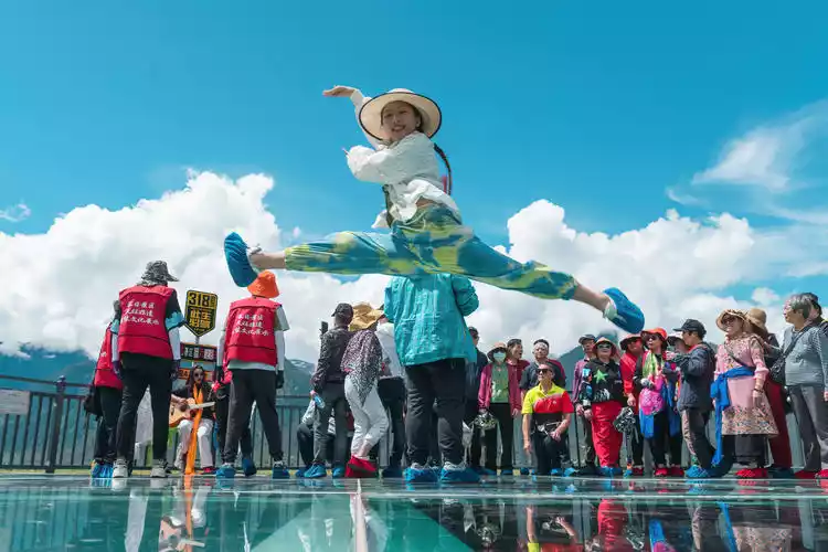
Day 1 Travel thousands of miles just to meet
Listen to the ancient rhythms and joyful beats; see the vibrant world and its dazzling dance; smell the purity and flowing sweetness of the plateau; taste the overflowing freshness and the lingering aftertaste; feel the warmth of millennia of sedimentation and the warmth of your fingertips. You and I are both extraordinary, journeying through Tibet.
I'd traveled thousands of miles from Sanya to fulfill a long-held promise: a trip to the Ancient Tea-Horse Road (Lhasa-Chamdo section) in Zhuobu, Tibet. The Ancient Tea-Horse Road was an ancient trade route between Yunnan, Sichuan, and Tibet. Because tea from Sichuan and Yunnan was traded with horses and medicinal herbs from Tibet, transported by caravans, it became known as the "Ancient Tea-Horse Road." The "Ancient Tea-Horse Road" connected Sichuan, Yunnan, and Tibet, extending into Bhutan, Sikkim, Nepal, and India, before reaching West Asia and the Red Coast of West Africa.
The Ancient Tea-Horse Road originated from the tea-horse trade in the ancient southwestern frontier, about 200 years earlier than the Silk Road. It is also one of the world's most spectacular natural scenery and the most mysterious cultural tourist routes. I believe that anyone who has walked this route will never doubt this. You can stop and go as you please, and the scenery is everywhere along the way.
In the past, when I drove to Tibet, Lhasa was the end of the journey, but this time, Lhasa was the starting point. The different scenery made me look forward to this trip.
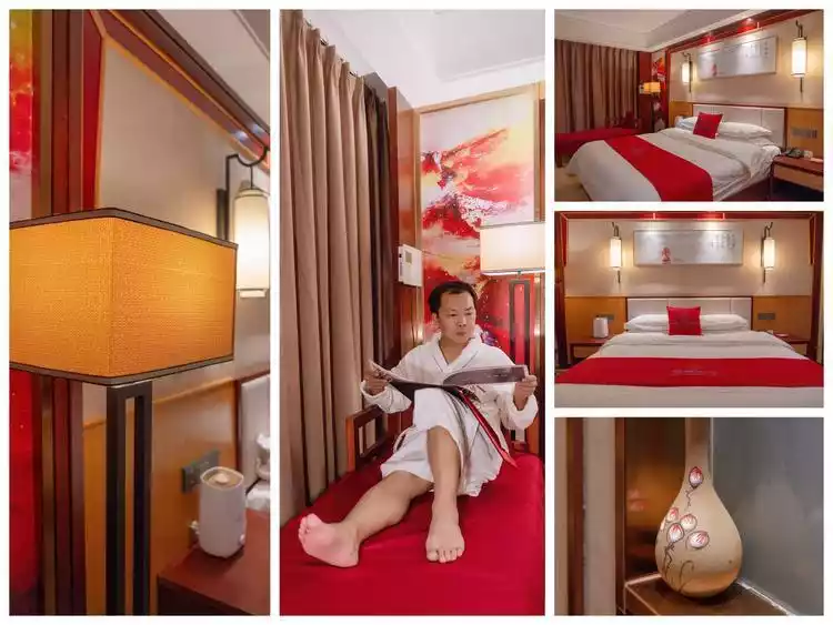
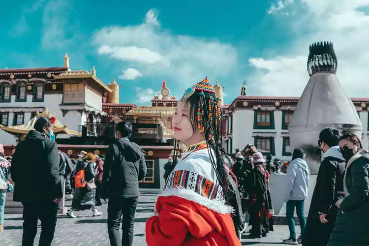
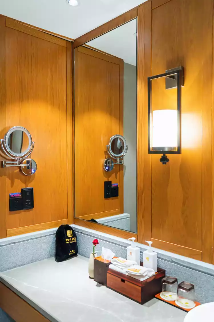
I was resting at the InterContinental Lhasa Paradise Hotel that day. As soon as I walked in, I saw a gift bag that Tibet Zhuobu had carefully prepared. It contained two portable oxygen cylinders, yak meat, yak milk clams, sunscreen, a sun hat, Tibetan incense... Tibet Zhuobu was so thoughtful! These were all essentials for me. Thumbs up to Tibet Zhuobu!

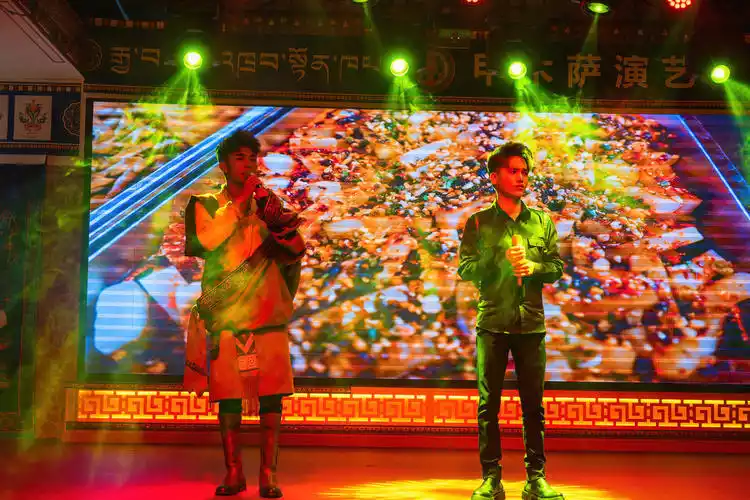
I had a wonderful time at the Jiamusa Tibetan Banquet, enjoying the performance and having a meal of ethnic food, then went back to the hotel to take a nap and rest. I am ready for my trip to Tibet and will officially set off tomorrow.
Day 2 Basongcuo, a turquoise lake surrounded by snow-capped peaks and green forests
With the opening of the Lhasa-Nyingchi Expressway, there is now another option for traveling from Nyingchi to Lhasa, in addition to the 318 bus. The Lhasa-Nyingchi Expressway shortens the original 8-hour drive to 5 hours.
Lalin Expressway is currently the only free expressway in my country. The speed is increased without reducing the beautiful scenery. The 409-kilometer-long road encompasses all the beauty of nature, including mountains, rivers, villages, snow-capped mountains, canyons... The scenery is beautiful and pleasing to the heart and eyes.
The Lalin Expressway Service Area is well-equipped with restaurants, gas stations, supermarkets, and restrooms. There are also many delicious restaurants along the highway, which are inexpensive and delicious, and will whet your appetite.
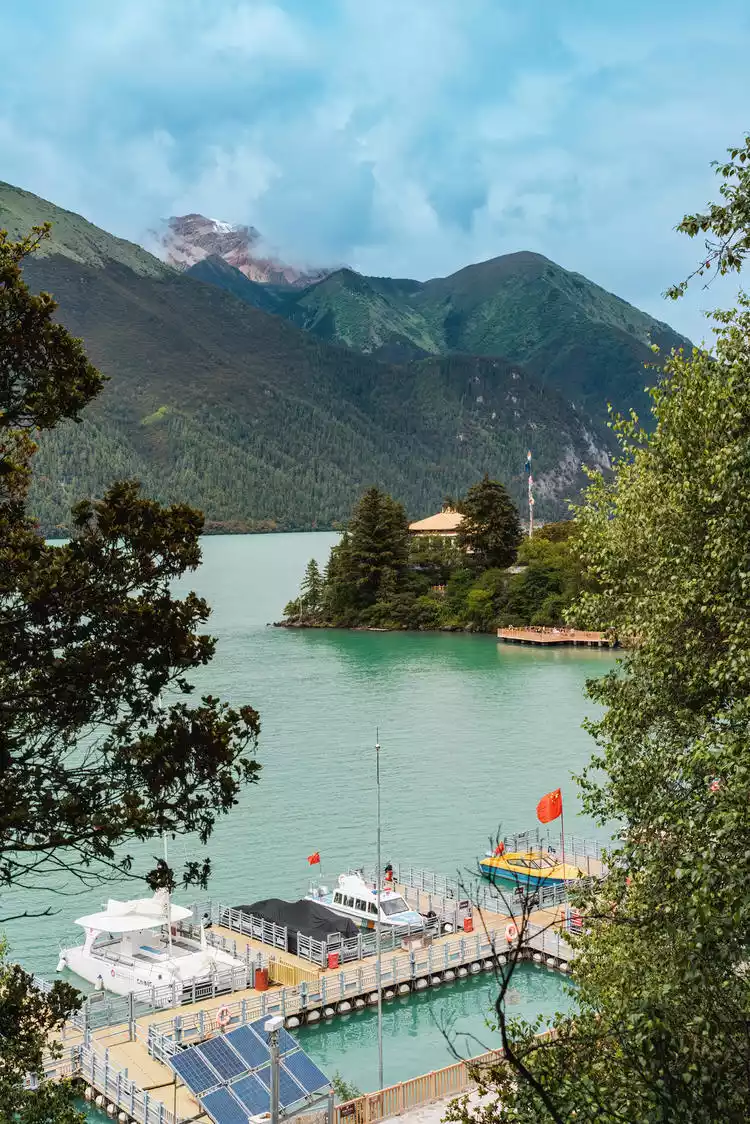
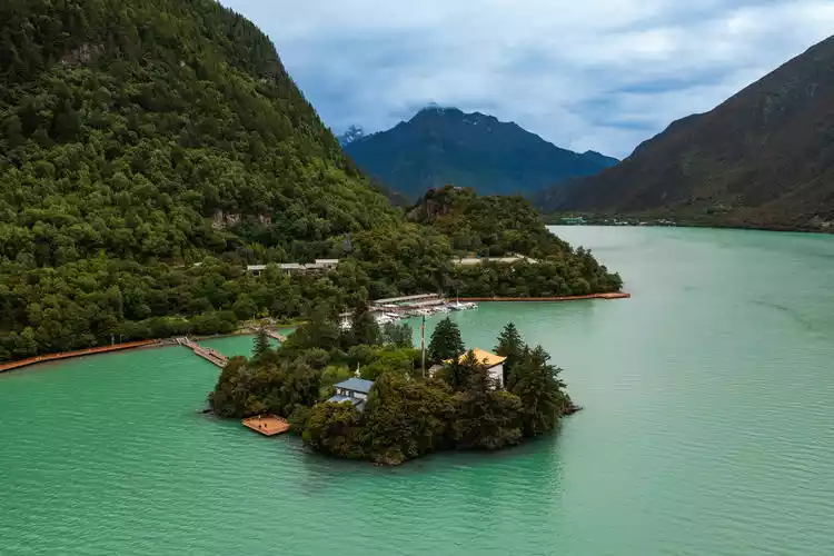
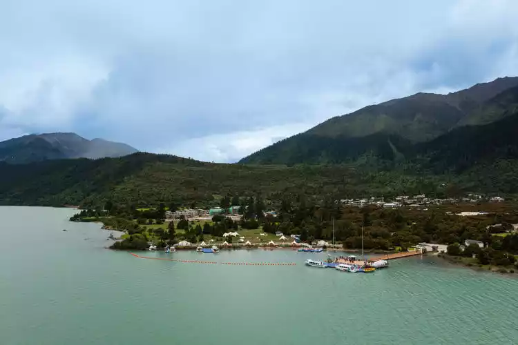
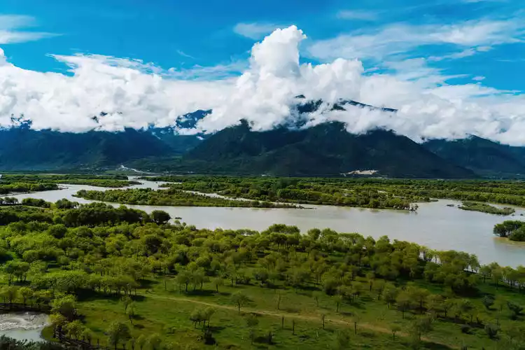
The first stop of our trip was Basongtso in Nyingchi. Basongtso is also known as Cogao Lake, which means "green water" in Tibetan.
For thousands of years, the magnificent Basumtso Lake has been like a flawless turquoise, quietly resting in the embrace of snow-capped peaks and green forests, nourishing and giving birth to countless wonders and magical legends.
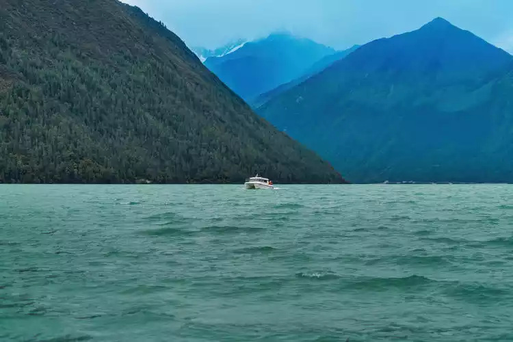
Basongcuo Lake, at an altitude of over 3,700 meters, is the lowest major lake in Tibet. Its waters are as clear and emerald green, reflecting the snow-capped mountains and trees in a breathtaking beauty.
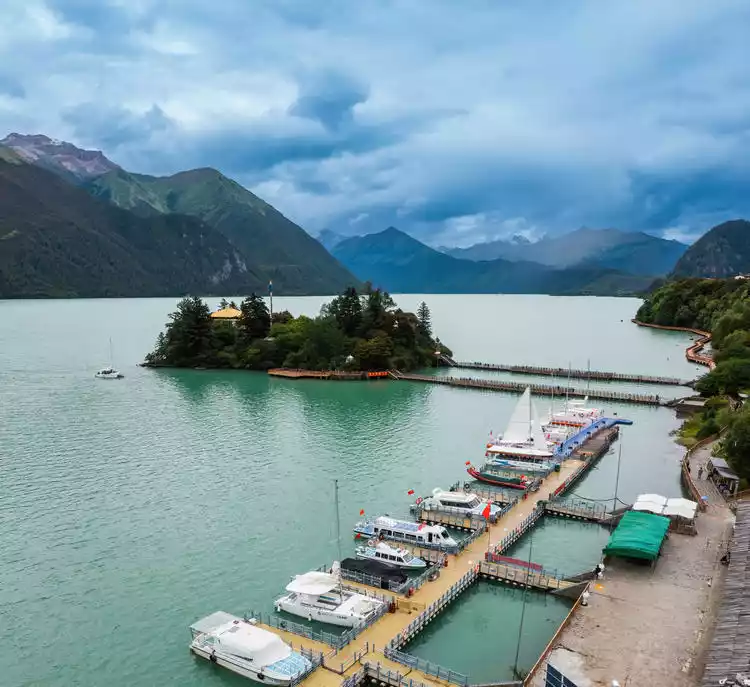
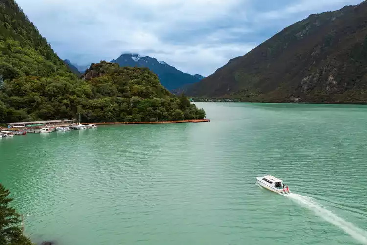
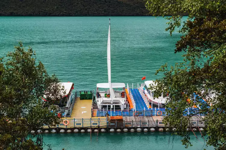
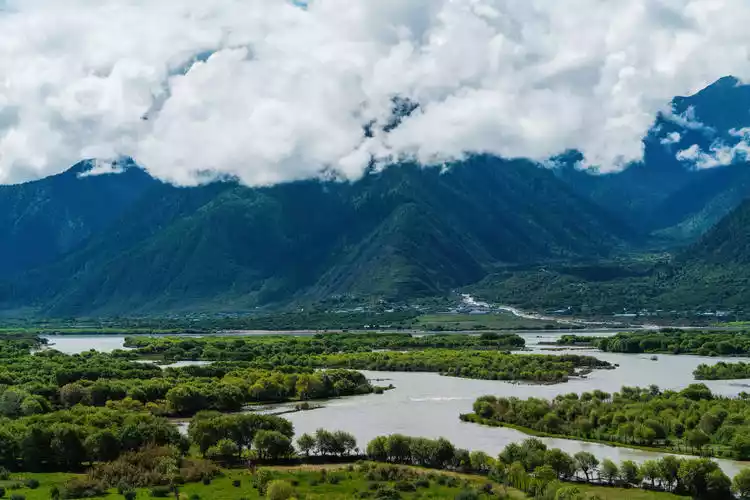
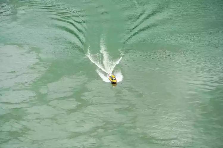
Take a cruise ship, floating on the lake, the breeze is blowing gently, the lake surface is turquoise, the vast snow-capped mountains are in front of you, and both sides are lush green. For a moment, you even forget that you are deep in the plateau and think you have come to the misty Jiangnan.
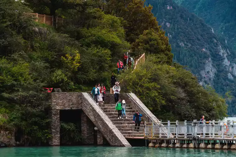
The Heart of the Lake Island, also known as Zhaxi Island, is said to be a hollow island, meaning it is not connected to the lake bottom but floats on the surface. Although this is just a legend, it still makes people feel magical.
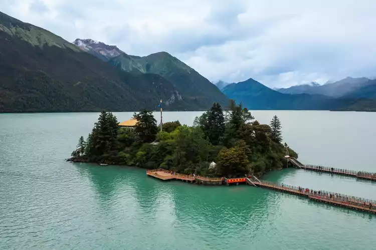
The cruise ship docks at the Forgotten Pier. It is said that this is a place where one can empty the mind and forget the troubles of the world, reconcile with oneself and blend with the world.
Forgetting requires talent and understanding. "Forgetting" is also a practice, it is letting go and also deconstructing again, like this lake, this water, this mountain, this touch of green, the beauty of order is revealed in harmony.
Tips:
Detailed address: Cuogao Township, Bahe Town, Gongbujiangda County, Nyingchi City, Tibet Autonomous Region
Ticket price: 120 yuan per person
Round trip boat trip: 150 yuan/person
Play time: 4 hours
Day 3: The beautiful Niyang River Scenic Area
Driving from Linzhi to the Yarlung Zangbo Grand Canyon, we passed the Niyang River Scenic Area, Benri Sacred Mountain, and Buddha Palm Sand Dunes along the way. We made a brief stop at the Niyang River Scenic Area and Benri Sacred Mountain.
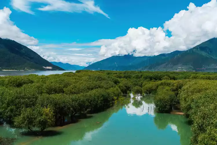
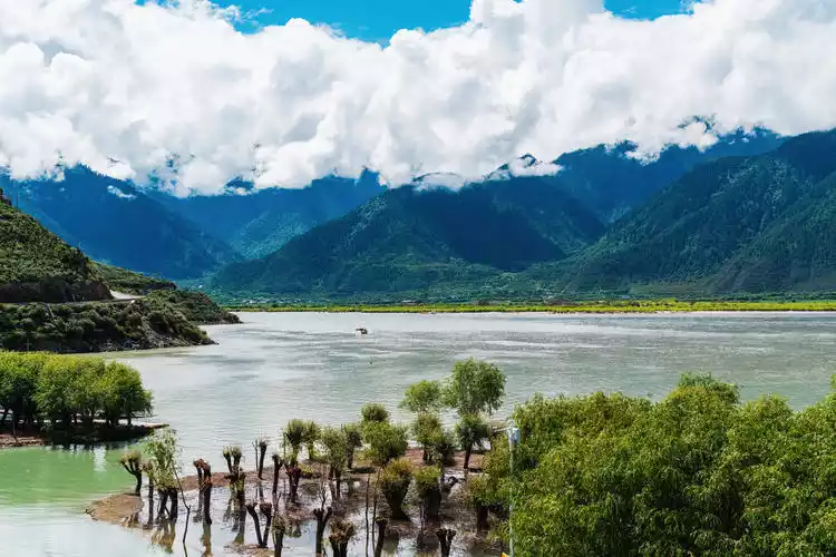
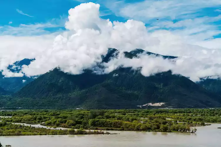
The Niyang River is the mother river of the people of Nyingchi. The river water winds down from the ancient glacier at an altitude of 5,000 meters. Its murmuring and graceful surface has the wildness of the universe running wild. The Niyang River Scenic Belt Scenic Area starts from Daze Village and ends at Mirui Demu Temple. There are countless beautiful scenery and historical relics scattered along the Mirui Highway.
The vegetation on both sides of the Niyang River is intact, the scenery is charming, and there are many scenic spots along the way. There are many wild birds in the Niyang River Scenic Area, and it is also the famous wintering area of black-necked cranes in Tibet.
I yearn for Nyingchi in spring, with its banks of the Niyang River adorned with peach blossoms and a scene of three lives and three worlds. I also love Nyingchi in summer, with its misty sea of clouds hanging mid-mountain, its blue sky and white clouds, and its verdant grass. How delightful would it be to experience the thrill of plateau rafting and immerse myself in the idyllic idyll of the Qinghai-Tibet Plateau, a place reminiscent of, yet distinct from, the Jiangnan region?
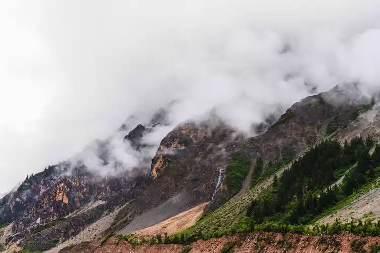
Visit the world's largest canyon and see China's most beautiful mountains
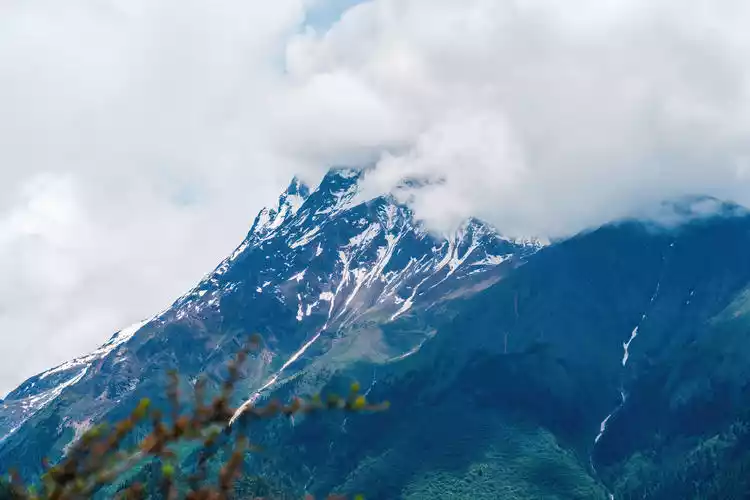
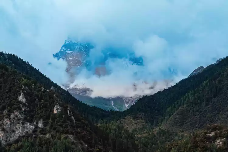
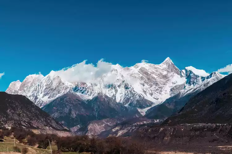
He is "thunder and lightning burning like fire", he is "a spear piercing the sky", he is "a magic needle that locks the universe", even the Monkey King's golden hoop cannot compare to his majestic figure at 7782 meters. He is the father of all mountains in Tibet and the most beautiful mountain in China - Mount Nanga Parbat.
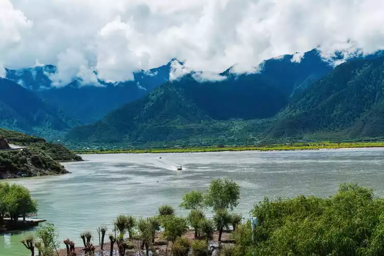
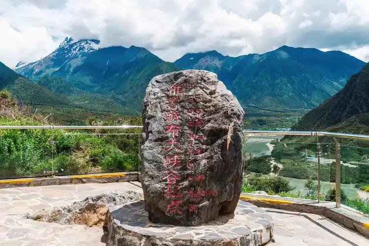
The second stop of our trip to Tibet was when we came to the world’s largest canyon – the Yarlung Zangbo Grand Canyon, and saw the most beautiful mountain in China – Namjagbarwa.
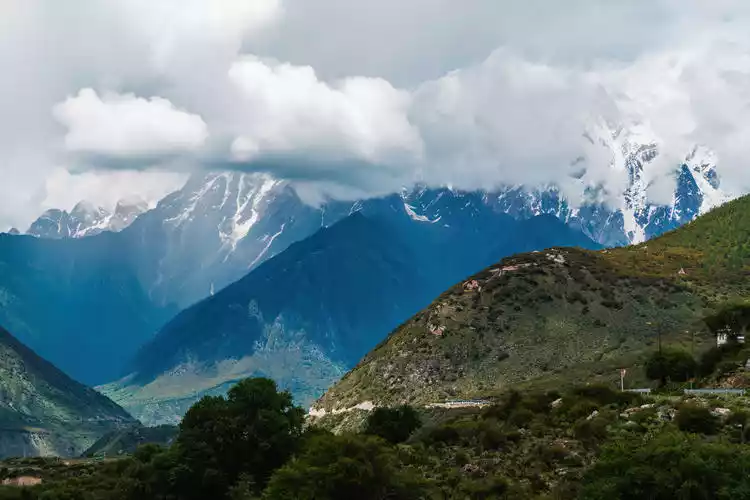
Tour buses come and go, and the four scenic viewing areas capture the clouds and mist, as well as the past. This is how you should enjoy the Yarlung Zangbo Grand Canyon, seeing the mountains, the water, the history, and the reality.
The third viewing platform of the mountain is the best place to see Mount Namjagbarwa. If you want to see the beautiful face of Mount Namjagbarwa, you really need a little bit of luck. There is only a window period of more than 50 days a year to see the whole picture of the sacred mountain. The rest of the time, the sacred mountain is shrouded in clouds and mist, and you can only appreciate the hazy beauty.
The 4th viewing platform is the closest to the Yarlung Zangbo River. "Yarlung" means water flowing from the sky in Tibetan, and "Zangbo" means river in Tibetan.
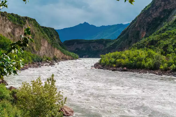
Time flies, never ceasing day or night. The river surges, its turbulent waves surging, the rumbling sound of the flowing water echoes in the canyon, and my ambition is in my heart.
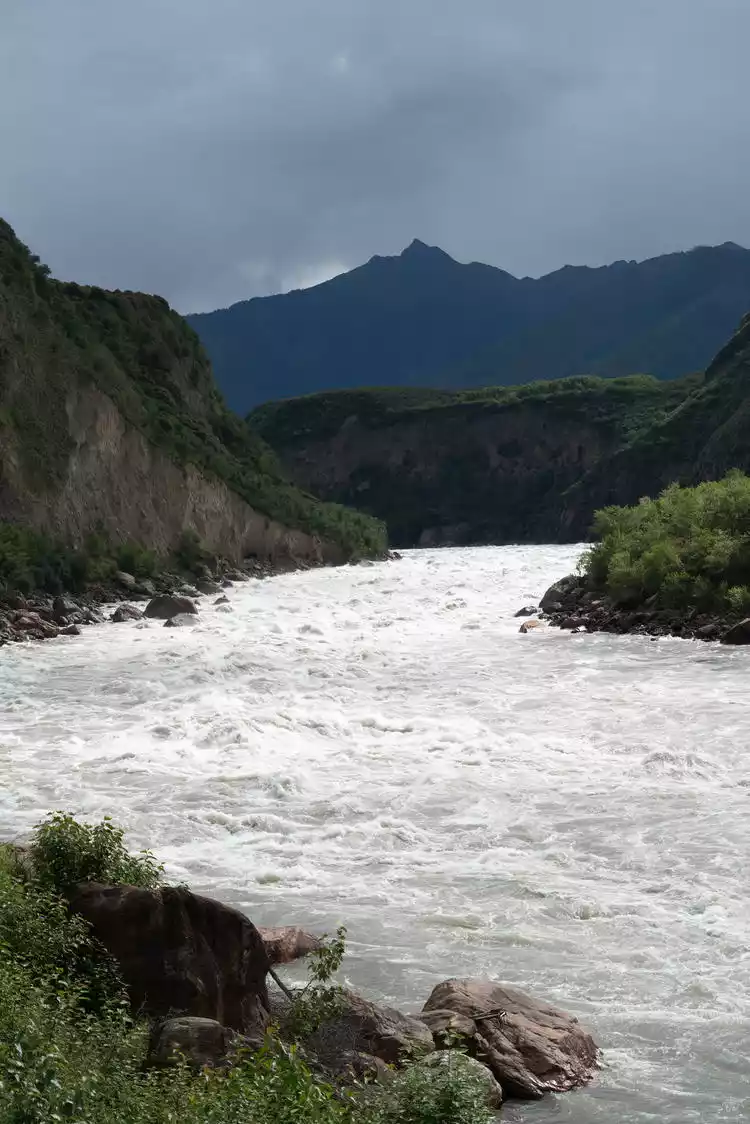
The first viewing platform, also known as the Daduka Ruins, marks the starting point of the Yarlung Zangbo Grand Canyon. The remains of the ancient castle here, once the manor castle of the Gongbu chieftain, have since vanished into the mists of history. The castle is gone, the Yarlung Zangbo River remains as it was yesterday, and Namjagbarwa, obscured by drifting clouds, has ever witnessed this past?
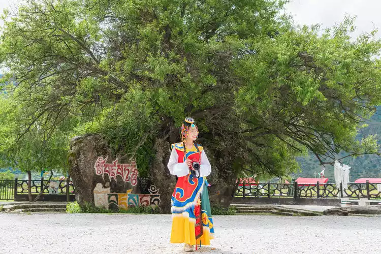
Visit the second viewing platform, also known as Love Square, where you'll find a thousand-year-old mulberry tree and a stone-growing tree. The thousand-year-old mulberry tree is said to have been planted by Songtsen Gampo and Princess Wencheng as a testament to their love, and symbolizes happiness, fulfillment, and longevity. The stone-growing tree symbolizes a love stronger than stone, and the peach tree splits the stone in two, symbolizing life as fire that can break even the most stubborn stone.
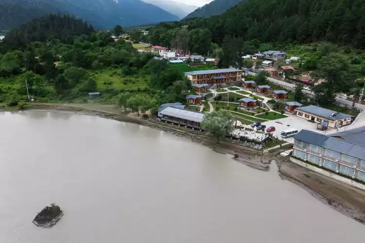
Overnight in Suosong Village, Tibet
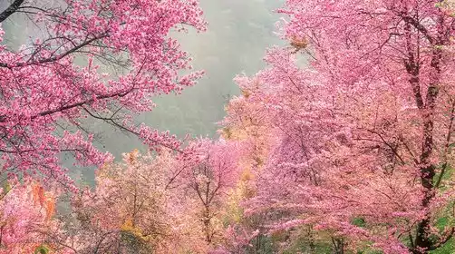
Suosong Village, located on the north bank of the Yarlung Zangbo Grand Canyon, offers the best vantage point for watching the sunset over Mount Namjagbarwa. Suosong Village has become incredibly popular in recent years, and reservations are especially tight during the Peach Blossom Festival.
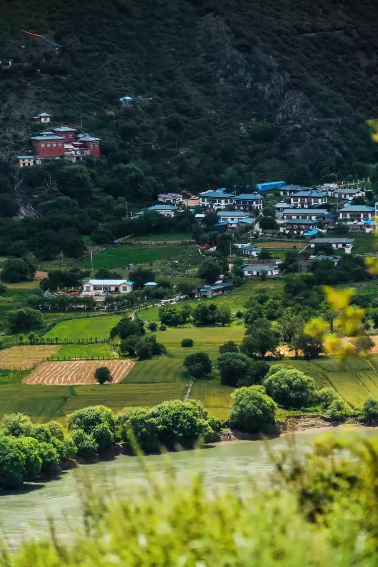
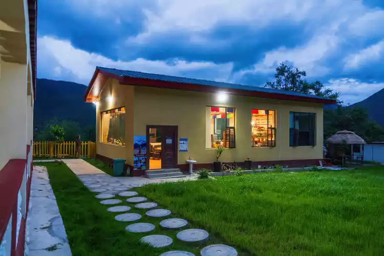
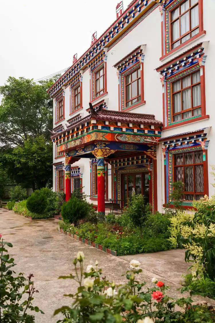
In the drizzle, we checked into the Tibetan Homecoming Hotel in Suosong Village. At this time, Suosong Village became even quieter and more peaceful, with a row of pastoral scenery, the Yarlung Zangbo River next to the village, and lush peach forests. Every spring, peach blossoms are in full bloom, blending with the surrounding rivers and snow-capped mountains, which is simply beautiful.
Day 4: Snowy Jiangnan, Eastern Switzerland – Lulang Town
Today's itinerary is to depart from Suosong Village in the morning, have lunch in Lulang Town at noon, cross the Tongmai Pass to see Guxiang Lake, and rest at the Ranwu Lakeside Hotel in the evening.
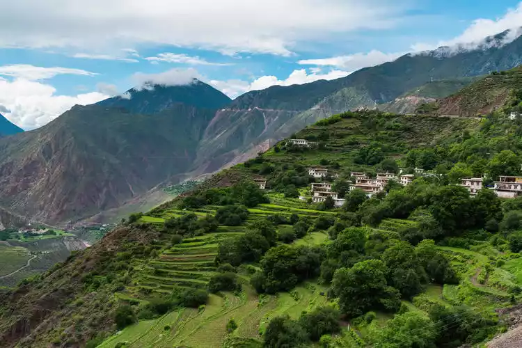
Amidst the beautiful snowy plateau, there lies a place known as the "Dragon King Valley." Its breathtaking scenery is known as the "Snowland of Jiangnan," the "dwelling place of the gods." At over 3,300 meters above sea level, it's nicknamed the "Switzerland of the East." This is the small town of Lulang, located in Nyingchi. In midsummer, the alpine pastures of Lulang are covered in lush green grass and blooming wildflowers, creating an idyllic scene that will captivate you.
The lush green of the young forests and the tranquility of the mother forests, along with the towering snow-capped Namjagbarwa, complement the forested landscape, further highlighting the majestic grandeur of the Tibetan Plateau. Strong Tibetan-style dwellings and buildings that blend Tibetan, Han, and Monpa ethnic characteristics are neatly dotted among the alpine pastures, creating a tranquil and peaceful atmosphere.
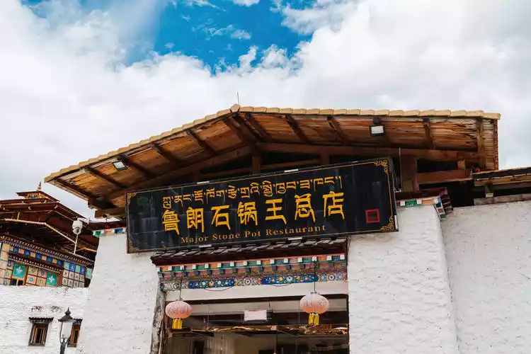
When you go to Lulang, you must try the stone pot chicken. The stone pot is hollowed out from a whole piece of stone, and the chicken is raised by local Tibetans. It is cooked with stream water flowing down from the snow-capped mountains, combined with ginseng, Tibetan Fritillaria, lily, wolfberry and other medicinal herbs, and slow-cooked over low heat to create a delicious dish.
Tips:
Detailed address: Lulang Town Government, Bayi District, Nyingchi City, Tibet Autonomous Region
Transportation Tips: Self-driving is the most comfortable way, with stops and starts, and beautiful scenery all the way. Cars from Bayi Town to Bomi all pass through Lulang. Chartering a car costs about 200 yuan and the journey takes about 3 hours.
Best time to travel: All seasons, each with its own unique scenery
A bridge is built, a natural barrier is opened to the public
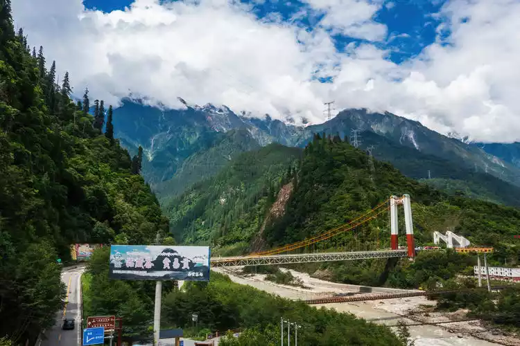
The Tongmai Bridge is a key project on the famous Tongmai dangerous section of National Highway 318 on the southern line of the Sichuan-Tibet Highway. Three cross-river bridges from different historical periods are distributed at the same location. The main one open to traffic is the Tongmai Bridge, a single-tower oblique span bridge. The original two bridges have suspended the passage of motor vehicles.
The old Tongmai Bridge is a wooden suspension bridge, similar to a zipline bridge suitable for only one person. The second bridge was built in 1950 by the PLA's 18th Army during its advance. The third Tongmai Bridge is a single-tower, single-span steel truss suspension bridge. In April 2016, the Tongmai section of the Sichuan-Tibet Highway renovation project, primarily consisting of five tunnels and two bridges, was completed. Travel time on this perilous Tongmai section has been reduced from an average of two hours to just 20 minutes.
Guxiang Lake, located near the famous town of Guxiang on the Sichuan-Tibet Highway, is a barrier lake on the Parlung Tsangpo River. The water is clear from May to September each year, creating stunning photos. Our visit coincided with the rainy season, so the water was slightly murky.
Guxiang Lake is not big, and is surrounded by trees. There are pavilions and towers on the lake. There is often snow on the tops of the mountains on both sides of the lake, and taking photos of the lake under the snow-capped mountains is also very beautiful.
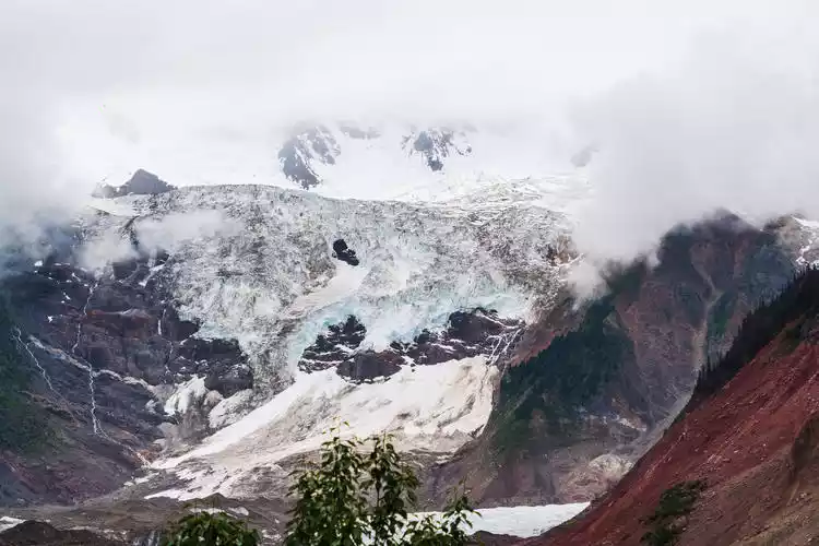
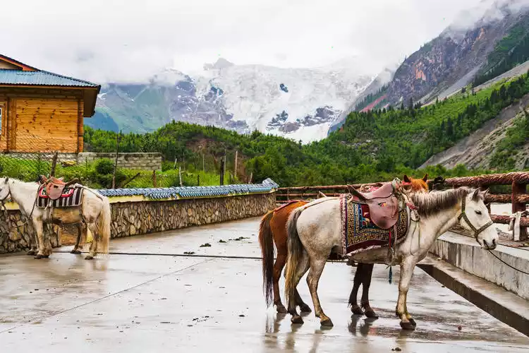
Day 5: Horseback riding to see the glaciers, a thousand-year-old sight
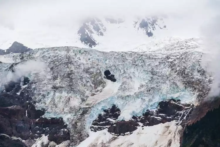
Some encounters are destined to happen. A few years ago, I drove along Highway 318 and passed by the Midui Glacier in Nyingchi. For various reasons, I was unable to witness its splendor. But this beautiful event was destined to happen six months later.
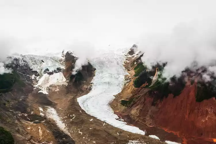
The Midui Glacier is formed by the confluence of world-class icefalls, each over 800 meters high and 1,000 meters wide. A primeval forest stretches between the two cascades. The main peak of the Midui Glacier is 6,800 meters above sea level, while the snowline is only 4,600 meters above sea level. The lower reaches of the glacier are nestled in a mixed coniferous and broad-leaved forest.
When the weather is fine, you can see the mountain flowers blooming around the glacier and the lush forest dancing like silver snakes.
Our meeting happened to be during a rainy day, and the sea of clouds was misty. Glaciers, forests and mountains were hidden in the clouds, appearing and disappearing from time to time. From a distance, they looked like traditional ink-and-wash landscape paintings.
It is still several kilometers from Midui Village to the foot of the glacier, and it is a climb, which is very demanding on personal physical strength. We chose to ride horses back and forth, which can not only save physical energy but also effectively prevent the occurrence of altitude sickness.
Most of the horses here are pack horses, small in stature but strong in endurance, well-suited to life on the plateau. Back in the day, these Tibetan pack horses were the primary means of transport along the ancient Tea Horse Road, carrying goods from one place to another and keeping the route busy.
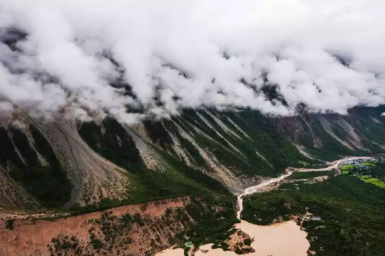
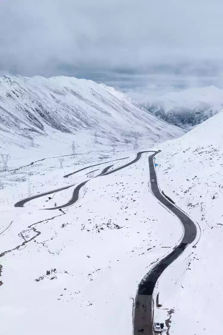
The 72 bends of the Nujiang River
According to the "Annals of Tibet," an explorer described Tibet's geography as follows: "The mountains are like a thousand winding paths, and the roads are not even a hundred steps flat. Rocks are everywhere, and there are no paths for people or horses. The terrain is extremely difficult and dangerous, and it is beyond description."
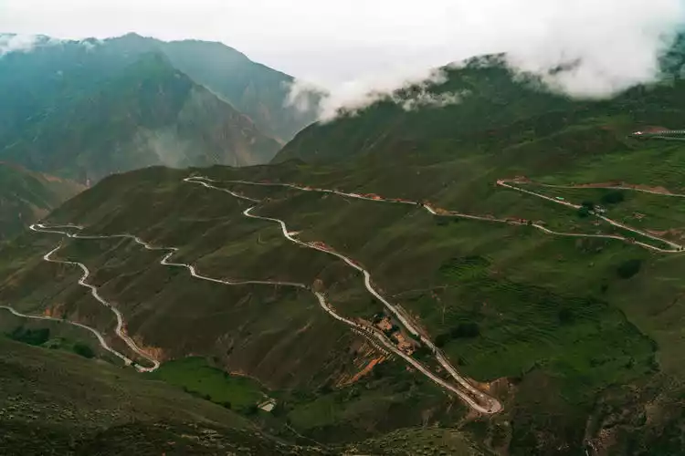
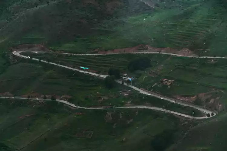
This description perfectly corresponds to the 72 bends of the Nujiang River, also known as the 99 U-turns, the 108 bends of the Yela Mountain, and the 99 bends of the Sichuan-Tibet Highway. While 72 is merely an approximate number, describing the sheer number of bends and the danger of the road, some have carefully counted them and discovered there are actually over 130 sharp bends. Not only are these turns sharp and steep, but most are U-turns. If you're not careful, the Nujiang River awaits you below. It's truly daunting, a true marvel of Chinese highways!
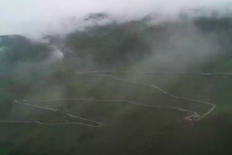
Many cyclists must pay attention here. They must control the speed, check the brakes in advance, and do not drive too fast. For those who drive, there is no need to say more. You should maintain a speed of less than 40km/h and go slowly. It usually takes about an hour to travel this route. Especially on rainy days, many drivers drive through the 72 turns, counting the overturned cars on the roadside and walking through it tremblingly.
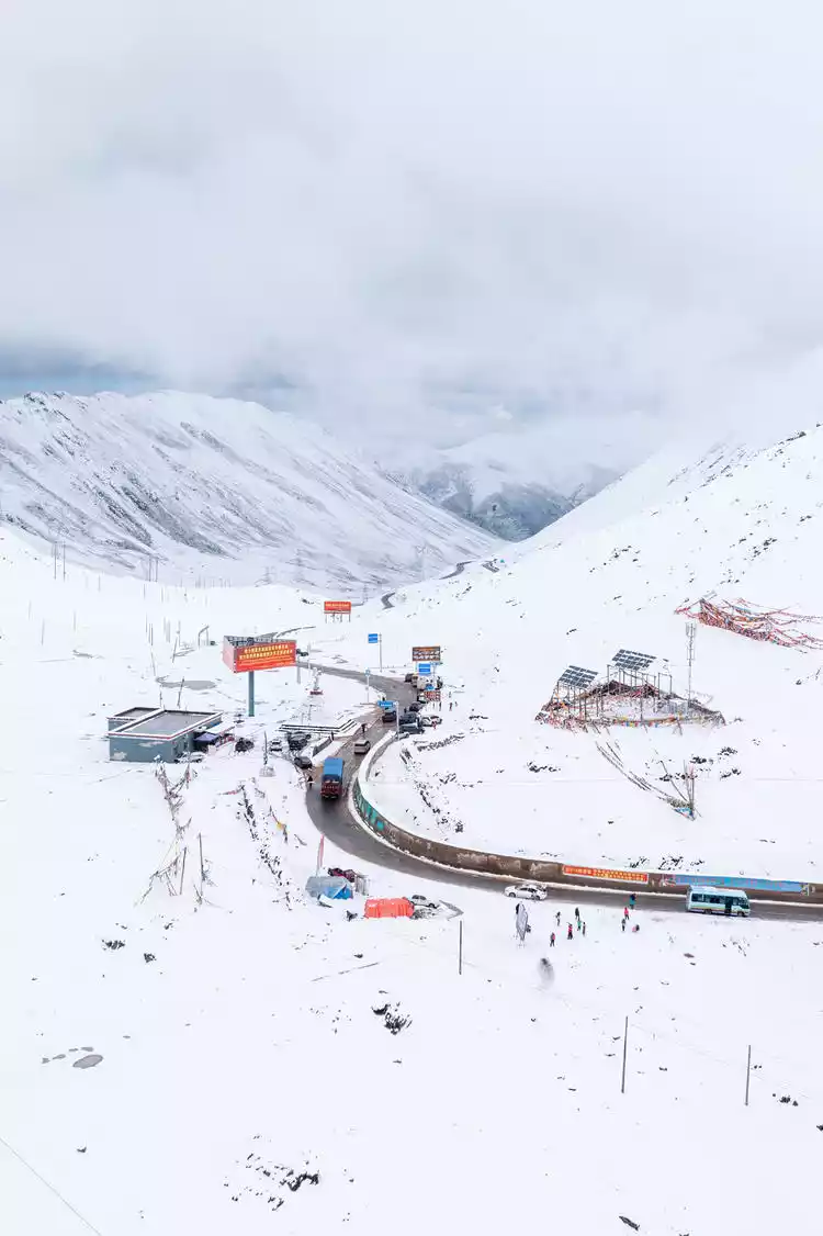
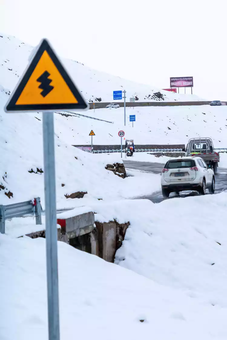
Day 6: Whispering at Dongda Mountain
Our itinerary today is to depart from Zuogong County, Qamdo City, cross the Dongda Mountain Pass, and arrive at Gola Village to see the ancient salt fields of Qamdo Salt Wells. As we approach the Dongda Mountain Pass, the snow on the mountain becomes increasingly thick. Last night's rain below the mountain melted into falling snow on the mountain, turning summer into winter in a split second. It's truly awe-inspiring and truly remarkable. Perhaps Dongda Mountain itself has something to say about this:
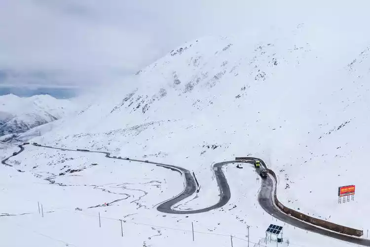
Hey, I'm from Dongdashan Pass. I'm stationed on the Sichuan-Tibet Highway 318 year-round. The last time I measured my height, I was 5,130 meters above sea level. I remember a few years ago, when I was measured, I was 5,008 meters tall. It seems I've grown taller. This impressive stature also makes me the highest point on the Sichuan-Tibet Highway.
Don't be intimidated by my imposing figure; I'm actually quite gentle. I remember yesterday, a group of Zhuob (good friends, brothers) passed by here, and I could see their joy and excitement. It must be midsummer elsewhere at this time of year, but even though they were lightly dressed, they were running and playing in the snow, unperturbed by the slightest hint of cold.
After millions of years of vicissitudes, I stand proudly here, witnessing the completion of National Highway 318 and the arrival of electricity to this snowy plateau. From then on, traffic came and went, and the natural barriers were bridged. At night, my family sat together, the lights warmed my heart, and the twinkling lights of thousands of homes echoed with the stars in the sky. This prosperity broke my eons of loneliness and brought me a bond that I longed for.
In the past few years, when people mentioned Tibet, they felt more mysterious than yearning for it, and they needed to prepare themselves mentally before making the trip, and even formed a so-called contempt chain.
In fact, in my opinion, as long as you have a pious heart, the beautiful scenery along the way will not lie, they will meet all your expectations. Road, rail, plane, as long as you want, you will always get there. In a few years, this place will be fully connected by highways and high-speed railways, and the beautiful scenery will no longer be far away.
I still have to say a message: Hey, I am from Dongda Mountain Pass, I am waiting for you here~
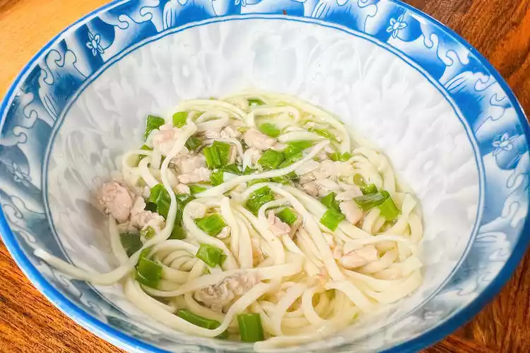
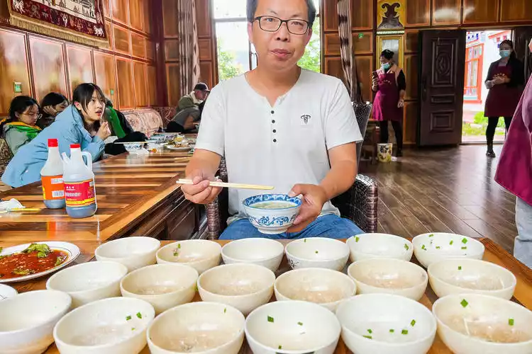
Guola Village Jiajia Noodles
As evening approached, we finally arrived at Gola Village. Our first priority was to find food and clothing. We had lunch? Dinner? Whatever you wanted, filling our bellies was paramount.
Gaga noodles is a specialty snack from the Yunnan-Tibet region. A large bowl is cooked each time and placed in small bowls. Each small bowl only holds one mouthful, and the waiter will add more food in batches. After you finish a mouthful, the waiter will add a little more, and you can finish a bowl after each mouthful. It is cooked with minced meat and is extremely delicious until you are full.
Eating Gaga noodles is a form of leisure and entertainment, and the complicated service is a way to express welcome to guests from afar.
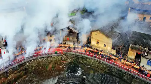
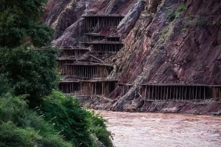
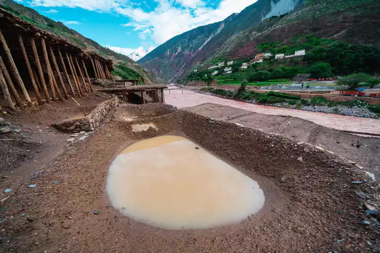
Changdu Millennium Ancient Salt Fields
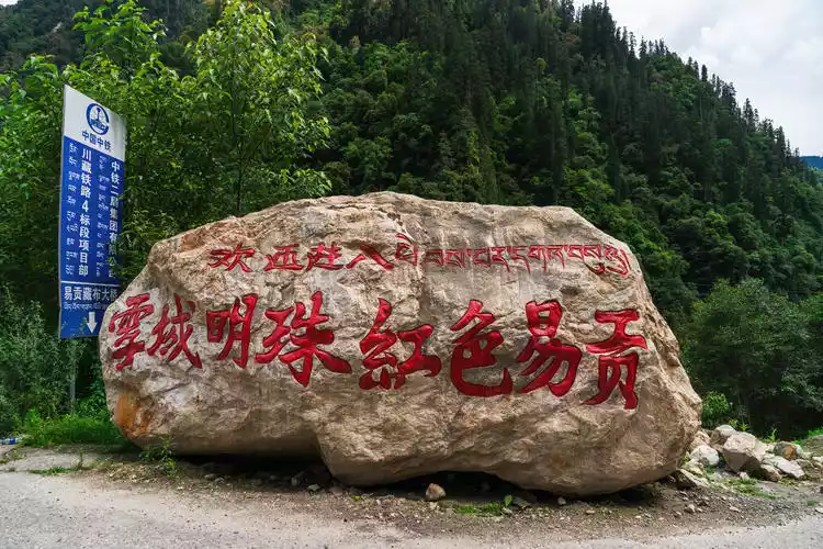
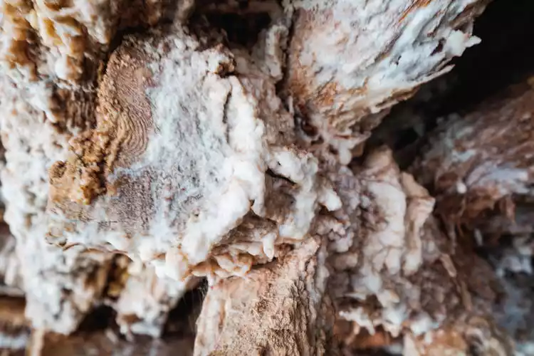
Over time, brine transforms into salt. Facing this gift from nature, the people of Gada have continued the tradition of hand-drying salt for over a thousand years, like the ever-flowing Lancang River, its source stretching back thousands of years and never ceasing.
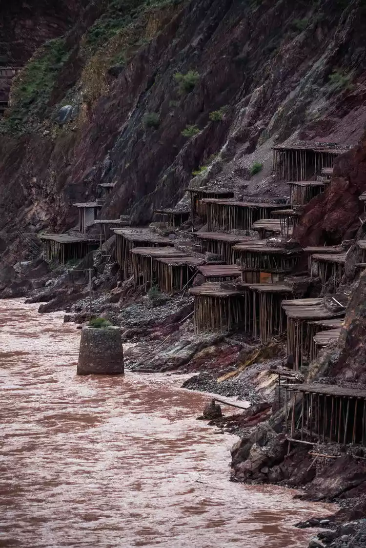
Located on the banks of the Lancang River in Naxi Ethnic Township, Mangkam County, Qamdo City, Tibet, Jiada Village boasts over 3,000 ancient salt pans. Built on the hillsides along the Lancang River, these salt pans are constructed using a framework of wooden pillars topped with a flat, rammed-down, permeable soil.
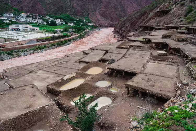
Local villagers still maintain the original method of hand-drying salt. They draw brine from the salt wells and salt ponds along the Lancang River and pour it into the salt pans. After being sun-dried and air-dried, the salt crystals form. This ancient craft has been practiced in Jiada Village for over 1,300 years.
The salt pans of Jiada Village on the west bank of the Lancang River are famous for their abundant production of red salt, with peak harvesting occurring between March and May. The salt pans are relatively wide, and the resulting salt is a light red, commonly known as peach blossom salt or red salt. The butter tea brewed with this salt is bright red and very sweet.
The Naxi and Shangxiayanjing villages on the east coast mainly produce yellow salt and white salt, commonly known as snowflake salt, which is more expensive than red salt. Separated by a river, the differences in geology and soil conditions have created a world of different pastel colors.
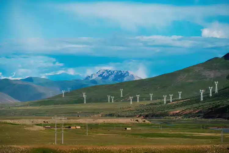
Day 7: Low-key luxury, Bonda Grassland
The sky is high and the clouds are light, the land is wide and gentle, the grass is lush and the cattle and sheep are leisurely.
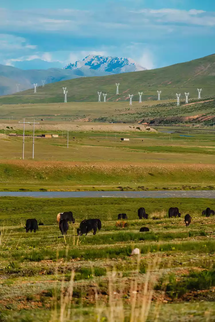
The Yuqu River meanders through it, nourishing this alpine grassland - Bonda Grassland. Even in summer, this grassland carefully protects this gift from nature. The green is very low-key, not ostentatious or luxurious, but pleasing to the eye.
Qamdo, an important hub on the Ancient Tea-Horse Road
The Tongtai Hotel in Qamdo is located on the banks of the Zaqu River. At midnight, the sound of the rushing water lulled me to sleep, and in my dreams, I savored the aroma of Sichuan cuisine and recalled the past of the Ancient Tea Horse Road. Qamdo, located in the eastern part of the Tibet Autonomous Region, is an important part of the Ancient Tea Horse Road.

The Chamdo Ancient Tea-Horse Road, located in the Chamdo region of eastern Tibet, was a major transportation route formed by the historical exchange of tea and horses between Tibetans and Han Chinese. Starting in U-Tsang, the route continued eastward along the Yarlung Zangbo River, passing through Nyingchi and reaching Chamdo, a key hub on the ancient Tea-Horse Road.
The Zaqu and Angqu rivers meet in Qamdo, becoming the Lancang River. The Lancang flows southward, becoming the Mekong River after leaving China, passing through Myanmar, Laos, Thailand, and Cambodia before emptying into the South China Sea at Ho Chi Minh City, Vietnam.
Conclusion
High mountains, snowfields, sea of clouds, rivers, green grass, leisurely yaks, eagles with spread wings, enthusiastic people, and radiant smiling faces... This trip to Tibet has left me with many memories and touching moments. I can't help but sigh at the vastness of Tibet. I have been to Tibet more than once, but each time it seems like I have only seen a corner of its face, hazy and mysterious, mysterious and beautiful, so beautiful that I can't bear to leave.
The 7-day trip was too rushed, so rushed that it was just a glimpse of life. My dear Zhuo Bu, would you like to travel with me next time?