Georgia Hiking Guide: Essential Equipment, Accommodation, and Attractions
Preface
When we first told our family, colleagues, and friends that we were planning a hiking trip to Georgia during National Day, everyone's immediate reactions were: "Georgia? What the hell?" "What kind of place is that?" "Is it safe?"
Let's take a look at it together. Georgia is located in the Caucasus region and is one of the three Caucasus countries, the other two being Armenia and Azerbaijan. The Caucasus Mountains are located in southwestern Russia, sandwiched between the Caspian Sea and the Black Sea.
This means you can see all kinds of people here, including Russians, Turks, Israelis, Middle Easterners, and Germans. Georgians are tall and have long faces, and many men have full beards, which gives them a fierce look. They don't feel very warm when communicating with people, but generally speaking, they don't have any bad intentions, making it a trustworthy tourist destination.
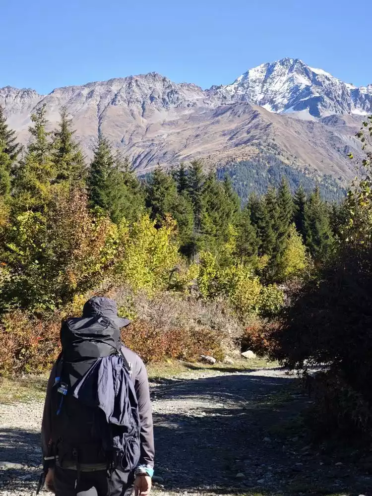
We chose Mestia and its surrounding areas as our hiking destination. The four-day trek from Mestia to Ushguli is the most well-known route. This route is moderate in distance and elevation, yet offers diverse scenery and convenient accommodations, making it a suitable hike for both beginners and experienced hikers.
In addition, after referring to information from some foreign hiking websites, we added a high-intensity day trip from Mazeri to Mestia, but it was also the most worthwhile day and is highly recommended!
Itinerary Overview
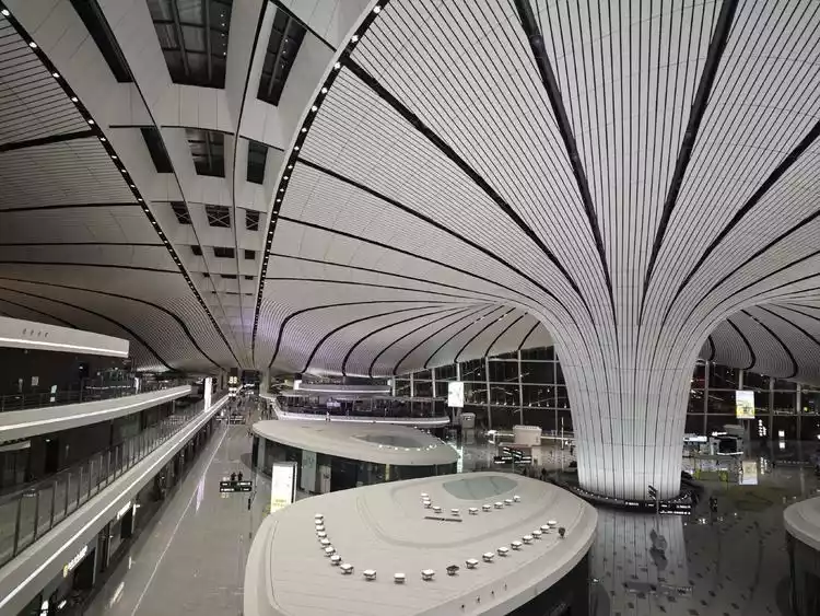
Itinerary: Shanghai -> Beijing -> Doha -> Tbilisi
Way: Airplane
Accommodation: Communal Hotel Plekhanovi
Day 1 Tbilisi -> Mestia -> Mazeri
Mode of transport: Minibus, private car
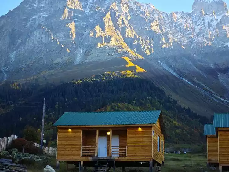
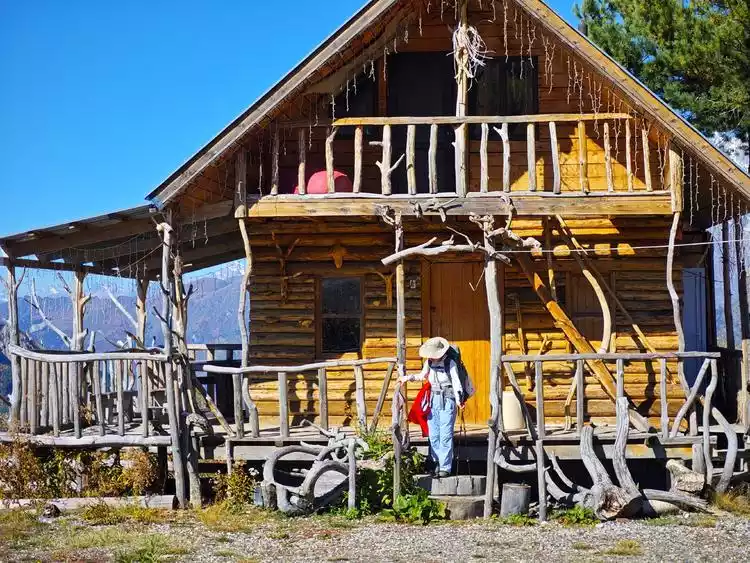
Accommodation: Ushba Cottages
Day 2 Mazeri -> Mestia
Method: Hiking
Accommodation: Hotel Old House Mestia
Day 3 Mestia -> Trabeshi
Method: Hiking
Accommodation: Guest House Gogia
Day 4 Trabeshi -> Adishi
Method: Hiking
Accommodation: Guest House Makhvshi, Grand House Adishi
Day 5 - 6 Adishi -> Mestia
Method: Lying down sick
Accommodation: Hotel Chatini Mestia
Day 7 Mestia -> Adishi -> Iprari -> Ushguli -> Mestia
Method: Hiking
Accommodation: Hotel Old House Mestia
What to bring
Equipment:
Backpacks: Osprey Kyte 36L + Osprey Kestrel 38L
Shoes: LOWA Renegade, Scarpa Kailash
Trekking poles: Both people have two pairs of crutches, a total of 4 MBC
Headlamp: Decathlon + Knightcore UT27
Charging equipment: Knightcore Carbo 20000
Survival
First aid equipment: a medical kit, several iodine cotton balls, a roll of muscle tape, a Swiss Army knife, dressings, medical non-woven fabrics
Medications: Niuhuang Jiedu tablets, multivitamin tablets, several Yunnan Baiyao plasters, Yunnan Baiyao aerosol, melatonin, acetaminophen
Food:
Water bottle: portable titanium cup, Kandi BeFree 0.6L water purification bag
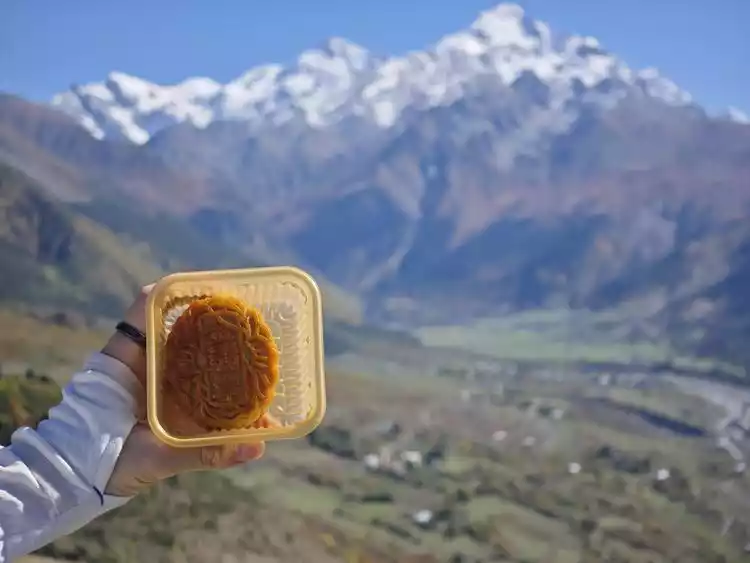
Road meal: some mooncakes
High-calorie foods: Combite isotonic + hypertonic energy gels, Snickers, chocolate
Clothing:
Quick-drying clothes: 3 quick-drying clothes (CoolMax+Merino) per person, 1 jacket
Underwear: 7 pairs of disposable underwear per person, and other items
Quick-drying pants: 2 pairs of quick-drying outer pants per person
Gloves: One pair of light outdoor gloves per person
Socks: Several pairs of various quick-drying socks
Raincoat: Two 3F backpack raincoats, two moisture-proof covers
Daily necessities:
Cleaning supplies: a toiletry bag, some napkins, some wet wipes, and some garbage bags
Camera equipment: Xiaomi Mi 13 Pro, Xiaomi Mi 14
Positioning equipment: Erbulu, Gaochi watch
Expenses
Measurement standard: RMB Total expenditure: 23259.59 (11,629.795 per person) Local expenditure (excluding air tickets): 11,081.59 (5,540.795 per person)
We roughly exchanged Georgian Lari at an exchange rate of 1:2.6. The following summary is a mixture of RMB and Lari, with Lari as the main currency, for reference only.

Transportation options to confirm before traveling
Since Georgia's transportation system is relatively poor, the first thing to consider is how to get from Tbilisi to Mestia. There are several ways to get there:
1. Minibus, price 50 lari per person, takes about 9 hours
2. Charter a car, the price is about 600-700 lari per car, it takes about 7 hours
3. Vanilla Air flight, costing about 90 lari per person, takes 1 hour
We decided to try Vanilla Sky first. Vanilla Sky is a local private airline. All information and ticket purchases can be obtained on their own website. They take off six days a week (rest on Saturdays), and there are one or two flights between Tbilisi and Mestia every day. The specific schedule is as follows.
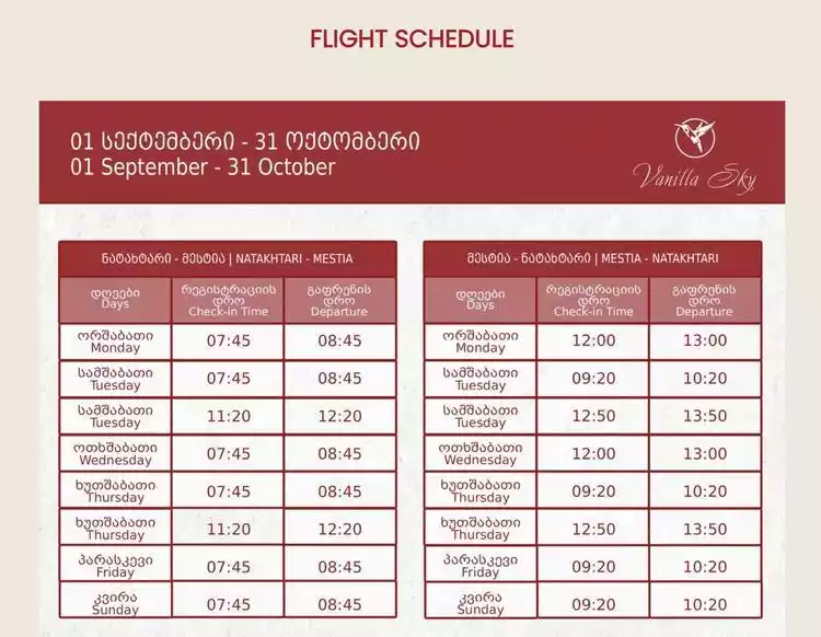
Each flight can only carry 12 or 13 passengers, making it very difficult to get a ticket. Crucially, it's also sporadic. I recommend checking their official website frequently and emailing the flight staff. Even so, flights can sometimes be canceled at short notice, so we ultimately opted for a minibus to Mestia.
There are two boarding points for minibuses from Tbilisi to Mestia:
1. Located at Tbilisi Bus Station Square
2. Samgori Bus Station
You can consult on WhatsApp and contact the minibus administrator at the car plaza for the specific departure time.
From domestic flights to Tbilisi
We purchased a two-stop flight from Shanghai to Beijing, Doha to Tbilisi.
After arriving in Tbilisi, immigration was smooth. Customs only checked my passport, took a photo, and let me pass after waiting for 1 or 2 minutes. However, I had to wait at least 20 minutes to check in my luggage.
After collecting our luggage and exiting the arrival hall, we entered a row of currency exchange counters across from us. To the left were car rental companies, and to the right were SIM card companies. Comparing the exchange rates at all the counters, IntelliExpress offered the best rates and the longest lines. (There were actually two other nearby with good exchange rates, but when we approached them, one said we'd have to wait 20 to 30 minutes. The other accepted our euros, then, after receiving our passports, said there was a system issue and they couldn't exchange the currency.)
I saw other people say online that after leaving the arrival hall, turn right into the departure hall. The exchange rate there is better, even better than in the city. You can also go and refer to it.
Tips: There are three SIM card operators in Georgia:
1. Magti: best signal, most expensive
2. Cellfie: Poor signal in mountainous areas, a wide range of packages, and affordable prices
3. Silknet, reportedly has average signal quality
I strongly recommend buying Magti. In actual tests, Cellfie is difficult to use in the mountainous area of Mestia and there is often no signal.
However, at the airport you can only buy Magti's monthly package, which is very expensive, costing around 50 lari. You can use the WiFi at the airport to check the line or call a car, and then go directly to the Magti business office in Freedom Square to apply for a 7-day unlimited data package (not including calls). The specific rates are: one SIM card - 10 lari, 7-day unlimited data package - 9 lari, a total of 19 lari. After that, you can recharge by yourself in the App "My Magti" on the last day of the current package. The package cannot be renewed in advance.
Comparative Measurement of Transportation Modes in Georgia
There are several types of public transportation:
1. Taxi
2. Ride-hailing apps
3. Public transportation
4. Subway
Taxis: First of all, I don't recommend taxis at all. I haven't used them myself, but based on various online information, taxis that are simply hailed often take detours, and are therefore extremely expensive, especially compared to the taxi-hailing apps mentioned below. The difference is huge.
Taxi-hailing software: The alternative to traditional taxis is the same taxi-hailing app as the domestic "Didi" and "T3 Travel". The most commonly used in Georgia is "Bolt", and some people also use "Yandex". In actual use, one "Bolt" is enough.
After you arrive in Georgia and apply for a SIM card, you can use the local SIM card to register and log in to "Bolt". Of course, you can also log in using a VPN when you are in China.
The usage is similar. After inserting your VISA card, you simply enter your departure and destination. Several types of car types, such as Express and Premium, will appear, along with the price. Please note that this is not an estimated price, but a fixed price. This means that no matter how long the journey is congested or how long the driver takes a detour, as long as the order is completed, the price you pay will be the price that appeared on the screen before you placed the order. This is very comfortable.
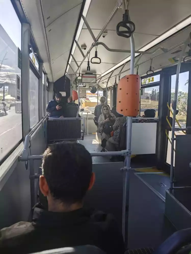
Public transportation:
Georgian buses don't accept cash. There are only two payment methods: VISA and bus cards. VISA cards must be chip-enabled. If you've already got a UnionPay VISA card from China, most don't have a chip, so you'll need to apply for a separate one. The fare is 1.5 lari per person, and you can use the same card for multiple fare payments. Bus cards are a more affordable option, but they can only be purchased at the counters at subway stations. The subway doesn't connect to the airport, so for first-timers in Tbilisi, the only way to get into the city is by bus or taxi.
The bus card is pre-loaded and costs 2 lari. The fare is 1 lari per person for both the bus and the subway, and you can use the card for multiple commutes. Keep your receipt and return it at any ticket counter for a full refund of the remaining balance plus the processing fee. Whether using a VISA or bus card, you can board the bus at any gate. The card reader will be visible on board and you can swipe your card directly.
Subway: Georgia’s subway was built during the Soviet era, more than 50 years ago, so it has a strong Soviet style: old, roaring, dim, and some stations are dug deep underground, which is also very interesting to experience.
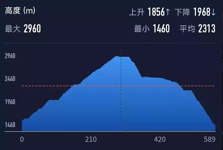
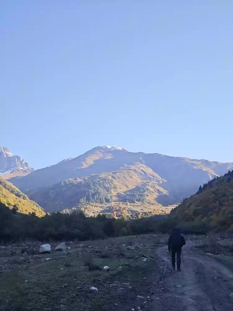
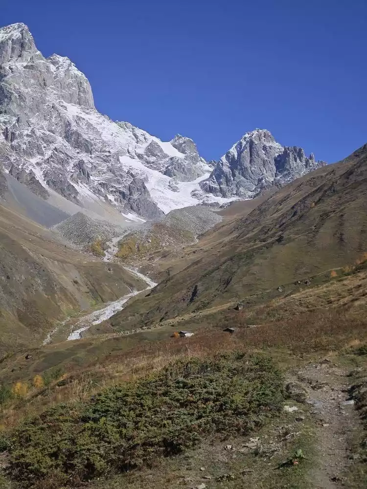
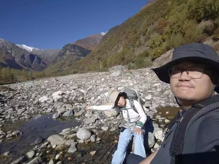
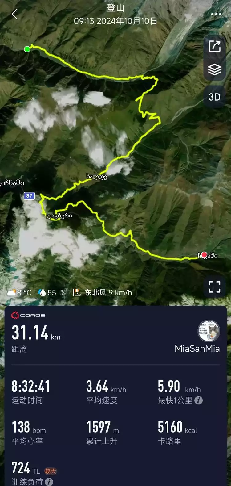
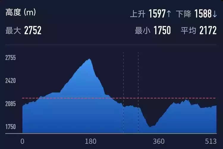
Mazeri - Mestia
First up is today's track preview
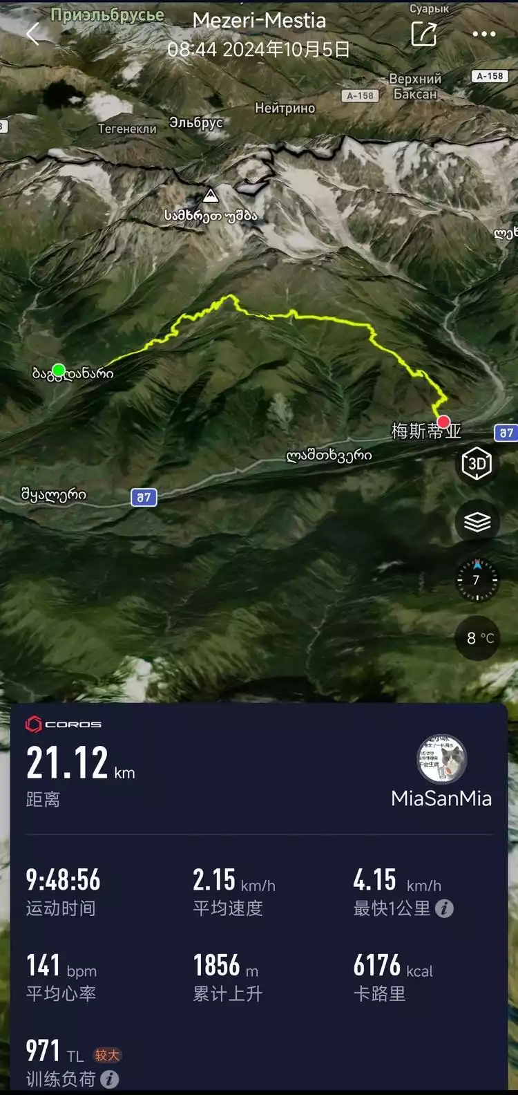
Then there are today's cumulative rise and fall
The alarm clock woke me up at 6:30. It was barely light and the temperature was chilly, but the electric oil heater kept me warm. Breakfast was mostly carbohydrates, perfect for hiking, and topped off with the local specialty fruits and vegetables: half a plate of tomatoes and half a plate of cucumbers.
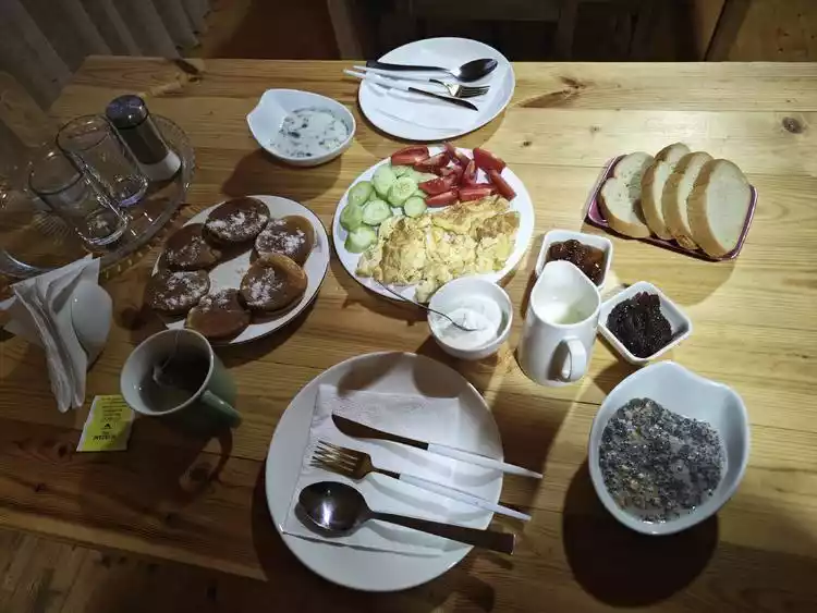
A unique dining experience: Whether you're at breakfast or dinner, the host always boils some hot water nearby, allowing you to choose between black tea bags or instant coffee. Black tea is almost always available, with green tea rarely seen. Besides instant coffee, many places also offer finely ground coffee, which can be brewed directly without using filters, creating a unique flavor.
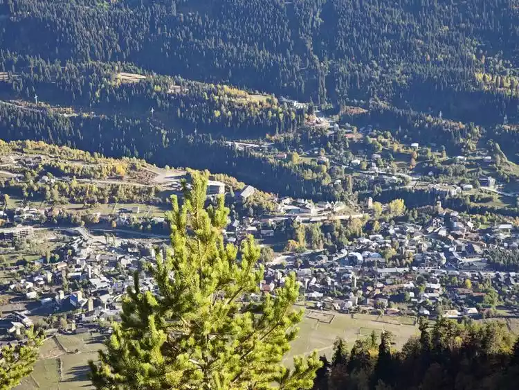
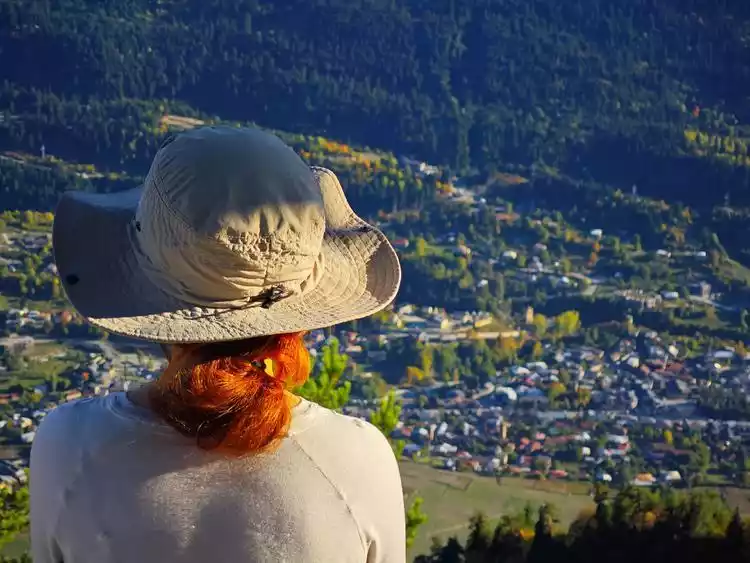
After finishing the meal, I went out and saw Rizhao Xiaojin Mountain, which was a good start for today's arduous journey.
Back in the room, I spent some time packing, took out my hiking poles, and went to say goodbye to the host. However, a small incident occurred during check-out. After returning the key and preparing to leave, the host awkwardly stopped us and explained through a translator that we needed to pay the room fee.
Since we'd booked it in advance through Booking.com, we assumed we'd already paid for the room. In fact, nearly all businesses in this area only accept cash, and even if we booked through Booking.com, we still had to pay cash on site. This left us short on cash, and we subsequently had to withdraw cash from ATMs several times, incurring fees. The good thing, however, is that once you've booked, you can't force a non-refundable stay.
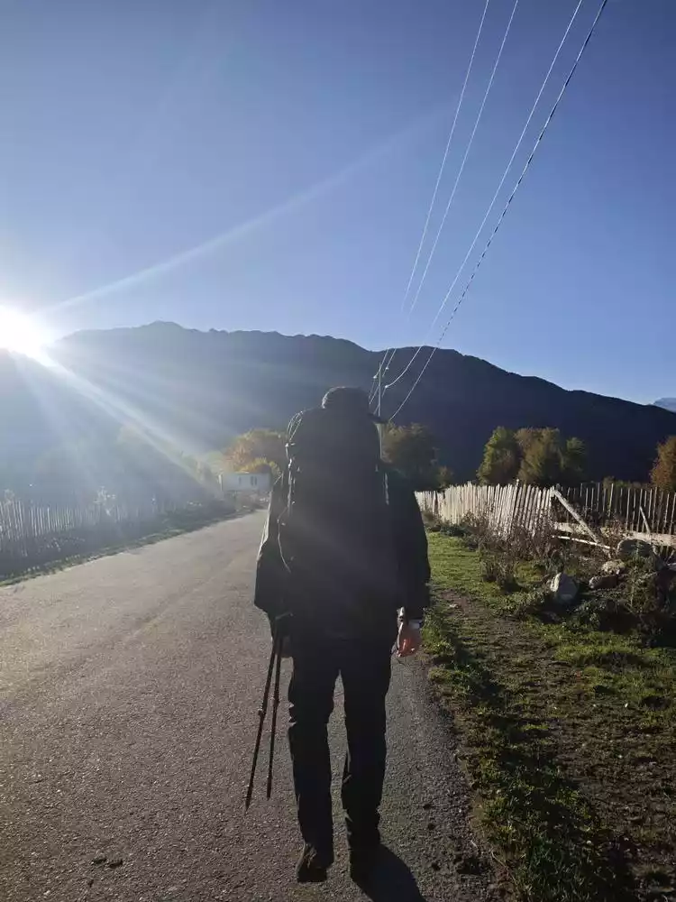
After some twists and turns, we finally set off and went down the mountain along the only road in the village.
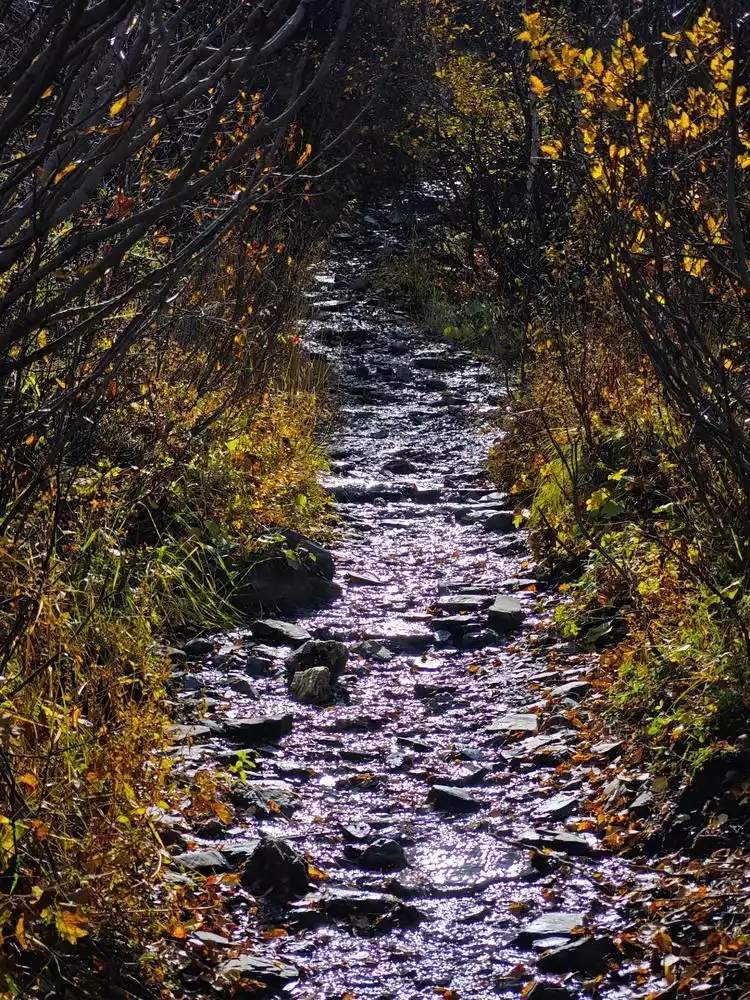
The initial section is still in the village and is mainly muddy roads.
Soon we walked out of the village and headed straight into the river valley and ravine, where the view became wider.
At this point we started to climb slowly, but the slope was not steep, so it was fairly easy to walk, and various small animals began to appear along the way.
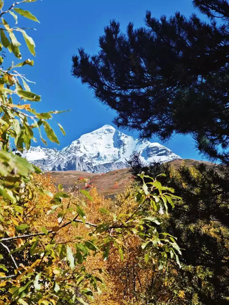
What you can see in the distance is Mount Guli.
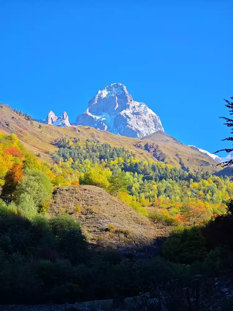
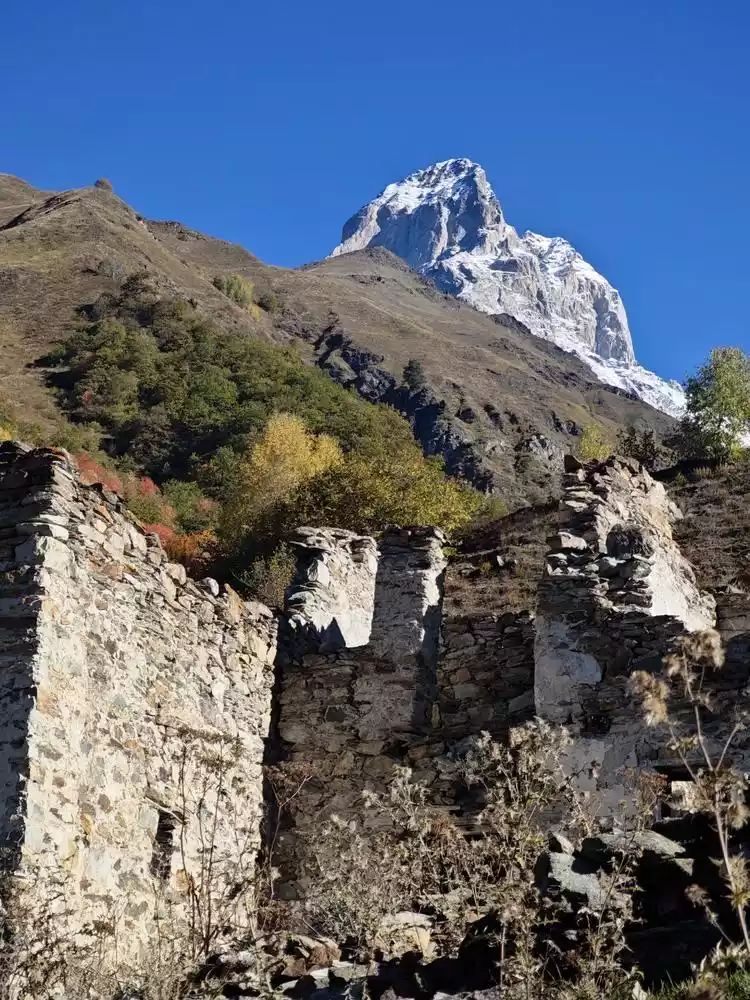
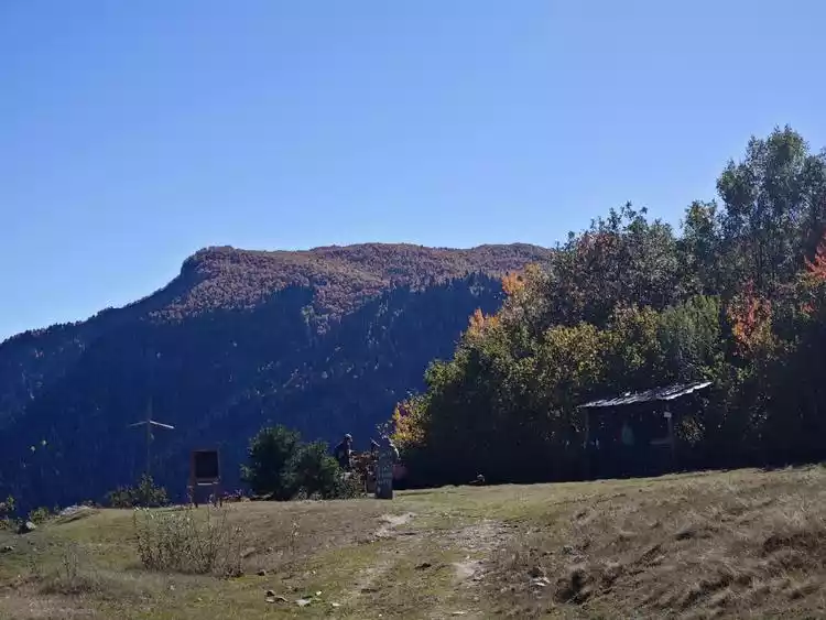
When we had almost climbed out of the riverbed, we came across the ruins of an abandoned village and some shepherds' huts.
After walking a little further, we discovered another feature of this place: the mountain was full of locusts, big and small, so densely packed that you could kill two with one step. People with locust claustrophobia are advised to think twice before coming here.
After climbing another 300 meters, we finally reached a flat mountain. A short distance away, we saw a small, uninhabited cabin, likely a seasonal home for shepherds. The GPS track indicated this was Guli Huts. Another 100 meters further, we reached the Guli Hot Springs, which the website's guidebook mentioned as a place to refill water. However, we didn't find any water when we reached the CP point, likely due to the dry season.
After returning, I continued to climb. At this time, my new shoes had begun to rub my heels and hurt. Here I can share with you the method I personally tested to deal with heel friction:
Tips:
1. Early stage: Try to break in the new shoes as much as possible and prepare socks that fit your feet. Pay special attention to the fact that cotton socks will increase friction after absorbing sweat and easily wear the heels.
2. Early stage: If small blisters have formed, you can try to wrap the heel with a Band-Aid or a thicker dressing. Note that ordinary long Band-Aids can easily be worn off and then turned into a very bad wear item.
3. Blister Stage: If you've developed large blisters, disinfect any sharp objects nearby and puncture the blisters, keeping the puncture as small as possible and the arched outer layer as intact as possible. Then, squeeze out the tissue fluid, apply iodine, and secure the outer layer against the dermis before wrapping it tightly with a larger dressing. It's recommended to reinforce the wound with a muscle tape over the dressing or large band-aid. After two or three days of this, calluses will form, and you'll be invincible!
If you don’t have any dressings or large Band-Aids, you can take out the medical non-woven fabric from your first aid kit, fold it and thicken it, and then fix it with a muscle tape. It’s really useful!
Continue walking forward and you will pass by a high mountain lake (Choushuigou).
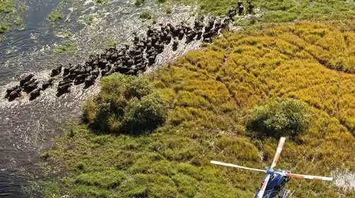
After passing this stinky ditch, you can no longer fully trust the route of the track, because cattle often come to this hill to graze, and the cattle will leave many cattle trails, and most cattle will choose to move horizontally. So if you just follow the visible road in front of you, you may find that there is not much climbing after expending a lot of effort to walk for 1 kilometer.
Therefore, it is most important to follow the general direction and choose the most suitable route for yourself. In order to prevent physical exhaustion caused by detours, it is necessary to prepare various chocolates, Snickers bars and energy gels according to your physical condition before setting off.
There is a platform in front of Guli Pass, which is perfect for taking photos.
Let’s just say that the scenery along the way is actually no different from western Sichuan, Inner Mongolia, and Xinjiang in China, but this pass really has a unique beauty.
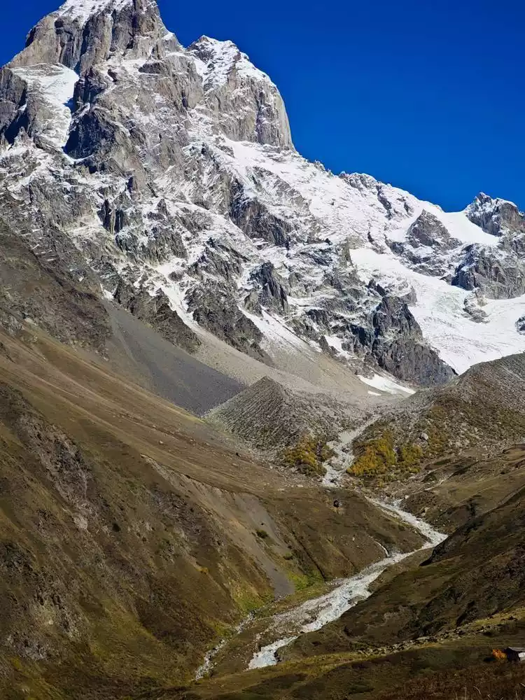
After climbing GUli, the road is all descending.

It's important to note that the sloping road and the damage caused by landslides make the most dangerous part of this hike - crossing the Pushkueri River. There's no clear path to follow. The slope, the current, and the slippery boulders demand extreme caution. After crossing the river, I discovered there was no clear path connecting me to the road on the other side of the mountain ahead, likely destroyed by a landslide. Using both hands and feet, I finally found my feet on solid ground. This short 10-meter section of road exhausted my remaining strength.
Therefore, I strongly recommend that friends who want to come to Georgia for hiking should carefully check out the caucasus-trekking website before coming. There is a very detailed route book and frequently updated GPS track files https://www.caucasus-trekking.com/
It wasn't until a few days later when I had some free time and carefully read the trail book on the website again that I saw the following words: "To get out, don't try to follow the original trail destroyed by the landslide. The terrain there is too steep. Instead, walk along the riverbed for about 10 meters (more or less, it all depends on the conditions of the snowfield), and then climb the trail when the terrain becomes more suitable for travel." If I had read it more carefully at the time, I could have reduced the risk and physical exertion.
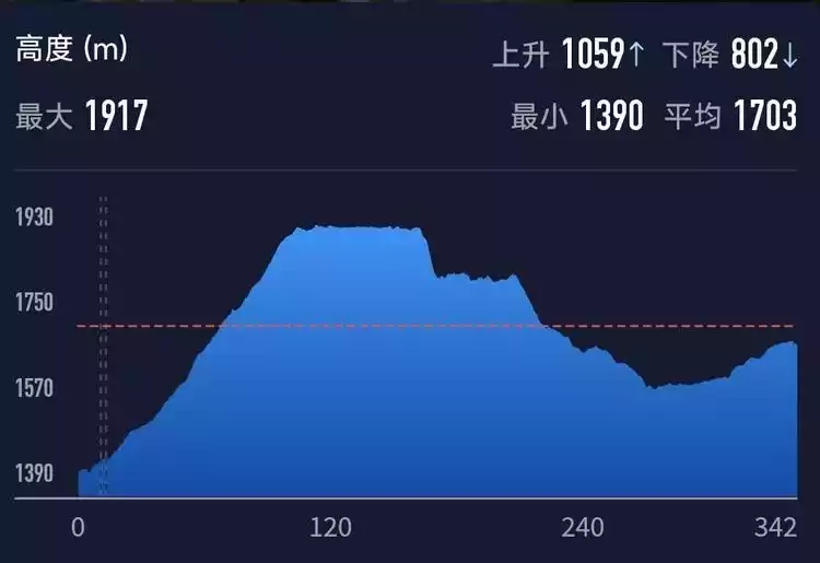
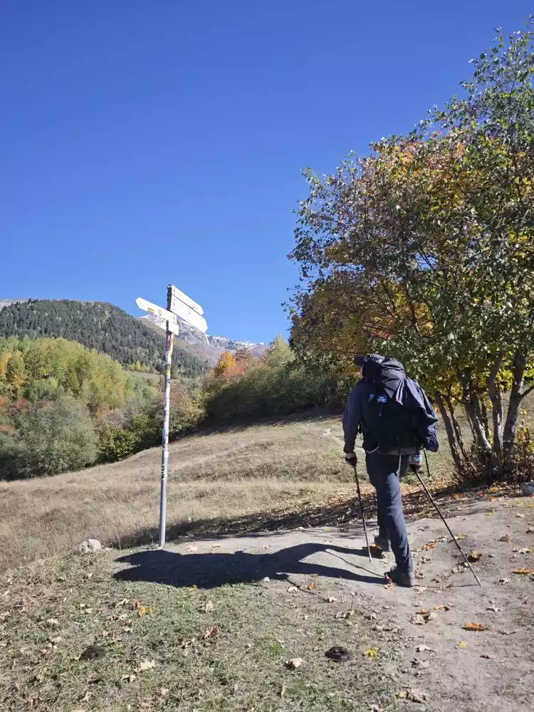
Mestia-Zhabeshi
First up is today's track preview
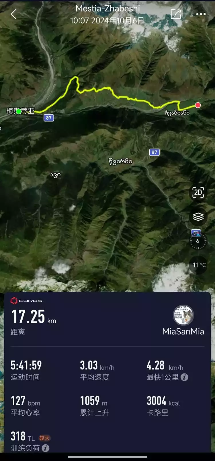
Then there are today's cumulative rise and fall
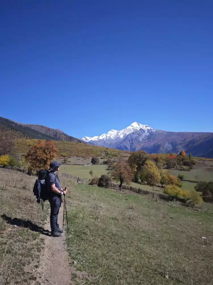
Today's journey was relatively easy. We passed through the town center from north to south and followed the main road out of the town. The initial section did not feel much climbing. The gravel road was sandwiched between trees on both sides, which was particularly like a section of the Dachaotai in Mount Wutai.
After walking about 3 kilometers, we suddenly encountered a steep slope after an S-shaped right-angle bend. We climbed about 200 meters in a distance of two kilometers, which was quite physically demanding.
Not long after walking, we saw another section, which was also the last section of the day. It was a steeper climb through the coniferous forest, also about 200 meters. This section was exactly the same as the coniferous forest section of the South Platform of Mount Wutai, so it is a good choice to go to Dachaotai before coming to Georgia.
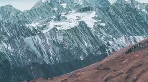
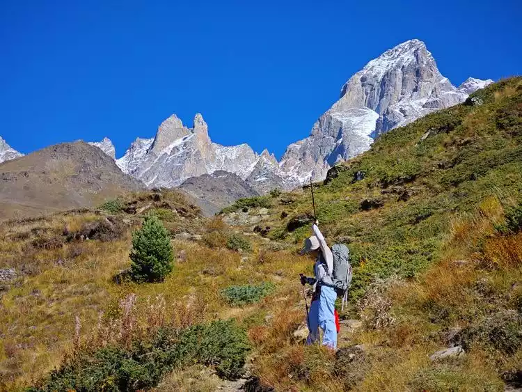
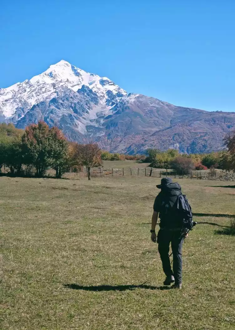
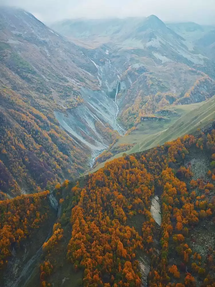
After passing through the coniferous forest, the view suddenly opens up. This should be the top of a low-lying flat-topped mountain, with vast alpine meadows and snow-capped mountains in the distance whose names I don’t know. It is a refreshing and pleasant experience.
After turning a corner, the famous coffee shed appeared in front of us.
Although there was only instant three-in-one coffee (and some fruit tea), we still bought a cup, went to the edge of the mountain top, took out the cushions, and sat down to enjoy today's lunch.
After resting, we encountered a fork in the road a short while downhill. One path led through the village at the bottom of the hillside, while the other was a parallel path higher up. We didn't recommend taking the hillside path because we got nothing but the scorching sun. We even ran into a pastoral area fenced off by locals and almost had to turn back before we could find the door.
Finally, I found an opportunity and found a way to descend to the village below. Although it was long and smelly and unremarkable, at least I had an idea of the route and could play with the stick when I was bored.
At about 19 kilometers, in front of a large river, the road splits into two:
1. Cross the river by bridge and continue along the paved road. This is also the route of foreign GPS tracks.
2. Continue forward and walk onto a gravel beach that looks like a riverbed. This is a route I downloaded from a domestic GPS track.
In the end we chose the second route, after all, the distance was short and it was still early.
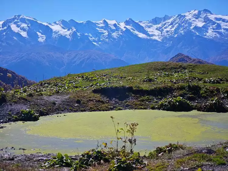
Note: There is a swamp next to the ranch, be careful!
Today's accommodation: Guesthouse Gogia
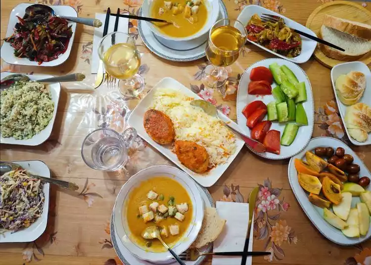
Tonight's dinner was the best Georgian meal I had during my trip to Georgia. I started with a bowl of sweet and salty pumpkin soup, and then had a variety of salads, bread, and meat. There was a wide variety and the taste was great (none of the typical salty taste of Georgian food). It's worthy of the award for the best homestay on booking.com!
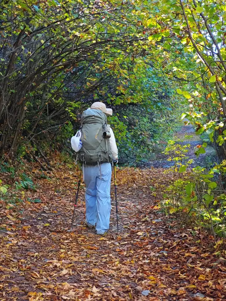
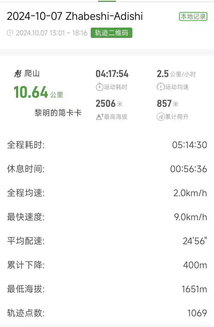
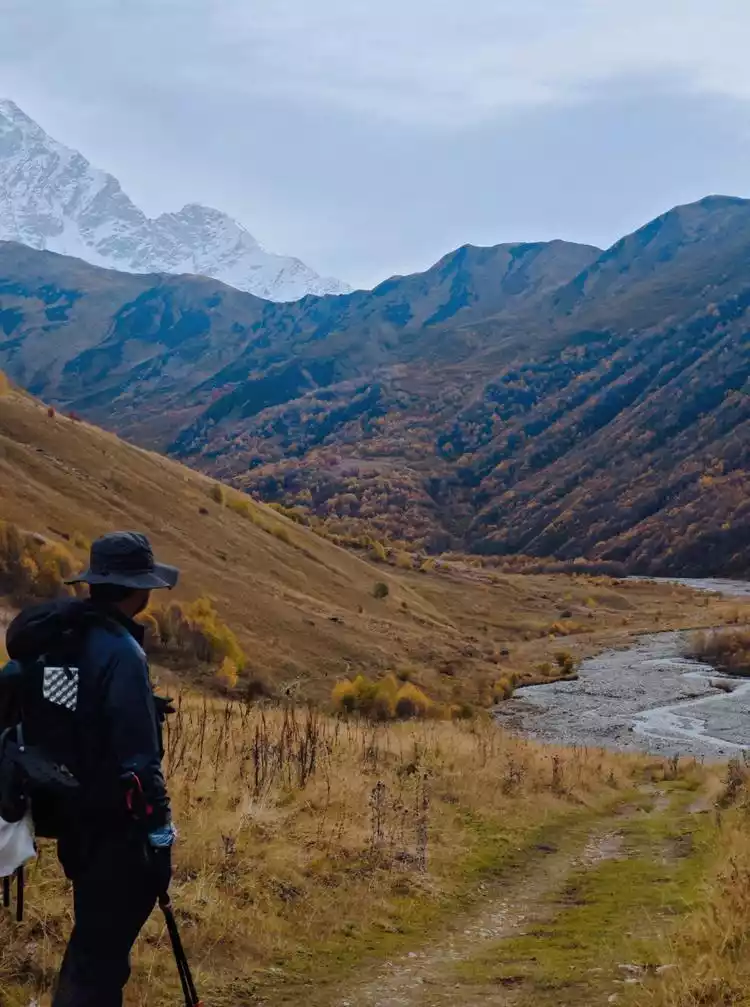
Zrabeshi-Adishi
First up is today's track preview
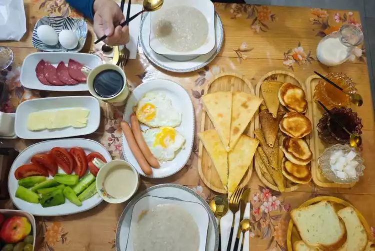
The breakfast was plentiful and delicious, including toast with jam, omelets, salty cheese, ham, eggs, their favorite half plate of cucumbers and half plate of tomatoes, and the national food khachapuri (salty cheese pancakes).
We set off after breakfast. Just like before Guli Pass, there are many cattle trails here. You don’t have to pay too much attention to the track route. Just look up and make the most appropriate choice of the road at the moment (we accidentally walked into a "dead end" because we kept walking with our heads down).
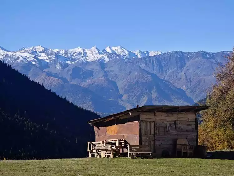
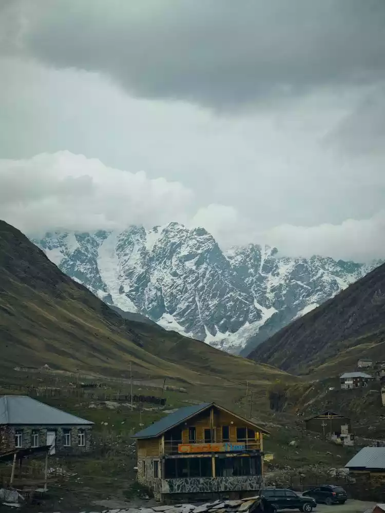
In the distance, we could see a cable car running from the foot of the mountain to the higher summit. This is also a ski resort, but it's probably only open during ski season. Later, we heard from "Müller" that the area reaches peak season in winter, and skiing is very affordable, costing 40 lari for a full day, including the cable car. Along the way, we passed some quirky, uninhabited cabins, likely guesthouses or long-term rentals, operating only during ski season.
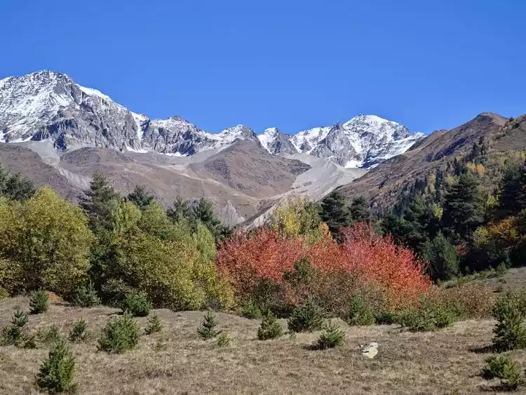
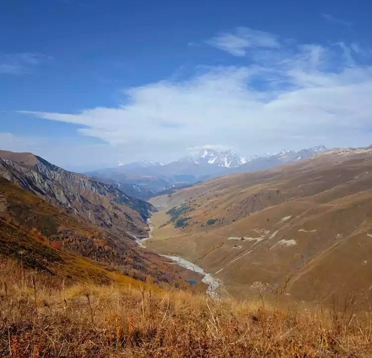
Adishi-Ushuguli
First up is today's track preview
Then there are today's cumulative rise and fall
We contacted "Mueller" on whasapp a day in advance, and we agreed to meet at 8 o'clock this morning to drive us back to Adishi. After packing our luggage, we left most of our luggage at the hotel and traveled light.
We started walking very fast. At first, we were still climbing out of the village. After leaving the village, we came to the river beach sandwiched between valleys. When we came to a fork in the road, we could choose the route next to the bed, which was more labor-saving.
After walking for about an hour, we arrived at the highlight of the day - crossing the river. There are two ways to cross the river:
1. Wade across the river yourself 2. Ride a local's horse for a fee
I chose the first option. Here are some tips to keep in mind if you need to wade across a river:
1. Unfasten the waistband of the backpack to help you escape quickly if you accidentally fall.
2. Acclimate to the water temperature in advance
3. Facing the direction of the river flow, the crab crosses the river. Please enjoy my river crossing video below.
The price of horseback riding has increased from 20 lari per person a few years ago to 25 lari per person now. Please enjoy the video below.
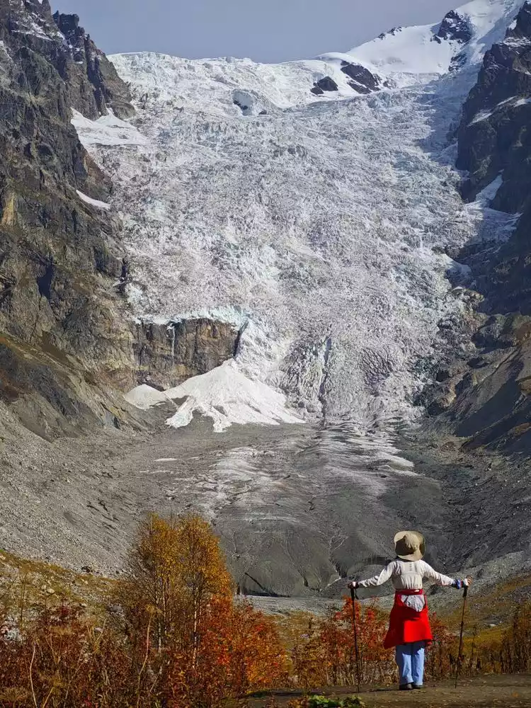
The river water is very cold. After all, the snow-capped mountains are not far away, and it is still relatively early. The temperature is probably close to 0 degrees when the water flows here.
After a while, my feet started to warm up, and after putting on my shoes, I started to climb. Today's road was slightly different from the previous days. There was a lot of water flowing down the road.
This makes walking very tiring and the road is also quite bad. If you come here, it is better to wear hiking shoes. I am afraid that cross-country running shoes are a bit difficult to use.
After a long climb, the trees around us finally became sparser, indicating that the altitude was getting higher and higher. Finally, we climbed to the top of the ridge. We still had to climb slowly along the ridge for a long time. The pass at the top of the mountain was almost devoid of scenery. The path down the mountain was difficult to see, and the road signs were not very clear. Be careful not to go the wrong way.
Continuing on, we came to Iprari, a very small village halfway up the mountain. There are not many accommodations, and many of them have very low ratings. In particular, we saw many people complaining about a B&B called "Sweet Home" on booking and Google's review systems. They said that the proprietress would treat you differently based on your taste and often quote high prices if she saw you were trying to rip off the customer. Everyone should be careful to avoid being ripped off.
However, there is a very special B&B here, "Raul Lushnu Darbaz". Although it is not on the path and requires a detour of about 1 kilometer, it is definitely worth considering. The most special thing is that this B&B retains many 17th-century structures and items. Living in it is like living in an ancient European stone city. Unfortunately, according to our plan, we had to miss it.
After passing Iprari, continue to go down the mountain. You will reach the foot of the mountain without walking too far. The foot of the mountain is also where villages live, and there are some accommodation options (including the Sweet Home mentioned above, which is also nearby).
There are actually three hiking routes from here to Ushguli:
1. Follow the paved road at the foot of the mountain. This is the easiest and simplest route, but there are no views at all. Many people take the road instead of finding other roads.
2. In the village of Davberi ahead, find the road heading north up the mountain and cross the mountain. This route is relatively more difficult, and actually requires a 600-700 meter climb, but it is much better than taking the road.
3. Rest for a day in Iprari. The next morning, follow the track south to Latpari Pass and then take the road north to Ushguli. There is basically no GPS track for this route on the Internet, but it can be pieced together from the tracks of the other two routes. Considering the length and the climb, the difficulty is at least medium to above average.
According to the website, the first half of this route is on a dirty and poor cattle trail, but the pass and the second half are definitely worth a try. Due to time constraints, we were very sorry that we could not try the third route and could only take the second one, which was a small regret. If anyone wants to try the third route, please contact me to obtain the track and other information.
Walk along the road for a while, after passing the "Dauber Guesthouse", when you see a small bridge across the river on the left, you can turn off the road, walk across the small bridge, and enter the village of Davberi.
 .
.
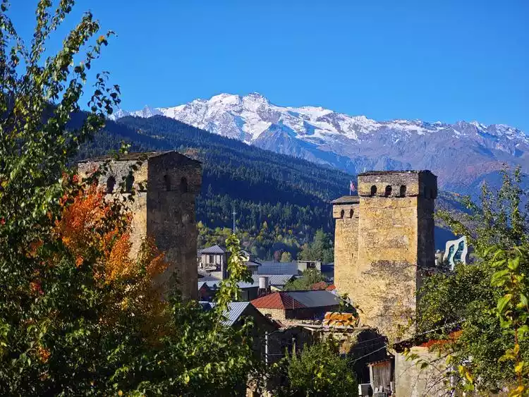
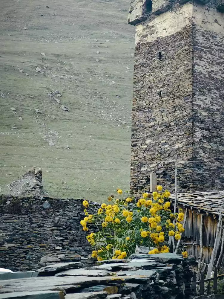
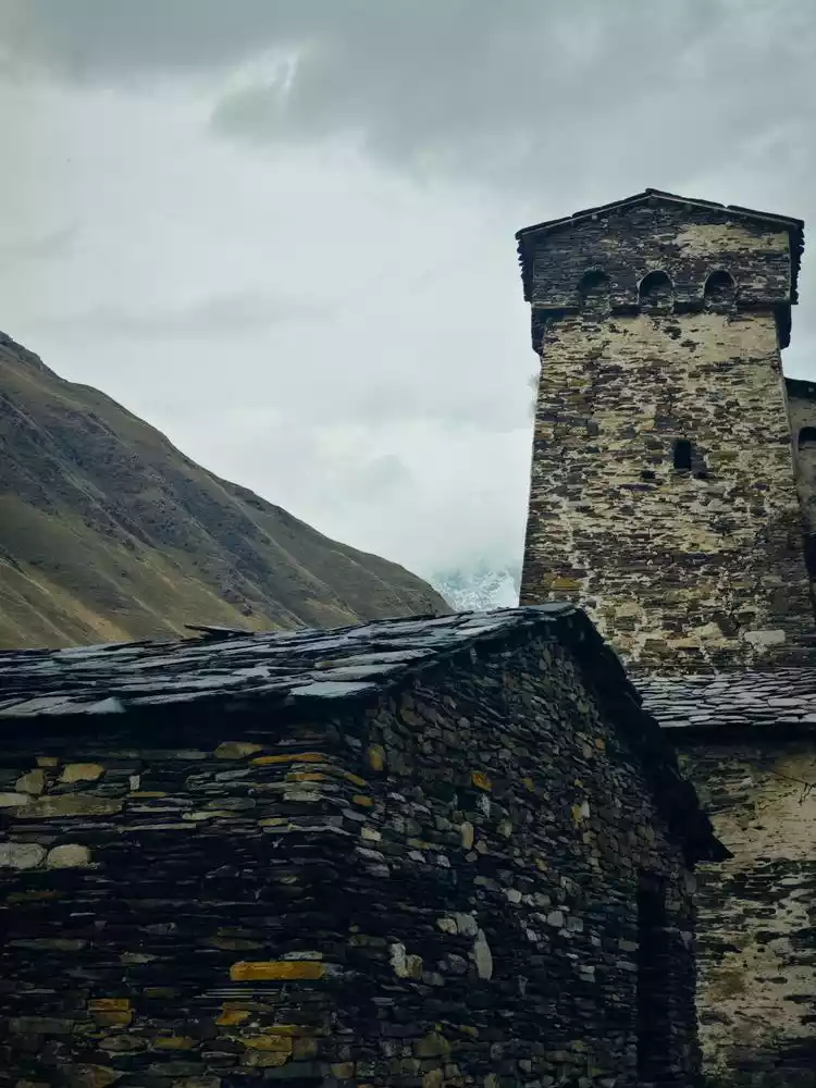
At around 5 pm, we finally arrived in Ushguli, a medieval village group in the Caucasus Mountains of Georgia. It has a long history and was once rated by National Geographic as one of the best tourist experience destinations in the world. It is a good place to take photos and check in.
Conclusion
On our last day, we were on the bus from Ushguli back to Mestia. On the way, we passed a group of hikers carrying backpacks on the road. They saw us and waved. We stopped and asked if they needed a ride. They said, "Thank you, but no, our journey isn't over yet."
The road is ahead, keep moving forward.