Guangfu Xiaoqijian | Climbing the mountain to view the lake and pass through Guangfu Xiaoqijian

Day 1 Shanghai → Guangfu → Xiaoqijian → Shanghai

All day

07:30-07:45 Meet at the designated location of China-TravelNote and sign in. Depart at 07:45 sharp, enjoy interactive activities and itinerary introductions on board, and have fun all the way!

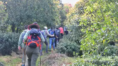
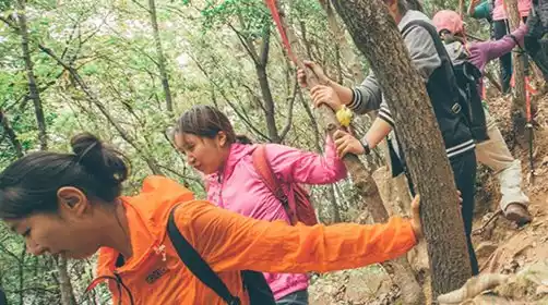
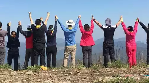
Around 9:30 AM, we warmed up and set off on our sprint. The hike took about 40 minutes, passing Dengwei Mountain and reaching Xuanmu Mountain. The initial hike allowed us to adjust to the pace and stay in shape. Don't fall behind! We then entered Midui Mountain and climbed to the summit for our first glimpse of the stunning Taihu Lake. We continued our journey through the mountains, passing Changshan and the Tanshan Mine. We climbed hills and steep slopes, and continued our long and arduous hike.

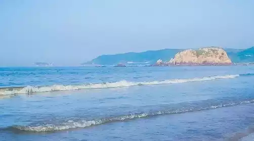
From 11:30 AM to 12:00 PM, we'll climb Tanshan, the highest peak in the Taihu Mountains, and enjoy a panoramic view of Taihu Lake while taking a lunch break. What a delight! After a satisfying meal, let's take a photo shoot! After lunch, we'll rest briefly and continue on our journey.

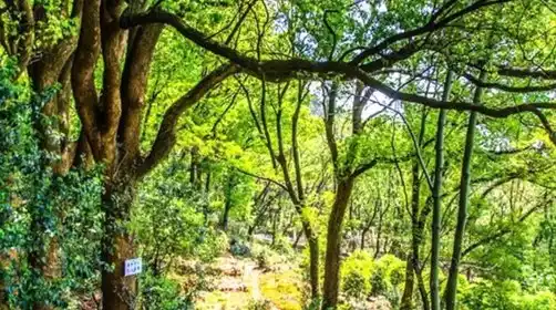
After lunch, we continued our journey, descending Tanshan Mountain to the Tandong Village bus stop, where we could descend and take the bus back. Tourists who didn't return continued on, heading towards Xiji Mountain and all the way to Tongjing Mountain, admiring the natural wonders of the copper well nestled in the rocky cliffs. We also overlooked the Guangfu Pagoda. We then descended to Xiangxuehai Lake, exited the Xiangxuehai Scenic Area, and returned to our starting point.

At around 17:00, we were led by the staff to board the bus back to Shanghai, and arrived back at the departure point in Shanghai around 20:00. Everyone was still reluctant to leave and kissed goodbye with tears in their eyes!

There will be slight adjustments to the closing points in autumn and winter, and the specific details will be announced by the tour leader on the day!

It gets dark earlier in autumn and winter, so it's recommended to bring a headlamp! Also, bring a set of clean clothes to change into after your hike to avoid getting cold in wet clothes!

Driving time: Shanghai to Guangfu, about 2 hours

Hiking: Today's hike is about 19km, with a total climb of 950+m and a maximum altitude of 234m.

Note: Today's hike is about 20km long and is in sprint mode, which consumes a lot of physical energy. Please register with caution and pay attention to safety!

  1. Q: Is it cold at night when camping?

    A: Camping in the mountains is very cold at night. The recommended comfortable temperature for sleeping bags in winter is around -10°C. It is recommended to have extra coats.

  2. Q: Is the activity completed? How many people are involved?

    Answer: Most activities along the surrounding outdoor leisure routes require 12 or more people to pay to proceed. For some activities, please refer to the page for details.

  3. Q: Will the trip continue if it rains?

    A: If there is light to moderate rain, the activity will proceed as normal. If there is heavy rain, the activity cannot be carried out and a full refund will be given.

  4. Q: Can I participate if I exceed the age limit?

    A: Those who are outside the age range but are in an appropriate physical condition can participate and can register first.

  5. Q: Are there any vacancies?

    A: You can register directly and the pass status will be displayed. If you encounter a substitute, please wait patiently.

  6. A: You will receive a message one day before your trip. Once payment is made, you can report to the meeting place and time according to the page.

  7. Q: If I register alone, do I need to pay the room supplement?

    A: For non-preferred accommodation routes, single tourists do not need to pay the room rate difference.

Guangfu Seven Peaks: In 2014, Wuzhong District renovated and maintained existing trails popular with hikers, completely connecting this stretch of mountainous terrain. This created the longest mountain trail complex in Suzhou, and to date, the longest in China. The winding trails connect the mountain ranges of Mudu's western suburbs (including Tianchi Mountain, Wufeng Mountain, Dajiao Mountain, Tianping Mountain, Lingyan Mountain, Tianchi Mountain, Huashan Mountain, Baixiangwan Bay, and Baimajian), Guangfu, the High-tech Zone, Wangshan Mountain, Xishan Mountain, and Dongshan Mountain, totaling approximately 100 kilometers. In addition to several long main routes—the Lingqi Line (starting at Lingyan Mountain), the Shili Wangshan Line, the Piaomiao Peak Loop, and the Moli Peak Scenic Belt—the main route also branches off into dozens of branch trails, connecting to nearby tourist attractions and small villages.