Day 1 Lijiang full day meeting day
All day
Tourists from all over the country flew to Lijiang to gather
Day 2 Lijiang → Feilai Temple → Liutong River
All day
【Itinerary Details】
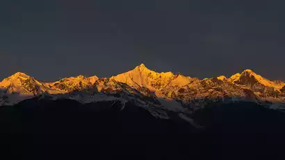
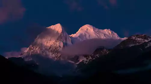
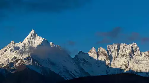
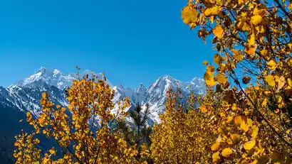
Departing in the morning, we'll drive through Shangri-La to Benzilan, a key town on the Ancient Tea-Horse Road. We'll have lunch there. In the afternoon, we'll cross the Baima Snow Mountain Range and reach Meili Snow Mountain, offering breathtaking views of the Thirteen Peaks. Passing Feilai Temple, we'll continue along National Highway 214 for about an hour to Liutongjiang Village on the Lancang River. We'll stay at a riverside hotel for the night.
Lijiang 2400m, Shangri-La 3300m, Feilai Temple 3450m, Liutong River 2100m

Day 3 Liutongjiang → Yagong → Zhangqia Camp → Bamboo Forest Camp
All day
【Hiking details】
11km hike, 650m ascent
【Itinerary Details】
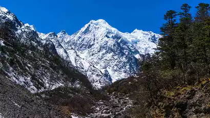
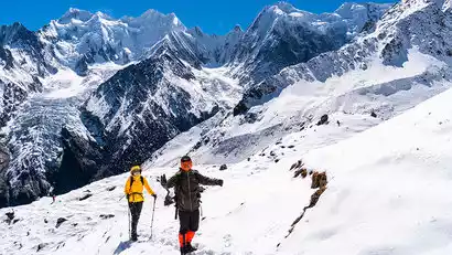
After breakfast, we set off by car. After just over half an hour, we arrived at the hiking starting point, the Yagong group in Liutongjiang Village. The village is located in a valley above the Lancang River, near the northern slopes of Meili Snow Mountain. From Yagong, we can see Mount Cogelaka. From this angle, it resembles a reclining lion, hence the name Leo Snow Mountain.
Here, we handed our equipment and supplies to the horse caravan, and the team members set off lightly, following the leader with small backpacks. We followed a gentle mountain path across the valley, crossed a bridge, and began the ascent. Strolling through primeval forest and bamboo groves, the snow-capped mountains loomed in the distance. After about four hours of hiking, we crossed a wooden bridge and a gravel slope to reach the Zhangqia Camp. After a short rest, we continued the 2-kilometer hike to the Bamboo Forest Camp.
Day 4: Bamboo Forest Camp → Pojun Camp
All day
【Hiking details】
5km hike, 550m ascent
【Itinerary Details】
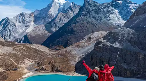
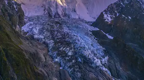
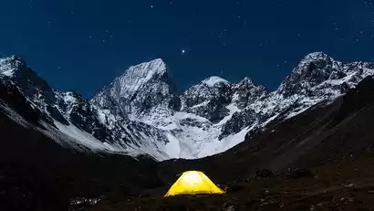
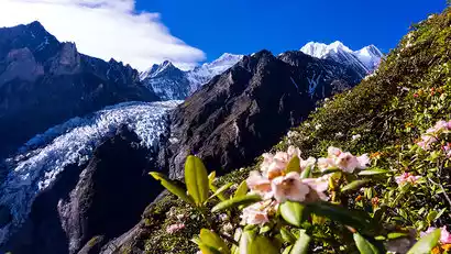
In the morning, after breakfast, we set off. Following a stream, we continued toward the snow-capped mountains, gradually gaining altitude as the distant peaks came into full view. We traversed the forest and over rocks, and the Mangkuanglaka Peak came into full view. We passed an abandoned cattle ranch, crossed a wooden bridge, and ascended the hillside, where Naridingka and its glaciers came into view. Continuing toward the snow-capped mountains, we soon arrived at Pojun Camp. Today's journey was relatively easy, allowing for a period of adjustment. Our camp faced the northern slopes of Meili Snow Mountain, offering sweeping views of Naridingka Glacier, Lairigongka Glacier, Naridingka Glacier, and Mangkuanglaka Glacier. Snow-capped mountains, glaciers, white clouds, blue skies, rivers, and meadows... It was a leisurely and relaxing experience. Today's hike was short, allowing us to slowly savor the mountain breeze and sunshine, capturing the beautiful scenery.
Day 5: Pojun Camp → Ciding Pass → Pojiang Ranch Camp
All day
【Hiking details】
6km hike, 670m ascent and 570m descent
【Itinerary Details】
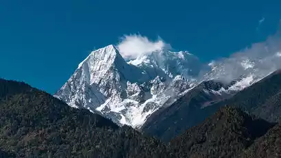
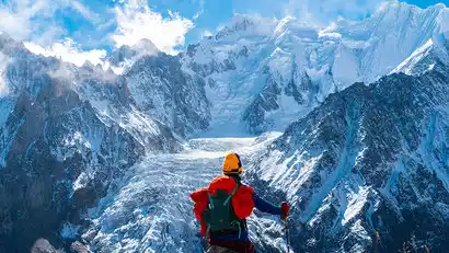
The weather was fine in the morning, allowing for photos of the sun setting over the northern slopes of Meili Mountain. After breakfast, we departed camp, passing a small pasture before climbing the pass. We first crossed a steep scree slope before continuing up the mountain to the heart of the glacial valley at 4,500 meters. We skirted a lateral moraine ridge and continued upwards to reach the highest point of this trip, Ciding Pass. All along the way, we could admire the northern slopes of Meili Mountain and the glacier, allowing us to photograph the glacier from various angles. After the pass, it was a vertical descent, descending over 500 meters to the valley floor, where we arrived at Pojiang Camp.
6. Tianpo River → Dalayigu → Qijiangyaka → Yagong → → Feilai Temple
All day
【Hiking details】
16km hike, 500m ascent, 1700m descent
【Itinerary Details】
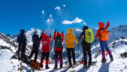
Departing from camp early in the morning, we entered the forest. We first descended, then ascended to the Dala Yigu Pasture. After a short rest, we continued our ascent, climbing over 100 meters to the Dala Cross Pass. From this pass, we could see the entire northern slope of the Meili Mountains, a beautiful vantage point. After another traverse, we arrived at an abandoned cattle shed (Qijiang Yaka). Then, we entered the woods and continued our descent towards Yagong, gazing at the northern slope of Meili Mountain as it gradually receded. As the altitude decreased, the vegetation became increasingly lush, with streams and rivers flowing through the forest. We crossed several wooden bridges along the way, eventually returning to the starting point of the hike, Yagong, marking the end of the hike. After a short rest, we returned to Feilai Temple by car and checked into the hotel. In the evening, we gathered for a celebratory dinner to celebrate the successful completion of the hike.
Day 7 Feilai Temple → Shangri-La → Lijiang
All day
The journey from Feilai Temple to Lijiang takes about 6 hours. Please book your return flight after 18:00.