Day 1 Various locations → → Chengdu ★Gathering day
All day
The first day is a full-day gathering day. Tourists will proceed to the meeting hotel according to their arrival time and check in at the front desk with "China - Travel Note + Name." Chengdu is a popular tourist destination in China, so tourists are encouraged to arrive early to stroll around, rest, and experience the slow pace of Chengdu's life while enjoying the various snacks and attractions.
At 19:00 in the evening, the tour leader will hold a pre-trip meeting at the hotel to check the travel equipment and inform the itinerary precautions. After the meeting, tourists who are not well prepared can purchase equipment in Chengdu.
Recommended places to visit: Jinli Ancient Street, Wuhou Temple, Kuanzhai Alley, and Chunxi Road, one of the top ten commercial streets in China.


Day 2 Chengdu → Siguniang Mountain Town → Shuangqiaogou
All day
Hiking Information:
Hike about 8 km, cumulative climb about 400 m
【Itinerary Information】:
After breakfast, we will gather and depart, passing Dujiangyan, Zipingpu Reservoir and the 8.8km long Balangshan Tunnel, and arrive at Siguniangshan Town for lunch.
Weather permitting, you can enjoy the panoramic view of Siguniang Mountain and its main peak, Yaomei Peak, from the Maobiliang Observation Deck, 1 km from Siguniang Mountain Town.
From the scenic area, take the scenic bus to Shuangqiaogou. First, take the scenic shuttle bus through a number of scenic spots to the Redwood Forest. Then, slowly descend along the river, where you can admire numerous alpine vegetation nearby and various snow-capped mountains in the distance. On the way, you will pass the undeveloped check-in point [Zhugana Co] in the scenic area. Then hike about 6 kilometers to the Potala Peak Station. You can choose to visit the major attractions in Shuangqiaogou by scenic bus in turn (rafting in Niyuba is available at your own expense from May to November). Meet up at the entrance of the scenic area at a suitable time and return to Siguniang Mountain Town.
We took photos and checked in, went down the mountain at the right time, took a car to Xiaojin County to find food, and then returned to the hotel to have a good rest.


Day 3 Xiaojin County → Majiagou → → Siguniangshan Town
All day
Notice:
The scenic spot announced that camping in Mumuli will be unavailable starting from July 29th. On that day, people will go hiking in Majiagou, Xiaojin County, and the accommodation will be changed to a standard room in the Daban Village B&B.
The hike is about 9.06KM, with an ascent and descent of 550M.
In the morning, we will drive to Majiagou for hiking.
After arriving at the scenic area, take a sightseeing bus to the starting point of the hike. At the foot of the snow-capped mountains, you will hike through high mountain lakes such as Yiang Qucuo, Majia Yuncuo, Qiongruocuomu, and Qumeicuo. Those with better physical fitness can also go to Dawa Yongcuo (commonly known as "Moon Lake")
Snow-capped mountains, lakes and meadows will accompany you along the way, and in autumn you will also receive a feast of colorful forests.
After the hike, return to the starting point, take a sightseeing bus back to the entrance of the scenic area, and proceed to Siguniang Mountain Town to check in.
Hiking Information:
Hike about 12 km, cumulative climb about 200 m
【Itinerary Information】:
In the morning, we will take a bus to Changpinggou for hiking. After arriving at Sigula Temple by scenic bus:
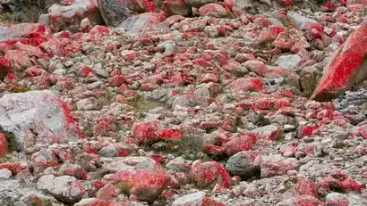
First, hike along the wooden plank road, passing the Chongchongjiao Waterfall and the Dead Tree Beach. The scenery is beautiful all the way, and the altitude rises slowly. After about 6 kilometers, start hiking on the dirt road, with gurgling water and quiet woods along the way. Pass by the Shangganhaizi (there is a small shop where you can get some supplies, but it may not be open at ordinary times) and the Red Stone Formation to arrive at the Muluozi Camp. Along the way, you can see the famous peaks of Siguniang Mountain such as Yaomei Peak, Xuanwu Peak, Pomiao Peak, and Luotuo Peak.
After arriving at Mumuli, check in to the camp tent and enjoy dinner in the restaurant tent, where the tour leader carefully prepares the food.


Day 4: Entrance of Changpinggou Scenic Area → Sigula Temple → Xiaganhaizi → Rilong Town
All day
Hiking Information:
Hike about 12 km, with a total ascent and descent of about 100 m
【Itinerary Information】:
After breakfast, we will gather and set off, hike to the vicinity of Xiaganhaizi, then hike back to Sigula Temple along the same route and take the scenic shuttle bus back to the entrance of the scenic area.
Walk to the hotel

Day 5 Siguniang Mountain Town → Haizigou → Chengdu
All day
After breakfast, we hiked to the entrance of the scenic area, bought tickets for Haizigou, and then started a half-day [Haizigou] acclimatization hike. We walked along the scenic plank road, slowly ascending, passing [Guozhuangping] and arriving at [Chaoshanping]. Along the way, we could enjoy the panoramic view of the four peaks of Siguniang Mountain and the scenery of Haizigou from a relatively high position.
Afterwards, they returned to Chengdu and disbanded
