


Day 1 Beijing → Shuiquanzi → Xiqueliang → Dayingliang → Taiwuding → Yushiliang → Shuiquanzi → Beijing
All day
hint:
1. This trip is divided into Team A and Team B. Team A hikes about 16 km, climbs about 800 m, and has a difficulty of 3.5 stars. Team B hikes about 11 km, climbs about 500 m, and has a difficulty of 2 stars.
Set a cut-off time. If the team does not reach the fork at 8 kilometers after 3 hours, Team B will automatically go.
2. Beijing is currently undergoing a large-scale military exercise, and entry inspections are strict and time-consuming. If you are traveling to Hebei, you will need to bring your ID card to pass the checkpoint. The journey is long and prone to delays due to checkpoint congestion. Return times are unreliable and may be delayed. Please carefully assess this risk and report any concerns with caution.
3. For group activities, please depart on time and arrive at the meeting point 15 minutes in advance. Please do not be late. Latecomers will not be waited for!
06:30
Meet at the meeting point 1, Guomao Station, Exit F, and sign in to board the train.
07:00
At the meeting point 2, take the subway from Jiandemen Station (Exit C), cross the road, and meet at the 711 next to Daoxiangcun. Sign in and board the bus.
Depart on time. During the journey, the tour leader will introduce the itinerary and precautions, and then proceed to the destination.
10:00
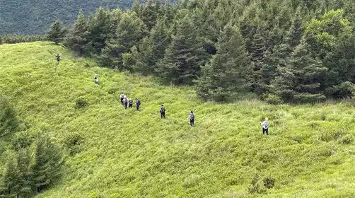
We will arrive at the starting point of the hike - Shuiquanzi at 10:00 AM. The team leader will help everyone warm up and get ready before starting today's itinerary.
11:00
Arrive at [Xi Que Liang - 2078 meters above sea level], [Da Ying Liang - 2075 meters above sea level], [Tai Wu Ding], and [Yu Shi Liang - 2160 meters above sea level] in sequence, with a checkpoint set up at 8 km from Xi Que Liang.
Enjoy lunch at a suitable location along the way, and there are supplies on the top of Taiwu.
6:00 PM
Arriving at the [Hike End - Shuiquanzi], the team leader will help everyone stretch their legs before boarding the bus back to Beijing;
9:00 PM
Arrived at meeting point 2 and meeting point 1 in turn, waved goodbye, kissed goodbye with tears, and looked forward to meeting again next time~
PS: The above time is only an estimate and will be adjusted according to actual conditions.