

Day 1 Jeju Island full day meeting
All day
All-day meeting day, free pick-up to the hotel
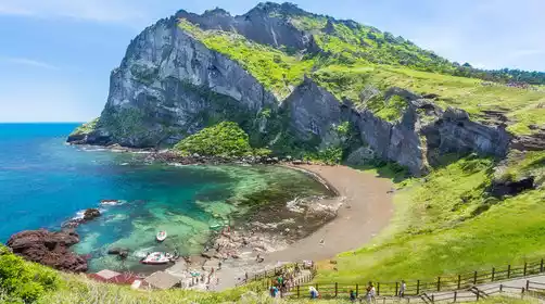
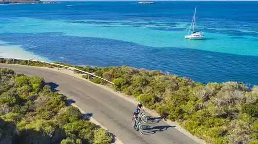
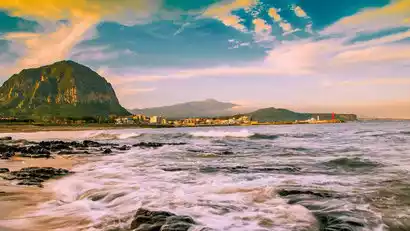
Jeju, located off the southwest coast of the Korean Peninsula, is South Korea's largest island and boasts the warmest climate in the country, earning it the nickname "Hawaii of Korea." The island offers numerous outdoor activities, including the historic Olle Trail hiking network and Hallasan, Korea's highest peak. Coastal cycling is another way to explore Jeju's scenery, and surfing at Woljeong-ri on the east coast is also highly acclaimed.
Day 2: Olai Trail Route 10, 15.6 km hike
All day
Hiking the highlights of Olai Trail—Line 10
After breakfast, we will drive to the Hwasun Golden Sand Beach hiking starting point to begin today’s Olle Trail hiking trip.
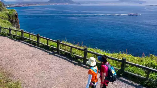
The Olle Trail is a renowned hiking network on Jeju Island, inspired by the Spanish Camino de Santiago. "Olle" means "doorway" in the Jeju dialect, symbolizing the path connecting villages and nature. The network comprises 26 main trails and five branch trails, totaling approximately 425 kilometers, circling Jeju's coastline and parts of the island's interior. Each trail ranges from 5 to 25 kilometers in length, suitable for hikers of all fitness levels.
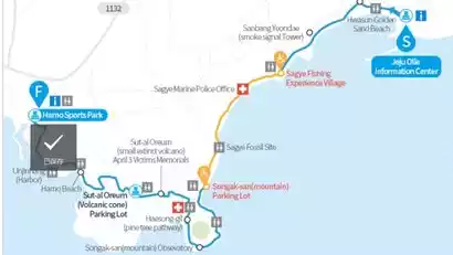
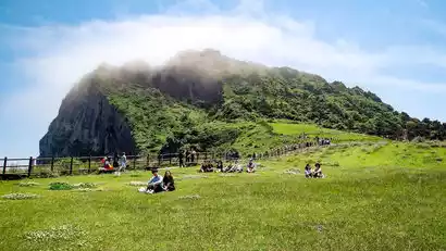
Our route, Route 10, begins at Hwasun Golden Sand Beach and ends at Hamo-ri in Daejeong-eup. Along the way, we'll pass Sseokeun-dari Bridge, Hwangwoochi Beach, Sanbangsan Mountain, and Songaksan Mountain. At the start of the journey, you'll be greeted by the majestic silhouette of Sanbangsan Mountain, with distant vistas of the island villages of Marado and Gapado. As you pass the coastal town of Sagye, be sure to look back to see the towering silhouettes of Halla Mountain and Sanbangsan Mountain juxtaposed against each other, creating a breathtaking panorama behind you.
Hiking Information
Hiking route: Line 10
Hiking distance: about 15.6 km, climbing is negligible
Hiking time: about 5-6 hours

Day 3: Climb to the summit of Hallasan Mountain (18.3km)
All day
【Important Tips】
Due to rockfall prevention work, the section of road from Guanyin Temple to Sanjiao Peak to the summit of Bailutan will be temporarily closed from September 15 to October 31, 2025 (date to be determined). During the National Day holiday, the team will adjust the route according to actual conditions to ensure a smooth summit.
Climbing to the summit of Hallasan Mountain (1950 meters), the highest peak in South Korea - Gwaneumsa Route (Upper), Seongpanak Route (Lower)
After breakfast, we set off for Halla Guanyin Temple, which is our starting point for our Halla Mountain climbing journey.
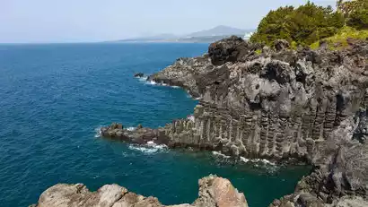
Hallasan, South Korea's highest peak (1,950 meters above sea level), is a landmark natural landscape on Jeju Island. Known as the "mountain that holds the Milky Way," its unique volcanic landscape, vertical ecological landscape, and distinct seasonal scenery attract numerous tourists and mountaineering enthusiasts. Numerous routes offer ascents to the summit, including the Seongpanak Trail, the Gwaneumsa Trail, Eorimok, and Yeongsil.
We chose the Guanyin Temple route and the Chengbanyue route, starting the hike at Guanyin Temple and reaching the top of Bailutan Lake about 8.7 km away. After having lunch here, we set off to go down the mountain towards Chengbanyue. This section of the road is relatively flat. After hiking about 9.6 kilometers, we arrived at the Chengbanyue entrance, ending today's hike. Afterwards, we took a bus back to the hotel in the city to rest.
Hiking Information
Hiking route: Gwaneumsa Temple - Hallasan Peak (Baekrokdam) - Seongpanak
Hiking distance: about 18.3km (8.7km for the Guanyin Temple route + 9.6km for the Chengbanyue route), climbing about 1,400m and descending about 1,300m
Hiking time: about 7-8 hours
Day 4 Disbandment in Jeju City
All day
After breakfast, we arranged for a group to be sent to the airport. Friends who wanted to continue to explore the island could choose to disperse freely in the city, ending our pleasant trip to Jeju Island.