Day 1 Shanghai → Daochangping → Farmhouse
All day
Ready to go!!!
7:15-7:30: Meet and check in at the designated China-TravelNote location. Departure is 7:30 a.m. (No latecomers are allowed). The onboard staff will engage everyone in conversation and play games, creating a lively atmosphere along the way.
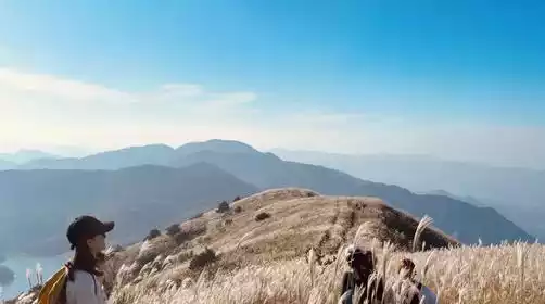
Around 12:00: We arrived at the starting point of the hike at [Daochangping] and hiked the entire route.
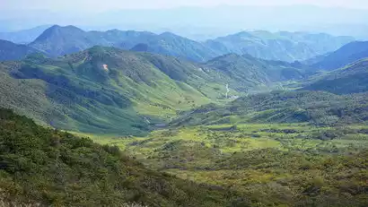
Lin'an Daochangping is an underrated winter snow-viewing route. The entire route is off-road, covered in thick snow, and you'll pass by streams along the way. It's a truly comfortable hike!
Regarding [Daochangping], it is also part of the Qingliang Peak Nature Reserve. It is a camping site for hikers and a high-altitude pasture for local villagers to graze sheep and cattle. There are many alpine meadows in the mountains and rivers of Jiangsu and Zhejiang, and the alpine meadows of Daochangping are not inferior to those of Wugong Mountain.
Hikers call it "Hulunbuir" in summer and "Northeast Snow Town" in winter.
Around 5:00 PM: We finished our hike and I boarded a bus to check into a farmhouse in Tiejiang Mountain, Ningguo.
Around 18:30: Prepare group meals (AA) or arrange your own dinner, then have a good rest and be fully prepared for tomorrow's brave challenge!
Day 2 Farmhouse → Blacksmith Mountain → Tianchi Lake in Western Zhejiang → Shanghai
All day
The Warrior's Journey Begins Now
[6:00] Get up, have breakfast at the hotel, pack up and get on the bus
【6:30】Depart on time
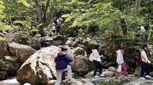
[7:00] Arrived at the starting point of the hike [Black Hole Waterfall Group], and everyone warmed up under the leadership of the team leader, ready to start today's [Yongzheng Tiandao Line] hiking plan!
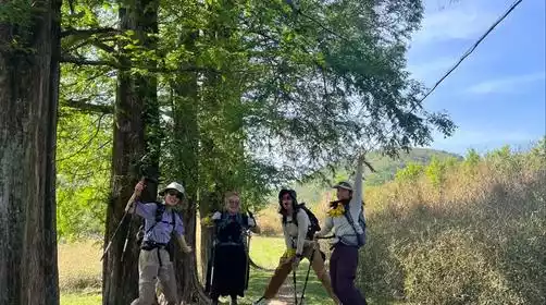
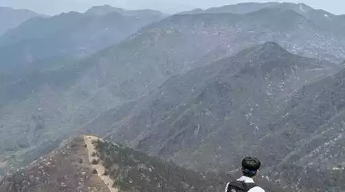
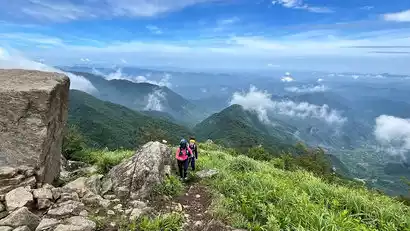
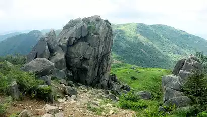
Around 10:00 AM, we arrived near Blacksmith Peak and enjoyed the ridgeline scenery along the way! We continued walking along the ridge, passing our iconic boulder for photos and check-in time! After reaching the summit, we found a flat spot, sat down on the alpine meadow, and shared a meal together!
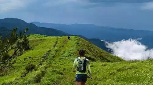
After a short break, we continued our journey, reaching the summit of Baishiyan Rock, descending to Xiaoping Creek, and sprinting towards Leli Peak. Later, we reached the summit together, overlooking Tianchi Lake from the ridgeline. The view was breathtaking, a feeling of tranquility and exhilaration, like "the divine pool is vast, the heavens are floating in the air."
Around 3:00 PM, we arrived at [Zhexi Tianchi]. After touring Tianchi for a bit, we headed towards Ningguo! (It's easy to get lost here, so be careful to identify the trails and the ribbons!)
Around 4:30 PM, we arrived at the hike's finish line. Congratulations on completing the Anhui-Zhejiang Skyline Trail! Back on the bus, ready to return to Shanghai!
Note: The gap between the front and rear groups may be too large. The front group can rest, eat and wait at the farmhouse at the finish line.
It gets dark early in autumn and winter, so you must bring a headlamp when going up and down the mountain!
Regarding the descent line: Due to its special geographical location, this route has no descent line, so based on the hiking conditions on the first day, you should make a reasonable judgment on whether you are capable of completing the entire journey today!
At around 20:30, we arrived at the departure point, and everyone said goodbye with tears and kisses, agreeing to continue challenging the Brave Journey route next time!