Niger
What are the most recommended things to do in Niger?
- Explore the historic city of Agadez and its UNESCO-listed old town.
- Visit the Tenere Desert and experience camel trekking and desert landscapes.
- Discover wildlife in W National Park, part of the transboundary W-Arly-Pendjari complex.
- Experience the Niger River and enjoy fishing, boat trips, and local village visits.
- Attend cultural festivals such as the Cure Salée Festival of the Tuareg and Wodaabe people.
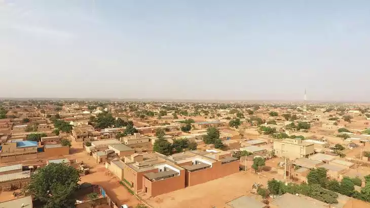
- Tour traditional markets and artisanal crafts in Niamey, the capital city.
Introducing Niger
Located in the central and western part of Africa, it is a landlocked country on the southern edge of the Sahara Desert. The country borders Algeria and Libya to the north, Nigeria and Benin to the south, Mali and Burkina Faso to the west, and Chad to the east. Most of the country is part of the Sahara Desert, with high terrain in the north and low terrain in the south.
Niger has a wealth of tourism resources, which makes it a very good tourist destination. Niger has a rich and diverse culture; rich flora and fauna; ancient historical relics, paleontological and cultural sites, etc.
Climate and best time to travel
The northern part has a tropical desert climate, while the southern part has a tropical savanna climate. It is one of the hottest countries in the world. The best time to travel is from November to March.
Recommended number of days and locations for visiting
Niger National Museum
Nestled on a hillside beside the Niger River in the capital, Niamey, the museum boasts a series of creamy white exhibition halls scattered across the scenic hillside. Construction began in 1959 and was completed in 1972, a 14-year project. The museum occupies approximately 24 hectares. Unlike most museums in the world, the National Museum of Niger is a landmark.
Aire and Ténéré Nature Reserve
The largest protected area in Africa, covering approximately 7.7 million hectares, the entire region accounts for only one-sixth of the total land area. The region includes the Aïr volcanic massif and a small Sahel region, where the climate, vegetation, and animals differ from those of the Sahara Desert, and is known for its diverse landscapes, plant life, and wildlife.
"W" National Park
Located in southern Niger, within the buffer zone between the Tamu and Dosso conservation areas, the park features an ecosystem that has evolved through continuous interaction with humans since the Neolithic period. It supports one of the largest populations of ungulates in West Africa.
Ténéré Desert
It is one of Africa's most famous deserts. Located in eastern Niger, it borders the Aïr Plateau to the west, the Ahaggar Plateau to the northwest, the Jado Plateau to the northeast, and opens to the Chad Basin to the south. It covers an area of 400,000 square kilometers, accounting for one-third of Niger's total area. Its name comes from the Tamashek language, literally meaning "desert."
Aire Heights
Not far north of the ancient trading town of Agadez in central Niger, a charcoal-gray plateau rises from the Sahara Desert like a coal-laden boat floating in a sea of cream: the Aïr Massif. Sculpted gradually over time, the Aïr's peaks and plateaus are a complex mix of rock types, including magmatic ring dykes, granitic intrusive rocks, Paleozoic sandstones, and more recent lava flows.
Recommended 2-day tour
Most Popular FAQs for Niger
What is the history and significance of this attraction/city?
Niger is rich in cultural heritage with ancient trading towns like Agadez and a history shaped by Tuareg, Songhai, and French colonial influences. It has archaeological sites, historic mosques, and a legacy of Saharan trade routes.
Where is it located and how do I get there (metro, bus, taxi, walking)?
Niger is in West Africa, bordered by Libya, Chad, Nigeria, Benin, Burkina Faso, Mali, and Algeria. Main entry points are Niamey International Airport and Agadez Airport. Travel within Niger is by buses, shared taxis, private cars, and walking in cities.
What are the opening hours and best times to visit?
Most sites are open year-round. The best time to visit is during the dry season, November to February, to avoid extreme heat and seasonal rains.
What is the entrance fee/ticket price, and how to buy tickets (online/offline)?
- W National Park: entry fees around $10–$20 per person, purchased at park entrance.
- Agadez historic sites: small local fees, paid onsite.
- Other cultural and tourist sites: fees vary; typically bought locally.
Do I need to book tickets in advance, and how far in advance?
For national parks and guided desert tours, booking 1–2 weeks in advance is recommended. Local cultural sites and markets usually do not require advance booking.
How much time is needed to fully explore it?
7–10 days are recommended to visit major cultural, desert, and wildlife attractions.
What are the must-see highlights or main areas inside?
- Historic city of Agadez
- Tenere Desert and Erg dunes
- W National Park
- Niamey markets and cultural centers
- Niger River villages
Are guided tours or audio guides available (and in which languages)?
Guided tours are available in French and English, especially in national parks, desert tours, and cultural heritage sites.
What are the best viewpoints or photography spots?
- Sand dunes in the Tenere Desert at sunrise or sunset
- Agadez mosque and old town rooftops
- Wildlife in W National Park
- Niger River banks and local villages
What is the recommended route or itinerary inside?
Begin in Niamey for city and cultural experiences, head north to Agadez for historic sites and desert excursions, then visit W National Park in the east for wildlife, and explore the Niger River region before returning.
Are night visits, light shows, or special tours available?
Night safaris and desert camping with local guides are available. Cultural events like the Cure Salée Festival are seasonal and offer evening experiences.
Is it crowded, and when are the least crowded times/days to visit?
Tourist areas are generally not crowded. The least crowded times are outside the peak dry season (November–February), especially March–October when some areas may be less accessible due to heat or rains.
What facilities are available (toilets, food, water, rest areas, shops)?
Cities and lodges provide basic restaurants, toilets, and small shops. Remote parks and desert areas may have limited facilities; carry water and essentials.
Is the attraction accessible for elderly, children, or disabled visitors?
City sites are accessible for most visitors. Desert treks and wildlife safaris may require good mobility and are less suitable for elderly or disabled travelers.
Is cash needed or are cards/mobile payments accepted?
Cash (West African CFA Franc) is widely needed. Cards are rarely accepted outside major cities and hotels.
What restaurants or cafes are available inside or nearby?
Niamey offers a variety of local and international restaurants. Agadez and towns near parks have small local eateries, often serving traditional Nigerien food.
Are there vegetarian/vegan/halal food options?
Halal food is common. Vegetarian and vegan options exist in major cities but are limited in remote areas.
What hotels or accommodations are close to the site?
- Niamey: hotels and guesthouses
- Agadez: heritage hotels and lodges
- W National Park: safari lodges and camps
- Desert areas: guided camps and lodges
What other attractions or landmarks are nearby and easy to combine in a day trip?
- Local villages along the Niger River
- Traditional markets in Niamey
- Sand dunes and oases near Agadez
Are there souvenir shops and what are the typical souvenirs?
Souvenirs include Tuareg jewelry, leather goods, carpets, and local crafts such as pottery and textiles.
What are the best transportation options to continue the trip after visiting?
Domestic flights connect major cities. Shared taxis, buses, and private 4x4 vehicles are common for intercity and remote area travel.