Pilgrimage Route G318, Sichuan-Tibet Highway, Lhasa is always on the road!
Sichuan-Tibet Highway
The Sichuan-Tibet Highway is short for the Sichuan-Tibet Highway. It was the first road to connect Chengdu, Sichuan, with Lhasa, Tibet. For thousands of years, before its completion, the ancient Tea-Horse Road, one of the world's highest and most treacherous transportation routes, snaked through the towering peaks of the Hengduan Mountains and the Tibetan Plateau, served as a hub for economic and cultural exchange among the ethnic groups of southwestern China.
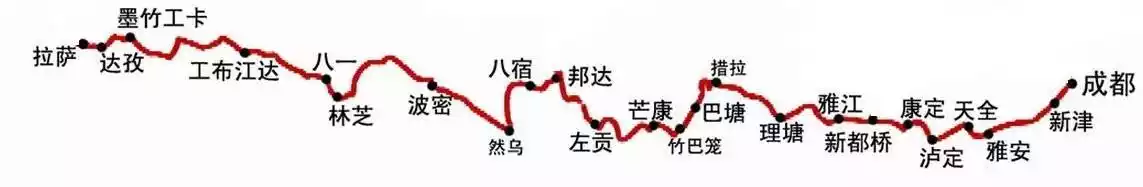
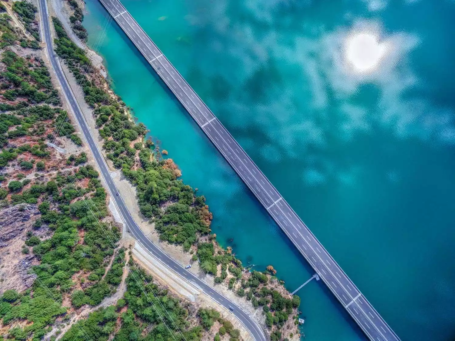
(Overview of the Sichuan-Tibet Highway)
What you climbed was just a mountain in your heart
Starting from Chengdu, the route passes through Erlang Mountain (2170 meters), Zheduo Mountain (4298 meters), Gaolusi Mountain (4412 meters), Jianziwan Mountain (4659 meters), Kazila Mountain (4718 meters), Haizi Mountain (4500 meters), Zongla Mountain (4150 meters), Lawu Mountain (4376 meters), Jueba Mountain (3930 meters), Dongda Mountain (5008 meters), Yela Mountain (4658 meters), Anjiula Mountain (4468 meters), Sejila Mountain (4728 meters), and Mila Mountain (5013 meters), before arriving in Lhasa.
Mila Mountain is the final mountain on the road to Lhasa and the highest point along the Sichuan-Tibet Highway. It serves as the border between Lhasa and Nyingchi, and also serves as the watershed between the Niyang River to the southeast and the Lhasa River to the northwest. Once you cross Mila Mountain, the holy city of Lhasa will soon appear before you.
That year, I climbed over 100,000 mountains, not for pilgrimage, but just to meet you on the way.
This shore has been reached, but the other shore no longer exists. If the other shore no longer exists, how can this shore exist?
When you cross the mountains to reach Lhasa, what you cross is only a mountain in your heart.
The past and present of the Sichuan-Tibet Highway
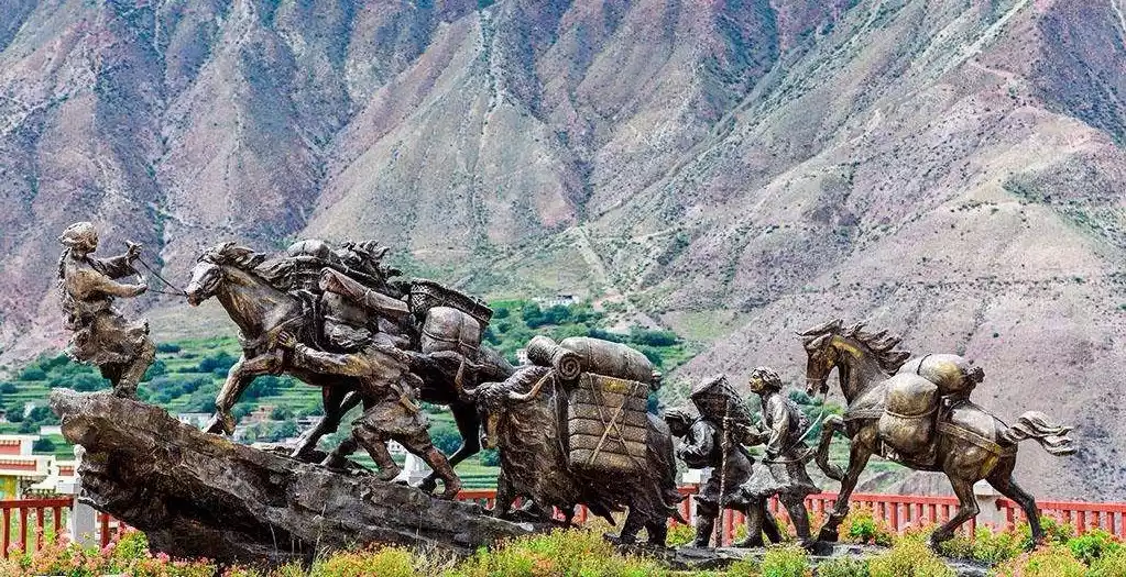
【Ancient Tea-Horse Road】
Tea, produced in mainland China, was first imported into Tibet during the Tang Dynasty, according to historical records. From that period onward, tea drinking gradually became a custom among Tibetans and a vital component of their culinary customs. Beyond the cultural connotations of culinary practices, Tibetan tea culture also encompasses a crucial aspect: Han-Tibetan trade. The Han-Tibetan "tea-horse trade" flourished during the Tang Dynasty, known as the "Tea-Horse Trade," referring to the barter exchange of tea from Han China for horses from Tibet. The Sichuan-Tibet Ancient Tea-Horse Road served as both an economic and political route, as well as a path for cultural exchange.
Sichuan-Tibet Highway
In early 1950, the People's Liberation Army was ordered to march into Tibet. Chairman Mao Zedong instructed the troops: "Advance while building the road." Using primitive tools like hammers, chisels, shovels, and pickaxes, 110,000 PLA soldiers, engineers, and laborers of all ethnic groups completed the construction of the northern Sichuan-Tibet Highway in just over four years in 1954. The southern Sichuan-Tibet Highway officially opened to traffic in 1958. Compared to the northern route, the southern route traverses more densely populated areas. However, much of the route lies within high mountain valleys, and the Tongmai fault zone, with its loose terrain, is prone to frequent mudslides and landslides, making the project even more challenging and dangerous.
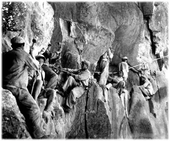
(In 1954, road builders on the Sichuan-Tibet Highway excavated the steep cliffs on both sides of the Nujiang River)
Between the boundless snow-capped plateau and the mountainous terrain of western Sichuan, a vital passageway stretches across the Tibetan Plateau, forever changing the history of roadlessness in my country's Tibet region. Construction began after the founding of the People's Republic of China and opened to traffic in 1959. The Sichuan-Tibet Highway is the longest, most arduous, and most labor-intensive plateau highway built since the founding of the People's Republic of China. For over 50 years, this highway has played a vital role in strengthening border defense and ensuring social stability, economic development, and ethnic unity in Tibet.
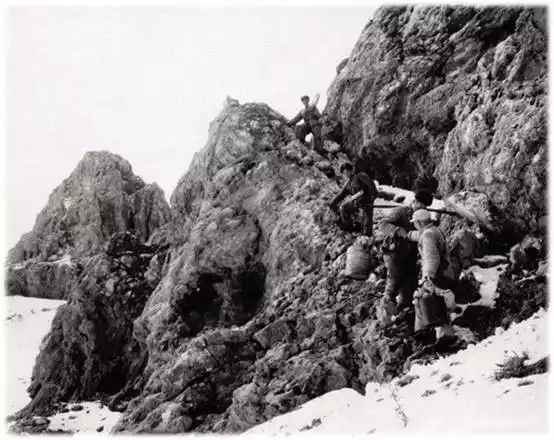
(The PLA had to rely on manual labor to transport supplies when encountering difficult roads)
My Sichuan-Tibet Highway
I first set foot on the Sichuan-Tibet Highway in 2016, and since then, I've been hooked, going there almost every year. Having traveled three highways into Tibet—the Yunnan-Tibet Highway and the Qinghai-Tibet Highway—my favorite is the Sichuan-Tibet Highway. I've sweated, suffered injuries, and shared stories along the way. It's become a part of my life.
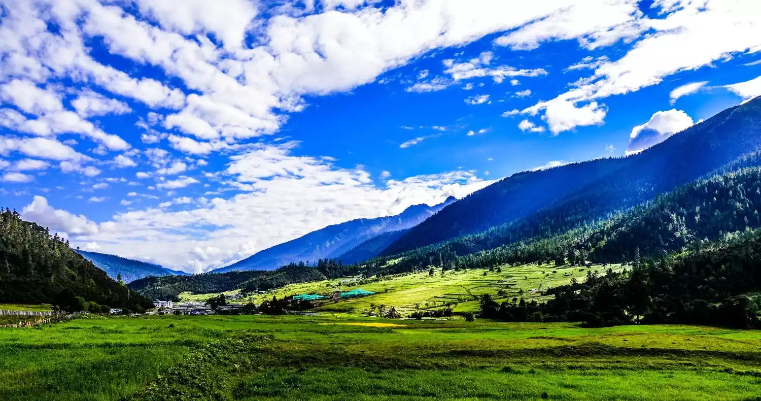
The Sichuan-Tibet Highway has the richest landscapes, including snow-capped mountains, primeval forests, sacred mountains and lakes, plateau meadows, and the Hetao scenery.
Sichuan-Tibet Highway, Sichuan Section
Chengdu, 500 meters above sea level
"In that rainy little city, I have never forgotten you, Chengdu. The only thing I can't take away is you..."
Many people know Chengdu because of Zhao Lei’s song “Chengdu”, but I fell in love with this song and this city because of this city.
I have visited hundreds of cities across the country, big and small. My favorite is Nanjing, followed by Chengdu. The reason why I like Chengdu is very simple!
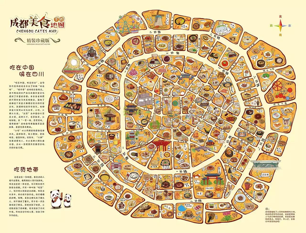
Food: Hot pot is really everywhere in Chengdu. You can smell the hot pot when you walk on the street. If you don’t eat spicy food, 90% of the food has nothing to do with you.
This is the guide for Sichuan-Tibet Highway. I will just briefly mention the food here and give you a food map so you can go eat on your own!
Tips:
Let me tell you in secret, my favorite food is skewers. I recommend the Steel Pipe Factory’s Small Liver Skewers, they are so delicious and fragrant.
There are many branches, but if you want to eat authentic food, you must go to the main store. Address: No. 333, Shuanglin North Branch Road, Chenghua District, Chengdu
Chengdu-Ya'an-Xinduqiao: 366km
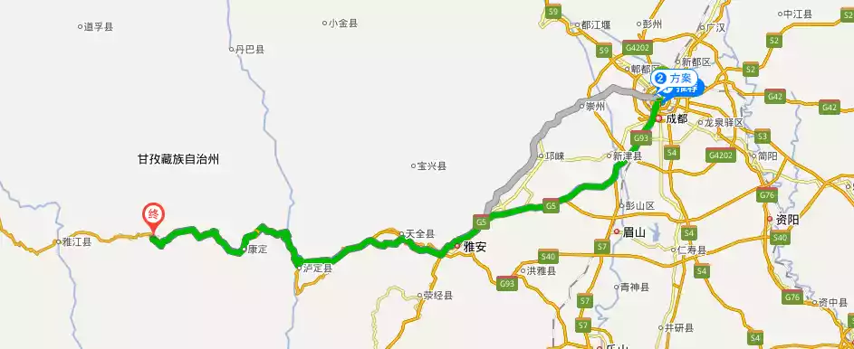
The Chengdu-Kangding Expressway has been fully opened to traffic. Generally, if you drive on the first day, you can directly reach Xinduqiao, which is the end point of the above map, while if you cycle on the first day, you can only reach Ya'an.
[Ya'an is 580 meters above sea level]
Ya'an is the true starting point of the Ancient Tea-Horse Road and the starting point of our Sichuan-Tibet Highway, National Highway 318. It's also known as the "Rain City." Locals say Ya'an only gets two rains a year, one in the second half of the year. I personally recognize this. I still remember the night before we set out on our Sichuan-Tibet Highway hike from Ya'an, a night of torrential rain that ensured a sound sleep.
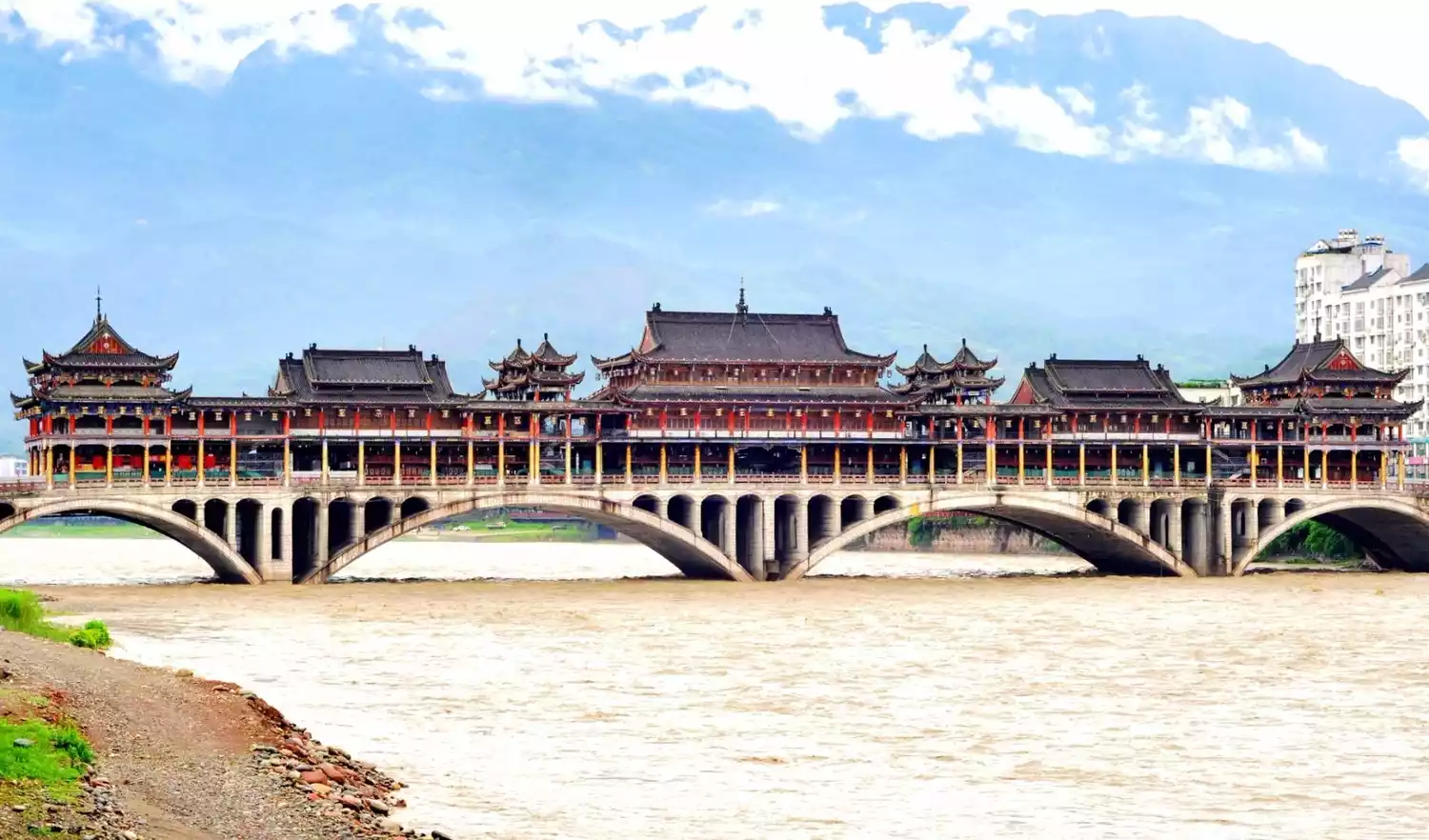
The Yazhou Covered Bridge over the Qingyi River is also a signature attraction of Ya'an. Speaking of the Qingyi River, a visit to Ya'an is a must-try: Ya fish. Ya fish is a Ya'an specialty, a species endemic to the mountainous regions of the Central Asian Plateau, also known as "Bingxue fish." It's found in the Ya'an section of the Qingyi River, hence the name. Resembling carp but with trout-like scales, it boasts a plump body and tender meat. Casserole Ya fish is a local specialty. The meat is truly melt-in-your-mouth delicious. Legend has it that during the Qing Dynasty, it was presented as tribute to Empress Dowager Cixi, who praised it as "the flesh of dragon and phoenix."
[Luding is 1,330 meters above sea level]
I won’t introduce this famous red city in detail, but the story of the Luding Bridge is well-known. The ticket price for Luding Bridge is 10 yuan, and it is located next to National Highway 318.
(Tourists at Luding Bridge)
[Kangding is 2,560 meters above sea level]
Kangding, a world-renowned historical and cultural city; its Paomashan Mountain, renowned across the world; and the timeless song "Kangding Love Song," captivating the world. Entering Kangding is like entering a truly Tibetan region, where the plateau's beauty greets you: snow-capped mountains and meadows. Mountain Buddha statues and Tibetan architectural ornaments are hallmarks of the Kham Tibetan people. Mugecuo, approximately 17 kilometers from the city center, is worth a visit. Known in Chinese as "Yerenhai" (Wild Man Lake) and also known as "Dahaizi," it is one of the largest alpine lakes in northwest Sichuan. Covering nearly 4 square kilometers and exceeding 70 meters in depth, it sits at an altitude of 3,700 meters. Because its waters are primarily fed by meltwater from the Nuwa Snow Mountain behind it, visibility is exceptionally high, typically 6-10 meters. Surrounded by mountains, forests, and grasslands, Mugecuo is surrounded by dozens of smaller lakes, including the Red Sea, the Black Sea, and the White Sea, like a moon surrounded by stars.
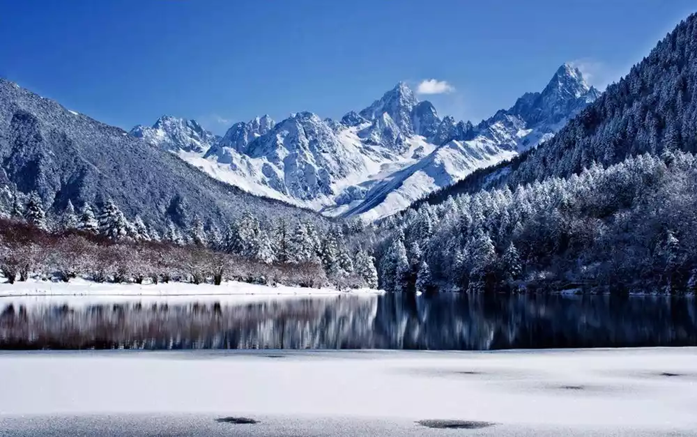
(Mugecuo in winter)
Tips:
If you're new to Tibet, Kangding's yak beef hot pot will make you fall in love. But what's most unforgettable are the hot springs in Kangding. I recommend Longtougou Hot Springs, the first hot spring in Kangba, for 15 yuan for unlimited time. It's the size of a swimming pool! But if you're new to the plateau, don't soak for too long!
[Xinduqiao Town is 3,300 meters above sea level]
Xinduqiao is a captivating "photography paradise," nestled at the fork of National Highway 318's north and south lanes. It's a picturesque paradise. Magical light, boundless grasslands, winding streams, golden cypress trees, rolling hills dotted with Tibetan villages, cattle and sheep grazing peacefully... the plains of western Sichuan blossom beautifully. This is Xinduqiao, a captivating "world of light and shadow," a "photographer's paradise." Note: this is a photographer's paradise, not yours. Hahaha, it's normal if your photos don't look the way you see them online; you probably need an eye for beauty. Just kidding! In Xinduqiao, any photo you take with your phone could be your phone wallpaper. You're kidding! Xinduqiao is, of course, at its most beautiful in autumn. So, without further ado, here are the pictures!
I prefer Xinduqiao in midsummer to the bleak golden autumn. Everything is brimming with life, and any photo I take looks like a Windows desktop. Endless grasslands, winding streams, rolling hills, scattered Tibetan villages, cattle and sheep grazing peacefully... The plains of western Sichuan blossom beautifully. This is Xinduqiao, a captivating "world of light and shadow," a "photographer's paradise."
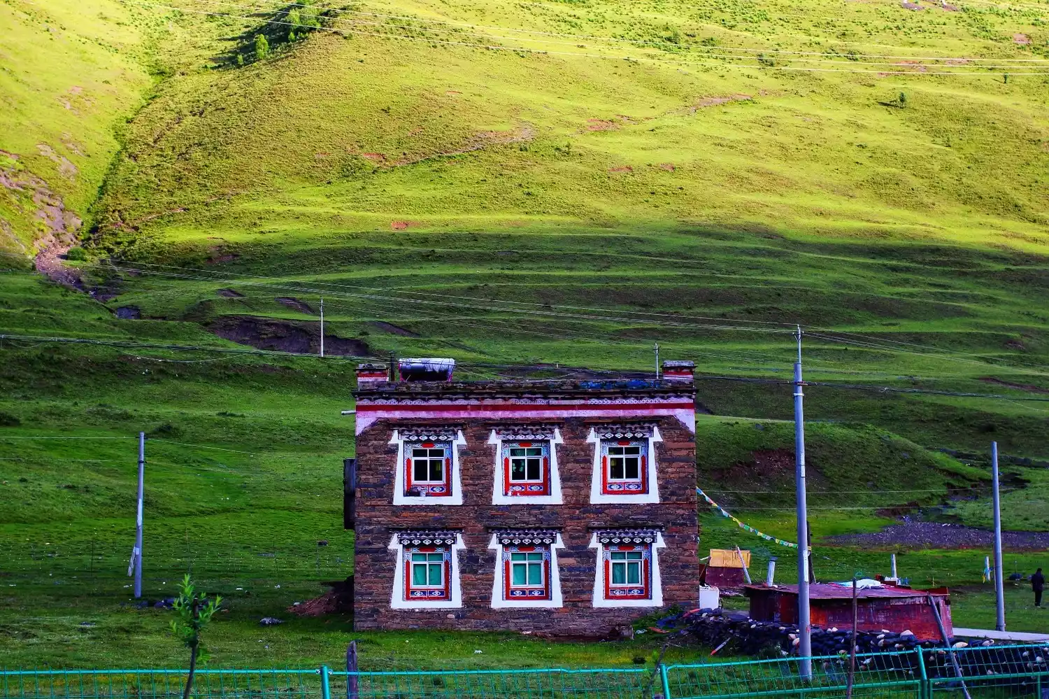
The Tibetan-style dwellings of Xinduqiao are distinctive, with spacious white-walled courtyards and vermilion-lacquered gates. Most are built of stone and face the sun, allowing for abundant natural light. Each building features three or four windows on each wall, with sun, moon, or triangular patterns painted in red, black, and white, symbolizing a prosperous population and a bountiful harvest. Driving along the Xinduqiao section of the road, one feels as if the curtains of "Shangri-La" are gradually opening. There, life and nature, people and the environment, peace and tranquility blossom in harmony. The sky's ever-changing colors make one forget the hardships of the journey.
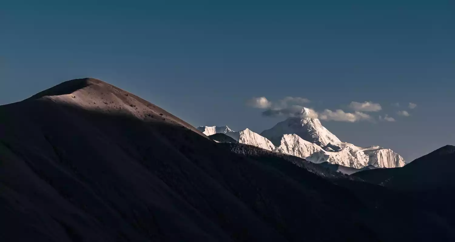
If the weather is good, you can climb up the hill and onto the viewing platform to see the King of Shu Mountains - Muya Gongga. It is usually easier to see it in the morning in summer.
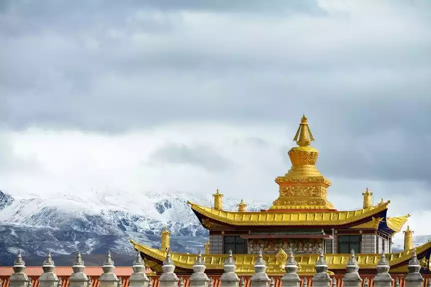
Located in Tagong Township, Xinduqiao Town, Kangding County, Sichuan Province, the Muyajin Pagoda was built in 1997 with donations from Dorje Tashi Living Buddha, the Drubqing Monastery, one of the six major Nyingma Buddhist temples. Over 100 kilograms of gold were used in its construction. Legend has it that when the temple was consecrated, auspicious clouds and a seven-colored halo appeared in the sky. If you're unconvinced, try climbing up and biting the roof to see if it's 24K gold. The Muyajin Pagoda sits on the beautiful Tagong Grassland, a place favored by the Bodhisattva. On clear days, you can see the Yala Snow Mountain.
Tips:
Staying in Xinduqiao, you can take photos of the starry sky and the Milky Way at night. But be sure to dress warmly, as the temperature can be very low at night, even in July and August.
Everyone experiences altitude sickness, but the adaptation time varies from person to person. Avoiding altitude sickness is simple and straightforward: drink more water, eat more fruits, and keep warm.
[Xinduqiao-Litang-Batang] Total distance: 364km
There is a fork road outside Xinduqiao Town, which connects Provincial Highway 215, Sichuan-Tibet North Line G317 and Sichuan-Tibet South Line G318. The most beautiful village Danba Middle Road goes north from here.
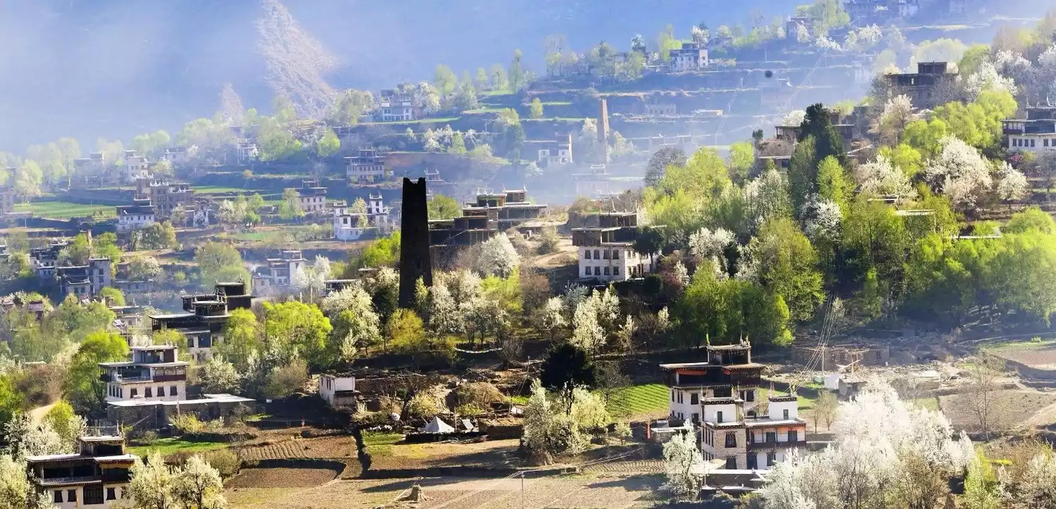
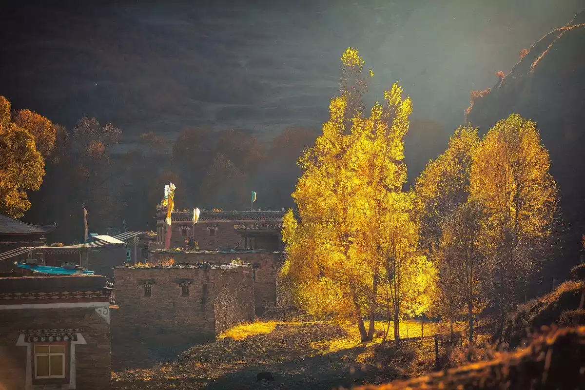
Danba Tibetan Village is the most distinctive of the Jiarong Tibetan villages. Jiaju, Niejia, Geshizha, and Badi Townships are particularly striking. Hundreds of dwellings, meticulously arranged and nestled into the natural landscape, embody the concept of harmony between man and nature. From afar, amidst the emerald greenery of the valley, lush fields and village houses nestled deep in the forest, accompanied by the occasional gurgling stream, unfold a dynamic and breathtaking landscape of the village. In 2005, National Geographic China ranked Danba Tibetan Village as the top of the six most beautiful ancient towns and villages in China.
Tips:
In the spring, pear and cherry blossoms bloom in Danba, attracting countless photography enthusiasts to come and take pictures. We at China-TravelNote also hold Danba pear blossom photography events every spring.
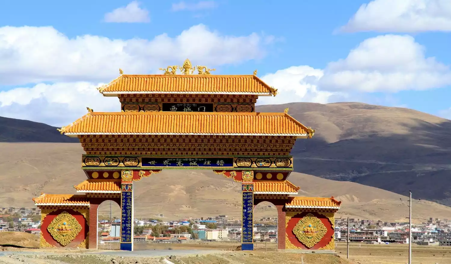
[Litang County is 4014 meters above sea level]
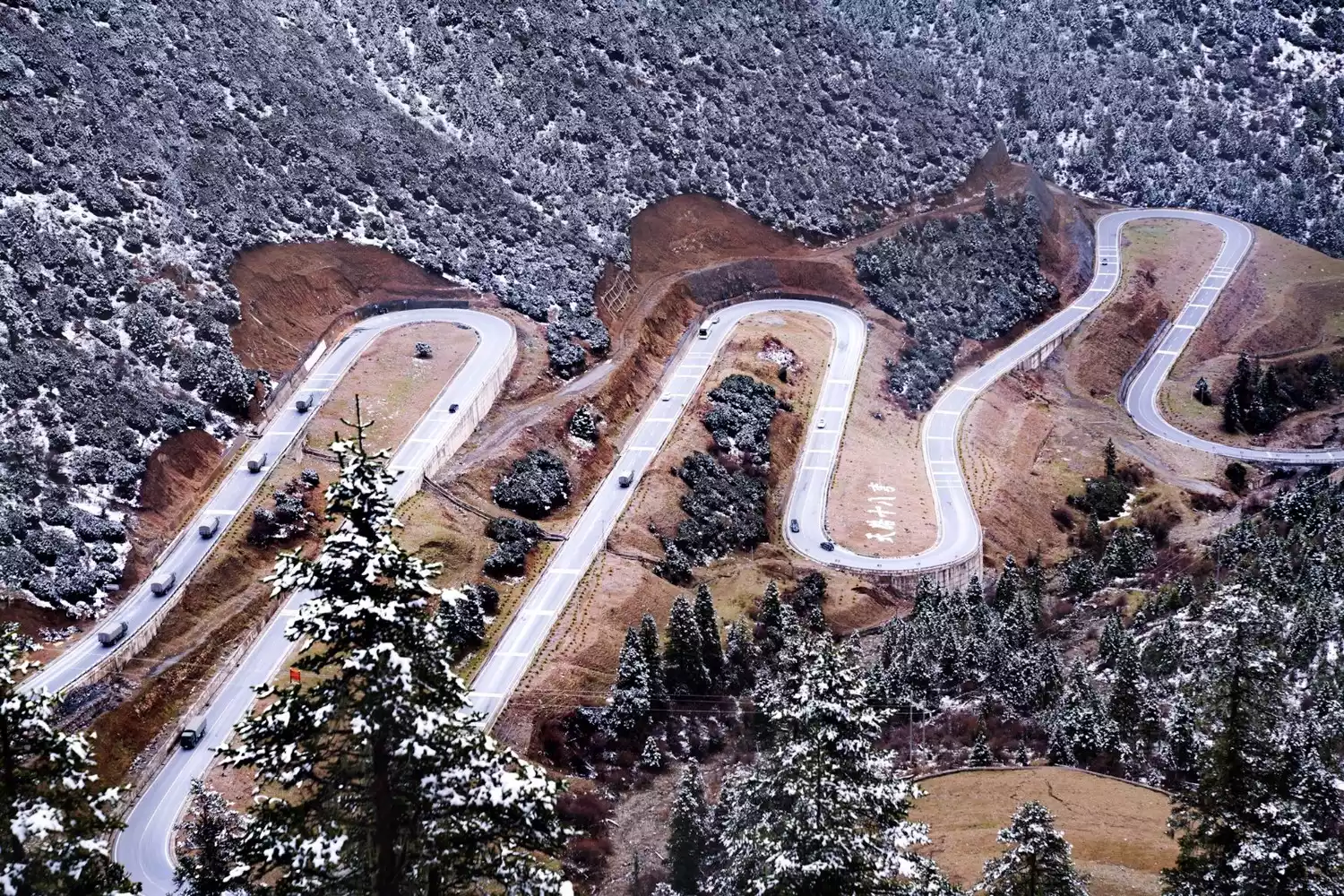
Starting from Xinduqiao, passing through Yajiang County, crossing the Gaolusi Mountain Tunnel, bypassing the 18 bends of the Sichuan-Tibet Highway, and crossing the Kazila Mountain Pass, you will reach Litang County.
Litang, a small plateau town at an altitude of over 4,000 meters, has been a major hub in the tea-horse trade since ancient times. Litang, meaning "flat grassy plain like a bronze mirror" in Tibetan, is home to the vast Maoya Grassland. This earned it the title of "the world's highest city." Speaking of Litang, one inevitably recalls the love poem by Tsangyang Gyatso:
White crane,
Please lend me your wings.
Don't fly far away,
Just go to Litang and come back.
This poem closely links Tsangyang Gyatso and Litang. Consequently, many people believe Litang is Tsangyang Gyatso's hometown. In fact, Tsangyang Gyatso never visited Litang, yet this place remains a deeply moving memory in his heart. Litang is the hometown of Tsangyang Gyatso's beloved.
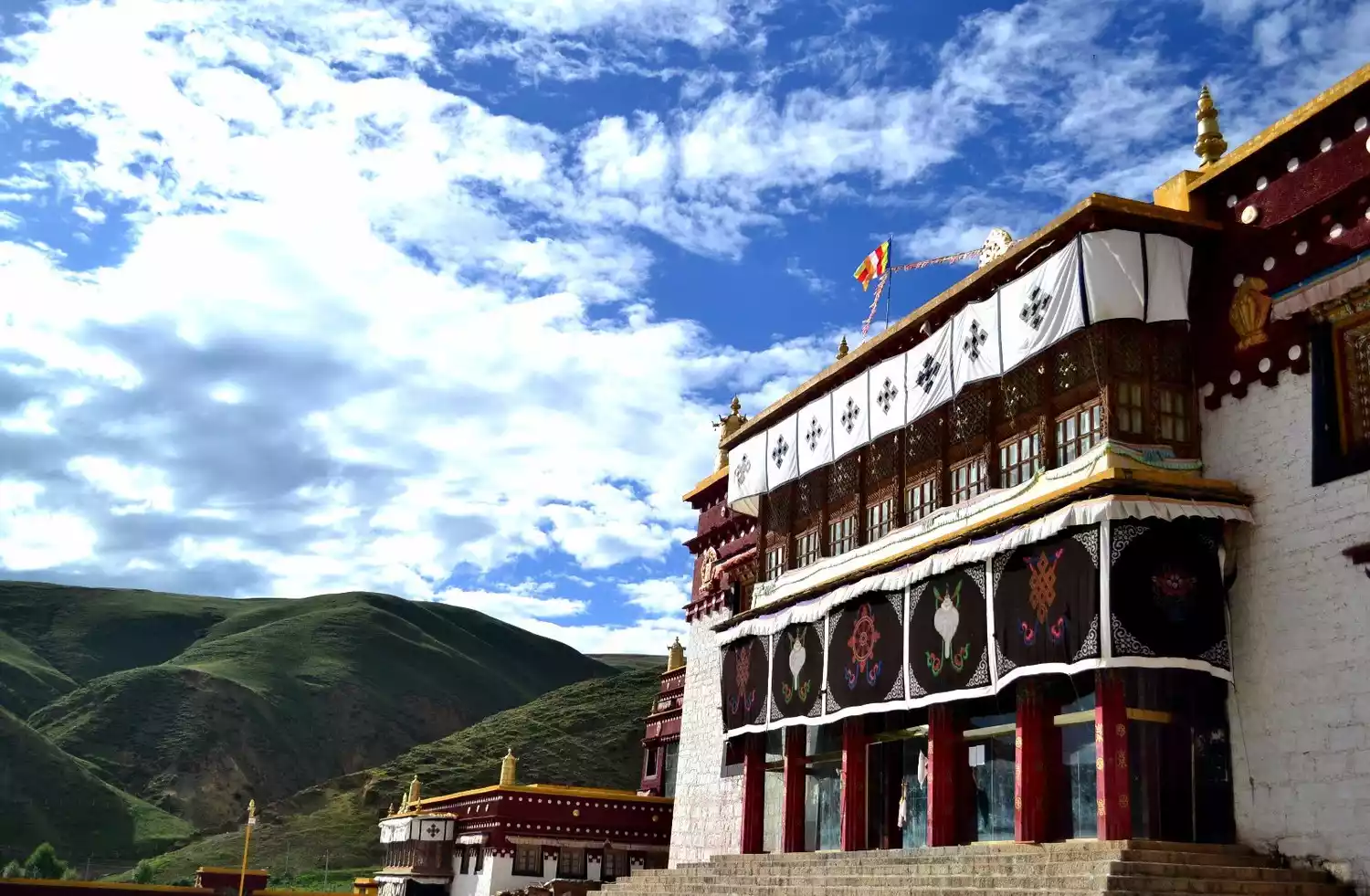
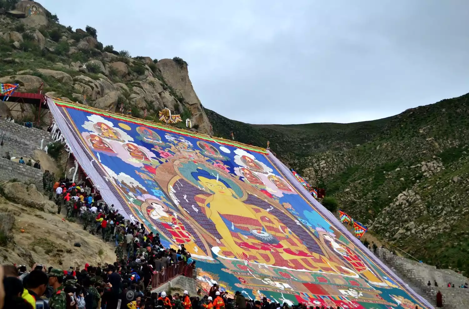
Speaking of Litang, one kilometer from Litang County lies the famous Litang Temple, also known as Changqingchun Keer Temple, situated on a hillside north of the county seat. Originally a Black Sect temple, it was converted to the Yellow Sect during the Wanli period of the Ming Dynasty, when the Third Dalai Lama passed through the area and consecrated it. Litang Temple, a renowned Gelugpa temple in Kham, is located on the slopes of Zhongmoraka Mountain, approximately one kilometer north of the county seat. The temple houses various gilded bronze statues of Sakyamuni, Buddhist scriptures, a saddle used by the Third Dalai Lama, and murals from the Ming and Qing dynasties, among other precious artifacts. Every year on the fifteenth day of the first lunar month in the Tibetan calendar, the temple holds a butter flower sculpture festival.
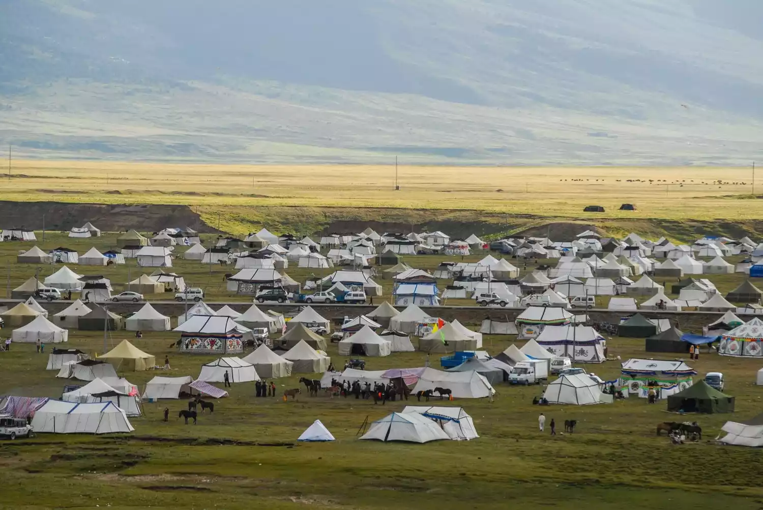
The Horse Racing Festival in Litang County has a long history of horse racing. Held on the third day of the sixth lunar month of the Tibetan calendar, this ceremonial event, known in Tibetan as "Zhubi Rixiao," meaning "June Mountain Circumambulation," is a traditional folk festival in Litang County. Historically, every year in the sixth lunar month, Changqingchun Khor Monastery in Litang County, a renowned Yellow Sect temple in Kham, held horse racing and equestrian demonstrations according to ancient customs. During this time, visit the Maoya Grasslands in Litang, where enthusiastic herders will invite you to sing and dance with them, treating you to curds of milk and butter tea.
Maoya Grassland, located in the central section of the Shaluli Mountains of the Hengduan Mountains, rises 3,800-4,500 meters above sea level. Spread across a wide, shallow basin between two peaks, it covers over 300 square kilometers. The grasslands are blessed with unique natural beauty: crescent-shaped freshwater lakes like Ruogencuo dot the grasslands, and the Wuliang River, originating from Mount Genyen, winds through the heart of the grasslands. A towering white pagoda stands on the grasslands, said to be one of the three great stupas built by Princess Wencheng during her journey to Tibet. If you've visited Litang and haven't visited Maoya Grassland, you haven't really been to Litang.
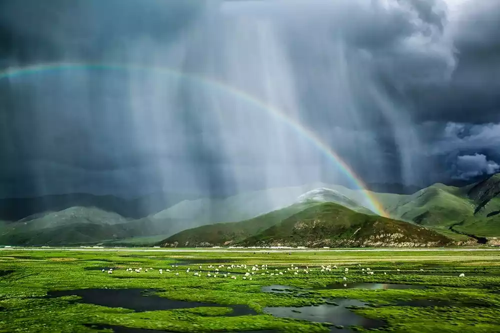
Surrounded by mountains, there is a lush and green grassland like a sea. This is the Maoya grassland.
Tips:
Litang County is at a high altitude. If you have a slight altitude sickness, you can continue forward and go to Batang County for accommodation.
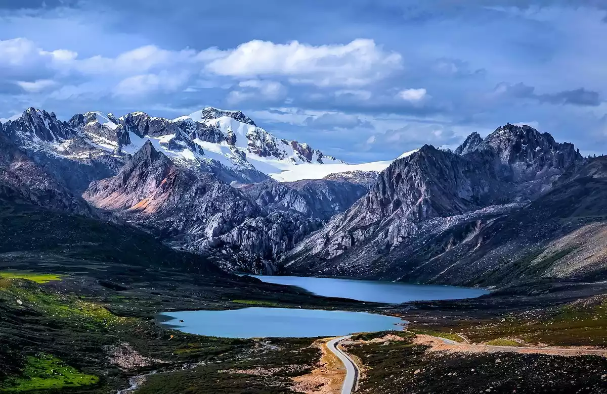
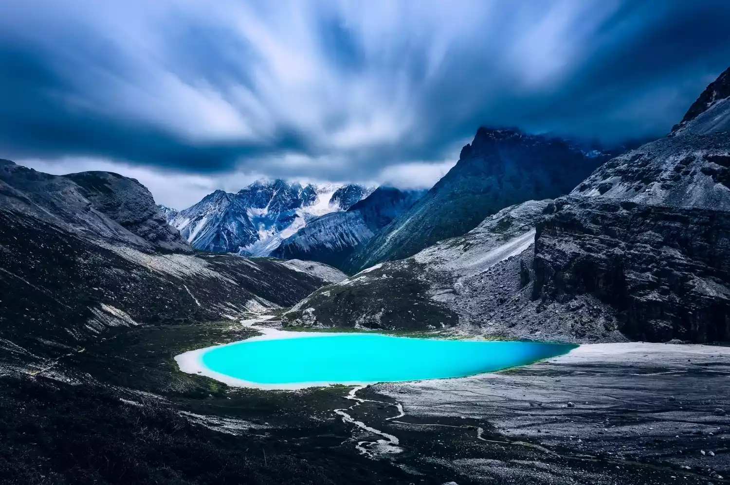
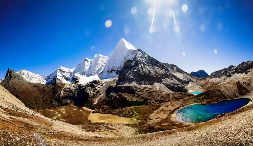
91 kilometers along G318, past Litang County, lie the Haizi Mountain Sister Lakes. These lakes are a dazzling pearl on the Sichuan-Tibet Highway. The Haizi Mountain Nature Reserve, located between Batang and Litang, is the largest ancient glacial relic on the Qinghai-Tibet Plateau, known worldwide as the "Daocheng Ancient Ice Cap." As global temperatures rise, the ice cap gradually melts, and snowmelt accumulates in glacial depressions and rock basins, forming lakes. These "Sister Lakes" lie quietly on Haizi Mountain, like two beautiful, shy maidens awaiting marriage, a scene of divine purity. Surrounded by snow-capped peaks, they resemble two shimmering pearls, like two tears of the snow-capped mountains, shedding their light at the foot of the mountain. This sacred, tranquil beauty will linger in your memory for a lifetime... They graced the cover of the tenth issue of "National Geographic China" in 2006.
[Daocheng Yading] The last tear on the blue planet.
Daocheng Yading, the secret place of Shambhala, is located 80 kilometers south of the intersection of National Highway G318 and Provincial Highway 217. The beauty of Daocheng Yading can only be experienced by visiting it in person, so I won't introduce it here in detail.
[Batang County is 2,580 meters above sea level]
The Cuopugou Nature Reserve is located in Cuo La District (Chaluo Township) north of Batang County, at the foot of Mount Haizi in Ganzi Prefecture, western Sichuan. It stretches from Maoya Dam in the east, bordering Litang County, to the 4,860-meter-high Yasu Mountain in the west, and south from Lieyi and Shaxi Townships to the sacred Zhajinjiabo Mountain, adjacent to Baiyu. Covering 900 square kilometers, it epitomizes the beauty of the Tibetan Plateau in western Sichuan and Tibet: snow-capped mountains, grasslands, forests, lakes, and temples. Cuopu Lake in Cuopugou is known as the "Holiest Lake of Kham."

Cuopugou is 20 kilometers north of Sister Lake, but it is currently not open to the public due to scenic area management and development. Let us look forward to her perfect return.
In the autumn, Cuopugou feels like the New Year in Baoyuze, don’t you think?
Sichuan-Tibet Highway, Tibet Section
[Batang-Jinsha River Bridge-Mangkang-Zuogong-Basu] Total length: 459km
[Jinsha River Bridge] After leaving Batang, we arrived at the Jinsha River Bridge, a must-see destination, at the 38th kilometer mark along the Sichuan-Tibet Highway. This is the Sichuan-Tibet boundary, marked by the center of the Jinsha River Bridge. A large sign stands in the middle of the bridge, making it a must-see for hikers on the Sichuan-Tibet Highway.
[Mangkang County is 4,317 meters above sea level]
Mangkam County is located in the southeastern part of the Tibet Autonomous Region, on the easternmost edge of Qamdo City, at the intersection of Sichuan, Yunnan, and Tibet. National Highways 318 and 214 intersect in Mangkam County, forming the Sichuan-Tibet Highway that runs all the way to Lhasa. Those wishing to visit the Thirteen Peaks of Meili in Yunnan can head south from here.
Continue along the Jinsha River. If you happen to arrive in July when the barley is ripe, the scenery will be very beautiful.
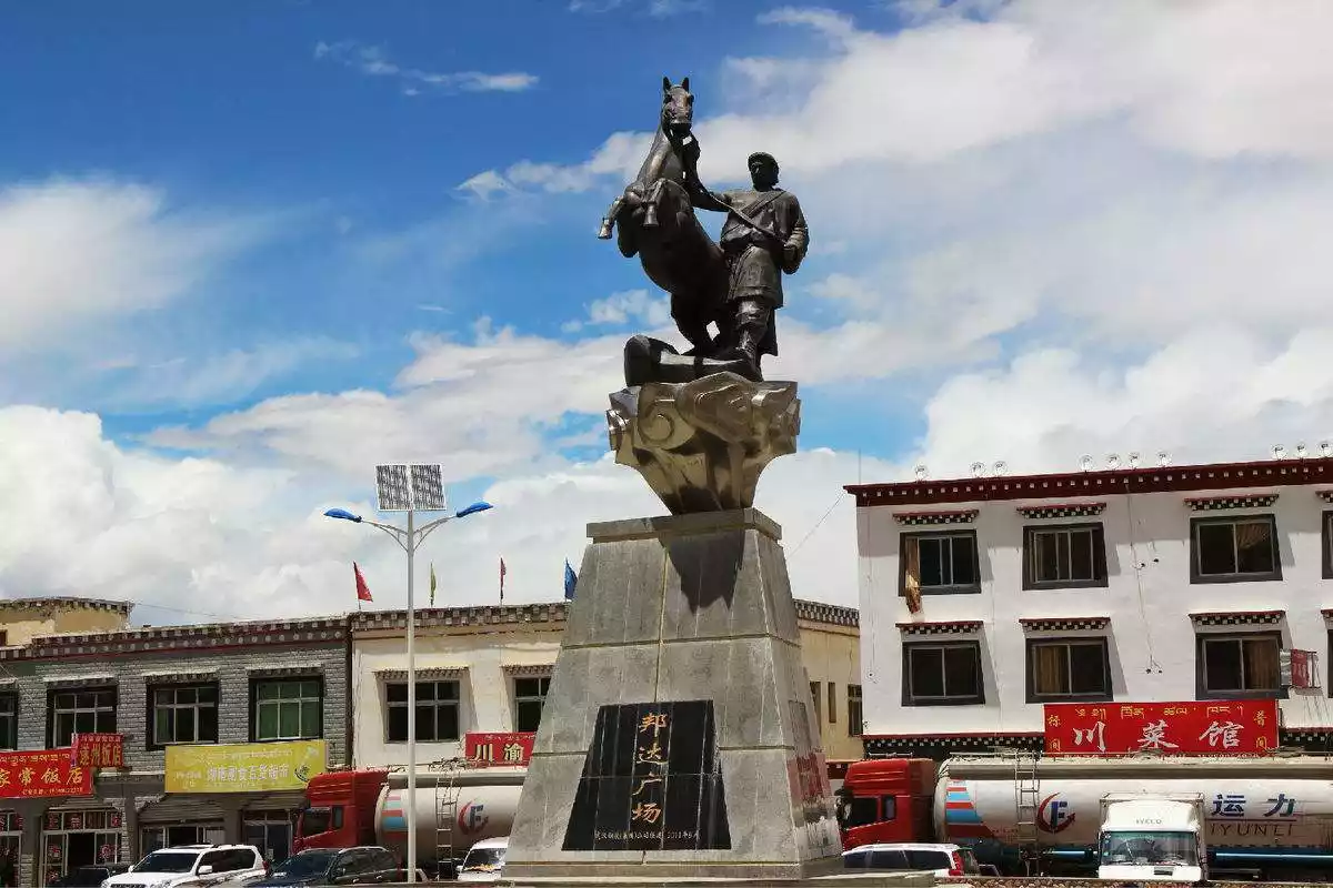
[Bangda is 4,300 meters above sea level]
Leaving Mangkang County, we crossed the Dongda Mountains, passed through Zuogong, and arrived at Bangda. Congratulations! You've reached the halfway point of your Sichuan-Tibet journey. Bangda is the midpoint of the Sichuan-Tibet Highway. It's also the intersection of the southern and northern Sichuan-Tibet routes, yet it's often overlooked, not even marked on some maps. Once a crucial stop on the famous "Ancient Tea-Horse Road," it's located between Zuogong County and Basu County on National Highway 318. A fork here leads north to Qamdo, part of the northern Sichuan-Tibet Highway. The upper reaches of the Yuqu River, a tributary of the Nujiang River, meander through the area. The vast, low-lying wetlands on both sides are covered with dense, low-growing meadow plants like wormwood and moss, creating a carpet of verdant grass. Herds of cattle and sheep roam the area foraging, and occasionally Tibetan antelopes roam among them.
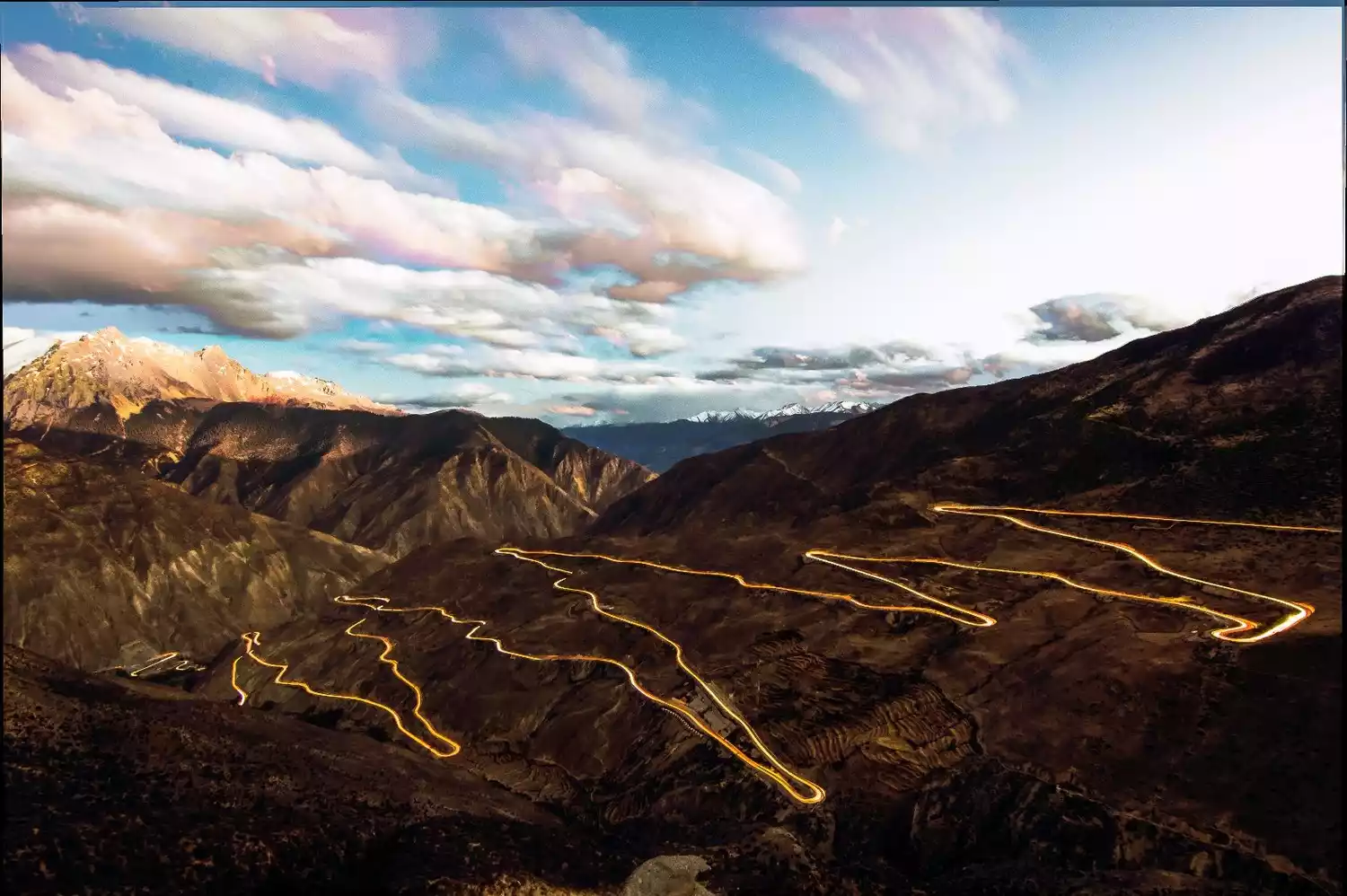
After leaving Bonda Square, you are about to face a challenge, the 72 bends of Nujiang River, also known as the fatal 72 bends.
[Nujiang River 72 turns]
The "Nujiang 72 Bends" is a road in Basu County, Qamdo Prefecture, Tibet Autonomous Region. It's also located between Bangda and Basu on the Southern Sichuan-Tibet Highway. This road is also known as the "99 Bends of Sichuan-Tibet." It's a landmark of the Sichuan-Tibet Highway, and anyone who mentions the highway often misses the 72 bends.
From its lowest point at 3,100 meters above sea level, it climbs all the way to the highest point, Yela Pass, at 4,651 meters, before winding down to Bangda Town at 4,100 meters. It's approximately 12 kilometers long. As a must-pass route on the southern Sichuan-Tibet Highway, its very dangers make it a truly challenging and rewarding road for many cyclists. Every year, passersby are captivated by the road. In 2010, the pristine black asphalt paving and widening work were completed. When drivers and cyclists travel along this heavenly road, they are left with only awe and awe.
[Basu County is 3,260 meters above sea level]
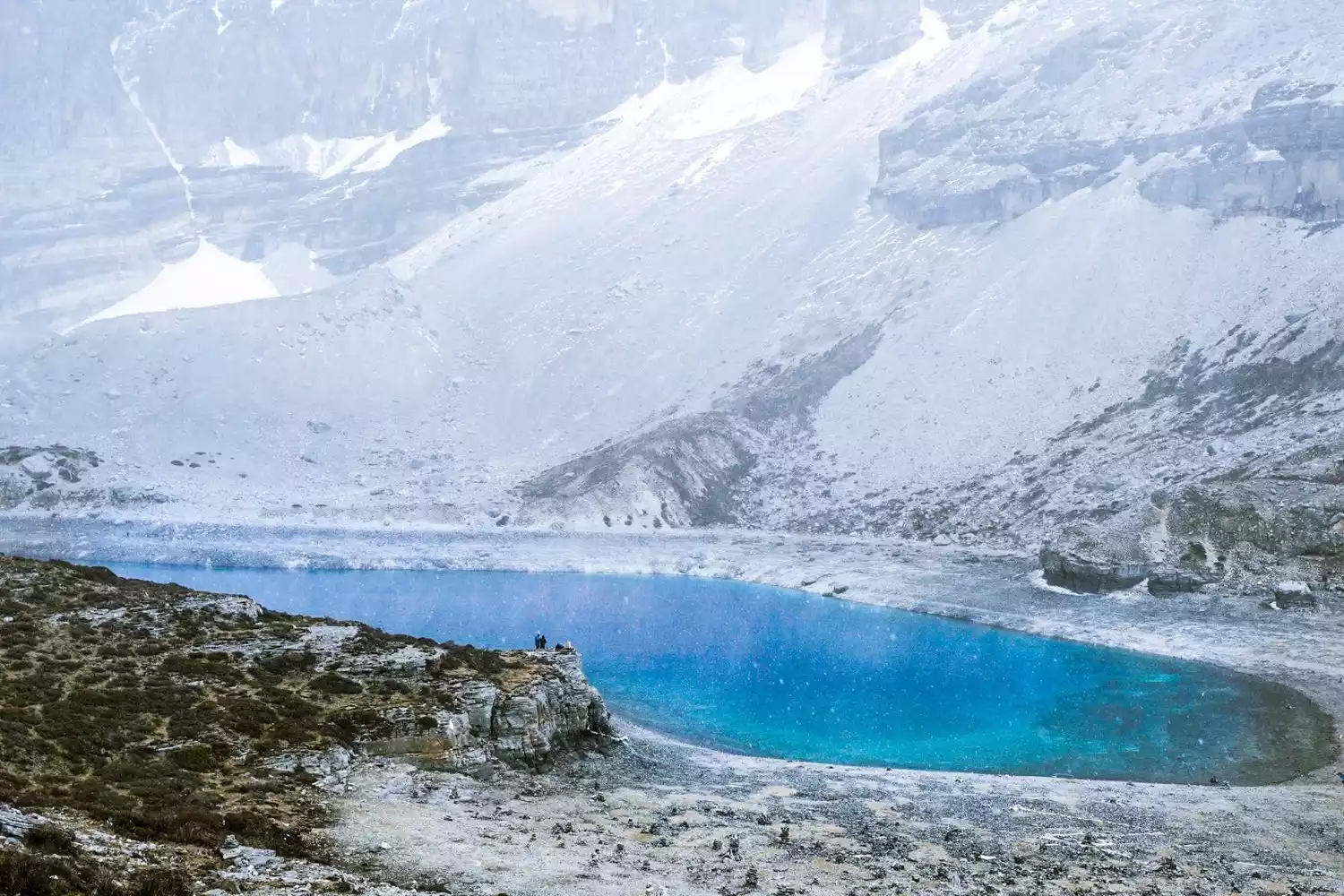
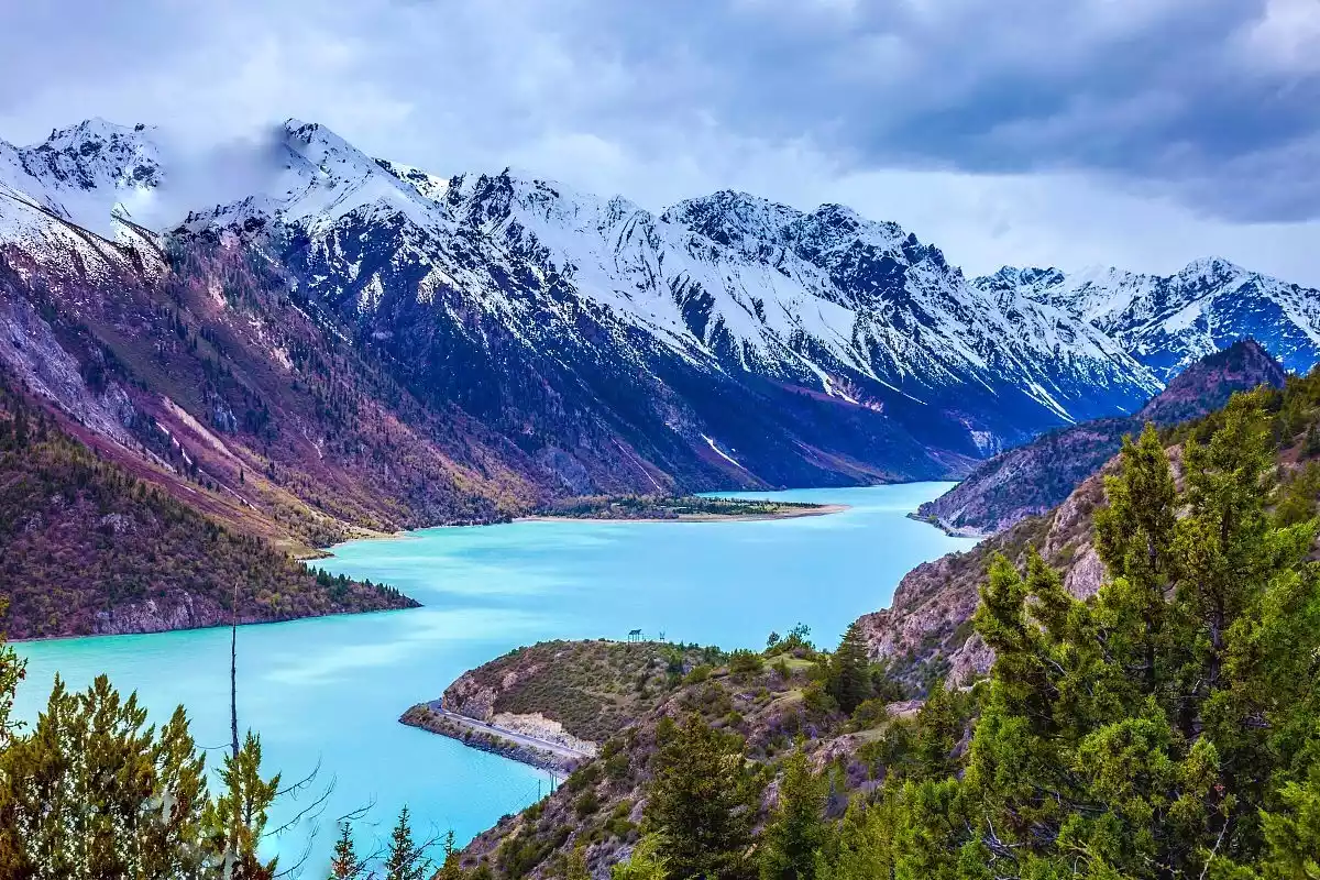
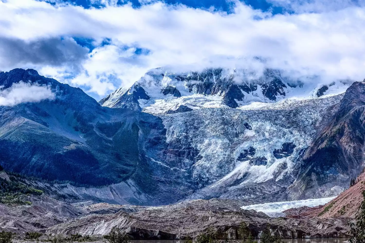
Basu County lies to the southwest of the Hengduan Mountains and to the northeast of the Nu River. Houses are mostly built on hillsides and are primarily earthen structures, typically two- to three-story buildings with square rooms and ornately painted pillars and beams. Basu County boasts the Bangda Grassland and Ranwu Lake, a vibrant blend of glaciers, lakes, grasslands, and primeval forests. Located 90 kilometers southwest of the county seat, National Highway 318 runs alongside the lake. It is the primary source of the Parlung Tsangpo River, a tributary of the Yarlung Zangbo River. The lake covers an area of 22 square kilometers, holds 140 million cubic meters of water, and is located at an altitude of 3,850 meters. Ranwu Lake is divided into three sections: upper, middle, and lower. The upper section, above Kangsha, is called Angong Lake, covering approximately 6 square kilometers. The lower and middle sections, from Kangsha to Ranwu Village, comprise the main body of Ranwu Lake, covering 16 square kilometers. The entire lake is a river-shaped channel, 29 kilometers long, with an average width of 0.8 kilometers and a circumference of 60 kilometers. To the north lies the Lagu Glacier, which extends to the lake's edge. Whenever the snow and ice melt, the water flows into the lake, ensuring a sufficient water supply. The G318 Sichuan-Tibet Highway runs along Ranwu Lake, and I personally consider this section one of the most essential parts of the Sichuan-Tibet Highway. The snow-capped mountains, forests, and lakes are a breathtaking sight. At the time, I thought, there's no need to rush to Lhasa; Lhasa is always on the way.
[Basu-Ranwu Lake-Bomi] Total distance: 218km
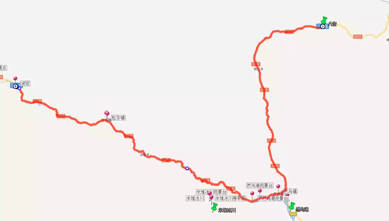
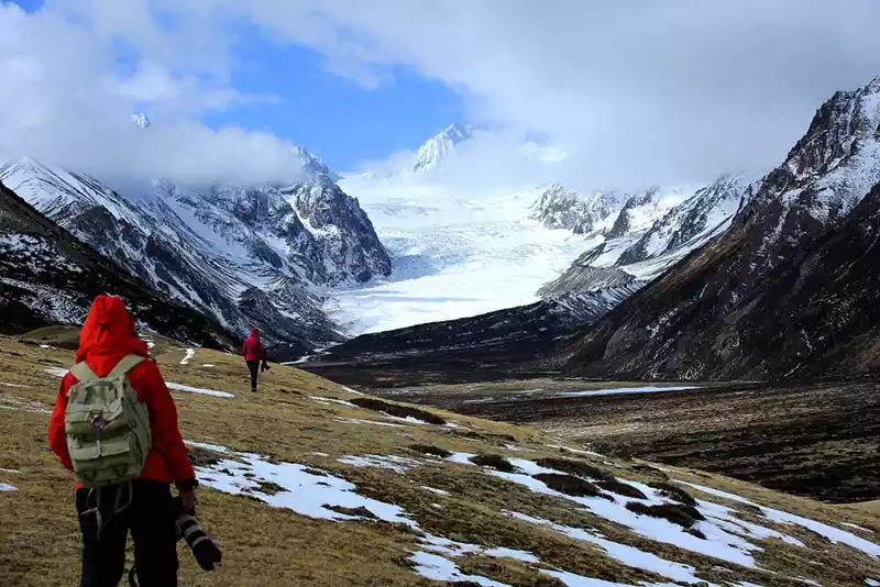
[Ranwu Lake Glacier] After leaving Basu, you can quickly reach Ranwu Lake. Ranwu Lake has been mentioned above, so I won't go into detail here. When you arrive in Ranwu Town, I personally recommend staying in a lake view room at the Ping'an Hotel in the middle of Ranwu Lake for one night. It is also the cheapest lake view room in history and you can experience it.
The next day, you can hire a local guide or charter a car to visit Renlongba Glacier, the "Father of Ten Thousand Years of Glaciers." Unlike the Laigu and Midui Glaciers, which have become renowned tourist attractions, Renlongba Glacier remains untouched and pristine, hidden deep in the mountains and little known to the public. However, its scale and grandeur rival those of the two. Because it's untouched and relatively unknown, you'll need a local driver to reach the entrance. Then, you'll hike through meadows and streams to the foot of the glacier, where you'll get up close and personal with the glacier. Our round-trip hike took over six hours.
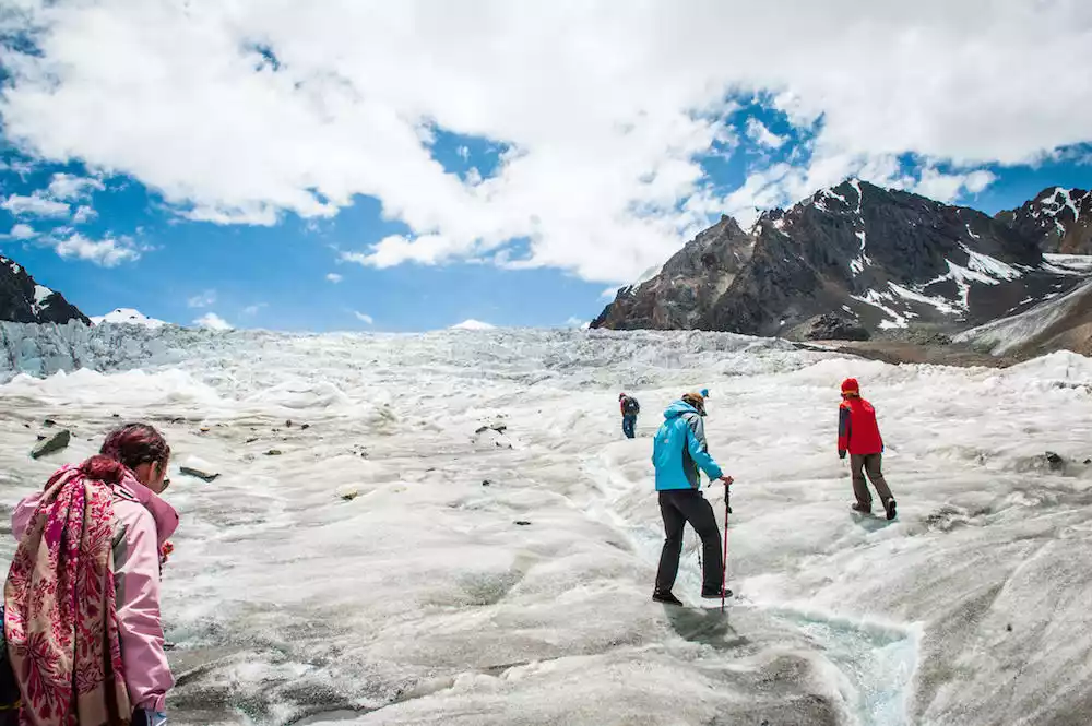
The Midui Glacier is located upstream of the Midui River, a secondary tributary of the lower Yarlung Zangbo River. It joins the Parlung Zangbo River from its southern bank at the 84-kilometer mark on the Sichuan-Tibet Highway. Located close to the highway, the Midui Glacier boasts a large scale and easy access, making it a prime example of southeastern Tibet's maritime glaciers. With its distinctive features and diverse types, it is renowned for its beautiful arch structures, a rare natural wonder. Here, glaciers, lakes, farmlands, villages, and forests blend together, creating a model of harmonious coexistence between man and nature.
 Tips:
Tips:
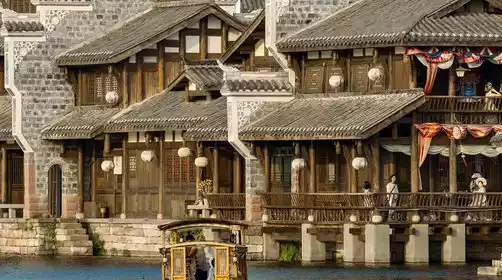
Ten kilometers west along the Parlung Tsangpo River, Wa Village lies within Ranwu Town. The houses are typical of southeastern Tibetan forest architecture, constructed largely of wood, even the roofs. At dawn and dusk, the slanting sunlight reflects off the glossy wooden roofs, creating a rich Tibetan atmosphere and making it a perfect spot for photography.
[Bomi County is 2,700 meters above sea level]
Bomi County lies in the eastern section of the Nyainqentanglha Mountains and the eastern tip of the Himalayas. Rising in the north and declining in the south, it's a mountainous landscape, with the Parung Tsangpo and Yigon Tsangpo River valleys in the center, and dozens of tributaries. It's also the hometown of Nyatri Tsampo, the first Tibetan king. Upon entering Bomi County, you'll see a large memorial archway inscribed with the words "Hometown of the Tibetan King." Seeing these words quickly signals your arrival in Bomi County. Arriving in Bomi feels like entering a city, with supermarkets, karaoke bars, and dessert shops, a distinct contrast to the bustling county towns we've encountered along the way.
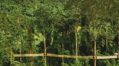
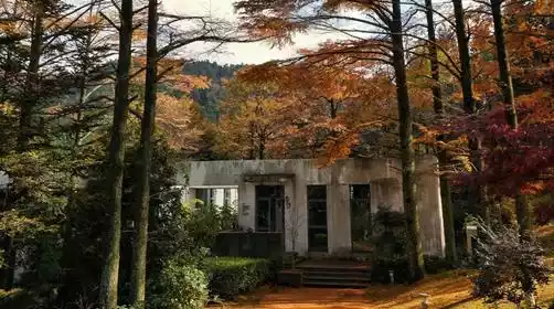
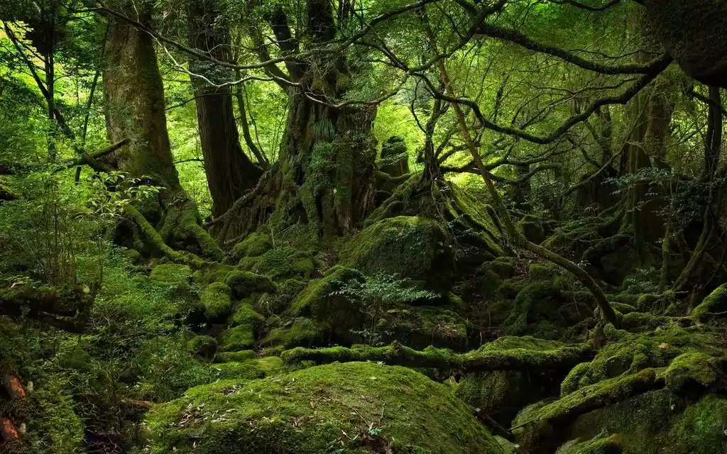
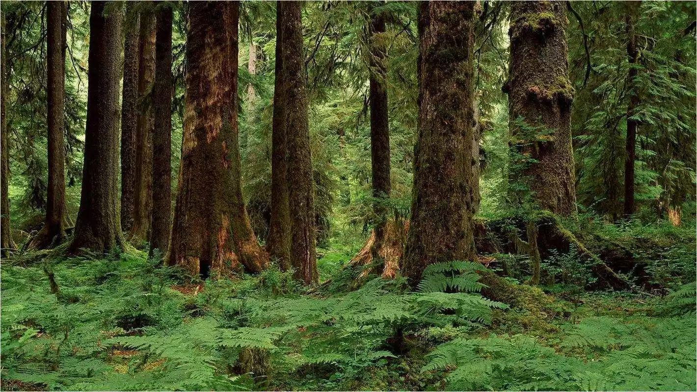
Here is also the little-known Bomi Primeval Forest, one of China's five most beautiful primeval forests. Due to its lack of development, it requires a local guide and a 3-4 hour hike to reach.
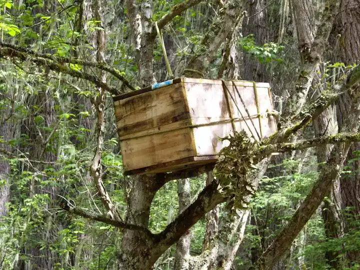
[Tree Burial] As you walk through the primeval forest, absorbing the supersaturated oxygen, if you pay close attention, you'll notice small wooden boxes hanging from the trees. That's right, tree burial. Tree burial is a very ancient burial practice. Its main form involves placing the deceased in a large tree deep in the mountains or outdoors, leaving it to weather. Later, a slightly modified method involves displaying the deceased on a specially constructed scaffold. Because the body is left to weather after being placed, tree burial is also known as "wind burial," "hanging burial," "wooden burial," "empty burial," or "suspended burial." Tree burial reflects the practice of living in trees, and therefore, represents a vestige of primitive life in its funeral customs. Tree burials are ubiquitous in the Bomi primeval forest. Even as a boy, entering the forest gives me chills, let alone girls, who scream with fear. Some even report seeing skeletons beneath the trees.
Tips:
The first of the top ten hiking routes - Medog, is to go there from Bomi County along the Medog Highway.
[Bomi-Nyingchi] Total distance: 228km
Starting from Bomi, the journey continues through primeval forests towards Tongmai, the last natural barrier on the Sichuan-Tibet Highway. Passing through Tongmai Town and crossing the Tongmai Bridge, you'll reach Pailongmenba Ethnic Township. After crossing the Sejila Mountain Pass (4,723 meters above sea level), you'll reach Lulang, the "Switzerland of the East."
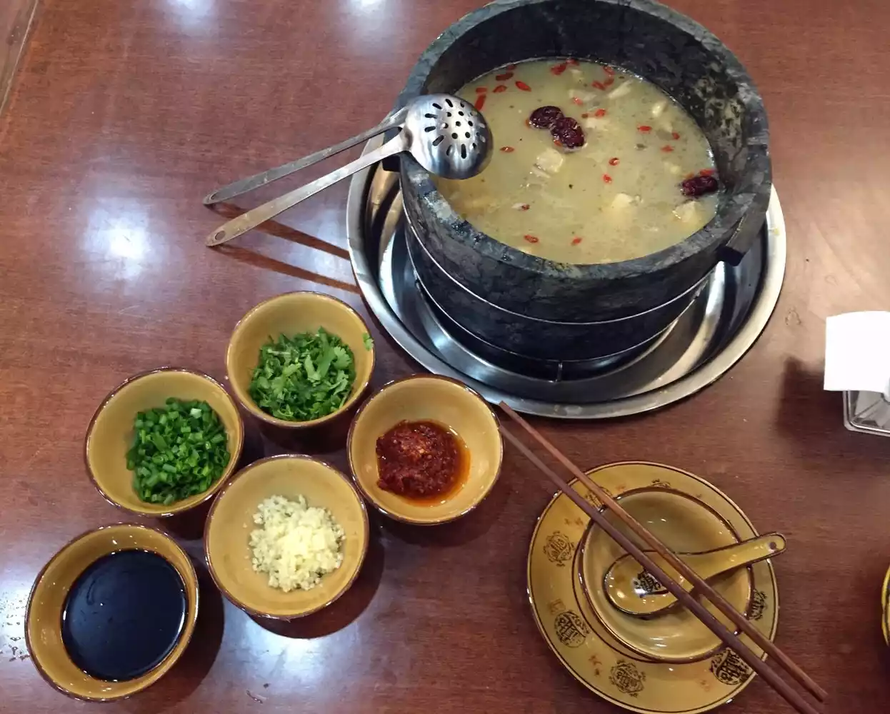
When talking about Lulang, one can't help but mention its stone pot chicken. The first stone pot chicken restaurant in Lulang opened in 1999. He Daiyun uses Tibetan fragrant chicken purchased from nearby residents, supplemented with four or five medicinal herbs, such as ginseng and gastrodia elata, and slowly stewed over a fire. The broth has a subtle herbal fragrance, and the chicken is tender and springy. The stone pot used for stewing the chicken is also very exquisite! It is hewn from a type of mica called soapstone, which is only found in Medog. Porters carry the raw stone from Medog, and then the Monba people carefully chisel it from a single block of stone. The process requires a steady hand, as impatient chiseling can easily pierce the soapstone, making this stone pot very expensive. The dark green mica pot is exceptionally heat-retaining and is said to be rich in 17 minerals and trace elements, including magnesium and iron. It's a must-try in Lulang! The average price per person ranges from 100 to 200 yuan.
The fork in the road from Lulang to Nyingchi, heading towards the airport, leads to a paradise - Suosong Village.
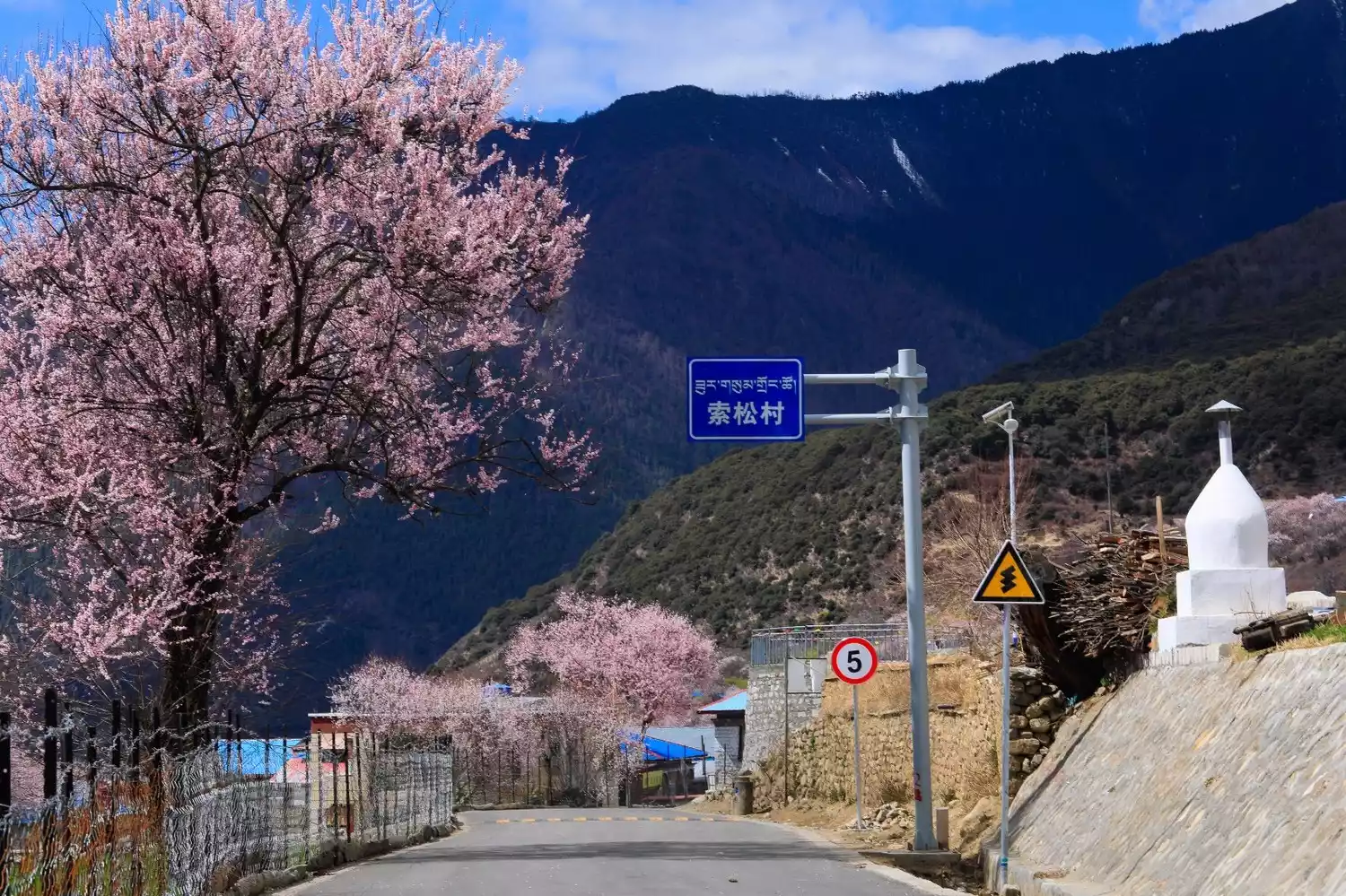
In the season when peach blossoms are in full bloom, come to Suosong Village in Nyingchi and have a buffet at the foot of Mount Namjagbarwa.
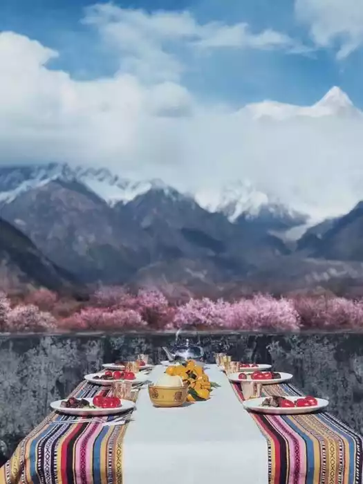
(A grassland buffet hosted by China-TravelNote in Suosong Village in the spring of 2018)
[Nyingchi is 3,100 meters above sea level]
Nyingchi is a transliteration of the Tibetan word "Nichi" or "Niangchi," which means "the throne of the Niang family or the throne of the sun" in Tibetan. Located in southeastern Tibet, on the middle and lower reaches of the Yarlung Zangbo River, it borders Lhasa and Shannan to the west and southwest, respectively, and Jiali County of Nagqu Prefecture to the west and Qamdo City to the east. Parts of its southern region border the Indian-occupied Southern Tibet region and Myanmar. Known as the Jiangnan region of Tibet, it boasts the world's deepest canyon, the Yarlung Zangbo Grand Canyon, and the world's third deepest, the Parlung Zangbo Grand Canyon.
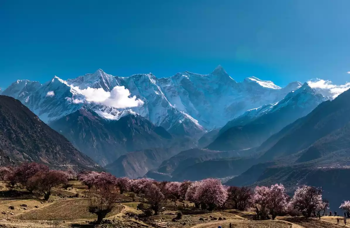
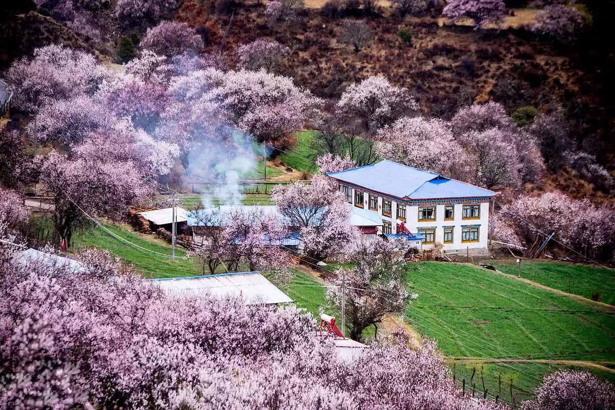
The Nyingchi Peach Blossom Festival is held in mid-to-late March every year. The winter in Tibet has not yet faded, but the peach blossoms in Nyingchi, Jiangnan, Tibet, are like the beautiful plateau red on the faces of Tibetan girls, competing with each other for beauty like intoxicating clouds. It not only allows people to appreciate the unique and charming scenery of the "Snowy Jiangnan", but also allows people to experience the most romantic and beautiful spring in Tibet.
[Nyingchi-Lhasa] 400km
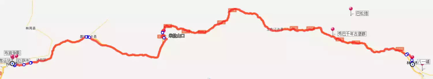
After leaving Nyingchi, you can take the expressway to Lhasa. The Lhasa-Nyingchi Highway is an intercity expressway in China's Tibet Autonomous Region, connecting the provincial capital of Lhasa with the prefecture-level city of Nyingchi. The Lhasa-Nyingchi Expressway runs parallel to the Lhasa-Nyingchi section of National Highway G318, reducing the one-way driving time between Lhasa and Nyingchi from eight hours to five.
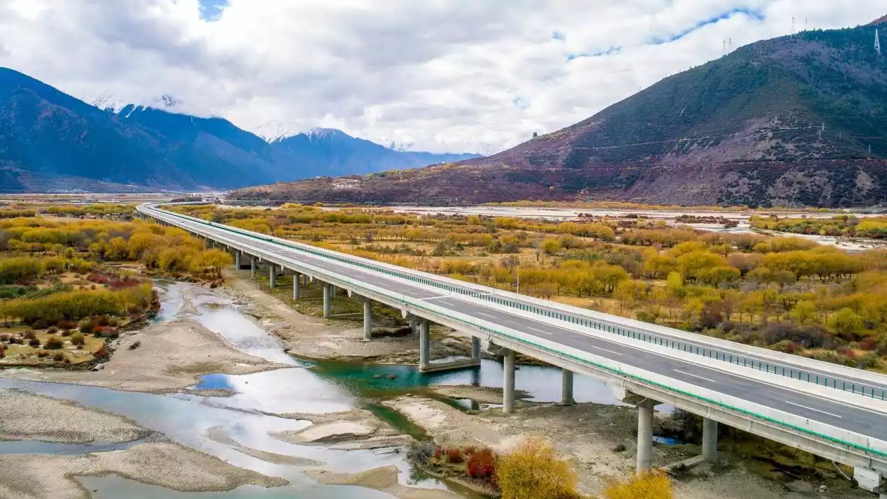
The Niyang River, also known as "Niangqu," the "Mother River" of Nyingchi City in the Tibet Autonomous Region, is known as the Niangqu River, meaning "tears of the goddess" in Tibetan. With its pristine vegetation along its banks and enchanting scenery, the Niyang River offers numerous scenic spots and is considered one of the most scenic rivers on the Qinghai-Tibet Plateau. The Niyang River Scenic Area is home to numerous wild birds and is also a renowned wintering area for the black-necked crane in Tibet.
If you take the Sichuan-Tibet Highway G318, you'll need to cross Mila Mountain, the last mountain above 5,000 meters on the Sichuan-Tibet Highway. After crossing Mila Mountain Pass, it's all downhill, and Lhasa is right before your eyes. You'll feel the joy of victory before your eyes, and the fatigue of so many days of travel will melt away in this moment. Lhasa, we're here!
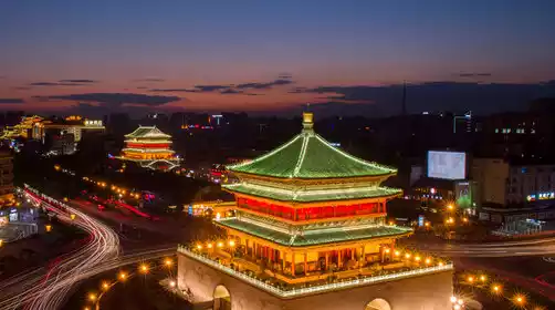
[Lhasa is 3,700 meters above sea level]
Lhasa, formerly known as "Jixuewotang", is a wetland in the Lhasa River basin.
When Songtsen Gampo moved the capital to Lhasa, he filled the swamps with soil carried by white goats. This river valley was also called "Resa", which means the place built by white goats carrying soil.
Princess Bhrikuti built the Jokhang Temple and enshrined a life-size statue of the eight-year-old Sakyamuni; Princess Wencheng built the Ramoche Temple and enshrined a life-size statue of the twelve-year-old Sakyamuni.
Later, Princess Jincheng of the Tang Dynasty swapped the positions of the two Buddha statues, and the Jokhang Temple enshrined a life-size statue of the twelve-year-old Sakyamuni until today.
People believe that the Jokhang Temple is extremely sacred and call the Jokhang Temple and the area around Barkhor Street "Lhasa", which means a sacred place.
The Potala Palace is built about one kilometer west of the Jokhang Temple and can be reached on foot from the Jokhang Temple.
Tickets for the Jokhang Temple must be booked online in advance, and then queue up at the east entrance of the Potala Palace to pick up the tickets.
Please be sure to bring your ID card when visiting the Potala Palace and Jokhang Temple.
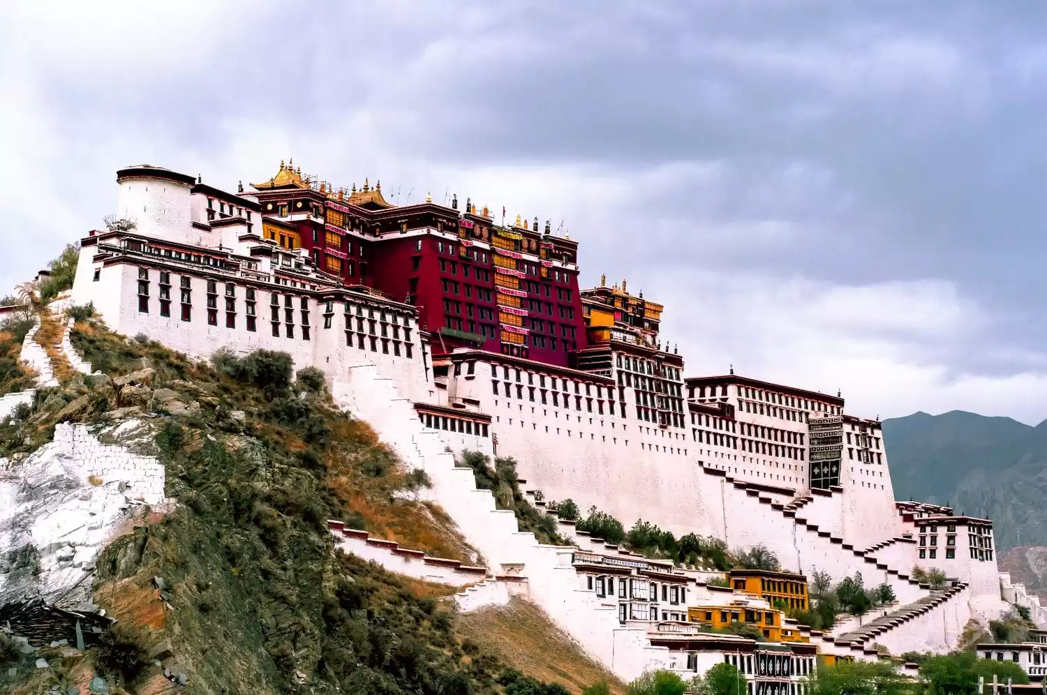
There is Nanshan Park on Cijuelin Road outside Lhasa, which is a good place to take panoramic photos of the Potala Palace.
Tips:
The Lhasa-Namtso route is 221 kilometers, while the Lhasa-Yamdrok Lake route is 104 kilometers. Road conditions are good throughout, but speed limits should be observed. Backpackers can hire a local car for the trip, costing around NT$100 per person.
Lhasa Gonggar Airport is approximately 60 kilometers from downtown Lhasa. A bus service is available, priced at 30 yuan. The airport bus terminal is located east of the Potala Palace at the Lhasa Civil Aviation Ticket Office. If departing from Lhasa, you can still board the bus here. The staff will arrange boarding order based on your flight departure time.
Lhasa Railway Station is located in the south of Lhasa, on the opposite bank of the Lhasa River. There is a bus stop a hundred meters to the right of the railway station exit. If you want to reach Potala Palace Square, there are two buses: Bus No. 1 and Bus No. 13. The fare is one yuan.
Taking photos while holding flags or banners is prohibited at the entrances of the Potala Palace and Jokhang Temple. Taking photos of armed police officers patrolling the streets is also prohibited. The consequences of doing so are serious, so please remember!
What I like to do in Lhasa
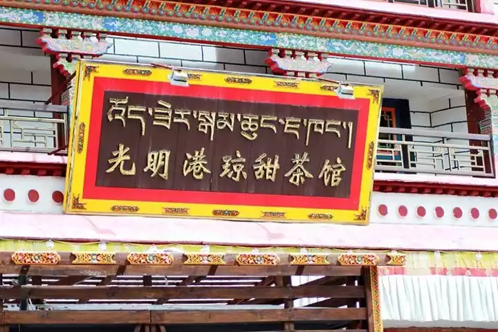
1: Go to Guangming Sweet Teahouse and play poker with local Tibetans for an afternoon, or chat with lamas about the outside world for an afternoon.
Lhasa's sweet tea is incredibly famous in Tibetan areas, and there are numerous sweet teahouses. Enjoying sweet tea in a teahouse is a popular way for Lhasa residents to while away the hours. Gather with friends at a sweet teahouse, chatting, enjoying a light snack, and more.
2: Bask in the sun at the Jokhang Temple Square and spend the whole afternoon in a daze.
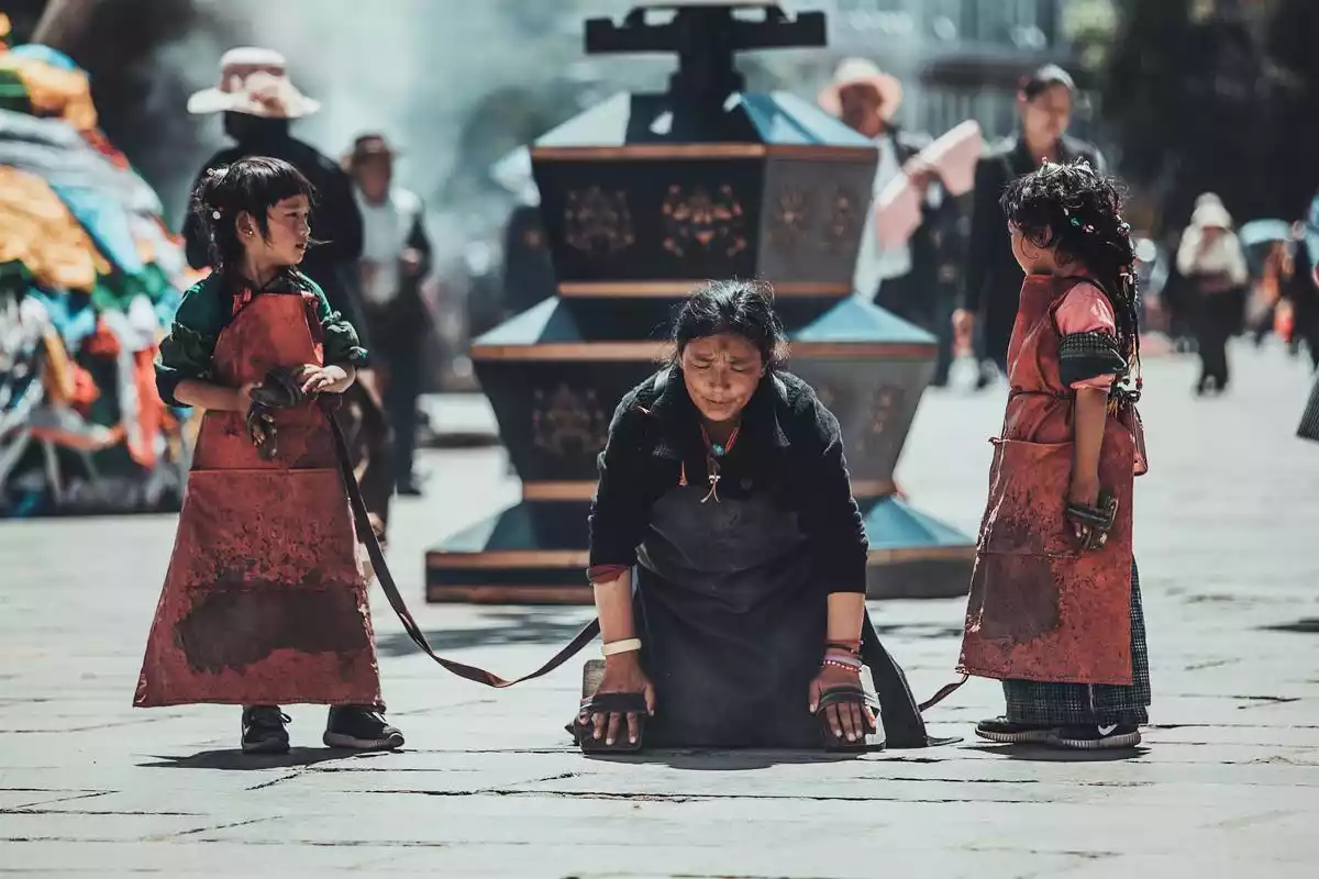
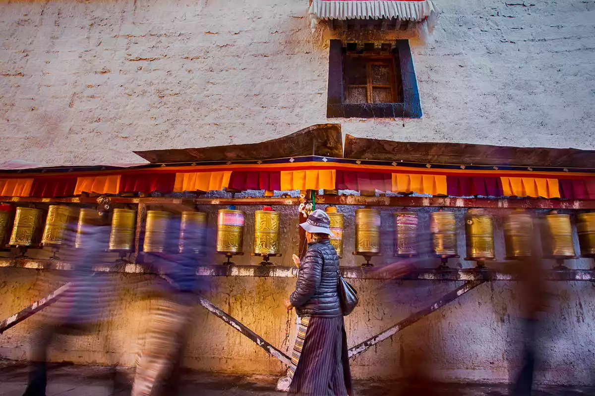
The Jokhang Temple, a fusion of Tibetan, Tang, Nepalese, and Indian architectural styles, has become a timeless classic of Tibetan religious architecture. Incense lingers daily in front of the temple, and devout worshippers prostrate themselves, leaving deep, body-length marks on the bluestone floor. Ten thousand butter lamps burn eternally, bearing the traces of time and pilgrims.
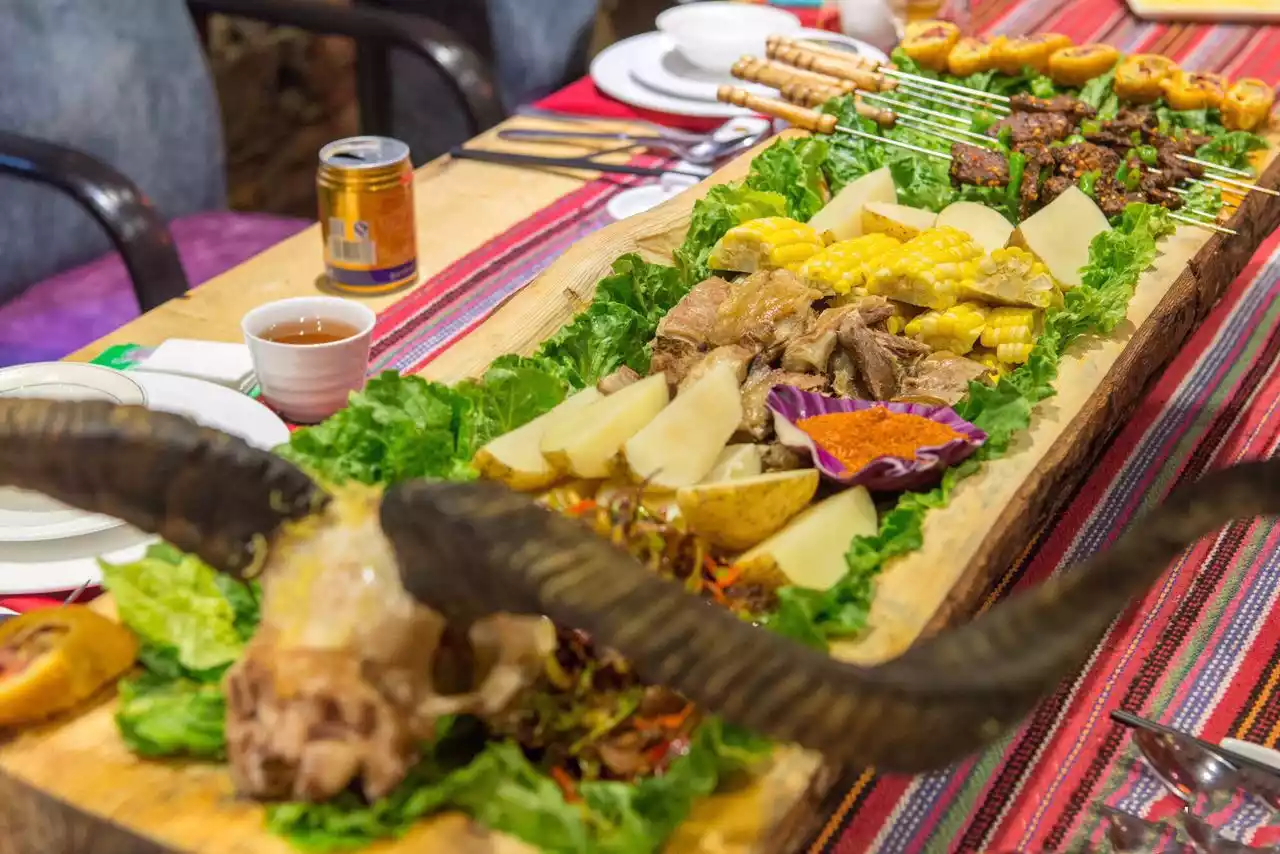
3. Savor an authentic Tibetan feast. When you visit Lhasa, why not try some authentic Tibetan cuisine? Eat a ball of tsampa, sip some butter tea, and stuff your mouth with a handful of plump beef or mutton, and you'll feel a sense of complete satisfaction.
Recommended restaurants: Snowland Restaurant (Tibetan cuisine), Lhasa Namasede Restaurant (Nepalese cuisine, Western cuisine, Tibetan cuisine), Lhasa Restaurant (Tibetan cuisine). Personally, I like the "nang" at Namasede the most, it's super delicious!
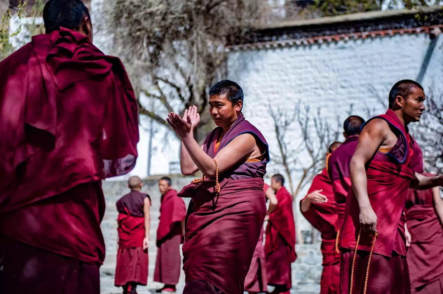
4: Visit Sera Monastery to witness a spirited debate. Debates are a form of discussion among Tibetan Buddhist monks, exploring Buddhist insights and knowledge through a series of questions and answers, sometimes involving multiple responses. The lamas participating in the debates perform exaggerated opening gestures, and given the large number of participants, the clapping and clapping of the participants can be heard from afar. The monks form groups of three or four, and while it's difficult to understand what they're saying, each one is incredibly serious, with no pretense of showmanship.
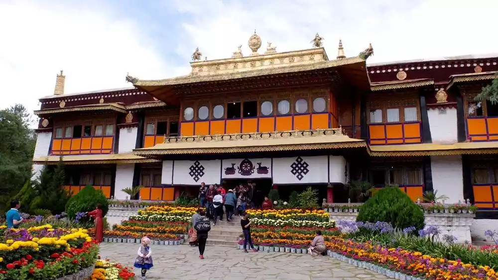
5. Watch a Tibetan opera at Norbulingka, the summer palace of successive Dalai Lamas and Tibet's largest garden, now also known as "People's Park." A Tibetan opera performance takes place daily at 11:00 a.m. Performers wear colorful felt and brocade costumes, auspicious masks or colorful crowns, and sing long, profound lines. This authentic Tibetan opera, a timeless experience, will transport you to a place you haven't been before.
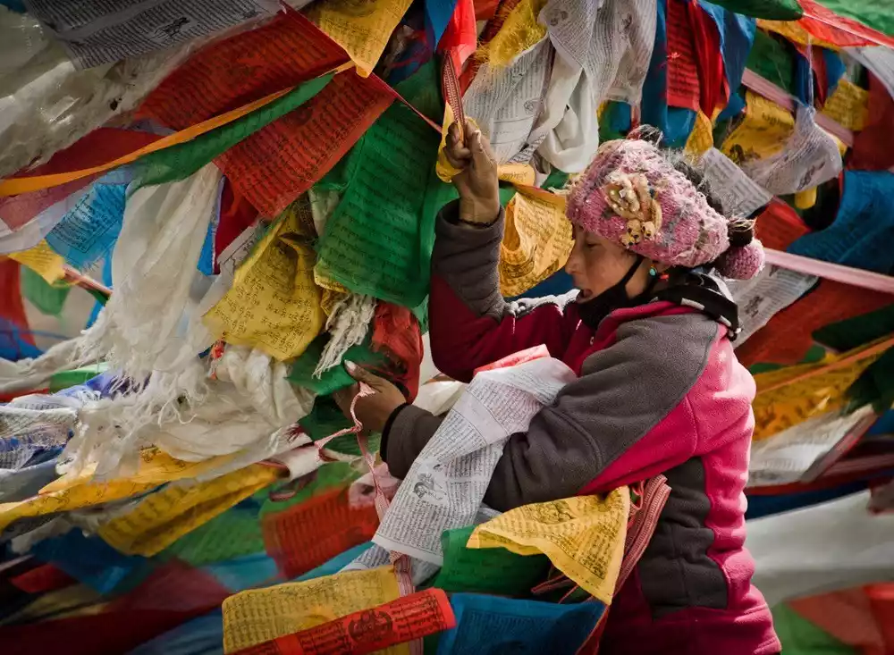
6. Join fellow Tibetans on a circumambulation. This unique religious practice of Tibetan Buddhism involves walking, praying, and circumambulating a specific route. It's a crucial part of the lives of believers. Regardless of gender, age, time of year, or weather, circumambulation is a common sight. Tourists visiting Lhasa typically choose to circumambulate the Barkhor Temple clockwise, a convenient and short route, turning the prayer wheels along the way.
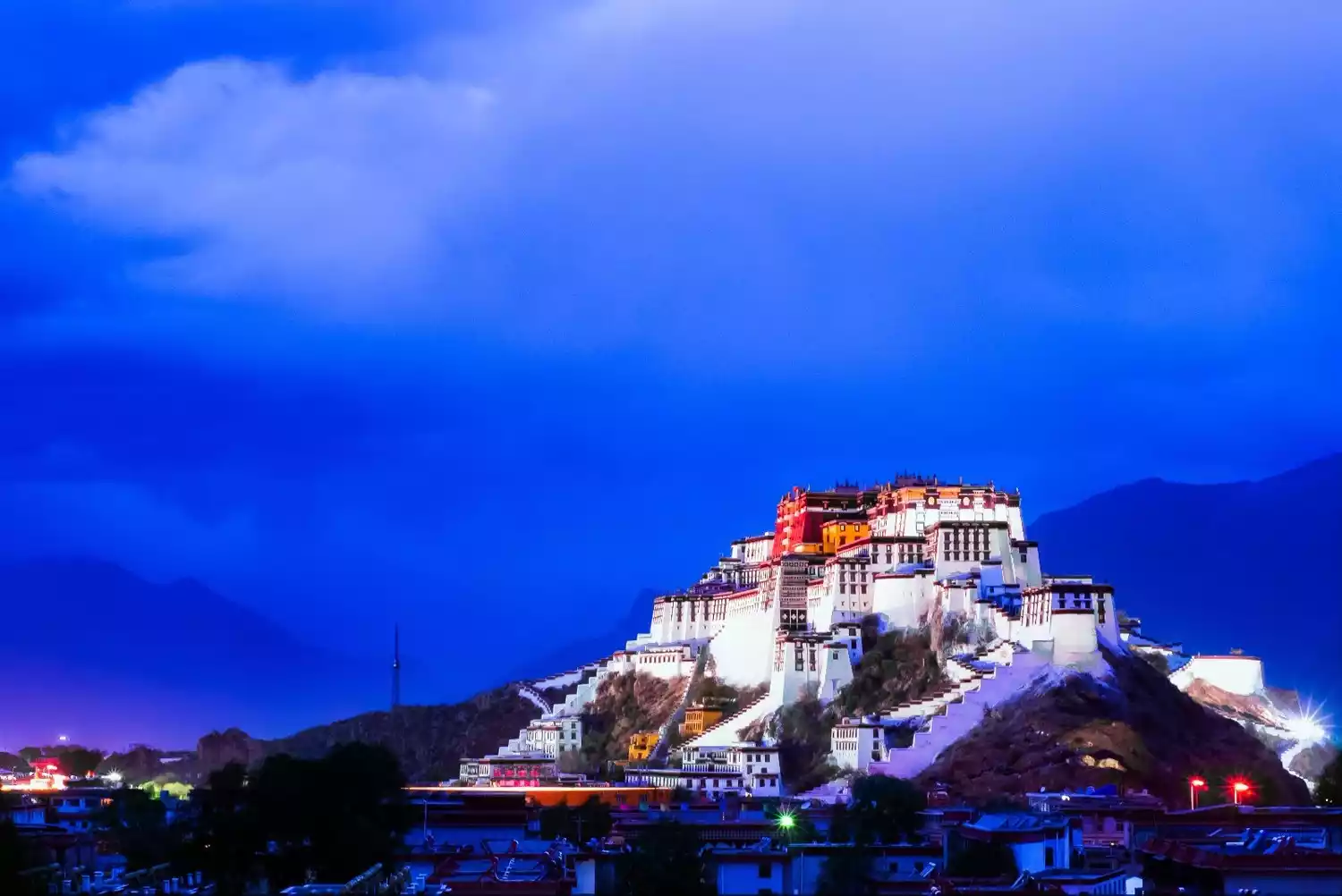
7: Go to the Potala Palace to see the night view. When night falls and a beam of light shines on the sacred Potala Palace, you will feel that the whole world is filled with holiness and tranquility.
[Statement] We are committed to protecting the content of every original creator, but because some pictures and texts come from various channels such as the Internet, we cannot trace the author. If there is any infringement, please contact us to delete it.