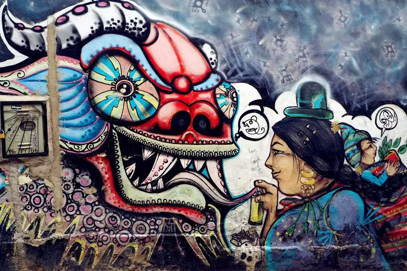
Enter the paradise of Bolivia and see the "Sky Mirror" Uyuni
Preface
Ten thousand words, thousands of pictures, China-TravelNote, who knows South America best, sincerely presents this ultimate guide to Bolivia to you!
In 2016, I traveled nearly all of South America, including Colombia, which had just emerged from a 50-year civil war. Visa issues ultimately stopped me in Venezuela (and I missed the last thing I wanted to see, Angel Falls). By then, with the exception of French Guiana, Suriname, and Guyana, I'd experienced the best of South America—a somewhat imperfect end to my travels.
In the following time, I will divide it into several strategies to reveal to you the travel strategies of South America, the most mysterious continent on earth for Chinese people and the ultimate destination for travelers.
Today let’s talk about the Mirror of the Sky - Bolivia.
Opening
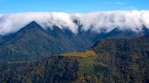
Bolivia, rooted in the history of the Inca Empire, has always been closely connected to Peru. It was the birthplace of Latin America's independence revolution and the last country to become independent. From Bolivar to Che Guevara, countless revolutionaries shed their blood here. From the Potosí silver mines, which supported the Spanish empire throughout the Age of Exploration for three centuries, to the now-beautiful wonderland of Uyuni, home to vast salt deposits, these regions have emerged from their mystique, having traversed a rich and weighty history.
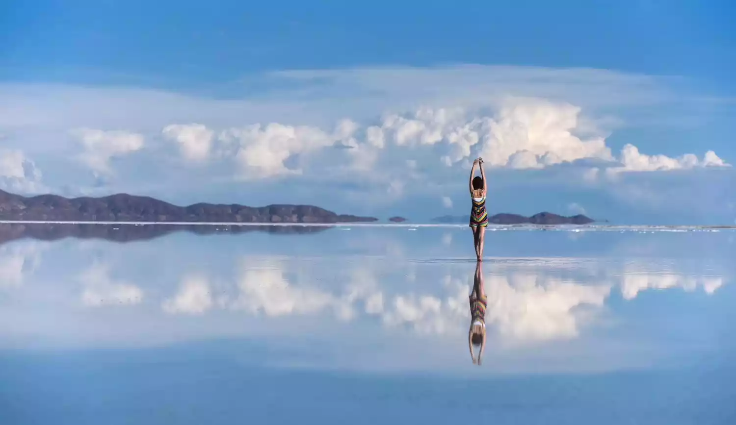
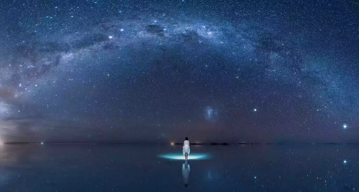
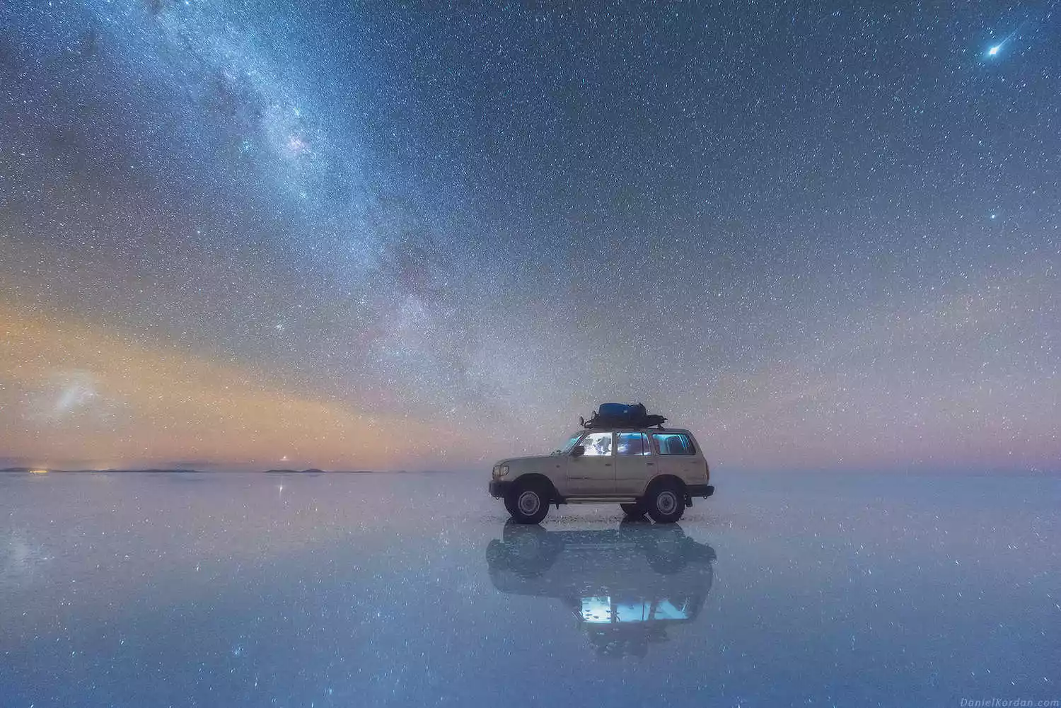
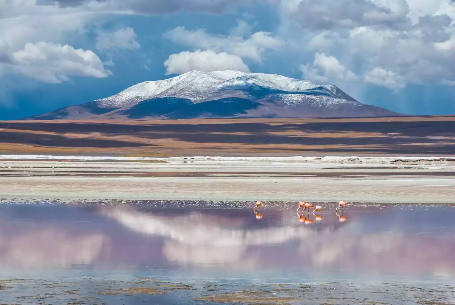
Uyuni Salt Flats, the "Mirror of the Sky" - the world's largest salt-covered wasteland, as pure as heaven

Lake Titicaca, the "Eye of America"—home of the Uru people, explore the mysterious world of floating islands, 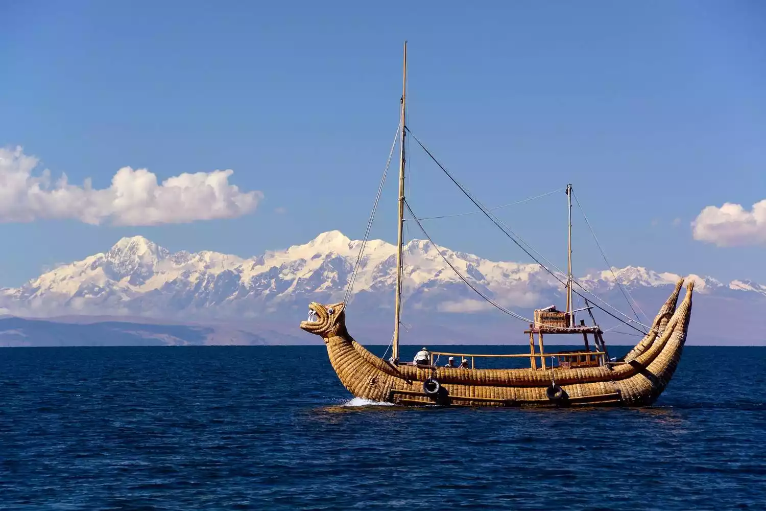 the "Gateway to Hell"—Potosi Silver Mine—once the richest city on earth, where 8 million Indians were buried.
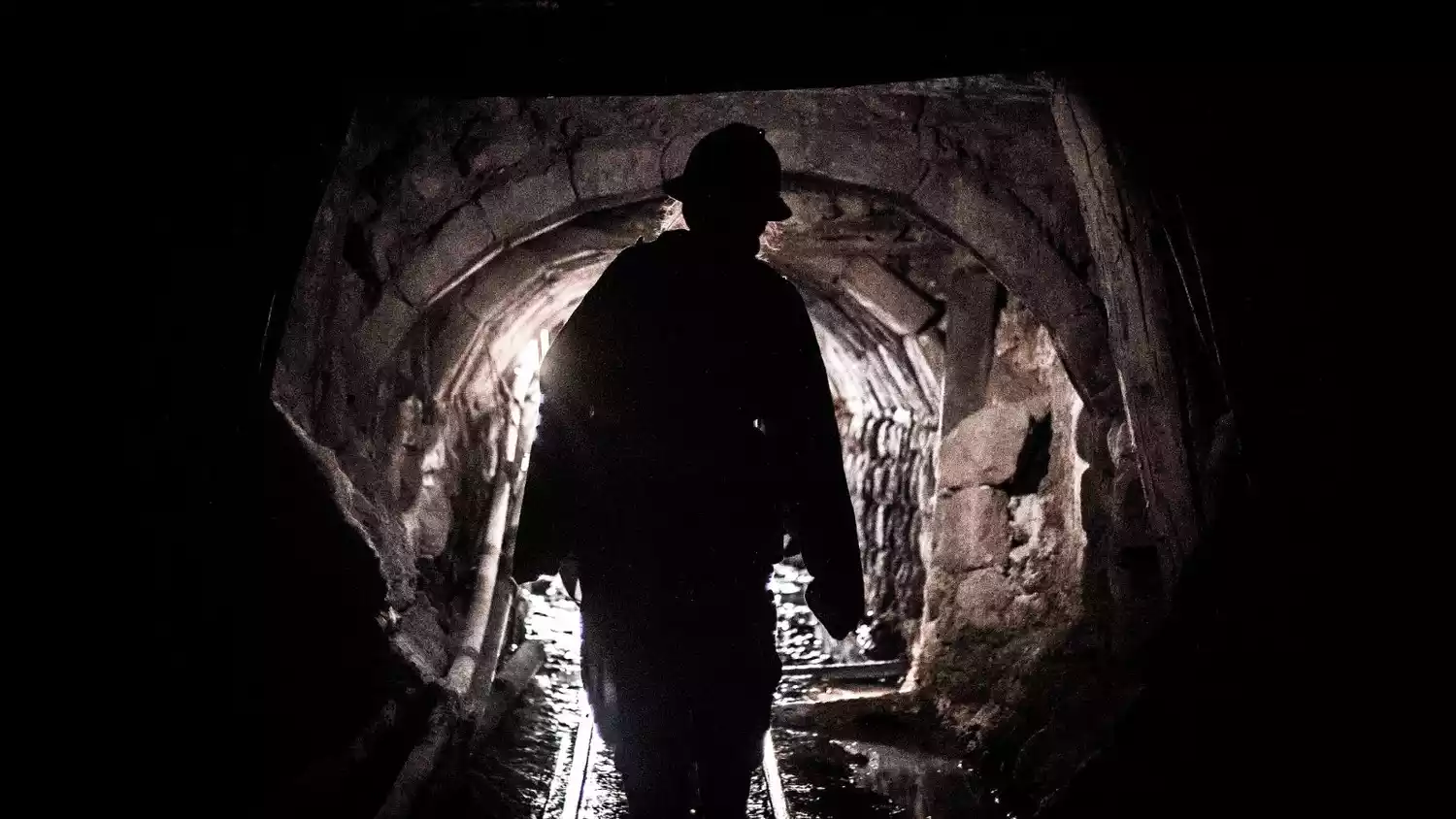
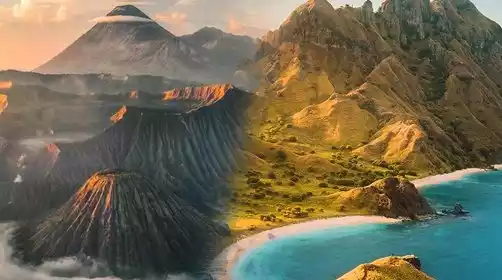
"Yellowstone of South America" by Eduardo Abaroa - the Tibet of South America, a national park located on an active volcano

Practical Guide
visa
• Bolivia visa on arrival
Bolivia has implemented visa on arrival. Different ports require different documents. It is recommended to prepare the following documents in advance:
A. Visa Application Form (Collect at Land Border Crossing)
B. Copy of passport front page
C. Air ticket and hotel reservations
D. Itinerary
E. Yellow fever vaccination certificate
F. Proof of assets (bank statement, not necessarily required)
G. $100-110 (some online claims of $30 are untrue)
• Apply for Bolivian visa in China
Currently, only Beijing is supported for processing Bolivian visas. The materials are similar to those for visa on arrival, and the visa will be issued within 10 working days.
Tips: In addition, traveling to South America generally requires transiting through the United States. According to the requirements of the U.S. Customs, as long as you set foot on U.S. territory, even if it is a transit, you need to hold a U.S. visa, so it is particularly important to apply for a B1/B2 U.S. 10-year visa.
season
Most travel agencies offer combined tours of Peru and Bolivia, but theoretically, Bolivia and Peru aren't ideal for traveling together. Generally speaking, January and February are the best times to visit the two countries. Bolivia's Sky Mirror is ideal for traveling during the rainy season, with a higher probability of flooding from December to March. However, traveling to Peru during the rainy season can be difficult, and other Bolivian cities are also less suitable during the rainy season. Flights to the highlands (except in coastal areas) can be frequently delayed due to weather, making travel more suitable during the drier months of June to August. However, since the two countries are close, traveling together is more convenient, so consider the trade-offs. Most of Bolivia and Peru are located in high altitudes above 3,000 meters, with some areas exceeding 4,000 meters. Therefore, even in summer, temperatures from December to February aren't particularly high. Rather, the temperature difference can be significant. Sunny days can be hot, and UV rays are very strong, so wearing short sleeves is recommended. However, mornings and evenings can be cooler, so a jacket is recommended. If it's cloudy and rainy, it can get quite cold, requiring a sweater or even a windbreaker. Temperatures can be even lower during other seasons. Coastal areas of Peru, such as Lima and Nazca, experience higher temperatures. But overall, long-sleeved shirts and jackets are recommended for travel to Bolivia and Peru. Since the Bolivian Sky Mirror is at its peak during the rainy season in February, traveling to both countries is best done around the Chinese New Year.
Altitude sickness
Peru and Bolivia are located in the South American highlands. The Uyuni Salt Lake is over 3,650 meters above sea level, many parts of the Eduardo Abaroa Nature Reserve are over 4,500 meters, Potosí is 4,090 meters, Sucre is over 2,800 meters, La Paz is over 3,600 meters, Lake Titicaca is over 3,800 meters, and Cusco is 3,400 meters. If you're used to living at lower altitudes, you'll likely experience some altitude sickness upon arrival. If you're worried about altitude sickness, be careful not to overeat on arrival, eat less meat and more vegetables, and avoid alcohol. Once you've acclimatized, you can resume your normal diet. Drinking plenty of water can also help alleviate altitude sickness. It's recommended to prepare some anti-altitude sickness medication and start taking it a few days in advance, as directed by your doctor. Bolivians and Peruvians often consume coca leaves, which improve circulation and oxygen delivery. During my three-day tour to the Eduardo Abaroa Nature Reserve in Bolivia, my driver gave us some coca leaves to try. These leaves are only effective if consumed regularly; occasional use is less effective. It should be noted that this coca leaf is the raw material of drugs. Although it is legal in Peru and Bolivia, it should never be taken out of the country.
About Transportation
International flights
 When traveling to South America, you usually choose to transfer to a flight in the United States, usually in Dallas (you need to hold a US visa and reserve enough transfer time, it is recommended to be no less than 2 hours), and your luggage is usually checked directly to the destination.
Domestic flights
LATAM, the result of a merger between Chilean Airlines and Brazilian Airlines, is one of the largest airlines in South America, serving Chile, Peru, Brazil, Argentina, Colombia, Ecuador, and other countries. This airline is available within Peru. A common issue with LATAM is that booking a flight in Spanish with Chilean nationality will result in significantly lower prices than in English! You can find the translation before purchasing! Official website: https://www.latam.com/en_un/
Flights within Bolivia can be purchased through the BOA official website: https://www.boa.bo/BoAWebsite
Long-distance bus
Bolivia and Peru have well-developed bus transportation, with numerous bus companies. Cruz del Sur is a well-known Peruvian bus company, while Todo Turismo and Panasur are two of the more reliable Bolivian bus companies. Tickets can generally be purchased at the bus station or by checking the schedule a day in advance. You can also book and check schedules online:
Cruz del Sur: http://www.cruzdelsur.com.pe/
Todo Turismo: http://www.todoturismo.bo
Panasur: http://uyunipanasur.com
Additional tips: The bus from Uyuni to La Paz is about 8.5 hours; the bus from Uyuni to Potosí is about 3.5 hours; the bus from Uyuni to Sucre is 6.5 hours; Potosí to Sucre is 3 hours; and the bus from La Paz to Copacabana is about 4 hours.
Bolivia Hop and Peru Hop
I recommend a hop-on hop-off bus. It's called Bolivia Hop in Bolivia and Peru Hop in Peru. They're both run by the same company, offering both domestic and cross-border travel. You can book a trip on their official website:
Bolivia: https://www.boliviahop.com/
Tips: This type of bus has several advantages: (1) The established routes cover many popular cities, and you can stay for any number of days. The tickets are valid for one year. (2) Hotel pick-up and drop-off services are provided, so you don’t have to carry your luggage to the station to take a taxi to buy tickets. (3) The bus is equipped with an English-Spanish bilingual guide who records and manages everyone’s accommodation and bus use dates in detail, and then arranges hotel pick-up and drop-off. It is considerate and convenient. (4) It is known as the safest bus company in the area, so there is no need to worry about theft.
Communication problems
Bolivia's mainstream carriers include Entel, Tigo, and Viva. You can usually buy a SIM card at street vendors or vendors with your passport. They're relatively affordable, costing around 10 Bs (about 10 RMB), and a 1GB top-up is also around 10 Bs, but be aware that it may only be valid for 7 days. 4G signal is available in most Bolivian cities, but is nearly nonexistent in the mountains between cities.
If you're using a domestic roaming SIM card, according to China Mobile's official website, international roaming in Peru costs 30 yuan per day for unlimited data; in Bolivia, it's 90 yuan per day, capped at 50MB of data (and you can't go over 50MB?). I can't find any information on China Unicom, but it's generally more expensive than China Mobile.
Language issues
Bolivia and Peru both speak Spanish, and English isn't widely spoken by locals. While hotel receptionists and landlords often speak English and can assist with local matters, English is rarely used for transportation, dining, and directions. This isn't a major issue, though. With a thorough travel guide, communication often isn't necessary; if necessary, simply use Google Translate. Ordering food can be challenging, as most restaurant menus are only in Spanish. Therefore, it's best to master some Spanish food vocabulary before your arrival to avoid being overwhelmed.
Security Question
This is a major concern for many travelers. Like Mexico, Latin America is often viewed with prejudice. In practice, Peru and Bolivia offer a relatively simple, even somewhat isolated, culture. The Peruvian capital, Lima, and Cusco are tourist hotspots, so theft is a possibility, so be mindful. Overall, Peru and Bolivia offer excellent travel safety.
Tips:
[Currency] The Bolivian currency is called Bolivian Boliviano BOB, abbreviated as Bs. 100 USD ≈ Bs685, which is similar to the equivalent RMB.
[Cash] In many cases, you may need to pay cash when joining a tour group, buying train tickets, and entrance tickets. In addition, when booking accommodation, it is best to check whether the hotel accepts credit cards. Generally, cheaper hotels accept more cash, so bring enough cash.
Credit Cards: UnionPay isn't accepted in Bolivia, but Visa and MasterCards are generally accepted. However, credit card fraud is a serious issue in South America, so it's recommended to bring two cards with you. If one card is stolen and frozen, you can always use the other.
[Sun protection] The ultraviolet rays in plateau areas are very strong, so you must be prepared for sun protection.
[Immigration Card] When entering Bolivia, you must fill out an immigration form and then be given an immigration paper. Be sure to keep it safe as it needs to be returned when you leave the country.
important cities
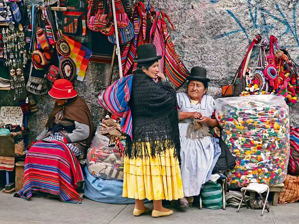
La Paz
This place is known as the Tibet of South America. It's not just for its breathtaking scenery—the pure sky reflected in Lake Uyuni is truly refreshing—but even more captivating is that it seems to be the most traditional country in South America, preserving the purest Amerindian heritage. Walking through the streets of La Paz, you'll see beaming women in felt hats and red shawls, with potbellies. Driving through the Andes Mountains, singing along, you'll reach the rainforest near Lake Pelé (Rio Beni). Despite being one of the poorest countries in the world, Bolivia is still a place where you can mingle with the optimistic and enterprising locals in Sucre.
Come to Bolivia and experience the beauty of the American Indian! Embark on an adventure in search of the ancient Inca civilization, return to the most pristine natural environment, and experience a magical moment of temporary isolation from the hustle and bustle of life.
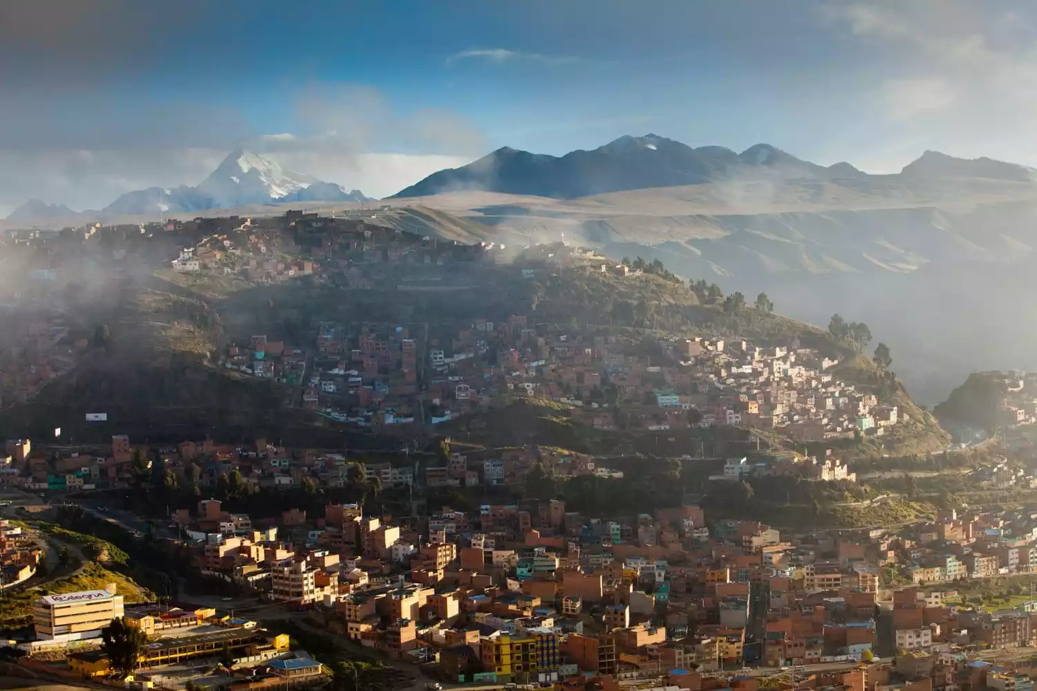
 The world's highest capital. La Paz sits in a high-altitude valley basin, over 3,600 meters above sea level, surrounded by mountains. Consider Lhasa, Tibet, China, which is only about this altitude. Indeed, entering Bolivia is inseparable from experiencing high altitudes; after all, Bolivia is often called the Tibet of South America.
 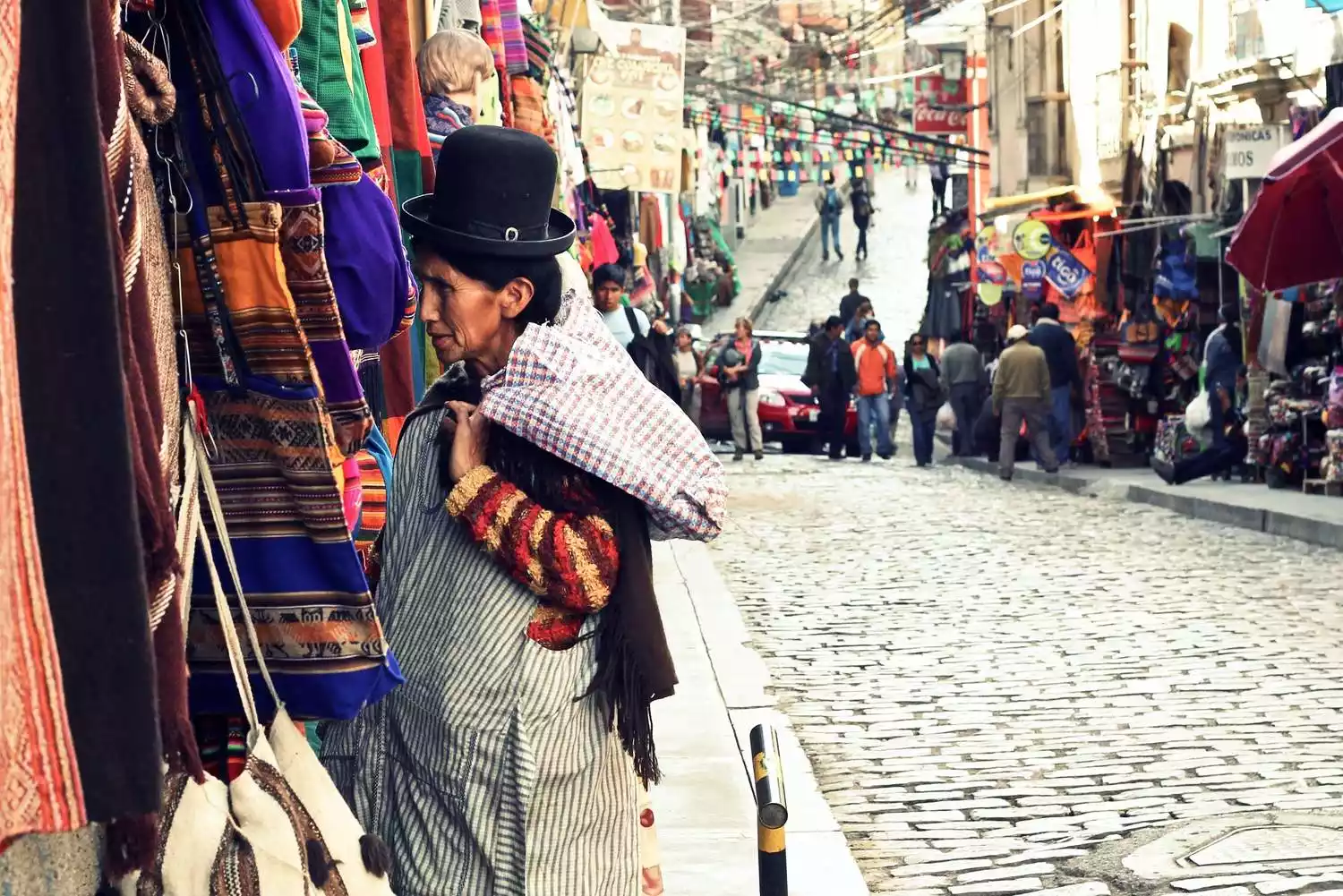 La Paz, despite being the capital, has the lowest GDP in South America. From a distance, the entire city resembles a large slum, situated on a vast, rolling plain. Public transportation is virtually nonexistent within the city. The Bolivian government has invested heavily in a fairly comprehensive cable car system, with a one-way ticket costing 3 yuan (the Bolivian currency is equivalent to the RMB). This essentially serves as a state-subsidized public transportation system, similar to the Beijing subway of several years ago.
But at night, the whole city is brightly lit, showing a prosperous scene. Take the cable car to the Killi Observation Deck, and you can even see a football field built in the middle of the densely packed buildings!
The Witches' Market! This is probably a very important reason to stop in La Paz. It sounds rather mysterious and eerie, but it's actually a street selling Bolivian souvenirs, including alpaca wool products and other strange and indescribable trinkets. Many shops have dried alpaca carcasses hanging in front of them, which is quite disgusting. It's said that locals bury these animals when building houses for good luck. Walking around, the air is filled with the unpleasant smell of herbs. There are actually many similar places around the world, such as Sonora, Mexico, and Togo, Africa.

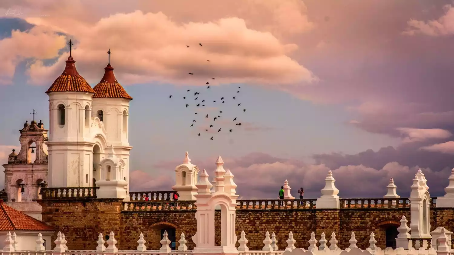
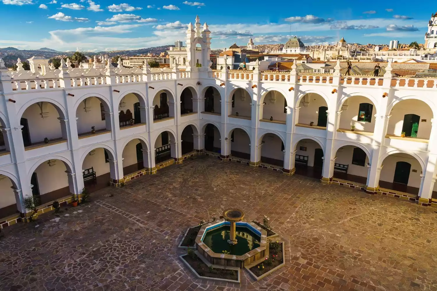
Sucre
Bolivia's constitutional capital is an awkward place. In 1809, the first shot fired against Spanish colonial rule in South America was fired. A single spark could start a prairie fire, and the flames of revolution quickly spread throughout South America. Ultimately, it was the capital that was finally liberated that was enshrined in the constitution. Sucre, with a population of 200,000, is known as the White City for its mostly whitewashed houses. Strolling through the small town is a delightful experience, where time seems to slow down.
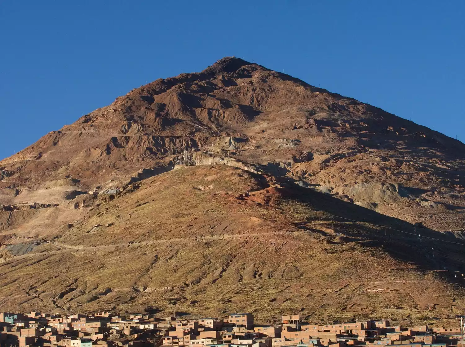
Potosi
If La Paz is the highest capital city in the world, then Potosí can be called the highest city in the world, with an altitude of over 4,000 meters.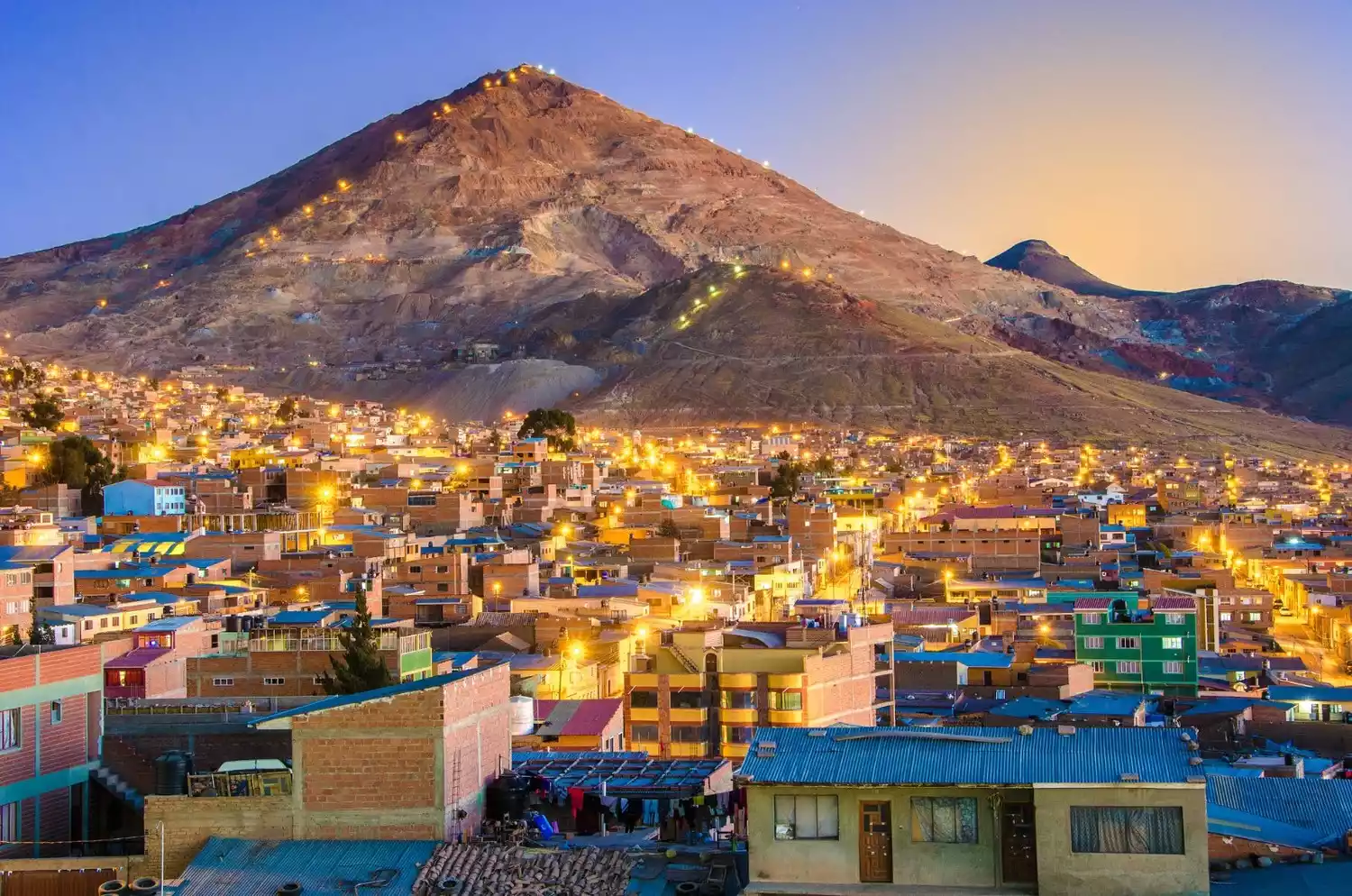
In the 16th century, the Spanish discovered the world's richest silver mines here, and Potosí became an overnight powerhouse! By the first half of the 17th century, its population approached 200,000, making it the largest city in the Western Hemisphere. Its silver production accounted for nearly half of the world's total. Over 80 churches sprang up, and by the end of the 18th century, the city's streets were paved with silver. The silver mines here supported the Spanish economy for over two centuries.
In the colonial rankings of the time, Bolivia was the center of wealth, while cities like Buenos Aires were considered desolate and desolate. However, this prosperous city, built on its silver mining, rose and fell with the mining industry. After Bolivia's independence in the 19th century, the city's wealth was plundered, with much of it transferred back to Europe and Spain. The silver mines were depleted, and the city's prosperity declined. The subsequent development of tin mining brought new vitality to Potosí, but it never regained its former glory. During the 300 years of silver mining, Spanish colonists forced local Indians to work in brutal conditions, claiming the lives of 8 million Indians and causing Mount Rico to drop 16 meters due to mining.
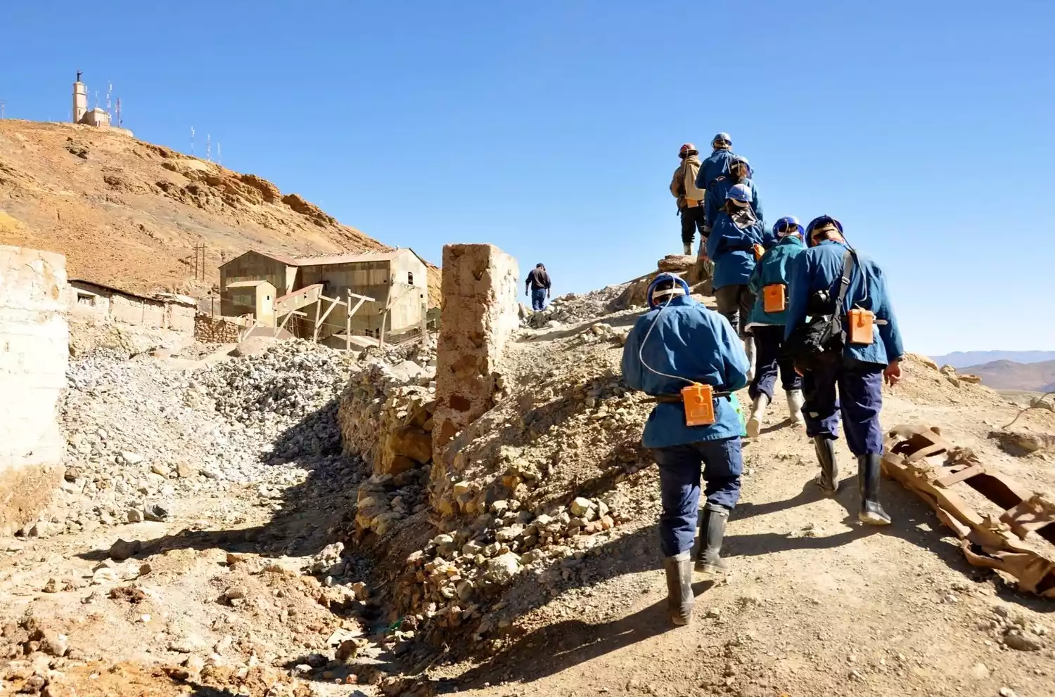
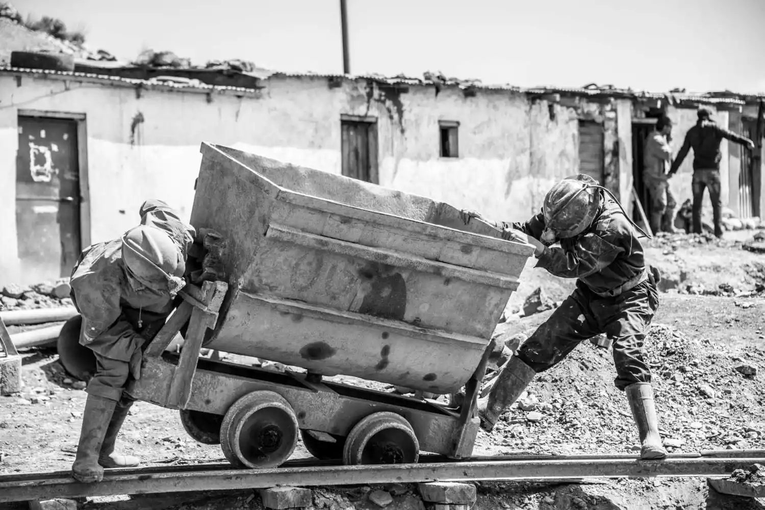
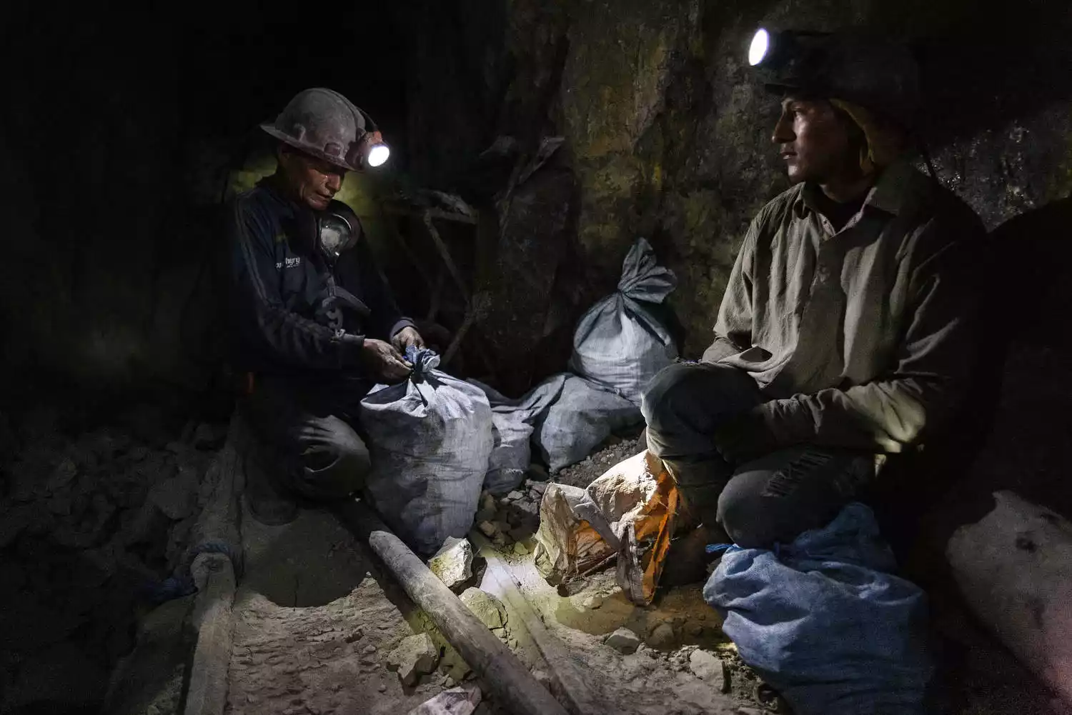
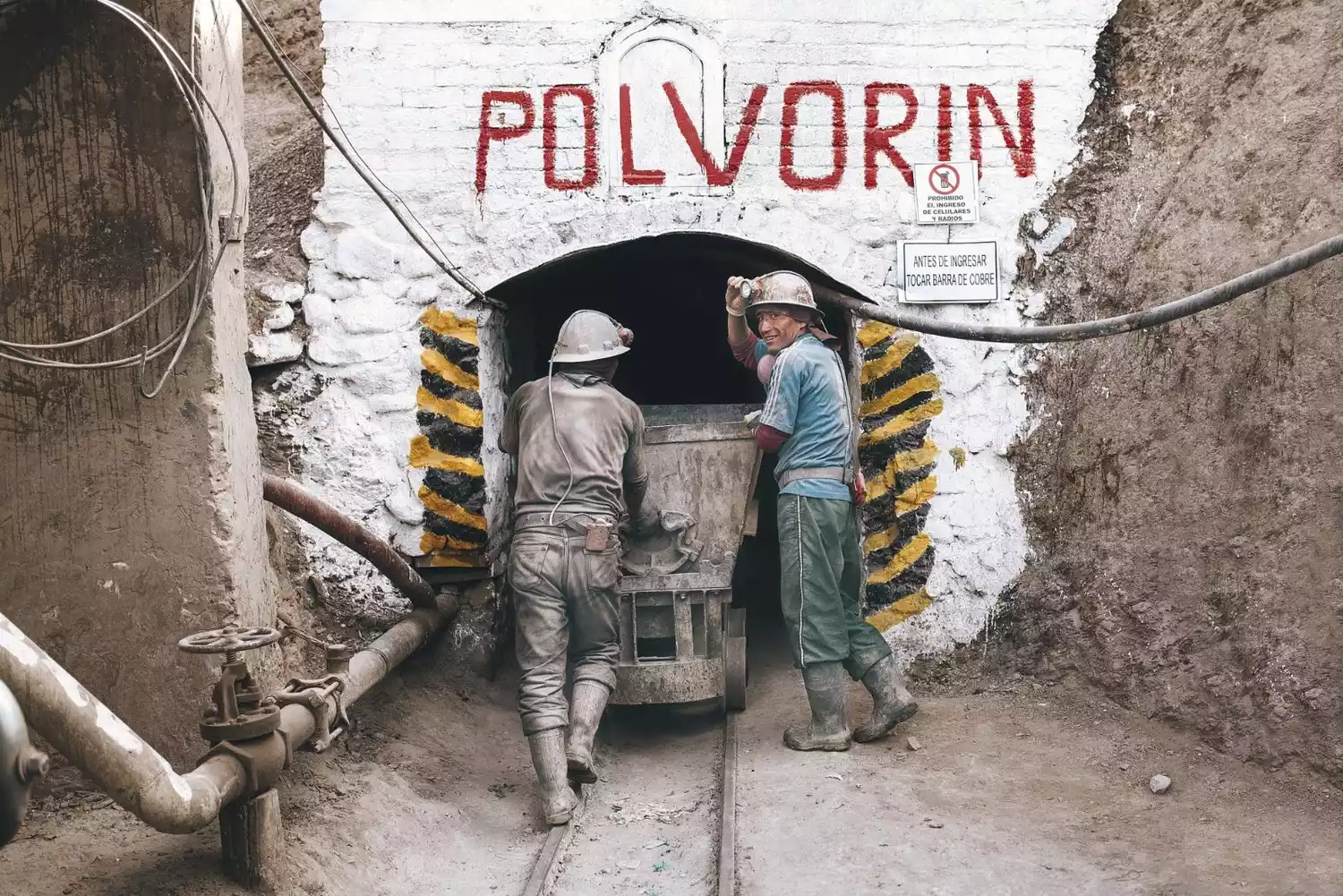
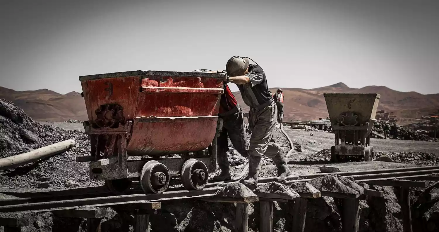
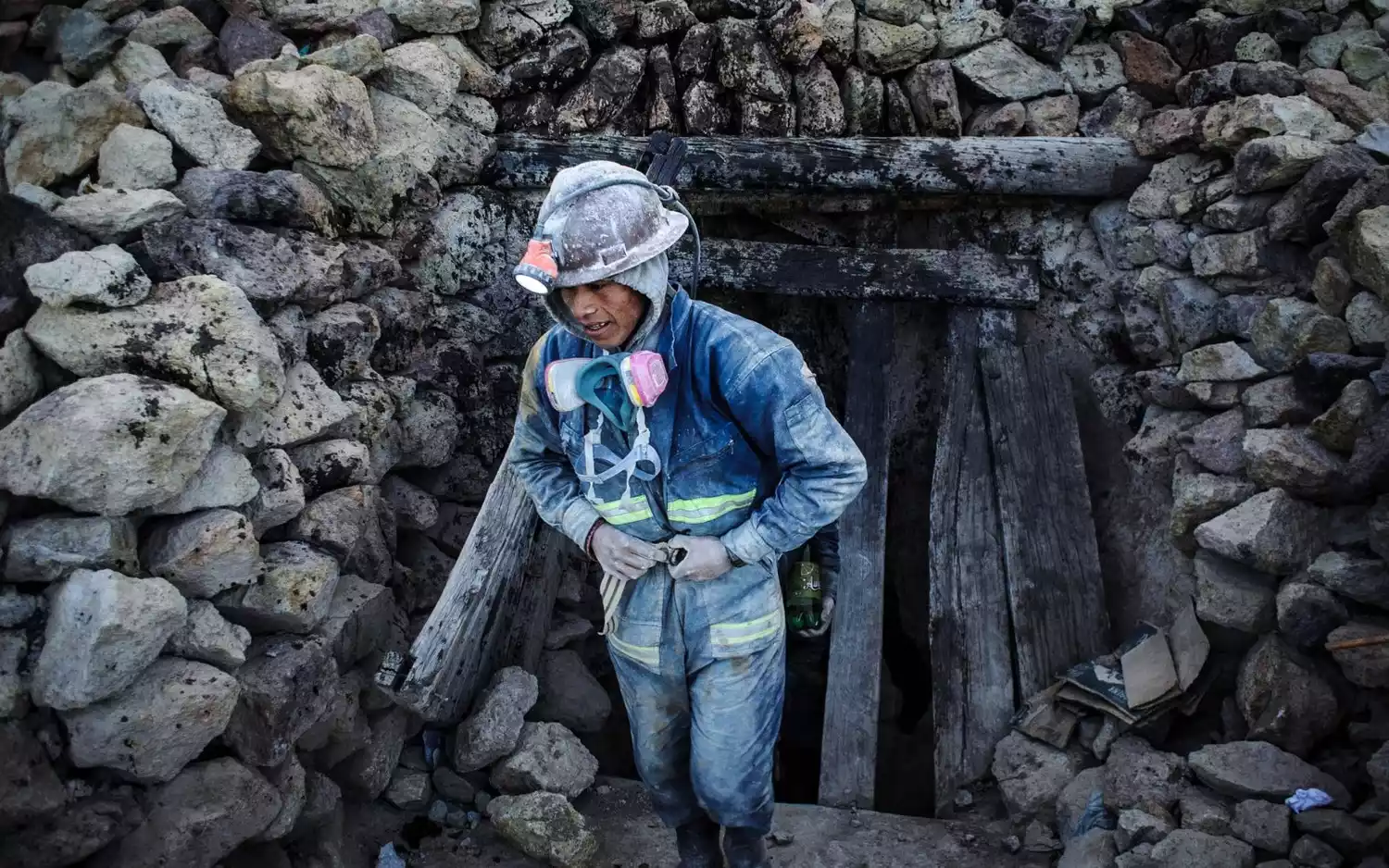
The most famous attraction here is the mine tour. When it comes to mine tours, many people think of the mine cafes in Poland and the underground salt cathedrals in Colombia. But in Potosi, you actually go down into the mines! Experience the toil of a miner. Imagine descending into a mine at 4,600 meters above sea level, with no sunlight, scarce oxygen, and the air thick with acrid sulfur dioxide fumes, accompanied by intense highs and a splitting headache! Plus, you can even detonate a detonator in the mines.
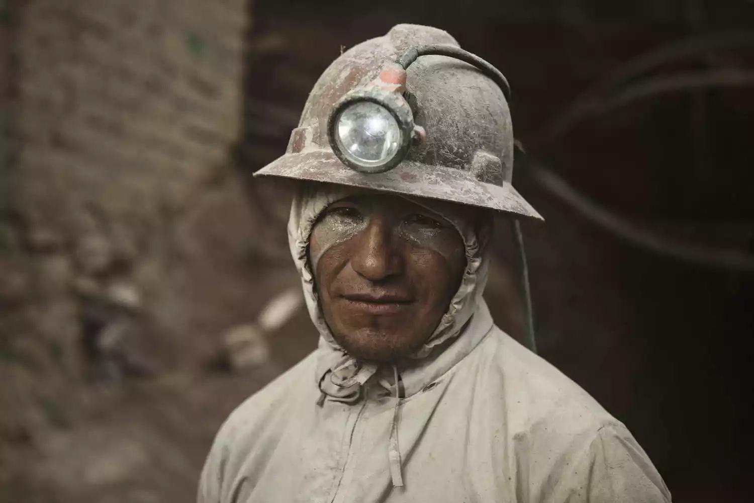
There are nearly 8,000 mines in Mount Lique alone, with over 50,000 miners toiling six to eight hours a day. Their life expectancy is between 35 and 40, and many die from pneumoconiosis. What struck me most about the mines was the presence of a mining deity in nearly every one. This was a Spanish colonial adaptation of the traditional Inca "mita" system of forced labor, where slaves rotated through labor and earned the rights of free men after a period of service. They used this nonexistent deity to mentally paralyze the Indians, yet it has now survived as a pseudo-religious symbol. For thousands of years, religion has permeated their rule, a dark irony in itself. The mining deity's genitals are enormous, symbolizing fertility and the perpetuation of life. Before entering the mines, we (miners) would drink 96% alcohol as an offering to the mining deity, lighting a cigarette for him to secure his protection.
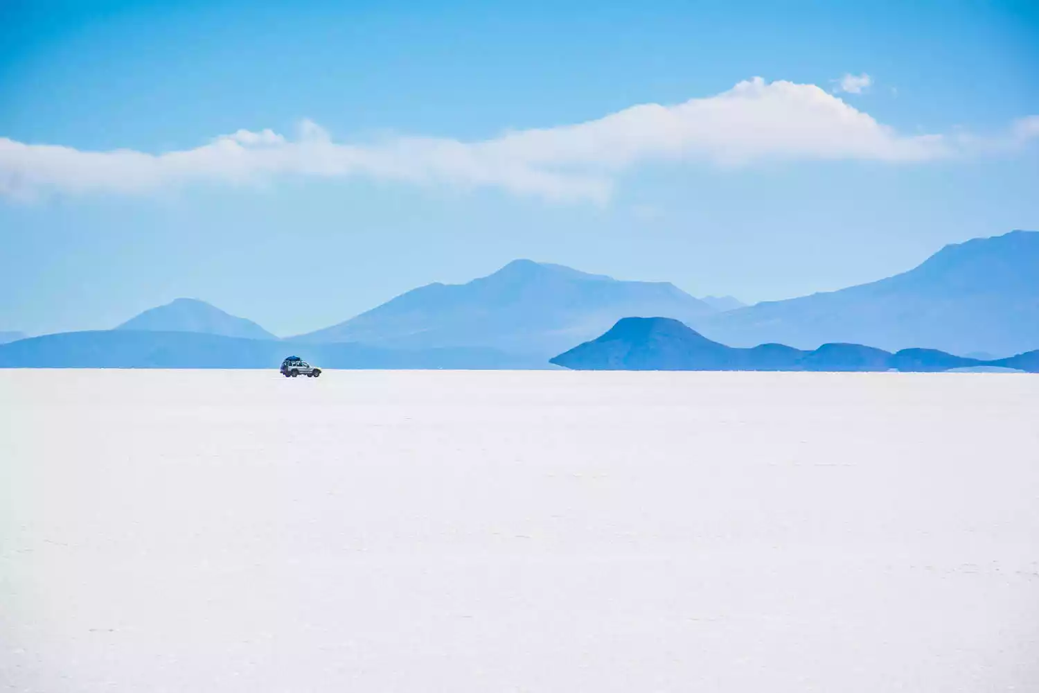
Uyuni
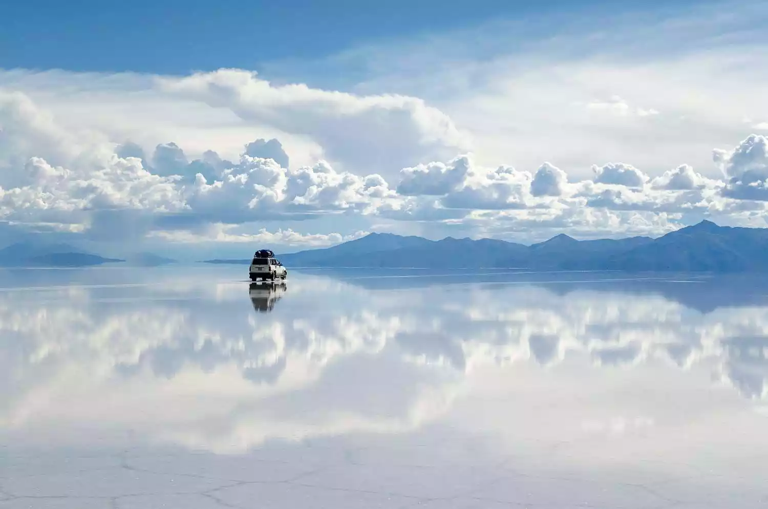
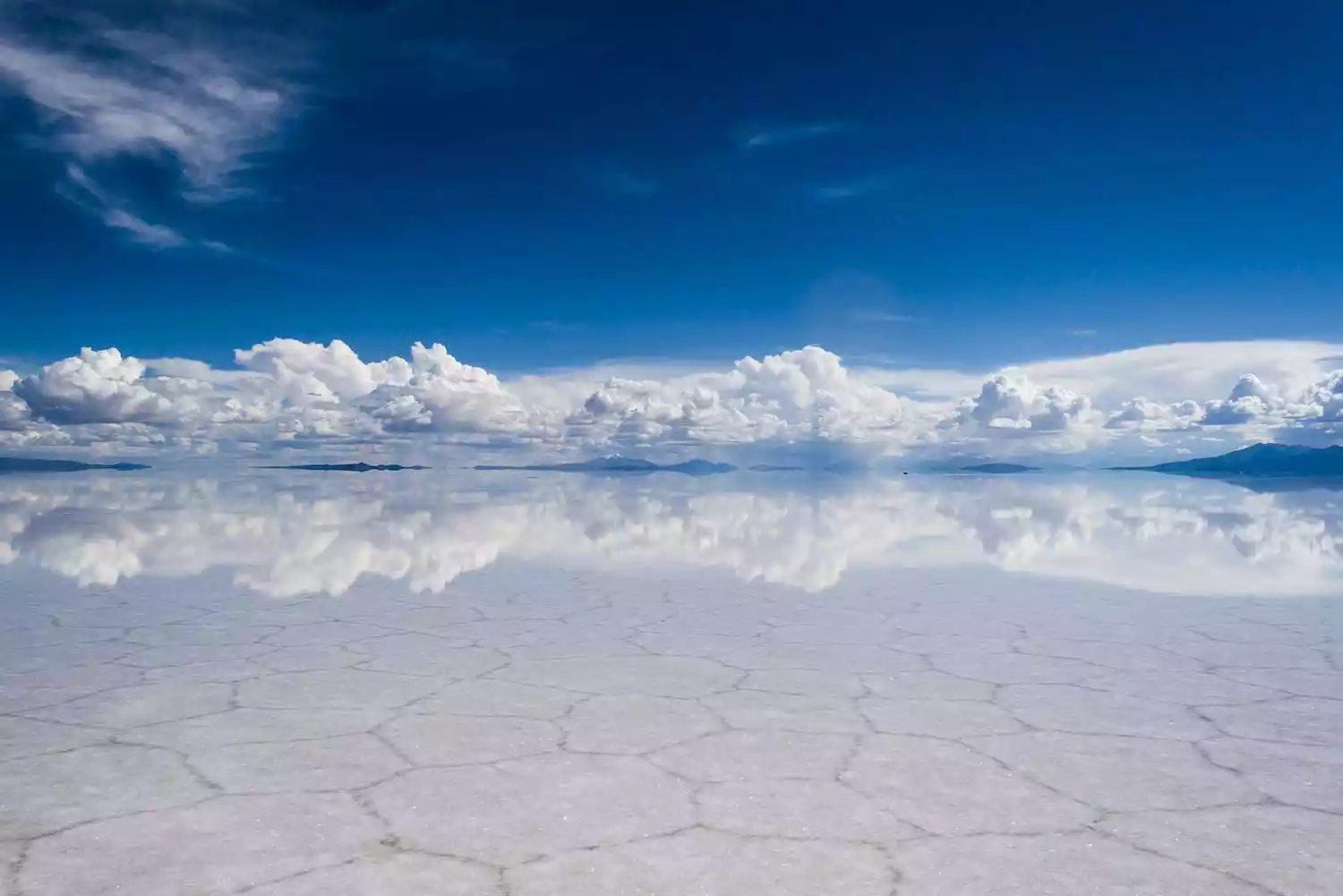
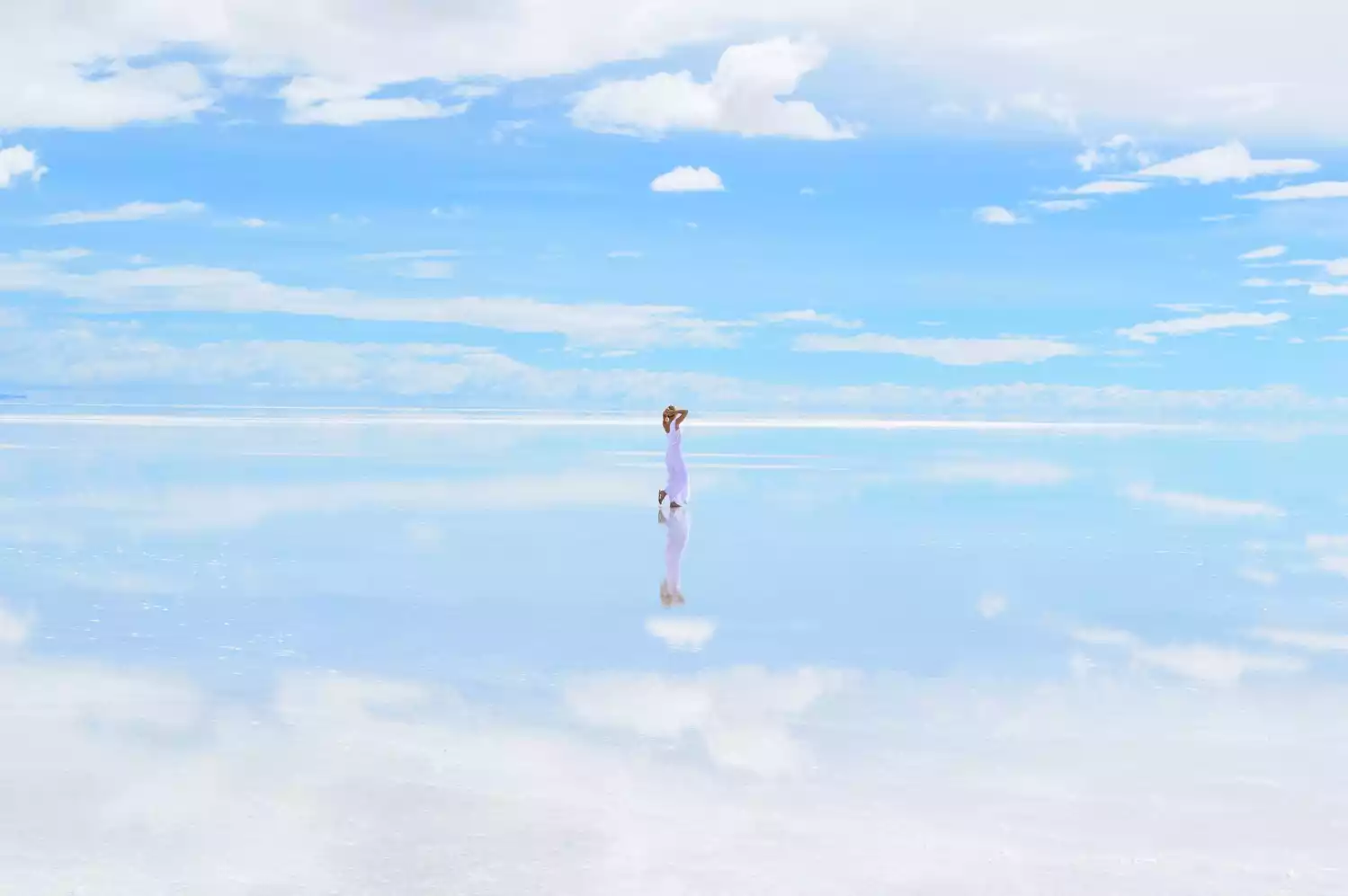
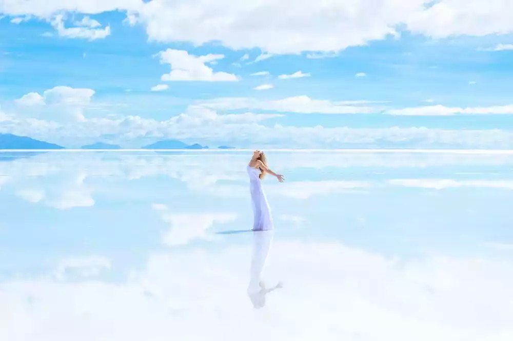
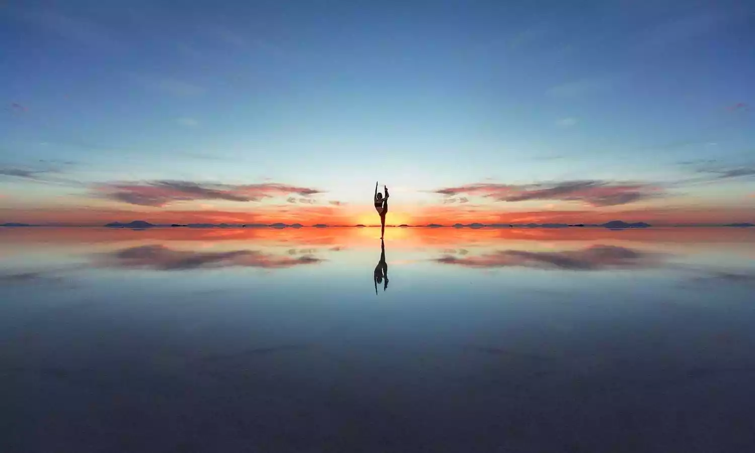
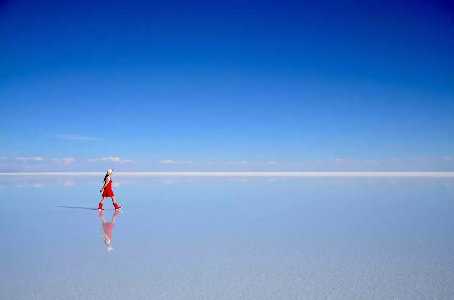
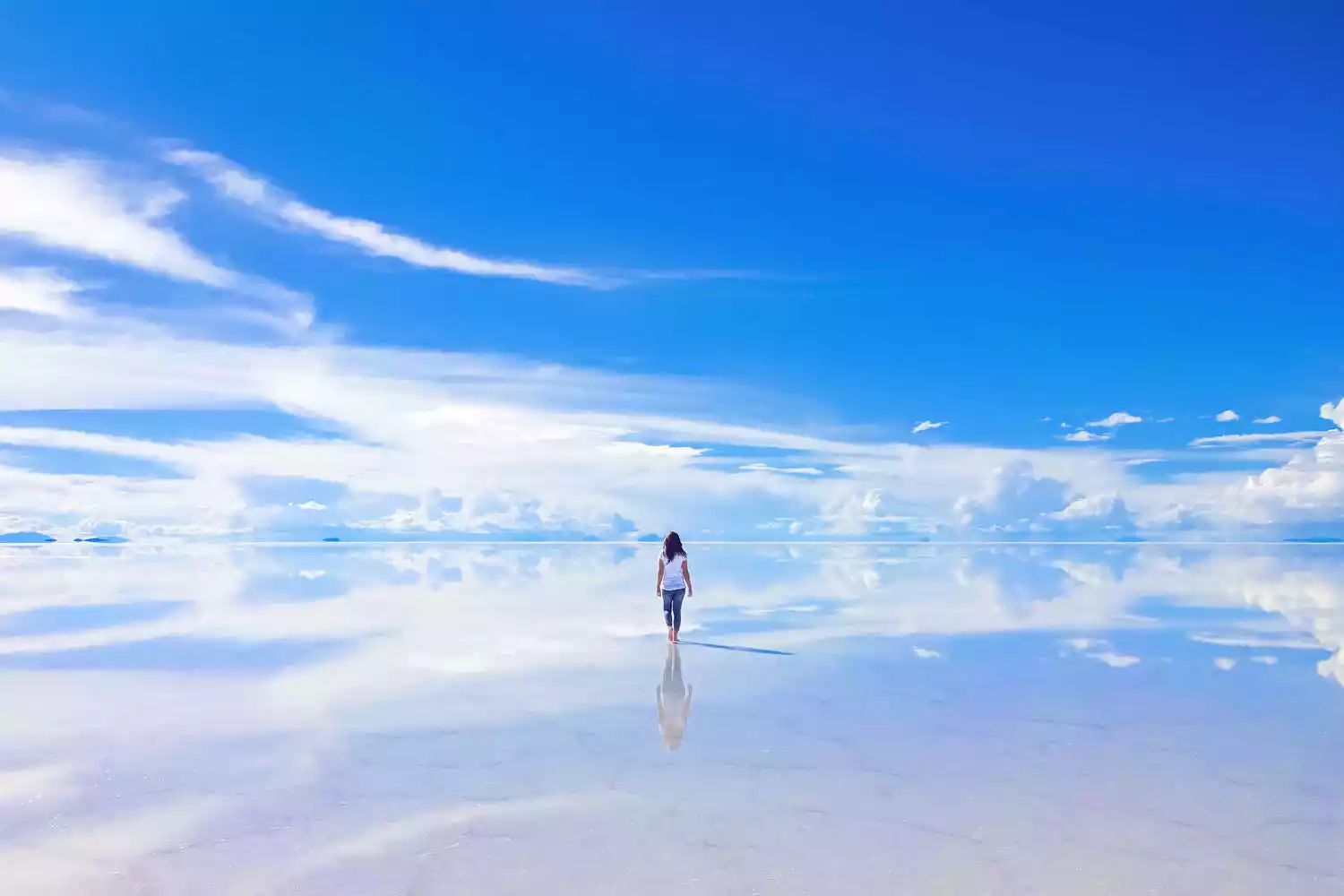
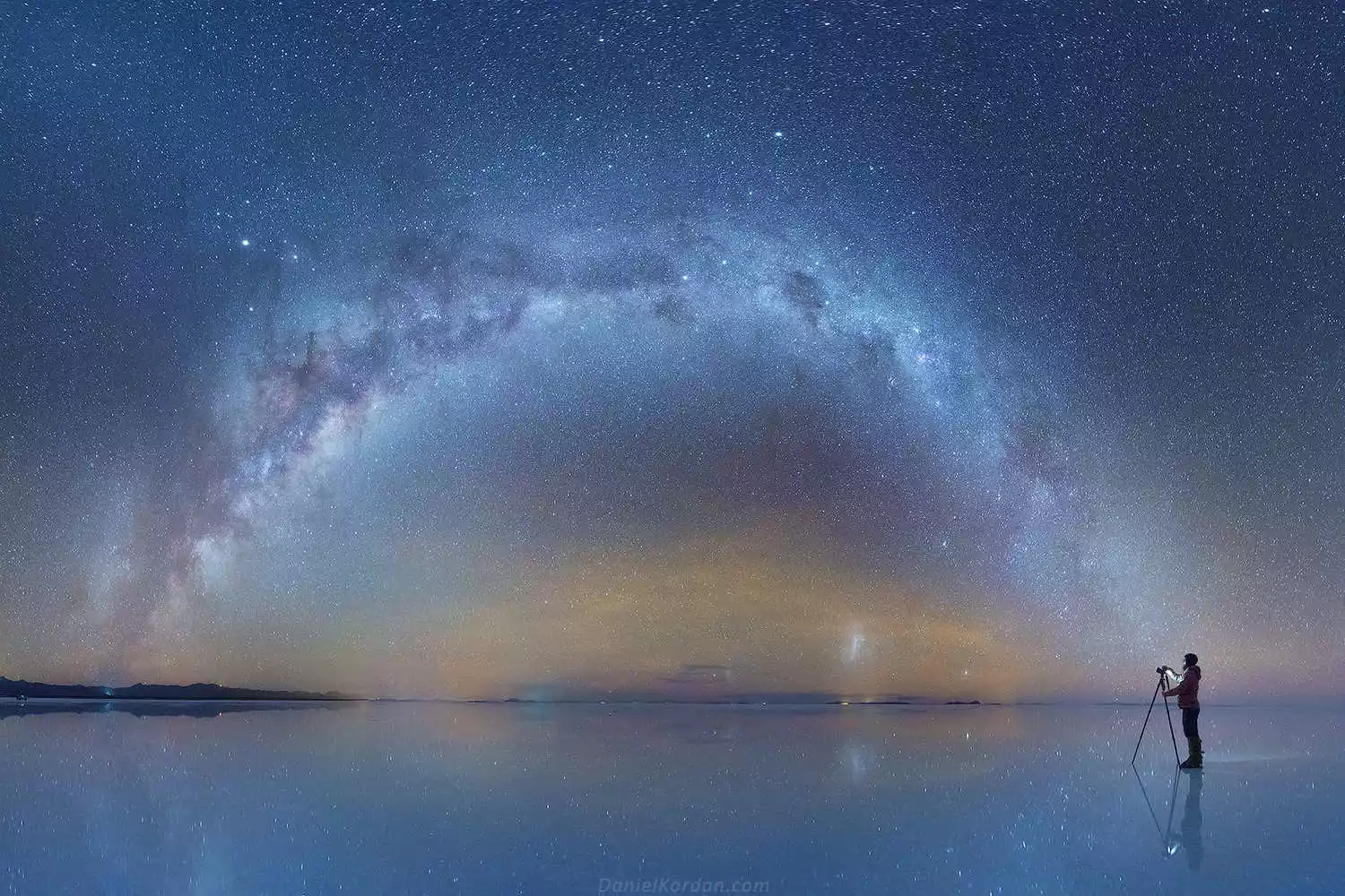
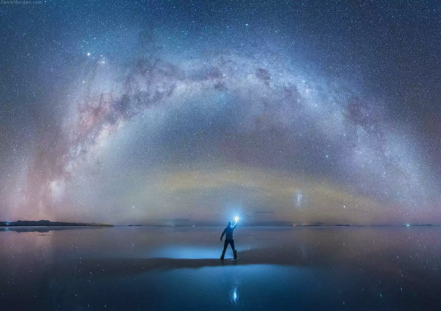
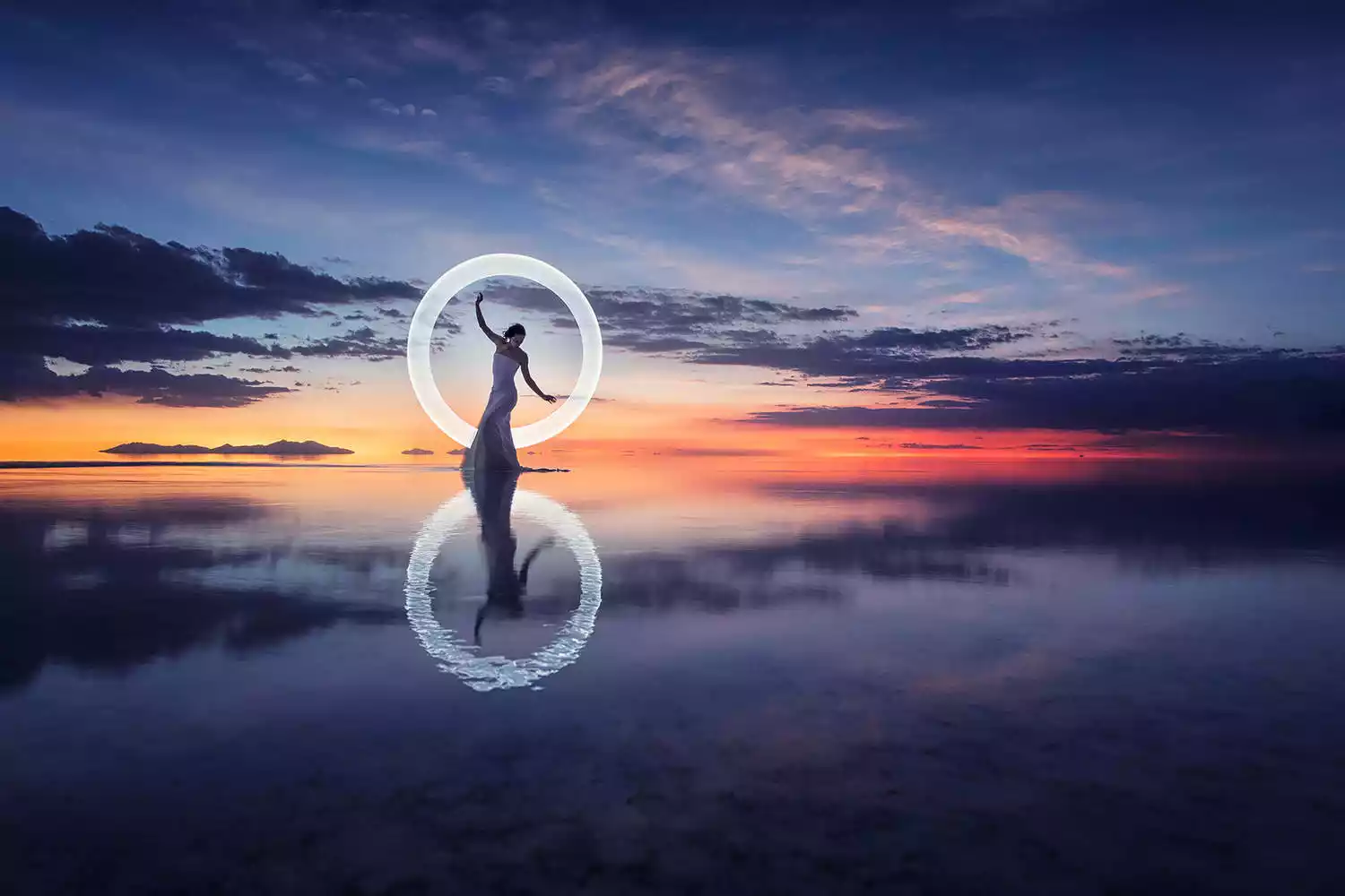
Sky Mirror – 99% of the reason you come to Bolivia is for this! Without further ado, here are the pictures.
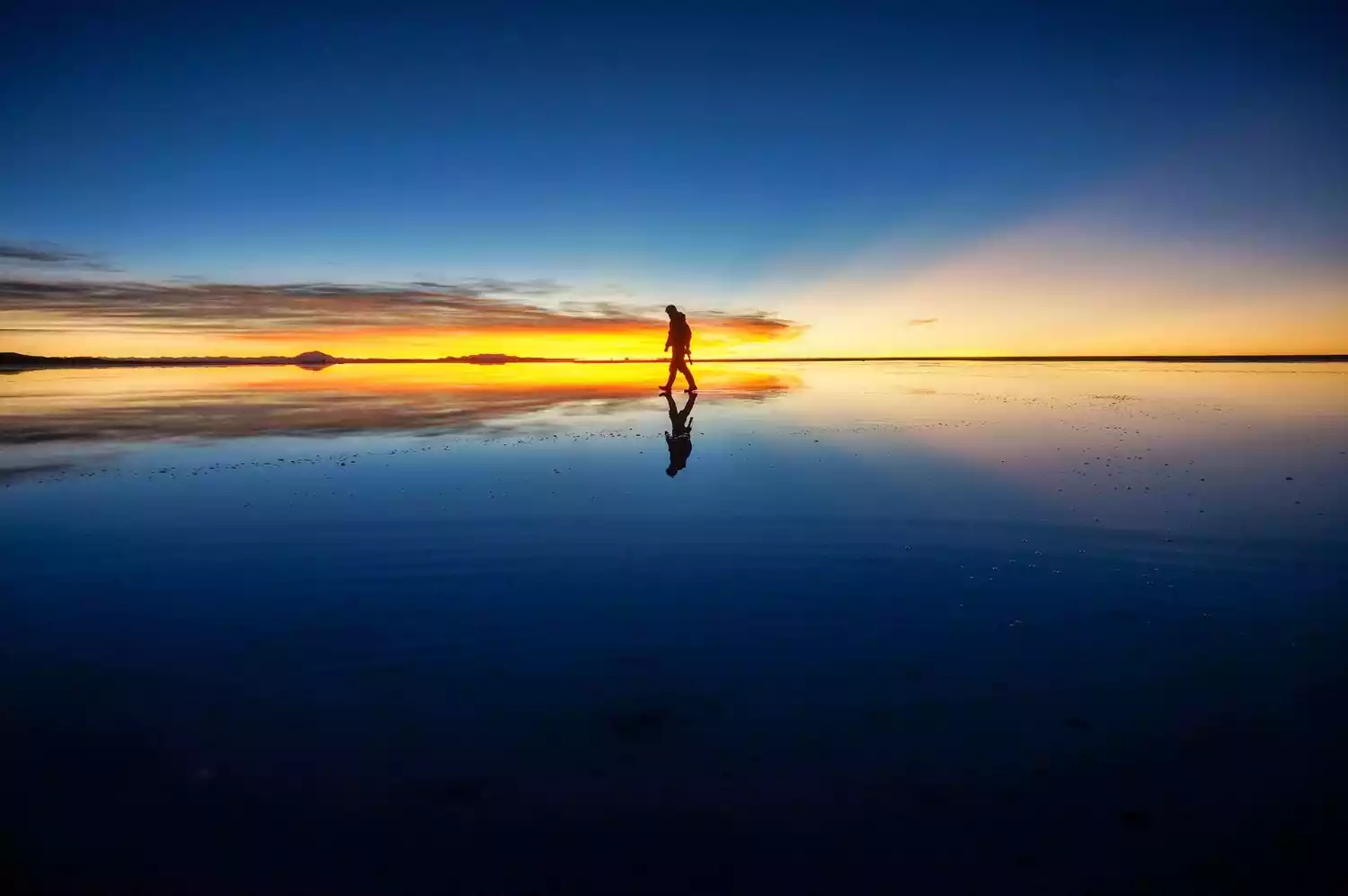
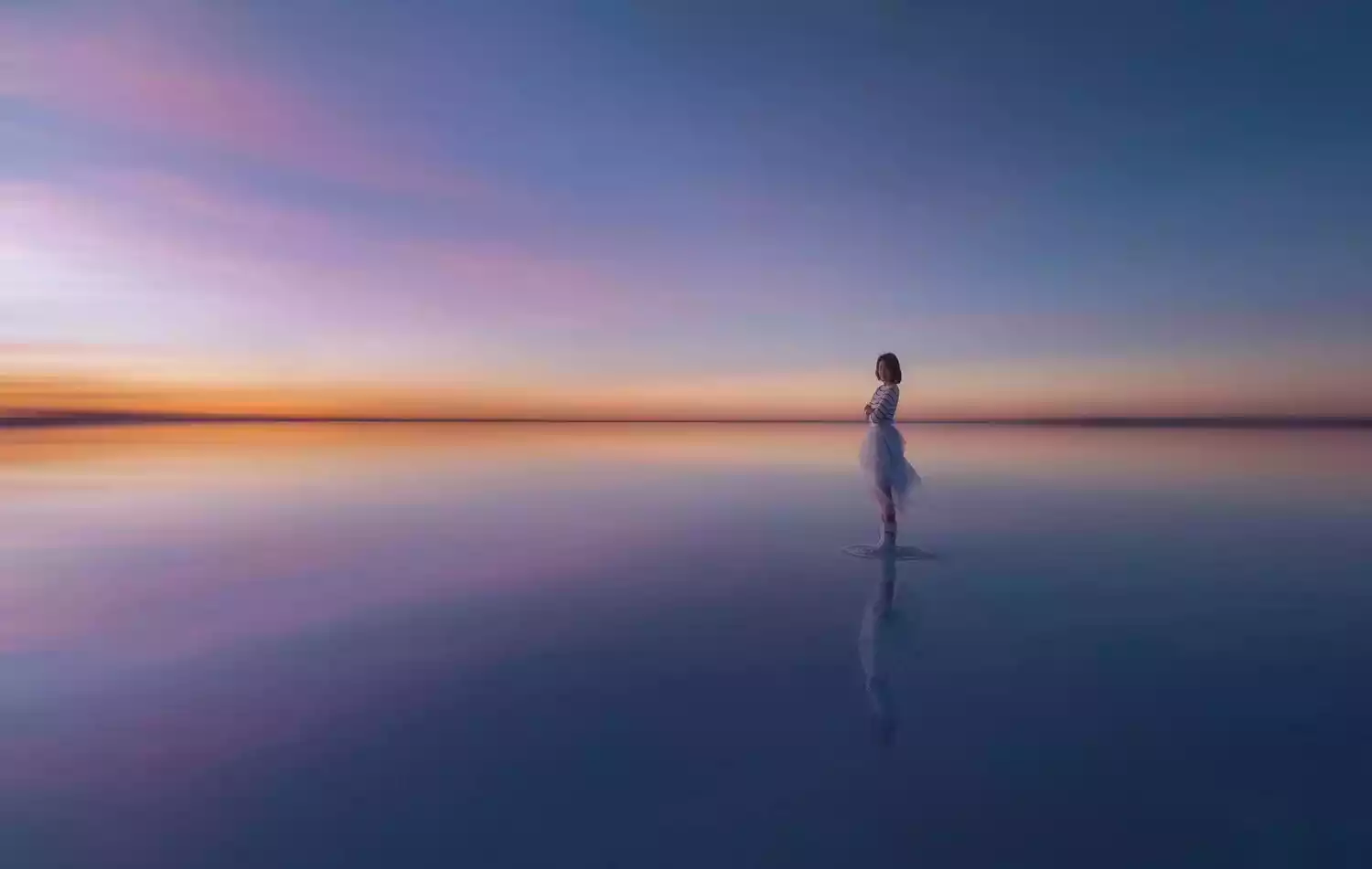

As early as when I was in elementary school, I saw the Uyuni Salt Lake in the encyclopedia of nature. Later, Japan's NHK TV station filmed the documentary "Bolivia: Mirror of the Sky", and this salt lake became popular overnight.
Coming to Bolivia was a daunting task. Visas required invitations and counter-signatures, flights were infrequent, and I had to transfer through the US or Europe. Local guides and hosts were few and far between, let alone English speakers. My journey was largely a documentary exploration.
However, recent years have seen significant growth, thanks to Japanese publicity for Uyuni. The town now boasts over 20 travel agencies offering three-day, two-night tours, as well as sky and sunset tours. In 2016, Uyuni unilaterally opened its visa-on-arrival policy to Chinese tourists. With increasingly convenient flights, visiting this uninhabited land is no longer a dream.
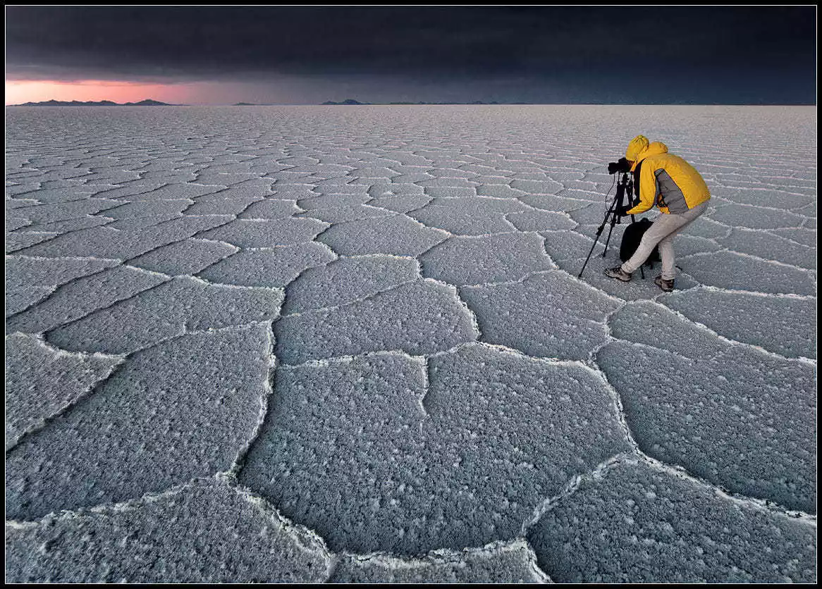
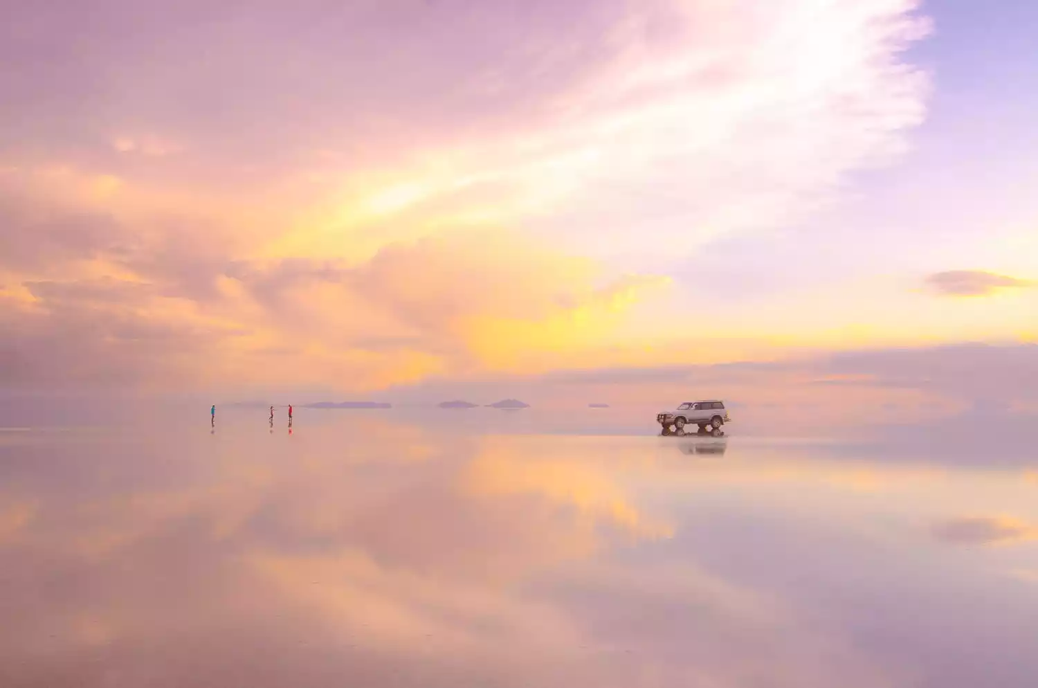
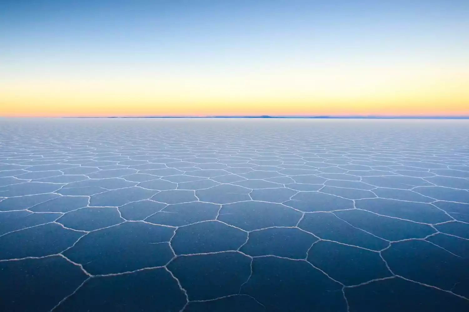


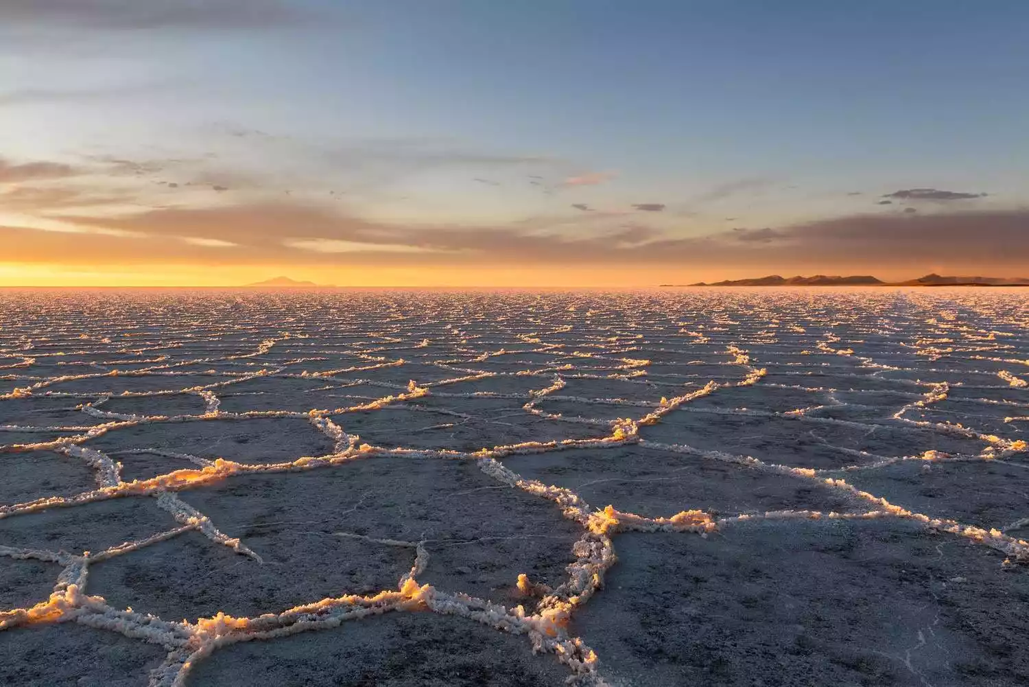
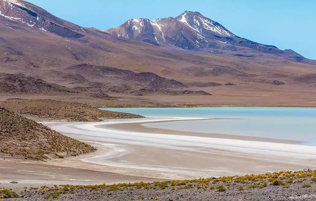
The Uyuni Sky Mirror only has a large area of water during the rainy season from January to March each year. This is when Uyuni truly shines.
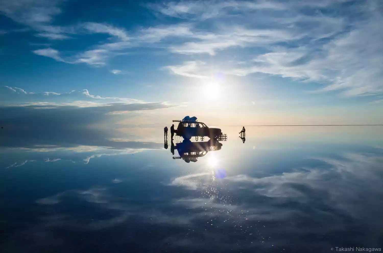
Actually, water is available in Uyuni year-round, the only difference being the size. Whether or not you can find water depends entirely on the driver! Many wealthy private tours chartering vehicles can also find water. Hodaka Travel is the cheapest, but the conditions are naturally much worse. If you want to see the mirror-like surface without wind, I recommend a sunrise tour rather than a sunset one. While sunrise tours are tiring, they are more likely to be windless. We saw photos taken by others on sunset tours, and the water was generally shimmering. So, in fact, you can find the mirror-like surface in Uyuni year-round! Uyuni is indeed more spectacular during the rainy season, but if your vacation is limited, it won't leave you with any regrets.
After discovering that this salt lake could be used to extract lithium, an element essential for lithium batteries, many countries have sensed this business opportunity. Today, the Uyuni government, committed to national development and the well-being of its people, has also opened up to cooperation. Remember, for nearly fifty years, the Bolivian government has fiercely defended this pristine land. Six factories have been built on this salt pan, two of which are directly invested by China. So, if you want to see the Sky Mirror, be sure to do so early; there's a good chance this dreamy, paradisiacal landscape will soon vanish from the face of the earth.
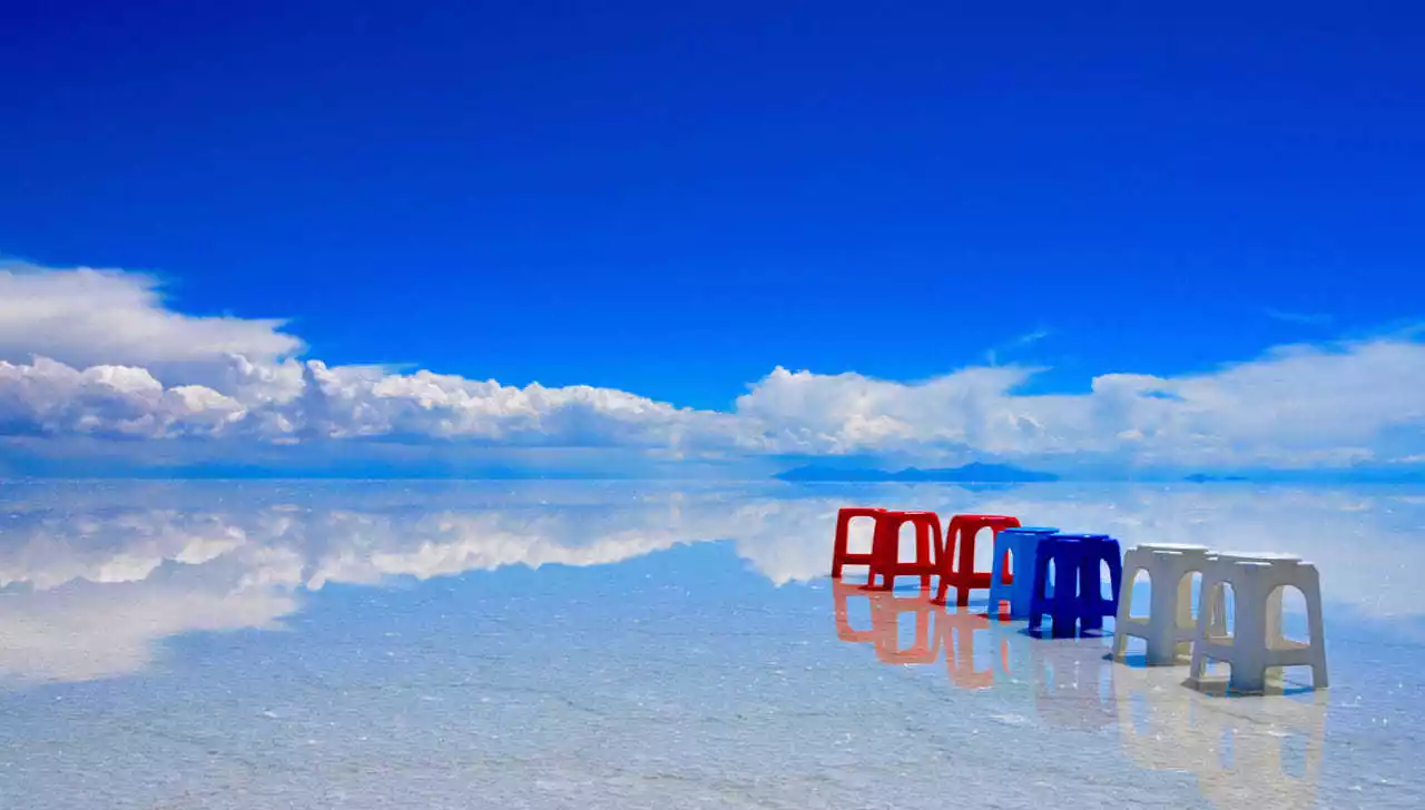
How to play Sky Mirror without water?
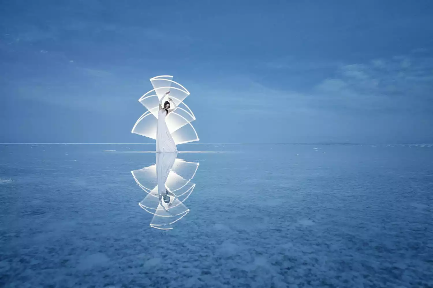
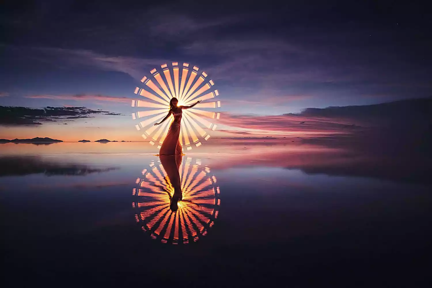
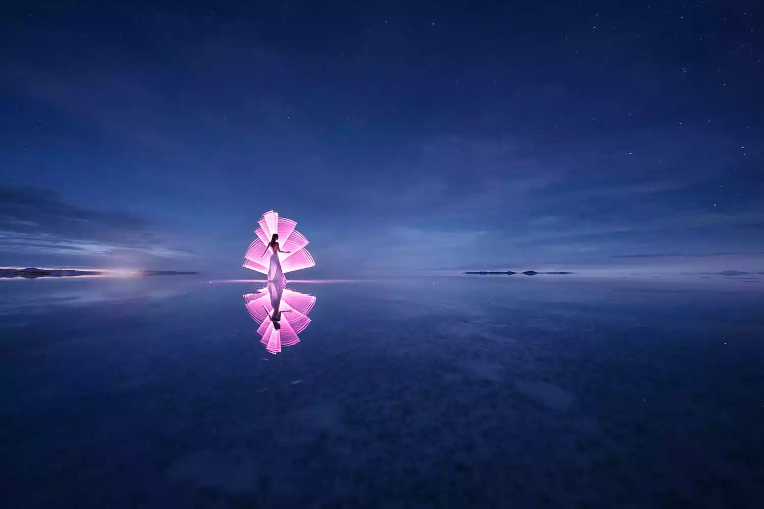


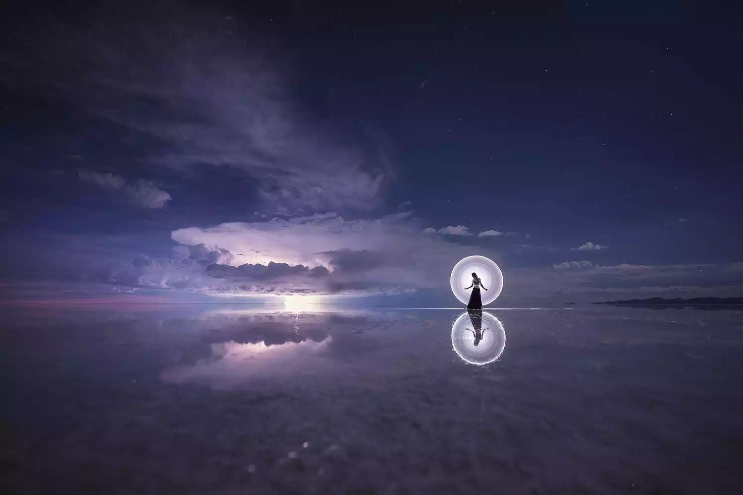
The endless, flat, arid salt pans have always been a place where people's imaginations run wild and their creativity is unleashed. Drivers who frequent the area year-round often have a few stock photography routines for tourists. The principle is simple: two people, one in front and one behind, or a prop in front and one behind, positioned at a suitable distance. The camera is kept close enough to the person in front or the prop that the photographer usually has to squat or even lie prone on the ground to create the illusion of immensity while the person behind appears tiny.
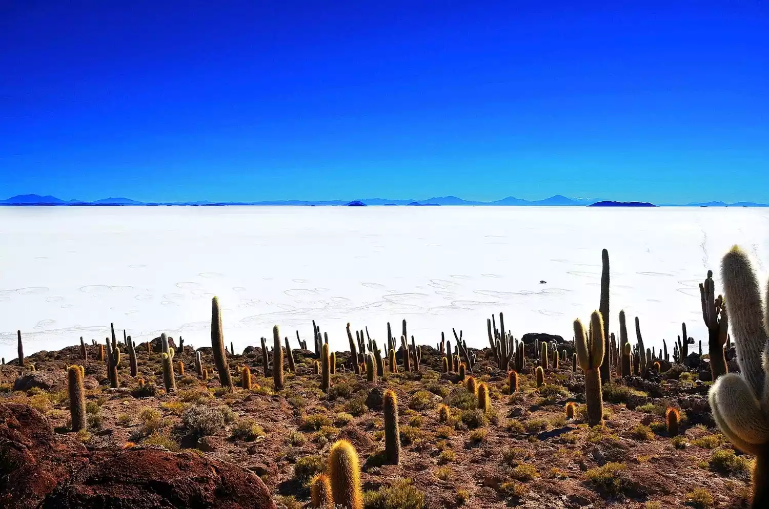
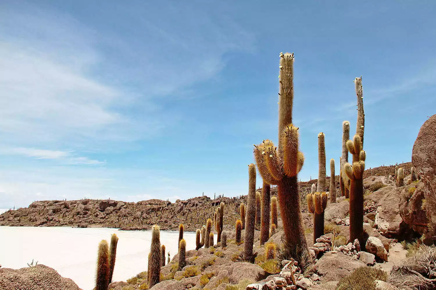
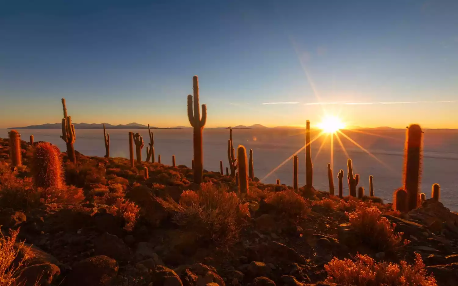
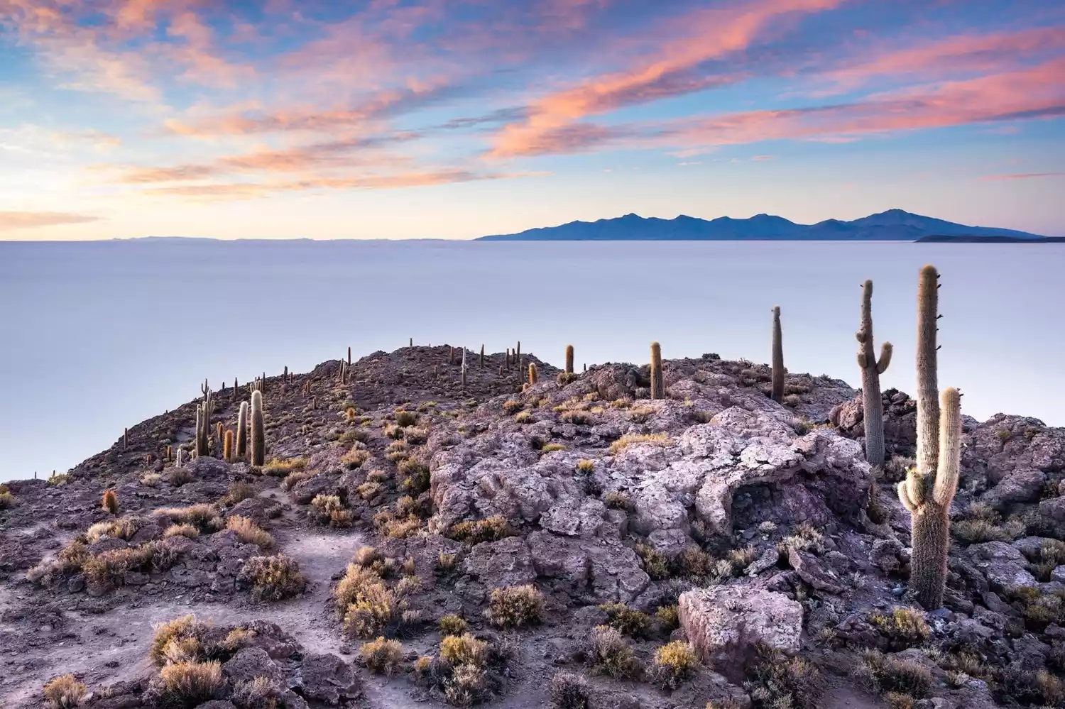
Cactus Island
Amidst the vast salt lake lie a number of "islands," the most remarkable of which is Cactus Island, Isla Incahuasi. We watched the sunrise from right next to it, and while it might not seem particularly remarkable from a distance, it was only after we "landed" that we discovered the sheer size of the cacti, covering the entire island with them – a truly breathtaking sight. It's said that these cacti grow about one centimeter per year, and that the cacti on the island are said to be hundreds to thousands of years old. Perhaps they could cultivate to become spirits, right?
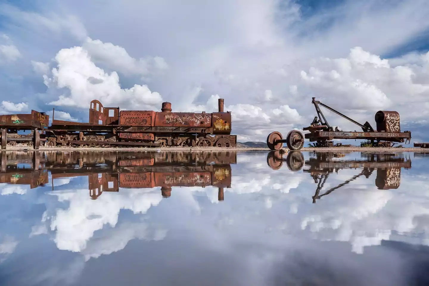
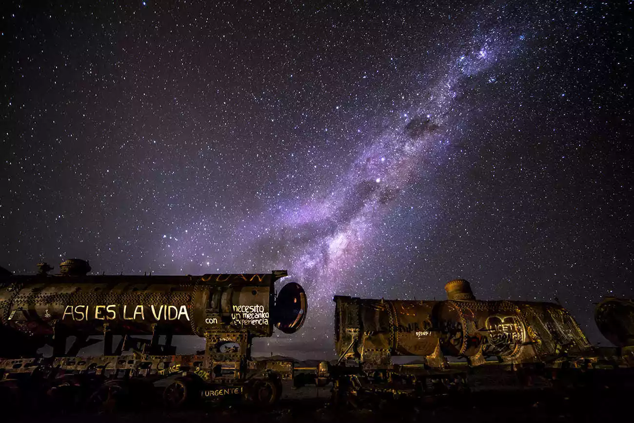
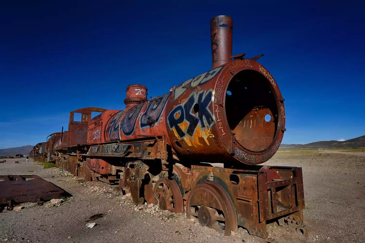
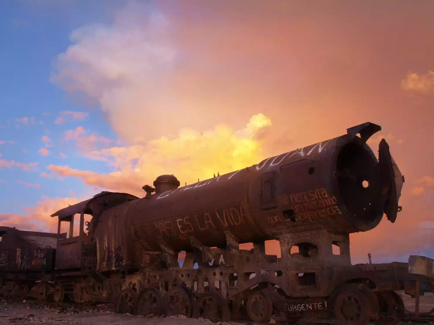
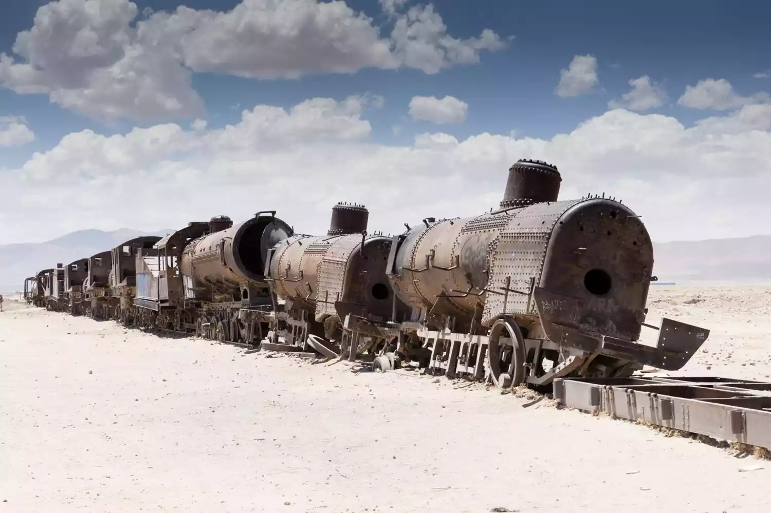
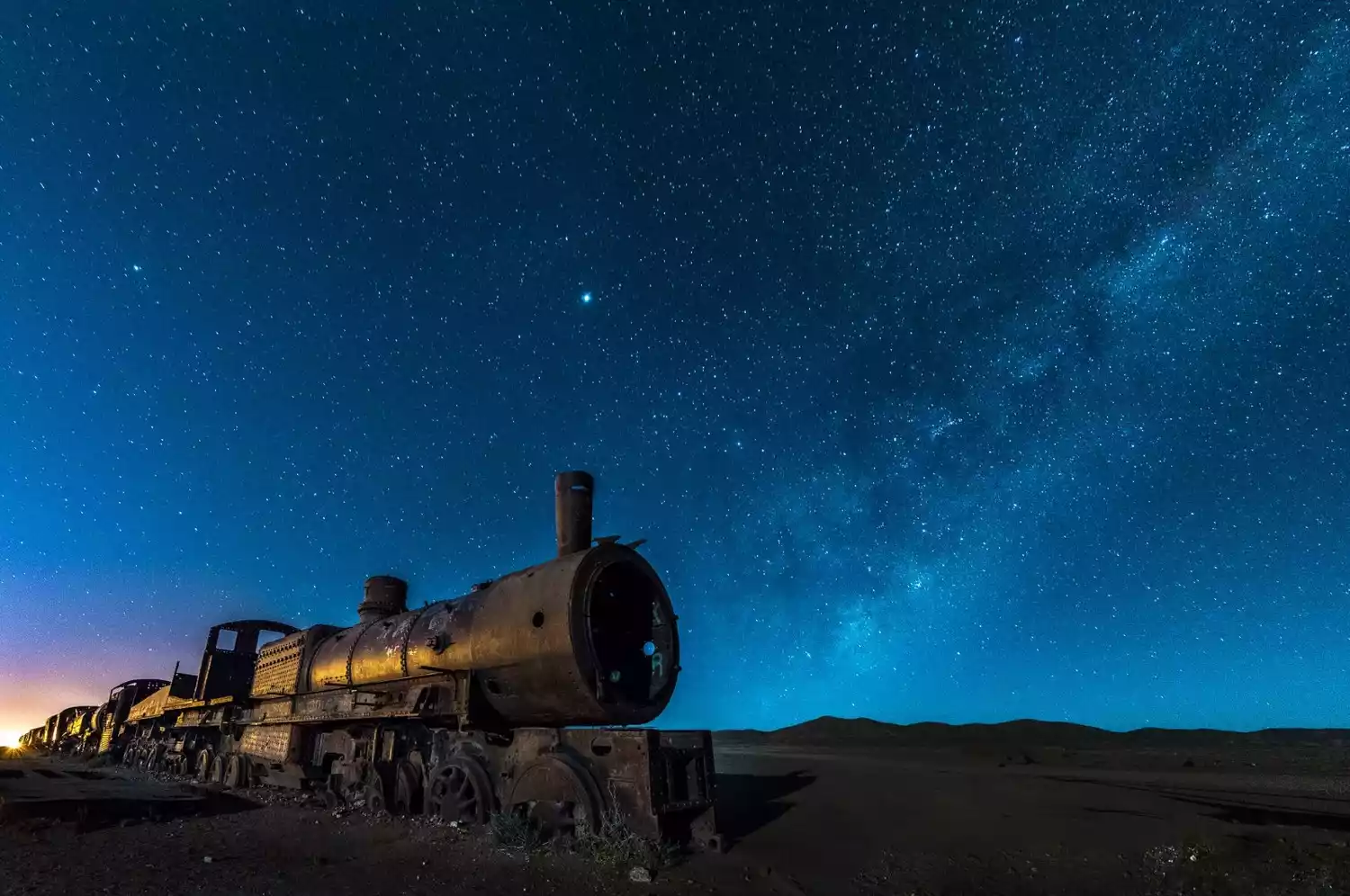
Train Graveyard
Just 3 kilometers from Uyuni lies the Train Graveyard. As mentioned previously, this site was abandoned due to the decline of the local mining industry and a territorial dispute with Chile. The pile of rusted, abandoned locomotives creates a sense of desolation and antiquity, and if you were to visit it at dusk, when no one is around, you might be able to capture some stunning photos.

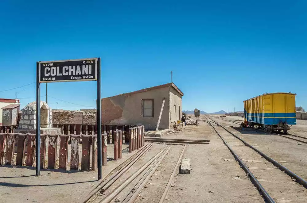
Korchani Village
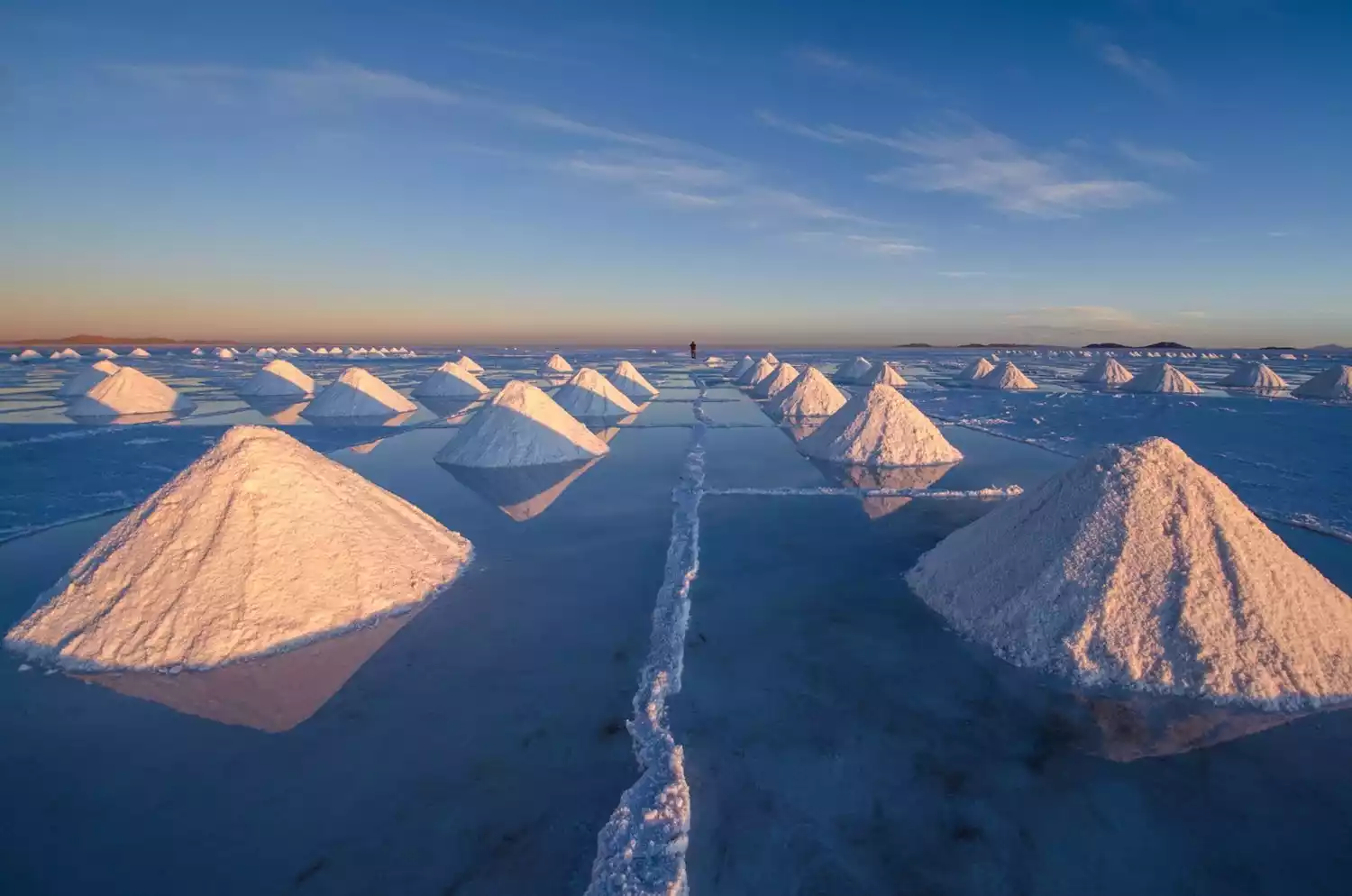
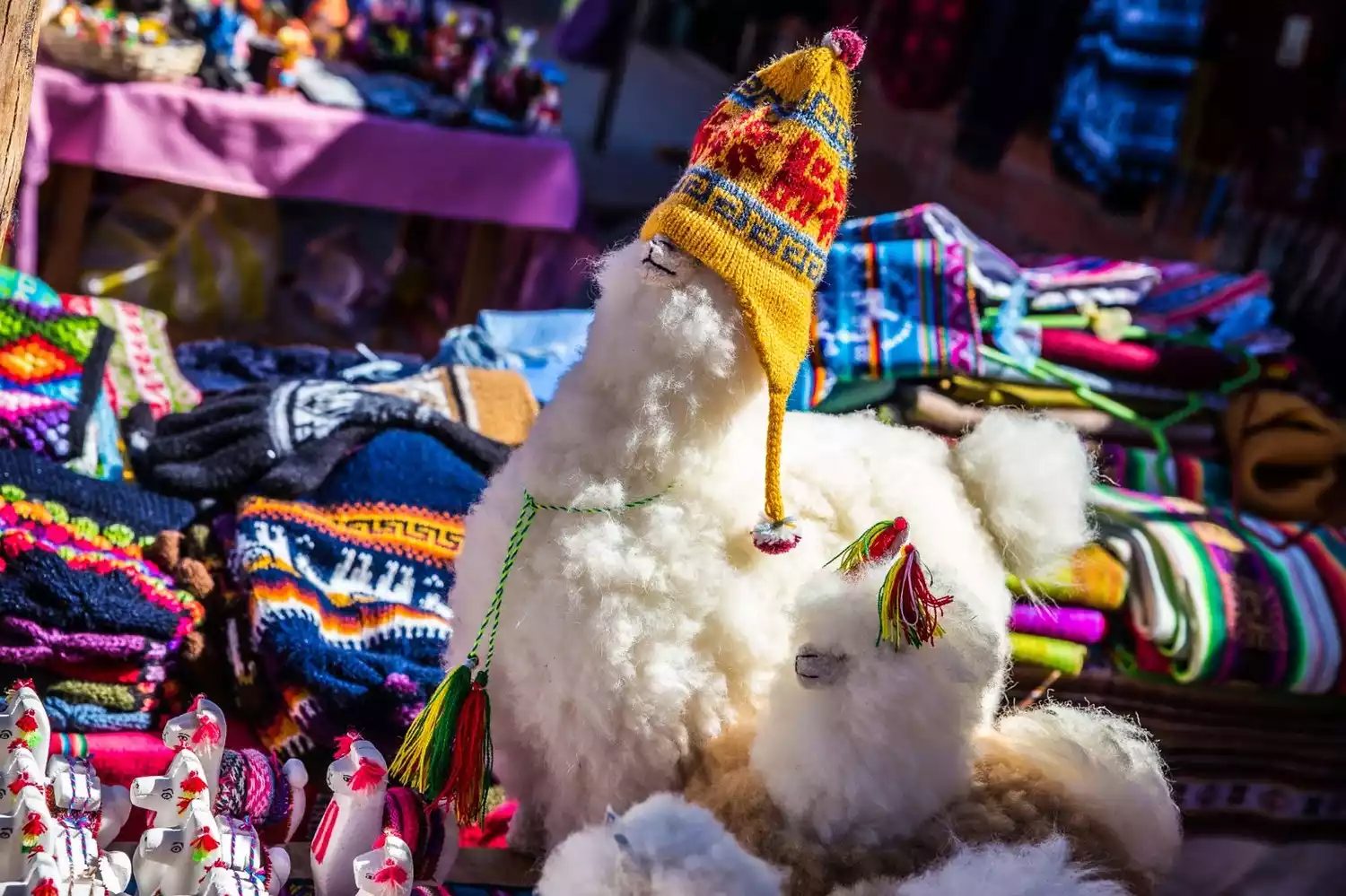
Exiting the salt flats, you'll pass through the village of Colchani, over 20 kilometers from Uyuni town. This is the essential path to the Sky Mirror. Tour groups often stop here for 20-30 minutes to buy souvenirs. It's essentially a simple dirt road, flanked by small shops selling souvenirs, primarily alpaca wool, a vibrant and colorful selection. Costs are relatively low in Bolivia, so regardless of quality, everything sold here is relatively affordable.
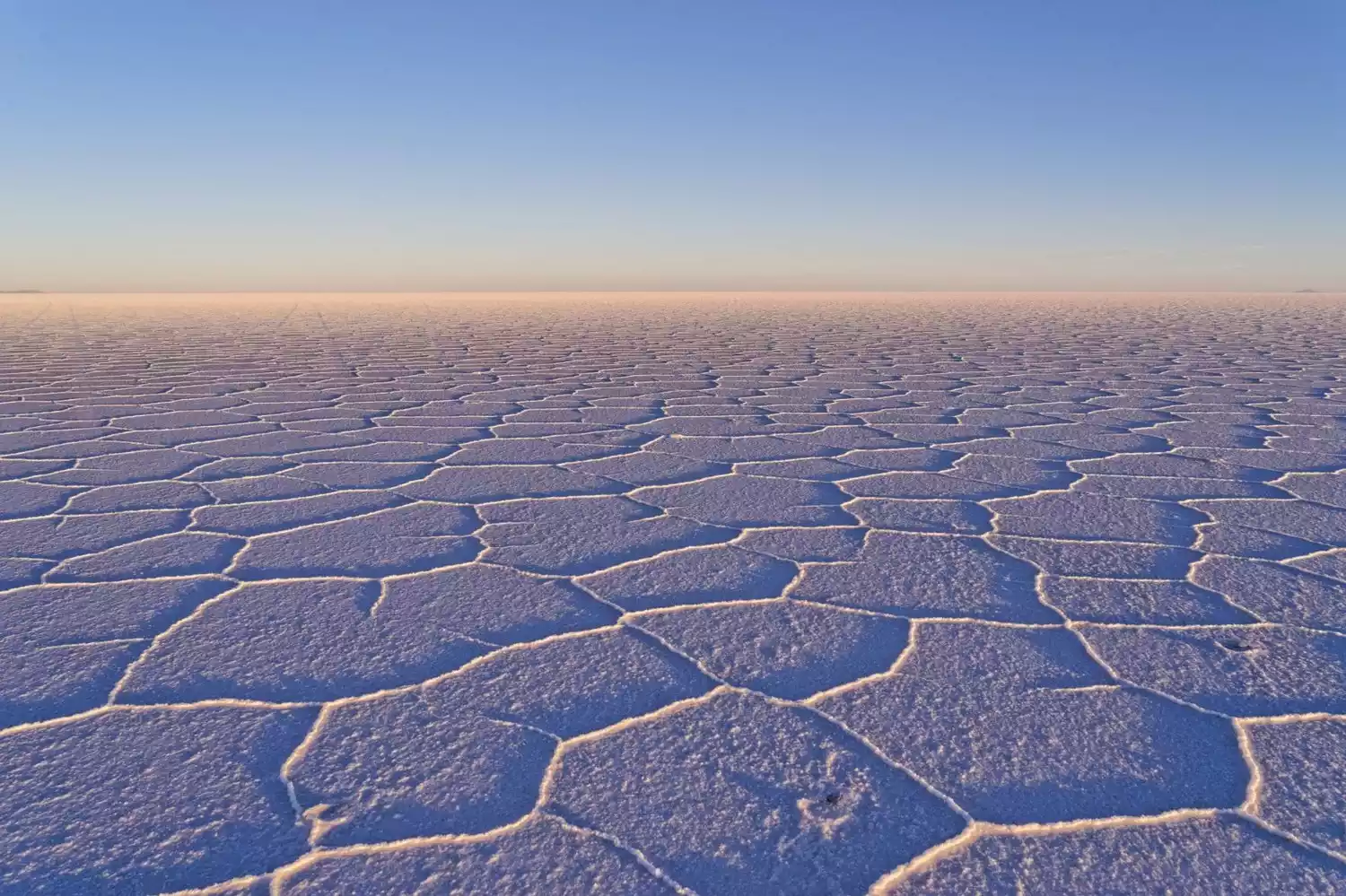
Old railway in Salar de Chiguana
The Chiguana Salt Pans, with an altitude of about 3,600 meters, are small and not particularly attractive. The only difference is that there's an abandoned railway line passing through them, making them a great photo spot (there's a similar railway line at our Chaca Salt Lake).
In the late 19th century, the Bolivian government planned to build a railway from Uyuni to Calama, Chile, to transport salt from the salt mines to the coast for export to Europe. However, due to a territorial dispute with Chile, Bolivia closed its borders to the outside world. Furthermore, the mining industry developed slowly and eventually declined in the 1940s, and the railway was eventually abandoned.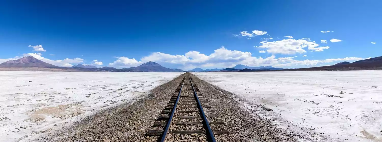
Let me interrupt here for a moment to share the history of Bolivia (this country is indeed quite tragic).
During the Latin American War of Independence in the 18th century, Bolivia was liberated and gained independence by a national hero from Caracas, Venezuela, Bolivar. The country's name is therefore derived from him. On August 6, 1825, Bolivia declared independence from Spain, taking the name of the Bolivarian Republic, later changing to its current name. In 1836, it formed a federation with Peru, which collapsed in 1839 due to the invasion of Chile. In 1863, rich saltpeter deposits were discovered in Atacama Province on the Pacific coast. In 1879, Chile sent troops to seize the mining areas, and Bolivia, in alliance with Peru, fought the War of the Pacific against Chile. Bolivia was defeated in 1883, and in 1904, it ceded its saltpeter-rich Pacific coast to Chile. This resulted in the loss of Bolivia's only coastal province, including the important port of Antofagasta, and the country became landlocked. It can be said that Bolivia has always been a soft persimmon and a sucker in the history of South America. It was defeated in two wars of aggression, and a large amount of its territory is linked to the same fate as my country's Qing government.
Eduardo Abaroa Nature Reserve
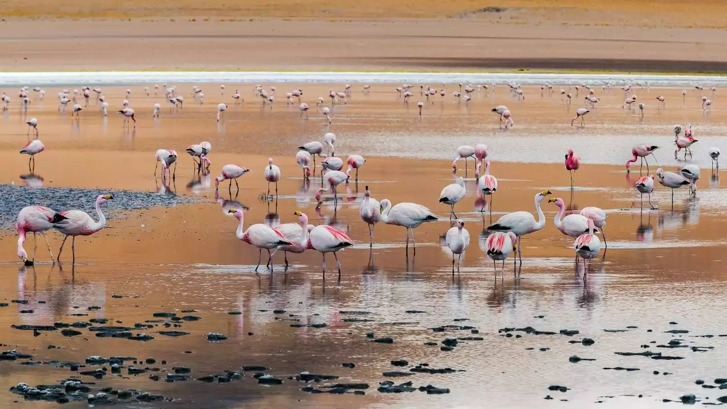
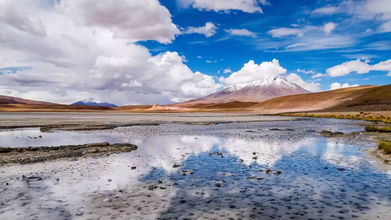
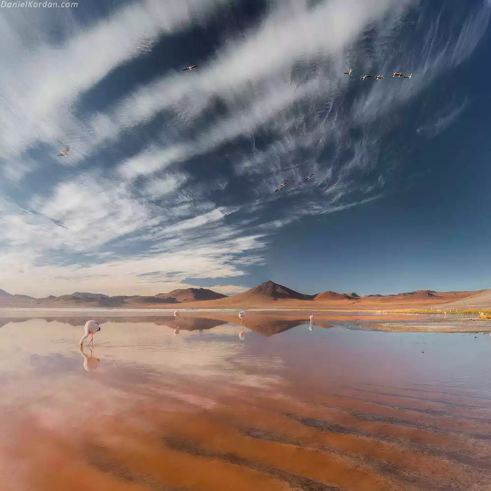
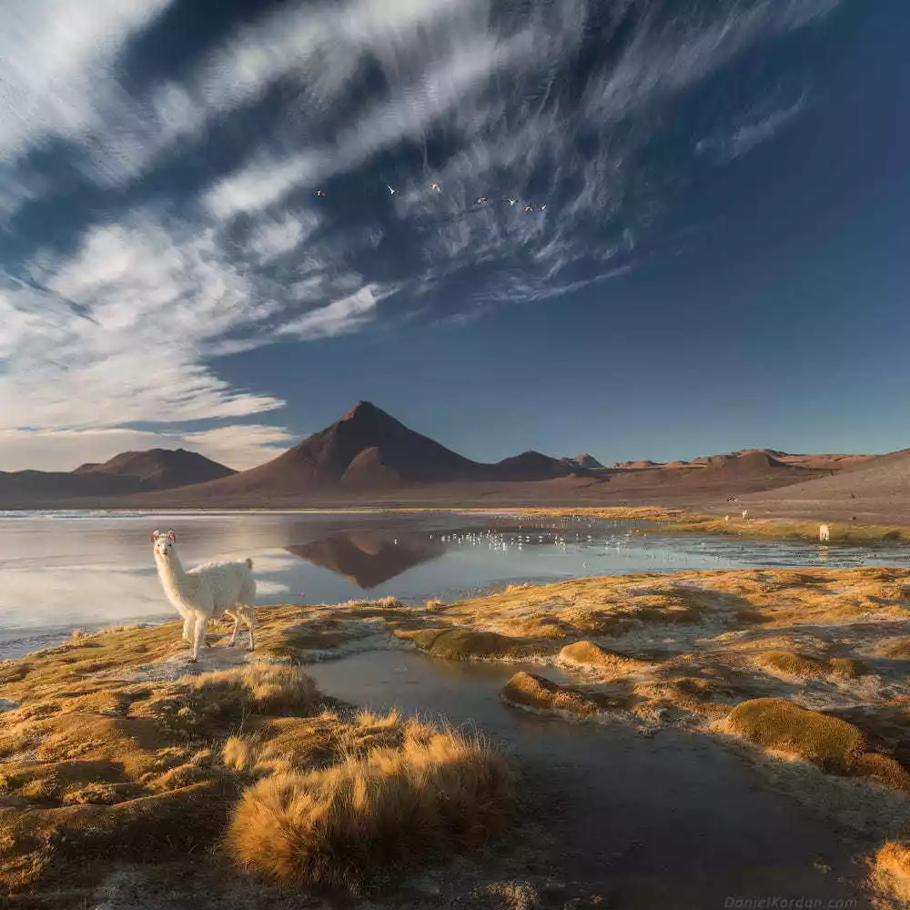
If you think Uyuni is only about the Sky Mirror, you're completely mistaken! A beloved attraction for Europeans and Americans is this national park, one 99% of us have never heard of. I call it the Yellowstone National Park of South America because of its sheer variety: volcanoes, geothermal hot springs, Red, Blue, Green, Black, and White Lakes, grotesque rock formations, endless snow-capped mountains, and graceful flamingos. You can even experience the changing seasons in a single day in this national park!
Tips: Once you enter the Eduardo Abaroa Nature Reserve, the altitude will continue to rise, reaching over 4,000 meters (similar to the experience of traveling to Ngari, Tibet). During your trip, be sure to monitor your physical condition and have plenty of medication for altitude sickness and dehydration. If you feel unwell, please inform your travel companions and driver immediately. Allow ample rest time and avoid forcing yourself to climb higher, as this can cause harm to your health.
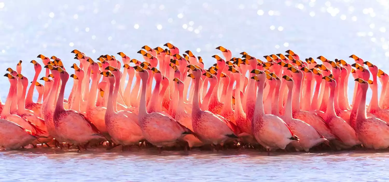
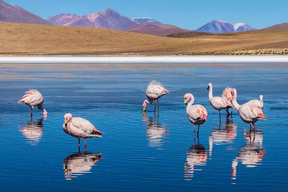
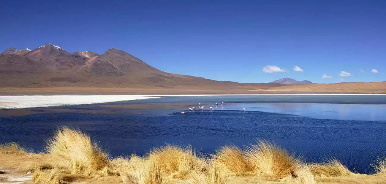
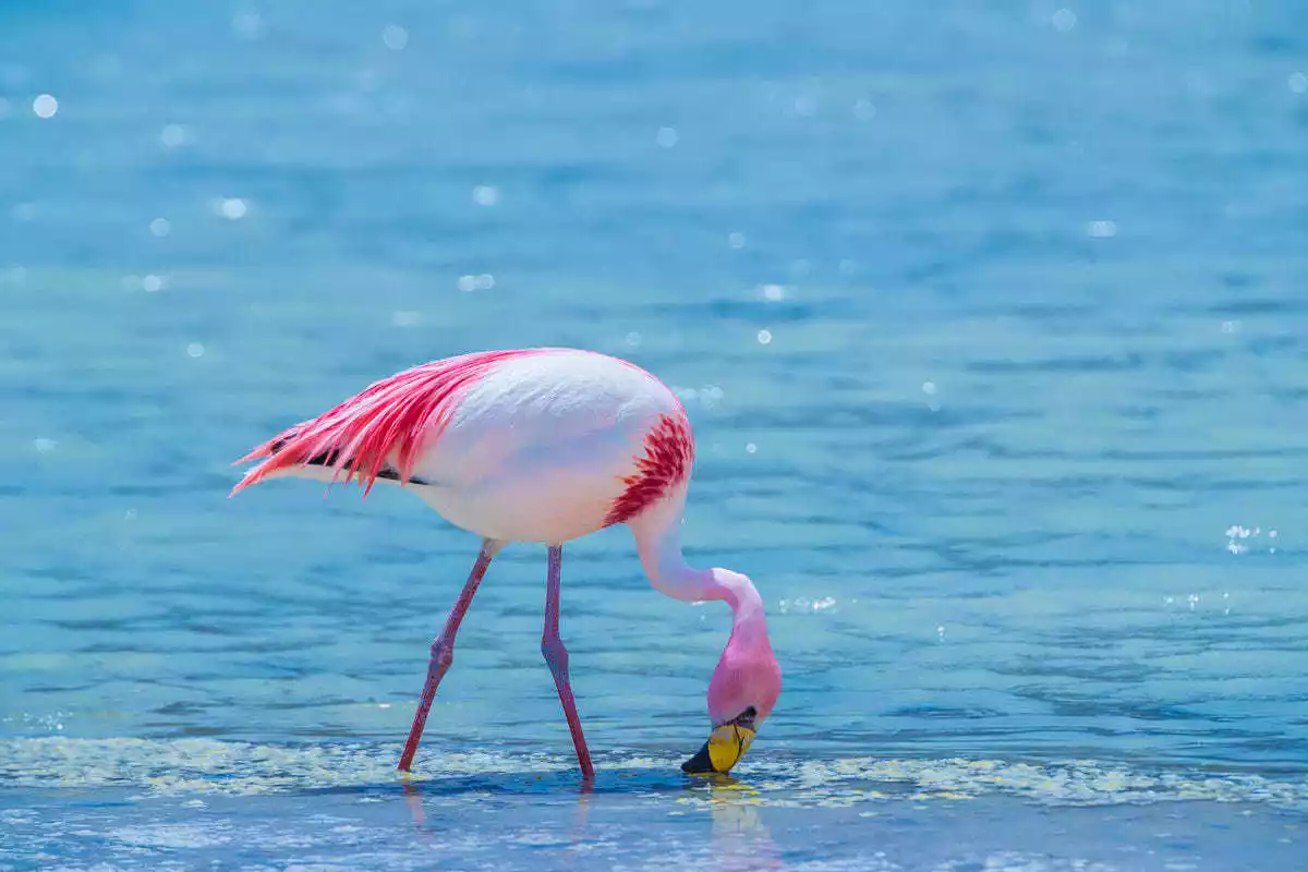
Laguna Honda/Hedionda/Canapa
The names are too complicated. I named them Blue Lake, Red Lake, and Black Lake. The highlight here is photographing the flamingos. Although flamingos are as precious as pandas to Chinese and Europeans, here they are as common as chickens.
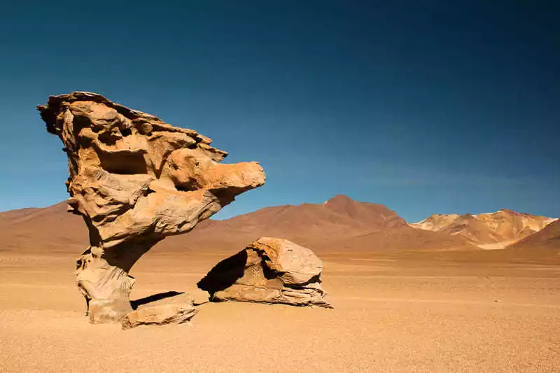
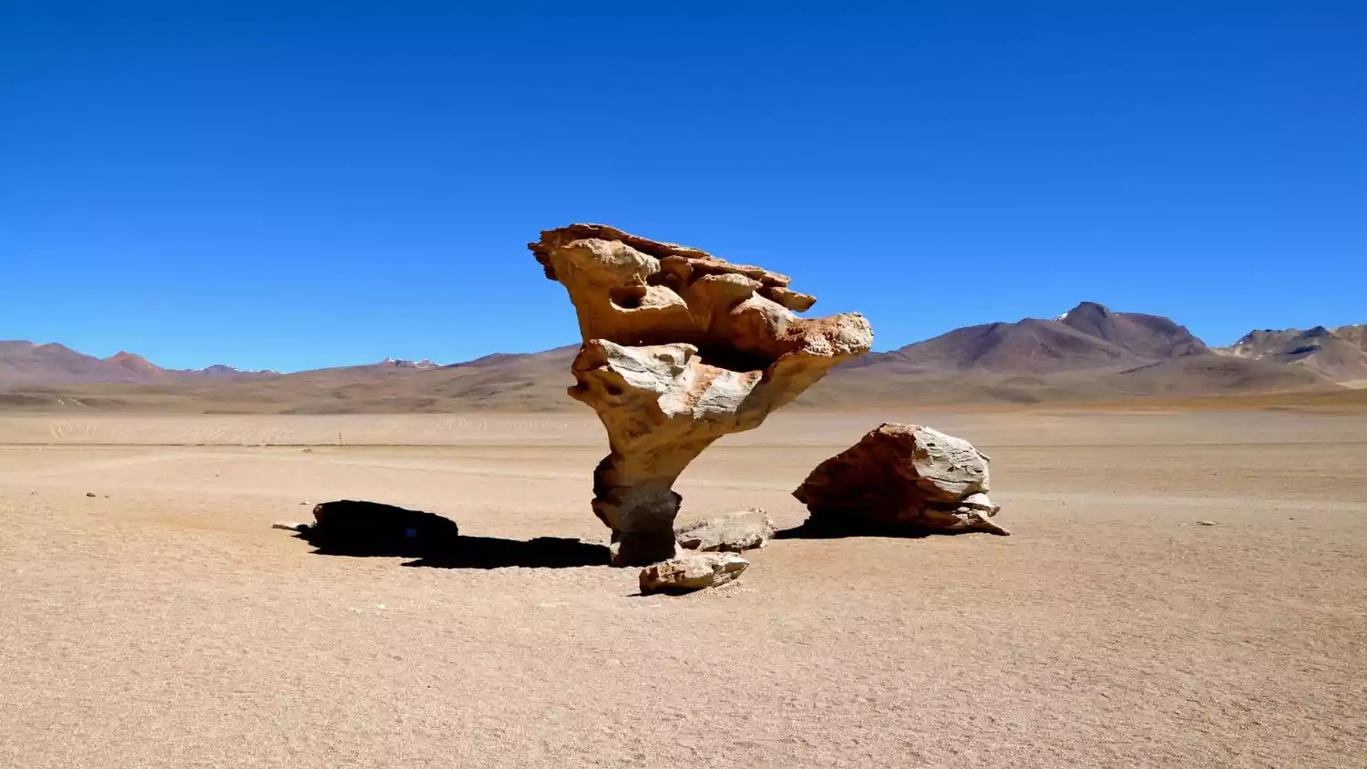
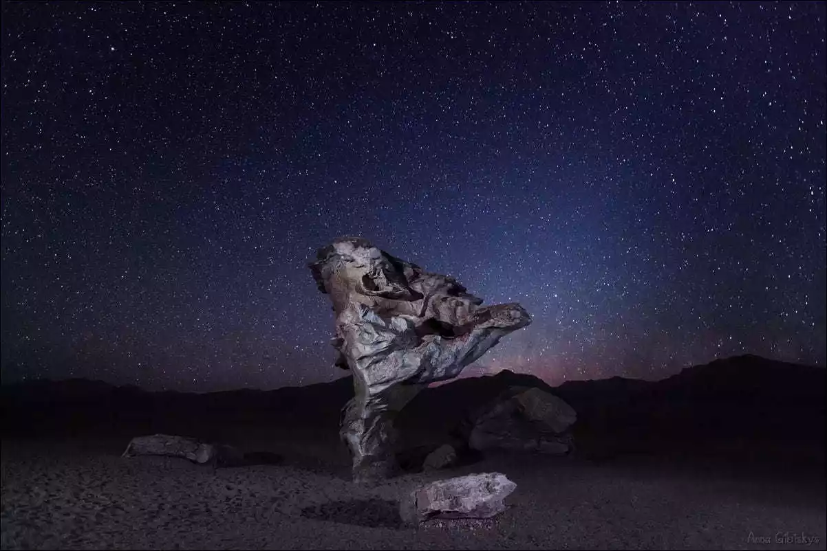
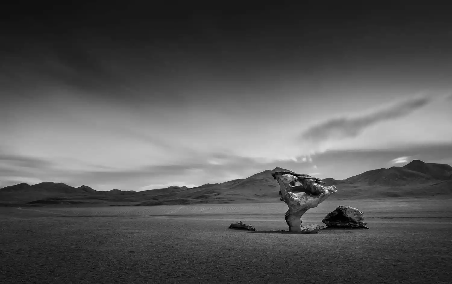
Árbol de Piedra Stone Tree
Entering the Siloli Desert, you'll pass several prominent rock formations amidst the flat sands. Arbol de Piedra (Stone Tree) is particularly striking. Sculpted into a tree-like shape by centuries of wind and sand erosion, it's narrow at the base and wide at the top, creating a unique shape that will amaze you with the wonders of nature.
The distant mountains against the backdrop of trees and rocks were also quite unique, a vibrant hue of red, orange, and white. The foothills were dotted with light yellow vegetation, and against the clear blue sky, the rich layers of scenery were truly stunning. We crossed the Siloli Desert and entered a small canyon, flanked by rugged rocks. This area was home to a unique type of plateau moss, a charming, umbrella-shaped, verdant plant resembling cauliflower. However, I was still feeling a bit dizzy from altitude sickness and felt listless, so I didn't get out of the car to take photos.
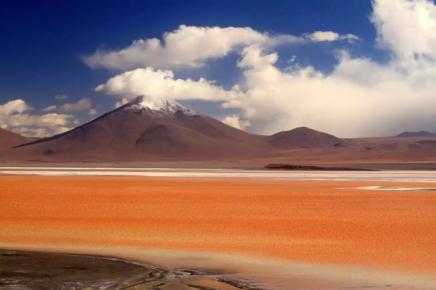
Laguna Colorada
This is one of the most amazing places on the trip, so you have to go even if it gives you a headache.
After getting off the bus, a biting cold wind swept through, and you suddenly realized that you had gone from summer in Uyuni to winter. We shivered in the chill, wrapped in thin clothes and shorts, and braced ourselves for half an hour, shooting footage. It was truly a challenge. The lake's red color is due to hot springs at the bottom, which nourish a red algae and other microorganisms. Furthermore, the lake is dotted with large expanses of white borax deposits, creating a striking contrast with the red. The interweaving of various shades of color creates a rich tapestry of colors, a true visual feast. A bit of light in the morning or evening would have created an even more vibrant and striking scene. From above, the flamingos quietly foraging on the lake's surface resembled scattered musical notes, their reflections like overlapping chords, composing a beautiful visual score.
To the east of the lake, there's a small area, presumably where hot springs seep out. In the early morning, wisps of mist linger over the surface, creating a dreamlike scene. Combined with the quiet silhouettes and reflections of the crane-like flamingos, the scene is truly breathtaking, like a fairyland. My friend, anxiously walking down to the lake's edge, accidentally startled a flock of birds on the shore, causing them to spread their wings and take off, a truly remarkable sight.
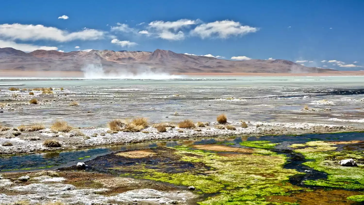
Geiser Sol de Mañana geothermal field
I call it the boiling mud. You'll find a similar scene in Yellowstone National Park, but only in this desolate, uninhabited area of Bolivia can you stand directly in the seething mud, with scorching steam constantly pounding you, feeling the direct impact of the volcanic heat! On the way back, your feet will be covered in a thick layer of black earth, instantly increasing your height by five centimeters.
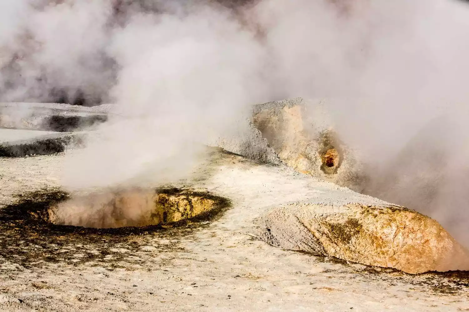
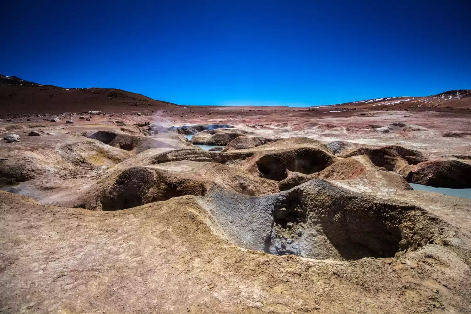
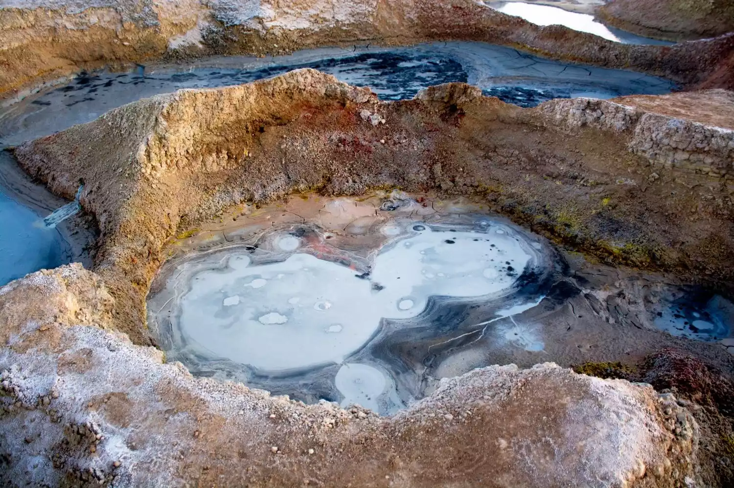
This is the highest point we've visited within the nature reserve, reaching an altitude of 4,885 meters. Sol de Mañana means "morning sun" in Spanish, and Geiser Sol de Mañana roughly translates to "Rising Sun Geothermal Spring." However, this isn't a geyser zone, as you might imagine, but rather a geothermal field consisting primarily of steam and mud pools. The most iconic feature is a steam pool, which is constantly bubbling with steam. It's said that the pressurized steam erupts up to 50 meters each morning. The geothermal field is much more beautiful than the El Tatio geyser we visited earlier in Chile. It features numerous, bumpy, gray-white hot mud pools, fringed by yellow sulfur traces. Further away, orange and white soil creates a rich, beautiful layering of colors.
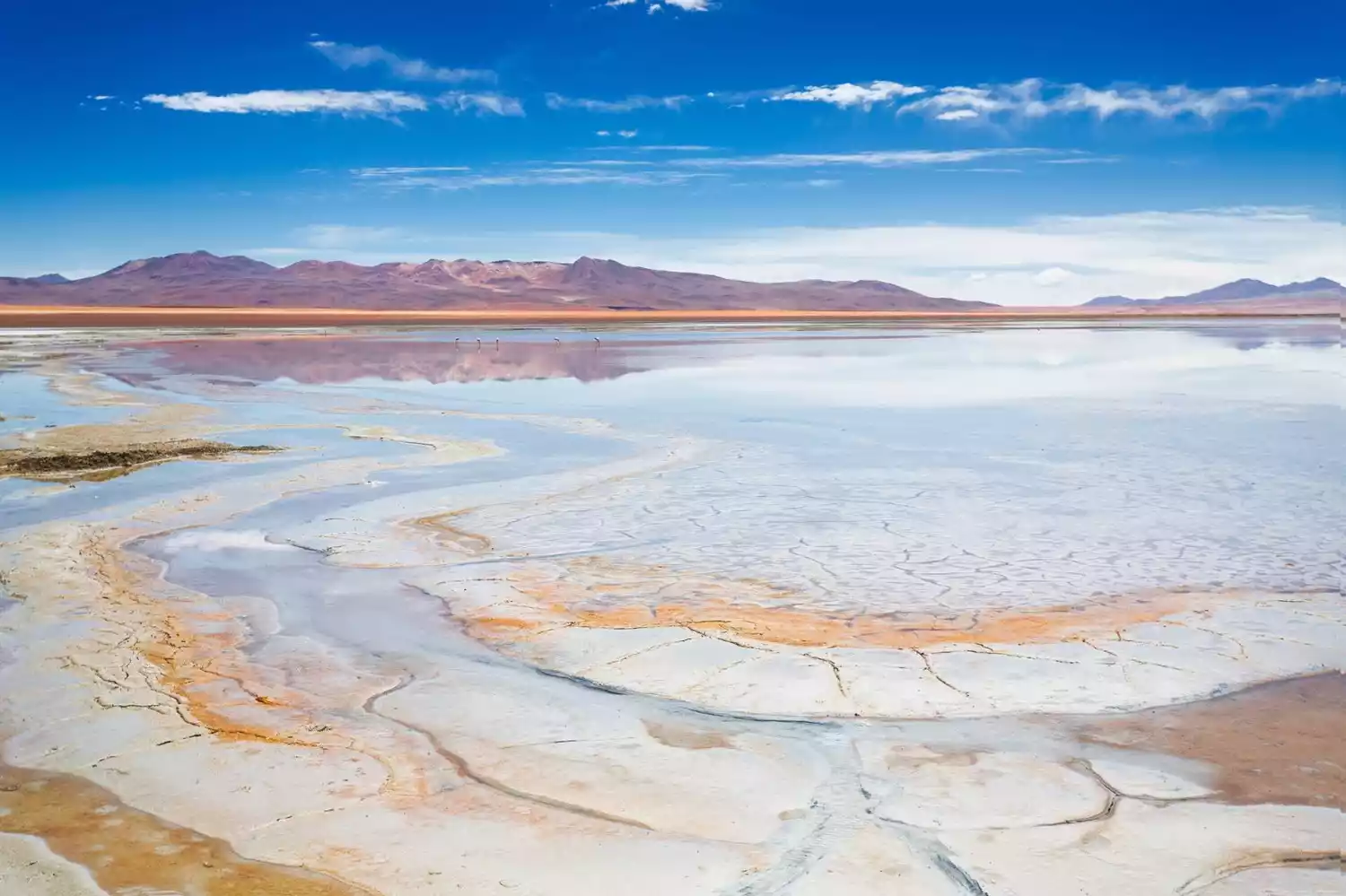
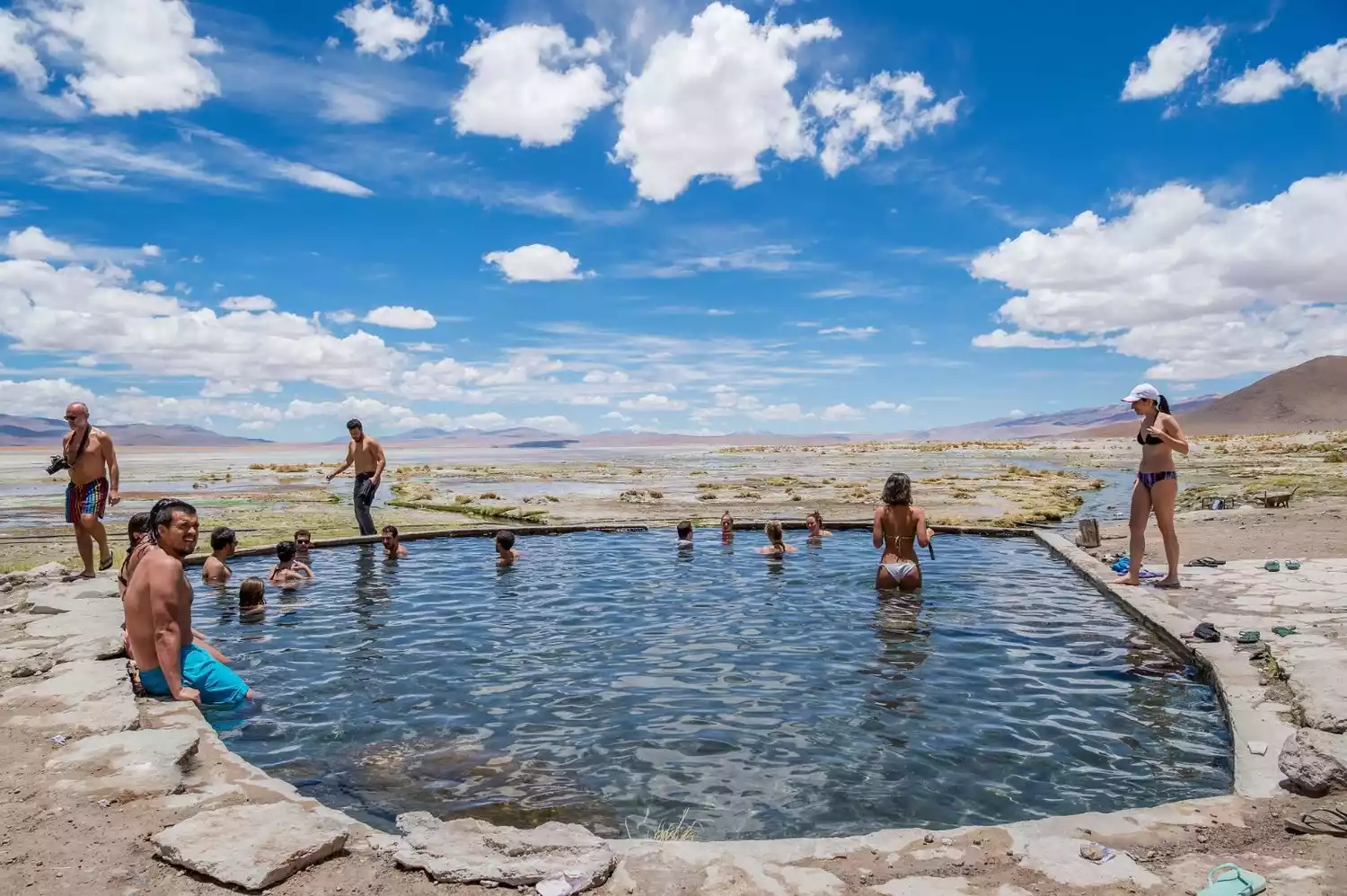
Small Hot Springs and Salar de Chalviri
Leaving the two lakes, we sped across the South American plateau, crossing the Daly Desert (Desierto Dali), admiring the vast expanse of desert along the way. This region still maintains a high mountain and desert climate, with the air being extremely dry yet exceptionally clear, making the distant mountain scenery even more breathtaking. In the distance, tiny four-wheel drive vehicles whizzed across the desert like mayflies, stirring up clouds of dust. The scene was quite picturesque, but following too closely or being overtaken by another vehicle was a disaster, as the dust would hit us in the face. Since our jeep travels in these areas year-round, the air conditioner was so dusty that even opening it would be dusty, so we didn't turn it on. The temperature outside the window wasn't particularly high, but closing the windows made it stuffy, so we had to open them. However, keeping them open meant constant dust, which we had to close quickly. Even so, we still inhaled quite a bit along the way. It took about an hour to reach Salar de Chalviri, another highland salt lake. Next to the lake are the hot springs of Termas de Polques. Tour groups departing from Uyuni will stay here for one night. Imagine, after a tiring day and the brilliance of the plateau, you drag your tired body into this hot spring pool under the snow-capped mountains, and instantly all your pores open up. It's such a pleasurable feeling! Best of all, this fairyland-like high-end experience only costs 6 yuan!
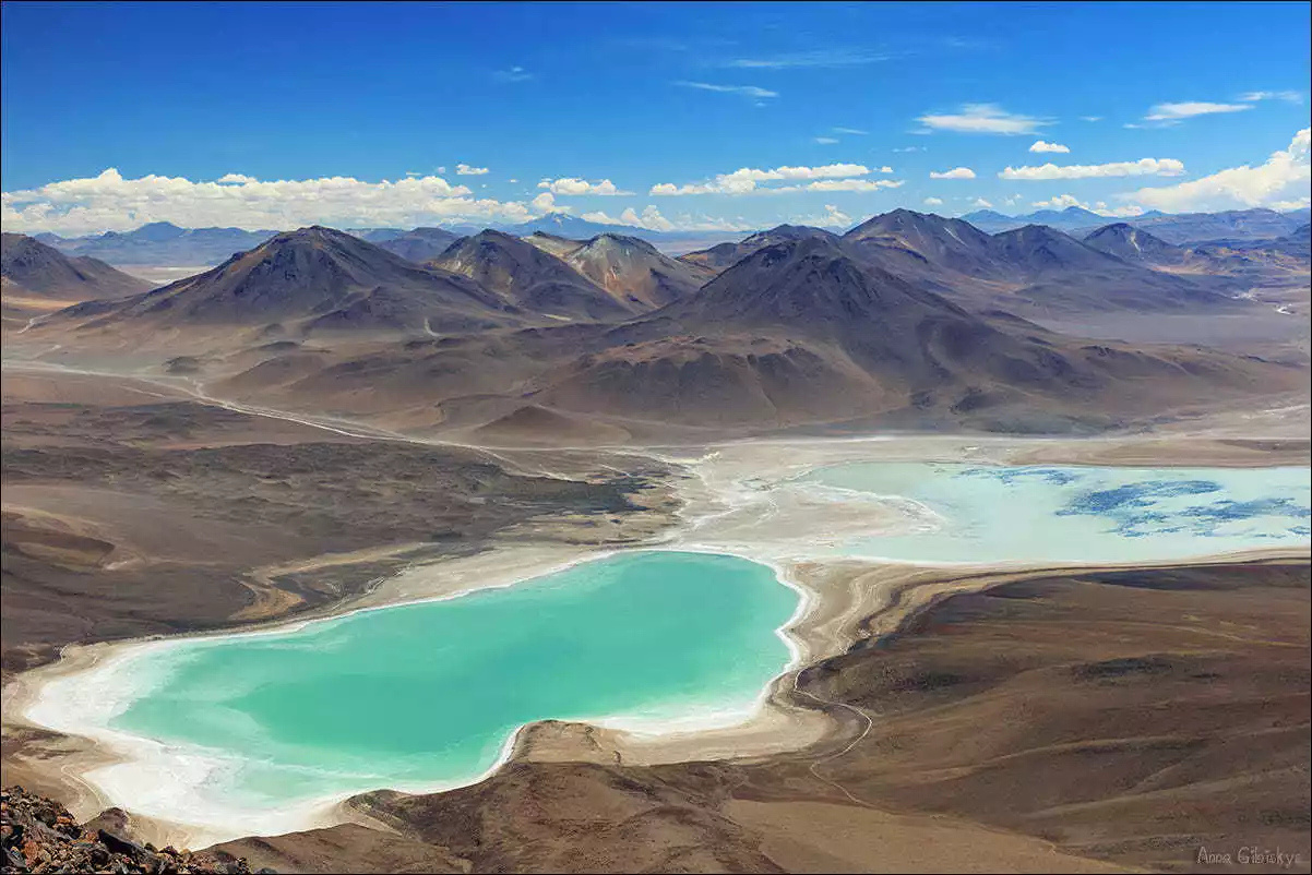
Laguna Blanca & Verde
The White Lake appears white due to the high concentration of minerals. It is shallow and milky white. It reflects the distant mountains and the blue sky in a pure and calm manner, which is refreshing. There are also some elf-like migratory birds from the plateau on the lake. The last attraction in the Eduardo Abaroa Nature Reserve is the Green Lake (Laguna Verde). The lake water is gem-green because it is rich in minerals such as magnesium, calcium carbonate, lead and arsenic. It is especially bright when there is wind and sunshine. Across the lake stands the highest peak in the area, Volcán Licancabur. This volcano rises into the clouds and is also the boundary peak between Bolivia and Chile. Beyond this mountain is the Atacama Desert in northern Chile. It is one of the driest areas in the world, and it is also Professor Do Min-joon's favorite place and the place that is most like his hometown.
Tips: Bolivia transiting through Chile:
After passing the Green Lake, tour groups departing from Uyuni will have two options: return to Uyuni by the same route or cross the border to Chile. Chile is visa-free for those holding a US visa. If you need to go to Chile, the tour group will re-arrange the vehicle, and the rest of the group will take the original vehicle and trek back to Uyuni after about 8 hours.
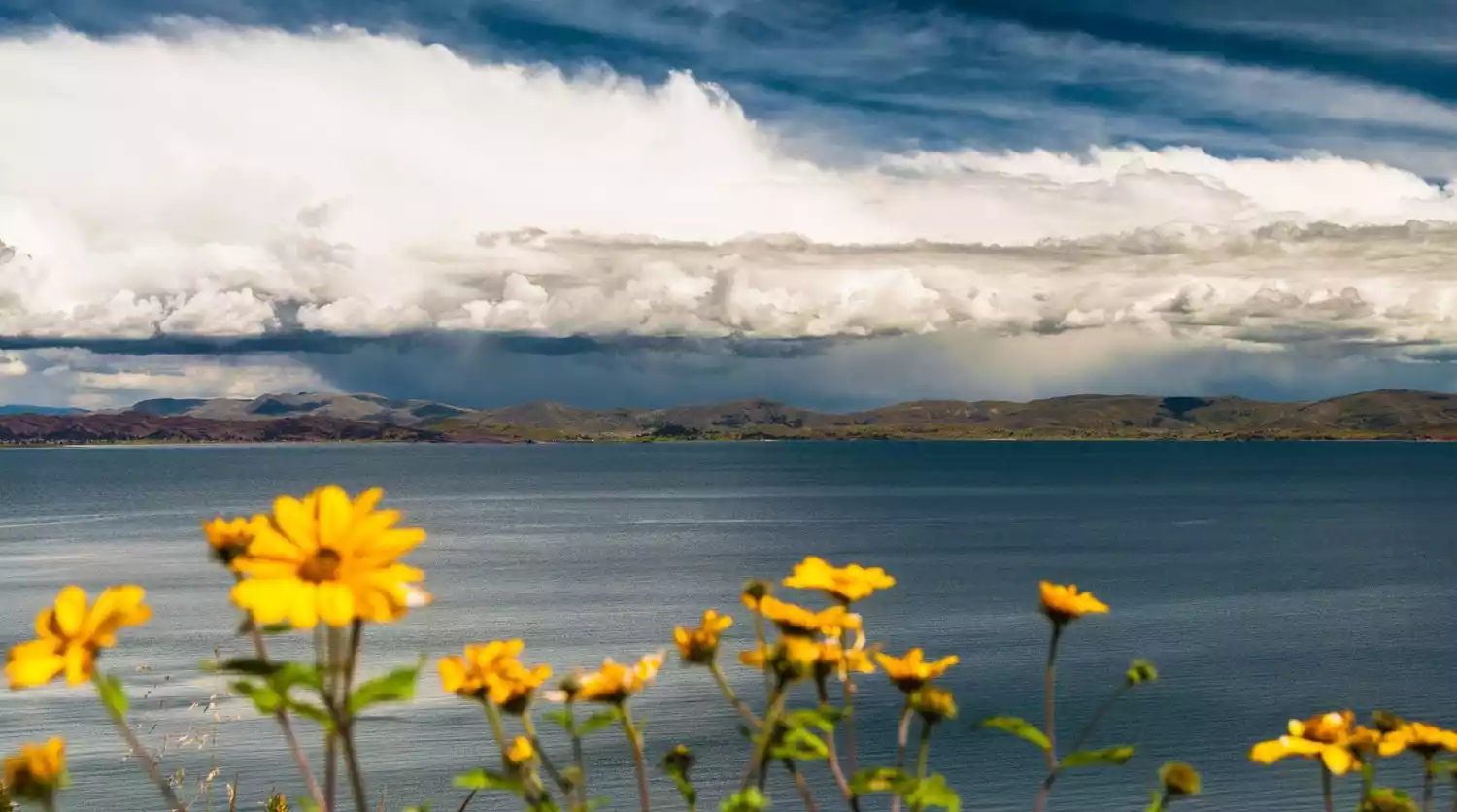
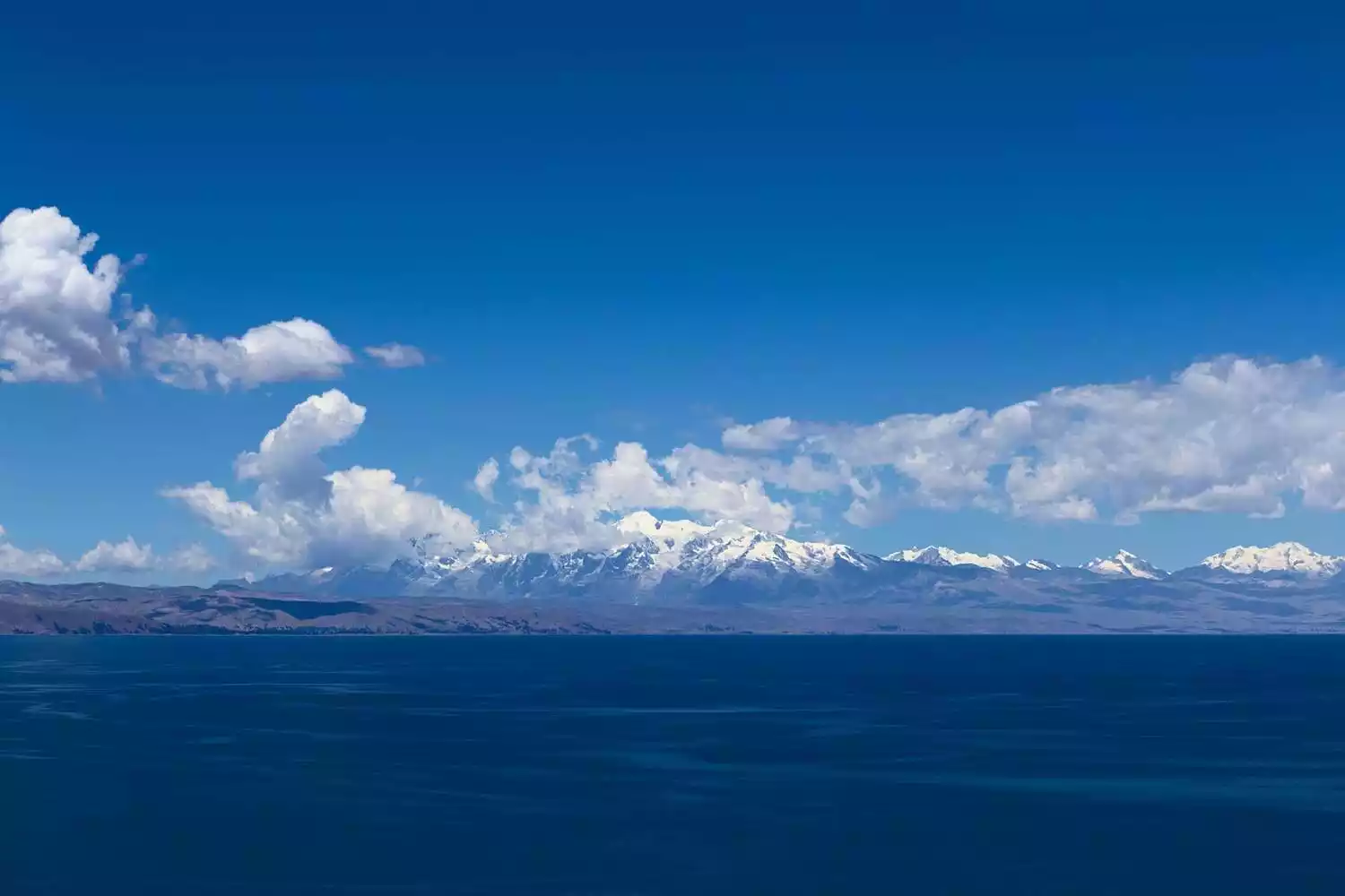
Lake Titicaca
Lake Titicaca, located on the border of Bolivia and Peru, is the highest navigable freshwater lake in South America. Surrounded by snow-capped mountains, its waters are azure blue, creating a picturesque landscape. Known as South America's "Mother Lake," it has been the cradle of numerous civilizations. The previously mentioned Tiwanaku civilization, as well as the later Inca civilization, both originated on the shores of Lake Titicaca. Dozens of islands within the lake are still inhabited, preserving traditional ways of life. Lake Titicaca can be visited from either Copacabana, Bolivia, or Puno, Peru. While the scenery on both sides is similar, the cultures on each side are distinct.
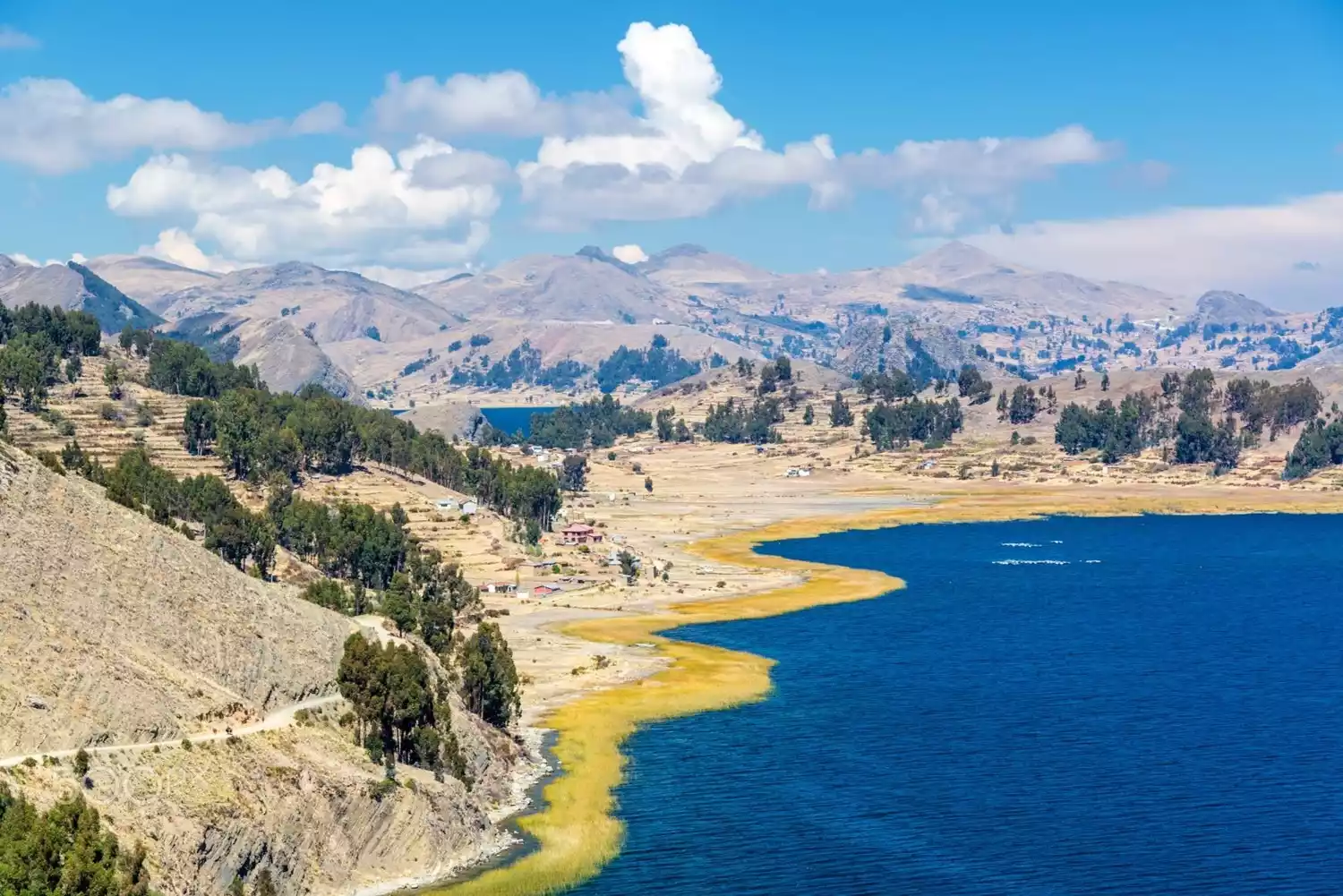
This is the border crossing between Bolivia and Peru. The city on the Bolivian side is called Copacabana, named after the world-famous beach in Rio de Janeiro. At first glance, it really looks like a small coastal town.
The waters of Lake Titicaca are so breathtakingly blue that it's hard to tell whether it's sea or lake. The town isn't large, with its main street lined with inns, restaurants, and travel agencies, creating a hippie-inspired atmosphere, like stepping back into Goa, India. The Peruvian city is called Puno (before Bolivia introduced visas on arrival, many South American travelers would apply for Bolivian visas at the consulate here, which took only one working day and was incredibly efficient. The visa agents were also very friendly. Now that Bolivia has visas on arrival, few travelers choose to apply here unless they're keen on crossing the border by land).
The hop-on hop-off bus service provides hotel pickup and drop-off, easing border crossings between the two countries and allowing you to visit attractions along the way. The bus company is called Bolivia Hop on the Bolivian side and Peru Hop on the Peruvian side, both run by the same company. Besides the La Paz to Cusco route, there are also numerous tours within Peru. By purchasing a package for a particular route online, you can spend as many days as you want in each city along the way, then return to the same company's bus. The onboard bilingual guide meticulously manages everyone's accommodation and travel dates, and arranges hotel-to-hotel pickup, which is incredibly thoughtful and convenient. Another great feature is that you can book tours along the route, such as the half-day Isla del Sol tour and the Puno Floating Islands tour, at the same time as booking your bus ticket. The prices for both the bus ticket and the small group tour are very affordable, and the guides are clear, making this a highly recommended option.
Tips: About border crossing:
After leaving Copacabana, our Bolivia Hop guide first took us to the Bolivian immigration office to clear our exit, then walked about a hundred meters to Peruvian customs to clear our entry. We had to carry our luggage through customs before transferring to Peru Hop's more spacious and comfortable bus. After crossing the border, it was another two and a half hours before we arrived in Puno. Because the bus was large, a minibus was arranged to take passengers to their reserved hotels upon arrival.
Sun Island
I consider this a rather disappointing attraction, its reputation being largely unrealistic. The boat ride from the pier takes about 70 minutes to reach Isla del Sol. Isla del Sol is the largest island on Lake Titicaca and the site of ancient Inca rituals and worship of the sun god. The boat disembarks at the South Pier and then follows the so-called Inca Trail north to the North Pier, where you'll board the return boat. The hike takes about an hour. Along the way, you can overlook the azure Lake Titicaca from the island's perch. It happened to be a clear afternoon, so while the scenery was a bit impressive, it wasn't particularly breathtaking. There are supposedly some ancient Inca ruins on the island, but I didn't see any.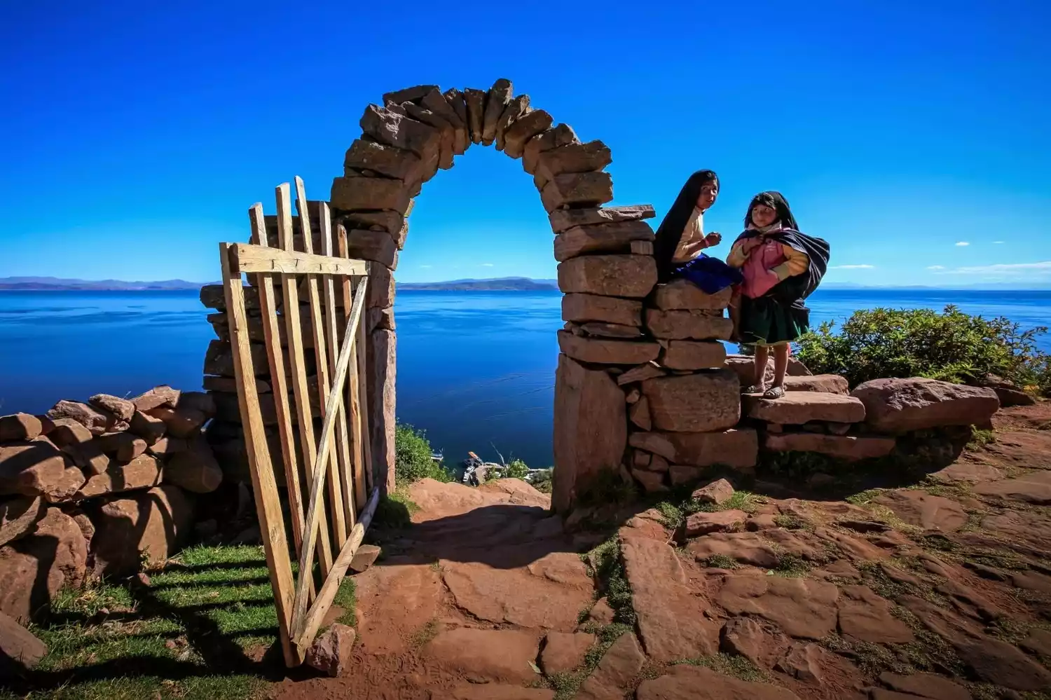
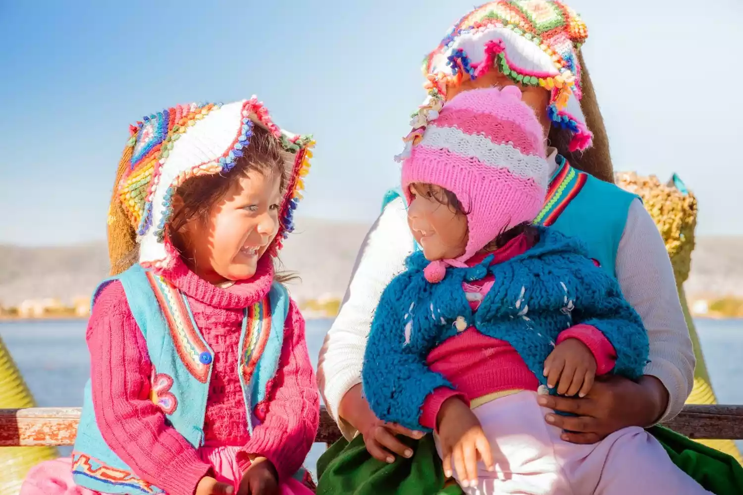
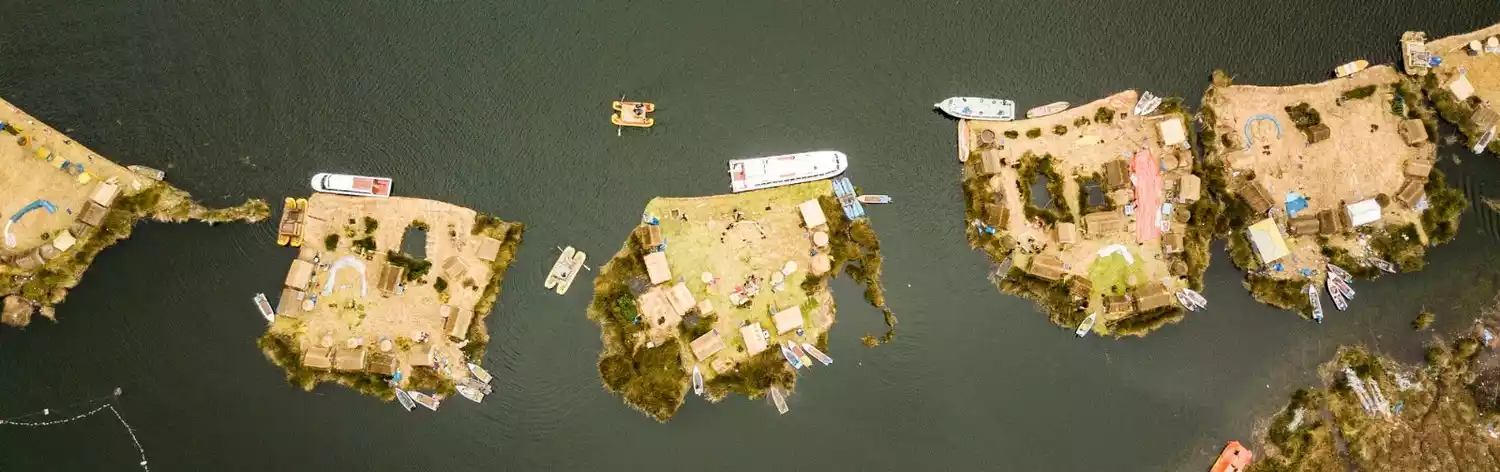
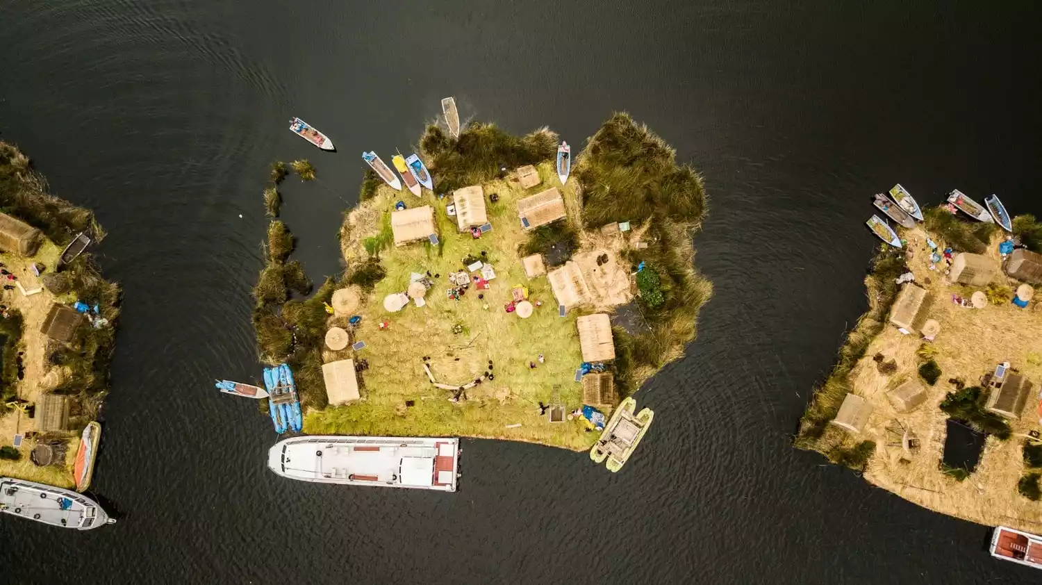
Ulu floating island
It is the highlight of Lake Titicaca and should not be missed!
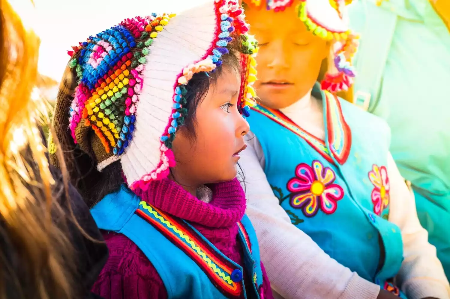
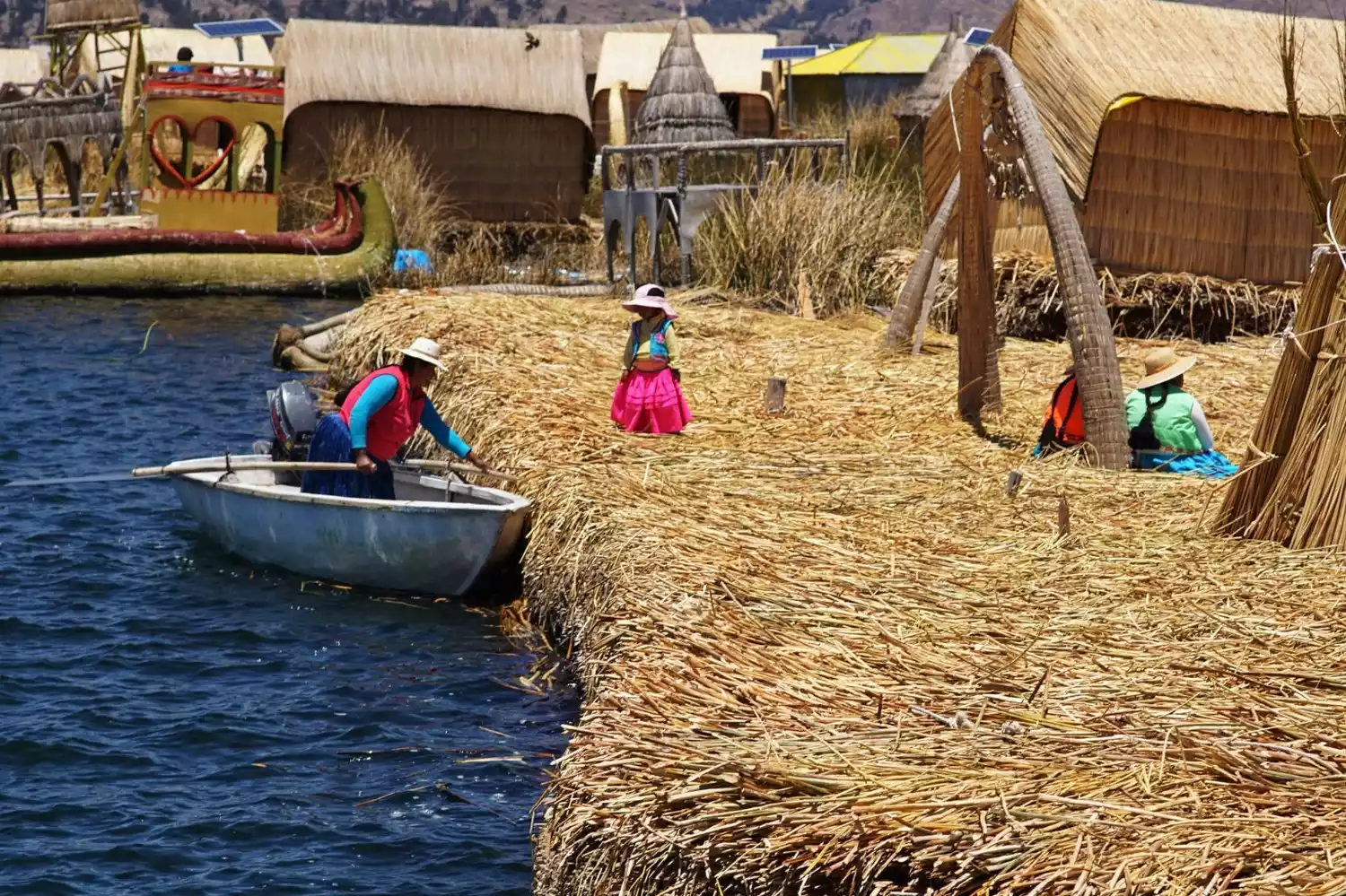
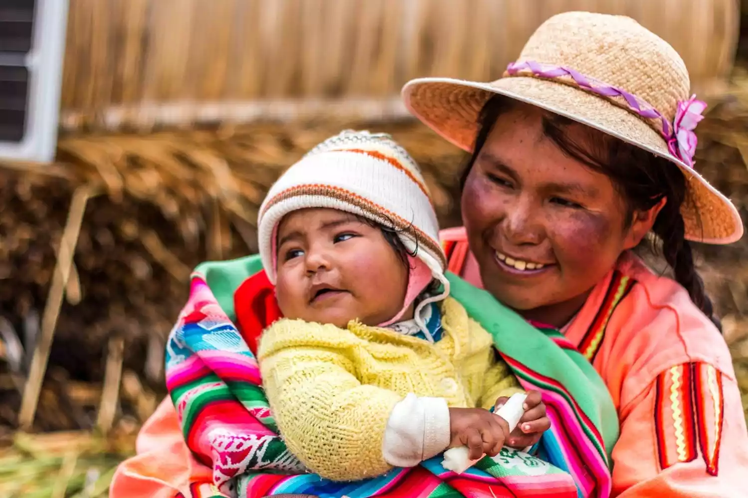
The inhabitants of these floating islands were originally the Uru, indigenous Indians who lived around Lake Titicaca. Later, to escape the Inca Empire, some fled to live on boats in the lake. They discovered that reed rhizomes could float, so they used them to build floating islands and weave reed houses, and have lived on the islands ever since. During our visit, we watched the island owner demonstrate the construction process of a floating island and also saw the islanders' daily lives, while our guide provided explanations.
Some say visiting the floating islands is rather commercialized, requiring tour groups. Once there, visitors are bound to see displays and handicrafts, much like visiting ethnic minority villages. This is also true for tourism development. It's hard to argue otherwise. The floating islands are located in a nature reserve in the northwest corner of Lake Titicaca.
According to reports, there are approximately 90 islands, and while they are all nearby, they are not completely connected. These islands are generally grouped together, with the largest islands only about 400 to 600 square meters. There are no fixed piers for tourists to reach them independently, and each island has a limited capacity. Therefore, tours can only be arranged with a tour group.
Different tour agencies likely work with different islands, so with a boatload of 20 to 30 people visiting just one or two, it wasn't overcrowded. Of course, you can't just go to every island you like, and the tour isn't long. However, there are English guides, so overall, it was quite informative, with some pros and cons.
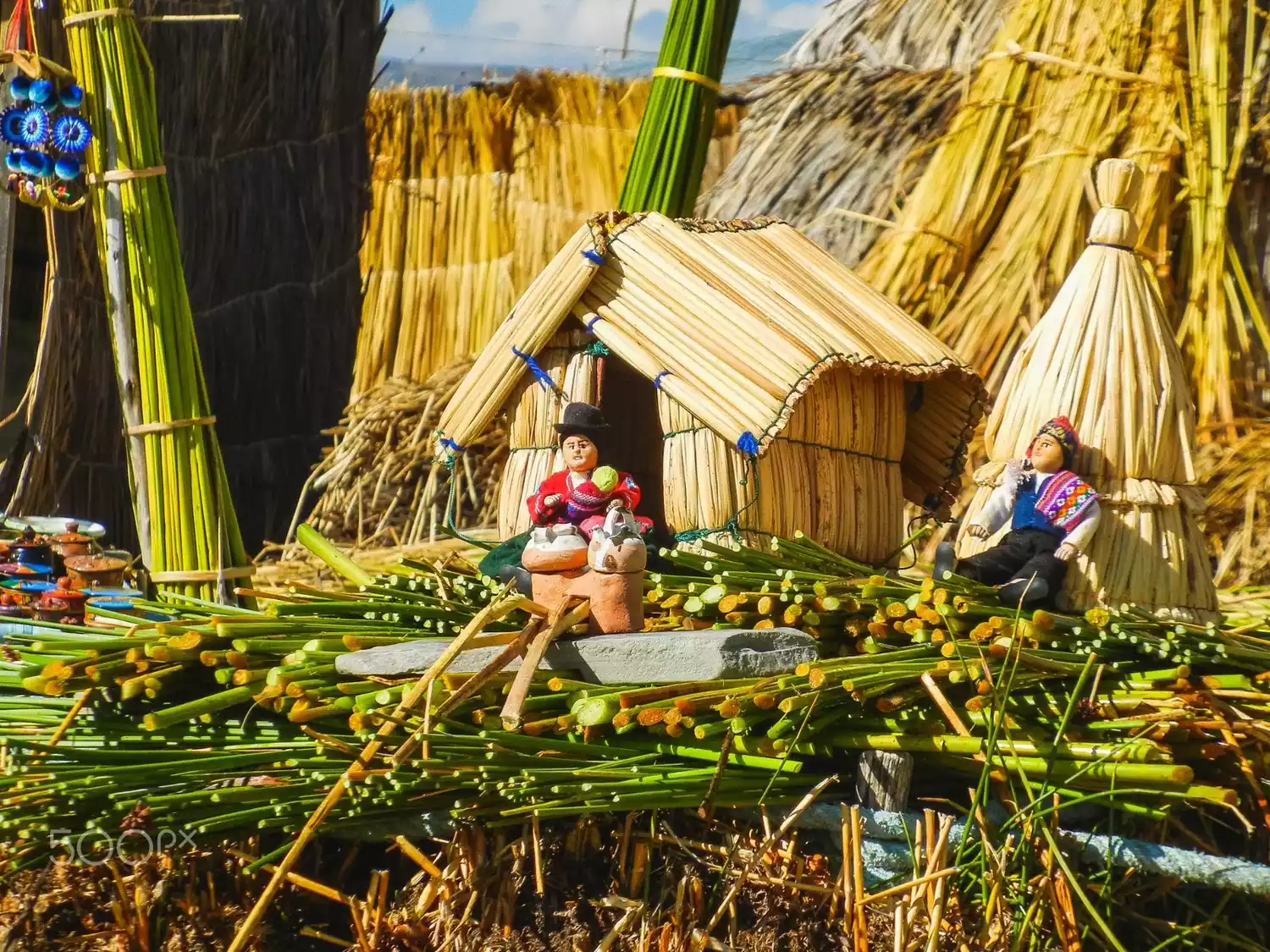
Building a floating island takes almost a year. Reed roots are dug in late summer, when the reeds are tallest and their rhizomes are densest, tangled with mud. These roots are light and float. These roots are dug in clumps and then tied together with ropes to form the "foundation" of the floating island. This process takes four to five months.
Layer upon layer of reeds is then laid on the foundation, raising the island above the water. Then, various thatched houses are woven from reeds, a process that takes several months. Because living in such a place is very humid, the houses are usually raised two steps. A new layer of reeds must be laid on the island every two weeks to prevent it from becoming soaked. The island owner demonstrated this by gently digging a small hole. The reeds underneath are wet, and a handful can be wrung out like a towel. These floating islands typically last 30-35 years, but the roots naturally decay and dissolve, eventually weakening the island and forcing a new one to be built. Thus, this craft has been passed down from generation to generation.
What's particularly interesting is that upon arriving on the island, women dressed in local costumes will sing and dance for you, while the men on the island practically do nothing. After exploring island life, the welcoming Uru people will invite you on a ride on their water sampans—small reed boats. According to local custom, if a boy wants to pursue a girl, he must craft one of these sampans himself, then pick her up and paddle into the woods to engage in some risqué activities.
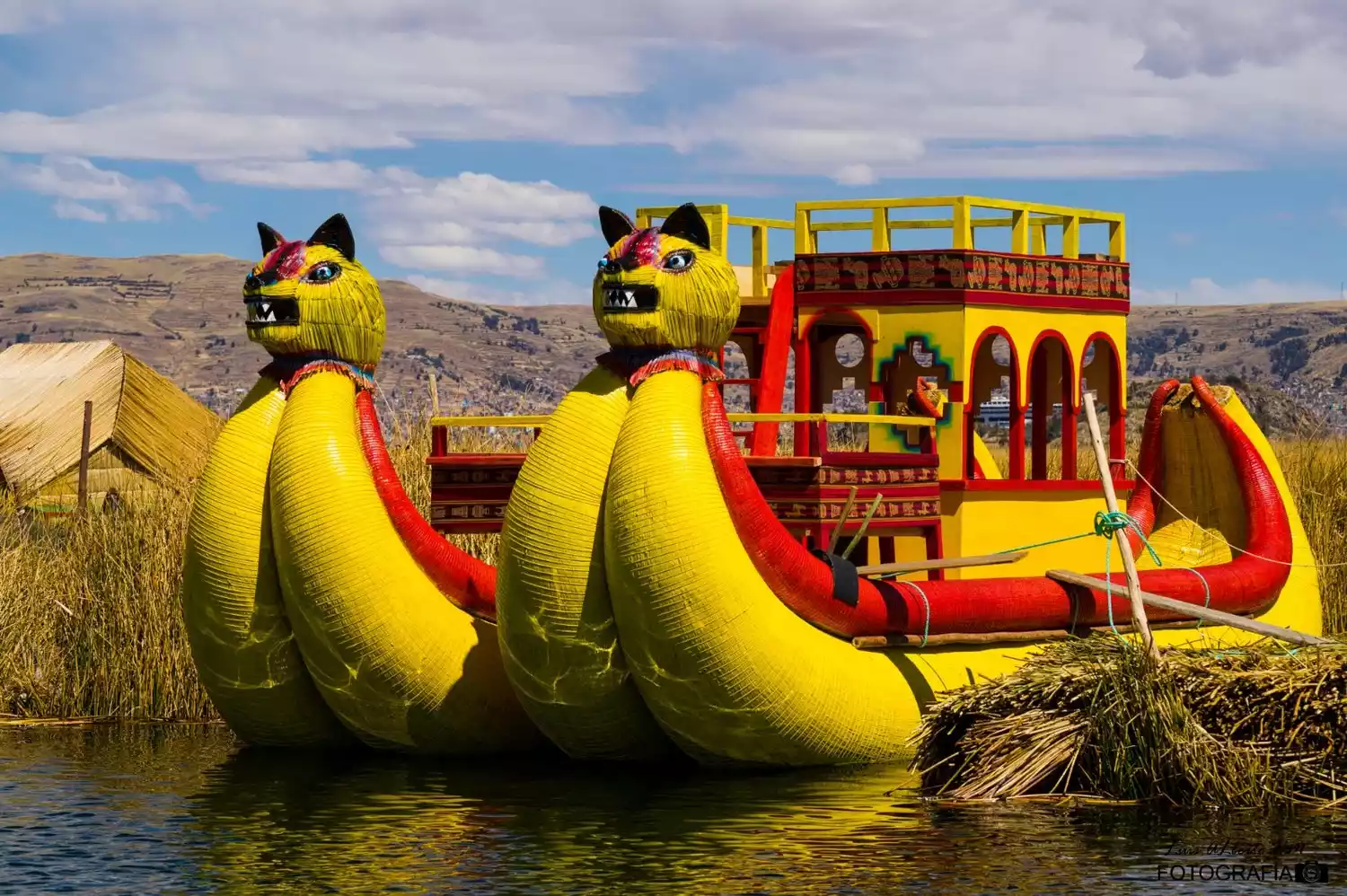

This simple boat carries a large part of the Uru people's daily lives, including transportation, fishing, and even marriages and childbirth. This option is optional (though it's quite small), but we recommend it as a way to support the locals. After the trip, a local woman, accompanied by her children, will sing a farewell song for you. The sound of the song, echoing across the vast expanse of Lake Titicaca, is truly captivating.
In retrospect, the life of the Ulu people is very similar to that of the Bajau people in Malaysia. Both are primitive, water-based tribes. The two days I spent with the Bajau a few years ago left a profound impression on me. It's a shame that the influx of tour groups has completely changed the experience. I hope the Ulu people can retain their simplicity and authenticity, and we won't disturb them too much.
Are you tempted? Then please follow our steps and take a trip to South America! ▼