Classic Silla Line Reverse - Guangdong Chuanditing Outdoor Hiking Guide
Preface
On November 10, 2009, China National Geographic published a list of "China's Top Ten Unknown Mountains." This list defines "unknown peaks" as those with elevations between 1,000 and 5,000 meters, featuring typical landform characteristics, unique biological resources, diverse ethnic customs, and a rich cultural heritage, as well as favorable ecological environments and good accessibility, thus opening up exciting outdoor routes for hikers. Guangdong's Chuandiding was shortlisted in second place, along with Jiangxi's Wugong Mountain and Hunan's Jiucailing.
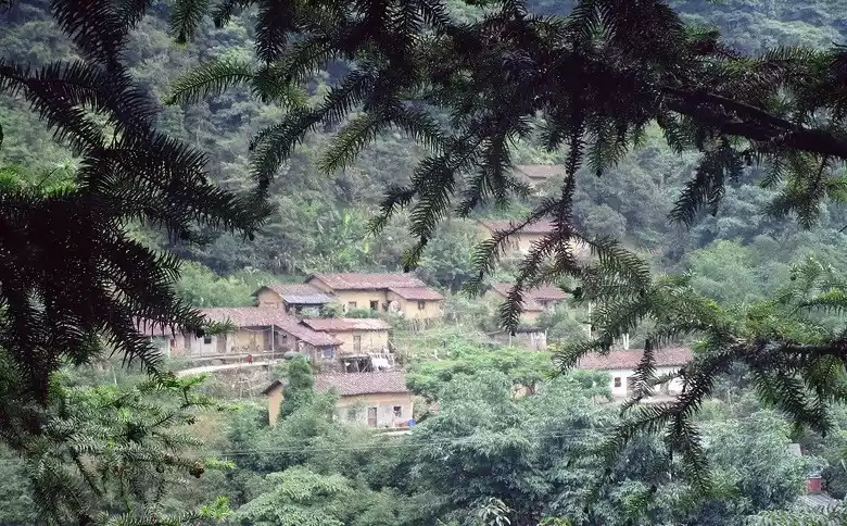
Overview of the bottom of the ship
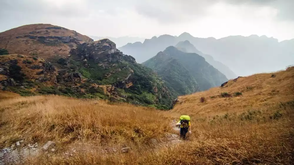
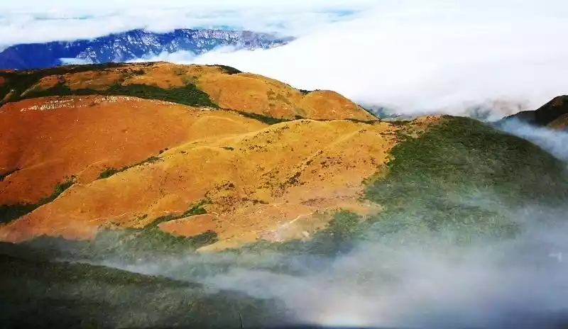
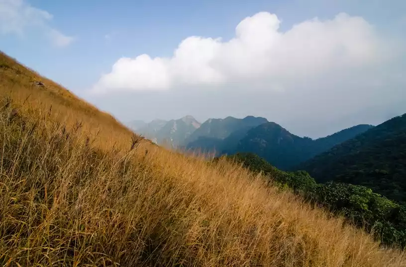
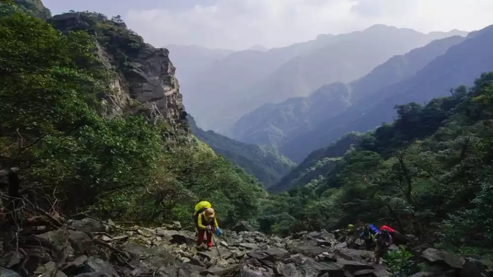
Located at the junction of Yingde and Qujiang in Guangdong Province, Chuanditing (Shengdiding) is a southern branch of the Nanling Mountains. Standing at 1,586 meters above sea level, it is the highest peak in Qujiang and the second highest peak in Guangdong. Encompassing a diverse mountain landscape, including bamboo forests, grasslands, streams, wetlands, cliffs, rocky slopes, and ridges, it's a "devilish" route known as "the pinnacle of Guangdong's self-torture." Hikers nicknamed the climb to Chuanditing "getting on the boat."
Historical legends
Legend has it that there's a massive mountain in the north, its summit resembling an upside-down ship, hence the name "Shuanditing." Chuanditing is five hundred feet high, steep and rugged, with winding paths, overgrown vegetation, and roaming snakes and beasts. To reach the summit, one must navigate deep valleys and gurgling streams, scale steep cliffs and rocky outcrops, and weave through dense grass and forests, finding the right path and winding their way up and down. Those who are not careful may lose their strength, stray, be bitten by snakes and insects, or fall on boulders. Given the numerous dangers, the mountain dwellers revere the mountain as a protective force.

Folk jokes
If you love her
Take her to the bottom of the boat
It was a beautiful and romantic place that warmed her
If you hate her
Take her to the bottom of the boat
It was a place with mountains. I got rid of her.
If you love him, take him on board
It was a beautiful and romantic place that warmed him
If you don't love him, take him on board.
It's a place where it's easy to get lost.
For hikers, the bottom of the boat is a place that makes people love and hate it, and can't stop...
Graduation trip boarding test
Nine out of ten boats are rainy
Located in Shaoguan, Guangdong, Chuanding has a subtropical monsoon climate, so rain is a common occurrence there. As the saying goes, nine out of ten boats experience rain, meaning sunny days are rare. The surrounding mountainous areas are often shrouded in rain and fog, making the weather unpredictable.
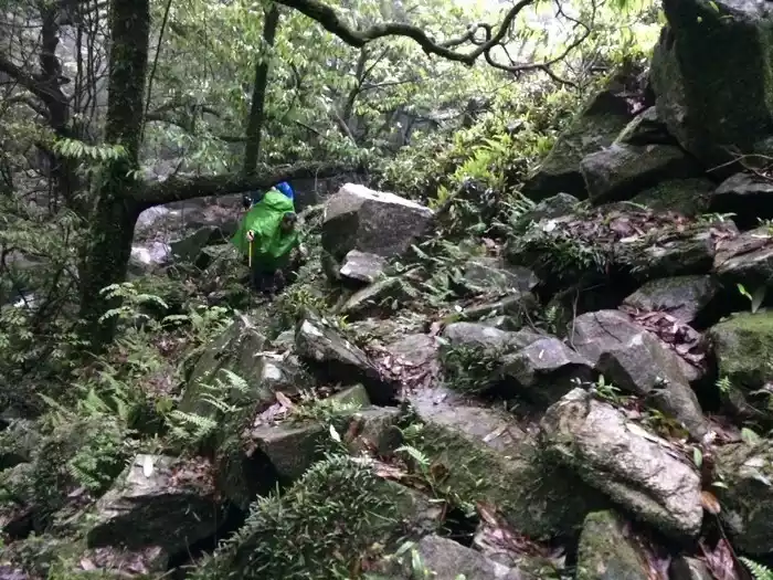
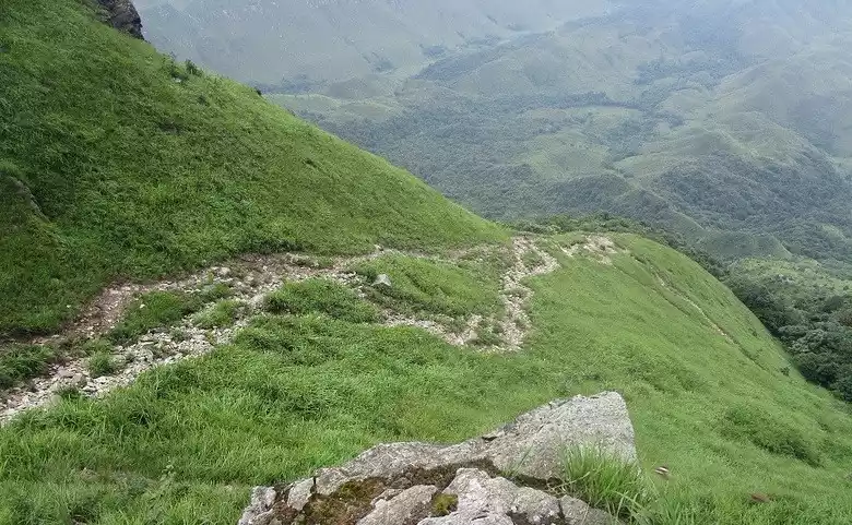
complex terrain
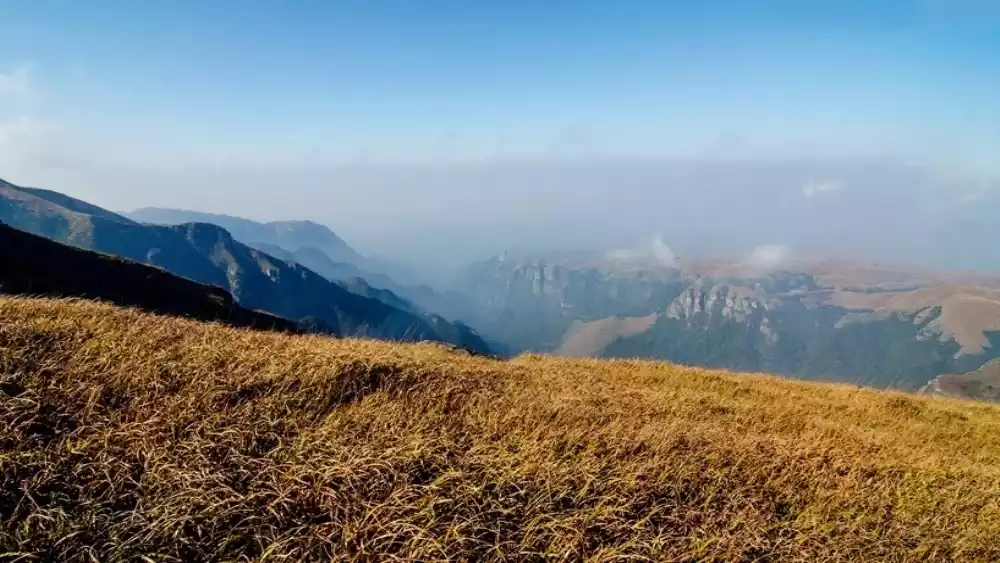
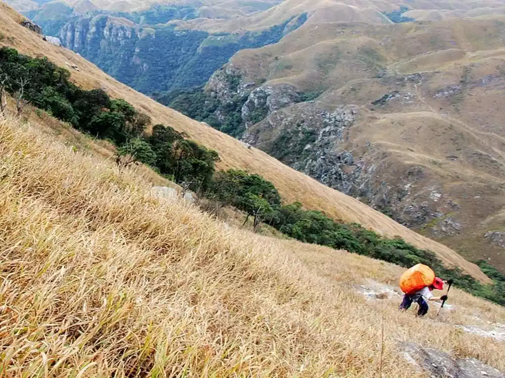
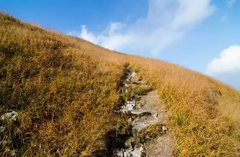
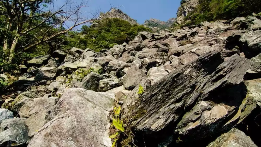
The top of the Chuandi River encompasses a variety of mountainous landforms, including bamboo forests, grasslands, streams, wetlands, cliffs, and rocky slopes. The most famous of these are the two rocky slopes, which are considered the most difficult sections of the Luoxin Line.
Many insects and snakes
The forests on the bottom of the boat are deep and the grass is dense, and the humid environment is very suitable for the survival of insects and snakes, so dealing with the harassment of insects and snakes is also a big challenge for the bottom of the boat.
Graduation Path
Climbing Chuandi Peak is fraught with challenges, and mastering them requires skill and stamina. The longer route also demands significant physical stamina. Therefore, reaching Chuandi Peak is equivalent to completing the graduation route. Here, you'll learn how to handle wet weather and master the techniques of navigating diverse mountain terrains: climbing rocky slopes, rappelling cliffs with ropes, and navigating streams. You'll also need to be prepared for dealing with venomous snakes, insects, and animals. Most importantly, you'll need sufficient physical reserves, which is the foundation for "graduating" from Chuandi Peak.
Two-day hiking tour
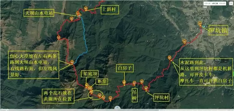
There are many routes to cross Chuanditing, including the Luo Line, Luoxin Line, and Buxin Line. The classic Luoxin Line is the most mature and the most sophisticated, but we'll reverse the route, from Xindong to Luokeng. This route is slightly less challenging, allowing you to explore a variety of terrain and take in the stunning scenery, perfect for a graduation trip for many hikers.
The Songdeok-Silla Trail covers approximately 35 kilometers, with the first day primarily consisting of a 12-kilometer hike uphill, and the second day a 23-kilometer descent. The rocky slopes along the route are the most challenging, but the reverse route solves this challenge, making the descent much easier than the ascent.
The two-day itinerary is as follows:
D1: New Cave - Upslope - Gorge Cave - Gaozhiding - Sunset Grassy Slope - Boat Bottom
D2: Chuandi top - cliff - rocky slope - canal - flat pit - Luokeng
Mountain climbing height
Sunset Peak is 1,410 meters above sea level, Gaozhangding is 1,260 meters above sea level, and the lowest altitude between it and Sunset Peak is 1,200 meters; Chuandiding is 1,586 meters above sea level, and the lowest altitude between it and Sunset Peak is 1,350 meters.
On the first day, we ascended about 1,450 meters and descended 250 meters. On the second day, we ascended about 100 meters and descended 1,300 meters.
Detailed itinerary
D1: Xindong Primary School - Shangxie Village (about 1 hour) - Xiadong, about 1.5 hours
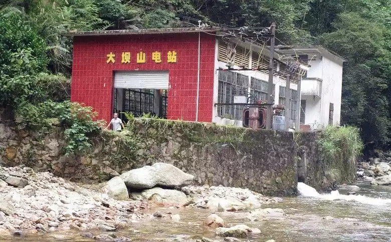
Walk 20 meters along the cement road from the primary school, turn left at a small house, and continue along the cement road for about 80 meters toward the mountainside. Pass the Shaguping area of Shangxie Village, reach the Damshan Power Station, cross the riverbed, and reach the trailhead of the gorge cave.
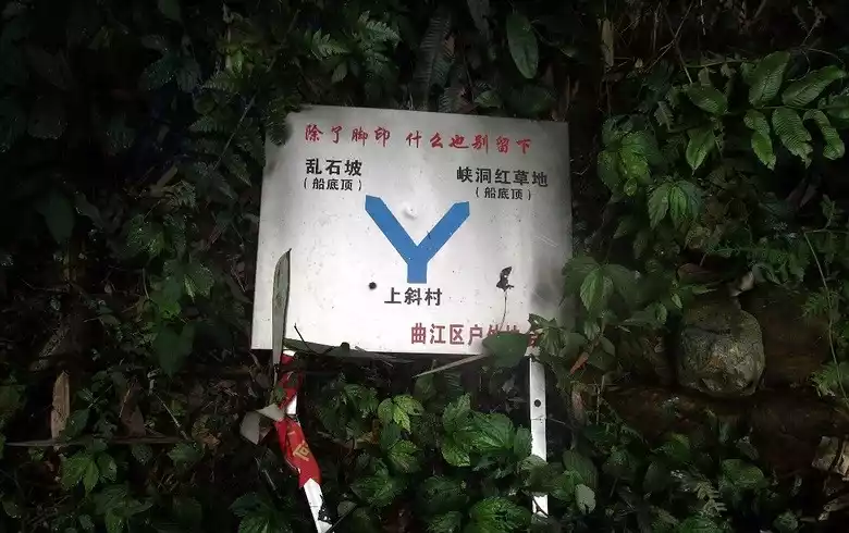
D1: Gorge Cave - Gaozhang Peak takes 2.5 hours
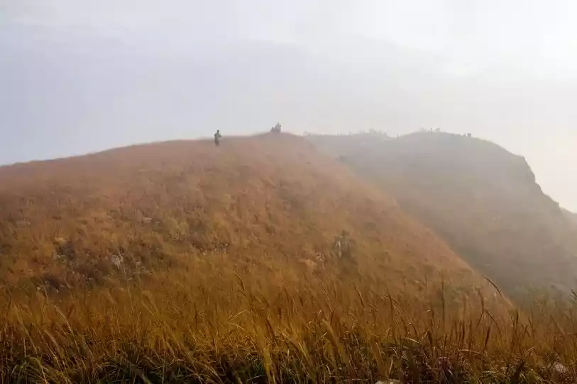
To the left of the thatched hut, ascend a small hill and pass through a forest. A 90-degree path on the left leads you to the correct route, heading down to Gaozhangding for water. We refilled our water at the river, a crucial refilling point. After this, we headed straight for Gaozhangding. The ascent to Gaozhangding passes through two jungles. This is the most tiring part of the boat trip, as it's quite high and the slopes are quite steep.
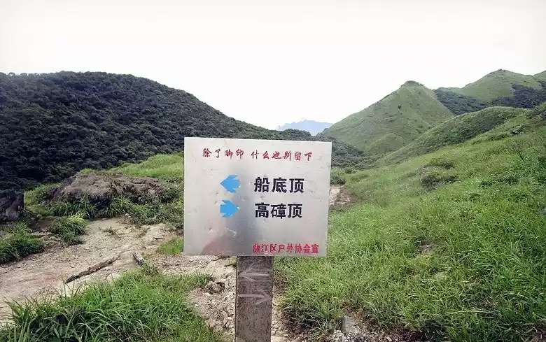
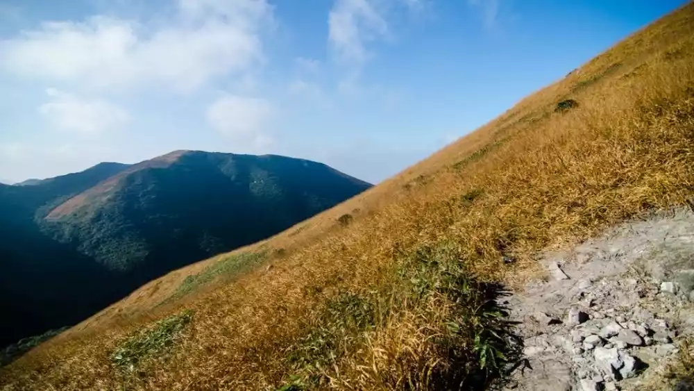
D1: Gaozhangding---Luorifeng Grassy Slope takes 1 hour
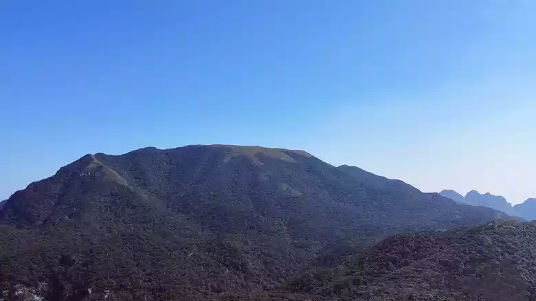
The farthest mountain is Chuandiding, the middle mountain with a grassy slope is Sunset Peak, and the place where we stood to take photos is Gaozhangding.
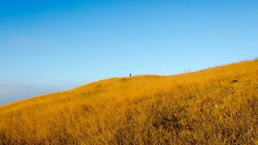
D1: Sunset Peak Grassy Slope - Crossing the Jungle - Boat Bottom Top - 2 hours
I didn't feel too tired when climbing this mountain, because the scenery of the big grass slope is so beautiful. I walked and stopped, and when I reached the top of the big grass slope of Sunset Peak, the grass slope moved with the wind, and the visual impact it brought was indescribable. After climbing Sunset Peak, you will encounter a small jungle when going downhill, and then go up a small slope, and then there are several dark jungles. The highest point is the top of the boat bottom.
Tips:
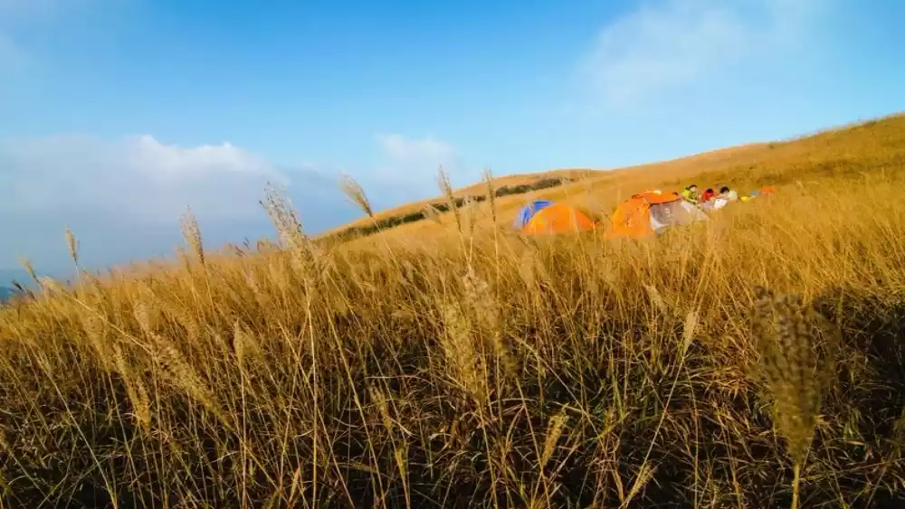
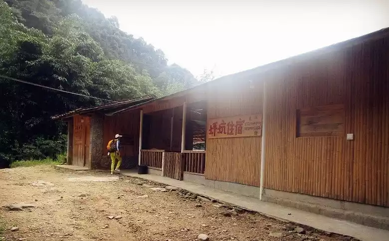
Accommodation
A: You can stay in a hotel in the woods under the boat. There are beds provided. This is for traveling light.
B: You can also camp at the small dense forest campground under the boat bottom, which has water in spring and summer but no water in autumn and winter. Or you can camp at the summit, which has no water.
D2: Ship bottom top --- cliff --- gravel slope --- water diversion channel takes 4.5 hours
The right side of the boat roof cuts down obliquely to the highest point of a hillside, about 50m away, with a cliff opposite.
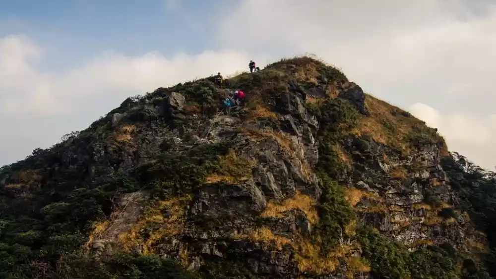
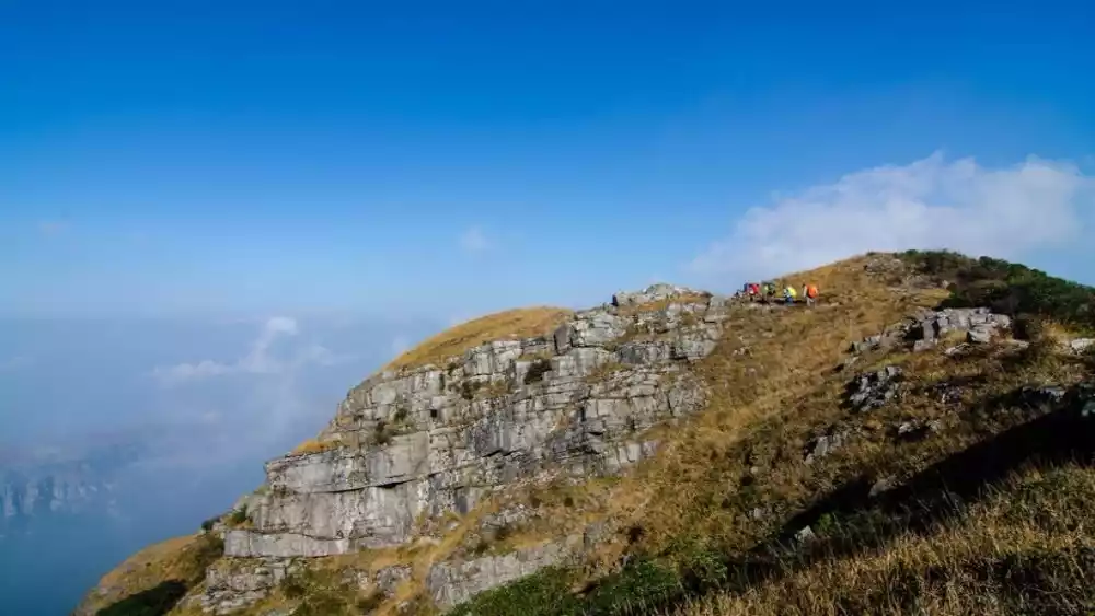
After climbing the cliff, continue straight for about 100 meters until you reach the edge of the valley, where you'll see a rocky slope. Hiking poles and knee pads are essential for descending the slope. After 20 minutes of descending the first rocky slope, you'll find a tree less than 3 meters tall on the left side. This is the dividing line between Pingkeng and Lianshan. Turn left to reach Pingkeng Village. Turn left to a ditch, and you'll see the second rocky slope. This slope is densely populated with trees, so it's safer to walk along the edge.
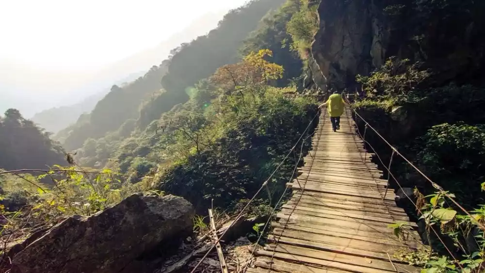
D2: Aqueduct---White House---Adjustment takes 1 hour
From the canal's starting point to the White House, there's a suspension bridge in between. After reaching the White House, leave the canal and head right down the mountain. After a few kilometers of winding mountain roads, descend to another suspension bridge. Cross it and continue uphill until you reach a large water pipe overhead. Go down the pipe, turn right, and ascend the mountain to a small canal, where you'll see the houses of Pingkeng Village.
When you get to Pingkeng, take a pickup truck to Luokeng Town, where you can split the bill.
Useful information
Related transportation
It is recommended to charter a car. Shaoguan East Station/Shaoguan Station is about a 1.5-hour drive from the starting point of the hike. The mountain road is narrow and winding.
Driving route: Beijing-Zhuhai Expressway - Qujiang - Shaoguan Southbound Expressway - Luokeng Town - Xindong Primary School
Outdoor equipment
Sleeping bag (approximately 10 degrees Celsius), hiking boots/trekking shoes, trekking poles, headlamp, raincoat, sun hat, skin coat/sleeves, 2L of water, two road meals (noodles, meat, pickled mustard greens, mountain kitchen), personal snacks (beef jerky, raisins, chocolate, fruit as needed), outdoor quick-drying clothes/loose sportswear, knee pads, gloves, assault/quick-drying clothes/socks, magic bandana, socks (backup), walkie-talkie (if you have one)
Supply points: Water can be replenished during the two days (rocky slope on the first day, and in the bamboo forest in the gorge on the second day)
Mobile phone signal: There are mobile phone network signals at the top of the boat bottom, the top of the sad slope, and the top of the high ridge.
Others: a small amount of cash, personal items, etc.
Recommended drugs
Ten Drops of Water, Fengyoujing, cold medicine, antidiarrheal medicine, and personal special medicines.
Best season
Be careful when visiting Chuanditing in the summer, as heavy rainfall can cause flash floods. Summer is also the time of year when the climate changes the most. Generally speaking, the climate is more stable in winter.
Conclusion
If you talk to hikers who've been on the boat, you'll find they don't just do it once. Most hikers go two or three times, and four or five times is common. You might wonder why, but it's the unique charm of Chuanditing that draws hikers back time and time again, challenging themselves again and again. It's well-deserved to be called Guangdong's most challenging mountain. Beginners yearn for it, and experienced hikers become addicted. If you don't believe me, why not give it a try?
Some pictures are from the Internet, please contact us to delete if there is any infringement