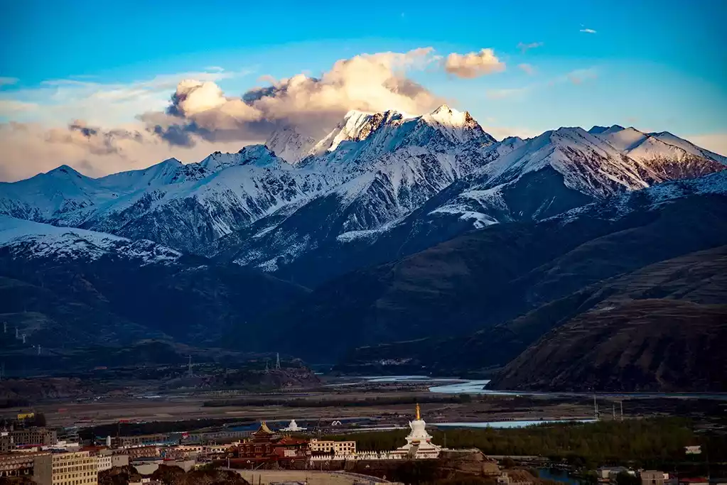
川西龙脉沙鲁里山旅游攻略,你知道的川西美景都在沙鲁里山
Preface
Those beautiful views that once swept the circle of friends
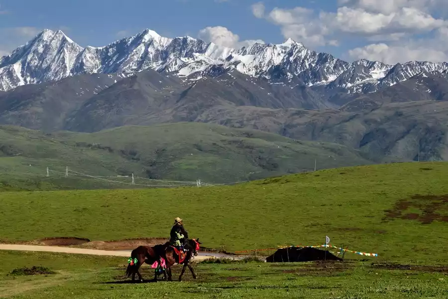
Every time during the holidays, my circle of friends is always flooded with all kinds of beautiful scenery. I wonder if the following photos have "ravaged" your circle of friends, made you like them crazily, or attracted you to walk out of the house and embark on the "road of no return" of constantly pursuing beautiful scenery.
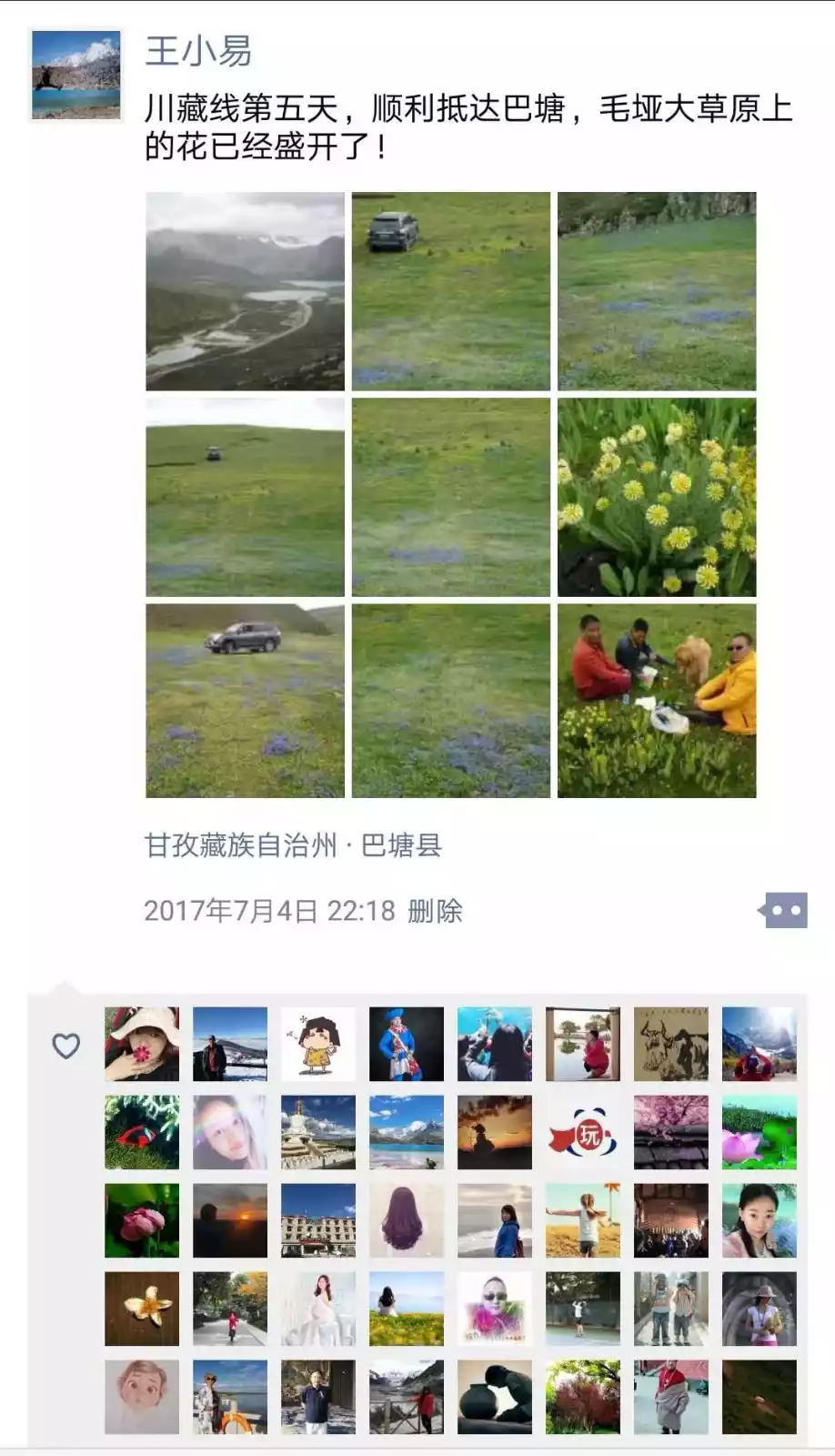
However, have you ever imagined that these beautiful views come from the same place, or the same mountain range: the Shaluli Mountains, known as the "Dragon Vein of Western Sichuan."
Where is Mount Saruri?
Transect the seven meridians
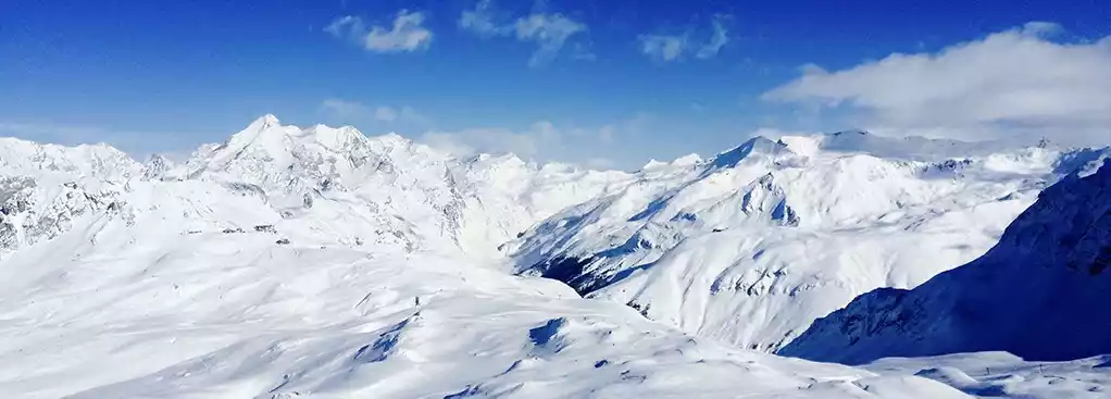
The Hengduan Mountains are located in the transition zone from the Qinghai-Tibet Plateau, the western Sichuan Plateau, and the Yunnan-Guizhou Plateau to the Sichuan Basin in western China.
This is the area with the most undulating terrain in China; this is the area with the most concentrated beautiful scenery in China; this is the area with the richest animal and plant resources and natural resources in China; and this is also the area with the highest concentration of ethnic minorities in China.
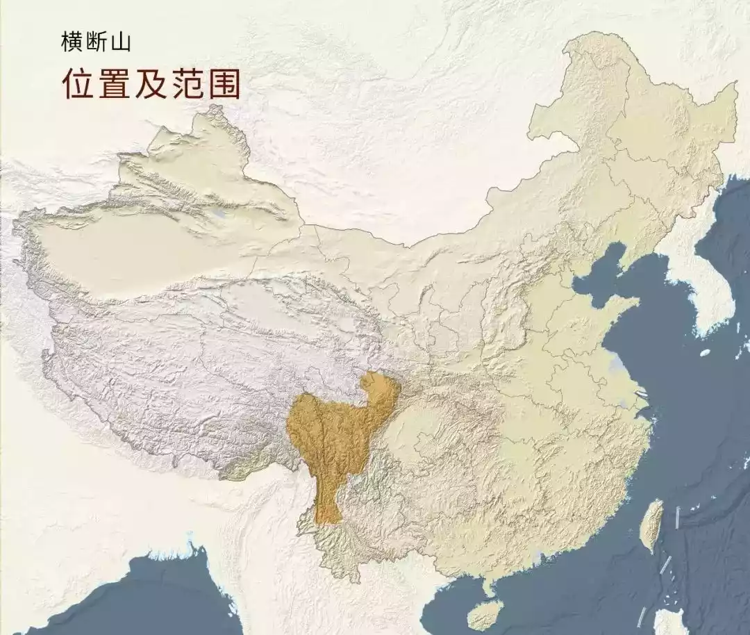
Location map of the Hengduan Mountains, image from the Planetary Research Institute
Starting from the western part of the Sichuan Basin, there are seven huge mountain ranges arranged parallel to each other from east to west. They are:
Minshan Mountain Range (main peak: Xuebaoding)
Qionglai Mountains (main peak: Mount Siguniang)
Great Snow Mountain Range (main peak Gongga Snow Mountain)
Sarulli Mountains (main peak: Mount Genyen)
Mangkang-Yunling Mountains (main peak: Kawagebo Peak)
Tanian Thaweng-Nushan Mountain Range (main peak Buga Snow Mountain)
Boshula Ridge-Gaoligong Mountains (main peak: Gaagapu Peak)
These seven north-south mountain ranges are collectively called the Seven Hengduan Mountains.
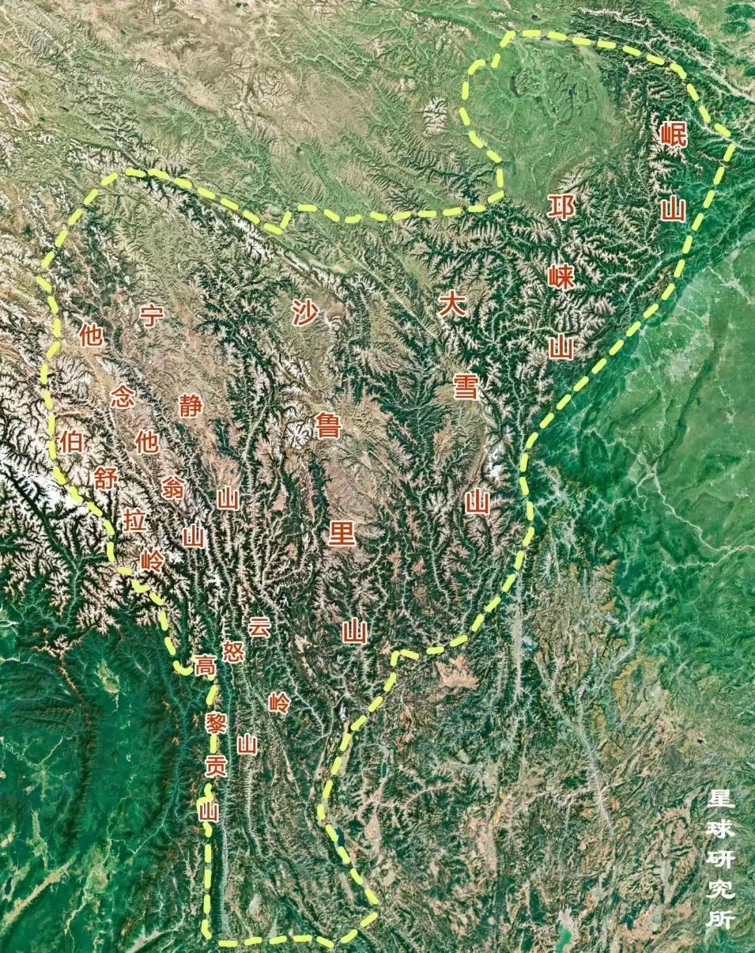
Cross-section of the seven meridians, image from the Planetary Research Institute
Six rivers with abundant water flow through the seven transverse veins. Each of these major rivers is renowned in history, culture, and geology. From east to west, they are: the Min River, Dadu River, Yalong River, Jinsha River, Lancang River, and Nu River.
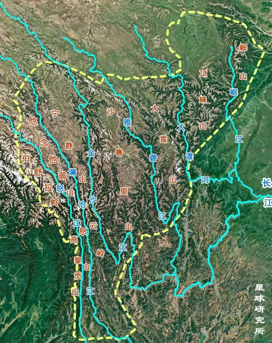
Map of the Hengduan Mountains' water system, image from the Planetary Research Institute
Where is Mount Saruri?
The Shaluli Mountains run from north to south and are located in the central part of the Hengduan Mountains. They start from the Shiqu Grassland in Sichuan in the north and reach the Yulong Snow Mountain in Yunnan in the south. They stretch for more than 600 kilometers from north to south and are 200 kilometers wide from east to west.
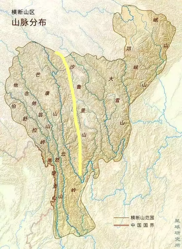
Schematic diagram of the location of Mount Shaluli. The yellow line on the way is the Shaluli Mountains. Image from the Institute of Planetary Research
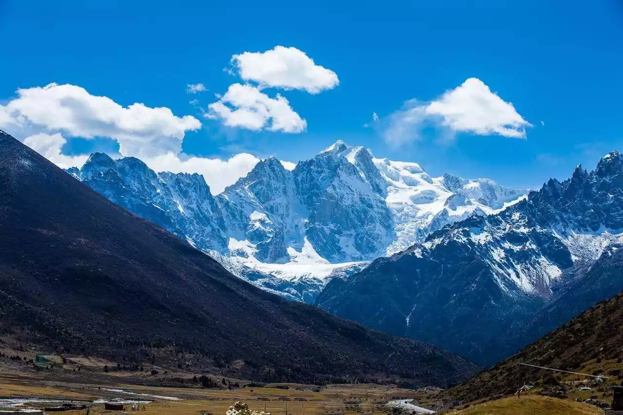
The Shaluli Mountains are the widest range in the Hengduan Mountains and the longest and widest mountain range in Sichuan. With an average elevation of over 4,500 meters, they are home to a series of snow-capped peaks. Peaks that have been trending on social media, such as Que'er Mountain, Kavaluozhi Mountain, Genyen Mountain, Haizi Mountain, the Three Sacred Mountains of Yading, Haba Snow Mountain, and Yulong Snow Mountain, all belong to the Shaluli Mountains.
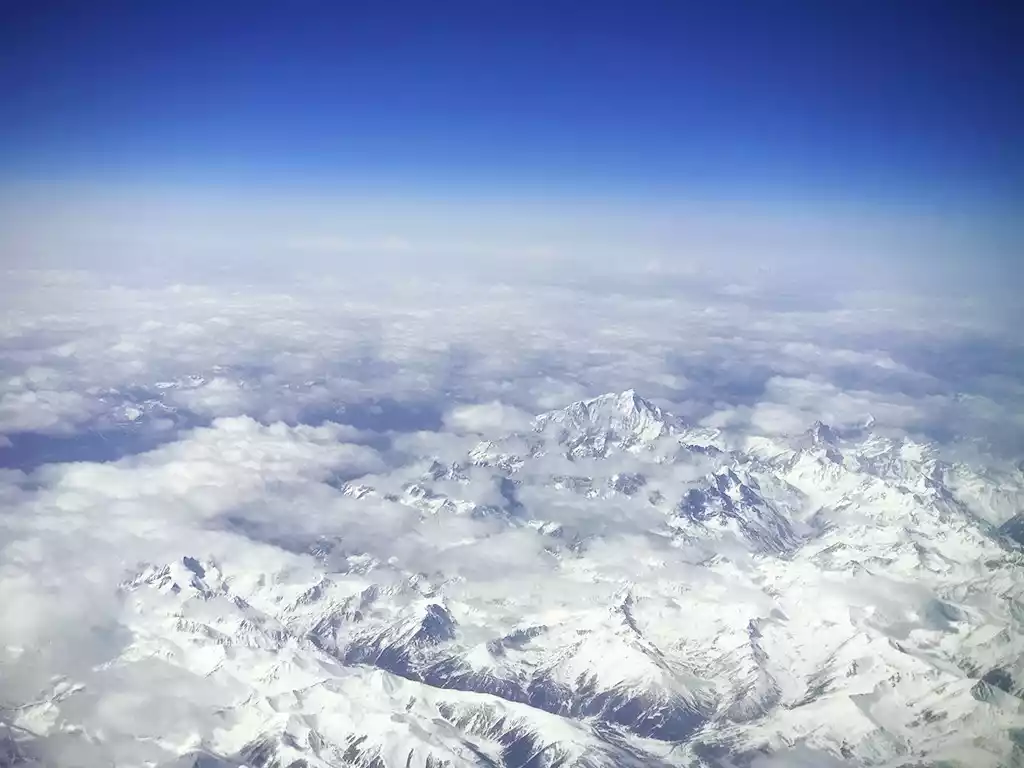
Looking at the Shaluli Mountains from the plane, the peak in the middle is the sacred mountain Genyen, and the three sacred mountains of Aden are faintly visible in the distance.
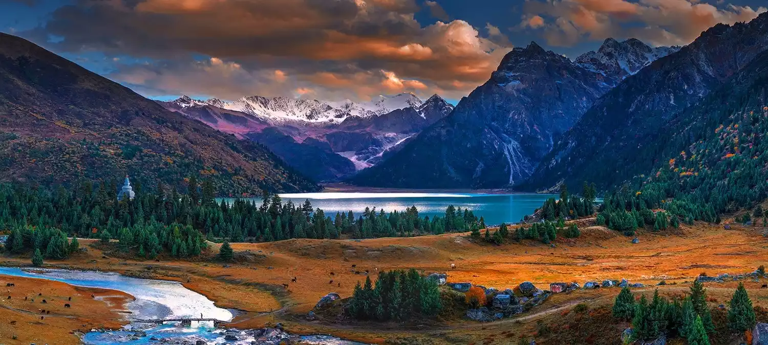
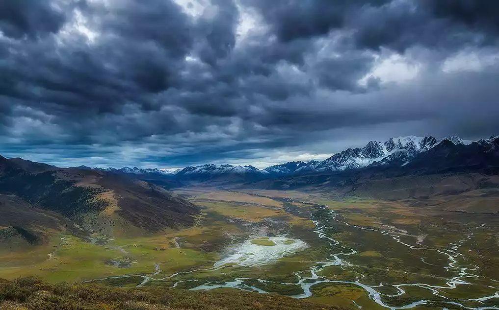
The Shaluli Mountains' vast north-south span and dramatic elevation differences create a rich tapestry of topography and landscapes. For example, Shiqu County in the north boasts alpine grasslands, while Xiangcheng County in the center enjoys a dry, hot valley climate. The region is also home to countless snow-capped mountains. The Yalong River and the Jinsha River flow east and west through the Shaluli Mountains, respectively, forming their natural watershed.
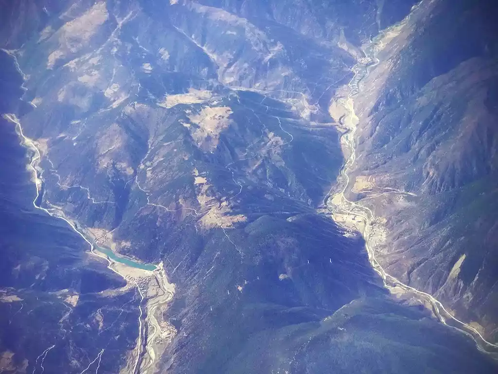
Canyon of the upper tributary of the Jinsha River near Cuopugou
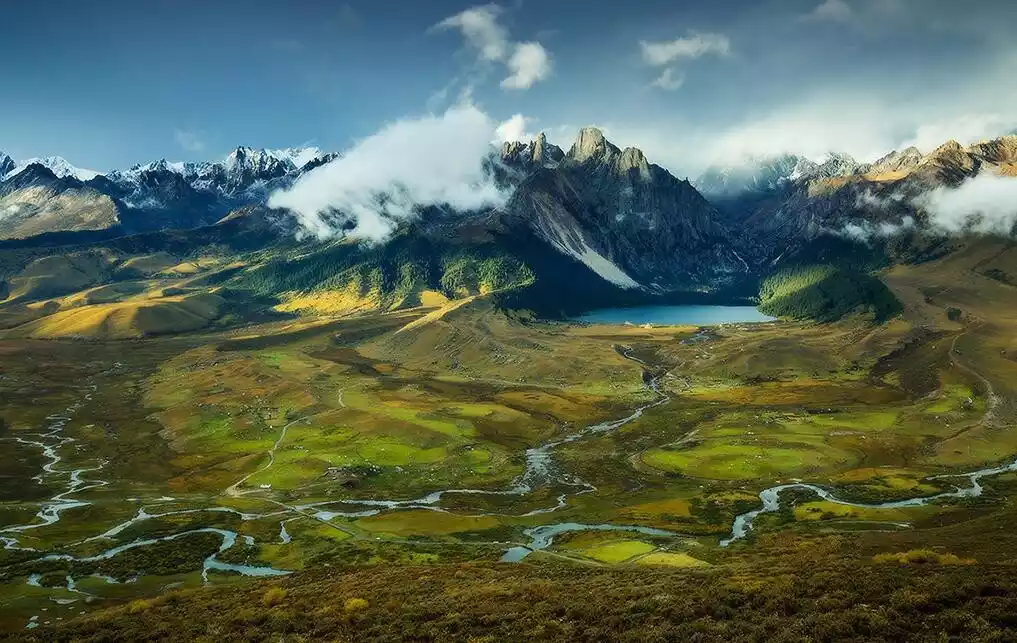
The crisscrossing valleys of the Shaluli Mountains have also developed numerous grasslands; preserved China's most densely populated group of lakes; left behind China's largest ancient glacial relics; and flowed out countless hot springs and canyon groups.
In summary, the Shaluli Mountains are the region with the most diverse topography and the densest distribution of natural scenery in the Hengduan Mountains, making it a well-deserved "Dragon Vein of Western Sichuan."
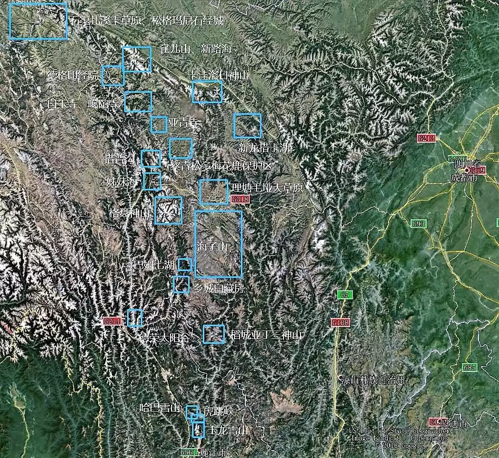
Landscape distribution map of Shaluli Mountains
The stunning scenery hidden deep in the Saruri Mountains
Ganzi Tibetan Autonomous Prefecture in Sichuan Province has a total area of 153,000 square kilometers and consists of 18 counties and cities.
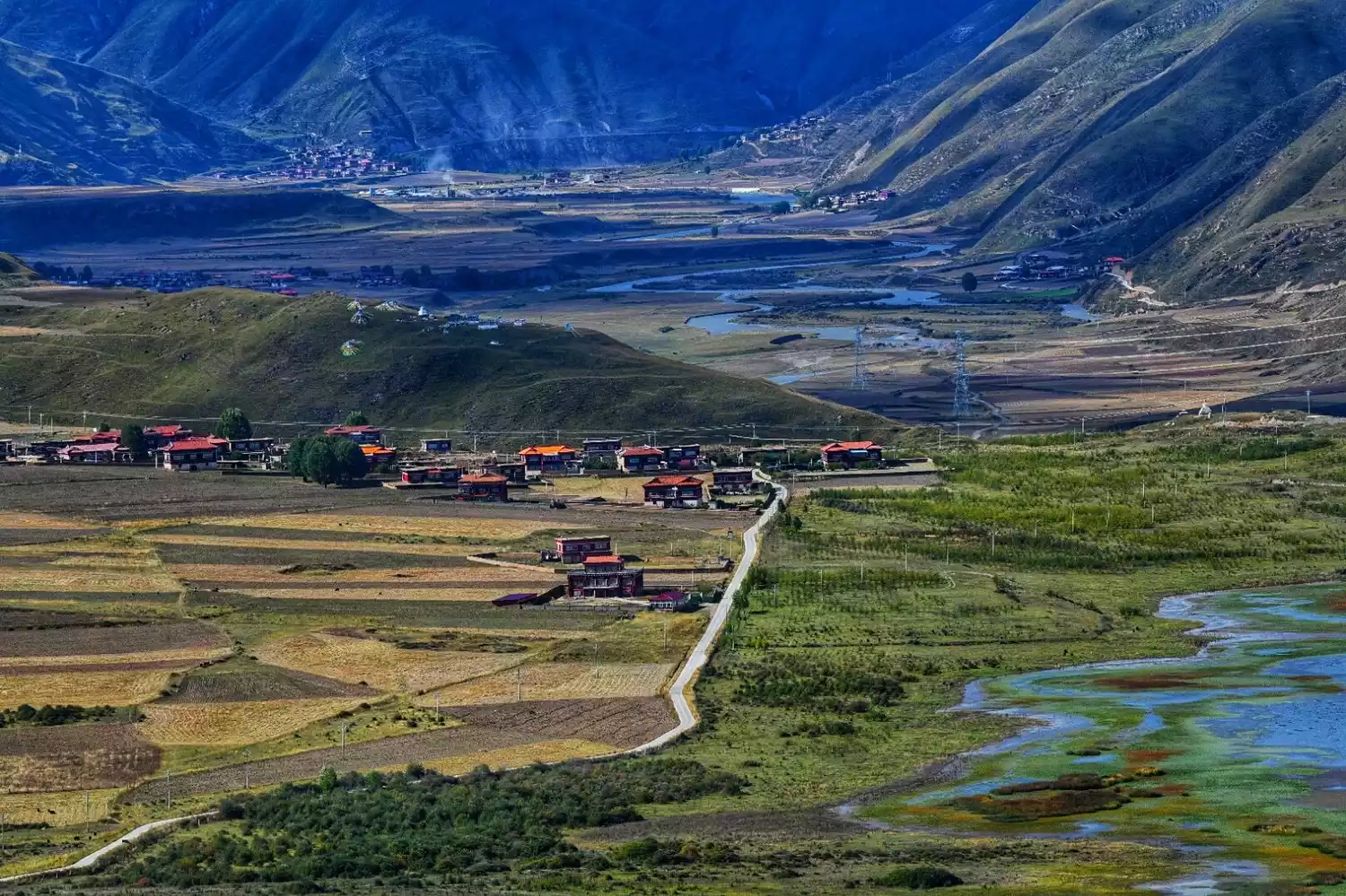
The Shaluli Mountains stretch from north to south across Garze Prefecture, encompassing eleven counties: Shiqu, Derge, Baiyu, Garze, Xinlong, Yajiang, Litang, Batang, Daocheng, Xiangcheng, and Derong. Together, they cover over 60% of Garze Prefecture. Follow our guide as we journey from north to south to admire the breathtaking scenery of the Shaluli Mountains.

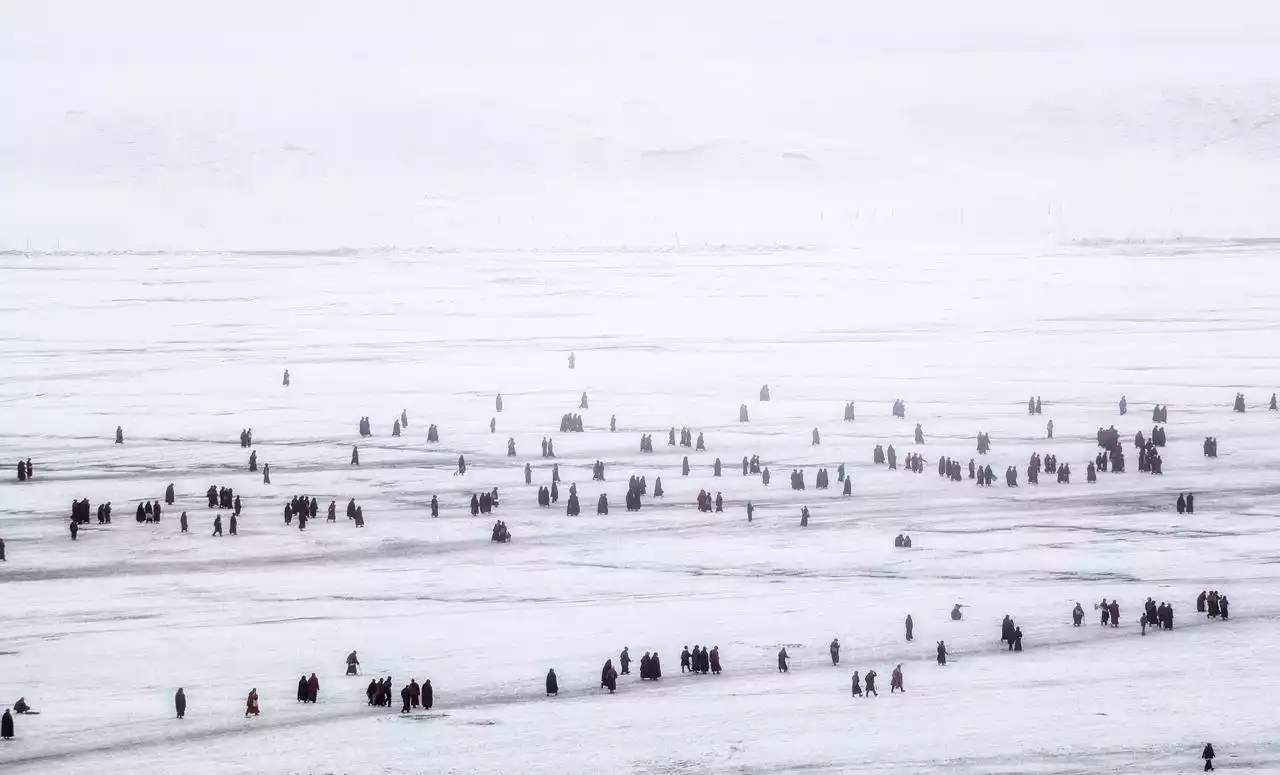
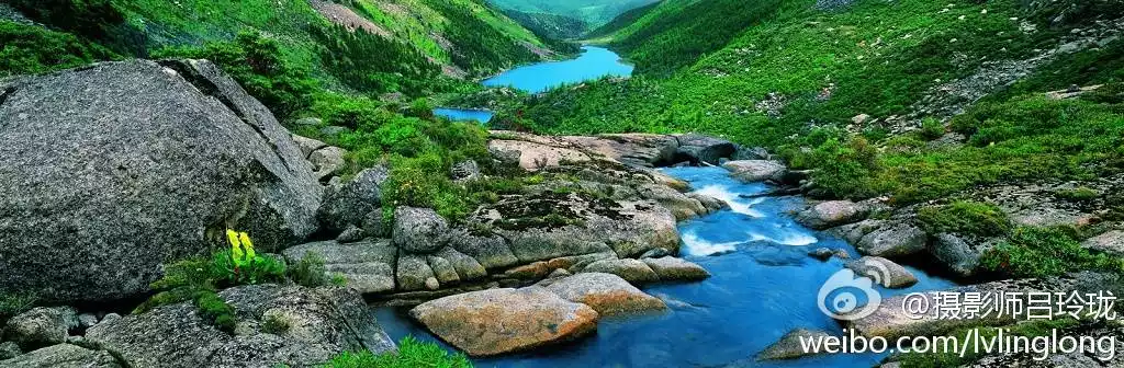
Shiqu - Zhaxika Grassland, Songgemani Stone Scripture City
"Zhaxi Ka," the Tibetan nickname for Shiqu, means "along the Yalong River." It is the largest grassland in Sichuan. Located at the northwestern tip of Sichuan Province, at the junction of Sichuan, Qinghai, and Tibet, it is the northernmost tip of the Shaluli Mountains. With an average altitude of over 4,000 meters, it enjoys an alpine grassland climate.
Zhaxika Grassland, picture from tourists@Highland Snowland
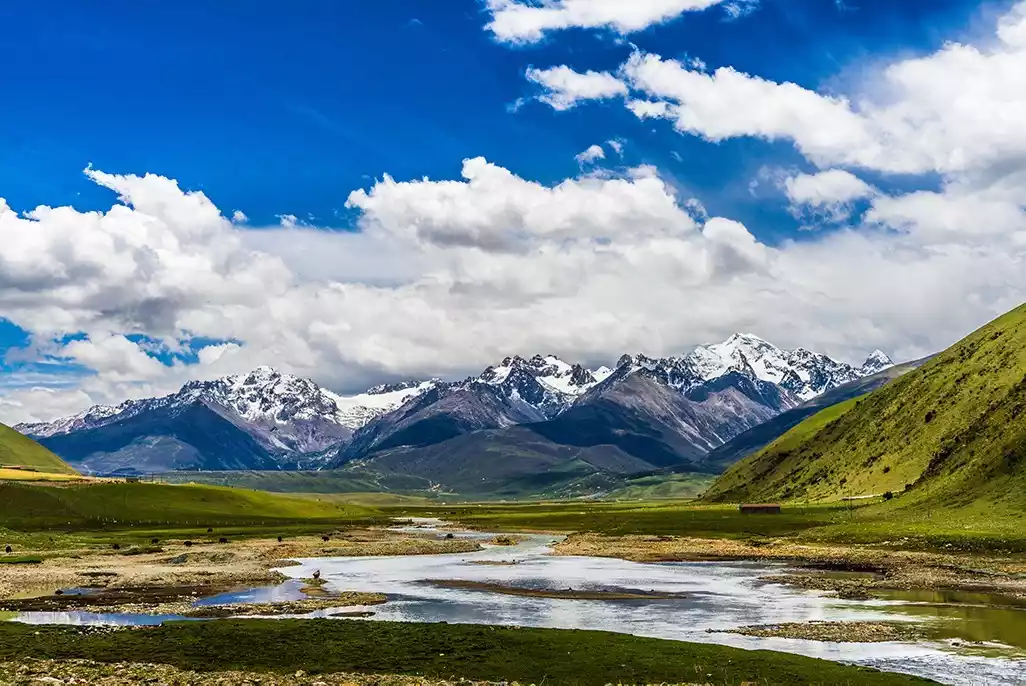
Image from Photo Network
Along with the Derge Grassland, the Zhaxika Grassland served as a year-round nomadic habitat for King Gesar's tribe. It's the setting for famous stories from the epic "King Gesar," such as "The Birth of a Hero" and "The Horse Race to Kingship." Renowned photographer Lü Linglong has photographed the area year-round, publishing her collection, "Shiqu: The Sun Tribe of Western China," showcasing Shiqu for the first time. In recent years, Lü Linglong has revisited Shiqu to photograph the plateau's most precious animal: the snow leopard.
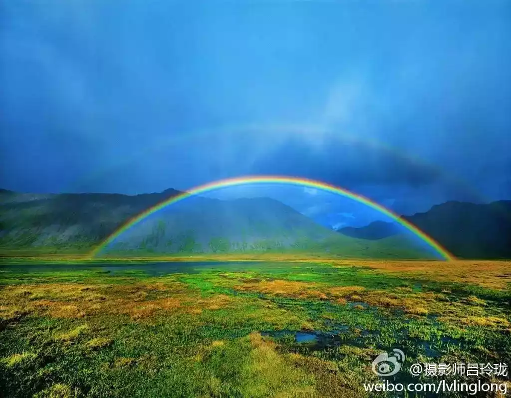
Lü Linglong's work, Zhaxi Ka Grassland, picture from Lü Linglong's Weibo
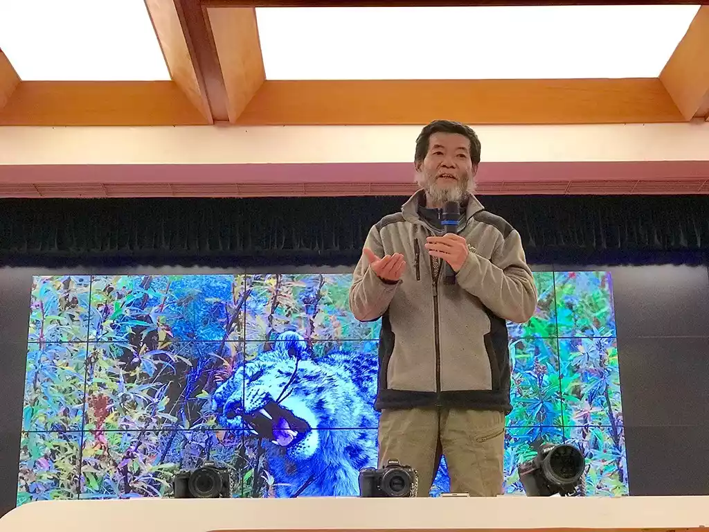
Teacher Lv Linglong shares her experience photographing snow leopards with photography enthusiasts
The Songge Mani Stone Scripture City, nestled deep within the Zhaxi Ka Grassland, is the world's largest Mani stone carving complex. It's said to have been built during the reign of King Gesar (roughly corresponding to the mid-to-late Northern Song Dynasty), and boasts a history spanning over a thousand years. To pray for the souls of those who died on the battlefield, the soldiers who followed King Gesar built a Mani pile here. Later, local residents flocked to the site to pay homage to King Gesar, continually adding stones to the original Mani pile, eventually forming the vast Mani City we see today.
Modern archaeological excavations reveal that the Stone Scripture City is only one-third of its actual size. Due to the soft grass, gravity has sunk two-thirds of the Stone Scripture City into the ground. The stone slabs used to construct the Stone Scripture City are not ordinary stones, but Mani stones engraved with scriptures, Buddha images, and auspicious patterns. The Stone Scripture City has entrances leading deeper into the interior, and the stone piles within are separated by prayer paths. In other words, it is a Mani pile resembling a "castle," and due to its enormous size, it is called a "city."
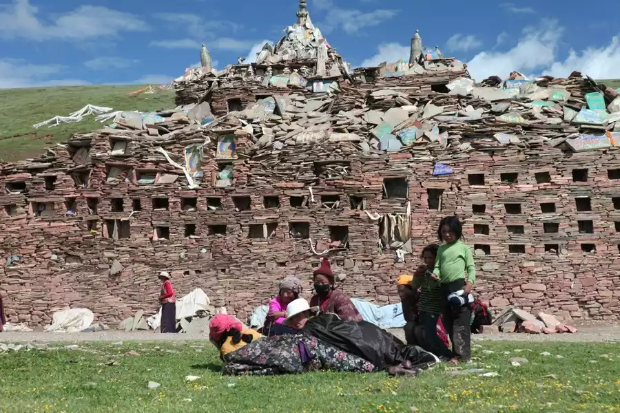
Songge Mani Stone Sutra City, picture from tourists@走走中人
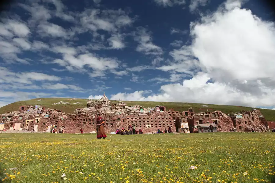
Songge Mani Stone Sutra City, picture from tourists@走走中人
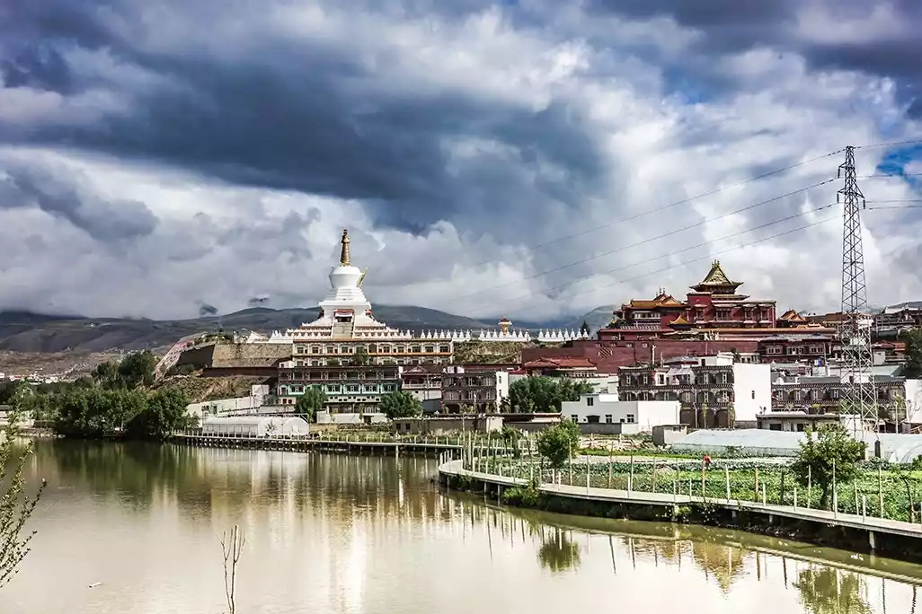
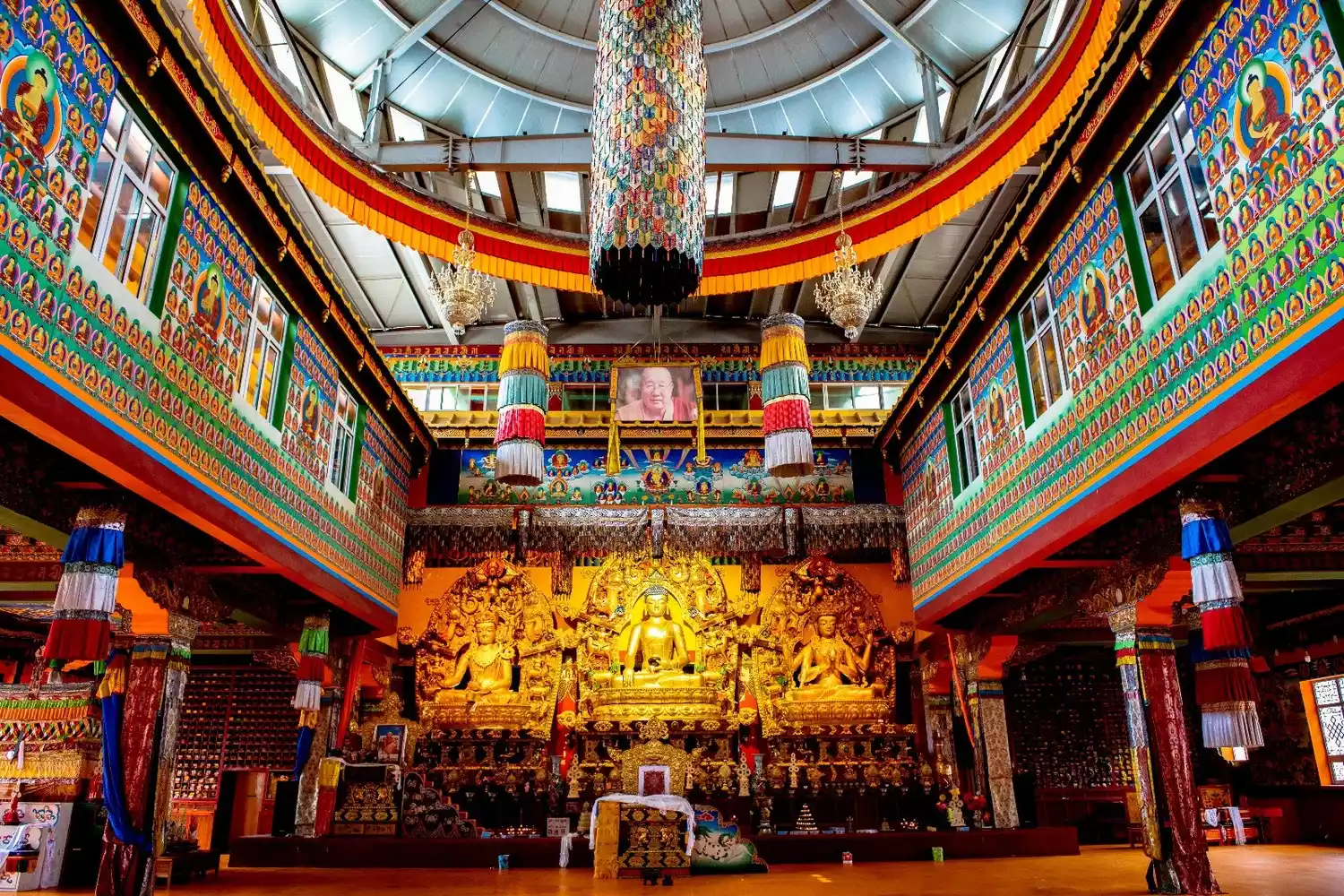
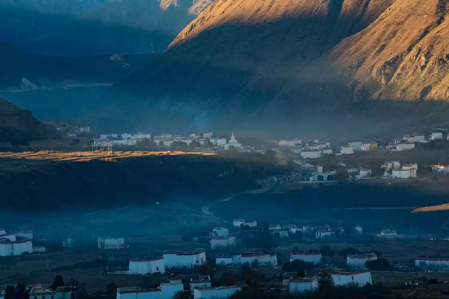
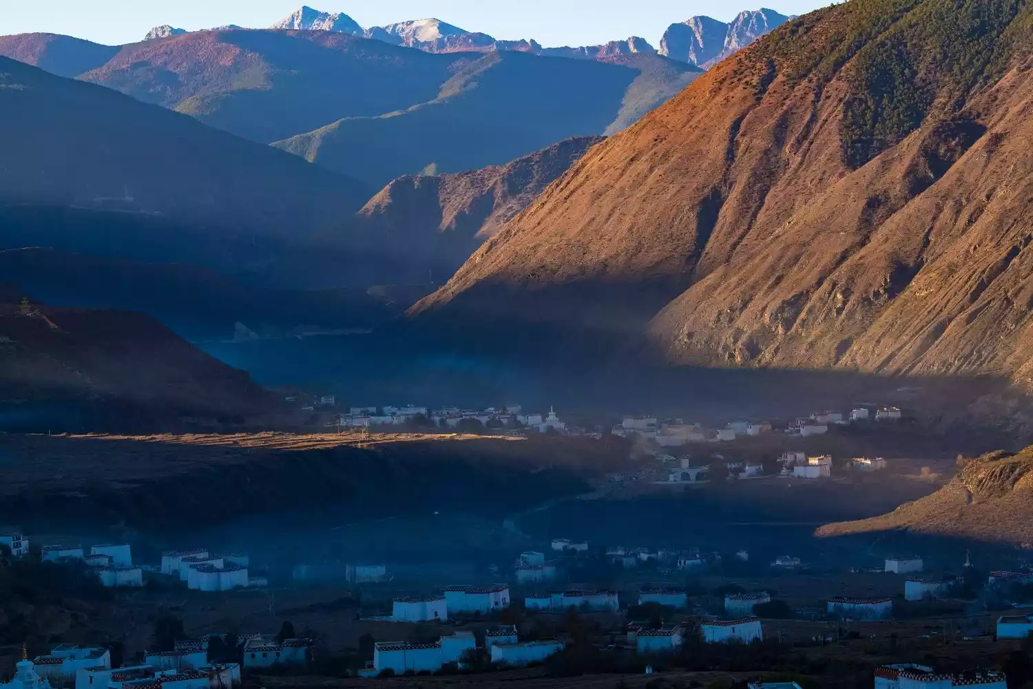
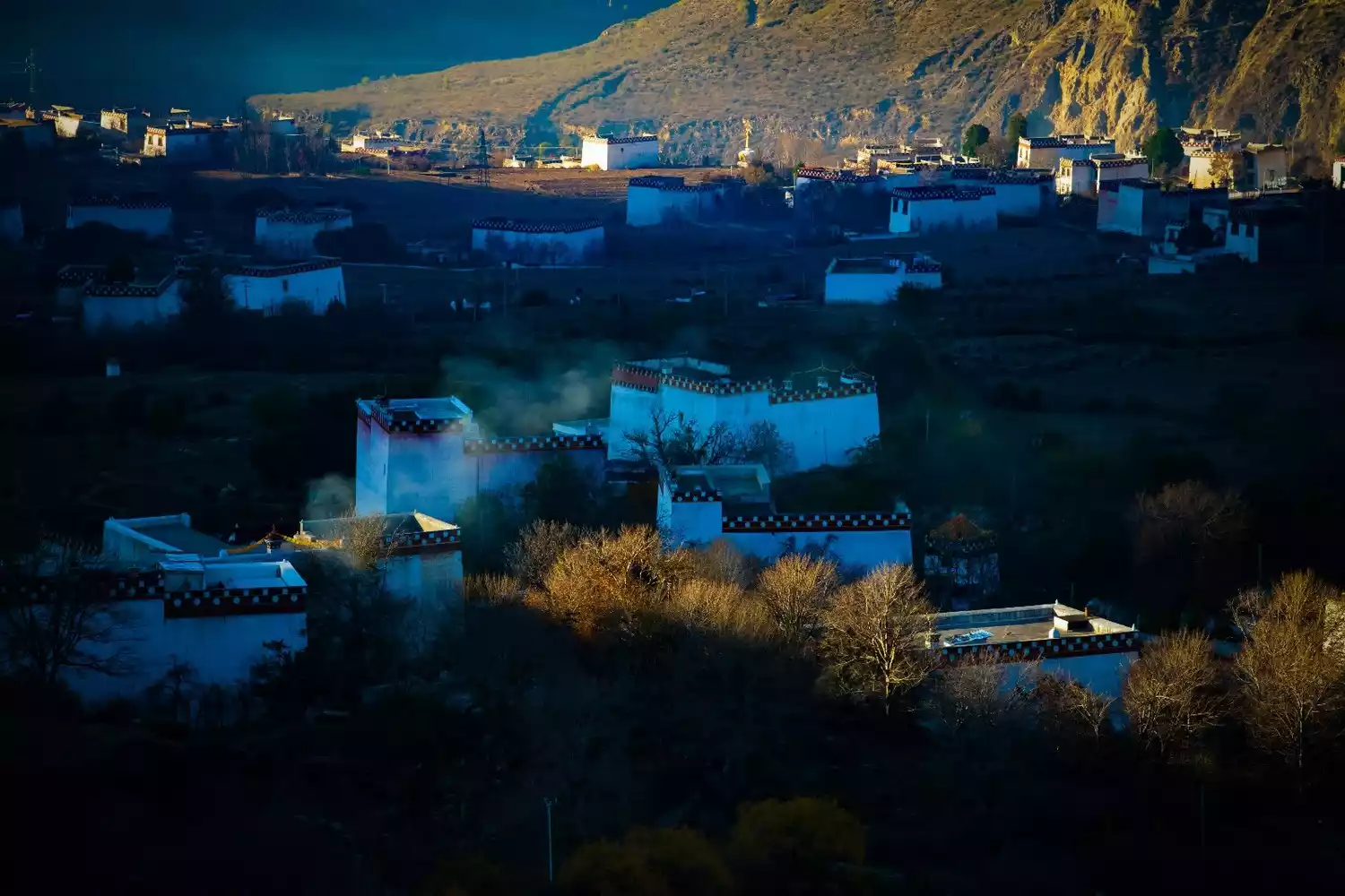
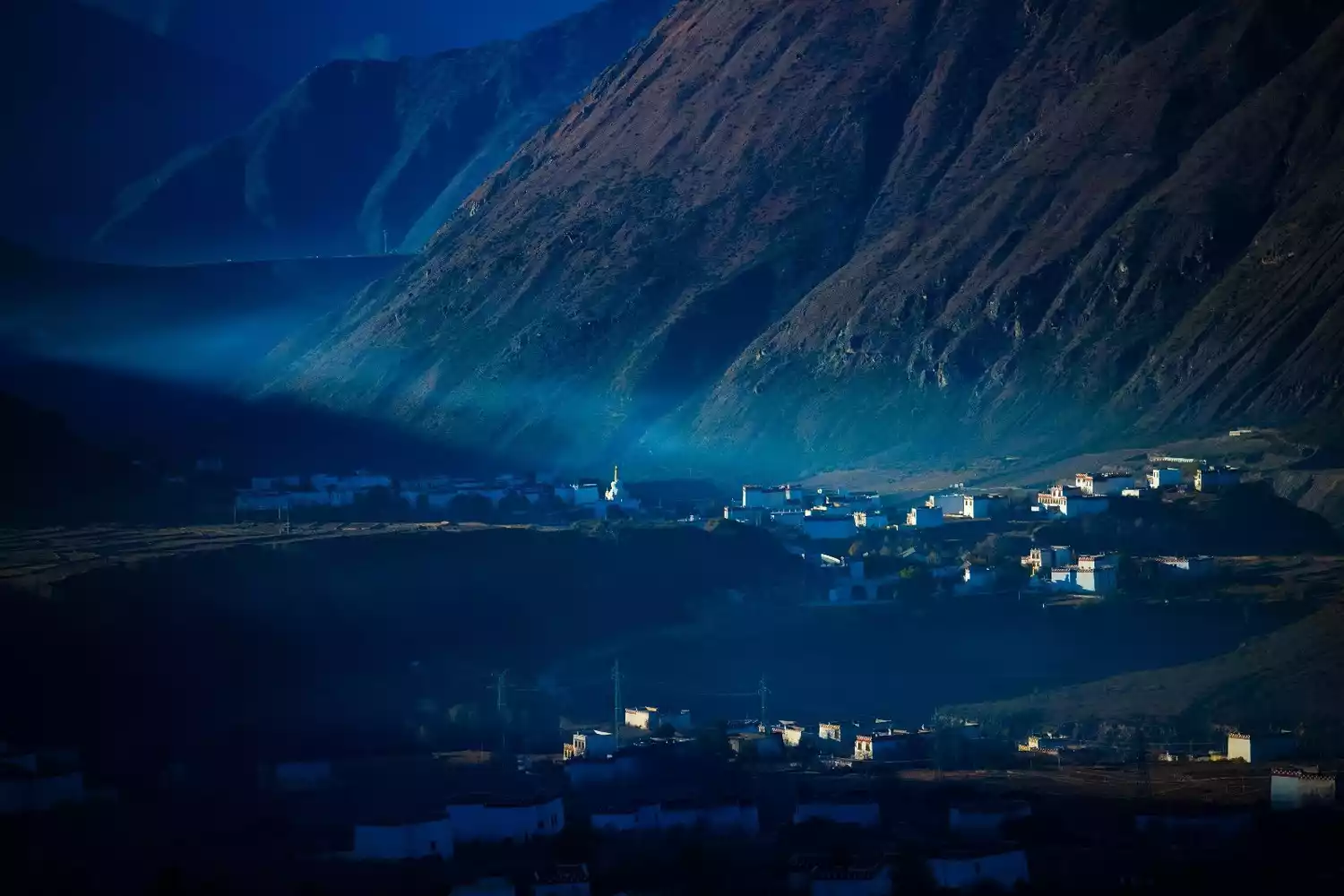
Derge - Derge Scripture Printing House, Queer Mountain
Derge, meaning "the land of supreme goodness," is nestled in the valley where Que'er Mountain, the highest peak in the northern section of the Shaluli Mountains, meets the Jinsha River. It was once the fiefdom of the Derge Tusi and the site of their ancestral temple. The Derge Sutra Printing House, once an annex of the Sakya sect's Gengqing Temple, is known as the "Derge Auspicious Gathering Wisdom Sutra Printing House" and is also known as the "Derge Palace" by Tibetans. Founded in 1729 by the 42nd Derge Tusi, Chokyi Danba Tsering (1689-1750), in the seventh year of the Yongzheng reign of the Qing Dynasty, it boasts a history of nearly 300 years.
The Derge Printing House houses over one million blocks of printed Buddhist scriptures from various religious sects, encompassing a wide range of Tibetan knowledge, including classics, medicine, calendar calculation, history, and thousands of carved paintings. It is a veritable treasure trove of Tibetan culture. The Derge edition of the Tripitaka printed by the Derge Printing House is considered a treasure in Tibet. Even blocks that are no longer usable are brought home and reverently enshrined.
Panorama of Derge Sutra Printing House
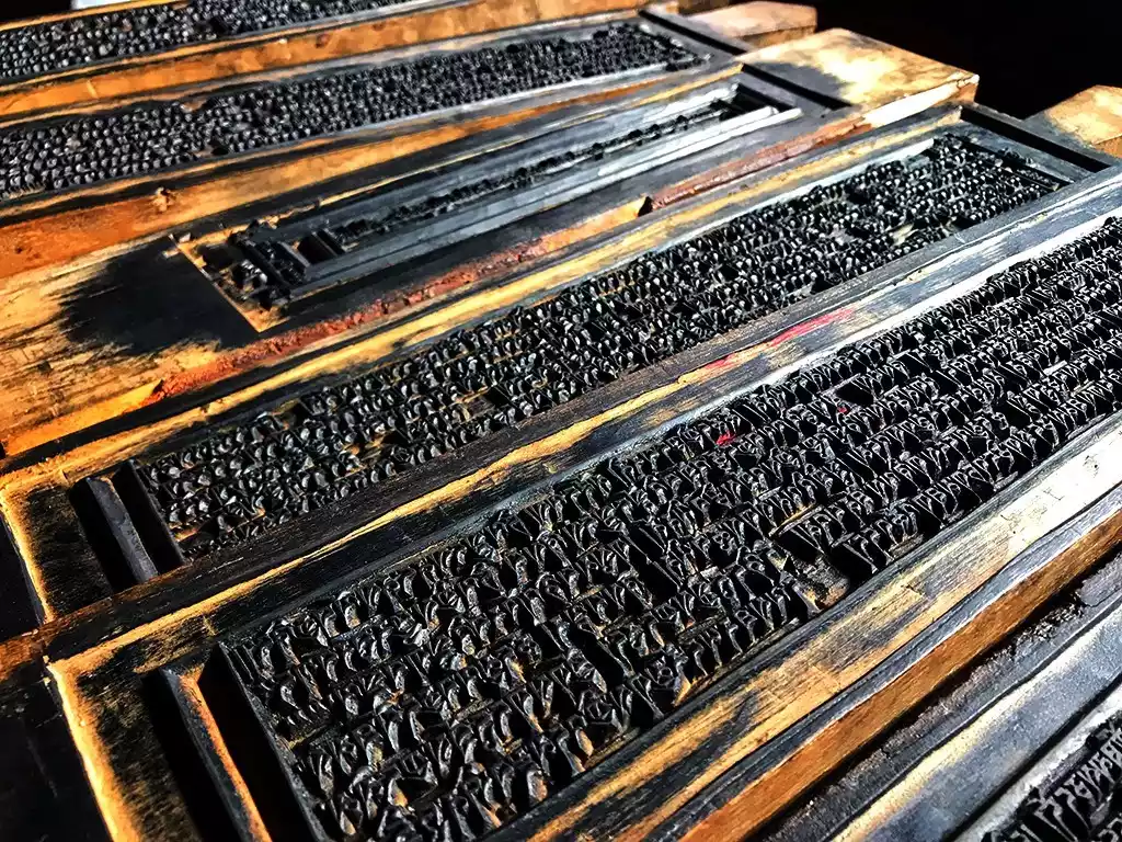
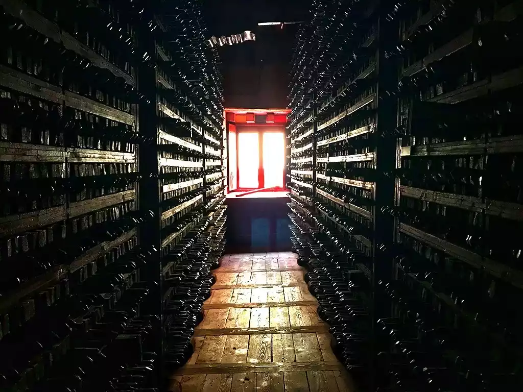
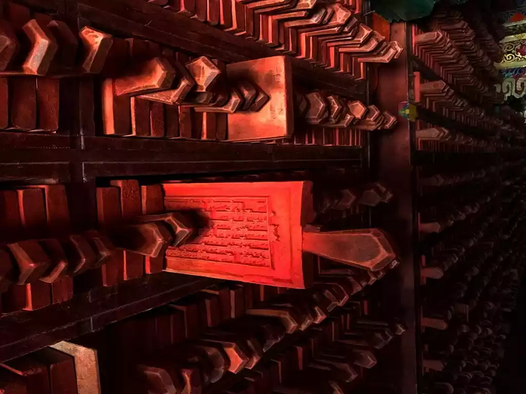
The Derge edition of the Tibetan Tripitaka printed in the Derge Printing House
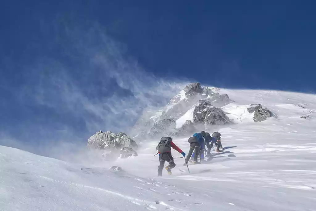
Queer Mountain is the highest peak in the northern section of the Shaluli Mountains. It is located next to National Highway 317 in Derge County. It has an altitude of 6,168 meters and is the fourth highest peak in Sichuan.
Que'er Mountain stands tall, towering above the surrounding ten 5,500-meter peaks. This is why there's a saying: "Climbing Que'er Mountain is like whipping the sky." The mountain's peaks are jagged and its ridges are jagged. The southern slope is exceptionally steep, with exposed bedrock, while the northern slope is perpetually covered in snow, making it difficult to climb.
The Queer Mountains are a mountainous region with a relatively high concentration of marine glaciers in China, boasting over 30 glaciers of varying sizes, covering an area of 80 square kilometers. The snowline lies between 5,100 and 5,200 meters above sea level. At the foot of the mountains, the glacial lake Yulong Lacuo (Xinluhai) is emerald green and pure, like a mirror set against the vast glacier front of the Queer Mountains. Glacially displaced moraine, deposited along the lake's northern shore and covered with sturdy spruce trees, lies atop it. In Tibetan, Yulong Lacuo literally translates as "the sacred lake that captivates the heart at first sight," with jade representing heart, dragon representing inclination, and Lacuo representing sacred lake.
According to legend, in the famous Tibetan epic "King Gesar," the hero Gesar's beloved consort, Zhumu, came to the lake and was captivated by the beautiful scenery and tranquil environment. She lingered by the lake and bathed and prayed devoutly. To commemorate Zhumu, later generations named the lake Yulong Lacuo.
Looking up at Queer Mountain from National Highway 317. Image from tourists@天涯
Yulong Lacuo at the foot of Queer Mountain, picture from tourists@高高凌鹰
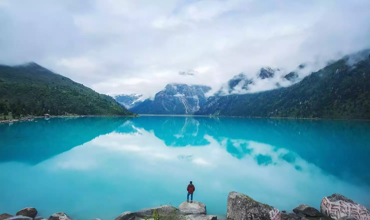
The pure blue Yulong Lacuo, picture from tourists@小乙
Queer Mountain is the most popular 6,000-meter-high technical snow mountain in Sichuan. Image from tourists@月月
Ganzi - Kasacuo, Ganzi Monastery
The Shaluli Mountains extend slightly eastward in the areas of Ganzi County and Xinlong County, and National Highway 317 passes through it.
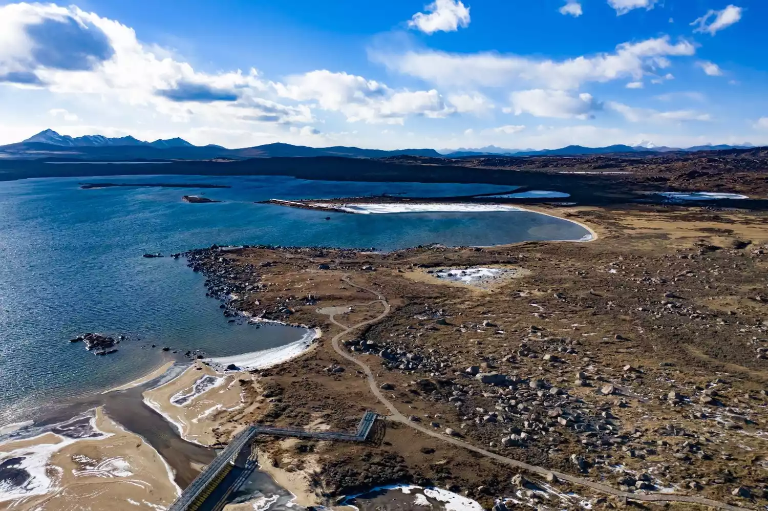
About 35 kilometers east of Ganzi County lies the renowned Kasa Lake. It's the largest waterbird habitat along the northern Sichuan-Tibet Highway and boasts the highest mandarin duck population in Sichuan. Kasa Lake itself isn't large, covering less than 2 square kilometers. But its unique location allows self-drive tourists to enjoy the lake without leaving the national highway. Along the winding mountain road of National Highway 317, the lake opens up to a breathtaking view of the water and mountains, a scene that springs to life.
If you'd like to get up close and personal with the lake and experience it more deeply, you can follow the path down to the lake's edge. Surrounded by mountains on three sides, Kasa Lake boasts a vast expanse and a bottomless depth. From a distance, the lake resembles a mirror embedded in the mountains. Mountains, river valleys, red tiles, flowers, cattle, horses, and fish form a serene and picturesque scene.
During the short summer on the plateau, the mountains are covered in green grass, birds sing, and flowers bloom. It seems as if just rolling by the lake would fill you with the fragrance. However, with recent warming, Kasa Lake has become a highly seasonal lake. The lake's surface area varies significantly between the wet and dry seasons. Some experts predict that within 30 years, Kasa Lake will disappear from view.
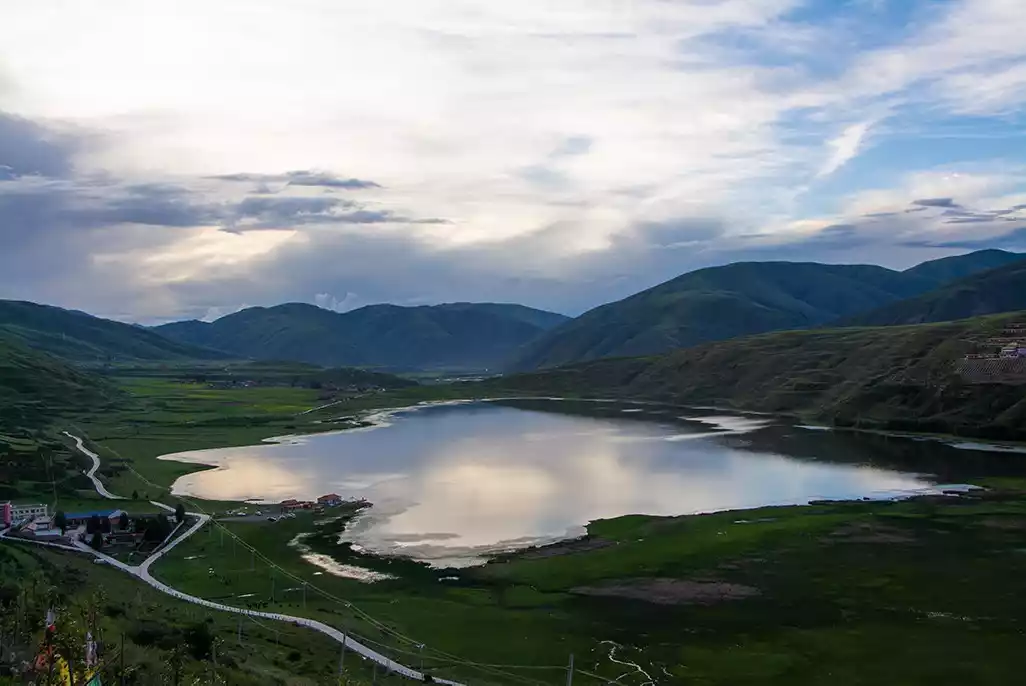
Lake Kasa at sunset
Summer is the most beautiful season for Lake Casa. Photo from tourists@wyc
Kasa Lake is extremely colorful at the turn of summer and autumn.
Garze, meaning "white and beautiful place," is named after the Garze Monastery, located near the county seat. The renowned Garze Monastery sits on a hillside north of Garze County. The snow-capped mountain directly opposite the monastery is called Kavalozhi, a renowned mountain known as the God of Wealth in the Sharuli Mountains. At the foot of the monastery, the Yalong River, running parallel to the Sharuli Mountains, flows through Garze County. Garze Monastery was first built during the reign of the Fifth Dalai Lama in the early Qing Dynasty. During this same period, thirteen monasteries were constructed in the northern Kang region, centered around Garze. Together with Garze Monastery, these monasteries are collectively known as the "Hor Thirteen Temples."
The setting sun frames Garze Monastery, the Yalong River Valley, and the sacred Mount Kavaluozhi, creating a sacred scene. Towering snow-capped mountains, a tranquil river, and golden sunlight bathe the valley. Garze Monastery and the Great Liberation Pagoda in front of it offer the perfect vantage point for photographing Garze County, the Yalong River Valley, and the sacred Mount Kavaluozhi.
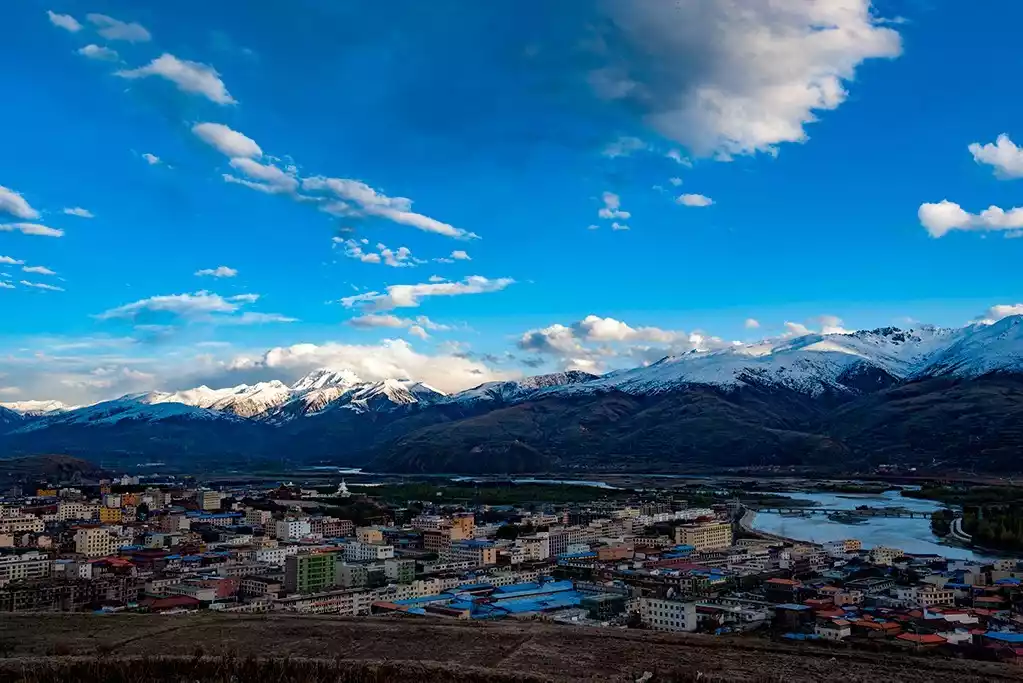
Panoramic view of Ganzi, with the Kawaluor Snow Mountain in the distance and the Yalong River on the right
Ganzi White Pagoda Temple
Outside Ganzi County, at the foot of the Shaluli Mountains, practitioners on the banks of the Yalong River. (Photo courtesy of tourists@爱摄影的车车)
Xinlong - Coka Lake and Kavalorji Sacred Mountain
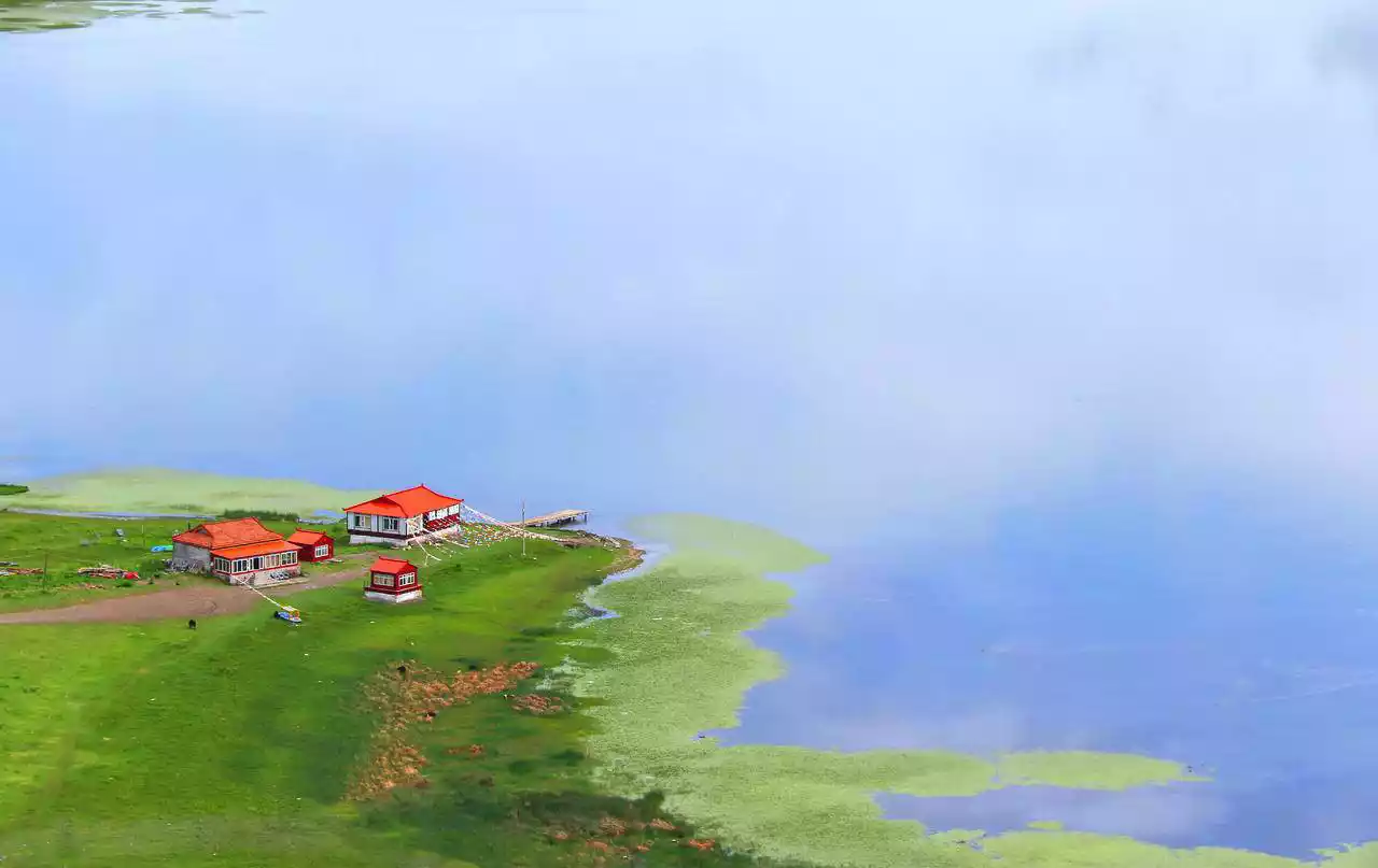
Cokha Lake lies nestled deep in the mountains of Mari Township, Xinlong County. Though small, it boasts the most dreamy reflections in all of western Sichuan! Its crystal-clear waters, like a mirror, capture the blue sky, white clouds, green trees, emerald hills, and crimson temples like a kaleidoscopic spectacle, as if the entire world were contained within its embrace. Originally, this small lake had no name until 1358, when Venerable Phurba Tenzin built a Kagyu monastery near the lake, naming it Cokha Monastery ("co" means lake, "ka" means edge, meaning "lakeside temple"). Since then, the Tibetan people have habitually referred to the lake as Cokha Lake.
As you approach Cokha Lake, you'll be struck by its crystal-clear water, the beauty of a mirrored world where heaven and earth merge. This is especially true during misty rainstorms, when thick fog lingers on the lake's surface, like a mysterious figure shrouded in a veil, framing the surroundings with an extraordinary solemnity. At this moment, the world outside the lake becomes indistinguishable from the real world within. Heaven and earth, mountain and lake, blend seamlessly into a magical fairyland. For a moment, you might even mistake the reflection in the water for the real world. Temples, plateau lakes, pristine forests, Tibetan dwellings, distant views of snow-capped mountains, Buddha statues, pagodas, wind horse flags, prayer wheels, fish, Tibetan dogs, and birds in the lake, the kindhearted Tibetan people, and the devout monks—all these are part of Cokha Lake's unique landscape.
The beauty of Cokha Lake can be simply summarized as "Six Wonders": Colorful Pools, Magic Lake, Reflections, Swimming Fish, Temples, and Lake Surroundings. Each wonder is a kind of otherworldly beauty.
Cokha Lake in the morning mist, picture from tourists@脱酒不沾
Cokha Lake, picture from China-TravelNote Photography Network
The idyllic Cokha Lake, pictured from China-TravelNote Photography Network
The sacred mountain of Kavaluozhi, also known as "Ziyongqiongge," meaning "Gateway to Wealth," is located in Xinlong County. Its 5,992-meter elevation is not particularly impressive among the mountains of the Sharuli Range.
Yet, its majestic and imposing presence makes it a renowned sacred mountain in Tibet. Legend has it that the deity of Kavalozhi is Yongzong Daojie, the God of Wealth, one of the Thirteen Great Gods of Tibet. He came here to bless the Xinlong region. It is said that pilgrimage to this mountain brings prosperity and lasting happiness. Therefore, it is deeply revered by followers of the Bonpo religion and Tibetan Buddhism.
The sacred mountain of Kawaluori is seen in Ganzi County, but it is located in Xinlong County.
Litang - Maoya Grassland, Genyen Sacred Mountain
"White-feathered crane, please lend me your wings; I will not fly far, I will only go to Litang and return." These are the lines written by the renowned Tibetan poet and legendary Sixth Dalai Lama, Tsangyang Gyatso. Later, after Tsangyang Gyatso's passing, people used this poem as a guide to locate the Seventh Dalai Lama, Kelsang Gyatso, in Litang.
Litang, known as "Letong" in Tibetan, means "flat plain like a bronze mirror." This name aptly describes Litang's topography. Litang County is situated in the northeast corner of this mirror-like grassland, the Maoya Grassland, surrounded by the Kazila and Haizi Mountains.
Litang, located on the southern route of National Highway 318, in the middle section of the Shaluli Mountains, is the most important town in the Kham region along this scenic route and is known as the first town in southern Kham. Summer is Litang's most beautiful season. Standing at Changqing Chunkor Temple and gazing southwest, the beauty of the Maoya Grassland is unobstructed: the snow-capped mountains recede into the distance where heaven and earth meet, while the grasslands, awash with blooming flowers, stretch vast and open, all unreservedly beneath the azure sky and white clouds. Occasionally, heavy rains strike, only to transform the landscape into a dazzling display of vibrant colors. Amidst the vast expanse of sky and earth, the Litang River dances across the earth like countless sleeves, casually dividing the meadows and merging countless small ponds. Farther away, cattle and sheep graze leisurely, and white and black tents dot the lush pastures. And before you, you see a riot of gentian, Tibetan primrose, and countless unnamed artemisia.
Summer is the season when flowers bloom in Litang, and it's also the happiest time for the people of Litang—the annual horse racing event brings the grassland, dormant for a year, back to life. Daytime on the grassland is a celebration of flowers, a world of horses and riders. Amidst the "city" of thousands of white tents, splendidly clad riders, wearing hero knots and carrying swords, glide through the air with valiant grace, displaying their agile physiques atop windswept steeds.
At dusk, the grasslands once again became a sea of joy. Milk tea scalded, fine wine wafted in the air; the crimson bonfires illuminated faces. Young men and women, dressed in their finest attire, strummed their zithers, danced joyfully, and sang moving ballads. The songs were cheerful and lingering, expressing enduring love and heartfelt blessings, enough to move people to "remember this foreign land as their home."
Maoya grassland in summer
Colorful flowers bloom across the Maoya grassland. (Photo courtesy of tourists@爱摄影的车车)
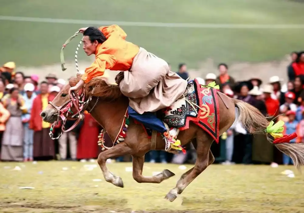
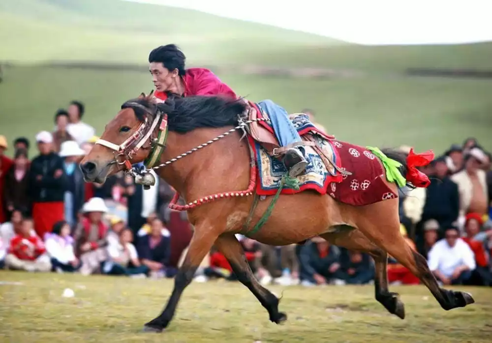
Litang August 1st International Horse Racing Festival. Image from China-TravelNote Photography Network
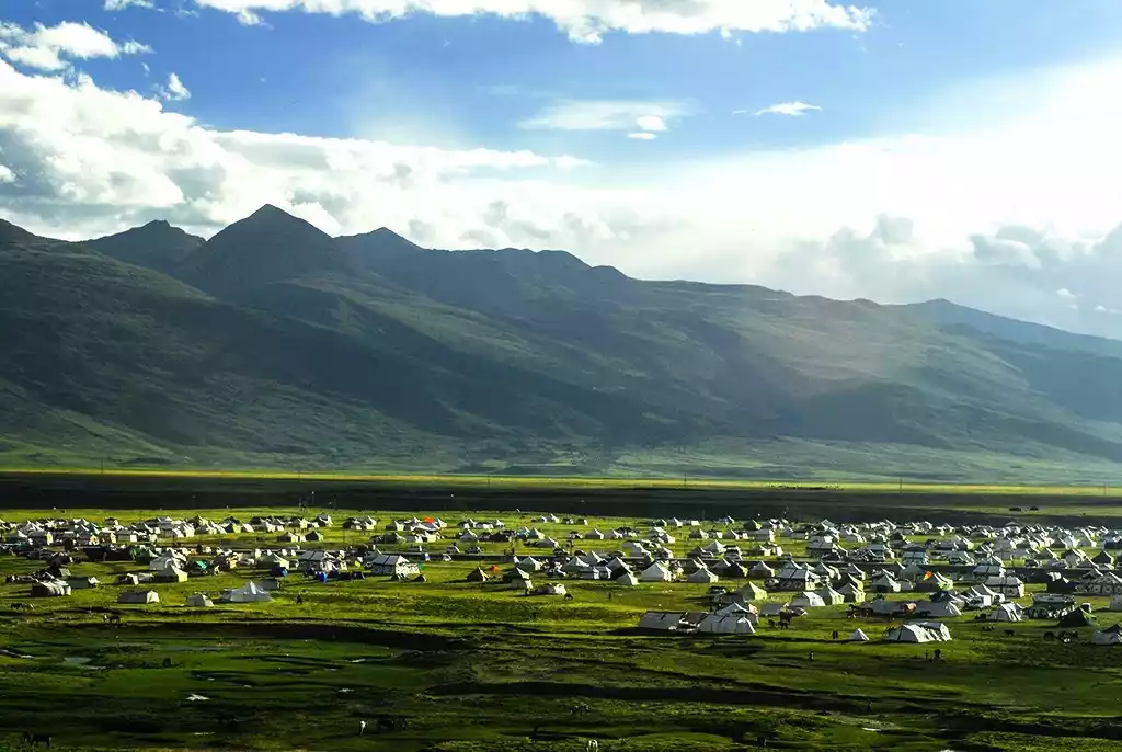
Litang Tent City in Summer
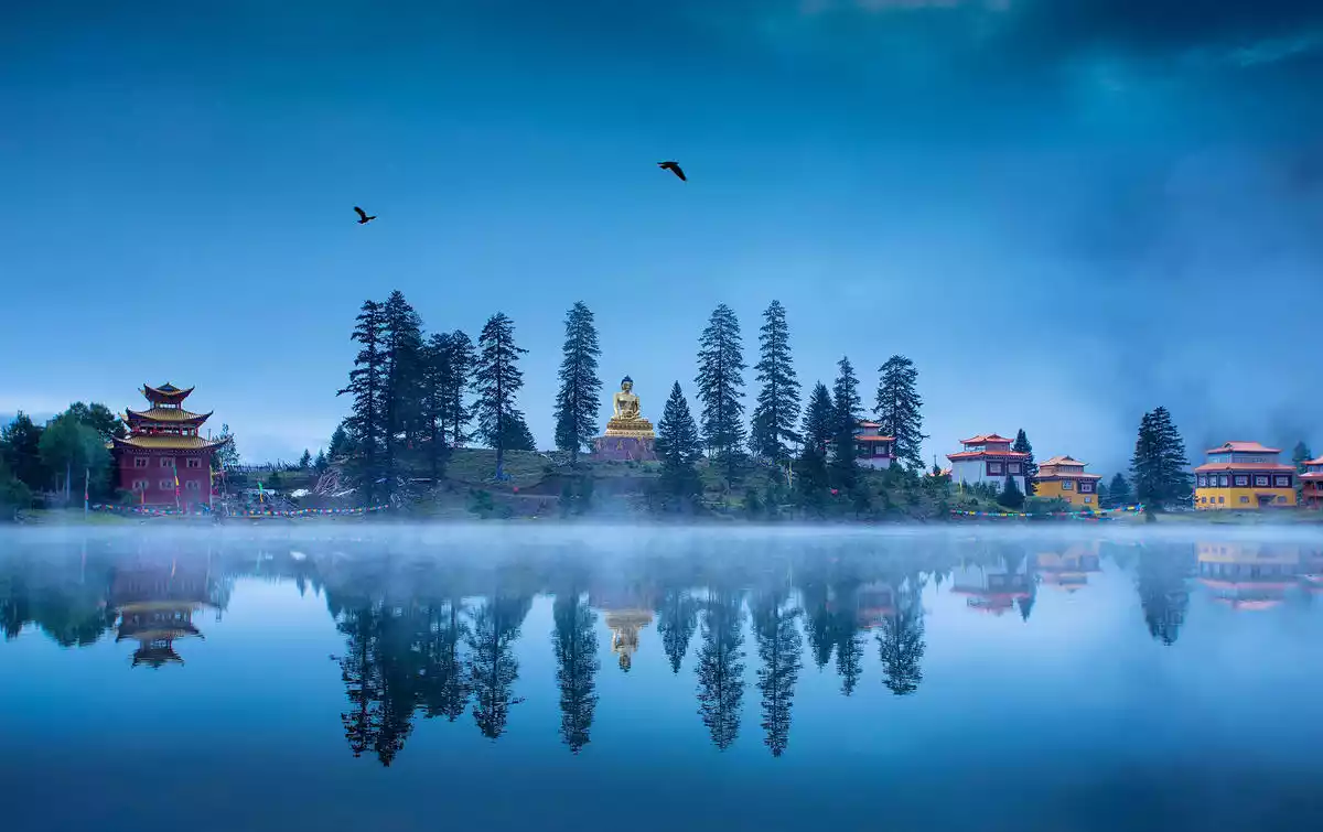
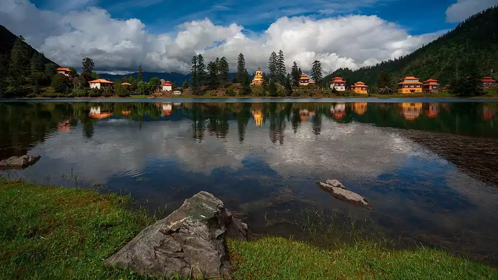
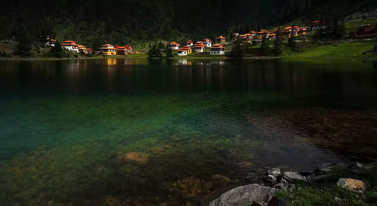
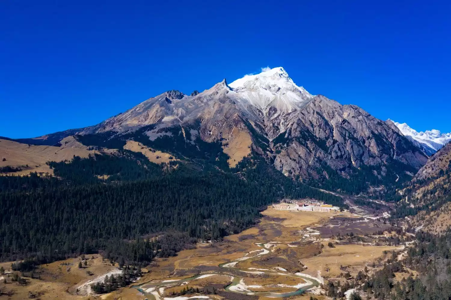
Mount Genyen, located west of Litang, stands at 6,204 meters above sea level and is the highest peak in the Shaluli Mountains. It is the third highest peak in Sichuan, after Mount Gongga and Mount Siguniang. It is also a hidden gem, unconquered by humans. Mount Genyen is one of two places in the world known as the Pure Land of Chakrasamvara, the other being Mount Everest, known as the "Third Goddess."
At the end of the Southern Song Dynasty, the first Karmapa, Dusum Khyenpa, founded Lenggu Monastery at the foot of Mount Genyen, becoming one of the birthplaces of the Karma Kagyu sect of Tibetan Buddhism. This secret place can only be encountered by crossing high mountains and deep valleys.
As China-TravelNote, dedicated to exploring the most stunning scenery, we've traversed every pass on the southeastern slopes of Genyen, waiting for the moment when the Milky Way passes over the Genyen mountains, filling the sky with stars; waiting for the moment, on a calm, windless morning, when the sacred mountain's silhouette is quietly reflected on the frozen lake. The journey to Genyen is arduous, but once you truly embrace the sacred mountain, you'll find that all the previous hardships and dangers pale into insignificance. No wonder a tweet once described Genyen as "a paradise in its extreme cruelty."
The main peak of Mount Genyen and Lenggu Temple, pictures from tourists@爱摄影的车车
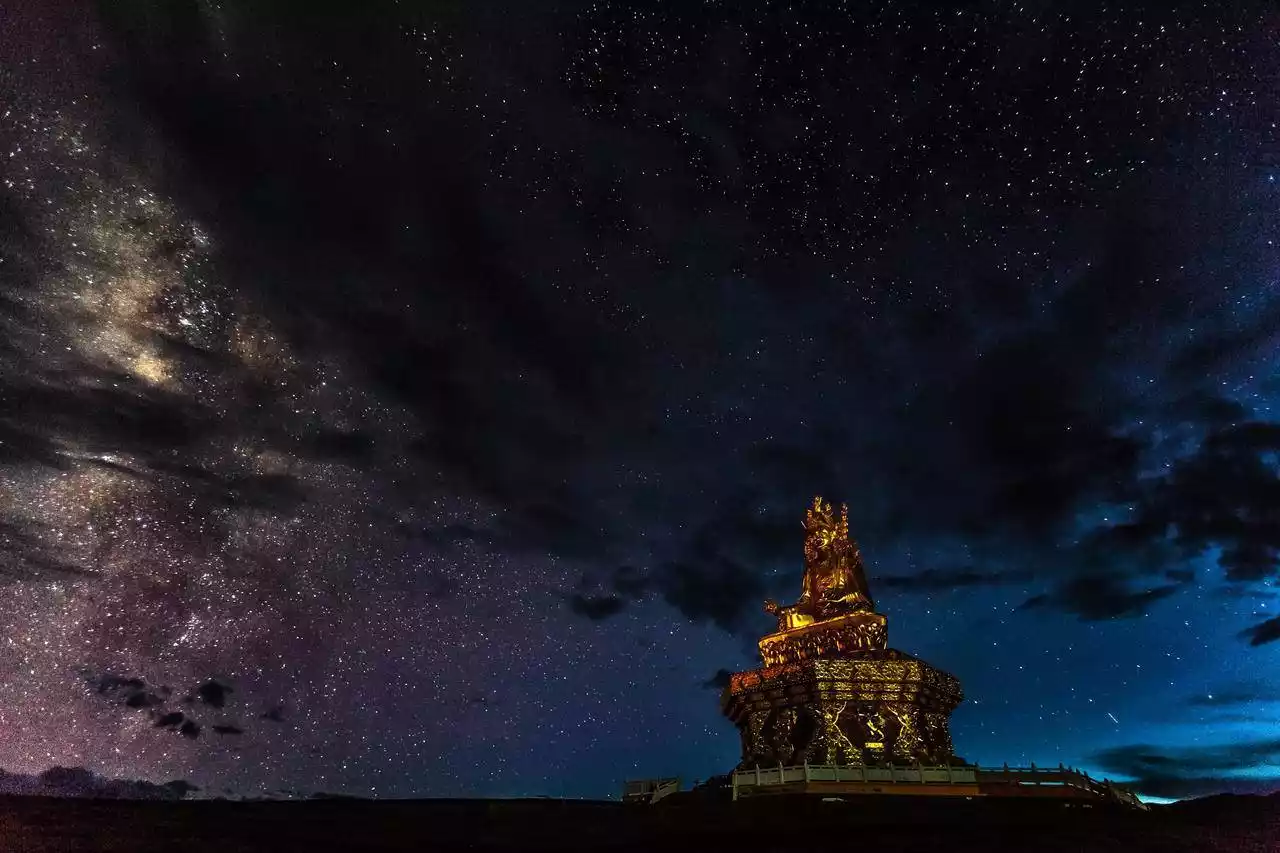
The author once saw a photo taken by the famous photographer Su Tie:
Beneath the starry sky, the water gurgles; the white pagoda and golden roof of Lenggu Temple stand silently in the night sky; behind the temple, the towering Genyen Mountains reach into the clouds. Everything around is illuminated by the starlight, as if it were daytime. Under the deep blue sky, echoes of ancient times seem to echo. The world spins imperceptibly, the stars stretched into lines, then woven into a web, finally encompassing all things on earth, the Milky Way, and the Milky Way.
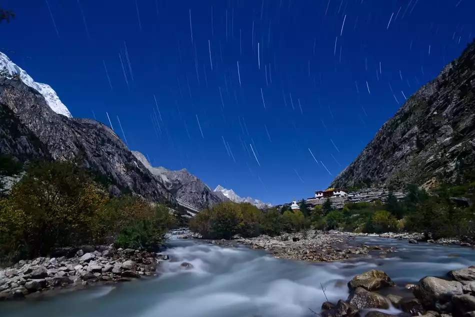
Night scene in Genyen, picture from famous photographer @Su Tie
China National Geographic once commented on Mount Genyen: "If you have been to the lonely and proud Mount Gongga and seen the beautiful Mount Siguniang, then this mountain hidden deep in the mountains of western Sichuan may be the last secret of Sichuan's snow-capped mountains."
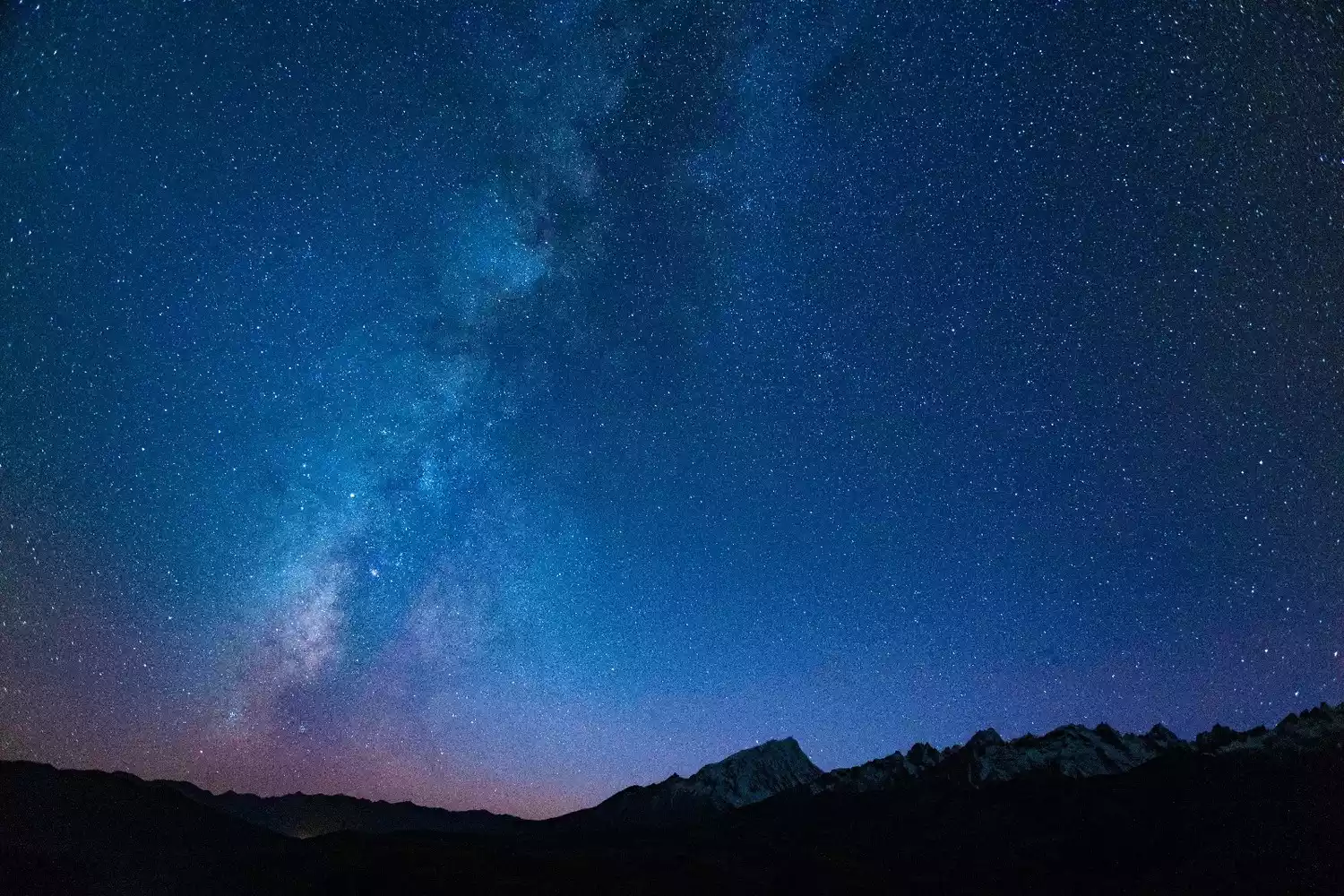
Mount Genyen under the Milky Way
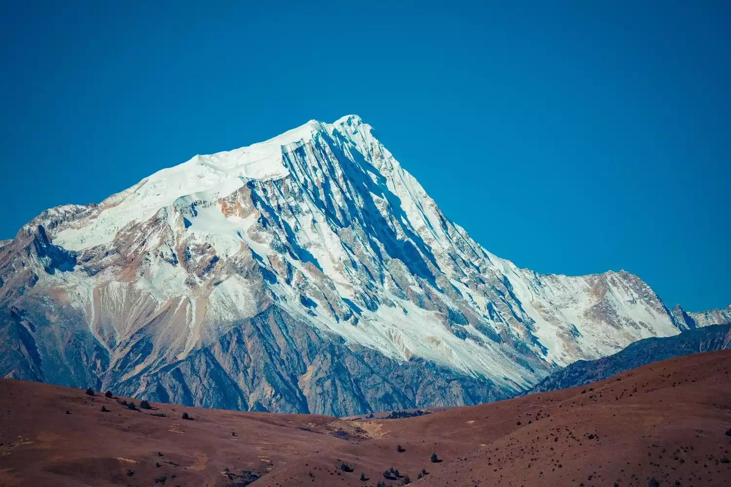
Southeast slope of the main peak of Mount Genyen
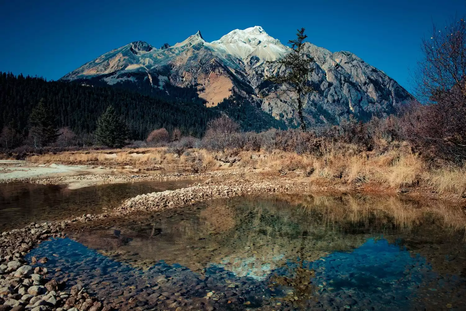
Genie Holy Mountain in front of Lenggu Temple
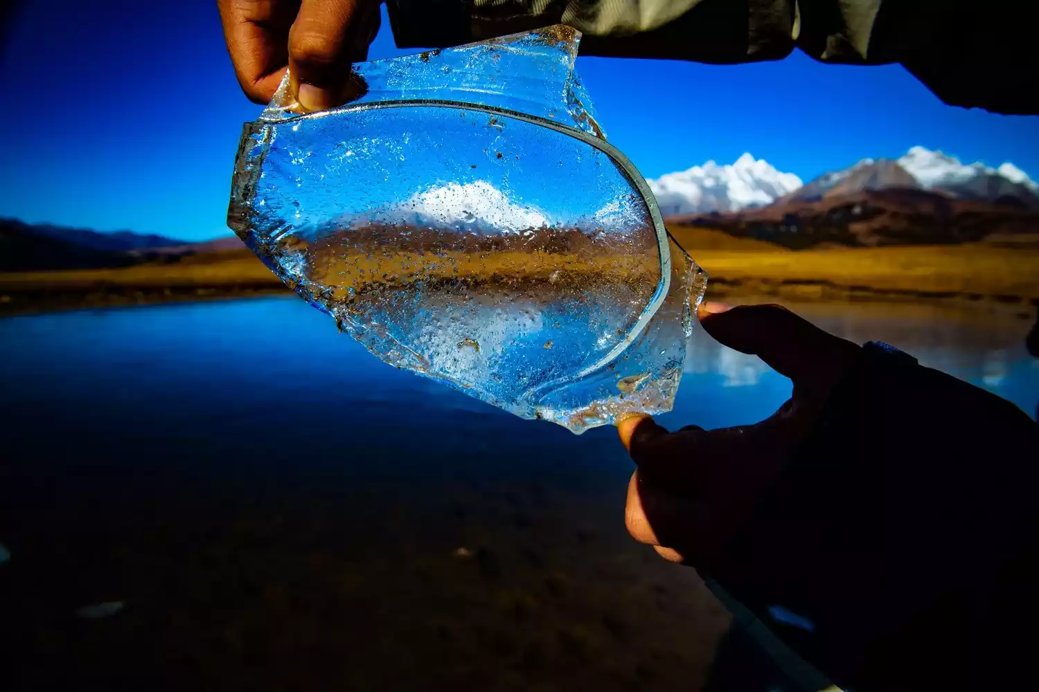
Looking at the sacred mountain through the ice
Batang - Sister Lake, Cuopu Valley
Heading west along National Highway 318, crossing the Haizi Mountain Pass in the middle section of the Shaluli Mountains, you'll see a breathtaking view around the corner:
A busy national highway stretches into the distance, where two turquoise, crystal-clear plateau lakes nestle side by side, exuding an intoxicating tranquility with each breath. Embedded in the desolate mountain plains, the lake stands like a turquoise, like divine compassion shed in tears, pure and flawless, endearingly beautiful.
As the name suggests, Sister Lakes are two lakes nestled against each other. Located in Batang, Sister Lakes is the last pass on National Highway 318 in Sichuan. After crossing the Haizi Mountain Pass at an altitude of 4,685 meters, the road descends to the Jinsha River and, after crossing the Zhubalong Bridge, enters Tibet. For this reason, the Sister Lakes of Haizi Mountain are considered a key geographical landmark along the Sichuan-Tibet Highway. In 2006, the Sister Lakes at Haizi Mountain Pass graced the cover of the annual special issue of "National Geographic China: China's Scenic Avenue."
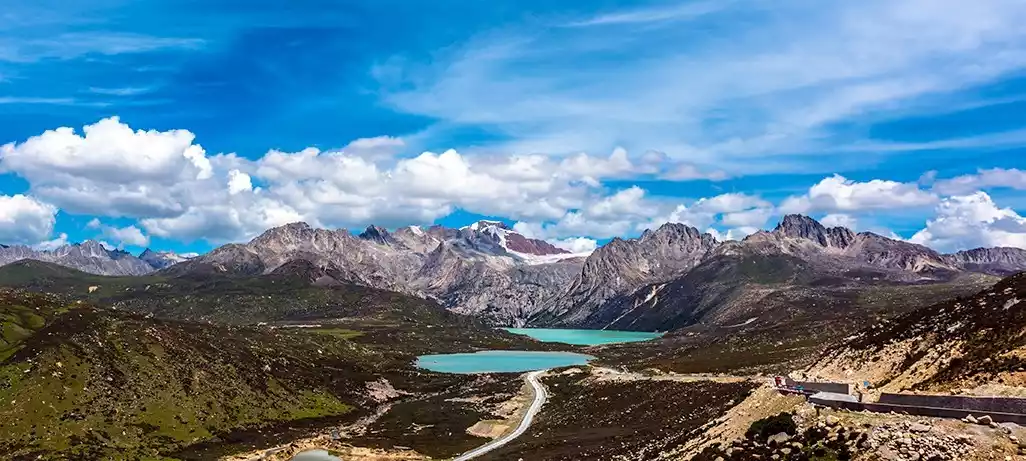
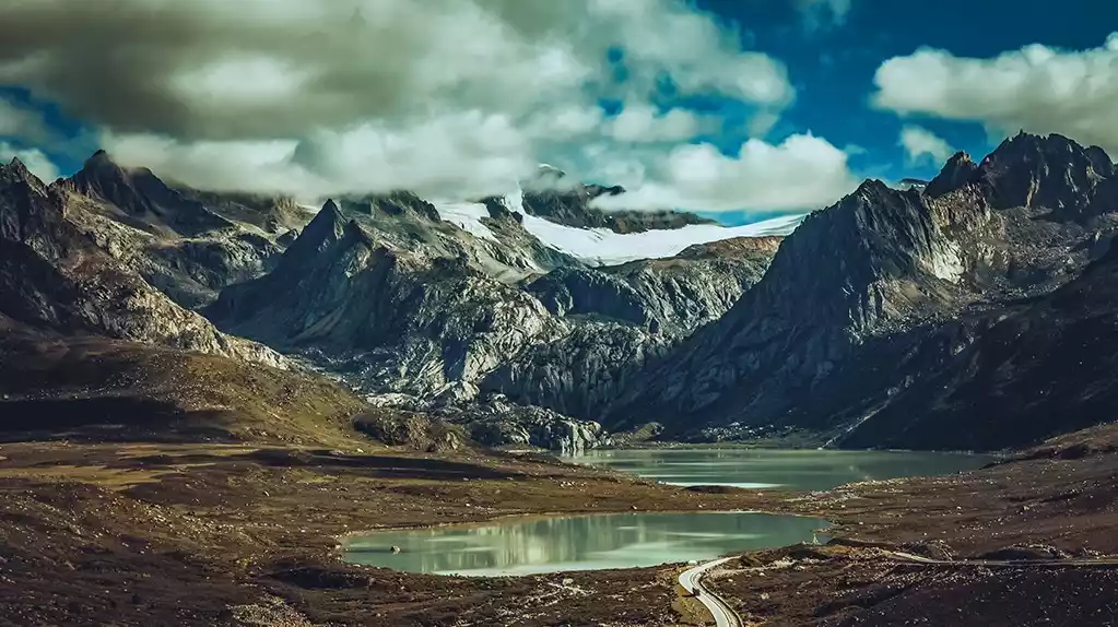
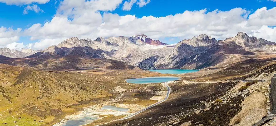
Sister seas in different light and seasons
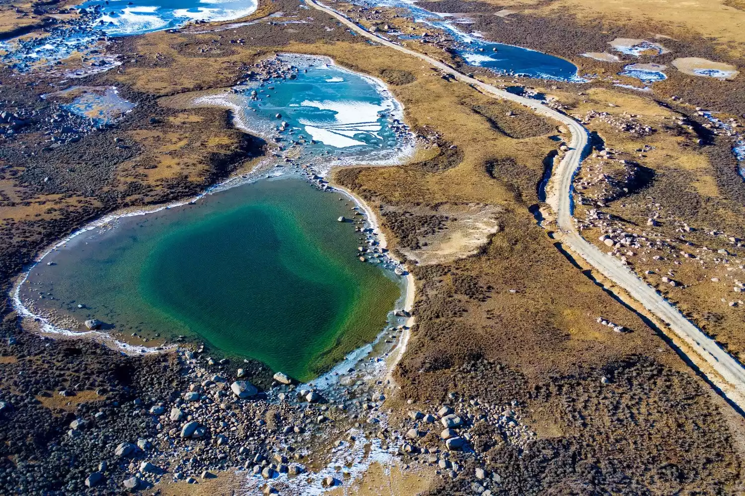
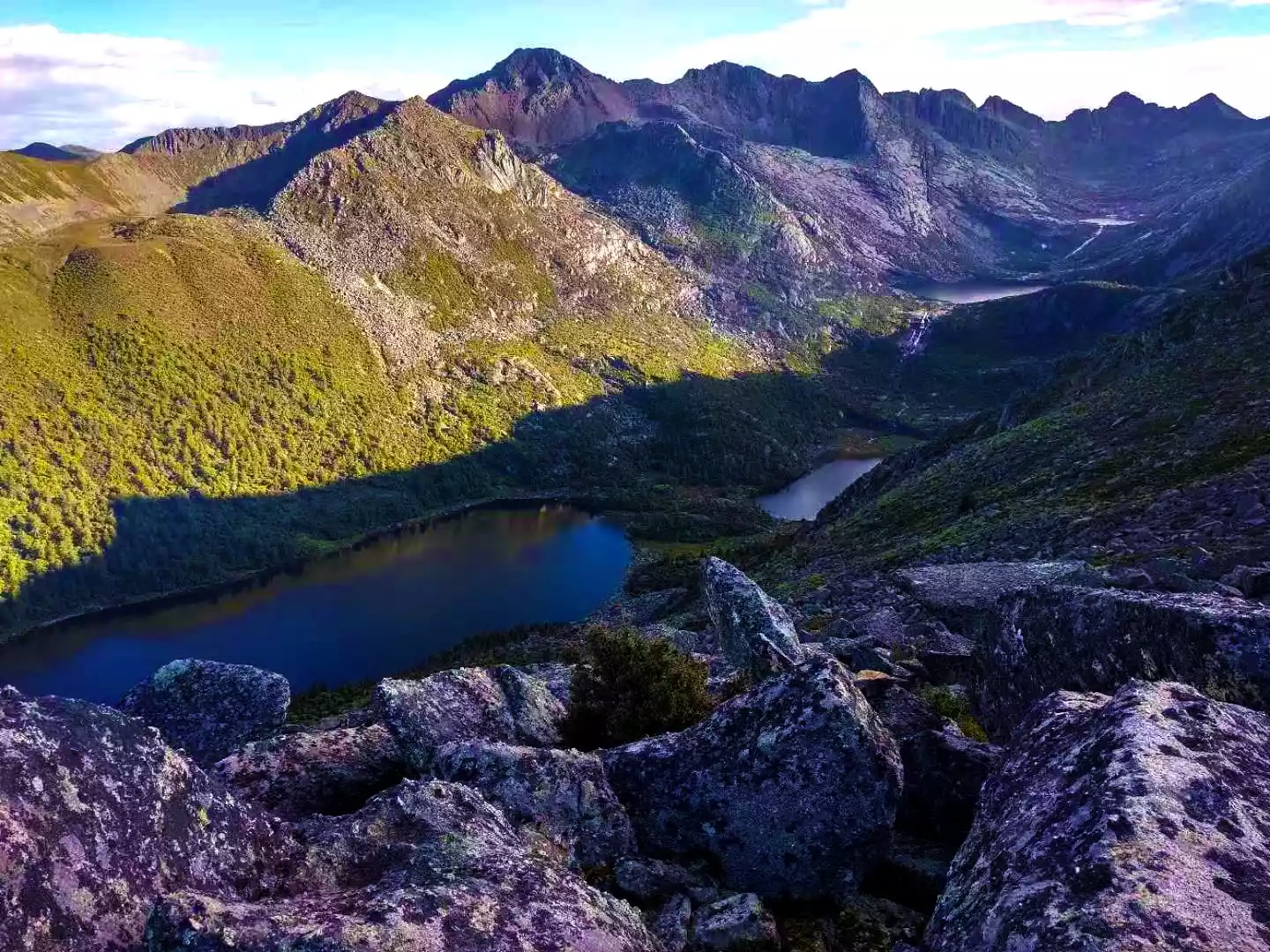
The Hengduan Mountains encompass nearly every landscape in China, save for the oceans and deserts: snow-capped mountains, lakes, forests, rivers, canyons, waterfalls, hot springs, springs, grasslands, wildlife, and monasteries. Similarly, the Shaluli Mountains inherit the Hengduan Mountains' rich heritage. However, in all of western Sichuan, only one place truly combines these beauties. This secret spot, nestled deep within the little-known mountains of the central Shaluli Range, is known as Cuopugou.
Tibetans prefer to call it "Khampa's First Sacred Lake" and "Soul of Shangri-La." Cop Lake, located at an altitude of 4,148 meters, consists of two lakes, one large and one small. Both lakes are surrounded by mountains, nestled against the craggy, exposed, and uniquely shaped sacred Zhajinjiabo Mountain (also known as the King's Castle). Facing it is the 5,833-meter Nitkangri Peak, surrounded by lush primeval forests and verdant grassy slopes. The lake area is enchantingly beautiful, with its shimmering, clear, and turquoise waters serenely bathed in the brilliant sunshine. The forests surrounding the lakes are home to numerous rare birds and animals, and schools of fish swim freely within.
Because the road is not yet accessible, the area has maintained its pristine ecological environment. The natural environment is remarkably tranquil, like a paradise. The Chaluo Hot Springs within Cuopu Valley are the largest geothermal hot spring complex in western Sichuan. Their high-temperature waters are renowned for their medicinal properties, including their ability to treat skin ailments and rheumatism.
Legend has it that after each campaign, King Gesar would invite his fellow soldiers to bathe in the abyss to wash away the dust of battle and to heal injuries and illnesses. Nestled in a forest meadow, nestled against the sacred Zhajingabo Mountain and facing Cuopu Lake, stands a magnificent monastery—Cuopu Monastery, a member of the Nyingma school of Tibetan Buddhism. While the exact date of its construction is uncertain, prayer flags flutter and chants blare. Day after day, it greets each sunrise. Monks often sit by the lake, calling out to the surface in deep, resonant voices. Only then do the fish flock to the lake to feast on the food the monks throw. Year after year, what seemed like a casual pastime has become a vital cultural event at Cuopu Lake—calling to the fish.
The scenery of Cuopugou, picture from tourists@阿戈
White Jade - Yachen Gar, White Jade Gar
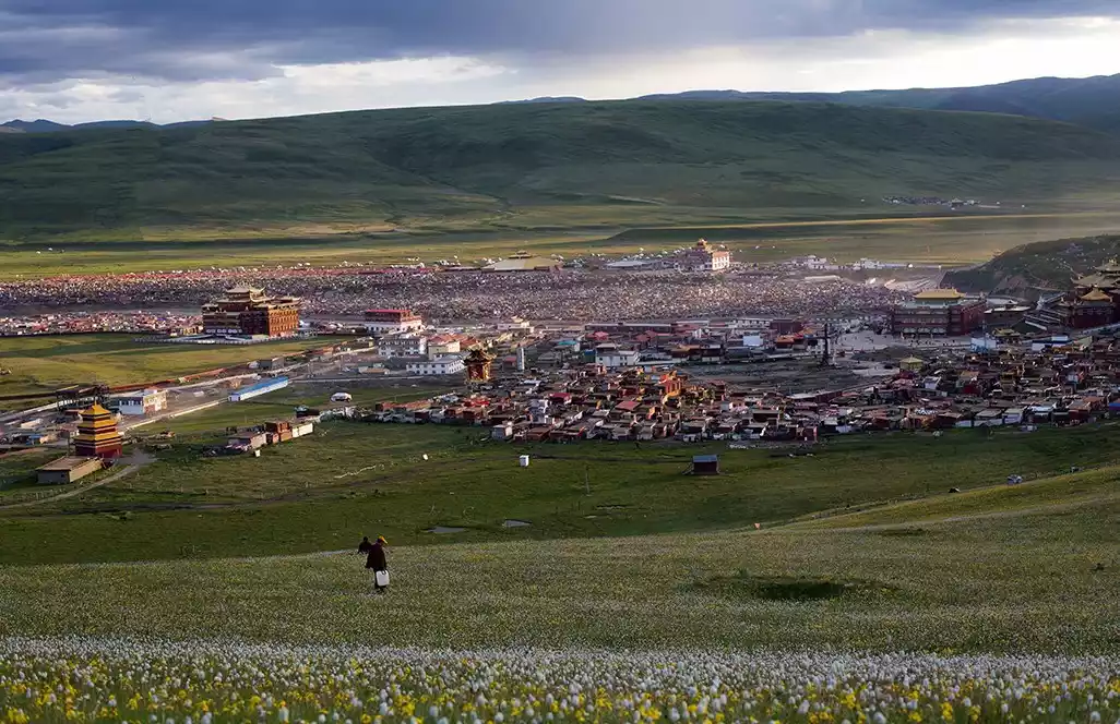
In the middle of the Shaluli Mountains, at the junction of Xinlong, Garze, and Baiyu counties, lies the largest uninhabited area in western Sichuan. In Tibetan, it's called Zanduocuonama, meaning "black sea water amidst rocks." Southwest of the uninhabited area lies a grassland called Changmai. Yachen Monastery is nestled in the heart of this grassland.
Yachen Gar may not be well-known among tourists, but its status in Buddhist circles and even internationally rivals that of Serthar Buddhist Institute. Yachen Gar's full name is "Yachen Ugyen Monastery." Founded in 1985, it is presided over by Lama Achuk Rinpoche, a Dzogchen master. He primarily teaches the Dzogchen teachings of the Nyingma school and strictly requires his disciples to practice in retreat.
Yachen Gar is divided into two districts, the Drakpa and the Jyumu, separated by the Changtai River. The temple's main scripture hall, the "Perfect Light Hall," is modeled after the renowned "Utse Hall," the main hall of Samye Monastery. Its imposing exterior features 160 pillars. Currently, there are approximately 10,000 Jyumu (nuns) and another 10,000 Drakpa (nuns), along with lay Buddhists and their families, for a total population of nearly 30,000, nearly equal to the entire population of Baiyu County.
Yachen Gar seamlessly blends grassland scenery with Buddhist sanctuary, offering breathtaking views and a vibrant cultural atmosphere replete with Buddhist chants. The relatively flat terrain allows for panoramic views from the vantage point. Compared to Seda, this area is more suitable for capturing large-scale scenes, offering a more pristine cultural scene, and the monks are more friendly.
Panoramic view of Yachen Gar, picture from tourists@爱摄影的车车
Yachen Gar Temple in the snow, picture from tourists@葱油冰
Yachen Gar under the starry sky, picture from tourists@爱摄影的车车
Naughty monks at Yachen Gar
Panoramic view of Yachen Gar, picture from tourists@落落
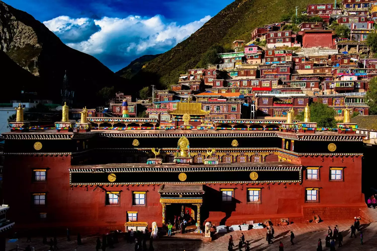
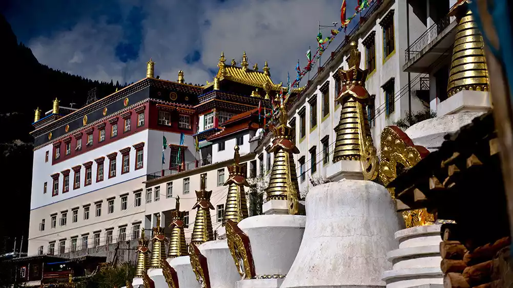
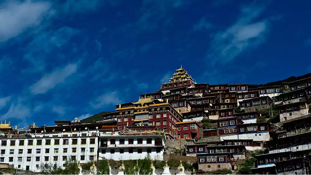
In Baiyu County, across the river from Tibet, is Baiyu Temple, one of the ancestral temples of the Nyingma school of Tibetan Buddhism.
Baiyu Temple, whose full name is "Baiyu Langjie Jiangqiulin," means "Auspicious and Victorious Bodhi Continent." Built in the 14th year of the Kangxi reign of the Qing Dynasty, it is one of the five major temples of the Derge Tusi. The temple's lineage is inherited by reincarnated Living Buddhas, assisted by several abbots. Twelve generations of Baiyu Dharma Kings have been appointed.
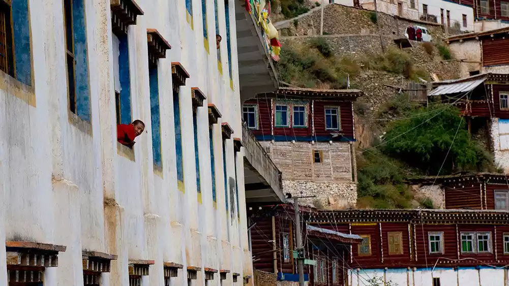
This is a small county town nestled in the heart of the Shaluli Mountains. Perched against a rocky peak, a temple completely dominates the mountain, its Buddhist halls and monks' huts stacked one after another, its scale breathtaking. Baiyu Temple occupies almost half of the county town. Its white walls, golden roof, and geraniums dazzle under the highland sun. The temple stands tall on the mountaintop, overlooking the Jinsha River, a river cascading down from the sky; it overlooks the devout people reincarnating in the worldly world, and the county town beneath it, which has undergone centuries of ups and downs.
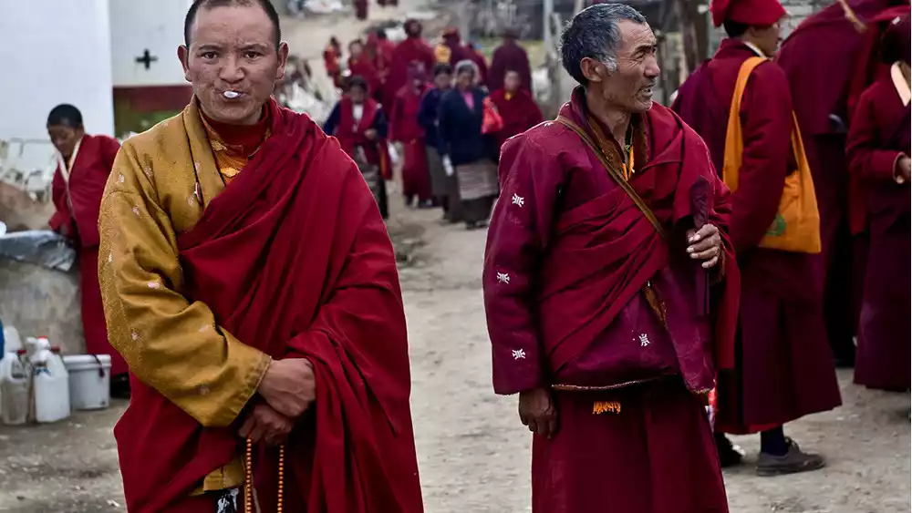
The monks at Baiyu Temple are very friendly. They exchange a greeting of "Tashi Delek" as they pass by, earning a knowing smile. A large open area in front of the temple's main hall is used for both grand ceremonies and more regular debates, the only way for monks to verify their knowledge. The main hall was damaged during the decade of unrest and has been restored in recent years. Three statues of Sakyamuni, Guru Padmasambhava, and the Four-Armed Avalokitesvara are enshrined in the center of the hall. Behind them are densely packed ceiling-high volumes of Buddhist scriptures. Despite their numerous contents, they are remarkably well-preserved, spotless. Like most temples in Tibet, the monks' quarters and other buildings are arranged around a few main halls, not strictly adhering to a symmetrical or central axis.
The highest point of Baiyu Temple still boasts a magnificent golden mandala, a hallmark of many Nyingma temples. Historically, thanks to the strong financial support of the local chieftains, Baiyu Temple boasts three large Buddha halls, seven scripture halls, and three stupas. The largest scripture hall can accommodate 2,000 people for chanting and meditation. In addition, there are countless monk quarters and smaller scripture halls used for lectures and study. At its peak, the temple boasted tens of thousands of monks. It was the largest Nyingma temple in Kham, and remains so today.
Baiyu Temple
Curious monks from Baiyu Temple
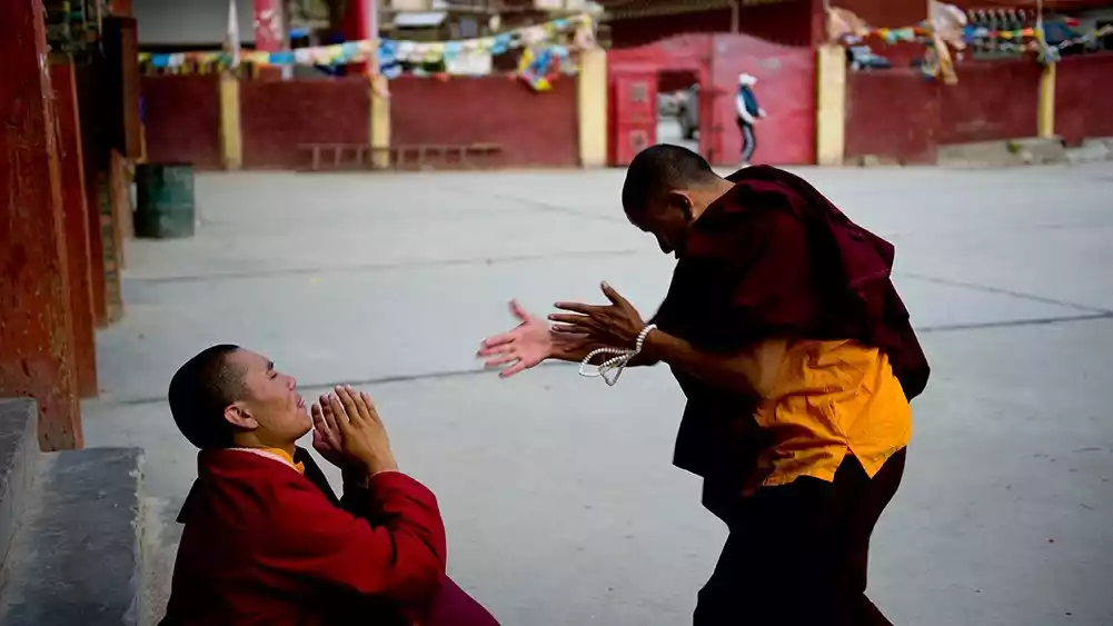
Debate
The main hall of Baiyu Temple, the photo above the Buddha statue is the contemporary Baiyu Dharma King
Daocheng - Haizi Mountain, Yading
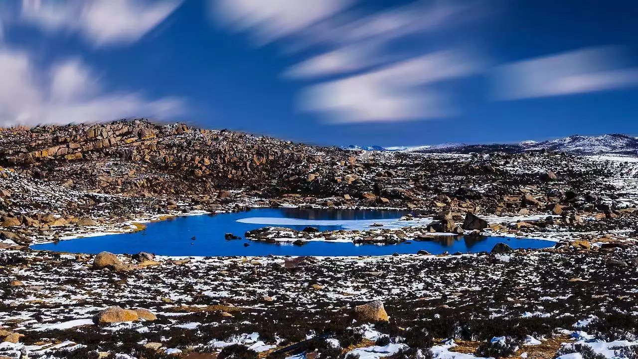
Haizi Mountain, located in the central section of the Shaluli Mountains, has an average elevation of over 4,500 meters. It boasts the highest concentration of lakes in the entire Shaluli Mountains and even the entire Hengduan Mountain Range. According to incomplete statistics, the Haizi Mountain region, covering an area of over 3,000 square kilometers, boasts over 1,200 lakes of varying sizes.
Haizi Mountain is renowned in geological circles. Geologists call it the "Daocheng Ancient Ice Cap," a magnificent sight left behind by the retreat of the Quaternary glaciers. It is the largest remnant of ancient ice on the Qinghai-Tibet Plateau. As the ancient glaciers gradually retreated, the forces of nature left behind a crisscrossing landscape of jagged rocks and lakes of varying sizes, shimmering across the mountain like thousands of diamonds accidentally scattered by a god.
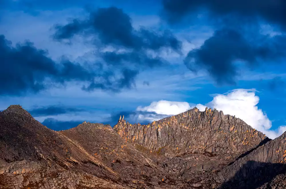
When entering Haizi Mountain, the first feeling you get is one of wildness - densely packed boulders are spread across the mountain, with some bushes and meadows among the rocks in the middle of the mountain, while there is no grass on the upper part of the mountain, only hideous boulders piled up on the hillside. The uplift, compression, collapse and accumulation brought about by millions of years of crustal movement are clearly visible before your eyes.
On the top of these boulders, the rocks resemble a stone forest, with pillars, stalagmites, stone mushrooms and other forms. They have a wide variety of shapes, resembling humans, animals, birds, and even cartoons, sparking endless imagination as you walk through them. The most vivid of these is a place called "Rabbit Mountain".
Xingyi Co, meaning "Offering Lake" in Tibetan, sits at an altitude of 4,420 meters and is the largest lake in the Haizi Mountain area. It is considered sacred by Tibetans. Its emerald green waters are teeming with fish, and its vast expanse is home to countless birds. Spectating the vast expanse of the sky and earth, the rock formations blanket the landscape, creating a breathtaking and magnificent natural landscape. A scenic boulevard, known as the "Shangri-La Sacred Road," traverses Haizi Mountain. The area, strewn with massive glacial boulders and resembling a lunar landscape, is a stark backdrop for wildlife, including hares, marmots, lynx, and birds. From the west pass of Haizi Mountain, the majestic figure of the sacred Mount Genyen can be seen in the distance. Descending Haizi Mountain, Daocheng Yading lies in the distance.
Haizi Mountain landform, picture from tourists@东高情
Tuer Mountain, photo from China-TravelNote Photography Network
Aerial photography of Xingyicuo, pictures from tourists@爱摄影的车车
The "Shangri-La Holy Road" in Jingmei with few cars
Overlooking the Genyen Mountains from Haizi Mountain
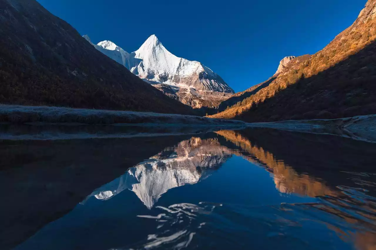
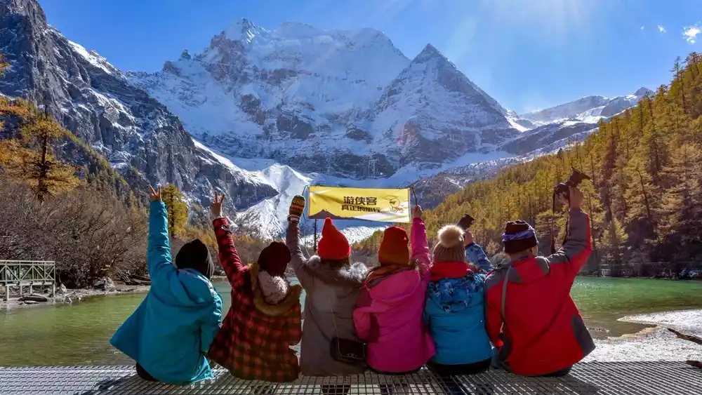
The three sacred mountains of Yading—Xiannairi, Xianuoduoji, and Yangmaiyong—are considered by Tibetans to be the incarnations of Avalokitesvara, Vajrapani, and Manjushri, respectively. In Tibetan, these three mountains are collectively known as "Nyainchen Gongga Risong Gongbu." Translated into Chinese, "Nyainchen" means "second only to," "Gongga" means "white and holy," and "Risong Gongbu" means "three guardian mountains," collectively meaning "three guardian mountains second only to Mount Gongga."
The Three Sacred Mountains are the highest peaks in the southern section of the Sharuli Mountains, forming a triangular formation. The northern peak, Xiannairi, reaches 6,032 meters, the southern peak, Yangmaiyong, 5,958 meters, and the eastern peak, Xialangduoji, 5,958 meters. Each peak has a distinct shape, yet all are pristinely white and spotless. A vast forest cascades through the mountainside, punctuated by cascading waterfalls. At the foot of the mountain, a wide valley meanders, punctuated by a mirror-like lake. This organic combination of snow-capped peaks, glaciers, forests, streams, waterfalls, meadows, and lakes, where wildlife roams, creates a tranquil haven.
Yangmaiyong Snow Mountain, picture from tourists@爱摄影的车车
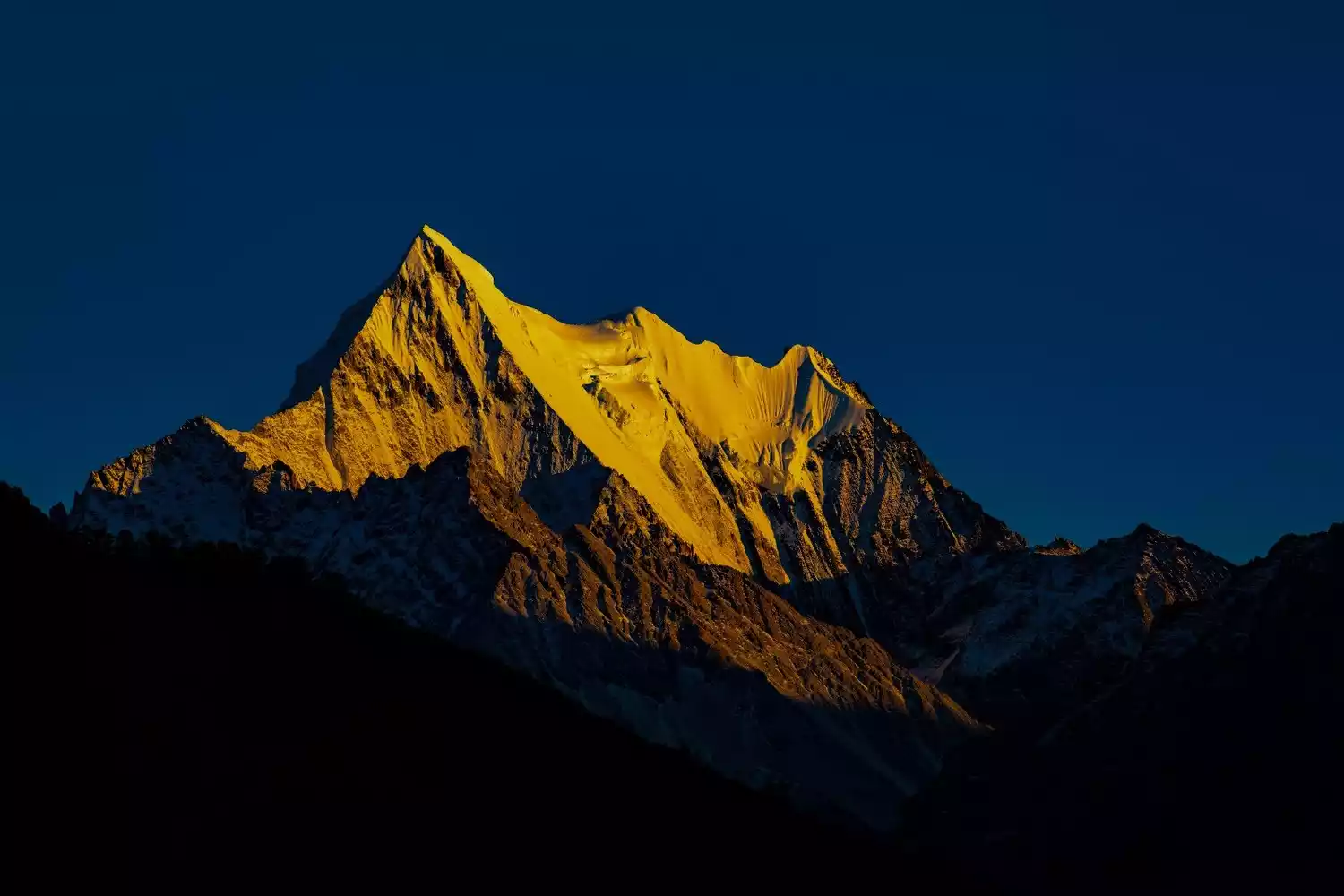
Xianuoduoji Snow Mountain at sunset
The rich autumn colors of Xiannairi Snow Mountain, picture from tourists@士官长
Overlooking the Milk Sea and the Five-Colored Sea, picture from tourists@阿馨
Heimani Pass, a viewing platform where you can see the three sacred mountains of Aden at the same time, exclusive to China-TravelNote
Xiangcheng - Baizangfang, Bam Seven Lakes
Xiangcheng, located in the southern part of the Shaluli Mountains, is one of the few low-altitude valleys among the mountains. It is called "Kacheng" in Tibetan, which means holding Buddhist beads.
There's a legend about Xiangcheng: During the Southern Song Dynasty, Dusum Khyenpa, the founder of the Karma Kagyu sect, visited Xiangcheng. Overwhelmed by the beautiful countryside, he decided to preach there. In his excitement, he accidentally tore a bodhi bead bracelet apart in a field. The 108 beads rolled everywhere, unable to be retrieved. Thus, the bodhi seeds originally from India took root and sprouted in Xiangcheng, becoming known as "Kangzhu."
The Baizangfang is the most important and distinctive landscape in the township. Its unique Tibetan architecture is based on the architecture of the Kham-Tibet region and incorporates the architectural art features of the Naxi and Han ethnic groups, forming a unique architectural style and system compared to other places on the Kham Plateau and even the entire Tibetan area.
Spring and summer are Xiangcheng's most beautiful seasons. From the mountaintop, the white-scented houses look like lost pearls, dotted amidst a sea of greenery. As spring arrives and flowers bloom, Xiangcheng transforms into a paradise, sparsely populated by tourists, a place of tranquility and peace. Every morning and evening, divine light shines upon the area. In the sidelight, accompanied by morning mist or smoke from cooking fires, the entire valley, with its countryside and white-scented houses, resembles a dreamlike wonderland.
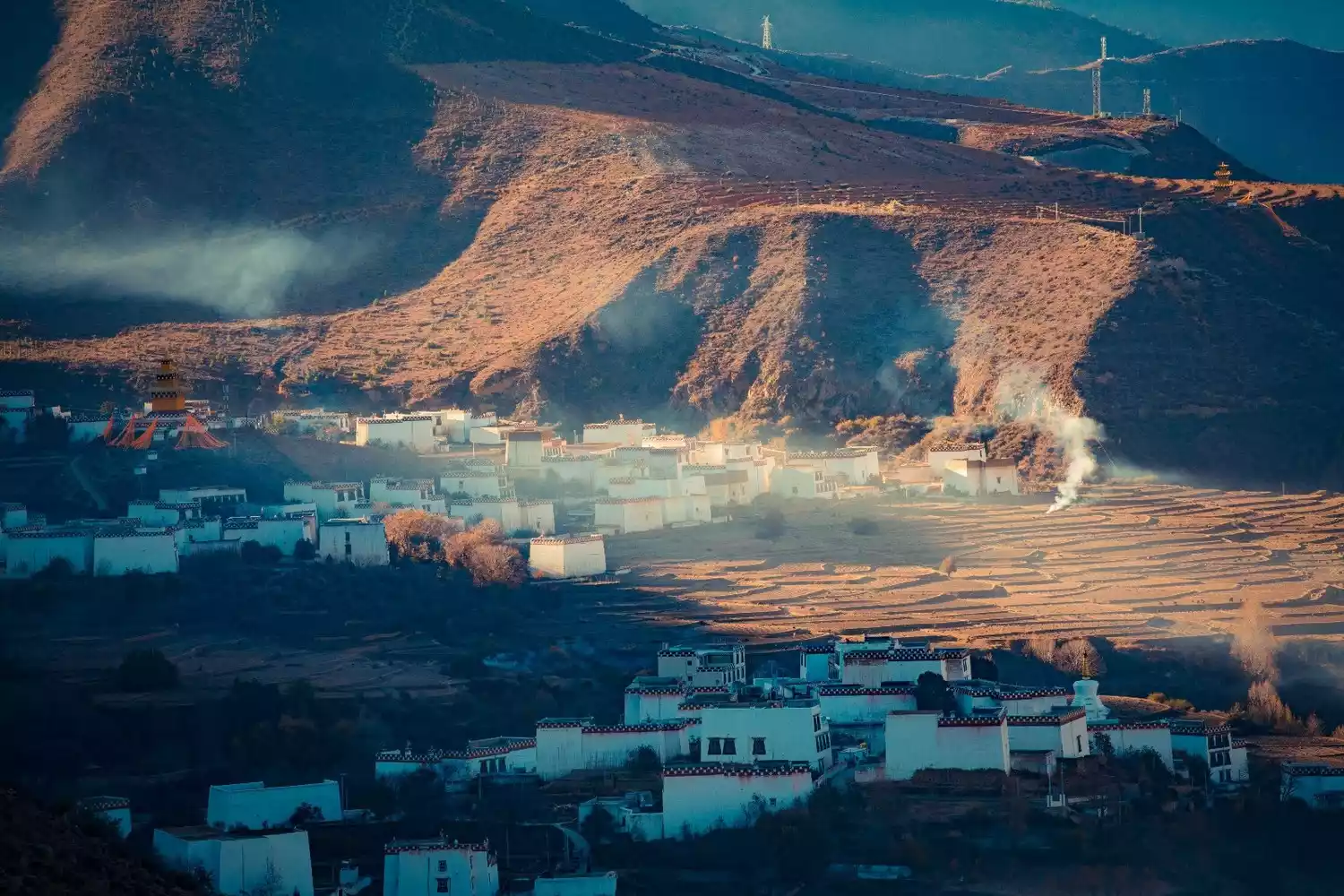
Xiangcheng Baizang House in the morning mist
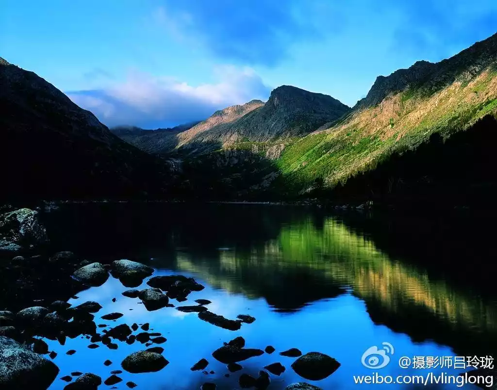
The Seven Lakes of Bamu, located at the foot of the Shaluli Mountains east of Xiangcheng County, have an average elevation of over 4,500 meters. Their breathtaking scenery is rarely visited, earning them the nickname "one of Sichuan's eight undiscovered secrets."
Because of its proximity to the Three Sacred Mountains of Yading, the Bamu Seven Lakes have always been regarded by locals as seven bowls of pure water offered by the mountain gods to the Three Sacred Mountains. The Bamu Seven Lakes are composed of seven alpine lakes in the same valley. The largest lake is also called "Rilang Yangcuo", which is the longevity holy lake for dozens of villages in the surrounding area. Therefore, these seven lakes are also called "Rilang Yangcuo Seven Lakes".
The seven lakes are distributed in steps and connected by waterfalls, and the area around the lakes still maintains the most primitive ecology.
The beauty of the Seven Lakes of Bam varies greatly depending on the light of the day, sometimes serene and sometimes brilliant. Lakes, waterfalls, primeval forests, meadows, snow-capped mountains, relics of the ancient Tea-Horse Road, temples, and Tibetan villages all combine to create a rare spectacle.
Lead-gray rock peaks cascade down from the horizon. Embraced by these seven natural terraces, seven mirror-like lakes are studded. Some are long like pipa, some are round like jade plates, some are blue like gemstones, and some are green like emeralds. Connected end to end, they resemble a string of beads. Rare and nationally protected animals such as white-lipped deer, bears, horse bears, blue sheep, argali, Sumatran serow, and pheasants live within the lake area. More than a dozen herds of blue sheep, numbering hundreds, regularly roam the area surrounding Qihai, bringing the total number to over a thousand. If you're lucky, you might even be able to take a photo with these animals.
Overlooking the Seven Lakes of Bam, photo from tourists@Falling
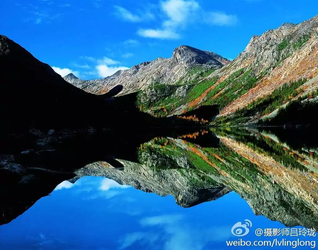
The most famous picture of the Seven Lakes of Bam in history, by Lü Linglong, picture from @吕玲珑老师's Weibo
Lijiang - Haba Snow Mountain, Jade Dragon Snow Mountain, Tiger Leaping Gorge
The Jinsha River cuts through the massive Shaluli Mountains in Yunnan, creating the world-class Tiger Leaping Gorge. Haba Snow Mountain and Jade Dragon Snow Mountain, the last remaining feature of the Shaluli Mountains, face each other across the river.
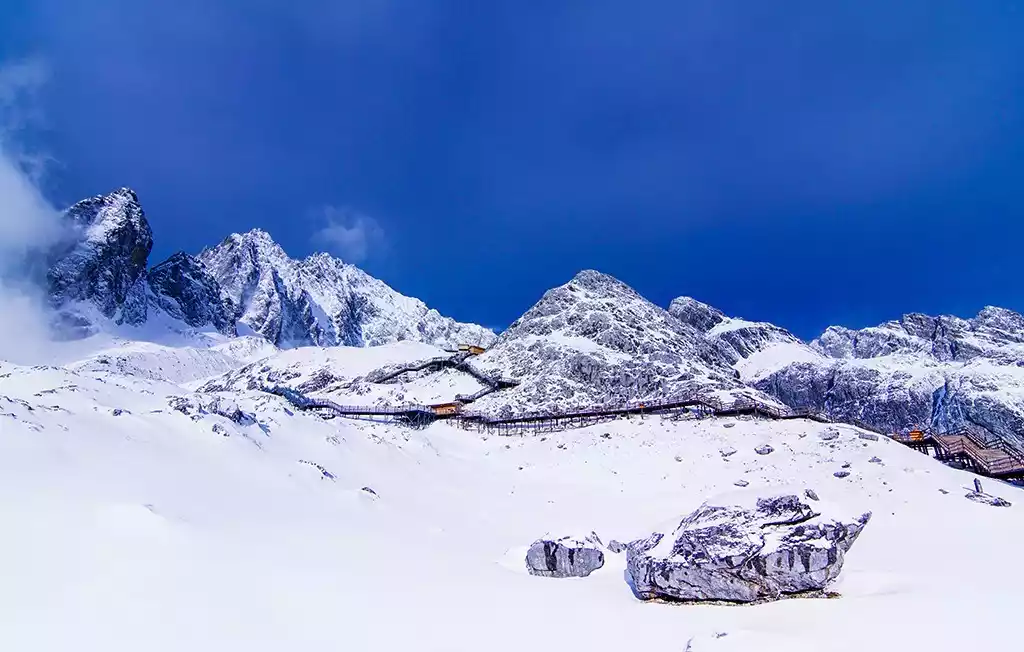
The Napa Grass Sea, formed by the trickle of water from the meltwater of Jade Dragon Snow Mountain's glaciers, nourishes the Naxi people and contributes to the renowned Old Town of Lijiang. Haba Snow Mountain, at 5,396 meters above sea level, is gentle in its upper reaches and steep in its lower parts, creating a majestic, beautiful, and mysterious appearance.
"Haba" means "flower of gold" in the Naxi language. The main peak of Haba Snow Mountain stands tall and proud, capped year-round with snow. Flanked by four smaller peaks, it resembles a silver tripod towering majestically amidst the blue sky and white clouds. Above 4,700 meters, the mountain is covered in snow year-round, and a well-preserved modern glacier adorns its summit. It is one of the most popular entry-level mountaineering peaks.
Baishuitai, located at an altitude of 2,380 meters on the eastern slopes of Haba Snow Mountain, is the birthplace of the Dongba religion of the Naxi people. From a distance, nestled among the green mountains, Baishuitai resembles terraced fields. In the sunlight, it resembles a frozen waterfall in a photograph. Stepping onto the white stone steps brings an indescribable coolness and refreshing sensation. Baishuitai was formed by calcium carbonate dissolving in spring water. As the spring water, containing calcium bicarbonate, slowly flows down, the carbonates gradually precipitate, forming the terraced surface over the years. Due to its terraced appearance, it is known as the "Immortal's Relics." Covering approximately three square kilometers, it is the largest Huaquan Terrace in my country.
Overlooking Haba Snow Mountain, picture from tourists@Erdos
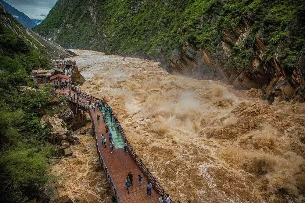
Tiger Leaping Gorge, picture from tourists@小鱼儿
Haba Snow Mountain is one of the most popular entry-level mountains in the mountaineering world.
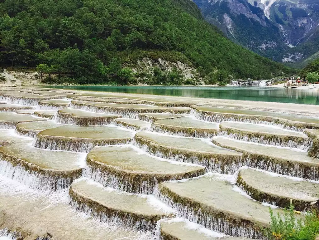
Baishuitai, the birthplace of Dongba culture, is located at the foot of Haba Snow Mountain and is the largest Huaquan Terrace in China.
Yulong Snow Mountain, with an altitude of 5,596 meters, is the peak closest to the equator in the Northern Hemisphere with snow all year round. It is also the southernmost peak of the Shaluli Mountains. It is called "Olu" in Naxi language, which means silver rock.
The thirteen snow-capped peaks stretch endlessly like a giant dragon soaring and dancing, hence the name "Jade Dragon" by the local Han people. Because the mountain is primarily composed of limestone and basalt, with distinct black and white, it is also known as the "Black and White Snow Mountain," a sacred mountain for the Naxi people.
Jade Dragon Snow Mountain is home to a massive temperate marine glacier. Meltwater from the glaciers converges at the foot of the mountain, nourishing the beautiful Napa Grass Lake in Lijiang. Napa Lake, meaning "lake beside the forest" in Tibetan, is an ideal habitat for rare species such as the black-necked crane.
In different seasons, Napahai presents different beautiful scenes. In spring, the grass is green, in summer, the grass sea is undulating, in autumn, it is golden, and in winter, it is covered with snow. The snow-capped mountains stand quietly and proudly in the distance. Rare birds, snow-capped mountains, grasslands, cattle and sheep weave the eternal scenery of Napahai.
Thanks to the combined influence of Jade Dragon Snow Mountain and Napa Grass Sea, Lijiang has long been a vital distribution center for supplies along the Yunnan-Tibet section of the Ancient Tea-Horse Road. At the end of the Song Dynasty and the beginning of the Yuan Dynasty, a branch of the Naxi ethnic group surnamed Mu migrated here and established what is now Lijiang Old Town. From then on, the Naxi people took root and flourished here, forming tranquil villages such as Dayan, Shuhe, and Baisha. This also gave rise to the Dongba script, the oldest pictographic script in use, and the unique Dongba religion, which continues to this day.
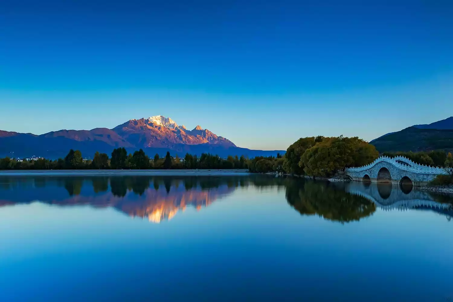
Jade Dragon Snow Mountain viewed from Lijiang Old Town. Image courtesy of tourists@小鱼儿
Close-up of Jade Dragon Snow Mountain
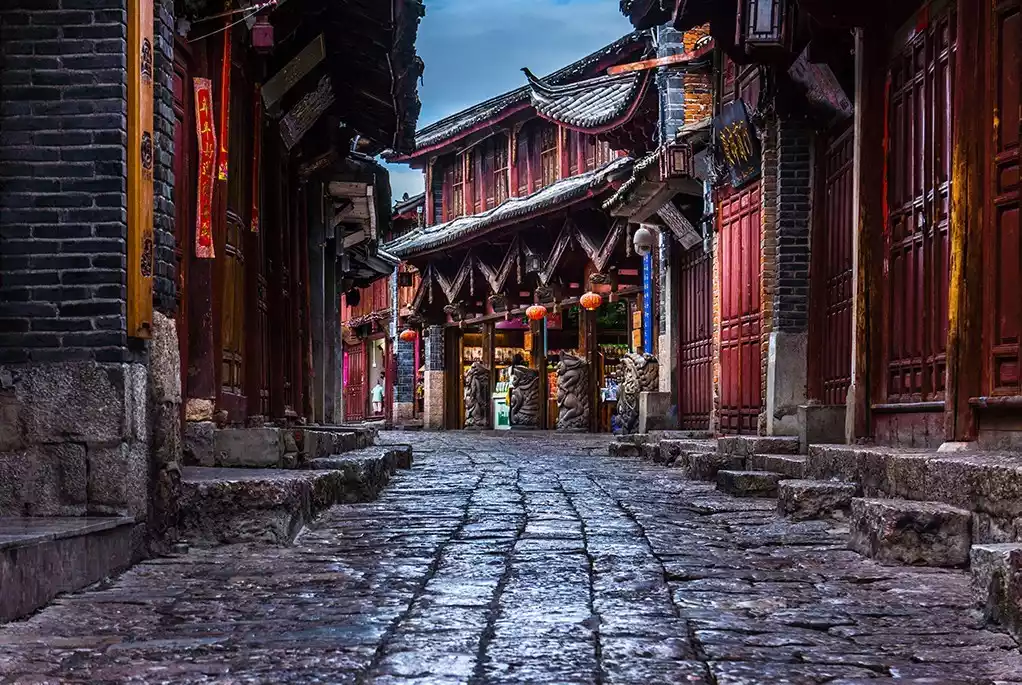
Lijiang Dayan Ancient Town has been preserved for thousands of years and is still in good working order.
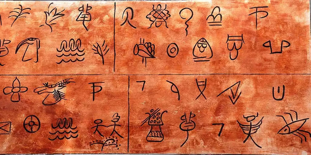
Naxi script, the only living hieroglyphic script in the world
Napa Grass Sea nourished by the glaciers of Jade Dragon Snow Mountain
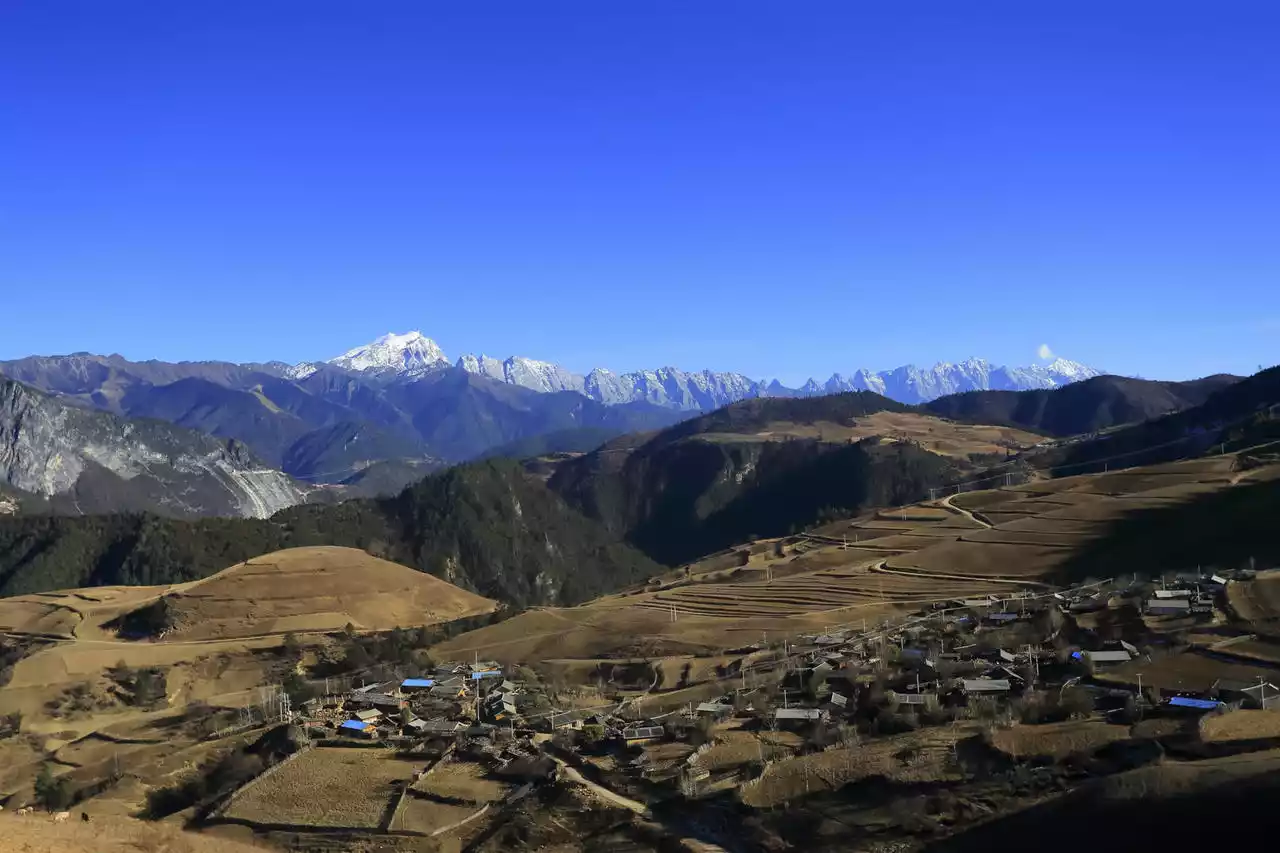
At this point, the 600-kilometer-long Shaluli Mountains gradually become flatter and gradually sink into the relatively low Yunnan-Guizhou Plateau.
Conclusion
The Shaluli Mountains, the largest range in Sichuan, boasts a wealth of stunning scenery. A short guide wouldn't be enough to fully capture it all. So, I've curated a selection of familiar, seemingly familiar, and undeniably unrelated sights to give you a comprehensive understanding of this mountain range, dubbed the "Heart of Hengduan" by National Geographic China.
Mount Saruri is huge and its landscape is extremely rich. There are so many places that even the editor has only heard of them. I can only look forward to slowly exploring and discovering them in the days to come.
The Sharuli Mountains, with its huge spatial span and extremely complex topography, concentrates diverse and rich natural scenery and gathers many unique cultural elements, thus attracting people from all over the world to explore and giving the area extremely high exposure.
Although "Shaluli Mountain" as the mother body is still an unfamiliar concept in people's cognition, the beautiful scenery of the western Sichuan Plateau that once flooded the circle of friends all came from this mountain range. Shaluli Mountain is worthy of the title of "Dragon Vein of Western Sichuan".
Except where otherwise noted, the above pictures were taken by the author or purchased from the photo website. Reproduction without permission is strictly prohibited.