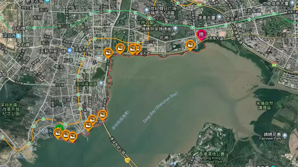
Five stunning hiking routes in Shenzhen, including directions
Preface
Shenzhen, also known as Pengcheng, is a municipality under the jurisdiction of Guangdong Province. Located in southern Guangdong, it sits on the eastern shore of the Pearl River Delta, separated from Hong Kong by a stretch of water. It borders Daya Bay and Dapeng Bay to the east, the Pearl River Estuary and the Lingdingyang to the west, Hong Kong to the south across the Shenzhen River, and Dongguan and Huizhou to the north. Rich in geological and tourism resources, Shenzhen is a haven for outdoor enthusiasts!
We love the mountains, climbing over them, and the paths we take are constantly changing: mountain paths, wild roads, gravel roads. Standing on a mountaintop, sweat dripping, a gentle breeze on your face, it feels like the world is yours. What are you waiting for? Join us for a hike!
Wutong Mountain
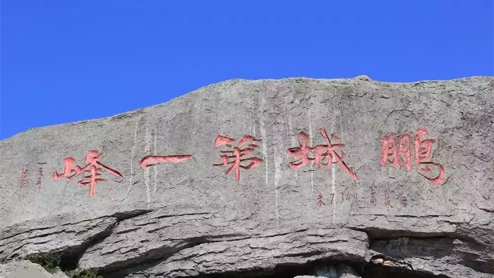
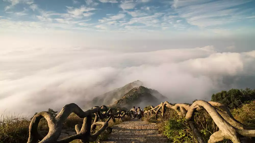
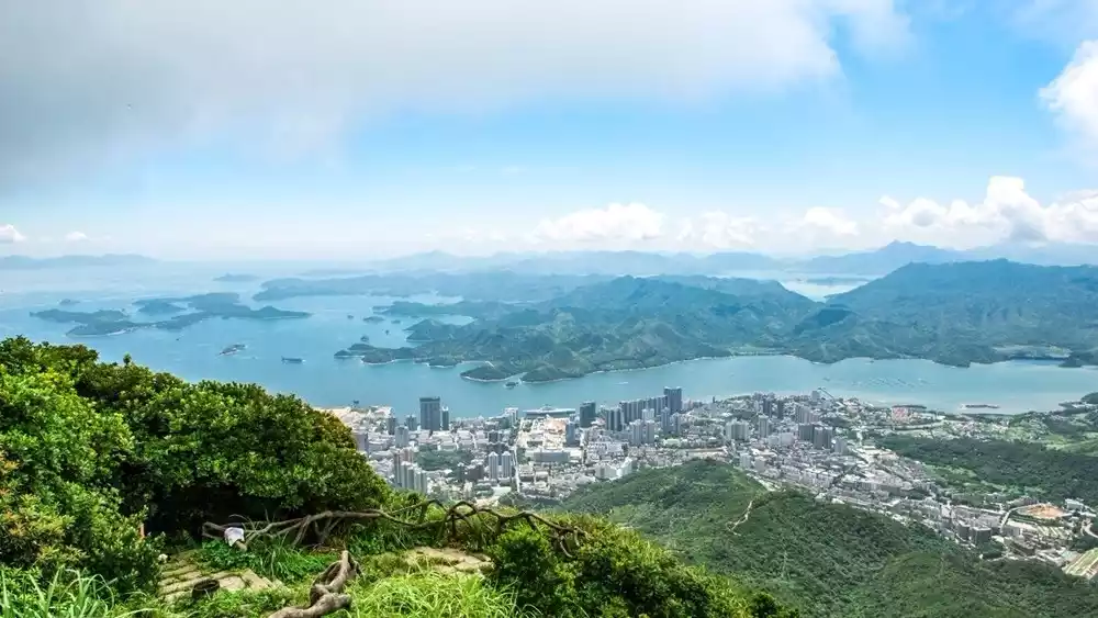
Wutong Mountain, with its main peak at 943.7 meters, is Shenzhen's highest point. It's a popular destination for outdoor enthusiasts and locals. There are several routes to climb Wutong Mountain. Starting from Wutong Mountain Village, you can follow the Luolongjie route up to the summit, then descend the century-old ancient road back to Wutong Mountain Village. This is a more outdoor route. For first-time hikers, we recommend starting from Wutong Mountain Village, ascending Haohanpo, then descending the winding mountain road back to Wutong Village. This is an easy-to-reach route, mostly on trails, and is relatively safe.
(Pictures from the Internet)
(Pictures from the Internet)
(Pictures from the Internet)
Tips:
Nature of activity: Mountaineering
Activity intensity: ★★★
Activity Difficulty: ★★★
Scenery index: ★★★
Hiking distance: 10 km
Hiking time: 4.5 hours
Hiking conditions: Jungle dirt road, stone steps
Hiking equipment: hiking shoes, outdoor clothing or (sportswear), trekking poles, knee pads, rain gear, adequate drinking water, food, etc.
Route tips: Please do not climb the mountain in moderate rain or above; the wind is strong on the top of the mountain, so please keep warm after reaching the top.
Transportation: Take the bus to Wutongshan Village Terminal (Routes 211, M445, and Wutongshan Holiday Special Line 2)
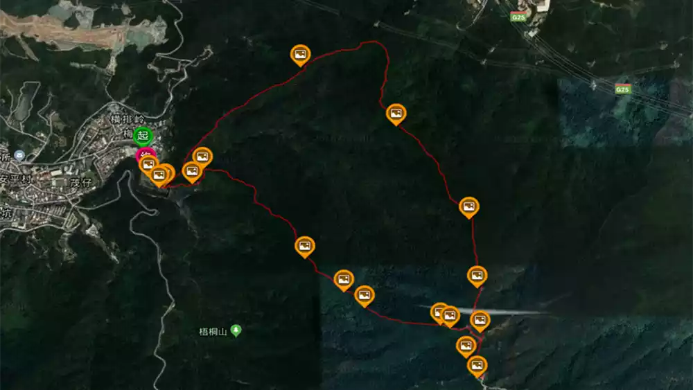
Route
Wutong Village - Luolongjie - Climb to the summit - Centennial Ancient Road - Wutong Village
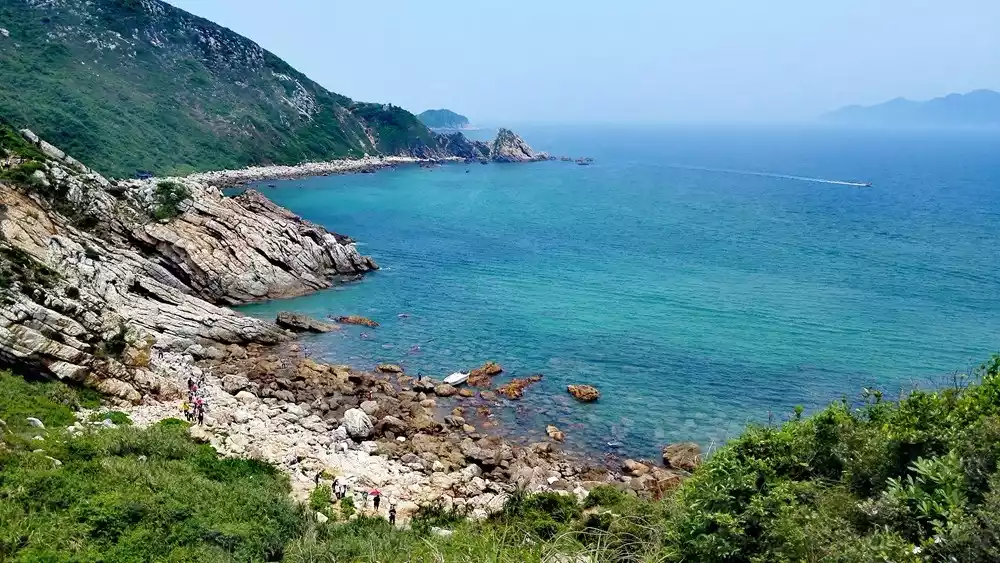
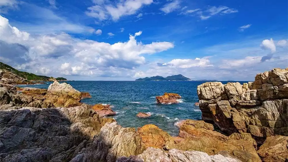
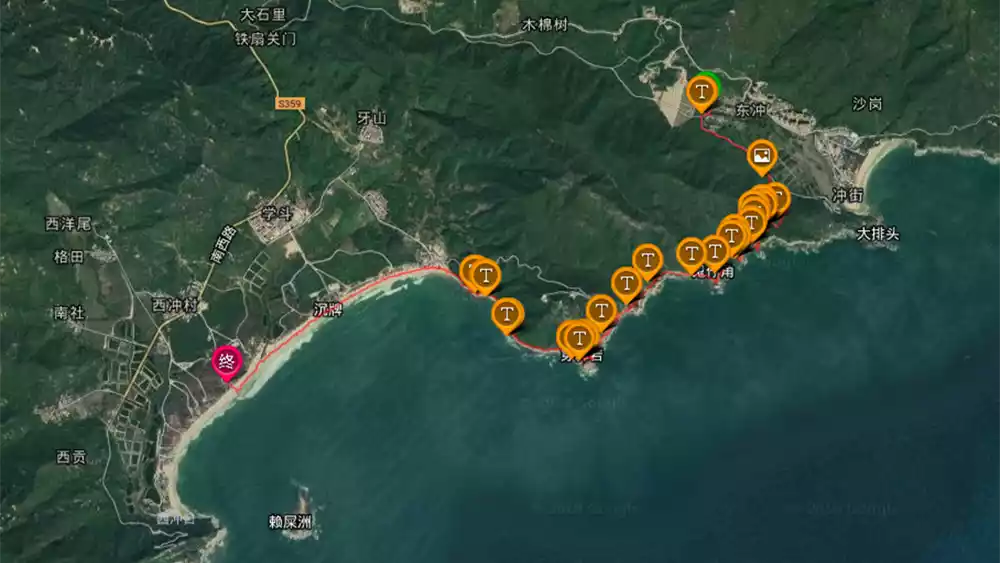
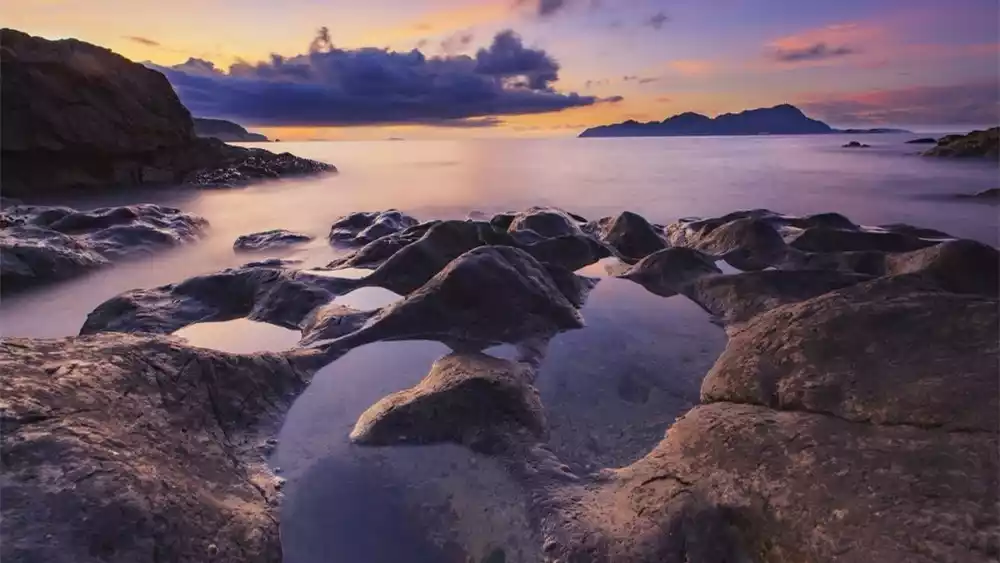
East and West Crossing
The Dongxi Chong Coastline is Shenzhen's most beautiful and classic coastal hiking route, boasting crisscrossing mountains, a long coastline, and stunning ocean views! This delightful hike, from east to west, involves half the journey along mountain roads and the other half along the coast, making it an excellent entry-level outdoor activity.
(Pictures from the Internet)
 (Pictures from the Internet)
(Pictures from the Internet)
Tips:
Nature of activity: Coastline crossing
Activity intensity: ★★
Activity Difficulty: ★★
Scenery index: ★★★★
Hiking distance: 8.5 km
Hiking time: 4.5 hours
Hiking conditions: Beach, jungle dirt road, reef
Hiking equipment: hiking shoes, outdoor clothing or (sportswear), trekking poles, knee pads, rain gear, adequate drinking water, food, etc.
Route Tips: Do not cross during typhoon weather; avoid activities in high temperatures as much as possible; wear 100% sun protection; warm up thoroughly and be careful of sprains;
Transportation location: Take bus M231 to Tung Chung Village Committee Station. After getting off, walk back about 500 meters to see the entrance. Self-driving is not recommended as the starting and ending points are not in the same location.
Route
Dongchong - Guizaijiao - Chuanbi Rock - Xichong Beach
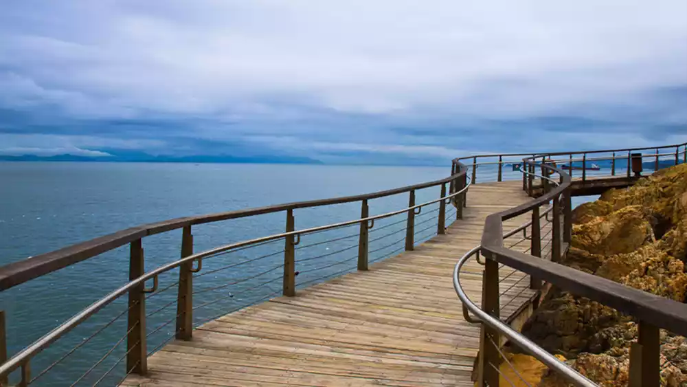
Shenzhen Bay Boardwalk
The Shenzhen Bay Coastal Boardwalk stretches from the mangroves to the Sea World, with vast mangrove wetlands to the east and a long coastline to the west. There are 10 themed landscapes. At a glance, the opposite bank is full of high mountains, with few urban buildings, a breeze, clear water, blue sky and white clouds, and the scenery is picturesque.
Connecting Mangrove Park to Shekou, linking people's livelihood and beautiful scenery, you can "check in" at these landmarks: the characteristic steel bridge of the Central River, Jacaranda Square, Nuwa Park Square, Lighthouse Park, Fishing Port Park, Lian Wharf Park, Marine Surveillance Square, Window on the Sea, and Yuehai Square... It is expected to become a new favorite for hiking enthusiasts.
It is a wonderful thing to pick an early morning or evening to meet up with your lover or close friends and walk along the coastline. If you are lucky, you may even see migratory birds nesting!
Due to the good environment and convenient transportation, many friends who like running choose to run at night here. In addition to hiking, this place is also suitable for cycling, but please note that cycling is not allowed on weekends and holidays!

(Pictures from the Internet)
(Pictures from the Internet)
(Pictures from the Internet)
Tips:
Activity type: Hiking, running, cycling
Activity intensity: ★
Activity Difficulty: ★
Scenery index: ★★★★
Hiking distance: 9 km
Hiking time: 3 hours
Hiking road conditions: cement road
Hiking equipment: casual clothes, camera
Route tips: In addition to hiking, this place is also suitable for cycling, but please note that cycling is not allowed on weekends and holidays!
Transportation: Take bus No. 80 or 121 and get off at Hongshulin Bus Station. Then take the subway to Hongshuwan or walk a short distance south from Hongshuwan.
Route
Sea World-Mangrove Wetland
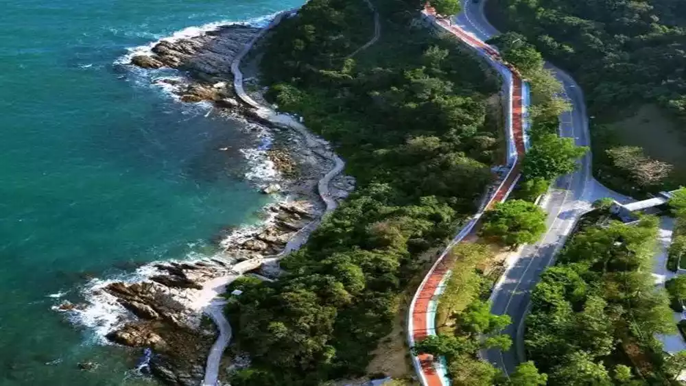
Eastern Coast Plank Road
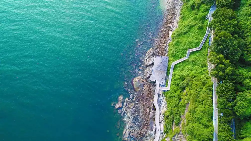
This is the world's longest coastal boardwalk, stretching a magnificent 19.5 kilometers. Starting from the Ancient Pagoda Park on Zhongying Street in the west and ending at Beizaijiao in the east, it comprises the Zhongying Street section, the Shatoujiao section, the harbor section, the fishing port section, and the Dameisha and Xiaomeisha sections. Along the way, there are hiking trails, walking paths, observation decks, piers, and stone arch bridges. It's a must-see for any Shenzhen hiker!
Encounter the beautiful seaside boardwalk, feel the impact of waves hitting the rocks, and overlook the vast sea and green mountains!
(Pictures from the Internet)
(Pictures from the Internet)
(Pictures from the Internet)
Tips:
Activity type: Coastline hiking
Activity intensity: ★★
Activity Difficulty: ★★
Scenery index: ★★★★
Hiking distance: 19.5 kilometers
Hiking time: 7 hours
Hiking conditions: seaside boardwalk, seaside highway
Hiking equipment: hiking shoes, outdoor clothing or (sportswear), trekking poles, knee pads, rain gear, adequate drinking water, food, etc.
Route tips: Do not cross during typhoon weather; avoid activities in high temperatures as much as possible; and take 100% sun protection measures.
Transportation: Take bus B626 and get off at Yantian Food Street Station.
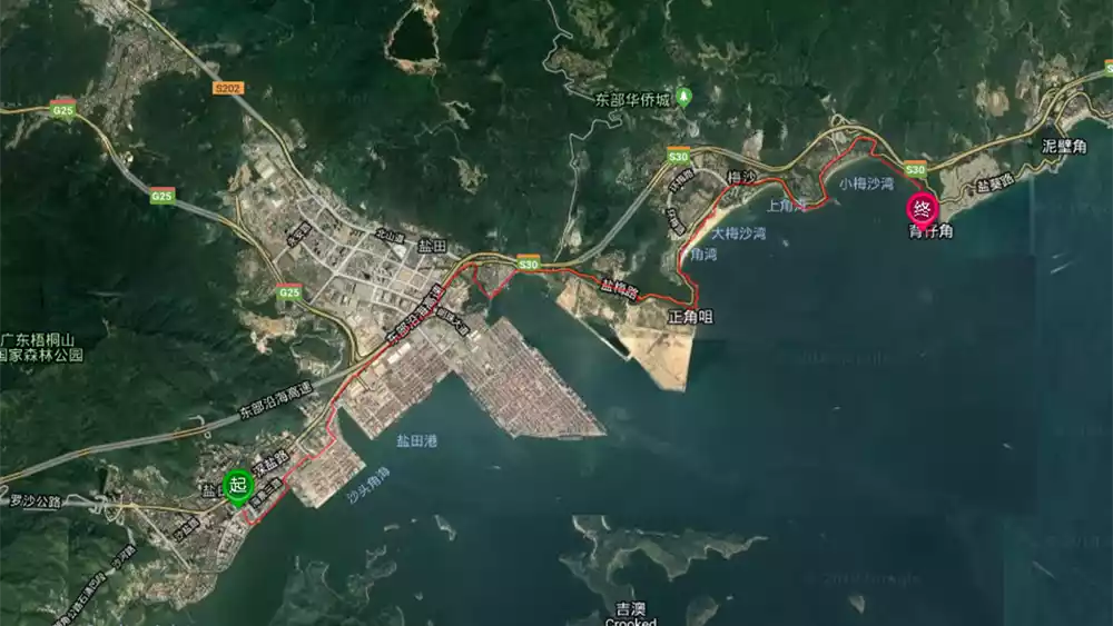
Route
Zhongying Street - Yantian Port - Dameisha - Xiaomeisha - Beizaijiao
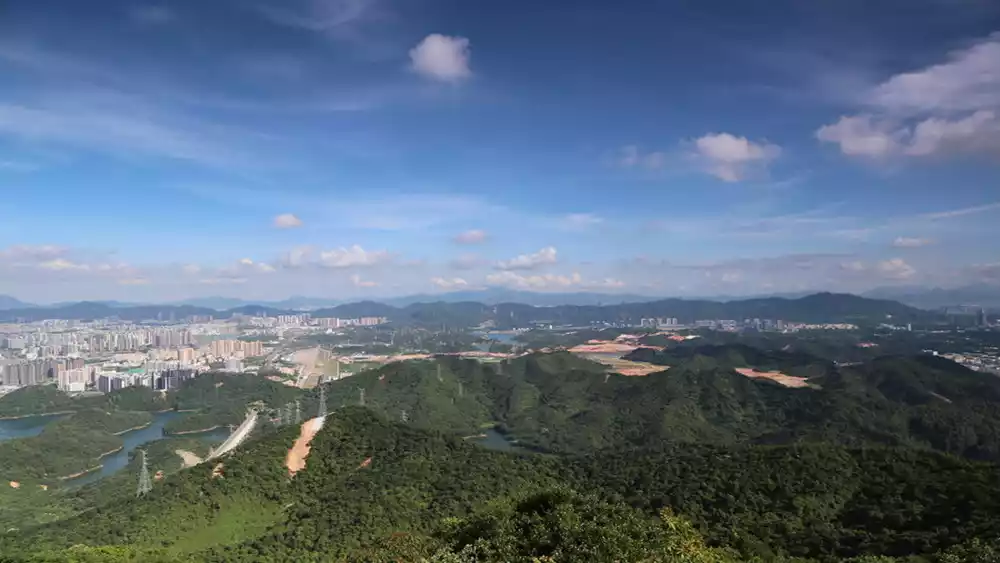
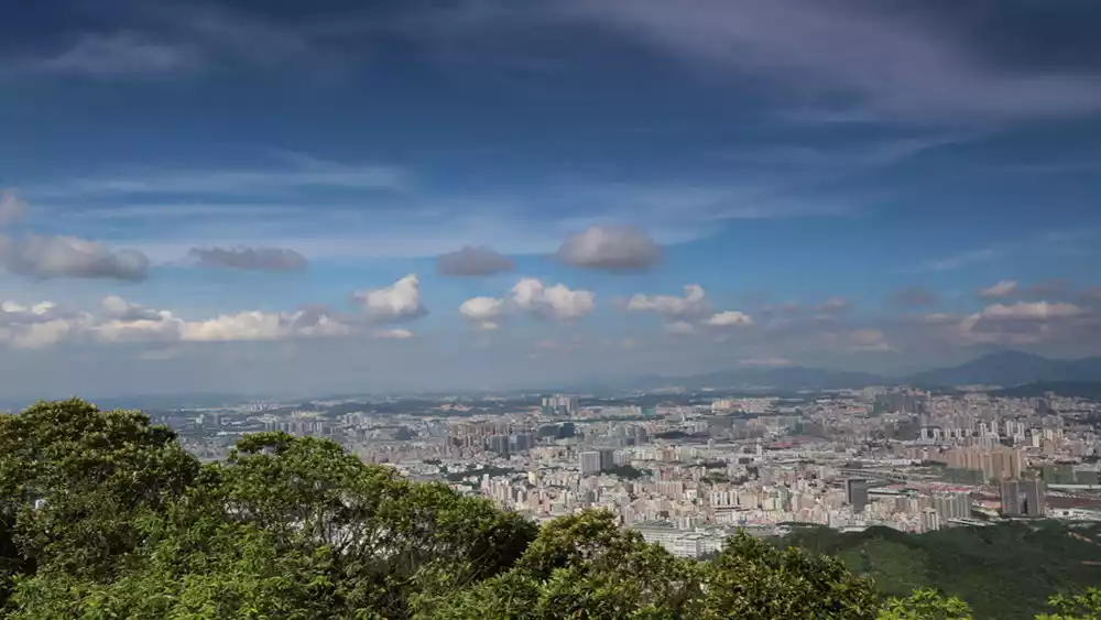
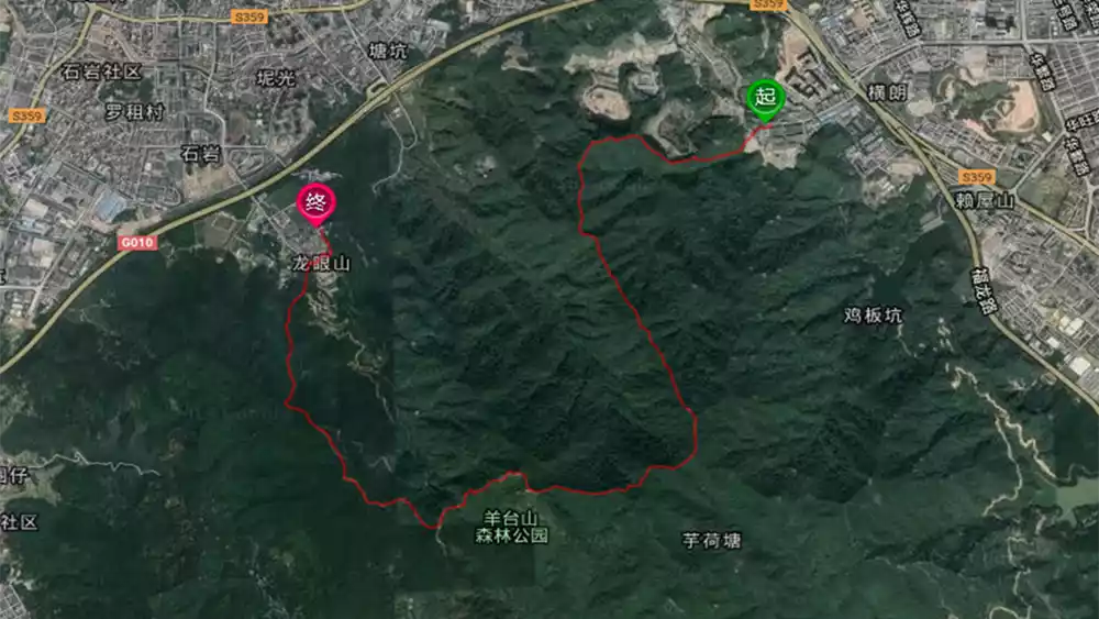
Yangtai Mountain
Yangtaishan Forest Park is located in the northwest of Shenzhen City. It is one of the eight scenic spots in Shenzhen. It is located between Bao'an District, Nanshan District and Longhua New District. It is adjacent to Shiyan Reservoir and Tiegang Reservoir to the west and Xili Reservoir to the south. It embraces Laiwushan Reservoir, Gaofeng Reservoir, Lengshuikeng Reservoir, Shipotou Reservoir and Jianfeng Reservoir.
Most of the main peaks are located in Shiyan, Bao'an District, at an elevation of 587 meters. It is the highest peak in northwest Shenzhen, boasting a majestic presence, a towering main peak, and a sprawling network of branches. Its subordinate peaks include Dongyangtai (465 meters) and Chidong (438 meters). It has become a popular destination for sightseeing, travel, leisure, and fitness for both Chinese and international tourists and the general public.

(Pictures from the Internet)
(Pictures from the Internet)
(Pictures from the Internet)
Tips:
Nature of activity: Mountaineering
Activity intensity: ★★★
Activity Difficulty: ★★★
Scenery index: ★★★
Hiking distance: 10 km
Hiking time: 5 hours
Hiking conditions: jungle dirt road, stone steps, gravel road
Hiking equipment: hiking shoes, outdoor clothing or (sportswear), trekking poles, knee pads, rain gear, adequate drinking water, food, etc.
Route tips: Please do not climb the mountain in moderate rain or above; the wind is strong on the top of the mountain, so please keep warm after reaching the top.
Transportation location: Get off at Shanghenglang Bus Station and take E14, M233, M244, M262, etc.
Route
Baiyun New Village - Helipad - Dayangtai Mountain - Yangtai Mountain Climbing Square
Conclusion
The meaning of life lies in experience. Don’t stay at home on weekends. Ask your friends to go hiking nearby. It will not only exercise your body and relax your mind, but also allow you to enjoy the beautiful scenery that you can hardly see on weekdays. It’s a win-win situation. Why not do it?