20 Secret Places in China: Breathtakingly Beautiful Despite Being Few in the World
Preface
Peak travel season is approaching, and as a seasoned traveler, I don't want to go to those crowded popular attractions! We need to find new dream destinations in China, hidden gems that can satisfy all our travel fantasies!
Today, I'm recommending 20 hidden gems in China. These hidden gems, hidden gems far from the crowds, are captivating and unforgettable.
If you really want a unique journey, follow me to these 20 secret places! Say goodbye to the herd!
Xinjiang region
Qiongkushitai
【Address】Qiongkushitai Village, Tekes County, Ili Kazakh Autonomous Prefecture
[Transportation] You must pass through Tekes and enter along the county road. The road conditions are relatively poor and require an off-road vehicle or local vehicle. There are often road closures due to construction.
【Recommended】1-2 days
【Ticket】No
【Best season】Late May to mid-September.
In midsummer, when the grass is green and the weather is warm, local Kazakh herders usually drive their cattle and horses to graze on the fertile grasslands. The snow-capped mountains, grasslands, river valleys, and forests create a beautiful scenery all year round, like a paradise.
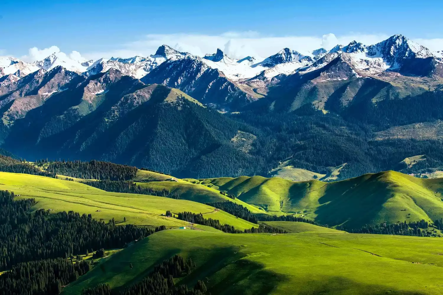
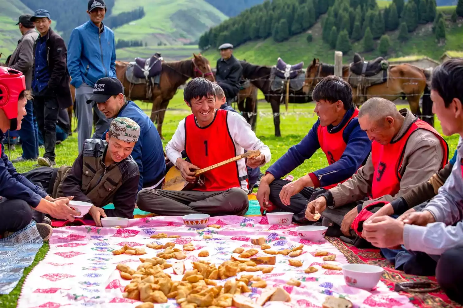
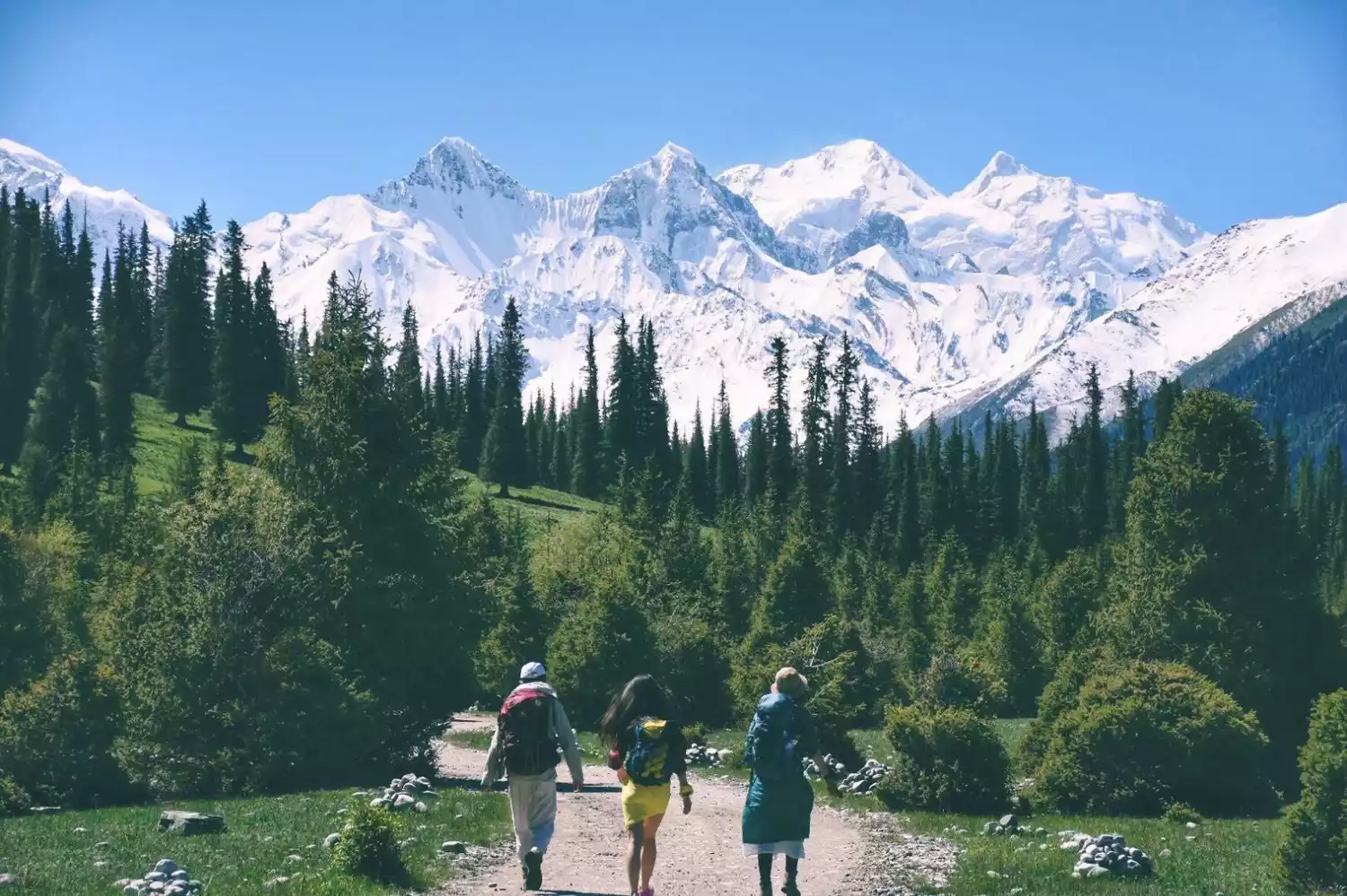
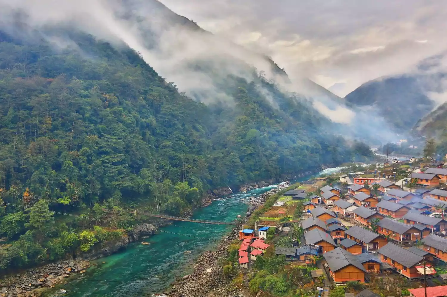
Qiongkushitai is a hidden village located at the foot of the Tianshan Mountains, deep in the Kalajun grassland. Due to poor transportation, it was unknown to the world until the first photographer came here and unveiled the mystery.
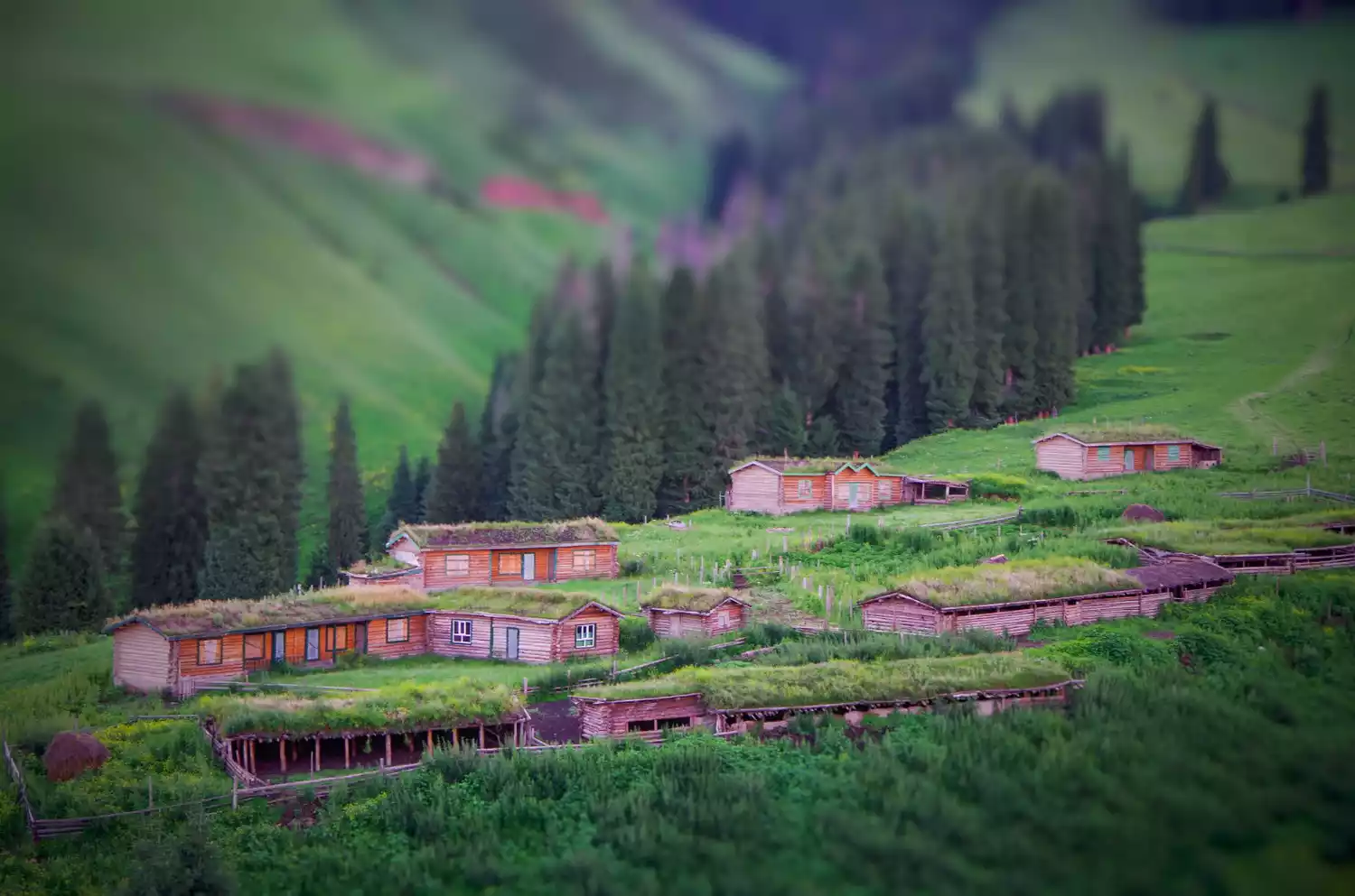
Along the way to Qiongkushitai, there are rolling grasslands. Yurts and wooden houses make the grasslands full of vitality and vigor. The nomadic Kazakh people graze and live here, which is like a paradise.
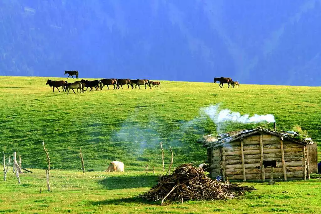
The village is small, with only a few dozen households. It's quiet and peaceful, and the local herders are very down-to-earth, hospitable, and enthusiastic. If you're lucky, you might even witness the spectacular Kazakh sheep-grabbing competition.
If you are a photography enthusiast, you must stay in Qiongkushitai for a night to experience the life of the Kazakh people. In the morning and evening, you can take many humanistic photos.
Shatta Trail
【Address】Zhaosu County, Ili Kazakh Autonomous Prefecture
[Transportation] Take a bus from Yining Prefecture Bus Station to Zhaosu County, then take a bus from Zhaosu County Bus Station to Xiata Township and then to the scenic area.
Best season: May to early June or late September to early October
[Recommended Tour] 0.5-1 day. 9km one way, 5-6 hours round trip
【Ticket】Ticket + Scenic Spot 100 yuan
Xiata, known as "Shatu Aman" in Mongolian, means stairs. The Xiata Ancient Road, crossing the 3,600-meter-high Hatamuzida Pass on the main ridge of the Tianshan Mountains, connects the north and south of the Tianshan Mountains and serves as a shortcut from Yili to southern Xinjiang.
As a road connecting the north and south of the Tianshan Mountains, it is also the most dangerous ancient pass on the ancient Silk Road. It is called the "Xuanzang Road" in the outdoor community and is a paradise for outdoor hikers and walkers.
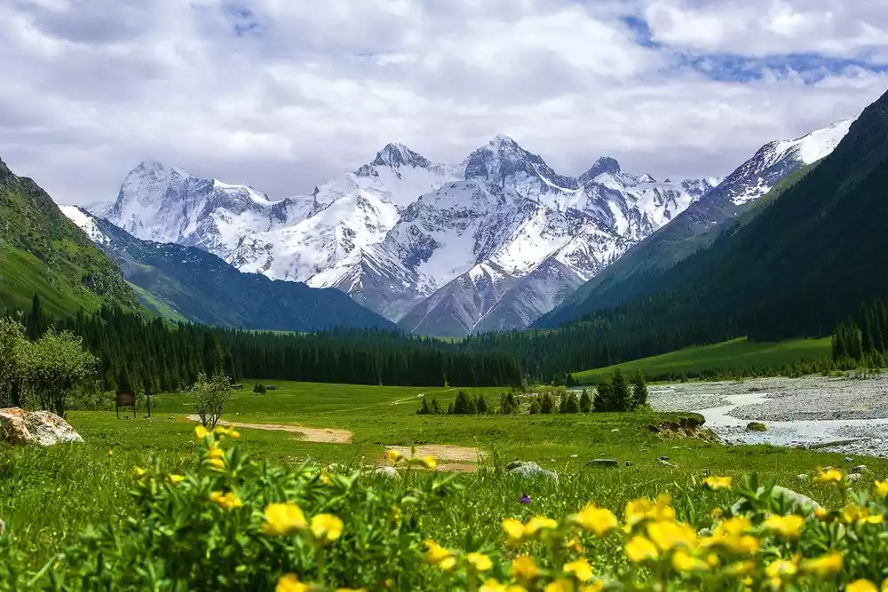
May to September every year is the most beautiful season for the Xiate Ancient Trail. The towering snow-capped mountains, the wild flowers all over the mountains, the lush green pines and cypresses, and the winding streams all make people feel as if they have strayed into a fairyland.
It is not recommended to walk too far when hiking the Xiat Ancient Trail. It can be just an experiential hike. A round trip of 8-18km is a good choice.
Red Mountain Grand Canyon
【Address】60km south of Kuitun City, the old mine of Hongshan Coal Mine, Kuitun City, Xinjiang
Best season: All year round
【Recommended】0.5 days
【Ticket】Free
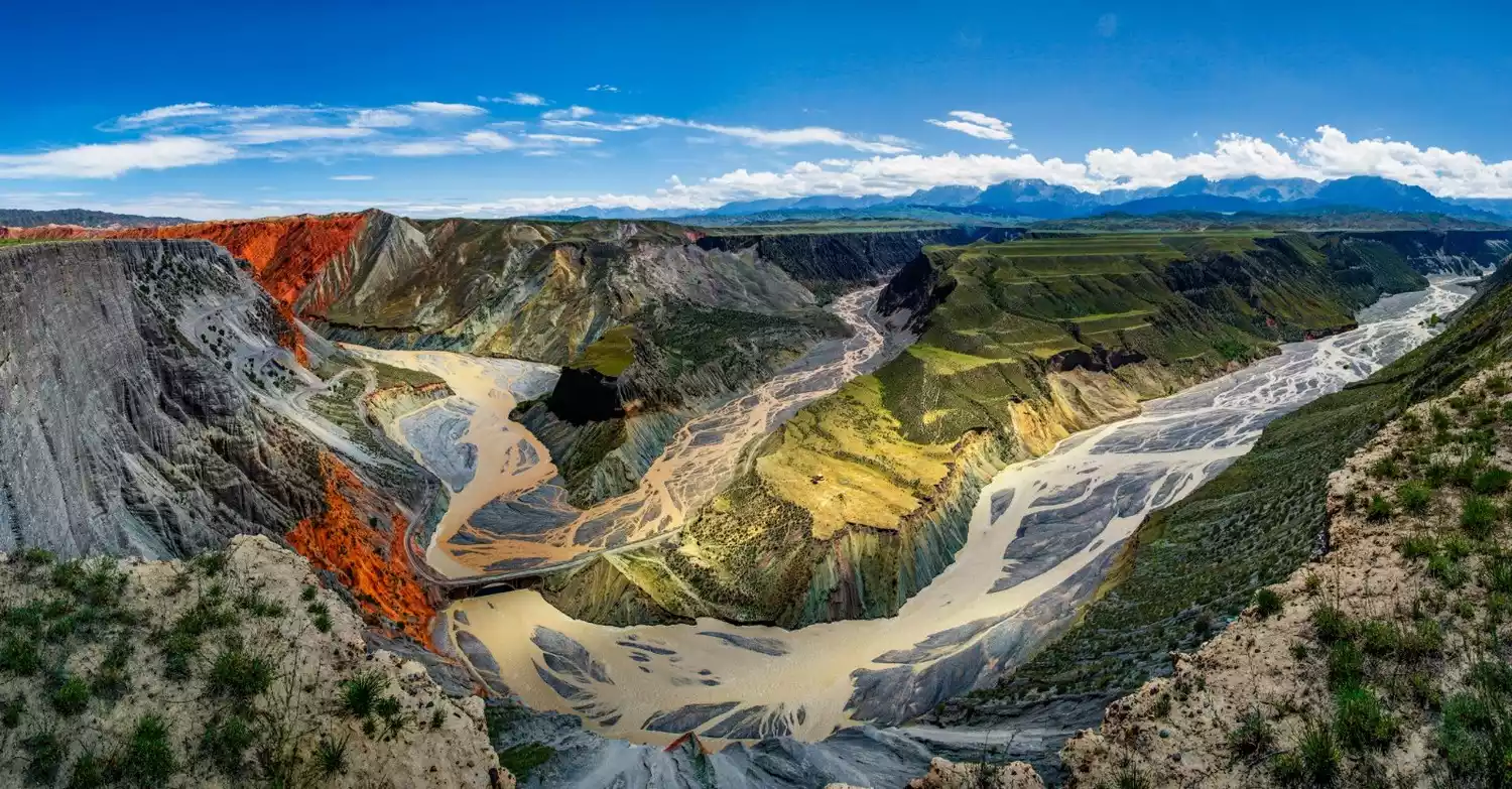
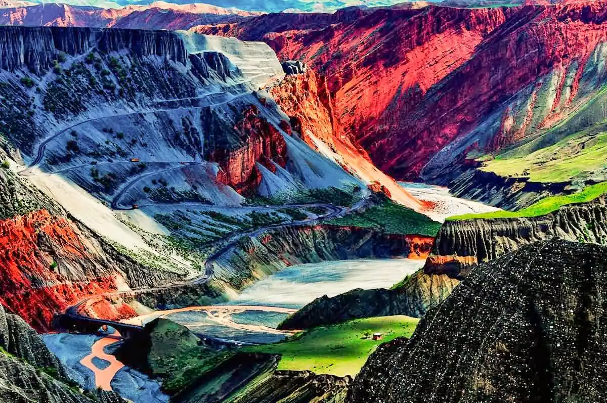
The Hongshan Grand Canyon, also known as the Anjihai Grand Canyon, is located on the north side of the Tianshan Mountains. The snow water from the Tianshan Mountains flows through here, forming a huge deep impact canyon.
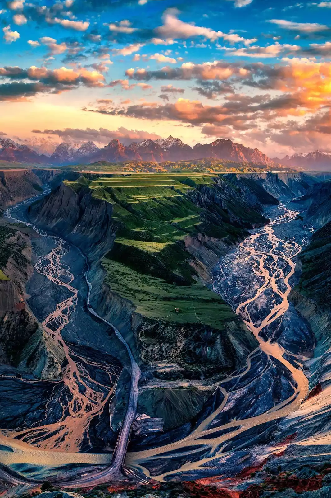
The upper part of the canyon is fertile grassland; the cliffs on both sides of the canyon have formed a spectacular spectacle of undulating rocks under the impact of rain and snow; the bottom of the canyon is flowing with snow water from the Tianshan Mountains, making it a must-visit place for photography enthusiasts.
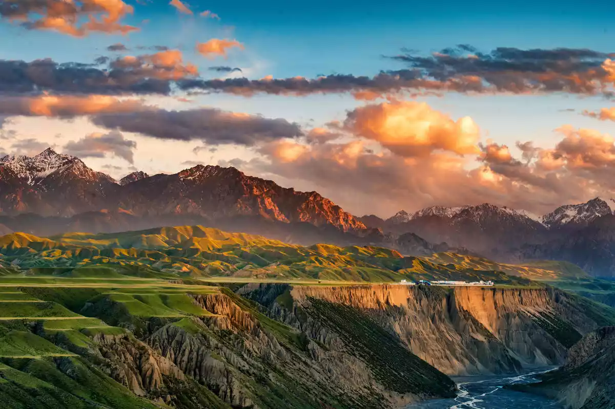
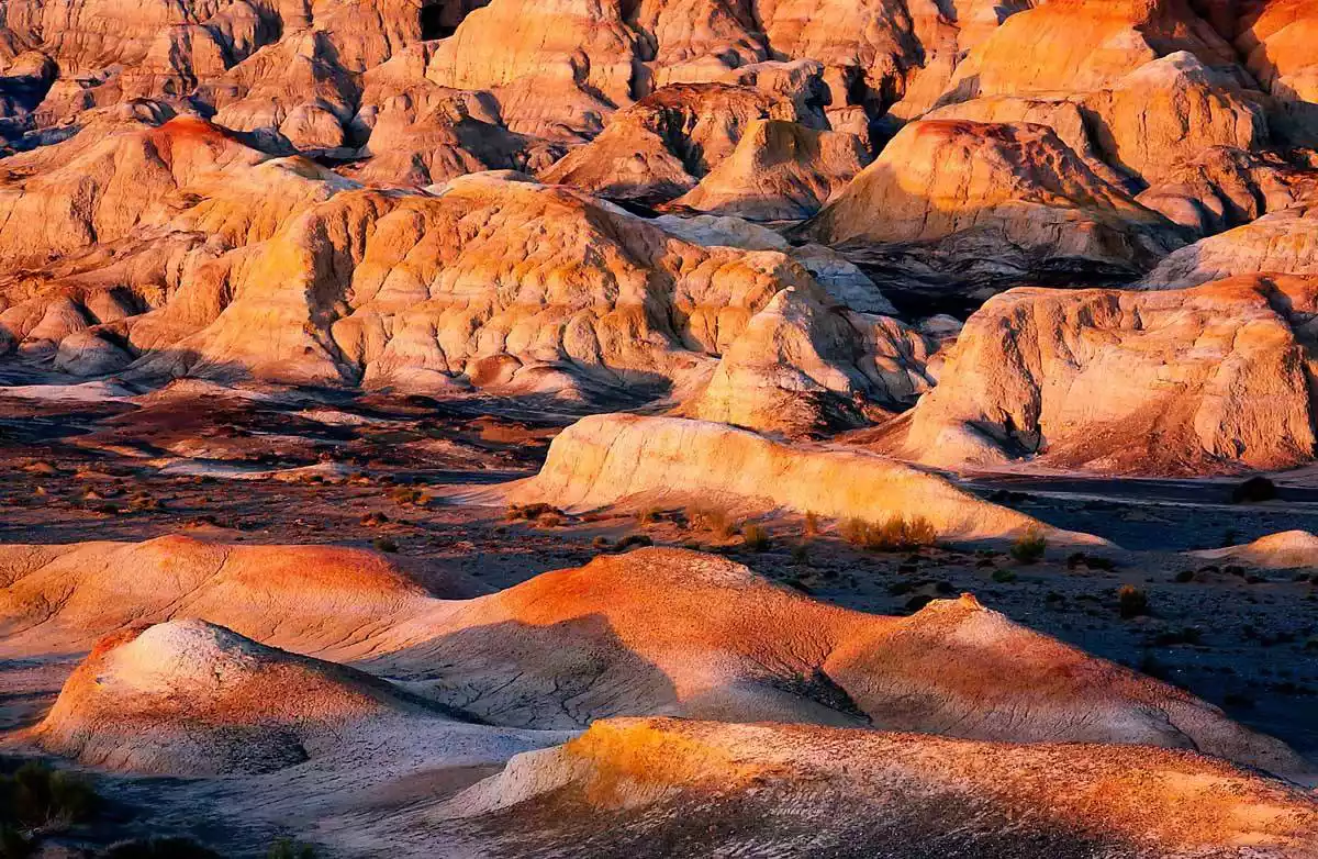
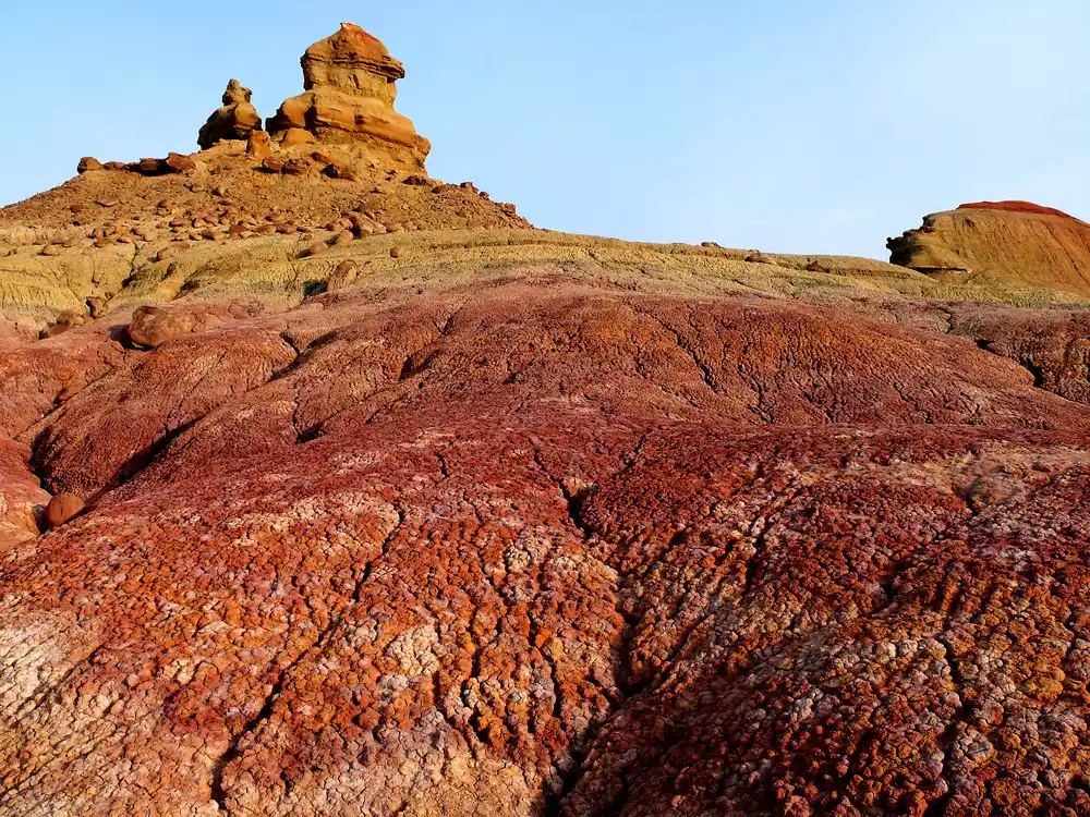
Qitai Ghost City
【Address】In the Gobi Desert 100km north of Qitai County, Xinjiang
[Best Season] Temperate continental climate, suitable for travel year-round
【Ticket】Free
[Transportation] You need an off-road vehicle to get there. It is a completely original Danxia landform and has not yet been developed into a scenic area.
When it comes to Danxia landforms, many people are most familiar with Zhangye's Colorful Danxia. However, few people realize that Northwest China boasts numerous lesser-known Danxia landforms. Qitai Ghost City is located 100 kilometers north of Qitai County, about a three-hour drive from Urumqi. This pristine Danxia landform requires an off-road vehicle to access, following the tracks along the gravel road.
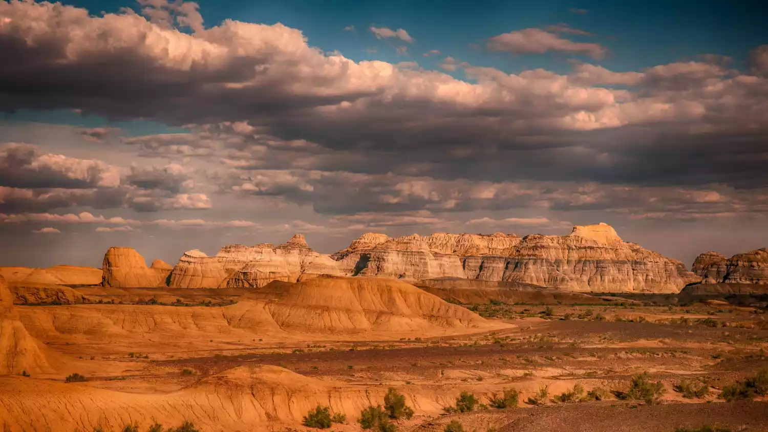
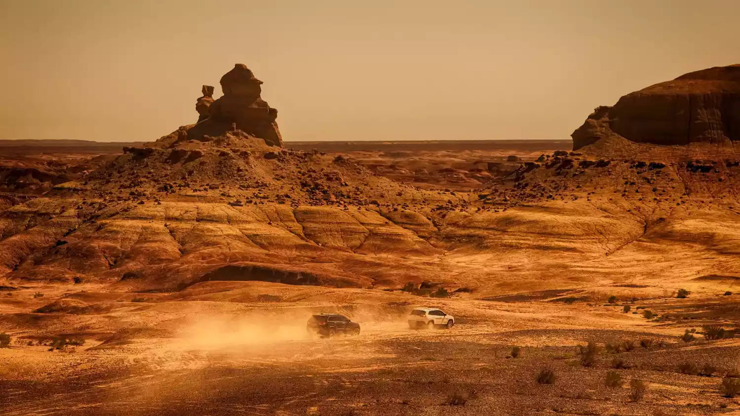
Qitai Devil City is incredibly large, and with no signal in the Gobi Desert, it's easy to get lost without a good guide. This, however, has also helped to keep its Danxia landforms hidden from public view, allowing them to remain intact. If you've already seen the throngs of people at Zhangye Danxia, why not take an off-road vehicle and explore the area? Camp in the uninhabited area, witness the sunrise and sunset over the Danxia landform, and admire the vast starry sky!
China-TravelNote made a special trip to explore the Qitai Ghost City, go off-roading and camping in the Danxia area, and leave your own footprints in the uninhabited area!
Sichuan-Tibet region
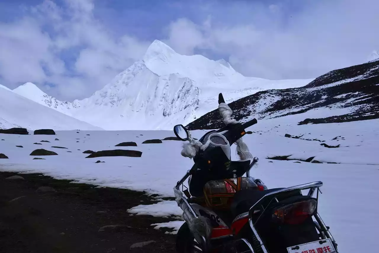
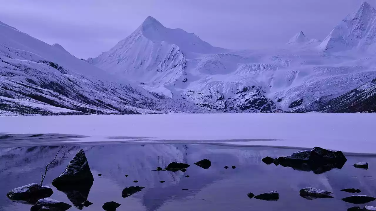
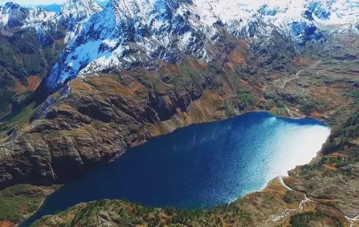
Lenggacuo
[Address] On a mountain 4,530 meters above sea level, 10 kilometers to the left of Yulongxi Village, Gonggashan Township
【Recommended Tour】Undetermined
【Ticket】No
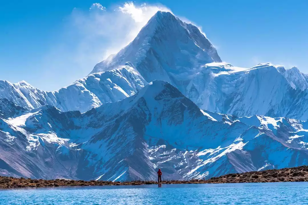
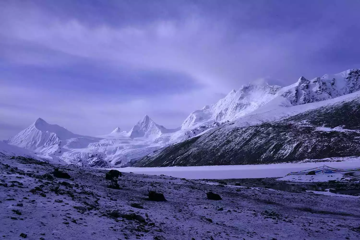
Lengga Co is one of the closest alpine lakes to Mount Gongga, located 23 kilometers away and 4,550 meters above sea level. Its most striking feature is its mirror-like reflection of Mount Gongga in the early mornings. Located southwest of Mount Gongga, Lengga Co offers an excellent vantage point for photographing the sunset and the starry sky above Mount Gongga.
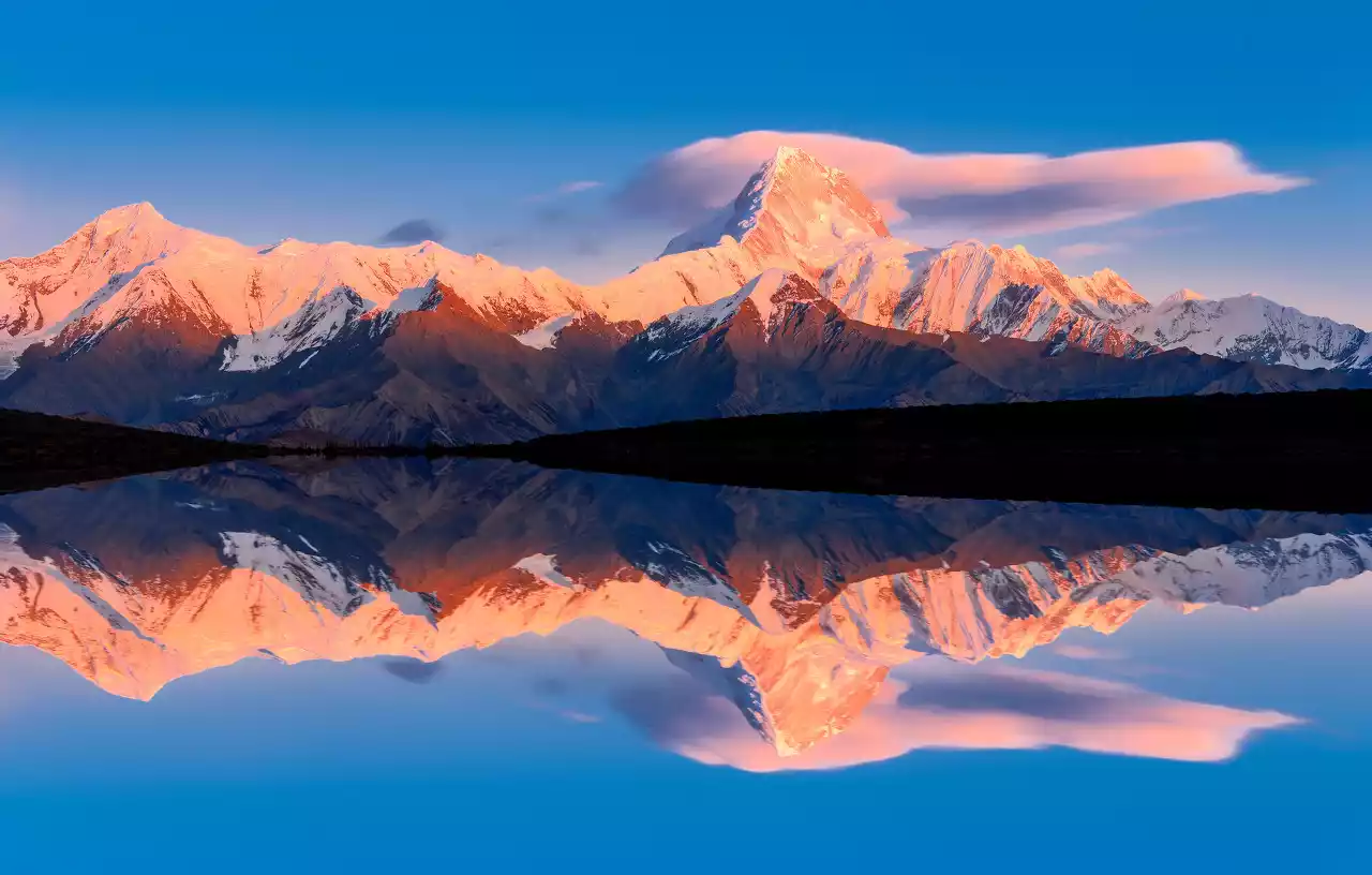
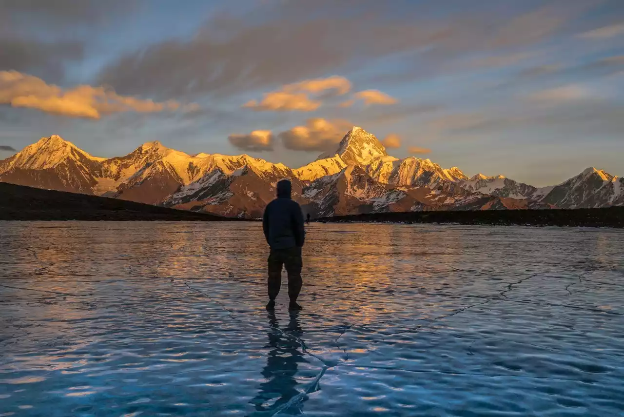
The Milky Way arch rises from behind Mount Gongga, forming a perfect arch in the latter half of the night. At this moment, a 12mm lens can capture both the snow-capped mountain's reflection and the Milky Way arch. Afterward, the Milky Way gradually becomes vertical, making this a truly exceptional photo spot among the many viewing platforms on Mount Gongga.
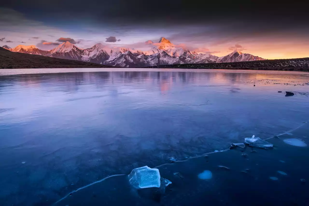
Mount Gongga's massive triangular pyramidal massif is defined by four main ridges: the northwest, northeast, southwest, and southeast. Surrounding these ridges are numerous stunning viewing platforms, offering breathtaking vistas. Standing on these platforms, the majestic figure of the King of Mountains in Sichuan unfolds in various forms. It is these numerous viewing platforms, large and small, that together form the scenic belt surrounding Mount Gongga.
Mount Genyen
【Address】Reke Township, Litang County, Sichuan
[Transportation] Take the shuttle bus to Litang from Chengdu Xinnanmen Bus Station, which departs at 9:15. It takes more than half a day to walk from Litang to Genyen.
【Recommended】1 day
【Ticket】No
Best season: Late May to mid-September
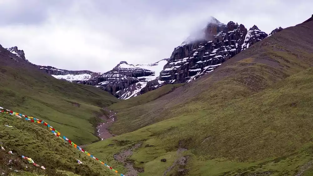
Mount Genyen is the 13th goddess among the 24 sacred mountains of Tibetan Buddhism in my country. It is also one of the eight holy places of Heruka. In Tibet, the holy places of Heruka are only the Himalayas and Mount Genyen.
Standing at any point in Lenggu Temple, you can look up and see the majestic Genyen Peak. The extremely clear air makes the snow-capped peak seem within reach, and gazing at it from a close distance brings a breathtaking beauty.
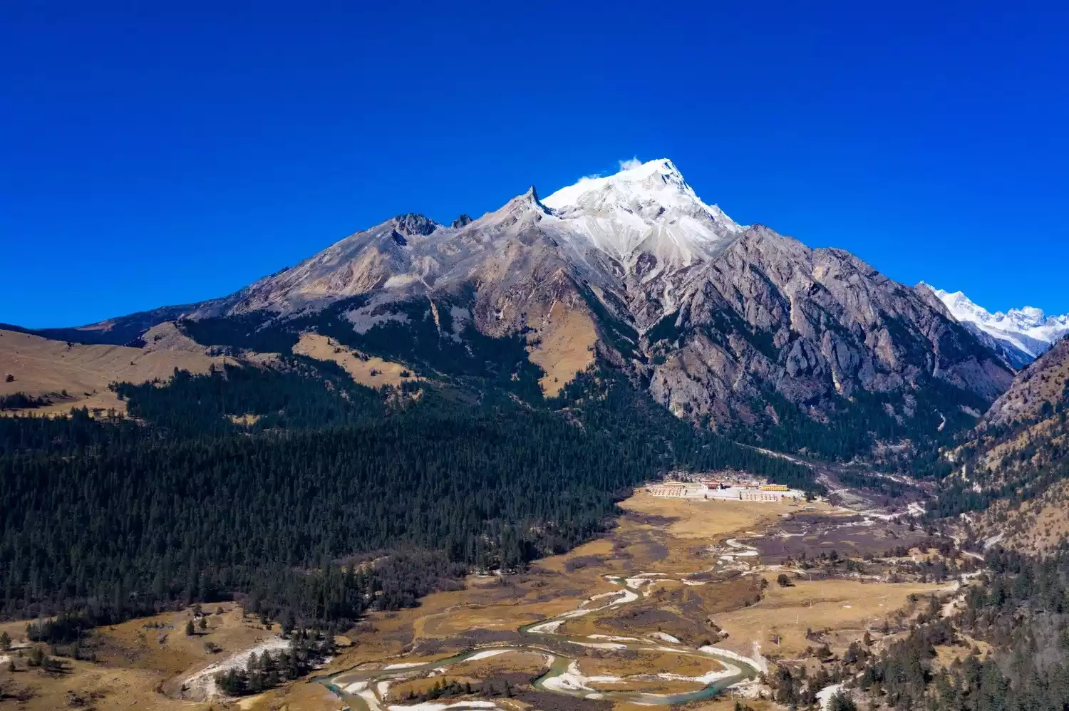
The Genyen Sacred Mountain has a gentle slope and is shaped like a Buddha. The main peak is flanked by four peaks, and the peaks on both sides are arranged in sequence, like stars surrounding the moon and gods protecting the Buddha, which is extremely spectacular.
The mountain top is covered with snow all year round, and the texture of the glacier is like a bride's wedding dress, with exposed rock at the hem. The hard lines like a knife cut are in sharp contrast with the flowing texture of the glacier.
At Lenggu Temple, you can also see the magnificent scenery of the golden mountain in the sun. In about 10 minutes, the snow-covered mountain top shows a color change from light green to light purple to bright yellow to golden yellow to orange-red to white after the sun rises. Every transition in between is subtle and moving. It is the most charming moment of the sacred mountain and cannot be understood without witnessing it.
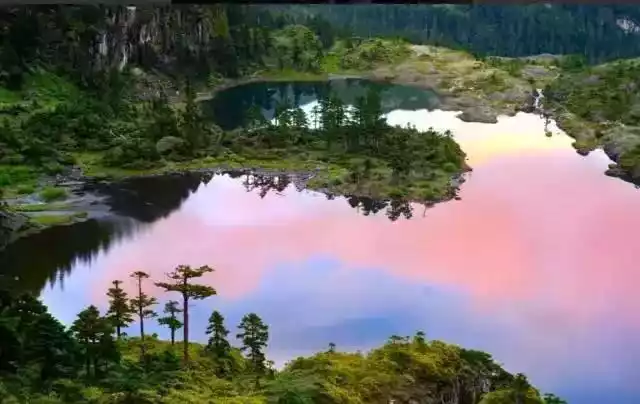
Cokha Lake
【Address】Mari Township, Xinlong County, Ganzi Prefecture, Sichuan Province
[Transportation] Bus: Chengdu Xinnanmen - Kangding - Xinlong County - Coka Lake
[Tickets] There is no entrance fee for the scenic spot. However, villagers may charge 10-20 yuan for parking on the way.
[Best Season] Spring and autumn are the best times to visit
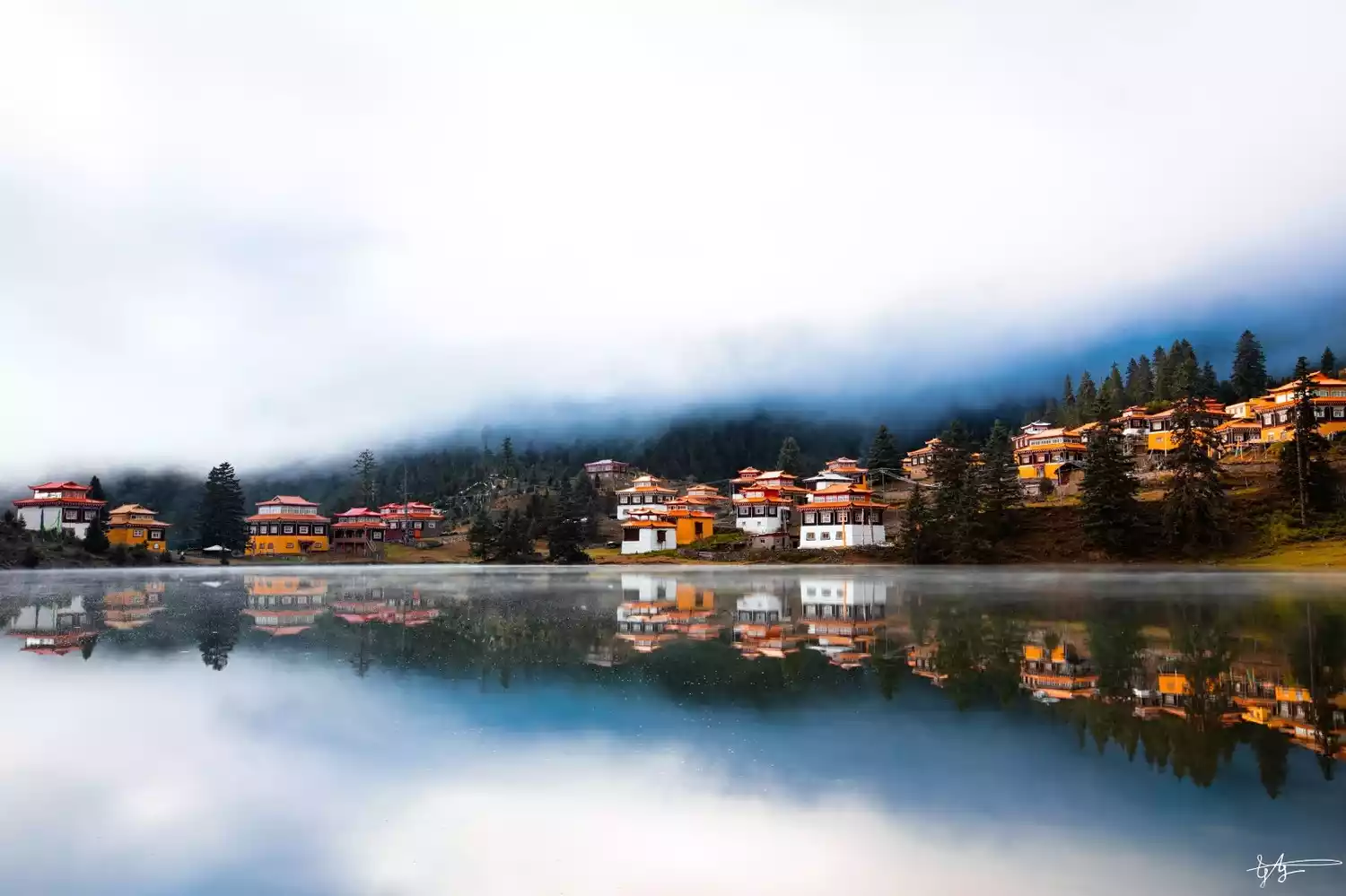
Cokha Lake lies nestled deep in the mountains of Mari Township, Xinlong County. Though small, it boasts the most dreamy reflections in all of western Sichuan! Its crystal-clear waters, like a mirror, capture a kaleidoscopic image of blue sky, white clouds, green trees, emerald hills, and crimson temples, as if embracing the entire world.
This small lake originally had no name until 1358, when Venerable Phurba Tenzin built a Kagyu temple by the lake and named it Cokha Temple (Cuo means lake, Ka means edge, meaning lakeside temple).
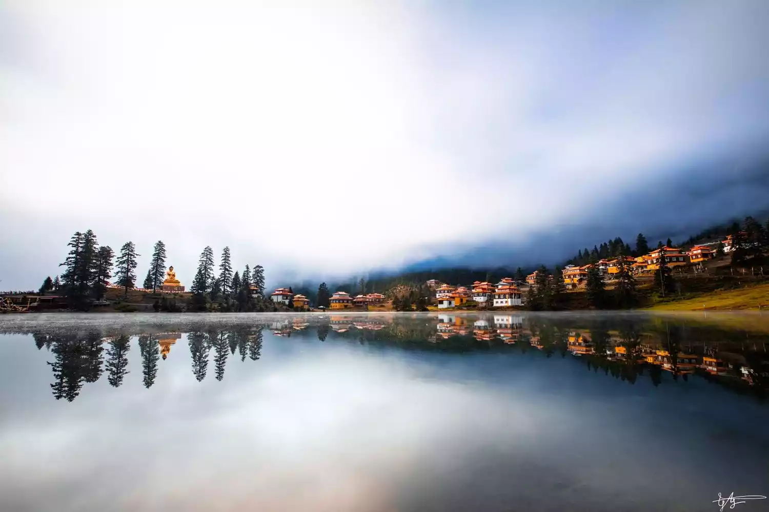
As you approach Cokha Lake, you'll be amazed by its crystal-clear waters, the beauty of a mirrored world where the sky and earth merge. Especially during misty days, the lake is thickly covered with fog, like a mysterious girl shrouded in a veil, adding an unusually solemn and awe-inspiring atmosphere to the surroundings.
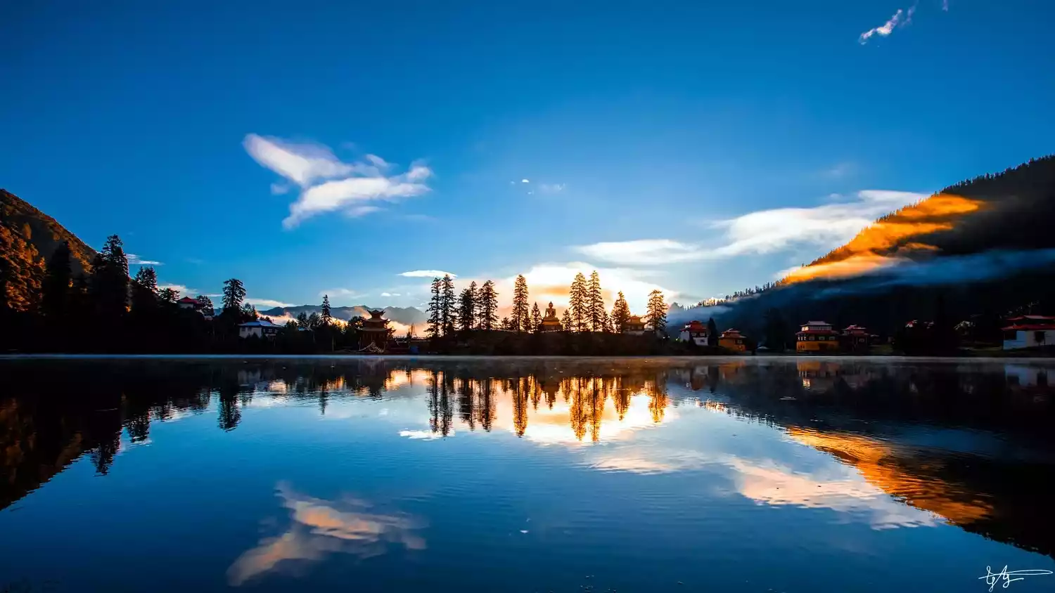
Temples, plateau lakes, primeval forests, Tibetan houses, distant snow-capped mountains, Buddha statues, pagodas, wind horse flags, prayer wheels, fish, Tibetan dogs, birds in the lake, kind-hearted Tibetans and devout monks are all part of the scenery of Cokha Lake.
Sapu Sacred Mountain
【Address】Puzonggou, Yangxiu Township, Buxi County
【Recommended】Half day
【Ticket】No
Best season: May to September
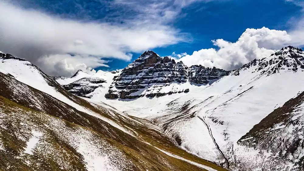
Sapu Sacred Mountain and Holy Lake are located in Puzonggou, Yangxiu Township. Sapu Sacred Mountain has been standing here for thousands of years, surrounded by mountains. Sapu Sacred Mountain has been standing here for thousands of years, surrounded by mountains. The main peak is revered as the king of local sacred mountains.
Its highest peak, also known as "Sapgun Lagabu," stands at 6,556 meters and is considered one of the sacred mountains of the Bon religion in Tibetan Buddhism. Due to the deep valley and inconvenient transportation, this breathtaking glacier has remained hidden and little-known, a virgin tourist destination yet to be developed.
Surrounding Mount Sap are numerous uniquely shaped peaks and stunning glacial lakes, forming a sacred mountain and lake complex that boasts both cultural heritage and stunning beauty. Here, you can try a light glacial lake hike to experience the majestic beauty of the snow-capped mountains up close.
Guge Dynasty
【Address】Located in Ngari Zada County
[Transportation] Alikunsha Airport is 160 kilometers away from the scenic area. You can take a tourist bus to the scenic area.
【Recommended】2-3 hours
【Ticket】60 yuan/person
Best season: Late May to mid-September
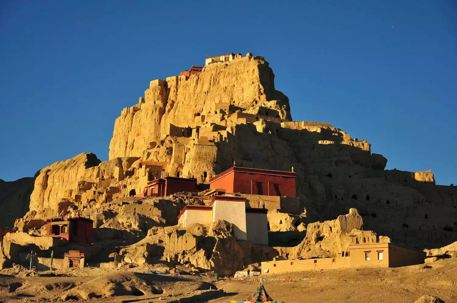
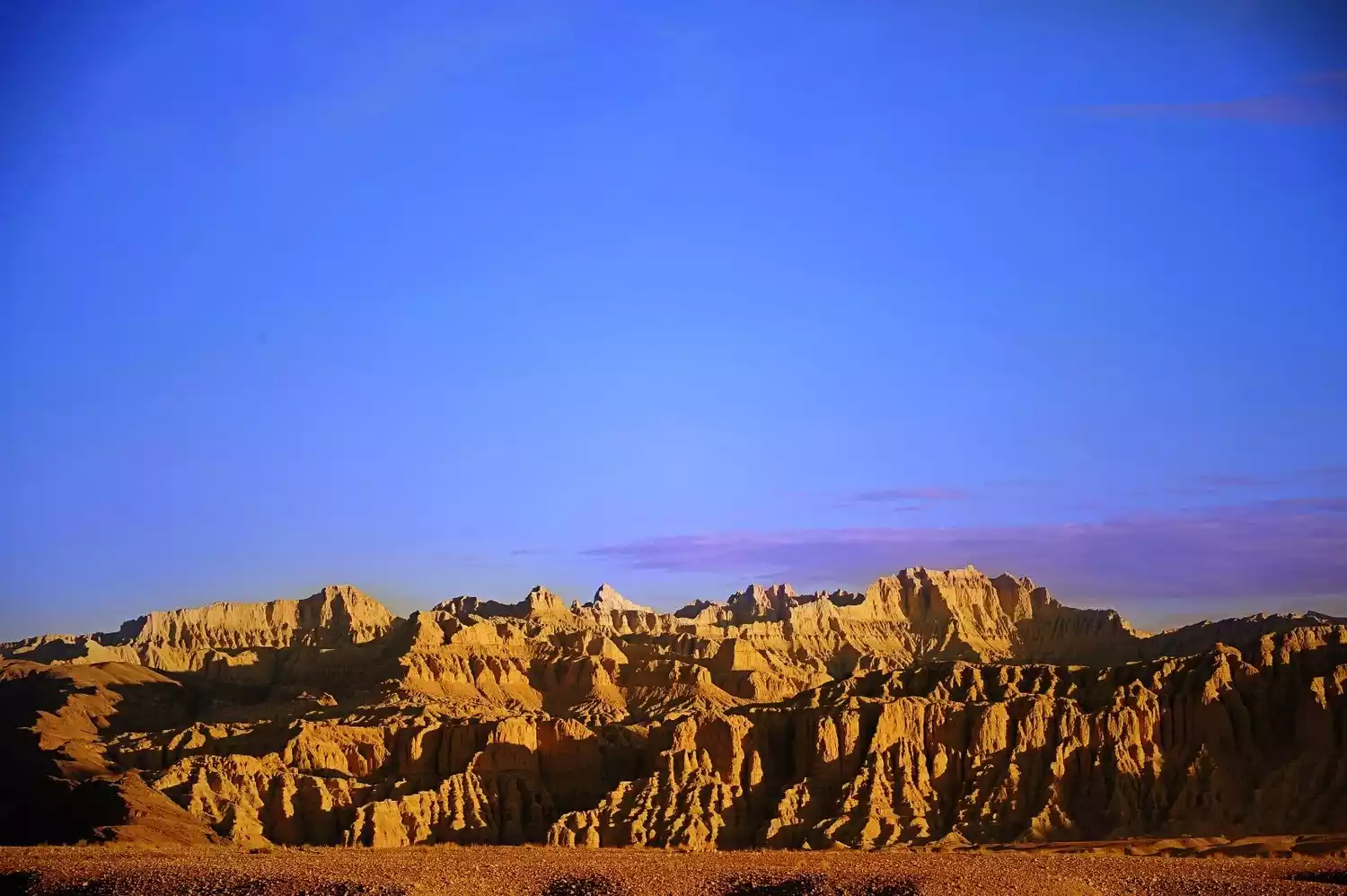
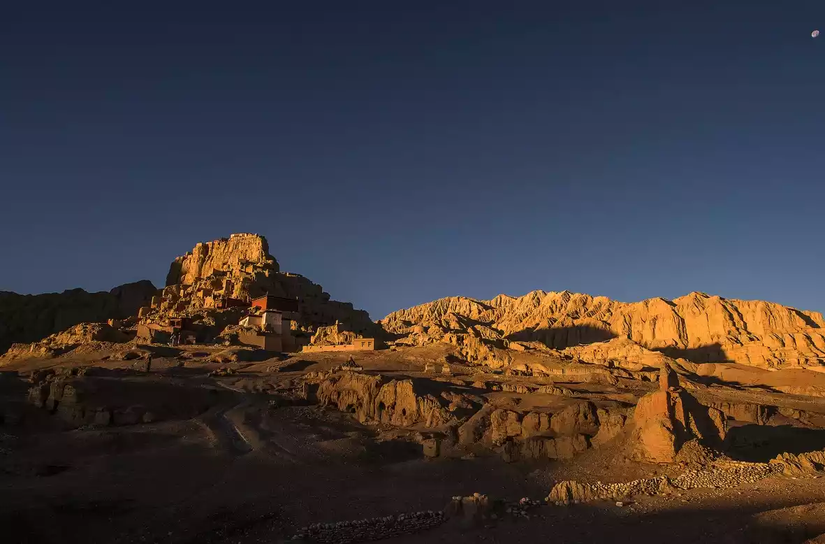
The ruins of the Guge Dynasty are located on a hill in Zhada County, Ali, covering an area of about 180,000 square meters. It is only more than 10 kilometers away from Zhada County.
The mysterious Guge Dynasty disappeared from history overnight 300 years ago, leaving us only the ruins that record the brilliant cultural and artistic achievements of Guge.
Just 15 years ago, Guge was still an unfamiliar name to many people. However, since 1985, when an expedition team organized by the Cultural Relics Management Committee of the Tibet Autonomous Region launched a series of fruitful archaeological work here, this kingdom, which had disappeared for 350 years, suddenly appeared in people's vision and attracted more and more tourists.
Over the past decade, carvings, statues and murals discovered around the Guge ruins have unveiled the mystery of the Guge Dynasty.
Tips:
Border Pass:
You need to check your border pass to go to Zhada County, so remember to bring your border pass with you.
You can apply for a border pass at your place of residence, or you can go directly to the Border Defense Corps on Najin Road to apply for it, but the procedures are a bit complicated.
You can also entrust a travel agency to handle it, which is more worry-free.
Eastern Inner Mongolia and Shanxi regions
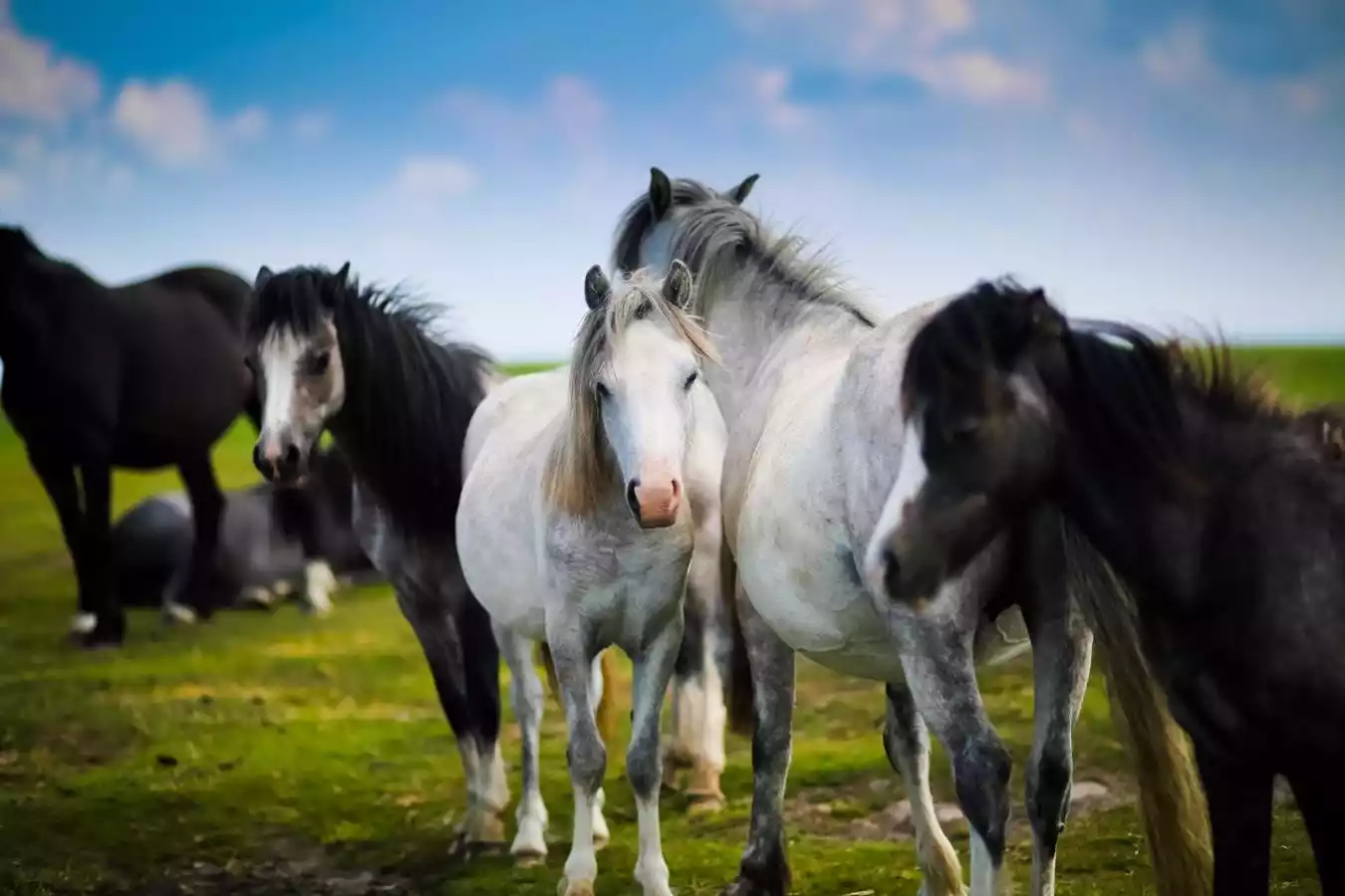
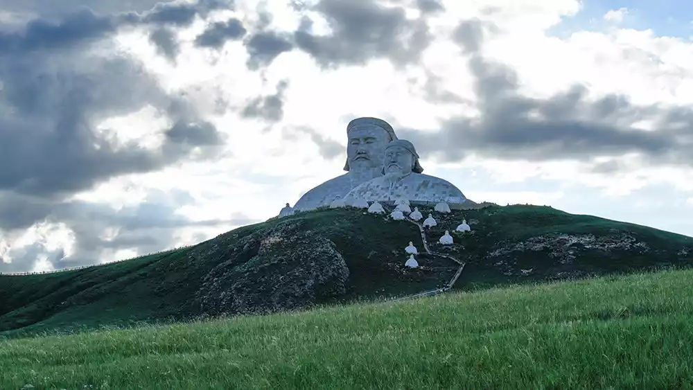
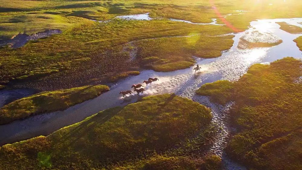
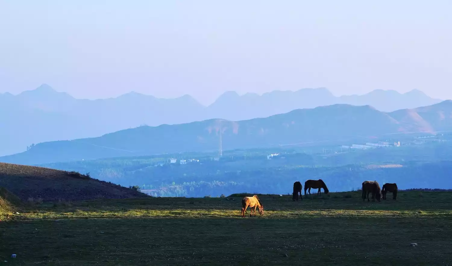
Ulagai Grassland
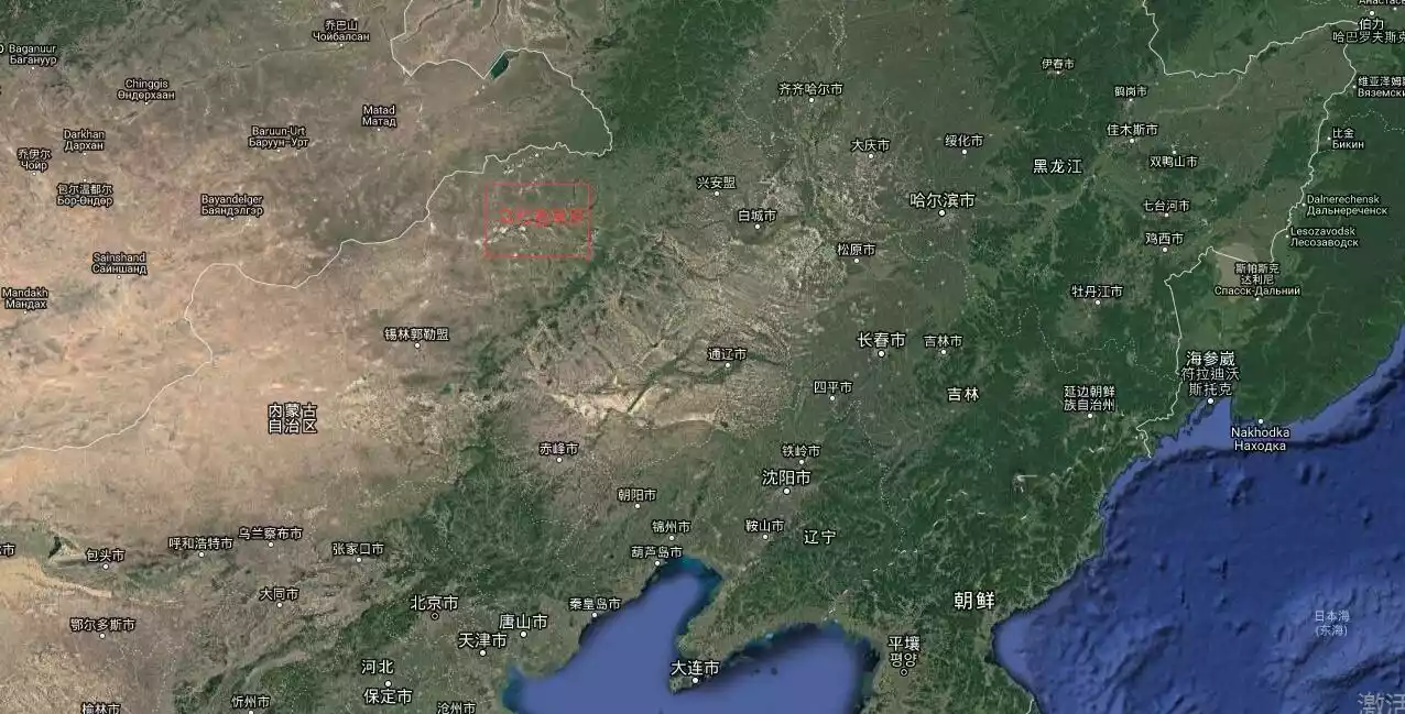
【Address】Northeast of Xilin Gol League, Inner Mongolia
[Best Season] May to September is the best time to visit the grassland. See the peony flowers in June and pick chives in August.
[Transportation] First go to the nearest city, Xilinhot, and then drive or charter a car.
【Recommended】2-3 days
[Tickets] Jiuquwan 30 yuan + Bulin Spring 20 yuan + Bingtuan Town 10 yuan = 60 yuan
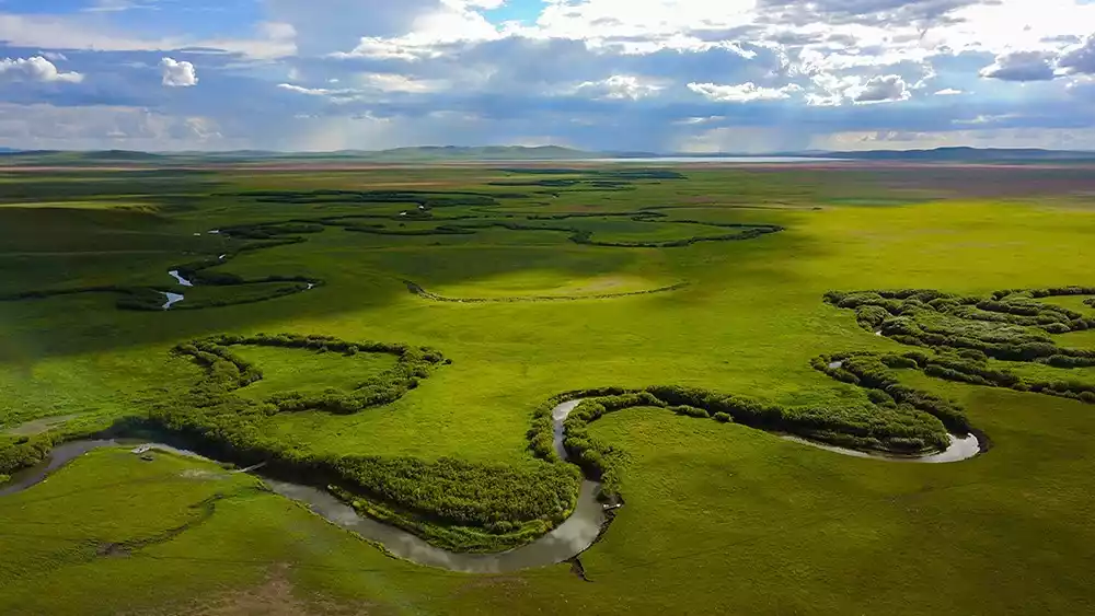
Located on the China-Mongolia border, the Ulagai Grassland is a sparsely populated and beautiful tourist destination in Inner Mongolia. Half of the grassland belongs to Tongliao City, Inner Mongolia, and half belongs to Xilin Gol League, Inner Mongolia. This sparsely populated area, home to grazing cattle and sheep, is a true grassland kingdom.
Strictly speaking, this is the last remnant of the Horqin grassland, because most of the Horqin grassland in Tongliao area has evolved into sandy land, and only the area close to Mongolia retains high-quality grassland resources.
Ulagai has Jiuqu Bay, Wild Wolf Valley, Peony Valley, Corps Town, etc. Most of the filming locations for the popular TV series "Wolf Totem" were completed in Ulagai. This is also the place where the Production and Construction Corps went to the countryside.
Enhe Russian Ethnic Township
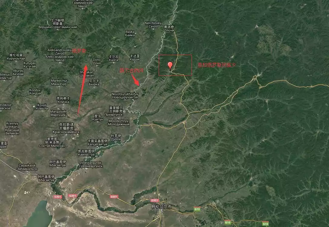
【Address】Northwest of Ergun City
[Transportation] It is recommended to drive or charter a car. If you take public transportation, take a bus from Hailar to Labdalin (Ergun), and then from Labdalin to Enhe. The whole journey takes about five hours.
Best season: All year round
【Recommended】1 day
【Ticket】Free
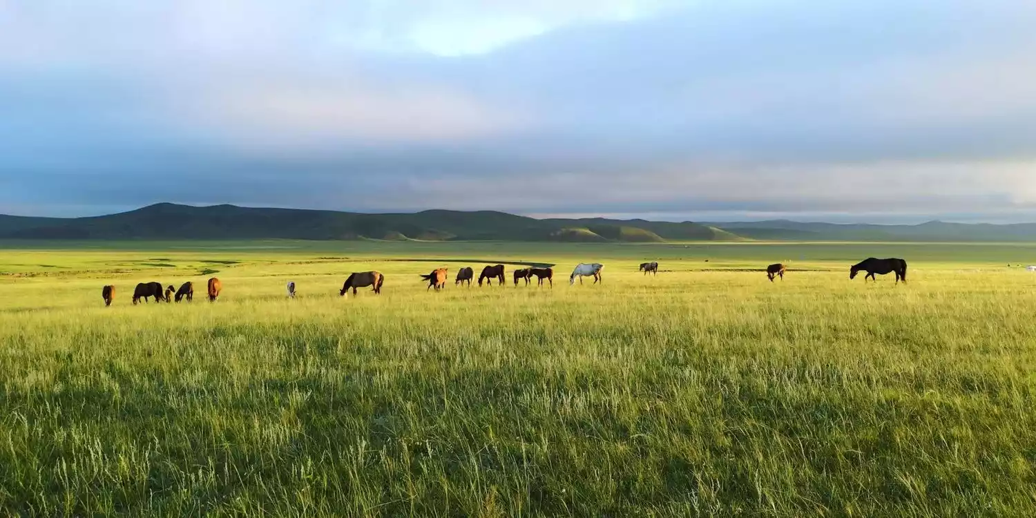
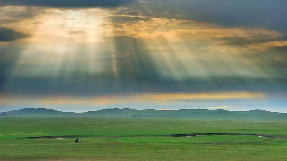
Enhe Russian Ethnic Township is located northwest of Erguna City in Hulunbuir. Twenty kilometers west of here lies the Erguna River, the Sino-Russian border. In this bustling Hulunbuir, Enhe is like a poet reclusive in the countryside, quietly sitting in the secret realm of this grassland.
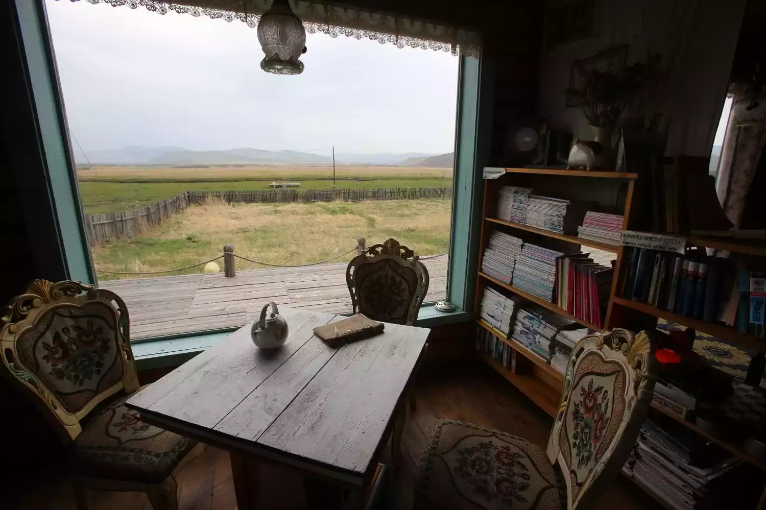
The town is small, but with the development of tourism, the traditional wooden houses have gradually become more noisy. More and more travellers choose to come here to enjoy the slow and dazed time.
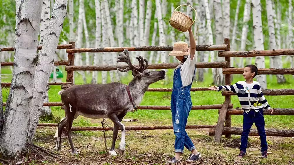
The Haur River beside the town flows quietly and merges into the Ergun River. The Enhe Mountains are covered with lush grass and wild flowers. The nearby birch forests are inhabited by grassland elves, reindeer. It is a very rare holiday destination.
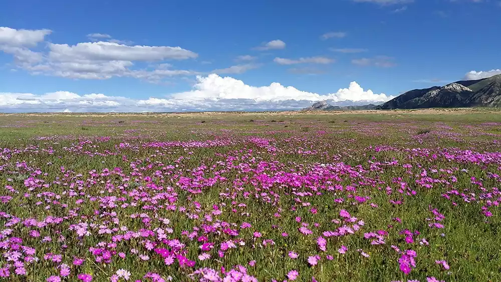
Bashang No Man's Land
【Address】Northern Hebei Province and southern Inner Mongolia Autonomous Region
[Transportation] It is recommended to drive or charter a car. If you take public transportation, first take a bus from Hailar to Labdalin (Ergun), and then from Labdalin to Enhe. The whole journey takes about five hours.
【Recommended】2-3 days
Tickets: 120 yuan/person
Best season: May to October
The flowers bloom in May after the snow melts, and the blooming period lasts throughout the summer until late August.
The temperature in July and August is only around 18-20 degrees Celsius, making it the first choice for tourism, leisure, summer escape and vacation in northern China.
In September, the dam turns from emerald green to autumnal yellow, creating a paradise for photography enthusiasts. This is also the time when lambs are just beginning to mature into sheep, and food lovers can enjoy the delicious roasted whole lamb.
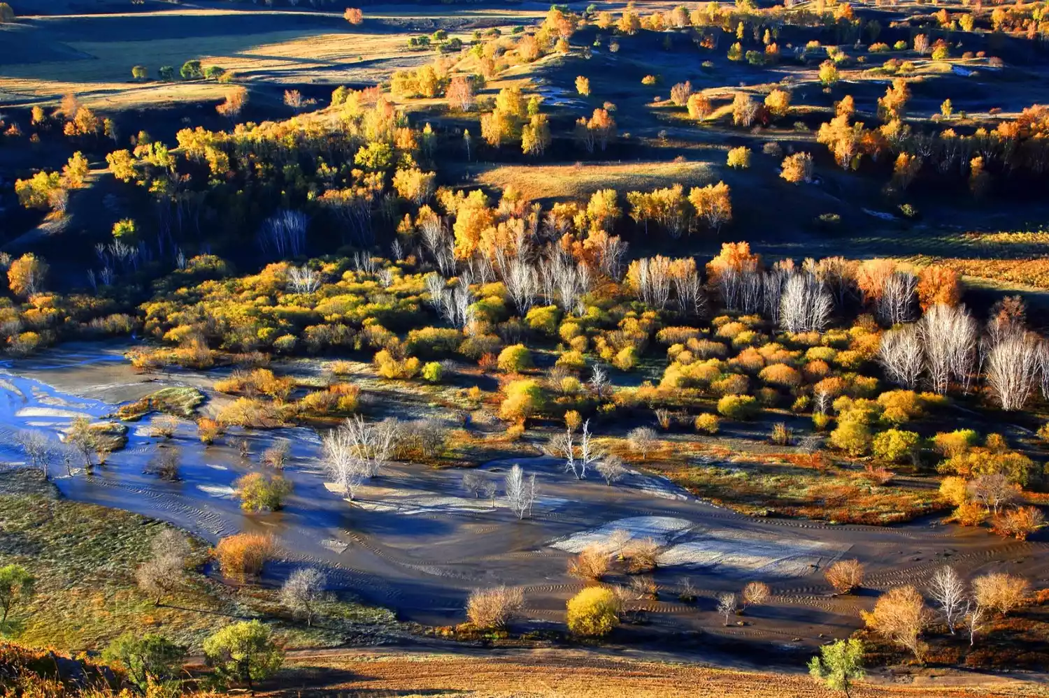
The well-known "Bashang Grassland" is located in Wulanbutong, on the border between Inner Mongolia and Hebei. The "Bashang No Man's Land" encompasses the vast area north of the Bashang Grassland, extending all the way to Huanggangliang, a foothill of the Greater Khingan Range. This vast, sparsely populated area, hundreds of kilometers in radius, is a mixture of grassland, sandy land, lakes, forests, and rivers, making it little known.
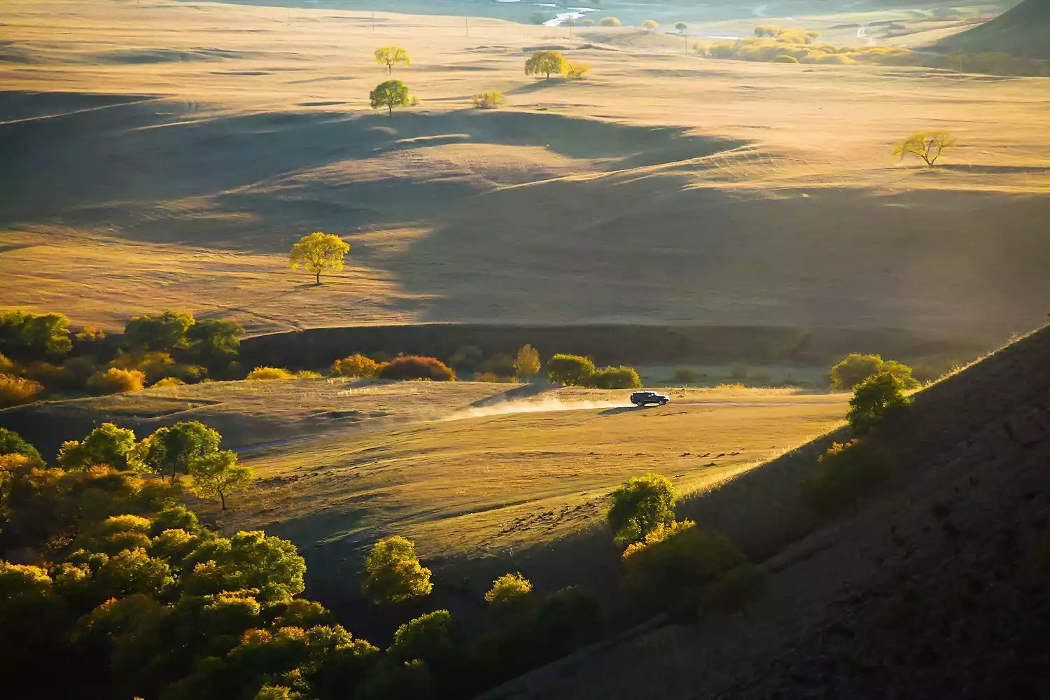
The uninhabited area of Bashang is mainly composed of Hunshandake Sandy Land, Gongger Grassland, Huanggangliang, Xilamulun Canyon and other areas. It is separated from Ulan Butong by more than 100 kilometers of grassland desertification zone and the Xilamulun River, the mother river of Bashang.
Due to the inconvenient transportation in this area, it can only be reached by 4x4 vehicle across the sand. However, the uninhabited area of Bashang has diverse landscapes and beautiful scenery, making it a rare and undisturbed grassland secret.
Laoniuwan
【Address】Pianguan County, Shanxi Province
[Transportation] First go to Datong or Taiyuan. Both places have regular buses to Pianguan, and then transfer to Laoniuwan
【Recommended】1 day
[Tickets] 96 yuan/person in peak season; 64 yuan/person in off-season
[Best season] Spring and autumn are the best
This is where the Great Wall of my country runs parallel to the Yellow River. Laoniuwan, the first bend of the Yellow River, has beautiful scenery.
Laoniu Bay becomes more magnificent and majestic as the sun sets. The sun shines on Laoniu Bay bit by bit. It is so spectacular when you close your eyes and touch it. Friends who like to recite poems and sing, can't you help but sing a song when you come here?
"The Yellow River has nine bends and eighteen turns. The divine ox opened the river to Pianguan. When the bright light came on, it was frightened and turned around to plow out the Laoniu Bay."
It is recommended that you get up early and take a speedboat to the observation deck in Inner Mongolia to watch the most beautiful Laoniuwan sunrise.
Tips:
The main attractions of Laoniuwan:
Baozi Tawan
The Baozi Tower Bay Scenic Area offers a panoramic view of the beautiful scenery of the Yellow River's nine bends and eighteen turns. It is most appropriate to describe Baozi Tower as "a cliff thousands of feet high like a monkey, with flying birds unable to fly over the cracked rocks."
Four Tower Bay
It has the typical mountain village scene of northern Shanxi. Farmers are working hard in the vast terraced fields that reach the clouds. The four tower bays in this scene give people an extremely soft feeling, as quiet as a virgin, making people linger.
Yangjiachuan Small Canyon
The Yangjiachuan Small Canyon, stretching 8 kilometers, features a unique landscape lined with the Great Wall, ancient castles, villages, temples, plank roads, and docks. Cliffs on both sides of the river reach into the clouds, woodcutters and herbalists sing as they walk. The valley floor is craggy with unusual rocks, springs gushing, and rare birds singing. The profound and tranquil pristine natural scenery creates a beautiful landscape painting.
Yunnan, Guizhou and Guangxi regions
Dulong River
【Address】Gongshan County, Nujiang Prefecture, Yunnan Province
Transportation: From Kunming, take a bus to Liuku (the capital of Nujiang Prefecture). There are 3-5 sleeper buses per day. From Liuku, it's another 280 kilometers to Gongshan. From Gongshan, you can hike to Dulong River.
【Recommended】2 days
【Ticket】50 yuan/person
[Best Season] Subtropical; best in autumn
Dulongjiang Township in Nujiang Lisu Autonomous Prefecture is a remote corner of Yunnan Province. The Dulong River, the main stream of the upper Irrawaddy River, originates in the southeastern Boshula Mountains of Zayu County in the Tibet Autonomous Region. Its source is called the Gadaqu River.
As one of the core areas of the "Three Parallel Rivers", it is recognized as a "natural museum of wild plants" and is one of the areas in my country where the original ecology is most intact.
It's located in the deep valleys of the southwestern Hengduan Mountains. Traveling northwest from Kunming, one must cross the Biluo Snow Mountain and Gaoligong Mountain, and cross the Lancang and Nu Rivers. A typical driving journey would take three days to reach Kongdang Village, the seat of government for Dulongjiang Township.
Many people have visited northwest Yunnan, but know nothing about this beautiful and mysterious river valley. Before the road was built, the Dulong River Valley was difficult to reach, and the six-month-long snowfall that blocked the mountains made the winter here almost isolated from the outside world.
Tips:
Dulong people:
The lush Dulong River Valley is the only place in China where the Dulong people live.
In the past, the Dulong people had no unified ethnic name and often used the region or river where they lived as their name, such as "Dulong" and "Dima." After the founding of the People's Republic of China, Premier Zhou Enlai personally named them the Dulong people, in accordance with their wishes. They now number approximately 6,300.
Tips:
Tattooed women:
There are three most popular theories about the origin of face tattoos:
First, in order to prevent the Tibetan Chawalung chieftain from robbing women, the Dulongjiang people generally had their girls tattooed when they were 12 to 15 years old. Tattooed women looked ugly, and the Chawalung chieftain would not come to rob women; second, the custom of tattooing was related to the tribe's totem worship that had long disappeared; third, the Dulong people at that time believed that women's facial tattoos were a symbol of beauty, and girls without facial tattoos would not be able to get married in the future.
When tattooing the face, an experienced woman would first use a bamboo stick dipped in pot smoke water to draw a pattern on the girl's face. Then she would use a small wooden stick to hit the hard thorns of thorns or a thorny wooden stick to pierce the skin according to the pattern. She would then rub pot bottom ash or grass juice into the wound. After the scab fell off, a blue-green pattern would be formed.
The tradition of facial tattoos has been abandoned. According to statistics, there are only more than 20 women with facial tattoos left in the world, and the youngest is already in her sixties. Perhaps in the near future, the last women with facial tattoos in China will become history.
Nan Jie Luo
【Address】Weixi Lisu Autonomous County, Diqing, Yunnan
[Transportation] Self-driving or charter
【Recommended】1 day
【Ticket】Free
Best season: June to November
Nanjie Luo (transliteration of Lisu language, also known as "Nanji Luo") is located in Badi Township, Weixi County, Diqing Prefecture, the heart of the Three Parallel Rivers. It can be reached by slowly entering along a winding path in the canyon.
This place has nine lakes and one mountain, but due to the high altitude, obstruction of mountains and inconvenient transportation of Nanjie Luo, it has not yet been developed and few people know about it.
Therefore, climbing this mountain requires a lot of physical strength and also requires facing altitude sickness, which increases the difficulty of reaching Nanjie Luo.
Wumeng Prairie
【Address】Pingdi Township and Wumeng Town in the northern part of Panzhou City
[Transportation] Wumeng Prairie has very convenient transportation. It only takes one hour to drive from Panzhou City to Wumeng Prairie in Pingdi Township, and the whole journey is on the highway.
【Recommended】2 days
【Ticket】60 yuan
[Best Season] Subtropical monsoon climate, the best time to watch is summer and autumn, with clear skies and suitable temperatures.
The Wumeng Grassland, also known locally as the Poshang Grassland, is one of the highest and largest plateau grasslands in Southwest China. With a peak elevation of 2,857 meters and an average annual temperature of 11.1°C, it's a great summer escape.
Here you can find endless unique plateau grasslands, thousands of acres of plateau dwarf rhododendron forests, beautiful alpine lakes full of magical colors, Yi ethnic customs with rich ethnic culture, the rare natural wonder of Buddha's Light, and the Niupingliangzi Mountains and Badan Mountains that combine grandeur, wonder, danger, steepness and seclusion.
Standing on the top of the mountain in the Wumeng Prairie, looking at the clouds rolling over the cliffs, eagles soaring in the blue sky, and the endless sea of fog, it is truly magnificent as the overturning rivers and the heroic as the Yangtze River flowing eastward.
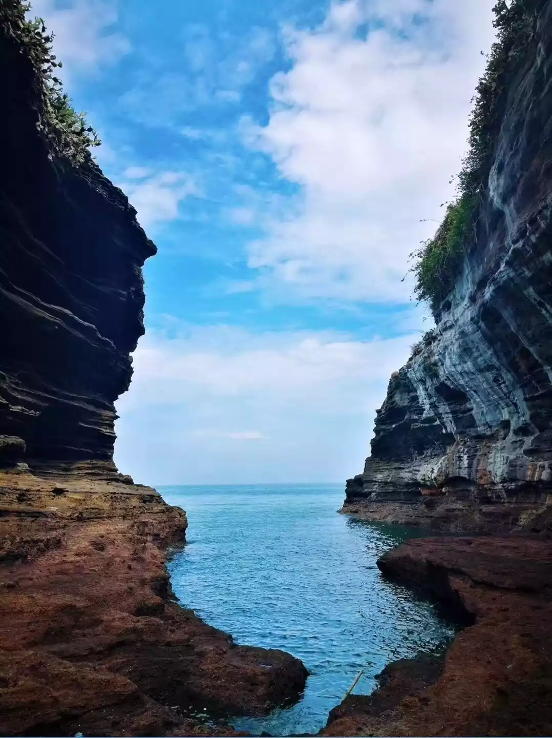
Sunset Island
【Address】Weizhou Town, Beihai, Guangxi
[Transportation] Take a boat from Beihai City, Guangxi to Weizhou Island. After visiting Weizhou Island, you can charter a boat to Xiayang Island. Speedboat 200 yuan/person (negotiable for larger groups)
【Recommended】2 days
[Tickets] Free, included in the Weizhou Island pass
[Best season] Mid-March to mid-December every year
Xieyang Island, located approximately 9 nautical miles southeast of Weizhou Island (1 nautical mile is approximately 1.83 kilometers), was formed by volcanic condensation and covers an area of 1.89 square kilometers. Because the sun shines down on the island from Weizhou Island, and because the island stretches across the southeast of Weizhou Island, with the south facing the sun, it is called Xieyang Island.
The volcanic rock formations on Xieyang Island are spectacular, and the lava landscape is unique. There are many small round pits on the rocks left by volcanic eruptions. After the tide, the pits are filled with sea water, which, refracted by sunlight, look like blue gems scattered on the rocks, becoming the most beautiful embellishment.
The water around the island is so clear that you can see the bottom. Standing on the edge of the rocks, you can see schools of colorful small sea fish.
Qinghai region
Emerald Lake
[Address] Northeast of Ikhchaidamu Lake, 10 kilometers northwest of Dachaidan Town
[Transportation] The self-driving route is the overlapping section of the old National Highway 215 and National Highway 315 in Da Qaidam North, which is the northeast corner of Da Qaidam Salt Lake.
【Recommended】About 1 hour
【Ticket】Free
【Best season】Late May to mid-September.
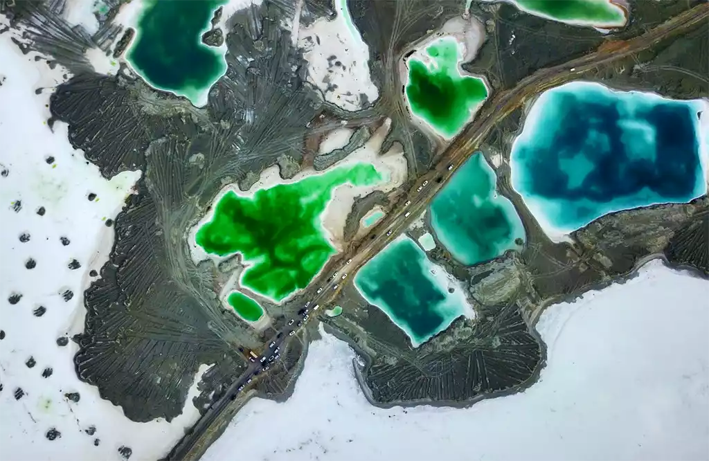
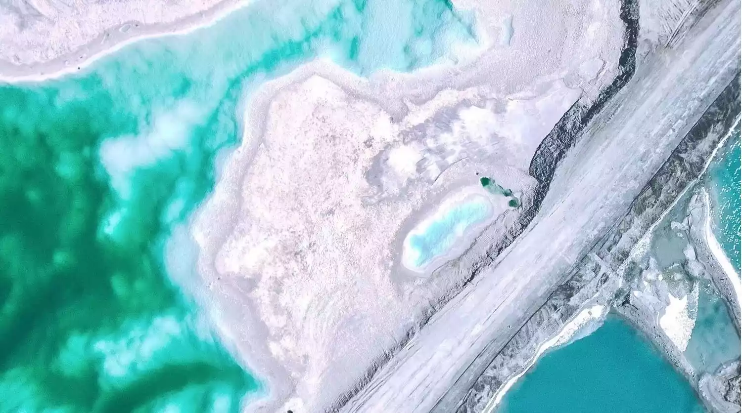
Emerald Lake, as its name suggests, boasts an emerald hue, a characteristic of its unique and proud character. Its waters are clear, its salinity moderate, and its abundant brine shrimp, though fishing is prohibited to protect the environment. The eastern side of the lake serves as an important winter pasture for herders, and various waterfowl also inhabit the lake during the migratory season.
Many people may not have heard of this place, but it's actually the former salt lake mining area of the Da Qaidam Chemical Plant. Years of mining left behind pits that have transformed into the beautiful "Emerald Lake" we see today. Standing by the lake, the mirror-like surface reflects the blue sky, white clouds, and snow-capped peaks, creating a fairyland-like experience.
Tips:
1. Emerald Lake is a mining area owned by a local chemical company and has existed for decades. There is a footpath for access, but it is not currently suitable for minibuses or buses.
2. As the mining area has not yet been developed for tourism and remains in its original state, we advise visitors to pay attention to safety and avoid entering the water at will to avoid accidents. Due to various internal and external factors (precipitation and production needs), the experience will be different every time you visit.
3. As this is a mining area with large vehicles traveling in it, please be careful not to park your vehicles in a way that affects their passage and production. Also, please do not cross the red and white iron gates and iron railings on the sidewalk in Emerald Lake to avoid entering the mining production area by mistake.
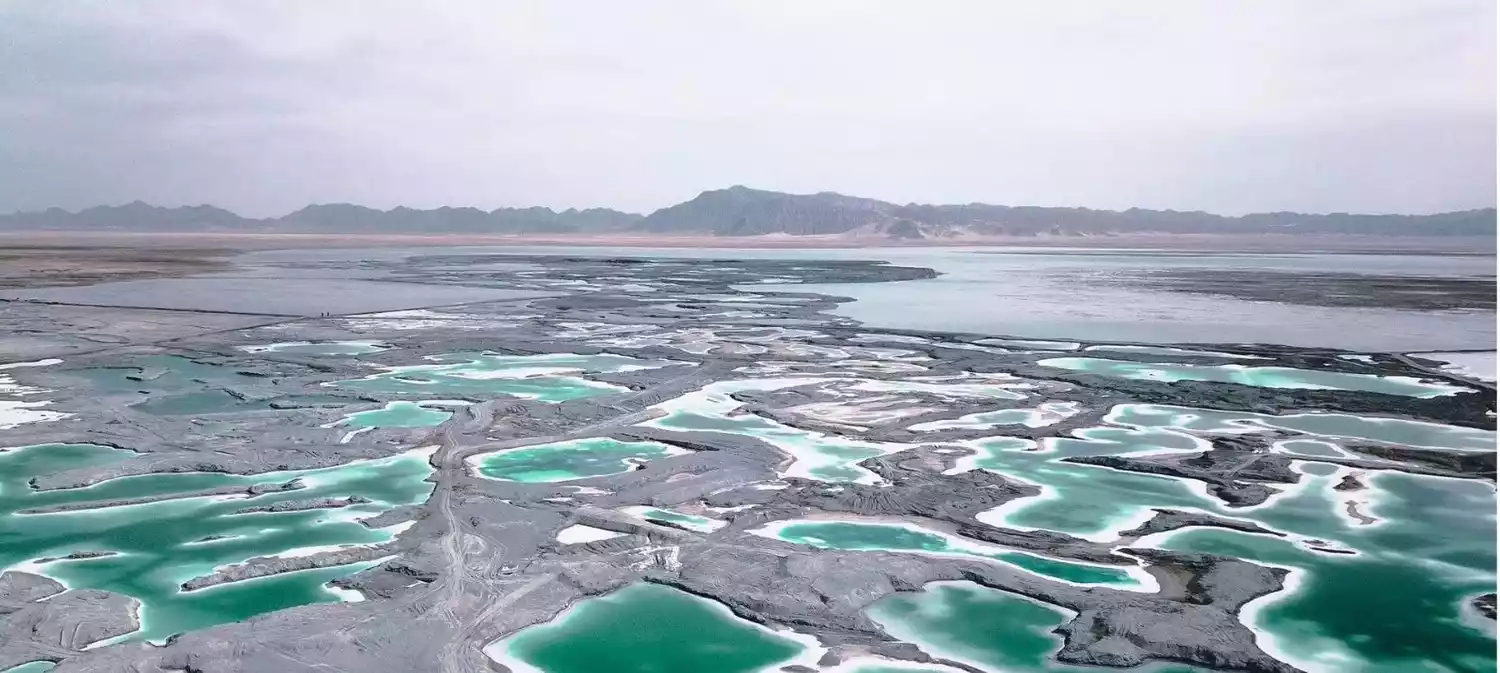
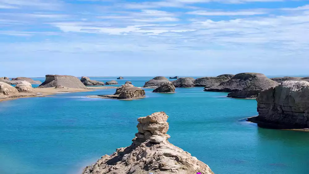
Water Yadan
【Address】Qaidam hinterland, close to National Highway 315
【Transportation】Charge a car or drive yourself
【Recommended】Half day
[Tickets] The temporary ticket price is 60 yuan/person, and the sightseeing bus ticket price is 60 yuan/person (round trip).
Best season: Late May to October
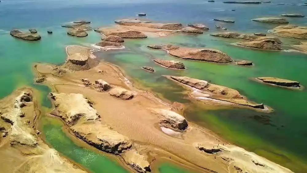
Among the unique features of the Northwest, one that must be mentioned is the water-based yardang that is the only one discovered in the world that combines yardang and water.
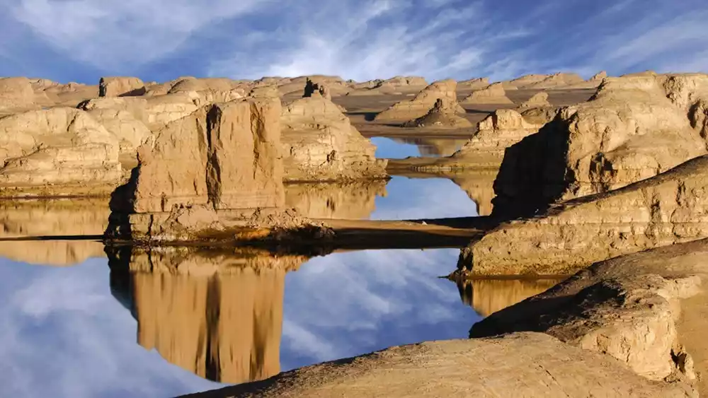
The traditional Yardang landform is in Dunhuang, but in a deserted Gobi desert, there is a body of water that carries the Yardang landform, standing proudly on the land of the northwest.
The Yardangs are scattered throughout the lake, and the rippling lake surface reflects the reflection of the Yardangs. The sky is blue, the water is emerald, desolate, profound, and vast. This is the only water Yardang in the world.
Gaduo Juewo
【Address】Gaduo Township, Chengduo County, Yushu Prefecture
[Transportation] Xining - Yushu Jie Ancient Town: There are 3-5 direct buses from Xining to Yushu Jie Ancient Town every day, with a driving distance of more than 800 kilometers.
【Recommended Tour】Undetermined
[Tickets] The temporary ticket price is 60 yuan/person, and the sightseeing bus ticket price is 60 yuan/person (round trip).
Best Season: The best time to circumambulate the mountain is between May and October. July and August are particularly beautiful, with mountain flowers in full bloom and meadows lush and green. September and October are after the rainy season, when the weather is relatively stable.
Gaduo Juewo is known as the King of Sacred Mountains in the Yangtze River Basin. The people of Yushu consider it their patron saint and a time-honored mountain. Gaduo Juewo is a sacred mountain, considered one of the four sacred mountains of Tibetan Buddhism, along with Mount Kailash in Tibet, Mount Meili in Yunnan, and Mount Amnye Machen in Qinghai.
As one of the four sacred mountains in Tibet, Gaduo Jowo fills everyone who approaches it with piety and faith. Pilgrimage to Gaduo Jowo is more than just an outdoor trip; it's a pilgrimage of faith, allowing you to immerse yourself in the majestic and beautiful mountain scenery and connect with your soul.
Tips:
There are three types of circumambulations at Gaduojuewo, large, medium and small. Generally, you can choose to transfer. There are three common ways to transfer:
The "Inner Circumambulation Path" is the circumambulation path around the main peak. It is famous for its steepness and the shortest route. It only takes half a day to circumambulate the entire path after reaching the front of Juewu Mountain. Only eminent monks and ordained people are allowed to walk this path, and women are especially forbidden to walk this path.
The “intermediate route” and “external route” take 2 days and 9 days respectively.
Donggecuo Lake
【Address】Gaduo Township, Chengduo County, Yushu Prefecture
[Transportation] Xining - Yushu Jie Ancient Town: There are 3-5 direct buses from Xining to Yushu Jie Ancient Town every day, with a driving distance of more than 800 kilometers.
【Recommended Tour】Undetermined
[Tickets] The temporary ticket price is 60 yuan/person, and the sightseeing bus ticket price is 60 yuan/person (round trip).
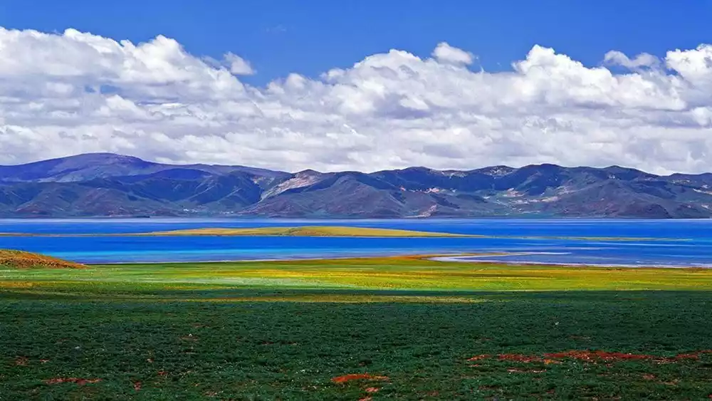
Donggecuo Lake, also known as the Black Sea in Chinese, the Lake Surrounded by a Thousand Mountains, and Tuosuo Lake, is a large freshwater lake on the Qinghai-Tibet Plateau. The lake's waters originate from rivers flowing from the Amnye Machen Mountains, flowing northwest into the Qaidam Basin.
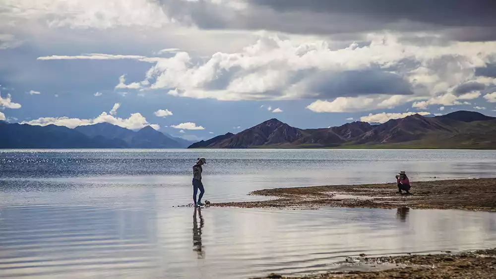
The remote Donggecuo Lake is an important wetland protection area in Sanjiangyuan. From the perspective of environmental protection, it is not advisable to encourage more tourists to enter as it is an uninhabited area.
The rivers flowing into the lake form large swamps through the delta area, and the vegetation is a plateau meadow with Pamir Artemisia as the dominant species. This is the main breeding ground for bar-headed geese, gulls and snipes.
The plateau wetland has always been called the Snow Girl, and the Donggecuo Lake under the blue sky and white clouds is the most beautiful one.
The distant mountains are dotted with white snow and red water plants, and the narrow and graceful lake is magnificent. If you are lucky, you can see water birds and precious plateau animals on the lakeside. Even on a clear day, you can see the Amnye Machen Mountains in the distance.
Conclusion
Exploration is always the characteristic of travelers. Even small travelers like us will pack our bags for the unknown distance, set off with a curious heart and eager expectations.
Today, many of these hidden gems remain hidden from the public eye, their charm undeniable. While someday, these places may become popular destinations, before they become popular, it's time to enjoy the most natural beauty untouched by the crowds!