The most comprehensive snow-capped mountain ranking in history, taking stock of the world's 20 most worthwhile snow-capped mountains, and explaining the highlights of the world's snow-capped mountains in detail
Snow Mountain Top-Preface
A wise man loves mountains, a kind man loves water
. After a three-year gap year and six years in the travel industry, I've traveled to six continents, visited Nepal 15 times, and trekked deep into the Pamirs and the Great Himalayas, gazing across the face of ten of the world's top ten 8,000-meter peaks. I've come to realize that my love for snow-capped mountains is greater than my life itself!
Everyone has a love for snow-capped mountains. What was the first snow-capped mountain you saw? What's your favorite?
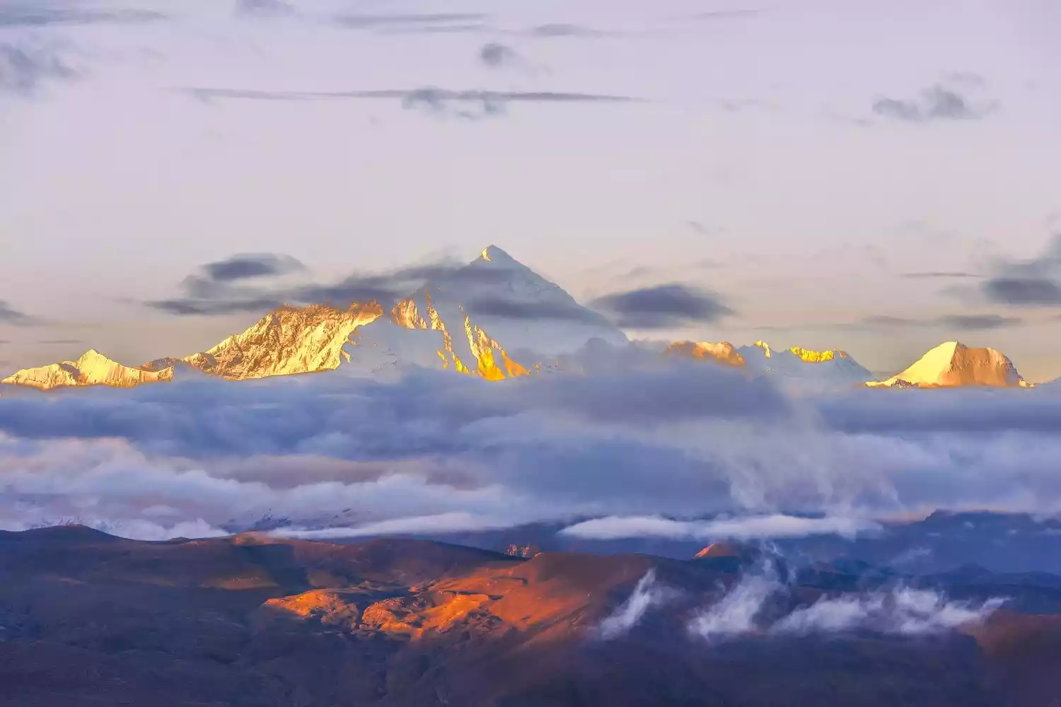
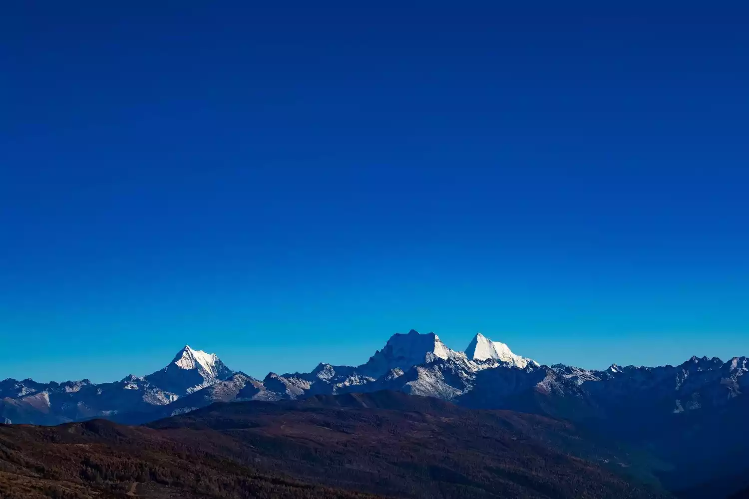
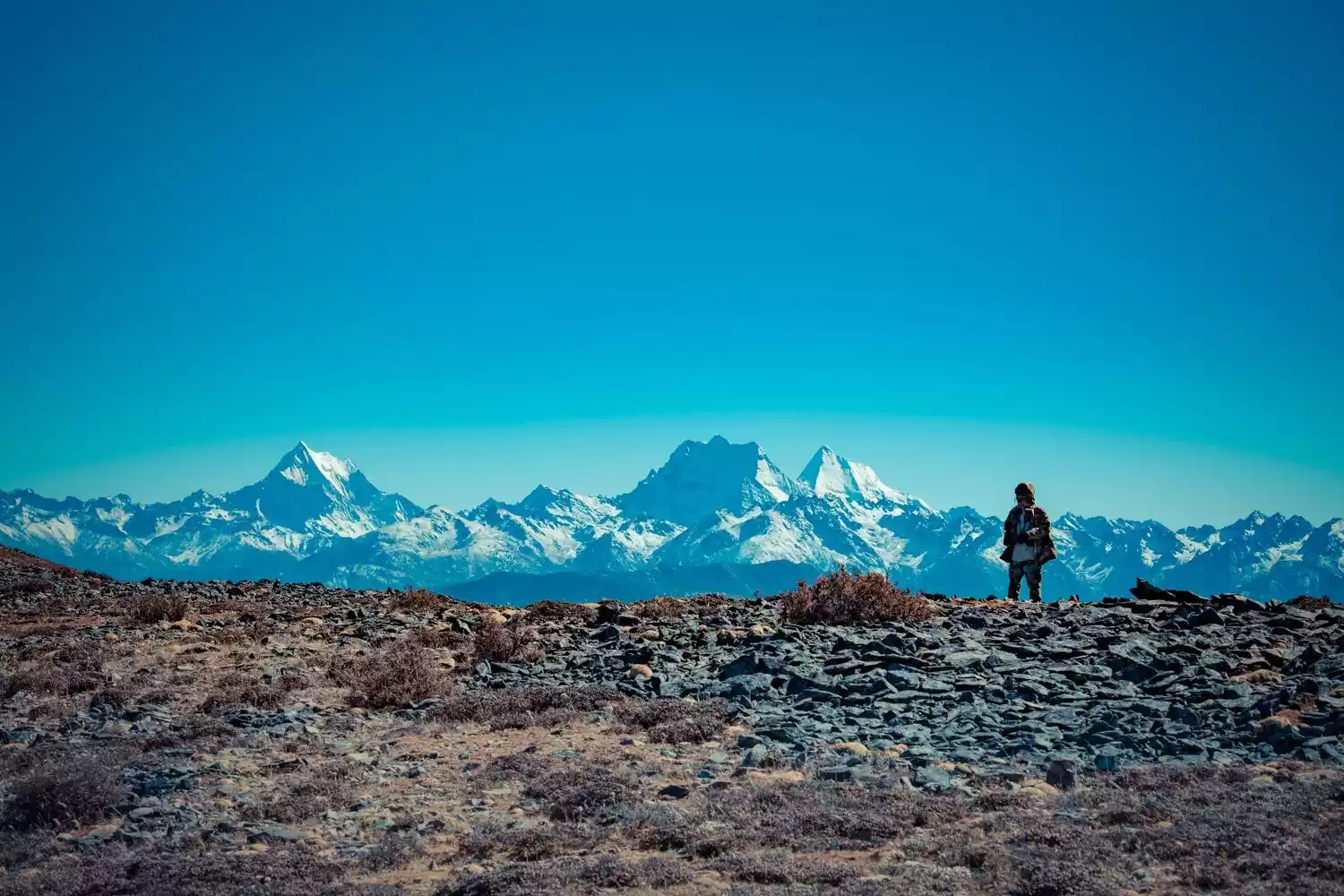
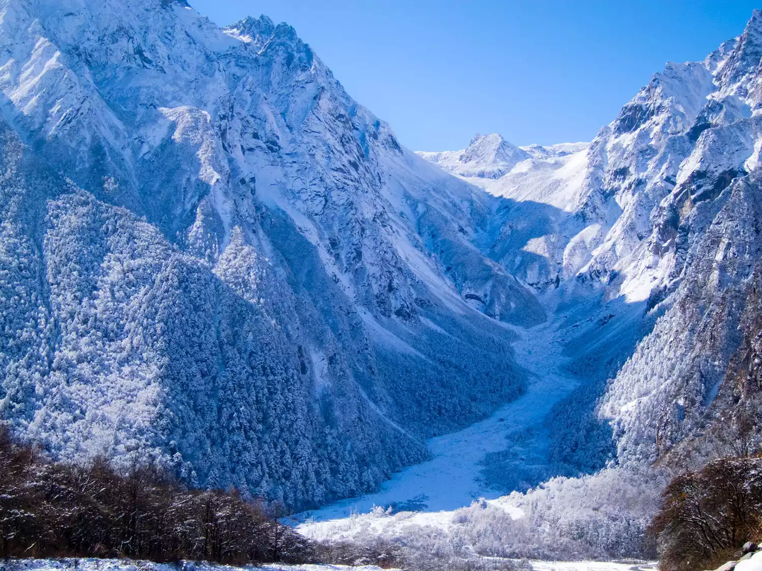
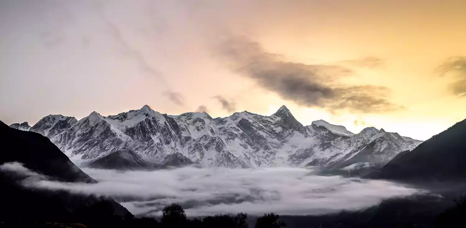
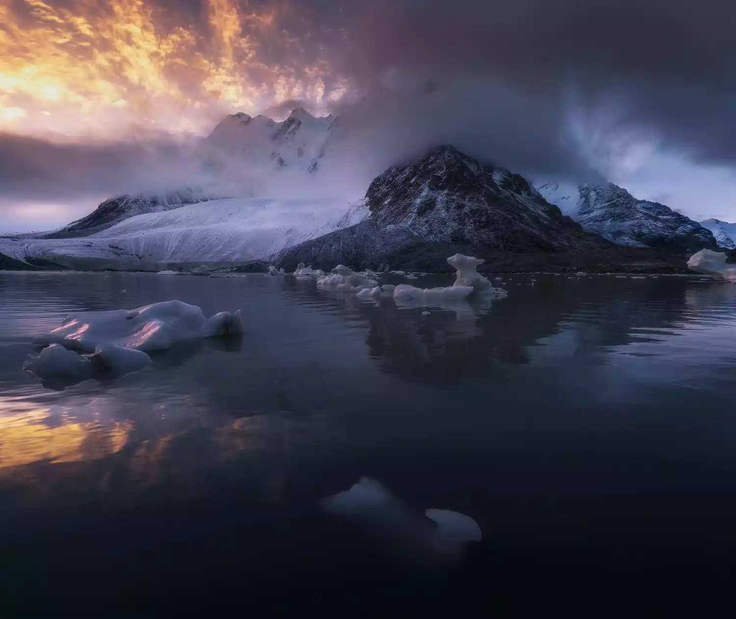
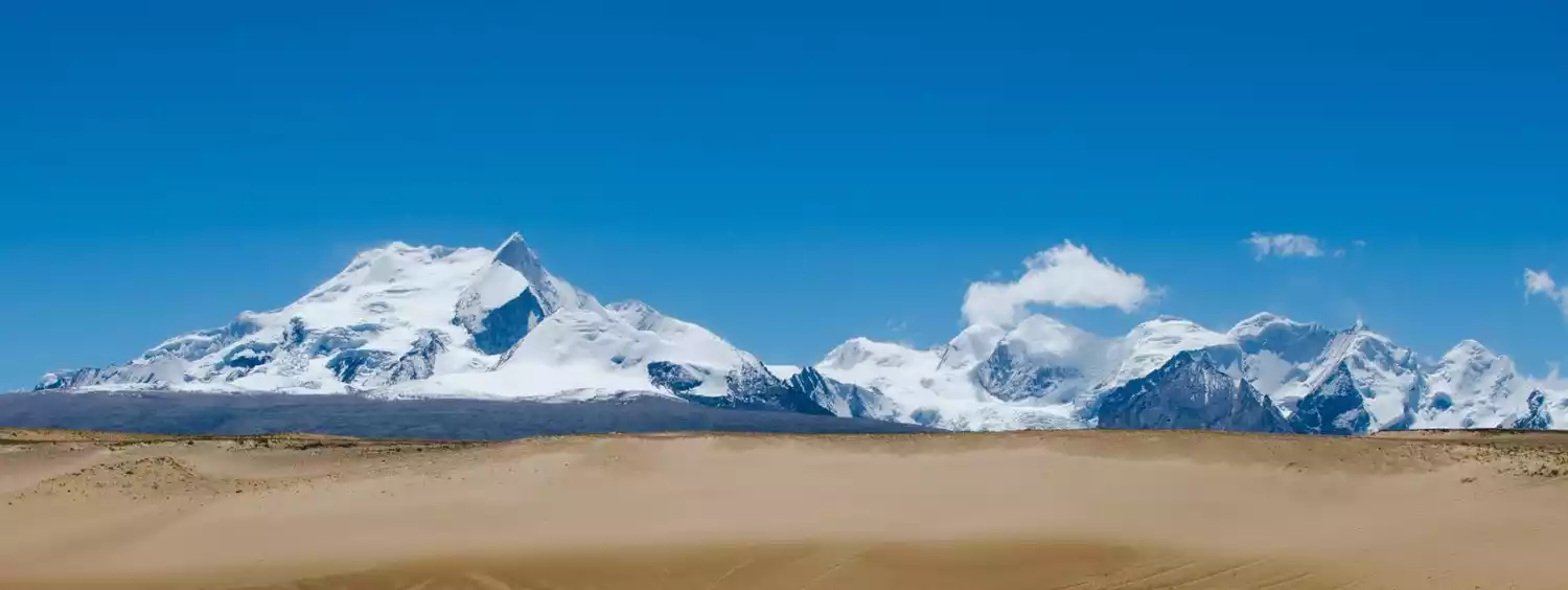
I don't know how to answer these questions. I believe that every question and every person who has experienced it has an answer of his or her own in his or her mind, so unforgettable, so hard to forget, with complicated emotions. After all, it is so majestic, so huge, and so high. When you hike into the Annapurna Mountains or walk on the Sagarmatha Trail, it looks cold, hard and solid, but with an indescribable quiet whiteness. The moonlight illuminates it so brightly that it is almost blinding. You think it is alive, but it is silent. Looking up at the Himalayas from here, it feels like the sky has been forced to leave only a small corner, and the huge mountain range extends to both sides, with almost no end. It is so huge and vast that it makes people panic. Not only do we become fragile and small, there is nowhere to hide in front of it, and even the entire mountain where we are is like a small boat floating on the sea!
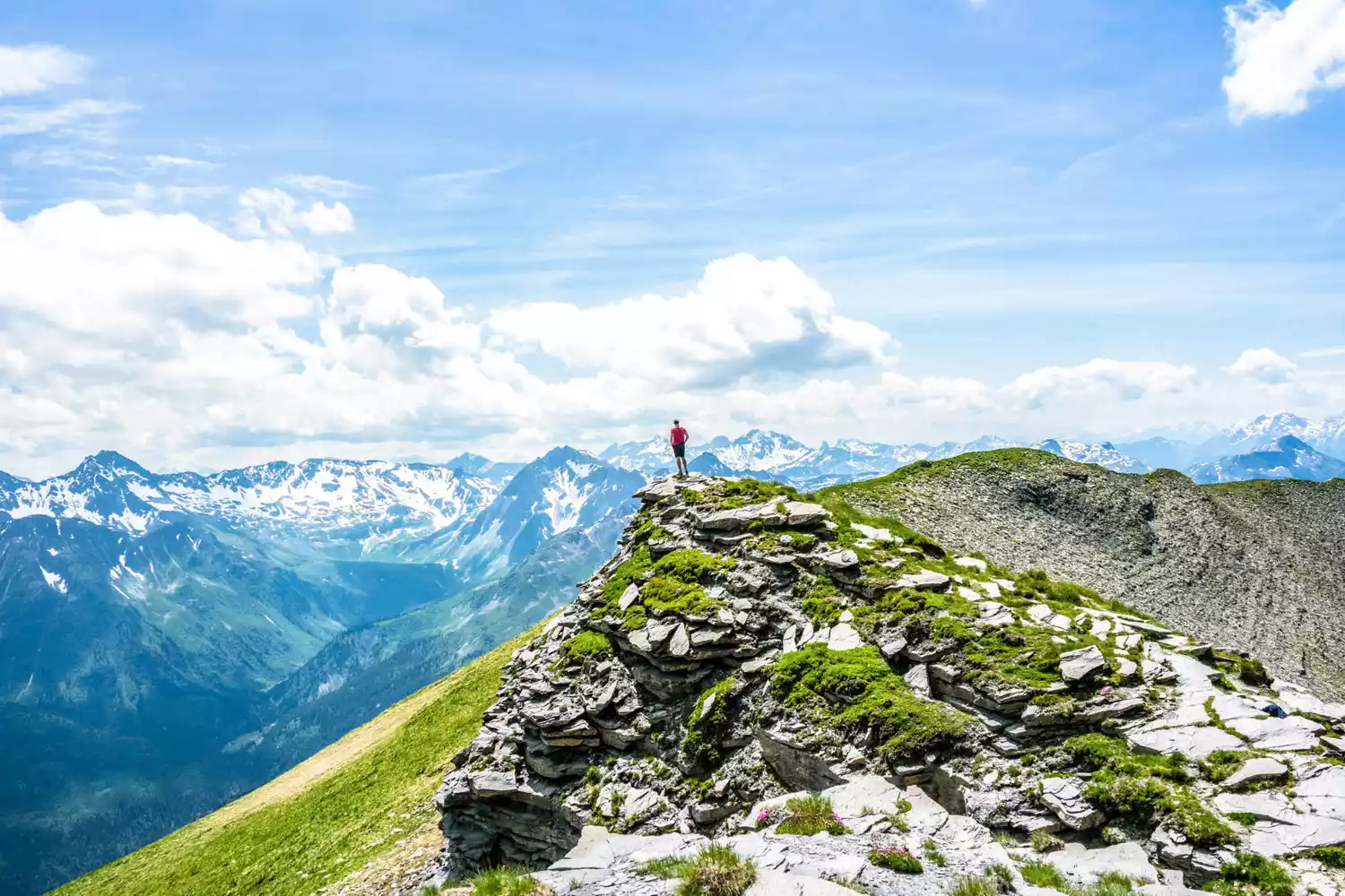
Today I have sorted out the 20 most worth-visiting snow-capped mountains in the world. If you can go and explore them in your lifetime, it will really be worth your life!
【Ranking is random in no particular order】
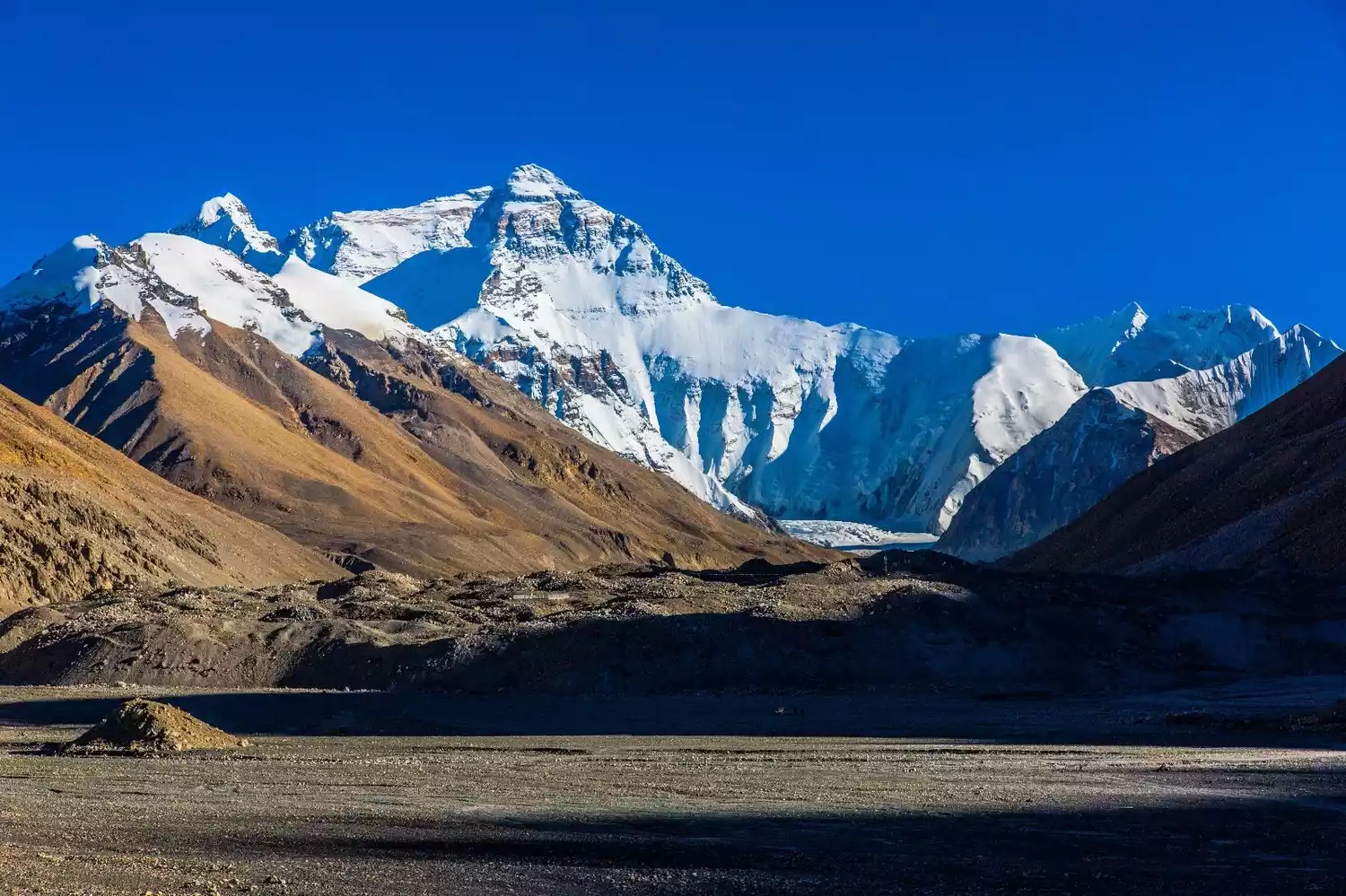
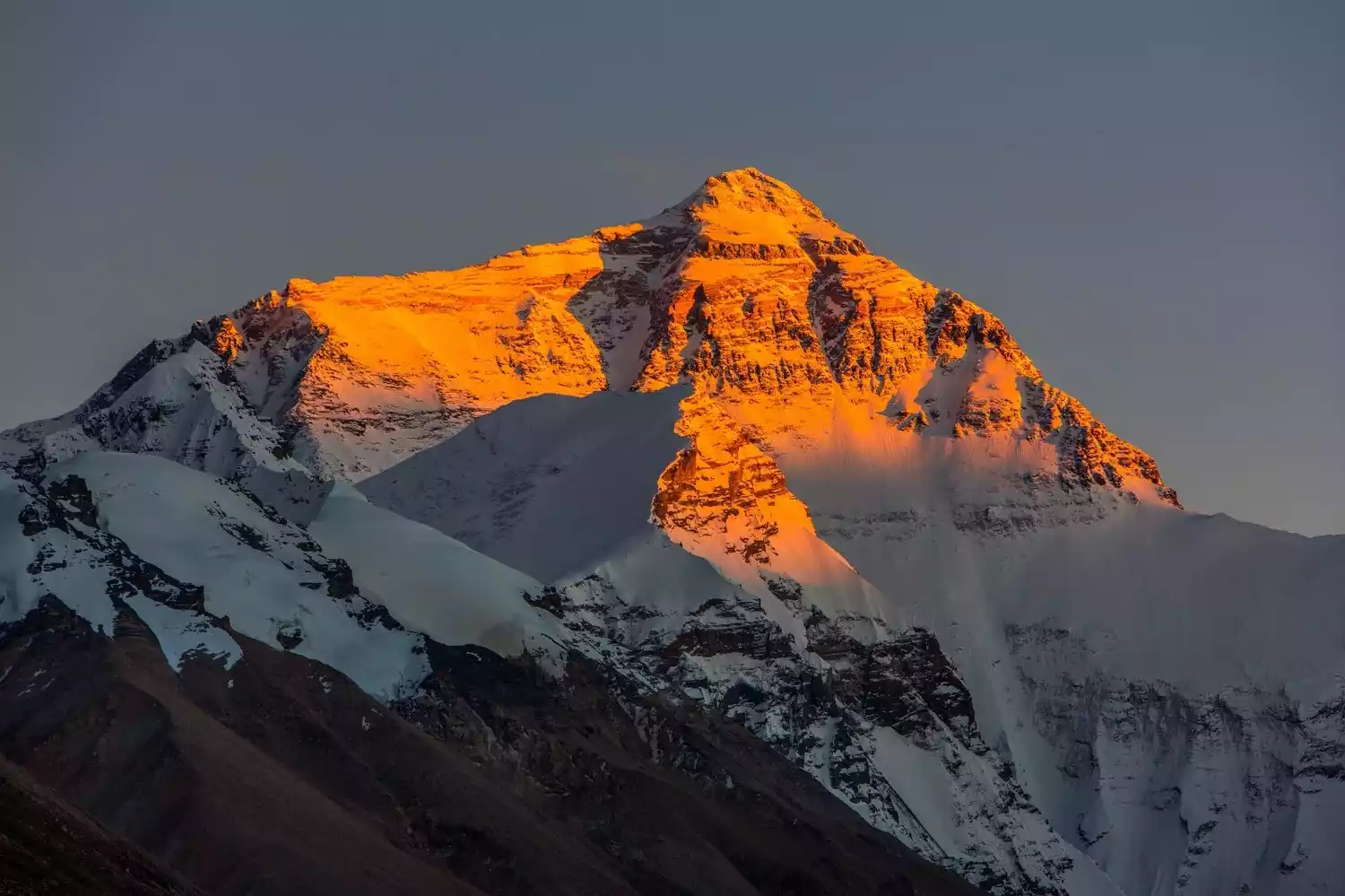
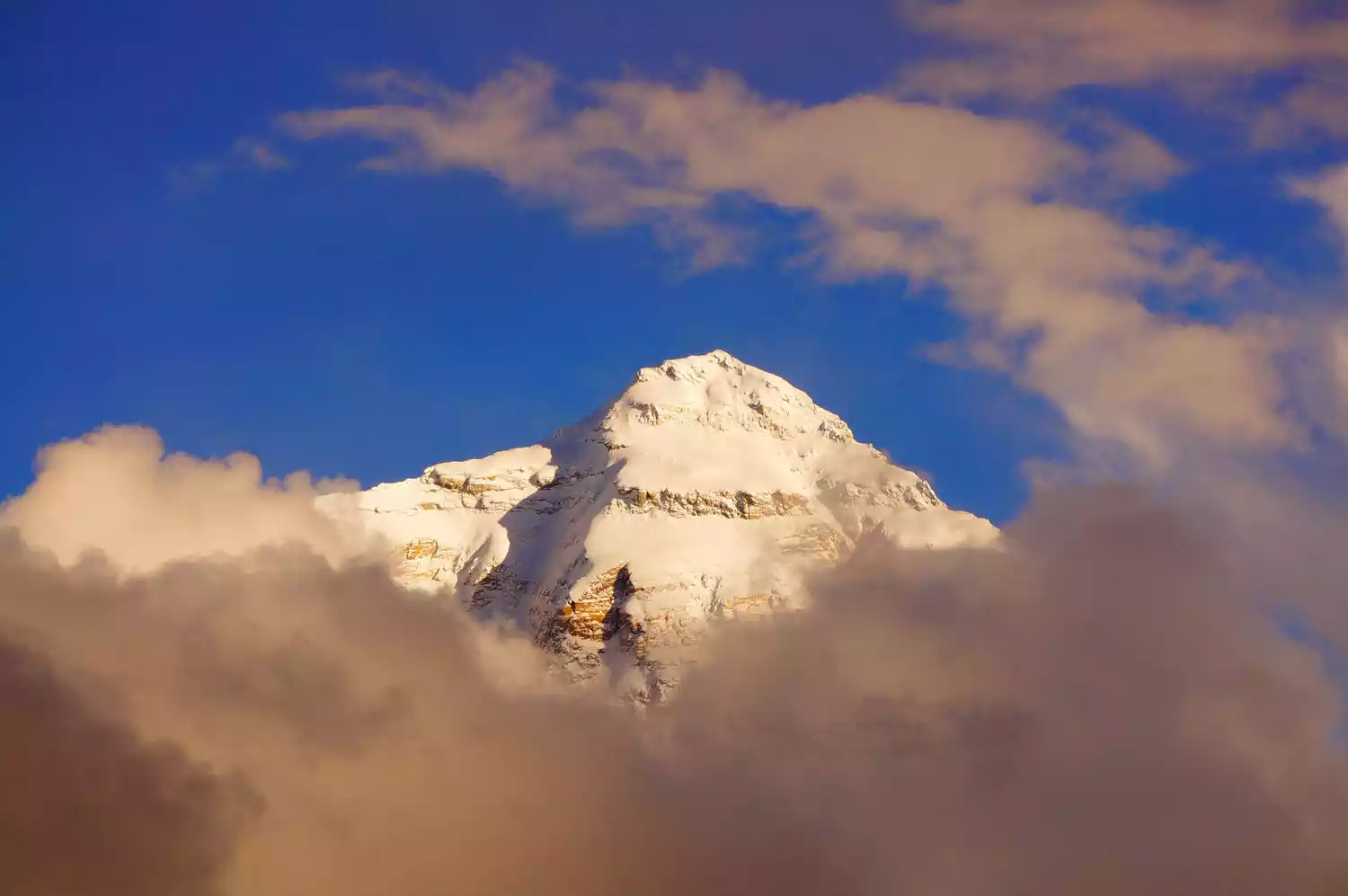
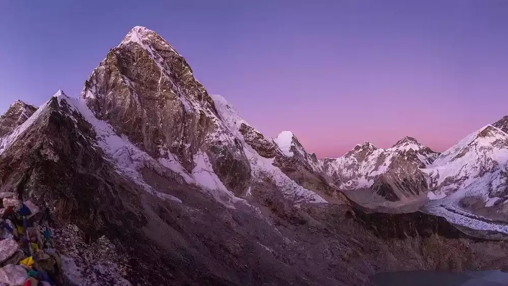
TOP 1 Mount Everest
-Roof of the World, Top of the Earth, Mother Earth-
Mount Everest, the highest peak in the world, is located on the border between China's Tibet Autonomous Region and the Kingdom of Nepal. Nepal calls it Sagarmatha.
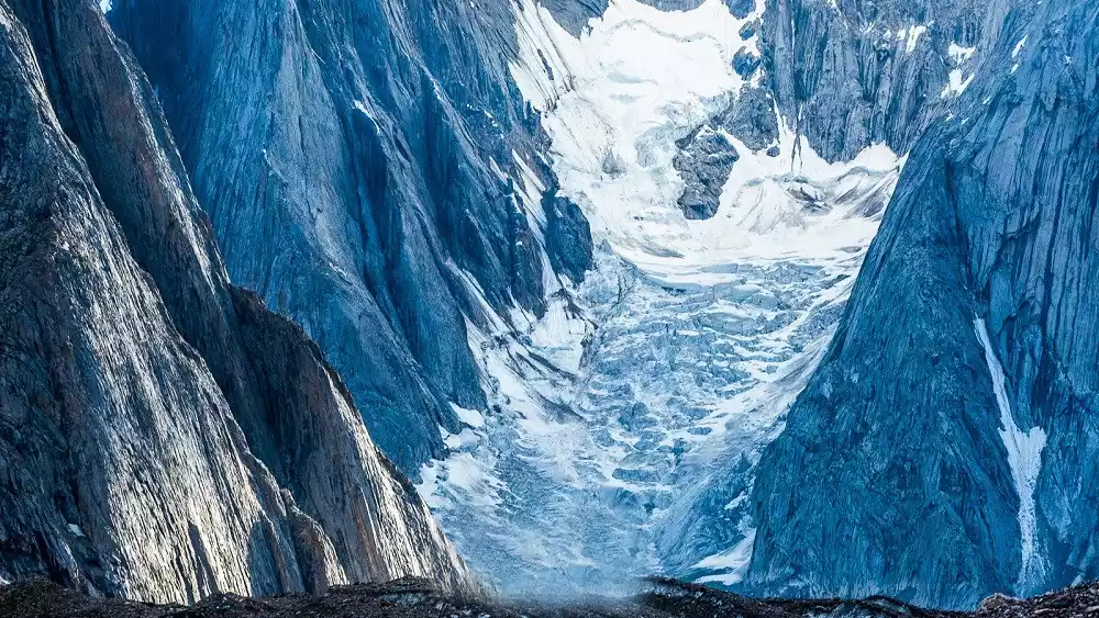
In fact, Mount Everest is a large horned peak with a prominent but not sharp top. It is located in the middle section of the Himalayas. Together with Lhotse, Makalu, Cho Oyu and many nearby peaks over 7,000 meters, it forms the most majestic alpine area in the world.
In Tibetan, "Qomolangma" means goddess and "Langma" means third, because there are four other peaks near Mount Everest, with Mount Everest ranking third.
Mount Everest stretches roughly east-west, with its northern slopes bordering the Qinghai-Tibet Plateau and boasting a relatively gentle terrain. Glacial erosion and river cuts into its southern and eastern slopes create a height difference of over 6,000 meters over a horizontal distance of approximately 53 kilometers. Resembling a gigantic pyramid, the mountain towers majestically and towering into the sky. Its terrain is extremely rugged and the environment is extremely complex.
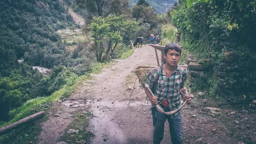
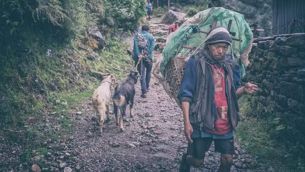
This is also the homeland of the world-renowned Sherpa people, a mountain tribe. The 150-kilometer Sagarmatha Trail is every hiker's ultimate dream! The Grand EBC Loop reaches elevations from 2,700 to 5,550 meters. Mount Everest is known in the West as "Everest," and Sagarmatha means "from land to sea" or "top of the world" in Nepali. Here, the name evokes the journey from flower-filled woodlands through beautiful villages and mountain paths to the shimmering summit of snow!
Location: The northern part is located in Dingri County, Tibet, China, the western slope is in Zhaxi Zong Township, Dingri County, the eastern slope is in Qudang Township, Dingri County, where the Everest Base Camp is located, and the southern part is located in Nepal, where the Everest Base Camp is located.
Altitude: 8844.43 meters
Recommendation index: ★★★★★
Tickets/Opening Hours
All day
First, you need to go through the mountain entry procedures at the hotel at the Xin Dingri intersection, then rent a car to Mount Everest or drive yourself. The entrance fee to the Dingri Mount Everest intersection is 180 yuan.
You also need to pay a road construction fee and a vehicle entrance fee based on the number of wheels, which is 100 yuan per wheel, plus a handling fee of 5 yuan.
Transportation Overview
It is not difficult to hitchhike from Shigatse or Lhatse to New Tingri, but the chances of getting a ride for the remaining 100 kilometers to the base camp are relatively low, so it is recommended to charter a car from Lhasa.
Note: The eco-friendly bus service from Basong to Rongbuk Monastery in the Mount Everest region has been cancelled. It is recommended that you drive directly to Rongbuk Monastery when chartering a car.
Best time to travel
The climate on Mount Everest is harsh, with few sunny days and often violent storms.
There are two best seasons for climbing Mount Everest: May and September to October. During these two periods, the wind speed at an altitude of over 8,000 meters is relatively low, and there is little rain or snow.
Tips:
The "Mount Everest Ban" some time ago actually targeted the core area of the Mount Everest National Nature Reserve, that is, the area above Rongbuk Monastery. It has little impact on sightseeing in Tibet, and you can also choose to hike to the South Slope Base Camp from Nepal without any impact.
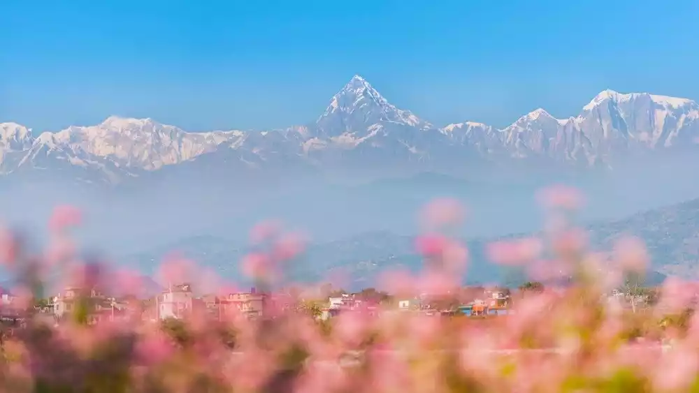
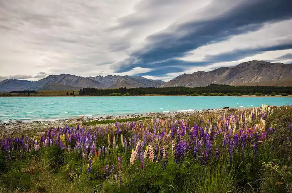
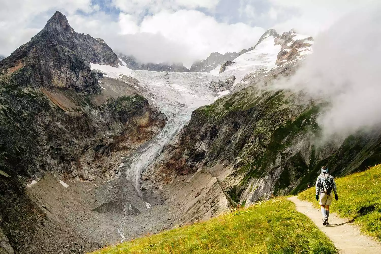
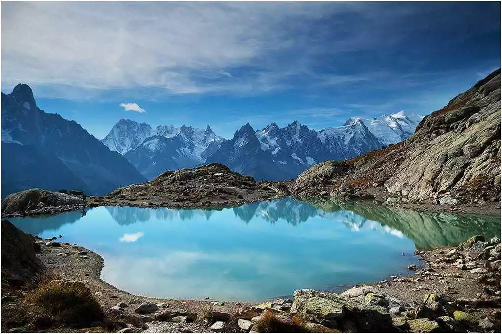
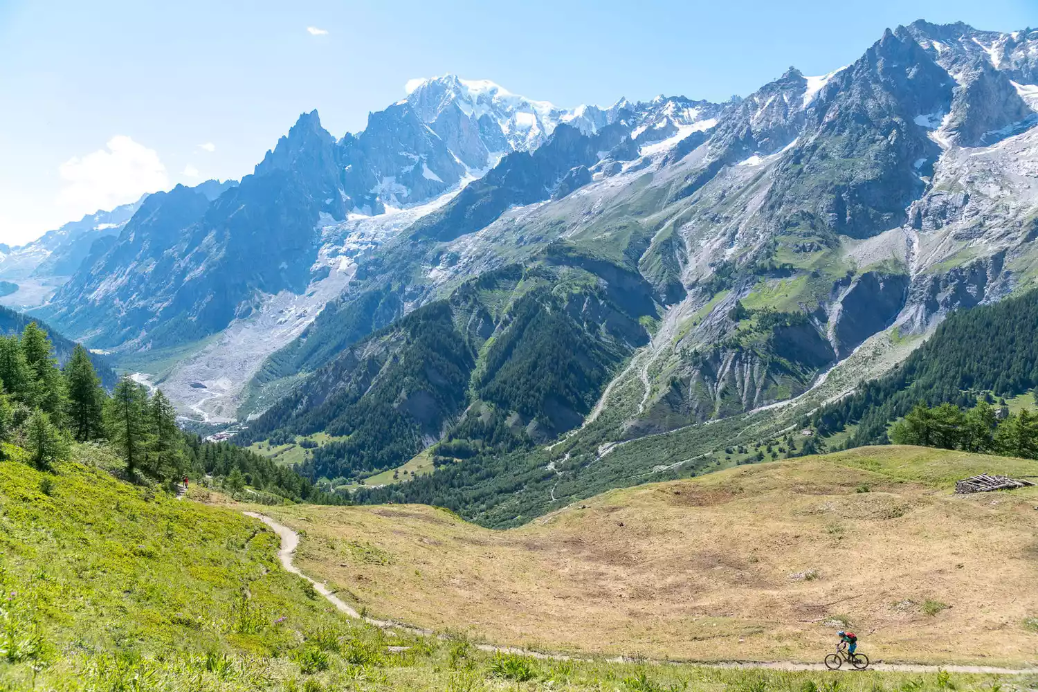
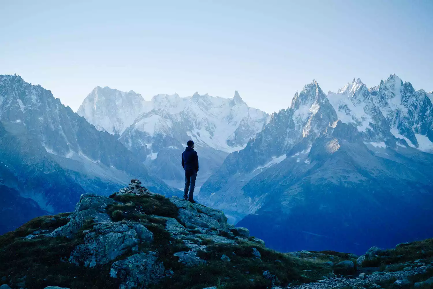
TOP 2 Annapurna
-The abode of the gods, the place closest to heaven, the place of purification-
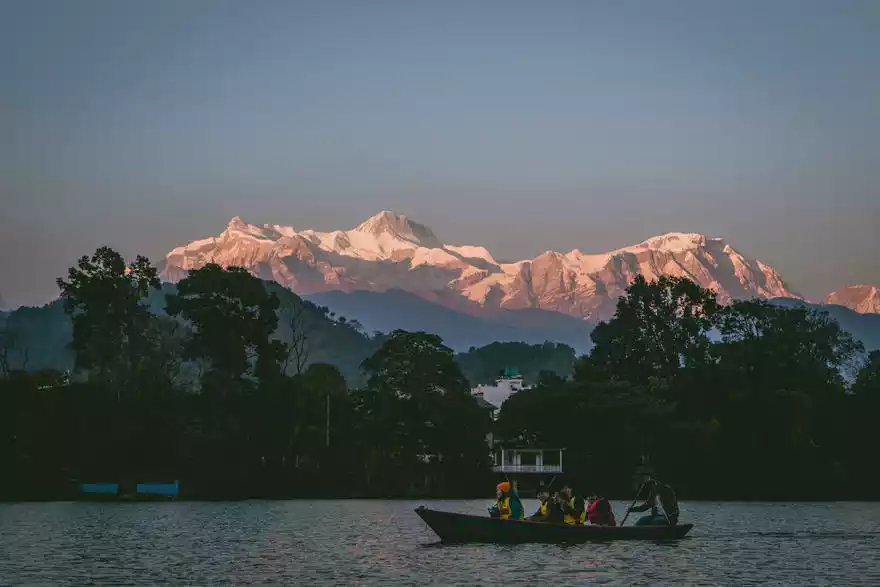
The Annapurna Group, part of the Himalayas, is located in north-central Nepal, north of the city of Pokhara. Annapurna I, at 8,091 meters, is the tenth highest peak in the world and the highest in the Annapurna Group. The Annapurna Group boasts five peaks exceeding 7,000 meters.
This route primarily circles the perimeter of the Annapurna Mountains, ascending along river valleys to the northern side of the main Himalayas, crossing a 5,416-meter pass before descending into a desolate valley steeped in Tibetan charm. This route, with its rich natural and cultural landscapes and challenging high-altitude pass crossings, has long been recognized as one of the world's most classic treks. Along the way, you'll pass ancient temples and alpine lakes, offering not only breathtaking mountain scenery but also the opportunity to experience diverse local customs and cultures.
Fishtail Peak is a mysterious peak in the Annapurna group of the Himalayas.
Fishtail Peak is a sacred mountain in Nepal, named after its resemblance to a fish's tail. Although not the highest mountain in Nepal, it has become a symbol of the country. From Pokhara, near Phewa Lake, you can see the sacred mountain and the surrounding peaks, jutting out from the lower mountains.
Climbing Fishtail Peak is prohibited, but tourists can take a small plane to see the magnificent scenery of Fishtail Peak and the Himalayas up close.
Its significance lies in the fact that it is the southernmost peak in the Annapurna group. When viewed from Sarangkot, the straight-line distance is only about 30 kilometers. The peak looks the tallest, with a domineering aura that stands out among chickens. Before the advent of modern measurement technology, local people have always worshipped it as the highest peak in the Annapurna group.
It is one of the three famous 6,000-meter-high sacred mountains that are prohibited from climbing. The other two are both located in China: Kawagarbo (6,740 meters) in Deqin, Yunnan, and Kailas/Gang Rinpoche (6,638 meters) in Purang, Tibet.
The Annapurna Base Camp route (ABC) is the most familiar and popular hiking route in China. It starts near Pokhara and reaches Annapurna Base Camp.
Highlights: This route is so famous because it allows you to see Mount Annapurna very closely, as well as the Fishtail Peak, the sacred mountain of Nepal opposite it. It is also the most familiar and popular hiking route among Chinese people.
Nepal's 4 classic trekking routes
1. The shortest is a four-day hike (Poon Hill, commonly known as Boon Hill hike)
2. The moderate-intensity Annapurna ABC circuit (Annapurna Base Camp) takes about a week
3. The more intense ABC loop takes about 15 days.
4. The most intense route is Everest Base Camp (EBC), which takes about a month.
The four trekking routes mentioned above are the most common. Some also refer to Pooh Hill as the "A-B-C" circuit, while the seven-day route is called "Base Camp." Another route is the 30-day Annapurna circuit, a combination of several routes, also known as the "Grand Circuit." Specifically, Pooh Hill is the least strenuous hike and is suitable for those with altitude sickness. At just over 3,000 meters above sea level, you can see snow-capped mountains and the sunrise.
The 7-day Annapurna Small Circuit is arguably the most budget-friendly route. This route boasts well-equipped facilities (though this is relative, as the route is largely mountainous and pristine). Small guesthouses are located approximately every two hours along the route, making it suitable for climbers with limited experience, stamina, and time. The base camp at the end offers the most stunning scenery, surrounded by snow-capped peaks over 8,000 meters high. Those with more stamina can try the 15-day Annapurna Large Circuit, offering even more spectacular and diverse scenery. The Everest Crossing (EBC) should be considered with caution. Nearly a month of heavy climbing with heavy loads is physically demanding and may not be for the average climber. However, this is also the most spectacular route, with minimal facilities along the way, allowing climbers to push themselves as much as possible. The most recommended time to travel to Nepal is winter, which is also a good time. If you follow National Geographic's Instagram, you'll see many National Geographic photographers currently filming in Nepal, enjoying the stunning scenery.
Location: Located in north-central Nepal. Annapurna I is located at 83° 49' 14'' East longitude and 28° 35' 45'' North latitude.
Altitude: 8091 meters
Recommendation index: ★★★★★
Tickets/Opening Hours
All day
You need to apply for a mountaineering permit and environmental insurance in Kathmandu or Pokhara
Transportation Overview
After landing in Kathmandu, you can choose a domestic flight, bus, or charter car to Pokhara, and then continue to charter a car to Nayapul. After arriving at Birethanti 1000, you will see the TIMS (Environmental Assurance) Check-Post Checkpoint. Get the environmental assurance certificate and climbing pass you prepared before climbing the mountain stamped here, and set off!
About hiking season
Spring: Mid-March to mid-June
is the best time to hike, after autumn. Due to the spring snowmelt, the ABC region may be at high risk of avalanches, but the EBC route is not at risk.
Summer: Mid-July to mid-August.
Two-thirds of the annual rainfall is concentrated in this season, making it the heaviest rainy season. While areas like Chitwan and Kathmandu remain unaffected by rain, the hiking experience may be somewhat diminished. While hiking is not considered dangerous, caution is advised. If you plan to travel year-round, it is recommended to advance or postpone your trip. Due to moisture from the Indian Ocean blowing into the Himalayas, the weather is hot and humid, with frequent rain, and the snow-capped mountains may be obscured by clouds.
Autumn: Mid-September to mid-November
is the best time to hike, but because the number of hikers is high in the past, hostels can be extremely crowded. Those who prefer a quieter environment should avoid this season.
Falling Leaves: Mid-November to mid-January.
The temperature begins to cool, but not too cold. Hikers tend to be much less crowded than in autumn, making this a recommended time to hike. However, this season also presents a high risk of heavy snowfall and extreme low temperatures, so gear should be prepared for winter. Additionally, some small hotels will close, and even larger hotels will experience significant closures.
Winter season: mid-January to mid-March.
Winter temperatures are quite low, with even hotel rooms experiencing sub-zero temperatures at night, and even lower temperatures on observation decks at night. Strong winds and snowfall are common, making snow accumulation difficult to avoid. Hiking can be challenging due to icy and snowy sections, so be sure to bring a thick down jacket if you're looking for a challenging hike.
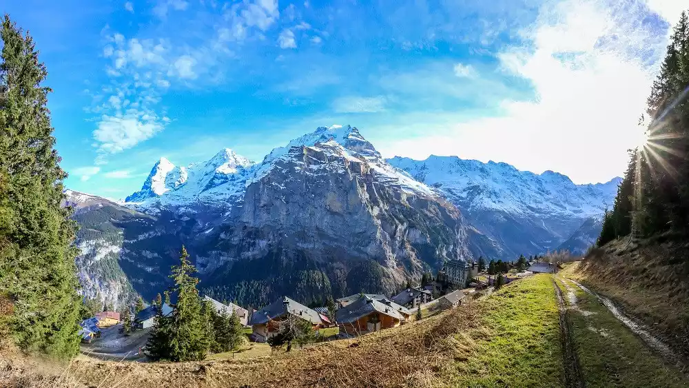
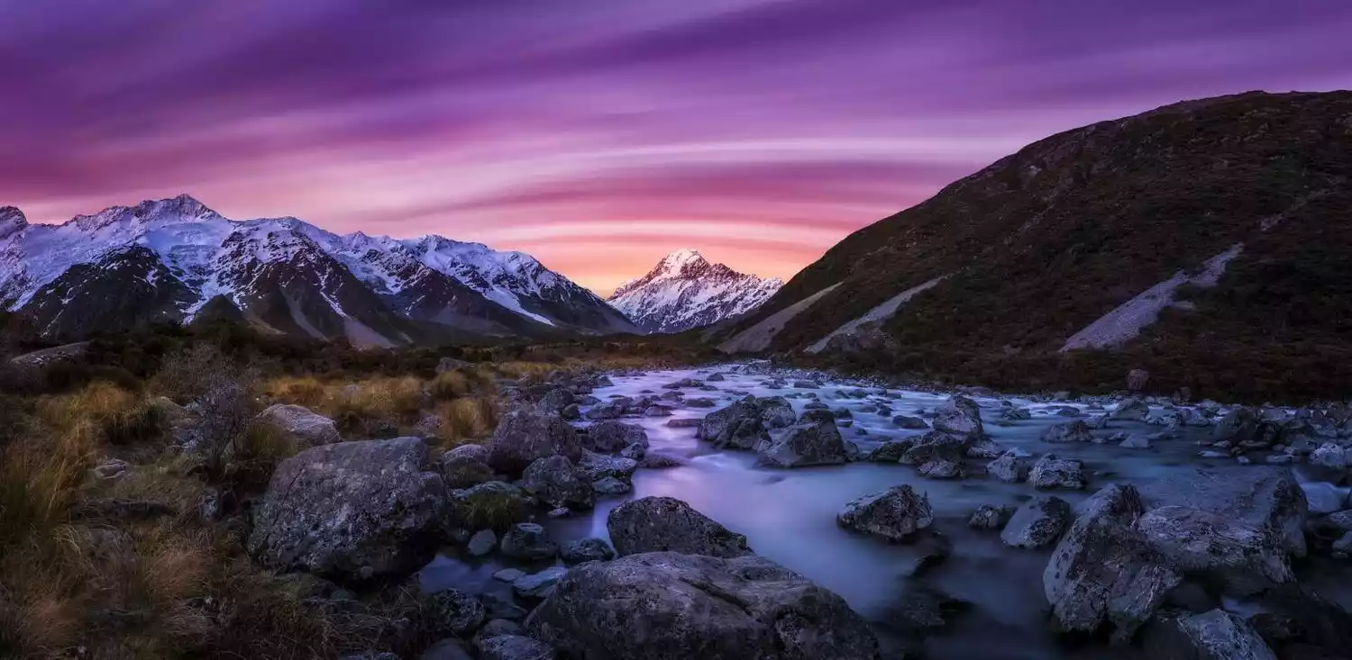
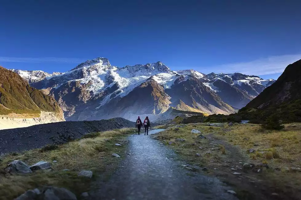
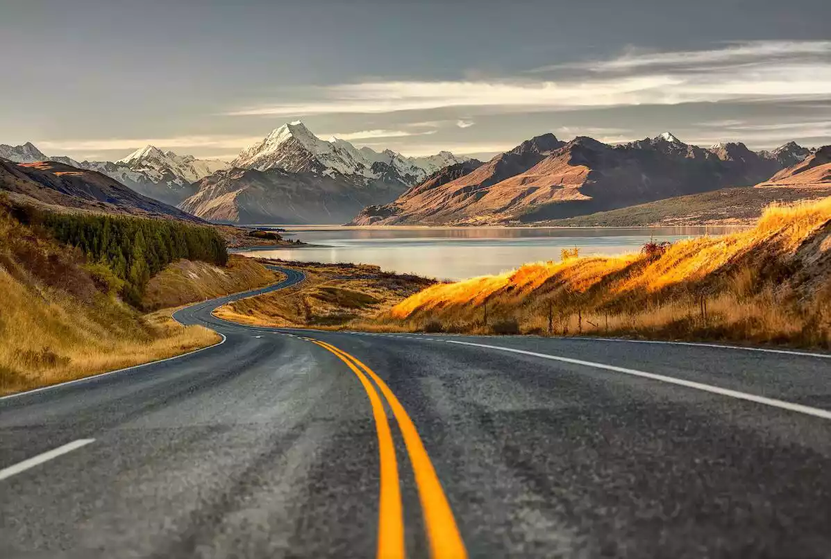
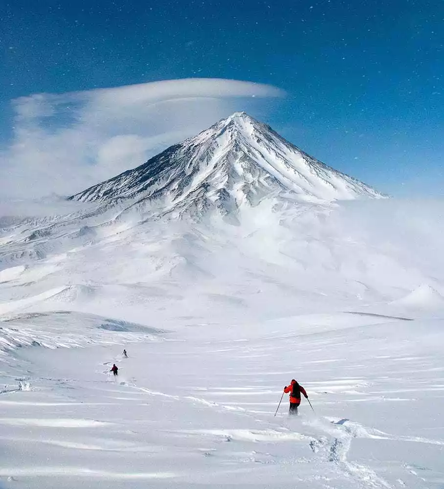
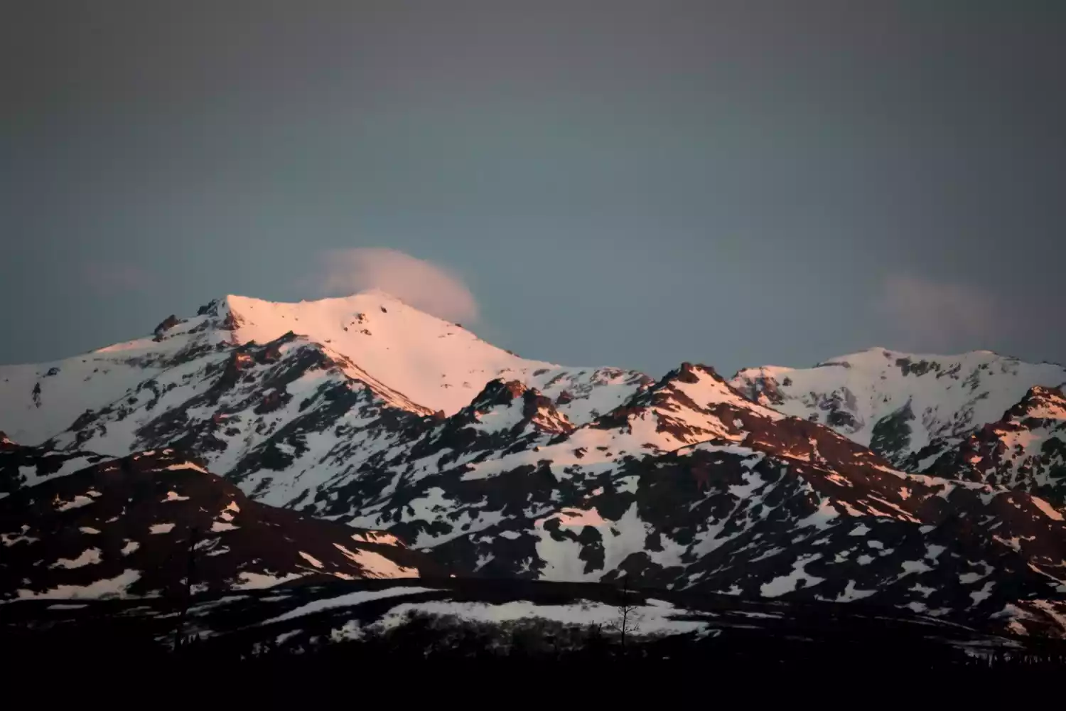
TOP 3 Mount Cook
- Southern Alps -

According to the legend of the Maori people, the indigenous people of New Zealand, there is a myth that Father Sky and Mother Earth united, and their descendants came to New Zealand. They turned a giant canoe into the South Island, and a group of descendants into the peaks of Mount Cook. One of them is called "Aorangi", which means "long white cloud". It refers to the glaciers and mountains seen by the Maori. Snow and glaciers cover about one-third of the area.
Among the mountains in New Zealand's South Island, Mount Cook is the most special one because of its year-round snow. Every year, many outdoor enthusiasts come here to climb to the top of Mount Cook; while tourists prefer to participate in helicopter landings on Mount Cook and glacier hiking activities.
When discussing this mountain, one person must be mentioned: Edmund Hillary. On May 29, 1953, Edmund, along with the Nepalese Sherpa Tenzing, successfully climbed Mount Everest, the world's highest peak, marking the first time humans have reached the summit. In addition to Mount Everest, he also climbed all 11 peaks in the Himalayas above 6,000 meters.
Edmund is a national hero to New Zealanders. His portrait graces the New Zealand five-dollar note, and he was knighted by the British Royal Family. To date, he remains the only non-politician outside the UK to be knighted by the Queen. He is considered one of the greatest and most legendary explorers of the 20th century. Mount Cook was the place where Edmund Hillary first learned mountaineering and where he frequently practiced in his early years. For tourists who love the outdoors and snowy mountain climbing, Mount Cook is a great choice.
Tickets/Opening Hours:
Best time of day to travel
All seasons are suitable for hiking. June to August is New Zealand's winter, when there will be relatively more snow.
Location: Southern Alps, located in the Southern Alps in the central and western part of the South Island
Altitude: 3754 meters
Recommendation index: ★★★★☆
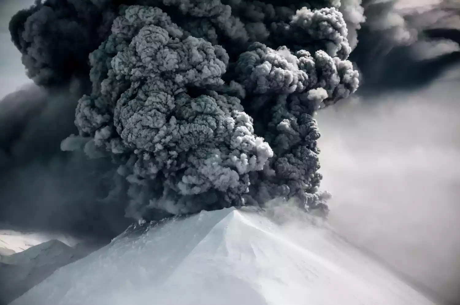
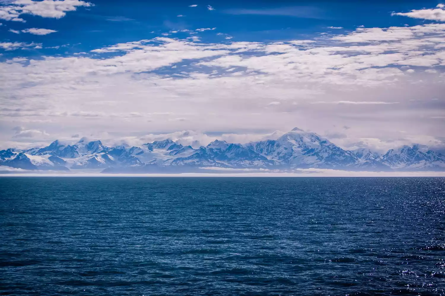
TOP 4 Avachinsky Peak
-The Patron Saint of Kamchatka-
If you want to have fun and find a place to lie down quietly, this may not be the place for you.
But if you have a restless heart and a soul longing for freedom, this will be the best place for you.
This is a place you would not come to easily, but it is a secret place that you will never forget once you have been there.
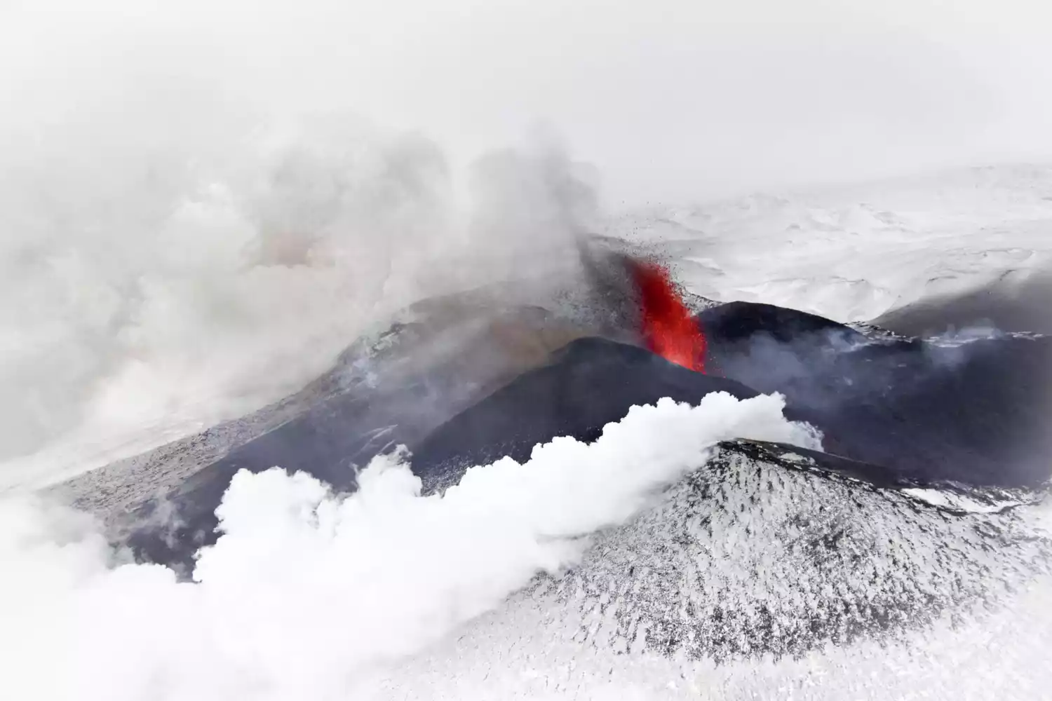
This is Kamchatka, a place you may not have heard of.
When you come to this secret place, you will definitely go to the symbol of Kamchatka - Avachinsky Peak. Although it is actually a volcano, it has become an awe-inspiring snow mountain under the cover of snow all year round. It is also the patron goddess of the locals.
Whenever winter comes to Russia's Far East, snow will cover the entire mountain peak. The white snow-capped mountains, the black sand beach in the distance, and the blue Pacific Ocean form a dreamy scenery.
Tickets/Opening Hours
Best time of day to travel
From February to April every year, there is snow and the temperature is relatively acceptable.
Location: 30 kilometers north of Petropavlovsk-Kamchatsky
Altitude: 2741 meters
Recommendation index: ★★★★
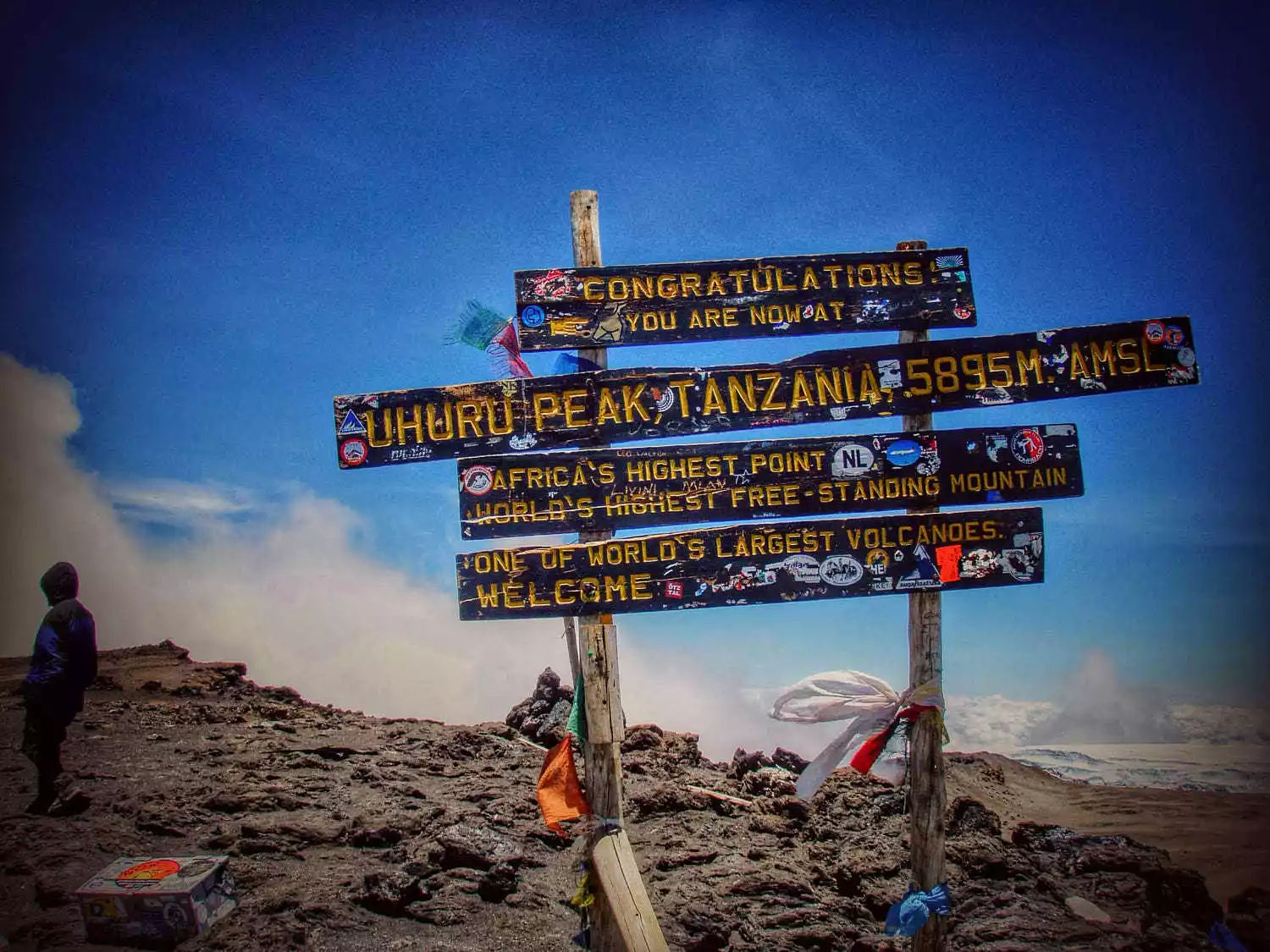
TOP 5 Mount Kilimanjaro
-The Roof of Africa, the World's Last Snow, the Glowing Mountains-

Hemingway's brief description of Mount Kilimanjaro has made many people in the world yearn for this mysterious mountain.
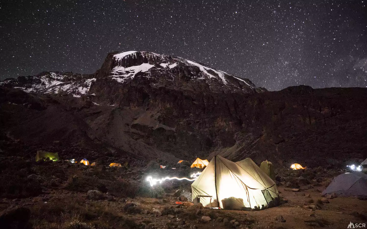
Mount Kilimanjaro is one of the highest points on Earth accessible by foot. There are six commonly used climbing routes: Marangu (also known as the Coca-Cola Trail), Rongai, Lemosho, Shira, Umbwe, and Machame (also known as the Whisky Trail).
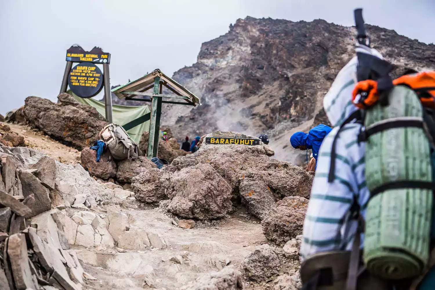
The Machame Route offers the most scenic views, but is steeper and more challenging. The Longgai Route is the easiest and the only route to cross Mount Kilimanjaro from the north. It avoids the crowds of the Coca-Cola and Whisky Route routes, offers varied scenery, and is slightly less challenging than the Whisky Route. The entire route requires no mountaineering skills or specialized equipment.
Approximately 10,000 to 20,000 people attempt to climb Mount Kilimanjaro each year, with 30-40% successfully reaching the summit. However, climbing via other routes is more difficult, especially from the glacier side, requiring expert climbers. The best climbing seasons are from June to October, when the weather is cool and dry, or from December to March, when the landscape is green but before the rainy season.
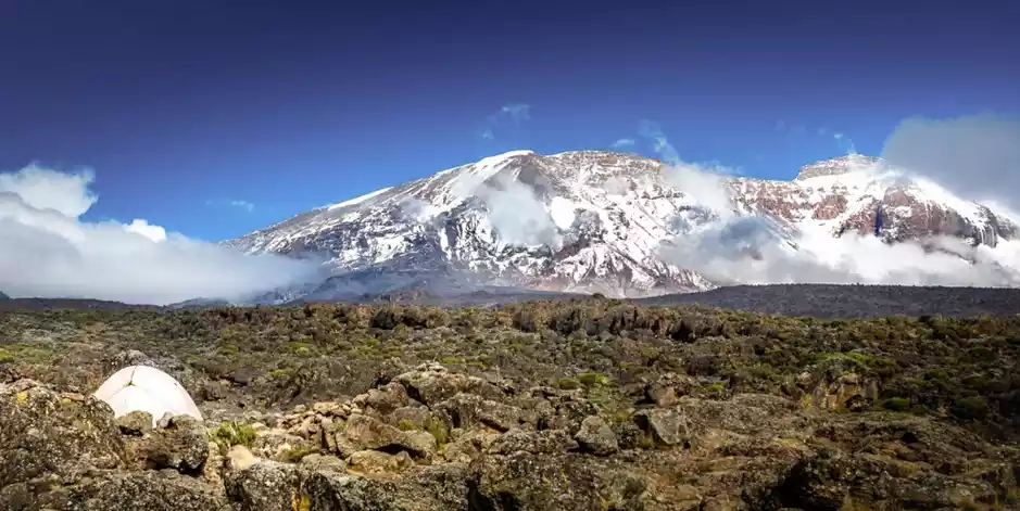
Part of Mount Kilimanjaro is designated Kilimanjaro National Park and a World Heritage Site. The Maqui people call the Western Peak "Oaki-Oai," meaning "Temple of God." Near the Western Peak lies the frozen, dried carcass of a leopard. What the leopard sought in such a high, cold place remains unknown.
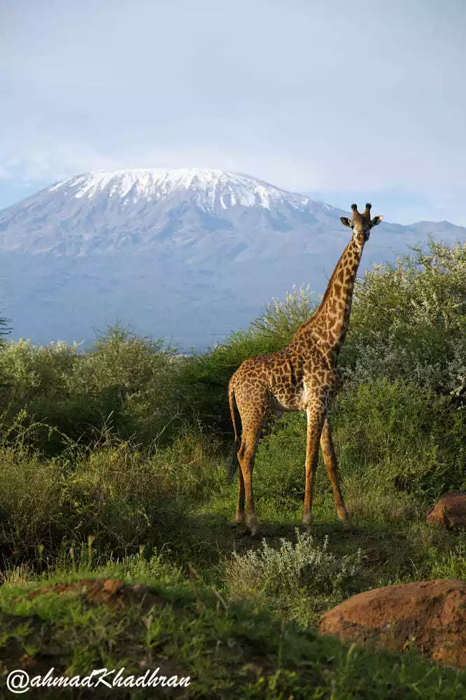
Location: Northeastern Tanzania, approximately 160 km south of the Great Rift Valley, and 225 km south of Nairobi, between the equator and 3° south latitude.
Altitude: 5895 meters, the highest point in Africa
Recommendation index: ★★★★★
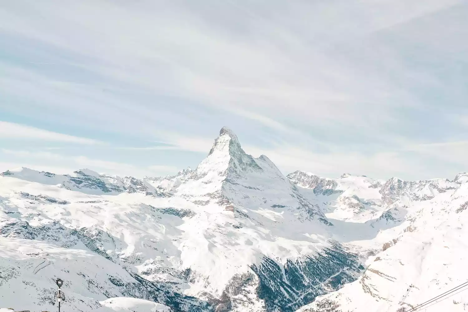
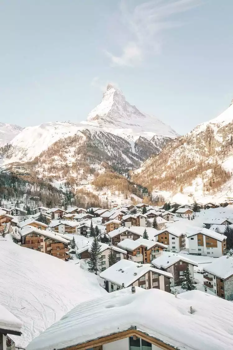
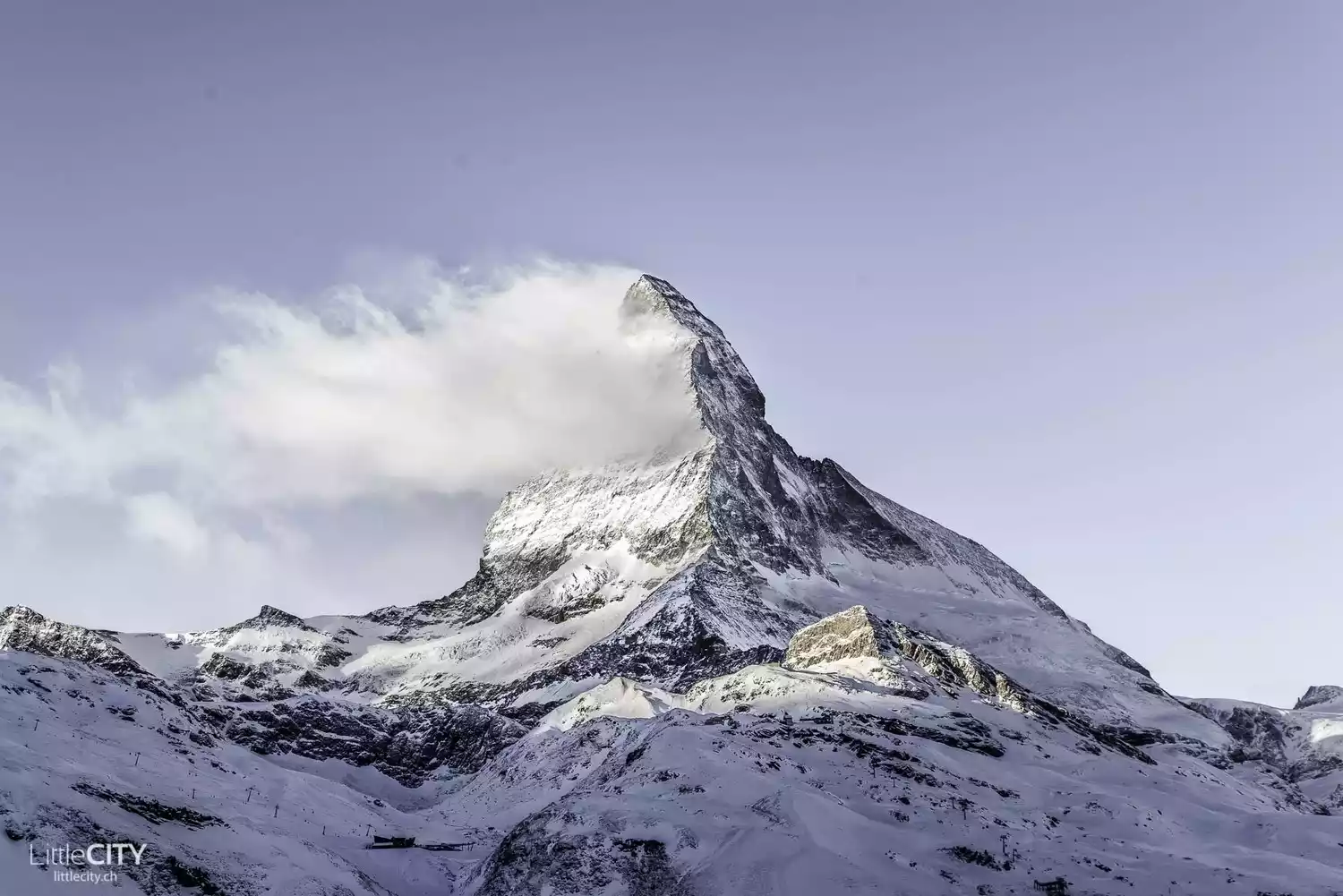
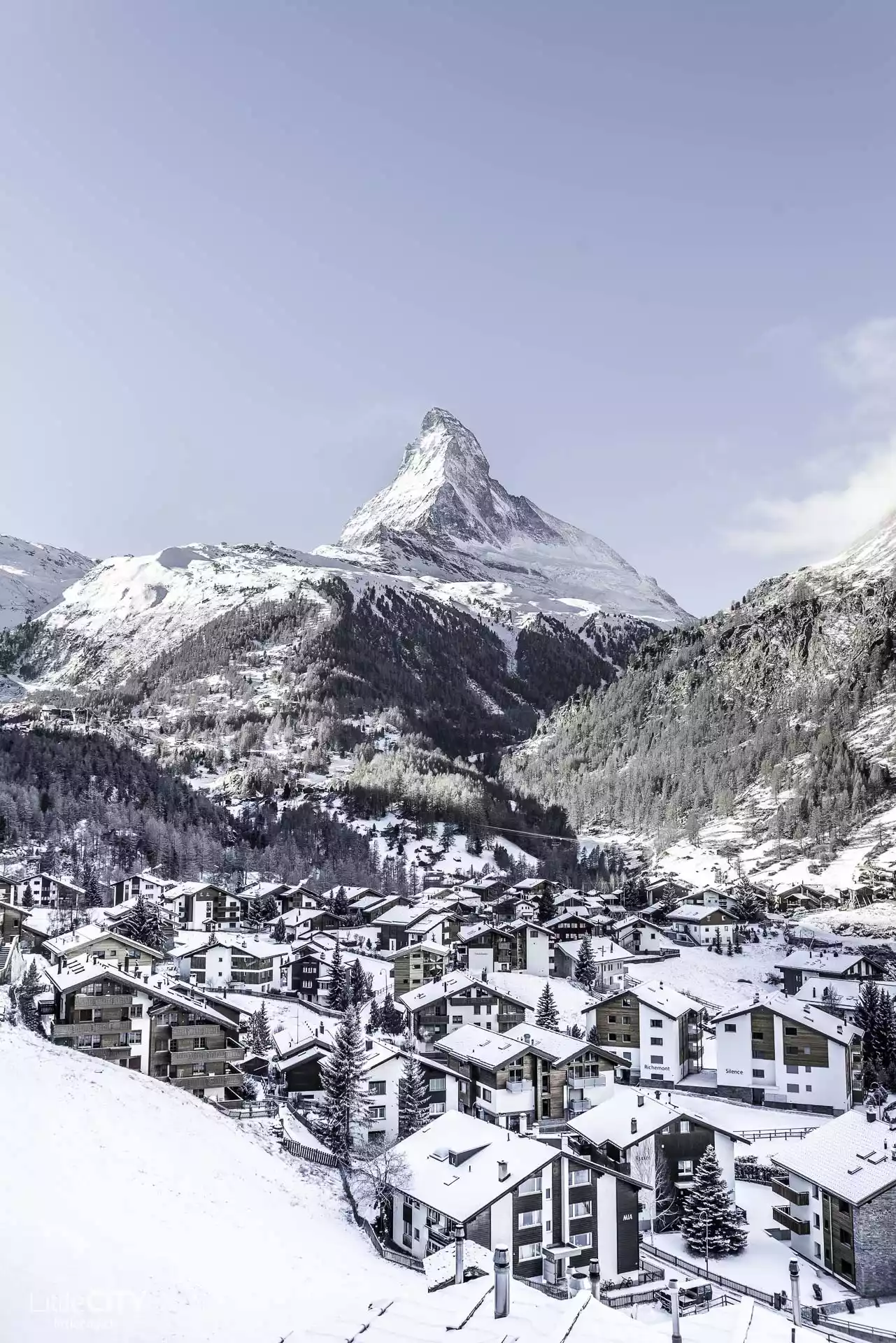
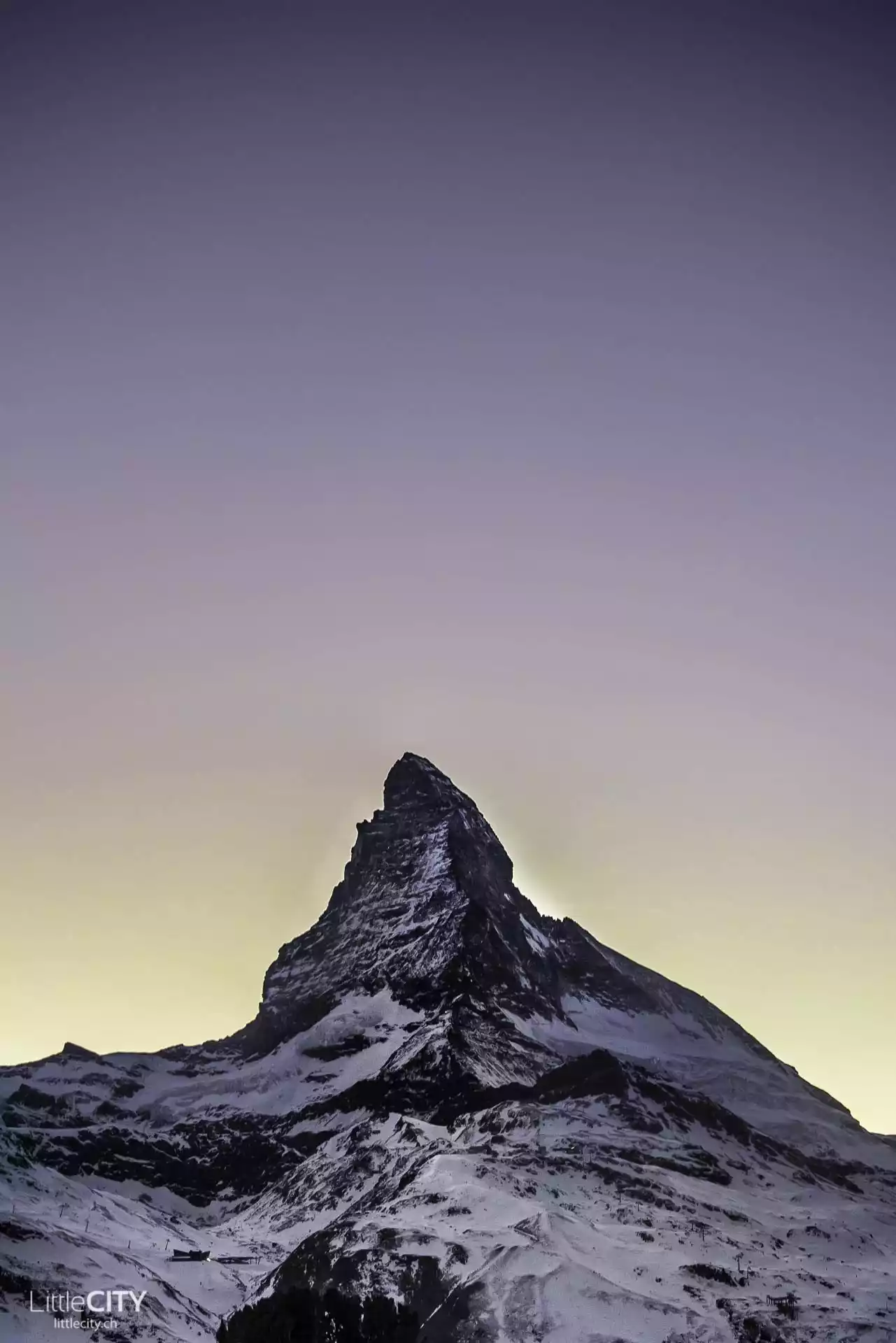
TOP 6 Matterhorn
-King of the Alps-
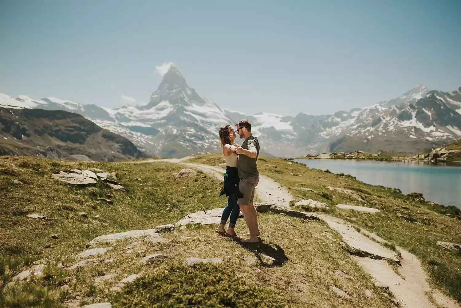
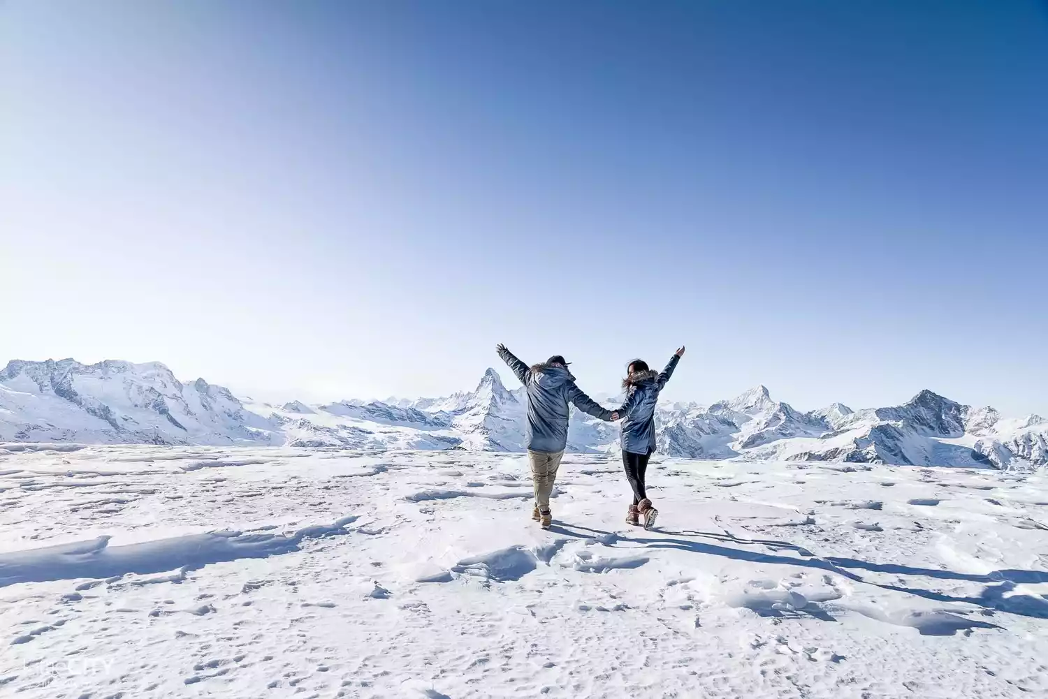
If you ask me which snow-capped mountain is my favorite in Switzerland, I'll answer without hesitation: the Matterhorn. As the most important attraction in the Zermatt area, the Matterhorn is a symbol of the Alps. While ranked relatively low in the Alps by height, it's renowned for its distinctive conical shape, rising a thousand meters above the ground and piercing the sky. Its imposing presence and sheer cliffs make it the last major peak in the Alps to be summited by mountaineers.
Of course, many people confuse it with Artesonraju in the Paramount logo. In 2001, the Matterhorn became a sister peak to the Jade Dragon Snow Mountain in Lijiang, Yunnan, China.
Transportation Overview
Located near Zermatt, Switzerland, it is recommended to take the European Railway to arrive. Zermatt is a pollution-free city and gasoline vehicles cannot enter.
Ticket Information
The Peak 2 Peak route offers a day trip to Gornergrat and Glacier Palace, two separate peaks. The entire route is by cable car or train, and with a 50% discount using the Swiss Travel Pass, the total cost for two adults and one child is CHF 232.
Best time to travel
The Matterhorn is open year-round. Hiking is available in the summer and skiing is in the winter. Nearby, you'll find everything from chalets to upscale hotels. The Matterhorn's slopes are relatively flat, making them suitable for beginners but may be a bit disappointing for advanced skiers.
Location: Zermatt, a small town in Valais, Switzerland
Altitude: 4478 meters
Recommendation index: ★★★★☆
Tips:
Zermatt's two cable car lines and a cogwheel train line allow visitors to admire its magnificent scenery from different angles. Early morning is the best time to see it.
7. Mont Blanc
- Lord of White, the highest peak in Western Europe -
Mont Blanc is the highest peak in the Alps and the highest peak in Western Europe, with an altitude of 4,807 meters. Its name means "Silver Peak" in French. The Mont Blanc circuit hike is famous for its superb mountain scenery.
Stand on the highest peak of the Alps, stroll through the pastures full of primitive atmosphere, and fully appreciate the magnificent beauty of Mont Blanc!
Location: On the border of Haute-Savoie, France, and Valle d'Aosta, Italy
Altitude: 4810 meters
Recommendation index: ★★★★
Transportation Overview
Generally, people going to Mont Blanc for hiking will gather in Chamonix. You can take flights to and from Geneva, Switzerland, and then take a bus or train to the destination.
Best time to travel
From June to September, the mountain is closed in winter and hiking is not suitable.
Tips:
It is important to remember that all summit climbs on Mont Blanc require the accompaniment and guidance of a local guide. Paragliding is also a must-do on any Mont Blanc trip.
8. Denali
-North America's tallest peak, Giant's Peak-
Influenced by the warm Pacific Ocean current, the Denali area boasts a relatively mild climate, radiating lush greenery even in the summer. Below 762 meters above sea level, forests, primarily composed of fir and birch trees, flourish. The vibrant green forests, snow-white peaks, and vast glaciers complement each other in the sunlight, creating a breathtakingly beautiful and refreshing landscape. Mount McKinley was designated a national park in 1917 and officially renamed Denali in 2015.
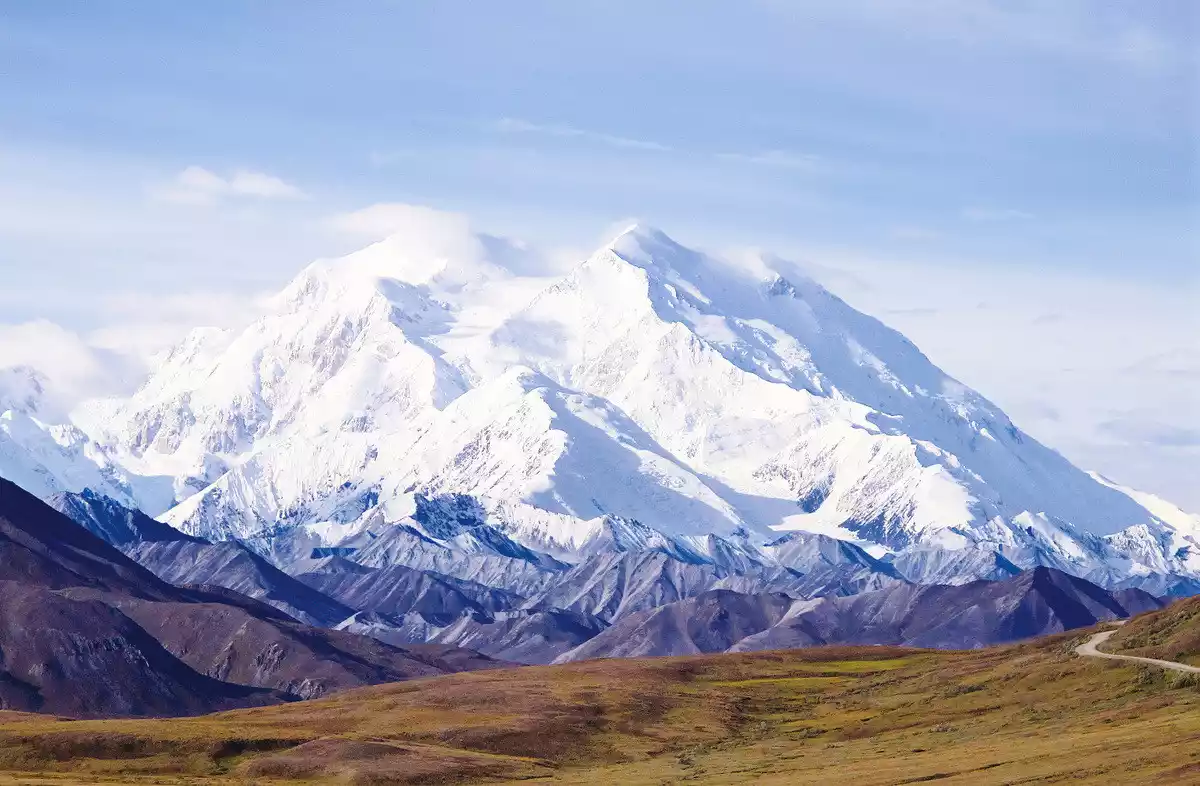
Originally named Mount Denali, it towers over Alaska, USA, and is the highest peak in North America, reaching 6,195 meters. It's a name long used by the Eskimos and Indians, the first indigenous people to conquer the North American continent. In 1800, it was named after the 25th President of the United States, William McKinley.
Denali National Park is the second-largest park in the United States after Yellowstone, covering over 6,800 square kilometers. Located in a remote area, it boasts a sparsely populated area, a cold climate, and unique natural scenery. Just 400 kilometers north of the park lies the Arctic Circle. The park's scenery is at its most magnificent at noon.
In Denali National Park, people can experience the darkness of winter and enjoy the long white nights of summer. The wonderful polar scenery is amazing.
Location: Located in south-central Alaska, in the middle section of the Alaska Range
. Elevation: 6,193 meters.
Recommended: ★★★★. Accessible
by
car from Anchorage.
Best time to visit :
Summer.
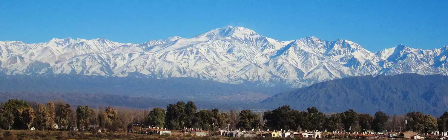
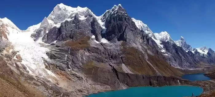
9. Andes
-The backbone of South America-
On the western edge of the South American continent, there stands a huge mountain range running from north to south. It is like a long dragon lying quietly on the east coast of the Pacific Ocean. This is the world-famous Andes Mountains, known as the "backbone of South America". The top of the mountain is covered with snow all year round and is very rich in mineral resources.
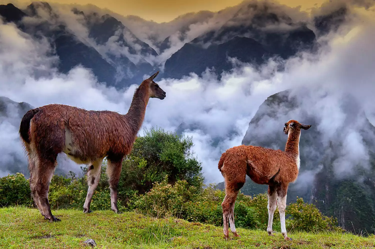
The Andes Mountains are not only the longest mountain range in the Americas, but also the longest in the world. Stretching 9,000 kilometers from north to south, it's 6,000 kilometers longer than the renowned Himalayas. From Trinidad in the north to Tierra del Fuego in the south, it spans seven countries: Venezuela, Colombia, Ecuador, Peru, Bolivia, Argentina, and Chile, covering an area of 1.8 million square kilometers.
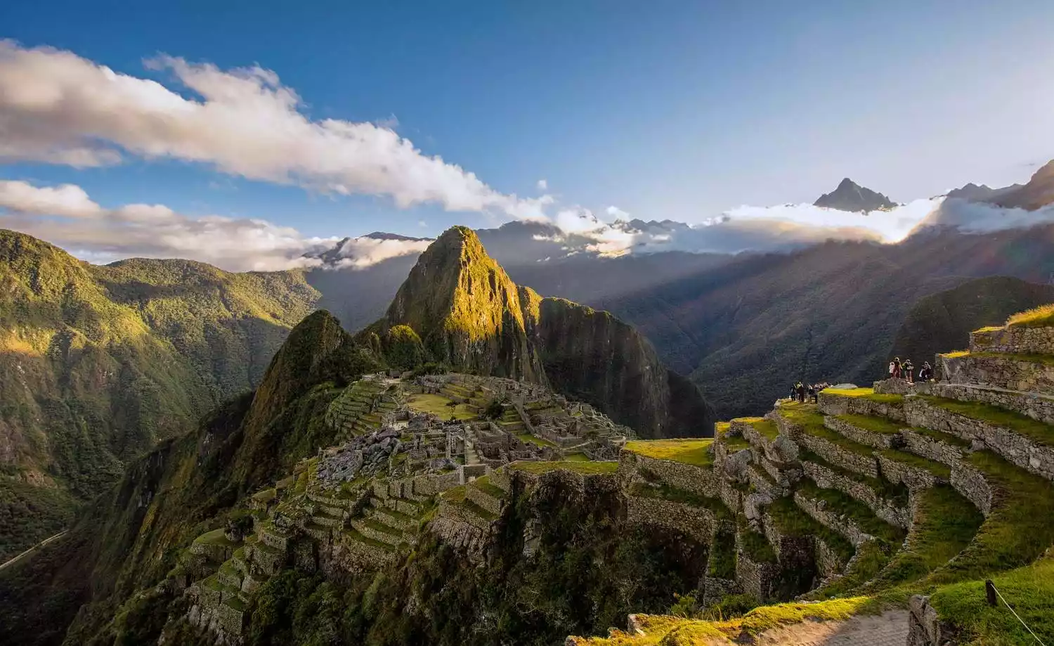
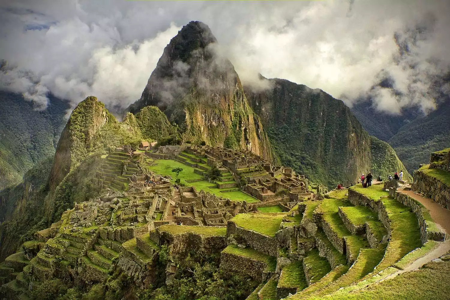
This section of the journey through Peru is the most storied and mysterious. Hundreds of years ago, Indians established the Inca Empire here. In the 15th century, the Inca Empire reached its peak, only to be conquered by the Spanish in 1532. Over time, the remains of the Inca Empire gradually faded into oblivion. It wasn't until the early 20th century, during a field trip, that an American university professor stumbled upon the ancient Inca city, buried beneath weeds. The ruins, now known as Machu Picchu, have been hailed as one of the Seven Wonders of the New World and have astonished the world.
Location: Located on the west coast of South America, it stretches over 8,900 kilometers from north to south, making it the longest mountain range in the world.
Highest elevation: 6,962 meters.
Recommended rating: ★★★.
Accessible
in many countries.
Best time to visit:
Year-round.
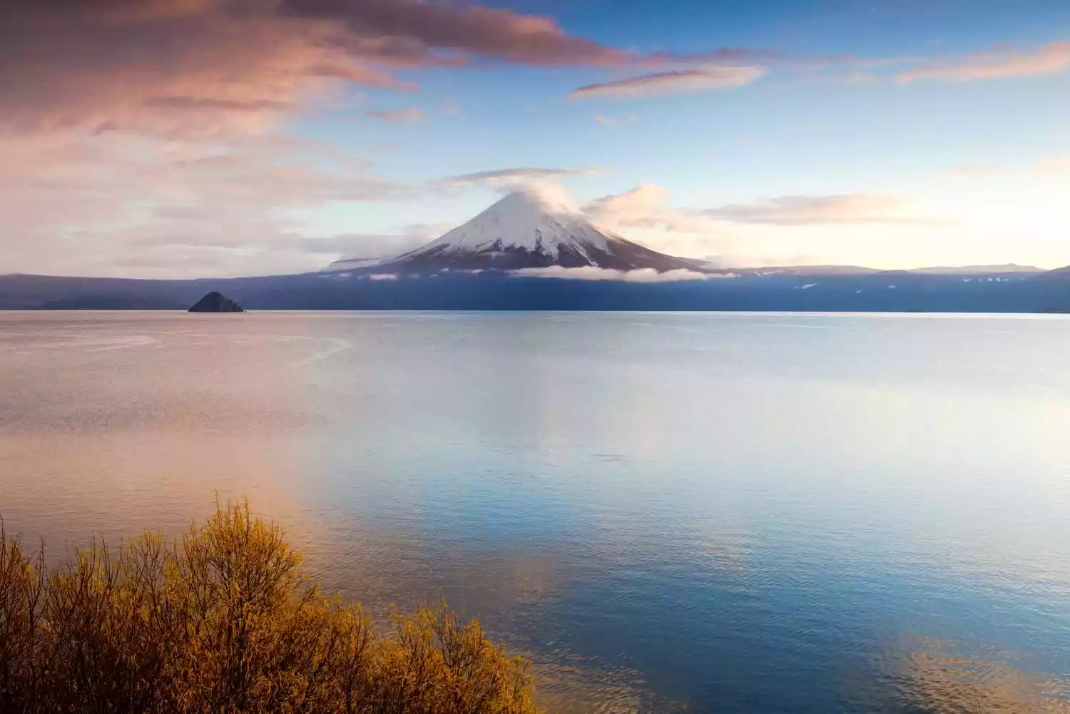
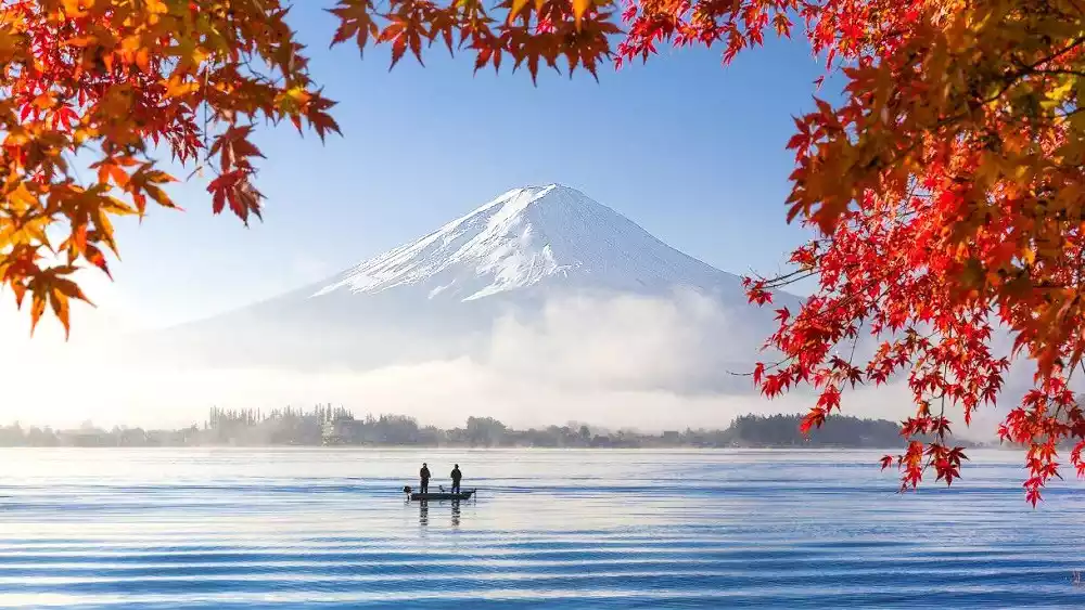
TOP 10 Mount Fuji
-Light of faith, sacred peak, Japan's highest peak-
Mount Fuji is Japan's highest peak and the first of its three sacred mountains. It is a symbol of national faith and the nation. Two craters at the summit have formed two beautiful volcanic lakes, and at the foot of the mountain are a variety of caves left by the volcanic eruption, some of which are still emitting steam.

The walls of the Fugaku Wind Cave are covered in stalactite-like icicles, known as "eternal snow." As a dormant volcano, Japan's highest peak, a World Heritage site, and a sacred mountain symbolizing Japan, Mount Fuji has many names. The desire to conquer and ambition to reach the summit is more appealing than admiring its beauty.
Climbing Mount Fuji and admiring the "Goraiko" (light) also attracts many foreign tourists every year. Rather than looking at it from afar, it is better to get closer and see its harsh and ever-changing true side.
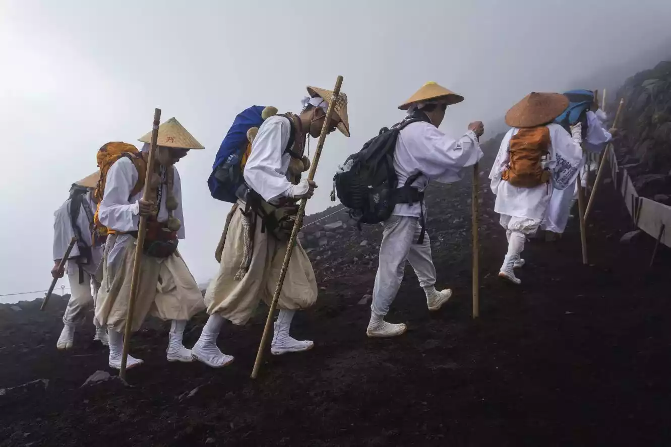
The Mount Fuji Festival, which runs for only three months a year (July to September), is a spectacular sight. Perhaps you've seen Mount Fuji from a plane, or even from afar. Mount Fuji is truly beautiful, and the best way to appreciate it is to conquer it! Many people consider climbing to the summit a "must-do" activity.
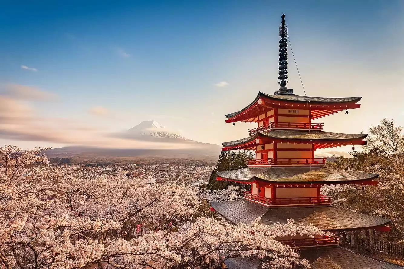
Location: Approximately 80 kilometers southwest of Tokyo
Altitude: 4810 meters
Recommendation index: ★★★★
Located approximately 80 kilometers southwest of Tokyo. From Shinjuku Station in Tokyo,
take
the JR Chuo Line to Otsuki Station, then transfer to the Fujikyuko Line and get off at Fujiyoshida Station.
Opening hours:
8:00 AM - 5:00 PM.
Tickets:
280 yuan for adults, 130 yuan for children.
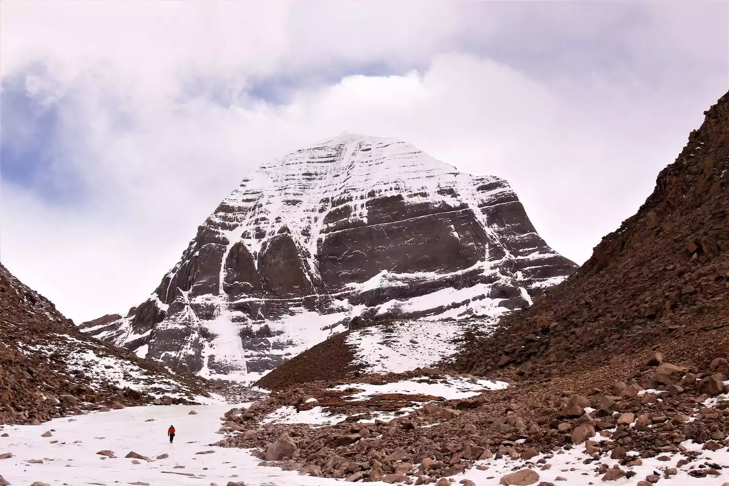
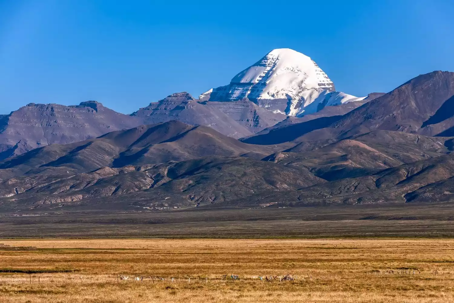
TOP 11 Mount Kailash
-King of the sacred mountains, the abode of the gods-
Mount Kailash, I think many people have heard of it, especially after the release of the movie "Mount Kailash", many people come here to visit, and it seems that going here has become a fashion. Mount Kailash, which means "Mountain of Gods" in Tibetan, is the main peak of Mount Gangdise. The Gangdise Mountains run across the Kunlun Mountains in the north and the Himalayas in the south, like a giant dragon lying on the vast plateau of Ali in western Tibet.
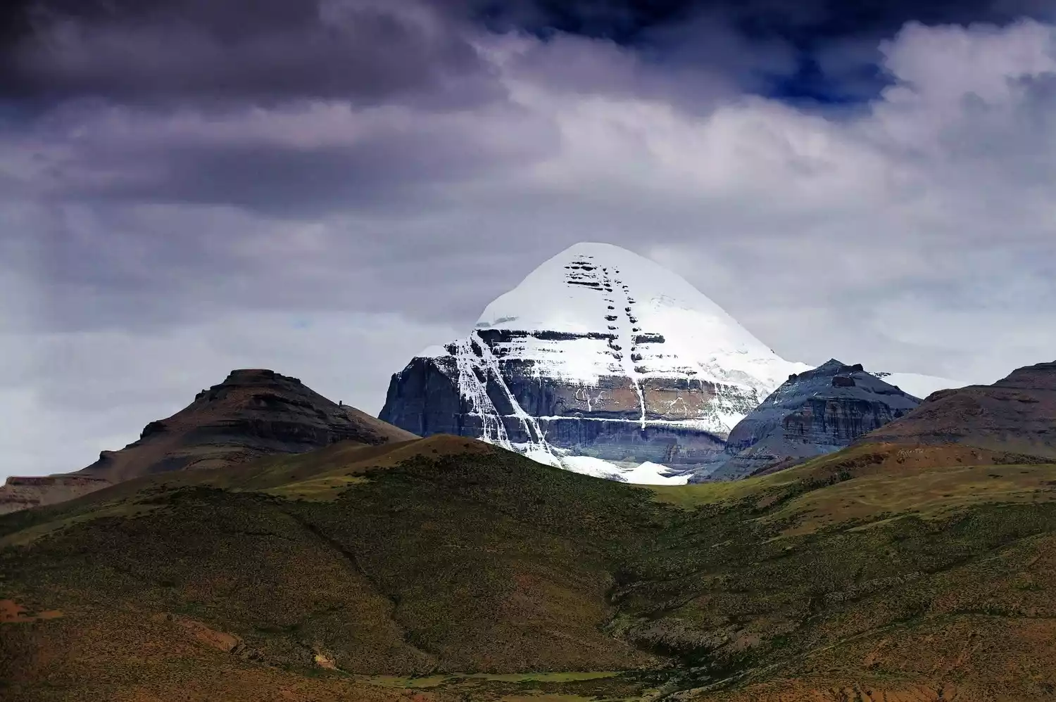
It is considered the center of the world by Hinduism, Tibetan Buddhism, the original Tibetan Bon religion, and ancient Jainism. Legend has it that circumambulating the sacred mountain once can cleanse a lifetime of sins, while circumambulating it ten times can save one from the sufferings of hell in samsara. Pilgrims flock to the mountain every year.
For centuries, Mount Kailash has been a place of fascination for pilgrims and explorers, but no one has been able to climb this sacred mountain, or no one has dared to violate the center of the world.
Mount Kailash is famous throughout the world. People come here because it is a sacred mountain, not a fashion. Come with your awe for life and reverence for the sacred mountain.
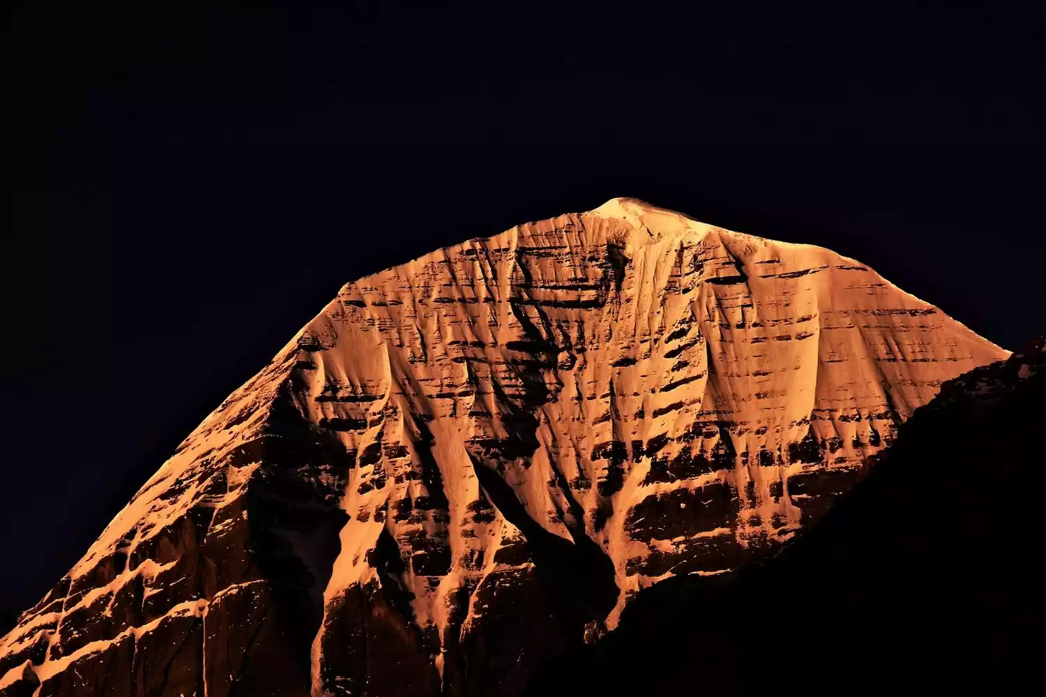
Location: Northern Purang County, southwestern Tibet Autonomous Region
Altitude: 6656 meters
Recommendation index: ★★★★☆
Tickets/Opening Hours
All day
Mount Kailash has now established a sacred mountain and lake scenic area, managed by a travel agency. Entrance fees are 200 yuan per person. Tibetans do not need to buy tickets.
Transportation Overview
There is one bus from Shigatse to Ali every day, which departs at 12 noon and arrives at Tachin (the starting point of the circumambulation) at 8 am the next morning.
There are also regular buses from Ali to Shigatse passing through Tachin every day, and there are also regular buses from Lhasa to Ali passing through.
Note: If your vehicle is not heading to Tachin, you can get off at the fork in National Highway 219 and then walk for more than half an hour to your accommodation in Tachin.
Best time to travel
The best months for circumambulating the mountain are September and October, but it's already quite cold. Another option is May to late June, when good weather is more common and can last for 6-8 days. The rainy season begins in early July, with the heaviest rainfall in July and August.
You cannot circumambulate the mountain in winter as it is closed.
Tips:
You must apply for a border pass to go to Mount Kailash. There will be checkpoints in Lazi and Baga to check the border pass. You will pass through it from the southern line of Ali to Tarqin and from Tarqin to Purang. There may be mobile checkpoints at times.
For the Bon religion in Ngari, circumambulating the sacred mountain is done counterclockwise, while Tibetan Buddhists walk clockwise. Both groups coexist harmoniously, each moving forward for their own beliefs.
Depart from Lhasa | 6~11 days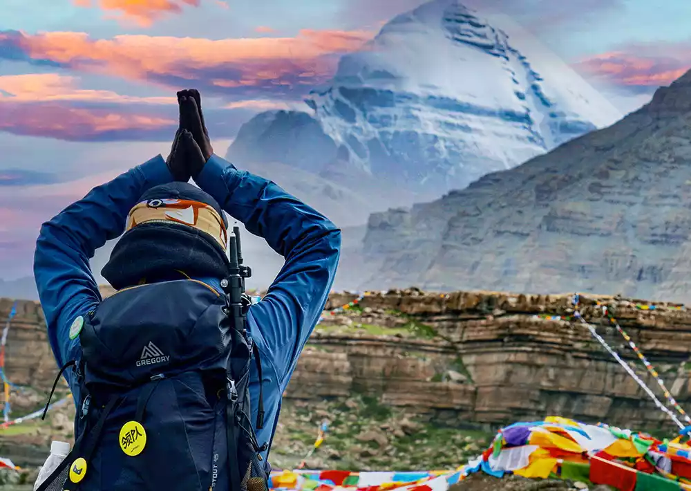
Mount Kailash: The Center of the World, 11-Day Circumambulation | A Himalayan Feast
¥7580 from 546 people have registered Register nowTOP 12 Mount Siguniang
-The Eastern Alps, the Queen of Shushan-
Located in Rilong Town, Xiaojin County, Aba Prefecture, Mount Siguniang is comprised of four continuous peaks. Perpetually covered in snow, they resemble four beautiful young ladies, each draped in white veils, standing in sequence above the Milky Way between Changping Valley and Haizi Valley, hence the name.
The main peak of Siguniang Mountain, Yaomei Peak, stands at 6,250 meters above sea level. Known as the Eastern Alps, it is the highest peak in the Qionglai Mountains. To the south of Yaomei Peak are Sanguniang Peak, Erguniang Peak, and Dagonuniang Peak.
Of the Four Sisters, the youngest is the most slender and graceful. The "Four Sisters" often refer to this highest and most beautiful snow-capped peak. These four sisters stand shoulder to shoulder, perpetually crowned by white clouds, draped with glaciers, and bound by emerald forests. Each one is pure and smooth, graceful and elegant, earning them the nickname "Queen of the Shu Mountains."
Location: Siguniangshan Town, Xiaojin County, Aba Tibetan and Qiang Autonomous Prefecture, Sichuan Province.
Altitude: Yaomei Peak, the main peak, is 6,250 meters above sea level
Recommendation index: ★★★☆☆
Tickets/Opening Hours
Siguniang Mountain Scenic Area:
Peak season: 7:30-16:00, off-season: 8:00-15:30; last admission after 15:30.
Peak season (April 1st - November 30th): Changpinggou 70 yuan (sightseeing bus 20 yuan), Shuangqiaogou 80 yuan (sightseeing bus 70 yuan), Haizigou 60 yuan
Off-season (November 1st - March 30th): Changpinggou 50 yuan (sightseeing bus 20 yuan), Shuangqiaogou 50 yuan (sightseeing bus 70 yuan), Haizigou 40 yuan
Transportation Overview
There are currently no direct flights to Mount Siguniang. You can first go to Chengdu Shuangliu International Airport, and then take a bus from Chengdu Chaidianzi Bus Station to the Mount Siguniang Scenic Area.
Buses depart from Chengdu's Chadianzi Passenger Transport Center for Mount Siguniang at 6:30 AM, 7:00 AM, 7:30 PM, and 12:00 PM daily, stopping at Rilong Town. The journey takes about five hours and costs 63 yuan per person. The fare from Dujiangyan is 40 yuan per person.
Best time to travel
The Siguniang Mountain Scenic Area is known as "a day trip to visit all four seasons, a year-round tour", and each season has its own attractions.
July and August are the best months to visit Mount Siguniang. During this time, the mountain is covered with blooming flowers, and you can also go down to the ravine to feel the cool water from the snow-capped mountains.
In addition, from mid-September to mid-October, the autumn colors of Siguniang Mountain are very charming, but the temperature is slightly lower, so please keep warm.
Tips:
1. Special tourist routes have been opened in Siguniang Mountain, including mountaineering, crossing, video recording, ice climbing, rock climbing and rafting.
2. The outdoor activity ticket is 150 yuan and is valid for 3 days. You can enter the ditch for camping or crossing only with the ticket and signed procedure form.
3. If you climb a mountain with an altitude of more than 3,500 meters without permission, you must pay the expenses that should be borne by you after receiving assistance from relevant organizations and institutions.
TOP 13 Daocheng Three Sacred Mountains
-The Last Shangri-La-
For those who are keen on snow mountain tourism, not visiting Daocheng would be a lifelong regret, because Daocheng's sacred peaks, namely the three snow mountains of Yading, are extraordinary, mysterious and spiritual, which is breathtaking.
Daocheng Yading's Three Sacred Mountains are known as the Three Protectors Snow Mountains. They consist of three snow-capped peaks: Xiannairi (6,032 meters), Yangmaiyong (5,958 meters), and Xianuoduoji (5,958 meters), situated close together yet distinctly separated, and arranged in a "品" (Chinese character "品") shape. They represent Avalokitesvara, Manjushri, and Vajrapani, respectively. The three peaks, perpetually capped with snow, echo each other from afar, reaching up to the sky.
According to the Buddhist text "Sacred Land Zanri Mixiang," of the world's twenty-four sacred mountains, Sanshan is ranked eleventh. Its zodiac sign is the Rooster, making it a sacred place for worship and pilgrimage to the gods and for accumulating merit. It is said that circumambulating the mountain once is equivalent to the merit of reciting 100 million Mani, and pilgrimage in the Year of the Rooster in the Tibetan calendar doubles the merit. It is a place that many Tibetans aspire to circumambulate once in their lifetime.
Three snow-capped peaks stand tall and white, like sharp swords piercing the sky. Below the snow line, glaciers plunge into the emerald green primeval forest. Snow-capped mountains, steep cliffs, precipitous cliffs, lakes, glaciers, grasslands, forests, and streams create a quiet and peaceful paradise for us.
Location: Daocheng County, Ganzi Prefecture, Sichuan Province
Altitude: North Peak, Xiannairi, 6032 meters above sea level; South Peak, Yangmaiyong, 5958 meters above sea level; East Peak, Xialangduoji, 5958 meters above sea level
Recommendation index: ★★★★☆
Tickets/Opening Hours
7:00-18:30
The ticket is included in the Aden Scenic Area ticket.
The ticket price for the Yading Scenic Area is 150 yuan/person + the sightseeing bus is 120 yuan/person. The battery car fee from Chonggu Temple to Luolong Cattle Farm is 50 yuan/one way and 80 yuan/round trip.
Transportation Overview
To reach the Yading Scenic Area, you need to charter a car from Daocheng County, but it can only go as far as Riwa Township. From Riwa to Yading Village, you need to change to the scenic area's sightseeing bus.
It takes about one and a half hours from Daocheng to Riwa, and about one and a half hours from Riwa to Yading Village. The round-trip bus fare from Daocheng to Riwa is 400-700 yuan per car, and if you share a car, it's about 50 yuan per person.
Best time to travel
April to June and September to November (July to August is the rainy season)
If you want to visit in the best season, you have to go in autumn (September-October), and October is the best month. The rainy season has passed in October, and the weather is relatively stable. The sky is clear most of the time, and the Three Sacred Mountains will be revealed generously.
Tips:
The Yading scenic area is large and the journey is long, so we recommend staying overnight in Yading Village. Accommodation in Yading Village is mainly in houses and inns, which are relatively affordable. There's no need to book in advance outside of peak seasons like Golden Week.
Depart from Chengdu丨9 days and 8 nights
Panoramic Autumn Scenery of Western Sichuan on the 9th Day | Milk Lake and Five-Color Lake Reopen!
¥4980 from 4315 people have registered Register nowTOP 14 Gongga Shan
-King of Shushan-
The title "King of Sichuan Mountains" is enough to describe it. Mount Gongga, meaning "holy mountain" in Tibetan, is the highest peak in Sichuan Province. It is the eleventh highest peak in the world and the highest in Sichuan Province, earning it the reputation of "King of Sichuan Mountains."
Surrounded by 45 peaks over 6,000 meters above sea level, it is the dream of many mountaineers and the second most difficult mountain to climb in China after Meili Snow Mountain.
The mountain is towering and majestic, with breathtaking scenery. Its perpetual snow caps the mountain, and from afar, it looms above a vast sea of clouds, a majestic and mysterious presence that inspires awe. Especially when the sky is clear, and the sun is shimmering on the mountain, the splendor of Mount Gongga, like a golden mountain, is truly unimaginable.
The Gongga Mountain Scenic Area is centered on Gongga Mountain and consists of Hailuogou, Muge Co, Wuxuhai, Gongga South Slope and other scenic areas. It covers an area of 10,000 square kilometers and is a national scenic spot.
Tickets/Opening Hours
8:00-17:00, last admission at 14:00.
There is a cable car at the foot of Mount Gongga that takes tourists up the mountain. The cable car costs 160 yuan and allows you to see the ice waterfall.
Transportation Overview
Kangding has special tourist buses going to Mount Gongga. There are also several buses departing daily from Chengdu Shiyang Station to Mount Gongga (to Tianwan).
Best time to travel
The best seasons to visit Mount Gongga are for mountaineering and for photographing and viewing the scenery.
The best time to go mountain climbing is from May to June, when the dry and rainy seasons are alternating. The temperature is suitable, the rainfall is light, and the roads are not too muddy.
The best time to photograph Mount Gongga is from October to mid-May of the following year, when the weather is clear.
If you want to go to Hailuogou to enjoy the beautiful scenery of meadows, forests and lakes, it is best to go there in summer and autumn, especially in autumn when the leaves turn red and yellow, the scenery in the mountain stream is even more beautiful.
Tips:
Things you can’t miss when visiting Mount Gongga:
1. See the golden mountain in the sun from the main peak of Gongga
2. Stroll through the ecological paradise of Hailuogou
3. Drink a pot of hot butter tea in Gonggar Temple
4. Hike on a spectacular glacier
5. Take a dip in the mountain hot springs
6. Try Kham cuisine
TOP 15 Namcha Barwa
-Father of all mountains, China's most beautiful snow mountain-
Mount Namjagbarwa is the highest mountain in Nyingchi. Light clouds rise up, and graceful cloud waterfalls slide down leisurely, surrounding the mountainside like white satin. The sword-like snow peaks emitting a cold blue light are looming in the gaps between the clouds.
This reclusive beauty has lived in seclusion year-round in the Himalayas. Among the 7,000-meter peaks, Mount Namjagbarwa is the tallest and 15th highest peak in the world. In 2005, China National Geographic named it China's most beautiful snow-capped mountain, dubbing it "Paradise in the Clouds."
Mount Nanga Bawa embodies almost every beautiful mountain imaginable, but unfortunately, it is rarely revealed. Due to the perpetual sea of clouds, even locals can only see its true beauty a few times a year. A British explorer once waited for a month at the foot of Nanga Bawa without being able to see its true form.
Location: Nyingchi Prefecture, Tibet, at the intersection of the Himalayas, Nyainqentanglha Mountains, and Hengduan Mountains.
Altitude: 7782 meters
Recommendation index: ★★★★☆
Tickets/Opening Hours
All day
free
Transportation Overview
Take a bus from Nyingchi to Pai Township (Pai Town), 80 km southeast of Bayi Town. Minibuses depart from the bridgehead of Bayi Town at around 8:00 every morning. The fare is 60 yuan per person and the journey takes about 4 hours.
From Pai Township, continue about 18 kilometers to the Zhibai Viewing Platform, and then hike a few kilometers to Zhibai Village. There are no regular buses for this section, so you'll need to charter a car, which costs over 200 yuan.
Zhibai Village is only 5km away from the main peak of Mount Namjagbarwa, and the scenery along the way is very spectacular.
Best time to travel
The rainy season in this area is relatively long, generally lasting from May to September each year, especially in July, August and September, when it rains almost every day and the cloud cover is also very heavy, so the peaks are shrouded in clouds and mist all day long.
February to April and October to November each year are the transition periods between the dry season and the rainy season, which are good times to choose mountain climbing.
Tips:
According to statistics, the number of days when Mount Namjagbarwa appears is only 65 days on average each year, so you should be prepared for the possibility of not seeing it.
There are several main viewing spots for Mount Namjagbarwa, including the viewing platform of the Yarlung Zangbo Grand Canyon Scenic Area, Zhibai Village, Sejila Pass, Suosong Village, etc.
Suosong Village is relatively simple and faces the snow-capped mountains. Peach blossoms bloom here every spring, and photographing the snow-capped peaks hidden by the flowers is also a favorite of many photographers.
{tips}
According to statistics, the number of days when Mount Namjagbarwa appears is only 65 days on average each year, so you should be prepared for the possibility of not seeing it.
There are several main viewing spots for Mount Namjagbarwa, including the viewing platform of the Yarlung Zangbo Grand Canyon Scenic Area, Zhibai Village, Sejila Pass, Suosong Village, etc.
Suosong Village is relatively simple and faces the snow-capped mountains. Peach blossoms bloom here every spring, and photographing the snow-capped peaks hidden by the flowers is also a favorite of many photographers.
TOP 16 Mount Bogda
- Xinjiang's No. 1 Sacred Mountain-
Bogda, meaning "sacred, supreme, spiritual mountain" in Mongolian, is a sacred mountain in the hearts of the people. Composed of three closely-knit peaks, it is perpetually capped with snow, earning it the nickname "Sea of Snow." At its foot lies the famous scenic spot "Heavenly Lake," making it a popular destination for mountaineers and tourists.
No matter where you are in Urumqi, as long as you look to the south and raise your head, you can see the majestic mountains stretching from east to west, and the towering snow-capped peaks that never melt all year round. That is the famous Bogda Peak of Tianshan Mountains.
Location: Fukang City, Xinjiang Uygur Autonomous Region.
Altitude: 5445 meters
Recommendation index: ★★★☆☆
Tickets/Opening Hours
All day
No tickets
Transportation Overview
To get to Bogda, you can first go to Tianchi Scenic Area, rent a horse from Tianchi and ride there, or you can start from Tianchi on foot.
Another way is to start from Baiyanggou under Tianchi Lake and go to Bogda Mountain Base Camp.
Best time to travel
The best time to visit Bogda every year is from June to October. In the midsummer season, the melted ice and snow flow down and merge into more than 30 large rivers, irrigating the oasis at the foot of the mountain. The scenery is charming and the mountains are fragrant.
Tips:
In order to protect the water sources of major cities in Xinjiang, in 2010, Changji Prefecture issued the "Tianshan Tianchi Scenic Area Protection and Management Regulations", which stipulates that in the future, anyone entering the Tianshan Tianchi Scenic Area for hiking, mountaineering, scientific research, filming and other activities must first obtain approval from the Xinjiang Tianshan Tianchi Scenic Area Management Committee.
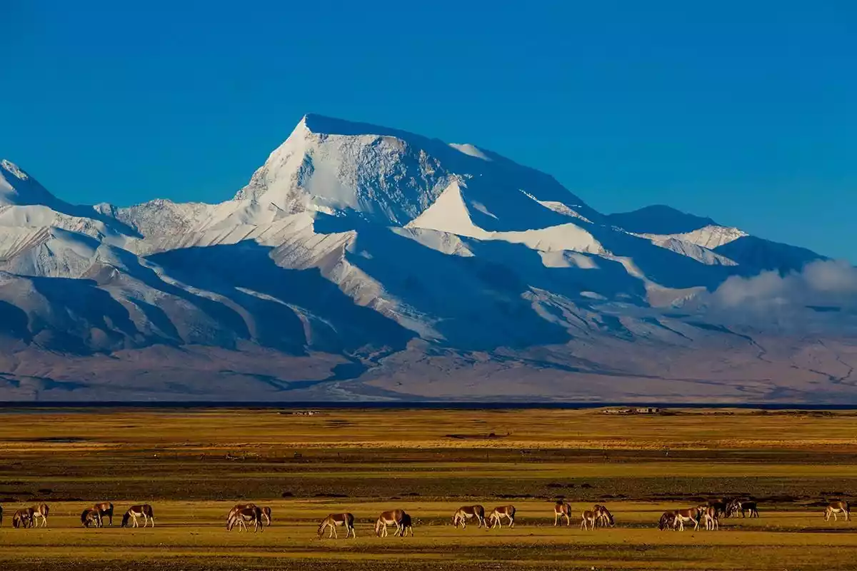
TOP 17 Namunani Peak
-Mountain of Our Lady, Holy Maiden Peak-
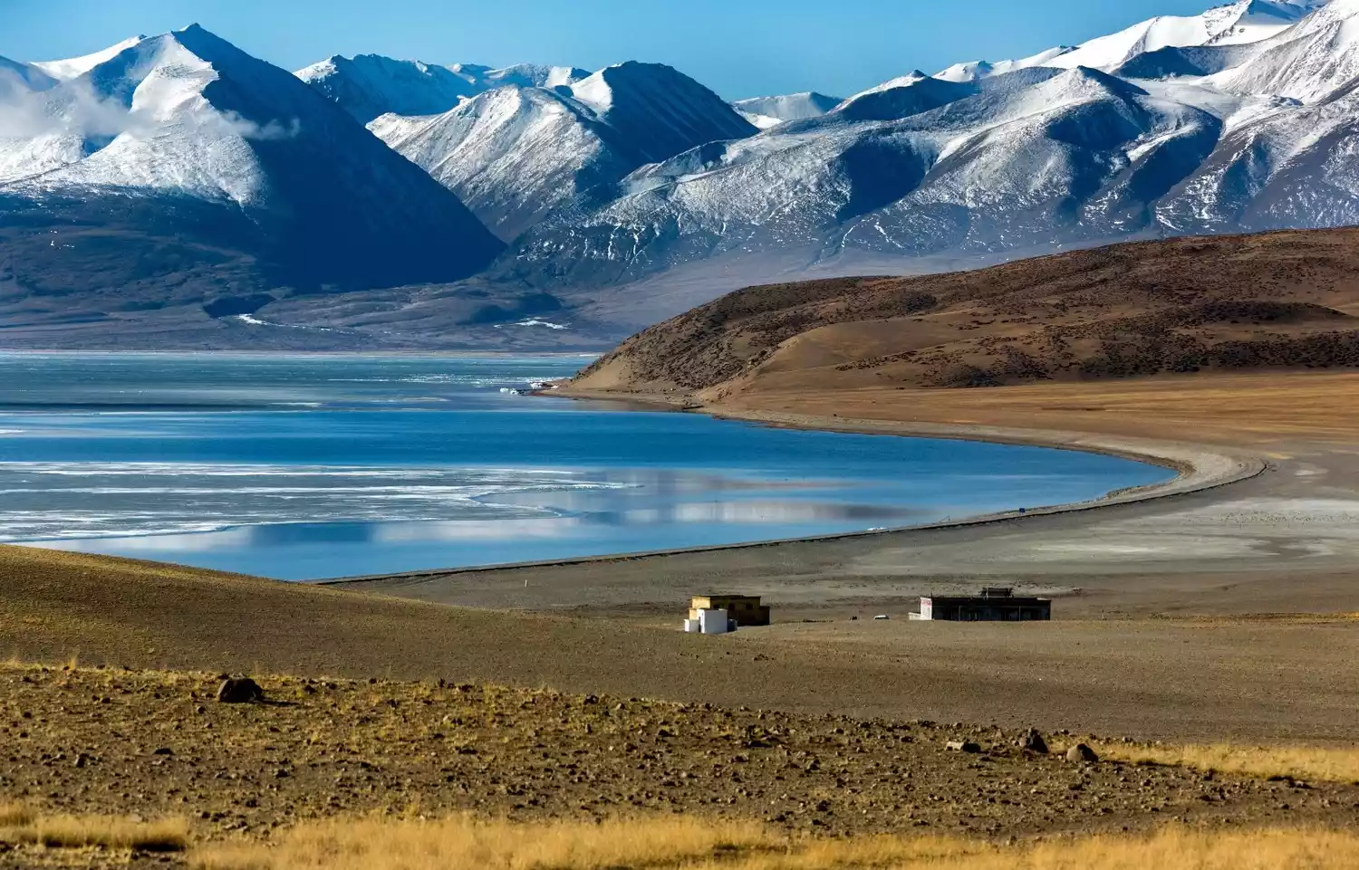
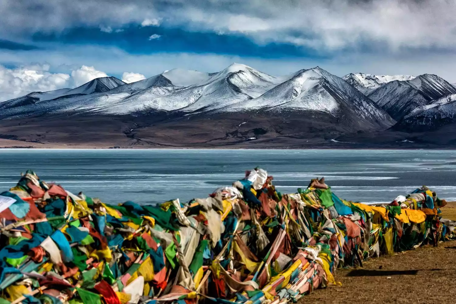
Mount Namuani is one of the main peaks of the Himalayas. Ranked as the fifth of the Himalayan goddesses, it wields wisdom, happiness, and longevity, and is also known as the "Fifth Goddess." To the left of Mount Namuani is the "Holy Lake" of Lake Manasarovar, and to the right is the "Holy Mountain" of Mount Kailash. On the other side of the road is the "Ghost Lake" of Lake Laang. This is the center of the world for Tibetans.
Mount Namuani contains the largest glacier complex in the Chinese Himalayas. Surrounding the peak are five massive glaciers, their surfaces riddled with crevasses and steep cliffs. It is said that the waters of Lakes Manasarovar and Laangco are formed by the melting snow from these glaciers.
Location: Ritu County, Ngari
Altitude: 7694 meters
Recommendation index: ★★★★☆
Tickets/Opening Hours
All day
free
Transportation Overview
There are two routes into the mountains: one is to go south from Urumqi, the capital of Xinjiang Uygur Autonomous Region, along the Xinjiang-Tibet Highway, through Yecheng Shiquanhe to Purang, a total distance of 3,044 kilometers.
The other route runs west from Lhasa, the capital of Tibet, through Shigatse and Saga to Purang, covering a total distance of 1,433 kilometers.
Best time to travel
The best time to climb is from May to late June, when good weather is common and can last for 6-8 days. The rainy season begins in early July, with the heaviest rainfall in July and August.
Tips:
You can watch the sunrise and sunset near Jiwu Temple.
TOP 18 Shishapangma
-The only 8,000-meter peak located entirely within China-
Shishapangma, meaning "severely cold climate, harsh and unpredictable weather" in Tibetan, is a Tibetan term for fourteen peaks over 8,000 meters in the world. Six of these, including the highest peak, Mount Everest, are located in China, but five of these are border mountains. The only 8,000-meter peak entirely within Chinese territory is Shishapangma, located in Niemula County, Shigatse, Tibet.
This is one of the modern glaciation centers of the Himalayas. The entire Kukangri Range boasts 6,000 square kilometers of glaciers and permanent snow, some of which are located around Shishapangma Peak. The crisscrossing crevasses and occasional massive ice and snow avalanches present numerous challenges for climbers. On May 2, 1964, a Chinese mountaineering team achieved the first summit.
Location: In the middle of the Himalayas, about 120 kilometers southeast of Mount Everest.
Altitude: 8012 meters
Recommendation index: ★★★☆☆
Tickets/Opening Hours
All day
No tickets
Transportation Overview
First, take a bus from Lhasa along the China-Nepal Highway through Gyantse and Shigatse to Sheger, a distance of 670 kilometers.
Go west for about 138 kilometers through Dingri Menha Dun, continue west for 50 kilometers and then head south. Follow the simple road for 20 kilometers to reach the northern foot of Shishapangma. On the north side of the Yebokangjiale Glacier is the mountaineering base camp at an altitude of 5,114 meters.
Best time to travel
The climate characteristics of Mount Shishapangma are generally similar to those of Mount Everest. April and May, and October and November are the best seasons for climbing and viewing Mount Shishapangma.
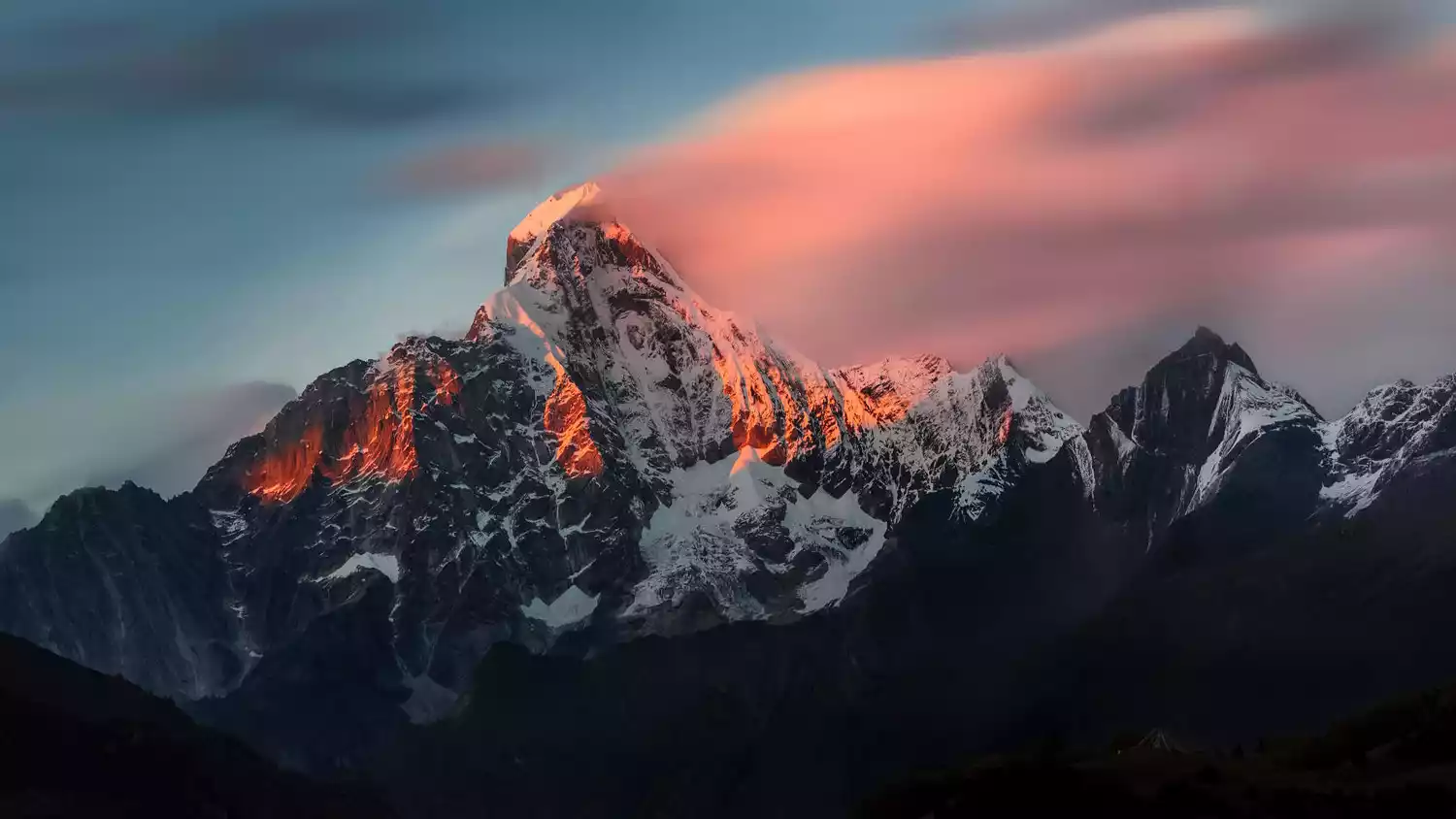
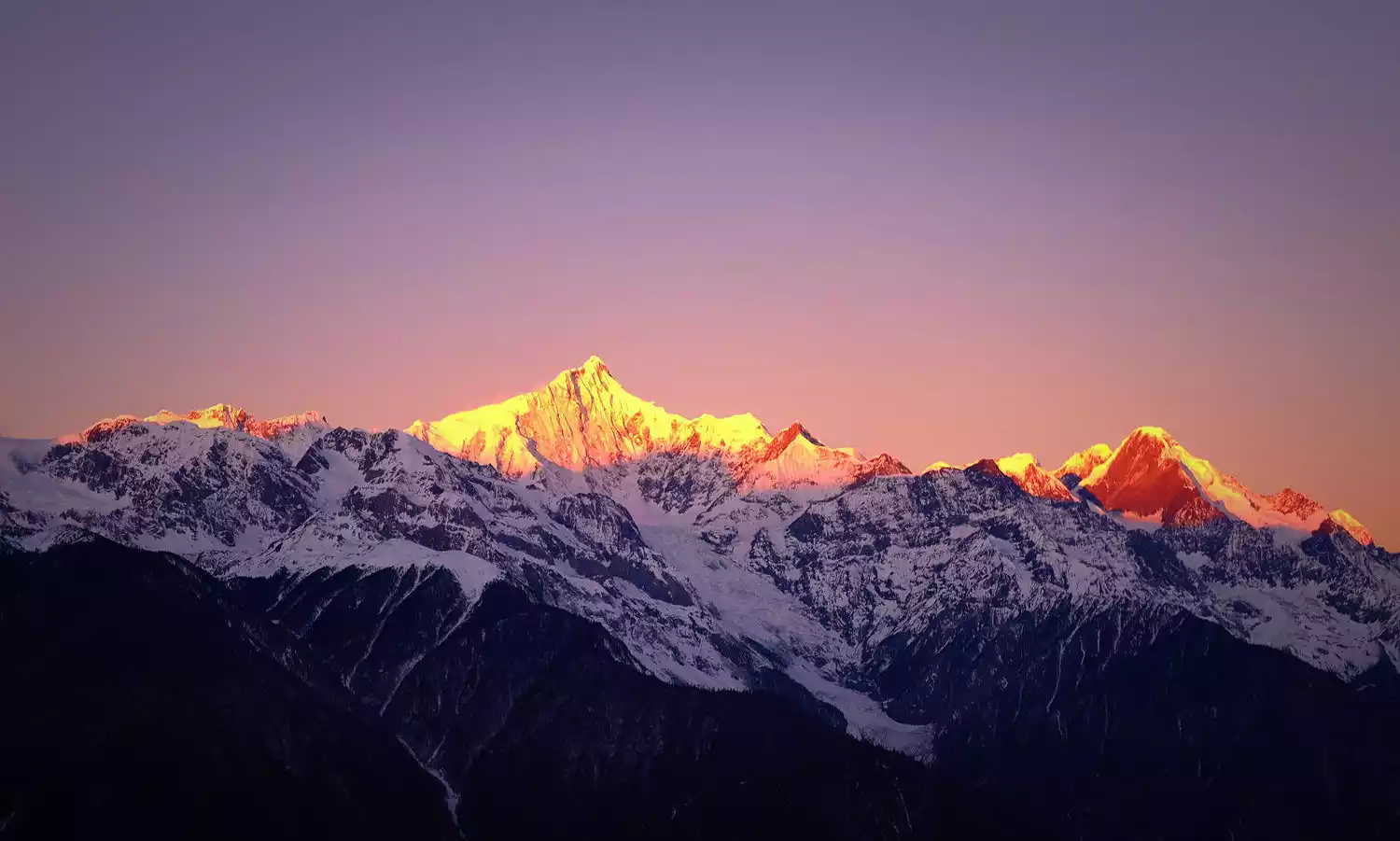
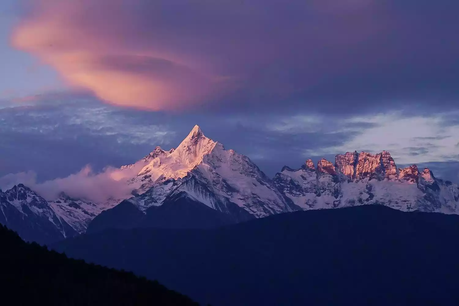
TOP 19 Meili Snow Mountain Kawakarpo
-The sun and moon in my heart-
Meili Snow Mountain, also known as Prince Snow Mountain, is the first of the Eight Sacred Mountains in Tibet and is known as Kawagebo Snow Mountain in Tibetan areas. Its highest peak, Kawagebo Peak, reaches 6,740 meters above sea level, making it the highest peak in Yunnan Province. Its main peak remains an unconquered "virgin peak" and is the only peak prohibited from climbing for cultural protection.
The word "Meili" means medicine mountain in Tibetan. It is named after the abundance of various precious medicinal materials. It is also a holy place of Yungdrung Bon religion. It is known as one of the four sacred mountains of Tibetan Buddhism along with Mount Kailash in Tibet, Mount Amnye Machen in Qinghai, and Gaduo Jowo in Qinghai.
The famous "Sunlight Shining on Golden Mountain" is a sight that countless backpackers yearn for. This rare sight often occurs in the early morning hours of clear days, when sunlight suddenly shines on the snow-capped peaks, gradually expanding to create a stunning spectacle that lasts for about 20 minutes before the entire mountain turns white, losing its golden appearance.
Location: Eastern part of Zayu County, Tibet and western part of Deqin County, Yunnan.
Altitude: 6740 meters
Recommendation index: ★★★★★
Tickets/Opening Hours
07:00-16:00 (Monday-Sunday, January 1st-December 31st)
Package 1 (including Jinsha River Bay, Wunongding, Feilai Temple, and Mingyong Glacier): 228.00 yuan
Package 2 (including Jinsha River Bay, Wunongding, and Feilai Temple): 150.00 yuan
Package 3 (including Jinsha River Bay, Wunongding, Feilai Temple, and Yubeng Village): 230.00 yuan
Meili Snow Mountain Avalanche Ticket: 55 yuan
Transportation Overview
【Shuttle Bus】
1. There is a daily bus from Shangri-La County to Deqin. The fare is about 67 yuan and the journey takes about 5-6 hours.
2. The shuttle bus from Deqin to Feilai Temple and Xidang Hot Springs is irregular. For more information, please call Deqin County Bus Station at 0887-8413322
【Charter】
1. From Deqin, you can take a taxi to Feilai Temple, the one-way fare is about 30 yuan; from Deqin to Mingyong Glacier, the one-way fare is about 150 yuan, and the round-trip fare is about 200 yuan; from Deqin to Xidang Village, the one-way fare is about 180 yuan
2. There are minivans from Feilai Temple that go to Xidang Village. You can arrange to share a ride with others. The specific price can be negotiated with the driver. Remember to negotiate the price with the driver and make sure to confirm the destination and itinerary in advance to avoid unnecessary trouble.
Best time to travel
The best time to view Meili Snow Mountain is from October to May of the following year. During this period, the probability of seeing the main peak and other peaks is the highest.
TOP20 The Aemye Ma-chhen Range
- "Father of the Yellow River" -
Amnye Machen Mountain, also known as Maji Snow Mountain, means "Grandfather God's Mountain" in Tibetan and is located in the eastern section of the Kunlun Mountains. "Ani" in Tibetan means "old ancestor" and also implies a beautiful heart, happiness, or generosity. "Machen" in Tibetan means the largest mountain at the source of the Yellow River and also implies grandeur and majesty. Amnye Machen Snow Mountain is not only naturally stunning, but also shrouded in mystery through various legends.
The local Tibetans believe that the Amnye Machen Snow Mountain is one of the twenty-one sacred snow mountains of the "Bokawa Jiangong" and that it is the fourth of the nine gods who created the world, Sparqiao Belag, a mountain god with immense power and magical powers who dominates the mountains, rivers and the earth.
Tibetans have a deep faith in gods. The Amnye Machen Peak has such great divine power that it naturally becomes a place of pilgrimage. During the "Year of the Sheep" in the Tibetan calendar or the years when the Shenmen (Niguo), Xuemen, and Gangguo are separated, pilgrims carry simple luggage, cooking utensils and food, and make a pilgrimage around the mountain to worship with all their pious heart, in order to eliminate sins and let their souls ascend to heaven.
Location: Northwest of Maqin County, Guoluo Prefecture, Qinghai Province
Altitude: 6282 meters
Recommendation index: ★★★★★
Tickets/Opening Hours
All day
free
Transportation Overview
Departure: There are three buses from Xining to Dawu Town, Maqin County every day, at 8:45 in the morning, 9:15 in the morning and 18:00 in the evening. The journey is 441 kilometers and takes about 8 hours.
It takes 5 hours to charter a car from Maqin County to Xueshan Township, which is the closest to the Amnye Machen Snow Mountain, and the cost is about 800-1000 yuan.
You can also charter a car from Lajia Township to Xueshan Township, which takes about 4 hours and costs about 600-800 yuan.
It takes about an hour to drive from Xueshan Township to the viewing platform.
Best time to travel
Between January and April every year.
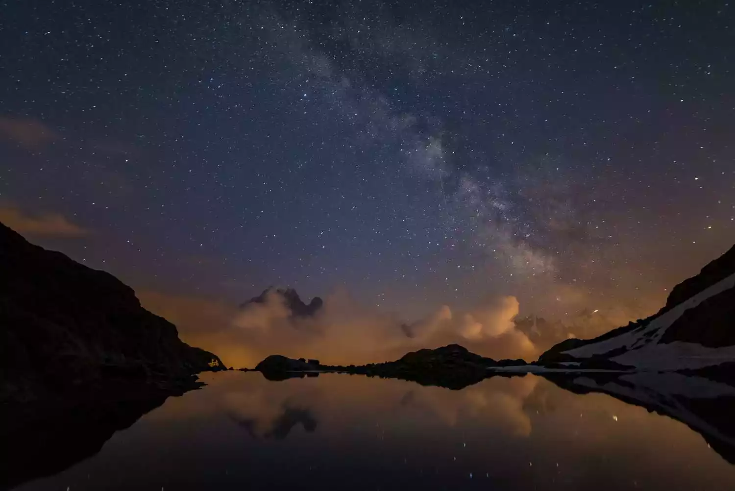
Encourage to move forward - written at the end
The power of the mountains is unfathomable and thought-provoking. When we explore them one by one, the peaks we look up at, the scenery we look down at, everything makes us calm and peaceful. It is all so shocking.
This journey is so difficult, and at the same time I reflect on myself, persevere, and explore endlessly. The next mountain is still waiting for us there, just like it has been for thousands of years!