Check out the top ten classic hiking routes to sacred mountains and lakes in Tibet, each one is worth collecting!
Preface
Hiking guide to the top ten sacred mountains and lakes in Tibet, worth saving!
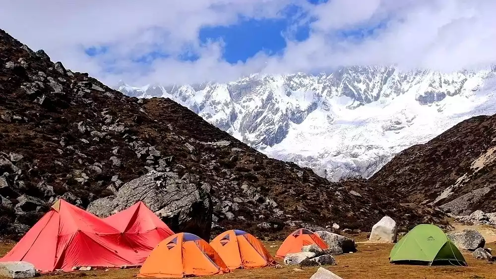
1. Secluded Valley - Mount Everest East Slope Hiking Route
time:
8-9 days, 5-8 hours a day, and about 9-15 kilometers a day
Difficulty Description:
6 stars, medium to high difficulty, anyone with some plateau hiking experience can complete it.
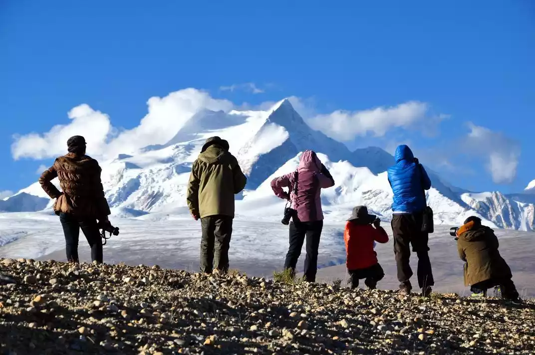
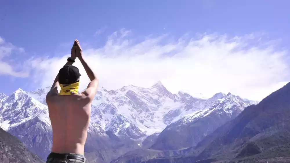
"Some people say that any attempt to get close to Mount Everest is the ultimate expression of returning to nature. Facing the top of the world, even if you don't climb, you will be tempted to cry."
Everest's eastern face was not a particularly famous hiking route in China 10 years ago, but it is very famous among hikers abroad.
In the last century, the eastern slope of Mount Everest and Gama Valley were praised by American and British explorers as one of the "Top Ten Scenic Spots in the World" and "One of the Top Ten Classic Hiking Routes in the World".

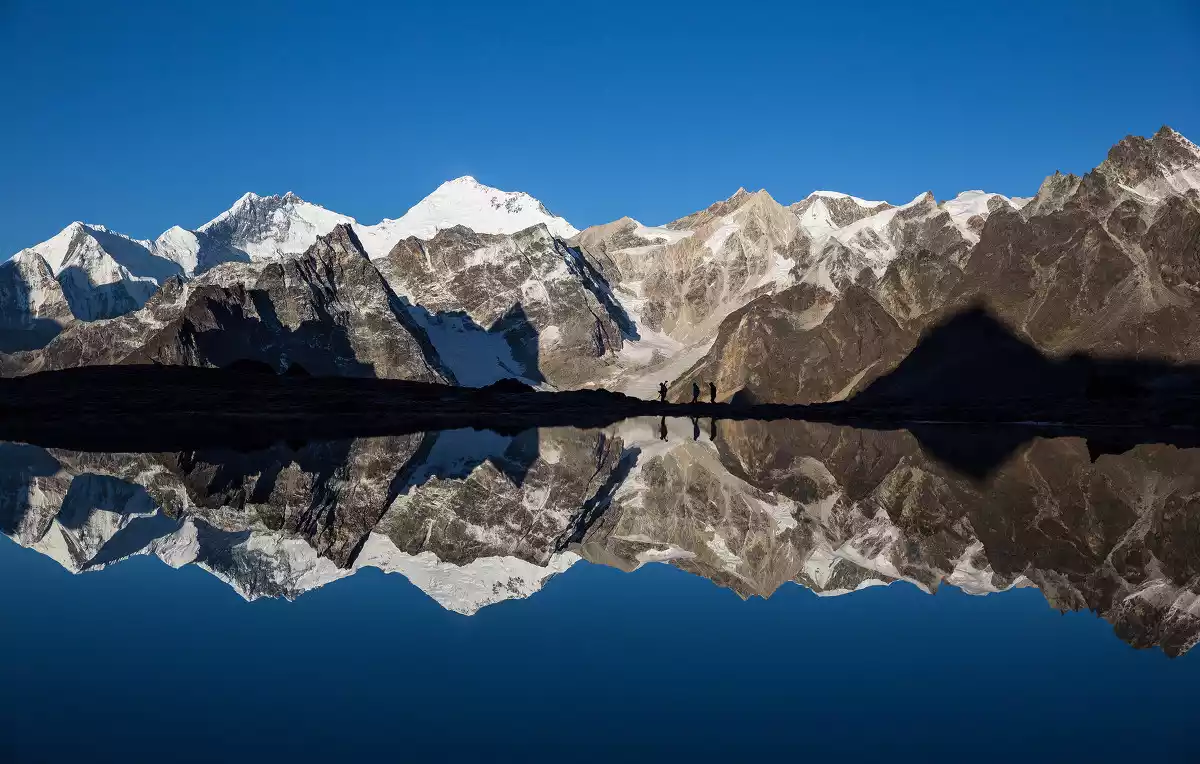
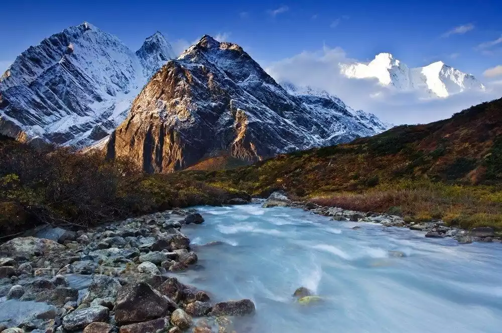
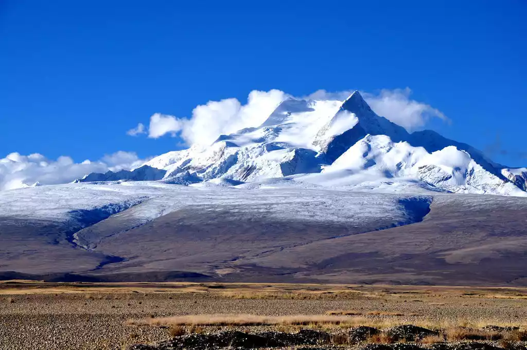
The entire hike is within the Mount Everest Nature Reserve, offering close-up views of three snow-capped mountains over 8,000 meters high: Mount Everest (8,844.43 meters), the world's highest peak; Lhotse (8,516 meters), the world's fourth highest peak; Makalu (8,463 meters), the world's fifth highest peak; and Mount Qomolangma (7,804 meters). This region is known as the Kingdom of Snow Mountains.
This route has a changeable climate, high altitude, is rarely traveled, and is extremely difficult, but that is its charm, giving people a sense of pleasure in challenging themselves.
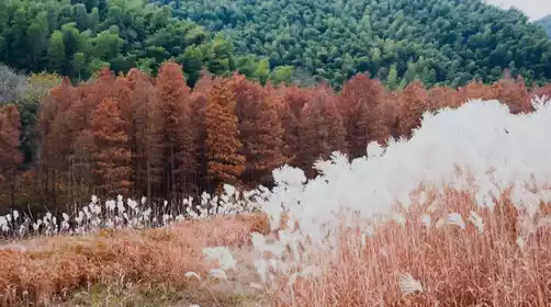
The route's altitude ranges from over 2,000 meters to over 5,000 meters, offering a diverse array of scenery, including the Himalayas, highland meadows, plateau lakes, glaciers, and primeval forests. By the end of September, after the rainy season, the weather is crystal clear, making it the perfect time to photograph the snow-capped mountains. Come here and savor the solitary, pristine beauty of this pure, snowy land.
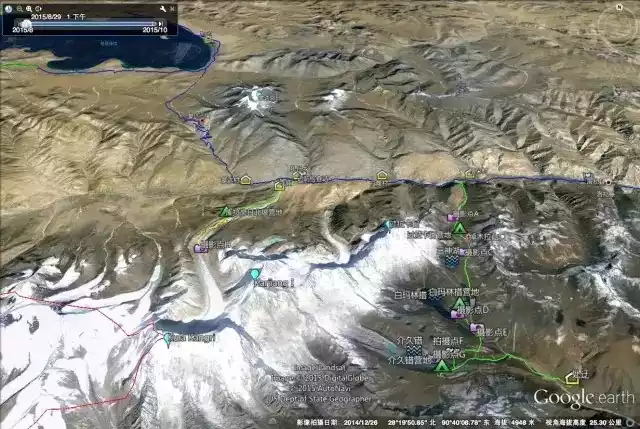
Reference itinerary:
Day 1 Lhasa (3660m) - 150km - Yamdrok Lake (4440m) - 30km - Karola Glacier - 166km - Shigatse (3890m)
Day 2 Shigatse - 294 km - Zhaxi Zong - 38 km - Qudang (3650 m) - 2 km - Youpa Village (3750 m)
Day 3 Youpa Village (3750m) – Xiaowu Co (4650m)
Day 4: Xiaowu Co (4650m) – Xiaowu La Pass (4900m) – Orchid Valley (4000m)
D5 Orchid Valley (4000m) - Lalang Co (4320m) - Xianong Pasture (4400m) - Tangxiang Viewing Platform (4550m)
Day 6: Oga Ranch (4690m) – Baidang (4950m) – Dongpo Base Camp (5310m) – Oga Ranch (4690m)
Day 7: Tangxiang Viewing Platform (4550m) – Gama Valley (4260m) – Badang (4310m) – Ega Pasture (4690m)
Day 8: Ega Ranch (4690m) – Batang (4310m) – Tangxiang Viewing Platform (4550m)
D9 Tangxiang Viewing Platform (4550m) - Cuoxuerenma (4950m)
D10 Coxuerenma (4950m) - Langmala Pass (5350m) - Laze Co (5050m) - Xinga
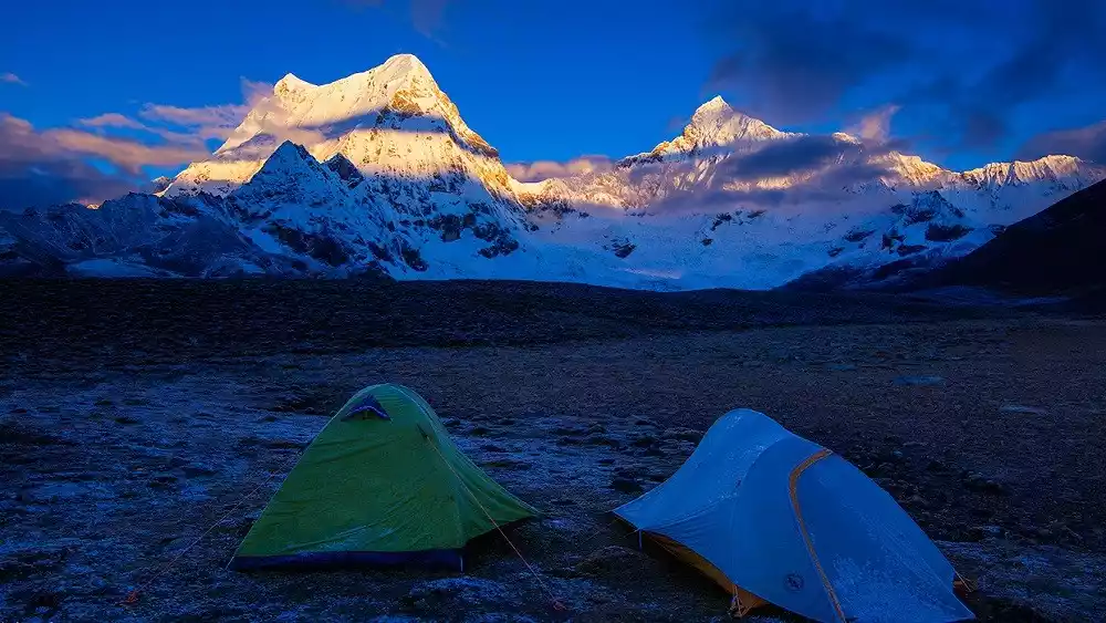
2. The Mark of Time - Shishapangma Hiking Trail
Time: 5-6
Difficulty Description: 6 stars
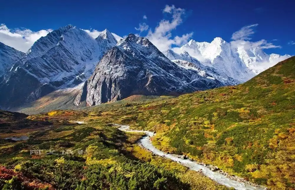
Shishapangma, the world's 14th 8,000-level snow-capped mountain, is located in the Himalayas. Shishapangma offers a completely different geographical environment and hiking experience from the eastern slope of Mount Everest.
Since Shishapangma is the only 8,000-meter snow-capped mountain located entirely in China, the hiking route can go all the way to the southern slope of the peak, all the way to Gongcuo on the eastern slope. This is equivalent to a 180-degree turn around the peak, allowing you to appreciate the 8,000-meter snow-capped mountains from all angles. It is almost surrounded by snow-capped mountains on three sides, which is a complete snow-capped mountain feast.
The vegetation in the Xifeng Mountain area is less than that on the east slope of Mount Everest, and the overall road conditions are better than those on the east slope of Mount Everest. Due to the sparse vegetation and relatively dry environment, the road conditions are relatively open and stable.
However, Xifeng is affected by the humid air currents from Nepal, which is adjacent to Zhangmu. It is very easy to fog in the afternoon and visibility will drop sharply. Outdoor enthusiasts who are not familiar with the environment in this area are advised not to go there alone.
Reference itinerary:
D1: Nyalam County – Xinde Camp (4620m)
Day 2: Hinde Camp (4620m) – Shishapangma South Slope Camp (5290m)
Day 3: Shishapangma South Slope Camp (5290m) – Jigabu Camp (4690m)
Day 4: Jigabu Camp (4690m) – Gongcuo Camp (5190m)
D5: Gongcuo Camp (5190m) - Ere Village (4460m)
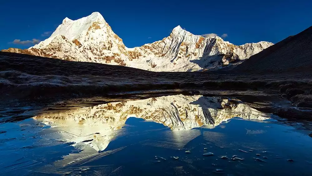
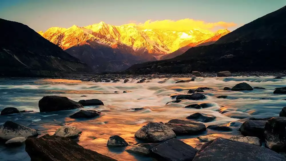
3. Snow Mountain and Lake Feast - Kulagangri Hiking Route
Time: 5-7 days
Difficulty Description: 5 stars
The Kulagangri trek is one of the three classic trekking routes in the Tibetan Himalayas. The other two are the Gama Valley on the east slope of Mount Everest and the Shishapangma circuit trek.
Kulagangri, at 7,538 meters above sea level, stands tall in the middle of the Himalayas and consists of three peaks. Although this route lacks the grandeur of the 8,000-meter-high snow-capped mountains, it boasts a bluer and more beautiful lake.
Four glaciers lie across the canyon we hiked through, with the two on the north side each stretching 10 kilometers. These glaciers boast spectacular forests of seracs, ice cliffs, ice walls, and steep slopes. Frequent ice and snow avalanches often occur in succession, their roaring and breathtaking. Nestled on the vast southern Tibetan plateau lie Yamdrok Lake and Pumok Lake, reflecting the majestic presence of these walls of ice and snow.
In mid-April each year, while everything on the northern slopes is still slumbering in the sweet dreams of winter, the warm Indian Ocean current flowing upstream transforms the southern valley into a vibrant world of vibrant flowers, green trees, and fluttering butterflies. The recommended time for mountaineering is generally April-May or September-October.
Reference itinerary:
D1 Lhasa-Lhoza (4500m) (7 hours by shuttle bus)
Day 2 Lhoza - Hiking starting point - Grassland Camp No. 1 (4720m)
D3 Camp 1 - Pass Lakari Camp (5050m)
Day 4: Pass Lakari Camp – Pass (5250m) – Three Gods Lake – Baima Lincuo Camp (4520m)
D5 Baimalincuo Campsite - Jiejiucuo Ridge Campsite (4830m)
D6 Jiejiucuo Ridge Camp (4830m) - Pass - Rega Camp (4560m)
D7 Baima Lincuo Lake Camp - Coyul - Se Township - Lhasa
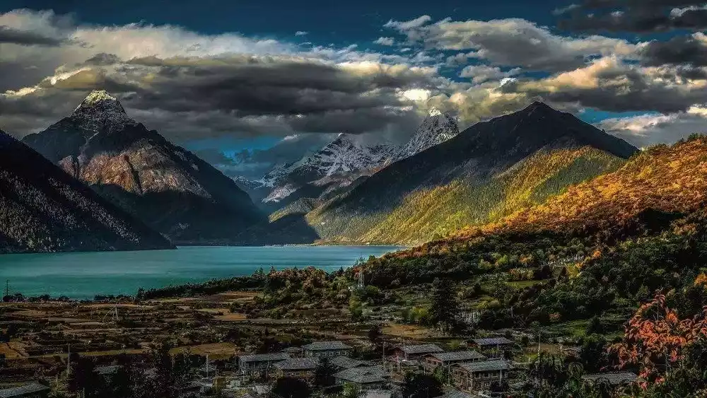
4. The Valley at the Horizon - Namjagbarwa Hiking Trail
Duration: 3 days
Difficulty Description: 4 stars
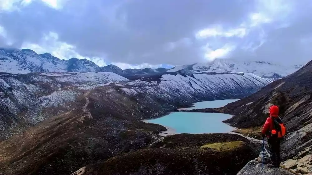
Mount Namjagbarwa, a paradise in the clouds, is the first of the ten most beautiful mountains in China. It has an altitude of 7,782 meters and is known as the "Father of Icebergs" and the "Paradise in the Clouds".
Naratso, known as the "Heavenly Lake," sits at 4,300 meters above sea level. Formed by the meltwater from the glaciers of Mount Namjagbarwa, it blends beautifully with the peak, creating a uniquely beautiful plateau lake. This hiking route allows you to experience the charm of Mount Namjagbarwa up close, while the snow-capped mountains, canyons, forests, and lakes create a breathtaking and awe-inspiring spectacle.
This route is a classic outdoor hiking trail, enriched and refined based on the local Tibetan pilgrimage route. It's not very difficult and can be completed by most people.
For thousands of years, the local Tibetan people have believed that all things in the world possess spirituality, and with this devout faith, they have traversed the rugged and winding trails. The world's largest canyon is vast and deep, China's most beautiful snow-capped mountains pierce the sky like spears, and the sacred lake Naratso is a breathtaking sight.
Walking here, you can quietly listen to and feel the many legends and holy relics of Guru Padmasambhava.
In March, peach blossoms are in full bloom; in June and July, rape flowers are golden all over the ground; in autumn, the mountains and fields are full of colors.
Reference itinerary:
Day 1 Pai Town – Gega Bridge (2880m) – Mount Namjagbarwa First Base Camp (3700m)
D2 South Peak First Base Camp - Rhododendron Forest (4200m) - Naratso (4300m)
Day 3: Nara Lake (4300m) - Namjagbarwa Observation Deck (2900m) - Pai Transfer Station (2800m)
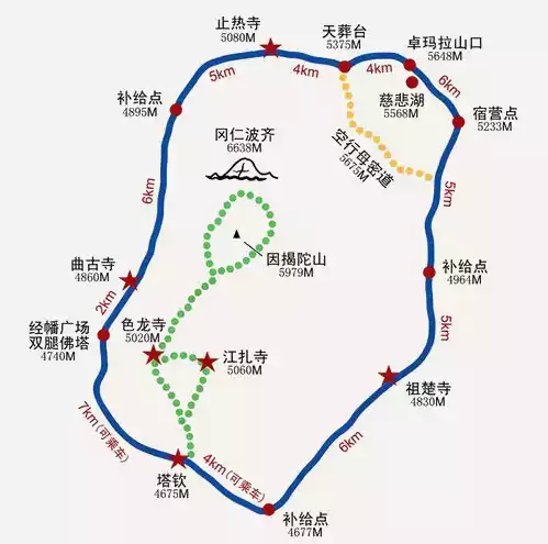
5. The Ultimate Temptation - Mount Kailash Hiking Trail
Time: 1-2 days
Difficulty Description: 6 stars
The hit movie "Gang Rinpoche" in the past two years allowed many people to see the real scene of Tibetan people's simple and pious circumambulation of the mountain, which further strengthened many people's beautiful dream of "going to Gang Rinpoche to circumambulate the mountain once in their lifetime".
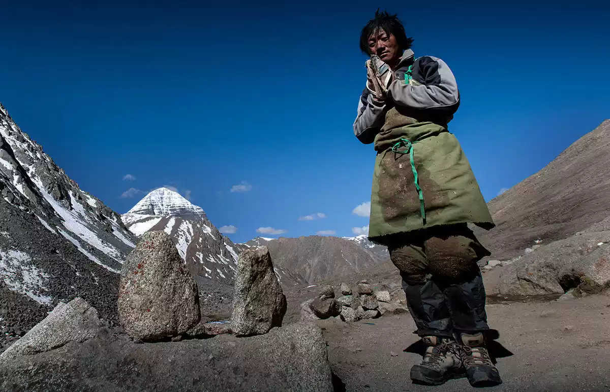
In Tibet, the greatest wish of a Buddhist is to make a pilgrimage to Mount Kailash. They believe that
circumambulating Mount Kailash once cleanses a lifetime of sins; circumambulating ten times spares one from the sufferings of hell for 500 reincarnations; and circumambulating a hundred times allows one to ascend to heaven and attain Buddhahood.
Circumambulating the mountain once during the Year of the Horse, the Tibetan calendar year of the Buddha's birth, increases merit twelvefold, equivalent to thirteen circumambulations per year. Believers circumambulate the sacred mountain on foot or by prostrating themselves, typically over a period of one to three days.
For the average person, circumambulating Mount Kailash can be physically and mentally challenging. However, the spiritual peace gained in the end makes it all worthwhile.
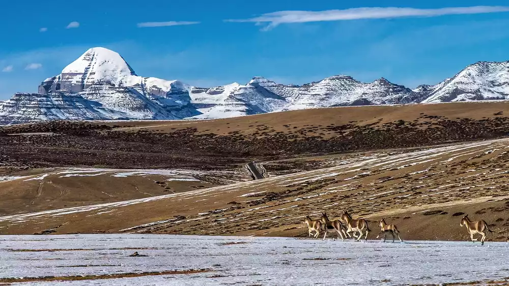
To circumambulate Mount Kailash, you need to conquer the highest point of Mount Kailash, the Zhuoma La Pass, at an altitude of 5,630 meters. This means that ordinary people will have to perform high-intensity activities at high altitudes, so if you have severe altitude sickness in Lhasa, it is best not to do this dangerous activity.
Reference itinerary:
Day 1: Taqin - Qugu Temple - Horse-head Mingwang Stone - Zhire Temple (22km)
Day 2: Zhire Temple - Sky Burial Platform - Crossing Zhuoma La Pass - Taqin (33.6 km)
6. Peaceful Pengbei-Kare Mountain Hiking Route
Duration: 5 days
Difficulty Description: 4 stars
Kare Mountain is a regional sacred mountain that is rarely circumambulated by the Han people. For thousands of years, believers in the surrounding area have walked along the rugged mountain roads, using the ancient form of circumambulation to express their worship and awe of the mountain in order to seek her protection.
Reference itinerary:
Day 1 Lhasa - Two Bridges and One Cave - Jiangtang Township, Gonggar County - Chabala Mountain - Kare Township - Jiangre Village (approximately 130 kilometers by car) - Kare Zhaoti Temple (4000 meters)
D2 Karezhaoti Temple - Holy Land of Practice - Youcuo - Zhaxicuo - Karezhaoti Temple - Qiupu Karezhao Mountain Alpine Pasture
D3 Qiupukare Sacred Mountain Ranch - Mountain Pass - Pu Village, Padang Township
D4 Pu Village, Padang Township - the dangerous "Semu Gongga" cliff - Qiongzong Zhapu Cave
D5 Qiongzong Zhapu Cave - Kare Zhaoti Temple - Kare Village - Lhasa
7. Counterclockwise rotation - Benri Mountain Hiking Route
Time: 1-2 days
Difficulty Description: 4 stars
Mount Bonri is the king of Bon religion's sacred mountains. There's an interesting phenomenon when circumambulating the mountain: Tibetan Buddhists must also circumambulate the mountain in the same counterclockwise direction as Bonists.
This circumambulation is similar to Sichuan's Moerduo Sacred Mountain, and is similar to mountain climbing. You ascend in one direction and descend in the other direction when you near the summit. Prayer flags guide you along the way, so you don't have to worry about getting lost. There are also inexpensive accommodations in the village at the foot of the mountain.
Although it is not a breathtaking beauty in itself, it can be regarded as an excellent viewing platform for photographing Mount Namjagbarwa.
Reference itinerary:
D1: Nyingchi Old Town - Dagze Monastery - Benri Holy Spring - Tomb of Zhigong Zamp - Niyang River Scenery - River Confluence - Mirui Village - Zongqiongding
D2 Zongqiongding (3360m) - Mountain Pass (4540m) - Sejila Mountain, National Highway 318 - Nyingchi Old County
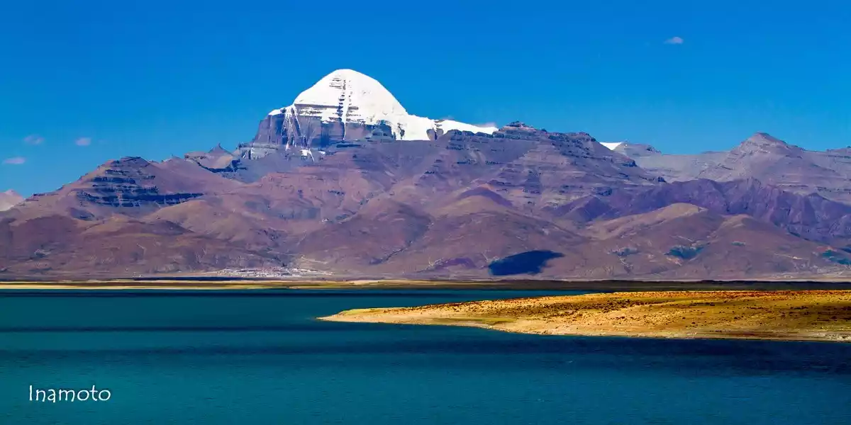
8. Hiking route around the first holy lake - Lake Manasarovar
Duration: 5 days
Difficulty Description: 6 stars
Today, Yamdrok Lake, Namtso Lake and Manasarovar Lake are world-famous as the "Three Holy Lakes of Tibet", so hiking routes have also been derived from the routes of local Tibetans to the three holy lakes!
Lake Manasarovar is flanked by the sacred Mount Kailash in the north and the 7,694-meter-high Mount Namunani in the south. Both the Lion Spring River and the Elephant Spring River originate from the sides of the sacred mountain and holy lake. It is considered the "first holy lake" by Tibetans.
Reference itinerary:
D1 Tarqin - Baga Checkpoint - North Shore of Holy Lake 40 km (20 km hike)
D2 North Shore of Holy Lake - Hol Township 20 km
D3 Huoer Township - Bare Village 20 kilometers
D4 Bare Village - Chuguo Temple 20 km
D5 Chuguo Temple - Guozu Temple - Jiwu Temple 50 km
9. Sky Mirror Road - Yamdrok Lake Hiking Route
Duration: 5 days
Difficulty Description: 6 stars
Yamdrok Lake is 4,441 meters above sea level, and the inner circle of the lake is about 145 kilometers. People who go to Yamdrok Lake usually take a day trip, but if you want to get deep into the heart of Yamdrok Lake, you have to do this.
Yanghu Lake boasts more than just blue. It also boasts the white of snow-capped mountains, the green of barley, and the red and yellow of Buddhist temples. If you don’t carefully explore its graceful curves, how can you find the joy of solving the mystery?
Reference itinerary:
D1 Lhasa - Langkazi - Azha Township 183 km (7 km on foot)
D2 Azha Township-Yongbuduo Island 12 kilometers
D3 Yongbuduo Island - Yulong Village - Dingba Village - Yalong Village/Nianba Village - Dongba Village 30 km
D4 Dongba Village - Zhiwu Village - Wuba Village - Zhagang Village - Sujiao Village - Guoba Village - Bajie Village 35 km
D5 Bajie Village - Dongga Village - Gongre Village - Miba Village - Zongba Village - Zhiba Village - Xueqing Village - Qida Village - Daobulong Village - Langkazi County 45 km
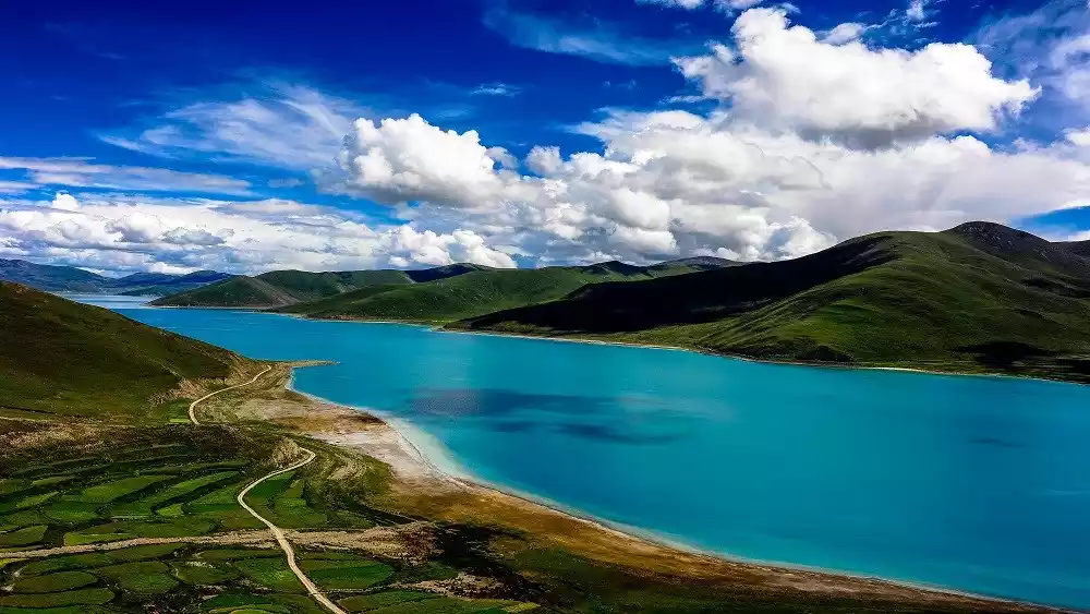
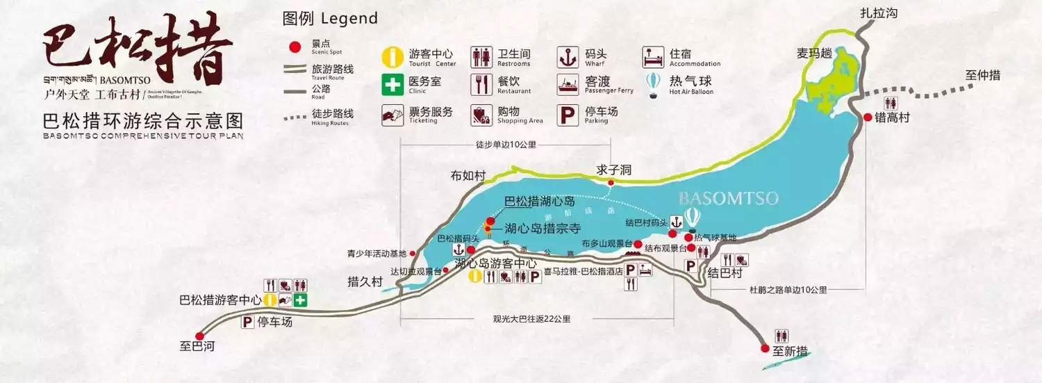
10. Spring at the Blue Lake - Basongcuo Hiking Trail
Duration: 2 days
Difficulty Description: 3 stars
Basum Co is not only the largest natural lake in southeastern Tibet, but also an important sacred lake in Nyingchi Prefecture. The Cozong Monastery on the central island and numerous temples surrounding the lake together embody the sacredness of Basum Co.
Cogao Village is a thousand-year-old village located deep within the sacred Basongtso Lake in Gongbu Gyamda County, Tibet Autonomous Region. To reach Cogao Village, one must first travel along a rural dirt road that winds along the shores of Basongtso Lake.
Perhaps because the road is difficult and dangerous, even though Basongcuo has long been famous, most ordinary tourists stop here.
But along the way, there are tall and straight pine forests with a faint pine scent and faint bird calls. There are also alpine rhododendrons dotted all over the mountains, swaying gracefully in the clear breeze; there is also the holy lake Basongcuo, which reflects the towering snow-capped mountains.
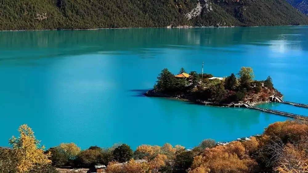
With a cool breeze as your companion all the way, it is still a route worth visiting!
Reference itinerary:
D1 Resort - Cuojiu Village - Bure Village - Xiaozai Cave - Qiuzi Cave - Sha'a Meadow - Cuogao Village
D2 Cogao Village - Duoqin Gunba - Jieba Village - Budo Mountain Viewing Platform - Resort