How many of Europe’s top ten classic and niche hiking routes do you know?
Preface
Norway boasts not only the Three Stones hike, Italy boasts not only the Dolomites but also the Blue Trail, and France's Corsica G20 is hailed as Europe's most beautiful hiking route. The UK and Germany also boast classic hiking trails. Europe is renowned worldwide as the birthplace of hiking, so let's explore some of Europe's classic and lesser-known hiking routes.
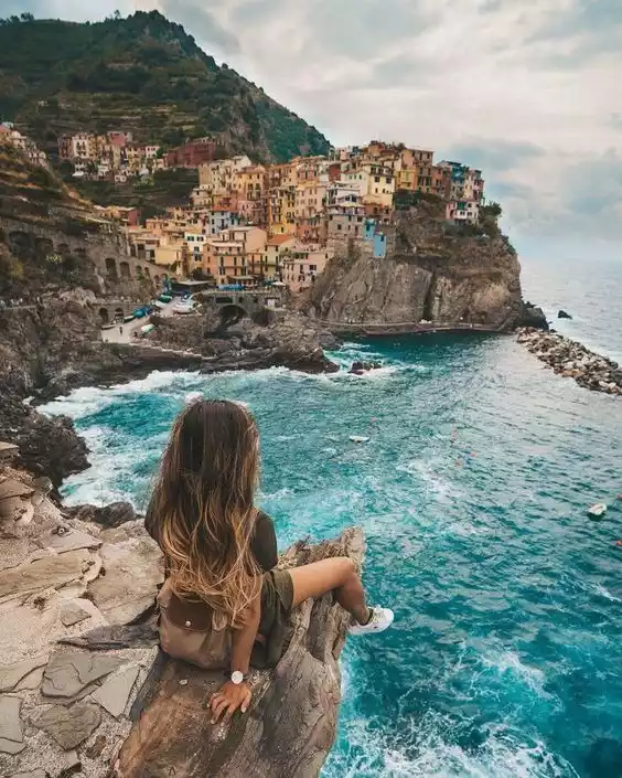
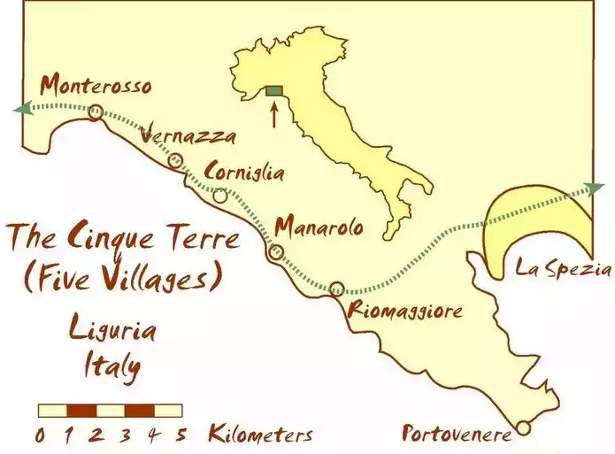
NO.1 Italy's Blue Trail
Because the Blue Trail is close to the coastline, it is like a necklace with five pearls, namely Riomaggiore, Manarola, Corniglia, Vernazza and Monterosso.
Although this journey requires at least 360 steps, narrow passages or dirt roads lined with olive trees, the five fishing villages will make up for you with their lovely scenery and relieve your fatigue and loss.
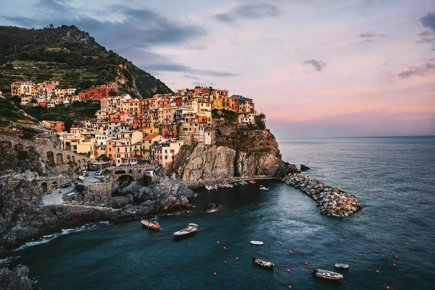
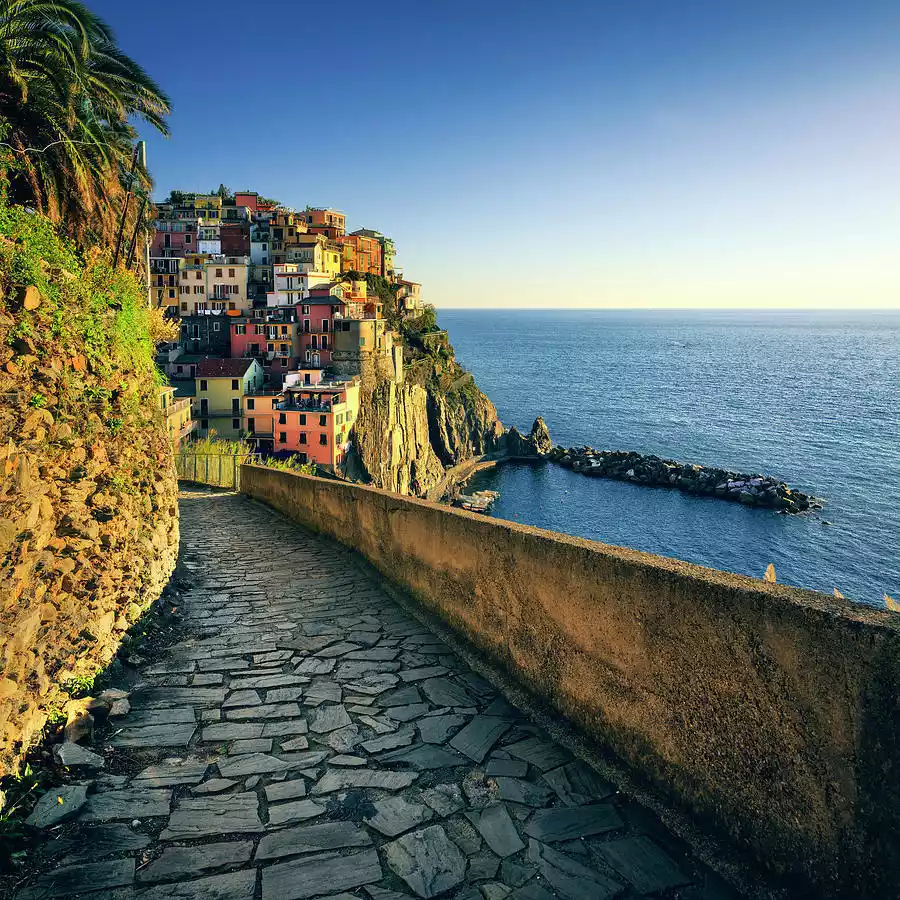
Wherever the Blue Trail goes, there is a gathering place of color. The "Road of Love" between Riomaggiore and Manarola is covered with colorful graffiti and vows of love.

Tips:
English name: Blue Trail
Location: La Spezia, Liguria, Italy
Length: 15-20 km
Duration: 5-7 hours
Difficulty: Easy
Best months: April-May, September-October
Important note: To hike the Cinque Terre, you need to purchase a pass – the Cinque Terre Card. There are two main types of passes available: the Cinque Terre Card and the Cinque Terre Card Train.
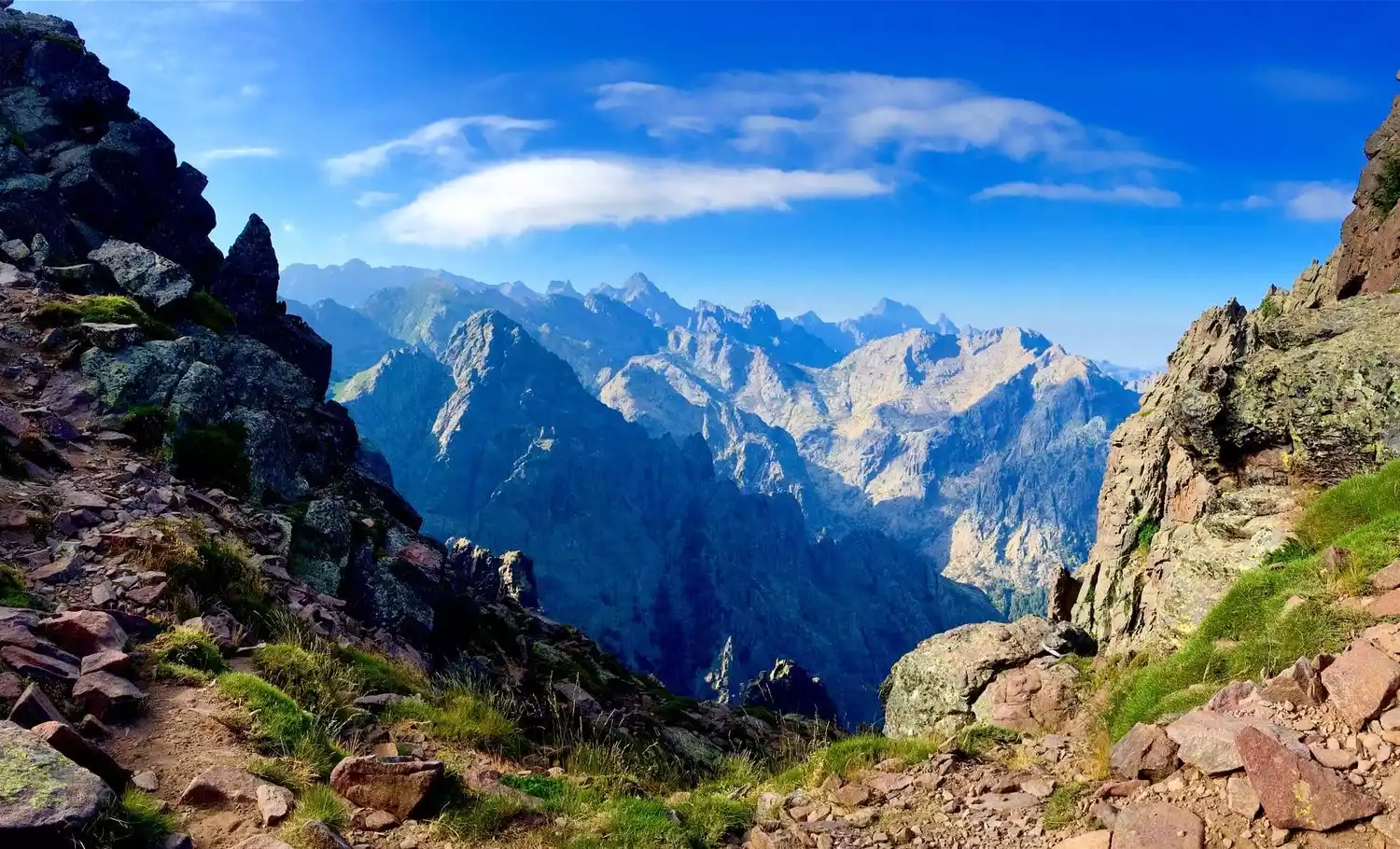
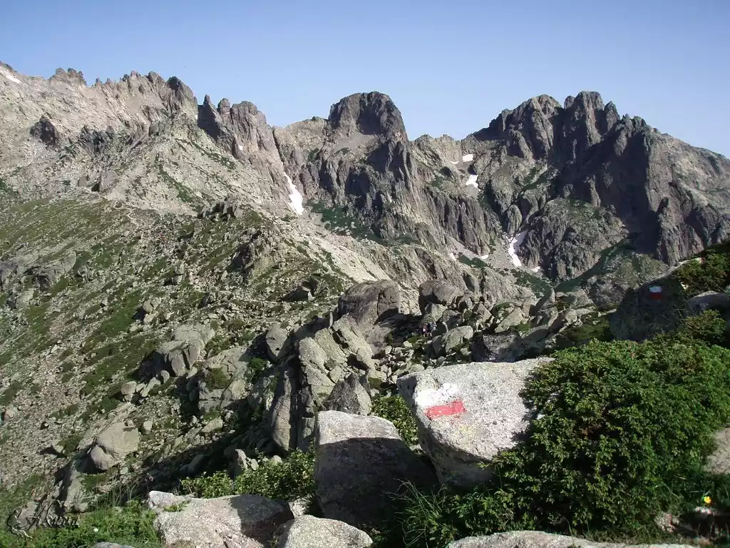
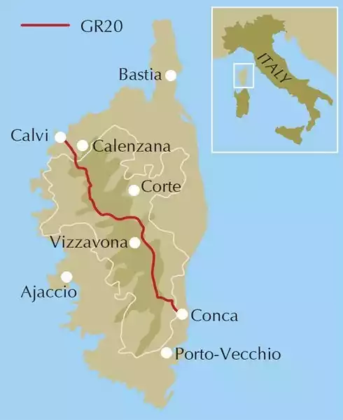
NO.2 GR20 Hike in Corsica, France
The GR20, known as Europe's most beautiful hiking route, is renowned in outdoor circles. Corsica, world-famous for Napoleon, attracts countless visitors with its beautiful, long coastline, azure sea, and pristine white sand beaches.
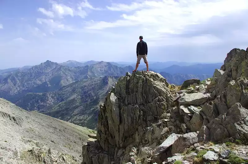
Corsica is a veritable mountain on the sea, with towering peaks in the north, tranquil bays in the south, and mirror-like lakes hanging between them. However, the hiking trails are challenging and treacherous. The GR20 trail, a 180-kilometer route, is wild, desolate, captivating, and full of challenges. The most demanding sections require you to carry heavy loads along cliffs without any protective gear and with barely an inch of foothold.
Tips:
English name: CORSICA'S GR20
Location: Corsica, southeastern France, western Italy
Length: 180 km
Duration: 16 days
Difficulty: Difficult
Best months: late June, early September
Important note: On this hiking route, since transportation is difficult to reach and manual material transportation is difficult, most supplies are provided by helicopter.
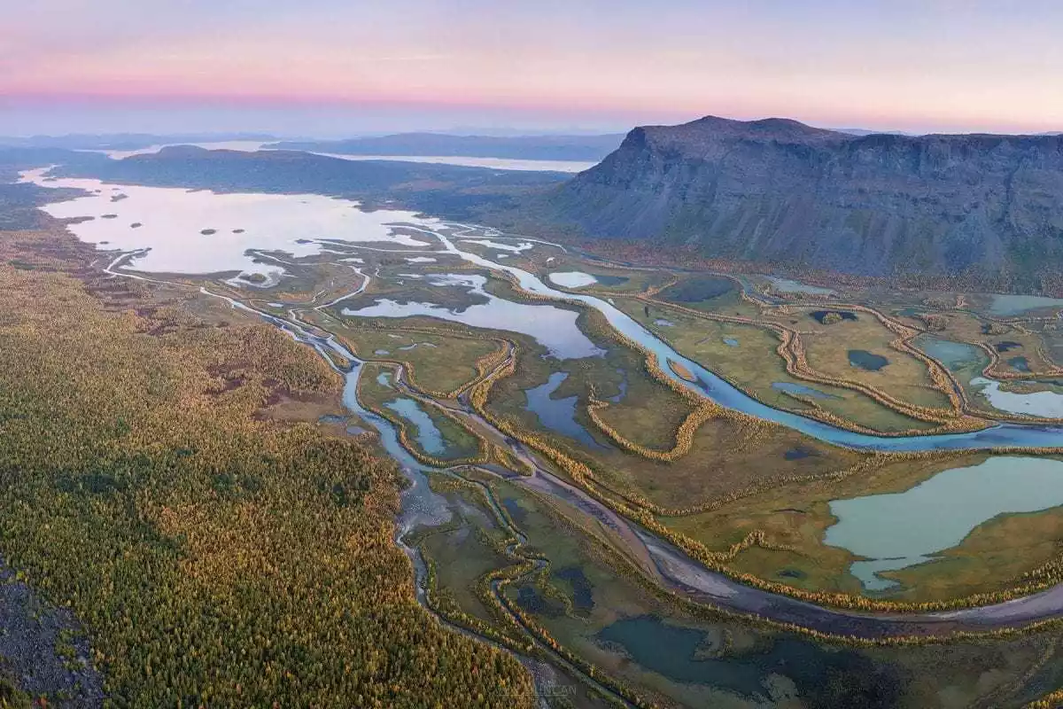
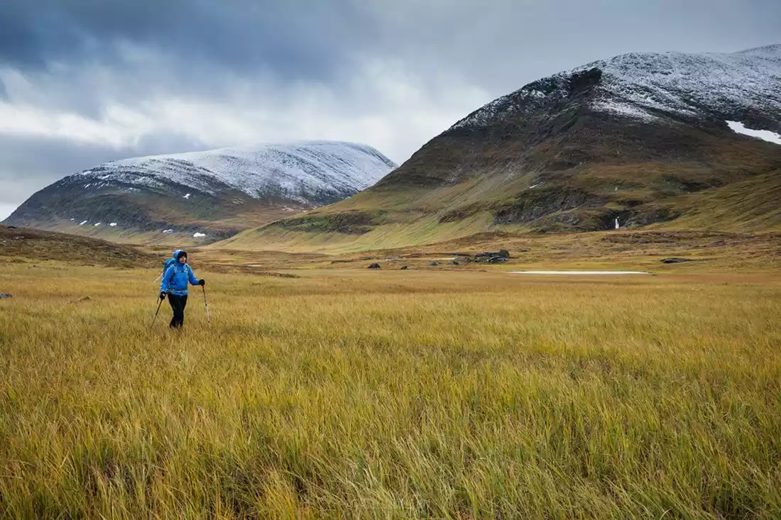
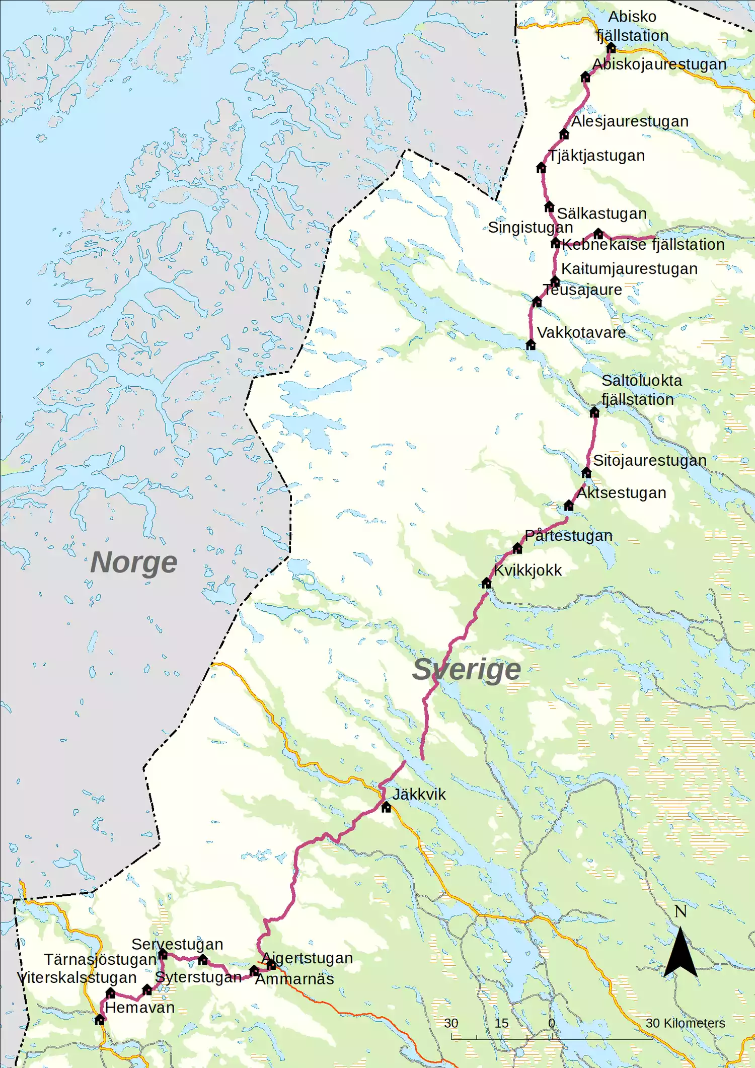
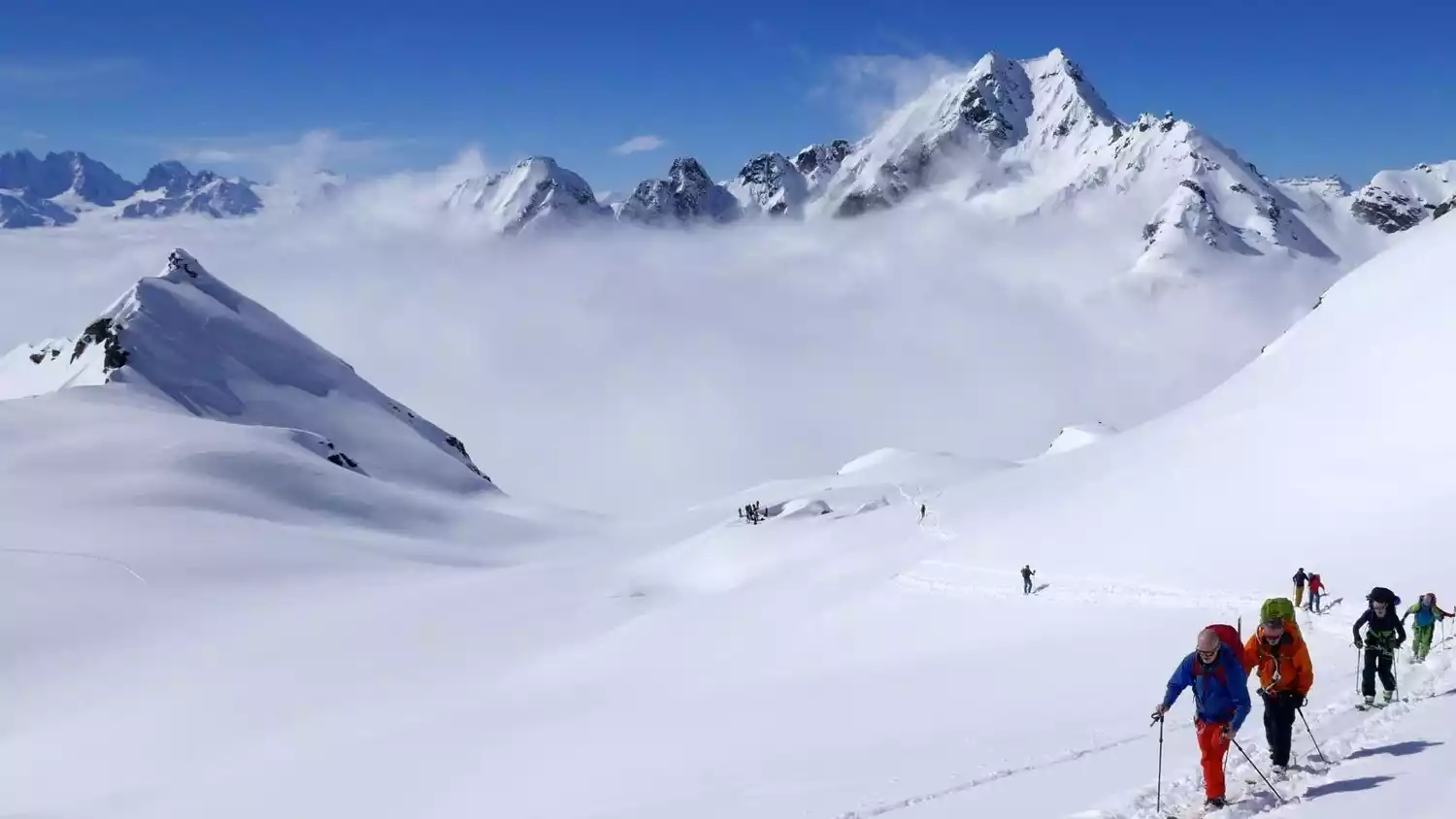
NO.3 Swiss King's Trail
The King's Trail is known as "one of the oldest hiking routes in Europe" and is gradually becoming a popular check-in destination for outdoor enthusiasts.
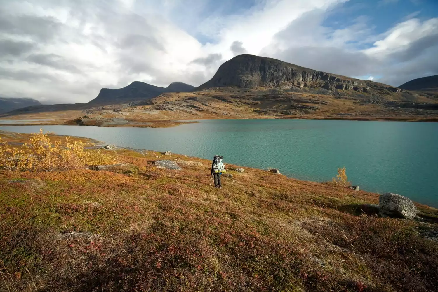
This route is known to have the most spectacular mountain scenery in the world, with solemn and tranquil snow-capped mountains, verdant mountain wilderness, dense birch forests, and vast low-lying mountains, bringing huge landscape differences and giving people a shocking visual experience.
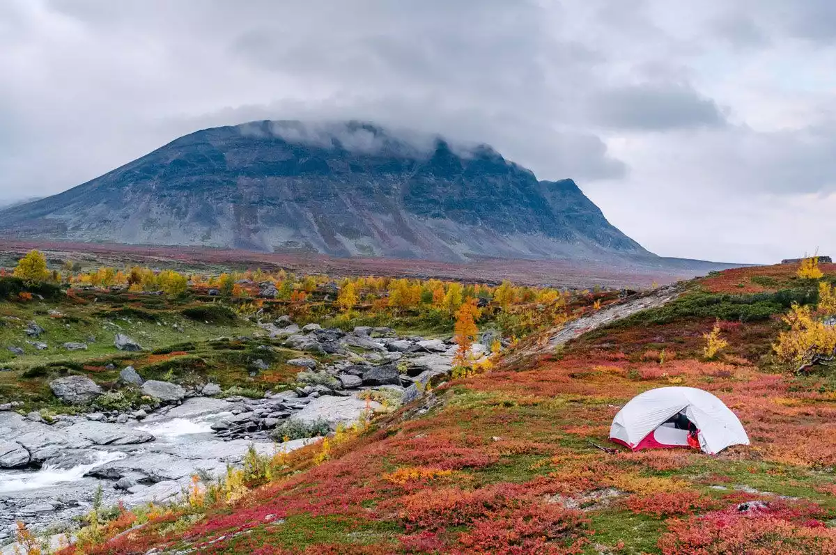
The trail is divided into four sections, each taking about a week to hike. By far the most popular section is between Abisko in the north and Kebna, Sweden's highest peak.
Tips:
English name: Kungsleden Trail
Location: Between Hemavan and Abisko in northern Sweden
Length: 440 km (4 lines)
Duration: 7 days (1 route)
Difficulty: Moderate
Best months: late June to early September
Important tip: You can start hiking the King's Trail from any starting point, but when walking in the Arctic, it is generally best to hike from north to south, because this way you can always walk towards the sun.
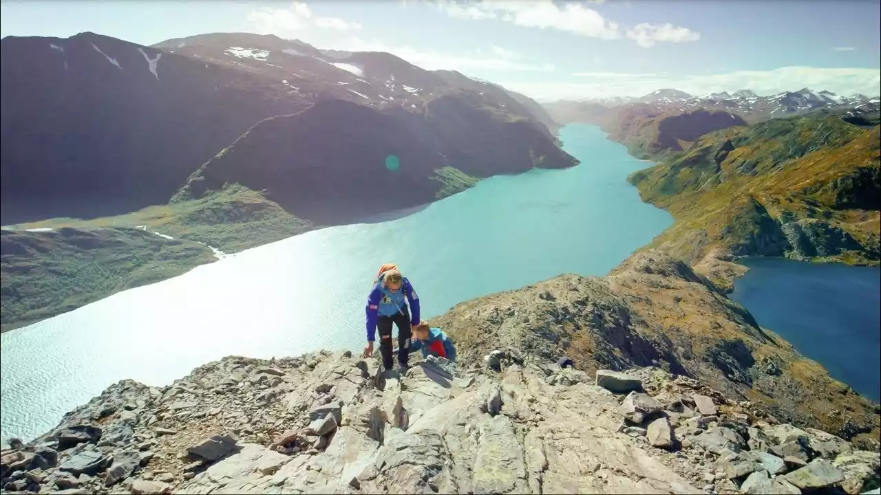
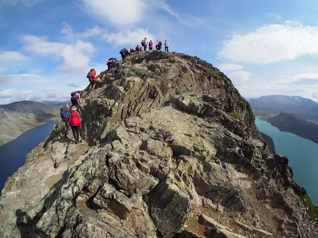
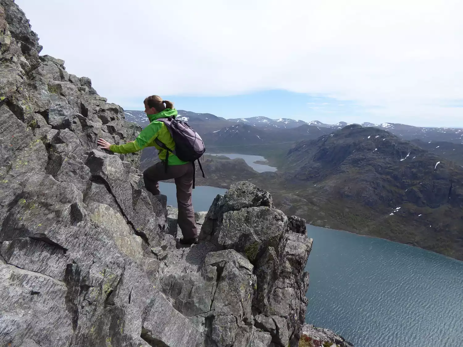
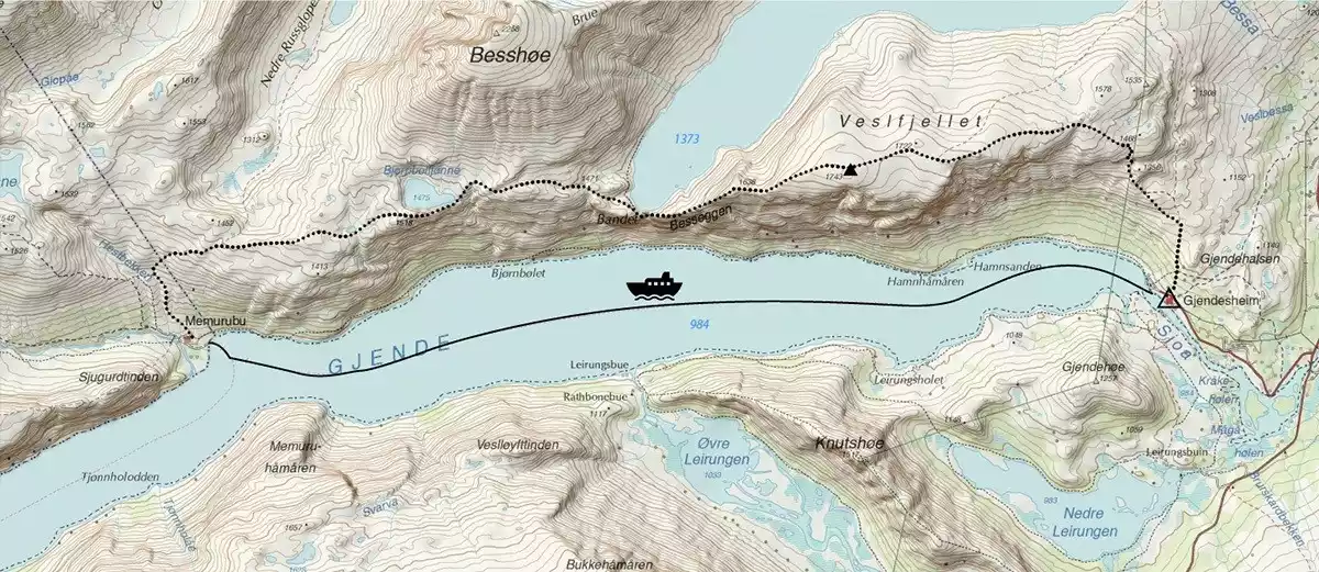
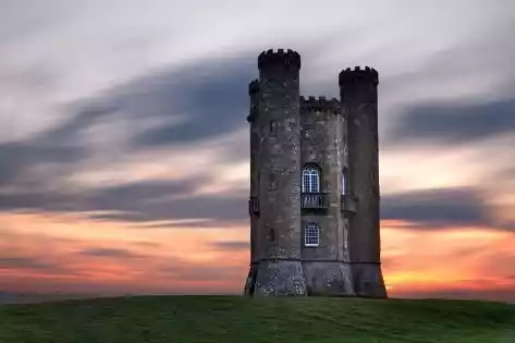
NO.4Best Ridge Hike, Norway
Due to its moderate difficulty and charming scenery, the Bessegge Ridge has become one of the most famous hiking routes in Norway. It was also commented by National Geographic as one of the "20 most thrilling hiking routes in the world".
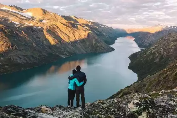
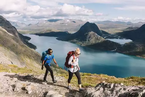
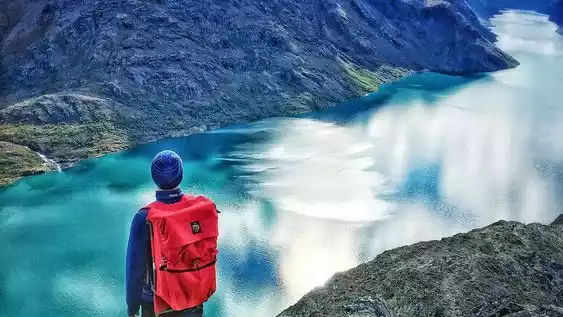
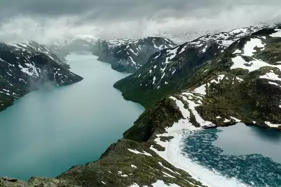
The thrill of the Best Ridge is different from that of ordinary hiking routes. When you stand on the highest point of the Best Ridge using your hands and feet and look into the distance, you will be pleasantly surprised: on one side is the emerald green Yande Lake, and on the other side is the deep blue Best Lake like the sea, and the two are separated by only a narrow ridge. The Best Ridge is thrilling but not dangerous, and the charming scenery on the ridge is fascinating.
Tips:
English name:BESSEGGEN RIDGE
Location: Jotunheimen National Park, Sogn og Fjordana and Oppland counties, Norway
Length: 23 km
Difficulty: Moderate
Best months: June to October
Important tip: Bass Ridge is suitable for hikers of all levels. It is of moderate distance and has a relatively gentle slope. However, there are still several narrow and relatively steep sections. You may need to use your hands and feet, so be careful when passing through.
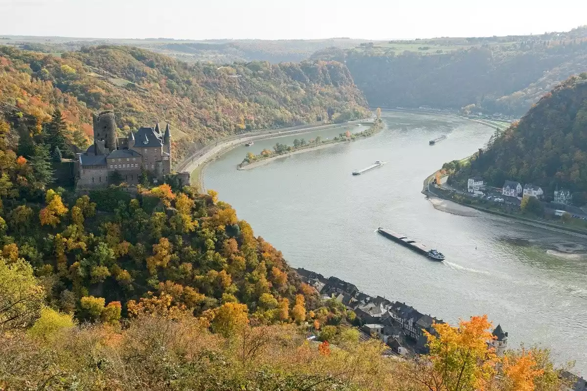
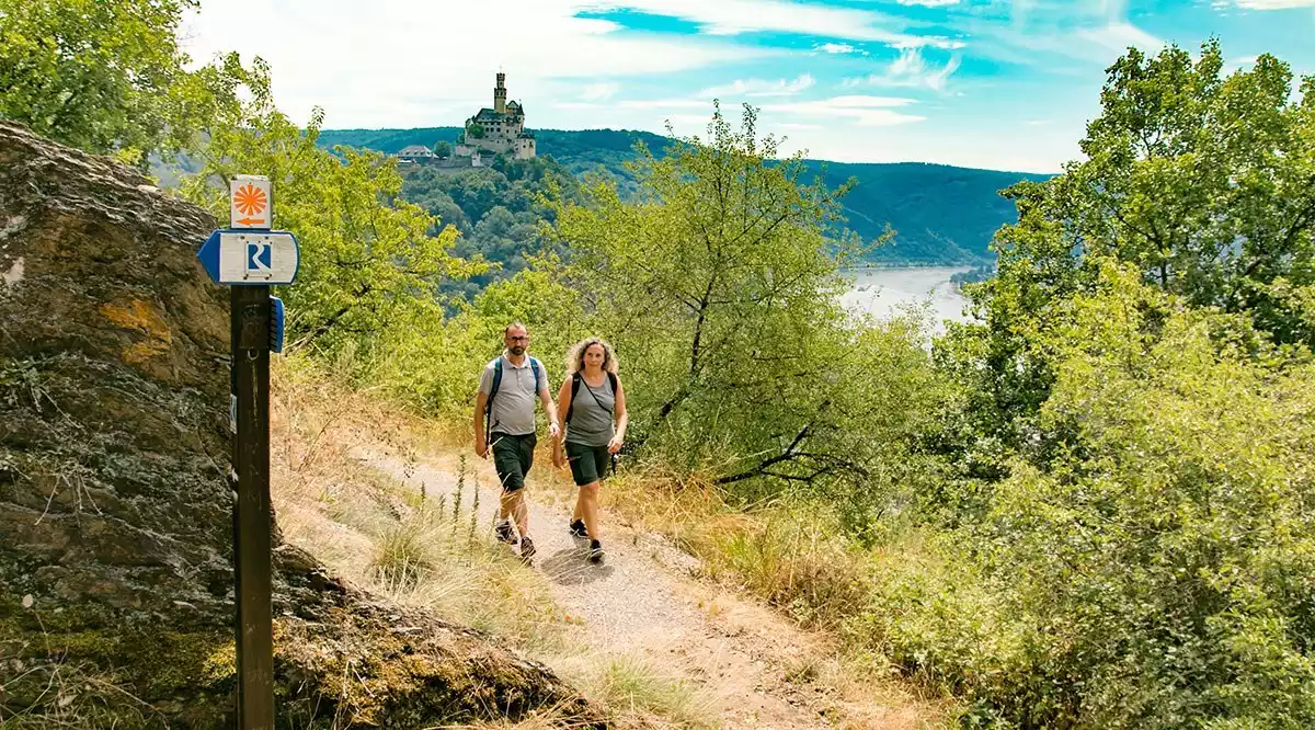
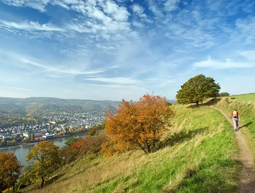
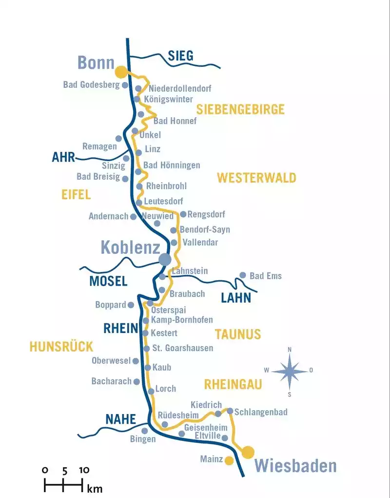
NO.5 Germany's Rhine Trail
The Rhine Trail was jointly planned and established by the German states of Hesse, Rhineland-Palatinate, and North Rhine-Westphalia in 2005. With its dense network of trails, clear signage, and rich landscapes and cultural history, the Rhine Trail has been recognized as Germany's most beautiful hiking trail.
Hiking this trail not only offers a glimpse into the unique scenery of western Germany, but also a glimpse into the rigor of the German nation. The trail begins in Bonn and ends in Wiesbaden, with four main sections (Seven Ridge Mountains, Lower Rhine Valley, Upper Rhine Valley, and Rhine Highlands) and 23 smaller sections.
Tips:
English name: RHEINSTEI
Location: Upper Rhine Valley, Germany, from Wiesbaden in Hesse to Bonn in North Rhine-Westphalia, along the right bank of the Rhine.
Length: 320 km
Difficulty: Moderate
Best months: Spring, summer, autumn
Important: The main road is marked with blue and white "RHEINSTEIG" signs along the way.
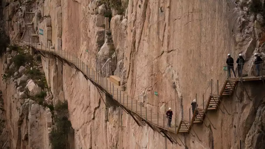
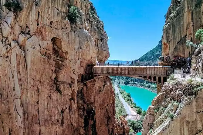
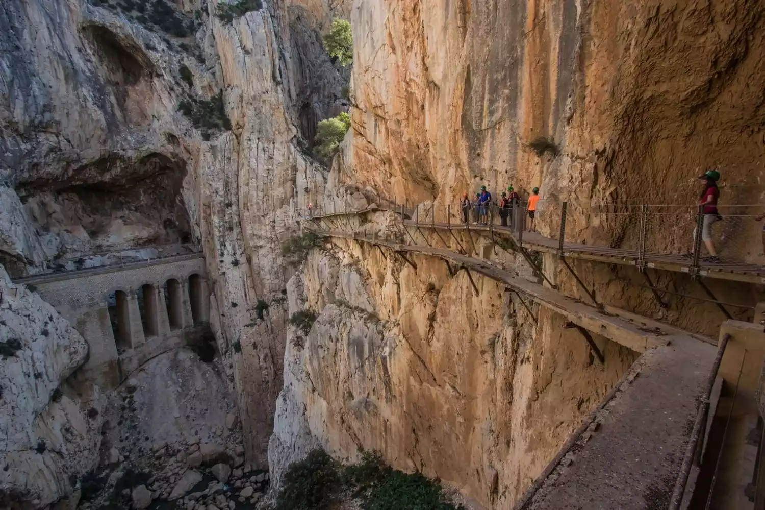
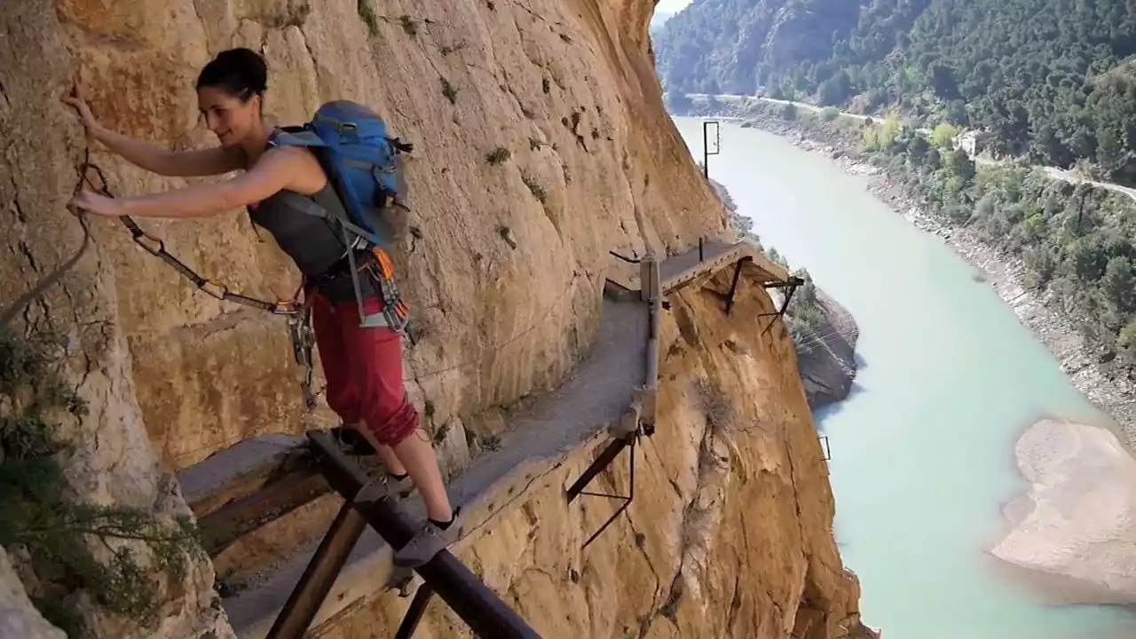
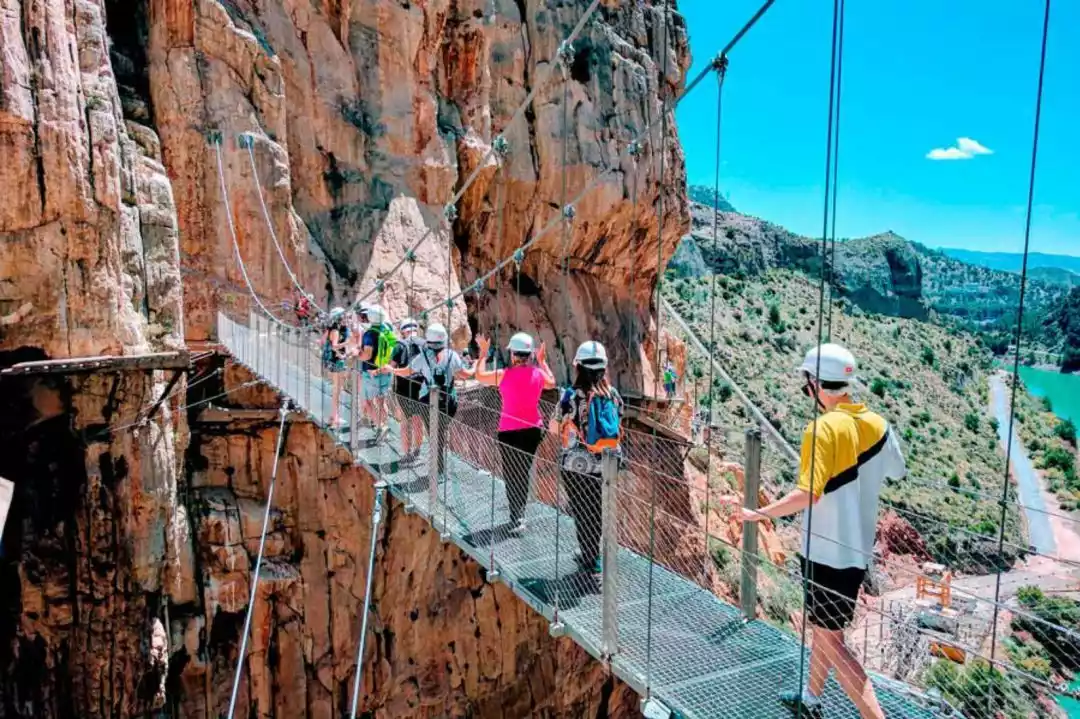
6. El Chorro Trail, Spain
The El Chorro King's Trail is built on a cliff 100 meters high from the El Chorro River in the canyon. It is about 7.7 kilometers long, of which 3 kilometers are paved with wooden boards, about 1 meter wide and no more than 50 centimeters at the narrowest point. One side has towering cliffs, and the other side has a deep valley with fast-flowing water. Therefore, this trail is known as the "most thrilling plank road in the world."
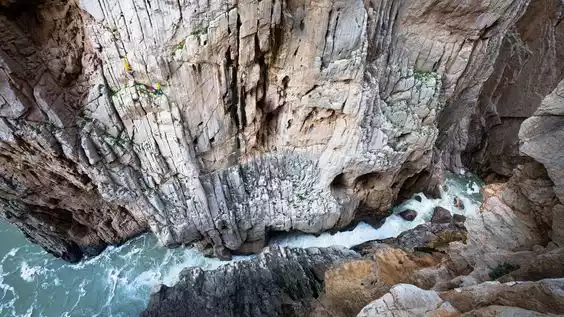
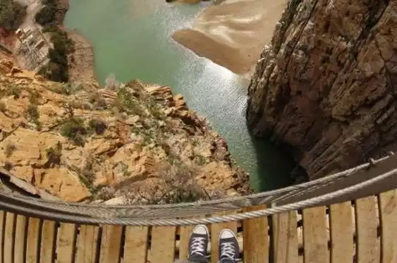
In 1921, King Alfonso XIII of Spain opened a reservoir and built a plank road through the canyon, so this plank road is also called the "King's Trail".
The trail is truly spectacular, built entirely in a unique natural environment. It stretches between three canyons, with sections that are mountain paths, but mostly wooden plank paths. It runs in one direction, from north to south, starting in the town of Ardales and ending in Alora.
Tips:
English name: El Caminto Del Rey Path
Location: El Chorro Gorge, Malaga Province, southern Spain
Length: 7.7 km
Best time to hike: All year round
Important note: The trail must be booked in advance, there are only 600 spots available each day, and hikers must wear a helmet to enter.
NO.7 Swiss Highlands Road
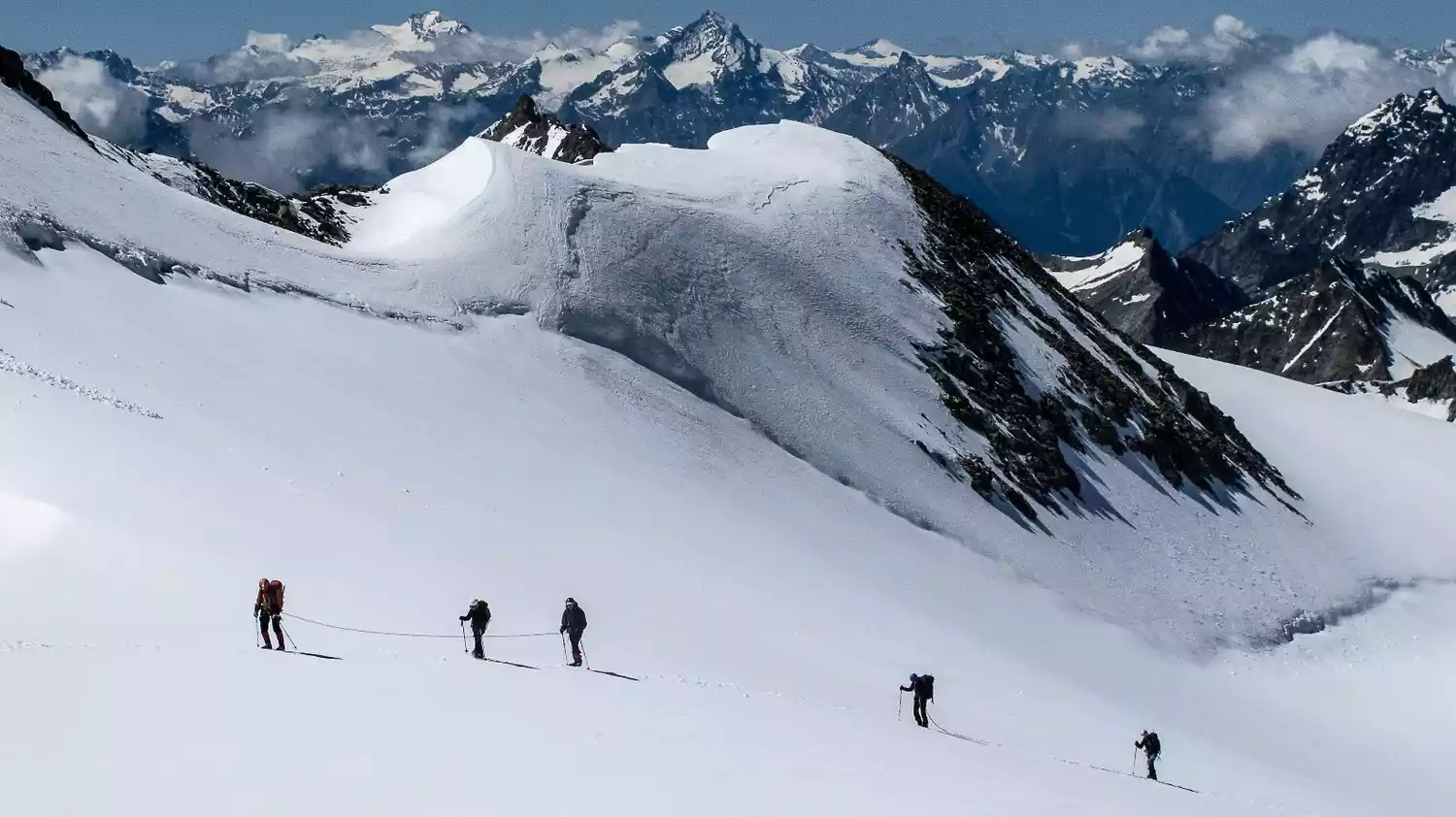
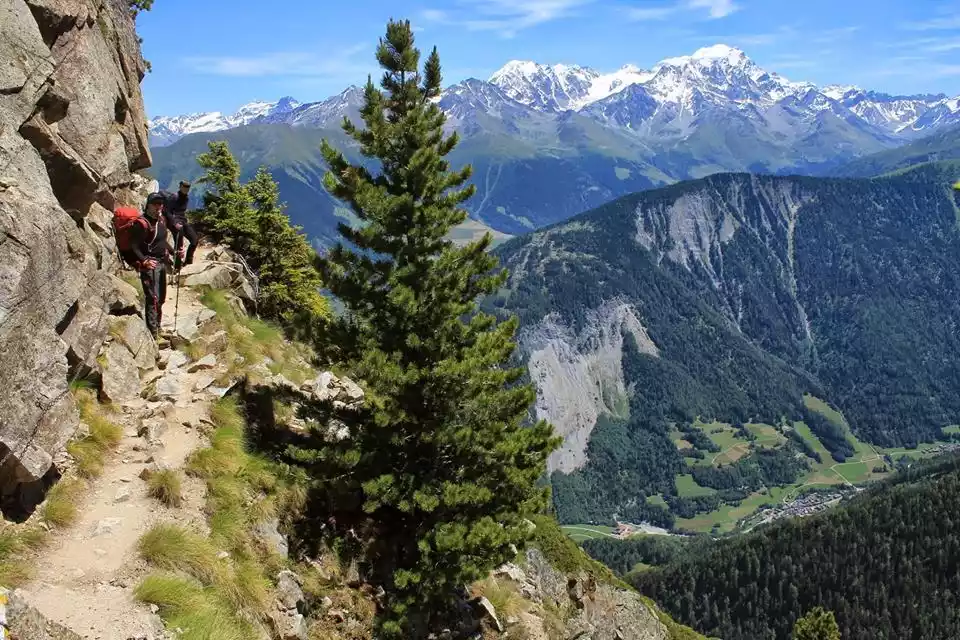
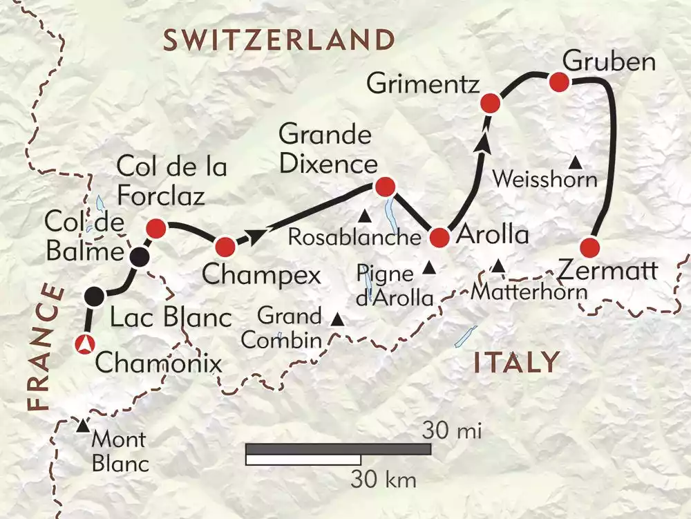
The Swiss Alps Route spans France and Switzerland, starting from the small town of Chamonix at the foot of Mont Blanc, the main peak of the Alps. The first half of the route passes through Argentière, France, and then enters Switzerland. The route along the village of Trienne all the way to the small town of Senbei with its beautiful lakes and mountains is the same as the route around Mont Blanc.
The second half of the hike is surrounded by the Alps. As you cross mountains and ridges, you can see almost all the steep and tall peaks in the Alps with an altitude of more than 4,000 meters. Finally, you arrive at the foot of the Matterhorn, the most beautiful peak in the Alps. The excitement is far greater than a simple hike around Mont Blanc.
Tips:
English name: HAUTE ROUTE
Specific location: France, Switzerland, starting in the small town of Chamonix on the eastern border of France, adjacent to Italy and Switzerland, and ending in Zermatt in Valais, Switzerland
Length: 180 km
Best time to hike: mid-June to mid-September
Important note: This route is a pure hiking route that does not require a permit, climbing skills or equipment, but it does require a high level of physical fitness.
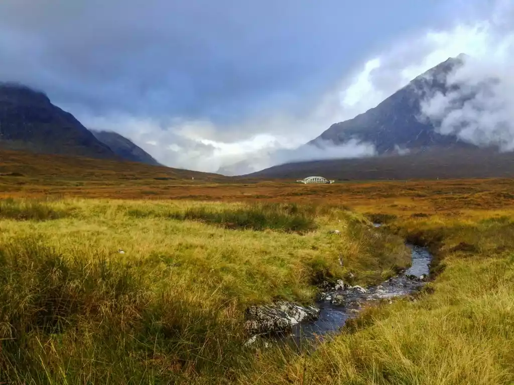
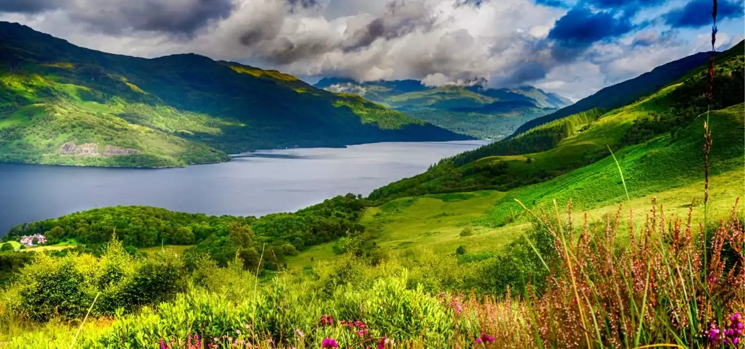
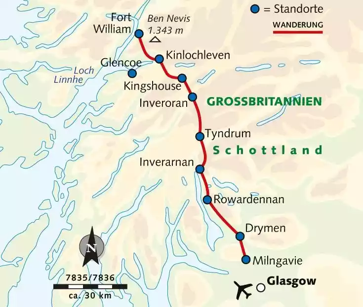
NO.8 West Highland Trail, UK
Scotland's first officially approved long-distance walking trail, the West Highland Path stretches from Milgai in Glasgow to Fort William.
This is a hiking route that leads directly to the most beautiful scenery in Scotland. From the Scottish countryside to the national park, from the quiet lakeshore trails to the steep mountain paths, the West Highland Trail shows the beauty of Scotland to the people passing by in its own unique way.
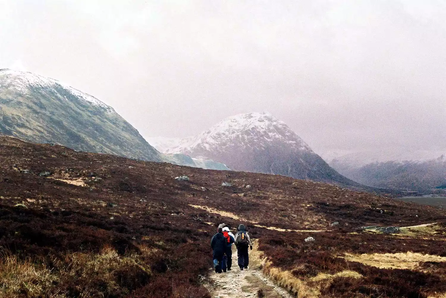
It passes by the Rannoch Moor or dances among the Campsie Hills. No matter where it goes, it can take you to appreciate the soft or wild beauty of Scotland, and the difficulty of conquering the hills of the West Highlands will also leave a deep impression on you.
 English name: WEST
Tips:
HGHLAND WAY
Specific location: Scotland, UK
Length: 154 km
Best time to hike: April to October
Important tip: There are luggage handling companies throughout the trip, so you can hand over your luggage to them and walk comfortably.
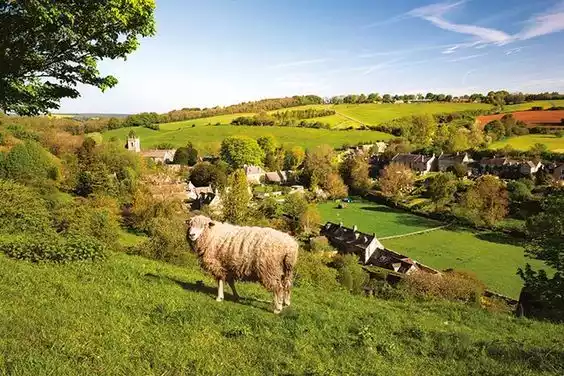
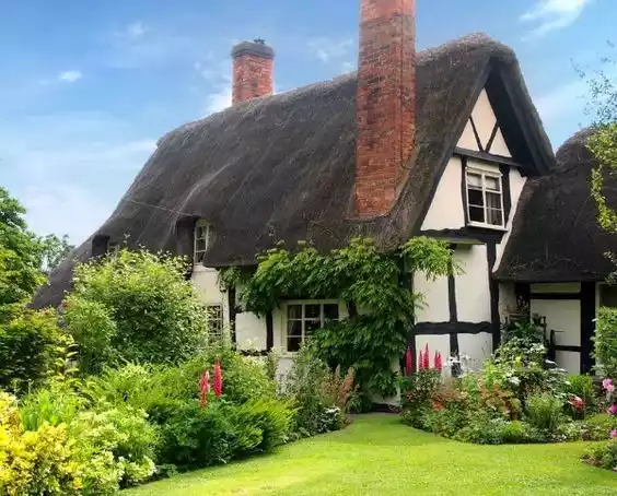
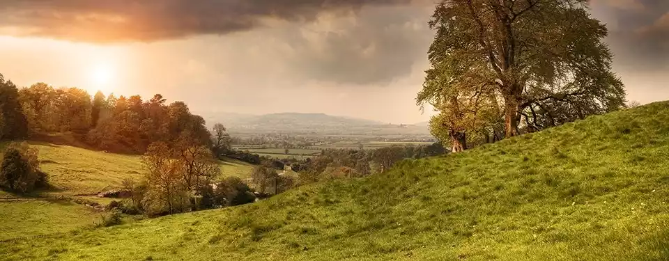
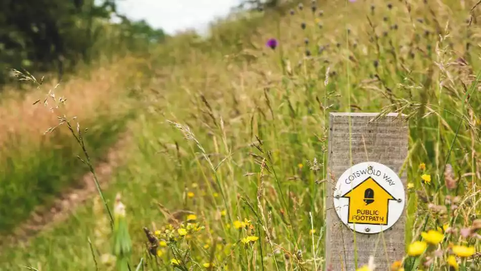
NO.9 Cotzel Road, UK
The Cotswolds is a collective term for the idyllic countryside west of Oxford and north of Bath. Dotted across these hills are hundreds of quaint, elegant English villages and towns. Their elegant colors, tranquil atmosphere, rich history, and iconic, romantic English countryside attract visitors from around the world.
The local tourism bureau has even linked together classic villages and towns to create a romantic road - the Cotswold Way, which has become the essence of a trip to the English countryside.
Tips:
English name: Cotswold Way
Location: Cotswolds, London, England
Length: 164 km
Best time to hike: April to September
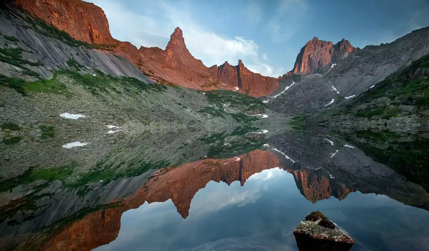
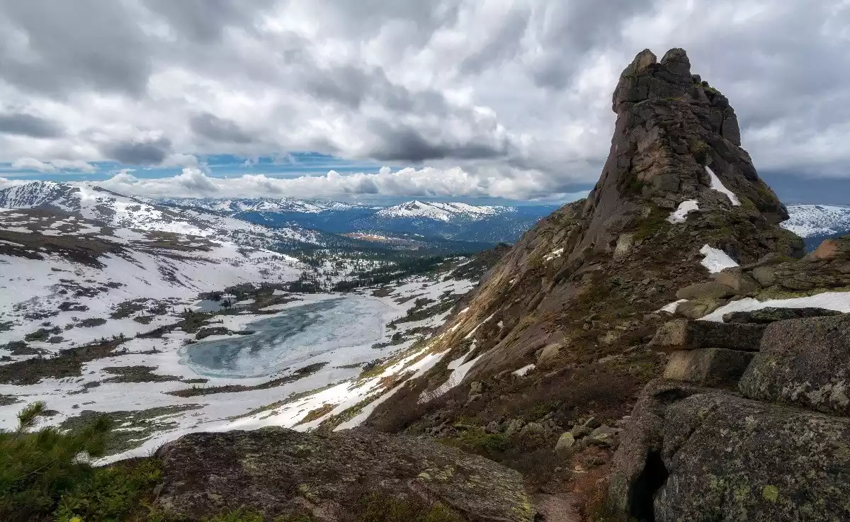
NO.10 Yelgaki Hiking, Russia
Yelgaki Nature Park, known as the "Russian Yosemite," is little known outside of Russia. Embarking on this hike feels like stepping into God's own garden.
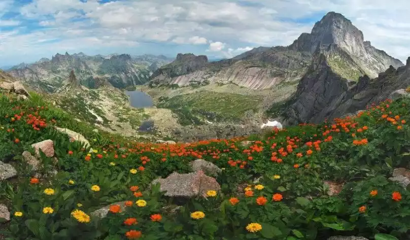
The park's mountainous terrain, clear lakes, dense coniferous forests and diverse biodiversity are perfectly combined to provide hikers with a compact scenic viewing area.
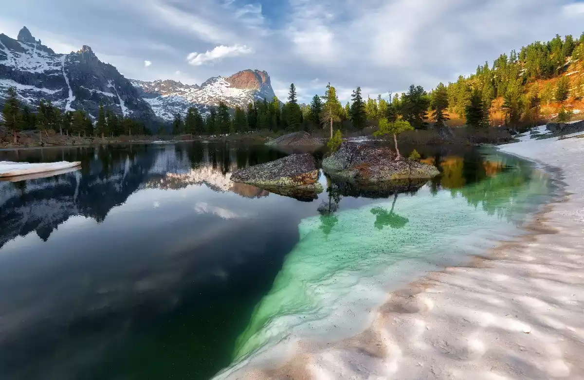
The park is dotted with streams that flow through dense taiga forests, green meadows, and colorful flowers. Fine water vapor in the morning light permeates the entire forest, and finally rushes forward with the most primitive power, forming spectacular waterfalls.
Tips:
English name: ERGAKI TRAIL
Location: Western Sayan Mountains, Krasnoyarsk Oblast, Russia
Length: 120 km
Best time to hike: July to September
Important note: There are bears in Yelgaki, so remember not to leave food where animals are.