The most comprehensive guide to Tibet, nine routes to Tibet, there is always one that will make you excited
In China, 26% of the country's land area is occupied by plateaus. In this land with an average altitude of nearly 4,000 meters, there are mountains and forests, lakes scattered everywhere, woods and meadows complement each other, and countless secret places on earth are distributed.
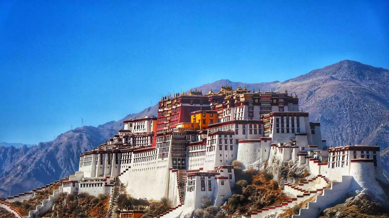
Located in the southwestern border of our country and as the epitome of China's plateau landscape, Tibet has undoubtedly become a place that continues to fascinate people.
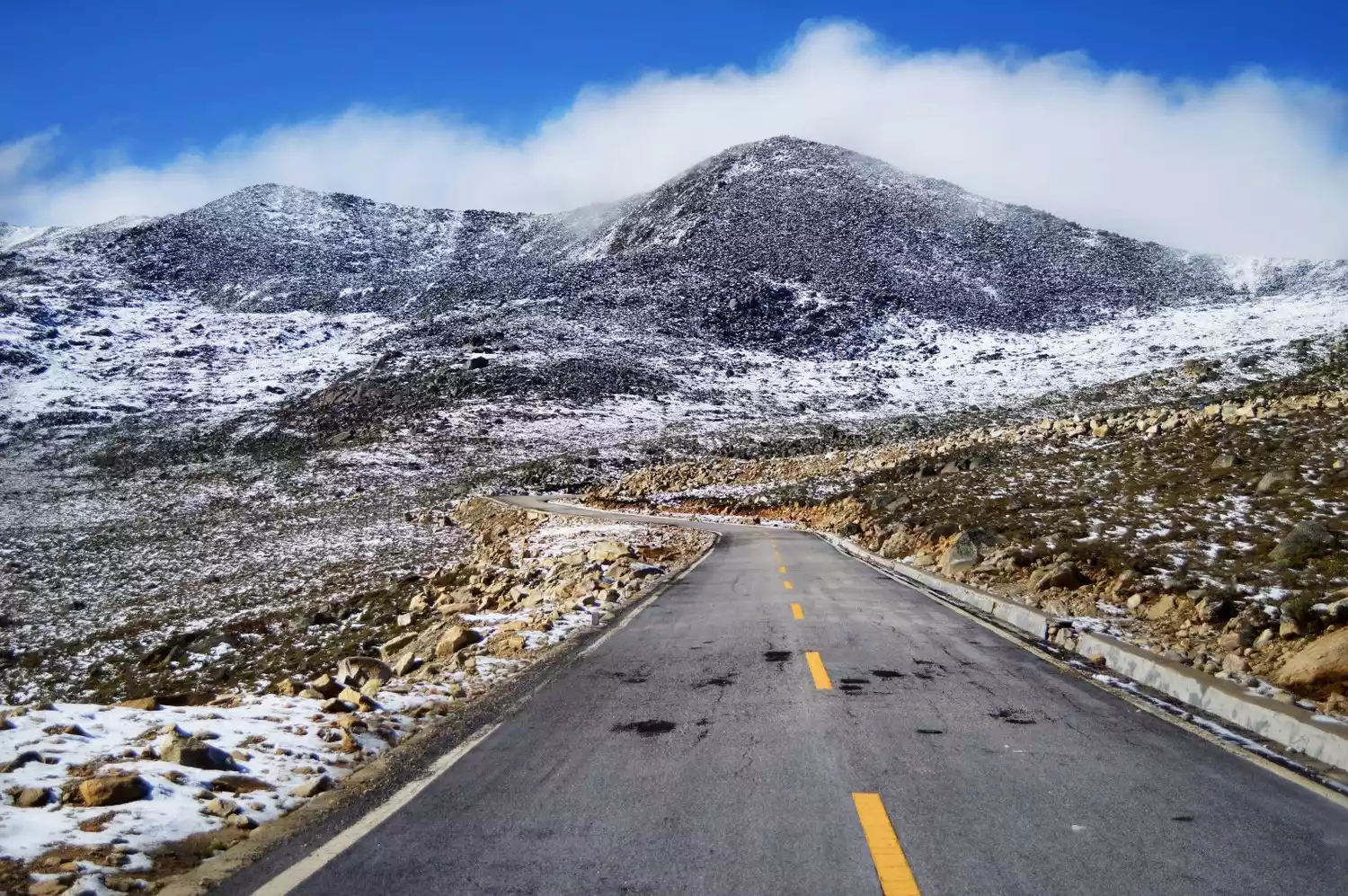
Highway to Tibet
Tibet is a perennial theme for Chinese travelers, driving all the way to Lhasa, their dreams soaring high above the mountains. From Chengdu to Kunming, and across the vast expanse of China, there's more than one way to Tibet. Here, You Xiaoxia has compiled the nine most common routes into Tibet from China, hoping they'll help you fulfill your dream.
Each route to Tibet has its own unique scenery, culture, wildness, and religion... Every route to Tibet has countless stories and its own unique charm.
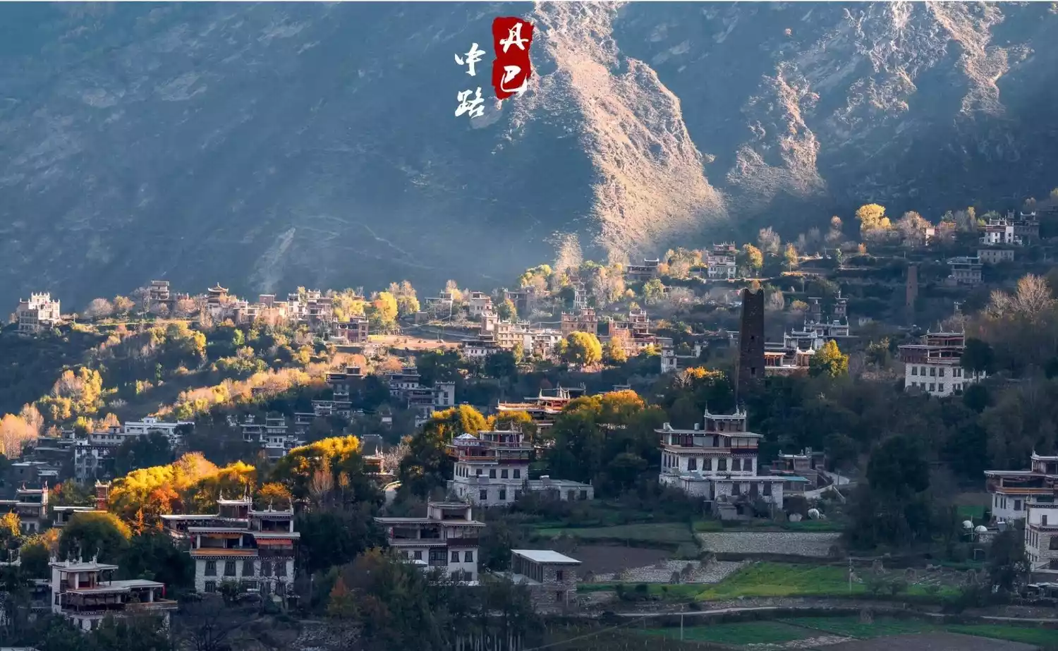
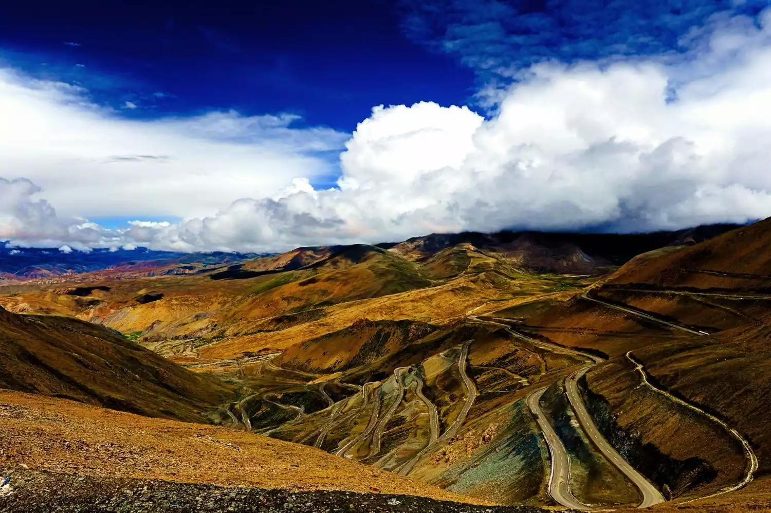
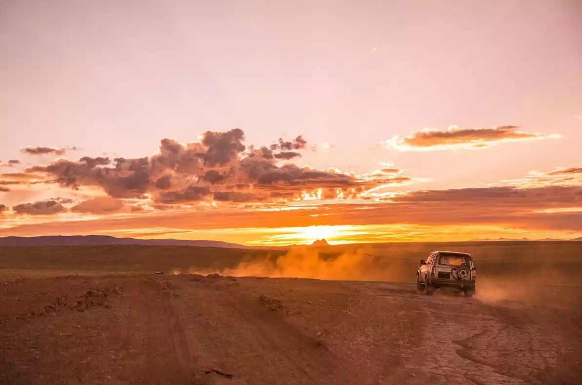
"Scenic Avenue" - Sichuan-Tibet South Line
📍Map
Overview
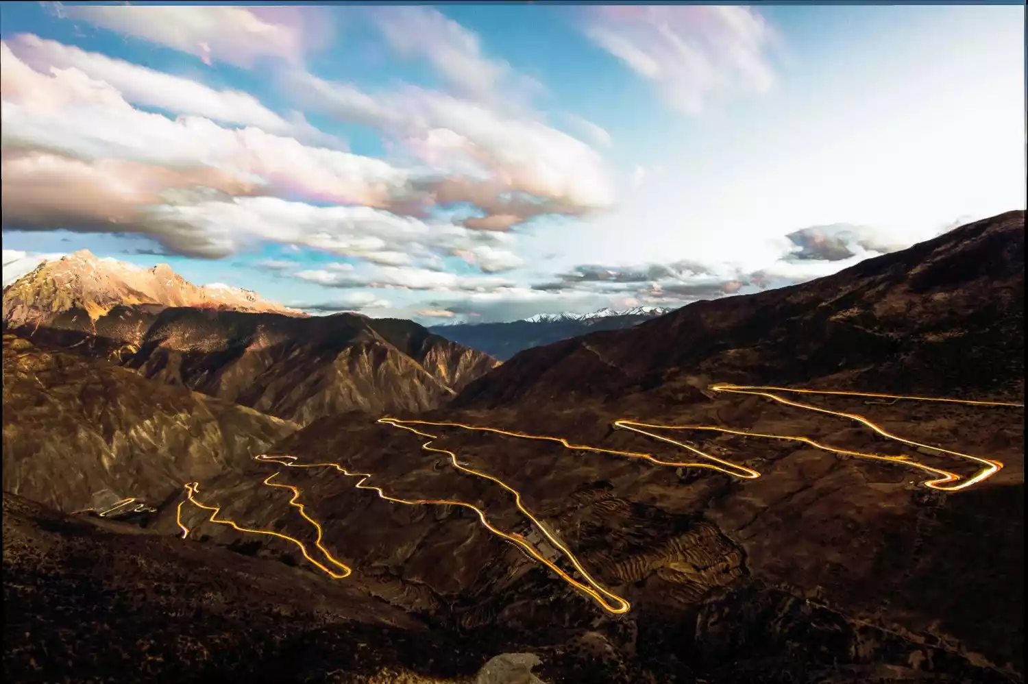
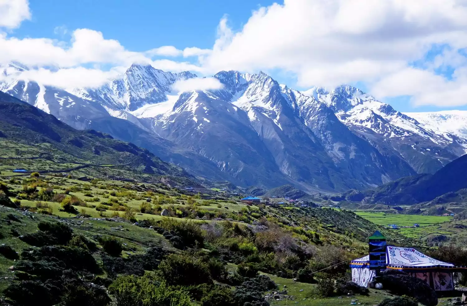
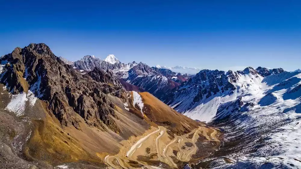
The Sichuan-Tibet South Line is about 2,140 kilometers long. It starts from Chengdu and passes through high mountains and canyons. Due to the continuous highway construction in recent years, the road conditions of the Sichuan-Tibet South Line have changed a lot. There is no need to worry too much about landslides, congestion and other problems that were once inevitable.
(Image source: Photo Network)
Scenic Road
The Sichuan-Tibet South Line is so classic that I was once confused about how to introduce it to everyone, worried that I would miss something special.
However, this highway into Tibet, which crosses the Dadu River, Yalong River, Jinsha River, Lancang River, Nu River, Yarlung Zangbo River and the famous Erlang Mountain, Zheduo Mountain and Nyainqentanglha Mountain Range, finally completely conquered me with its natural scenery.
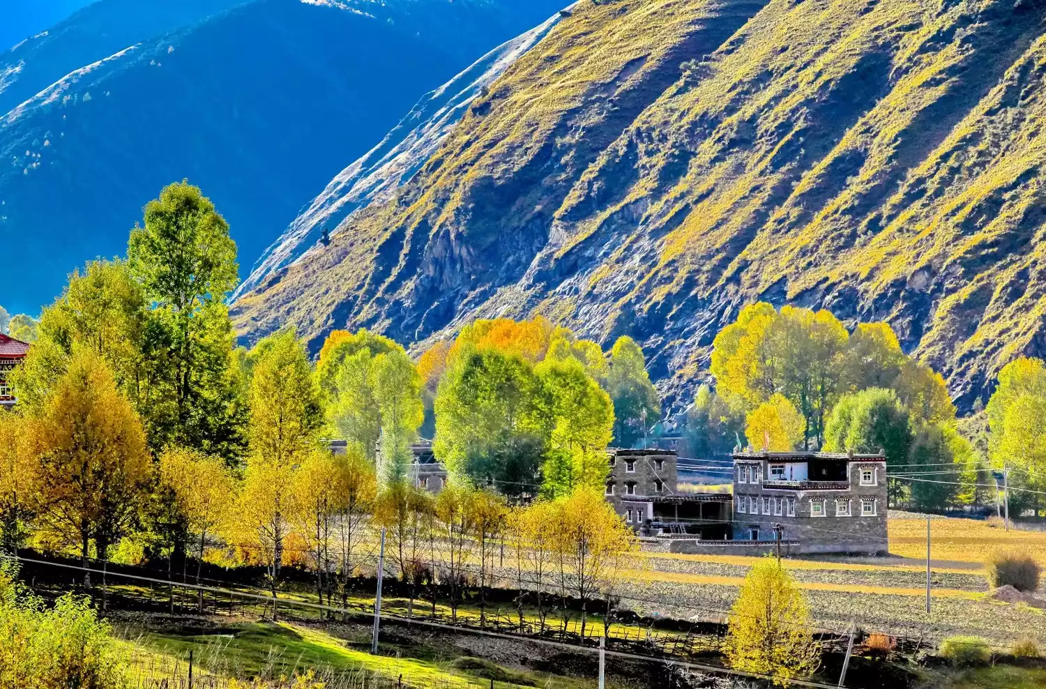
As the most popular route to Tibet, the Sichuan-Tibet South Line is known as "China's most beautiful scenic avenue". Mountains, rapids, blue sky and white clouds, secret canyons... On the Sichuan-Tibet South Line, you can see almost all the scenery you can imagine.
Xinduqiao, known as the "Photographer's Paradise", is recommended by China National Geographic as the best viewing spot for Mount Gongga.
The unique and uncommon landscapes such as the 72 bends of the Nujiang River and the Laigu Glacier will also be fully displayed.
(Image source: Photo Network)
"Religious Secret Land" - Sichuan-Tibet North Line
📍Map
Overview
The Sichuan-Tibet North Line is about 2,040 kilometers long and bypasses Chamdo and Nagqu. The road conditions are relatively poor, and almost only hardcore off-road vehicles can complete this more challenging route.
Religious Humanities
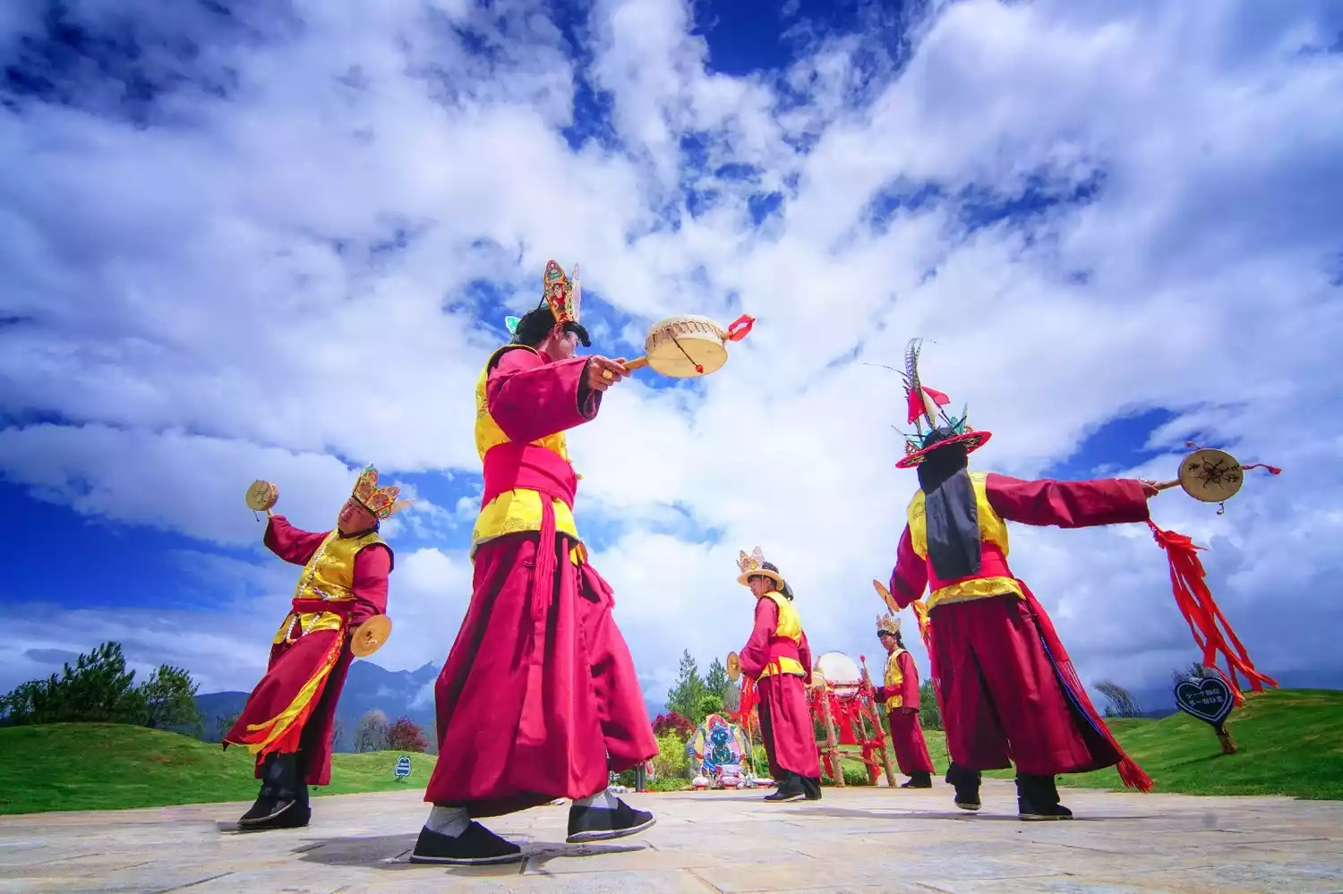
Compared to the bustling Southern Sichuan-Tibet Route, the Northern Sichuan-Tibet Route seems much more lonely, isolated and less crowded. I think the most unique aspect of this route to Tibet is its mystery, and its unique cultural landscape makes it so special.
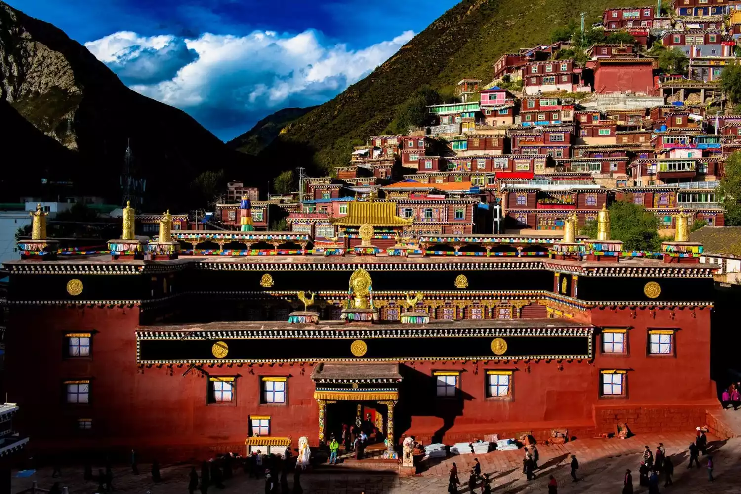
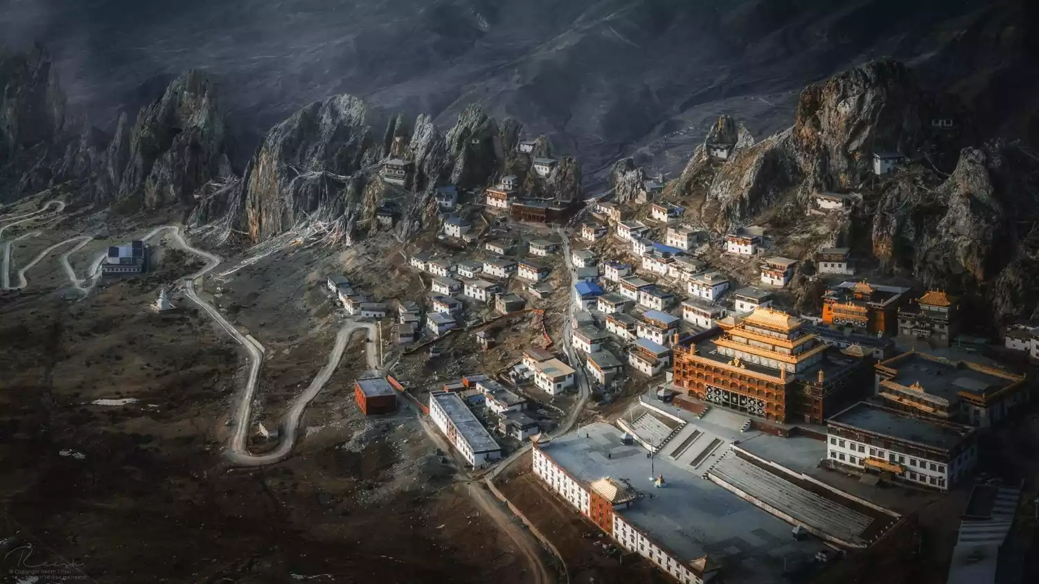
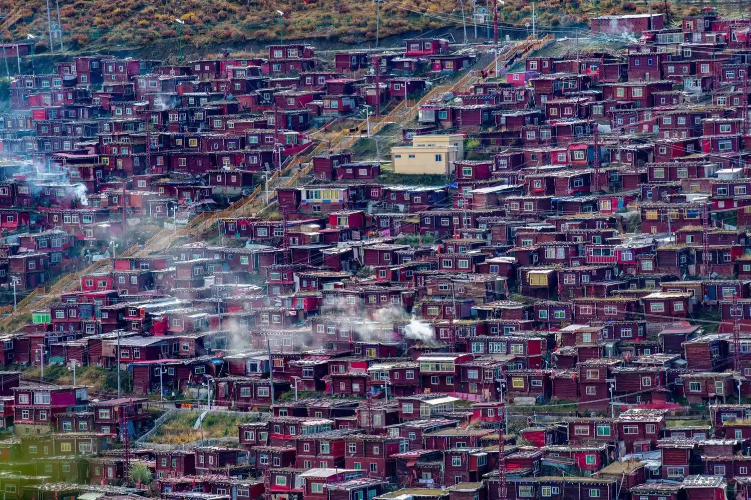
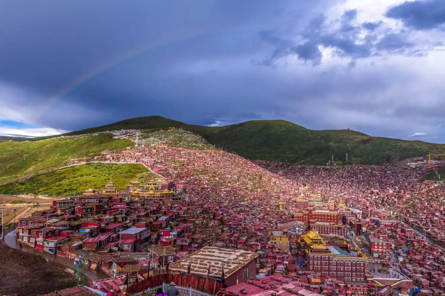
The mysterious base camp of Bon religion, Zizhu Temple, the mysterious Buga Snow Mountain deep in the secret realm, the Tibetan Buddhist kingdom of Seda and Derge Printing House... Religion and humanities are the undisputed themes of this route into Tibet.
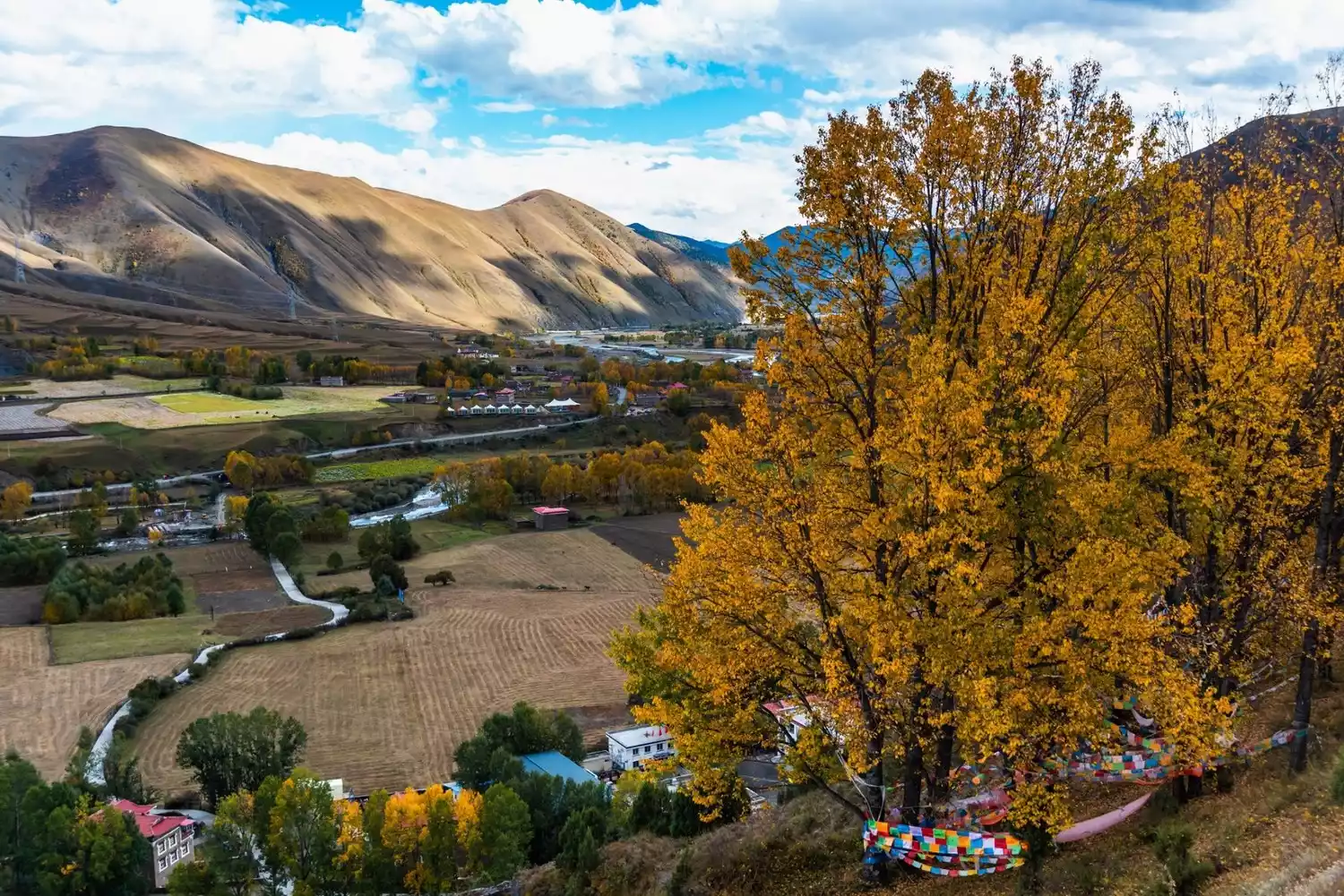
Danba is the birthplace of Jiarong Tibetans. Here, this ancient and mysterious ethnic group will be displayed in front of you in a panoramic view.
There is also China's most distinctive religious college - Seda, where densely packed monks' quarters surround several magnificent scripture halls. The start of the sky burial ceremony will bring a great shock to your heart.
There are so many surprises waiting for you to discover. Along the way, you will feel the majesty of the mountains created by the majestic power of nature, and the soul impact brought by the most primitive and mysterious religion in Tibet. All of this will be unforgettable.
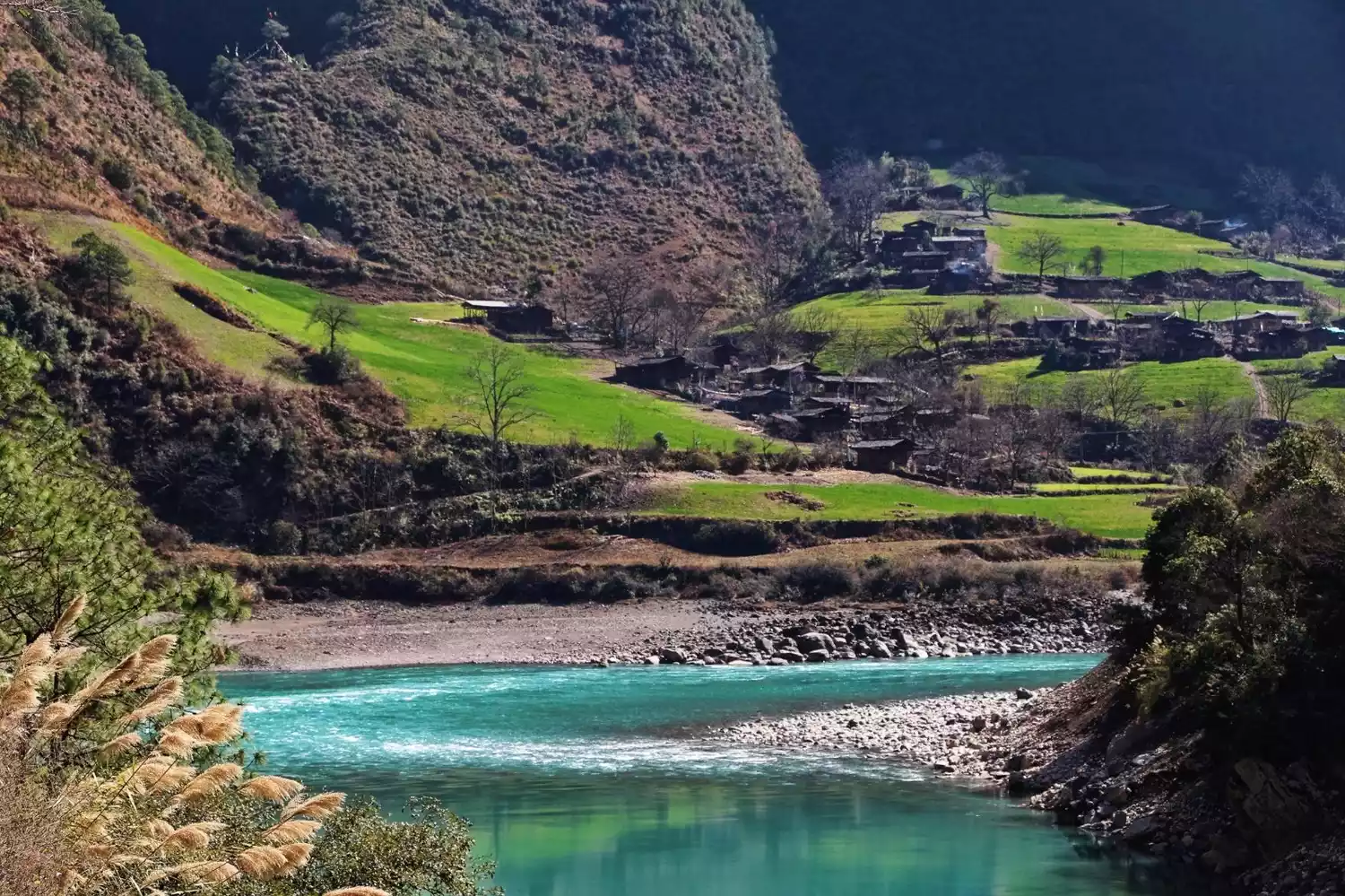
"Ethnic Customs" - Yunnan-Tibet Line
📍Map
Overview
The Yunnan-Tibet Highway, stretching 1,950 kilometers from Lijiang, Yunnan, is another classic route into Tibet. The route boasts excellent road conditions, passing through the Thaniantaweng Mountains before joining the Sichuan-Tibet Southern Highway in Mangkam County.
Meili Snow Mountain
The starting point of this route is the famous Meili Snow Mountain.
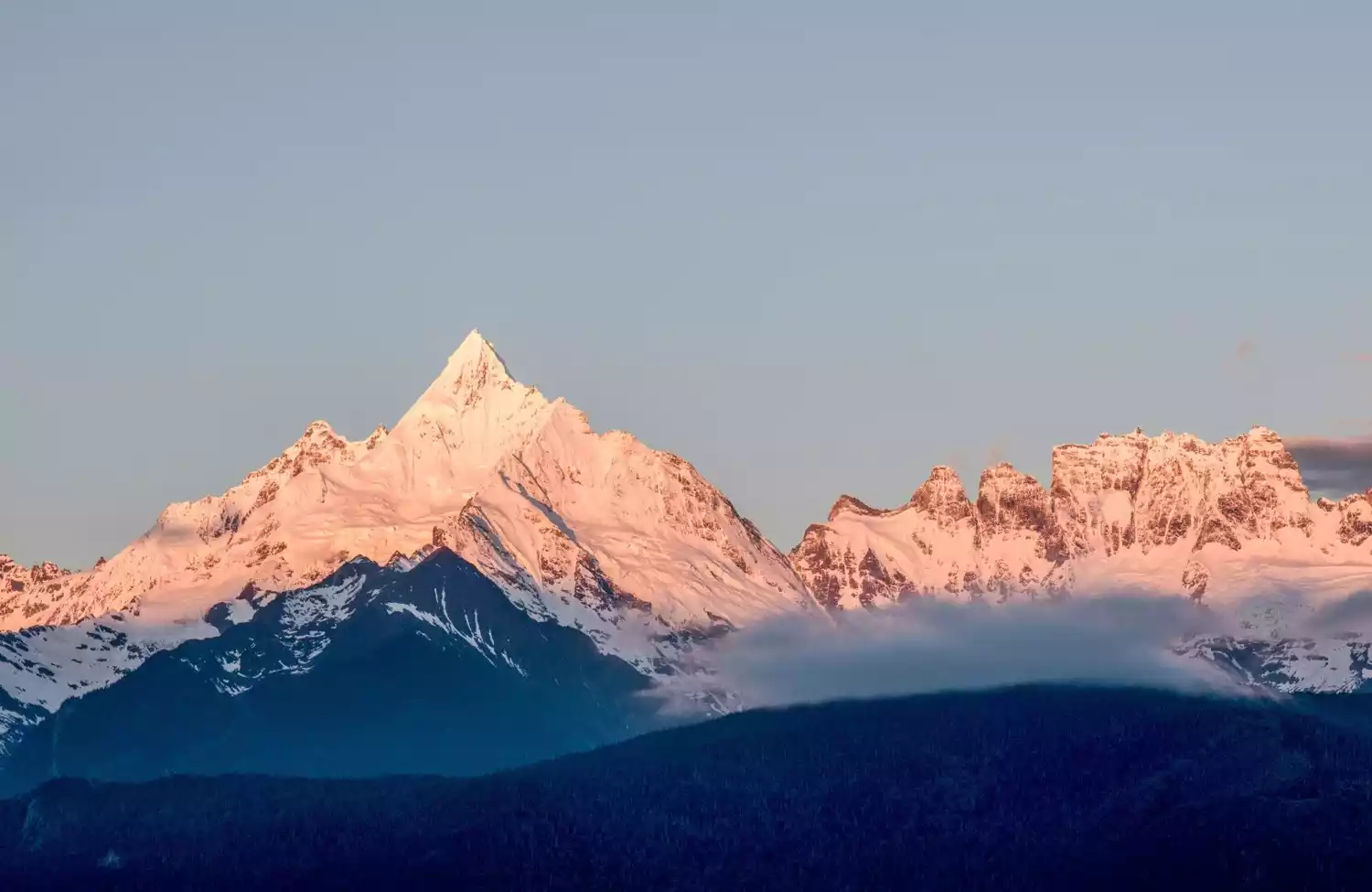
Although located inland, the Meili Snow Mountain's north-south slopes intersect with the east-west Bay of Bengal, creating an unpredictable climate year-round with constant rain and snow, making it one of the snowiest regions in China. The Lancang and Nu Rivers flow down from the mountain's base on either side.
Foreign style
Deep in the heart of Yunnan, the Yunnan-Tibet Highway is filled with Yunnan-style ethnic integration. Starting in Dali, you enter a colorful world of ethnic minorities, where beautiful houses and lively songs and dances are unforgettable.
(Image source: Photo Network)
There are many ethnic groups in Dali, including Tibetan, Miao, Naxi, etc., as well as Tibetan residences and Tibetan people with unique characteristics.
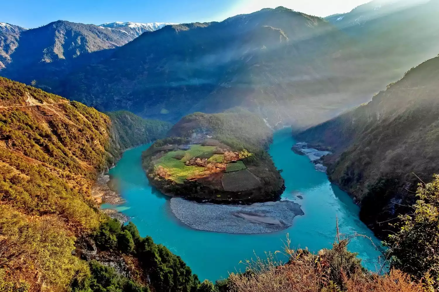
"Highway Cross-Country" - Bingchacha Line
📍Map
Overview
Another route to Tibet from Yunnan is the 1,900-kilometer journey from Dali to Lhasa via Bingchacha. Bingchacha is not a place name, but rather the abbreviation of Bingzhongluo, Chawalung Township, and Chayu.
Top off-road trails
When I first heard about this route, I remembered its extremely domineering title: "The most difficult road to Tibet". Bingchacha used to be almost the most desirable place for Chinese off-road enthusiasts, a place full of challenges and unknowns.
Gravel, potholes, rocks, landslides, quicksand, and rolling stones are scattered throughout the route. It is difficult to get food and accommodation along the way, and it is inconvenient to resupply. Countless difficulties await those who challenge this route.
Between Gaoligong Mountain and Nujiang River, Bingchacha goes deep into the canyon. The narrow and rough muddy road on the cliffs can only be passed by brave and careful experienced drivers.
Nujiang Grand Canyon is the longest, most mysterious, most beautiful, dangerous and most primitive canyon in the world.
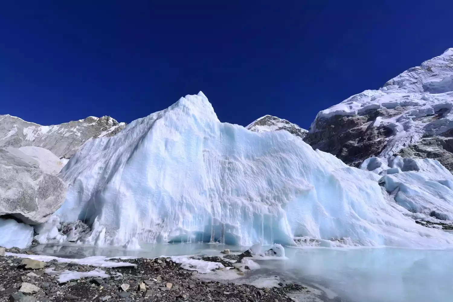
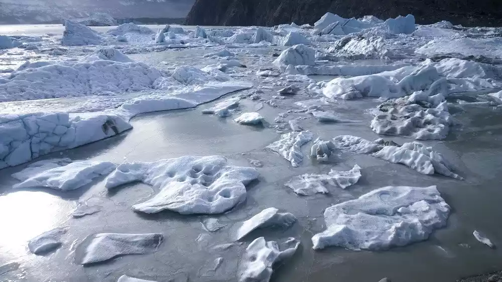
After successfully passing the most painful section of Bingchacha, coming to the ancient glacier is a reward for the successful.
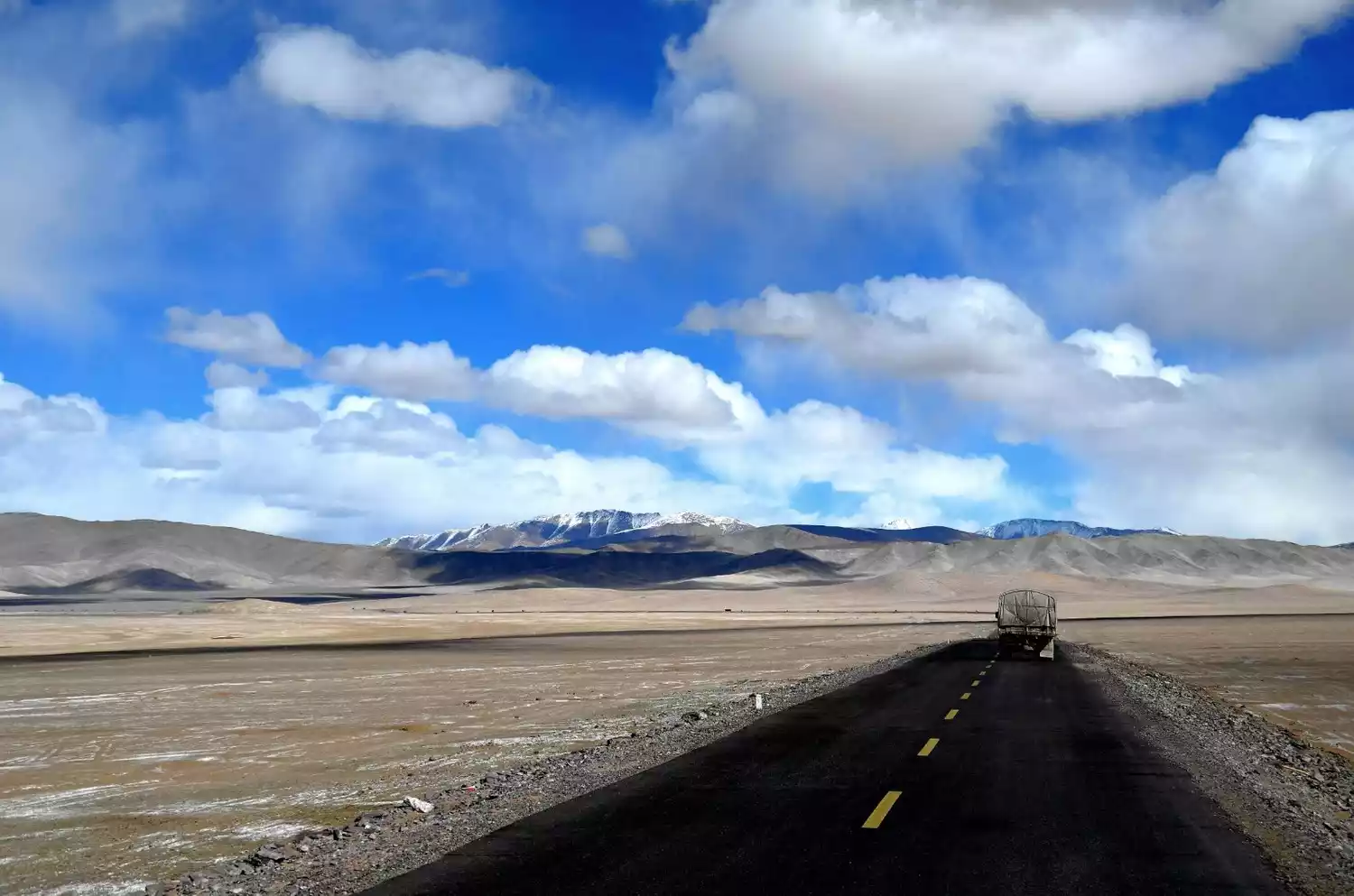
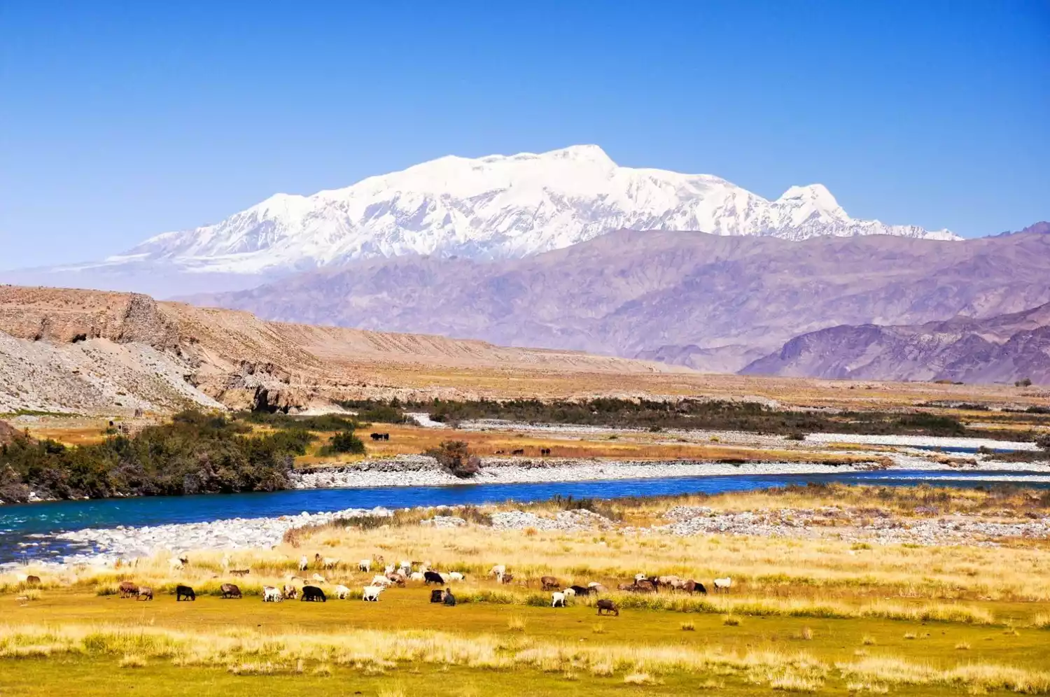
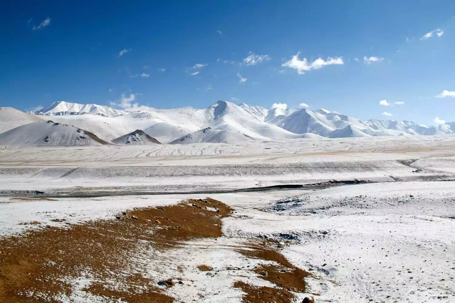
"Desolate and Uninhabited" - Xinjiang-Tibet Highway
📍Map
Overview
The Xinjiang-Tibet Highway is a road that challenges the limits of human endurance. While the road conditions aren't particularly bad, the 2,750-kilometer journey is still considered the loneliest, most desolate, and most dangerous.
(Image source: Photo Network)
Crossing mountains and rivers
Over the course of just a few days, at an average altitude of over 4,500 meters, the journey saw a dramatic rise in elevation from 1,300 to 6,000 meters. Along the way, we traversed five mountains over 5,000 meters, crossed 16 glacier passes, and crossed 44 glaciers. Famous mountain ranges like the Kunlun Mountains, the Karakoram Mountains, the Gangdise Mountains, and the Himalayas appeared before us one after another.
(Image source: Photo Network)
Ali No Man's Land
In addition to the altitude, what is even more terrifying is the long-distance crossing of uninhabited areas.
On the Xinjiang-Tibet Highway, there are often no human settlements for hundreds of kilometers. Long sections of the journey are extremely lonely, with deserts, Gobi, flying dust, and howling winds. There is no trace of life. Only the road under the wheels and the occasional passing trucks can remind us that this is still Earth.
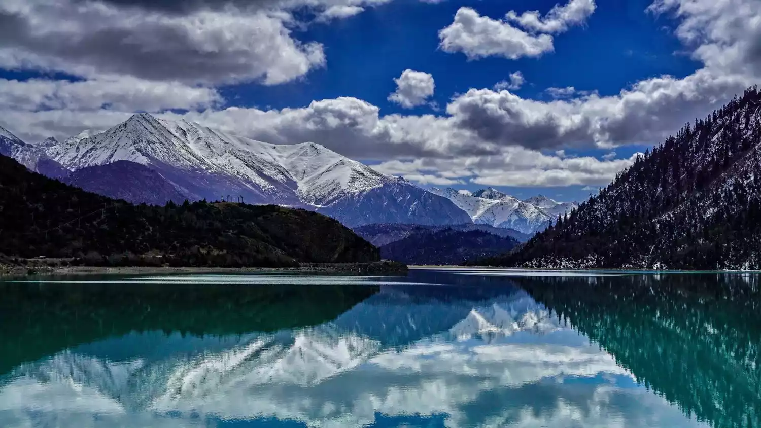
Countless plateau lakes dot the boundless Gobi Desert. After crossing the famous Jieshan Pass, the lakes of northern Tibet suddenly appear before your eyes. The Ali uninhabited area is dotted with tens of thousands of plateau lakes, one after another: Pangong Lake, Manasarovar Lake, and Laang Lake.
"Bird and Beast Paradise" - Qinghai-Tibet Highway
📍Map
Overview
From the world-famous Qinghai Lake to the sky-high Chaka Salt Lake, the legendary Kunlun Mountains, and the vast Hoh Xil, the 1,900-kilometer Qinghai-Tibet Highway brings people a different kind of expectations.
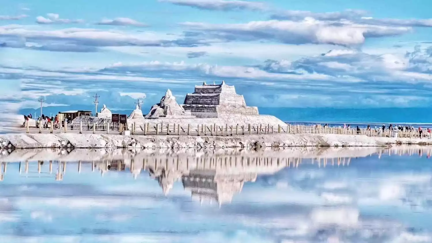
Chaka Salt Lake
The Qinghai-Tibet Highway begins at the renowned Chaka Salt Lake. Its vast expanse shimmers with silver waves. Amidst the vast expanse of white clouds, towering mountains loom in the distance, the blue sky, white clouds, and snow-capped peaks are reflected in the lake. Here, the colors are pure: the grasslands a vast and tranquil yellow, the snow-capped mountains a continuous white, and the sky a boundless azure.
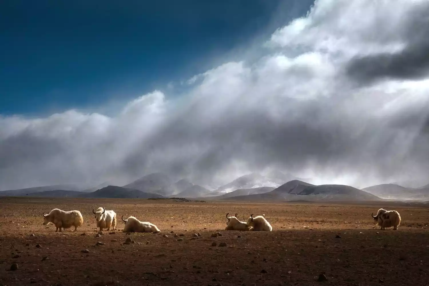
Hoh Xil
Unlike the Xinjiang-Tibet Highway, which is considered a forbidden zone for life, the Qinghai-Tibet Highway's attitude towards life can only be described as paradise. The existence of the Hoh Xil Nature Reserve has made this area increasingly prosperous, with black-necked cranes, Tibetan wild donkeys, blue sheep, wild yaks, and countless other animals thriving here.
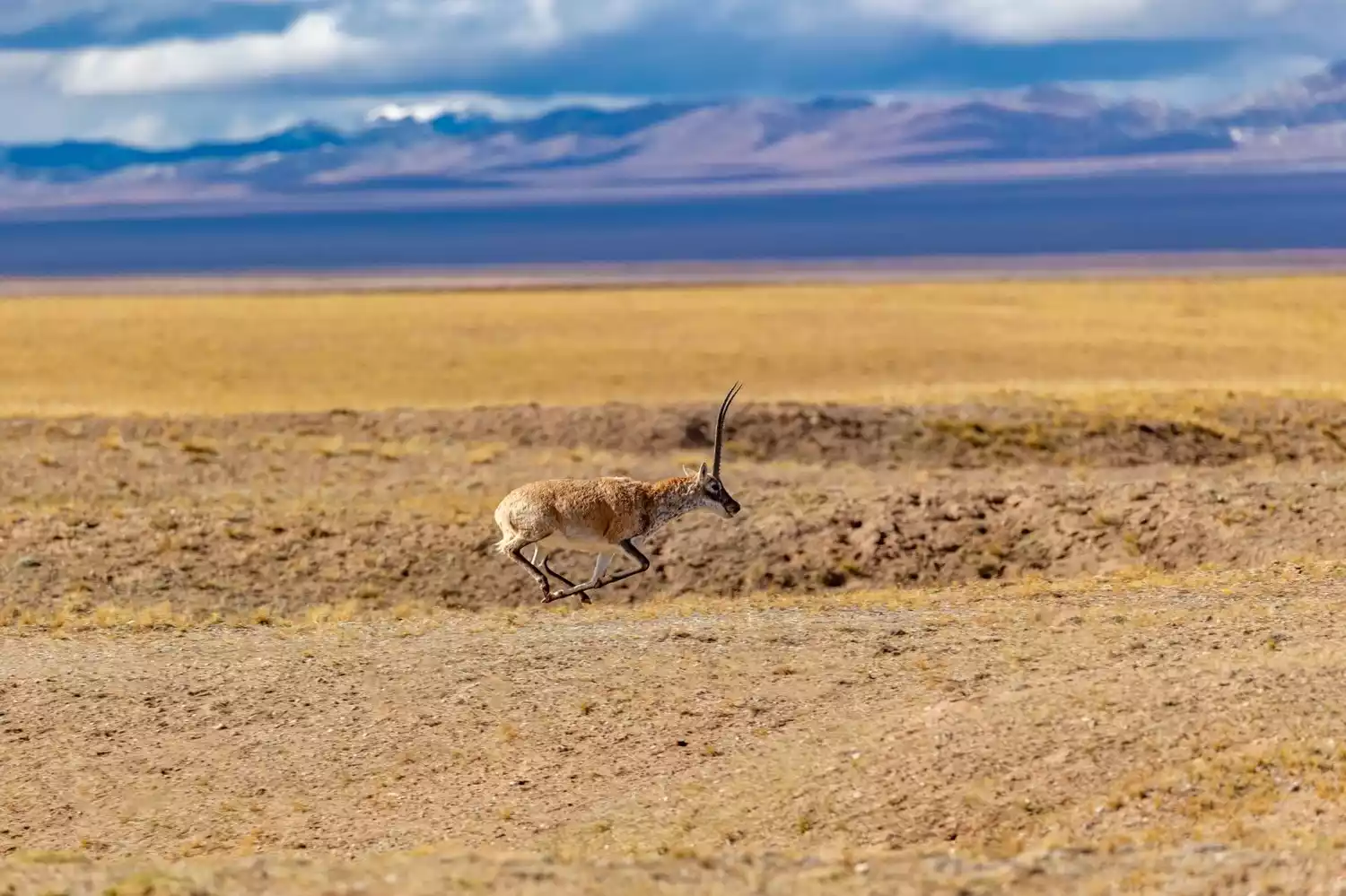
The most famous animal among them is undoubtedly the Tibetan antelope. Thanks to years of unremitting protection, the number of Tibetan antelopes has exceeded 60,000. This very distinctive animal, with its huge and black horns, runs on this clean land. It is a veritable snow elf.
"Exploring History" - Tang-Tibet Ancient Road
📍Map
Overview
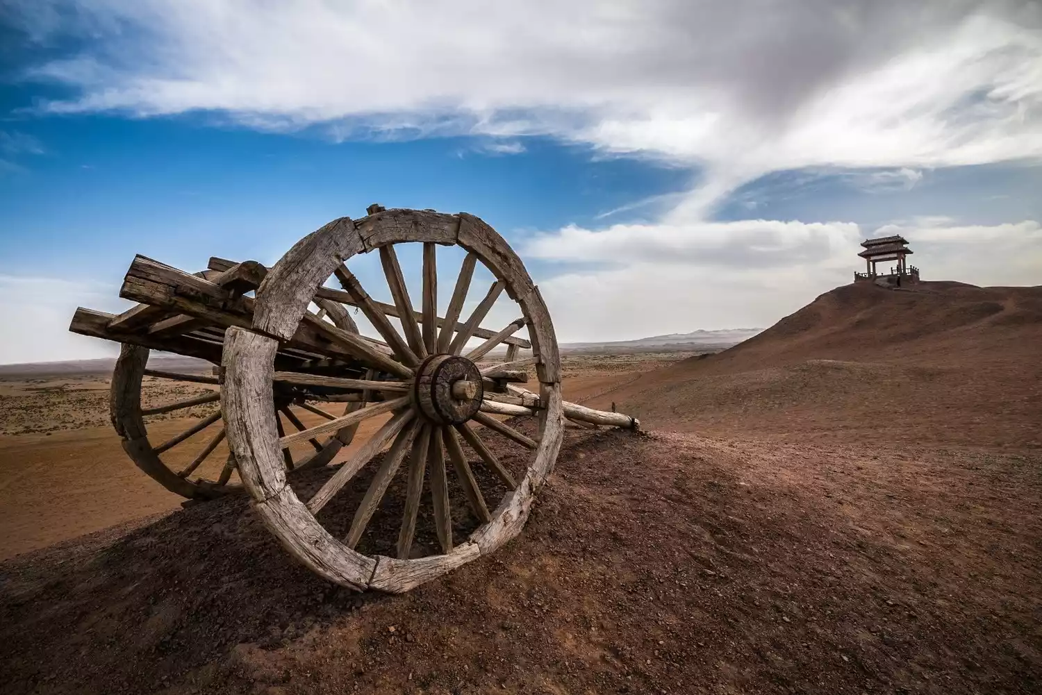
This is the oldest route into Tibet, 2,150 kilometers long, with a maximum altitude of 4,929 meters, starting from Yinchuan City.
Princess Wencheng's Journey to Tibet
More than 1,300 years ago, in order to improve the relationship between Han and Tibetans, a 16-year-old girl traveled for three years from the warm and fertile Guanzhong Plain, traversing four provinces of Shaanxi, Gansu, Qinghai and Tibet, climbing over mountains and overcoming altitude sickness and severe cold, conquering 3,000 kilometers, and came to the high and dry Tibetan Tubo Kingdom to marry a princess.

(Image source: Photo Network)
Even with paved roads, off-road vehicles, and modern communications and navigation technology, reaching Tibet is still not an easy task. Princess Wencheng's greatness will be forever remembered on this thousand-year-old ancient road.
(Image source: Photo Network)
Animaqin
Another gift from the Tang-Tibet Road is the Amnye Machen Snow Mountain. Composed of 13 connected peaks rising 5,900 meters above sea level, Amnye Machen is also the dojo of Avalokitesvara Bodhisattva and is considered one of the four sacred mountains of Tibetan Buddhism, along with Mount Kailash in Tibet, Mount Meili in Yunnan, and Gaduo Jowo in Yushu.
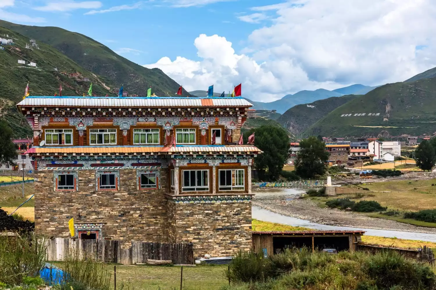
The Tang-Tibet Ancient Road, which merged with the Northern Sichuan-Tibet Line in Chamdo early on, also has an innate religious and cultural atmosphere. The mysterious Bon religion welcomes the travel-weary guests on the Tang-Tibet Ancient Road here.
"Original Exploration" - Zaduo Line
📍Map
Overview
Zaduo line is the most primitive and mysterious line that is still little known to people.
This route starts out together with the Tang-Tibet Ancient Road, passes through Yushu and then moves towards Zaduo County, then crosses the Tanggula Mountains and merges with the Sichuan-Tibet North Line.
Primitive Exploration
Thousands of years ago, the Tang-Tibet Ancient Road, a crucial component of the Silk Road, snaked along the Lancang River in Zaduo. The diverse ethnic groups living along the river coexisted for generations, thriving and flourishing. Millennia later, in Zaduo, they continue to live a beautiful chapter of life alongside the river, with their diverse lifestyles and cultures. As the most pristine and least-known route into Tibet, the Zaduo route has meticulously preserved its pristine cultural heritage.

(Image source: Photo Network)
"High Mountain Realm" - China-Nepal Highway
📍Map
s
Overview
This route is relatively more special.
Starting from Kathmandu, passing through the Gyirong Port, and heading east along National Highway 318, the 940-kilometer road is not long, but it truly concentrates the most densely populated extremely high mountain landscapes on the earth.
Jilong Port
The Gyirong Port is a channel for China-Nepal border trade. It is located in Reso Village, Gyirong Town, Gyirong County, Shigatse Prefecture, and is adjacent to the Zhangmu Port across the mountains.
Because it is located on the border, the exotic buildings, the Nepalese vehicles shuttling back and forth, and the Nepalese men and women passing by all show the prosperity of the border town.
The Kingdom of the Extreme Mountains
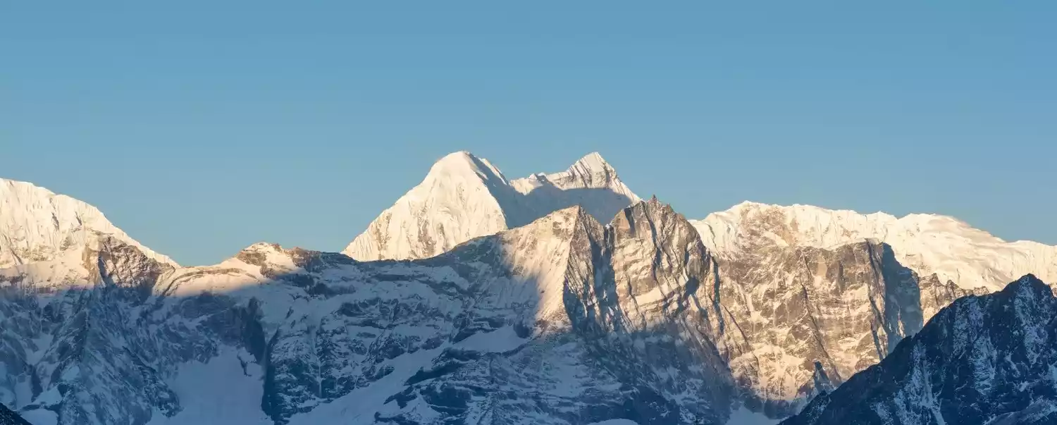
Nine of the world's 14 snow-capped mountains over 8,000 meters tall flank this remarkable highway. Mount Everest, Shishapangma, Annapurna, Kanchenjunga...all the planet's most majestic peaks will unfold before your eyes all at once. Travel the China-Nepal Highway and cross the Himalayas on wheels.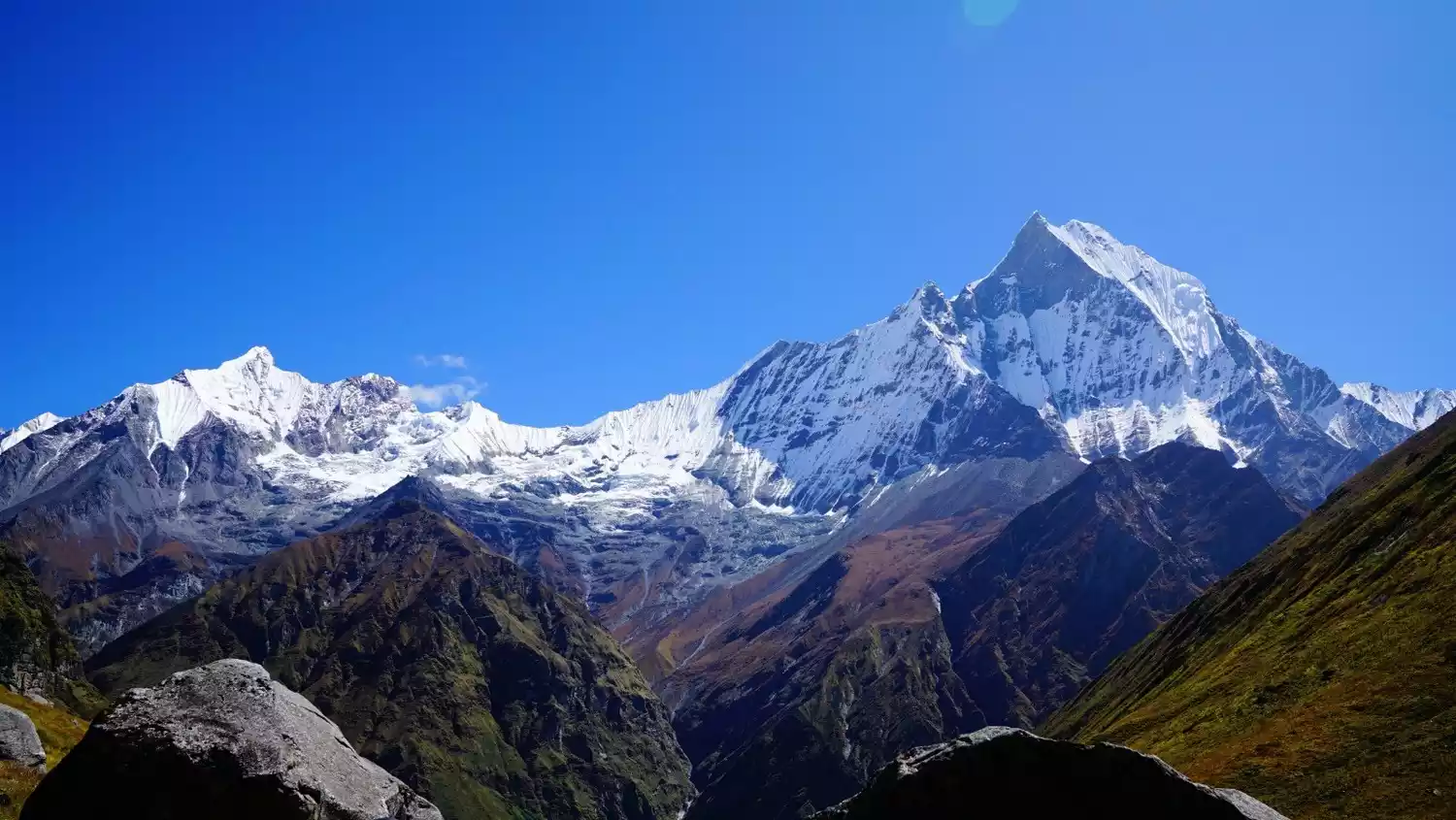
Conclusion
There are so many stories happening in this magical land of Tibet. There may be ten thousand ways of entering Tibet for ten thousand people. Look here to find the way to Tibet that suits you best.