Recommended China road trips! 12 western highways, featuring hidden gems and rarely-visited destinations!
Preface
Road trip, these four words are almost synonymous with freedom and adventure, and just looking at them makes one’s blood boil!
If you're a travel enthusiast and the "old internet-famous" 318 Highway isn't enough, take a look at these 12 lesser-known highways in western China. Some aren't even marked on maps. Explore and adventure like a true explorer! Every photo along the way will be a masterpiece, and you'll experience the most pristine, wild, and stunning scenery!
northwest
Wave Highway-China's Loneliest Highway
G315 starts from Xining in the east and ends in Kashgar in the west, with a total length of 3,063 kilometers. The freedom of travel and one's own insignificance are fully reflected on such a road, so G315 is also known as "China's loneliest road."
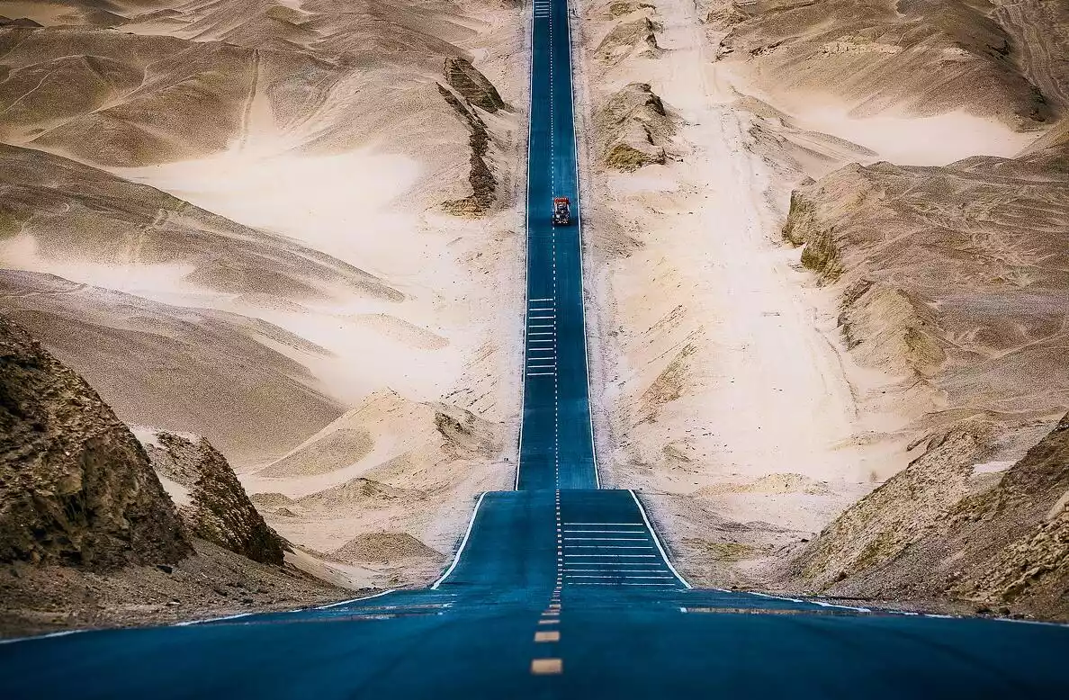
This time, we'll focus on the section from Xiaochaidan Lake to the Water Yadan, along the wavy road. As you drive to the highest point, you can feel the sensation of a road soaring into the sky.
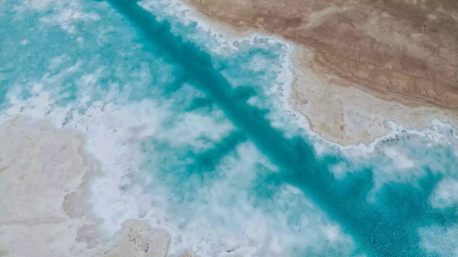
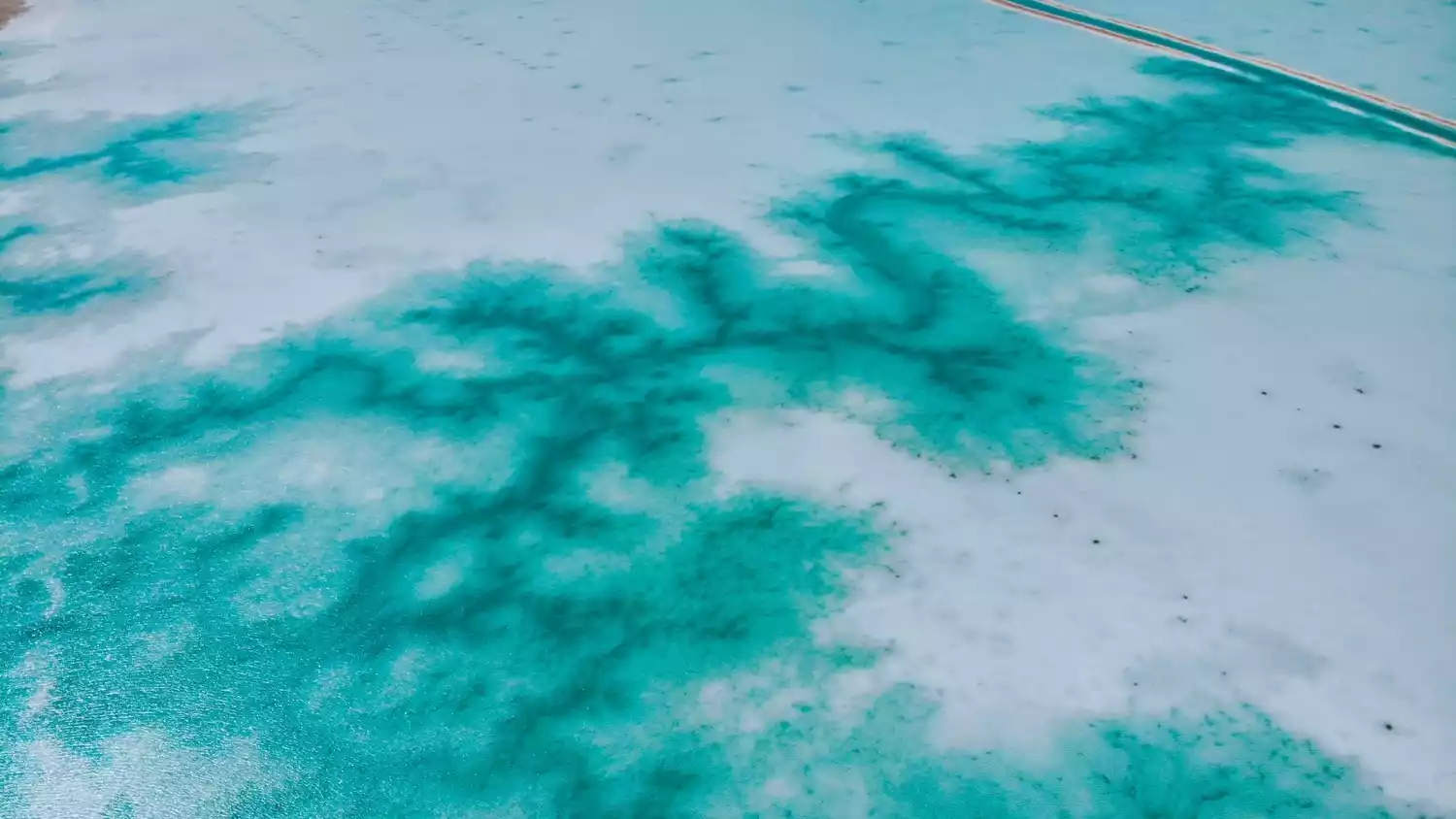
Before arriving at the Water Yadan, you will also pass by the recently popular "Northwest Maldives" - Dongtaijinaier Lake. The color of the lake water is as shining as "Tiffany Blue", and the beautiful scenery of the surrounding water and sky will make tourists feel that the trip is worthwhile.
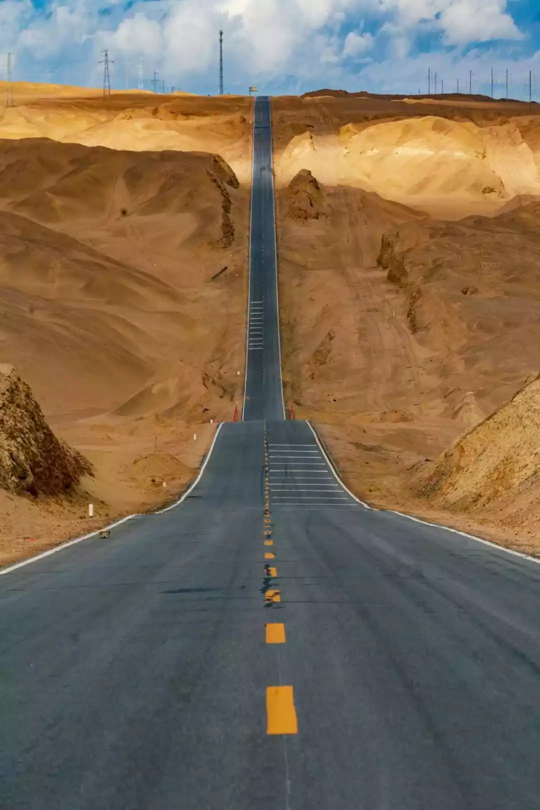
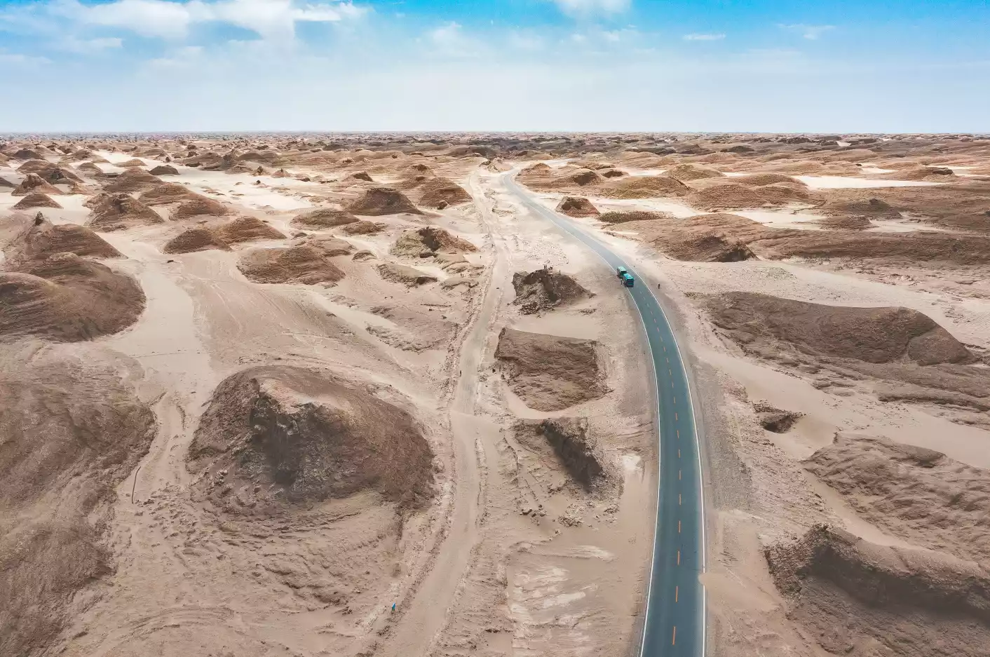
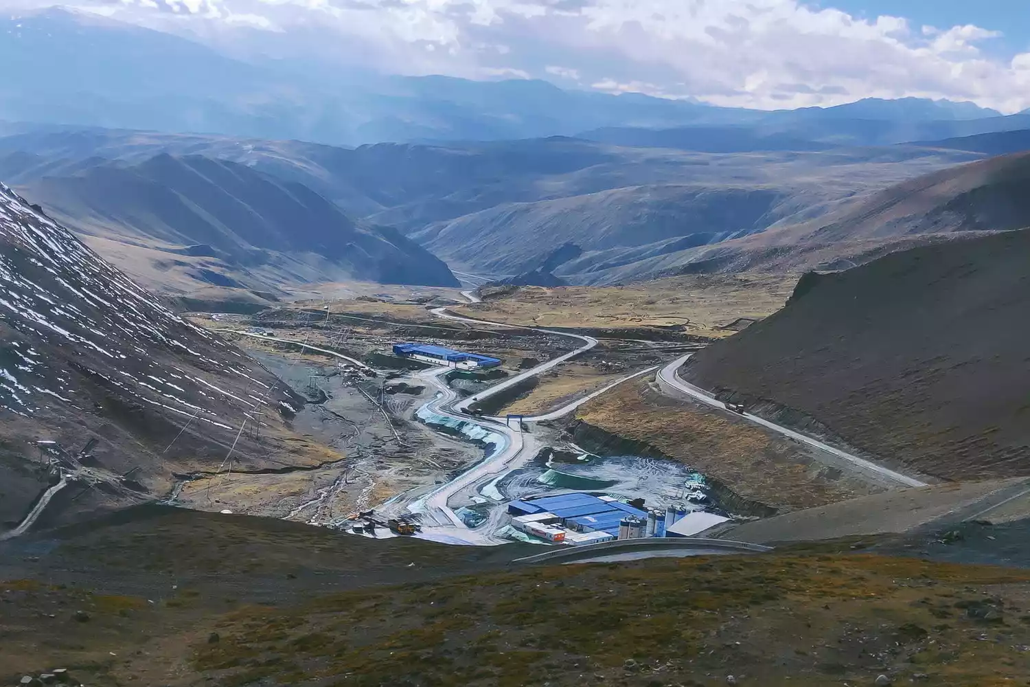
Mars Highway 1-Yardang Scenic Avenue
It starts between the 953km and 954km signs on G315 National Highway and ends at the ruins of the No. 5 Oil Base in Lenghu. It is 88km long, so it is also called "Mars Highway 88".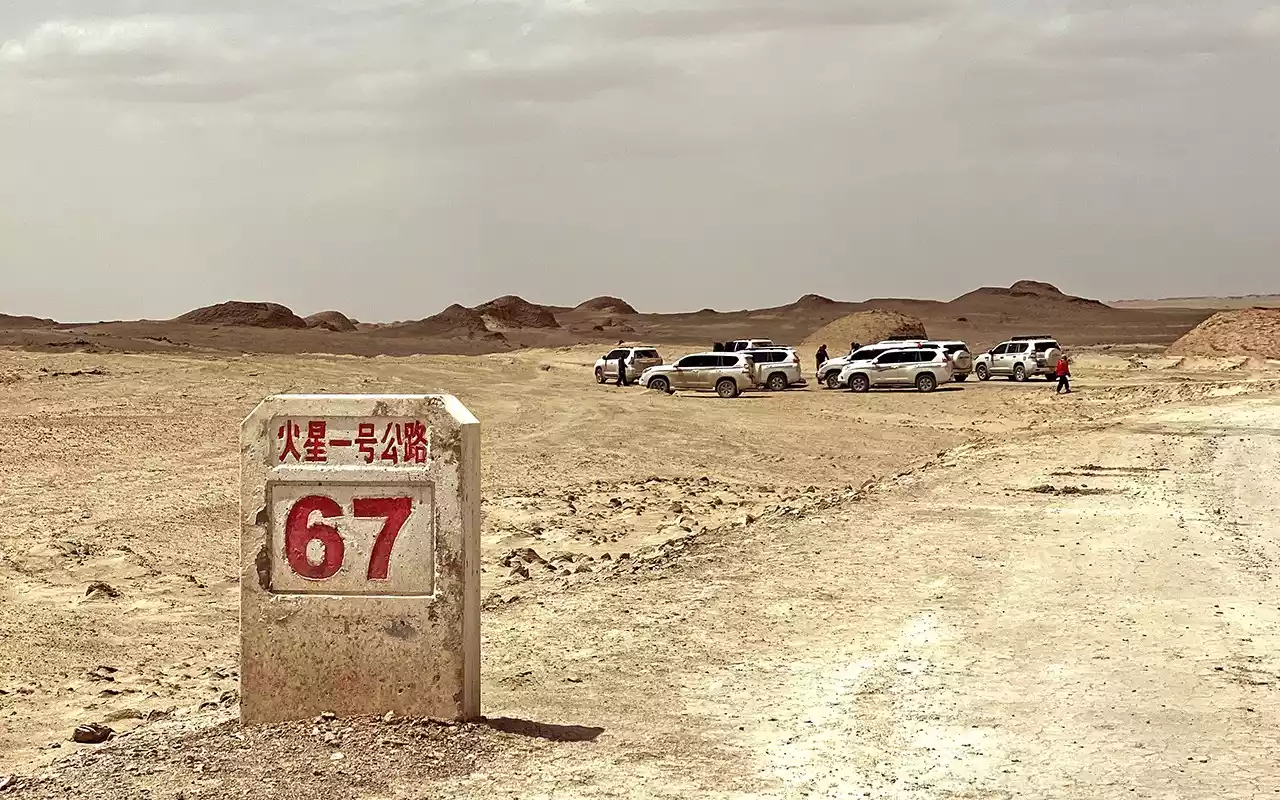
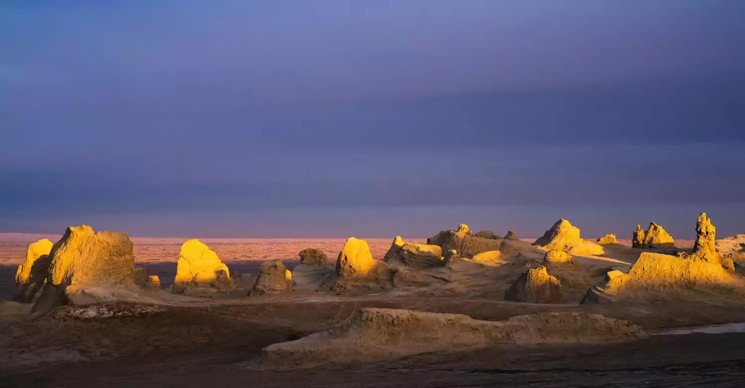
After officially entering Mars Highway 1, the yardang group began to appear, like a group of whale backs on the sea. The deeper you go, the larger the whaleback-shaped yardangs become and the denser their arrangement, which is why people call them "whaleback-shaped yardangs".
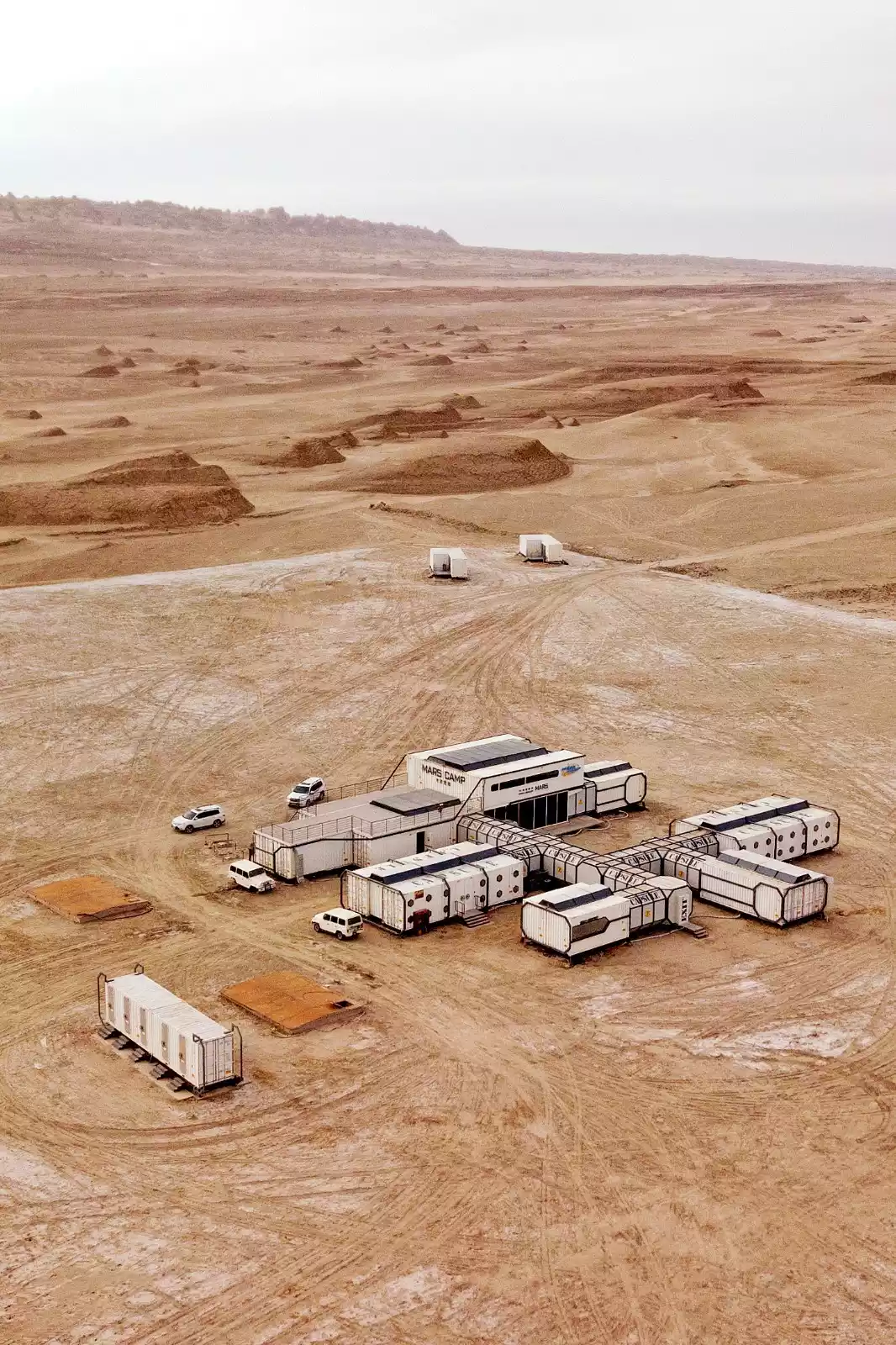
Passing through the mysterious and sci-fi Mars base, and continuing deeper, the landforms of the Yadan are more diverse. One of the forks in the road can also lead to the Eboliang Yadan. Mars Highway 1 can be said to be the most spectacular Yadan landscape avenue.
Depart from Xining | 7 days and 6 nights
7-Day Off-Road Adventure: Mangya Secret Realm | Explore Eboliang Ghost City and Aiken Spring!
¥6980 from 1231 people have registered Register nowShangri-La Holy Road - Stunning Western Sichuan Scenery
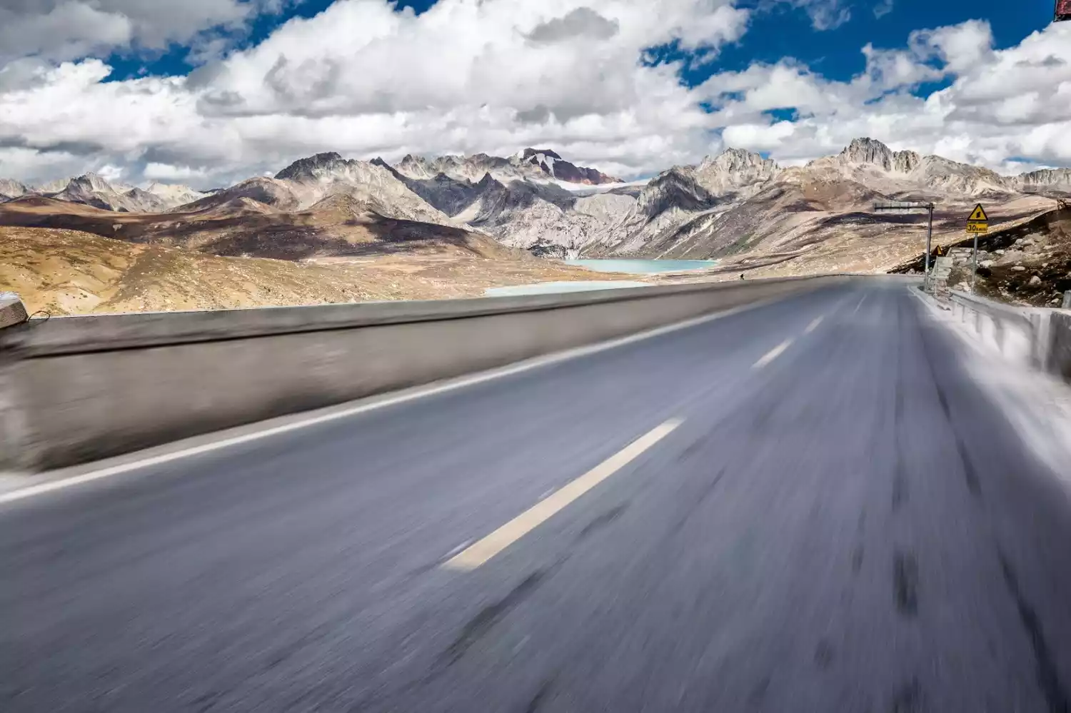
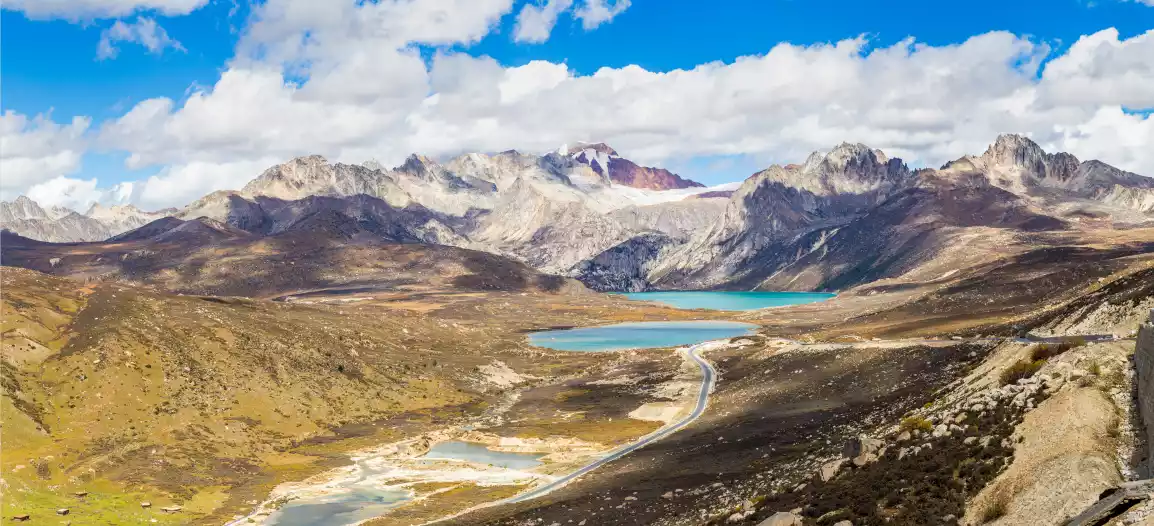
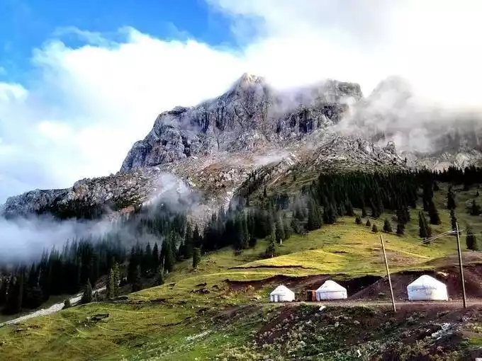
Before talking about the Shangri-La Holy Road, we have to mention Haizi Mountain first. It is located in the middle section of the Shaluli Mountains, with an average altitude of more than 4,500 meters. It is the area with the most concentrated distribution of lakes in the entire Shaluli Mountains and even the entire Hengduan Mountains. There are more than 1,200 lakes of various sizes.
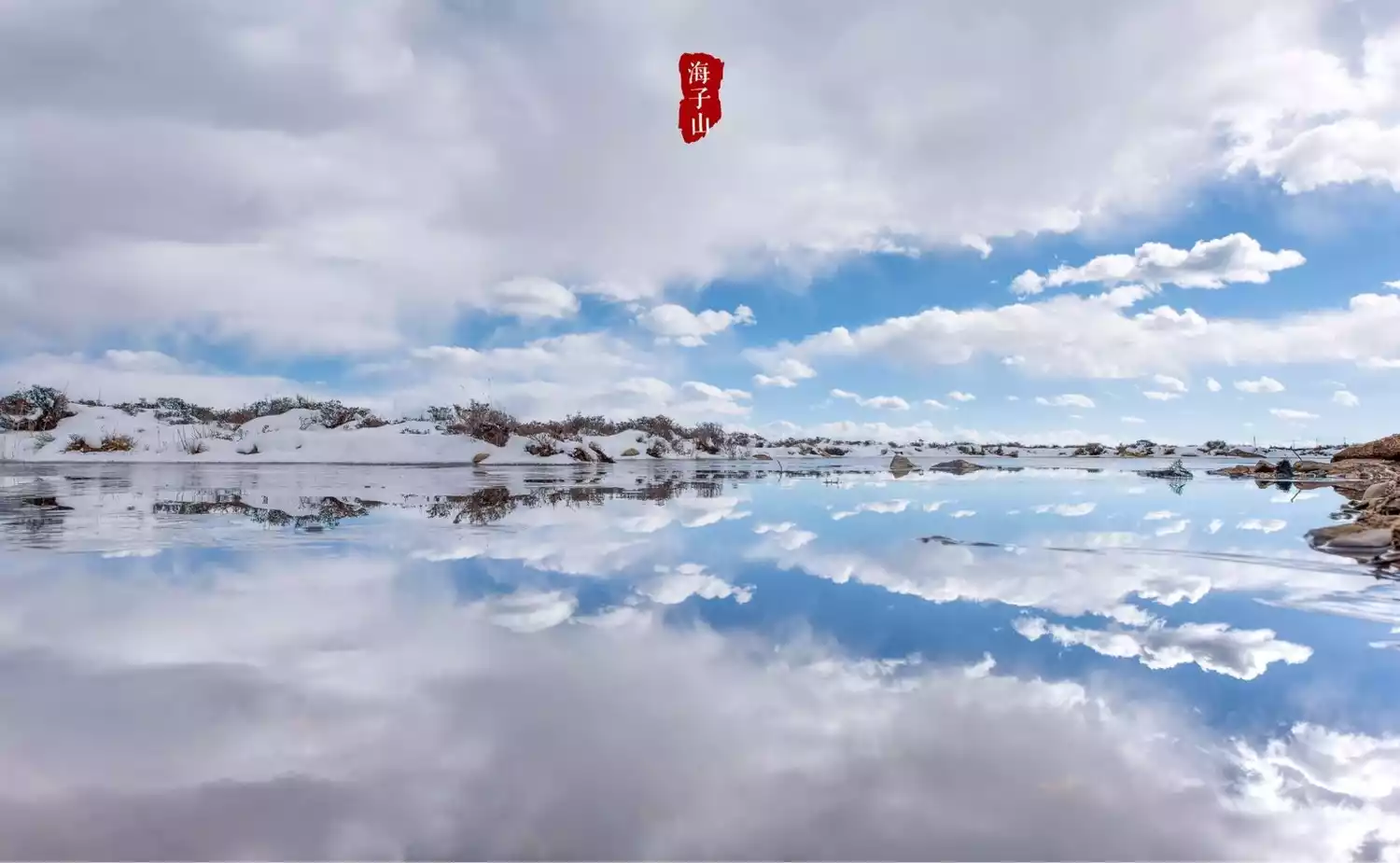
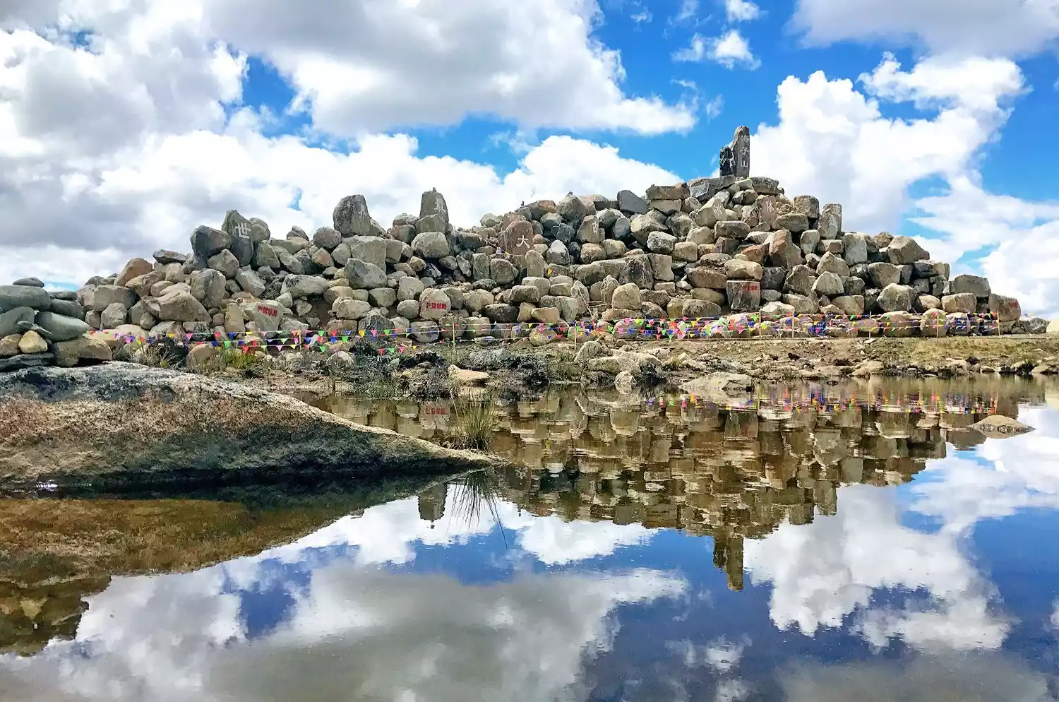
Entering Haizi Mountain, you will see a desolate and bleak scene. Huge rocks cover the mountain streams, interspersed with some bushes and meadows. There is no grass on the upper part of the mountain, only hideous stones on the hillside.
In the Haizi Mountain, which is as desolate as the surface of the moon, a scenic avenue known as the "Shangri-La Holy Road" passes through it. When you walk down the Haizi Mountain, Daocheng Yading is in sight.
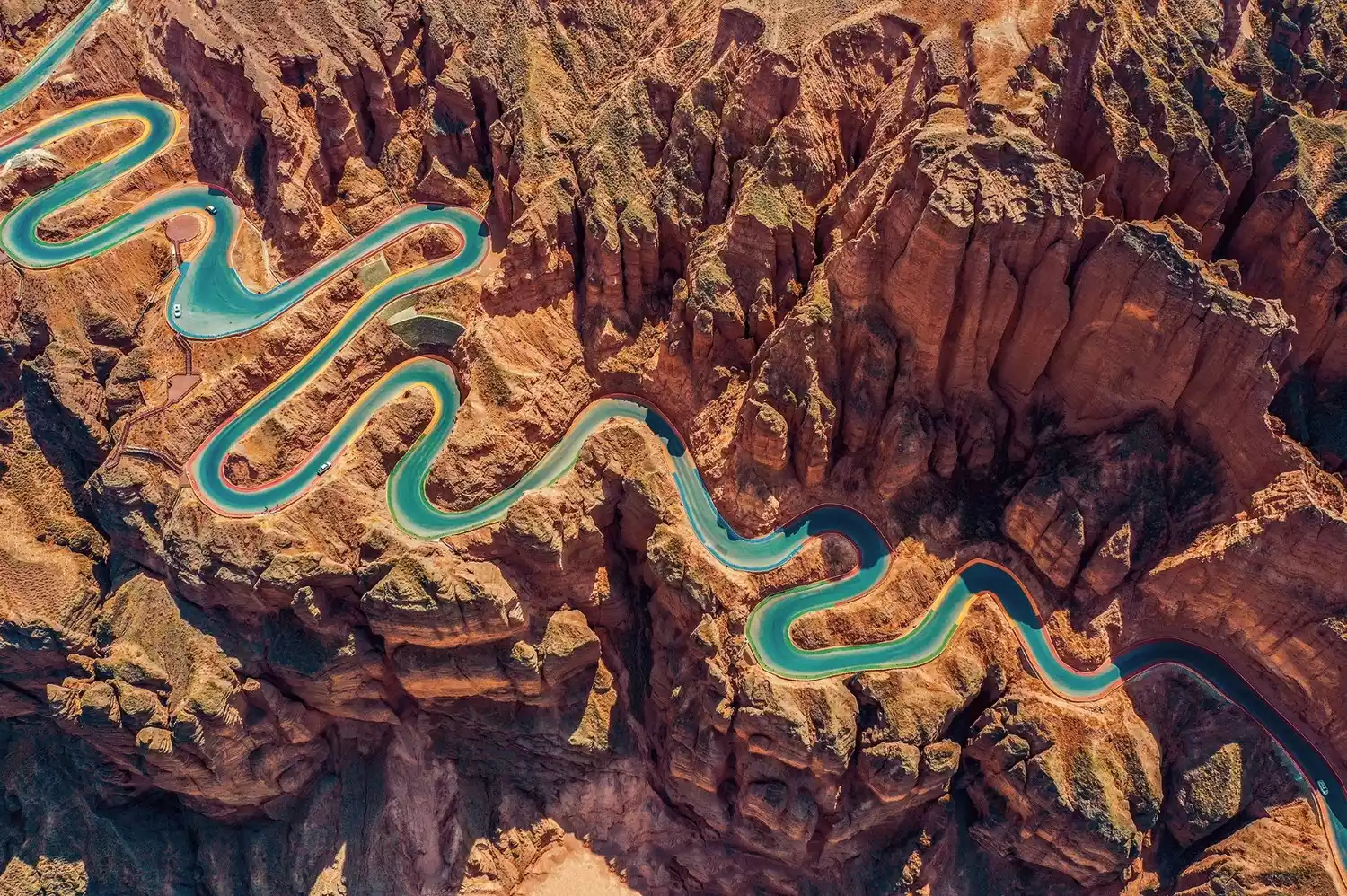
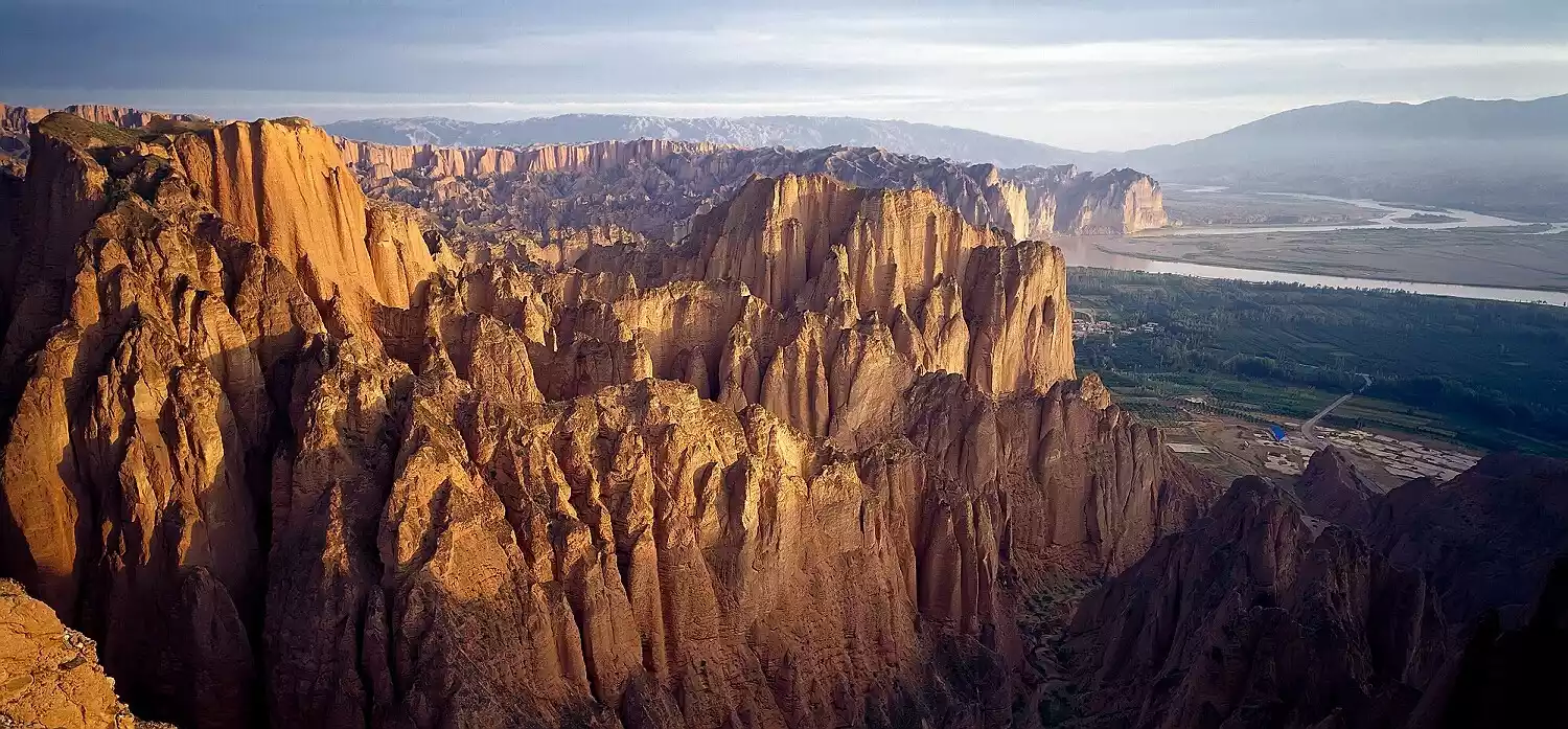
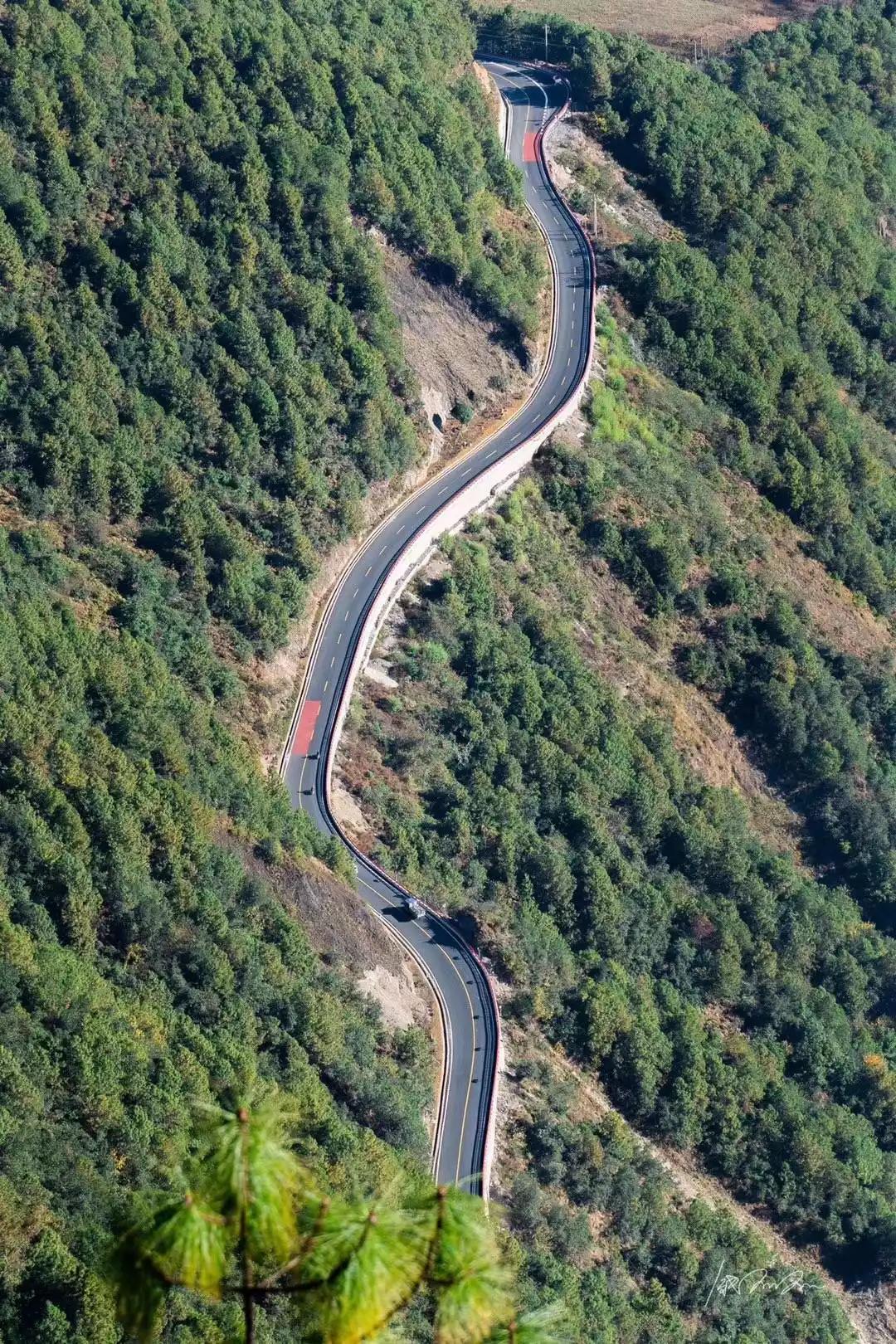
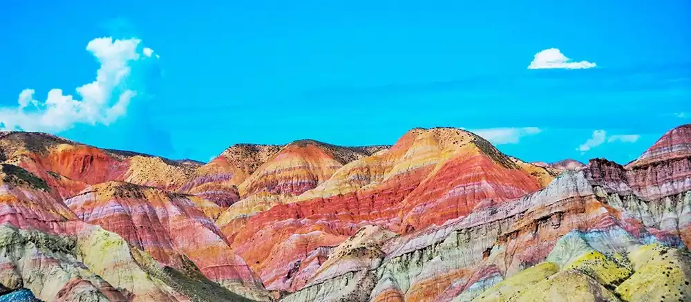
Yellow River Stone Forest Highway-Stone Forest Wonders
This is the only way to the Yellow River Stone Forest National Geopark. The road is extremely winding. When driving on it, the towering stone forest on the side seems to block out the sky.
The shoulders on both sides of the highway are paved with ceramics in five colors: red, blue, green, yellow and orange. From the air, it looks like a colorful avenue embedded in the barren stone forest, making the road itself a beautiful landscape.
Drive across the highway and arrive at Longwan Village, an ancient village on the bank of the Yellow River. Take a sheepskin raft on the turbulent Yellow River and drift in it, soaring over the vast expanse of water.

Take a donkey cart ride in the Yinmagou Canyon, sit on the gorgeously cushioned floor, and look sideways up at the canyon, which is like a gallery.
Tibet
China-Nepal Highway-Transnational Scenic Avenue
The China-Nepal Highway connects China's Tibet and Nepal. It starts from Lhasa, passes through Shigatse and Lhatse County (National Highway 318), then splits into two east-west branches, and finally reaches Kathmandu, the capital of Nepal.
The journey is not only full of challenges, but also includes the sacred lake Yamdrok Lake, the majestic Mount Everest, the glorious history of Sakya, the difficult journey and the joy of reaching the destination.
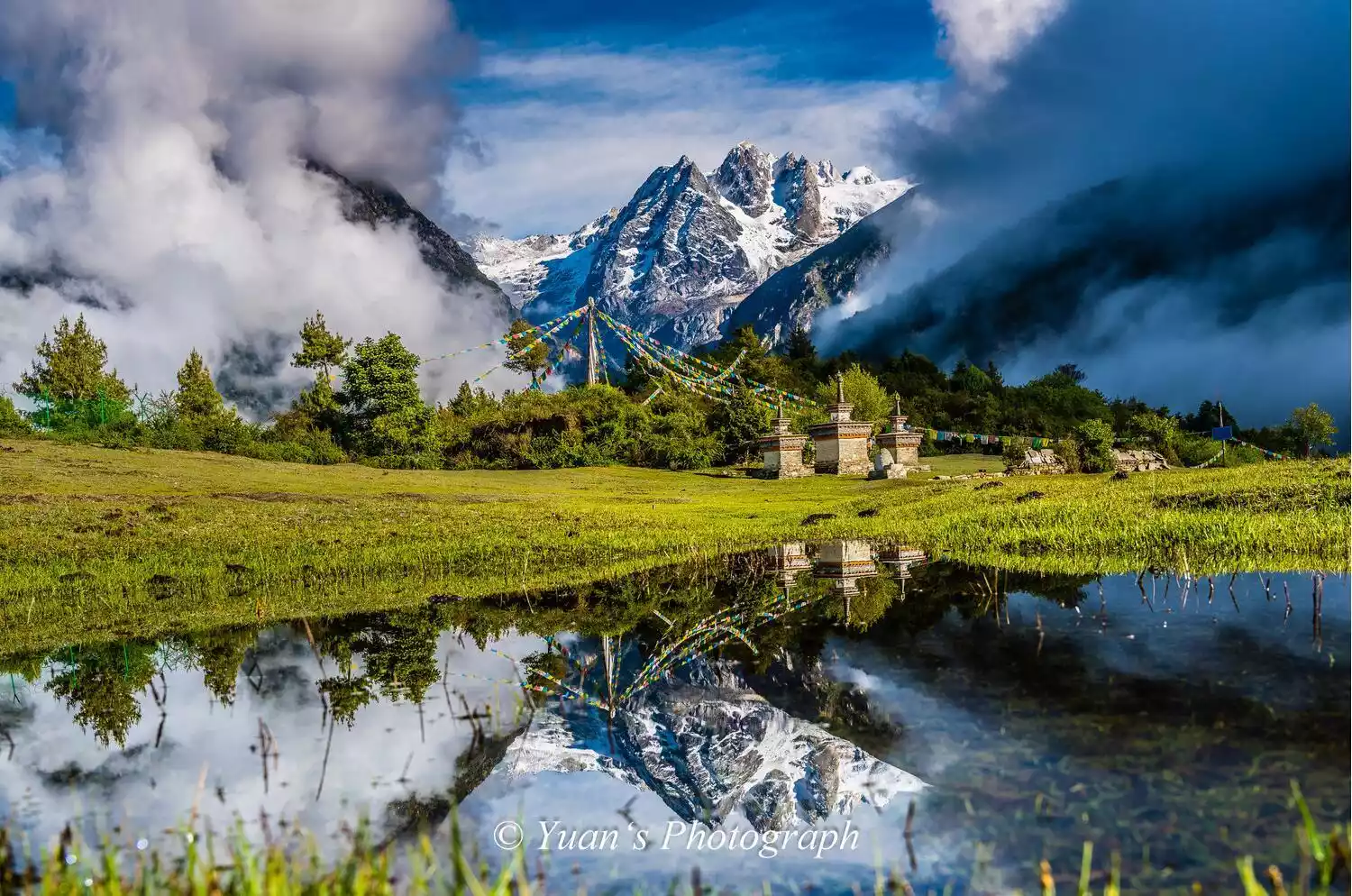
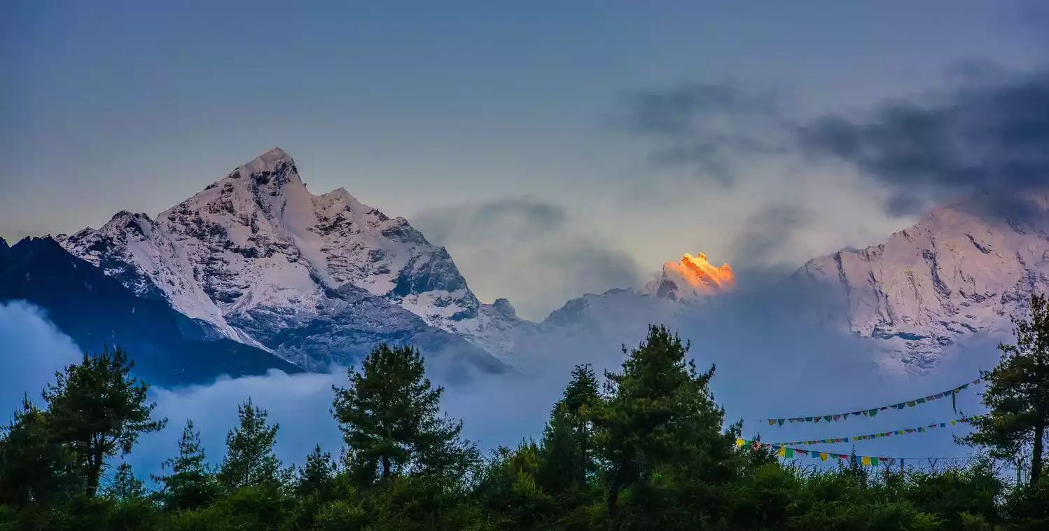
When you cross the Himalayas, the endless snow-capped mountains are extremely shocking. The challenge combined with the beautiful scenery will definitely make you unforgettable in your life.
Guizhou
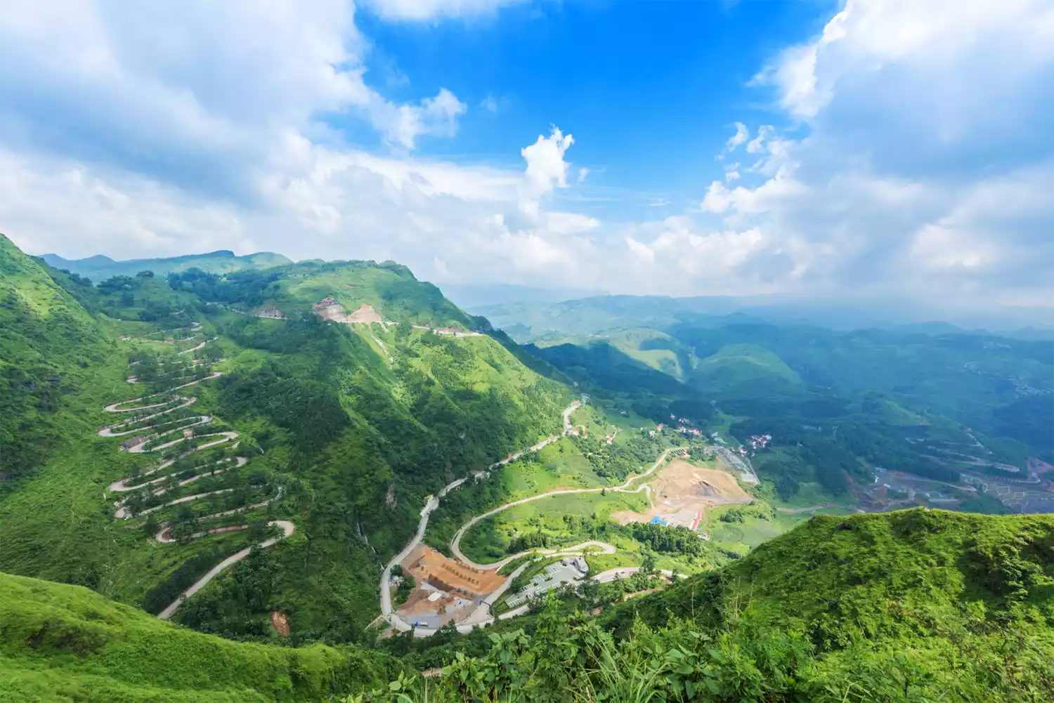
Qinglong 24 Turns - A Historical Bend
The 24 turns of Qinglong, where "one man can block the passage of ten thousand men", were the only land transportation line for the rear areas of China during the War of Resistance Against Japanese Aggression. It was the main artery for international aid to China and was like a "bend in history".
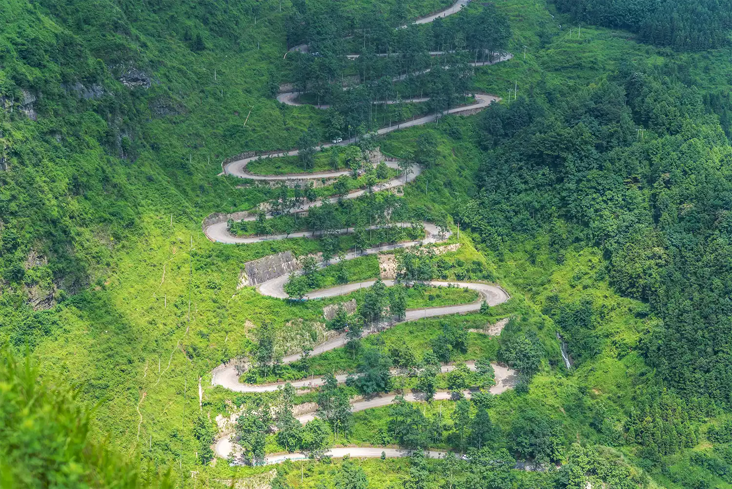
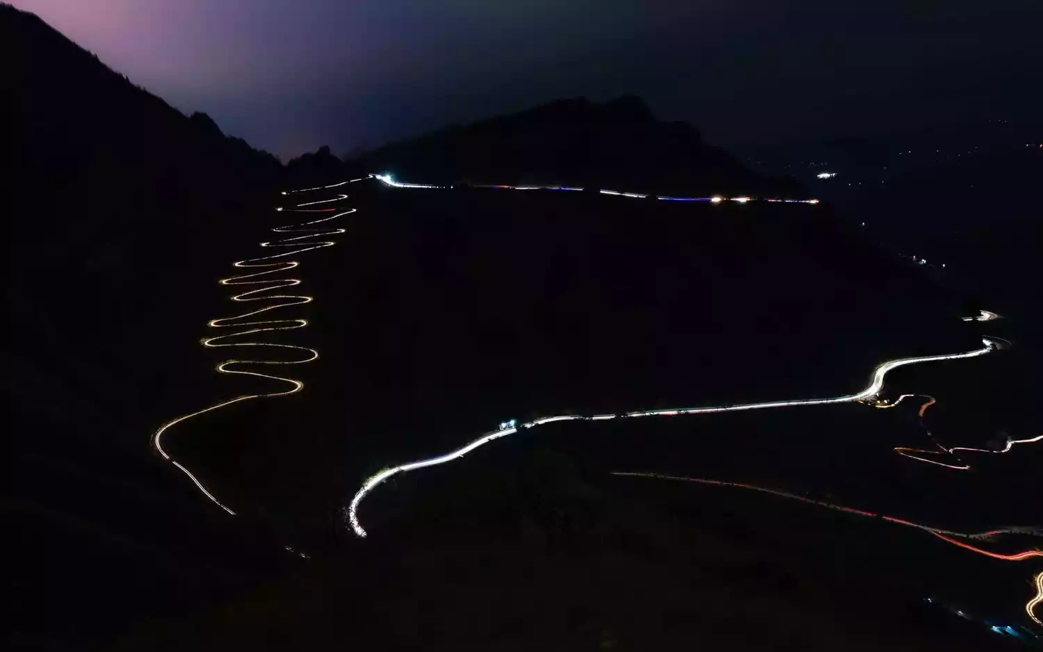
The straight-line distance from the foot of the mountain to the top of the mountain is about 350 meters. The highway is built in an "S" shape on a slope with an inclination of about 60 degrees. The entire length is about 4 kilometers. It is winding and has dense bends. There may be a "U-turn" every less than 100 meters.
Yunnan
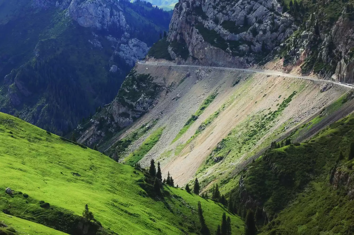
Bingchacha - The Mysterious and Dangerous Road to Tibet
Bingchacha, as one of the routes into Tibet, is the most mysterious and dangerous. It is a name that experienced outdoor enthusiasts will scream when they hear it.
The entire road follows the mountainside, with steep cliffs on one side and the roaring Nujiang River on the other. It has always been a legendary existence, with high mountains and dangerous waters, and the road is long and difficult. It is famous, but I have never been there.
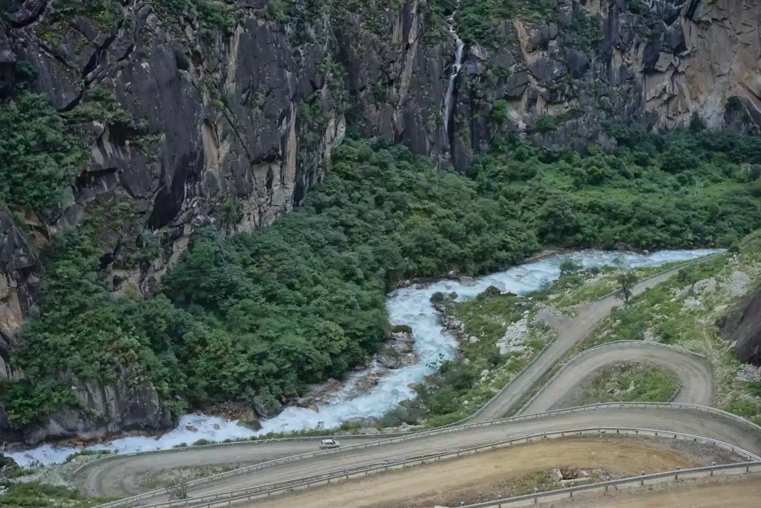
"I've heard of it for a long time, but I've never seen it" is the best way to describe Bingchacha, but the recent road repairs have given us hope of taking everyone there.
Xinjiang
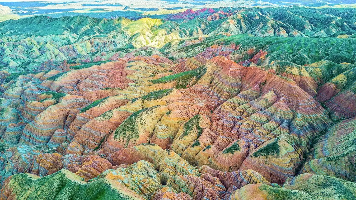
101 Danxia Highway-Tianshan Geographic Corridor
Highway 101, also known as the National Defense Highway, is a Tianshan Highway built in the 1960s to prepare for war and famine and prevent attacks by the Soviet revisionists. It is known as the Tianshan Geographical Corridor.
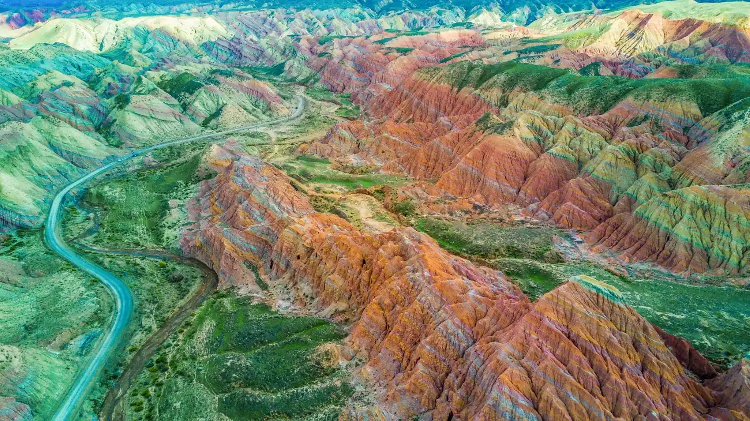
The 101 Danxia Highway is one of the most beautiful sections of the route. It is deserted but full of colorful beauty.
The diverse terrain and landforms of the northern slopes of the Tianshan Mountains are breathtaking. The sheer cliffs, hills, and ravines that combine the Yadan and Stone Forest landforms create a vibrant sea of color. The distinct layers of scenery on both sides of the highway make it an excellent route for photography, exploration, and hiking.
Panlong Highway - a new internet-famous highway
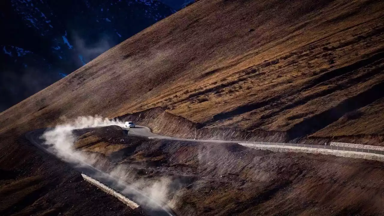
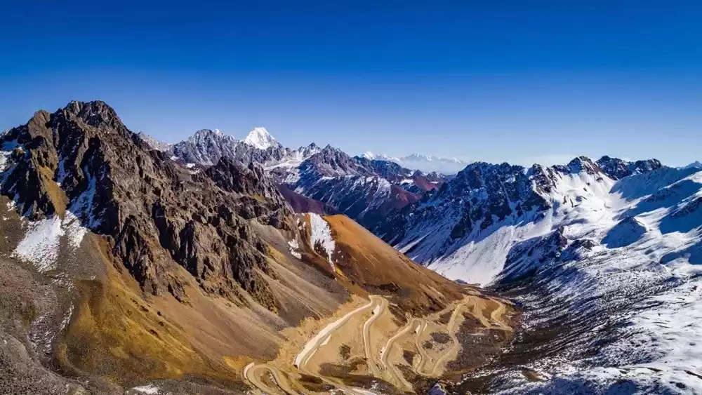
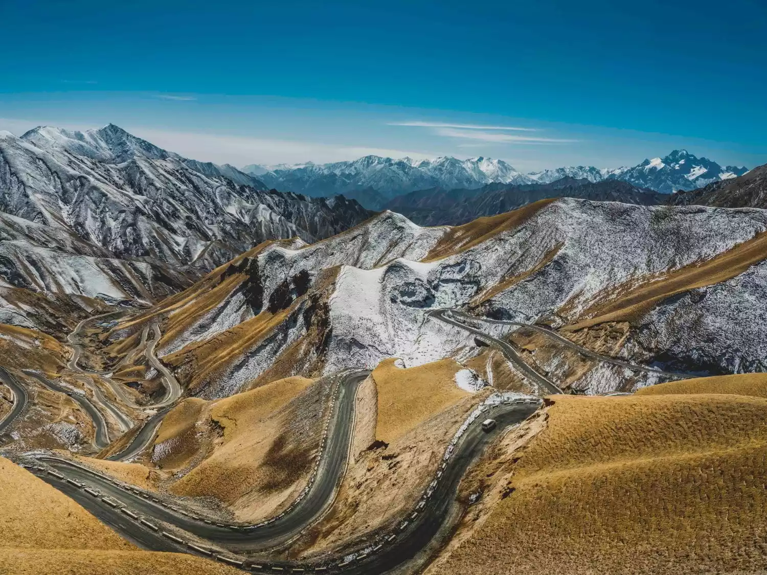
The Panlong Highway, a newly popular internet-famous highway located in Wacha Township, Tashkurgan Tajik Autonomous County (Tashkurgan County), Kashgar Prefecture, Xinjiang, is said to have 208 bends, many of which are 180 degrees or even 270 degrees. It is like a giant dragon, hovering on the Pamir Plateau at an altitude of about 4,100 meters.
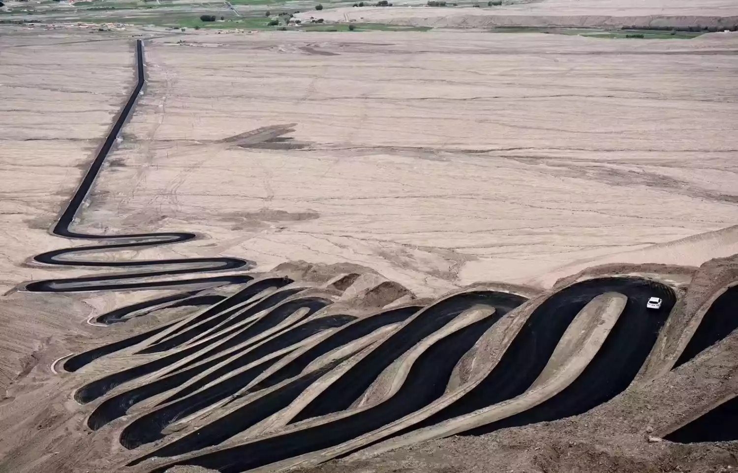
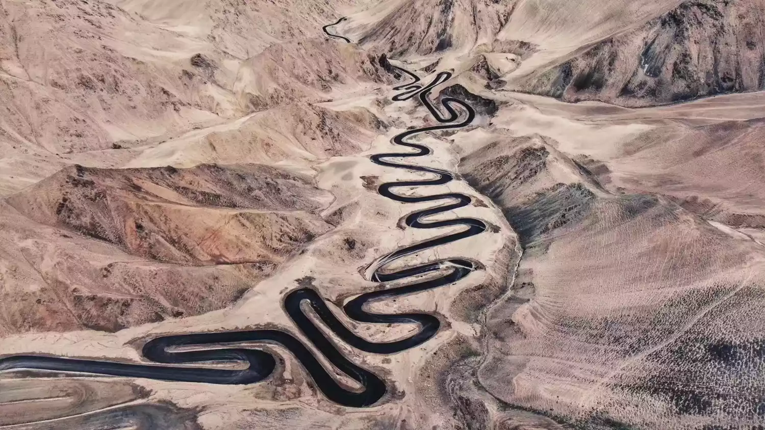
The dark asphalt road combines perfectly with the colorful mountains and the snow-capped mountains in the distance, forming the "electrocardiogram" of the Kunlun Mountains.
Depart from Kashgar | 3 days and 2 nights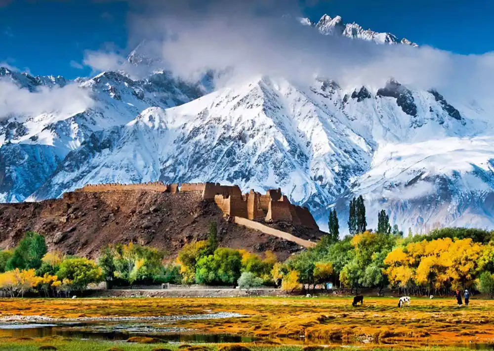
3-Day Small Car Tour of the Pamir Plateau | Departing from Kashgar
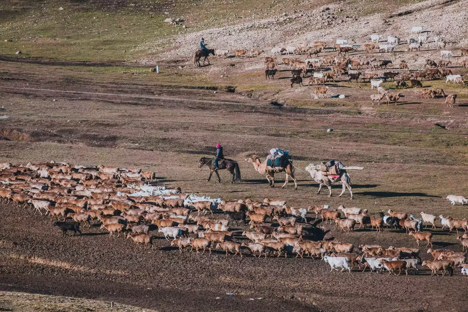
¥2380 from 582 people have registered Register nowChina-Kazakhstan Border Highway-Spectacular cattle and sheep migration scene
The China-Kazakhstan border highway starts from Baihaba, with a total length of 122 km, passing through the Hujilt Translocation Road, the largest cattle and sheep translocation road in the Kanas area.
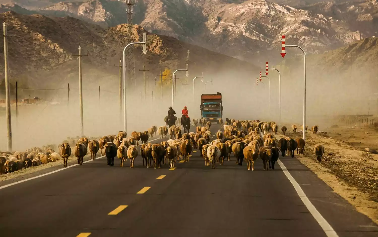
This place is very suitable for visiting in autumn. First, the autumn colors in northern Xinjiang are unparalleled, and second, you can see the spectacular migration of cattle and sheep.
Kazakh herders in the Altay region of Xinjiang will bring their families and yurts and move their cattle and sheep to winter pastures with lower altitudes and higher temperatures in winter, and then return to summer pastures in spring and summer.
This great migration of life repeats itself year after year.
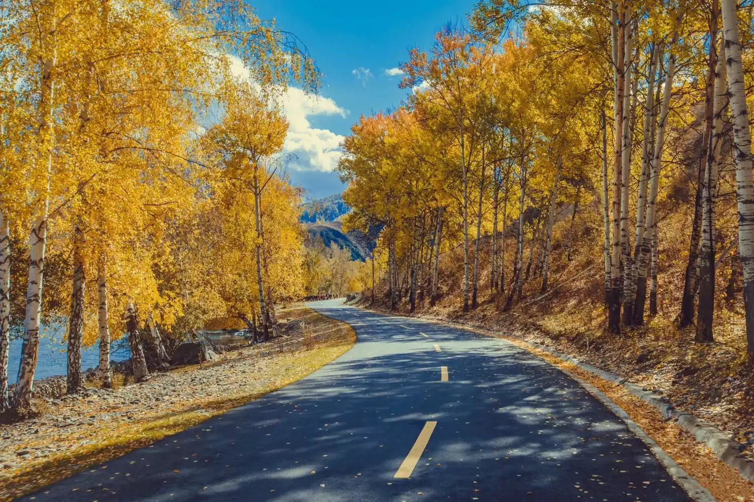
Yizhao Highway - Xinjiang's lesser-known scenic avenue
The Yizhao Highway is a section of the ancient Silk Road's "Gongyue Road," passing through Yining, Chabuchaer County, and Zhaosu, covering a total length of 150 kilometers.
Driving on the Yizhao Highway feels like traveling above the clouds, allowing you to experience what it means to "see four seasons in one day, and experience a different sky every ten miles."
The highway is distributed in vertical zones, including high mountains, meadows, snow-capped peaks, fir forests, Gobi Desert, and sea of flowers. If you are lucky enough to arrive in midsummer, the rape flowers will bloom all over the mountains and fields, and the beauty of the Zhaosu Plateau will continue.
Tasha Trail
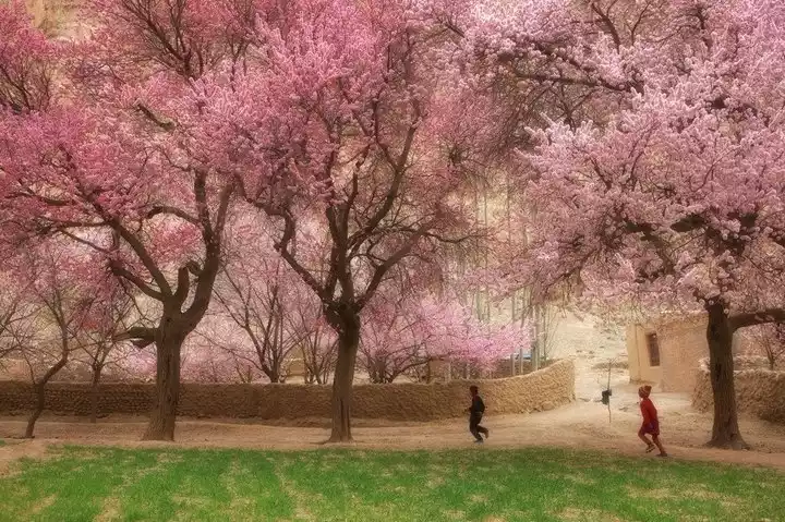
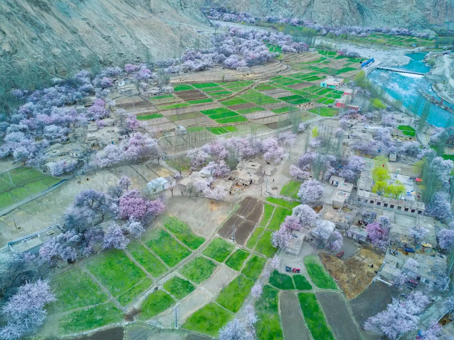
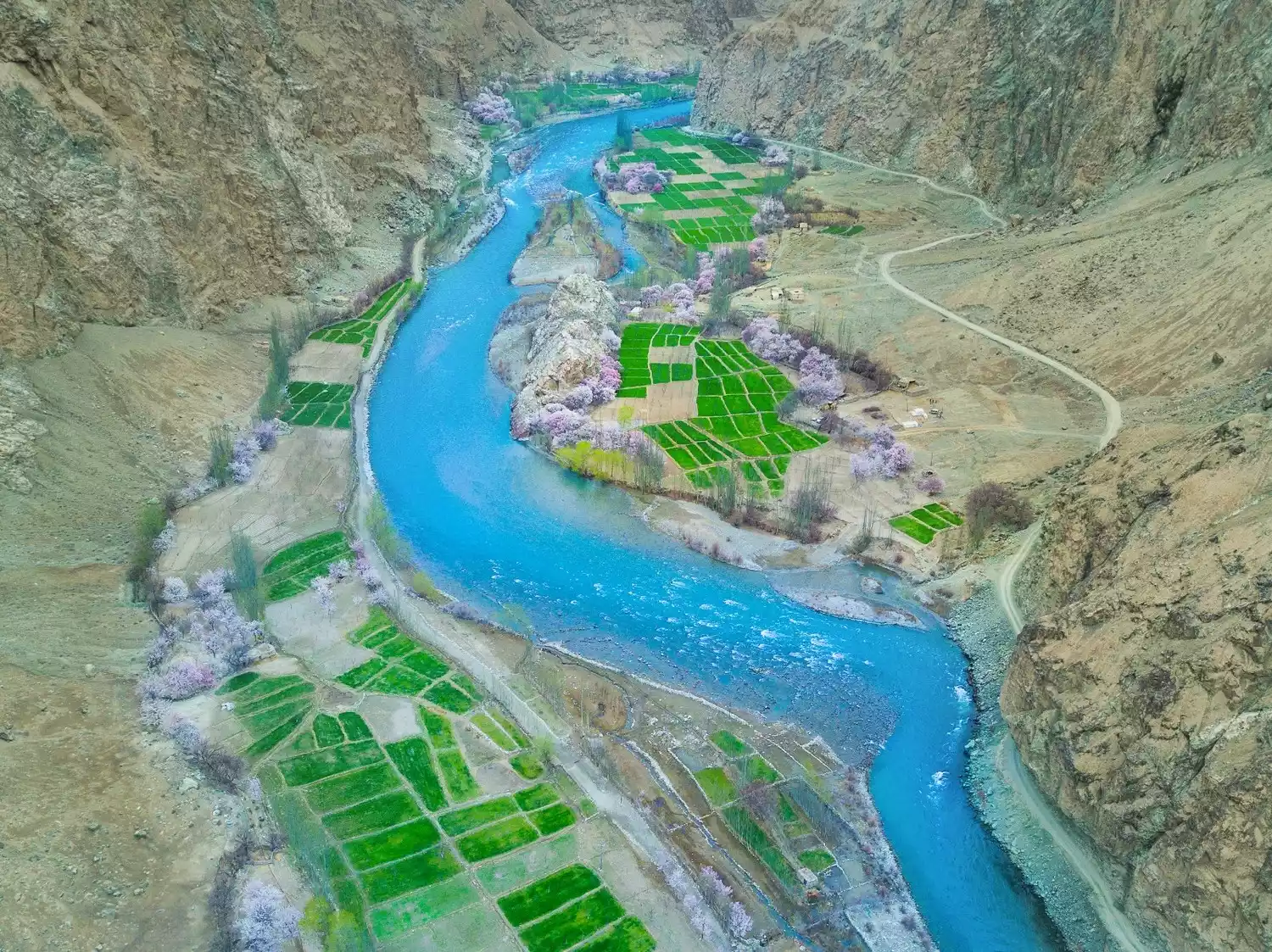
The Tasha Ancient Road is a road from Tashkurgan County to Shache County. Thousands of years ago, it was the route that Xuanzang of the Tang Dynasty took when he returned from his journey to seek Buddhist scriptures. It is a secret place in southern Xinjiang that is rarely visited.
On one side of the Tasha Ancient Road is a cliff, and on the other side are ancient villages and Xinghuagou, which are mainly inhabited by the Tajik ethnic group. Walking through them, it feels like entering a paradise. If you have the opportunity, you can come here to be an isolated villager and experience the quaint and comfortable rural life.
Depart from Kashgar | 8 days and 7 nights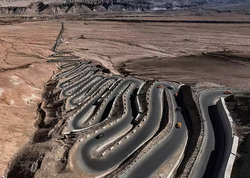
8-Day Off-Road Adventure in Southern Xinjiang | Crossing the Kunlun Mountains and the Pamir Plateau
¥5880 from 335 people have registered Register nowConclusion
This journey is not only for the destination itself, but also for a visual feast. The mountains are rolling and the water is rippling. Slow down the car, open some windows, and feel the breeze coming in through the gaps until it wraps you up in comfortable reverie.