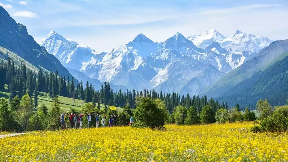
Xiate Ancient Road: A Western Wonderland of Sea of Flowers and Glaciers
Preface
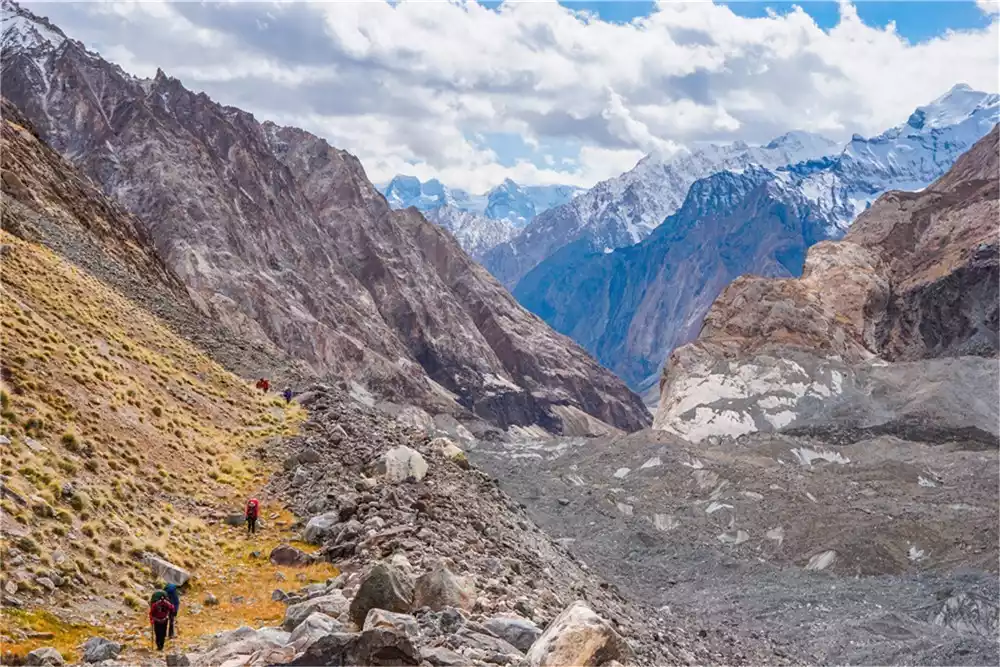
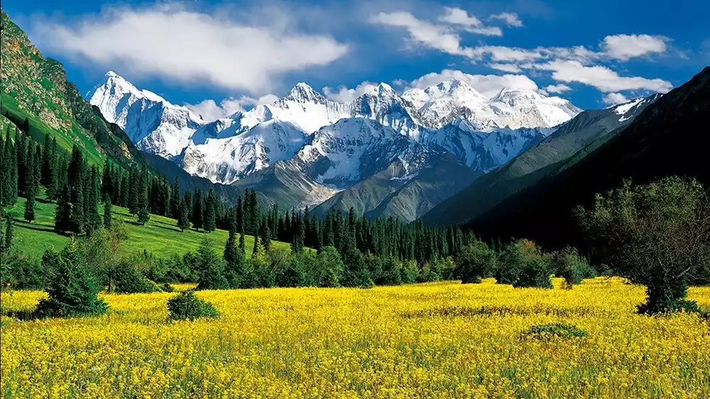
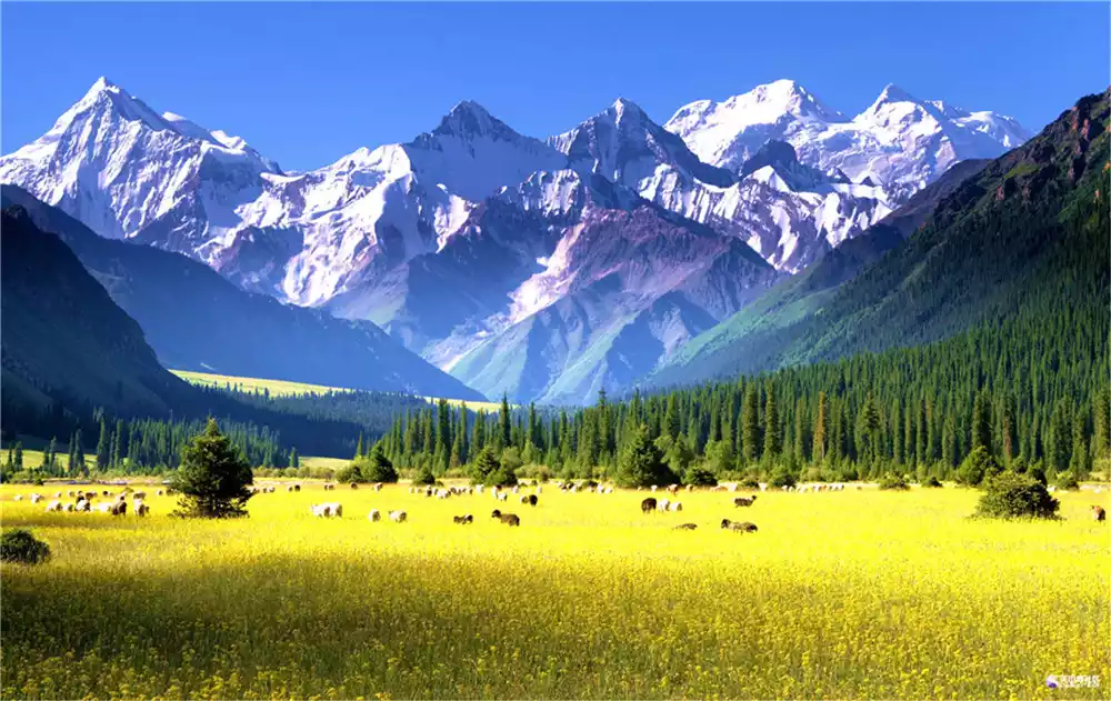
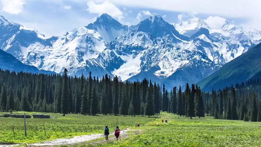
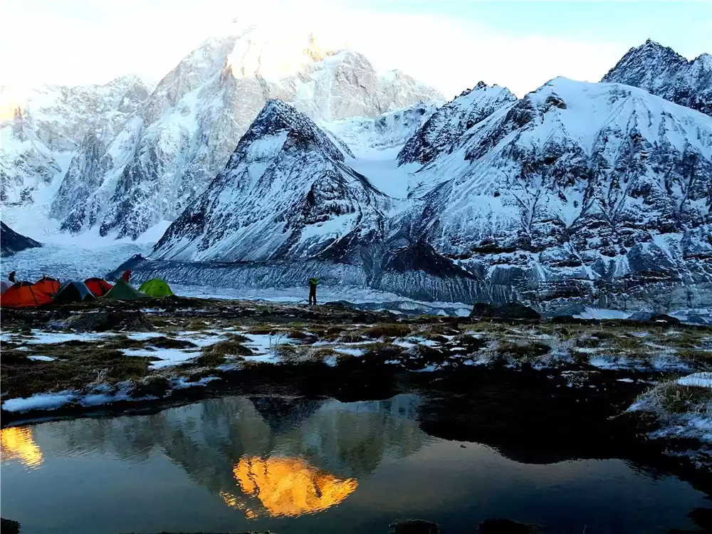
When you have gone through hardships and climbed up the Hadamuzida Pass, the watershed between the northern and southern Tianshan Mountains, you seem to have entered a world of ice and snow. The towering snow-capped mountains around you appear and disappear in the clouds, and the endless Muzart Glacier under your feet winds up the valley like a jade belt and disappears in the sea of snow and clouds.
The images and texts carved into the boulders and the stacked stones of the Mani bags tell the story of the ancient trail's vicissitudes. You'll feel how insignificant humans are in the face of nature, and how great the pioneers of the ancient trail were. When faced with danger and hardship, you often discover the kindest and greatest side of human nature. This is part of the joy of traversing the Shat Trail.
Route Features
Xiate, known as Shatu Amantai during the Qing Dynasty, is located at the foot of the Khan Tengri Mountains southwest of Zhaosu. It served as a transit station between Ili and Aksu. The Xiate Ancient Road runs from Xiate Pasture in Zhaosu County, Ili Kazakh Autonomous Prefecture, in the north to Pochengzi in Wensu County, Aksu Prefecture, in the south. Connecting the north and south of the Tianshan Mountains, it stretches 120 kilometers. It serves as a shortcut from northern Xinjiang to southern Xinjiang and is renowned as one of the most treacherous ancient passes on the Silk Road.
With the completion of the highway connecting southern and northern Xinjiang, this ancient road has long been deserted. People have to take a long transportation line of nearly 2,000 kilometers to travel from Wensu County in southern Xinjiang to Zhaosu County in northern Xinjiang.
Due to the complex geological conditions of the ancient road, numerous high mountain passes, rapids and glaciers, building a highway through the ancient road has become the dream of a generation.
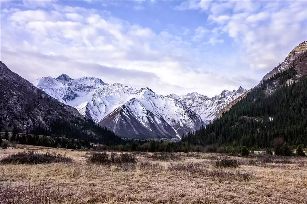
Xiate Gorge runs north-south, with a gentle slope and a wide, straight valley. The Xiate River flows swiftly downward, and the famous Xiate Hot Springs are located 30 kilometers from the valley entrance. The Tang Dynasty monk Xuanlei traveled this ancient trail on his pilgrimage to the West to seek Buddhist scriptures, earning it the name "Tang Monk's Former Trail."
Difficulty level
Professional level: Restricted activities (extremely thrilling + difficult + beautiful scenery)
Level 5 (High Intensity + Extreme Danger + High Skill)
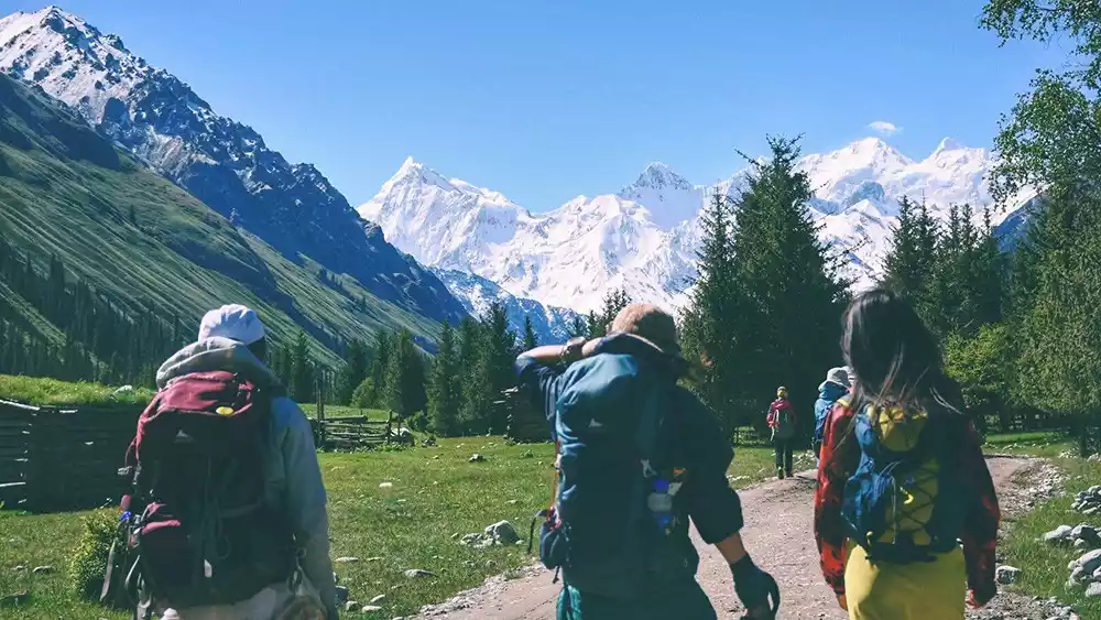
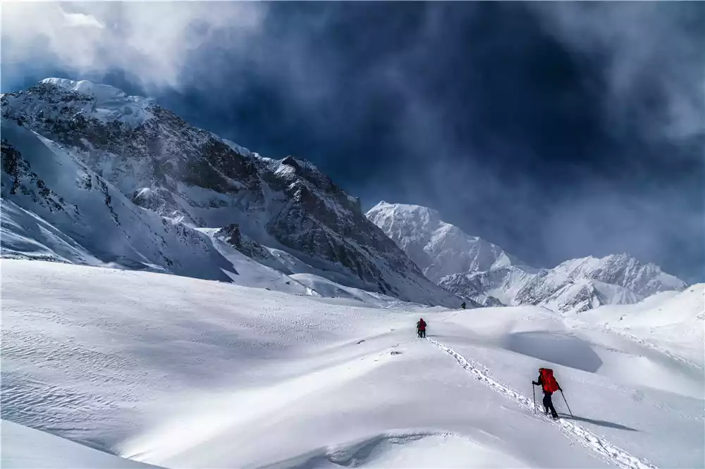
The Shat Trail is a high-risk hiking route that combines archaeology and exploration. The fragmented Muzart Glacier, crevasses, glaciers, and the turbulent Southern Muzart River pose significant threats along the way. Furthermore, horses are unable to cross the Muzart Glacier, forcing explorers to carry all their equipment and food on their own backs. The high-altitude mountainous area is also a severe test of physical strength.
The hike typically begins at Shat Hot Springs, heading upstream along the Shat River Valley. After a dozen kilometers, you'll see the Muzart Snow Peak. Turn right, cross the wooden bridge, and continue upstream. After a few kilometers, you'll find a valley to the south, which leads to Hadamuzida Pass. After descending Hadamuzida Pass, you'll reach the Muzart Glacier. Cross the glacier and walk along its left side to reach the ancient castle. After passing the castle and descending the glacier, follow the horse trail south along the Muzart River Valley to the Guanghui Quarry.
The Shat Trail is one of the longest and most dangerous hiking routes.
Because the route across the glacier is extremely arduous and long, local herders rarely approach it. A few, desperate to trade horses and cattle, often take the risk, often losing their cattle and horses to the elements. The glacier pass is formidable, a haven for wildlife and a destination for adventurers.
"China Hiking" introduces the four main dangers of crossing the Xia Te Ancient Road:
First, crossing the glacier, with its numerous cracks and crevasses, presents dangers everywhere.
Second, the glacier is located at the end of the glacier, where there is an ice slope over 100 meters high, with slopes of over 70 degrees. Sliding down is fatal.
Third, there are many wild animals, and there is a risk of being attacked (we saw almost none on this trip);
Fourth, the water of the Muzart River is turbulent and icy, and crossing the river is dangerous. Dong Wuxin died while crossing the river.
In short, we must attach great importance to it in our thoughts and take it seriously in our actions.
Route climate
Zhaosu County belongs to the cold temperate subarid climate zone, with an average annual temperature of 2-9℃, an extreme maximum temperature of 33.5℃, and an extreme minimum temperature of -40.1℃.
There are strong winds in spring, with the maximum wind speed exceeding level 8. Except in summer, the area is often hit by cold currents from Siberia, and the temperature drops sharply. In winter, the snow on the northern slope of the Tianshan Mountains and the Daban Pass is very thick, making it difficult to pass. July and August are the flood season. The high temperature in midsummer causes the glaciers to melt rapidly, and the water level of the Muzart River surges, cutting off the ancient road, making it impossible for people and animals to pass.
Best time to hike
To sum up, the best time to explore the Shat Trail is from mid-May to mid-June and from October to November.
Round-trip transportation
Outbound
There are sleeper or semi-sleeper buses from Urumqi to Zhaosu County at 15:00 every day. The ticket price is 66-117 yuan and the journey takes 14-16 hours.
You can rent a car in Zhaosu County to go to Xiate Township, or take a shuttle bus from Zhaosu County Bus Station to Xiate Township, which takes 3 hours.
You can rent a car from Xiate Township to Xiate Hot Springs, or you can rent a car directly from Yining City. The road to Xiate Hot Springs has been repaired, but there is a toll booth at the entrance, so you must transfer to the scenic area bus. Alternatively, you can rent a car from Urumqi City and reach Xiate Hot Springs directly in Xiate Township, Zhaosu County, Ili County, which takes 20 hours.
Return
You must make an appointment in advance to pick you up at the Guanghui Quarry. Otherwise, you will have to wait at the Guanghui Quarry for the stone truck to return to the Fifth Regiment, then take a bus from the Fifth Regiment to Aksu, and then take a bus from Aksu back to Urumqi.
Wonderful attractions along the way
Chateau Springs
Located 28 kilometers from the entrance of the Shat Valley, most of the journey from the entrance to the hot springs is through a sea of flowers. The Shat Hot Springs have six bathing pools, which contain a variety of minerals with health benefits.
What’s peculiar is that the different baths are only a few steps away, and the hot spring temperatures vary from 25°C to 64°C. It should be noted that the hot springs are only available from May to October, and the water temperature of Pool 2 is the most suitable. Of course, you can also choose a bath with a temperature that suits you.
Muzart Glacier
Muzart, meaning "Ice Pass," sits at an altitude of nearly 5,000 meters and forms a crucial part of the Khan Tengri Peak glacier area in the western Tianshan Mountains. The glacier is over 30 kilometers long and 2 kilometers wide. Due to glacial movement, rocks have fallen from the peaks on either side of the valley, covering the glacier. As the glacier gradually retreats, the rocks block the ice and snow beneath them, preventing them from melting. As a result, the rocks gradually become suspended in the air, resembling giant mushrooms from a distance.
Route Details
D1 Shat Hot Spring - Shat Ranch - At the foot of Hadamuzida Pass
Over 30 kilometers from the Shat Valley lies the renowned Shat Hot Springs in the Yili region. Its tranquil environment boasts water temperatures ranging from 42°C to 64°C, containing a variety of minerals. Remarkably, the water temperature varies from pool to pool. However, this hot spring is seasonal, available only from May to October.
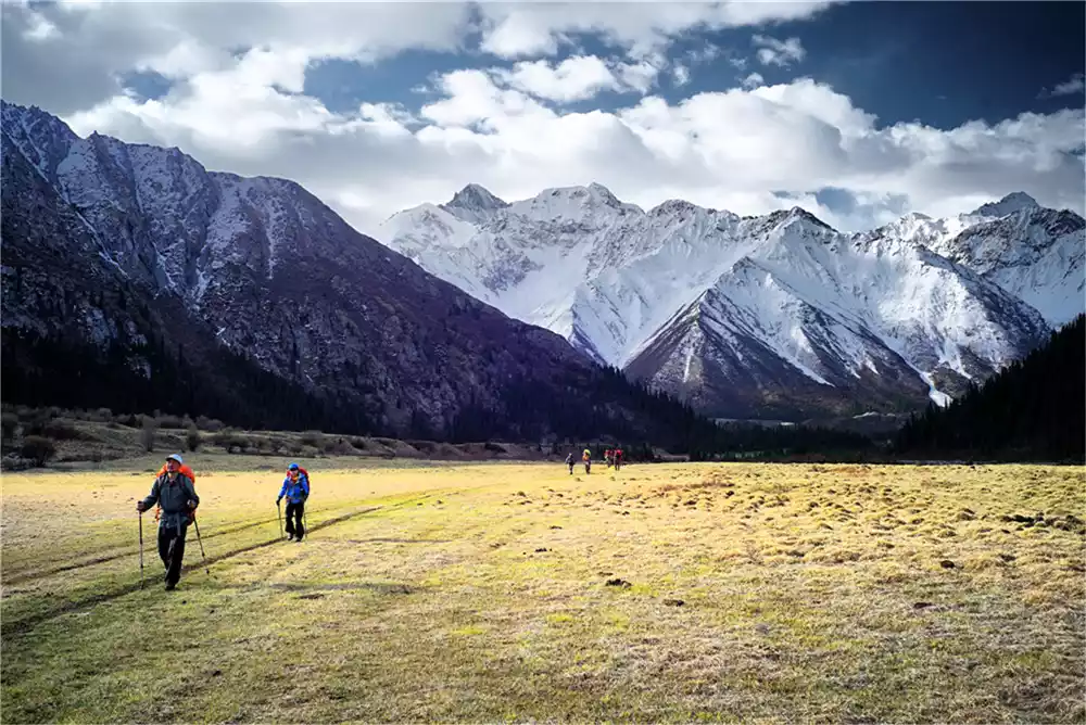
Starting from Shat Hot Springs, head upstream southeast along the river. For the first half of the route, there's a clear path along the river's east bank, and the altitude gradually increases. After about 5 kilometers, passing three herders' settlements, the view opens up to a vast expanse of grassland in the canyon: Shat Pasture.
After walking about 5 kilometers, you will reach the end of the ranch. The canyon gradually narrows and the river becomes more turbulent. At this point, the river splits into two branches, and there is a wooden bridge before the river splits.
Note: From here, cross the bridge to the west bank of the river and continue upstream along the west side of the river after the fork. After crossing the wooden bridge, there are two horse trails. Take the left one. Afterward, there's a section of road that has been carved into a steep cliff and is impassable, requiring a detour around the mountain. Exercise extreme caution when navigating this section. About one kilometer from the bridge, looking east, you'll see the magnificent Erchaletor Glacier, which serves as a sign to correct your course.
After going down the mountain horse trail, we headed west along the river. After walking about 2 kilometers, we arrived at the last pastoral settlement under Hadamuzidaban, where we set up camp.
Tips:
1. Xiate Township is located in the border area, so you need to apply for a border pass on the way. The half-pass fee is 2 yuan. Don't forget to bring your ID card.
2. On the way from Zhaosu to Xiate Township, you'll see numerous ancient sites. The massive earthen mound cemeteries left by the Wusun people stand like small peaks on the vast grasslands beyond the mountain pass, creating a majestic and spectacular scene. There are also numerous stone figures on the grasslands.
D2 Climb Hadamuzida Pass
Muzart Pass (3,582 meters) is a pass on the ridgeline of the Haweizhouliha Mountains. It marks the watershed between the northern and southern Tianshan Mountains. To the north lies the glacier at the source of the Xiate River in Zhaosu County, and to the south lies the source of the Muzart River in Baicheng County, Aksu Prefecture. Five kilometers south of the pass lies Hadamuz Pass (3,509 meters).
The east and west sides of the pass are flanked by peaks ranging from 5,000 to 5,400 meters above sea level. The ancient trail follows the Xiat River, crossing the Muzart Pass and Hadamuz Pass on the main Tianshan mountain range, traversing the Muzart Glacier, which is over ten kilometers long and hundreds of meters thick, and continues along the Muzart River to Wensu County, south of the Tianshan Mountains.
Continue west along the horse trail for about 3 kilometers to the river. From here, looking south, you'll see Hadamuz Pass. Be aware that the terrain here is complex, with numerous river forks in the canyon, so it's crucial to find the right path before heading towards the pass. Once you reach the river, begin searching for favorable terrain to cross. This is the first difficult part of the day.
This is the source of the Chat River. The river water, which is formed by the meltwater from the glaciers, is turbulent and extremely cold. If you accidentally fall into the water, you are in danger of being washed away and will quickly suffer from hypothermia, resulting in serious consequences.
After crossing the river, follow the horse trail south, following the river's source upstream into the canyon. It's important to find and follow the horse trail until you reach the pass. Otherwise, the icy and gravelly terrain will be extremely tiring. Two kilometers up, on the east side of the trail, you'll see the famous Ayigerjale Glacier, cascading down from between two peaks resembling stone gates, deep into the valley. It's a truly spectacular sight. The winds here are so strong that you shouldn't linger for long. Continue along the trail until you reach the top of the pass.
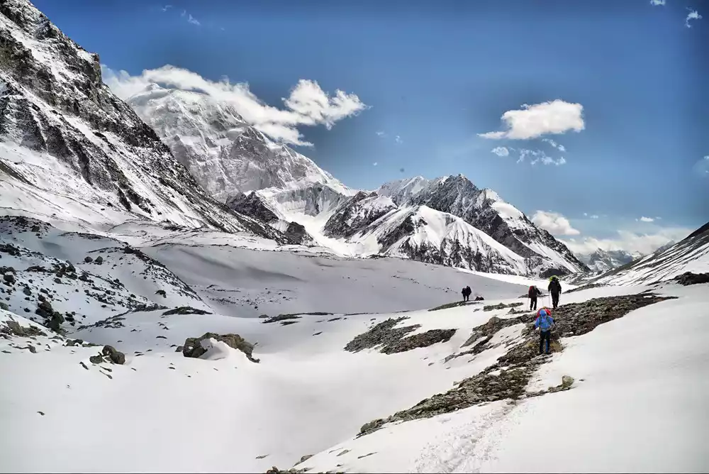
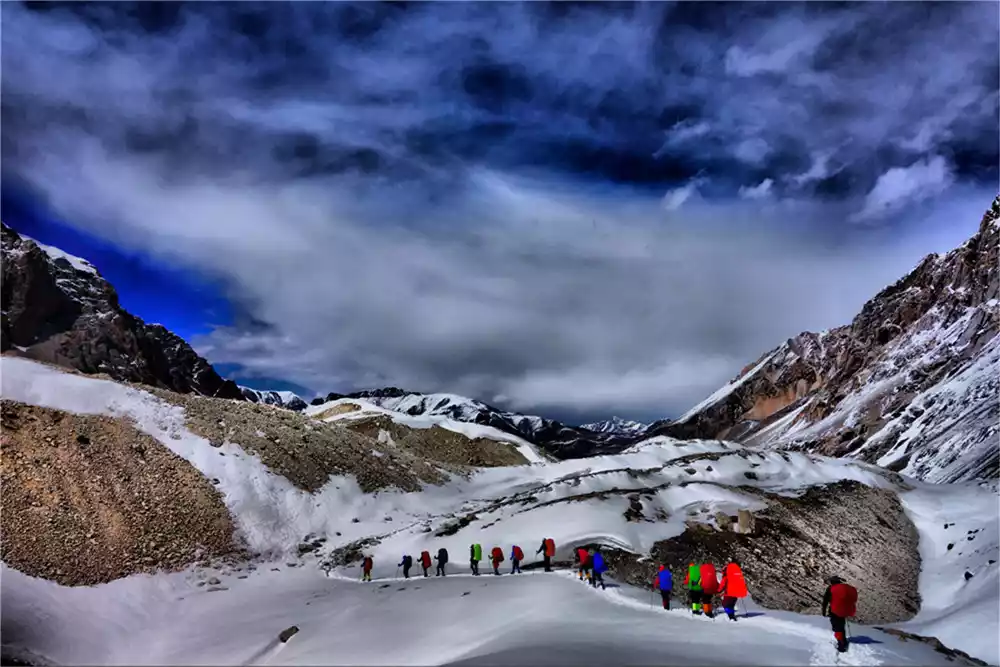
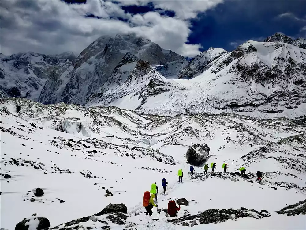
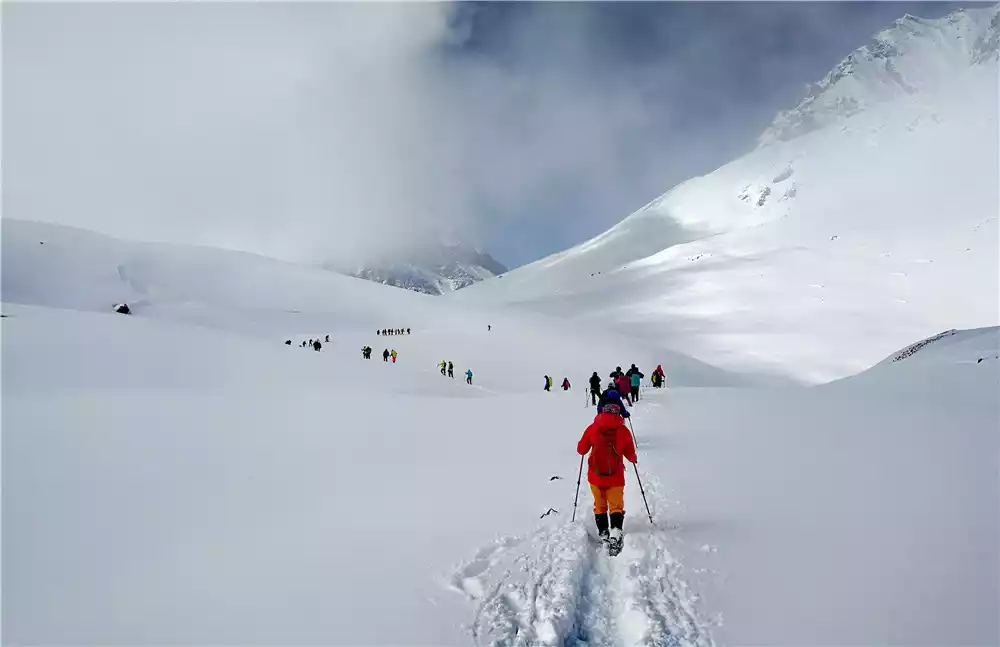
The summit of Hadamuzida Pass is a glacier about two kilometers wide, flanked by steep mountains on either side. Far from the flat, expansive landscape one might imagine, the glacier's surface is undulating, a mix of ice and rock, with frequent, dangerous breaks. There are no horse paths to speak of. Three large longitudinal crevasses run through the glacier, creating a complex terrain. There's no other way to cross it except through repeated attempts. If luck fails, one must return and re-establish their path. Therefore, while the pass is relatively short, it consumes considerable time and effort.
We camped at Osaka Peak that night. The nighttime temperature was often below zero, but water was easily accessible. Besides staying warm, we also had to be careful to protect ourselves from animals when camping.
Tips:
1. To reach the Daban Pass, you must cross the Shat River. There is no bridge here, so you have to climb over a huge rock. You need a ladder and a climbing rope to get up.
2. When climbing the pass, you must find an ancient road, otherwise the road is very rugged and will consume a lot of physical energy.
3. Due to the rapid increase in altitude, the marching speed should not be too fast. It is sufficient to reach the pass before sunset.
4. In summer, there are many fresh and tender wild mushrooms on the green meadows on the Daban Pass.
5. There is no combustible wood once you reach the pass, so you have to use gas or oil stoves to boil water and cook.
6. Hadamuzidaban is a sparsely populated area where wild animals often roam. Never travel alone.
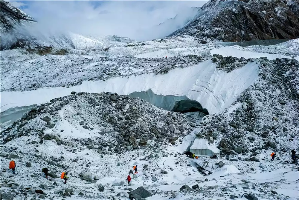
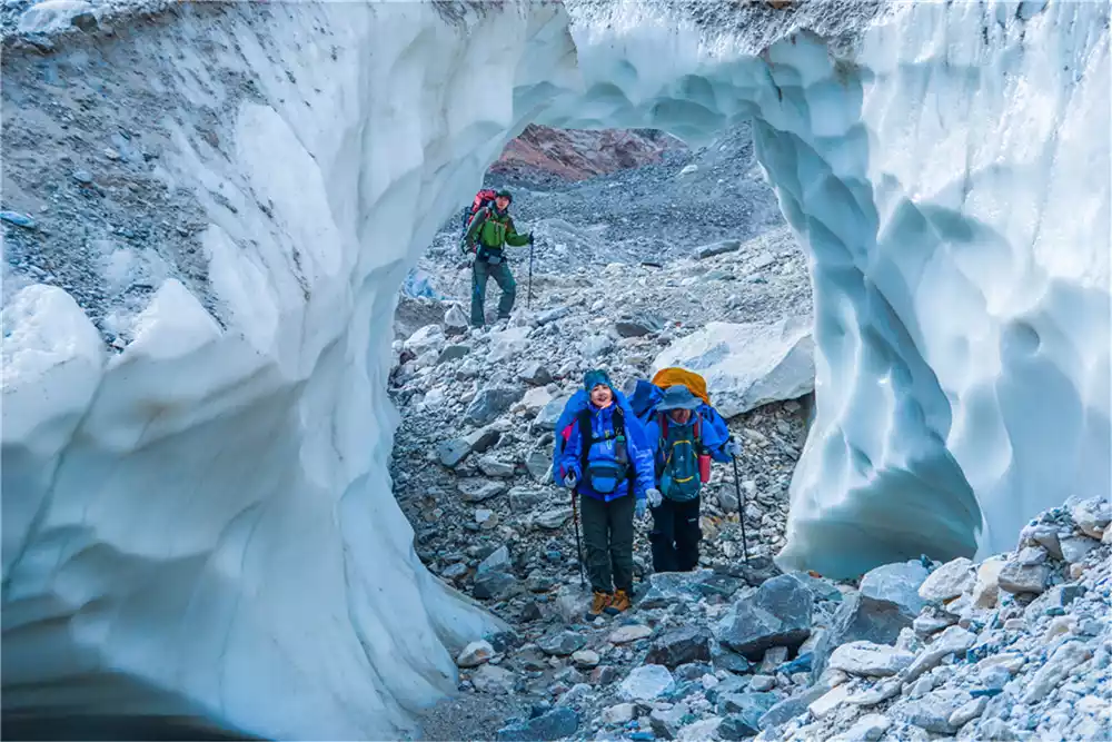
D3 Crossing the Muzhar Glacier
The Bashkrimis Glacier, originating at the foot of Xuelian Peak, and glaciers from snow-capped mountains above 5,000 meters converge near Daban to form the Muzart Glacier, over 30 kilometers long and 2 kilometers wide. Tens of thousands of years of glacial movement and the shedding of peaks on either side of the ice valley have left a layer of rock covering the glacier. From a high vantage point, the glacier resembles a giant brown dragon cascading down from the snow-capped mountains.
Descend westward along the valley, following the glacier's terrain. In other words, the general direction of travel is southwestward, following the glacier down the valley. After descending the glacier from the Muzart Pass, the typical route involves first crossing the glacier and then ascending the mountain to the left (east) side of the gorge. A horse trail runs along the steep mountainside, leading southeast. The trail is often unclear and requires careful identification, but it's much less challenging and dangerous than walking directly on the glacier. Even so, extreme caution is required in this terrain.
The pass with an ancient castle on the eastern cliff is located south of the Muzart Glacier. The glacier drops dramatically over 100 meters from the pass, making it a difficult and dangerous point to cross. About 3 kilometers after descending the glacier, a larger glacier emerges. Keep to the right (west) side of the glacier and follow the current.
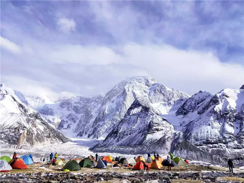
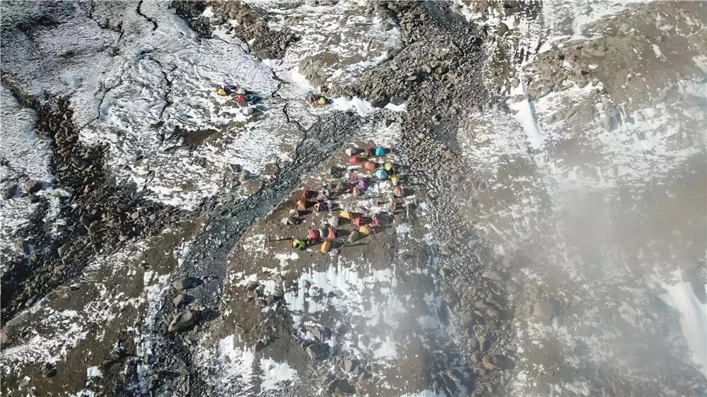
Don’t rush down the glacier that night. Instead, camp in the ancient barracks beside the ancient trail at the end of the glacier (there are many ruins of ancient barracks, the west walls of the houses are still preserved, but the roofs are gone, and tents can be set up inside the houses).
Tips:
Crossing the glacier is extremely dangerous and requires the use of climbing ropes. In summer, ice crevasses are often exposed, but the glacier surface is very rugged, and a slip could easily lead to falling into the crevasses. Therefore, groups must be formed to protect each other in dangerous sections.
2. Do not follow the glacier. After crossing the 2-kilometer-wide glacier, climb up the opposite mountainside to find the ancient trail and then go down along it.
D4 Lower Muzart Glacier - Entering the Southern Muzart River Valley
After leaving the castle, we set foot on the glacier. Due to the glacier's retreat, the drop at the end of the glacier is significant, reaching 500 meters in just 300 meters. This section of the route is the most difficult and treacherous on the Muzart Glacier. The descent to the valley floor is also extremely dangerous. Reaching the valley floor, which is so close, takes nearly four hours.
After descending the glacier, you'll enter the Namzart River Valley. You'll soon discover an ancient path along the river's east bank. Descending along this path, you'll reach an ancient fortress in the evening. Nearby are numerous bunkers and burial mounds, with a surveying tower at the highest point. The river widens beyond the fortress. You can set up camp for the night among the red sea buckthorn bushes on the river's east bank.
Tips:
1. The glacier has a dramatic drop, with some areas almost 100 meters vertical. The glacier is crisscrossed with crevasses, and the depths are unseen. When descending the glacier, it's important to have strong and skilled team members repeatedly explore the route to find a relatively safe route.
2. To ensure safety, a team must have at least two pairs of crampons, two ice axes and a 100-meter climbing rope for the pathfinders to use.
3. In summer, there are many ephedras in the Namzart River Valley. Their fruits are red and sweet, with high nutritional value and can be eaten.
4. Traces of wild animals can be found everywhere here, so it is best not to act alone.
D5 Climb the cliffs and cross the river to enter the summer pasture
About 20 kilometers after leaving the Mumzart Glacier, the river valley widens. In summer, the ice and snow melt, and the nearly 800-meter-wide riverbed is flooded. On the east bank, a steep cliff over 100 meters long and nearly 150 meters high flows through it, interrupting the ancient trail. To cross, you must climb over the cliff; never wade!
After passing the steep wall, you have to cross three rapids originating from the snow-capped mountains in the east. The water flow is very strong and icy cold. After crossing the river, you enter the summer pasture.
Tips:
1. When side climbing, be sure to use a 100-meter climbing rope for protection. If necessary, hammer rock spikes into the rock to secure the rope.
2. Since the water in the mountains comes from melting glaciers, you must cross the river in the morning when the water volume is the lowest.
3. Be sure to use a rope for protection when crossing the river. Once you are washed down, you will quickly enter the main river channel and there will be no possibility of survival.
4. Don’t force yourself to cross the river. If you find the water is too high, it is better to return the way you came.
5. If the water volume is not large after October, you can walk directly on the riverbed, or you can wade to the west bank of the river and go down along the west bank to Pochengzi.
D6 Cross the Iron Bridge - Quarry - Pochengzi - Laohutai Township - Baicheng County
After crossing the river, the road is relatively flat. About 10 kilometers down the west bank leads to the quarry. A metal bridge leads to the east bank. Another 10 kilometers down the east bank leads to Pochengzi in Wensu County. Pochengzi is an ancient fortress, and the remains of its walls are still visible, especially the section of wall that stretches over 100 meters to the foot of the mountain, which remains intact.
To the east of the Namuzart River is Baicheng County of Aksu, and to the west is Wensu County. After crossing the river and traveling 10 kilometers, you will reach Laohutai Township of Baicheng County. From the township, you can take a shuttle bus to Baicheng County.
Precautions
1. When crossing a glacier, you must follow the following principles:
(1) Act in groups and follow orders. Individual action is strictly prohibited.
(2) The team leader explores the way and the team members follow
(3) Use protective equipment correctly
2. Apply for a border pass:
Xiate Township is located in the border area, so you need to apply for a border pass on the way. You must bring your ID card with you. (You can apply for it at the Xiate Township Border Police Station)
3. Safety equipment:
Glaciers and glaciers pose the greatest threat to hikers on the Chatt Trail. Whether navigating glaciers or glaciers, a process of exploration, protection, and follow-up is required. A suitable safety harness, a sling, two carabiners, and a strong rope constitute a safe crossing system. If a person is caught in a rapid in a river, rescue is difficult without a safety harness and rope. For safety, a main rope of at least 30 meters is required to accommodate varying river widths. Belay personnel on shore should also use a figure-eight method to reel in and release the rope.
4. The rules to be followed when crossing the river in Shat:
(1) Use safety equipment correctly
(2) Choose a suitable crossing point and avoid forced crossing.
(3) Protect the front and back
(4) After crossing the river, wipe off the water immediately and put on dry shoes and socks to prevent hypothermia
5. Line rescue:
Outdoor Rescue:
Xinjiang Red Cross Blue Sky Rescue Team
Blue Sky Rescue Team
National unified rescue hotline: 4006009958