Take stock of classic mountain circumambulation routes in western China and explore the sacred mountain and lake hiking routes hidden deep in the plateau
Preface
Circumambulating the mountain is a popular religious practice among Tibetan Buddhists. Believers are so devout because they firmly believe that circumambulating the mountain can cleanse a lifetime of sins, prevent rebirth in the Avici Hell, and even lead to enlightenment in the next life. Death during the circumambulation is considered a blessing, and as a result, there is a constant flow of pilgrims.
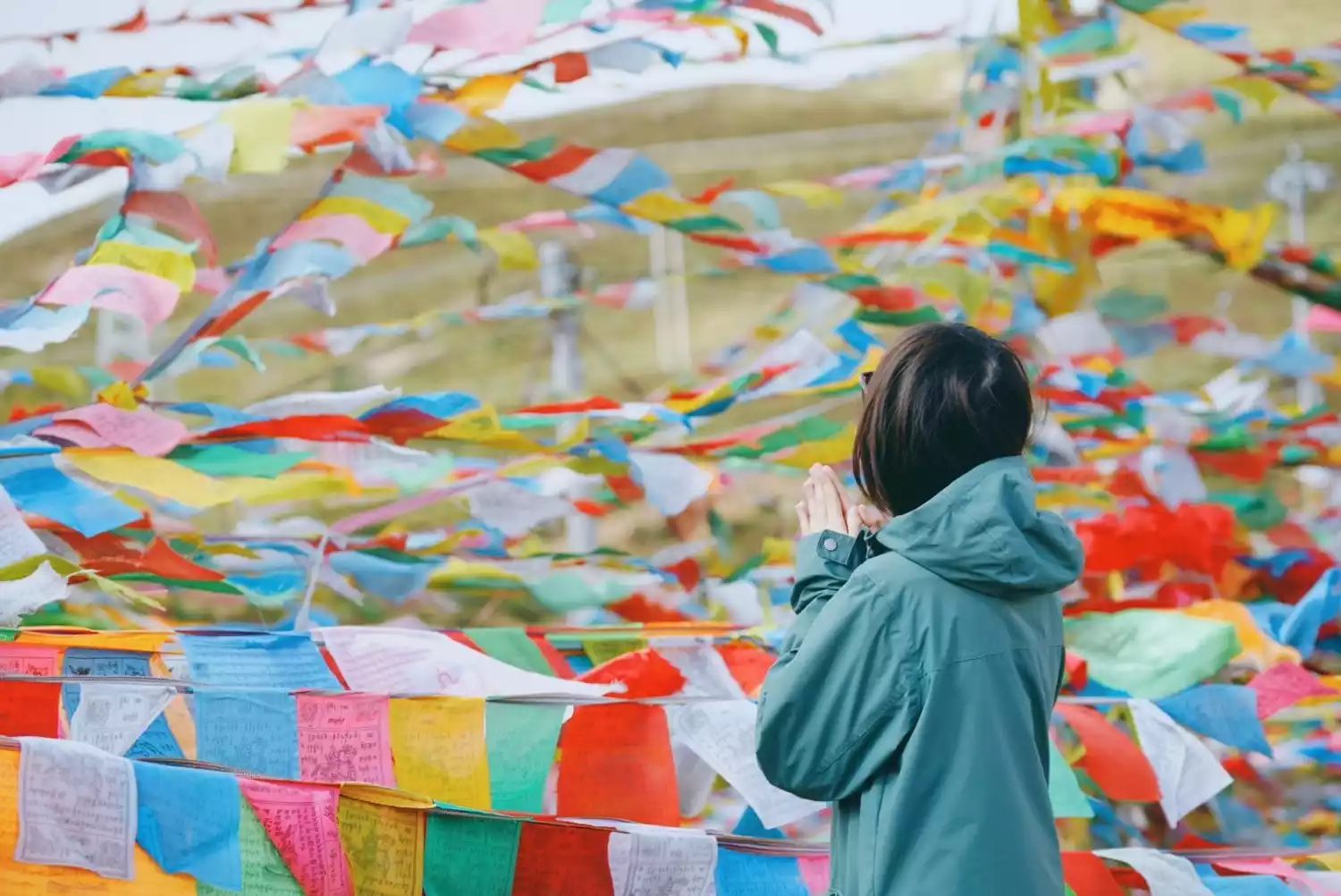
In addition to circumambulating the sacred mountain, Tibetan compatriots have many other ways to pray: worshiping the sacred lake, using prayer wheels, building Mani piles, etc., all of which are derived from the customs of Bon religion.
On the way to the circumambulation, you will meet countless devout people, appreciate the true side of the sacred mountain and holy lake, and enjoy the scenery in the cold wind. These unparalleled impacts will make people feel inexplicably shocked.
Today, let’s take a look at the sacred mountains that carry our faith and embark on our circumambulation journey!
Circumambulate Mount Kailash
📍【Location】Northern Purang County, southwestern Tibet Autonomous Region
🏔【Mountain Altitude】Kailash is 6656 meters above sea level, and the hiking altitude range is 4800-5500 meters

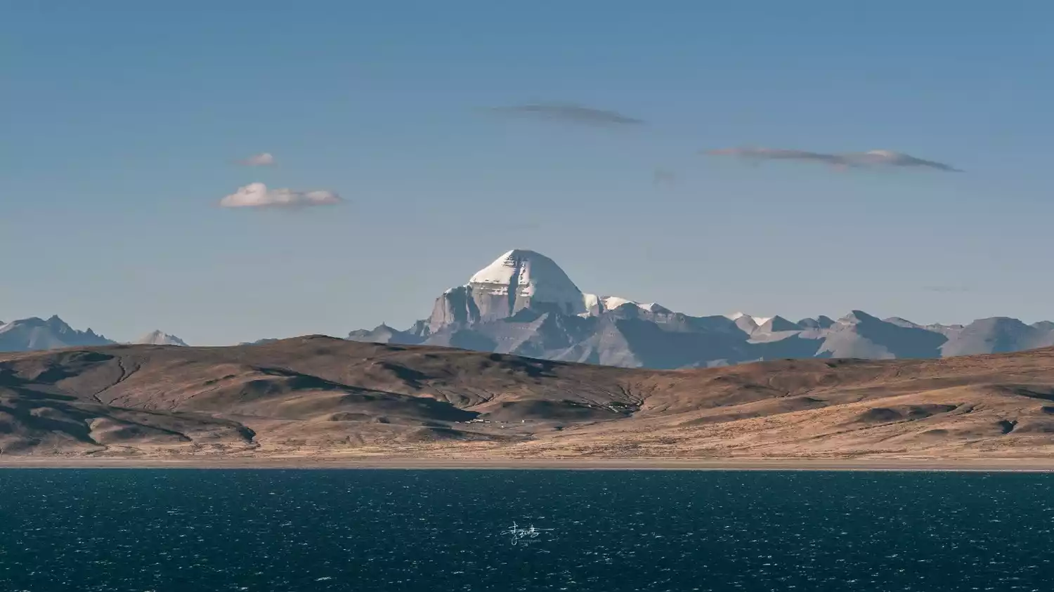
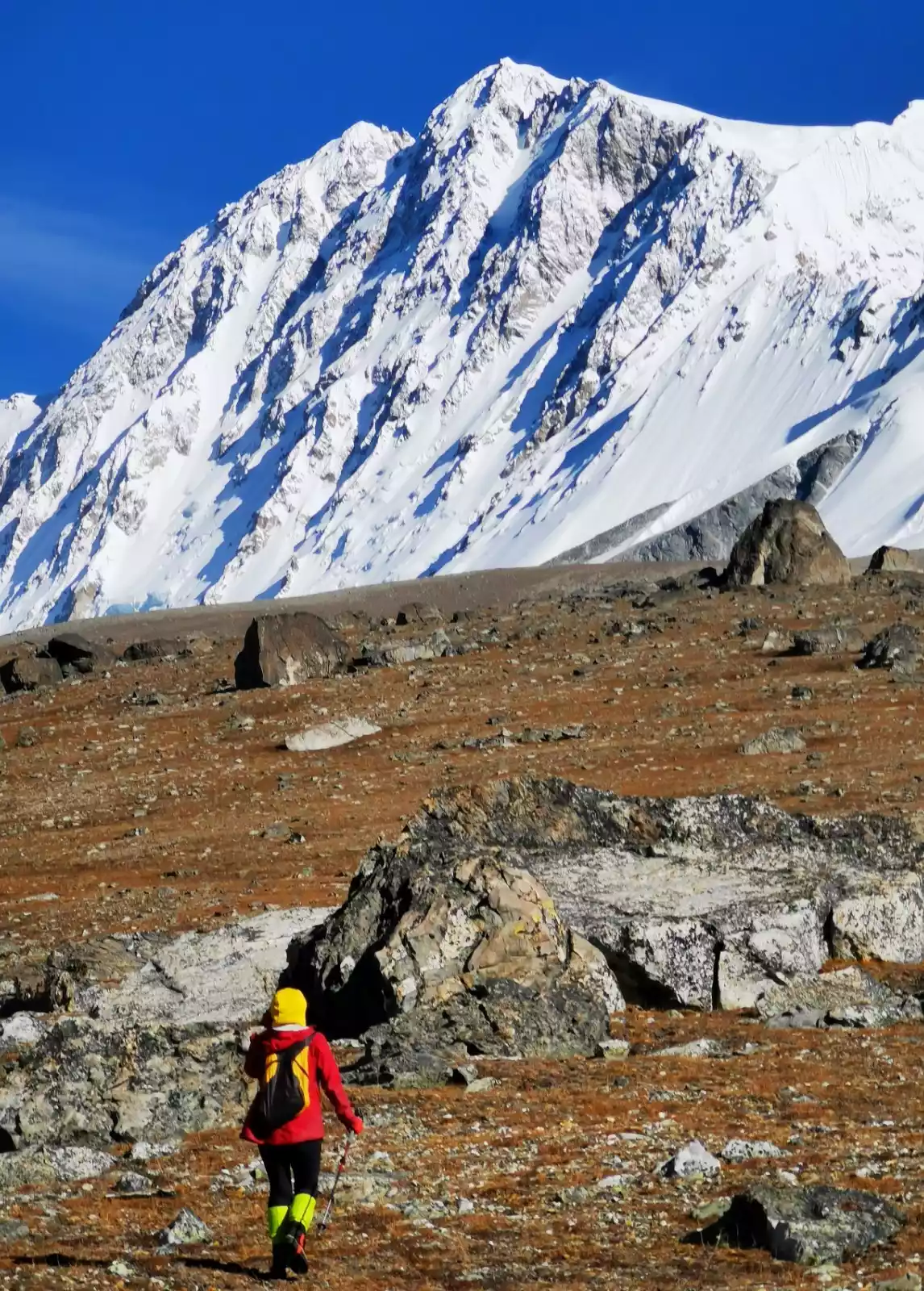
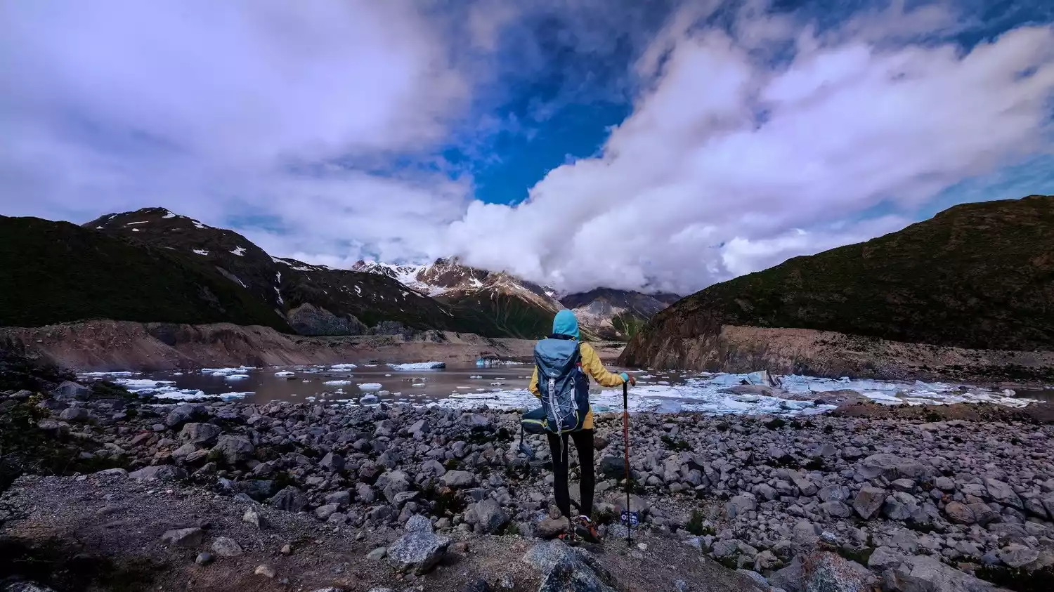
Mount Kailash, known as the "Mountain of the Gods," is known as the King of Tibet's sacred mountains. Although no one has yet climbed this sacred mountain, it remains a beloved destination for Buddhists and outdoor enthusiasts. In Tibetan Buddhist tradition, Mount Kailash is considered the center of the world, where the gods reside. Circumambulating the mountain three times cleanses a lifetime of sins, while circumambulating it ten times secures one from the sufferings of hell in the next cycle of reincarnation. Consequently, pilgrims flock to the mountain year after year.
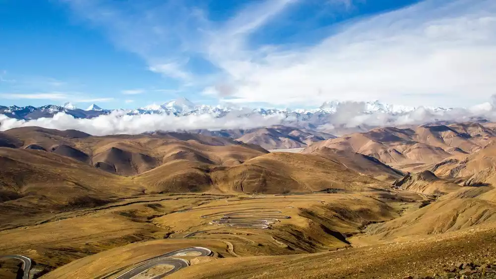
This is a real in-depth hiking route in Ali. Participating in it not only allows you to experience the pilgrimage route firsthand, but also allows you to see the great Himalayan snow-capped mountains at the Jiawula Pass, with 5 8,000-meter-level snow-capped mountains in full view.
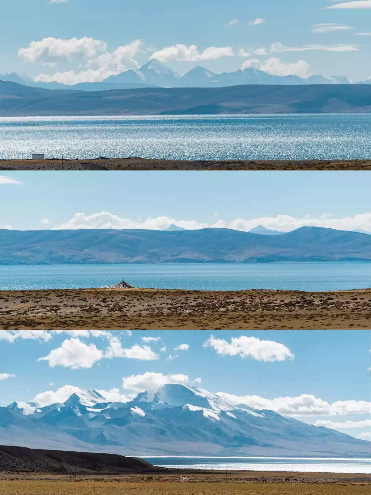
Admire the beauty of Tibet, where various lakes of different sizes are scattered across the country, each with its own unique shape. Visit Yamdrok Lake and Manasarovar, two of the three "holy lakes", and stroll along the lakeside. The cool wind blows on your face, and the thunderous sound of waves is heart-stirring.
Tips:
[Hiking Overview] The total itinerary is 10 days, including 2 days of hiking, with a total mileage of about 55km
[Activity Difficulty] ★★★★★☆☆
Suitable for outdoor enthusiasts aged 16-65, healthy and free of cardiovascular diseases such as high blood pressure and heart disease
[Best Travel Time] The best months to circumambulate the mountain are September to October, but the temperature is already quite low. May to July is also a good choice, as there is less rainfall and good weather during this period. You cannot circumambulate the mountain in winter because it will be closed.
Depart from Lhasa | 6~11 days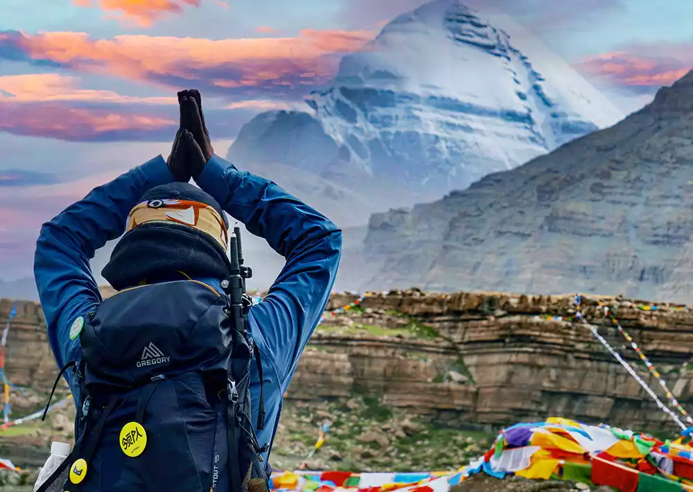
Mount Kailash: The Center of the World, 11-Day Circumambulation | A Himalayan Feast
¥7580 from 546 people have registered Register nowKulagangri circumambulation
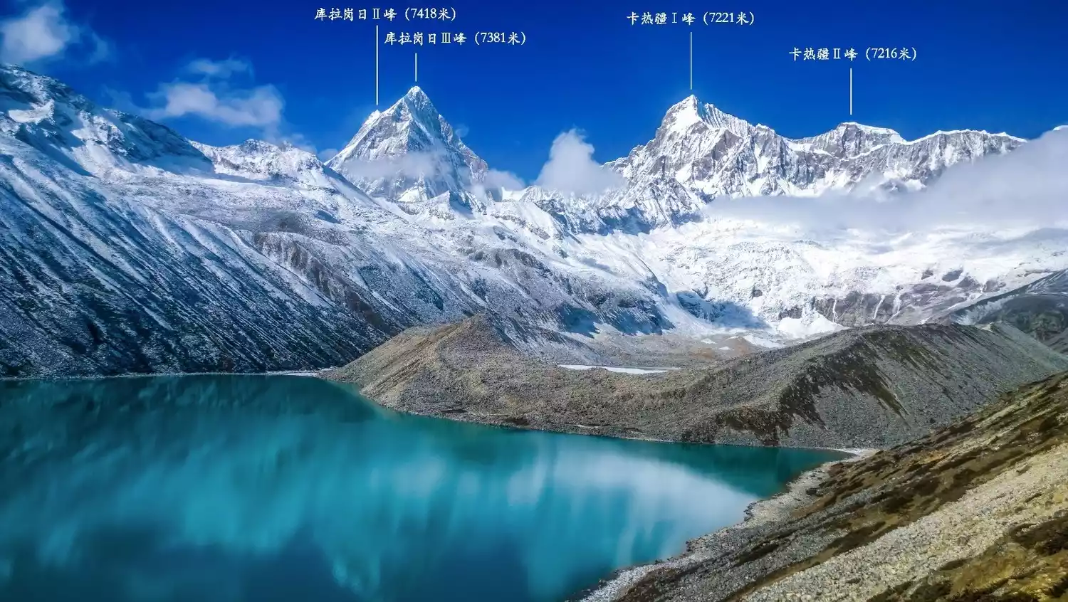
📍【Location】Located in the middle of the Himalayas on the border between China's Tibet Autonomous Region and Bhutan
🏔【Mountain Altitude】The main peak is 7538 meters above sea level, which is the highest peak in Shannan area. The hiking altitude range is 4200-4900 meters
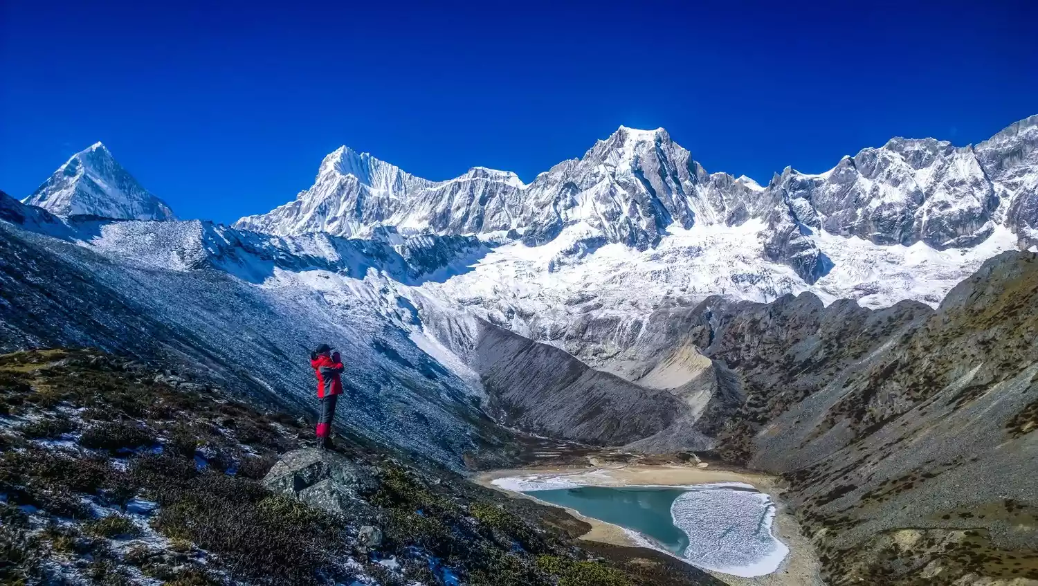
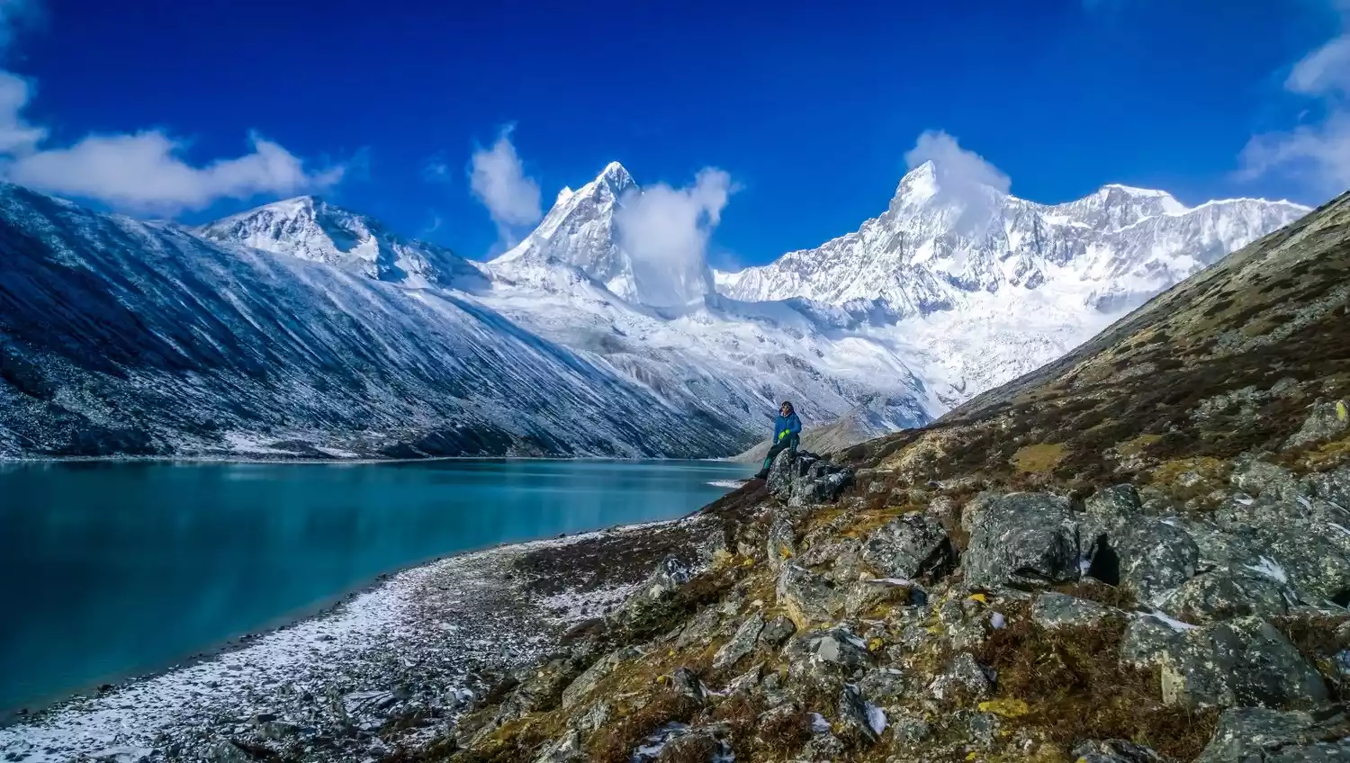
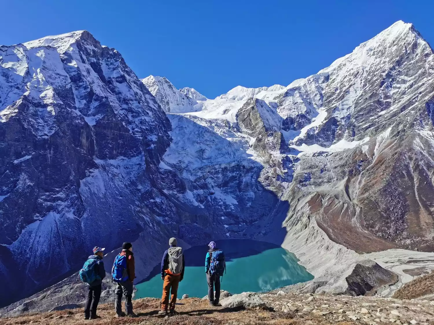
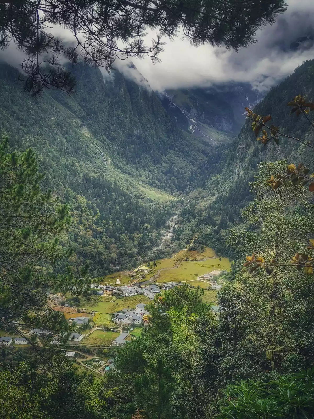
Plateau lakes and magnificent snow-capped mountains complement each other. This is Kula Kangri, standing in the middle section of the Himalayas. After crossing the Mondala Pass, you can get a close look at the spectacular Kula Kangri peaks - 6 snow-capped mountains over 7,000 meters. This is definitely the most stunning hiking route in the Kula Kangri area.
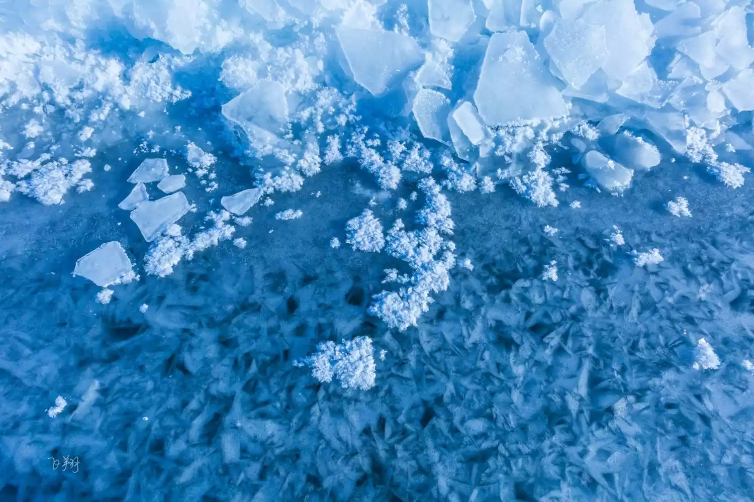
When you circumambulate Kulagangri in winter, in addition to the magnificent snow-capped mountains, you can also see the blue ice of Pumoyongcuo, which is exclusive to winter. The nearby villagers drive their sheep across the ice to the island in the middle of Pumoyongcuo. Every scene during the journey shows another side of life.
No more "one lake after another", this time you will be greeted by the small lakes hidden deep in the Tibetan area, such as Baimalincuo, Zhegongcuo, Jiejiucuo, etc., and explore the world's highest mysterious village - Tuiwa Village, where there are few people and beautiful scenery, and you can enjoy the most authentic appearance of Tibet.
Tips:
[Hiking Overview] The total itinerary is 6 days, including 3 days of hiking, with a total mileage of about 33km
[Activity Difficulty] ★★★★☆☆☆
Suitable for people aged 18-60, healthy, with high-altitude hiking experience, and no cardiovascular diseases such as high blood pressure and heart disease. Outdoor enthusiasts
[Best Travel Time] April to June and September to December are the best seasons for hiking in Tibet, with clear weather and good road conditions. From January to March, the lakes are frozen, offering fantastic blue ice views, making it a great time to see snow-capped mountains.
Depart from Lhasa | 6 days and 5 nights
6-Day Kulagangri Circumambulation | 30km Light Hiking to the Holy Mountains and Lakes
¥3780 from 829 people have registered Register nowCircumambulate Shishapangma Mountain
📍【Location】Located in Nyalam County, Tibet, China
🏔【Mountain Altitude】The main peak is 8027 meters above sea level, and the hiking altitude range is 4600-5200 meters.
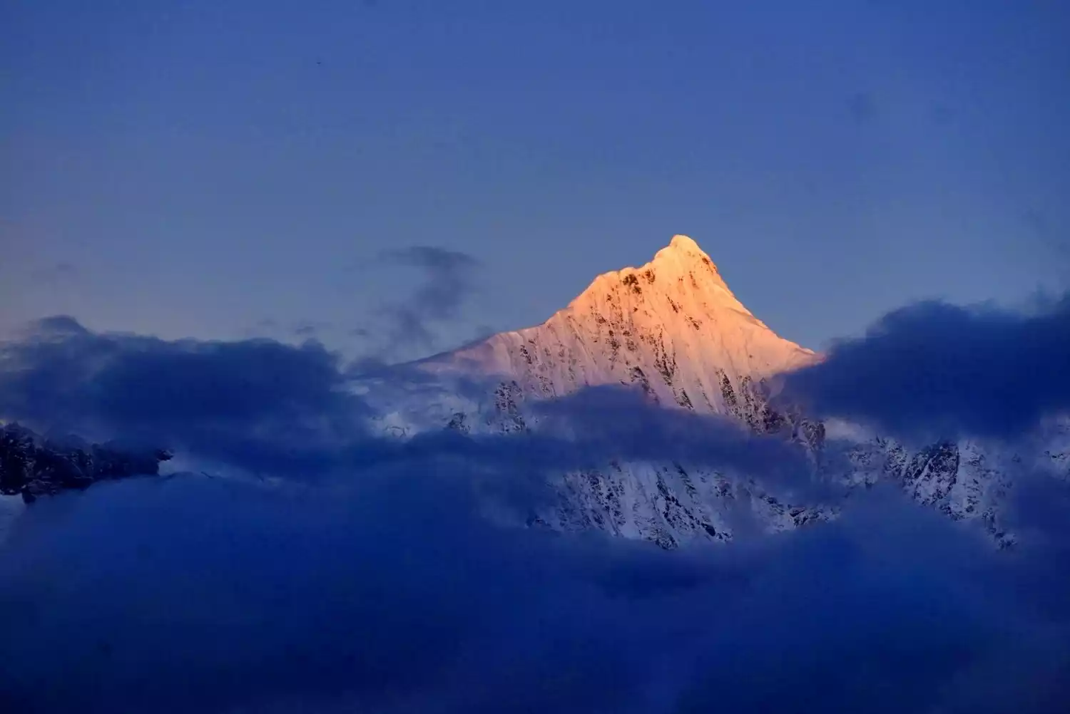
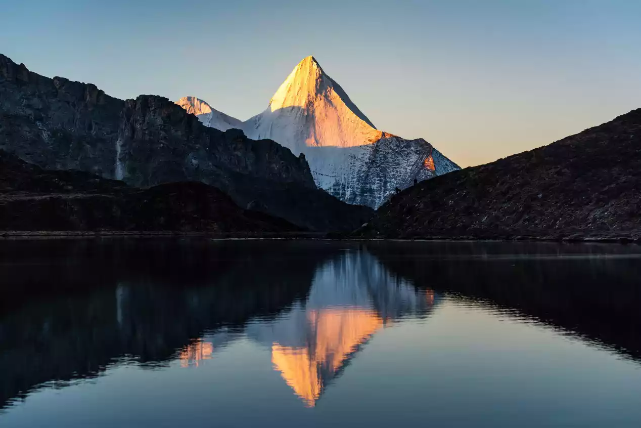
As one of the most famous peaks in the Himalayas, Shishapangma has a vast glacier area and seracs several thousand meters long.
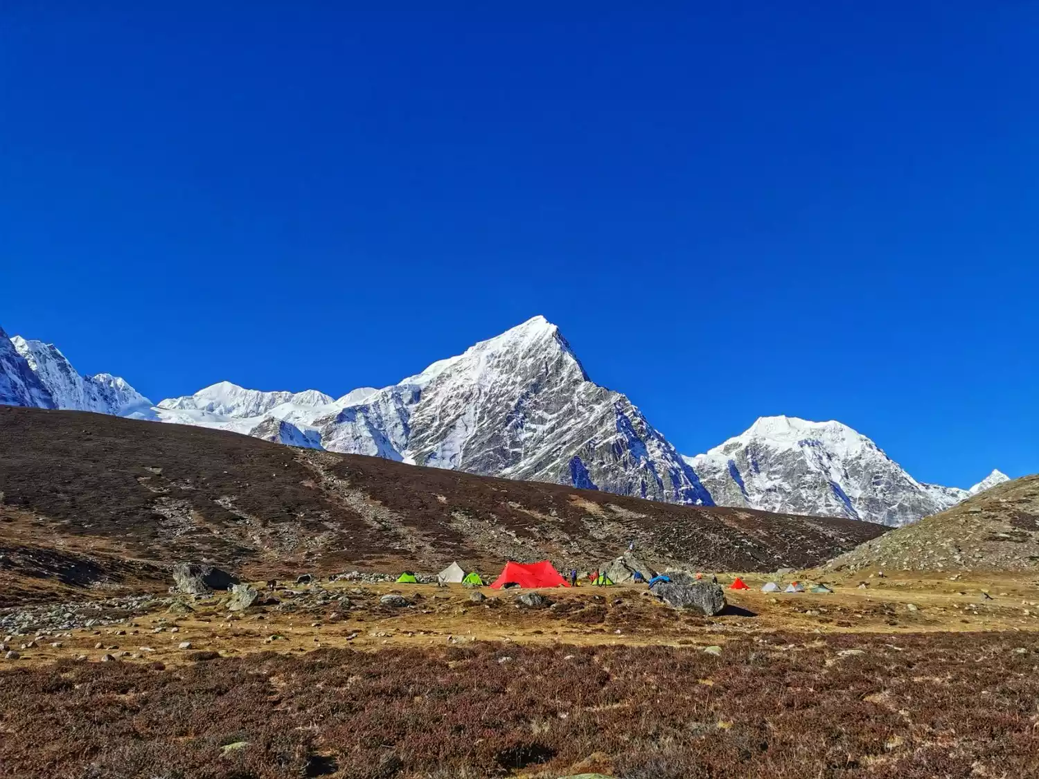
Our circumambulation trek, however, primarily covered open, flat terrain. High mountains, lakes, high altitudes, and a relatively gentle route were the defining features of the Shishapangma Circuit. By the time we reached Gongcuo Camp at 5,200 meters, Shishapangma was within 10 kilometers of us. This sense of proximity and imminent pressure was a powerful sensory experience for hikers.
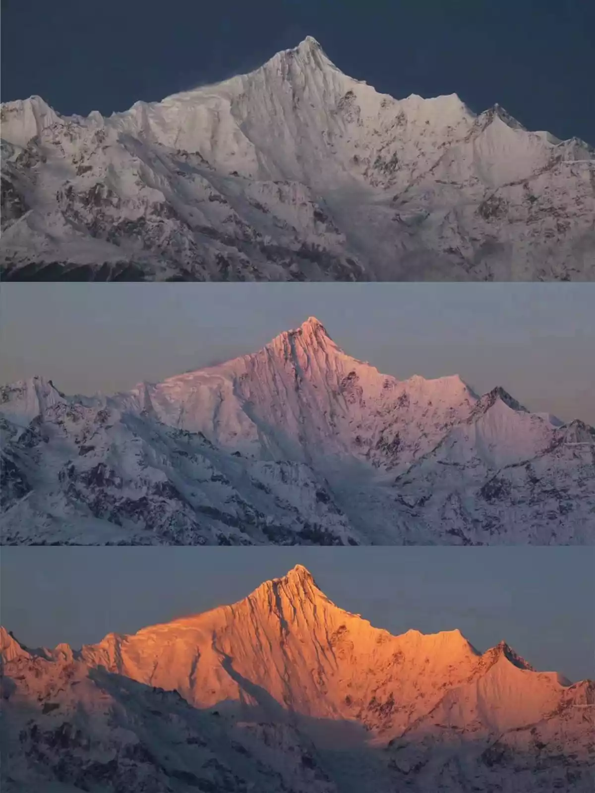
You can take pictures of the reflection of Shishapangma and the beautiful sunrise of Shishapangma on your rest day, leaving you with no regrets.
Tips:
[Hiking Overview] The total itinerary is 11 days, including 5 days of hiking, with a total mileage of approximately 41km
[Activity Difficulty] ★★★★★★☆
Suitable for: Extreme outdoor enthusiasts (aged 18-55, healthy) with plateau travel experience and physical fitness
[Best Travel Time] The best months to circumambulate the mountain are: April-May and September-November. During this period, there will be many consecutive days of good weather.
Meili Mountain Circumambulation
📍【Location】Located in the northeast of Deqin County, Diqing Tibetan Autonomous Prefecture, Yunnan Province
🏔【Mountain Altitude】Meili Snow Mountain is 6740 meters above sea level, and the hiking altitude range is 2150-3700 meters
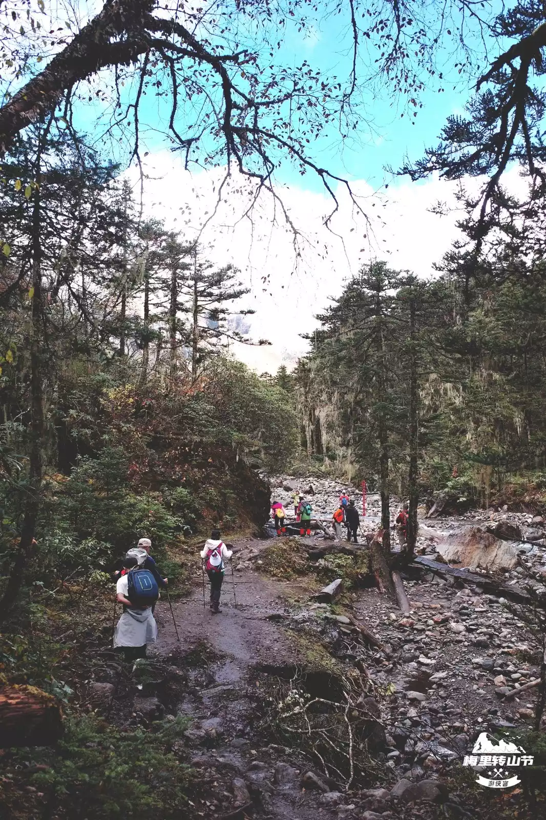
Meili Snow Mountain, a renowned pilgrimage site in Tibet and the highest peak in Yunnan, lies at the foot of the mountain. Yubeng Village, a Tibetan village, lies nestled in the vastness of the Lancang River, creating a sense of isolation.
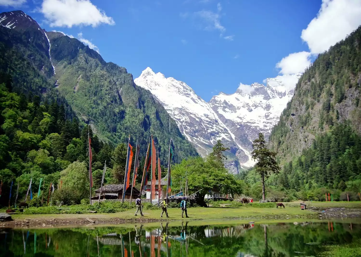
Walking is the main mode of transportation in Yubeng Village. Walking to Meili Neihuan, Yubeng Divine Waterfall, and under the double rainbow, you will suddenly realize the obsession of several lifetimes and let go of the obsession of several lifetimes.
Tips:
[Hiking Overview] The total itinerary is 7 days, including 4 days of hiking, with a total mileage of about 53km
[Activity Difficulty] ★★★★☆☆☆
Suitable for outdoor enthusiasts aged 16-65, healthy and free of cardiovascular diseases such as high blood pressure and heart disease
[Best Travel Time] June to August has heavy rainfall and is not suitable for mountain climbing. The winter and spring months from October to May are the best times to view the Meili Snow Mountain. The best season is after the end of October when the weather is clear and transparent and the main peak can often be seen.
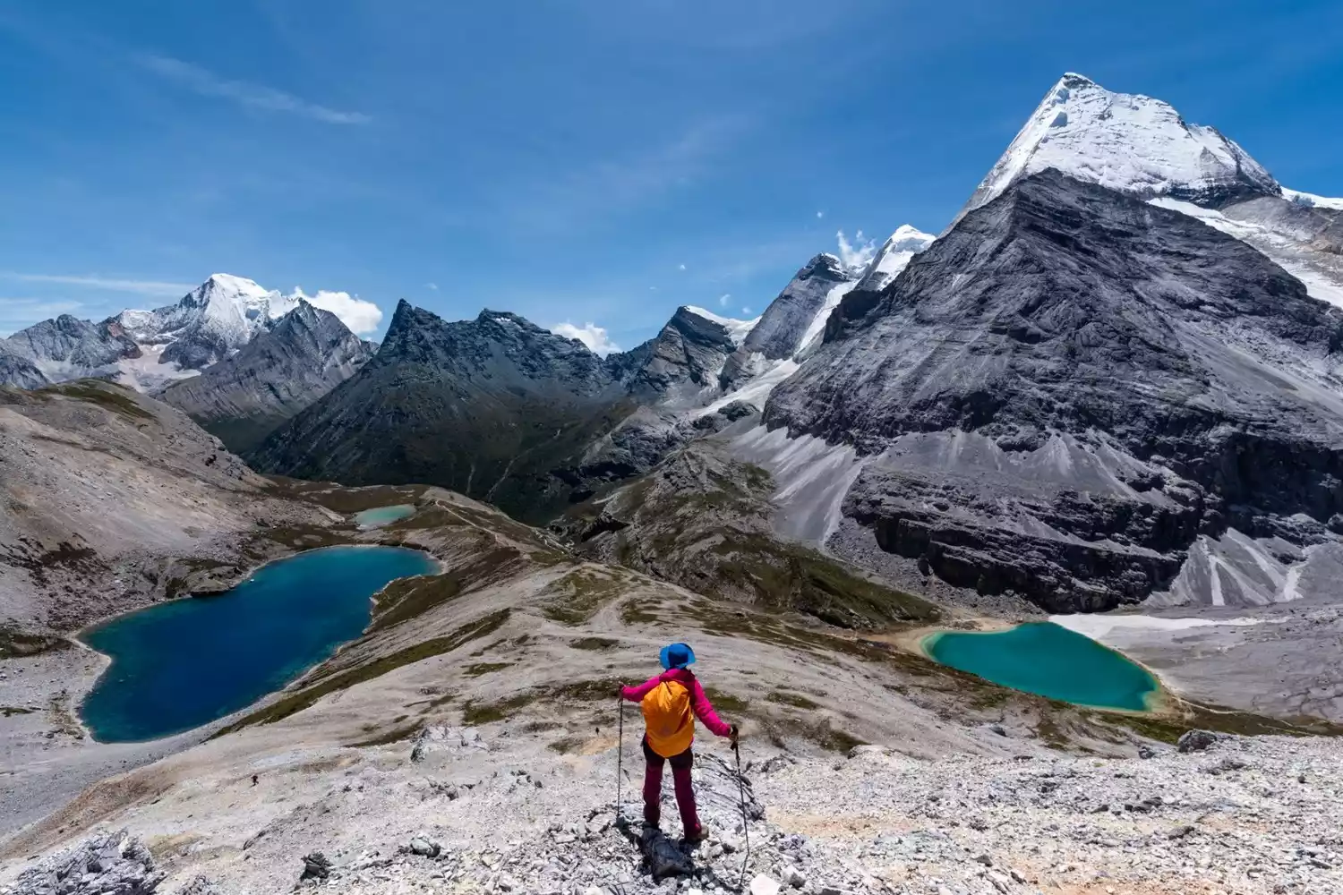
Yading Grand Pilgrimage
📍【Location】Located in Daocheng County, Sichuan, the peaks are Xiannairi in the north, Yangmaiyong in the south, and Xianuoduoji in the east.
🏔【Mountain Altitude】The highest altitude is 6032 meters, and the hiking altitude range is between 4000 meters and 5000 meters
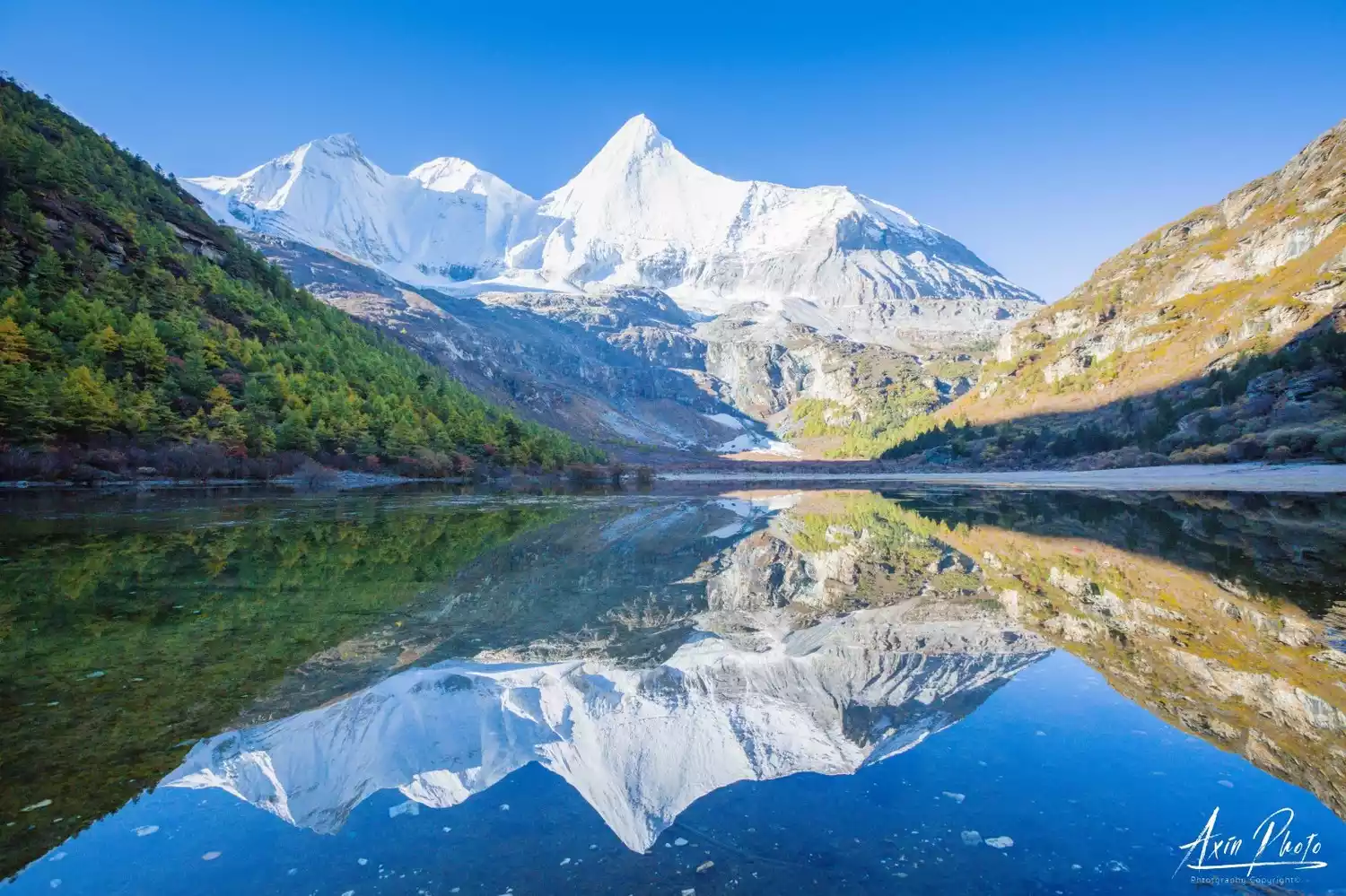
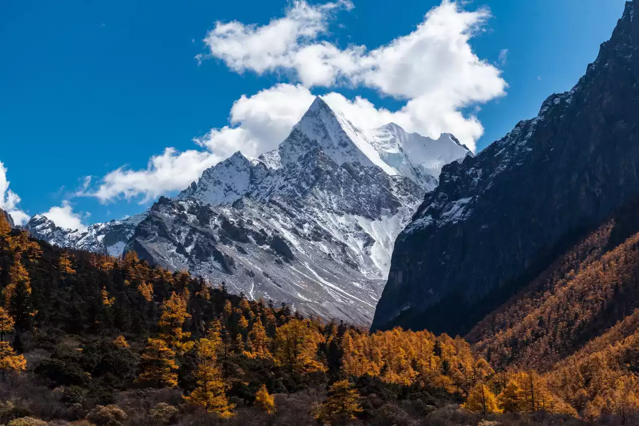
The Yading Grand Circumambulation Tour is based on the Rock Route hike. Starting from Chonggu Temple in the Daocheng Yading Scenic Area, the 7-day, nearly 80-kilometer trek circumambulates the perimeter of the Three Sacred Mountains. The journey offers breathtaking views of the three towering snow-capped peaks and passes through 10 alpine lakes, some of which are both internet-famous and lesser-known. This breathtaking scenery is no less difficult and intense than the Rock Route hike, so tourists are required to have appropriate physical fitness and hiking experience.
Tips:
[Hiking Overview] The total itinerary is 11 days, including 7 days of hiking, with a total mileage of approximately 78km
Difficulty: ★★★★★☆☆ Suitable for people aged 16-60, healthy, with experience in plateau travel and the physical ability to support it
Best Time to Travel: The best time to visit is during the azalea bloom season in late May and early June, when you can admire numerous seas of azalea along the way. The best time to visit is mid-to-late October, when you can see the vibrant forests blanketing the mountains. Rain and snow are also less likely during these two periods, making the chances of seeing snow-capped mountains higher.
Depart from Lijiang | 9 days and 8 nights
9-Day Yading Pilgrimage | Pilgrimage to the Three Sacred Mountains of Yading, Highland Adventure
¥7999 Starting from 39 people have registered Register nowCircumambulate the sacred mountain of Nagama
📍【Location】Located in Xiangda Town, Nangqian County, Qinghai Province, at the confluence of the Zaqu River and the Qiangqu River
🏔【Mountain Altitude】Mount Nagama is 3640 meters above sea level
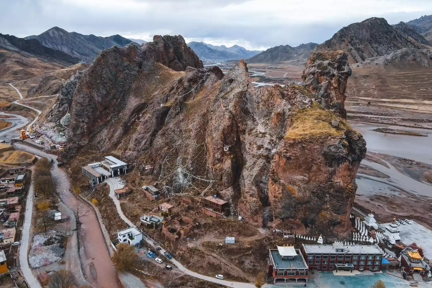
"Nagama" means "the first of a hundred sacred mountains", so Tibetans believe that circumambulating this mountain is equivalent to circumambulating a hundred sacred mountains.
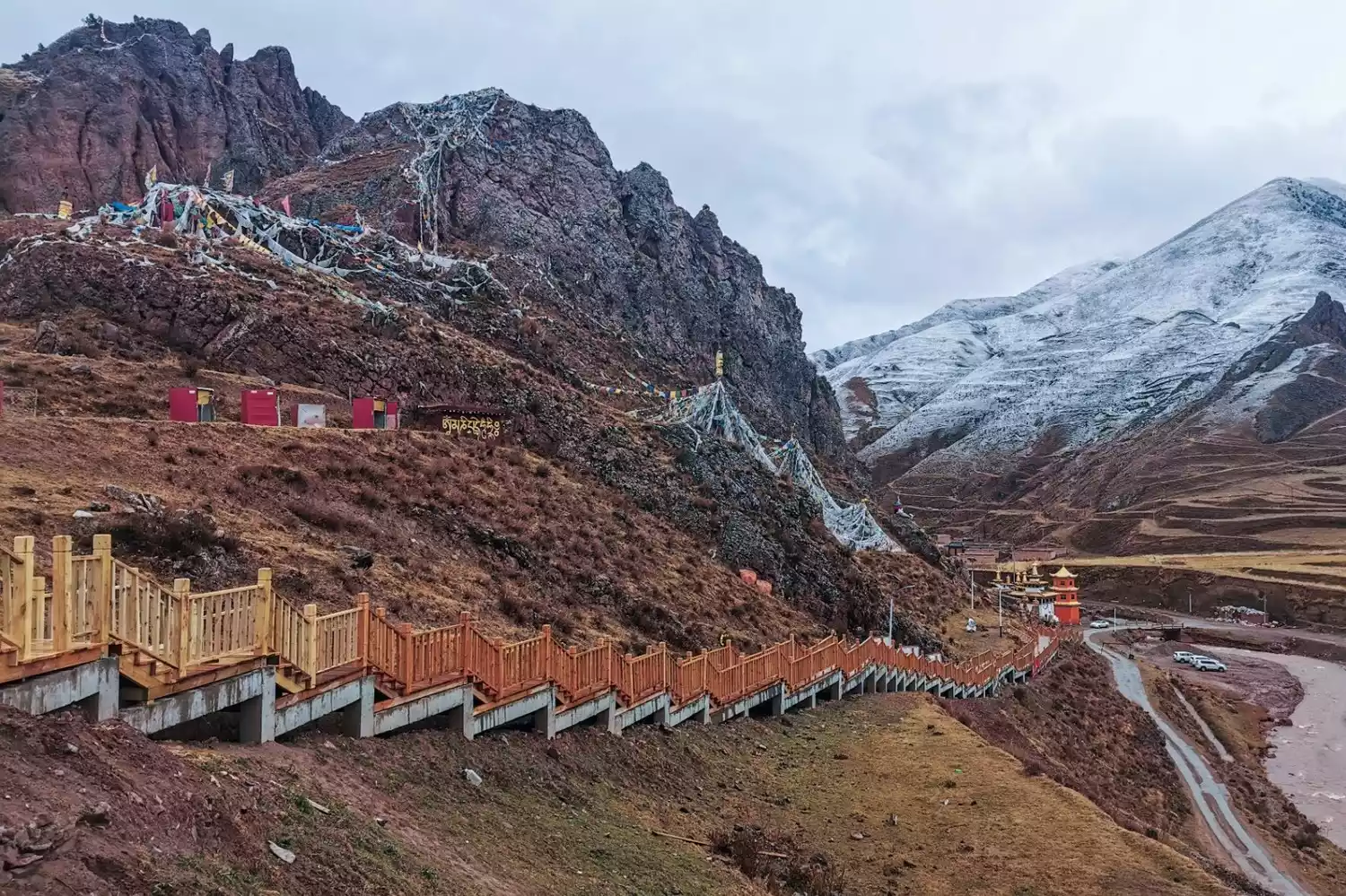
A complete circumnavigation of the sacred mountain is only 2km. We will complete the circumnavigation along the wooden plank road, completing our journey to the sacred mountain. We will then follow the breathtaking scenery of the Gar Monastery Grand Canyon to Gar Monastery. We will then ascend to the Upper Monastery amidst the rugged rocky peaks to explore its inner wonders.
Tips:
[Hiking Overview] The total itinerary is 10 days, including 1 day of hiking, with a total mileage of about 2km
Best Time to Travel: The best time to visit is during the azalea bloom season in late May and early June, when you can admire numerous seas of azalea along the way. The best time to visit is mid-to-late October, when you can see the vibrant forests blanketing the mountains. Rain and snow are also less likely during these two periods, making the chances of seeing snow-capped mountains higher.
Depart from Xining | 7 days and 6 nights
7-Day Off-Road Adventure: Nangqian Secrets | Explore the Secrets of Qinghai and the Source of the Yangtze River, Yushu
¥7980 from 42 people have registered Register nowConclusion
These sacred mountains may not be the highest peaks in the mountains, nor are they popular online attractions, but once you step into the territory of the sacred mountains, its stories will be imprinted in your mind bit by bit.
The sense of accomplishment of crossing the mountain pass, the plateau lakes you pass by, the snow-capped mountains visible above—the scenery here is pure and untouched by the mundane, and the experience here is unprecedented and awe-inspiring. The majesty and mystery of the sacred mountain will make every pilgrim want to embrace it.