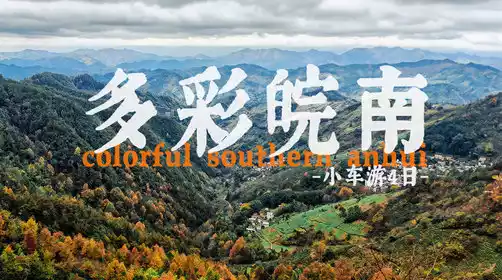
A self-driving guide to the Yunnan-Tibet Highway: the best routes into Tibet. See all the beautiful scenery along the way in one guide!
Preface
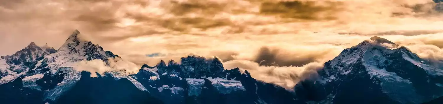
For those who love road trips, the Yunnan-Tibet Highway has always been a god-like existence. Because it has always been the most difficult road to Tibet, there are dense mountains, canyons and rivers along the way, and the road conditions are complicated, but what comes with it are magnificent natural scenery and wonderful cultural customs!
Compared with the classic 318 Sichuan-Tibet Highway, a self-driving trip along the Yunnan-Tibet Highway allows you to see more cultural customs, more obvious changes in the geographical environment, and more diverse natural landscapes. It is another special and novel experience.
More and more people are choosing to drive to Tibet. Every year from May to October, scores of drivers flock to experience the wonders of this route. Starting today, we'll embark on this classic route, using wheels instead of feet to explore the wonders of the Yunnan-Tibet Highway, both grand and minor.
Route Overview
Classic Yunnan-Tibet Line
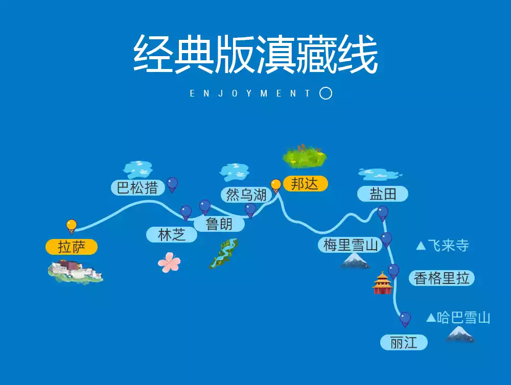
The altitude rises slowly from low to high throughout the entire route, covering all the classic check-in destinations and giving tourists more room to adapt.
DAY1: Lijiang gathering day
DAY2: Lijiang - Shangri-La - Feilai Temple
DAY3: Feilai Temple - Salt Well - Dongda Mountain - Zuogong
DAY 4: Zuogong - 72 bends of Nujiang River - Basu - Ranwu Lake
DAY5: Ranwu Lake - Midui Glacier - Lulang
DAY6: Lulang - Sejila Mountain - Nyingchi - Basongcuo
DAY7: Basongcuo - Disbandment Day in Lhasa
Advanced Yunnan-Tibet Line
Explore the deep mountains of Sap, walk into the mysterious Holy Elephant Gate, and visit the original Tibetan villages. It is like a landscape corridor that combines classic and niche elements.
DAY1: Lijiang gathering day
DAY2: Lijiang - Shangri-La - Feilai Temple
DAY3: Feilai Temple - Salt Well - Mangkang
DAY4: Mangkang - Qamdo - Leiwuqi
DAY5: Leiwuqi - Zizhu Temple - Baqing
DAY6: Baqing - Sapu Sacred Mountain - for example
DAY7: For example - Bangor
DAY8: Bangor – Holy Elephant Gate – Lhasa
DAY9: Lhasa disbandment day
Pilgrimage scenery along the way
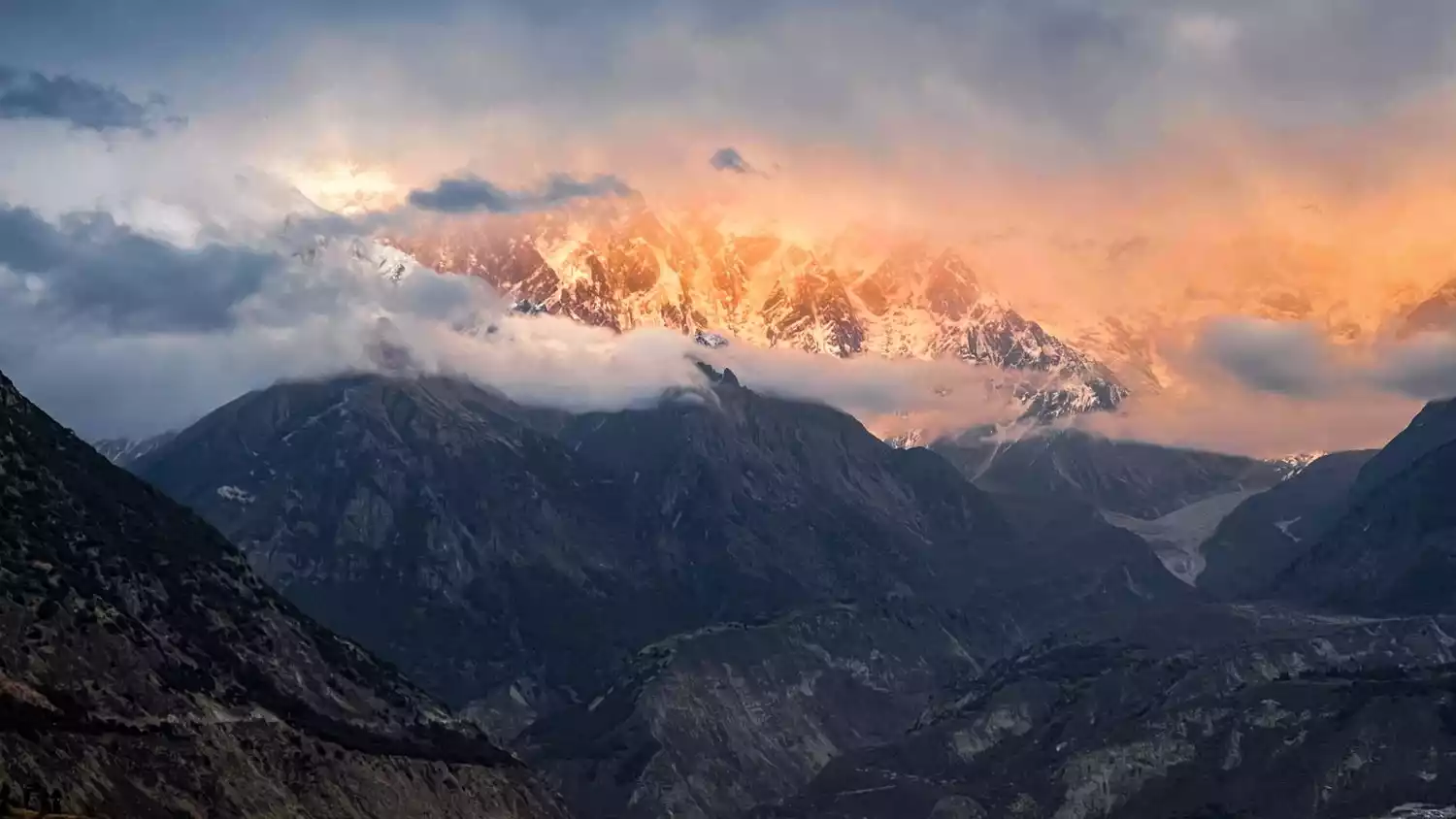
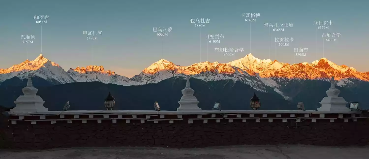
Meili Snow Mountain
Located in Deqin County, Diqing Tibetan Autonomous Prefecture, Yunnan Province, there are 13 peaks with an average altitude of more than 6,000 meters, known as the "Thirteen Peaks of Prince". The main peak, Kawagebo Peak, has an altitude of 6,740 meters and is the highest peak in Yunnan.
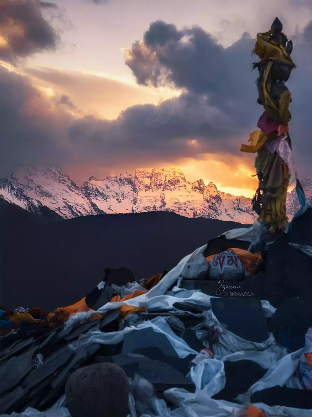
The Meili Snow Mountain has both the magnificence of the snowy plateau and the beauty of the south of the Yangtze River: on top of the snow-capped mountains, there are cirques and glaciers, and the ice and snow are dazzling. They are rare modern marine glaciers in the world; below the snow-capped mountains, there are azure and soft lakes, vast forests and boundless grasslands, which bring a strong impact to people both in terms of feeling and color.
⏰Best time to travel
The best time to view Meili Snow Mountain is from October to May in winter and spring. The best season is after the end of October when the weather is clear, the air is clean, and the transparency is high, and you can often see the main peak.
salt wells
The Mangkang Salt Well is located in the Hengduan Mountains in the southeast of the Tibet Autonomous Region, at the intersection of Yunnan, Sichuan and Tibet provinces, and is the eastern gate of Tibet.
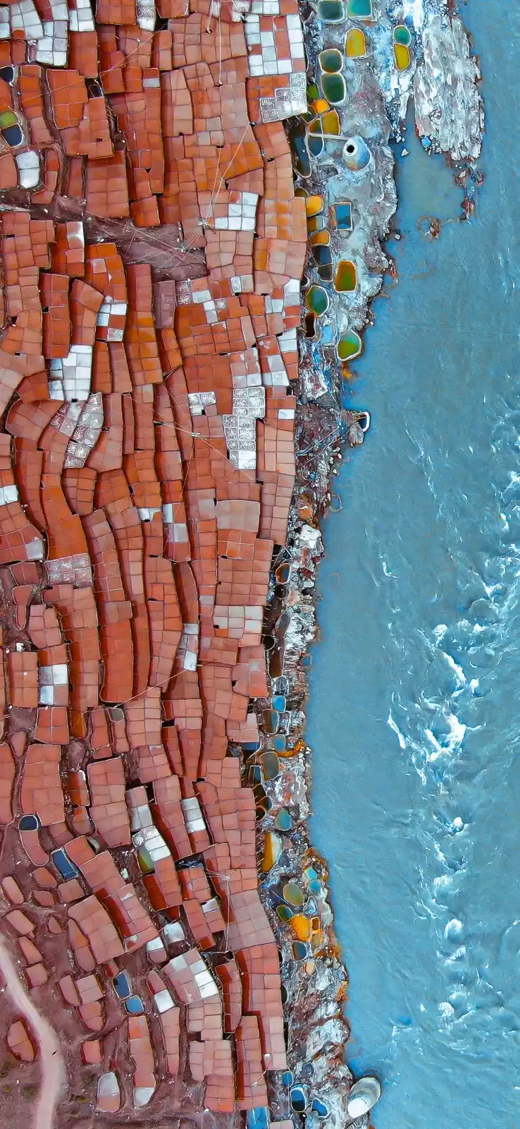
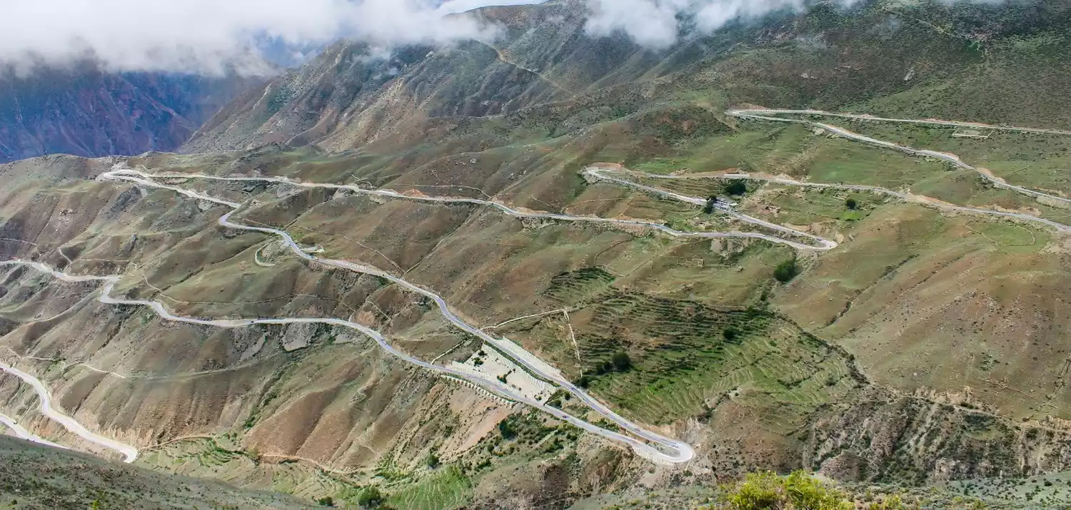
The traditional handmade salt production in the ancient salt fields has a history of 1,300 years. It is the only place in my country that has preserved the original and complete handmade salt drying method and has been recognized as a national intangible cultural heritage. Historically, the Mangkang Salt Well was the main route from Tubo to Nanzhao, and it was also the only way for Yunnan tea to be transported to the inland of Tibet. Today, it is the first stop on the Yunnan-Tibet Highway from Yunnan to Tibet.
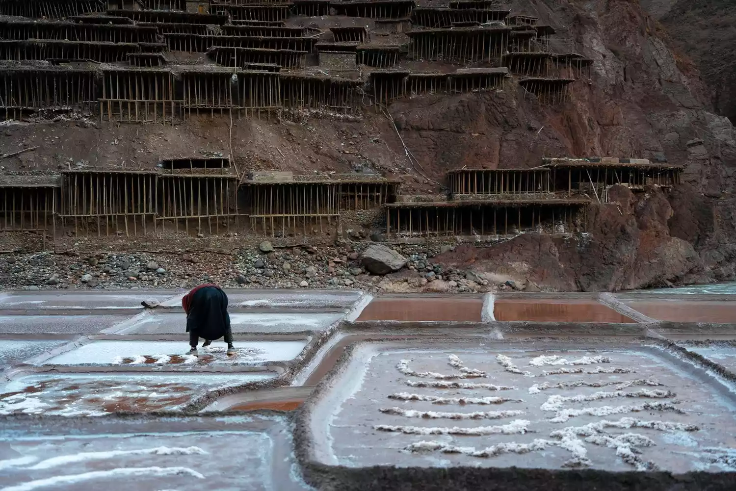
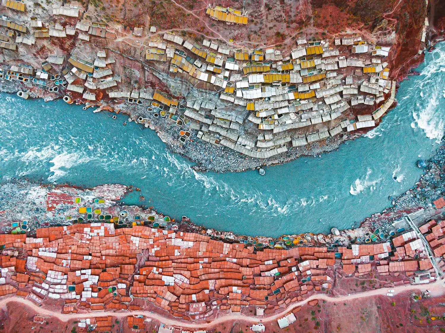
The salt fields built layer by layer on the mountain are majestic. The processed salt is red and white. Taken from overhead drone photos, it looks like a palette of warm colors. The salt farmers follow the footsteps of their ancestors, working hard on the rugged and dangerous trails, continuing their lives while also creating a unique landscape in the world.
⏰Best time to travel
The climate here is relatively hot and dry. The peak season for salt mining is from March to May. During this period, you can come and see the craftsmanship handed down from ancient times.
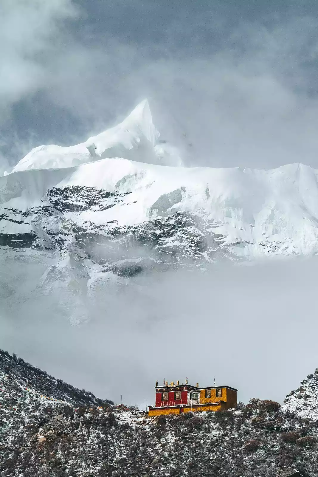
Zizhu Temple
Located on the famous Zizhu Mountain in Dingqing County, Qamdo Prefecture, eastern Tibet, it is one of the oldest and most important temples of Yungdrung Bon and one of the highest temples in Tibet.
While Zizhu Monastery is a cultural attraction, its natural beauty is also truly remarkable: rising majestically from a sheer cliff face, it towers over the surrounding peaks. Six overlapping Zen caves and jagged rocks symbolize the Six Perfections. Its high altitude imbues the monastery with an inherent sacredness, attracting many believers who practice meditation there. The caves nestled within the precipitous cliffs have become a pilgrimage site.
⏰Best time to travel
The best time to worship at Zizhu Temple is from late June to mid-August. At the end of June every year, Zizhu Temple holds an annual Dharma assembly and religious dance.
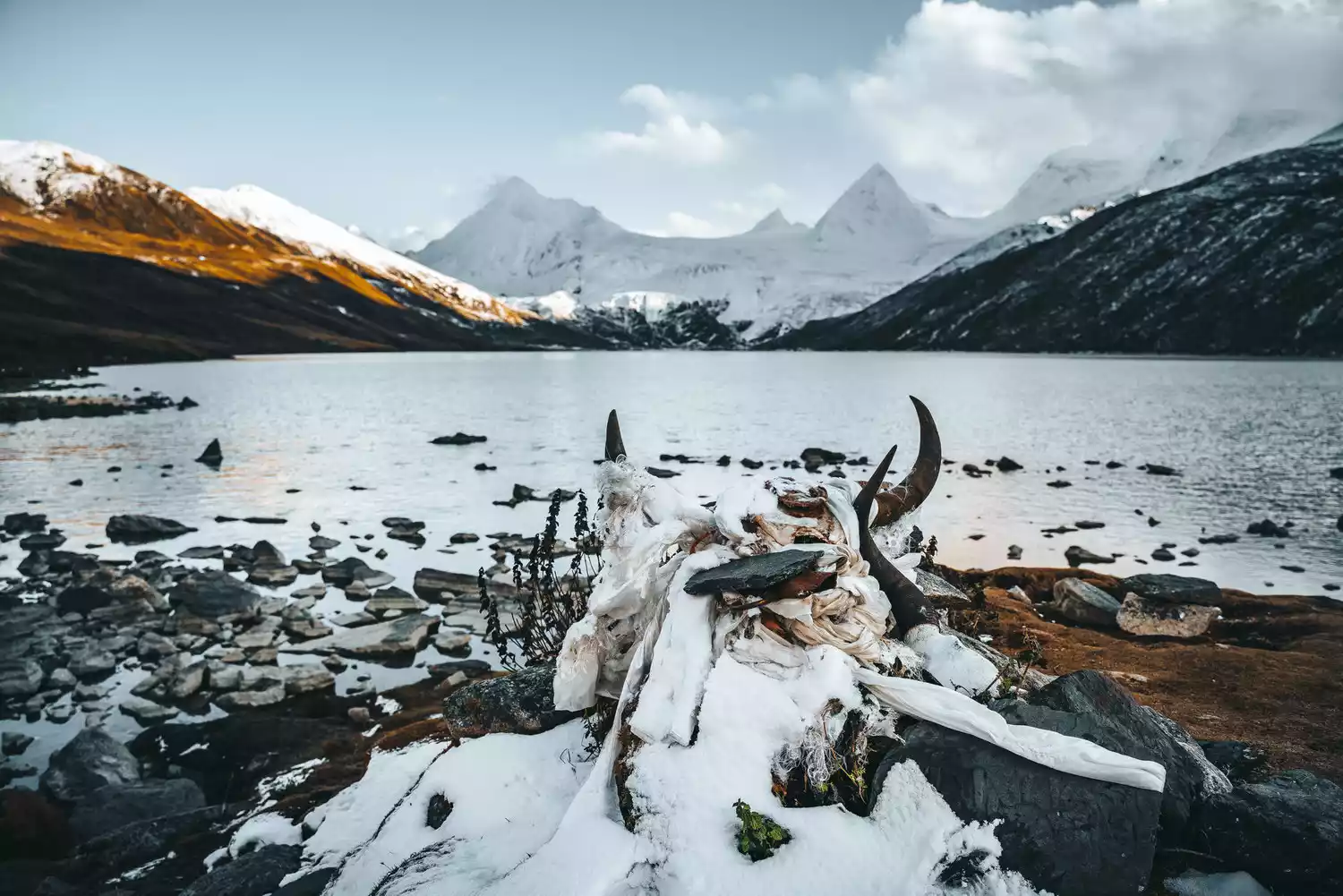
Three Color Lake
Located in Puyu Village, Bianba County, Qamdo Prefecture, Tibet Autonomous Region, the "Three Color Lakes" are Black Lake, White Lake and Yellow Lake. They appear different colors under the sun, hence the name "Three Color Lakes".
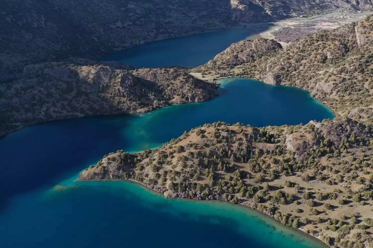
The Black Lake, one of the three lakes, is not black, but turquoise. From a distance, it appears emerald green, contrasting beautifully with the distant mountains, creating a fairyland-like scene. The White Lake is a pale grey, with green trees reflected on its surface and fish leaping in the water, creating a lively scene. The Yellow Lake is crystal clear, and in summer, visitors can even see vast expanses of unknown flowers blooming by its banks. The three lakes are arranged in an irregular "品" (Chinese character for "品") pattern, resting peacefully in the embrace of Tibet's sacred mountain, Nyainqentanglha. They are all formed by meltwater from the mountain's snow.
The scenic area not only concentrates on natural landscapes such as plateau lakes, sharp glaciers, strange mountains and peaks, but also has the Bianba Temple with a history of more than 700 years and the Dazong Ruins with a history of more than 400 years.
⏰Best time to travel
There are many sunny days and long sunshine here, and the four seasons are not distinct, so you can appreciate the unmissable beauty of the plateau lakes no matter when you come: the hottest months are July and August, and the coldest months are December and January.
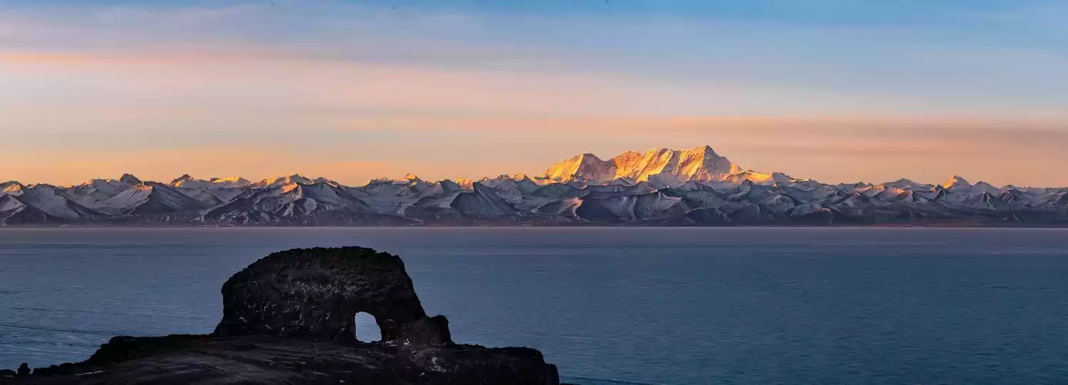
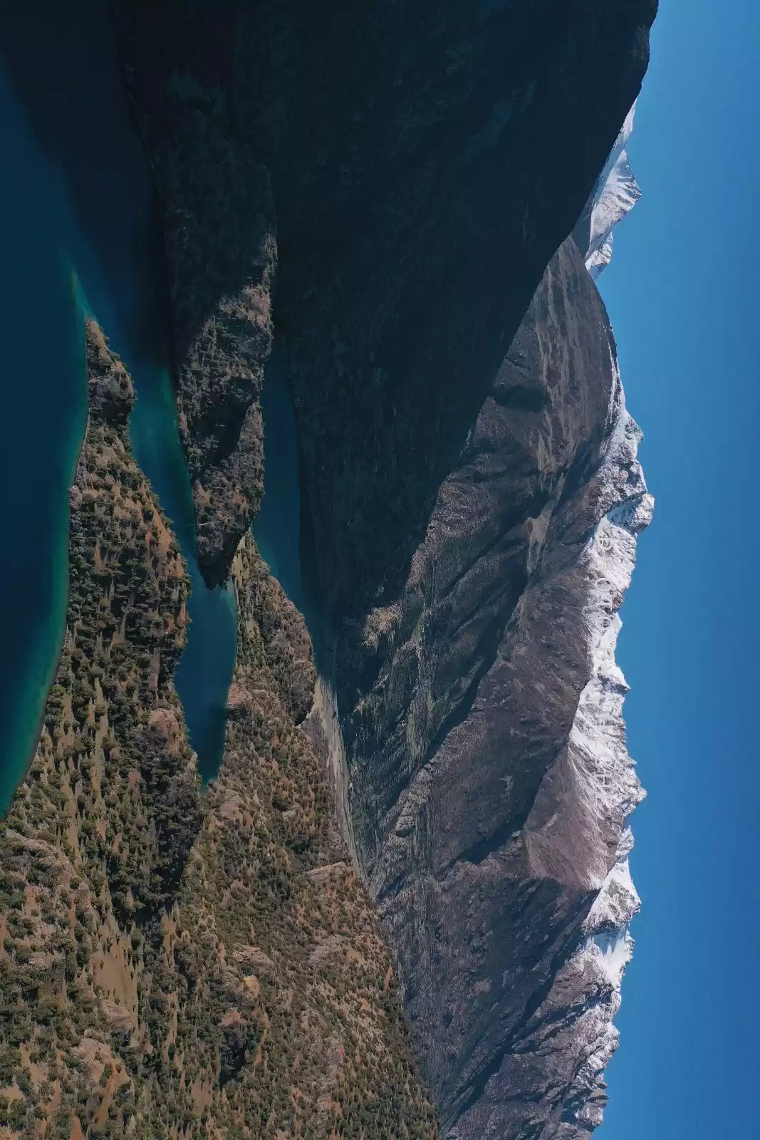
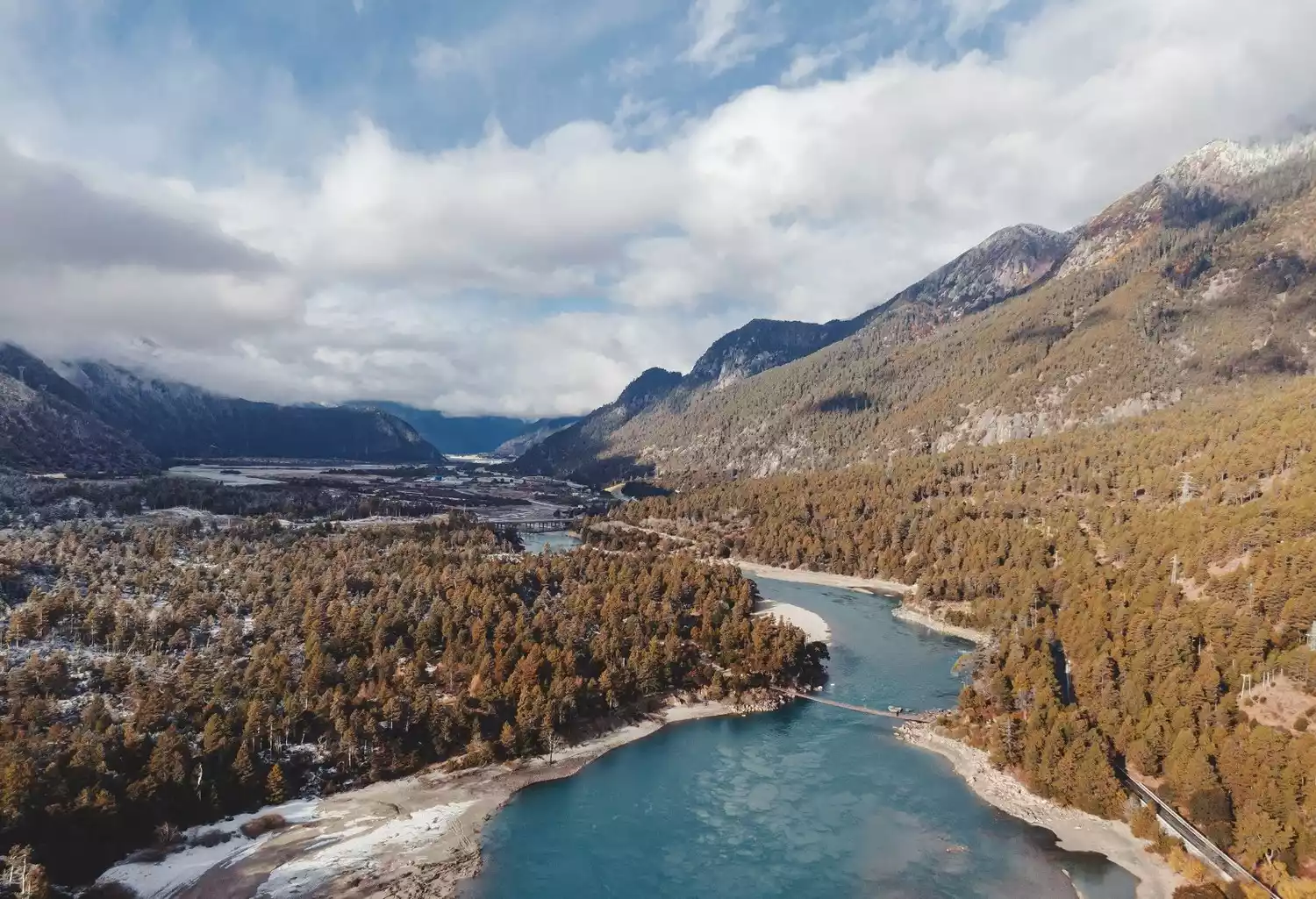
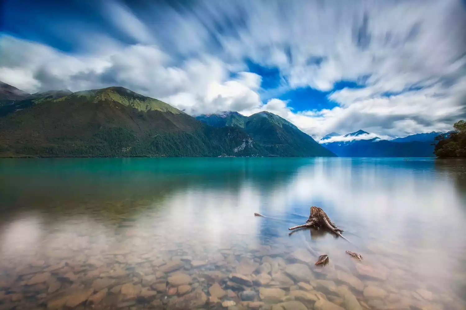
Ranwu Lake
Located on the Sichuan-Tibet Highway, 89 km southwest of Basu County in Qamdo, Tibet, it is the main source of the Parlung Tsangpo River, a tributary of the Yarlung Zangbo River.
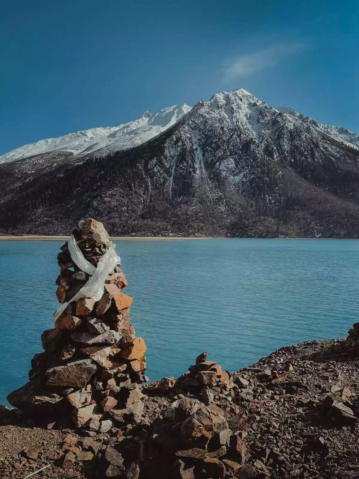
The surface of Ranwu Lake is like a mirror. The water appears in several colors such as blue or green in different seasons. There are also extremely rich lakeside scenery. In spring, the shadows of trees are swaying, and in autumn and winter, the mist is filled. In the near distance are green grasslands and freshly harvested barley fields. In the distance, there are colorful rhododendrons and shrub forests on the hillside. The top of the mountain is covered with snow-capped mountains that never melt and undulate all year round, forming the unique and magnificent scenery of the Qinghai-Tibet Plateau.
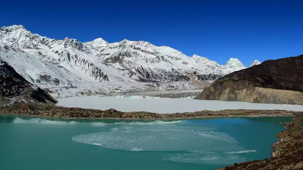
There is also the famous Laigu Glacier to the north of Ranwu Lake. The glacier extends to the lakeside. Whenever the ice and snow melt, the snow water flows into the lake, ensuring that Ranwu Lake retains abundant water resources.
⏰Best time to travel
Late autumn is the best time to visit, when the sky is clear and the lake is calm and blue.
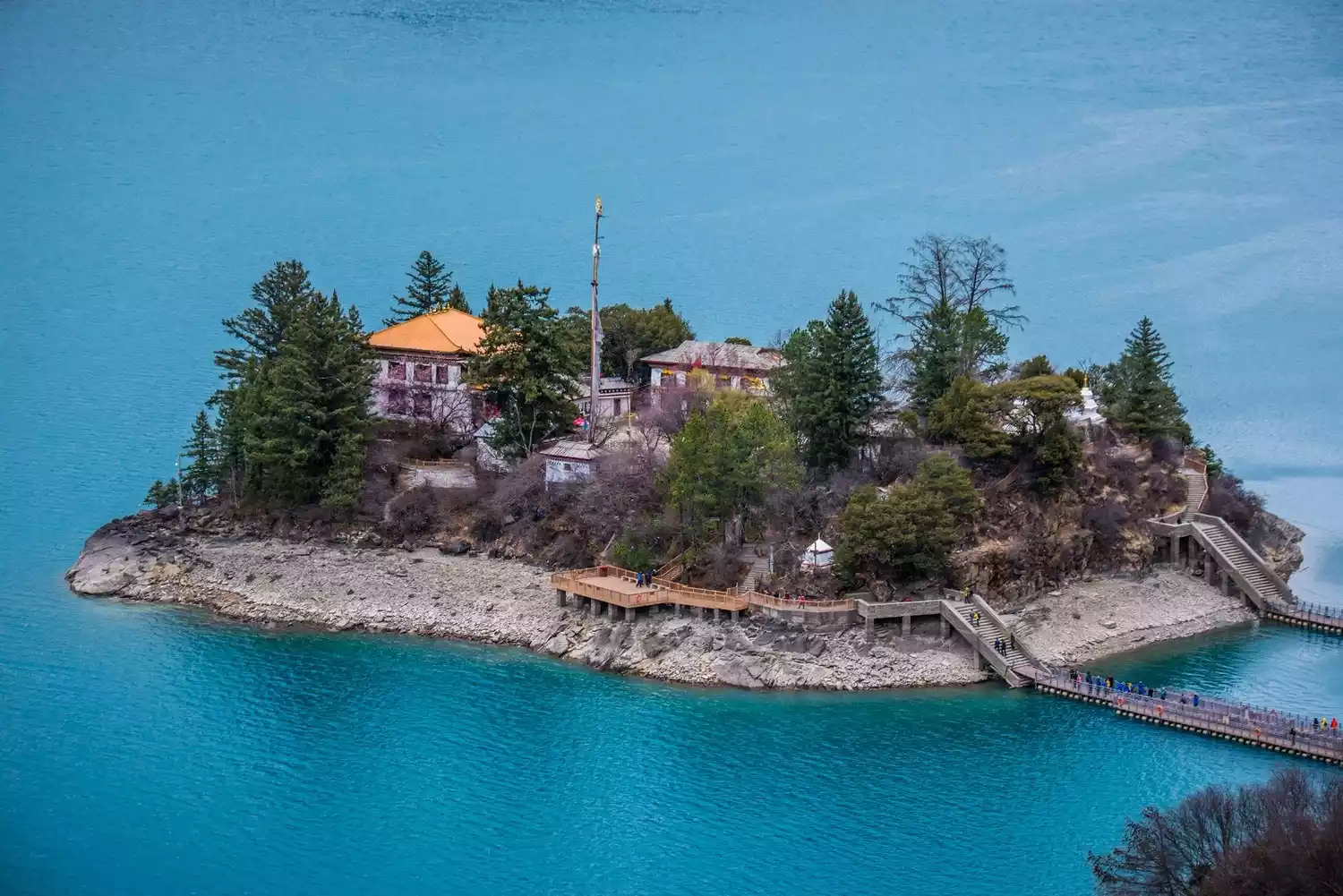
Basongcuo
Located in the high gorge and deep valley in the upper reaches of the Ba River, more than 50 kilometers away from Gongbu Jiangda County in Nyingchi Prefecture, it is a famous holy place of the Red Sect of Tibetan Buddhism.
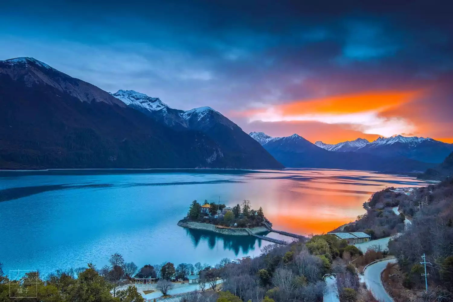
About 100 meters from the shore of Basongcuo lies a small island called Zaxi Island. Legend has it that it's a "hollow island," meaning it's not connected to the lakebed but floats on the surface. When you visit the island, try stamping your feet to see if you feel a hollow sensation.
On the island there is a Tang Dynasty building called "Cuozong Gongba Temple". On both sides of the entrance are wooden carvings of male and female genitals. The god of fertility is the patron saint of the plateau residents, protecting the health and happiness of themselves and their families.
⏰Best time to travel
Spring and autumn are the best seasons: in spring, flowers are in full bloom and snow-capped peaks are reflected in the lake; in autumn, the mountains are covered in red, the forests are dyed red, and the fiery red maple leaves reflect the bright sunlight and are reflected in the blue lake. The scenery is breathtaking.
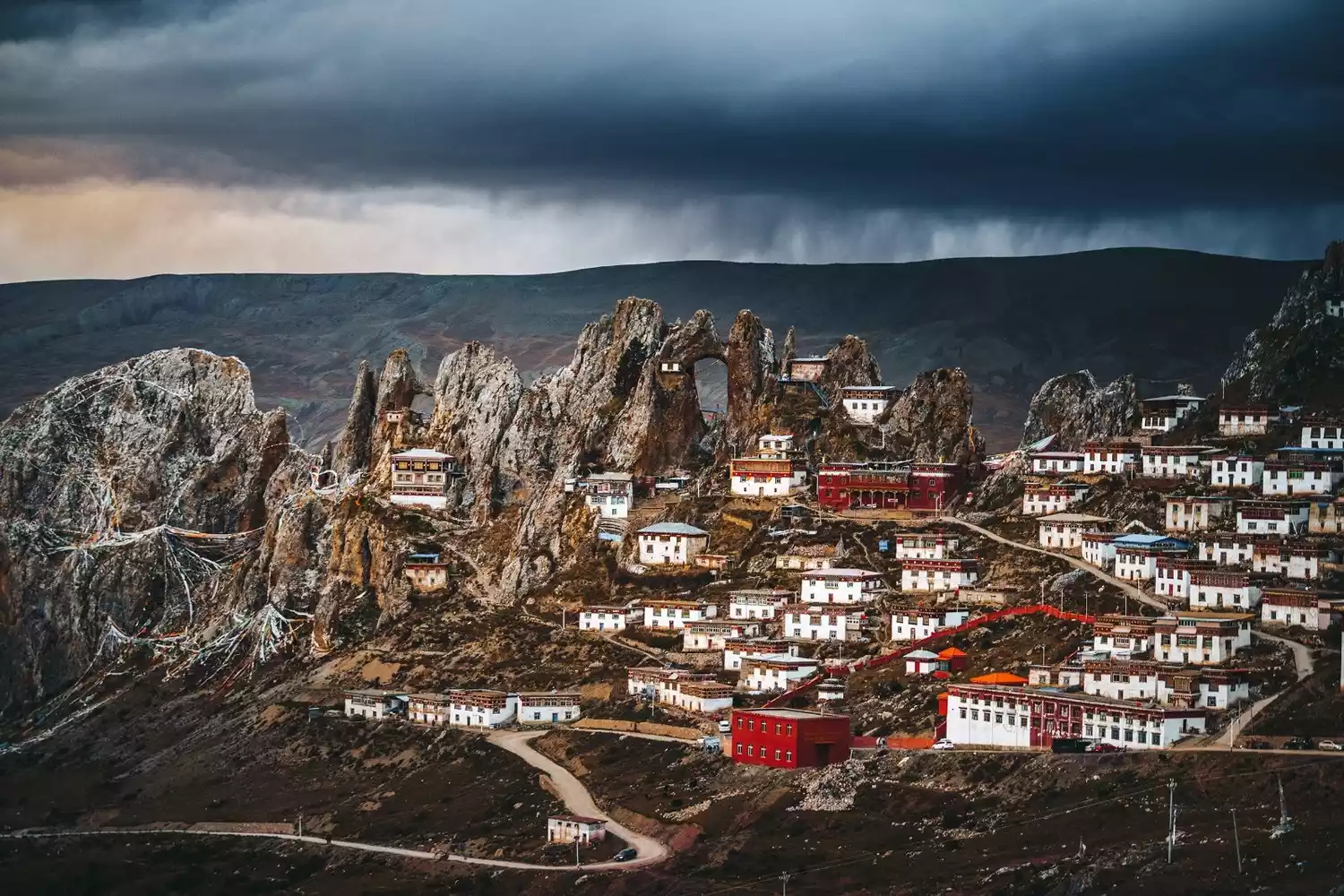
Sapu Sacred Mountain
Located in Puzonggou, Yangxiu Township, Buqi County, it is surrounded by mountains and covered with snow all year round. It is mysterious and stunning. The main peak is revered as the king of the local sacred mountains.
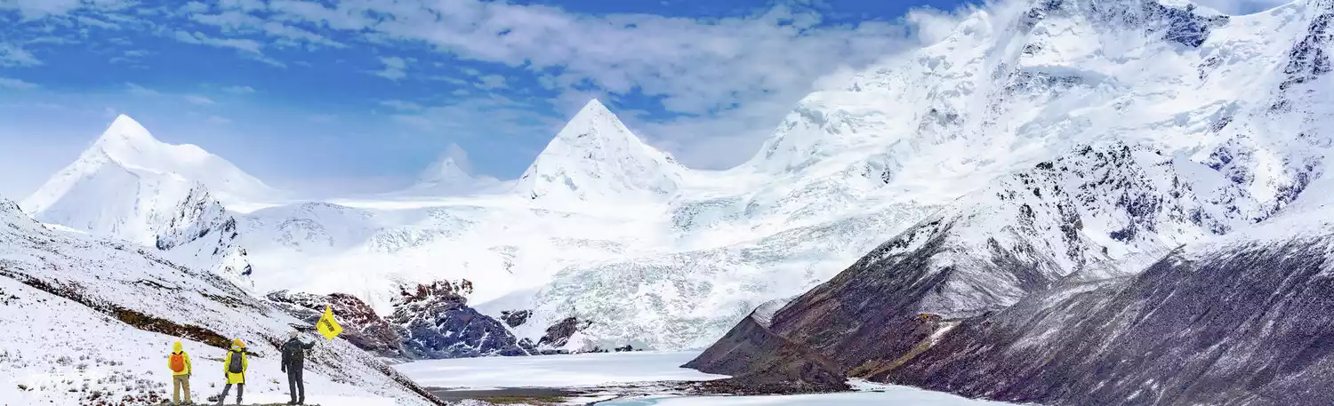
Sapu Snow Mountain boasts a unique mountain shape and pristine glaciers. The entire sacred lake is actually a cluster of peaks and glaciers. The snow-capped mountains, from left to right, represent Sapu's wife, his illegitimate son, Sapu's second son, Sapu's eldest son, Sapu, and Sapu's daughter. Due to the high altitude and the rugged and treacherous road leading to Sapu Sapu, this breathtaking and mysterious glacier has stood quietly for millennia, and access to the foot of the sacred mountain is inaccessible without an off-road vehicle.
⏰Best time to travel
Every summer, the top of Sap Lake is covered in snow and shrouded in mist, while at its base, flowers bloom, grass grows green, and the water and grasses flourish. Every year on May 15th, a grand religious ceremony of circumambulating the lake and praying for blessings is held near Sap Lake, attracting many pilgrims.
Namtso Lake·Holy Elephant Gate
Namtso Lake is located between Dangxiong County and Bange County, the southeastern border of Nagqu City. It is the second largest lake in Tibet and the third largest saltwater lake in China.
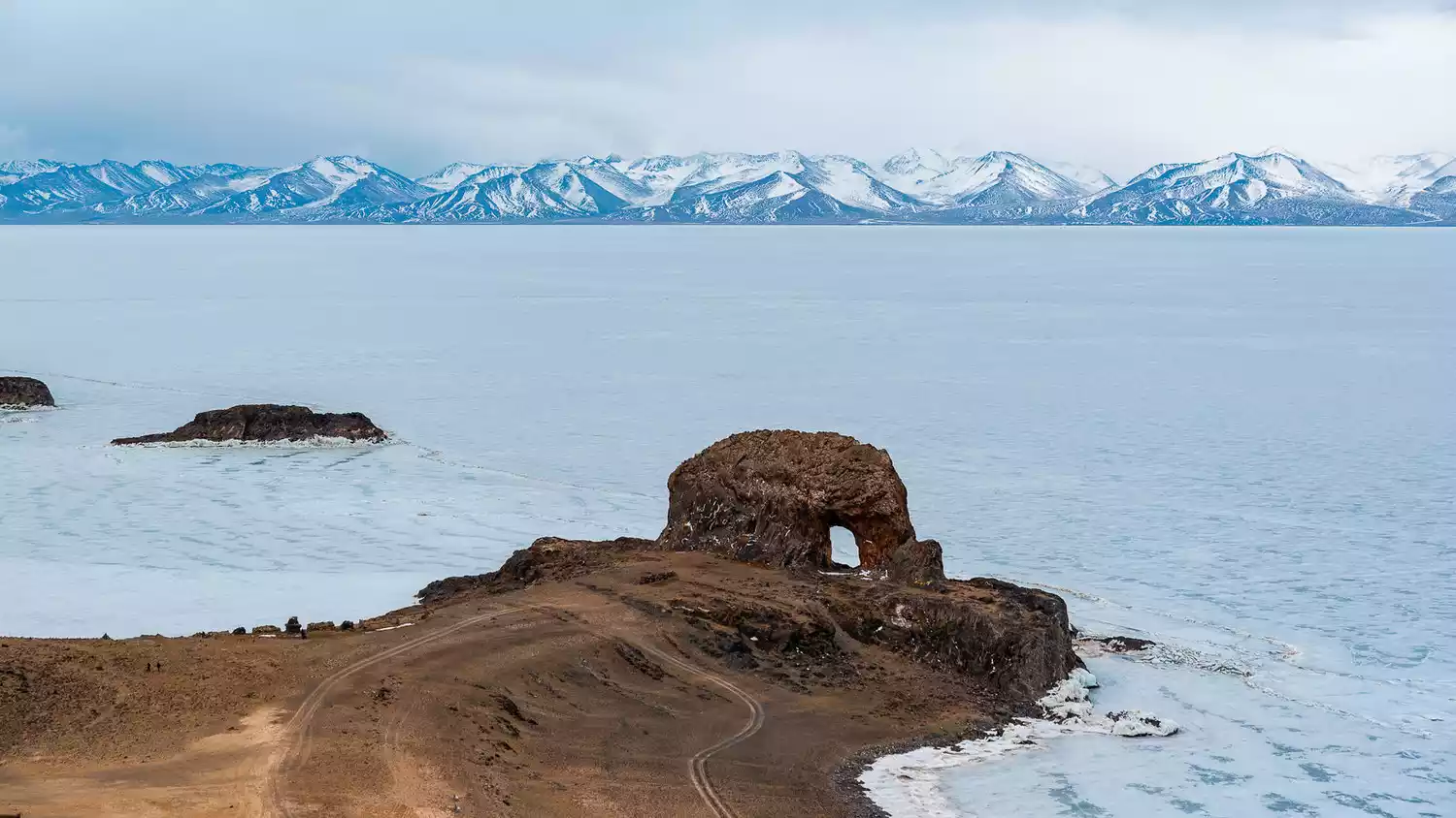 To the south lies the Nyainqentanglha Mountains, which are covered with snow all year round, and to the north lies the plateau hills. It is like a huge mirror inlaid on the northern Tibetan Plateau. The deep blue water of the lake adds a bit of mystery.
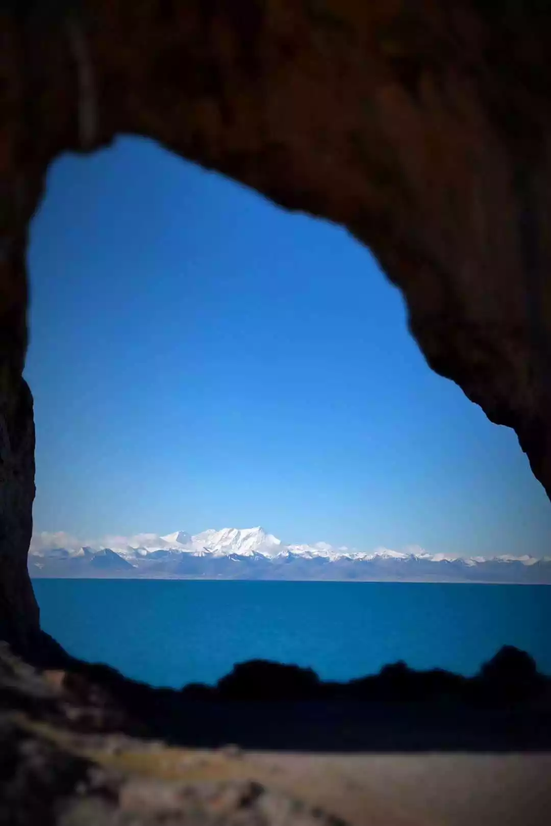

On the Chaduolangka Island in the north of Namtso Lake, there is a huge naturally formed stone elephant - the Holy Elephant Heavenly Gate. The area between the stone elephant's body and trunk is regarded by local believers as the holy gate to heaven. Countless monks and hermits practice meditation here. Because it is very niche, it is known as the last mysterious place in Tibet.
⏰Best time to travel
The rainy season is from June to September. From October to November, Namtso is inaccessible due to heavy snow. From November to May, the weather is cold and dry, making it unsuitable for travel.
Conclusion
The Yunnan-Tibet Highway is a land of breathtaking scenery, with the gradually increasing altitude helping travelers overcome altitude sickness. From hills to mountains, from rainforests to deserts, beauty and grandeur coexist, elegance and ruggedness coexist!
The beautiful scenery along the way is even more fascinating, and these attractions themselves are attracting a steady stream of travelers from home and abroad.