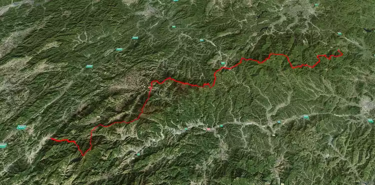
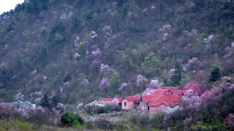
A super guide to traversing the 200km Tianmu Mountains! A section-by-section analysis of the Zhejiang-Anhui Great Cross-Island Trail, perfect for beginners!
Preface
While browsing a forum, I came across a fascinating post titled "A 200km Horizontal Trek Through the Tianmu Mountains." If you're interested, check it out! I was truly inspired by it, and the author is none other than my acquaintance, @ChengDaMin and @LiuXingYu. What a master! Hearing the person share their experiences, I'm even more eager to try it! For those with limited stamina and outdoor experience, a traversal of the Tianmu Mountains seems out of reach. So, I've compiled a list of routes and suitable seasons for your reference!
Tianmu Mountains
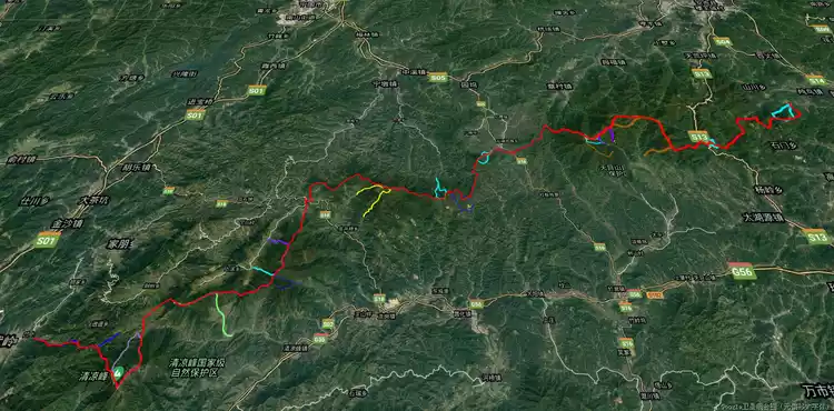
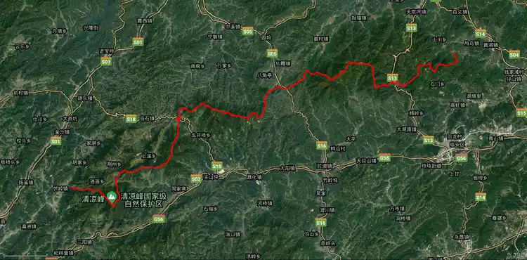
The Tianmu Mountains are located in northwestern Zhejiang Province, stretching from Huzhou in the east, bordering the Taihu Plain, to the west, extending to the Zhejiang-Anhui border, overlooking Mount Huangshan. The mountain range is 200 kilometers long and approximately 60 kilometers wide. Its main peak, Qingliang Peak, is located at the border of Lin'an City and Jixi, Anhui Province, at an altitude of 1,787 meters. The Qingliang Peak National Nature Reserve is designated by both Anhui and Zhejiang provinces.
Lin'an City also boasts West Tianmu Mountain (1,505 meters) and East Tianmu Mountain (1,479 meters), two peaks centered on the Tianmu Mountain National Nature Reserve. Later, the Anji Small Salamander National Nature Reserve was established in Anji, Huzhou (adjacent to the main peak of the Tianmu Mountain Nature Reserve). Since then, the Tianmu Mountain range has three national nature reserves, thanks to its exceptional natural resources.
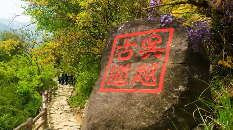
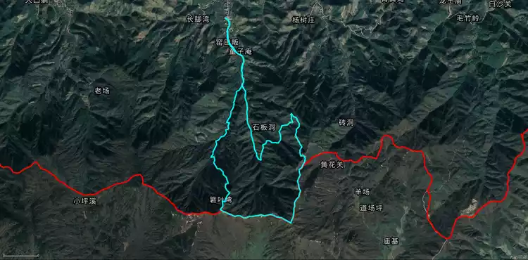
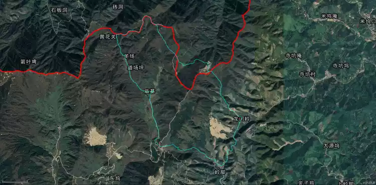
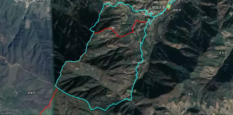
Huihang Ancient Road (all seasons)
The Huihang Ancient Road is located in Fuling Town, Jixi County, Anhui Province. It passes through Jiangnan Village, the "First Pass in Jiangnan", Yaoyaoling, Matouling, Xuetangling, Lantianao, and ends at Maxiao Township, Lin'an District, western Zhejiang. It is an ancient Huizhou merchant road with profound cultural connotations, preserving numerous ancient villages, ancient passes, ancient stone roads, ancient bridges, ancient tea pavilions, ancient trees, etc.
The ancient road was first built in the Tang Dynasty and has a history of more than 1,000 years. It is the third famous ancient road in China after the "Silk Road" and the "Ancient Tea-Horse Road". It has played a huge political, economic and cultural role in history. At the same time, it is also a corridor that combines natural scenery and mysterious culture.
The entire ancient road follows Longxu Mountain and is beside Dengyuan River, which is the main feng shui dragon vein of Jixi County. Xiaoyao River on the ancient road is the source of Xin'an River.
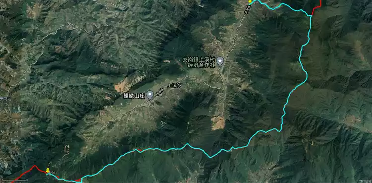
The reverse route of the Huihang Ancient Trail, which we often hike, starts in Yonglai Village, Jixi (yes, it's also in Anhui Province) and ends in Longchuan, Jixi, Anhui. The actual hiking section is all within Anhui Province. We usually exit the highway at Jiakou, Lin'an, and take a shuttle bus through Yinlongwu, Zhechuan Village (the Anhui border is just past the Huihang Ancient Trail archway), and Yonglai Village to the Huihang Scenic Area ticket office. From there, we ascend the mountain, passing Yixiantian, Lantianao, Shangxuetang (where you can eat), Xiaxuetang, Huangmaopei, and Jiangnan First Pass to reach the Longchuan entrance. The core attractions are Lantianao, Jiangnan First Pass, and Xiaoyao Valley, and there are plenty of supplies along the way.
Tips:
Ps. The difference between reverse and forward walking: forward walking has more uphill climbs and will be more tiring than reverse walking. Lunch is usually chosen near Huangmaopei.
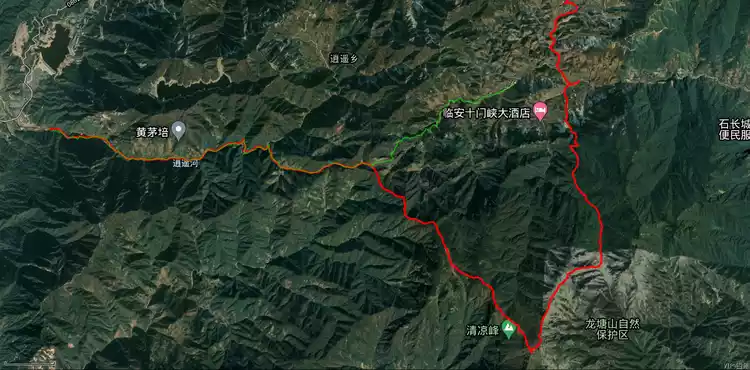
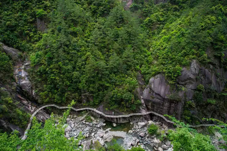
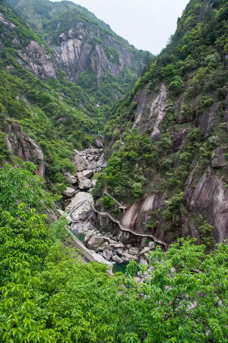
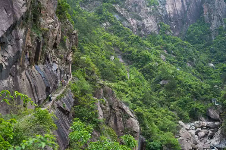
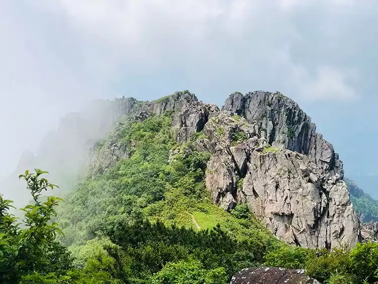
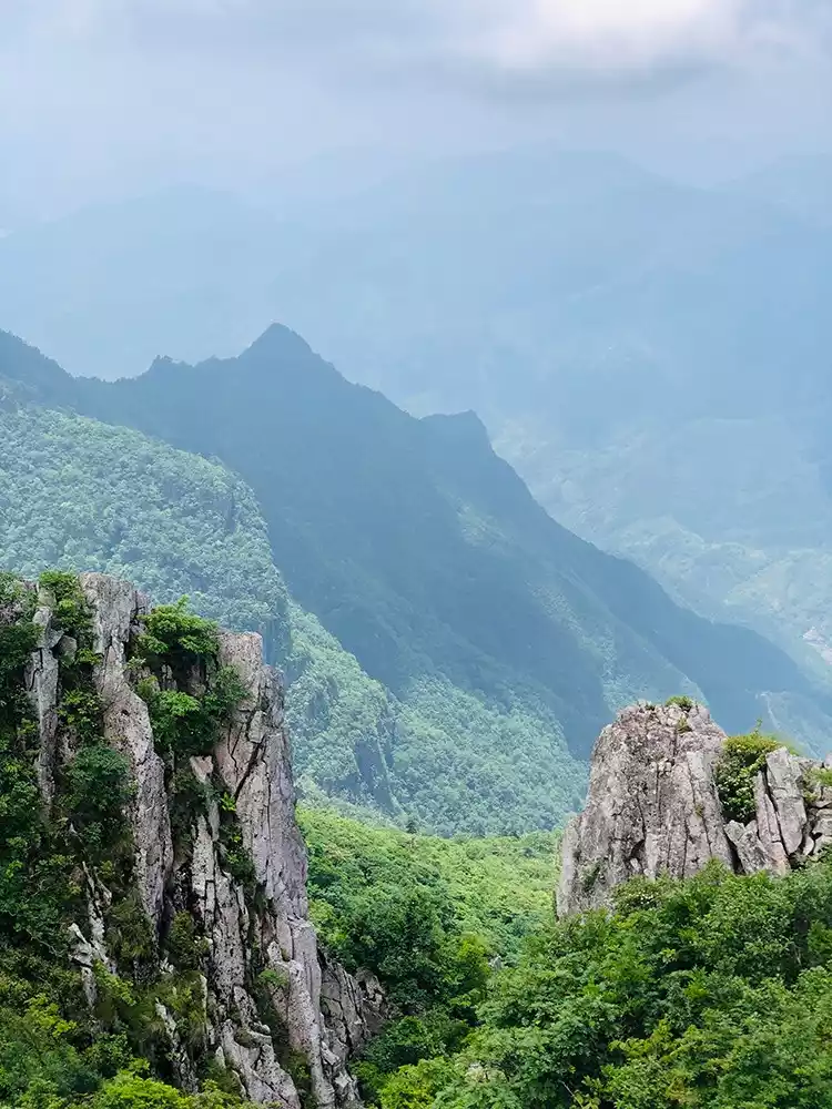
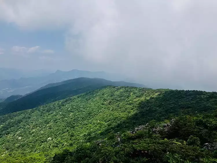
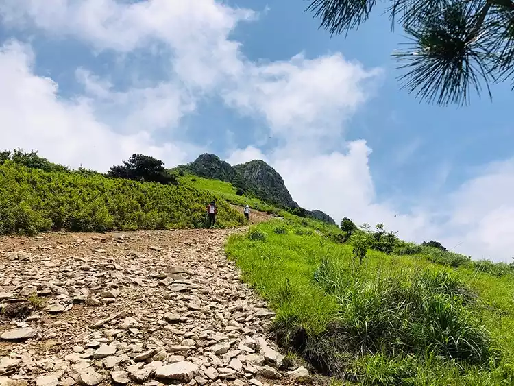
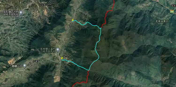
Qingliang Peak Loop (available in all seasons)
The Qingliang Peak Nature Reserve is located at the junction of Jixi County, She County in Anhui Province, and Lin'an County in Hangzhou. The main peak is Qingliang Peak, which is 1,787 meters above sea level and is the highest peak in western Zhejiang. Climbing to the top, you can overlook the mountains. If you are lucky, you can see the spectacular sea of clouds. The Qingliang Peak Nature Reserve got its name from this.
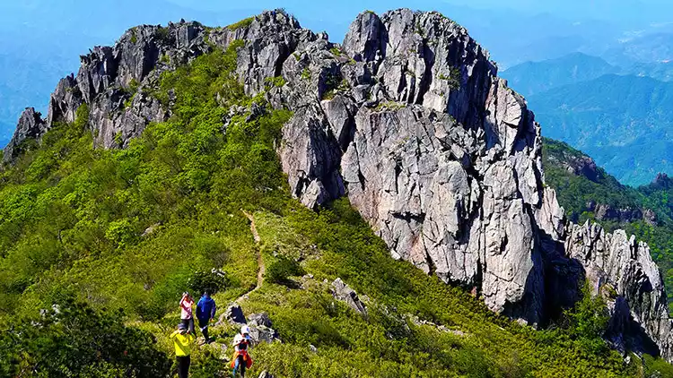
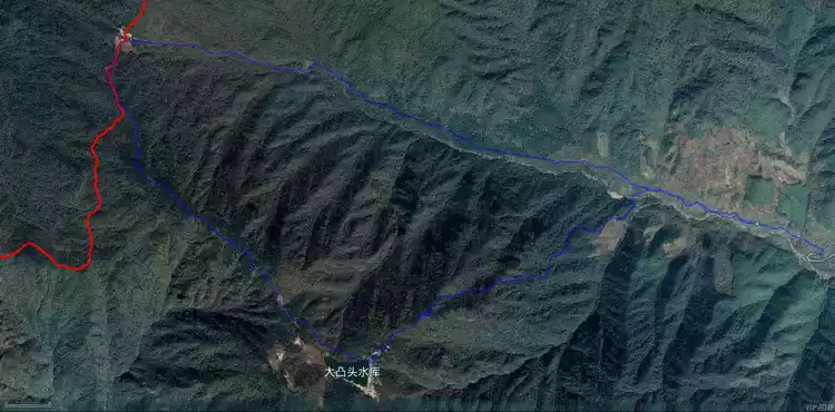
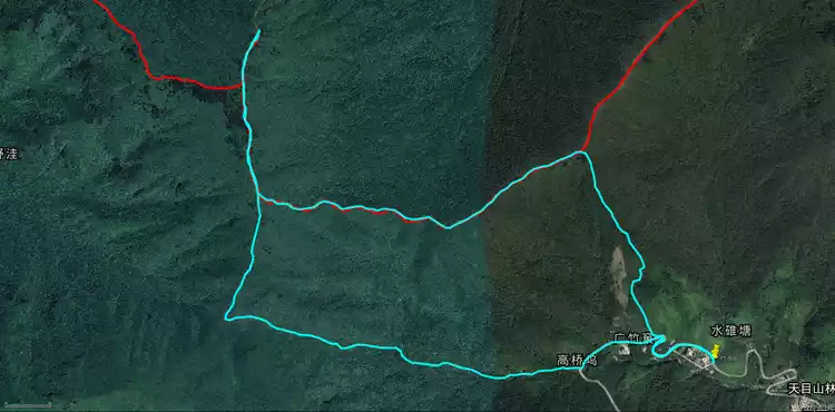
There are two ways to climb Qingliang Peak: the north-south line crossing and the north line loop. The north-south line is generally a camping and wild climbing route, which requires a high level of physical fitness and experience. The north line loop is 18 kilometers long, with a cumulative climb of about 1,200 meters. It is more suitable for people with a certain level of physical strength. It not only preserves the experience of reaching the summit, but also has a low threshold.
Tips:
The climate at Qingliang Peak is changeable. It is often windy, rainy and foggy at the top of the mountain, but sunny at the bottom. You need to have spare equipment.
Depart from Hangzhou | 2 days and 1 night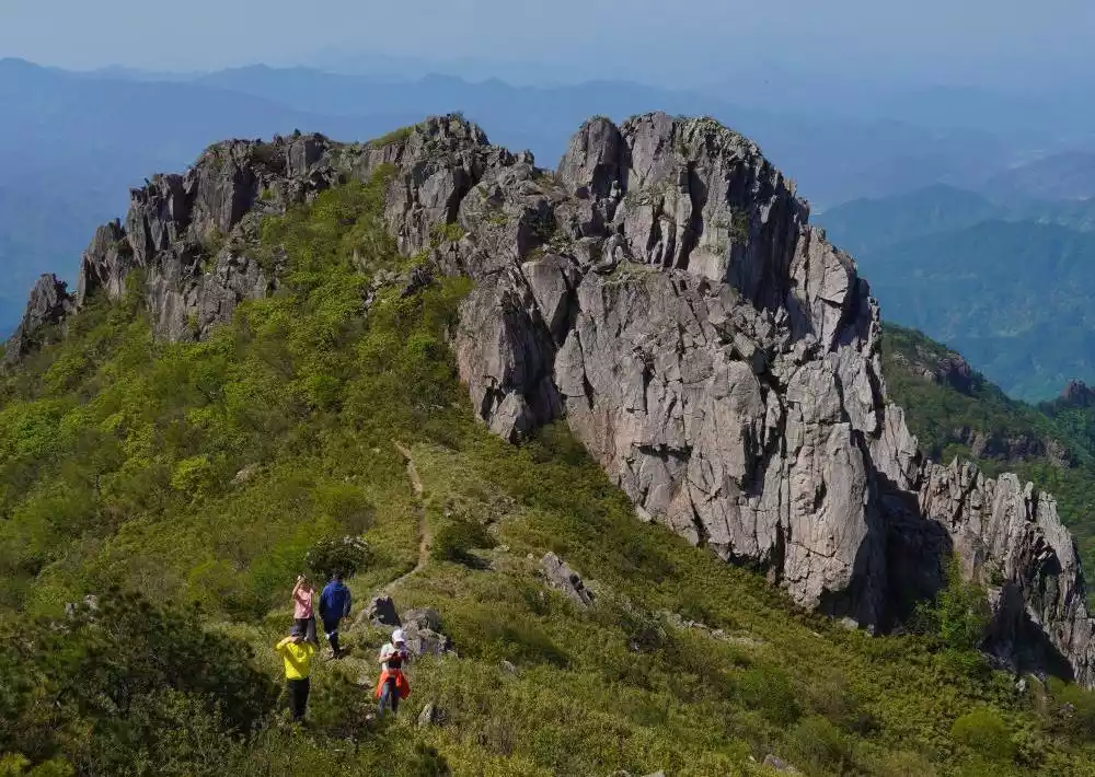
Qingliang Peak, the Summit of Western Zhejiang | Challenge the 16km North Route of Tianmu Peak in Western Zhejiang
¥380 from 2079 people have registered Register nowThree-point (autumn and winter)
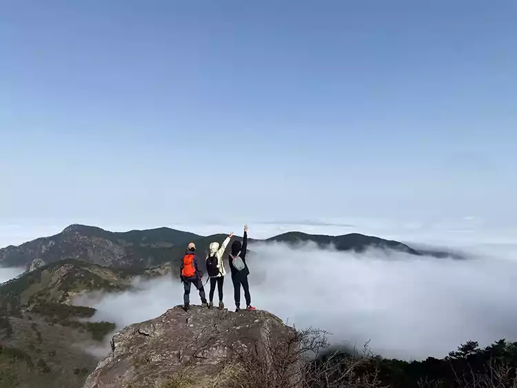
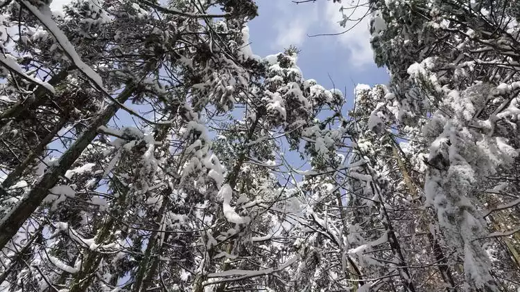
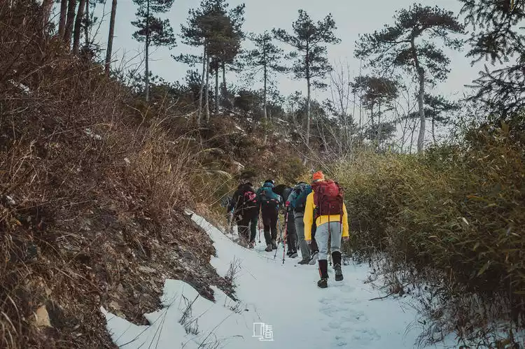
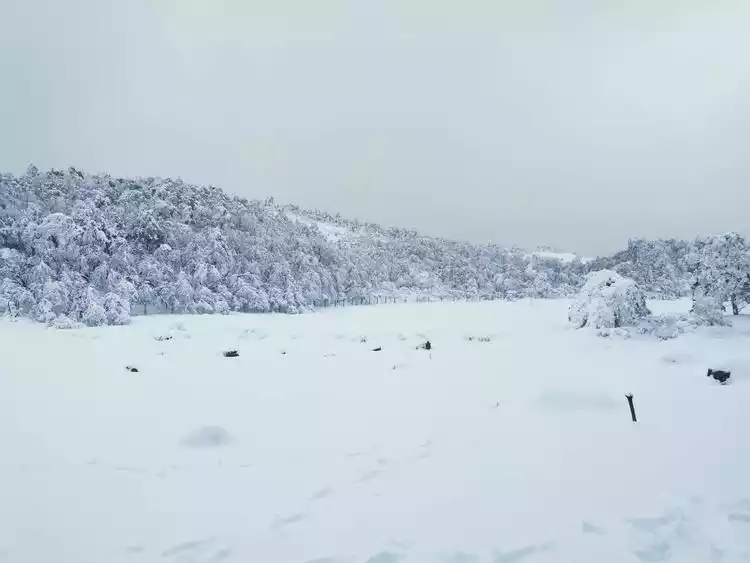
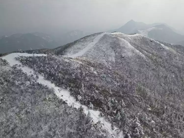
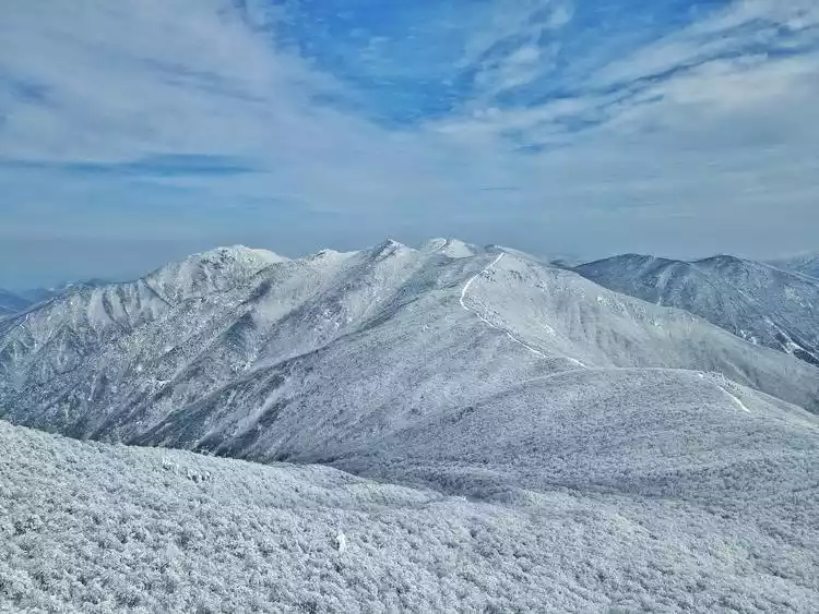
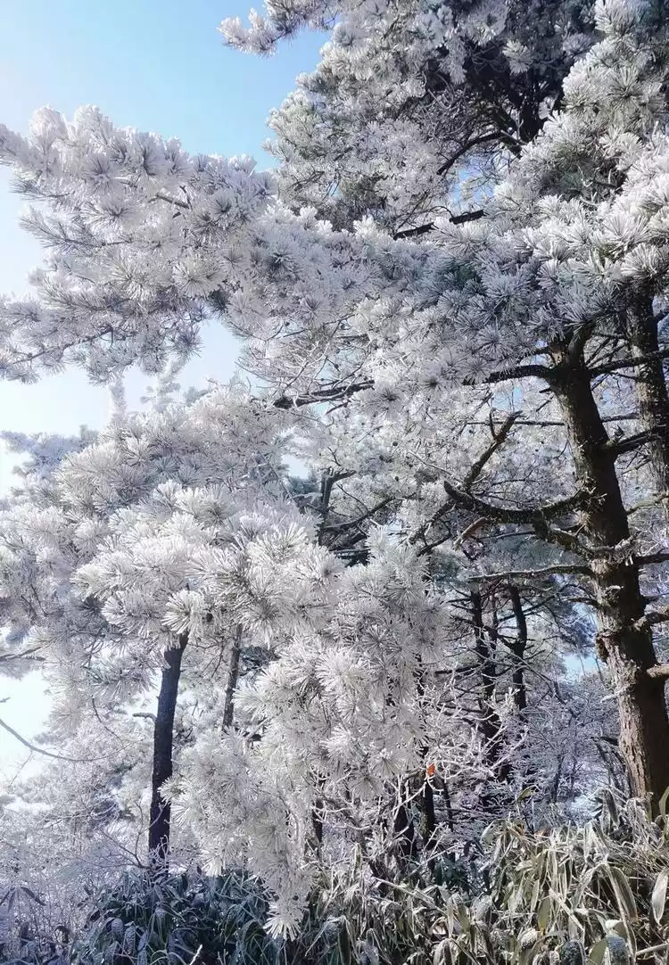
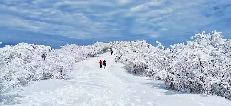
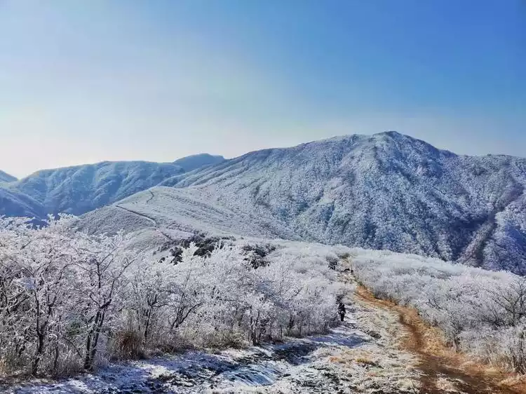
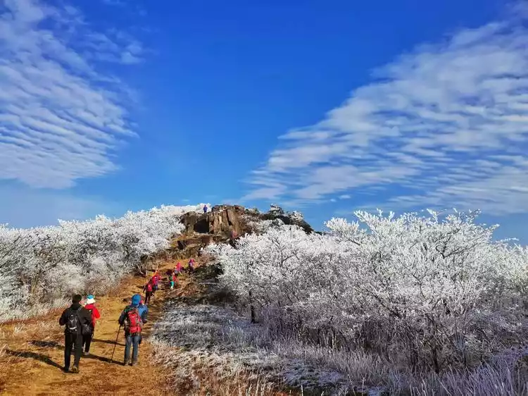
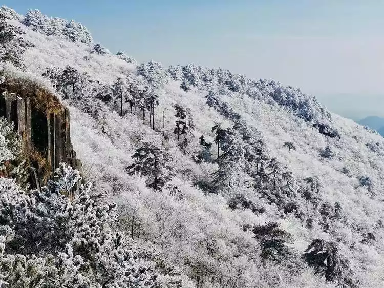
The Three Peaks Crossing, comprising Taizi Peak (1558 meters), Baizhang Ridge (1334 meters), and Tonggong Peak (1558 meters), is collectively known as the "Three Peaks." Located in western Lin'an, the route begins in the Qingliang Peak area in the south and ends in the Western Zhejiang Grand Canyon in the north. The entire route follows the mountain ridge, offering expansive views of both sides. You can often see seas of clouds and mist waterfalls, and in winter, rime. With luck, you can even see mist waterfalls.
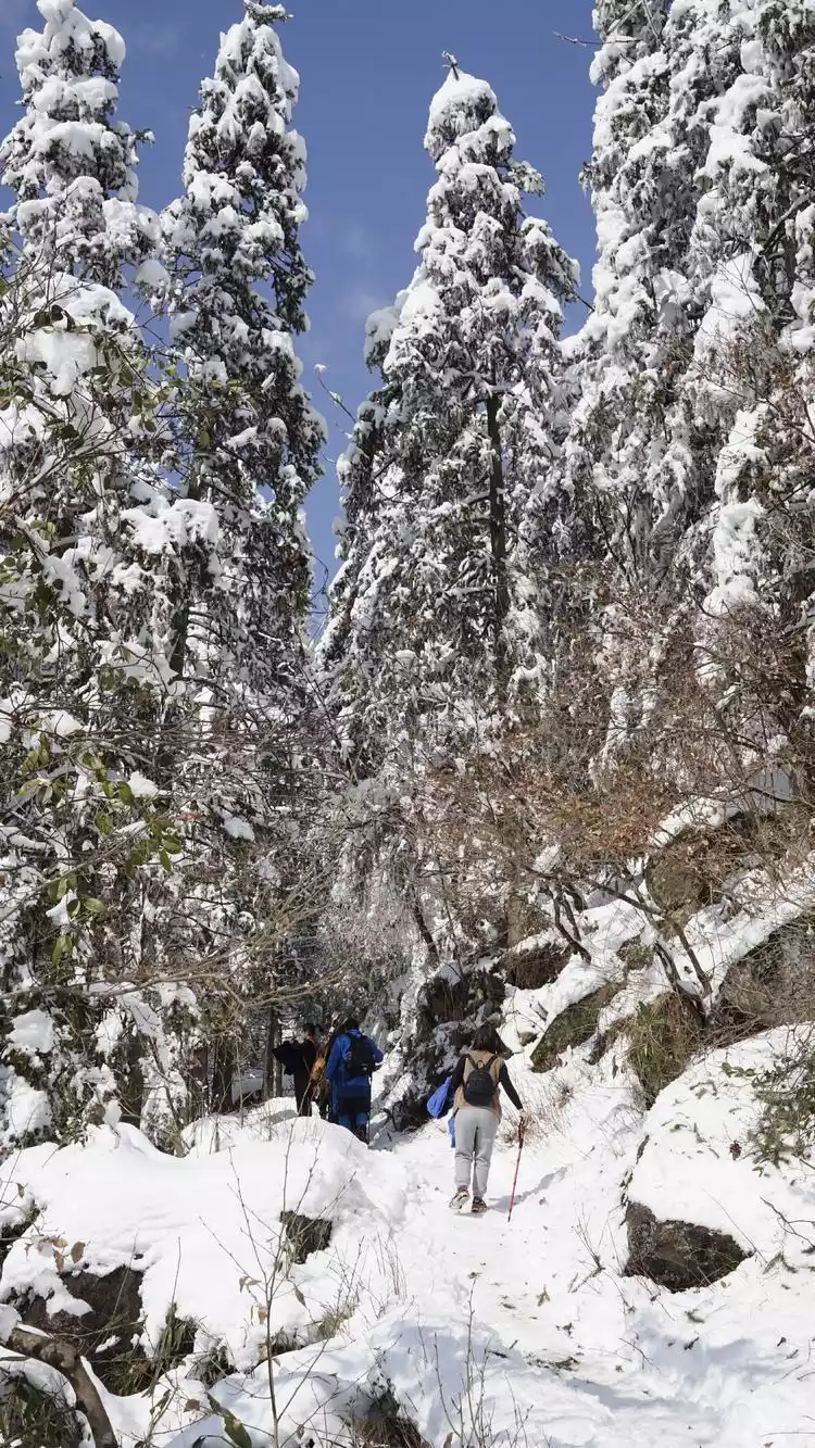
The three peaks are 24 kilometers long and have a cumulative climb of about 1,200 meters. It requires high physical fitness and is more suitable for walking in spring and autumn. After breaking up the three peaks, there will be more routes to walk, which is also suitable for viewing rime and snow in winter.
Tips:
The road conditions along the Three Peaks are poor, with many small woods. It is not recommended to try without excellent physical fitness. Moreover, this route is mostly taken in autumn and winter, when it gets dark early, so headlights and flashlights are a must.
1. Prince's Peak
For beginners who just want to see the rime and snow, driving to the Taizijian pass takes about 40 minutes to reach the summit, where the view is expansive and a great place to admire the sunrise and sea of clouds. For more advanced hikers, consider the Taizijian-Shangmaxiao traverse route.
Tips:
The Hualang Line is now wide and can be reached without bad weather or epidemic prevention and control. If there is rime or snow, this is also a good place for outdoor white snow viewing.
2. Baizhang Ridge
When it snows, it is known as the Greater Khingan Range of Zhejiang. The vast forest attracts many tourists and is more suitable for autumn and winter. The Yunding Lake Reservoir on the top of the mountain is also a rare sight. You can camp at the Baizhangling Campground below. It is close to the ancient trail and the road conditions are very good. It is suitable for the general public to go up and down the original route. Outdoor people can consider the 9-kilometer loop route, which has a cumulative climb of about 800 meters.
Tips:
1. It is a popular snow-walking route. Depending on the weather, you can choose to go up and down the original ancient road or take a circular route. The ancient road is safer and suitable for self-driving, parents and children, and the elderly. Pay attention to the time to go up the mountain!
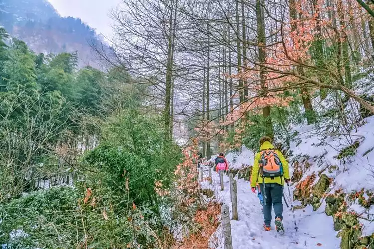
2. Wear crampons on snowy days. Remember! Going down the mountain is very slippery. Be careful. Bring a headlamp and flashlight when traveling in winter. Keep warm.
3. There are farmhouses and small shops in the village at the foot of the mountain where you can buy hot water, instant noodles, and supplies.
3. Tonggongjian
It may be the least famous peak among the three peaks. It is still very comfortable to walk there in autumn and winter. It is more niche and away from large groups. The walking method is generally U-shaped, passing through Baizhangling Camp and going down the mountain from Shixi Village.
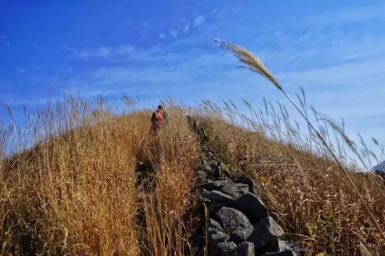
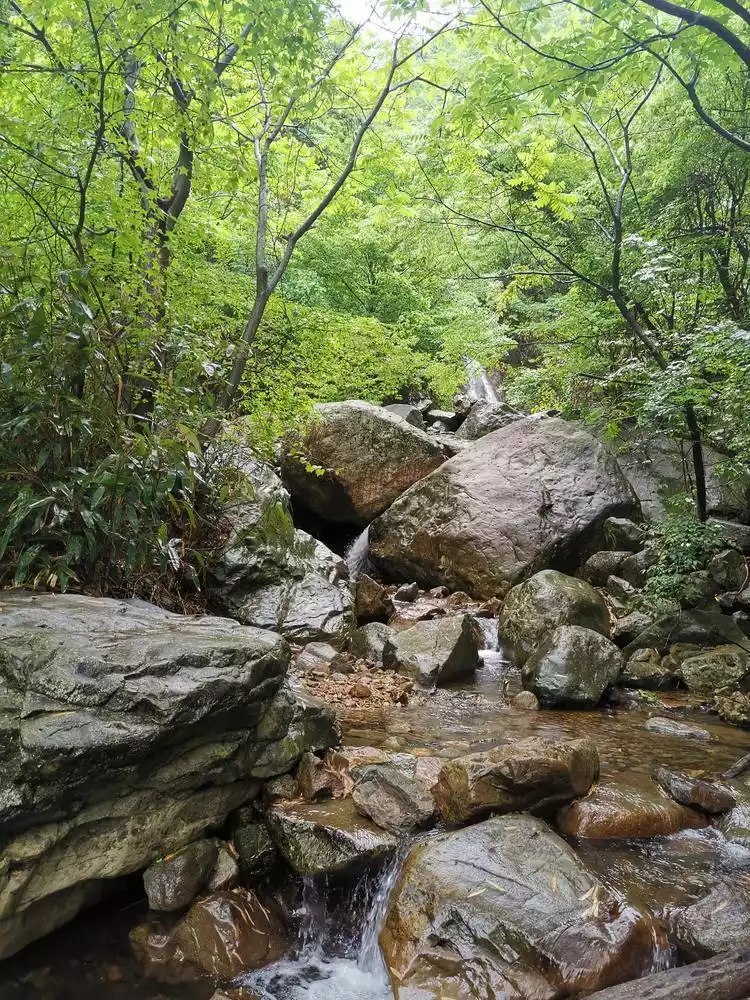
Wuyue Ancient Trail (all seasons)
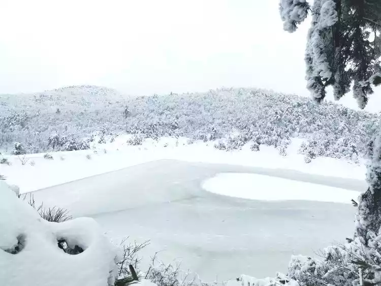
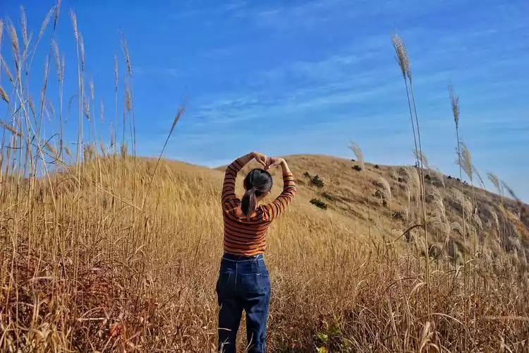
The Wuyue Ancient Road served as the primary route between Wuyue (Lin'an, Hangzhou) and Southern Tang (Ningguo, Xuancheng) during the Five Dynasties and Ten Kingdoms period. The ancient road traverses the Tianchi Lake in western Zhejiang, located at an altitude of 1,100 meters atop Qianqing Mountain. The lake's clear, deep blue waters blend seamlessly with the sky, while the gently sloping hills offer expansive views. This lake is the primary habitat of the sika deer, a Class I protected species. Surrounding the lake are low mountains, lush grasses, gurgling springs, and crisscrossing streams. A vast basin forms its center, creating a scene of mountains grazing on Qianqing Mountain and water flowing into the lake.
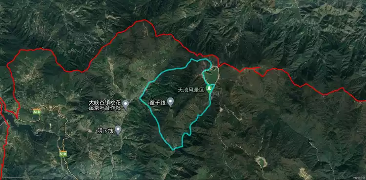
The Wu Yue Ancient Road has different scenery in each season. There are wild cherry blossoms in spring, mountain streams in summer, reed marshes in autumn, and rime and snow in winter. You can check in multiple times.
There are generally two ways to travel the Wu Yue Ancient Trail. One is to take the crossing line from Ningguo, Anhui to Lin'an, Hangzhou. The other is to stay in Hangzhou, go up from Daijia Village to Tianchi in western Zhejiang, and then go down the mountain from Qianqingguan on the Wu Yue Ancient Trail. The whole journey is about 13 kilometers, with a cumulative climb of about 800 meters, which is more suitable for the requirement of staying in Hangzhou during the epidemic.
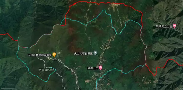
Blacksmith Mountain (suitable for all seasons)
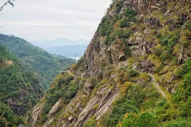
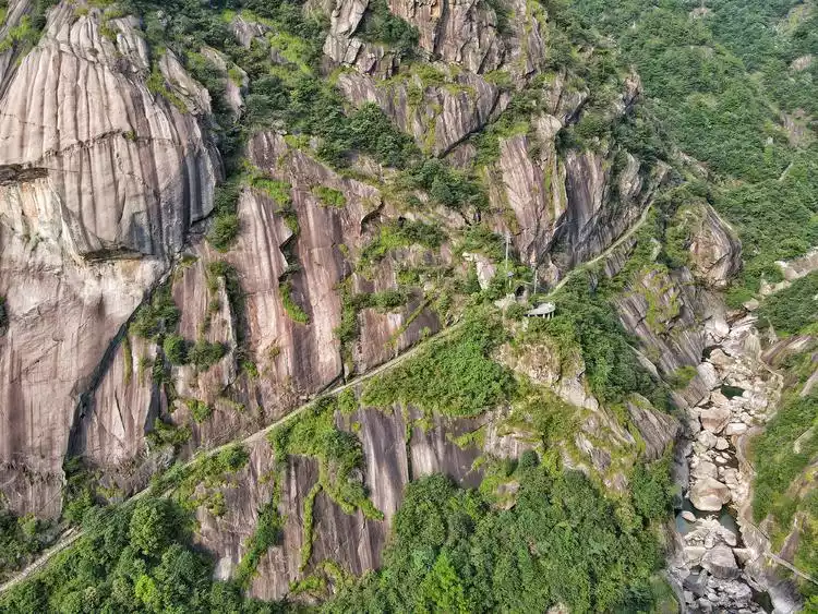
The Blacksmith Mountain Loop is a brand-new route derived from the Ningguo classic outdoor route Dochangping. The route is a 13-kilometer loop with a cumulative climb of about 900 meters. There are mountains to climb, streams to trace, waterfalls to view, and rocks to adventure. When you reach the top of the Blacksmith Peak at an altitude of 1,180 meters, the Tianmu Dragon Ridge rises high, just like the vast green alpine meadows of Wugong Mountain. When the alpine rhododendrons are in full bloom, red tassels are dotted all over the mountaintops, and the mountain flowers are in full bloom.
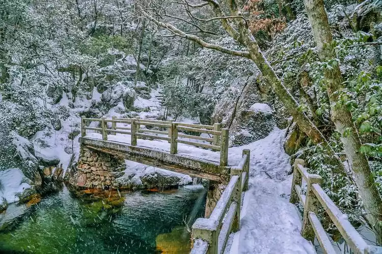
Downstream of Tiejiang Mountain, Longtou Mountain and the opposite Shanzi Mountain rise steeply and towering, flanked by lush vegetation and shady trees, forming a deep, long canyon. Rivers, streams, and waterfalls are scattered throughout this canyon. As you approach, you'll be greeted by splashing water, swirling in mist, and the rumbling sound of water echoing through the gorge. We climbed up and down the canyon, crossing streams and climbing rocks, using handrails and climbing chains down steep slopes. The scenery was both breathtaking and truly immersive. In winter, the mountains are blanketed in rime, and icefalls hang high, making it a perfect place for snow-walking.
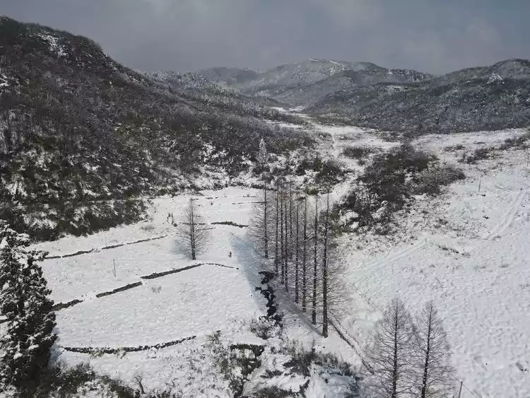
Dojo Terrace (Winter)
Daochangping, also known as Laoling, was a major transportation route between Zhejiang and Anhui provinces in ancient times. During the Three Kingdoms period, due to the constant disputes between Wu and Wei, a pass was built here, 15 feet high and 8 feet wide. It was heavily guarded and equipped with a lookout tower and a parade platform, now abandoned. This is Huanghua Pass. At an altitude of 1,000 meters, there is an open area of over 4,000 mu (approximately 1,000 mu). The entire open area slopes to the south, and the flat land and surrounding ridges form a giant "chair", a rare sight. The route is 10 kilometers long, with a cumulative climb of about 700 meters, making it a perfect place to enjoy rime and snow in winter.
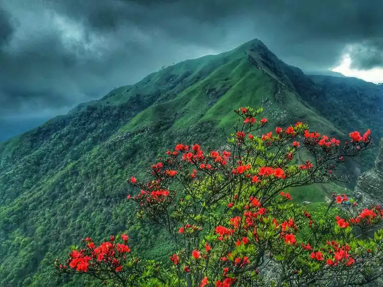
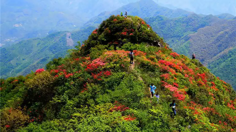
Tanggong Mountain (May 1st)
Tanggong Mountain is 1,130 meters above sea level. The entire route is about 11 kilometers long, with a cumulative climb of about 1,000 meters. There are large areas of naturally grown alpine rhododendrons. Starting from April every year, more than 100 acres of rhododendrons will continue to bloom for more than a month. From a distance, it looks like a huge wreath worn on Tanggong Mountain.
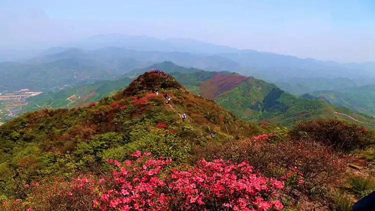
According to local elders, Tanggong Mountain's high altitude, strong winds, and low temperatures make it difficult for most plants to grow. However, the resilient azaleas stubbornly thrive in the cracks of the rocks. Although their growth is slow, their flowers bloom with remarkable splendor. The azaleas on this mountain have a history of nearly a thousand years. Today, some trees reach up to three meters tall, with canopies reaching four meters, a rare spectacle.
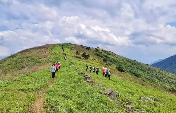
Qijian (Autumn and Winter)
Seven Peaks is a term used in the outdoor world, referring to the seven peaks that need to be crossed when crossing the ridge from West Tianmu Mountain-Xianrenting to East Tianmu Mountain-Dashiending (or vice versa).
The seven peaks are: Xianren Peak, Longwang Mountain, Yaowang Peak, Qianmu Field, Tonghanggang, Yangtianping and Daxianding, which are actually nine peaks.
The main peak of East Tianmu Mountain, Daxianding, stands at 1,479.7 meters above sea level; the main peak of West Tianmu Mountain, Xianrending, stands at 1,505.7 meters. The two peaks face each other, 8.65 kilometers apart in a straight line, but 70 kilometers apart in actual distance. All seven peaks are located within Lin'an City. Tianmu Mountain was formerly known as Fuyu Mountain. The "Yuanhe County Chronicles" states: "Tianmu Mountain is 60 miles north of the county seat. It has two peaks, each with a pond on its summit, facing each other, hence the name Tianmu." This is the origin of the name Tianmu Mountain.
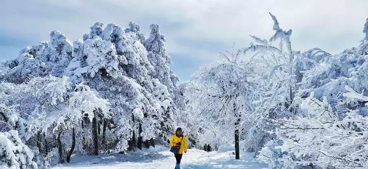
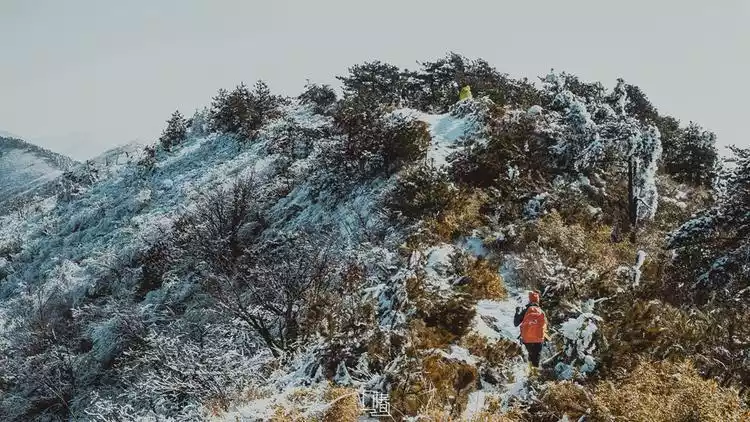
The traditional Seven Peaks traverses 33-45 kilometers, with a cumulative ascent of approximately 2,500 meters. It's typically completed over two to three days, though some trail runners have managed it in a single day. This makes it unattainable for the average hiker. The scenery at the Seven Peaks itself isn't particularly impressive, but it's generally better in autumn and winter, when the weather is cooler. Winter's rime and snowfall are even more stunning! Longwang Mountain, Jieli Peak, Yaowang Peak, and Xianren Peak are particularly popular in winter, with the internet-famous firebreaks and snowy rime frequently trending on platforms like Xiaohongshu.
1. Longwang Mountain
Longwang Mountain in Lin'an, located at the western end of the East and West Tianmu Mountain Range, is close to the main peak of the West Tianmu Mountains, Xianrending. At 1,587 meters above sea level, it is the highest point in the range. From this vantage point, you can admire the crouching mountains, offering a panoramic view of the famous firebreaks and Jieli Peak. It's a popular winter hike in the snow. The Longwang Mountain hike typically loops, starting and ending in Xiguan Village. The route consists of a mix of ancient roads and dirt roads, covering approximately 10 kilometers with a cumulative elevation gain of about 800 meters, making it suitable for the general public.
2. Joint Peak
Jieli Peak (1,423 meters above sea level) is located near Yaowang Peak. It's called Jieli Peak because of the numerous jointed rocks along this section of the ridgeline. The route is steep, with three ridges dotted with unusual peaks and rocks, sheer cliffs, and forests of dead branches. The ridgeline offers expansive views and the most spectacular scenery, making it the highlight of the Seven Peaks Trail. In winter, due to the popularity of Longwang Mountain, this area appears even quieter and less popular.
The loop is about 10 kilometers, with a cumulative climb of about 800 meters. The starting point coincides with the mountain road and Longwang Mountain. After reaching the firebreak, Longwang Mountain is to the left and Jieli Peak is to the right.
Zhinan Village (Autumn)
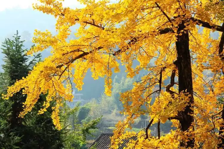
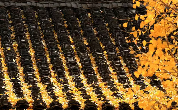
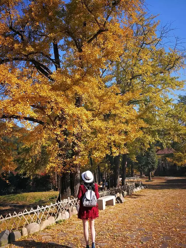
Zhinan Village, nestled on the banks of the Nantiaoxi River at the source of Taihu Lake in Lin'an, sits nearly 600 meters above sea level and boasts a history stretching back thousands of years. With over 470 mu (approximately 1,000 hectares) of terraced fields dotting the village, it's a photography enthusiast's paradise and is hailed by the outdoor community as one of the most beautiful ancient villages in East China. At the end of October, the rice paddies turn golden, and the village's ginkgo and red maple trees are tinged with autumnal colors. The golden ginkgo and fiery red maple trees are a must-see for photography enthusiasts!
The general itinerary is to take the Shenlongchuan loop, which is about 7 kilometers long and has a cumulative climb of about 300 meters. It is suitable for all ages and is the best choice for enjoying the autumn.
Yaotou Mountain (Spring and Autumn)
Yaotou Stone, with an altitude of 1,095 meters, is the easternmost thousand-meter-level peak in the Tianmu Mountain Range, the highest peak in Hangzhou City, the main peak at the eastern end of the Tianmu Mountain Range and one of the important sources of Taihu Lake. It is located at the junction of Yuhang, Lin'an and Anji.
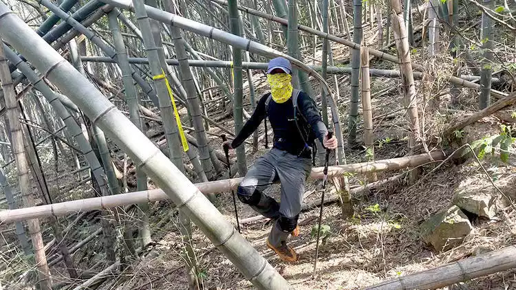
Yaotou Mountain can be walked together with Hongtao Mountain. The whole journey is about 13 kilometers, with a cumulative climb of about 1,000 meters. There are bamboo forests all over the foot of Hongtao Mountain, and the road conditions are unclear. You must go with an experienced team.
Conclusion
The mountains are there. Although we cannot follow the footsteps of the great god and walk the 200-kilometer Tianmu Mountains, we can complete it in sections. Each section has its own unique charm. I hope to meet you in the mountains!