A classic hiking guide to the Southern Taihang Mountains: the 9th Wonder of the World! Why is it called the "Backbone of the World"?
Preface
"The weather is cold and the sun is dim, the Taihang Mountains are vast and boundless; I have heard of the dangers of this place, but now I am going alone."
What kind of towering mountain was it that attracted Bai Juyi to go there alone to find out what it was?
What kind of place is it that gave birth to so many rivers? As the "source of three rivers" of the North China Plain, it nourishes the homes of people in Hebei and Henan.
It stretches across China from north to south and is known as the "backbone of China."
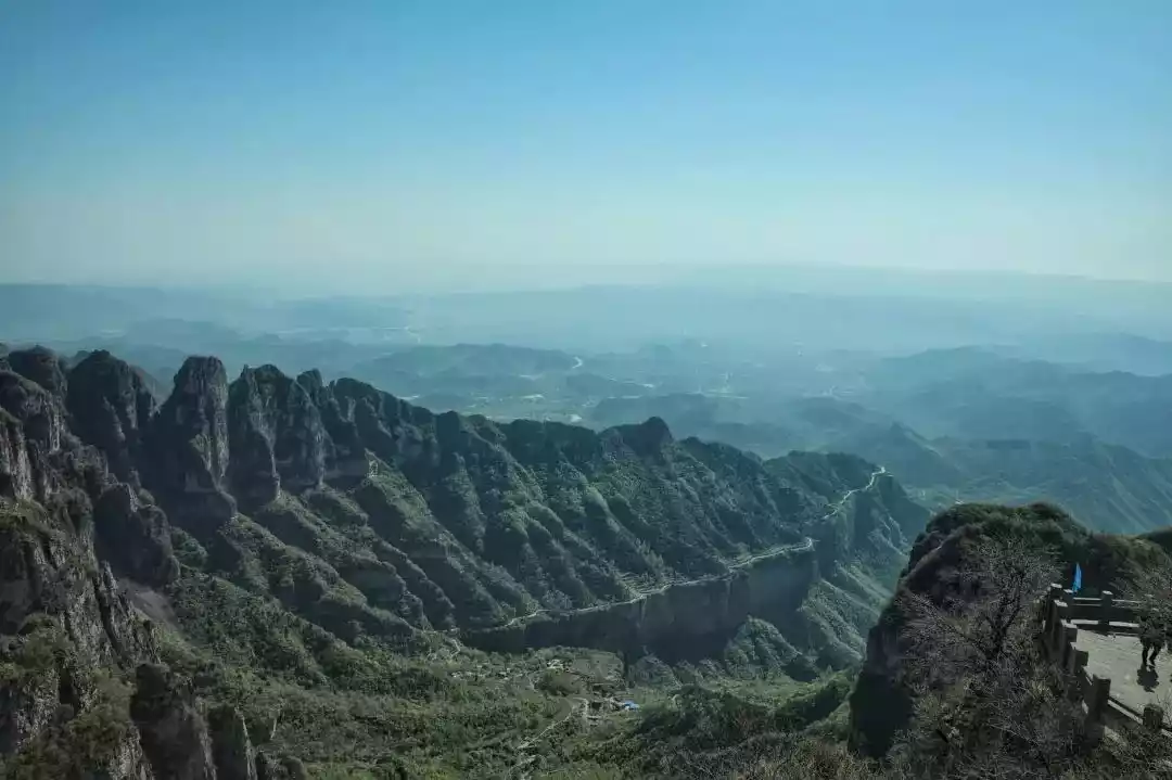
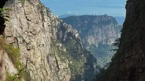
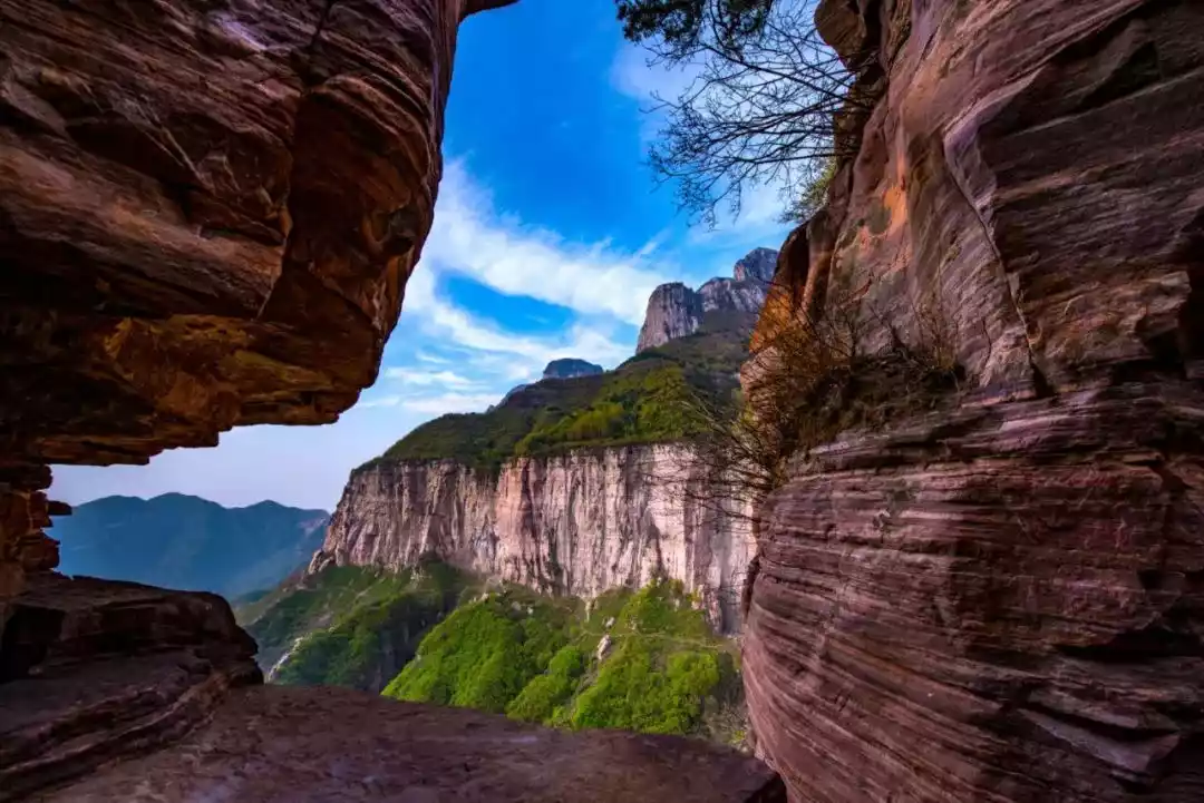
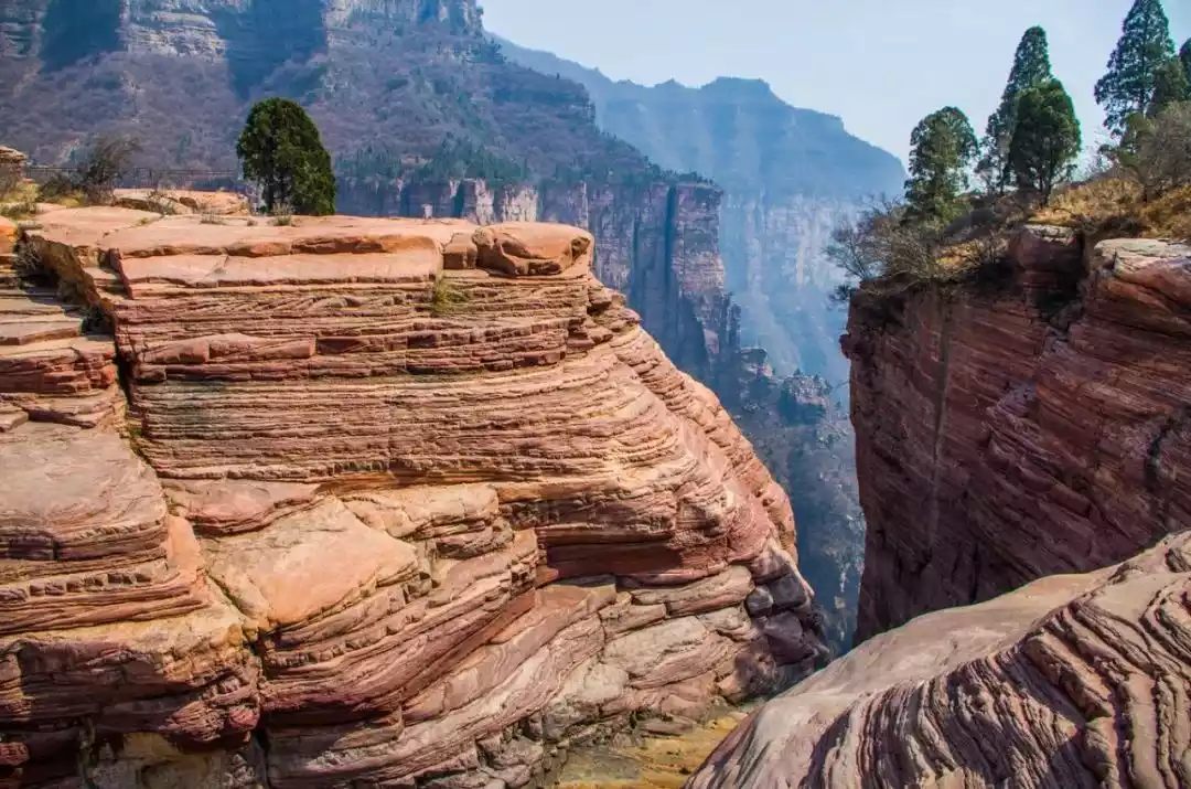
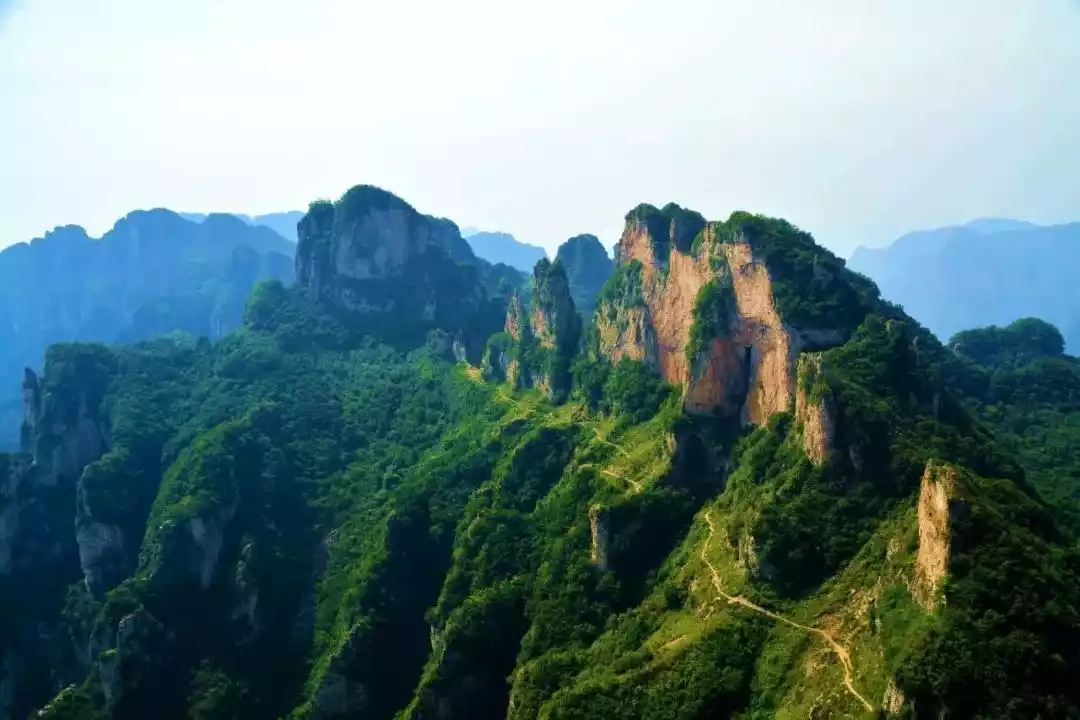
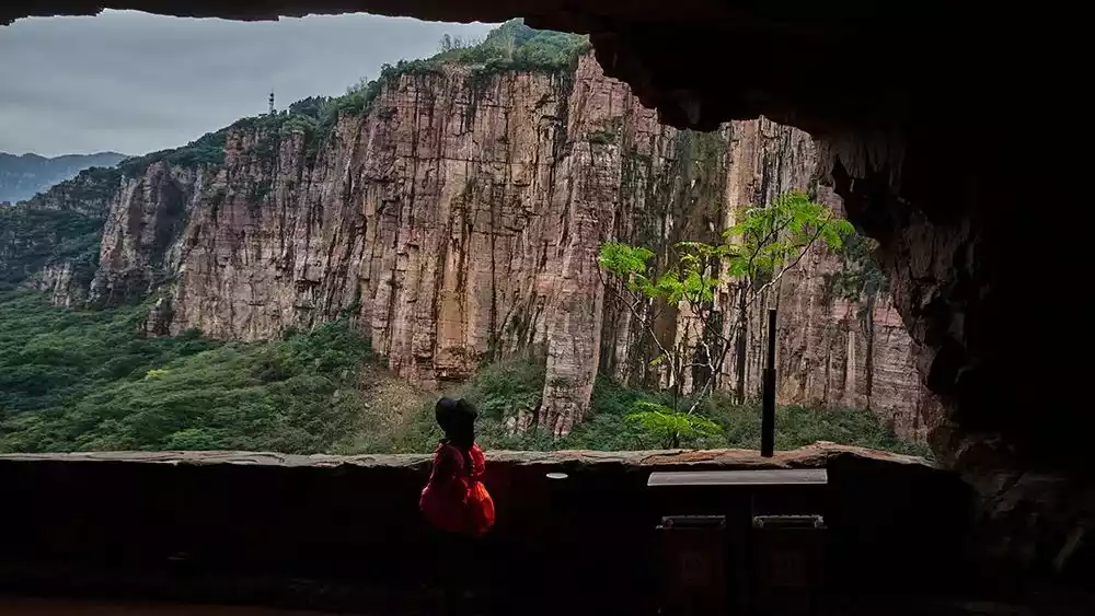
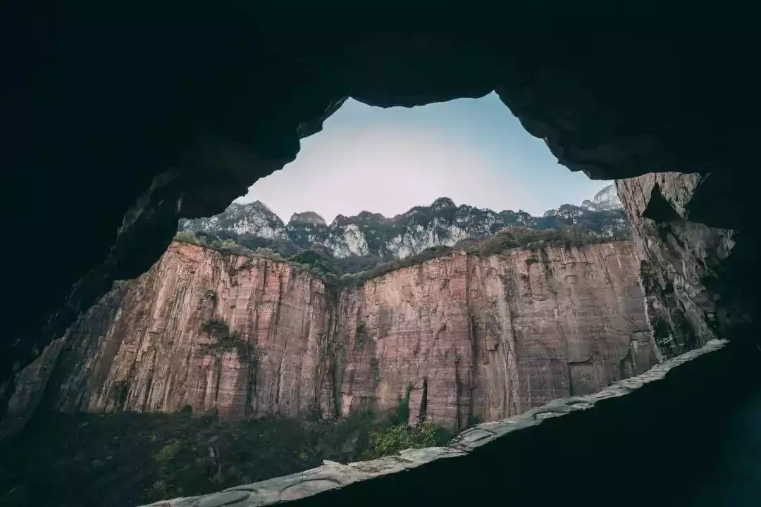
There are also towering cliffs here. Looking around, you can see that the cliffs are thousands of feet high and majestic, but the vegetation is rich and the scenery is beautiful everywhere.
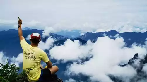
This is the Taihang Mountains, a legendary mountain known as the "Backbone of the World" and the "Ninth Wonder of the World".
What kind of mountain range is Taihang Mountain? It is known as the "backbone of the world" and has forced people to move mountains and break walls.
"Wugong in the South, Taihang in the North"
A widely circulated saying in the outdoor circle, "Wugong in the south, Taihang in the north", refers to the two classic outdoor hiking routes in the north and south.
China's magnificent mountains and rivers are known as "the beauty of the south and the majesty of the north." Wugong Mountain, once ranked among China's ten "unknown" peaks, has long been a popular outdoor sports destination, renowned for its stunning sea of clouds, sunrises, and alpine meadows.
However, Taihang Mountains, the most beautiful place in northern China, is rarely known for its grandeur and magnificence.
Design@Yin Guoguo
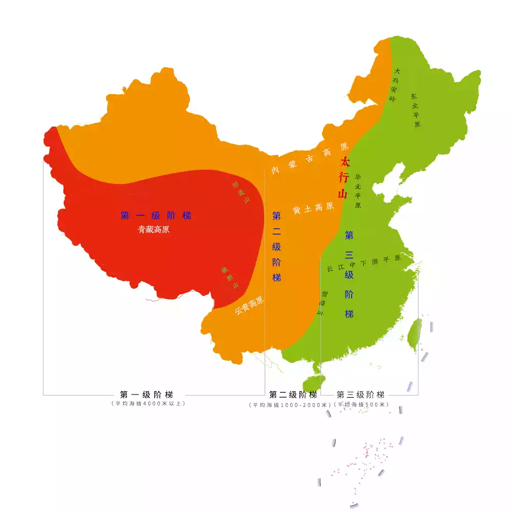
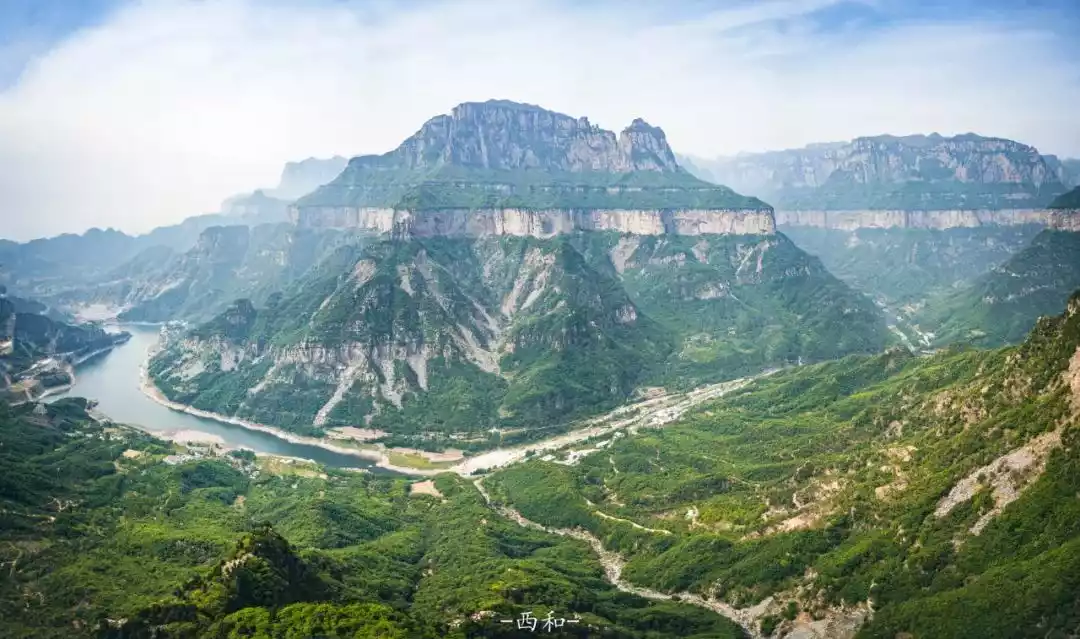
The Taihang Mountains run through the heart of China, connected to the Yanshan Mountains above and the Qinling Mountains below. They are the geographical boundary between the North China Plain and the Loess Plateau, and are also a natural leap from China's third terrace to the second terrace.
Why is South Taihang so outstanding?
People usually divide Taihang Mountains into three sections: North Taihang in Hebei, West Taihang in Shanxi, and the part at the junction of Henan and Shanxi is called South Taihang.
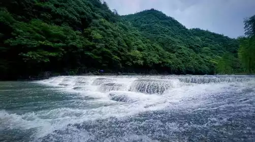
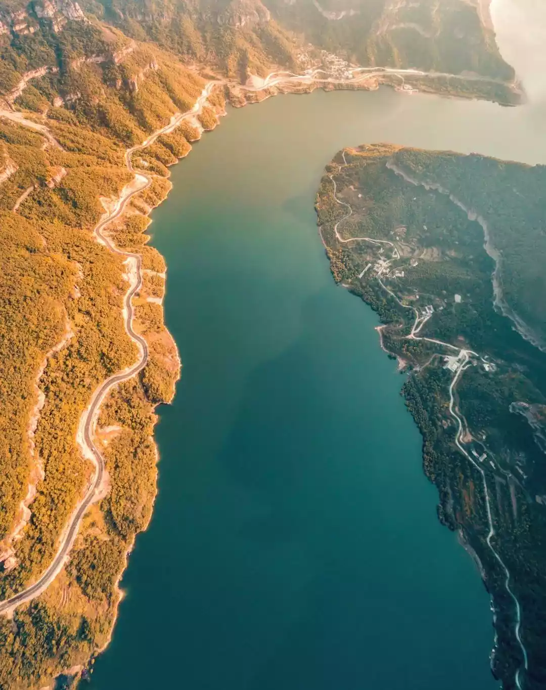
While northern mountainous regions often suffer from water shortages, the Southern Taihang Mountains seem to be a favorite of the Creator. The Xinxiang and Jiaozuo areas, where the Southern Taihang Mountains are located, are known as the "North China Underground Reservoir" due to their abundant groundwater resources and numerous surface springs.
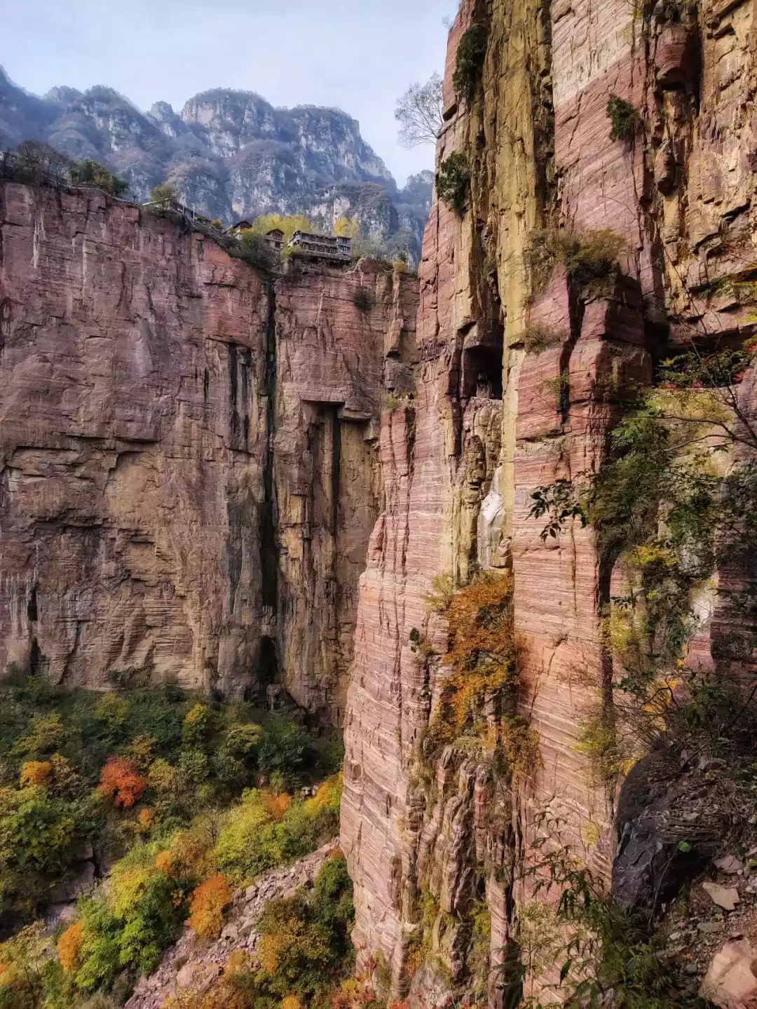
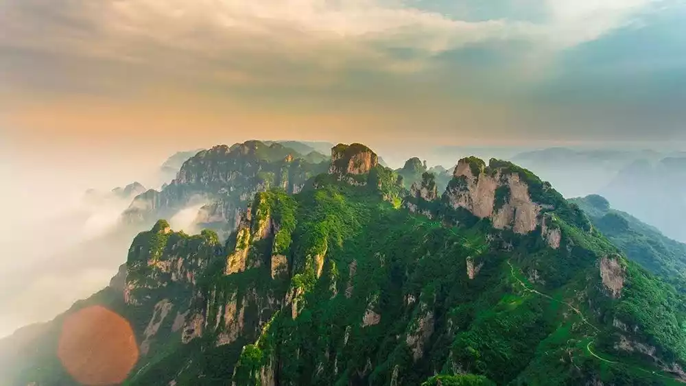
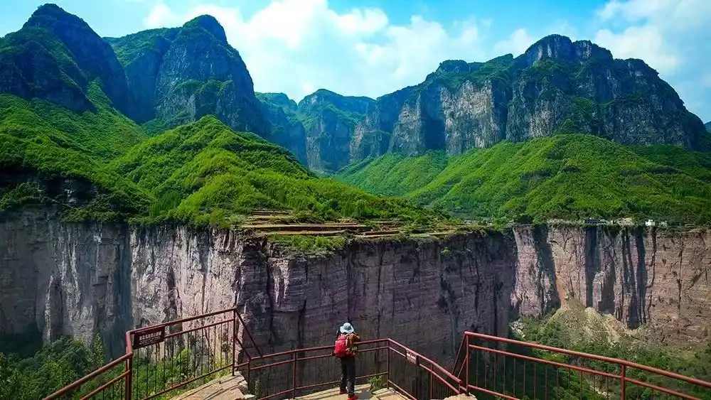
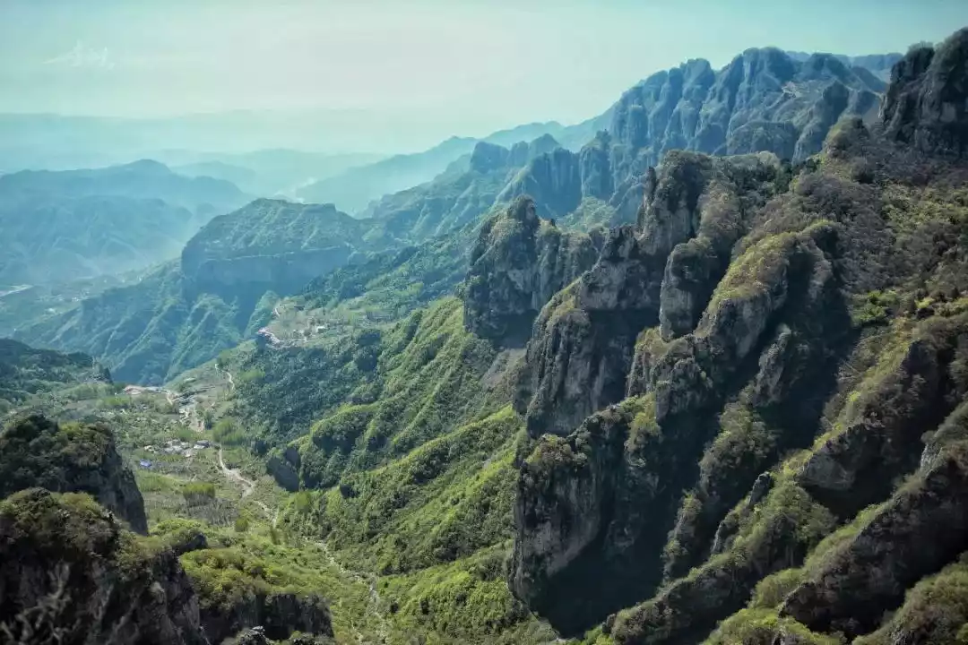
The unique rainfall nourishes the southern Taihang Mountains, making it lush and vibrant. The northern momentum of high mountains, deep valleys and towering cliffs formed by geographical faults and the southern elegance of overlapping peaks and rushing waterfalls are seamlessly intertwined here, which can be said to be both majestic and beautiful.
No wonder China National Geographic praised it highly, saying, "The Taihang Mountains have given the most beautiful section to the southern Taihang Mountains."
Why is South Taihang a classic hiking destination?
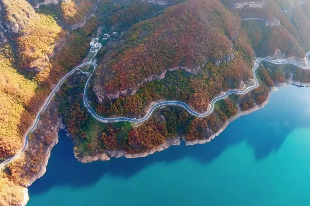
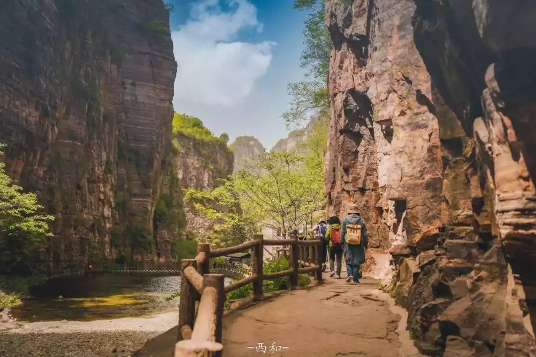
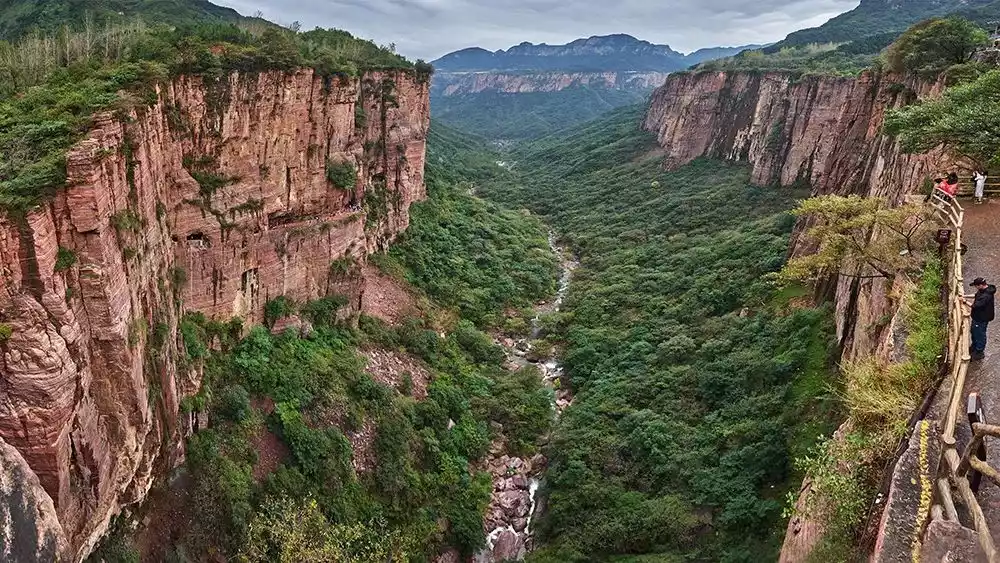
The mountains are high and the valleys are deep, with natural dangers and obstacles. Some areas of the southern Taihang Mountains are not even accessible by road, thus preserving the complete natural scenery and unique local customs and practices.
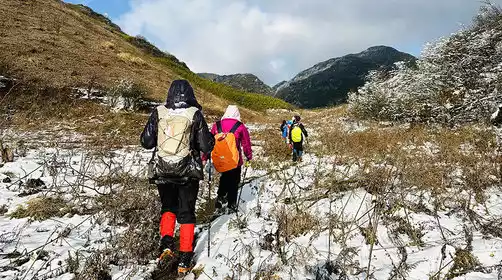
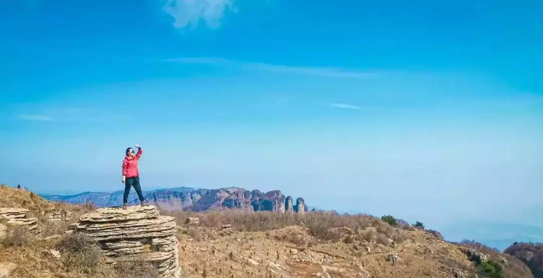
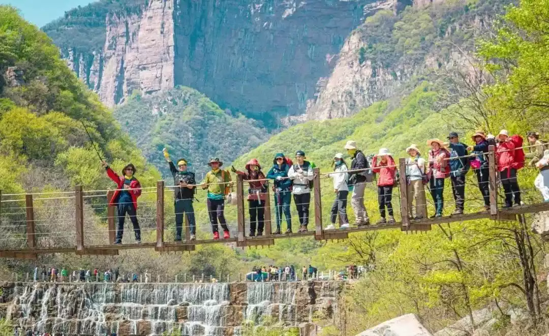
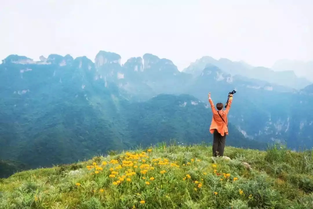
A safe and beginner-friendly hike. As a renowned domestic hiking route, the South Taihang Crossing offers a relatively low level of difficulty and a relatively short duration. With an average elevation of approximately 1,500-2,000 meters, it's a great entry-level outdoor adventure for most people.
The Taihang Mountains have multiple landforms and rich experiences. They are characterized by numerous broken rocks and towering cliffs. The terrain is so steep that many stunning views are difficult to reach by car.
The best way to get close to the strange, dangerous, beautiful and secluded Taihang Mountains is to hike there. This is also the best example of "the world's most magnificent, strange and extraordinary sights are often found in dangerous and remote places."
There are many villages in the valleys along the way, and you can connect any section of the road you want between transition points, which also extends into many routes.
China-TravelNote has selected the best of them and launched the five-day outdoor classic journey to the South Taihang Mountains. The tour leader has many years of independent operation experience in the Taihang Mountains and is good at having fun, bringing everyone a pure travel like friends.
Things to do when hiking in South Taihang Mountains
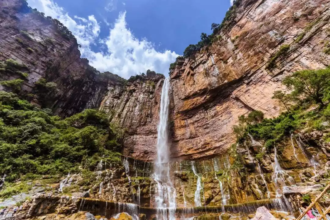
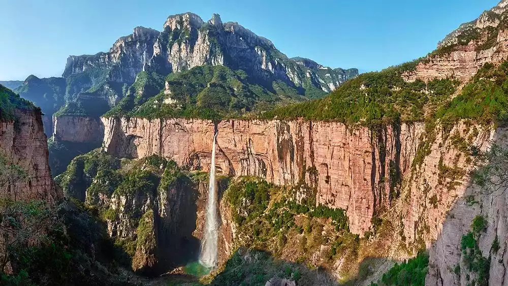
01Touch the Baligou Tianhe Waterfall, the "highest waterfall in North China", with your own hands and feel the shock of the waterfall plunging three thousand feet.
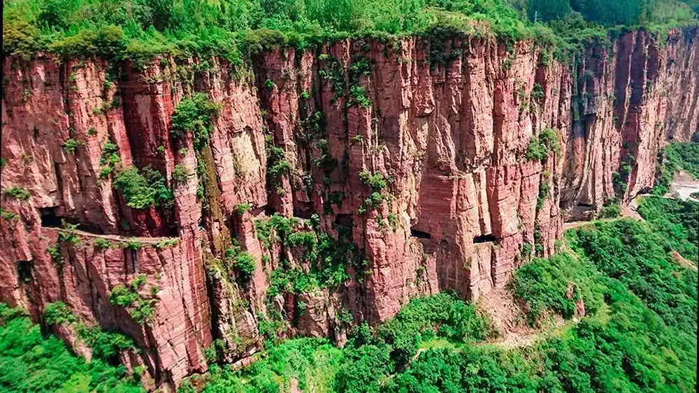
Under the sedimentation of the East-West Fault Zone, the southern Taihang Mountains have jagged mountains and steep cliffs, forming numerous canyons and cliffs.
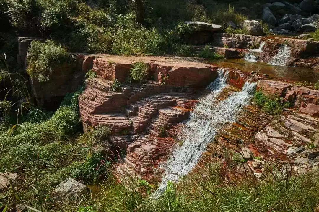
Coupled with the most abundant rainfall in the entire Taihang Mountains, the South Taihang Mountains, which are fully nourished by rain, are even more beautiful where water and sky meet, and pools and waterfalls are connected, showing green mountains, clear waters, red cliffs, and sea of clouds that are rare in the north. It is beautiful beyond words, like a fairyland or a painting.
Picture @Photo.net
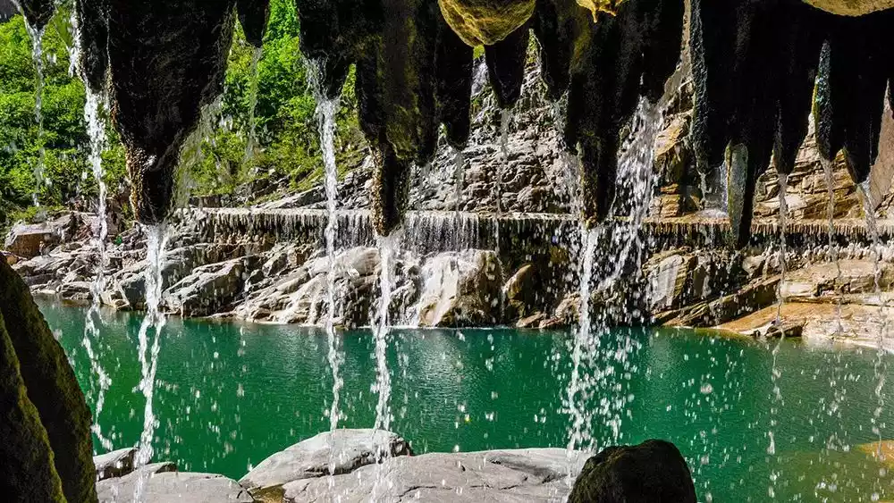
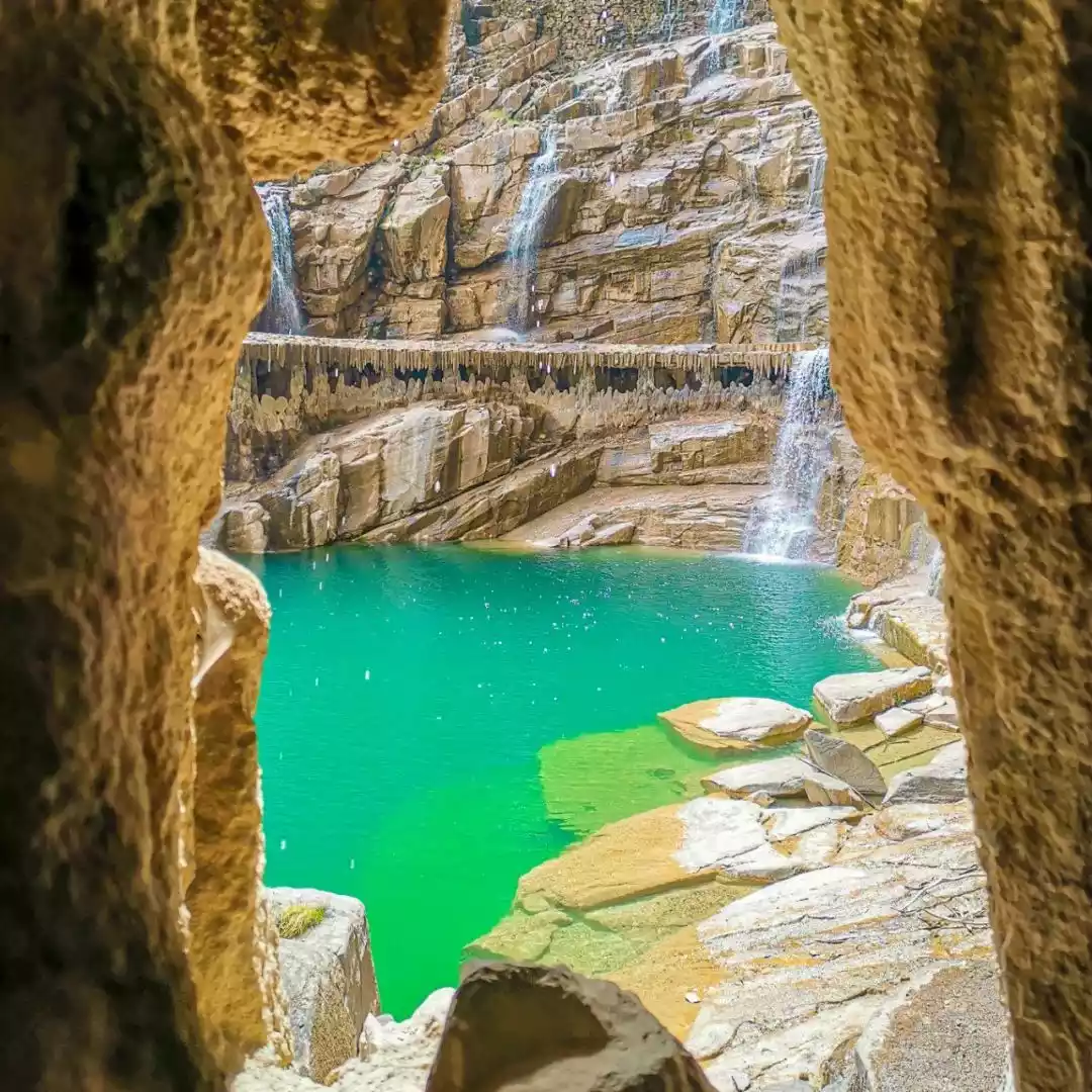
Tianhe Waterfall, with a drop of more than 180 meters, is the waterfall with the largest drop in the entire North China region and a landmark check-in spot in the southern Taihang Mountains.
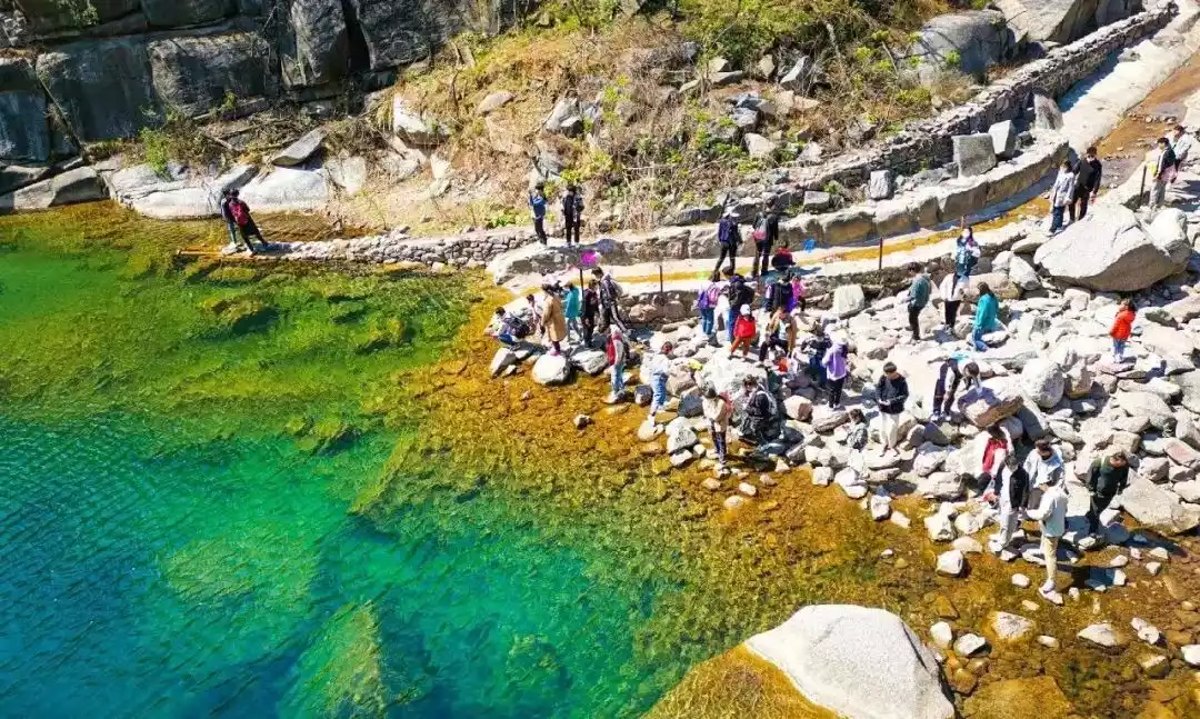
Below the waterfall is a clear blue pool. The mysterious Water Curtain Cave surrounds half of the pool at the bottom of the waterfall. Walking through it, you can see the waterfall singing, the water curtain like silk, and the flying pearls and splashing jade.
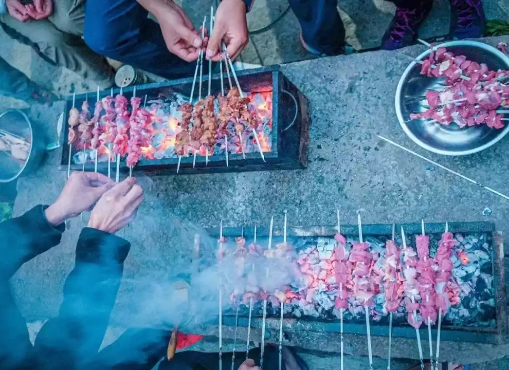
02Stay in Baodu Village, a paradise on earth, witness the catching of free-range goats in the wild, and taste a whole lamb banquet, a delicacy from Taihang Mountains.
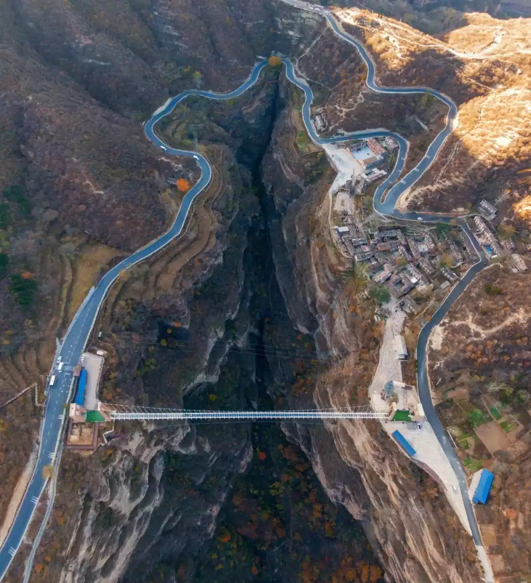
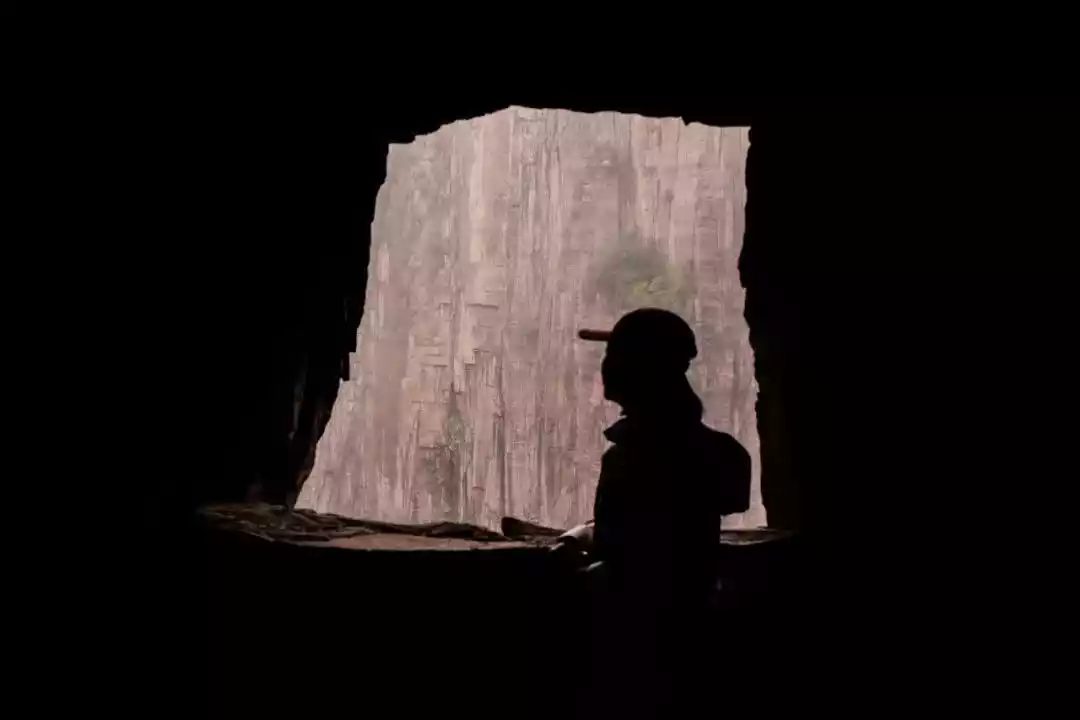
Baodu Village, located deep in the Taihang Mountains, is isolated and isolated from the world. It is the only village in Shanxi Province without access to roads.
Baodu Village has a long history. According to legend, Ma Wu, a founding general of Emperor Guangwu of the Eastern Han Dynasty, grazed cattle here when he was young. The river was wide and the valley was deep, and the water was turbulent, so the cattle could not cross the river. Ma Wu carried the calf across the river every day to eat grass. Day after day, the calf grew bigger and bigger, but Ma Wu still carried the calf across the river and developed supernatural powers. Therefore, the village was named Baodu Village and the river in front of the village was named Baodu River.
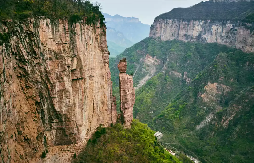
Baodui Village is located on the cliffs of Taihang Mountain, with continuous mountains to the north and south. The village is located in the river valley between the two mountains. The river valley stretches to the entrance of the village and encounters a cliff, forming a unique incision, which is called Laolongkou.
Laolongkou is composed of a huge piece of ochre-red rock. After hundreds of millions of years of river erosion, deep grooves have been cut into the rock. The unique landform of the smooth cross-section is beautiful and magnificent, making people marvel at the wonders of nature.
During the flood season in spring and summer, you can see the mighty river flowing from west to east to Laolongkou. The "Dragon Spit Water" waterfall with a drop of more than 300 meters is majestic and shocking.
Baodui Village is not big and has retained its original natural landscape and customs. There are only five households in the village and the villagers make a living by herding sheep.
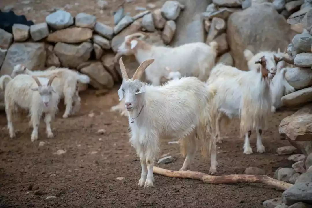
In the village, you can also see sheep pens built against natural caves. The sheep with calves are all good climbers. They have been drinking the clear spring water of Baodu River since they were young and eating grass from the top of Taihang Mountain. They climb mountains every day for exercise, and their meat is extremely tender.
Every year, many outdoor enthusiasts from nearby cities hike to sample authentic free-range goat meat. Having traveled so far, we couldn't miss this opportunity. China-TravelNote has specially arranged a goat feast featuring local specialties, including braised goat, stewed goat, grilled goat, and three other dishes.
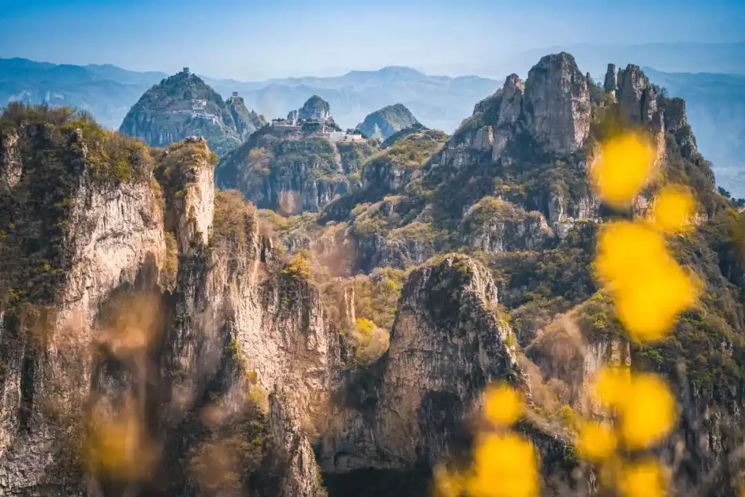
03In the Red Rock Cliff Grand Canyon, overlook the geological miracle created by billions of years of crustal movement.
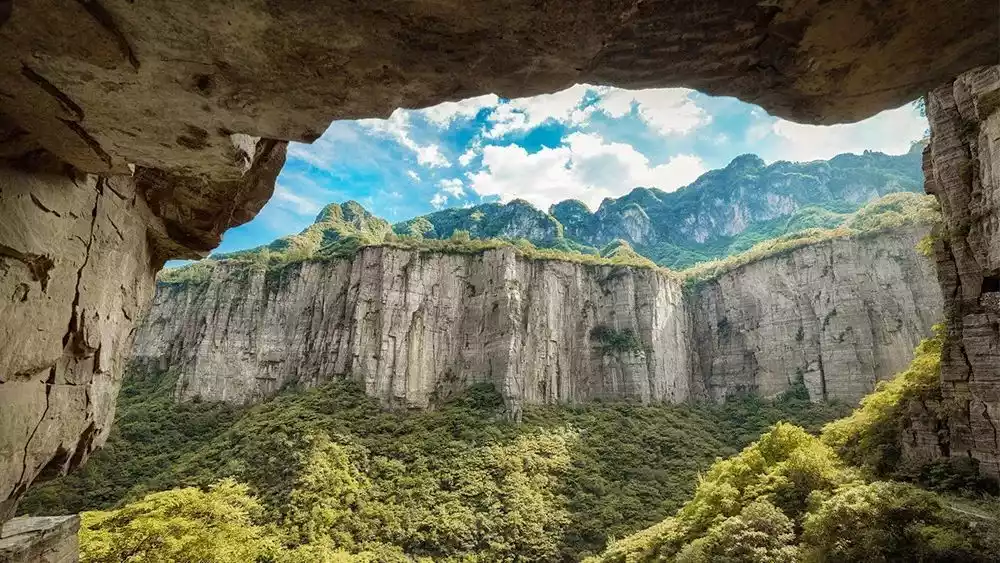
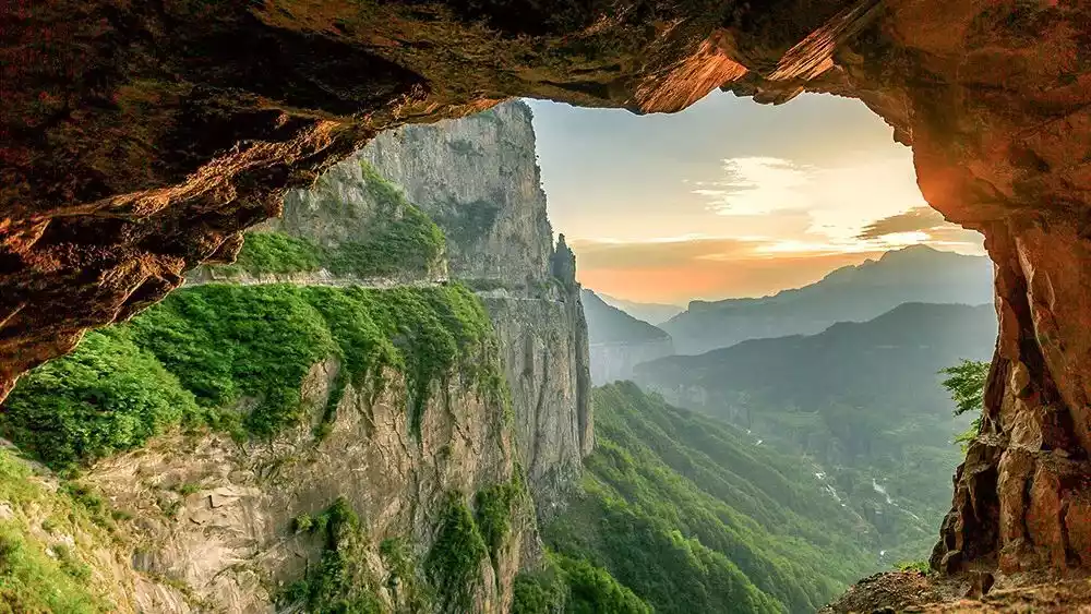
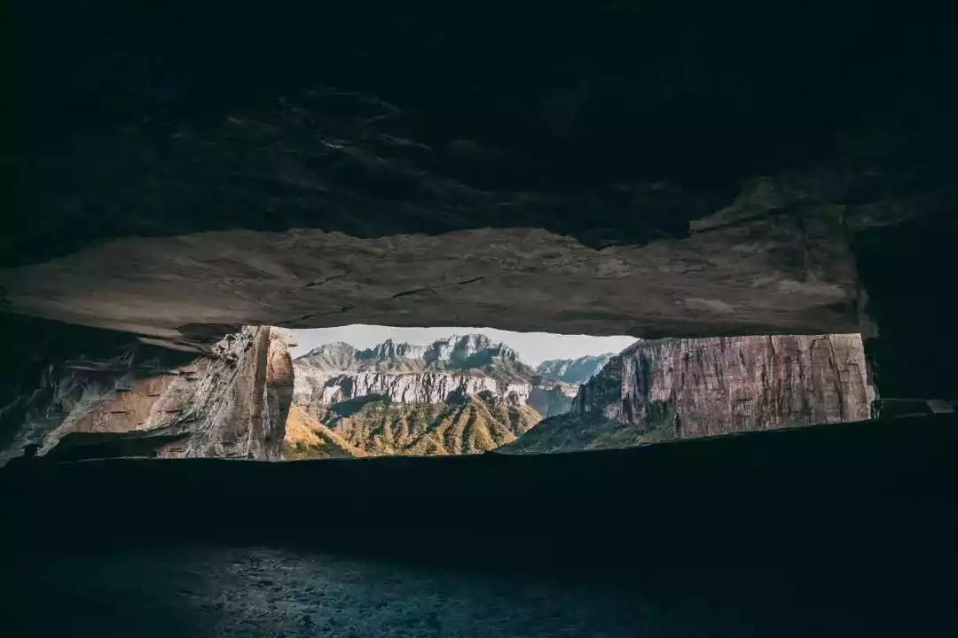
The Guoliang Village Canyon is over 200 meters deep, 500 meters wide, and stretches for more than 20 kilometers. The cliffs on both sides are as sharp as if they were cut by knives and axes, and the rocks are red in color, earning it the nickname "Red Rock Cliff Canyon."
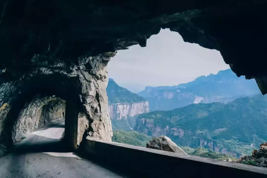
On the north side of the canyon lies Guoliang Cave, a cliff corridor. Looking south from the cave entrance, one can see the majestic cliffs, the smoke from the tiled houses on the cliffs, and the sturdy yellow elm trees on the cliff edge. From the south side of the canyon, one can see the 35 skylights of the cliff corridor and the majestic Guoliang Cave that stretches across the cliff.
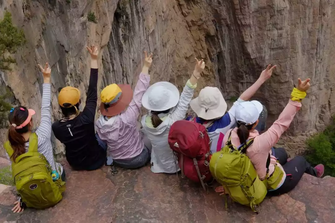
04 Hike from Shiziling, the highest peak in South Taihang Mountains, to Wangmangling, the second highest peak in South Taihang Mountains, and enjoy the essence of Taihang Mountains and rivers. You will have no regrets after completing the hike.
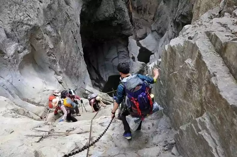
The Shuangling Crossing refers to the crossing between the highest peak of Shiziling in the southern Taihang Mountains and the second highest peak, Wangmangling. It covers special terrains such as canyon crossing, mountain ascent and descent, ladder climbing, and cliff walking. The top of Shiziling is covered with stone buds.
Wangmangling is known as the "Supreme of Taihang Mountains" and is often described as "unknown to the Taihang Mountains without climbing Wangmangling." The Shuangling Crossing is considered the most beautiful and dangerous route in southern Taihang. Walking along the ridgeline between Shiziling and Wangmangling, you can take in sweeping views of the mountains both near and far.
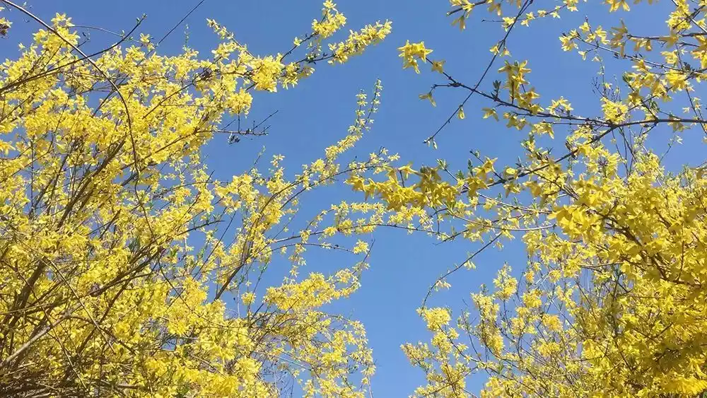
This place is also a famous Chinese medicinal material base with large areas of wild forsythia. Every spring, the mountains are covered with forsythia flowers in full bloom, like a golden ocean.
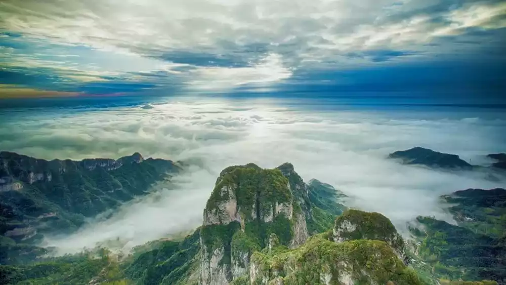
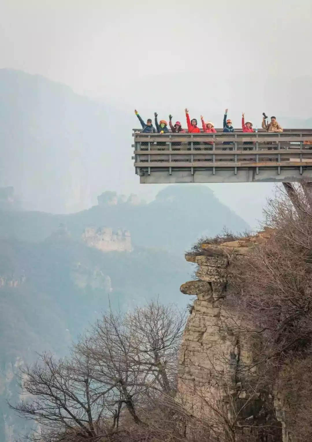
05Watch the sunrise on the top of Wangmangling, the highest peak in Taihang Mountains, and sigh, "There is no need to climb the Five Mountains when all the wonderful peaks in the world are gathered here."
According to legend, in the late Western Han Dynasty, Wang Mang pursued Emperor Guangwu of Han, Liu Xiu, and stationed troops here, hence the name.
Wangmangling is located in the highest area of southern Taihang Mountains and the most dangerous part of the fault zone between the Loess Plateau and the Zhongzhou Plain. It overlooks the Hebei-Henan Plain from the southeast. It is surrounded by low terrain, but its dominance makes people appreciate the charm of "the ridge of Taihang Mountains in the sky since ancient times".
Li Rui, Mao Zedong's secretary during his lifetime and a leader in contemporary poetry, once praised it: "If you have not climbed Wangmang Ridge, how can you know Taihang Mountain? With all the wonderful peaks in the world gathered here, why bother climbing the Five Sacred Mountains?"
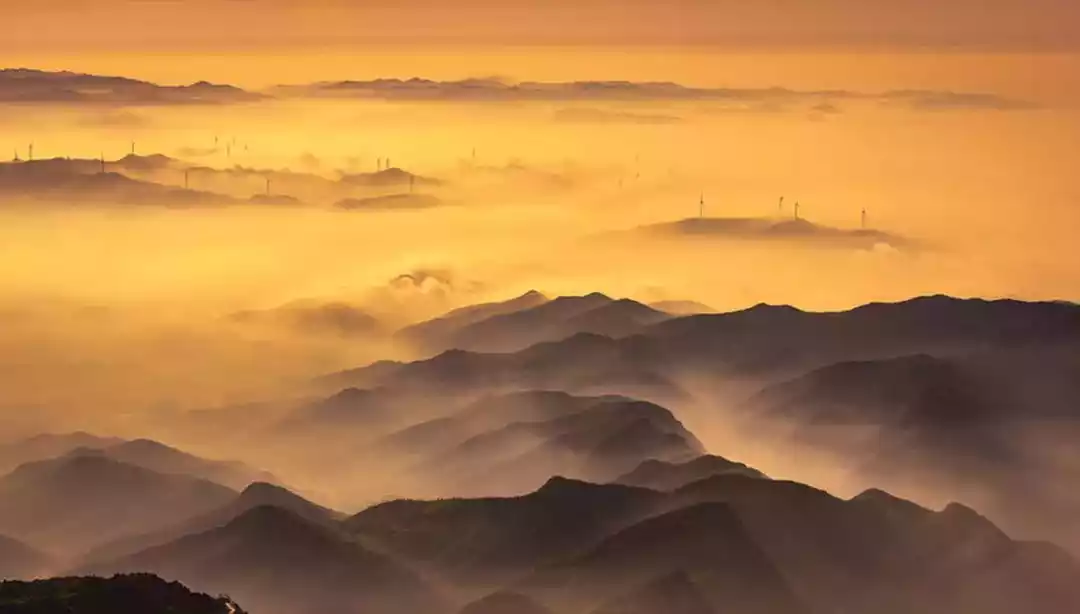
Due to the large altitude difference in Wangmangling, a sea of clouds appears after heavy rain or snow, which occurs for about one hundred days a year.
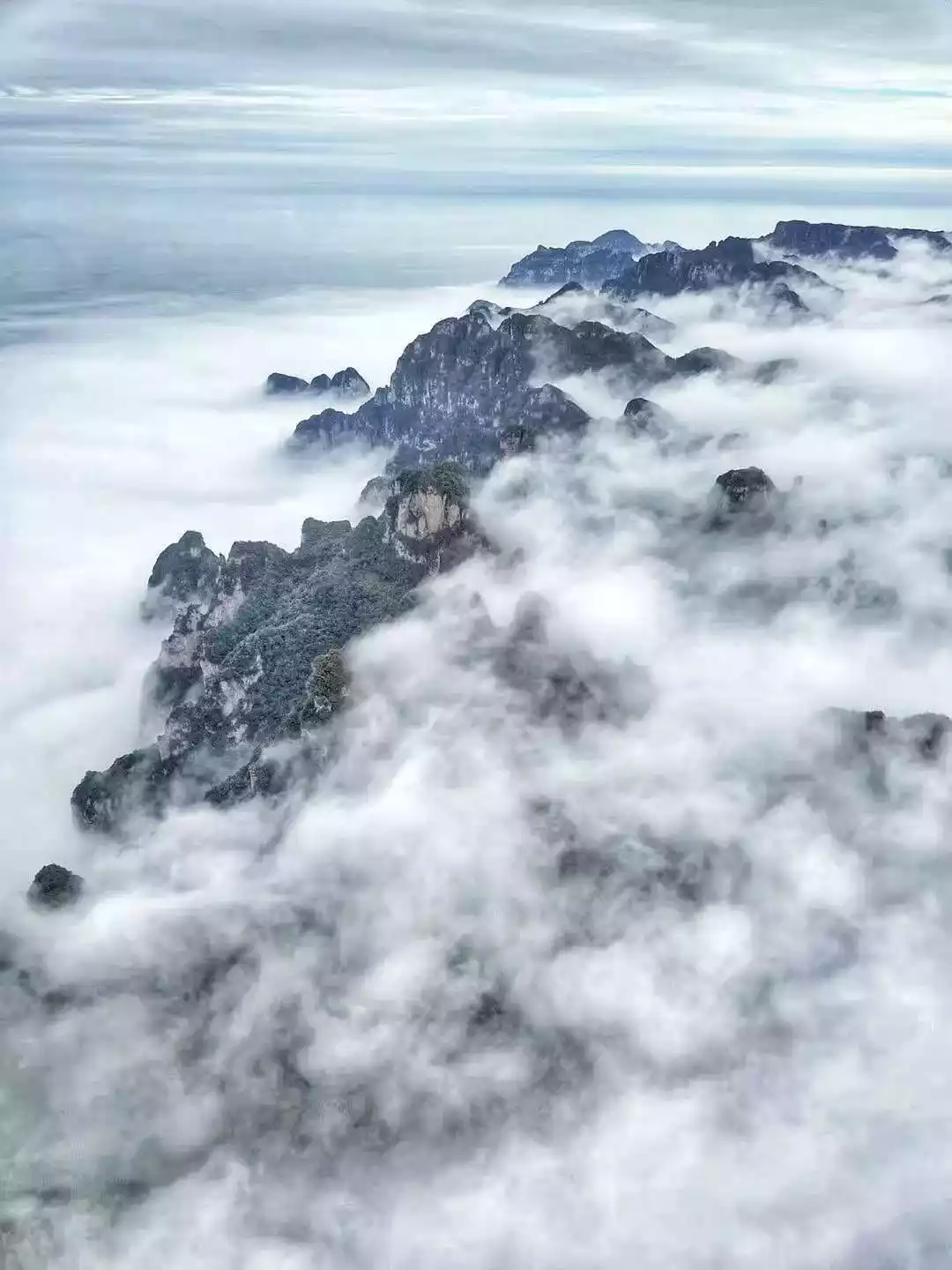
It rushes and winds between the mountains and canyons, sometimes like a rushing river, sometimes like a nine-day waterfall, sometimes like a thousand-acre calm lake, and sometimes like the waves of the sea. The sea of clouds rises and falls, and the peaks appear and disappear, with various postures, just like a fairyland.
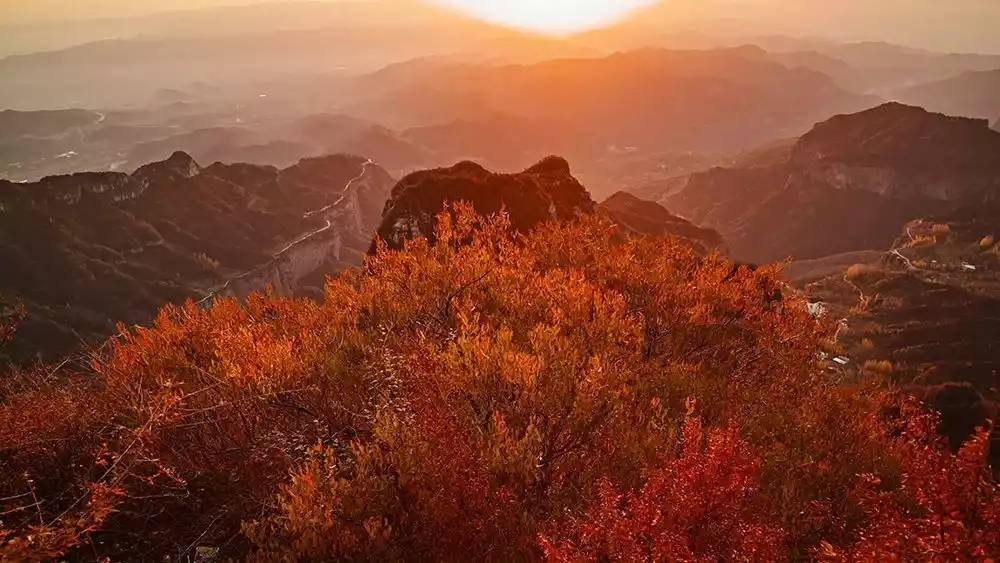
The most spectacular thing about Wangmang Ridge is the sunrise. On sunny days, the peaks are immersed in a vast sea of clouds like fish scales, from gray to colorful clouds to shining golden scales.
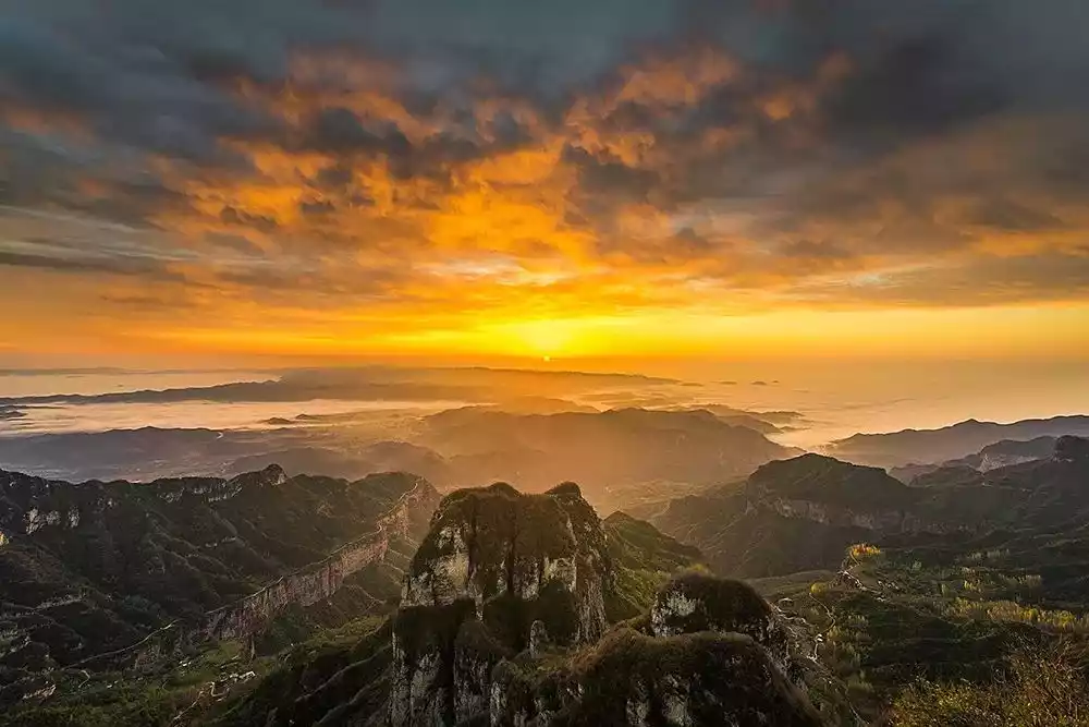
A red sun rises slowly, and for a moment the mountains are dyed with colorful rays of light. Its majestic and glorious momentum surpasses all the peaks.

The sunrise and sea of clouds at Wangmangling are both unique and have earned the reputation of "the sea of clouds is on par with Huangshan, and the sunrise is comparable to Mount Tai".
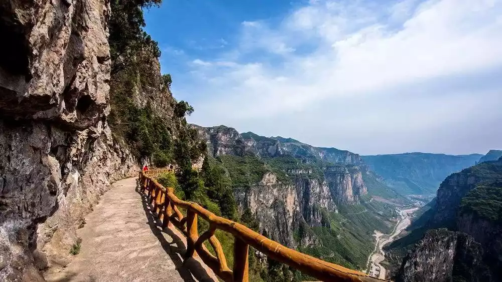
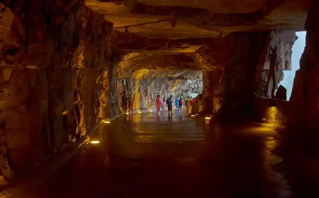
06 Measure the "Ninth Wonder of the World" with your feet - Taihang Mountain Cliff Road
Guoliang Village is located high on the cliff of Taihang Mountain. The ancestors of the villagers fled to this desperate place for refuge.
Previously, the road in and out of the village was a set of stone steps carved entirely from stones on a cliff with an angle of nearly 90 degrees, called the "ladder to heaven".
The path is steep and can only accommodate one person. Without any protective measures, it is extremely dangerous to enter or exit the village. The entire village is basically isolated. Usually, people carry mountain products from the "ladder to heaven" to the outside of the mountain in exchange for some necessary daily necessities.
In 1972, villagers spontaneously sold their goats and yams and raised funds to buy steel hammers and steel files. Under harsh conditions without electricity and machinery, a drilling team consisting of 13 strong laborers in the village braved the wind and snow, tied hemp ropes around their waists, hung on the cliff, and used steel drills and hammers to drill rows of blastholes on the red rock cliffs, creating a road leading out of the mountain.
The people of Guoliang had no mechanical equipment and relied entirely on manual labor. It took a total of 5 years to chisel away 26,000 cubic meters of stone from the cliff with hammers, wearing out 12 tons of steel drills, and breaking 4,000 8-pound hammers.
On May 1, 1977, Guoliang Cave, known as the "Cliff Corridor", was finally officially opened to traffic. It demonstrated the Taihang people's hard work and the brilliant miracles they created, and can be called a real-life version of Yugong moving mountains.
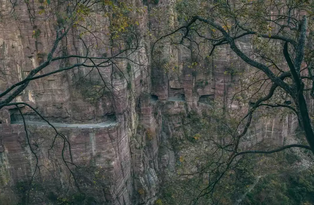
The Guoliang Cliff Highway is the most famous among the Southern Taihang Cliffs. People who have never been to Taihang find it difficult to understand the shock of the towering cliffs. Guoliang Village is located on the top of this cliff and is praised as "the ninth wonder of the world", "one of the ten most dangerous roads in the world", and "one of the eighteen most peculiar roads in the world".
The China-TravelNote South Taihang series of itineraries have been carefully considered and arranged, covering all kinds of typical landforms in the South Taihang Mountains, including various forms of hiking such as canyon crossing, "ladder to heaven" climbing, cliff walking, and hanging wall roads.
The route is full of overlapping mountains and different scenery at every step. It can be said to be the most classic outdoor crossing route in South Taihang.
Conclusion
The towering Taihang Mountains stretch for 800 miles, filled with breathtaking scenery. "The beauty of the Taihang Mountains is often underestimated." Experience the essence of the Taihang Mountains in one trip, leaving no regrets! Let's set out together and measure the Taihang Mountains with our own feet!