Explore the Tianshan Mountains in Xinjiang! Unlock the unknown South Tianshan Mountains and head west to the westernmost point of China
Preface
In 2023, we once again embarked on our journey to explore China. This year's destination was "South of the Tianshan Mountains," a destination I had planned for three years.
This is not Yili, but it is better than Yili! This is a secret place unknown to the people of Xinjiang, a place with hellfire, Wuhua Mountain, flower sea grassland, snow-capped mountains and glaciers, red desert... This place will subvert your perception of the "Gobi Desert" in southern Xinjiang.
There were no commercial attractions along the way! There were practically no tourists! This was also China-TravelNote's first foray into new territory. With a curiosity for geographical exploration, we journeyed westward along the Tianshan Mountains, exploring the unique landscape of "South of the Tianshan Mountains."
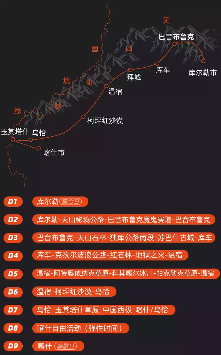
This Explore China trip brought together eight fascinating people, including loyal fans, first-time travelers, and newcomers trying their hand at a safari. Of course, the success of our safari was also inseparable from our three dedicated guides. In the summer of 2023, we'll travel together, singing and laughing, to witness a new side of southern Xinjiang.
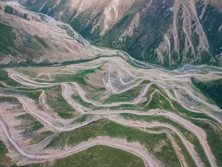
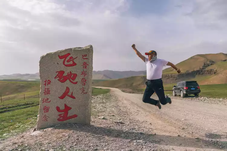
Bayinbuluke-Devil's Track
This mysterious stretch of road was inspired by Han Han's film "Speeding Life." Bayinbuluke lacks an ocean, but it does boast vast forests, expansive grasslands, and a thrilling racetrack with endless curves. The sight of a rally car traversing the narrow gravel road, trailing long trails of smoke, the wild racing scene blending with the gentle beauty of the grasslands left a deep impression on every filmmaker.
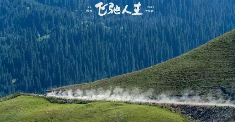
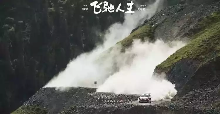
Maybe because of my familiarity and love for Xinjiang, I have watched the movie three times. I have also been trying to find the filming location of this track, hoping to witness it with my own eyes.
The first time I looked for the "Devil's Track" was two years ago during the [Exploring China Season 3: Electric Sky Road]. That time I chose to enter from Bayinbuluke Town, but unfortunately the scenic area had set up a checkpoint there, so I was persuaded to turn back and left with regret.
Two years later, I had the opportunity to come to Bayinbuluke again. I found the entrance to the other end of the Devil's Track, started from Hejing, crossed a secret road in the Tianshan Mountains, and crossed back to Bayinbuluke, finally fulfilling my dream of "Speeding Life".
The road condition from Hejing to Bayinbuluke was asphalt in the first half, and gradually turned into a gravel road in the second half. The winding mountain road along the way shocked Chengdu, who was not familiar with the devil's track at all.
We set off at 8:30 in the morning and wandered around until the afternoon when we finally saw the winding mountain road at the top of a mountain in the distance. This is one of the filming locations. We finally arrived at the Devil's Raceway! !
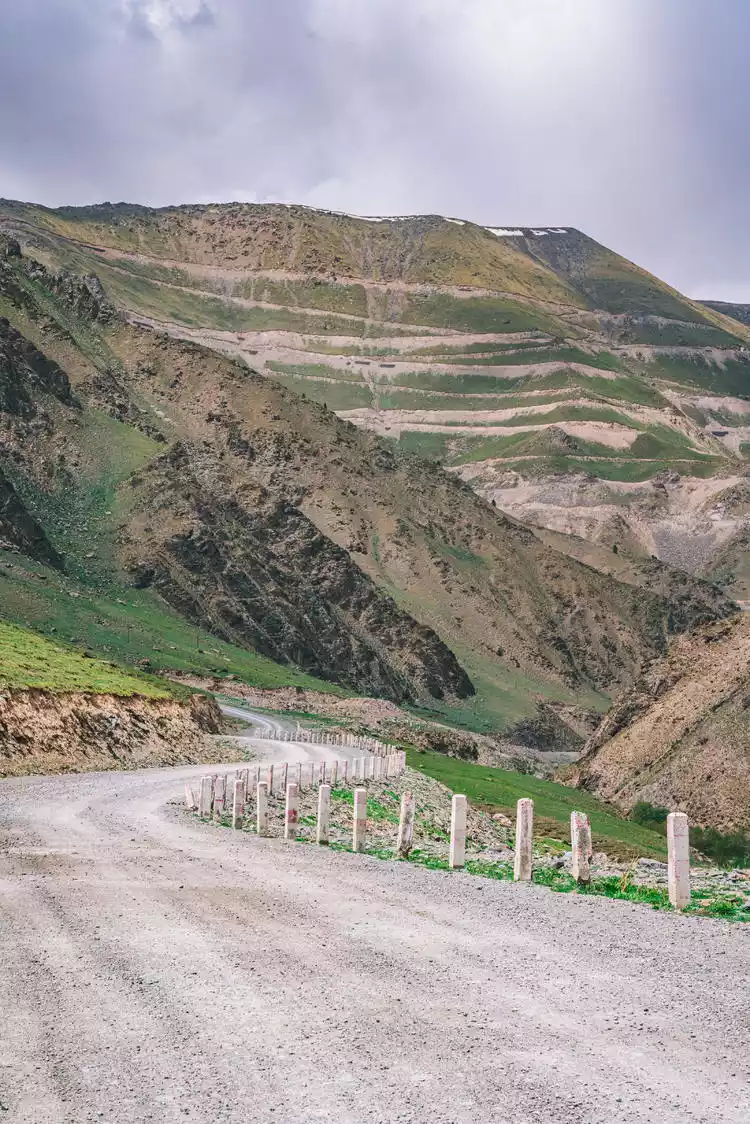
The continuous hairpin bends and narrow lanes only suitable for bicycles made it take a full half-hour to reach the top of the mountain. The view from the top was breathtaking. Director Han Han left a stone tablet on the roadside, which is also very artistic. It is indeed a classic racing movie and worth remembering.
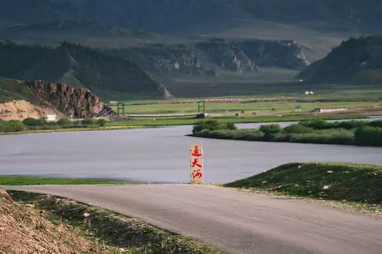
After passing the devil's track, the desolate Gobi landscape in southern Xinjiang turns into the fertile Bayinbuluke wetland grassland. This is also the filming location of the Tongtian River in the famous TV series "Journey to the West". The largest river in Bayinbuluke, the "Kaidu River", converges here, passes through the Tianshan Mountains, and flows into Lake Bosten and the Tarim River.
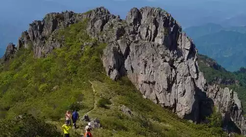
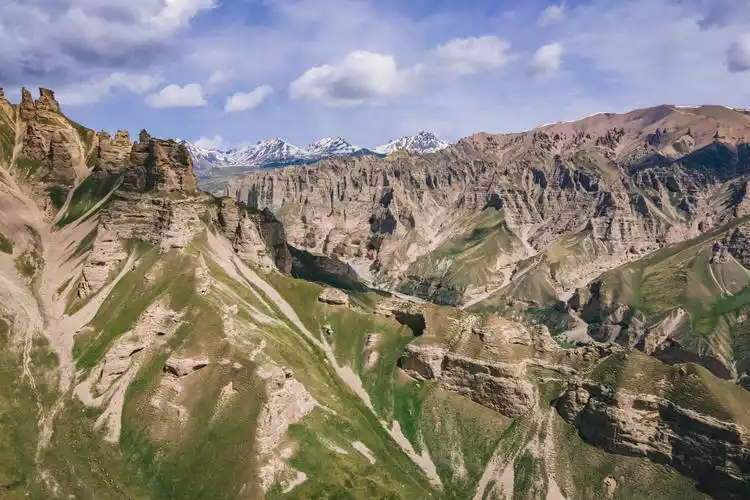
Tianshan Stone Forest
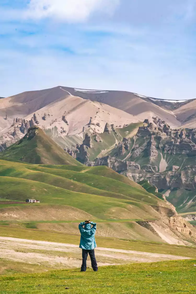
I visited Tianshan Stone Forest two years ago by walking the Electric Sky Road. However, the weather was not very good last time and I was in a hurry, so I couldn't go deep into the valley to have a look. This time I had the opportunity to visit this niche secret place again, [Tianshan Stone Forest], and I was even more surprised.
There were many wild animals along the way, including countless groundhogs, eagles, foxes, and scenes of foxes preying on groundhogs.
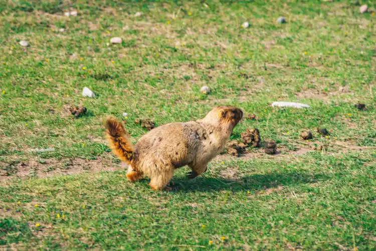
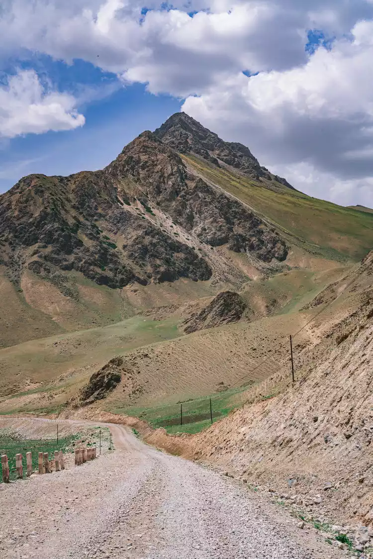
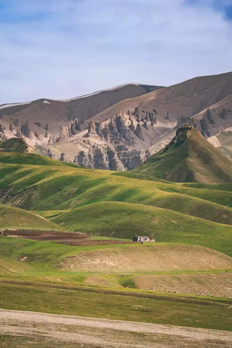
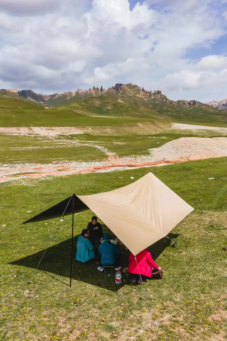
Climbing to the top of Kok Usuda Pass, looking around, you can see that there seems to be a primeval forest scattered on the hillsides on both sides of a deep valley, surrounded by snow-capped peaks. When you get closer, you can see that it is not pine and cypress, but a graceful "stone forest".
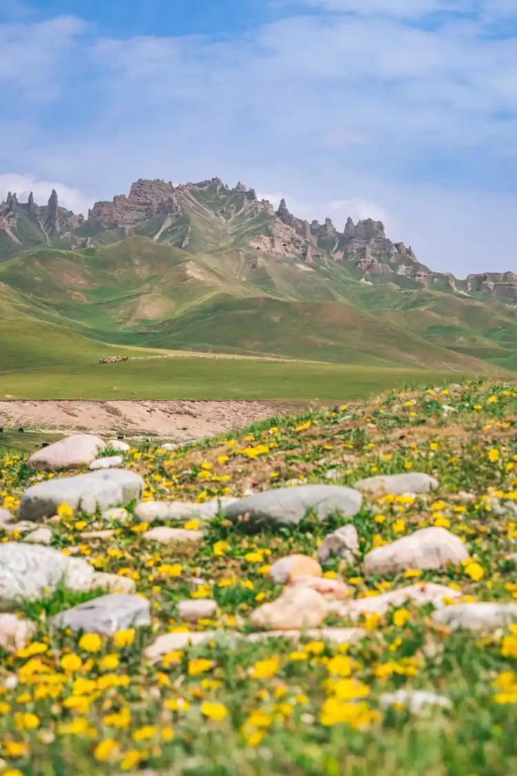
Millions of years of natural processes have sculpted this sandstone and rocky forest into a myriad of bizarre and fascinating shapes. Some resemble ancient castles, others resemble people and animals, all vivid and lifelike; others resemble swords and spears, piercing the blue sky. Dotted throughout the landscape are caves and holes, leading to winding paths. In the Stone Forest Valley, flowers bloom everywhere, and apart from cattle, sheep, and herders, there are no other tourists, creating a truly secluded paradise.
The beautiful grassland and stone forest landscape, coupled with the blue sky and white clouds, is a perfect place to relax. The masters thoughtfully set up the canopy and put tables and chairs for a snack. The feeling of vacationing couldn't be more comfortable.
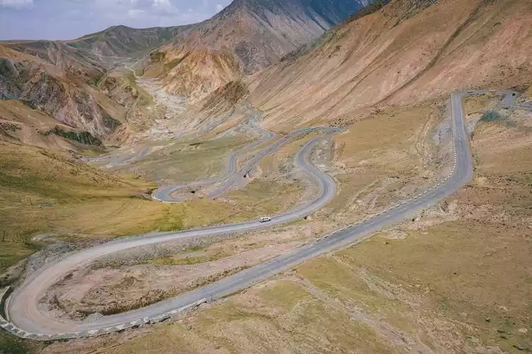
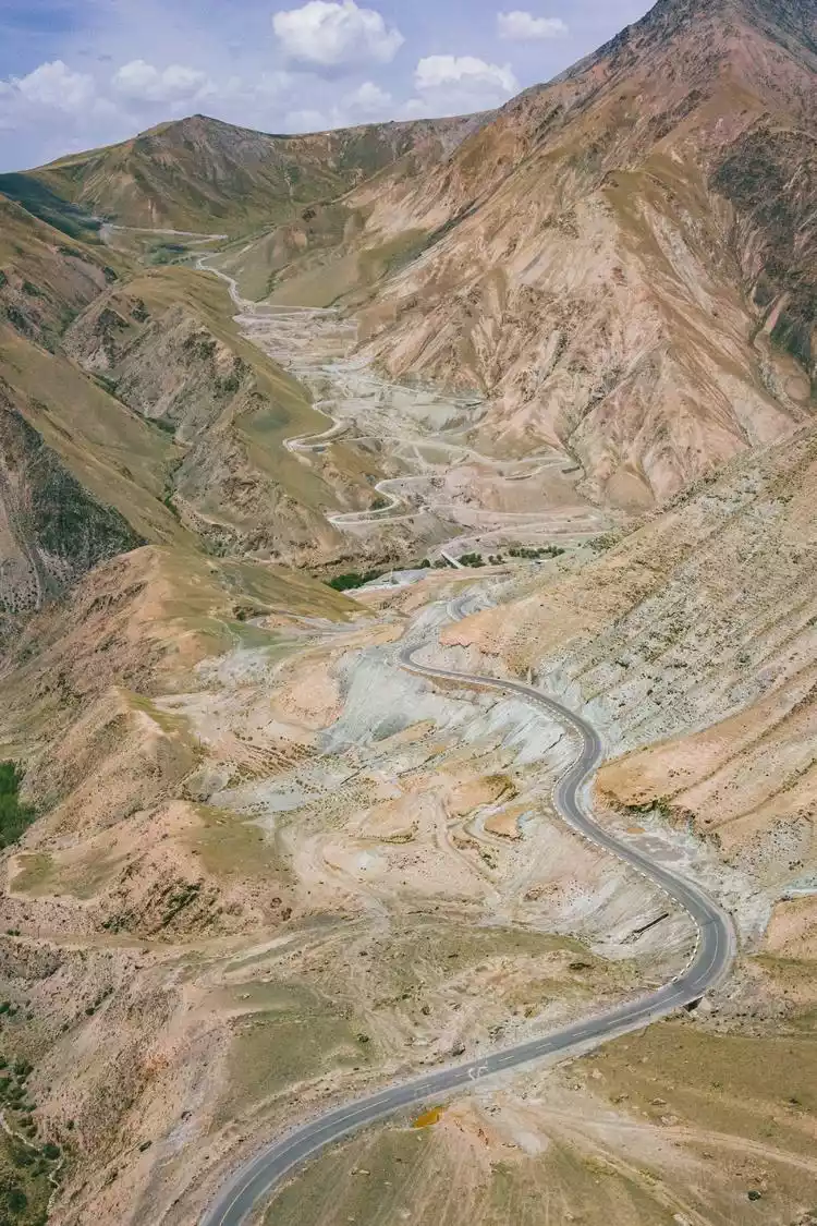
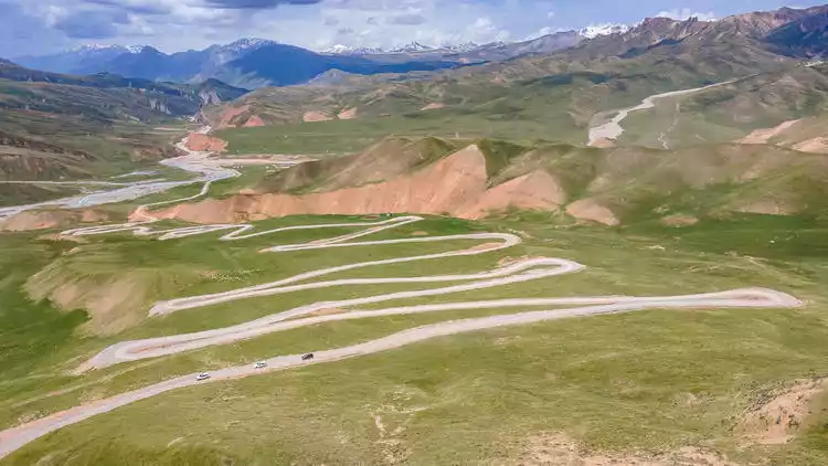
On the way back, I tried to use a drone to take aerial photos and found that the winding mountain road here also appeared in "Speeding Life". Director Han Han did a lot of research on routes and filming locations for this movie.
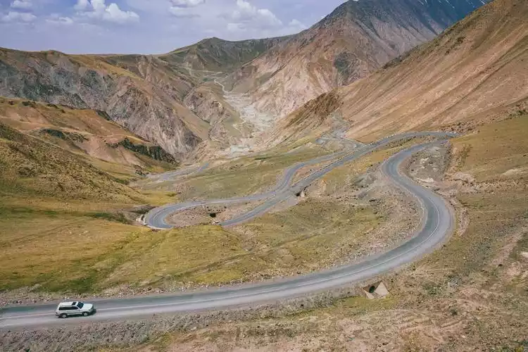
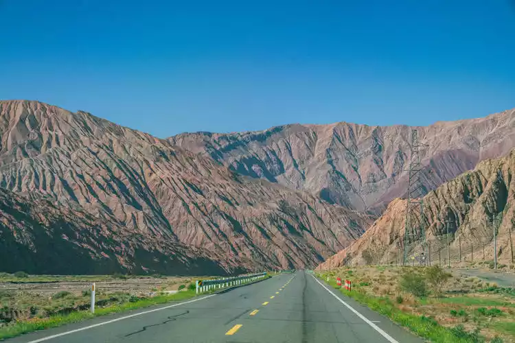
Duku Highway-Southern Section
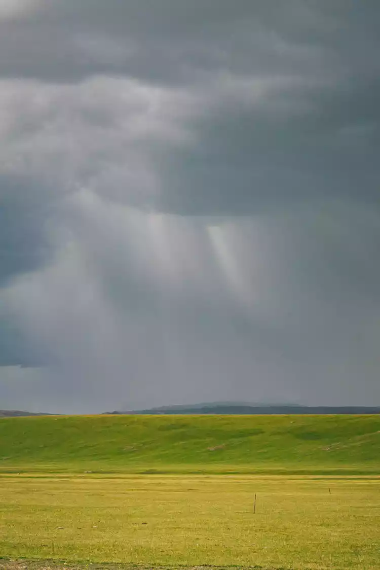
Leaving the Stone Forest, we continued along the southern section of the Duku Highway, heading towards Kuqa in southern Xinjiang. The weather on the grasslands can change quickly: one moment it was blue and white, the next it was overcast. From the car, we could clearly see a thunderstorm cloud drifting ahead, bringing down a shower of rain.
In 2023, the Duku Highway had been delayed in opening to traffic. We arrived in Xinjiang on June 10th, but still hadn't received any news. Fortunately, late that night, we saw a message from netizens about a successful passage through the southern section of the Duku Highway. This gave us a glimmer of hope as we made our way to Bayinbuluke. The Duku Highway can turn an 800+ kilometer journey into a 200 kilometer shortcut, crossing mountains and building bridges. It's a heroic highway, and a scenic avenue for the Tianshan Mountains.
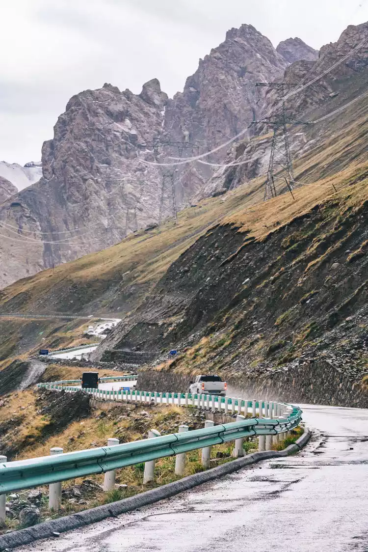
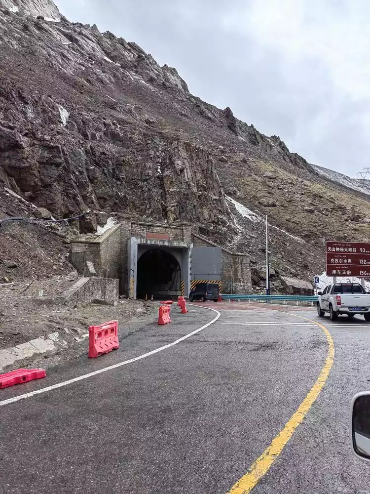
Arriving at the highest point of the southern section, Tielimaiti Pass, the tunnel gate was wide open. The road construction workers had opened the passage for everyone in advance. The official announcement said the opening ceremony would be held on the 18th, so we were very lucky to be able to pass through in advance.
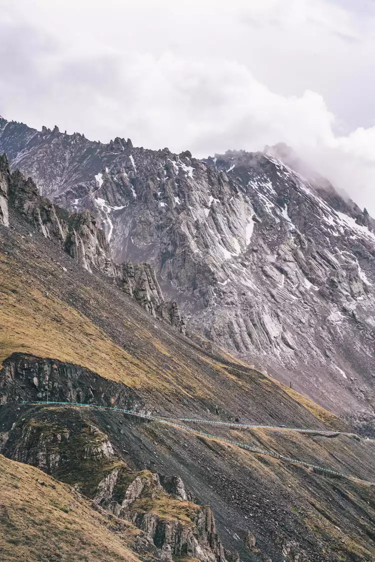
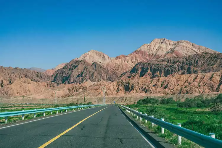
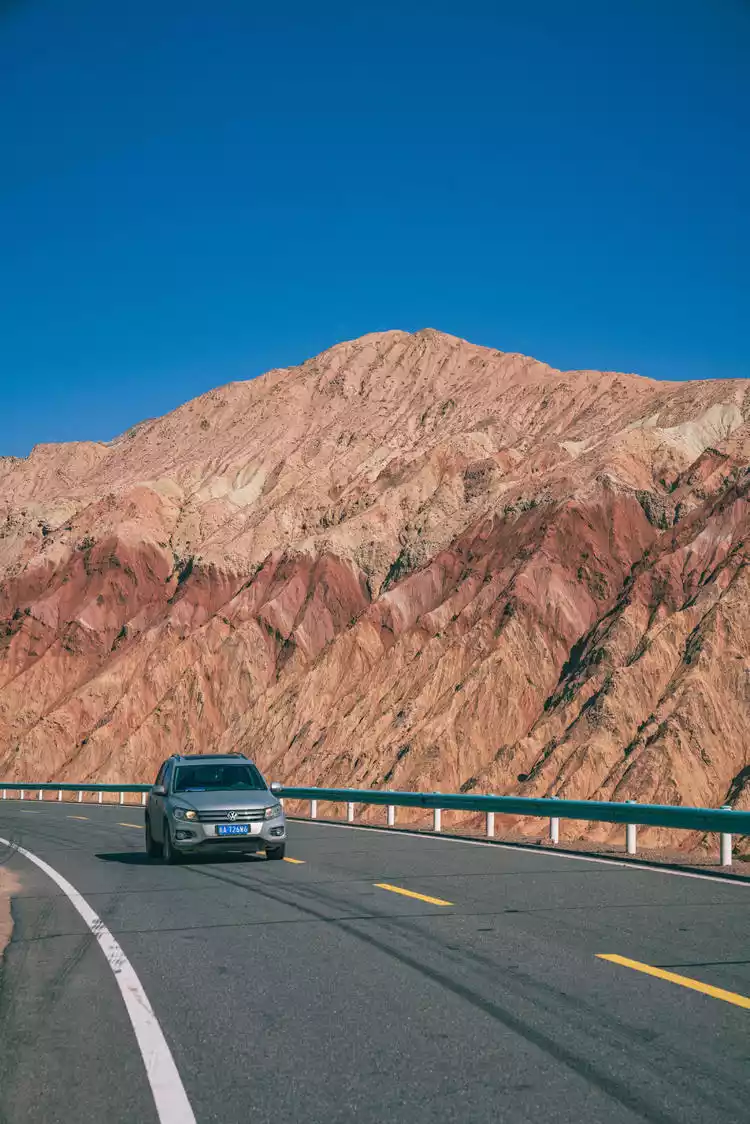
Crossing the Tielimati Pass in the southern section of Duku and passing the Big and Small Dragon Ponds, the scenery along the way changes from lush greenery to the reddish-brown Danxia mountains. As the vegetation gradually decreases, the earth reveals dry yet rich colors like a palette.
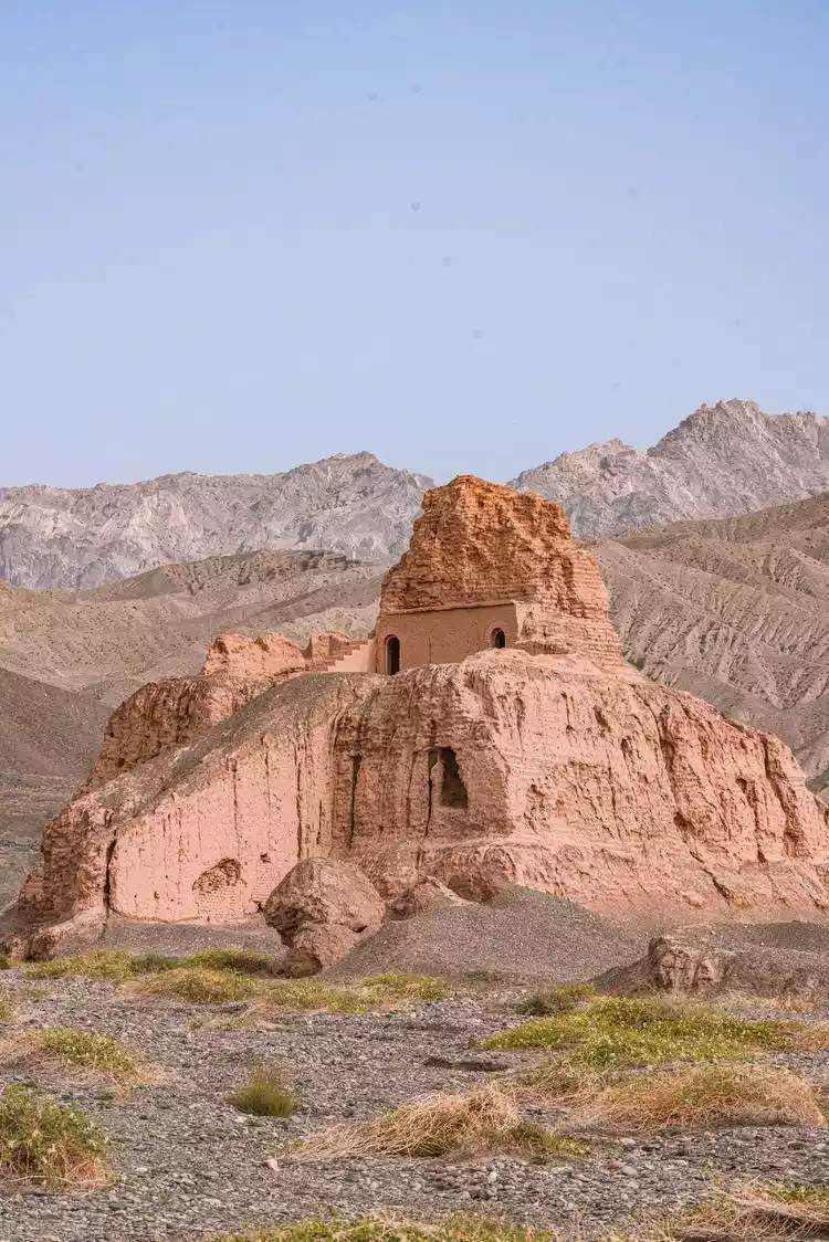
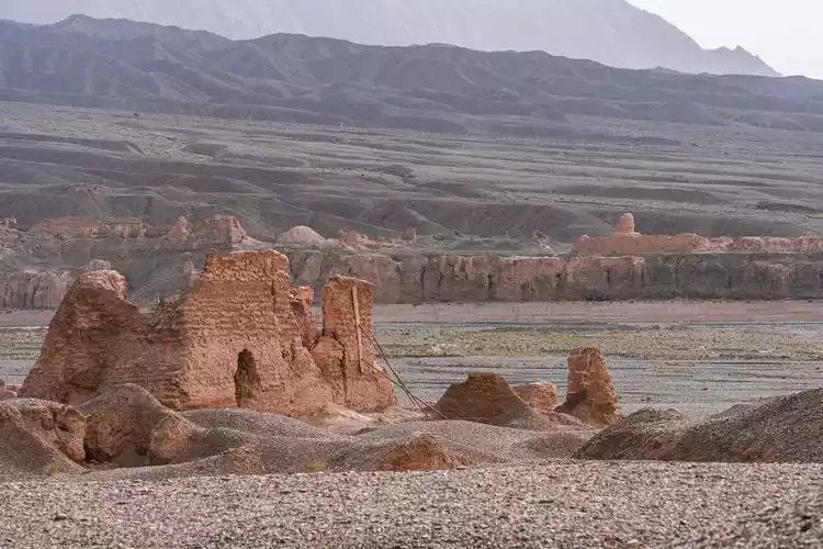
Kuche-Subashi Buddhist Temple
The Subashi Buddhist Temple Ruins, also known as the Zhaohuli Temple, is located in the northeast of Kuqa County, Xinjiang. The ruins are divided into two temples, the east and the west, distributed on the east and west banks of the river, facing each other.
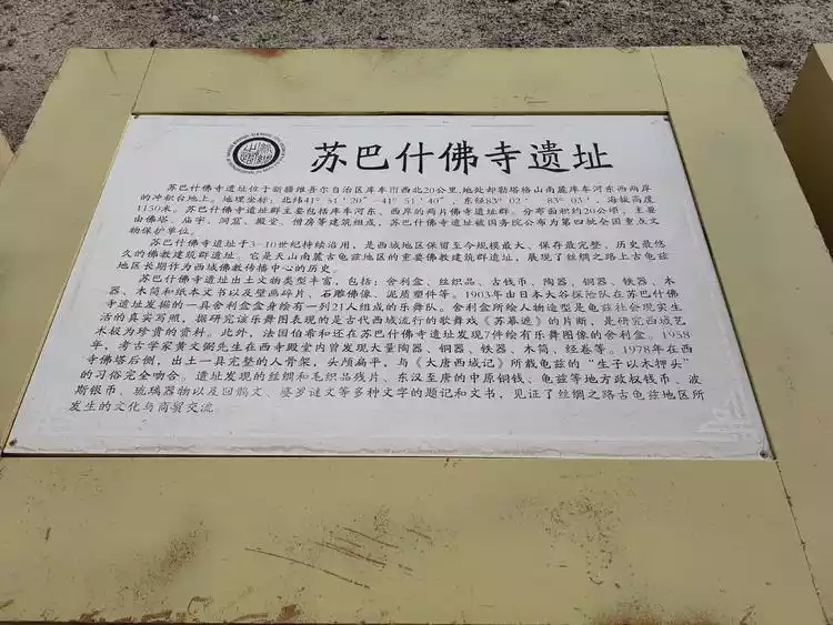
At the 38th session of the World Heritage Committee, the site of the "Silk Roads: Chang'an-Tianshan Corridor" was successfully inscribed on the World Heritage List. The Subashi Buddhist Temple Ruins primarily comprise two clusters of Buddhist temple ruins on the east and west banks of the Kuche River. Spanning approximately 20 hectares, they primarily consist of pagodas, temples, caves, halls, and monks' quarters.
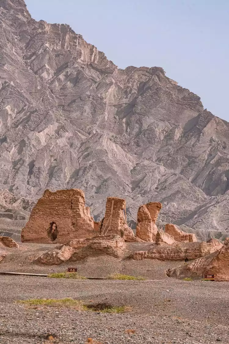
The Subashi Buddhist Temple ruins, in continuous use from the 3rd to the 10th century, are the largest, best-preserved, and oldest surviving Buddhist architectural complex in the Western Regions. They demonstrate the long history of the ancient Kucha region as a center for the spread of Buddhism in the Western Regions along the Silk Road.
Kumarajiva, a renowned ancient Chinese Buddhist translator and eminent monk from Kucha, was sent to the Subashi Buddhist Monastery at the age of seven to begin his Buddhist studies. As an adult, he mastered the Mahayana and Hinayana teachings, becoming a renowned monk in Kucha and giving numerous lectures there.
Some 400 years later, during the Tang Dynasty, Subashi Buddhist Temple was still thriving, with a constant flow of monks. Xuanzang, who passed through the area, was also deeply impressed. In his "Great Tang Records on the Western Regions," he described Subashi Buddhist Temple as follows: "Over forty miles north of the deserted city, bordered by mountains and separated by a river, there are two monasteries, both named Zhaohuli, but named east and west. The Buddha statues and decorations are beyond human effort." He stayed at the temple for over two months, studying and preaching. Archaeologists estimate that over 10,000 monks attended Xuanzang's lectures. Two generations of eminent monks, following the Buddhist teachings, met across time and space at Subashi Buddhist Temple.
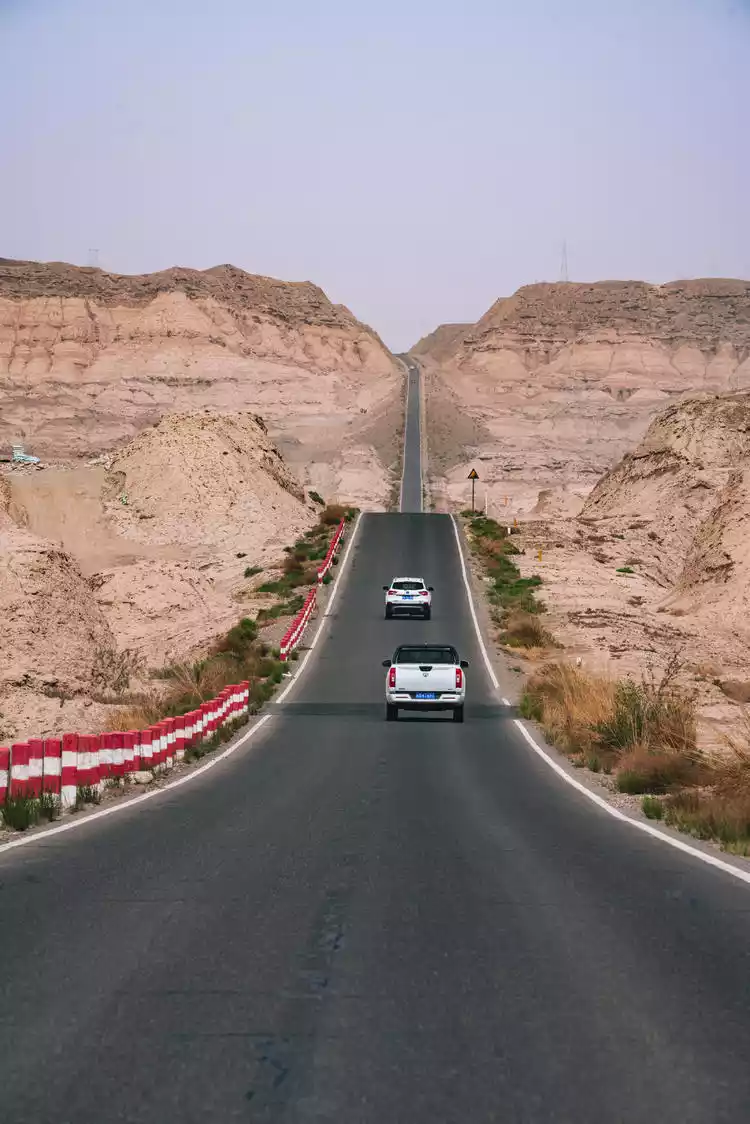
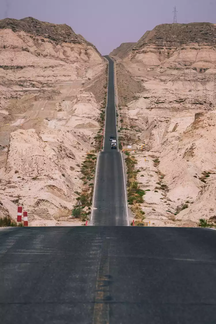
Kuqa-Bolang Highway
Leaving Kuqa County and driving south from the Duku section, we arrive at a mysterious stretch of road called the Wave Highway. This straight road undulates with the terrain, with gullies dotting the sides, resembling undulating waves.
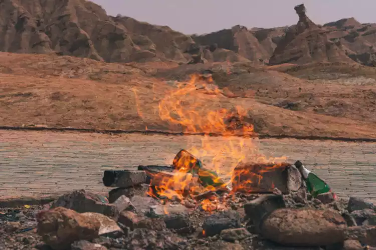
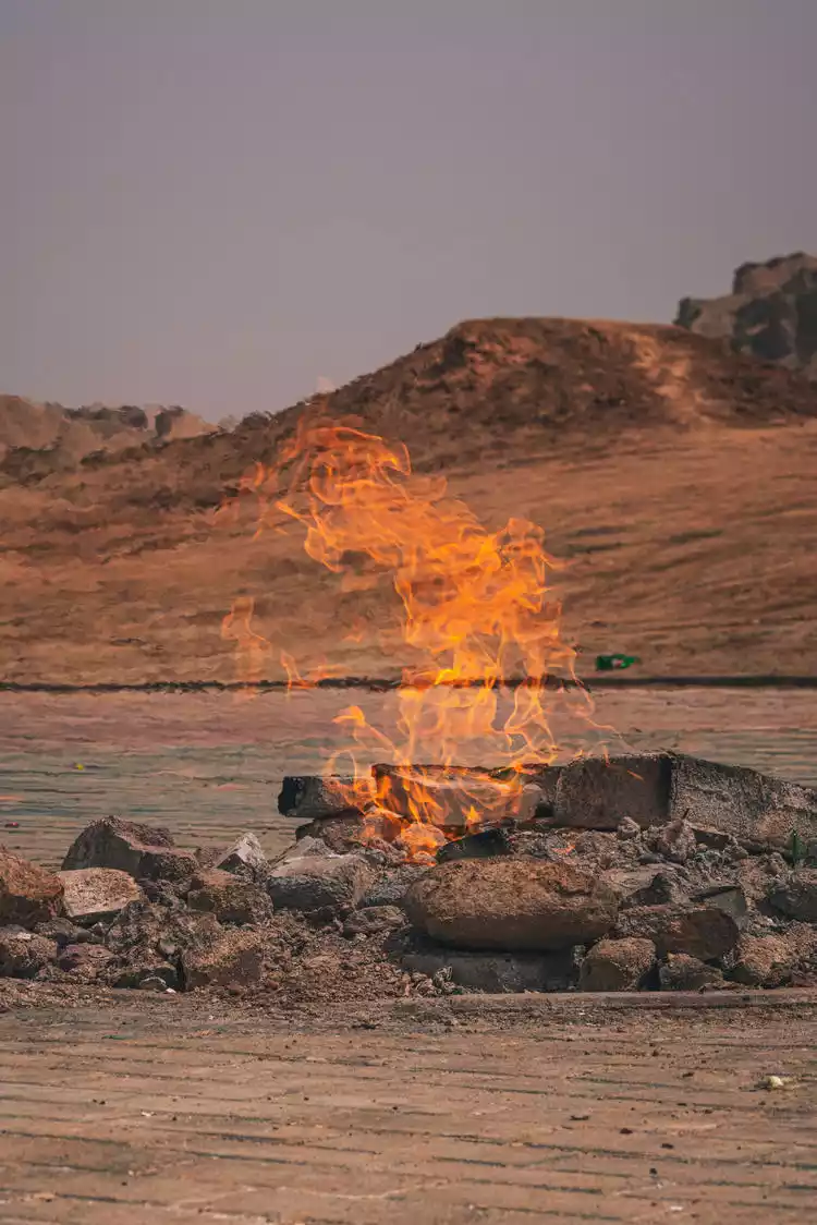
Baicheng-Hellfire+Redstone Forest
Leaving the Wavy Highway, we found the famous "Hellfire" in Baicheng. Under the land of southern Xinjiang, there are rich minerals, and natural gas leaked from the surface through cracks in the rock strata, forming a never-extinguished hellfire.
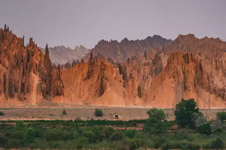
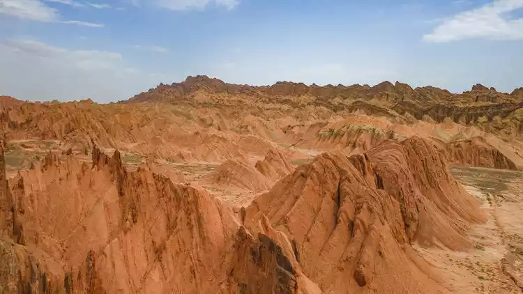
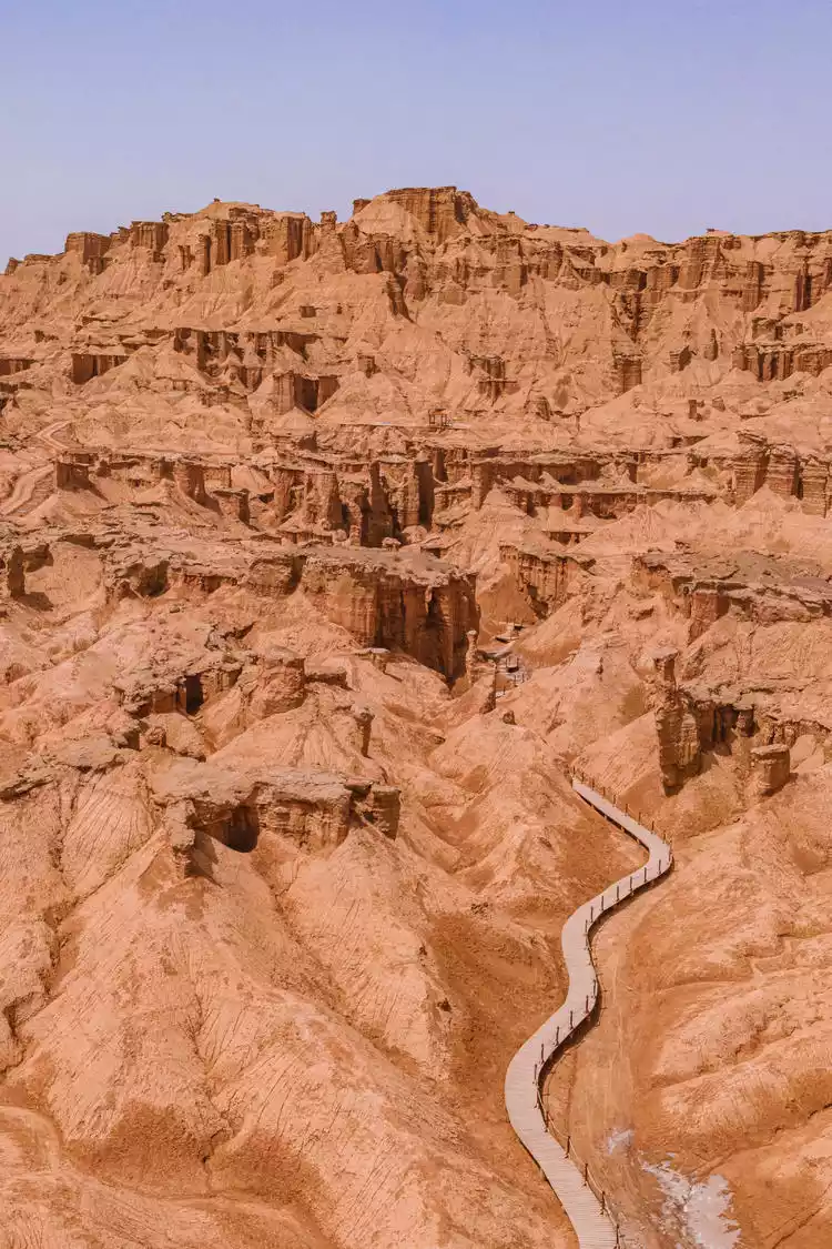
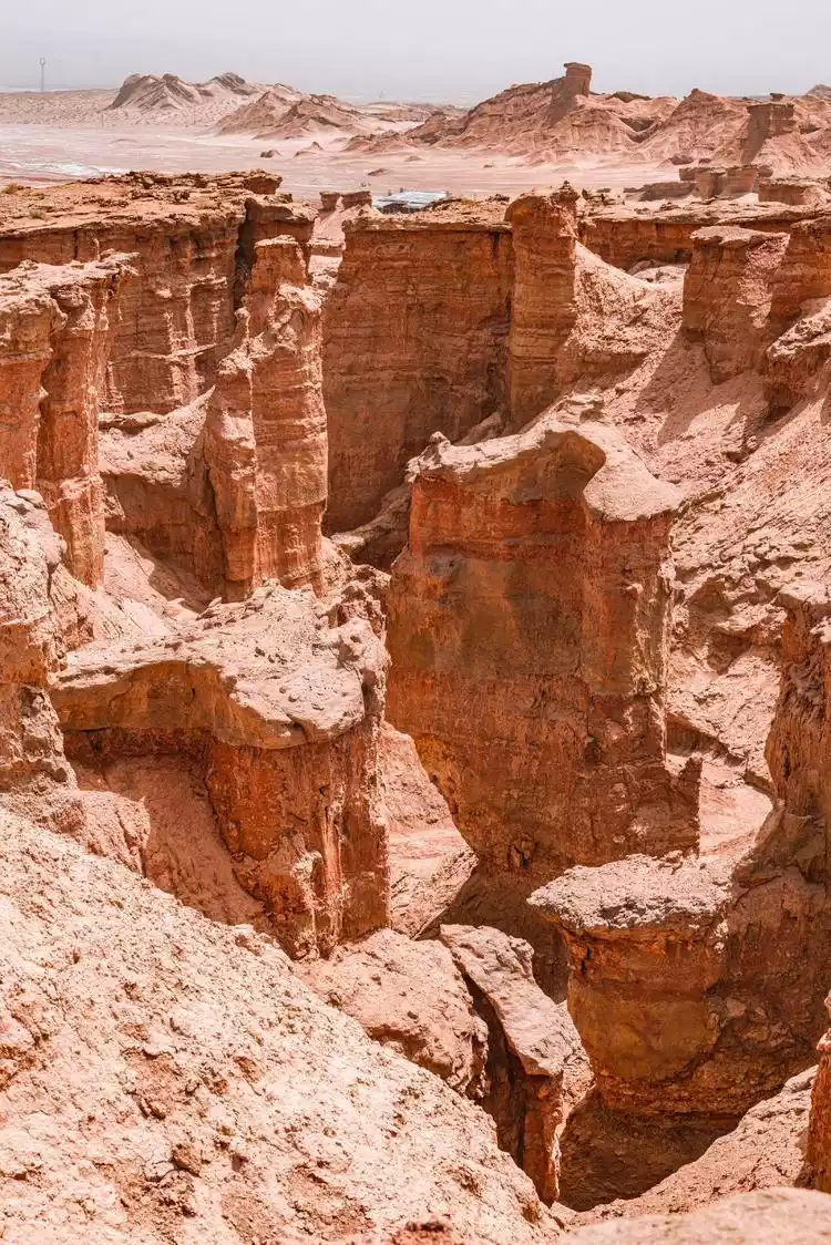
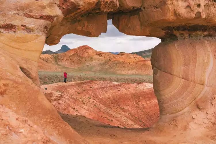
Not far from the Hellfire lies the reddish-brown Yardang wind-eroded landform, known as the Red Stone Forest. Millions of years of wind and rain erosion in an arid environment have shaped the rock and soil into a diverse array of valleys, peaks, terraces, and pillars. Within the winding gullies, large and small, layers of brown-red, yellow-green, and gray-green earth blankets stack up, resembling a deserted historic city.
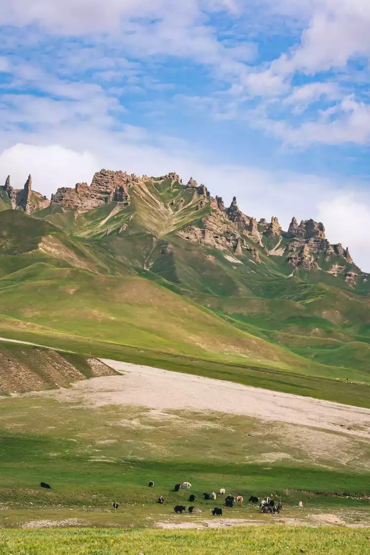
Wensu-Pakleke Grassland
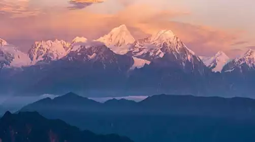
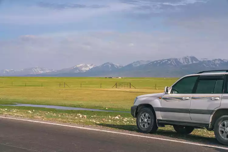
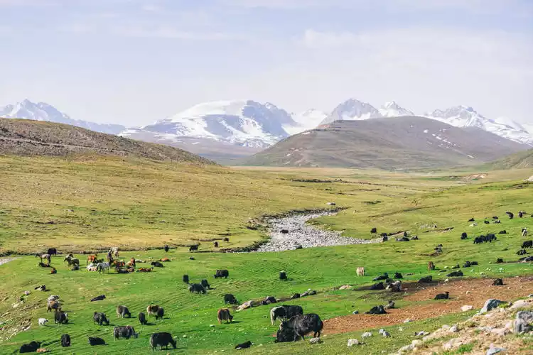
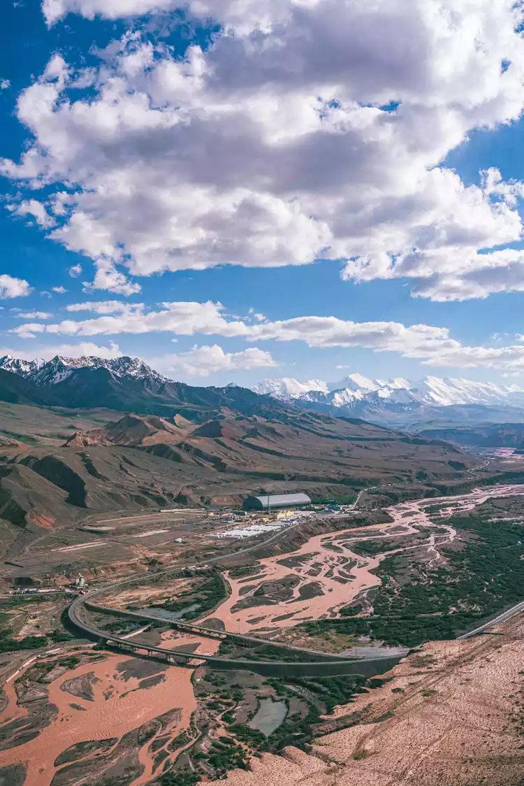
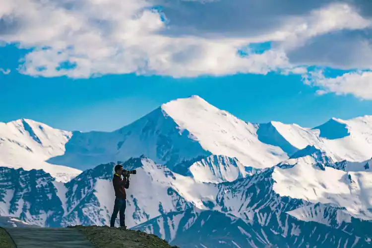
Arriving in Wensu, we headed towards the snow-capped mountains of the Tianshan Mountains, the highest peak [Tomur Peak] (7,443 meters). There are a large number of snow-capped mountains and glaciers here. In summer, the meltwater from the glaciers nourishes the earth, forming the fertile Tianshan grassland landscape.
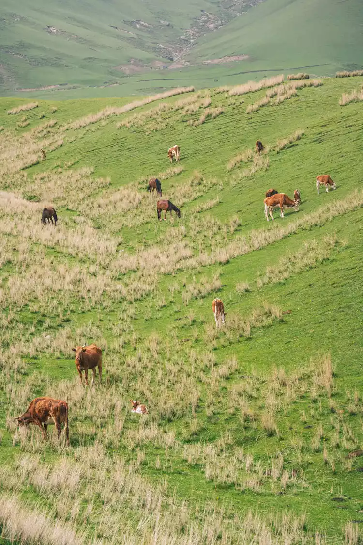
We visited the Ateoynak and Paklek grasslands. Unlike the Ili grasslands, these grasslands lacked towering spruce trees. Instead, the undulating grasslands resembled the curves of a human body, contrasting beautifully with the distant Keqikar Peak (6,342 meters) and Keqikar Glacier. Herds of cattle and sheep roamed the grasslands. It wasn't Ili, but it was better than Ili! Unfortunately, the weather wasn't good; it was dusty and sandy all day.
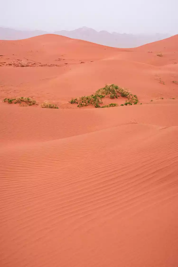
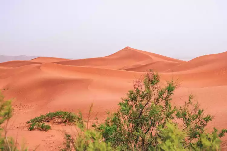
Keping-Red Desert
Traveling west along the Tianshan Mountains, we passed through Keping County and visited a secret desert, the Keping Red Desert. This is a recently developed niche secret. The undulating red sand dunes, blown into winding curves by the wind, look like a sea of fiery red under the sunlight.
Yuqitash Grassland
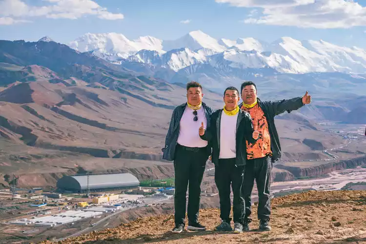
Leaving Wuqia County, the westernmost county, and continuing west, we passed the intersection of the Tianshan and Kunlun Mountains. To our left lay the majestic Kunlun Mountains, known as the "Mother of All Mountains," sandwiched between Xinjiang and Tibet. To our right lay the sprawling Tianshan Mountains, one of the world's seven major mountain ranges, dividing Xinjiang into northern and southern Xinjiang. These two mountain ranges meet in Wuqia County, offering a breathtaking view of the unique scenery of both majestic ridges.
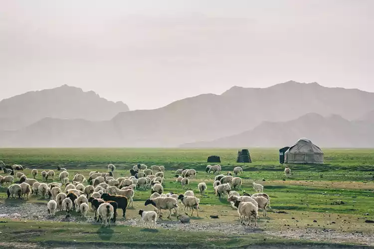
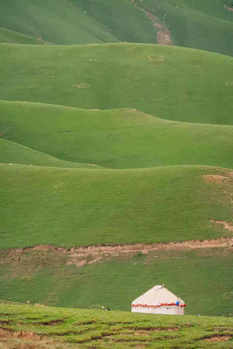
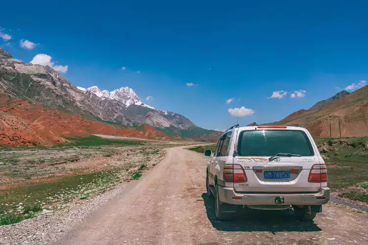
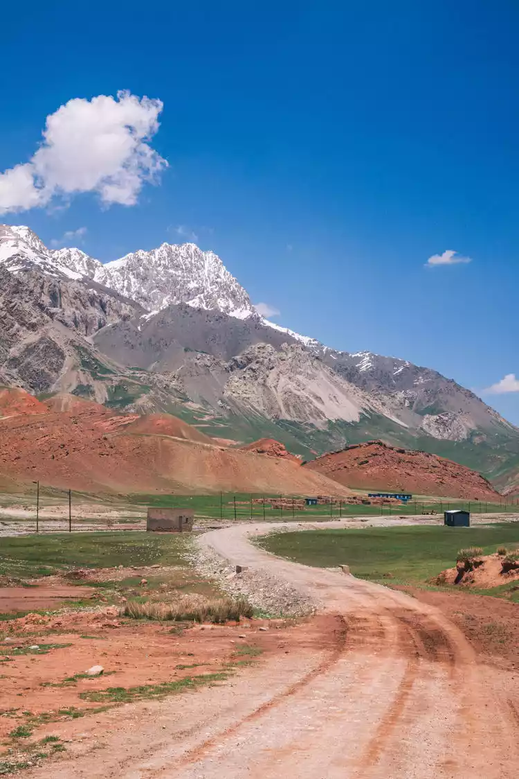
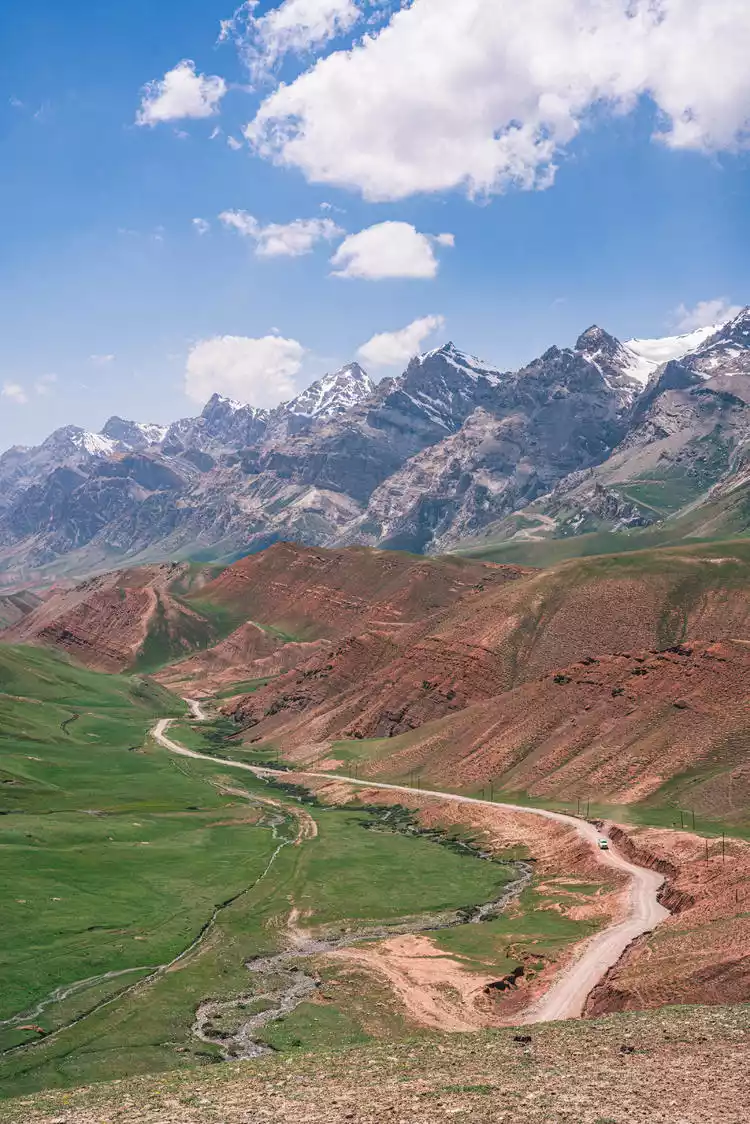
Afterwards, we explored the Yuqitash Grassland, a nomadic grassland on the China-Kyrgyzstan border. Yuqitash means "three stones," referring to the three snow-capped peaks. Yuqitash is the fertile grassland nestled between them. Yuqitash is the highest and largest summer pasture in southern Xinjiang, boasting abundant rain and snow, abundant water, and lush grass. It's a paradise for livestock and a treasured pastoral area.
The vast meadows, the crimson soil, the azure sky, the dotted white yurts, and the amiable and kind Kyrgyz herdsmen make it a paradise.
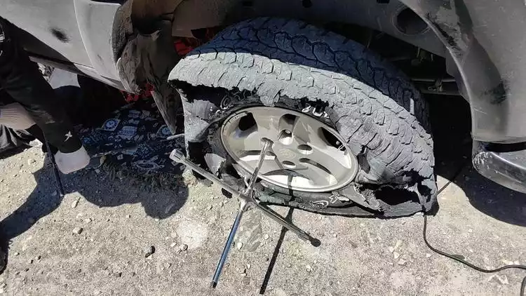
Our exploration of the Yuqitash grasslands was full of twists and turns. The main road we had originally planned to explore was washed away by rain, collapsing for days and still under repair. When we arrived at the management station, we were told that the area was no longer open to the public and that we couldn't pass through even after the road was repaired because it was too close to the border. After turning around at the landslide, we, unwilling to give up and determined to avoid giving up, tried an alternative mountain road to Yuqitash. The road conditions were much worse than before, with bumpy gravel and a puncture on the tire of car No. 3. Accidents always happen when you're on the road.
Fortunately, we finally arrived at the Yuqitash grassland smoothly, which is located at the foot of the snow-capped mountains and grasslands, just one step away from the border.
After crossing mountains and rivers, we reached a 3,500-meter pass. When we reached the top of the mountain and looked into the distance, all the hard work along the way was worth it.
China's Westernmost
After descending the mountain, we continued westward to China's westernmost point [Jigen Township]. This is where the last ray of sunlight sets in China and borders Kyrgyzstan. We took a group photo at the "Westernmost Point of China" stone tablet.
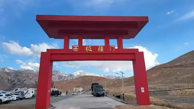
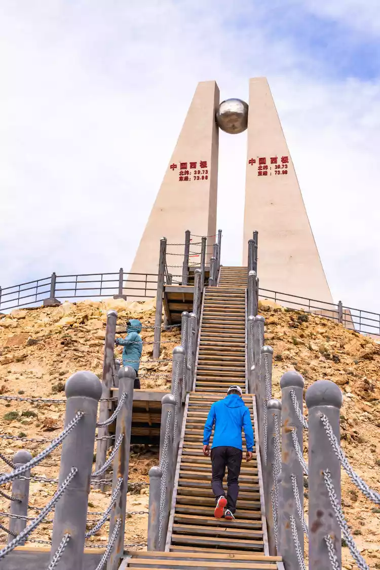
Looking out at the Irkeshtam Border Crossing between China and Kyrgyzstan, with its endless snow-capped mountains, we have arrived at the westernmost point of China!

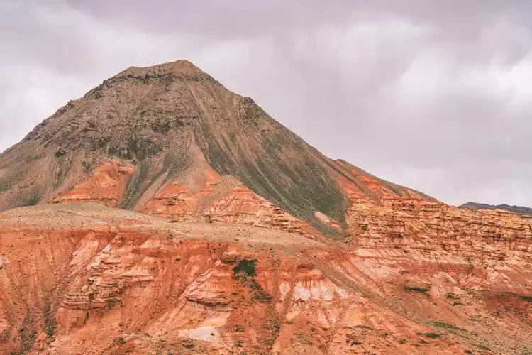
Kezhou-Red Valley
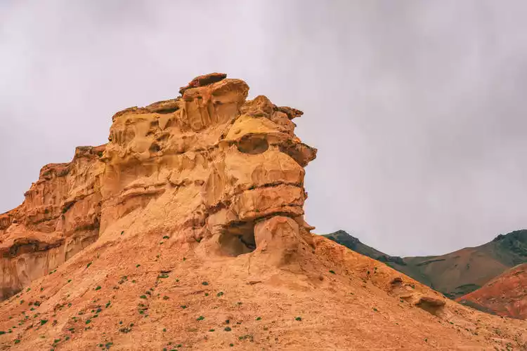
On the last day, we went to a secret place in Kezhou, the Red Valley, which is located in the border area of Kyrgyzstan. The magical Danxia landform blends with the snow-capped mountains and grasslands, and weathering into various shapes.
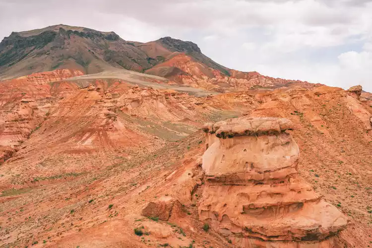
There's the "Skull Mountain" that resembles a skull, the "Hat Mountain" that resembles a magic hat, and various red weathered rocks. Off-road vehicles can overcome the terrain here and take you deep into the Danxia Valley, where you can climb high and gaze far into the distance and marvel at the wonders of nature.
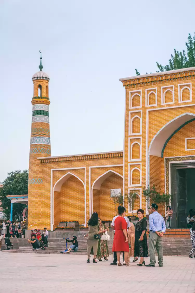
Kashgar
On our final day, we arrived in Kashgar, the central city of southern Xinjiang. Kashgar, a frontier city in western China, was a major commercial port on the ancient Silk Road and a crucial intersection of Central Asian economics, transportation, culture, and civilization. As our trip drew to a close, we stopped in the old town for some food and drinks, capping off our exploration of the region.

Conclusion
Many people often think of southern Xinjiang as a place focused on cultural and exotic attractions. In reality, it also boasts its own unique landscapes. Beyond deserts and Gobi, it boasts endless grasslands, vibrant canyons, rolling snow-capped mountains, and azure lakes. South of the Tianshan Mountains, we've only explored less than a quarter of southern Xinjiang, leaving us with countless hidden gems to explore. We look forward to seeing you again in the next season of Explore China!