The latest Taihang Mountain hiking guide! Measure the backbone of the world with your feet!
Preface
The beautiful mountains and rivers of China are known as "beautiful in the south and majestic in the north", and "Wugong in the south and Taihang in the north" is widely circulated in the outdoor circle.
The Taihang Mountains run through the heart of China, connecting to the Yanshan Mountains above and the Qinling Mountains below. It is the geographical boundary between the North China Plain and the Loess Plateau, and is known as the "backbone of the world."
The Taihang Mountains are a haven for hiking enthusiasts, boasting high mountains and deep valleys, with some areas inaccessible by road. With its magnificent and majestic natural scenery and the authentic spirit of Yugong moving mountains, the Taihang Mountains are a favorite destination for hiking enthusiasts.
As a senior tour leader who leads tours to Taihang Mountains more than a dozen times a year, I would like to share with you some of the most unique sights worth visiting in Taihang Mountains.
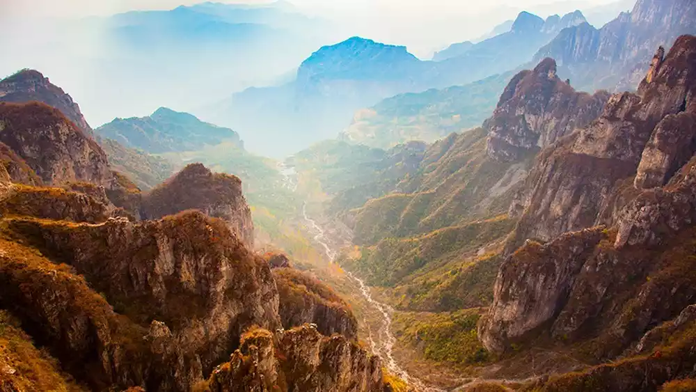
1. Mountain
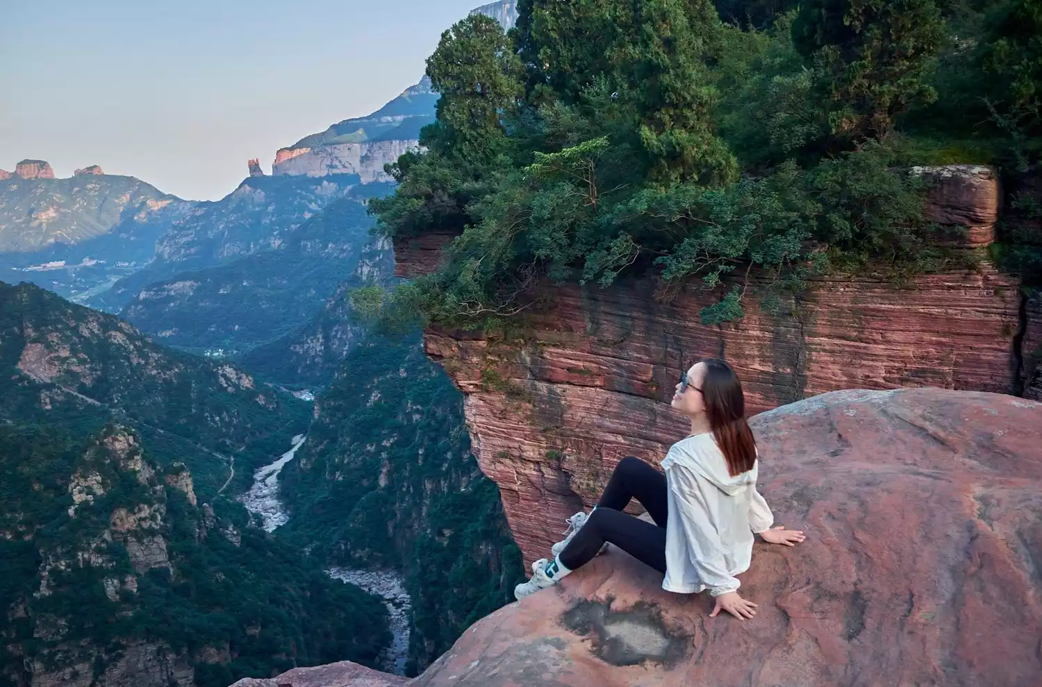
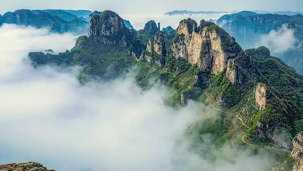
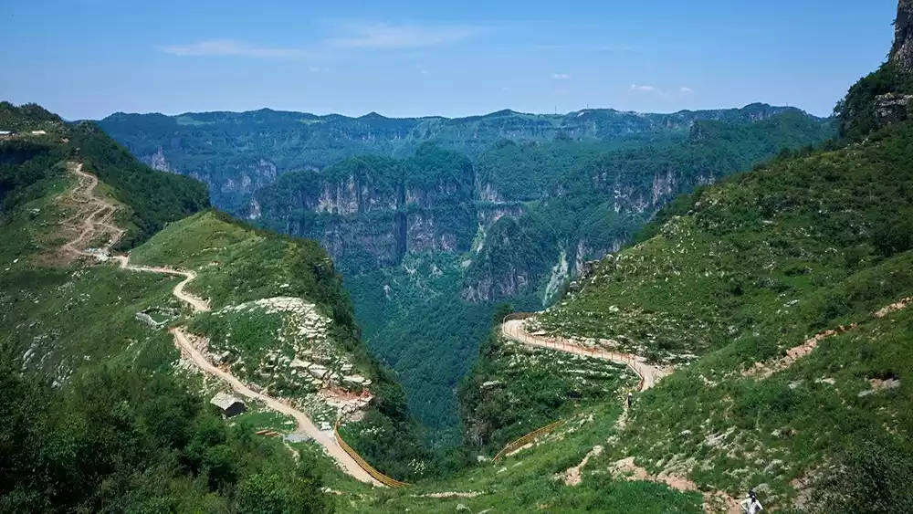
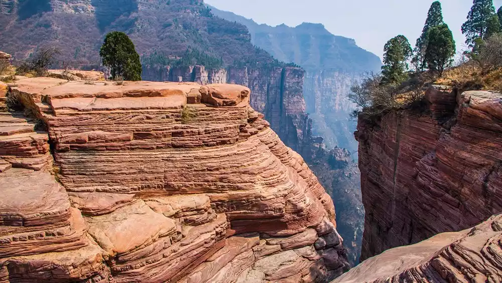
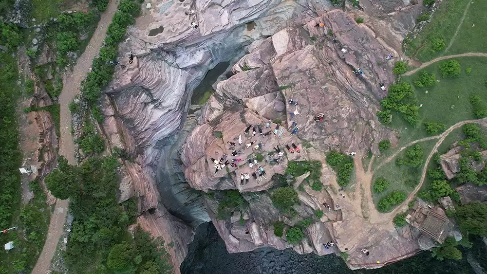
As the most beautiful place in Beixiong, Taihang Mountain has broken veins, towering rocks and steep cliffs. The steep terrain has attracted countless travelers.
Recommended check-in spot - Wangmangling
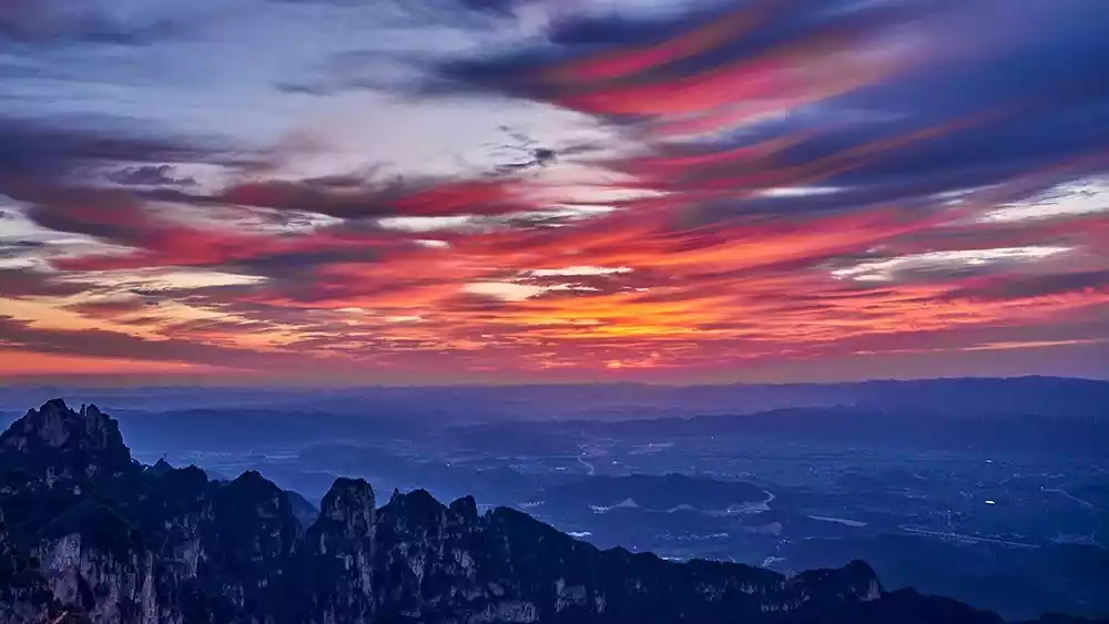
Legend has it that Wang Mang, pursuing Emperor Guangwu of Han, stationed his troops here during the late Western Han Dynasty. Wangmang Ridge lies at the highest point of the southern Taihang Mountains, nestled at the most strategic point of the fault zone connecting the Loess Plateau and the Zhongzhou Plain. Looking southeast over the Hebei-Henan Plain, its dominance, surrounded by low terrain on all sides, allows one to appreciate the splendor of the "heavenly ridge of the Taihang Mountains since ancient times." Li Rui, Mao Zedong's former secretary and a leading contemporary poet, once praised the ridge, saying, "Without climbing Wangmang Ridge, how can one truly understand the Taihang Mountains? With all the world's marvelous peaks gathered here, why bother climbing the Five Sacred Mountains?"
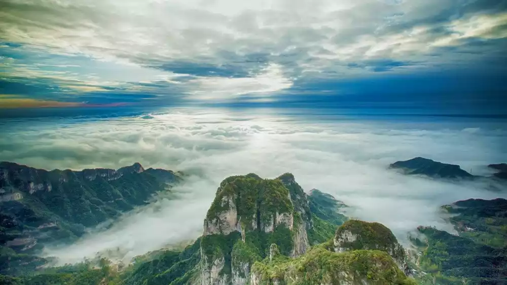
Wangmangling is the most dangerous section of the fault zone connecting the Loess Plateau and the Zhongzhou Plain. Due to the dramatic elevation difference, a sea of clouds appears after heavy rain or snow, which occurs approximately 100 days a year. These clouds surge through the peaks and valleys, sometimes resembling a rushing river, a waterfall, a vast lake, or even the surging sea. The clouds rise and fall, and the peaks appear and disappear in a myriad of forms, creating a scene resembling a fairyland.

The most spectacular sight of Wangmangling is sunrise. On clear days, the peaks are immersed in a vast sea of clouds that resembles fish scales. From gray to colorful clouds to shining golden scales, the red sun rises slowly, and for a moment, the mountains are bathed in a myriad of rays of light, with a magnificent splendor that surpasses all other peaks.
The sunrise and sea of clouds at Wangmangling are two unique sights, with the reputation of "the sea of clouds is on par with Huangshan, and the sunrise is comparable to Mount Tai."
Recommended routes
Wangmangling is a mature scenic spot. You can buy a ticket at the foot of the mountain and take the scenic bus directly to it. The main hiking routes in the surrounding area are:
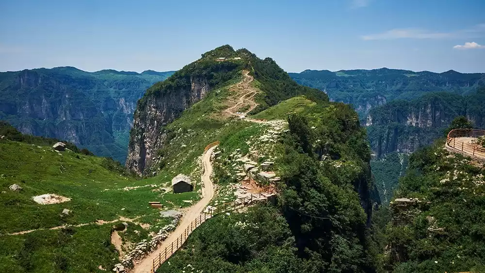
1. Shuangling Crossing
The route traverses the southern Taihang Mountains from the highest peak, Shiziling, to the secondary peak, Wangmangling. The terrain along the way is diverse, offering a variety of outdoor experiences.
Check-in point along the way - Holy Statue Heaven Gate
2. North Gate of Wangmangling
Compared with the hiking route that crosses Shuangling, the north gate of Wangmangling starts from Nanma'an and climbs up the steps. The stone forest along the way is very beautiful, especially when the sea of clouds rises.
3. Take the scenic bus to Xiyagou
Although Shuangling Crossing is a classic, the Wangmangling Scenic Area has been restructured in recent years, and the road from Xiaoti Mountain to Wangmangling in Shuangling Crossing has been hardened, which is not very friendly to outdoor enthusiasts.
After hiking to Xiaoti Mountain, it is recommended to take the trail on the left to go directly to Xiyagou.
Then take the scenic bus from Xiyagou to Wangmangling and take a small loop to enjoy the scenery.
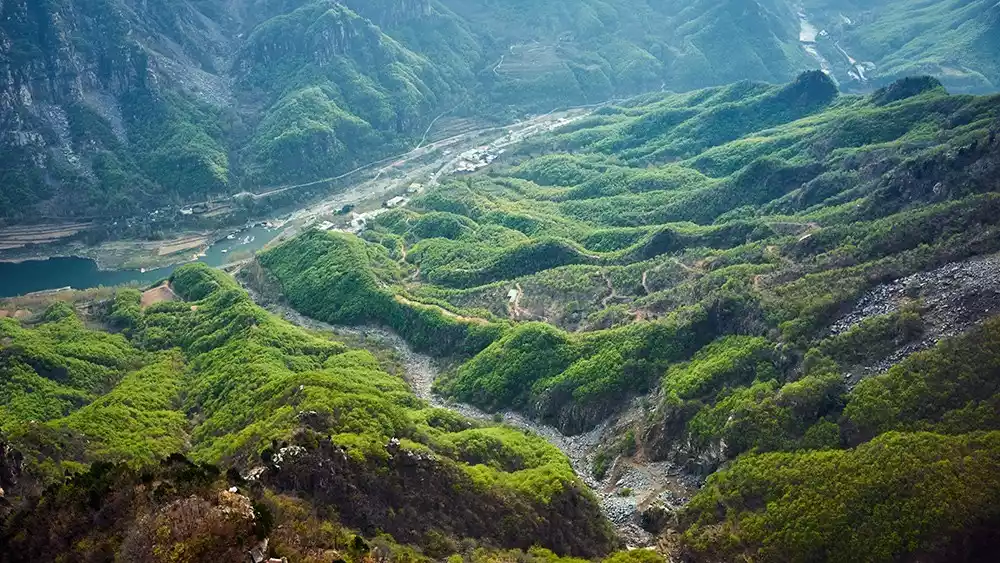
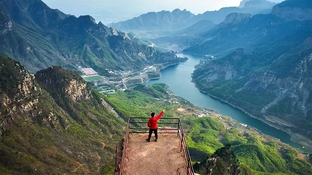
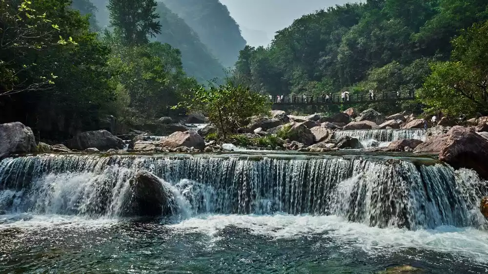
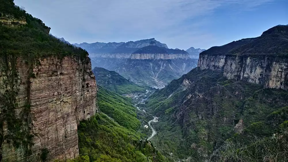
2. Water
People usually divide Taihang Mountains into three sections: North Taihang in Hebei, West Taihang in Shanxi, and South Taihang, the part at the junction of Henan and Shanxi.
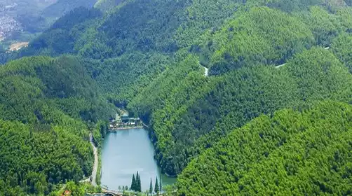
While northern mountainous regions often suffer from water shortages, the Southern Taihang Mountains seem like a favored region of nature. With abundant groundwater resources and numerous surface springs, they are known as the "underground reservoir of North China." This unique rainfall nourishes the Southern Taihang Mountains, making them lush and vibrant.
The majestic north with its high mountains, deep valleys and towering cliffs formed by geographical faults and the graceful south with its overlapping peaks and rushing waterfalls are seamlessly intertwined here, combining both grandeur and beauty.
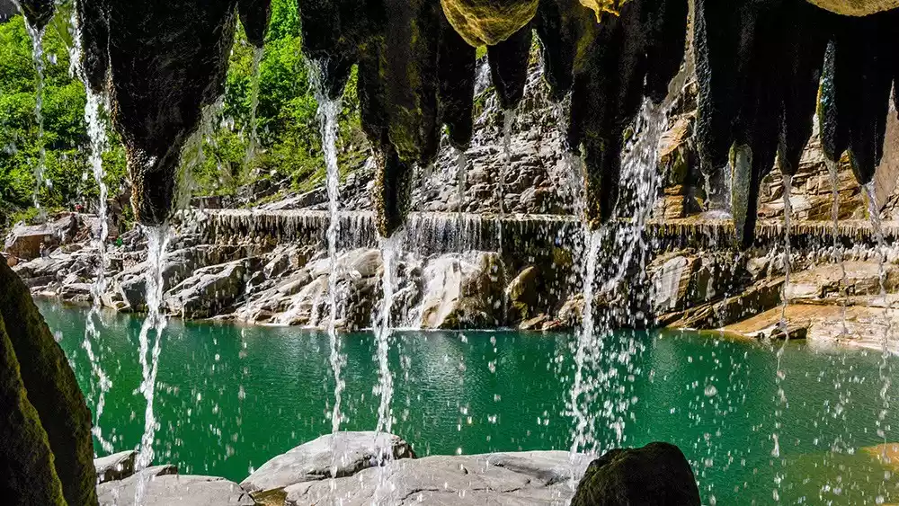
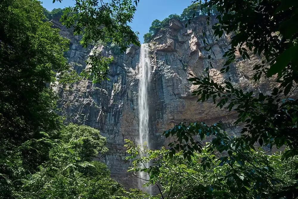
Recommended check-in spot - Baligou Tianhe Waterfall
The South Taihang Mountains, shaped by the sedimentation of the East-West Fault Zone, have a jagged terrain with precipitous cliffs and sheer cliffs, forming numerous canyons and cliffs. Coupled with the abundant rainfall of the entire Taihang Mountains, the region, saturated by rain, is a scene where water meets sky, and pools and waterfalls connect. This creates a breathtaking display of verdant mountains, clear waters, crimson cliffs, and seas of clouds, a scene rarely seen in northern China. It resembles a fairyland, a painting.
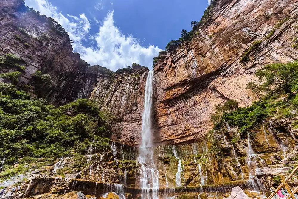
Tianhe Waterfall, with a drop of over 180 meters, is the highest waterfall in North China. It's also a landmark in the southern Taihang Mountains. Beneath the waterfall lies a shimmering emerald lake, and a mysterious water curtain cave surrounds half of the lake's base. Walking through it, you'll witness the cascading waterfall, the flowing water curtain, and the cascading pearls and jade.
Recommended routes
Route to Baligou Tianhe Waterfall Scenic Area and Hiking Route:
The easiest way is to walk directly from the Baligou Scenic Area to Tianhe Waterfall along the hiking trail, or take a sightseeing bus to the sightseeing bus station 500 meters away from the waterfall and walk there.
Hiking route
From Baodu Village to Baligou, there is a small path that was worn out by villagers who have been herding sheep and visiting relatives for generations.
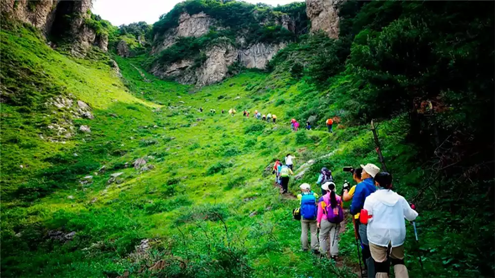
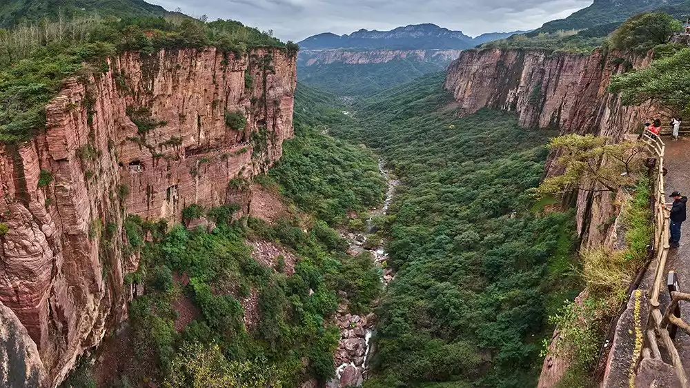
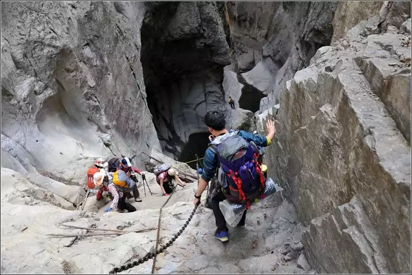
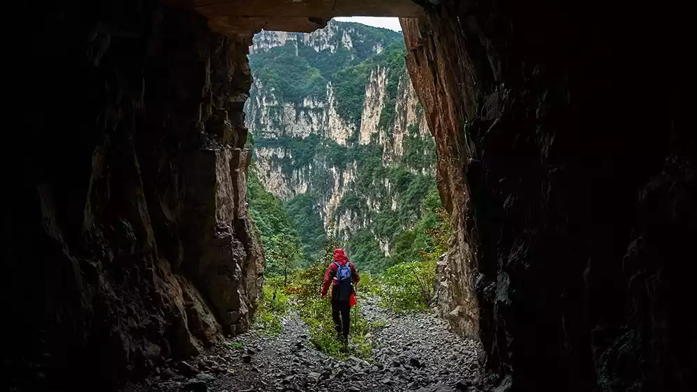
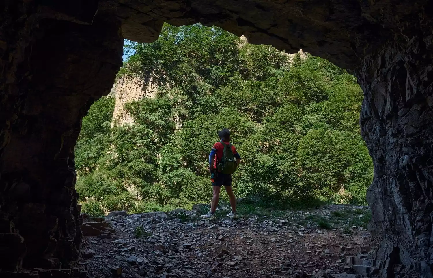
3. Valley
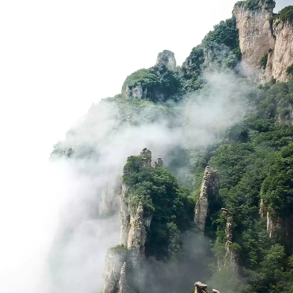
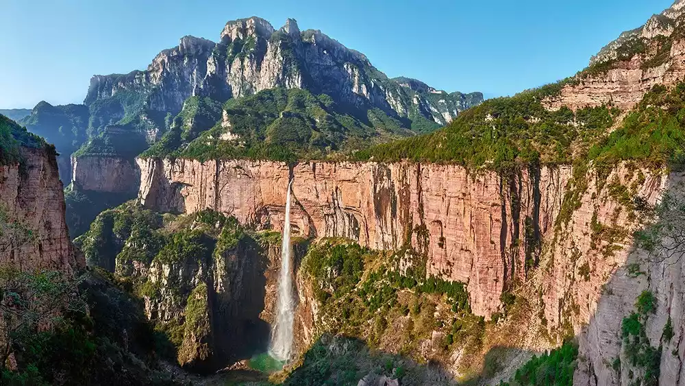
The Taihang Mountains Gorge, with its towering cliffs, majestic peaks, interlaced terraces and cascading waterfalls, exemplifies the "northern majestic scenery." From the valley floor, this is a fantastic photo spot, offering spectacular views and stunning views of the Taihang Mountains.
There are many viewing platforms for everyone to lean on and overlook, taking in the sight of all the mountains. Suddenly, one can't help but feel the grandeur of the people of Taihang Mountain.
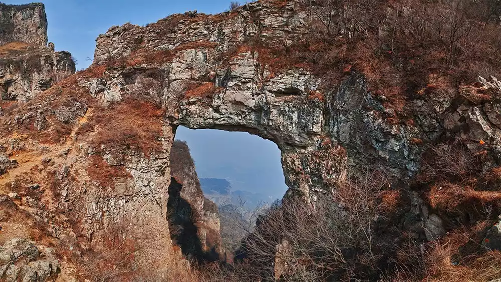
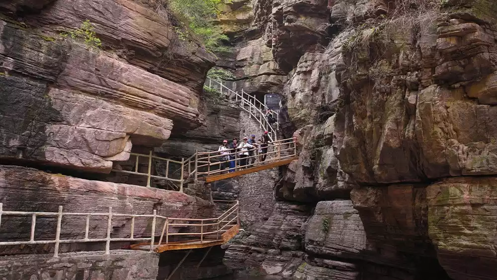
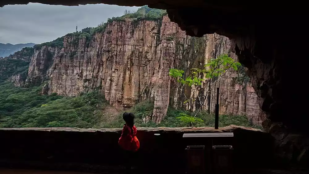
Recommended check-in spot - Red Rock Cliff Grand Canyon
Overlooking the Red Rock Canyon, this spot offers a stunning photo opp, offering breathtaking views of the surrounding mountains. From afar, the vertical red rock walls resemble a towering city wall. On rainy days, misty clouds rise, making you feel like a celestial being up there!
Recommended routes
From Guoliang Village, take a scenic shuttle bus to Nanping, then transfer to a sightseeing bus to reach Danfengou, a hidden ravine nestled among the cliffs. Here, towering red rock cliffs rise up to a thousand-foot cliff on one end and a towering stone wall on the other. Legend has it that Taishang Laojun cultivated elixirs here and distributed them to the immortals. Within, waterfalls and springs flow, and a winding plank road carved into the cliff leads directly to the valley floor.
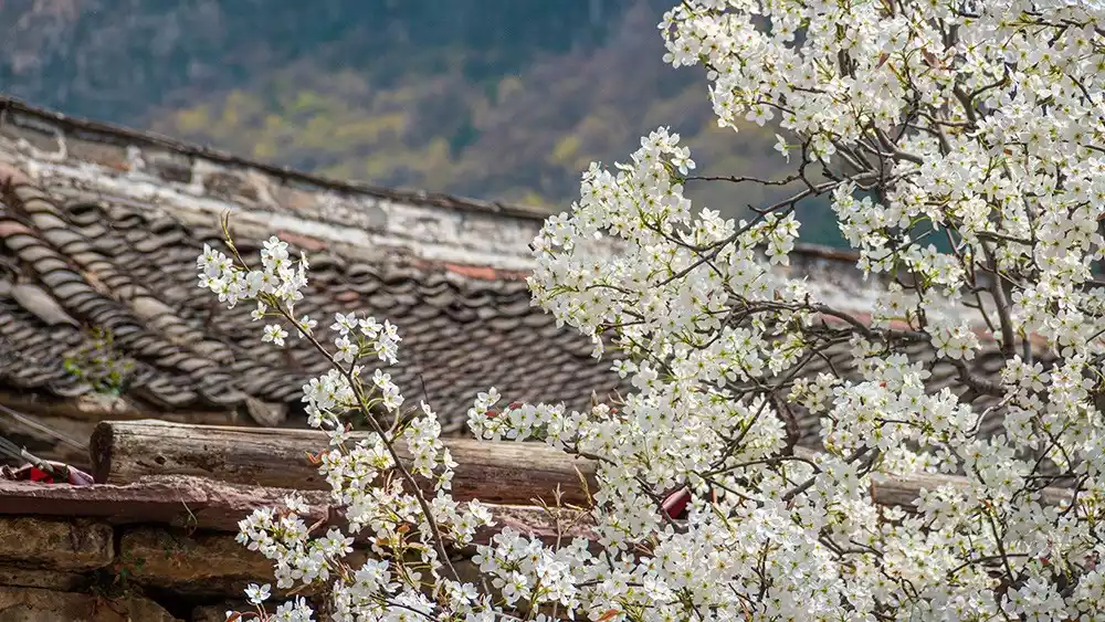
4. Village
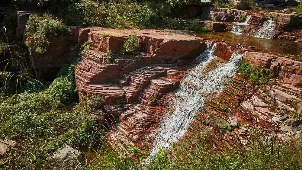
Baodu Village, the only village in Shanxi Province without road access, lies at the end of the Baodugou Grand Canyon. Not far from the village entrance is Laolongkou, a famous checkpoint in the southern Taihang Mountains. River water carves deep grooves into the rocks, creating a unique landscape with smooth, germanium-red cross-sections that is breathtakingly beautiful and awe-inspiring. During the flood season, the majestic Longsui Waterfall, with a drop of over 300 meters, is a truly breathtaking sight.
Recommended check-in spot-Baodui Village
Baodu Village, with only five households, has preserved its pristine natural landscape and local customs. Baodu Village boasts a long history. Legend has it that during the Eastern Han Dynasty, Emperor Guangwu of Han, a prominent general, once grazed cattle here as a child. The river was wide and deep, and the current was so turbulent that the cattle could not cross. Every day, Ma Wu carried a calf across the river to graze. Day after day, as the calf grew larger, Ma Wu continued to carry the calf across the river, developing supernatural powers. Hence, the village was named Baodu Village, and the river in front of the village was named Baodu River.
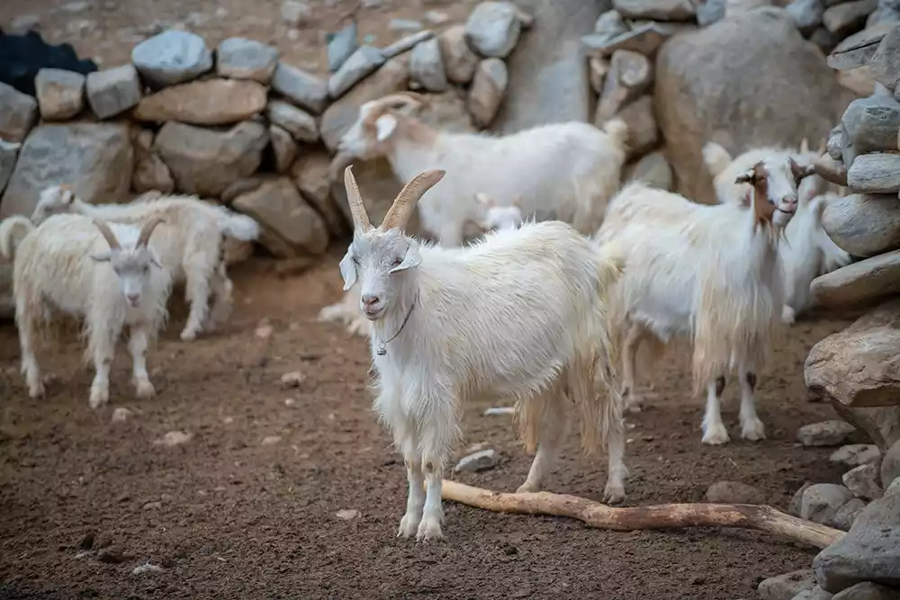
Baodu Village is a small village where residents make their living by herding goats. Within the village, you can see sheep pens built against natural caves. Baodu's sheep are skilled climbers, having grown up drinking the clear spring water of the Baodu River and grazing on the grasses of the Taihang Mountains. Their daily climbing gives them incredibly tender meat. Every year, outdoor enthusiasts from nearby cities make the trek just to sample this authentic free-range goat meat.
Recommended routes
The journey from Mawu Village to Baodu Village on foot is full of rolling hills and peaks, and then into the canyon, with overlapping peaks and towering ancient trees on both sides.
This is a narrow valley with three drops in the canyon. In the flood season, the stream forms a beautiful waterfall here. Below is a smooth stone wall formed by the waterfall's erosion over billions of years. The entire terrain has a small mouth, a round belly and a deep bottom, just like two large water tanks arranged at different heights and created by nature.
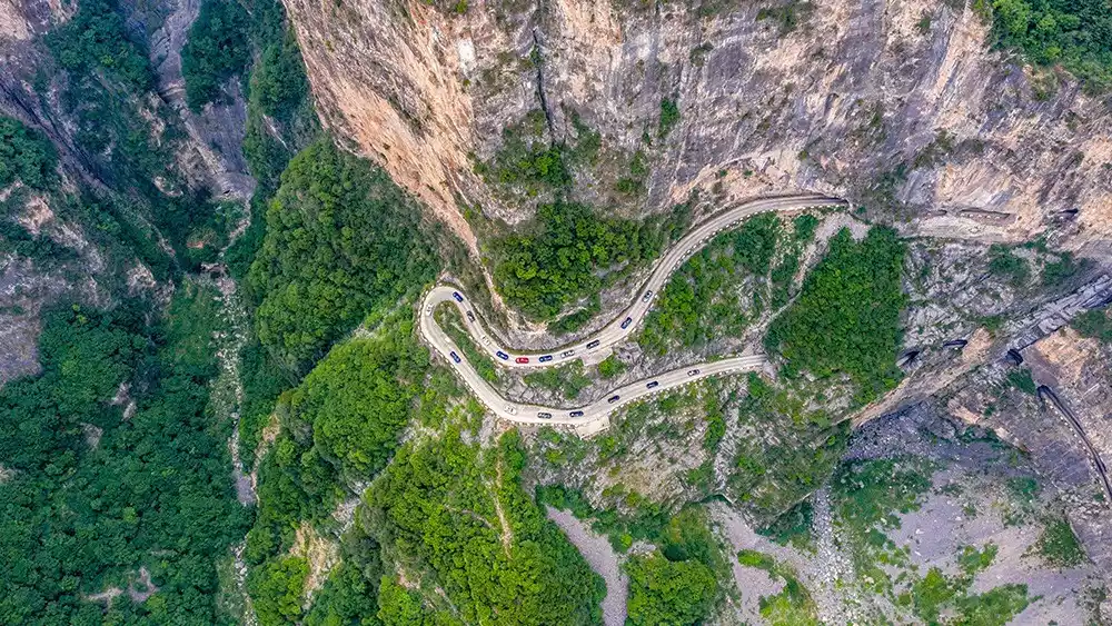
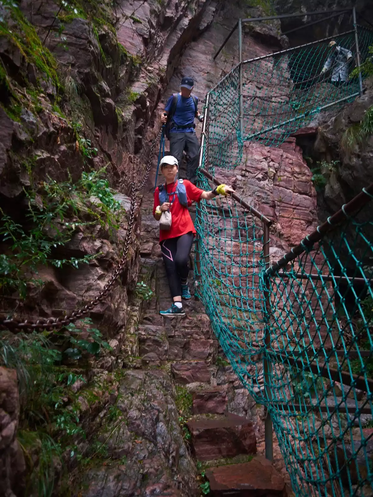
5. Cliff-hanging Highway
The Taihang Mountains, stretching across four provinces, are a mountainous region with difficult traversal. The people of the Taihang Mountains have long been cut off from the outside world.
Guoliang Village sits high atop the Taihang Mountains. The villagers' ancestors fled this desolate area for refuge. Previously, the village's access was a series of stone steps carved into the nearly 90-degree cliff face, known as the "Heavenly Ladder." The steep, narrow path, barely wide enough for one person, lacked any protective equipment, and was extremely dangerous, rendering the village essentially isolated. The villagers often carried mountain goods from the "Heavenly Ladder" out of the mountains in exchange for daily necessities.
As the saying goes, if you want to get rich, build roads first. In 1972, villagers spontaneously sold goats and yams to pool funds to purchase steel hammers and files. In harsh conditions without electricity or machinery, a team of 13 strong men from the village braved the wind and snow, tied hemp ropes around their waists, and dangled from the cliffs with steel drills and hammers, meticulously carving rows of blastholes into the red rock cliffs, creating a road leading out of the mountain.
Without any mechanical equipment, the people of Guoliang worked entirely by hand for five years, hammering away 26,000 cubic meters of rock from the cliffs, wearing out 12 tons of steel chisels and breaking 4,000 eight-pound hammers. On May 1, 1977, the Guoliang Cave, nicknamed the "Cliff Corridor," was officially opened to traffic. It showcases the Taihang people's endurance and the remarkable feats they have achieved. It's a true-life version of Yugong moving the mountains.
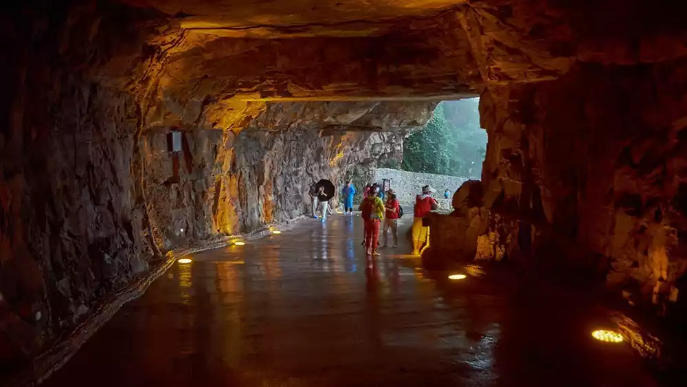
Recommended check-in spot - Guoliang Hanging Wall
The Guoliang Cliff Road is the most famous of the Southern Taihang Cliffs. Those who haven't been to the Taihang Mountains find it difficult to comprehend the awe-inspiring sheerness of the cliffs. Guoliang Village, nestled atop this cliff, has been hailed as "the ninth wonder of the world," "one of the world's ten most dangerous roads," and "one of the world's eighteen most extraordinary roads."
Recommended routes
Walk from Lianhua Village to Guoliang Village
Charter a small car from Xiyagou to Lianhua Village in Shanxi Province, then hike to Guoliang Village. Journeying through the Taihang Mountain gorges offers a romantic and rugged beauty. Surrounded by layers of peaks, one gazes upward, peaks piercing the heavens like blades, surrounded by cliffs on all sides. The experience is akin to soaring into the clouds, a glimpse of nature's wondrous beauty. Along the way, we'll witness the overlapping peaks, picturesque scenery, and even discover the beauty of wild hanging tunnels.
Conclusion
As a famous hiking destination in China, the South Taihang Mountains are high and deep, with dangerous terrain and some areas even inaccessible by road, preserving the intact natural scenery and unique local customs and practices.
The Taihang Mountains have multiple landforms and rich experiences. The best way to get close to them is to hike to them because of their steep terrain and numerous broken rocks and towering cliffs.
This is also the best example of "the world's most magnificent, strange and extraordinary sights are often found in dangerous and remote places."