West of Tibet | A 9-Day Travel Guide to Heavenly Ngari!
Preface
"Watching the sunset through Lake Manasarovar" "Waiting for the golden snow-capped mountains of Mount Kailash" "Seeing the world from the highest point of Mount Everest" "Marveling at the half-sand dunes, half-lakes" "Exploring the mysterious lost city of Guge Kingdom".
It is said that the real Tibet lies to the west of Tibet. It is not only remote but also vast, not only vast but also empty. It is this remote, vast and empty western land that has a fatal attraction for many people.
Its uniqueness stems not only from its vastness and grandeur, but also from the slow journey to reach it. This journey, so long it seems like a lifetime, allows us ample time to experience blizzards, to walk through the vastness of the world, and to contemplate our significance to the world.
"Longing for Tibet" says, "Every time I see pictures about Tibet, my heart is filled with emotion and even tears well up in my eyes without exception." Until I see the real Tibet, any language seems pale and powerless in front of its beauty.
I looked at the scenery through the window of the moving car. Perhaps I had become the scenery of the snow-capped mountains and lakes. Looking back at the photos I recorded, every frame was like a movie.
DAY1 First time seeing Xining, the hand-pulled lamb is delicious
After a long flight, we finally arrived in Xining, a historic plateau city. Many people originally came here to continue their journey to Tibet, the Qilian Mountains Grand Loop, or the Haixi region, but as long as you give Xining some time, you will not be able to resist falling in love with this city.


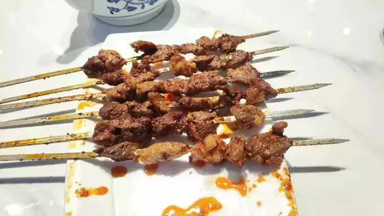
Every city has its own delicious food worth checking out, and this little-known fourth-tier city is no exception. After a few hours of sitting, the first stop after landing was food, not hotels or sightseeing spots! Xining's culinary scene revolves around lamb and noodles.

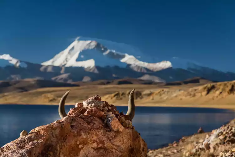
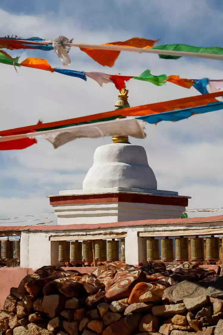
Ta'er Monastery, located in Lushar Town, Huangzhong County, southwest of Xining City, is one of the six major monasteries of the Yellow Sect of Tibetan Buddhism in my country. It is named after the large silver pagoda built within the Dajinwa Temple in memory of Tsongkhapa, the founder of the Yellow Sect. It is called "Gunbenxianbalin" in Tibetan, which means "Maitreya Temple of 100,000 Lion's Roar Buddha Statues."
As soon as we arrived at Ta’er Monastery, a few snowflakes began to fall from the sky. The white snow landed on the sacred pagoda, and the whole temple was filled with a unique sense of mystery.
Bidding farewell to the hand-pulled lamb and the inexplicable evil wind in Xining, we officially started our journey to Tibet. Although it did not have the grandeur of a hard seat direct to Lhasa, it was still a railway train to Tibet to see China.

The general itinerary is as follows: From Xining, head all the way west, the first stop is Lhasa, the world's highest city, continue forward to explore the sapphire Yamdrok Lake hidden in Shannan, then continue west to Mount Kailash, the center of the world... In short, just go west regardless of anything, arrive in Ali and then go home!
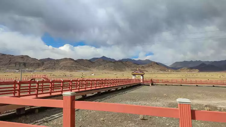
DAY2 Cross the Hoh Xil and arrive at the Sun City Lhasa
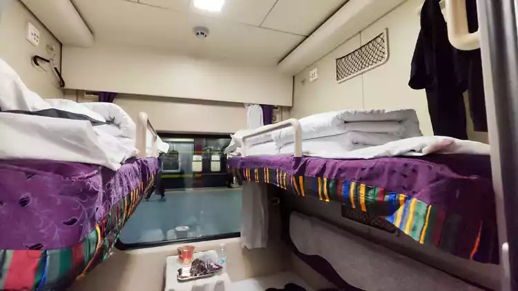
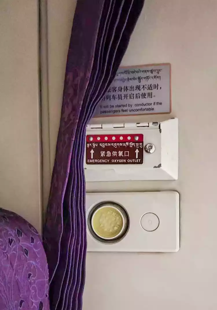
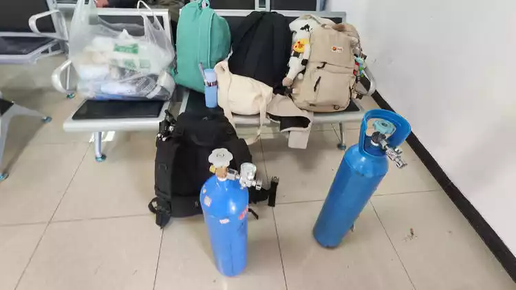
Since it was off-season, the train wasn't crowded with people heading to Tibet, making it feel empty and lacking in liveliness. We boarded the Z165 train from Xining around 7:00 PM and headed for Lhasa. Being my first time in Tibet, I was terrified of altitude sickness, so I immediately searched for the legendary oxygen port. It was surprisingly well-designed: it was right on the wall of the berth.

Most of the special forces college students I met on the road came out alone and took a 24-hour hard sleeper to Tibet, and then took the train out of Tibet and back to school. The youngest among them was only 19 years old and still a freshman.

I fell asleep at night looking at the starry sky outside the window, and was woken up inexplicably in the morning. The sunrise over Qiangtang was already outside...
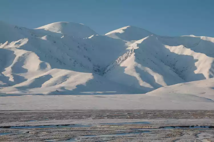
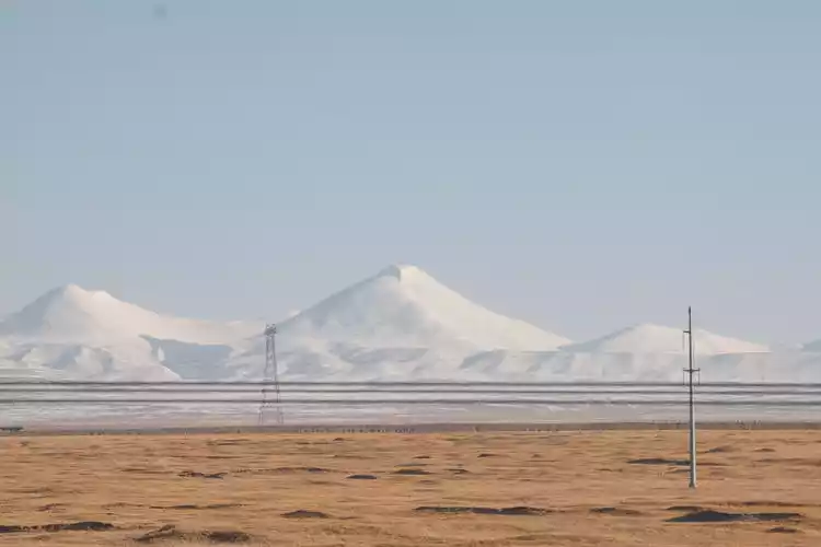
We encountered clouds of love and military vehicles of the Tibetan Army Corps on the way. Unfortunately, the sky was not kind and turned from sunny to cloudy in the second half of the journey. After more than ten hours of shaking, we arrived at the final destination of this train - Lhasa.
DAY3 Feed the seagulls at Yanghu Lake and climb a mountain in Karola
After queuing up for border passes early in the morning, we set off smoothly by car. After a two-hour trek, we arrived at Yamdrok Lake, one of the three sacred lakes in Tibet.
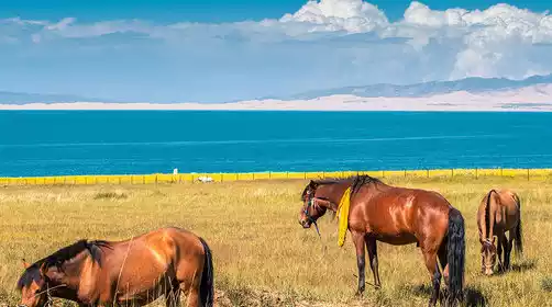
Yamdrok Lake is known as the most beautiful body of water in the world. "Yamdrok" means "above," "Zhuo" means pasture, "Yong" means jade, and "Tso" means lake. Putting these together, it literally translates to "jade lake above the pasture," a literal interpretation of the lake. In the minds of Tibetans, Yamdrok Lake is like "the scattered turquoise earrings of a goddess," as no matter which angle you look at it, you can never see the whole of Yamdrok.
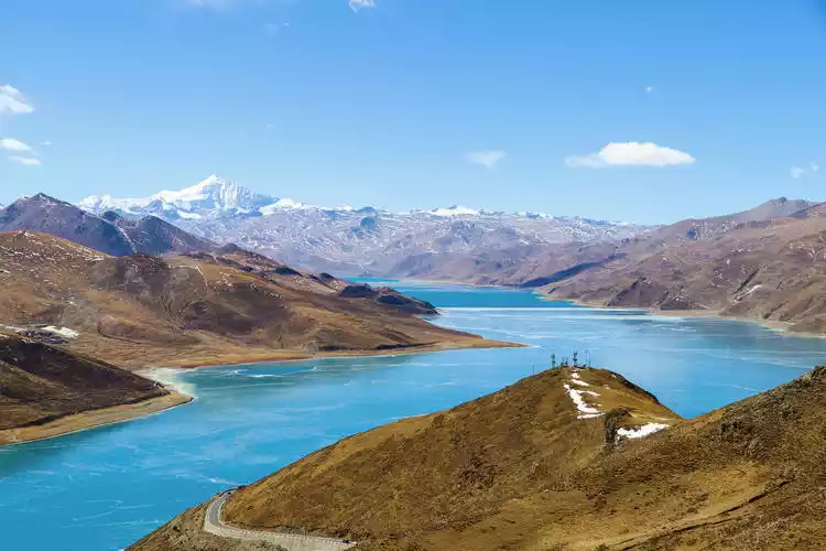
It has three sisters, Kongmu Co, Chen Co, and Bajiu Co., together with the ancient Yamdrok Lake. The four sisters are connected like brothers and sisters in the huge lake basin, and are inseparable. Together they form a holy lake that we cannot see the edge of.
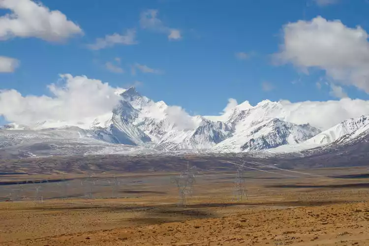
After finishing our trip to Yanghu Lake, we drove for more than an hour and arrived at the foot of Karola Glacier, which is said to be the closest glacier to the highway. In the foot of nature, humans always seem very small.
The Karola Glacier was famous in the movie "Red River Valley". Today, you can still clearly see the traces of ice and snow disappearing due to blasting on the Karola Glacier.
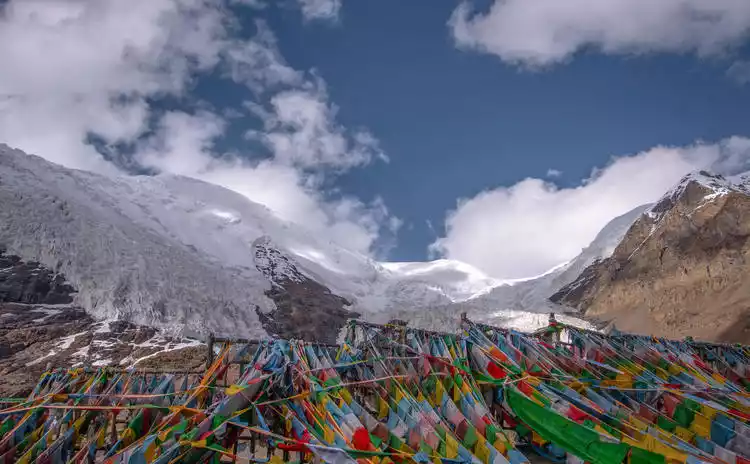
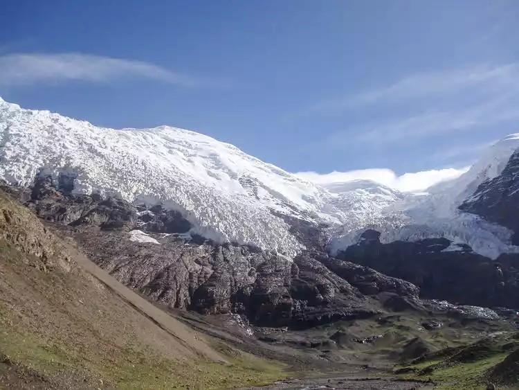
This massive glacier stretches from the misty mountaintop to the roadside, just a few hundred meters away. Its shimmering blue brings a refreshing coolness. Although the glacier's overall appearance is layered in black and white due to years of road dust, the upper half, illuminated by the sun, shimmers like a giant thangka hanging on the mountainside.
DAY4: Pilgrimage to Tashilhunpo Monastery and visit Inner Mongolia, a small Tibetan area
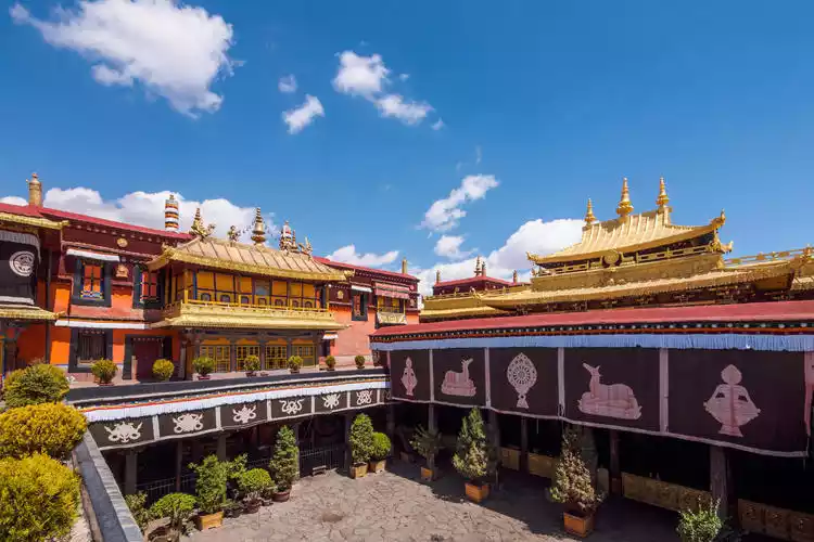
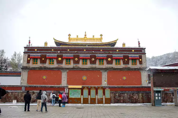
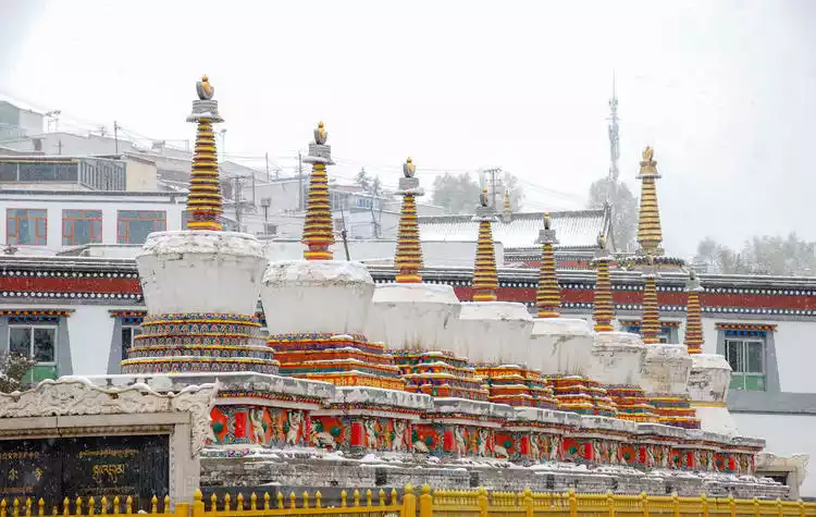
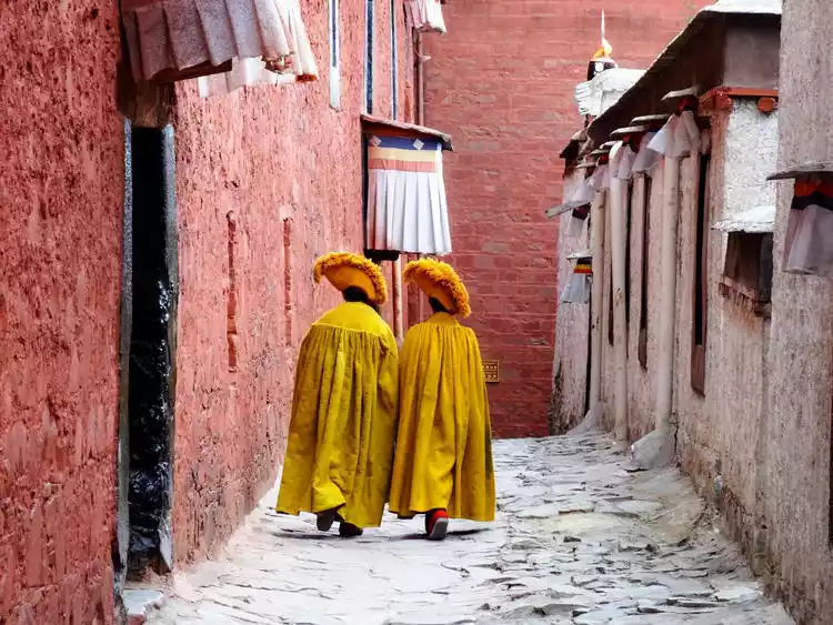
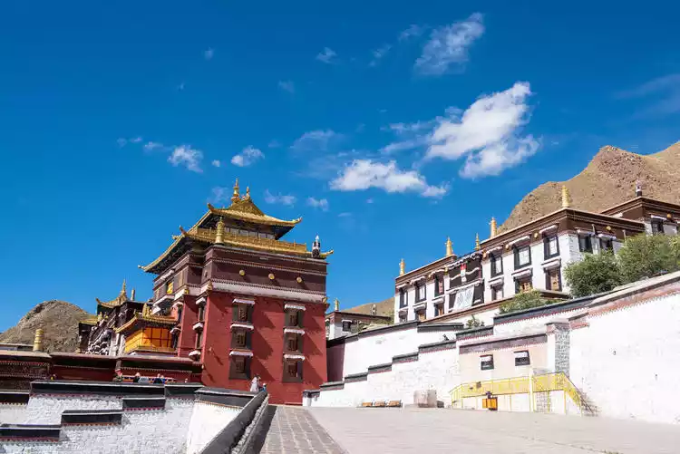
I've always dreamed of visiting Tashilhunpo Monastery, a perfect blend of Buddhist culture and beautiful scenery. Tashilhunpo Monastery is the largest monastery in the Shigatse region of Tibet, nestled on the eastern slopes of Mount Nima, west of Shigatse. It has served as the residence of successive Panchen Lamas since the Fourth Panchen Lama. Along with Lhasa's "Three Great Monasteries"—Ganden Monastery, Sera Monastery, and Drepung Monastery—it is collectively known as the "Four Great Monasteries" of the Gelugpa sect of Tibetan Buddhism.
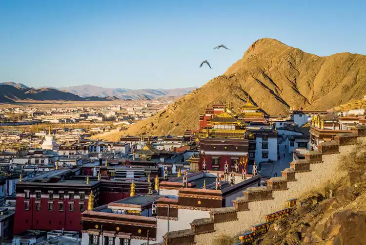
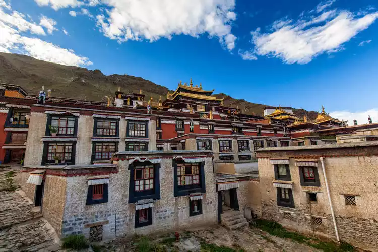
Arriving at Tashilhunpo Monastery, I was immediately captivated by its magnificent architecture. Nestled at the foot of the majestic Himalayas, the temple complex is divided into distinct courtyards, each imbued with a religious atmosphere. The towering white walls and red roofs exude a rich sense of ethnic charm. The Buddhist statues, murals, and stone carvings within the temple occasionally shimmer with golden light, while the majestic gate exudes a sacred power.
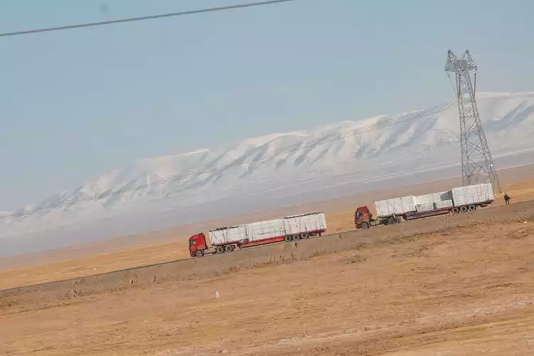
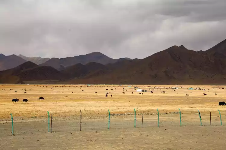
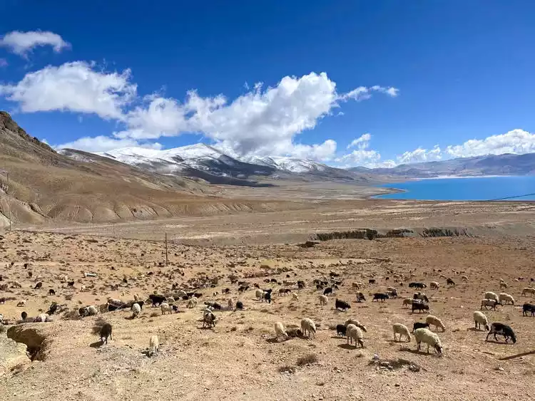
After finishing the visit to Tashilhunpo Monastery, we continued on our journey. Today's driving distance was long, totaling 460 kilometers. On the way from Shigatse to Saga County, we saw a sign of "Sangsang Grassland" on the side of the road. Here, the terrain is relatively flat. Due to the high altitude and cold weather, the population is sparse. In some places, there are no people within dozens of kilometers.
Later, after the guide explained, we finally understood that "Sangsang" in Tibetan means a place with good water and grass quality. The reason we saw so many cattle and sheep is because this is a pristine pasture where local herders graze their sheep.
We checked into Saga County that night. I had always assumed that accommodations in such a remote, sparsely populated area would be quite basic, but reality slapped me in the face. Whether it was a simple bowl of fried noodles or a pot of mutton stew, both were surprisingly delicious.


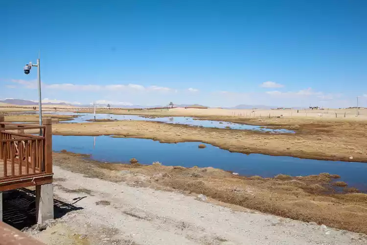
DAY5 Overlooking the center of the universe at Lake Manasarovar
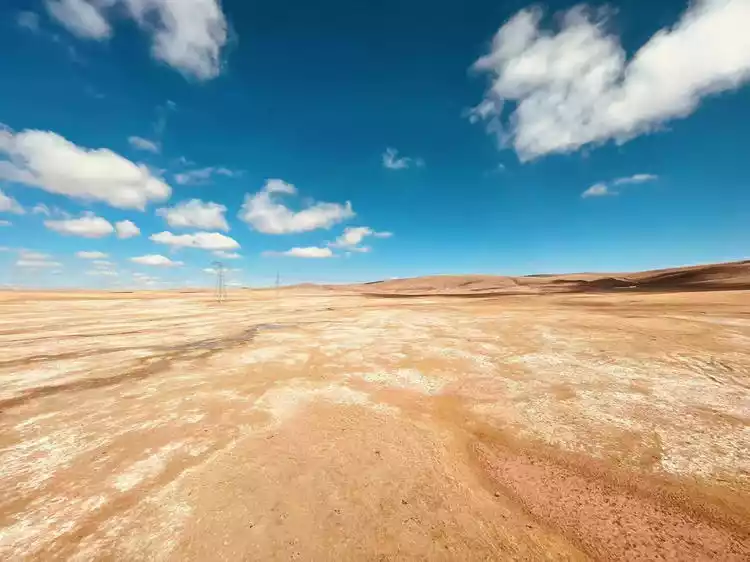
After breakfast, we left this beautiful plateau town and continued driving towards the border along National Highway 219. After half a day's trek, we passed an unnamed viewing platform, where the foreground was the desert, the middle ground was the azure lake, and the distant view was the continuous Himalayas.
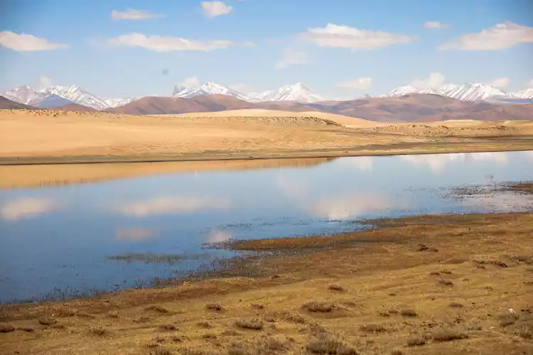
I walked along the plank road leading to the observation deck, and at the end, I finally lost my temper and slowly tumbled down. I set up my tripod on the sand and began to snap photos non-stop. Perhaps that's what travel is like. At a scenic spot, you might just feel like you've completed your mission by simply checking in, but along the way, there are always little surprises. The most beautiful scenery is along the way.
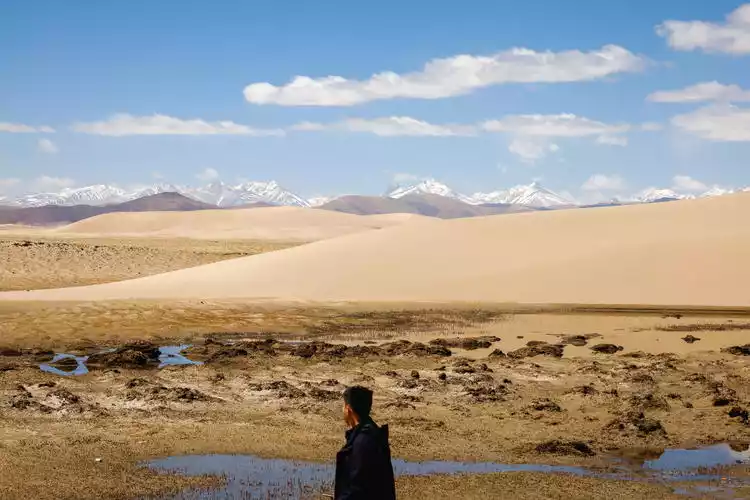
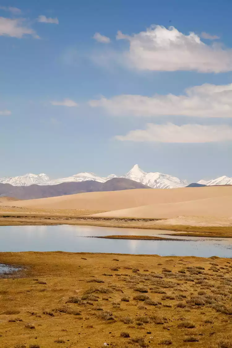
After taking enough photos of Wuming Haizi, we continued onward, finally spotting its unique, mysterious arc in the afternoon! At that moment, despite the shaking car, we opened our shutters as fast as we could and began shooting into the distance. Looking south, we could see its famous landmark: a Buddhist swastika formed by a huge ice trough running vertically down from the peak and a horizontal rock formation.
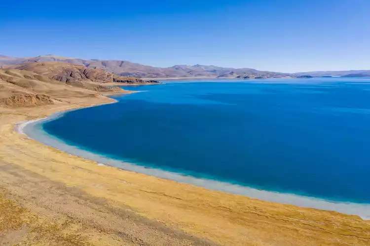
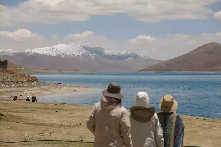
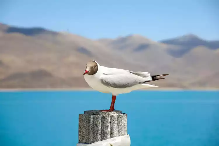
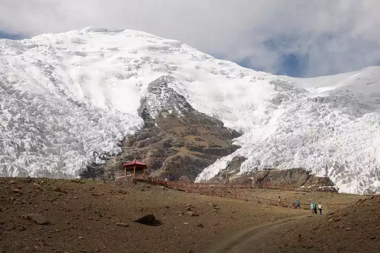
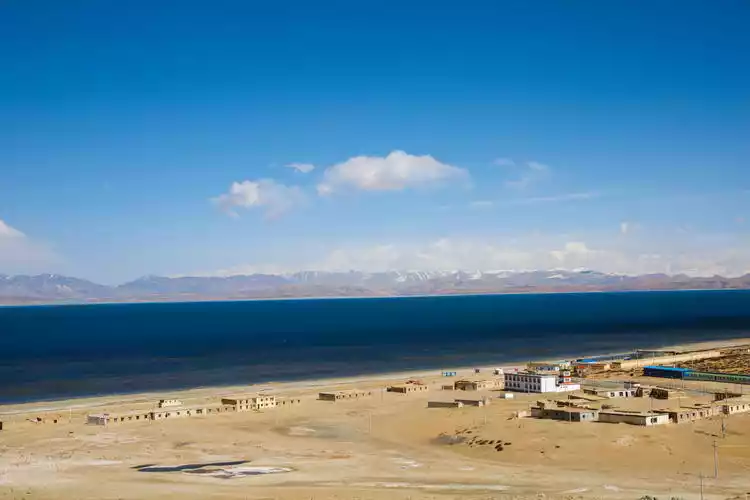
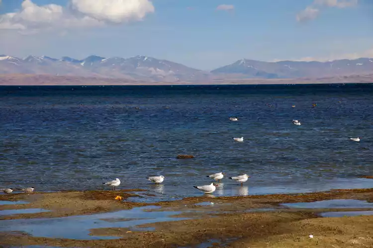
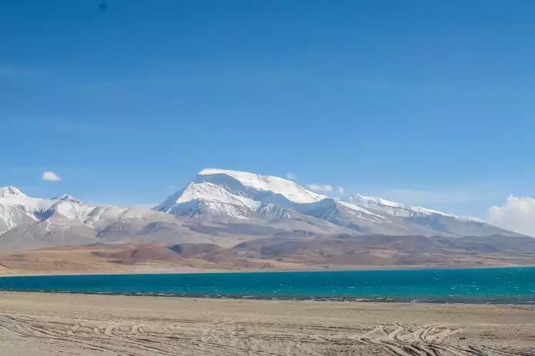
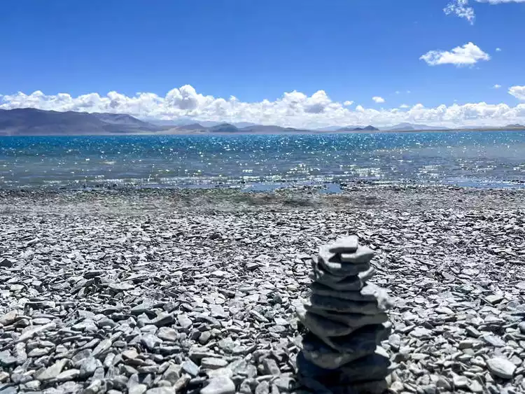
After calming down, we arrived at our first stop of the day: Lake Manasarovar. This azure lake has been dubbed the most sacred lake, the center of the world, one of the three sacred lakes, the most transparent freshwater lake, and the source of Asia's four largest rivers. Seagulls flocked by the lakeside, and the whistling wind seemed to warn outsiders not to defile this land.
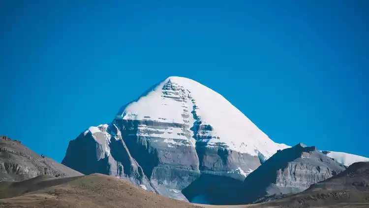
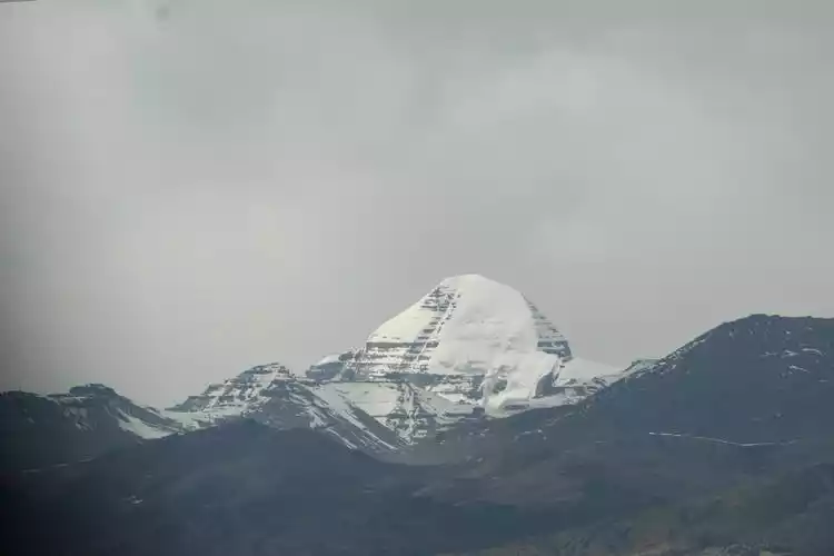
From the perspective of mythology, Mount Kailash represents the masculine sun, the father god, while Lake Manasarovar represents the gentle moon, the mother goddess. From a religious perspective, Mount Kailash and Lake Manasarovar are recognized as "sacred mountains" and "holy lakes" in the hearts of Tibetan compatriots. Bon religion, Hinduism and Tibetan Buddhism regard this place as the center of the world.
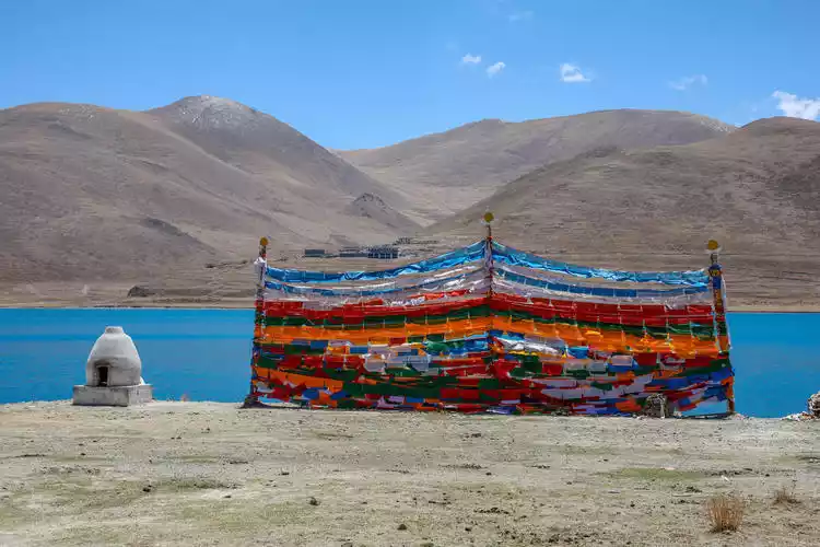
Prayer flags, white pagodas, Tibetan stones, sacred birds—all the elements of Tibetan culture commonly known to the public are gathered here. Even a moment's stay on this sacred land, illuminated by the sun and moon, is a blessing from the gods.
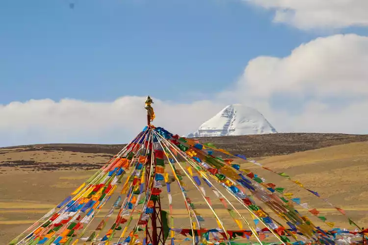
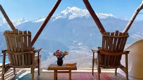
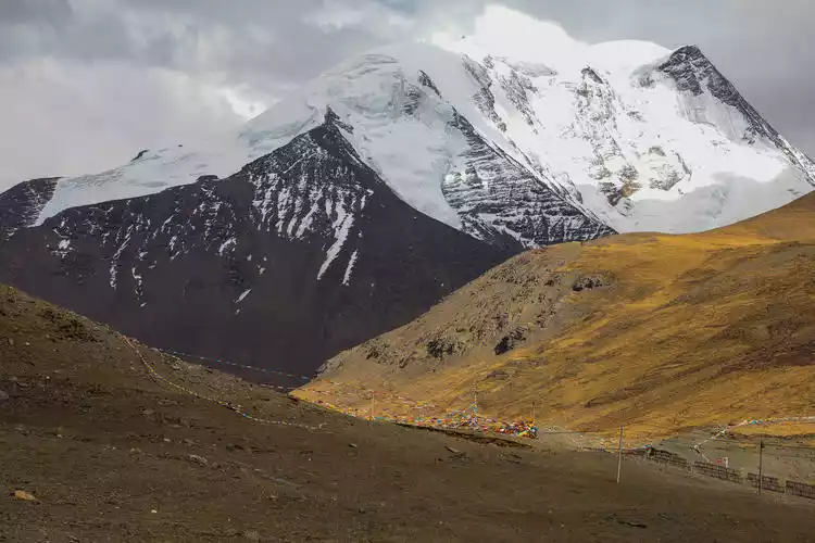
At night we stayed at the 219 National Highway Viewing Hotel south of Mount Kailash. Standing on the viewing platform of the inn, we were able to see the majestic and heroic appearance of Mount Kailash.
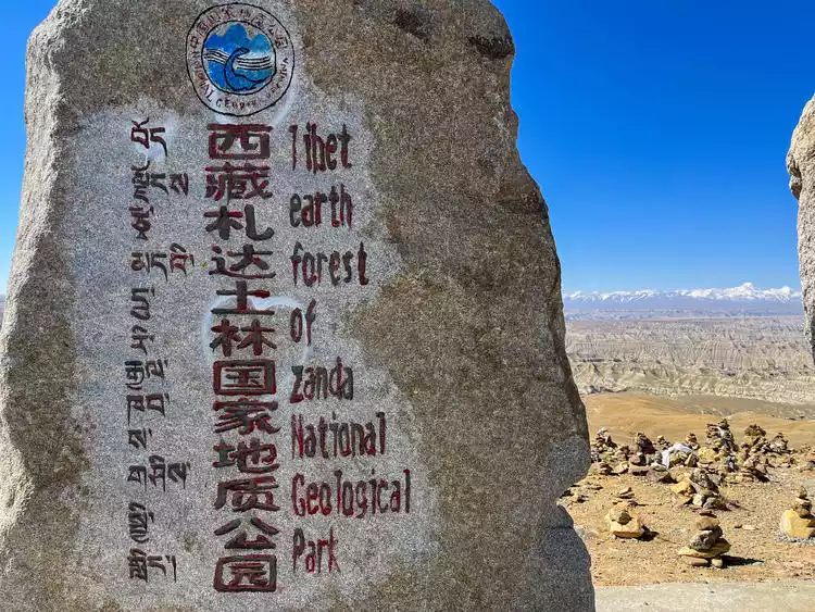
DAY6: Go deep into the Zada Earth Forest to search for the lost Guge Kingdom
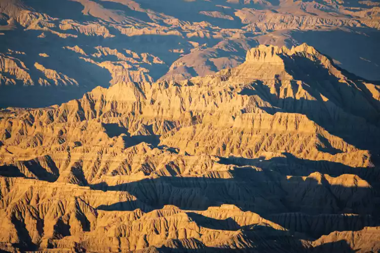
Departing from Mount Kailash, we drove along National Highway G219 gradually towards Zhada County, crossed a high mountain pass and arrived at National Highway G565. In the distance, a group of earth forests suddenly appeared on the surface, which was particularly spectacular.
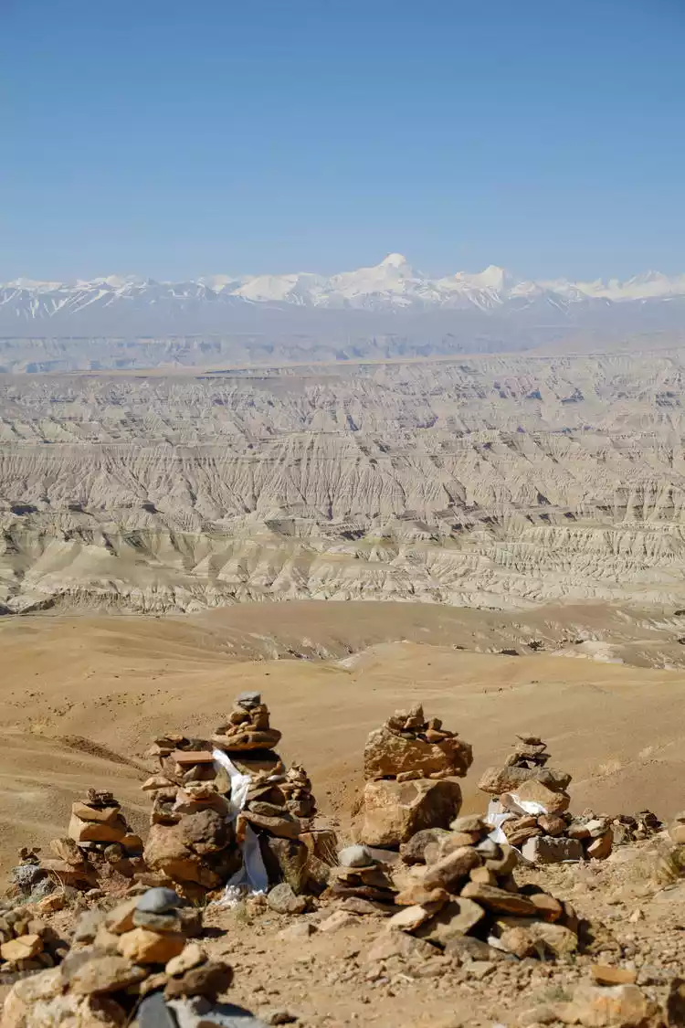
I'd seen pictures of this place before setting off, and it was captivating, like an alien world. Looking out into the distance, the view was breathtaking, with ravines crisscrossing, undulating, and layers of steep, towering cliffs. It was a truly magnificent sight. It's hard to believe such a place exists without actually visiting it. I couldn't help but marvel at the wonders of nature.
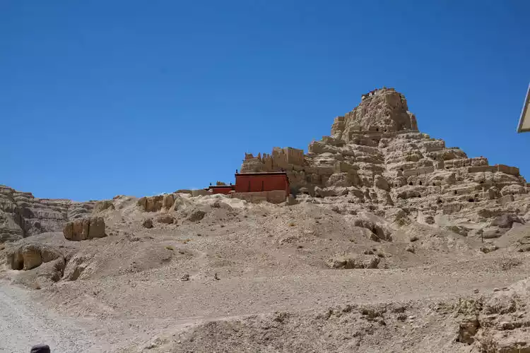
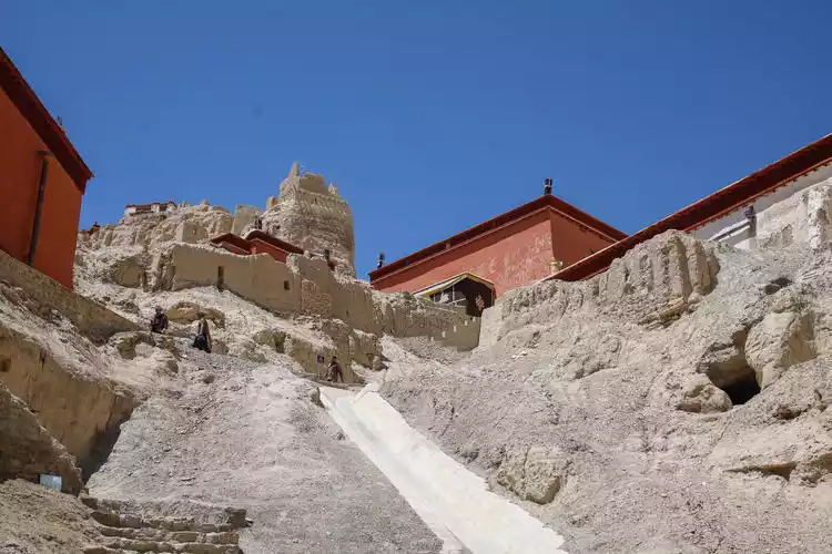
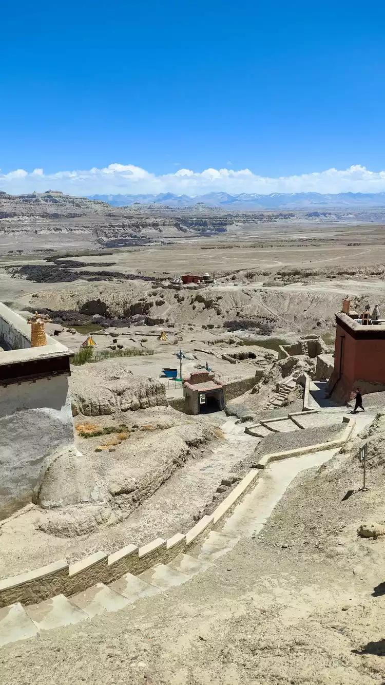
Then we drove through the earth forest, and following one bend after another, we arrived at the westernmost end of this trip, the ruins of the Guge Dynasty.
It's said that the Guge Kingdom ruled for over 700 years, spanning the Song, Yuan, and Ming dynasties. Yet, this kingdom, boasting such a sophisticated and splendid culture, suddenly vanished overnight, leaving its existence virtually unknown for a long time. Today, while we may not know the history of its demise, we can still experience its former glory through its ruins.
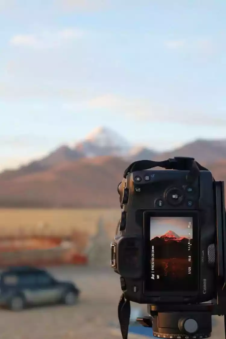
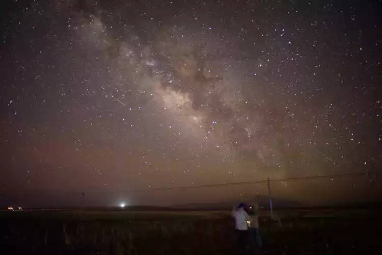
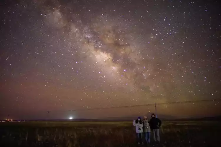
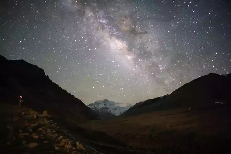
As night fell, we decided to get up in the middle of the night to capture the Milky Way. Our daytime scouting and the software's predictions suggested it would be impossible to capture both the Milky Way and the snow-capped mountains in the south, so we opted for a less light-polluted area to capture a few quick shots.
DAY7 Desert hike, check in Badain Jaran
After bidding farewell to the campsite where we'd spent two nights, we began our return journey, heading east back to civilization instead of westward toward the secrets of Ngari. Compared to the vibrant itineraries of the previous two days, today was rather dull, practically sitting in the car from morning till night. Since we'd spent the early morning photographing the Milky Way and the stars, we hadn't gotten much rest, so the car was filled with snoring.
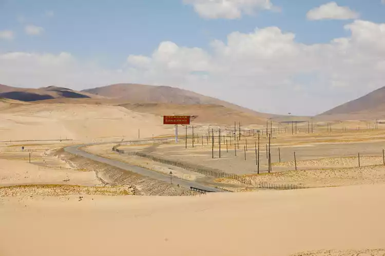
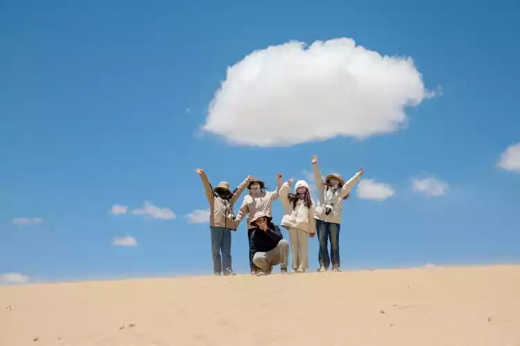
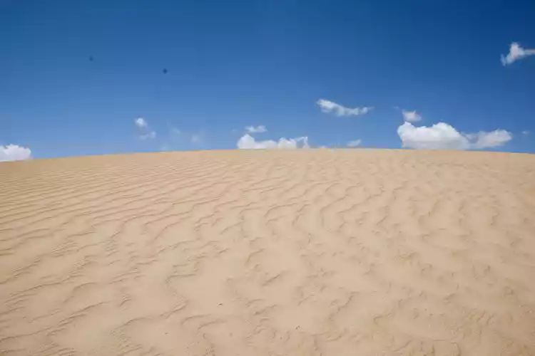
In the afternoon, we arrived at the Zhongba Sand Dunes, my favorite free attraction of the entire trip. The desert is as captivating to people from the south of China as the Snow Country is to those in the south. Walking through the vast desert feels like being far away from civilization. The golden dunes seem endless and breathtaking.
Personally, I really wanted to camp on this sand dune and wait for the arrival of the starry sky, but considering the subsequent itinerary, we had to say goodbye. In the evening, we stayed in Saga County again.
DAY8 Take a photo with the world's highest peak
Let's go! Today we'll head to Base Camp to admire the world's highest peak. After leaving National Highway 219 and heading from Saga to Mount Everest, we'll see Peku Co, the largest lake in the Shigatse region.
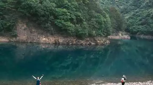
Although this lake isn't as famous as sacred lakes like Manasarovar and Namtso, it's a relief to be able to walk down to the lakeside and experience the azure sea. The surface is perfectly calm, like a ribbon, without a single ripple. The exquisite tranquility flows like a piece of soft music, filling your heart.
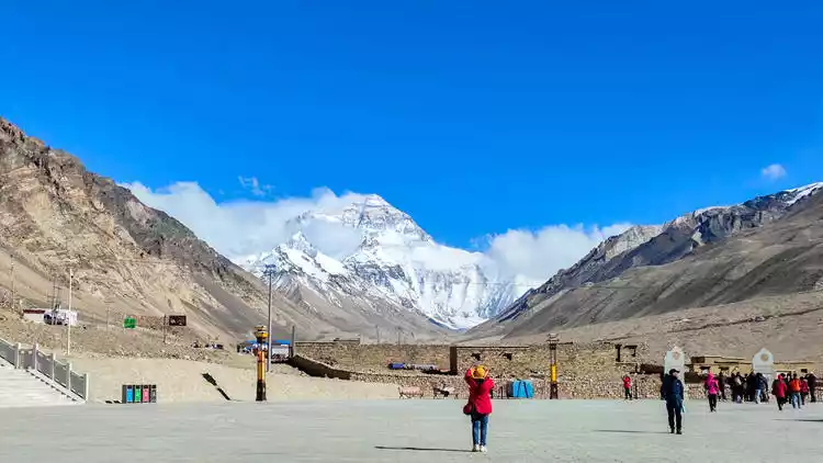
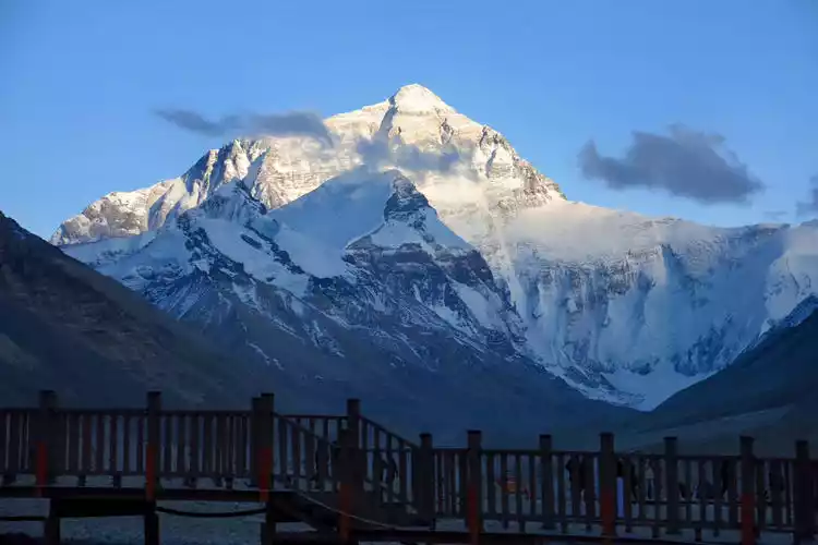
Leaving our wishes behind, we set off again. After countless turns, we arrived at the gate of the Mount Everest Scenic Area. Here we changed to a scenic shuttle bus and then drove along the winding road directly to the observation deck, arriving at the foot of the Himalayas!
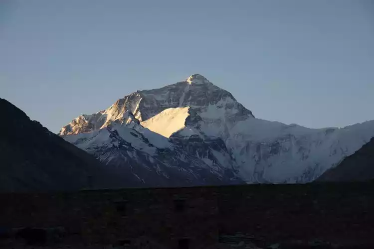
Regarding Mount Everest, I believe everyone is familiar with it: 8848.86m, the main peak of the Himalayas, the world's first, the border mountain between China and Nepal, explorers' paradise... countless names seem to tell the world about its greatness.
Mount Everest is right before our eyes, but we're a little disappointed that we can't reach Everest Base Camp anymore. We can only admire the world's highest peak from afar, from Rongbuk Monastery. Although I've seen it countless times on TV and online, standing in front of it is still awe-inspiring, its grandeur and holiness! This time, we viewed Mount Everest from the north slope. I hope to be able to actually walk up to it in the future and experience the heroic deeds of the climbing team from the south slope.
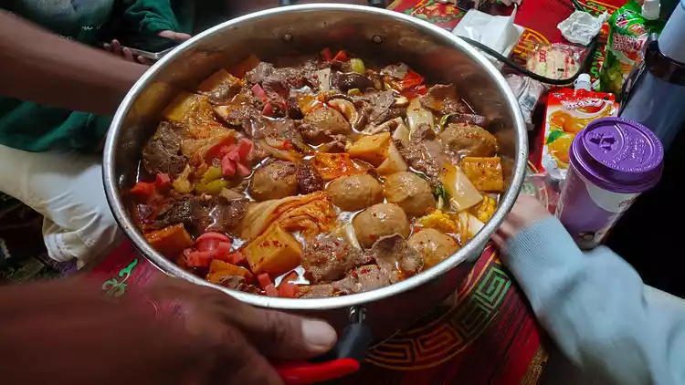
At night, we were eating hot pot in the tent and looking at the noisy crowd outside on the 5,000-meter plateau. We decided to do the same as the night before in Mount Kailash. As the saying goes, since we are here, it would be a pity not to have a try as a special forces soldier.
We played cards until the early morning, then packed up our camera gear and headed towards Mount Everest. It's worth mentioning that the wind was so strong I couldn't extend my tripod, so I had to hang a bunch of backpacks underneath to keep it from being blown over.
D9 Return to Lhasa
Today is the last day of the Ali South Line. After watching the golden mountain of Mount Everest in the sunshine, we set off to return to Lhasa. The total driving distance is 600 kilometers. We basically spent the whole day on the road.
Conclusion
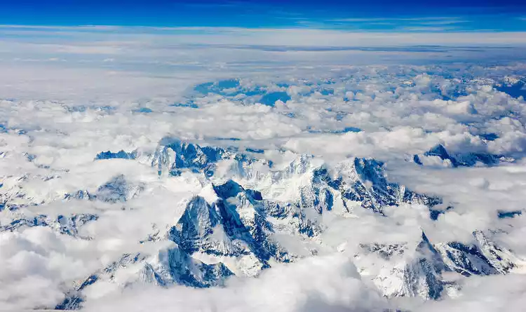
This vast land boasts the majestic Himalayas and the sacred Mount Everest, nature's most beautiful gifts to Tibet. Here, you can experience boundless grasslands and azure, turquoise lakes. Run alongside Tibetan antelopes, leaving their joyful footprints in the wind; stroll beside pristine plateau lakes, listening to their gentle murmurs. And when night falls, Tibet exudes a unique charm. The starry sky glitters like diamonds, seemingly connecting you to the universe.
Here, you can feel the peace and tranquility deep within. West of Tibet is a journey of the soul. Whether you're seeking the wonders of nature or searching for inner peace, this place promises a unique and unforgettable experience.