Recommended Winter Hiking Spots in Hangzhou | Lin'an's 9 Seasonal Snow Mountains
Preface
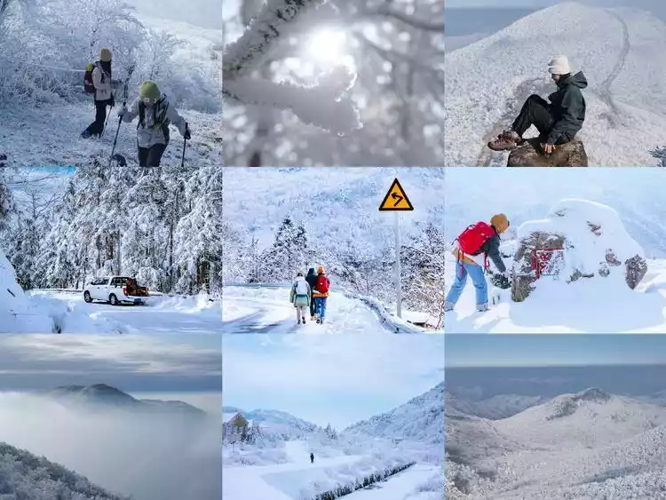
The popularity of Tianchi Lake and Longwang Mountain in western Zhejiang in the past two winters has once again refreshed many people's perception of Hangzhou. The stunning and shocking snow and rime scenery makes many people unable to believe that this is in Hangzhou.
We should have confidence in Hangzhou. It's not that the Northeast is unaffordable, but rather that Lin'an offers better value. Hangzhou boasts not only the exquisite charm of Jiangnan, but also a wild and vast side, with rime, snow, and everything in between, transforming you into a northern snow country at any moment. And the first snow in Hangzhou always falls in Lin'an.
Why is Lin'an considered the top destination for snow viewing in Jiangsu, Zhejiang and Shanghai?
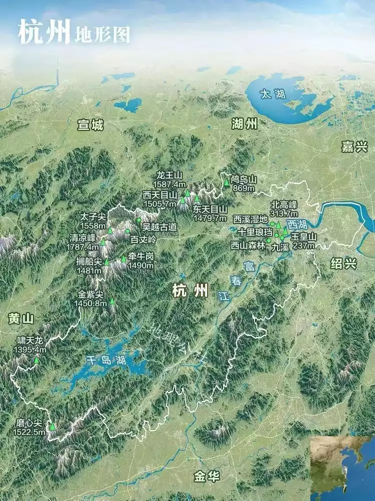
First of all, it is the geographical location. As the northwest mountainous area of Hangzhou, Lin'an can be the first to be exposed to the cold air from the south and intercept the water vapor from the west to the east. The high altitude + sufficient water vapor + sufficiently low temperature make snowing stress-free.
Lin'an boasts numerous peaks over 1,000 meters high, with a temperature difference of around 10°C from the city. This explains why it rarely snows in the city, but the mountains are already blanketed in white. If the city forecast calls for rain and temperatures near 0°C, then Lin'an's mountains are definitely ripe for snow, so pack up and head out to see the snow.
*This image is from Geographic Commune
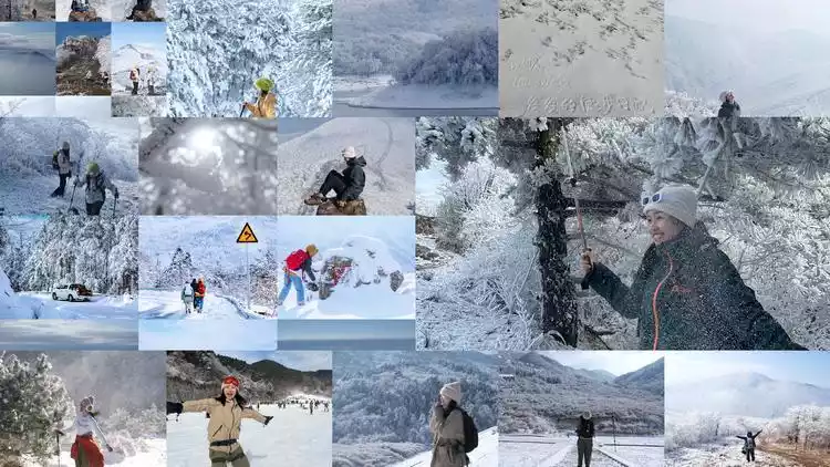
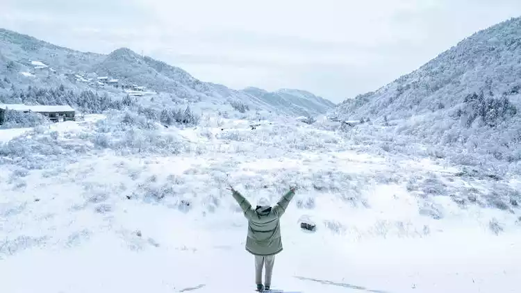
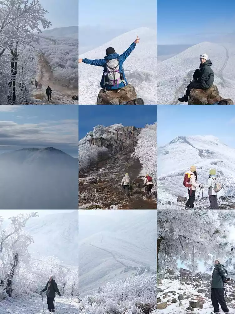
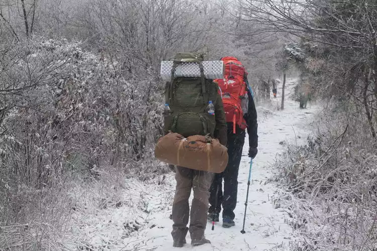
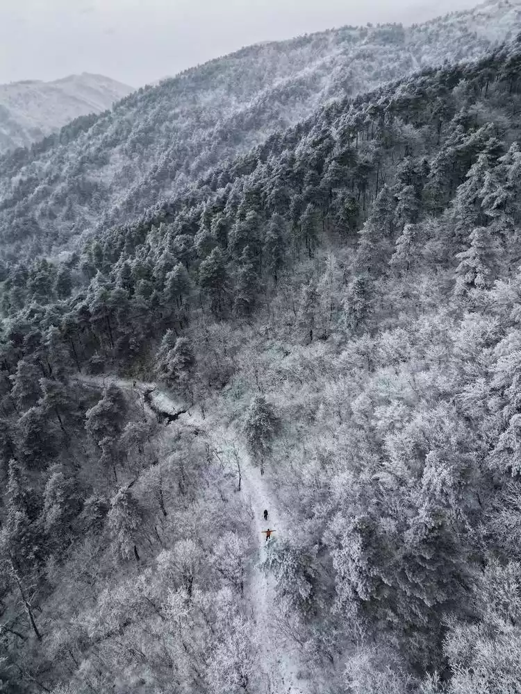
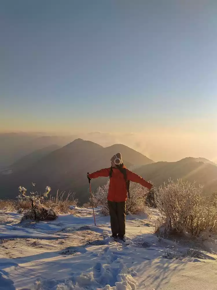
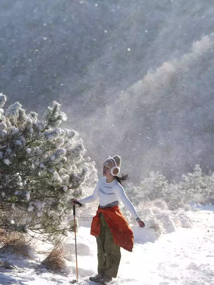
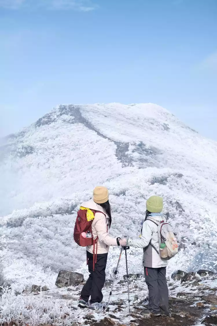
Every winter I always have to go to Lin'an to see the snow, only then do I feel that this winter is complete. Longwang Mountain, Baizhang Ridge, Taizijian, Tianchi Lake in Western Zhejiang, Qingliang Peak - the snow scenery here is so beautiful that it seems unreal. There is no ceiling for the gifts of nature.
The once quiet little village has become very lively with the arrival of the snow season. Traffic is congested and many villagers have started small businesses. Even people have to queue up when hiking to the mountain pass.
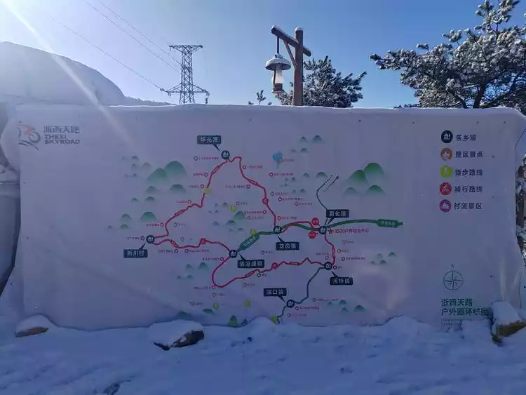
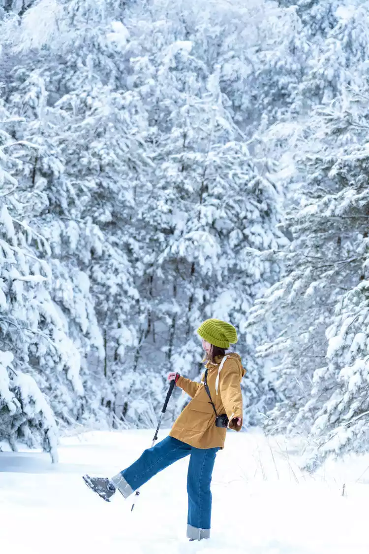
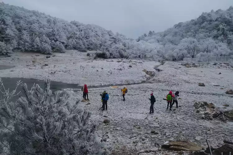
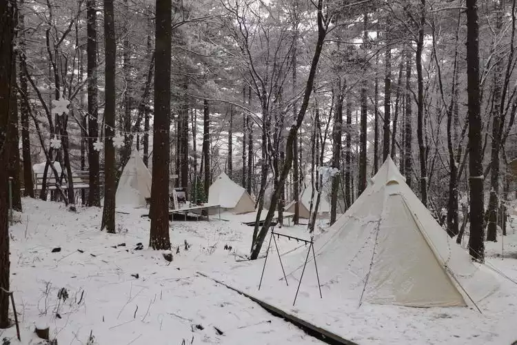
If we broaden our horizons beyond winter, all this becomes predictable. Lin'an is Hangzhou's outdoor paradise, densely covered with pristine forests, offering a diverse landscape year-round. Hiking, river tracing, snowshoeing, wild climbing, camping, and off-roading are just some of the places where countless people first began their outdoor adventures. Now, with official intervention and the repositioning of the area as a "Nature Exploration Park," "Prince Peak Station," and "Western Zhejiang Sky Road," Lin'an's outdoor atmosphere is only growing stronger.
Lin'an is Hangzhou's wild and hidden gem, so it's no surprise that it snows.
Lin'an's 9 Great Snow Hiking Routes
① Tianchi Lake in Western Zhejiang
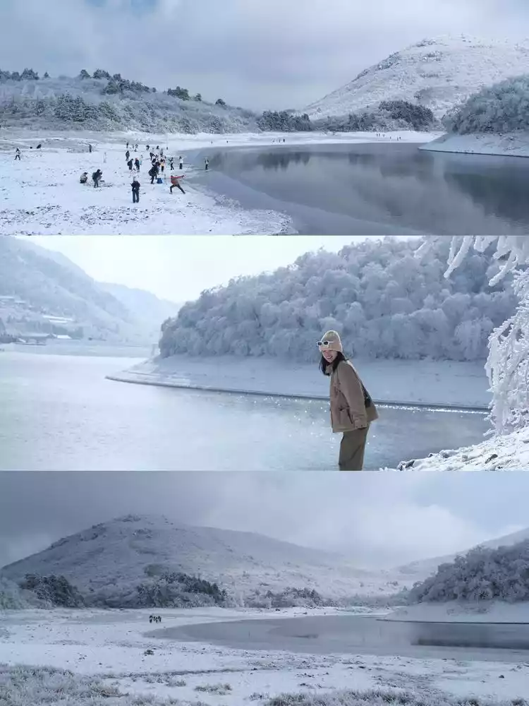
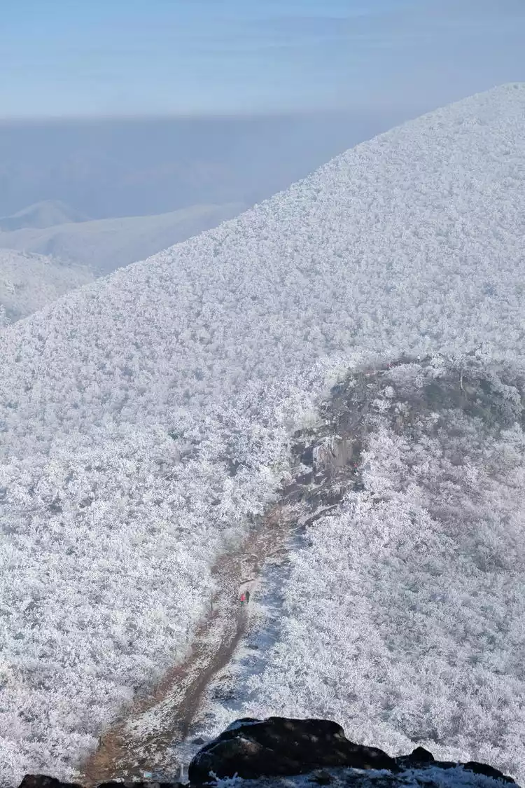
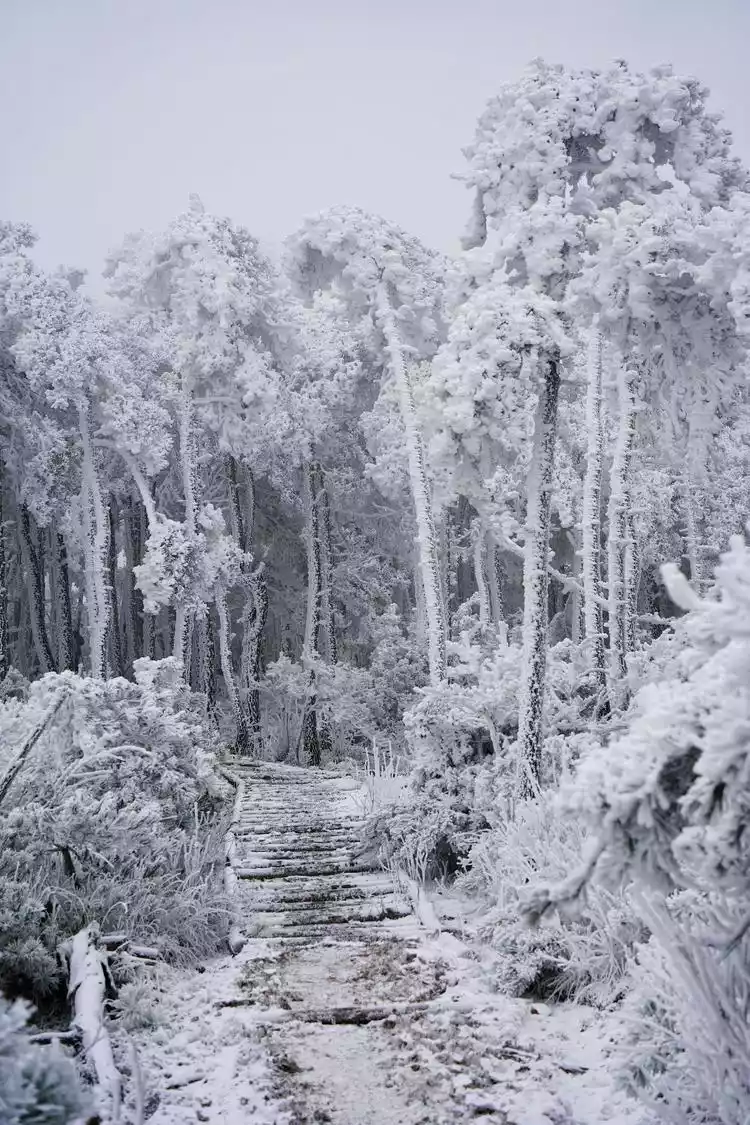
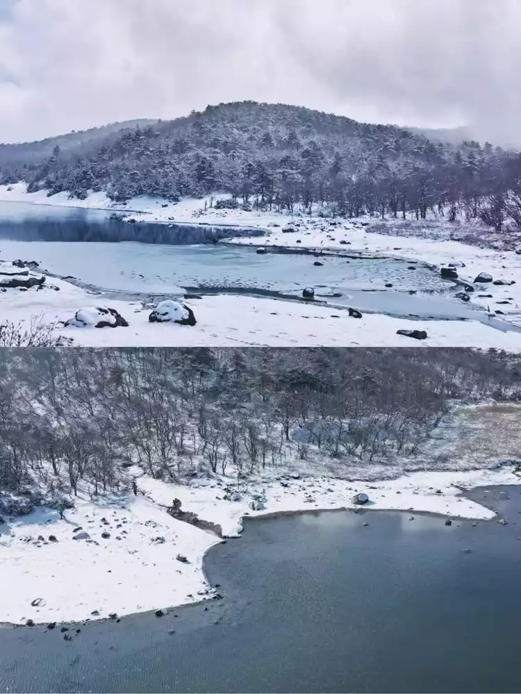
Tianchi Lake in Western Zhejiang is located within the Qingliangfeng National Nature Reserve in Zhejiang Province, perched atop Qianqing Mountain at an altitude of 1,100 meters. It's a highly suitable spot for snow viewing, boasting a diverse landscape featuring alpine reservoirs, scattered islands, lush forests, clusters of houses, a panoramic view of Leli Peak, and the little-known Sika Deer Detection and Protection Station.
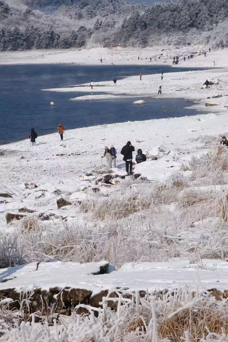
After snowfall, the beauty of the Tianchi Lake in western Zhejiang is even more pronounced, transforming into a northern landscape in a flash. Accessible by foot or car, the lake quickly gained popularity, attracting huge crowds of tourists. This has led to negative buzzwords like "congestion," "avoiding potential pitfalls," and even littering the area, which seems unfair to the lake. While the mountain remains, it's also an informal scenic spot, primarily a natural area. Research your trip in advance to be friendly and approachable.
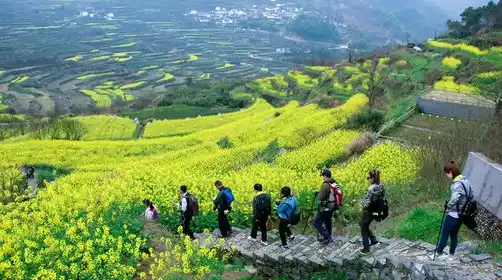
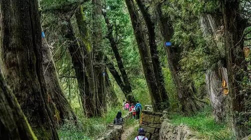
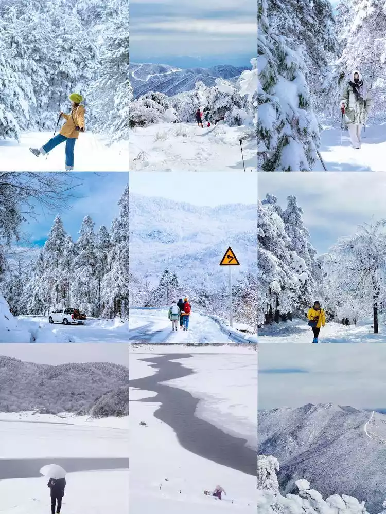
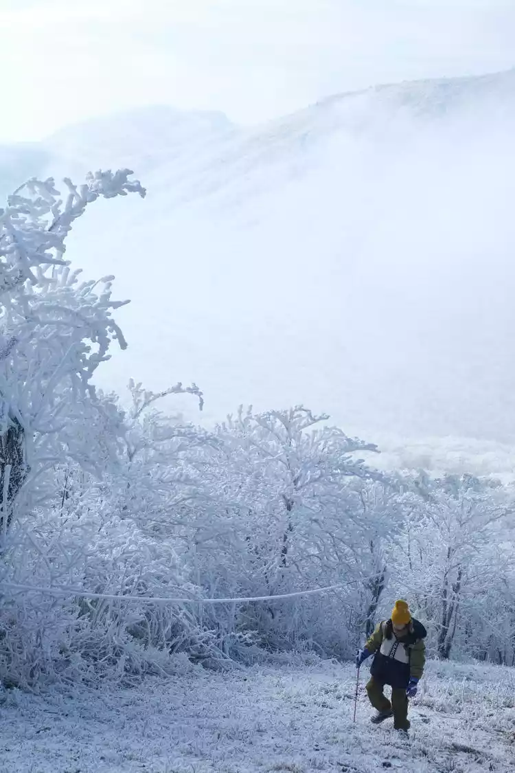
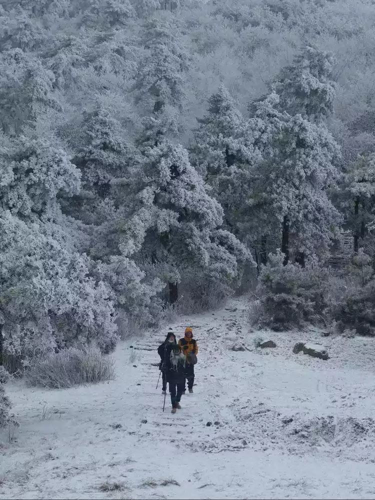
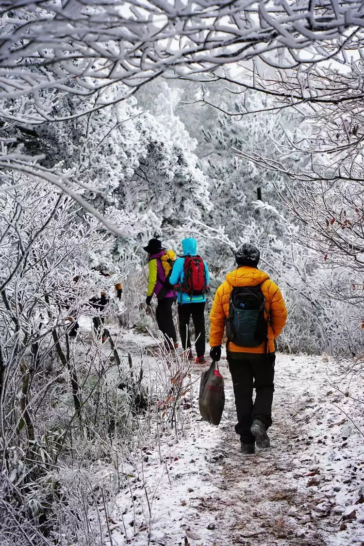
Hiking up the Wu Yue Ancient Trail, you can move through the mountains and fields, cross streams, explore the remains of the ancient trail, and occasionally encounter the "Christmas tree" in the pine forest. This is also the romance in the wilderness.
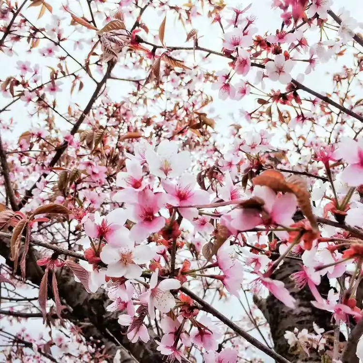
The Wuyue Ancient Road, located at the border of Ningguo County, Anhui Province, and Lin'an County, Zhejiang Province, dates back to the Five Dynasties and Ten Kingdoms period, when it served as a vital route between Wu and Yue, and a highway for Huizhou merchants to Zhejiang during the Ming and Qing dynasties. The Wuyue Ancient Road offers a truly captivating hiking experience year-round, with a vibrant display of scenery year-round, including a sea of azaleas and wild cherry blossoms in spring, canyon streams offering fun and rafting in summer, wild hawthorn and reed marshes in autumn, and rime-covered trees in winter.
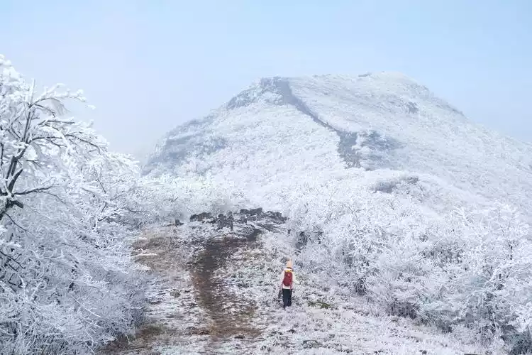
The view from the highest point, Leli Peak, is superb. Walking along the long and gentle ridgeline, you can overlook the scattered islands and the calm water of Tianchi Lake.
Tips:
Hiking information
Distance: 12km Duration: 6h Road conditions: Wild road, ancient path steps Highest altitude: 1150m Total climb: 800m
②Longwang Mountain
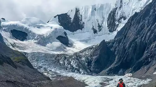
Stretching across three counties in two provinces, namely Anji, Lin'an, and Ningguo, Longwang Mountain, known as the "First Peak of Tianmu Mountain," boasts a peak at 1,587.4 meters. This route vividly embodies the saying "the most breathtaking scenery is at the summit." The breathtaking ridgeline firebreak stretching to the horizon is breathtaking, making it hard to believe that Hangzhou still harbors such a wilderness, a far cry from the refined image of the Jiangnan region.
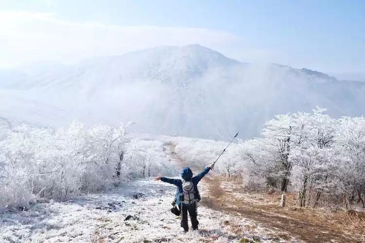
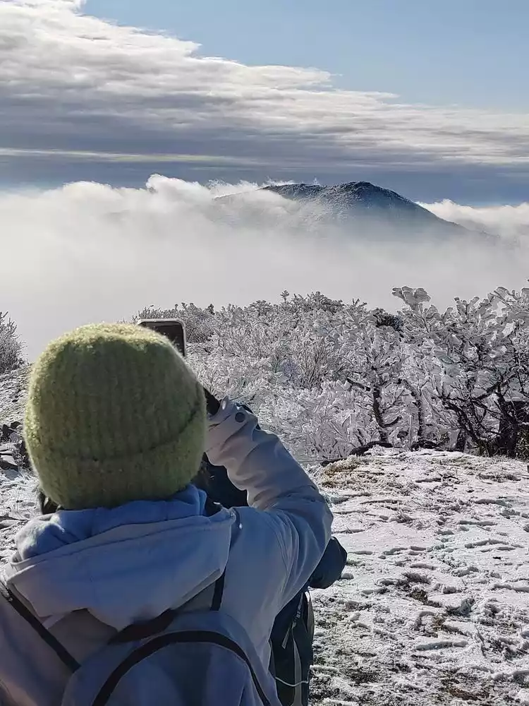
The best weather conditions are when the sky clears up after snowfall, when there is ample moisture and a surging sea of clouds. The magic of nature never ceases to amaze!
Longwang Mountain, the seasonal snow-capped mountain in Zhejiang, is worth visiting! It also guarantees no altitude sickness hhh
Tips:
Hiking information
Distance: 10km Time: 6h Road condition: Off-road Highest altitude: 1594m Total climb: 800m
③ Joint Peak
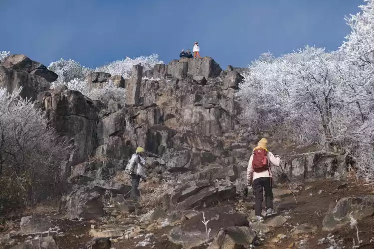
It's a good neighbor of Longwang Mountain! Also located in the Tianmu Mountains, its vast, winding ridgeline and the rime trees hanging from its summit rival those of Longwang Mountain. However, compared to Longwang Mountain's popular top-tier attractions, Jieli Peak seems more niche and offers a more diverse experience.
The path up to Jieli Peak and Longwang Mountain is the same. Hidden in the bamboo forest, the trail ascends a long, wild path, then splits to the left and right at the firebreak. The path is dotted with rock joints, forming a series of natural steps, a marvel of nature. The steps vary in height, requiring sometimes hand and foot climbing, sometimes external forces, and sometimes squatting and sliding. This adds a touch of wild climbing to the hike. Crampons are essential for navigating the rock formations in snowy and icy weather, and one must be extremely careful and cautious.
Tips:
Hiking information
Distance: 9km Time: 5h Road condition: Off-road Highest altitude: 1585m Total climb: 777m
④ Baizhang Ridge
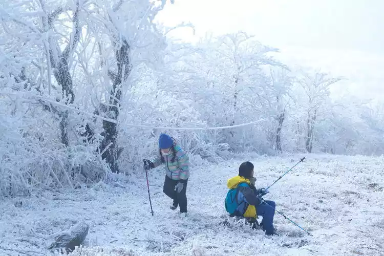
Among the peaks of Lin'an, Baizhang Ridge stands out as a reserved and introverted mountain. Unlike the vast firebreak ridgeline, Baizhang Ridge is tucked away in dense forest, with the Yunding Glacier Lake atop it standing like a jewel in the forest. These geographical conditions also lend themselves to the formation of rime icicles. The dense trees and mists of the mountains create abundant moisture, making rime icicles a natural phenomenon when cold air cools the area, earning it the nickname "the Greater Khingan Range of the South."
The following pictures are from group member Joey
The snow scenes in the past two years have made the village at the entrance of the ancient trail famous, and a lot of improvements have also been made. There are homestays and cabins in the village and the middle section of the ancient trail.
The usual way to go is to start from Shuangshi Village, take a loop and turn back.
① Outdoor Walk (Shuangshi Village - Forest Farm - Ice Lake - Shuangshi Village): Follow the mountain road all the way up to the Ice Lake. This section of the road is very steep and slippery. Then continue down to the forest farm and return to Shuangshi Village along the ancient road. The round trip is about 10km, and the up and down the mountain takes 5-6 hours.
② Leisure Walk (Shuangshi Village - Forest Farm): Go up and down the ancient trail to the forest farm, then to the glacial lake and back down the mountain. The hike is slightly easier and suitable for those with average physical strength and who like to take photos. This section of the trail is mainly paved with large stones and is relatively easy to walk. The round trip is 7km and takes 4-5 hours.
Genting Glacier Lagoon
Tips:
Hiking information
Distance: 10km Duration: 6h Road conditions: Wild road, ancient trail Highest altitude: 1448m Cumulative climb: 900m
⑤Prince's Peak
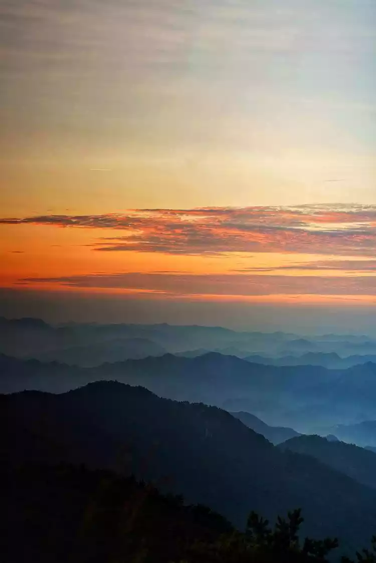
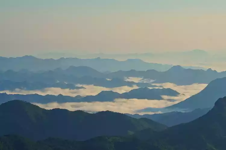
As part of the Western Zhejiang Sky Road, Taizijian, with its stunning sunrises and sea of clouds, has become a must-see for countless outdoor enthusiasts. Among the other routes, Taizijian is also relatively accessible, reaching the summit in about 30 minutes for those with a quick walk.
From the Taizijian Station, you'll reach the summit via a roughly one-kilometer slope. The slope is gravelly and easily slippery, and after a snowfall, the icy surface is even more impassable. So, while the slope may be short, it's essential to be well-equipped, especially with crampons and trekking poles, which come in handy at crucial moments.
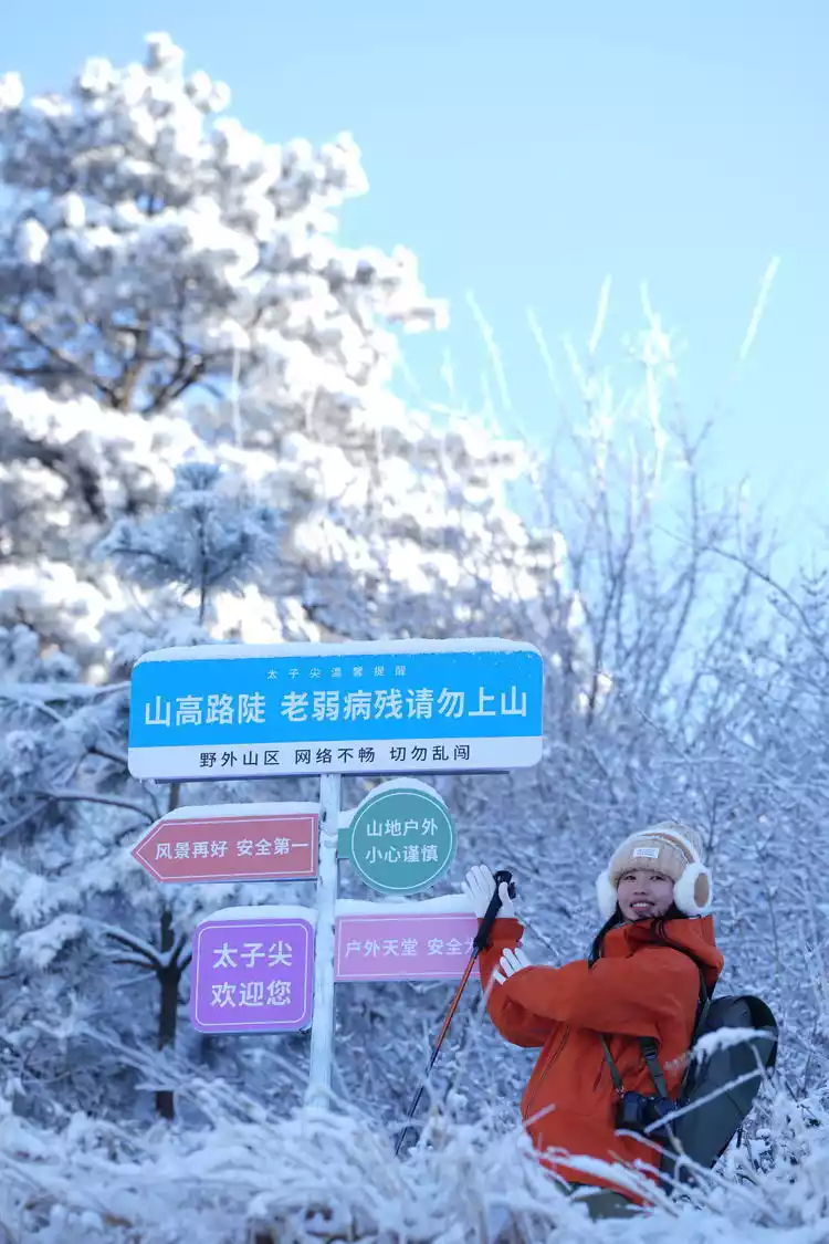
Continue forward and take a photo with the stone tablet inscribed with "Prince Peak." The innermost wooden platform offers a superb view, offering panoramic views of the surrounding mountains, embracing nature. The stunning ridgelines and peaks resemble a natural ink painting. Near the platform is a perfect spot for camping, where you can almost reach out and touch the sky, with stars, sunrises, and seas of clouds all within easy reach.
Prince Peak in summer, with romantic sunrise and winding mountains
Tips:
Hiking information
Distance: 2km Time: 1h Road condition: Off-road Highest altitude: 1558m Total climb: 400m
⑥ Tonggongjian
Tonggongjian (1558m), Taizijian (1558m), and Baizhangling (1334m) are collectively known as the Three Peaks of Tianmu. They are located in western Lin'an, stretching from Qingliang Peak in the south to the Grand Canyon of Western Zhejiang in the north. Much of this route follows the ridge, offering expansive views and panoramic views of both sides of the mountain.
If the challenge of a continuous trek is too intense, consider cutting off sections. A round trip to Tonggong Peak and Baizhang Ridge in a single day is also a good option. Those with more stamina can opt for a single day of trekking through all three peaks. This is a style that even a beginner like me can't even begin to match. In short, different approaches offer different kinds of fun. The most important thing when traveling outdoors is to do it within your capabilities.
Tips:
Hiking information
Distance: 14km Time: 7.5h Road condition: Off-road Highest altitude: 1591m Total climb: 1000m
⑦ Dojo Terrace
"Daochangping" is a poetic name, capturing both the terrain and its secluded atmosphere. During the Three Kingdoms period, the Wu and Wei states divided territory here, creating a pass along the ancient road. While yellow flowers once abounded, the Huanghua Pass is now hard to find. Yet, alpine meadows still exist in southern Anhui. Even within the vast expanse of the Tianmu Mountains, such expansive alpine meadows are rare. The hiking experience is excellent, and in winter, the blanket of snow may be covered in thick pine needles.
Starting from Yuxi Village, the trail passes Daochangping Reservoir, with a thousand acres of alpine meadows just beyond. After the snow, the meadows are covered in white, creating a sense of vast wilderness on the mountaintops. This route is relatively uncommon among Lin'an's many snow-hiking trails, so you don't have to worry about crowds, but rather enjoy a sense of solitude and tranquility.
Tips:
Hiking information
Distance: 12km Time: 6h Road condition: Off-road Highest altitude: 993m Total climb: 700m
⑧Qingliang Peak
Qingliang Peak is where my outdoor adventures began. Ignorance is bliss, and I was so incredibly brave when I tackled Qingliang Peak as a beginner. The experience ended with a pair of worn-out sneakers—yes, I didn't even know what hiking boots were back then. I stumbled upon this and became a beginner! The panoramic view from the summit is unforgettable. The mountain breeze and the breath of freedom are always captivating.
Qingliang Peak, the highest peak in the Tianmu Mountains of Lin'an, boasts a height of 1,787.4 meters, earning it the title of "Top of Western Zhejiang" and a classic hiking route in East China. However, because it lies within the Qingliang Peak Nature Reserve, a priority area for biodiversity conservation in western Zhejiang's hilly and mountainous regions, stricter regulations have been implemented in recent years, prohibiting hiking through it.
Tips:
Hiking information
Distance: 16km Time: 9h Road Condition: Off-road Highest Altitude: 1787m
⑨Daming Mountain
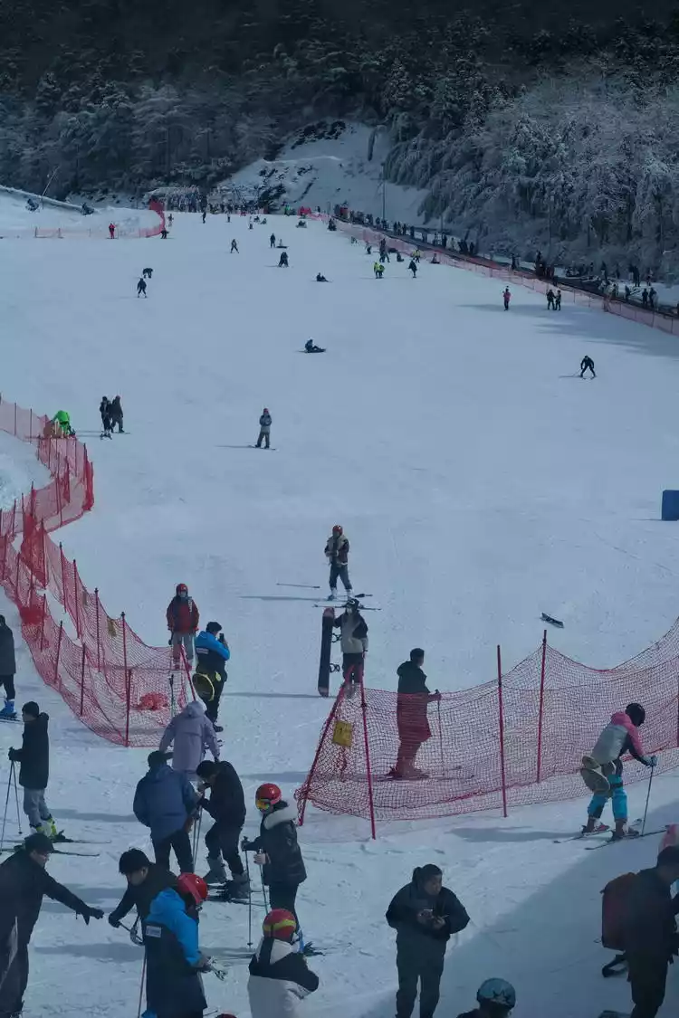
As one of the official scenic spots among these areas, Daming Mountain is a perfect choice for those who prefer a lazy winter. The scenic area's cable car takes you directly to a fairytale of ice and snow in the alpine forest. Its climate and geology are similar to those of Huangshan, earning it the nickname "Little Huangshan of Western Zhejiang." With elevations ranging from 1,000 to 1,400 meters, Daming Mountain is also known for its high concentrations of fog, snow, and rime. Beyond its natural beauty, the area also boasts an alpine forest ski resort and a forest campsite, making it a great choice for a weekend spent in the mountains.
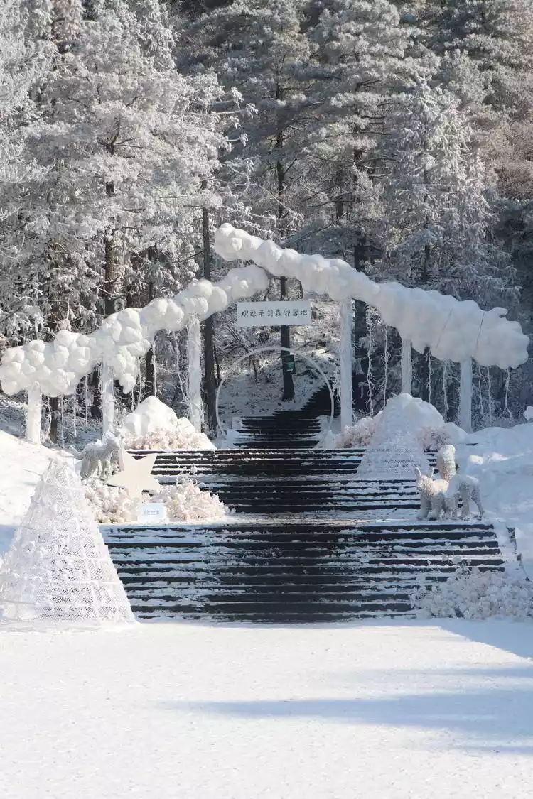
Skiing is a must in winter and you can also enjoy the charm of white opium here.
Outdoor hiking: a new social currency for young people
The hiking craze of the past two years has taken social media by storm, successfully breaking through the social circles of young people. Why are so many young people embracing outdoor hiking? And are they even finding spiritual solace in it? Can the hardships of hiking alleviate the drudgery of work?
"Hiking is probably one of the few things young people can do that pays off with minimal effort. After trudging up the dry slopes, you'll immediately receive positive feedback from nature."
"I was in agony and exhaustion as I climbed the long, dry slope over the pass. The slope seemed endless, my steps heavy, the mountain wind chilled. As my energy wore on, I felt a slight discomfort, but I had to keep going. I had to get down before the sun went down. The last few kilometers felt long. The conditions were rough and difficult when we stopped for lunch and camped in the mountains, but this sole refuge in the wilderness gave me a real sense of security. After I got down, I was left with bruised fingernails and aches all over my body. I cursed myself and decided I would never do this again."
"But when I see the vast stars and the majestic mountains; when I run on the frozen lake; when I wait for the sunrise, I know it's all worth it. I can still see hope. At this moment, I am just a child in nature. I can put aside the troubles in life for a while."
Let’s go back to the original question - regardless of whether the hardship of hiking can really eliminate the hardship of work or even life, the most important thing is that it is the expectation and small sense of ritual in the repetitive and boring life, as well as the timely positive feedback from nature.
Tips for winter outdoor gear
The principle of winter outdoor travel plan is to wear warm clothes in three layers with light weight to keep warm from head to toe.
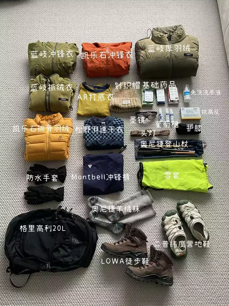
Head hat
The head is easy to lose heat, so if the wind is strong on the top of the mountain, you need to keep warm. In winter, you can bring two hats for hiking: a woolen hat for warmth and a sun hat for when you sweat a lot during the climb.
Outer layer - hard shell jacket
Windproof and waterproof, it can block cold wind to a certain extent. The material is generally resistant to friction and easy to clean if it gets muddy.
Middle layer - fleece/down
Wear the fleece as the middle layer first, and pack the down jacket in the bag. It is used to prepare for the extremely cold weather. Otherwise, it is very dangerous to get yourself into an extremely cold state in the wild. Therefore, it is best to have a light and easy-to-store down jacket.
Inner layer - quick-drying base layer suit
The innermost layer should be made of quick-drying material to quickly wick away sweat. Otherwise, the sweat will not be able to be wicked away and the clothes will get wet easily and you will catch a cold easily when the wind blows. P.S. Also, avoid wearing cotton as a base layer.

Cashmere socks for feet
The wool material is thick and warm, anti-freeze, anti-slip and anti-friction, and the overall comfort is good
Combat pants
Wear windproof and waterproof trousers as the outer layer. When you go to see the snow and step on the mud, you can wipe it clean from the calf to the trouser legs with wet wipes. It is very worry-free.
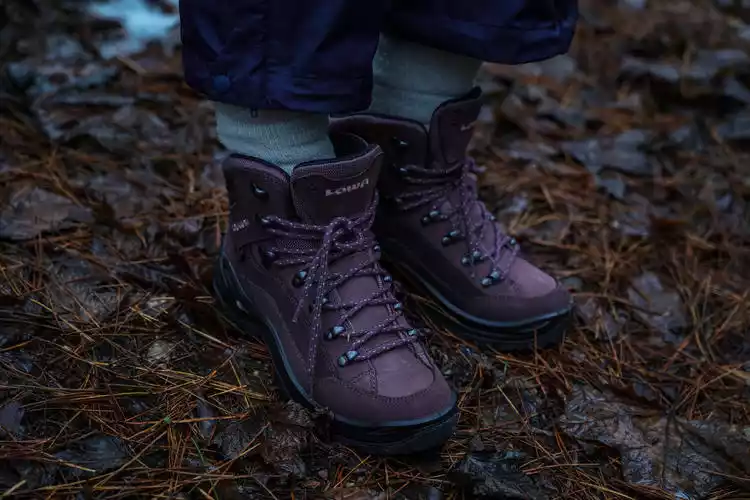
mid-high-top non-slip hiking shoes
Hiking in the snow will inevitably lead to slippery surfaces due to ice or snow, so it is safer to wear mid-high waterproof hiking shoes (if you also bring crampons, it will be a double buff for added safety).
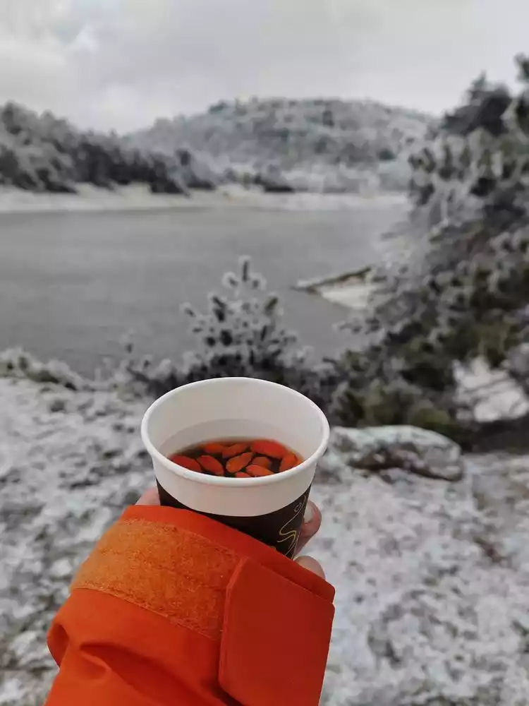
In short, follow the "three-layer outdoor clothing rule" for easy on and off clothing, lightweight, warm, and convenient. Besides lightweight and warm clothing, pack a simple trail snack, a thermos with hot water and a bottle of soft drink, a headlamp (darkness can be dangerous in winter when it gets dark early), trekking poles (useful for both ascending and descending slopes), and knee pads (to protect your knees when descending).
When traveling outdoors, the key is to set off happily and return safely!