Day 1 Kathmandu ★Meeting day
All day
Tourists from all over the world are attracted by the call of the snow-capped mountains and come to Nepal, a small country at the southern foot of the Himalayas. Upon arrival, you will be picked up at the airport (one registration fee, only available on the day of assembly). You will then check in at the assembly hotel in Kathmandu.
How to get there
There are many flights to Kathmandu (Tribhuvan International Airport, airport code KTM) where you can choose from. We recommend purchasing direct flights from all over the country to Kathmandu:
Direct flights to Kathmandu from many domestic cities (Chengdu, Beijing, Kunming, Guangzhou, etc.)
In addition, you can choose to transfer. If you purchase a connecting flight, please note that there should be a certain amount of time between the two flights: generally more than 3 hours, so as not to miss the flight.
丨Physical fitness & experience requirements
Age: 18-65
Physical fitness: Ability to hike 15 kilometers and climb more than 1,000 meters in a single day
Experience: Experience in high-altitude travel (no altitude sickness at around 4,000 meters, or experience in long-distance hiking over 3,000 meters)
Route reference: Hiking Yubeng, Changchuanbi, Gongga Five Lakes, etc.

Day 2 Kathmandu → Pokhara
All day
Driving time: Kathmandu-Pokhara is about 200 kilometers, about 8 hours
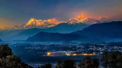
After breakfast, we will gather by bus to Pokhara (885 meters above sea level), known as Asia's Little Switzerland.
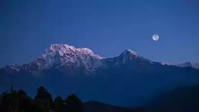
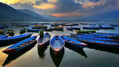
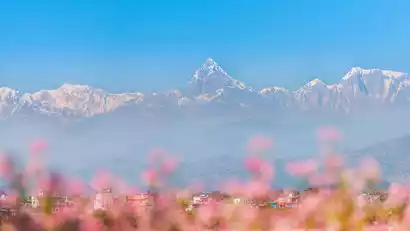
Dense forests, turbulent rivers, clear lakes, and winding rural scenery, coupled with the majestic Annapurna Mountains (the highest peak exceeds 8,000 meters) towering to the north, attract tourists from all over the world. The northern shore of Phewa Lake is home to the tourist-filled Phewa Lakeside District, the heart of the city. Most hotels and restaurants are located along the lakeside, known as the Lakeside District. Like the Thamel District, this area is a popular gathering place for local and foreign tourists.
Kind tips:
The distances between points in Nepal are long and the road conditions are not particularly good. It is recommended that you prepare some snacks, movies, etc. to increase the fun of the journey.
Day 3 Pokhara → Jhinu (1730m) → Sinuwa (2340m)
All day
Driving time: 4 hours
Hiking distance: about 6.4 kilometers (excluding road repair sections)
Cumulative elevation: +920m; -300m
Maximum altitude: 2350m
Estimated time: About 4 hours
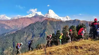
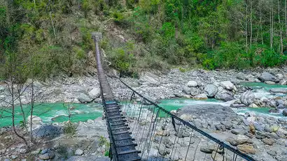
Today, we'll officially begin our mountain hike. Please pack your belongings in advance; any unused items can be left in Pokhara. After breakfast, we'll drive to Jhinu, heading deeper into Annapurna. After approximately 3.5 hours, we'll reach the trek's starting point, Jhinu (1730m). Gather your gear and set off!
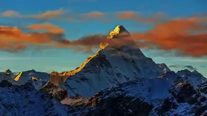
Despite the numerous hikes, this day's route remains largely intact, dominated by subtropical rainforest. The trail is lined with thick buttresses and vines. The striking Fishtail Peak (6,993m), the symbol of the Annapurna Conservation Area, remains a virgin peak, considered sacred by Nepalese. Today is the first day of our hike, and we're aiming for acclimatization, so we haven't planned any extensive hikes. After about 2.5 hours, we arrive at our tonight's destination, Sinuwa (2,340m), where we'll check in.
Note: Due to road construction at the foot of the mountain, off-road vehicles cannot reach Jhinu at present. You need to get off at Matque and start hiking. The hiking distance will increase by about 5km and the hiking time will increase by 2 hours.
Day 4 Sinuwa (2340m) → Himalaya (2900m) → Deurali (3230m)
All day
Hiking distance: about 12 kilometers
Cumulative elevation: +1100m; -200m
Maximum altitude: 3230m
Estimated time: About 8 hours
Today's hike will be relatively long and challenging, passing through a rhododendron forest. We'll reach Kuldi and enter the upper Modi Khola Valley. This section of the trail is the bottleneck of the trek, and from March to May, you'll see a vibrant display of rhododendrons.
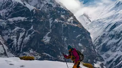
From Sinuwa, the journey is essentially through the alpine jungle. Walking there felt like being transported to the world of Avatar, with monkeys often leaping and scurrying from the trees on either side, and perhaps even a puppy accompanying you on your hike. Following the path through rhododendron forest, we passed several avalanche notches before arriving at Deurali (3,230 meters) where we checked into a guesthouse, where you could sip fragrant coffee by the fire and gaze out at the snow-capped mountains.
Day 5 Deurali (3230m) → Fishtail Base Camp MBC (3700m) → Annapurna Base Camp ABC (4130m)
All day
Hiking distance: about 10 kilometers
Cumulative elevation: +1050m; -120m
Maximum altitude: 4130m
Estimated time: About 6 hours
Everyone was thrilled, for today we would reach our destination. After breakfast, we crossed the canyon and followed a path that steadily ascended. The trees gradually disappeared behind us, and the scenery began to grow wilder and more desolate. Between Himachuri and the sacred Fishtail Peak, we would first reach Fishtail Base Camp (3,700 meters). (Since climbing Fishtail Peak is prohibited, this isn't really a base camp.)
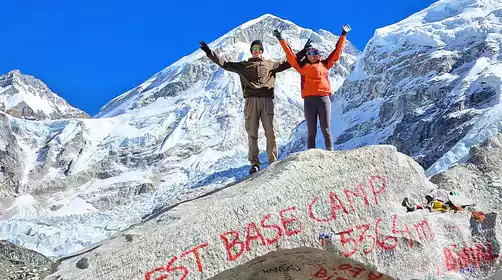
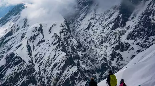
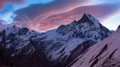
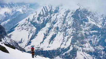
After another gentle climb of about two hours, we'll reach our destination, Annapurna Base Camp (4,130 meters). This amphitheater-like setting offers a 360-degree, unobstructed view of the snow-capped mountains. At night, a vast starry sky opens, and meteors streak across the sky, leaving behind a dazzling white glow. Here, you'll truly experience what it's like to be surrounded by snow-capped mountains, and you'll truly feel how close heaven is.
Day 6 Annapurna Base Camp ABC (4130m) → Bamboo (2310m)
All day
Hiking distance: about 16 kilometers
Cumulative elevation: +100m; -1920m
Maximum altitude: 4130m
Estimated time: about 7-8 hours
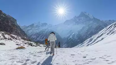
Today is the highlight of our trip!!! Weather permitting, we'll be treated to an unparalleled view of the golden mountains at breakfast. The sun slowly spreads from Annapurna to Annapurna South, finally casting a 360-degree radiance on all the snow-capped peaks, ablaze with golden and orange light. All the hard work melts away in that moment. While you're excited to take photos, be mindful of any strenuous activity, as we're already at an altitude of over 4,000 meters.
After enjoying and photographing to our heart's content, we began our return journey. Perhaps you still felt a little unsatisfied, perhaps you'd like to linger a little longer, but the beauty has already etched itself in your mind, a moment you'll never forget. As the blazing sun gradually paints the cold snowy peaks red, the earth feels the warmth of the sun, marking the beginning of a new day's journey, a moment that shakes the soul to its core. We bid farewell to ABC and began our descent. Although the journey was long today, the downhill slope didn't feel strenuous at all.
We stayed at [Bamboo (2310 meters)] at night and fell asleep peacefully with the snow-capped mountains as our pillow.
Day 7 Bamboo (2310m) → Jhinu (1730m) → Pokhara
All day
Driving time: 3.5 hours
Hiking distance: about 10 kilometers
Cumulative elevation: -1000m; +420m
Maximum altitude: 2310m
Estimated time: About 5 hours
Today's journey continues downhill. While it will feel easy, the descent can be very strenuous on the knees, so please be careful not to rush or walk too fast. After about five hours, we'll reach Kihnu and then drive back to Pokhara, where we'll check into a comfortable hotel. We'll relax with a massage. In the evening, we'll celebrate our five days with a celebration dinner, where we'll reminisce about the memorable moments of the past five days! You don't need many trips like this; just one is enough to savor for a long time, even a lifetime to fully appreciate its meaning.
After leaving the Annapurna Mountains, if you don't need any equipment or clothes after hiking, you can leave them for the porters. They go in and out of the mountains all year round, and their equipment wears out a lot and their income is limited. It is also important to note that after five days of hiking, the porters are very tired. Foreign countries pay special attention to the tipping system, and porters' tips are one of their important sources of income. China-TravelNote has paid the corresponding part for everyone, but hikers still need to pay a part in person as a recognition of the porters' hard work.
Tip reference
Porter reference: US$5 per day per member
Guide reference: US$10 per day per member
Day 8 Pokhara★ Disbandment Day
All day
Today is the day to disband. Choose your return flight or car based on your needs. Friendly reminder: Please arrive at the airport three hours in advance for international flights to check in. If you have the means, you can also book a small flight from Pokhara to Kathmandu (25 minutes) to avoid the hassle of taking a bus. If necessary, please contact the staff to book your flight.
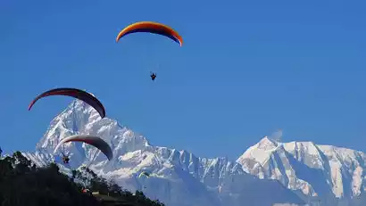
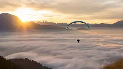
Tourists who aren't in a rush to return home can relax and explore Pokhara, browsing the unique Nepalese shops, enjoying a cup of coffee, or continuing their journey. Alternatively, if the weather cooperates, they can go paragliding. As a world-renowned paragliding destination, many travelers who visit Pokhara hope to experience a flight and see the beautiful Phewa Lake and the Annapurna Mountains from a different perspective.
Recommended tours:
If you have extra time: Continue your journey
to Patan in the Kathmandu Valley and immerse yourself in medieval culture.
Head to Chitwan, the largest virgin forest in South Asia, and traverse the forest to track the precious white rhinoceros, crocodiles, black bears, and Bengal tigers
If you like Buddhist culture, you can go to Lumbini, the birthplace of Buddha, and experience the religious charm there.