Day 1 Kathmandu ★Meeting day
All day
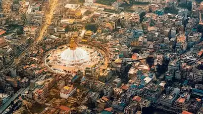
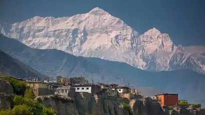
Tourists from all over the world are drawn to the snow-capped mountains and come to Nepal, a small country at the southern foot of the Himalayas. Upon arrival, you will be picked up from the airport (one free pick-up per registration for two or more people) and then check in at your hotel in Kathmandu.
How to get there
There are many flights to Kathmandu (Tribhuvan International Airport, airport code KTM) where you can choose from. We recommend purchasing direct flights from all over the country to Kathmandu:
Direct flights to Kathmandu from many domestic cities (Chengdu, Beijing, Kunming, Guangzhou, etc.)
In addition, you can choose to connect. If you buy a connecting flight, please pay attention to the time between the two flights: usually more than 3 hours. This will prevent you from missing your flight due to delays.
丨Physical fitness & experience requirements
Age: 18-65
Physical fitness: Ability to hike 20 kilometers a day and climb more than 1,000 meters
Experience: Experience hiking at altitudes above 4,000 meters
Route reference: Gongga Grand Loop, Yading Grand Pilgrimage, Meili North Slope, Haba Snow Mountain, etc.

Day 2 Kathmandu → Besisahar (820m) → Chame (2710m)
All day
Driving distance: Kathmandu to Camellia is about 230 km and takes about 10 hours
After breakfast we drive from Kathmandu, along the beautiful Kathmandu Valley and Trishuli River. When the weather is fine, we can see the spectacular snow-capped mountains along the way.
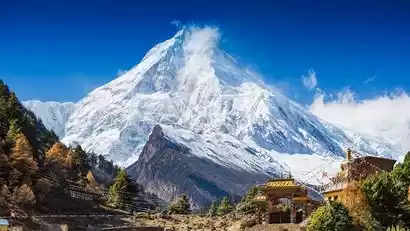
We had lunch at Besisahar, which was once the starting point of the Grand Circuit hike. In the afternoon, we drove to Chame, the starting point of this hike. Along the way, we could see the unique rural scenery of Nepal: vegetation, rivers, villages, farmland and high mountains. Nearby is the Manang Valley in the Himalayas, from which we can appreciate the Lamjung Himal (6900m), Annapurna II (7555m above sea level) and Annapurna IV (7525m) from a unique perspective.
As night falls, Annapurna South, at an altitude of 7,219 meters, shines particularly brightly against the starry sky. You can enjoy the tranquility of the mountains at night!
Day 3: Chame (2620m) → Bhratang (2850m) → Pisang (3210m)
All day
Hiking distance: about 14 km
Hiking time: about 8 hours
Cumulative lift: +900M/-270M
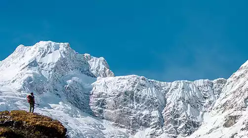
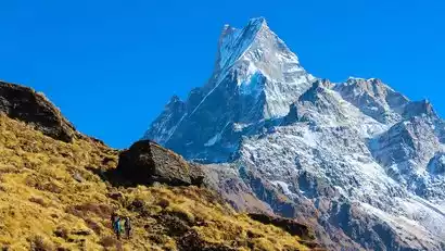
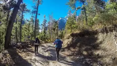
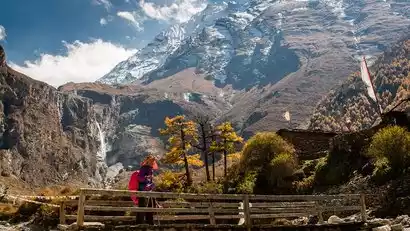
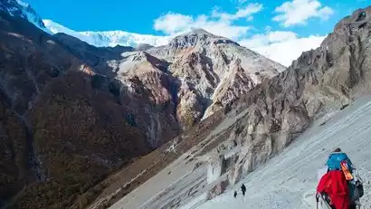
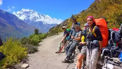
Today marks the first official day of our trek. We geared up, filled our water bottles, and headed for our destination. The scenery along the way was breathtaking. As we followed the river corridor, we were greeted by exotic landscapes, and everyone enjoyed taking photos. As we ascended, we could feel the peaks of Annapurna staring down at us. Nothing could compare to the majestic peaks and tranquil scenery surrounding us.
The initial journey begins with a 400-meter ascent, following a steep uphill path through dense forest. At the end of the dense forest, we are surrounded by the majestic Himalayan peaks, stretching from Manaslu to Annapurna. We hike past the local Gurung village and through breathtaking alpine valleys. Upon reaching Bhratang, we'll see Paungda Danda Rock, a renowned, polished rock face rising over 1,000 meters from the flat ground. After an hour's hike, we reach our destination, Upper Pisang, a beautiful Tibetan village. Due to Nepal's climate, the area is in bloom year-round, a truly breathtaking sight. The clean gravel roads and the friendly faces along the way will make you forget the fatigue of the journey, and it also serves as a great viewing platform.
Day 4 Pisang → Manang (3540m)
All day
Hiking distance: about 16 km
Hiking time: about 10 hours
Cumulative lift: +700M/-500M
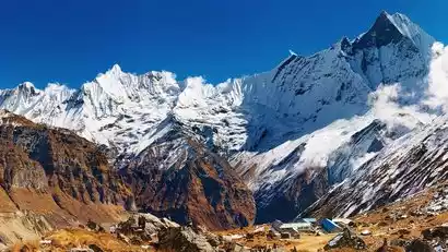
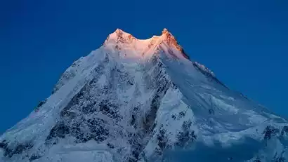
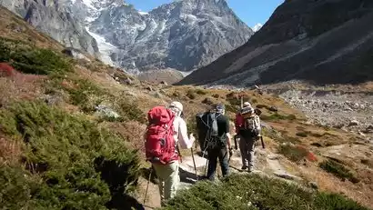
From Upper Pisang, you can see Annapurna's four peaks and Annapurna II. Below Annapurna II is the famous Monkey Face, as well as Ganggapurna and Tarke Gyang. After breakfast, we set off along the river valley. The scenery along the way was incredibly layered. It's incredible to see the lush, colorful jungle at the foot of the snow-capped mountains at this altitude!
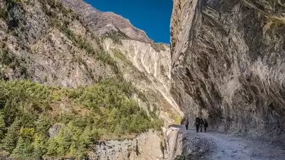
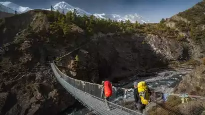
We hiked in the secret valley of the Marsyangdi River. The trail was lined with thick buttress plants and vines entwined on both sides. Occasionally, mules and horses carrying supplies passed by. They were carrying food for all hikers to consume in the hotel. Mule bells rang, wild cherry blossoms were everywhere, and European and American tourists often jumped into the waterfalls and streams dotted in the woods. After 6 hours of hiking, of course you will feel a little tired, but every few steps you will see a very beautiful little inn where you can sit down and have a cup of hot coffee or hot lemon. We advocate an immersive travel. We arrived at Manang on the big loop.
Day 5 Manang → Khangsar → Sri Kharka (3900m)
All day
Hiking distance: about 10KM
Hiking time: about 6 hours
Cumulative elevation: +550M
Today's journey is shorter, about 4 hours of hiking, mainly to allow everyone to adapt to the plateau, but the scenery along the way is beautiful. You can see the Annapurna Mountains and the canyon scenery, and continue to move towards the west of Manang.
The hiking trail descends along the riverside, crossing the Khangsar River to reach Khangsar, a traditional village known as "Nepal's Last Village." If you time it right, around April each year, you'll be treated to a vibrant display of rhododendrons—nine species, to be exact—blooming along the path, creating a breathtaking spectacle. The rhododendron is Nepal's national flower, and stumbling upon a vast expanse of it during this season is truly a stroke of luck. And if that's not enough, the area is home to 100 mammal species, 60 reptile and amphibian species, and over 450 other species.
We rested briefly here before continuing along the gentle, easy trail to Sri Kharka. Walking there, we felt like we were transported to the world of Avatar. Along the way, we visited several ancient temples still thriving deep in the mountains. We checked into the inn, rested, and sipped fragrant coffee by the fire, gazing out at the snow-capped mountains.
Day 6 Sri Kharka (3900m) → Tilicho Base Camp (4200m)
All day
Hiking distance: about 6 km
Hiking time: about 4 hours
Cumulative lift: +500M
Today's hike was also short, lasting about four hours. However, we passed through a dangerous landslide area, so we needed to be extremely careful and follow the guide and other staff carefully. After crossing a pass, we descended to the canyon floor, where we could see Binghu Creek. From there, things got easier, and we continued a short hike to Binghu Base Camp.
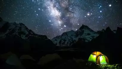
Check in at [Tilicho Base Camp] at night. If you are a photography enthusiast, please prepare your camera so that you can take pictures of the beautiful starry sky.
Day 7 Tilicho Base Camp → Tilicho Lake → Sri Kharka (3900m)
All day
Hiking distance: about 20 km
Hiking time: about 10 hours
Cumulative lift: +1200M/-1260M
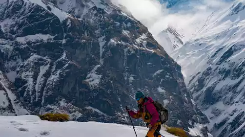
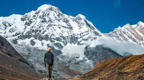
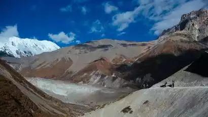
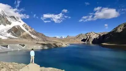
We set off at first light to avoid the strong winds that would otherwise entangle us on the icy lake. After a 3-4 hour hike, we reached Tilicho Lake, the world's highest glacial lake. As the scorching sun gradually stained the icy peaks red, the earth felt the warmth of the sun, marking the beginning of a new day of life, a truly soul-stirring experience. The snow-capped mountains and stunning icy lakes along the way offered a breathtaking experience unlike anything we'd experienced in the previous few days.
We lingered at the glacier lake for a while, enjoying and photographing to our heart's content, before heading back. Perhaps you'd still be reluctant to leave, perhaps even lingering a little longer, but the beauty has already etched itself in your mind, a moment you'll never forget. We then returned by the same route to the glacier lake base camp for lunch. After lunch, we continued our descent to Srikharkas. With the snow-capped mountains as our pillow, we drifted off to a peaceful sleep.
Day 8 Sri Kharka (3900m) → Yak Kharka (4050m)
All day
Hiking distance: about 12 km
Hiking time: about 6 hours
Cumulative lift: +600M/-620M
Today we are going back to the ACT Grand Loop. There are fewer people walking this section and the trail is not very obvious. Everyone should follow the guide and try to walk together.
After breakfast we started hiking. The road was flat in the morning. We passed through a cypress bush and then went down a steep slope to the Jharsang Stream. From here we returned to the classic hiking trail of ACT and finally reached the Yak Kharka Yak Farm at an altitude of 4,000 meters.
Day 9 Yak Kharka (4090m) → Thorung Phedi → High Camp (4850m)
All day
Hiking distance: about 9 km
Hiking time: about 8 hours
Cumulative elevation: +900M
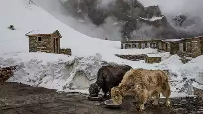
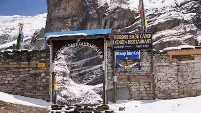
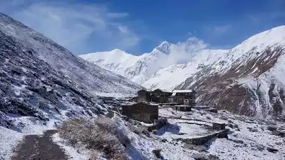
After breakfast, we'll head to Thorung Phedi. Phedi means "foot of the mountain" in Sherpa. We'll have lunch here and then make the 1.5-hour climb to High Camp in the afternoon, making it easier to cross the pass the next day. We'll also stay here, where the unique sea and barren landscape create a unique snow-capped mountain landscape.
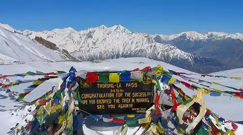
Day 10 High Camp → ThorongLa Pass (5416m) → Muktinath (3800m)
All day
Hiking distance: about 14 km
Hiking time: about 8 hours
Cumulative lift: +530M/-1780M
We set off at 5 am and after 3 hours of hiking, we arrived at the world's largest pass - [ThorongLa Pass], where there are many peaks and the scenery is very spectacular.
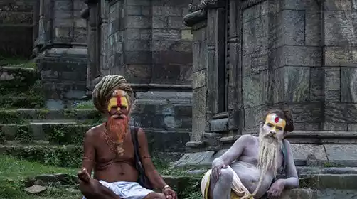
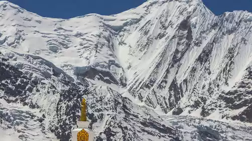
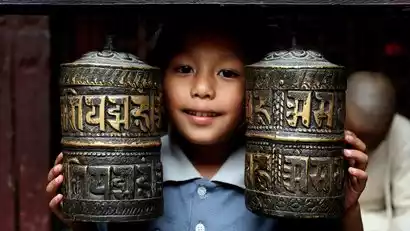
This will be an exciting and unforgettable day on the Annapurna Circuit! We'll cross the Tolung Pass at 5,416 meters, a high-altitude hike that promises to be incredibly challenging. However, we'll overcome all obstacles amidst the stunning views of the Himalayas. In the evening, we'll reach the village of Muktinath in Lower Mustang. The descent is steep, so be careful with your knees. Muktinath is a sacred site for both Hindu and Buddhist pilgrims, showcasing both religious traditions and architecture. A small Buddhist temple surrounded by 108 water spouts is a unique local architectural feature. After the hike, join our China-TravelNote tour guide for a closer look.
After leaving the Annapurna Mountains, if you no longer need any equipment or clothes after hiking, you can leave them for the porters. They go in and out of the mountains all year round, so their equipment wears out a lot and their income is limited. It is important to note that porters work very hard. Foreign countries attach great importance to the tipping system, and porters' tips are one of their important sources of income. China-TravelNote has paid the corresponding part for everyone, but hikers still need to pay a part in person as a recognition of the porters' hard work. Tips are recommended for each team member US$5/person/day
Day 11 Muktinath → Pokhara (820m)
All day
Driving distance: Muktinath-Pokhara is about 200 kilometers, about 7 hours
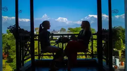
Early in the morning, we returned to Pokhara, a world-renowned tourist destination, by off-road vehicle. The lush forests, turbulent rivers, crystal-clear lakes, and winding rural scenery, along with the majestic Annapurna Mountains (its highest peak exceeds 8,000 meters) towering to the north, captivate visitors from around the world. The northern shore of Phewa Lake is home to the tourist-heavy Phewa Lakeside area, the heart of the scenic area. Most hotels and restaurants are located along the lakeside, known as the Lakeside District. Like the Thamel District, this area is a popular gathering place for local and international tourists.
Day 12 Pokhara★ Disbandment Day
All day
Today is the day for disbanding. You can choose the return flight/car according to your needs.
Tourists who aren't in a rush to return home can relax and explore Pokhara, browsing the unique Nepalese shops, enjoying a cup of coffee, or continuing their journey. Alternatively, if the weather cooperates, they can go paragliding. As a world-renowned paragliding destination, many travelers who visit Pokhara hope to experience a flight and see the beautiful Phewa Lake and the Annapurna Mountains from a different perspective.
Tips: For international flights, please arrive at the airport 3 hours in advance to check in.
1. Currently, Kathmandu is the only city in Nepal that has direct domestic flights. For international flights, please arrive at the airport 3 hours in advance to check in.
2. From Pokhara to Kathmandu, you can choose to take a small plane (about a 25-minute flight) or a tourist bus (the road from Pokhara to Kathmandu is currently under construction and the road conditions are poor. The journey is 200 kilometers and takes about 8-10 hours).