Day 1 Various locations → → Lhasa ★ Gathering day
All day
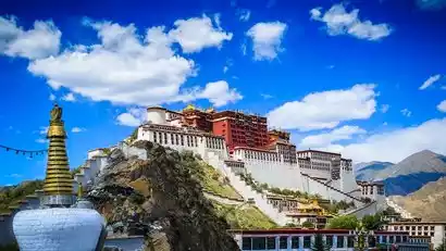
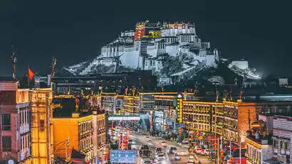
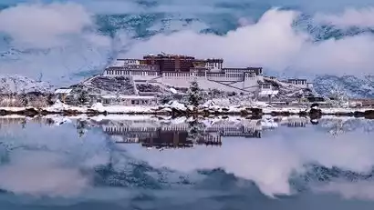
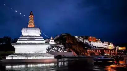
Today is a full-day gathering day. Tourists from all over the country will arrive in Lhasa according to their own transportation methods. They will proceed to the meeting hotel and check in by submitting their "China-Travel Note + Name" form. After check-in, it is recommended to rest and acclimate to the plateau to prepare for the upcoming tour. Tourists in good physical condition can freely explore Lhasa city for photography. Recommended locations include the Potala Palace Yaowang Mountain Observation Deck, Zongjiao Lukang Park, Jokhang Temple Square, and Barkhor Ancient City. Due to the high altitude of this activity, it is strongly recommended that tourists arrive in Lhasa in advance to acclimate and minimize the effects of altitude sickness.
Day 2 Lhasa → Niyang River Valley → Yarlung Zangbo Grand Canyon → Suosong Village
·morning
After breakfast, we'll depart for a two-hour drive across the Mila Pass (5,013 meters) and officially enter Nyingchi. Continuing on, we'll reach the northern bank where the Niyang River merges into the Yarlung Zangbo River. Here, the Niyang River Valley, a braided channel carved by sandbanks, green willows, pastures, and grasslands, evokes the tranquil and graceful beauty of a Jiangnan water village. We'll follow the Niyang River, the mother river of Nyingchi, to the Yarlung Zangbo Grand Canyon, stopping at the Niyang River Valley Observation Deck for photos and stunning views of the Yarlung Zangbo River.
·afternoon
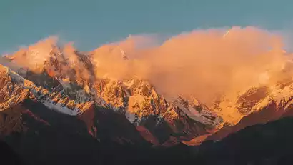
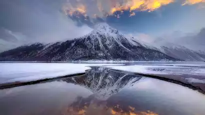
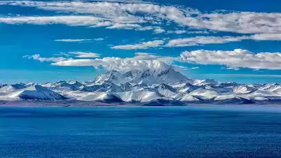
At dusk, we came to the viewing platform of Mount Namjagbarwa to take pictures of the sunset over the Yarlung Zangbo Grand Canyon and the golden sunset over Mount Namjagbarwa.
Stay at the characteristic inn in Suosong Village that night.
Day 3: Suosong Village → Sejila Mountain Pass → Lulang
·morning
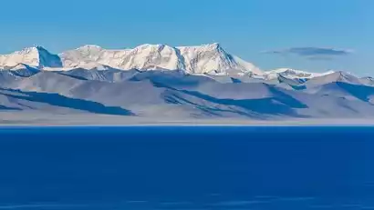
Wake up to the idyllic scenery of snow-capped mountains, the chirping of birds, and the fragrance of flowers. Take morning photos of Mount Namjagbarwa and the Grand Canyon at dawn. This breathtaking scenery is truly breathtaking. Standing on the Jiangya Observation Deck, you can admire Mount Namjagbarwa to your left, the snow-capped Doxiong La Mountains to your right, the mighty Yarlung Zangbo River surging through, and the valley dotted with cattle and sheep. The scenery is breathtaking. The valley is dyed red by red willows and sea buckthorn, creating a breathtaking spectacle.
·afternoon
After noon, we will leave the Grand Canyon and bid farewell to the secluded paradise of the Grand Canyon. We will cross the Sejila Pass at an altitude of 4,702 meters and stop at the pass to take photos. We will have the opportunity to see the true appearance of Mount Namjagbarwa and Mount Kalabai!
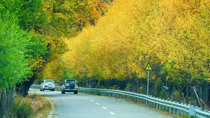
After crossing the pass, we descended into Lulang Town for a colorful autumn forest and rural photography tour. Here, nestled against the backdrop of snow-capped mountains, lies Zaxigang Village, home to herds of cattle and sheep, where a traditional agricultural and pastoral lifestyle persists. Beneath the mountain lies a vast sea of forest, shrouded in white clouds like Hadas. Tall, groves of cycad pines spread out in layers, covering the entire mountain range. Gazing at the mist-shrouded snow-capped mountains in the distance, I gazed back amidst the hearty downpour. Quietly gazing at the surrounding beauty, I felt as if I had become a pastoral poet at the foot of the snow-capped mountains.
Stay in nearby Lulang at night.
Day 4 Lulang → Gangshan Spruce Forest → Ranwu Town
·morning
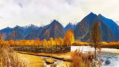
Today we set off from Lulang, accompanied by snow-capped mountains, lakes, shrubs and forests along the way. The whole way is the typical snow-capped mountain valley landscape of eastern Tibet. The height difference of the mountains in autumn creates the unique colorful world of Nyingchi!
First, we went to Gangyun Spruce Forest for sightseeing and photography. This is a small secret place hidden on the Sichuan-Tibet Highway, with an altitude of only 2,700 meters. We walked in the forest, breathing plenty of oxygen to shoot and create.
·afternoon
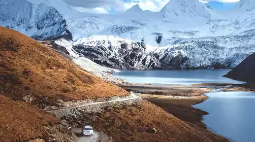
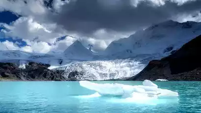
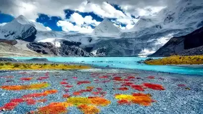
Afterward, we'll sail upstream along the Parlung Tsangpo River to Ranwu Town, where we'll find Ranwu Lake, a renowned highland glacial lake in Tibet. The towering snow-capped mountains, pristine white glaciers, and turquoise waters all showcase its natural beauty. Meet up at the right time to head to Lower Ranwu Lake for photography. Follow the lakeside plank road and ascend to the observation deck to capture the sunset from various angles!
We stayed in Ranwu Town at night.
No. 5 Natural Wuzhen → Jampa Ling Monastery → Qamdo
·morning
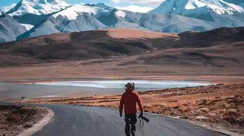
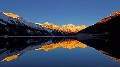
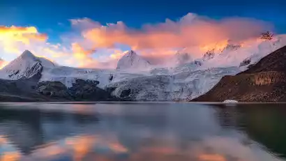
I woke up early today and headed to Upper Ranwu Lake to photograph the morning sunrise. The soft morning light illuminated the hilltops surrounding the lake, and the waters were emerald green and tranquil. In calm weather, it was a great angle to capture the reflections of the snow-capped mountains. The narrow Anmu Co River winds westward for over ten kilometers, gradually narrowing into a valley dotted with rocks and small islands.
·morning
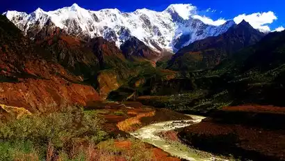
We continue our journey, crossing the 72 bends of the Nu River and the dangerous Hengduan Mountains, admiring the scenery of weathered rocks. On the way down, the pristine forest and rural scenery complement each other, creating a pleasant scenery.
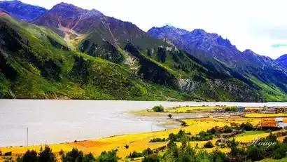
On our way to Qamdo, we crossed the Bangda Grassland, a relatively pristine Tibetan grassland with blue skies and white clouds, meadows and streams, cattle, sheep, and horses – it offers everything a photography enthusiast could want. We took photos as we went, letting our shutters run wild.
·afternoon
Then we will come to Langla Mountain Pass (4572 meters above sea level), where we will stop to take photos. The steep mountains, dense primeval forests at the foot of the mountains, and clear mountain streams, together with the sacred mountain, form a beautiful landscape.
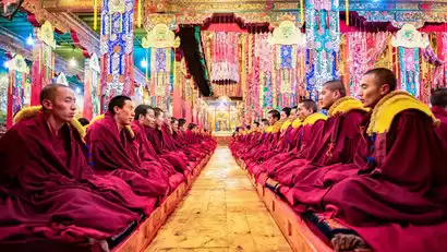
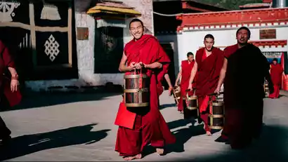
We arrived at the Jampa Ling Monastery (the focal point of today's photography) just in time. The temple embodies a devout faith and rich cultural themes, with red clay, red walls, and red-robed monks. Entering the temple, you can see countless monks sitting in the spacious Buddhist halls within the high-walled courtyards, a truly spectacular sight. (Please respect the temple's customs and do not offend the practicing monks.)
We will stay in Qamdo that night, a large city in eastern Tibet. Tourists who still have enough energy can meet up to take photos of the night view of Qamdo.
Day 6: Qamdo → Zizhu Monastery → Dingqing
·morning
After breakfast, we set out to shoot at the Kamado Pagoda Forest Temple, an ancient building built more than 800 years ago. It still stands tall after going through the baptism of time and has maintained the square shape of the early pagoda. In Tibetan, it is interpreted as a tower like a house.
·afternoon
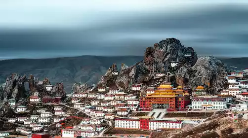
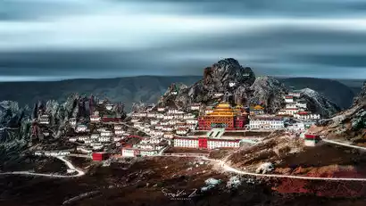
Afterwards, we headed to Tsezhu Monastery to photograph Tibet's "Sky City." Built 3,000 years ago, Tsezhu Monastery is one of the oldest and most important monasteries of the Bon religion. This was a key photo spot on our trip. Following our guide, we first ascended Tsezhu Mountain to capture the temple's details and cultural heritage from within. We then returned to our photo spot, awaiting sunset to capture panoramic views of Tsezhu Monastery and Tsezhu Mountain.
After the filming, we went to Dingqing County to stay.
Day 7 Dingqing → Buga Snow Mountain → Baqing
All day
Today we drove along G317, taking photos as we went, quietly watching the autumn colors in front of us. Both sides of the road were full of poetry and distant views.
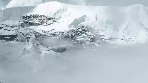
Arrive at the glacial secrets of Buga Snow Mountain. Standing at 6,328 meters, Buga is the highest peak in the eastern section of the Tanggula Mountains, capped year-round by snow. This time, we'll explore the Poge Glacier on Buga's southern slopes. It's the longest of the five intact hanging glaciers, with a drop of over 2,100 meters.
After the filming tour, we drove to Suo County to check in.
Day 8 Bachen → Sap
All day
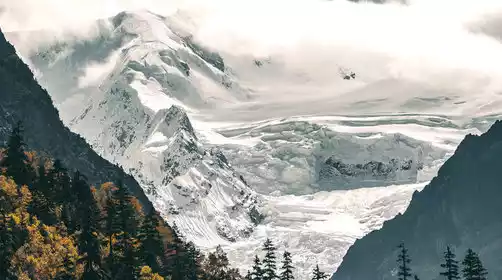
Today marks the highlight of our trip, as we journey to another hidden gem of the snowy mountains: Sapu Sacred Mountain. Known as Sepugangri in Tibetan, Sapu's main peak stands at 6,956 meters. Surrounded by a cluster of uniquely shaped peaks and stunning glaciers, it forms a sacred mountain and lake complex, rich in both cultural heritage and breathtaking beauty.
Today we'll be taking photos. First, follow our guide to capture the magnificent snow-capped mountains and glaciers up close. Then, we'll reach the edge of Samtso Lake to capture the stunning fusion of the sacred lake and mountain. At this point, be sure to set up your camera and quietly wait for the sunset and the glow of the evening glow. Many Tibetan travelers know nothing about Sapu. From a certain angle, Sapu Mountain is even an equilateral triangle, a testament to nature's ability to create such geometric patterns. From a glacier perspective, a massive glacier floats, seemingly resembling an ocean glacier. The dramatic drop in the mountain's glaciers is like the "Great Wall of Despair" in the novel.
China-TravelNote arranged to stay in Sapne that night and wait for the night to fall. If the weather is good, you can take pictures of the starry sky. The plateau at an altitude of 4,600 meters and the starry sky without any light pollution are extremely brilliant.
Day 9 Sap → Damu Monastery → Nagqu
·morning
This morning, we'll continue to the foot of Sap, waiting for the sun to shine upon the sacred mountain and photographing the golden mountain in the sunlight! After a night of calm, the hustle and bustle of the day has dissipated, allowing us to return to a pure moment and savor the present. We'll depart for Nagqu at the appropriate time.
·morning
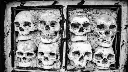
After the photoshoot, we will head to a mysterious temple, Damu Monastery. This is one of the few temples in Tibet that preserves the heads of the deceased after sky burials. China-TravelNote has specially arranged this secret holy place. We hope that everyone will remain respectful when visiting, refrain from making loud noises, and seek permission from the temple management before taking photos.
·afternoon
We then stopped by to photograph the First Bend of the Nu River and stayed in Nagqu city that night.
Day 10 Nagqu → Namtso
·morning
This morning, we drove past the "King on the Throne" Sangdan Kangsang Peak at an altitude of 6,580 meters. He is the guardian deity of Buddhism with infinite power, and the numerous peaks and lakes around him are his attendants.
·morning
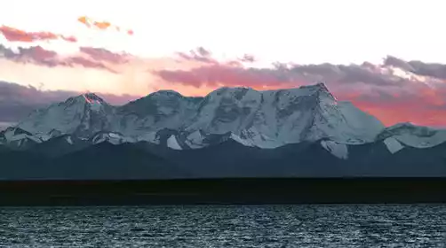
Continue forward and cross the highest point of this trip, Nagenla Pass (5190 meters above sea level), and take a distant view of the Nyainqentanglha Mountains.
·afternoon
In the evening, we arrived at Zaxi Peninsula of Namtso and photographed the sunset over Namtso.
Overnight in Namtso Township.
Day 11 Namtso Township → Lhasa ★ Disbanding day
All day
We'll rise early today and head back to Lhasa, where we'll be transported to the Lhasa Civil Aviation Bus Ticket Office for the final leg of our journey! We'll bid a reluctant farewell to the holy city of Lhasa, depending on your flight or train schedule. If you have extra time, you can explore Barkhor Street and bring back gifts for friends and family. However, bargaining is crucial, and your taste is key. Our advice: have fun with small purchases, but exercise caution with valuables. Tourists staying in Lhasa can book accommodations by clicking the link below.