Day 1 Various locations - Lijiang★Assembly Day
All day
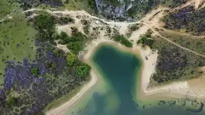
Today is a full-day gathering day. Please proceed to your hotel on your own. After arranging your accommodations, you'll be free to explore Lijiang's Dayan Ancient Town to acclimate to the plateau climate, or enjoy a sunset at Qingxi Reservoir. After dark, the vibrant life of the ancient town is also worth looking forward to.

Day 2 Lijiang → Thousand Lakes Mountain → Shangri-La
All day
Hiking Information
Hiking route: round trip about 12 km, 632 m elevation gain and 632 m descent (hiking starting point 3377 m - Burnt Forest 3960 m - Black Lake 4009 m - hiking starting point 3377 m), about 7 hours;
Luggage information: It is recommended to pack your luggage separately. Use an outdoor backpack to carry necessary items and supplies. Large luggage can be stored on the tour vehicle.
Meal information: There will be no supplies along the way that day, so you need to bring your own lunch and drinking water.
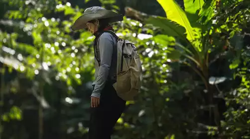
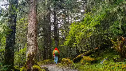
Hiking in Qianhu Mountain, wandering through alpine forests and lakes
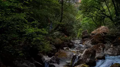
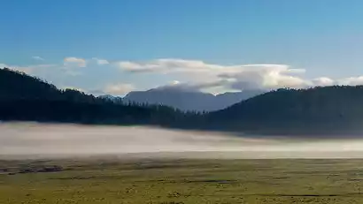
After breakfast, we departed for Qianhu Mountain. After passing the forest ranger station, we entered the forested area. A short hike up the mountain, amidst towering fir and spruce trees, was a truly captivating experience. As we gradually entered the heart of Qianhu Mountain, alpine marsh wetlands began to emerge. From May to June, plateau azaleas begin to bloom. The forest edges and within the forests are dominated by large, vibrant corollas of yellow, red, and white azaleas. The meadows, however, are carpeted with dense, intertwined clumps of dwarf azaleas, forming a stunning purple-red carpet. In summer and autumn, a variety of small wildflowers, such as primroses and southwestern irises, sway in the wind above the wetlands.
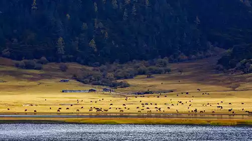
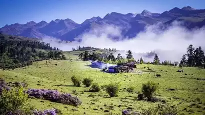
We will hike to the Burnt Forest, check in and take photos there, and then arrive at the Black Lake. Along the way, the undulating pastures are blooming with colorful flowers, and cattle and sheep are leisurely grazing on the grass. The cabins on the meadows and the clear mountain lakes make it seem like entering a fairyland in the clouds.
Day 3 Shangri-La → Niru Village → Colorful Waterfall → Niru Village
All day
Hiking Information
Hiking route: approximately 13 km, with an altitude climb of 407 meters and a descent of 407 meters (starting point 2839 meters - Xiadiaoge Pass 3246 meters - Xiadiaoge Ranch 3139 meters - Qicai Waterfall 3000 meters - end point 2839 meters), about 6 hours. There are many downhill slopes on the day, so knee pads are recommended.
Luggage information: It is recommended to pack your luggage separately. Use an outdoor backpack to carry necessary items and supplies. Large luggage can be stored in the village inn or on the tour vehicle.
Meal information: There will be no supplies along the way that day, so you need to bring your own lunch and drinking water.
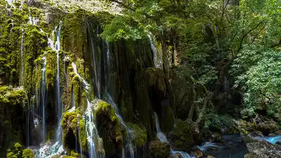
Colorful waterfall loop, encounter large and small pearls falling on a jade plate
After breakfast, depart for Niru Village. Upon arrival, begin the hike to the Colorful Waterfalls. Follow the mountain horse trail to the Colorful Waterfalls, weaving through the tranquil forest. Upon reaching the waterfall, take in the stunning photo opportunity. The water drips like pearls from the lichen-covered rock faces, evoking the allure of pearls falling on a jade plate. Then, follow the plank road built along the river valley back to Niru Village, enjoying the canyon scenery along the way. The lush vegetation along the riverbanks, the blooming flowers and green leaves in spring and summer, and the vibrant yellow and red maple trees in autumn, offer a visual feast.
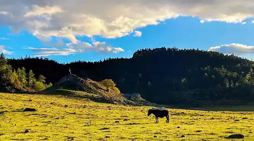
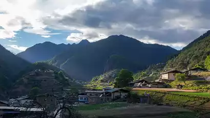
We stayed in Niru Village that night. At sunset, the light slanted across the village and fields, with occasional crowing of chickens and barking of dogs. It felt like we were in a paradise, and we could walk around the village freely.
Day 4 Niru Village → Xirenlong Ranch → Selie Lake → Yellow Sea → Black Sea → Selie Lake
All day
Hiking Information
Hiking route: about 14 km, with an altitude increase of 970 meters (Muyitang Pasture 3050 meters - Xirenlong Pasture 3420 meters - Lizhen Pasture 3500 meters - Selie Lake 4000 meters - Nanbao Pasture 4020 meters), about 8 hours
Meal information: There will be no supplies along the way, so you need to bring your own lunch. Simple meals will be provided at the campsite for dinner.
Luggage information: Pack your luggage in advance. Leave large luggage at the Niru Village Inn. Carry necessary supplies and warm clothes with you. Mountaineering bags will be checked in by luggage horses at Muyitang Ranch. There are 4 people/luggage horse (equipped for D4-D5). The weight of the mountaineering bag should not exceed 15KG.
Camp at Nanbao Ranch and explore the starry sky above the ranch lakes
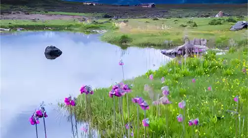
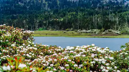
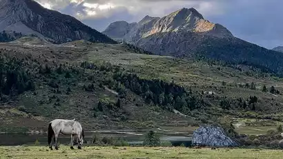
After breakfast, we'll depart. Personal luggage and supplies will be transported to Nanbao Ranch by horseback. We'll only carry food, water, and spare clothing. We'll take a bus to the starting point and begin our light hike. We'll pass Xirenlong Ranch, Lizhen Ranch, and Selie Lake. After setting up camp at a ranch near Selie Lake, we'll head to Nanbao Ranch and explore the Yellow Sea and Black Sea, completing a 1.5-kilometer loop around the lakes. The changing light creates a vibrant, ever-changing landscape for these alpine lakes, and at night, a starry sky awaits.
Day 5: Serie Lake → Shuoer Ranch → Dinglang Lake → Niru Village
All day
Hiking Information
Hiking route: about 10 km, with an altitude drop of about 980 meters (Selie Lake 4000 meters - Shuo'e Pasture 3900 meters - Dinglang Lake Pass 4030 meters - Muyitang Pasture 3050 meters), about 7 hours
Meal information: There will be no supplies along the way, so you need to bring your own lunch
Luggage information: Please carry necessary supplies and warm clothes with you. The mountaineering bag will be checked in by the luggage horse. There are 4 people/luggage horse (equipped for D4-D5). The weight of the mountaineering bag should not exceed 15KG.
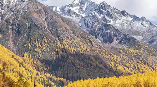
Crossing alpine pastures and forests, different scenery in different seasons
After breakfast at the camp, we packed up and headed back to Niru Village along a different route. After a gentle descent, we arrived at Shuo'e Pasture, where we quietly passed through primeval forest and azalea forests before reaching Dinglang Lake. After circling the lake halfway, we continued downhill, crossed a river valley, and arrived at our starting point for yesterday's hike. The scenery along the way varies with the season. In May and June, azaleas blanket the pasture, while in autumn, the landscape is a stunning display of golden blossoms.
Day 6 Niru Village → Shangri-La → Lijiang ★ Dismissal Day
All day
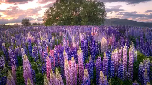
After breakfast, we set out by car and stopped briefly at Xilanpen Pass, where the azalea flowers bloom like a sea during the azalea season. Then we went through Shangri-La to Lijiang city to disband.
In order to facilitate everyone's return, two disbanding points are specially arranged:
1. Disband at the Shangri-La Harmony Tower around 1:00 PM. This location is close to the Shangri-La Airport and High-Speed Railway Station. Returning travelers from Shangri-La on the same day should book flights after 3:00 PM or trains after 2:00 PM.
2. Disband at Lijiang City (near the Blue Sky Hotel, the airport shuttle bus departure point) around 4:00 PM. Returning travelers on the same day should book flights after 7:00 PM or trains after 5:00 PM. For those staying in Lijiang, please book your hotel through China-TravelNote or make your own reservations.