Day 1 Zhengzhou → Huixian → Hankou → Dishui Village → Wangmangling → Xiyagou → Xilian Temple → Baodui Village
All day
Meeting point (boarding point):
6:30 am, at the entrance of Xi'an Hotel, Zhengzhou East High-speed Railway Station (no long-term parking, please arrive early)
7:00 Liuzhuang Subway Station Exit D2 (departs on time, please arrive early)
Please abide by the boarding time. If you are late, we will not wait for you. Please go to the next stop or the last stop on your own.
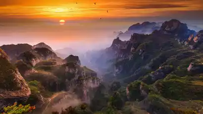
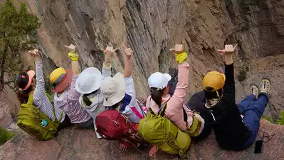
Around 9:15, we arrived at Hankou Village, the starting point of the climb. We warmed up here, took a group photo, and started climbing.
9:45 Passed by a village called Dishuizhai (an ancient village with no access to the road, the last supply point in the morning, and started to climb higher)
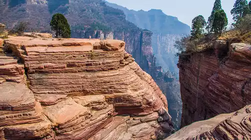
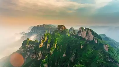
10:40 Arrive at Shuangru Peak of Wangmangling. This place is very beautiful with many viewing platforms. Then start to go down the mountain (do not go to Shiziling. If you add Shiziling to the itinerary, D1 needs to increase by 12 kilometers, which is too strenuous)
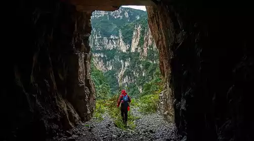
Enter Xiyagou Road around 12:00 (you can choose to hike here or take a villager's van to the entrance of the unlit tunnel. The cost is at your own expense, about 10-15 yuan)
Around 13:30, after crossing the 1.5km cave, we arrived at the Xilian Temple Scenic Area and had lunch with noodles and cold noodles.
At 2:00 PM, we set off for Baodu Village. Baodu, nestled deep in the mountains, is the only village in Shanxi Province without access to a road. The local, wild-raised lamb is renowned far and wide, attracting foodies from far away provinces who journey across mountains and rivers to feast on it. "Lamb is as good as ginseng in winter, and nourishing in spring, summer, and autumn," and having come so far, we couldn't miss this opportunity. If we arrived early, we'd catch the lamb! (˙<>˙)/; if we arrived late, we'd call the farmers and have them prepare the lamb. We could choose from braised, stewed, or grilled options. (ˉ ▽ ˉ)
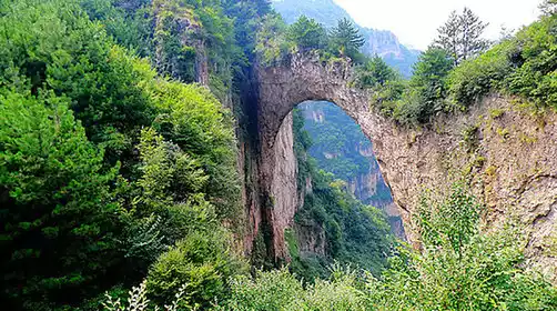
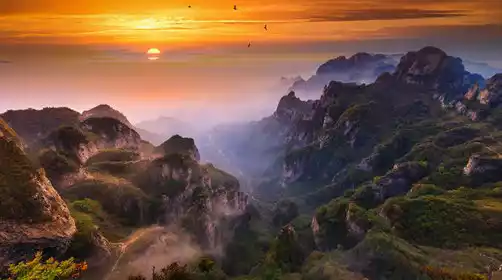
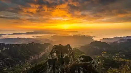
We arrived at Baodu Village around 5:30 PM. If we arrived early, we could visit the nearby Laolongkou, a magical red rock canyon. The river, dripping through the rock, has carved deep grooves. The unique, smooth, germanium-red landscape is breathtaking, a marvel of nature's uncanny handiwork. During the flood season, we can also witness the majestic Longsui Waterfall, with a drop of over 300 meters. We enjoyed ourselves, took photos, and returned to Baodu Village.
The total walking distance is 30km, and if you take a car, you can save 6-7 kilometers
At night, farmers can take a bath to unload the day's fatigue and prepare for the next day's departure (you can go to Laolongkou to see the stars at night, which is a 1 km walk away)
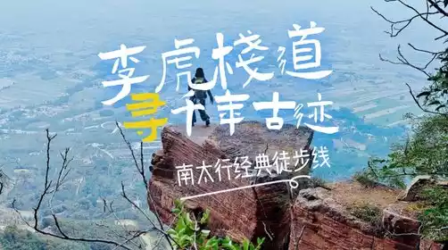
Note: Strong hikers are only recommended to sign up for this full route, otherwise it may affect the experience of fellow hikers. New hikers can sign up for the leisurely South Taihang experience section.
If you are physically exhausted, be sure to follow the leader's advice and descend promptly, avoid rushing to the summit, and take a tricycle to save energy (at your own expense)
Day 2: Baodui Village → Qixiantan → Yixiantian → Mawu Village → Hongdoushan Grand Canyon → Shuangdi Village → Zhengzhou City
All day
At 7:00, I got up in the morning, had breakfast prepared by the farmer, and started to prepare to set off.
At 8:30, we arrived at the undeveloped Qixiantan scenic area. Here, springs flow and waterfalls cascade down from the sky, forming a series of seven deep pools, hence the name Qixingtan.
At 9:30, we headed to Mawu Village, an ancient village deep in the canyon.
Mawu Village is said to have been named after Ma Wu, who established a mountain stronghold here during the late Western Han Dynasty. The village, steeped in pristine natural beauty, is a rare natural ecological park. Upon arrival at Mawu Village, you can restock on water and rations. The road continues through rolling hills, with peaks competing for breathtaking beauty. Entering a canyon, the banks are lined with towering peaks and ancient trees.
Around 11:30, we arrived at the Yew Grand Canyon
Arrive at Shuangdi Village (the end of the trip) around 13:30-14:30, and return to Zhengzhou after lunch.
Arriving in Zhengzhou city around 16:30, we will stop at the boarding points one by one and kiss goodbye with tears
If you are catching a high-speed train and your trip is approaching, the bus will prioritize the fastest speed (elevated throughout the journey) and reach Zhengzhou High-speed Railway Station first to provide convenience for out-of-town tourists!
It is recommended to buy high-speed rail tickets after 17:00