Live Your Best Lives
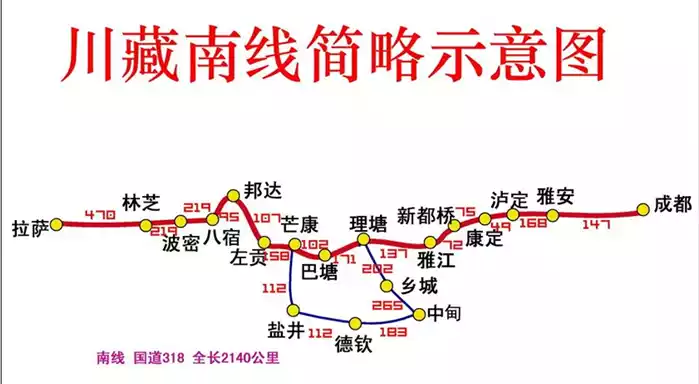
Looking for the stamp traces of the secret land in western Sichuan
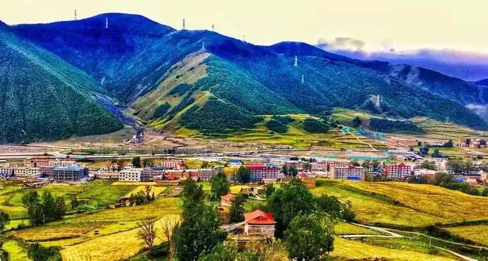
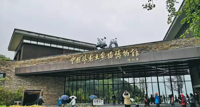
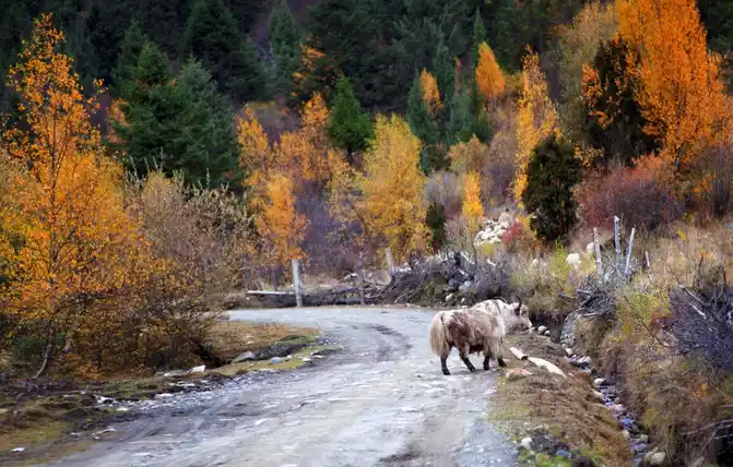
Hengduan Mountain is the most densely scenic place in China, and the extrusion and collision of the Qinghai-Tibet Plateau and the Sichuan Basin have formed a vast plateau and continuous mountains in western Sichuan. Mountains and canyons are adjacent here, and clear springs meet rapids. From the water color of Jiuzhai Huanglong, to the Wolong Nature Reserve inhabited by the national treasure giant panda, from Aden, the pure land of the world, to the majestic Gongga Mountain, the highest peak of Hengduan Mountain, a number of fascinating beauties gather on the western Sichuan Plateau. So western Sichuan became a travel mecca that I went to again and again.
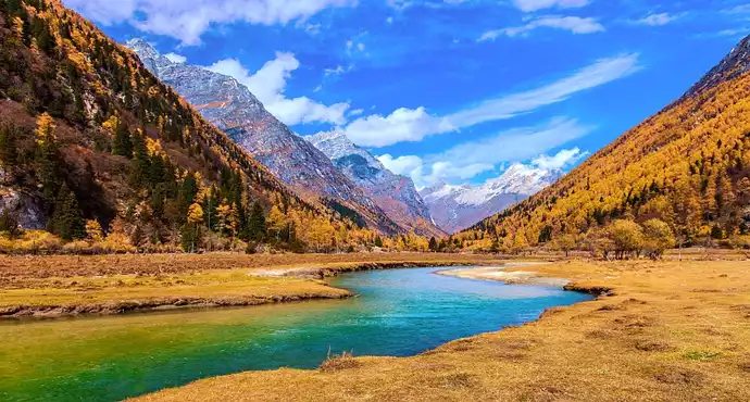
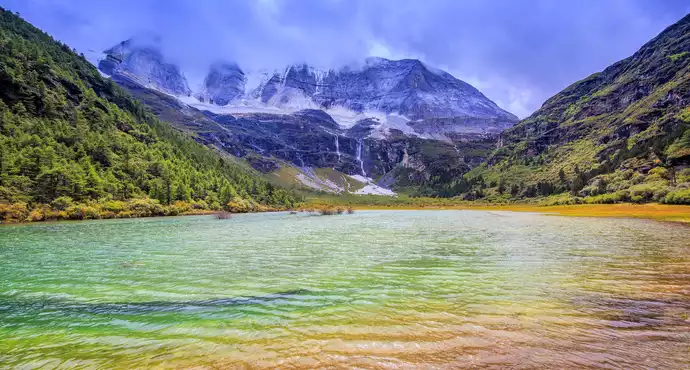
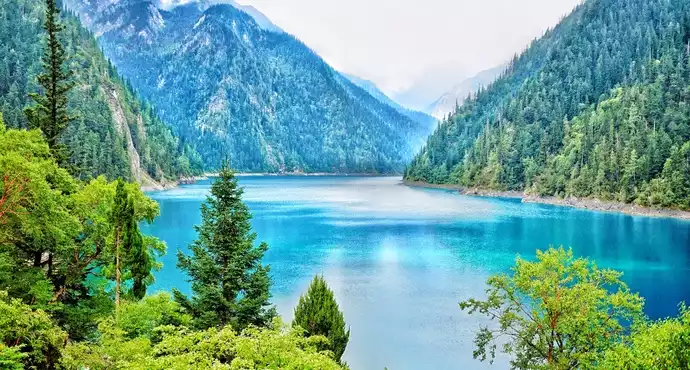
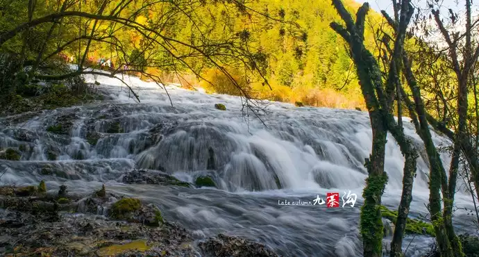
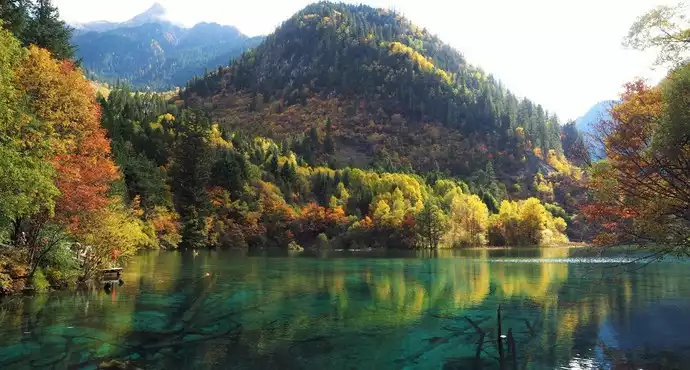
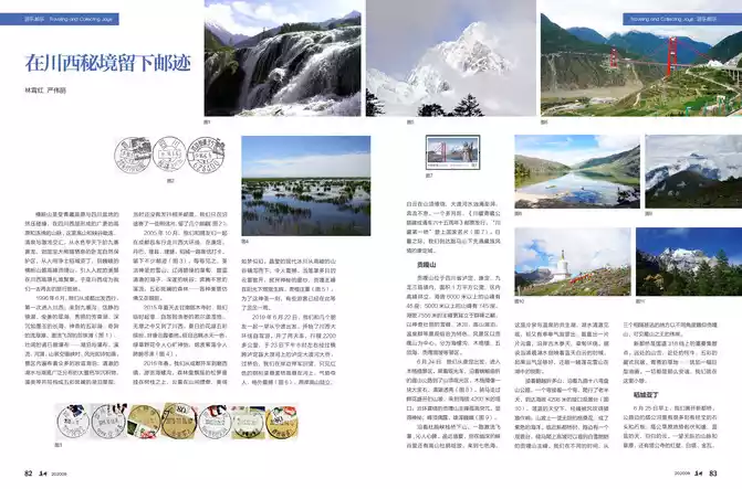
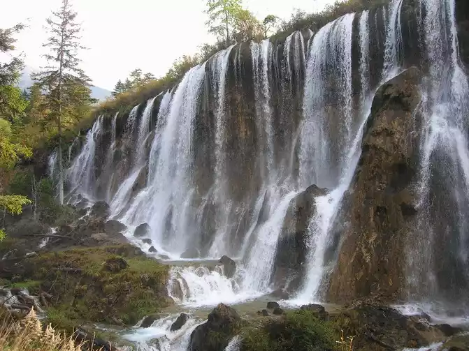
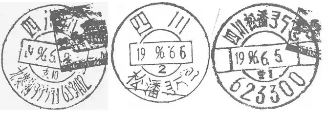
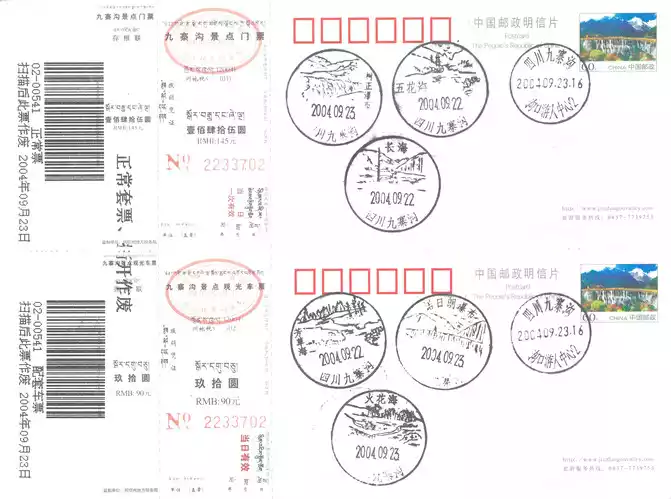
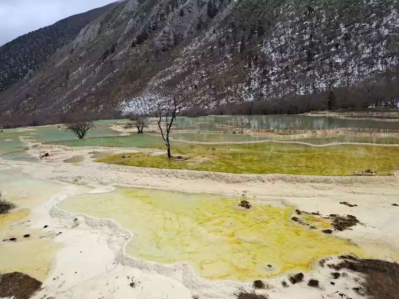
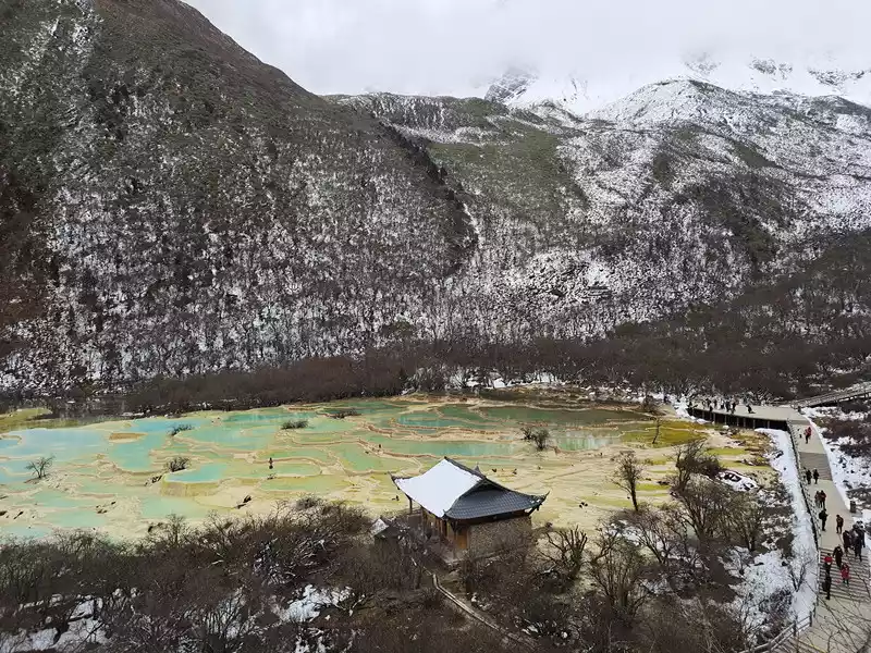
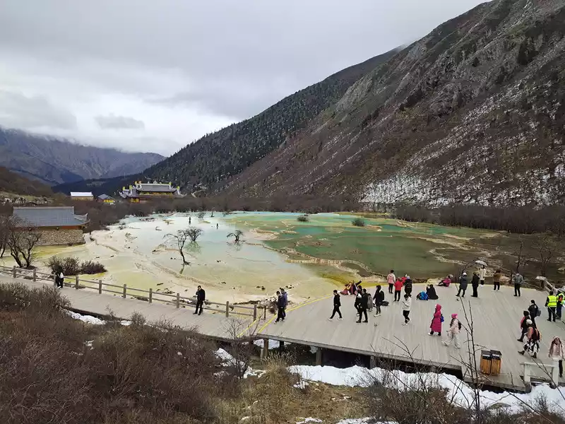
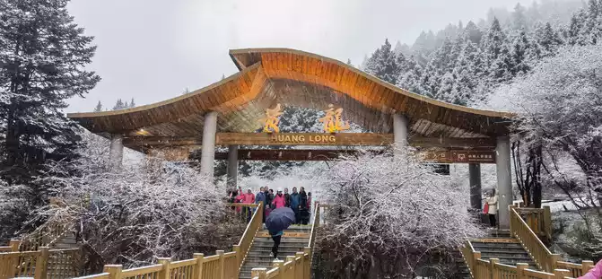
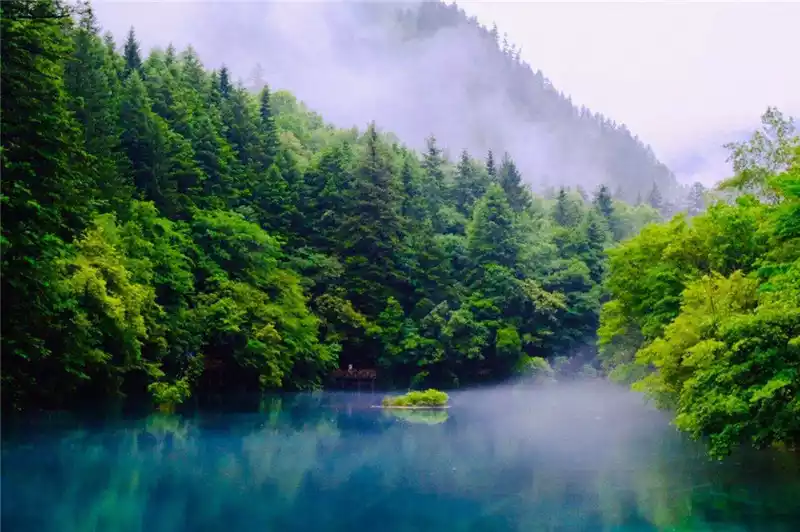
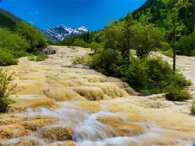
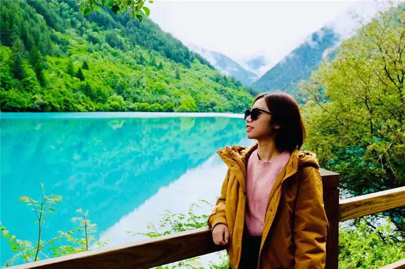
In June 1996, he set off from Chengdu and headed west, entered western Sichuan for the first time, and came to the fairy tale world of Jiuzhaigou. The tranquil mirror lake, the handsome green lake, the beautiful grass lake, the deep sea like ink jade, the magical colorful lake, the strange flowing green beach, the pearl beach with the rushing water (Figure 1), and the magnificent Norilang Waterfall...... lakes and waterfalls, streams, river beaches, and mountain springs are intertwined, and the scenery is picturesque; Under the top of Xuebao, the main peak of Minshan Mountain, the yellow dragon is like a giant calcified slope valley, like a golden "dragon" soaring through the world. The scenic area is dotted with many karst lakes, the clear lake water and a large number of travertine sediments and algae widely distributed at the bottom of the lake together form a colorful lake landscape, large and small pools, under the sunlight, shining dazzling waves, forming a colorful Yaochi jade basin. At that time, no relevant stamps were issued, and only some postcards were sent along the way, leaving a few postmarks (Figure 2).
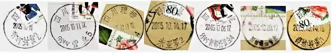
In October 2005, he and his photographers chartered a car in Chengdu to walk the Western Sichuan Grand Ring Road, sending letters and checking in all the way in Kangding, Danba, Lixian, Litang, and Daocheng, leaving a lot of stamps (Figure 3). Every time I see it, the holy and sacred snow-capped mountains, the vast turquoise meadows, the blue and clear sea, the deep canyons, the rushing streams, the colorful forests... All kinds of beautiful scenery seem to be in front of you again.
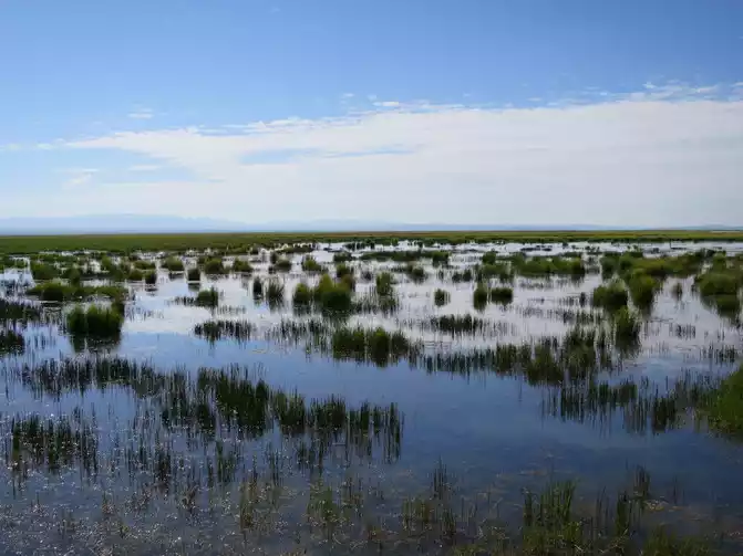
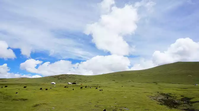
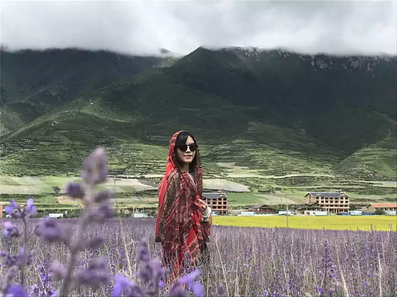
When I went to Langmu Temple in Gannan in the summer of 2015, I decided to drive to the vast Ruoerge Wetland and inadvertently went to western Sichuan. The summer flower lake is full of brilliant flowers, red, pink, yellow, and all kinds of unknown flowers, competing in the green grass. The blue lake water is dyed a faint lotus color, colorful, like clouds on the ground. The extreme view of the water and sky is the same color, the green grass and wildflowers are refreshing, and the smoke and reeds are refreshing (Figure 4).
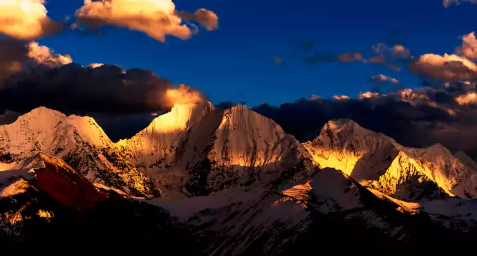
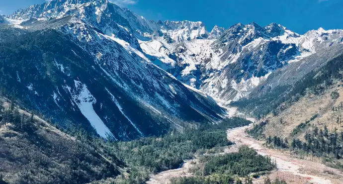
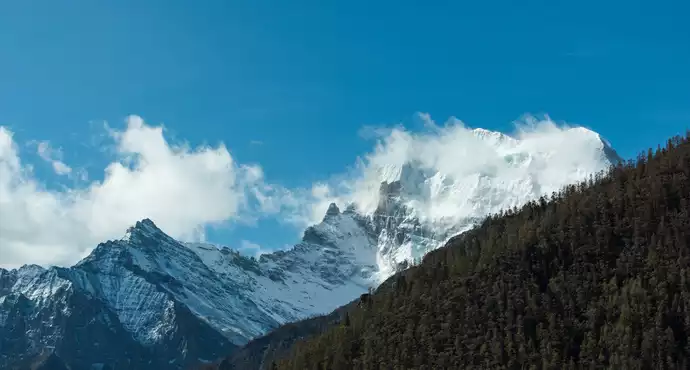
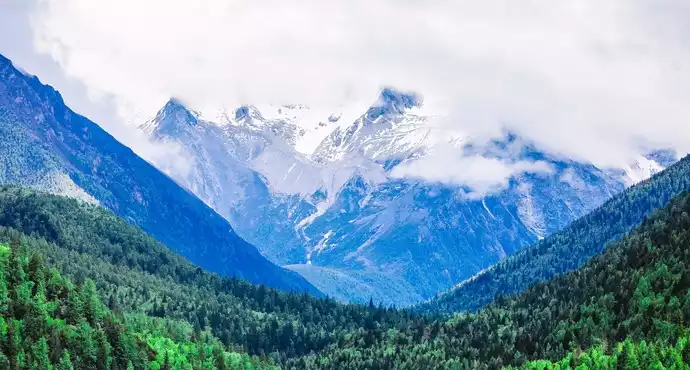
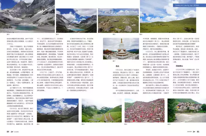
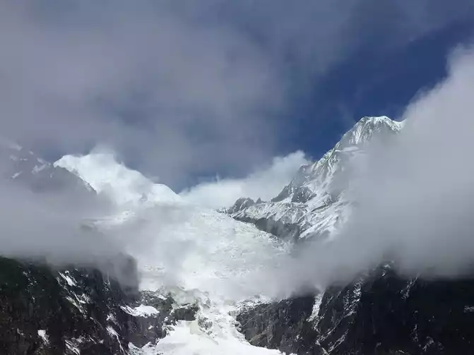
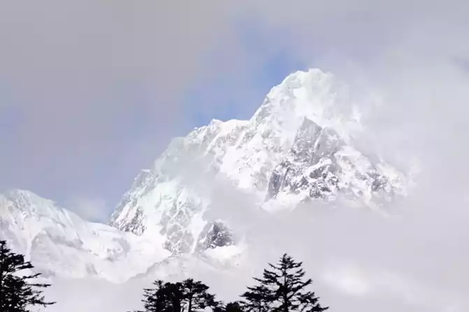
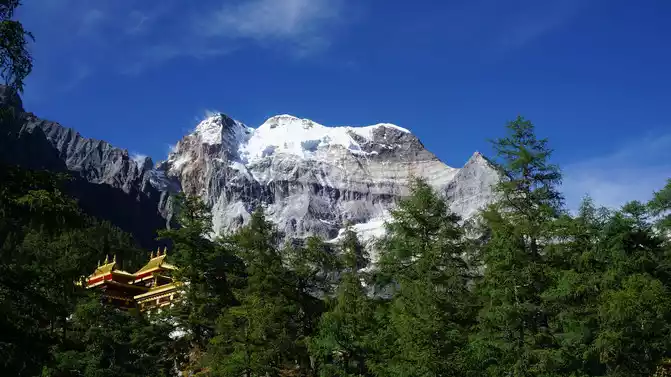
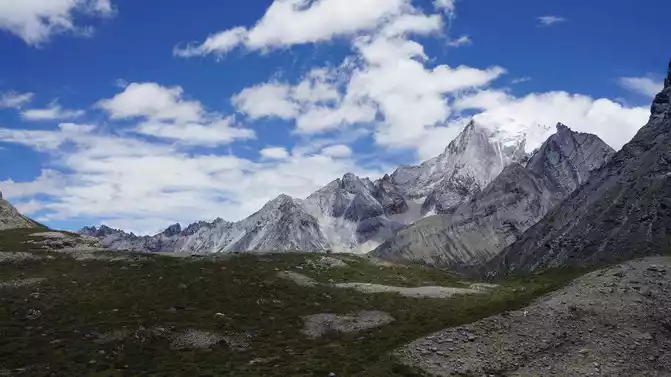
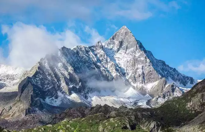
In the spring of 2016, I drove from Chengdu to Moxi Town to visit Hailuogou. The swaying pines and vines in the forest hang on the branches, and the clouds and mist are ethereal in the mountains, which is as beautiful as a dream. Crystal modern glaciers cascading down from high valleys are amazing. When the clouds that had shrouded him for many days dispersed and the veil of mystery was lifted, the main peak of Gongga shone in the sun, solemn and solemn (Figure 5), and the tourists at the scene exclaimed and worshipped. For this sacred moment, some tourists have been waiting here for a whole week.
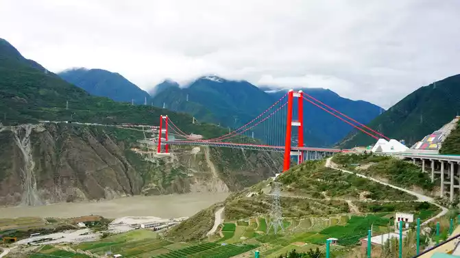
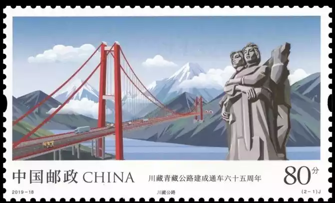
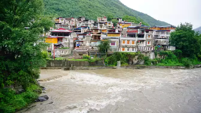
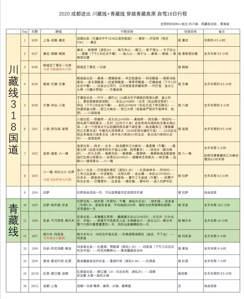
On June 22, 2019, several friends set off from Ningbo early in the morning and started a self-driving tour of the Western Sichuan Grand Ring Road. After driving for two days and traveling more than 2,200 kilometers, it passed the Luding Dadu River Bridge across the Dadu River in Luding County at about 18 p.m. on the 23rd. After crossing the bridge, we stopped on the shore and looked back, only to see the red steel truss suspension bridge hanging high on the river, which was imposing and particularly eye-catching (Figure 6). The high mountains on both sides of the river stand steeply, white clouds linger on the top of the mountain, and the Dadu River is surging and rushing. More than one month later, the stamp "65th Anniversary of the Completion and Opening of the Sichuan-Tibet-Qinghai-Tibet Highway" was issued, and the "Sichuan-Tibet First Bridge" appeared on the national business card (Figure 7). At dusk, we arrived at the Tibetan city of Kangding City under Paoma Mountain.
Gongga Mountain
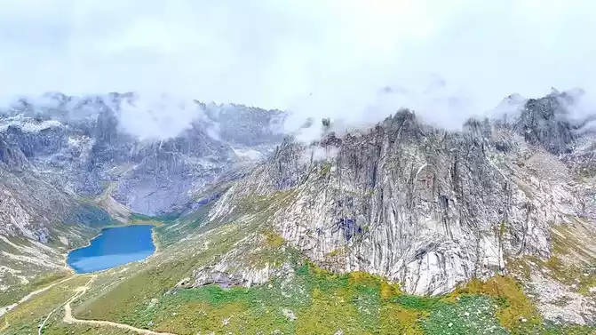
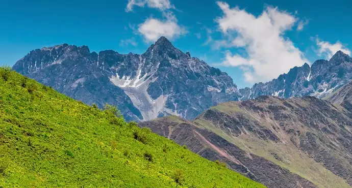
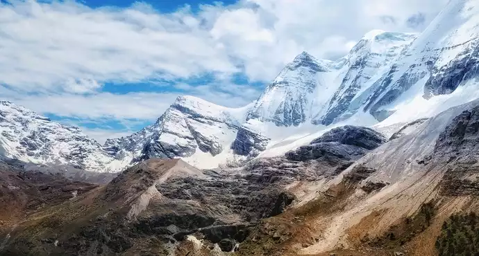
Gongga Mountain is located in Luding, Kangding and Jiulong counties of Sichuan Province, covering an area of 10,000 square kilometers, with 45 peaks above 6,000 meters above sea level, 145 ice peaks above 5,000 meters, and the main peak at an altitude of 7,556 meters towering on the top of the peaks, featuring magical and magnificent snow peaks, glaciers, mountain lakes, hot springs and other landscape combinations. The scenic area is centered on Gongga Mountain and is divided into scenic spots such as Hailuogou, Mugecuo, Wuxu Sea, and Gongga South Slope.
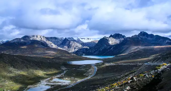
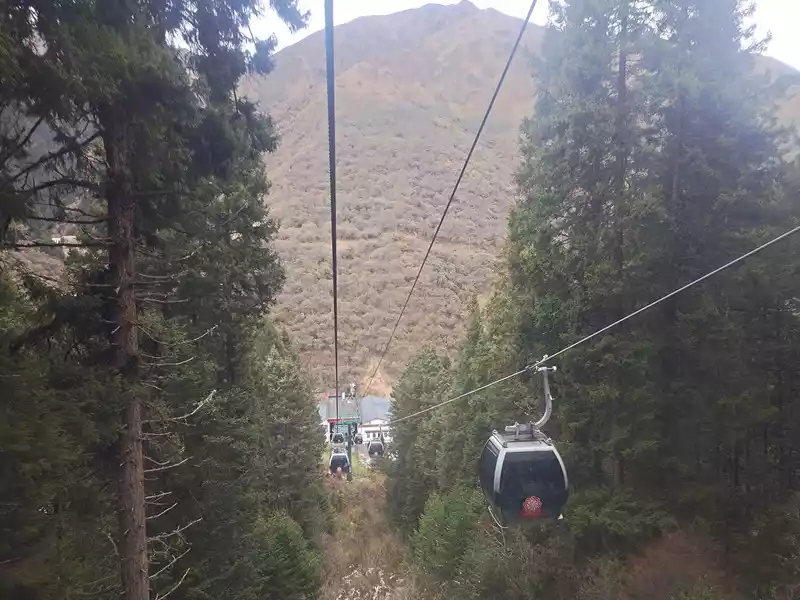
On June 24, we set off from Kangding and entered the Mugecuo Scenic Area. Take a sightseeing bus along the winding mountain road to the top sightseeing area, Mugecuo is like a big gem, clear and translucent (Figure 8). Ride a horse through the flowery hillside to the pass at an altitude of 4,200 meters. The main peak of Gongga Mountain is solitary and abrupt around the clouds and mist, and the peak is occasionally exposed, majestic and majestic (Figure 9).
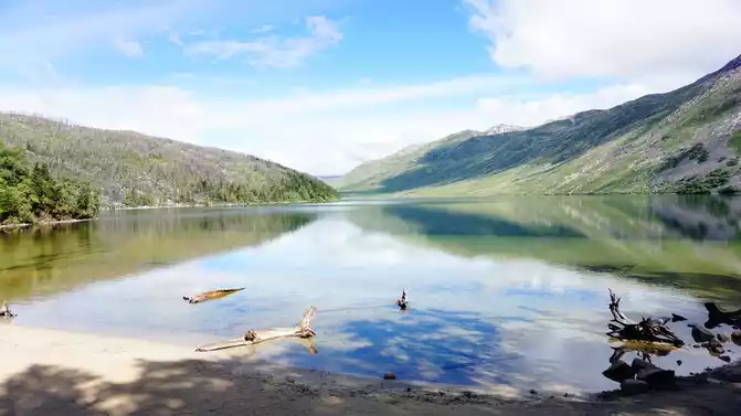
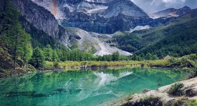
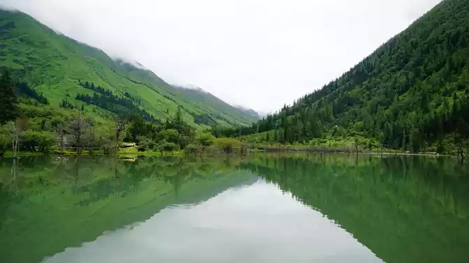
Descend the mountain along the rhododendron gorge trestle, and the torrent waterfall is refreshing all the way. Although it is close to midsummer, there are still alpine rhododendrons blooming in the deep canyon. Coming to the Seven Colors Sea, this is a symbiotic lake of cold springs and hot springs, the lake water is crystal clear, but there are strings of bubbles coming out, clouds and mist, towering ancient trees along the shore, and meadows surrounding. It is said that when the lake reflects the blue sky and white clouds in the early morning, if you are lucky enough, you can see the reflection of the lotus snow mountain in the lake.
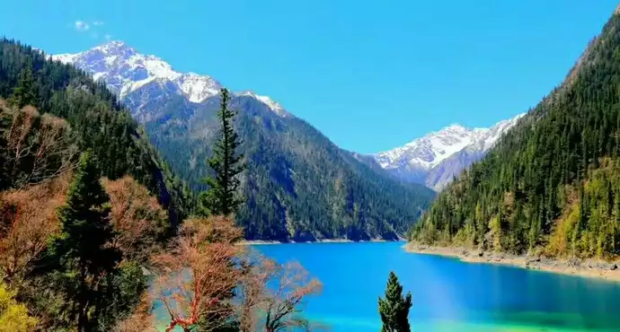
Then climb over Zheduo Mountain, along the nine bends and eighteen bends of the mountain road, bend after bend, crawl for half a day to reach the Yakou Observation Deck at an altitude of 4,298 meters (Figure 10), under the blue sky, the prayer flag is blown by the wind. The endless Gesang flowers on the hillside have become a sea of purple. When you get close to Xindu Bridge, there is an observation deck on the side of the road, and you can see the snow-capped main peak of Gongga Mountain by climbing up the high slope. We look at Gongga Mountain from different angles at different times, from three places far apart, and we can see the majesty of the king of Shu Mountain.
Xindu Bridge is an important distribution point on National Highway 318. The mountains in the distance, the yaks nearby, the colorful Tibetan-style houses, and the green grasslands...... It's like a giant oil painting. Everything is so peaceful, we take a nap here.
Daocheng Aden
left Xindu Bridge on the morning of June 25, and there were many stones and stone slabs engraved with scriptures in the Tagong River on the side of the road, which was a shock of faith.The terrain of the Tagong grassland is undulating, the blue sky, the white clouds, the endless mountains and grasslands, as well as the red walls, white pagodas, and golden tiles of the Tagong Temple, forming a picture full of Tibetan style.
Walking along 318, I kept seeing cyclists, walkers, roller skaters, kowtows, and people pulling cars to do live broadcasts, and I believe that their destinations are Lhasa, the holy city thousands of miles away. I sincerely admire their bravery and piety! After crossing the 4,412-meter-high Gaoersi Mountain Pass, we arrived at Yajiang County at noon, which is a typical mountain town with narrow streets, and the Yalong River passes through the city from north to south, intersecting with National Highway 318. After a hearty meal of beef, move on.
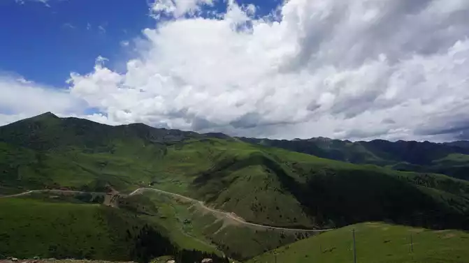
Walking through the eighteen bends of the sky road and passing through the Scissors Bend Mountain Tunnel, the canyon is winding and quiet, the top of the mountain is majestic and round, the green grass is quiet, and the yaks are in groups. Then cross the Nimagon Pass at an altitude of 4,668 meters and the Kazila Mountain Pass at 4,718 meters. As far as the eye can see, thousands of mountains and valleys, layers of mountains, one layer farther away from the other, layer lighter than the other, winding and continuous, until the edge of the sky, it is really like walking on the road of heaven.
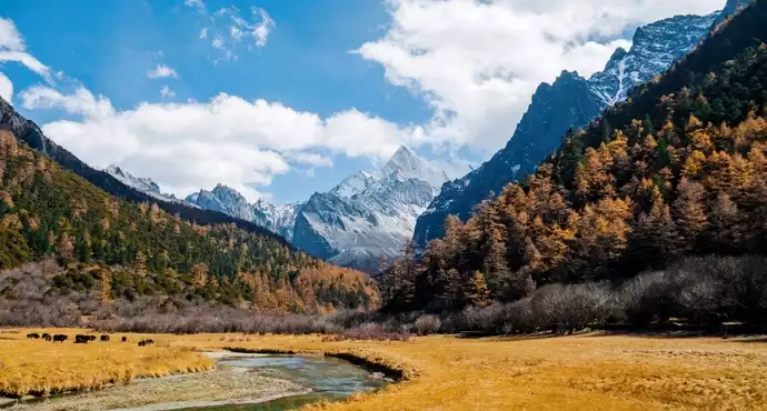
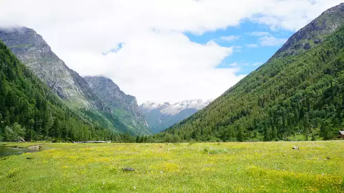
After passing through Litang, which is 4,014 meters above sea level and is known as the highest county in China, you can climb over Haizi Mountain, which is full of boulders and seas, and there are peaks not far away that are like rabbit ears, which are vivid. Due to continuous climbing over the mountains and more or less altitude sickness, we are no longer in the mood to stop and enjoy the beautiful scenery in front of us. Gritted his teeth, he continued to climb over Mount Powa at an altitude of 4,485 meters, and finally arrived at Daocheng Shangri-La Town before dark.
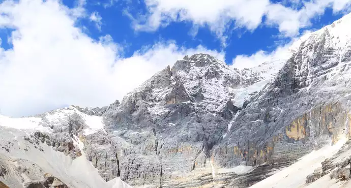
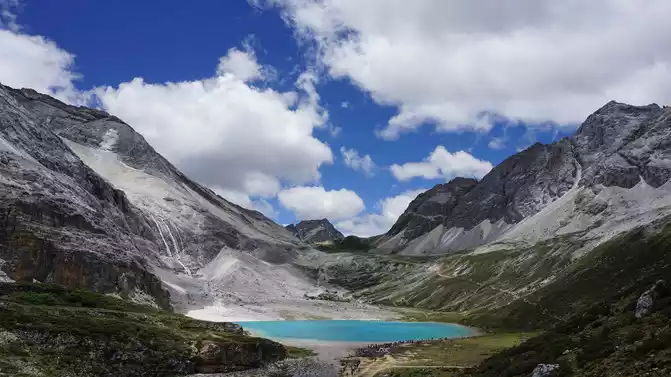
On June 26, after entering the Aden Scenic Area, take a sightseeing bus to Zhaguanbeng and first take a short route to the Pearl Sea (known as "Dolma Latso" in Tibetan) through Chonggu Temple. At an altitude of 6,032 meters, Xian Nai Ri (meaning "Guanyin Bodhisattva" in Tibetan) is the first of the three sacred mountains in the Aden Scenic Area, and its shape resembles a big Buddha with a body reclining back, and the peak is covered with snow all year round, majestic and magnificent, dignified and auspicious (Figure 11). Under the drifting and rolling of the clouds, they appear and disappear, changing everywhere, making everyone constantly guess and reverie. The sea of pearls formed by the melting snow of the day of the fairy is like an emerald embedded on the lotus throne, rippling with blue waves, and the reflection of snow-capped mountains and trees in the turquoise sea of pearls, forming a fairyland-like picture. From time to time, there was a rumbling thunder, it turned out to be an avalanche, and the ice and snow on the mountain poured down like a waterfall, which was majestic and spectacular. Sitting quietly by the lake, watching the clouds roll and relax, but the top of the mountain has always been shrouded in clouds, and we just wait like this. 4 hours passed, and I still couldn't wait for the clouds to peak, so I could only leave with a hint of loss. Unexpectedly, on the return train, the clouds on the top completely dispersed, and we finally got to see the whole picture of the Xiannai Ri Sacred Mountain.
On June 27, the second entered Aden. The weather is good, and you can see the beautiful snowy peaks of the three sacred mountains on the way in by scenic bus. Transfer to a battery car to the 4150-meter-high Luorong cattle farm. The cattle farm is surrounded by continuous alpine meadows, wildflowers bloom on the meadow in early summer, all over the mountains, herds of cattle and sheep graze leisurely by the river and on the hillside, and the three snow-capped peaks stand not far away, a harmonious scene.
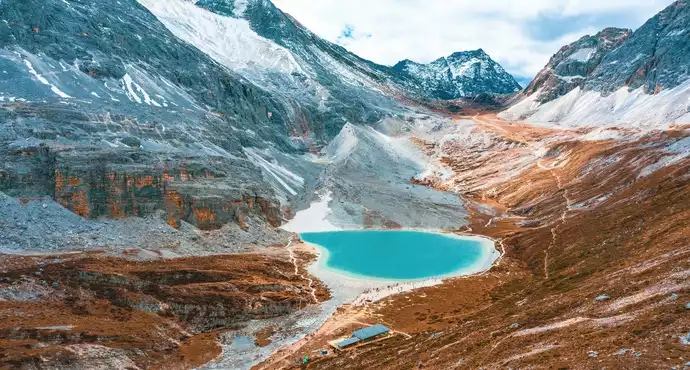
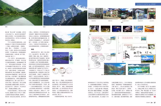
Get off the Luorong Cattle Farm tram stop, walk through a wetland meadow, and ride a mule up the mountain to the special horse farm. After getting off the mule, I began to climb up the steep mountain road with difficulty, walking for about 1 hour, and reached a three-way intersection, on the left was a flat road to the milk sea. We climbed a steep slope of about 500 meters to the right, and after climbing over a high slope, the five-colored sea (Figure 12) appeared on Yangmai Yong Snow Peak (meaning "Manjushri Bodhisattva" in Tibetan, 5,958 meters above sea level. ) between the embrace. Because of the reflection of snow-capped mountains and meadows, the water color looks ethereal and fantastic. Looking to the left, the sea of milk (Figure 13) surrounded by snow-capped mountains is shaped like water droplets, with blue snow water in the middle and a circle of milky white water around it. Looking around, Yang Maiyong and Xiano Dorji Snow Peak (meaning "Vajra Hand Bodhisattva" in Tibetan) seem to be within reach (Figure 14). It winds along the sharp blade ridges of the two wings of the triangular pyramidal snow-capped mountain, and the blade ridge is dark on the side of the light, and the lines outlined in the blue sky are sharp and stylish.Walking forward along the ridge, while admiring the snow-capped mountains and the sea, everything here is so pure and dreamy.
On
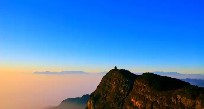
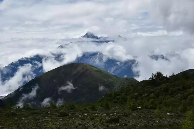
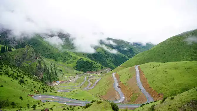
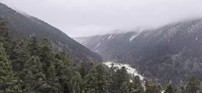
June 28, Seda marched along Provincial Highway 217 to Ganzi. After passing Haizi Mountain (Figure 15), you can see the strange rocks after ice erosion and the large and small lakes (ice eroded rock basins) dotted with them, which is a spectacular and regrettable scene. I couldn't help but get out of the car and take a tour. When I saw the roadside guide sign, I knew that this was the world's largest glacier site. This time I finally made up for the regret of rushing in when I went in.
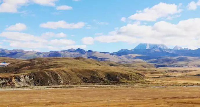
After eating at Litang at noon, we continued to move forward. The mountains are like daisies, the floating clouds are vast, the grass is green, the yellow flowers are everywhere, cattle and sheep are grazing, eagles are soaring, and the tents dotted with stars are like white jade (Figure 16), and the alpine pastures greet us with the richest colors. Then along the Yalong River Grand Canyon, the water in the canyon is turbulent, the sound is out, and occasionally you can see snow-capped mountains. There are few vehicles on the highway, and when you feel lonely, Tibetan villages, prayer flags, and temples appear on the side of the road, which makes people feel like they are back in the world. Arrive at Shanggra Hotel in Ganzi at 7:45.
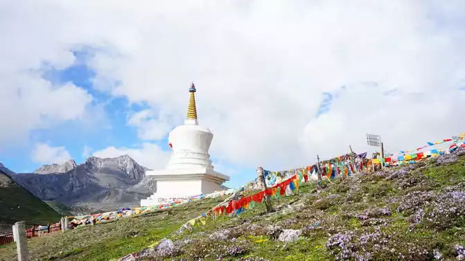
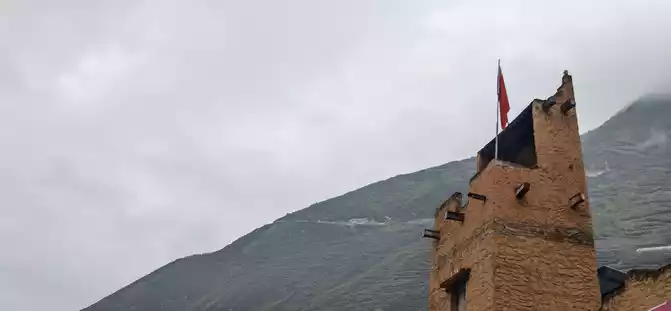
On June 29, I woke up in the morning and opened the window, and the snow peaks were in sight. Ganzi County is surrounded by several snow-capped mountains. The sun shines through the gaps in the clouds on the plateau under the snowy peaks, like a fairyland. By the way, I went around the White Pagoda (Figure 17) and saw many believers worshipping Buddha at the White Pagoda, they marched around the White Pagoda while chanting scriptures, and there were also monks chanting scriptures around the pagoda.
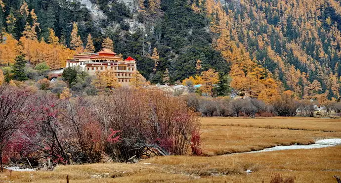
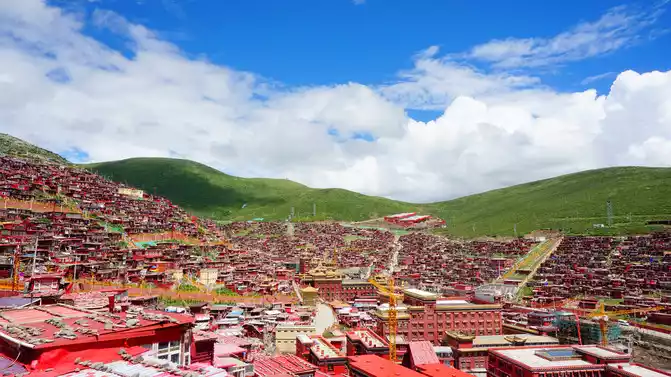
After breakfast, take County Road X6983, a new road that was just opened to traffic two months ago and cannot be found on the map. The mountain road is winding, clouds and mist (Figure 18), and all kinds of wildflowers bloom in the grassland along the way, making it difficult to distinguish between fairyland and earth. At 2 p.m., we arrived at Wuming Buddhist College surrounded by mountains.
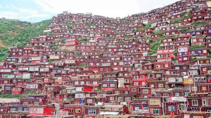
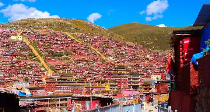
We climbed up the steps, climbed to the top of the mountain, and looked around, only to see the monk's house in the ditch, centered on the Great Sutra Hall of the Buddhist Academy, densely built on the hillsides on all sides, and countless crimson wooden houses, stretching countless and out of sight (Figure 19). These red houses are the residences of more than 10,000 monks. When I came here, I was deeply shocked by this hot red house and devout pilgrims!
Leave Seda. Walking along the banks of the Naqu River, the scenery of the canyon is beautiful, as if you have mistakenly entered a paradise wonderland. After that, along National Highway 317, the Sequ River followed the rolling river all the way. Arrive at Guanyin Bridge before dark. The hotel we stayed in was built by the river, and under the window was the cliff rapids, and we fell asleep with the sound of the water on our pillows.
Siguniang Mountain
came out of Guanyin Bridge on the morning of June 30 and proceeded along National Highway 317 by the Dajinchuan River. Along the way, I saw the Songgang watchtower on the hillside, the Zhuokeji Tusi official village built on the mountain, and the Xisuo house facing the river back mountain (Figure 20). Turning from Malkang to the S210 provincial road, the road conditions are even worse, with falling rocks and landslides everywhere. Thanks to the timely cleanup of the road guards, we were able to move forward. At about 10 o'clock, we passed through the Mengbi Mountain Pass, which is the only passage from Malkang to Xiaojin County, and it is also the second snowy mountain crossed by the Chinese Workers' and Peasants' Red Army during the Long March, and there is a commemorative sculpture of "Snow Mountain Red Road" at the foot of the mountain. Shortly after passing the former site of the Lianghekou Conference, a serious landslide was encountered in Mupo Township. Four large excavators and bulldozers worked together on the site and finally dug a way for us 40 minutes later.
At 2 p.m., visit the Shuangqiaogou Scenic Area, which is a more mature scenic spot among the three scenic spots of Siguniang Mountain. Take a scenic transportation car, all the way to the forest, stream, snow-capped mountain.... Take in the panoramic view and get off at the foot of a mountain in an hour. All kinds of alpine flowers are covered with wide lawns, cattle and sheep roam among them, surrounded by beautiful sea buckthorn forests, high mountains and clear waters, vast land and blue sky, like a fairyland. Walking in Shuangqiaogou, green trees, clear lakes, snow-capped mountains and colorful forests on both sides (Figure 21).
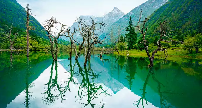
On the morning of July 1, I took the first shuttle bus of the scenic spot into Changpinggou, the weather was sunny, and you could see four sister mountains at the mouth of the ditch, which were majestic and straight, and the steep mountains pointed straight to the sky (Figure 22). Riding a horse along the stream to the dry tree beach, I saw a patch of dead trees standing in the blue mercury sand, the trees were independent, the branches were vigorous, and the dead shadows reflected the flowing water was beautiful. Continue to climb and wade through the inaccessible primeval forest, where the mountains are high and dense, the ancient cypress is tall and straight, the green pine branches are dense and leafy, and even the sea buckthorn has grown into a big tree, the trunk is covered with moss, and the branches are covered with pine and vines. The ice and snow of the mountains melted, the waterfalls fell sharply, and the stream meandered through the woods. Sometimes you can also see Red Pebble Beach. When you reach the wooden mule, the wildflowers all over the mountains spread out from the front of the eyes to the horizon, lined with snow-covered camel peaks and blue skies and white clouds, which is breathtaking (Figure 23). The guide introduced that if you continue to walk for two days, you can cross the Bipenggou on the back of Siguniang Mountain. Limited by physical strength, we stopped here. When I left the scenic spot, the sky was already a little cloudy, and Siguniang Mountain quietly disappeared into the sea of clouds.
On the way back to Ningbo, our hearts still remain in western Sichuan. I believe that everyone who has walked through National Highway 318 and 317, as well as those unknown provincial highways and county roads in western Sichuan, will have their own mental journey. The unparalleled beauty of glaciers and snow-capped mountains, plateau lakes, vast grasslands and blue skies and white clouds on the way always makes people linger. When you come to the atmosphere created by the fluttering prayer flags, the temple with the golden dome and red walls, the majestic white pagoda, and the ubiquitous mane stone, you will feel that the hustle and bustle in your heart has stopped and the world has become peaceful. You will find that there is indeed a pure land in this world, which exists in the depths of your soul, allowing you to appreciate beauty while being in awe and worship!
Whentraveling, philatelic
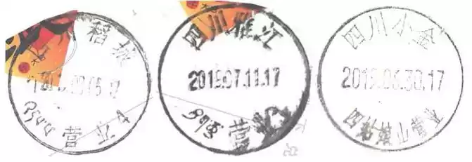
collectors like to send letters and check in along the way. When passing through Kangding City, Tagong Grassland, Yajiang, Xinduqiao, Litang, Daocheng, Seda, and Guanyin Bridge, I drove to the local post office. Sometimes during non-business hours, I stuff envelopes and postcards into the door mailbox. There is a mailbox at the ticket office of the Aden Scenic Area, but when I received the postcard, it was found that it was also sold with the postmark of Daocheng County, and it was estimated that it was sent to the county seat. I regret not being able to leave the mark of Aden at the foot of the beautiful snow-capped mountains. In Daocheng Shangri-La Town, where we stayed for 3 nights, even if we used navigation tools, we couldn't find the post office, probably this town really doesn't have a post office. At the Seda Wuming Buddhist Academy, I found the familiar green mark of the post office in a red building. I walked through several streets along the mountain trail into the post office, and to my surprise, the staff told me that this post office only distributes mail and does not accept it. The only time I had to sell stamps myself, on the evening of June 30, I found a post office in a newsstand in Siguniangshan Town, but there was no one. In desperation, a few shouts attracted the owner of a nearby hotel. I bought 2 sets of postcards with Siguniang Mountain Scenery, sat in them and wrote the address, slowly stamped them and left them at the post office to send them (Figure 24).After returning home, the mail sent in Xinduqiao, Litang, Seda, and Tagong grassland has not been received so far, and Yajiang delayed sending it for ten and a half days (Figure 25), and the postmarks of Kangding and Guanyinqiao are not clear. Compared with the Great Ring Road in western Sichuan more than ten years ago, I feel the fading out of the postal service and the decline in service levels. I really hope that the photos of the post office taken on this trip will not become history (Figure 26).

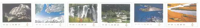
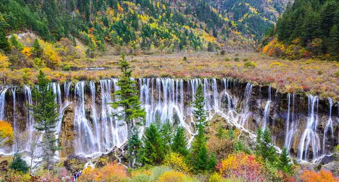
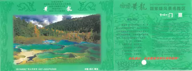
As early as 1989, the former Ministry of Posts and Telecommunications issued a postage postcard of "Sichuan Scenery", the cover used the Hailuogou Gongga Snow Mountain Rizhao Jinshan scene, among the 10 postcards, there are Jiuzhai Waterfall, Huanglong Autumn Colors, Top of Minshan Mountain, Hailuogou Gongga Snow Peak, Erlang Mountain Snow Scenery, Hongyuan Scenery and other 6 to show the scenery of western Sichuan (Figure 27). On New Year's Day 2003, Jiuzhaigou launched postcard tourist tickets with Nuorilang Waterfall as the main picture. When my friend went on a trip, he stamped 6 Jiuzhaigou scenery stamps on it (Figure 28). In 2004, Huanglong also launched the "Huanglong Competition Pool" special postage map postcard ticket (Figure 29). In 1998, "Jiuzhaigou" appeared on the national business card, showing the beautiful scenery of Changhai (Figure 30), Fangcao Sea, Wuhua Sea, Shuzheng Waterfall (Figure 31, envelope drawn by Zhang Youju, one of the stamp designers), and Nuorilang Waterfall. Unfortunately, in August 2017, the Jiuzhaigou earthquake caused the Nuorilang Waterfall to collapse. China's largest and most beautiful waterfall, frozen on stamps and postcards, has become an eternal memory.
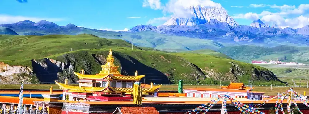
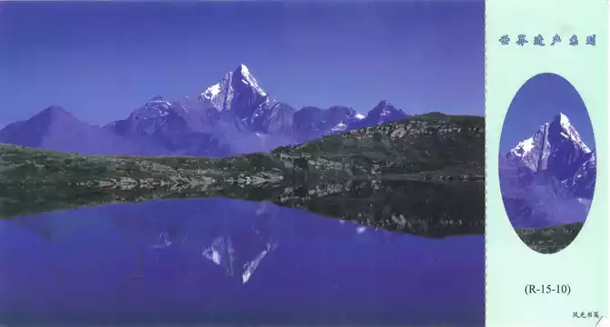
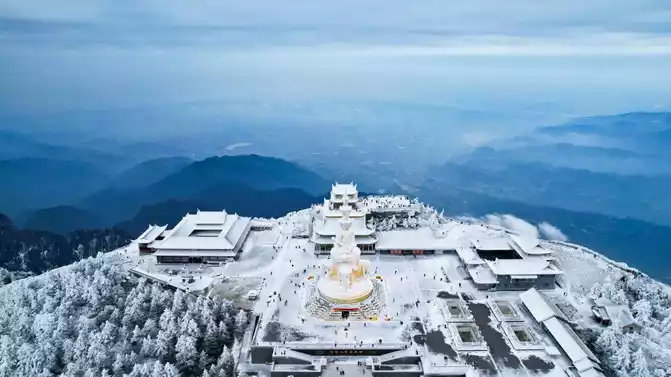
In 2007, Gongga Mountain (Figure 32) was on the national business card. The "Yellow Dragon" stamp (Figure 33) was not issued until 2009. The World Heritage Site Siguniang Mountain, known as the "Queen of Shushan" and the "Oriental Alps", and Aden, the last pure land on earth, are still hidden in the boudoir. Looking forward to more beautiful scenery in western Sichuan becoming a national business card.
Number of days: 4 days, , Updated: 2021.12.12
Number of days: 3 days, Average cost: 2000 yuan, Updated: 2023.02.01
Number of days: 2 days, Average cost: 1520 yuan, Updated: 2020-06-04 14:22

Number of days: 10 days, Average cost: 5000 yuan, Updated: 2023.08.10
Number of days: 13 days, Average cost: 5000 yuan, Updated: 2020.10.19
Number of days: 5 days, Average cost: 3500 yuan, Updated: 2021.03.27