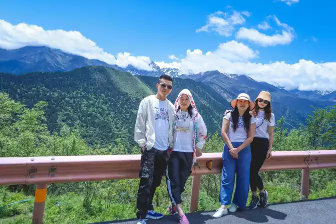
Live Your Best Lives
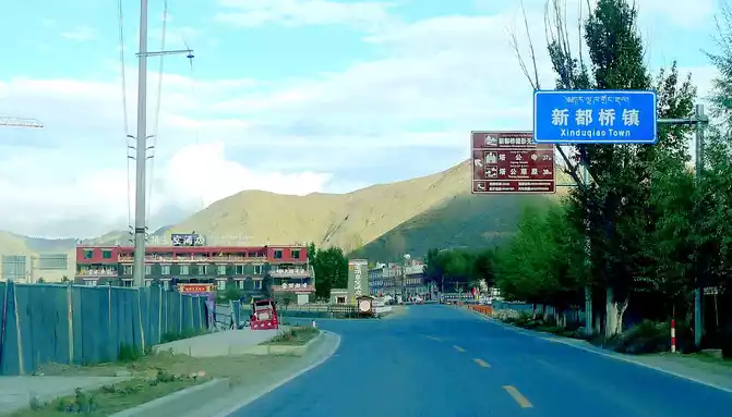
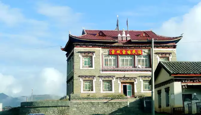
On October 8 (D5), yesterday from Danba, arrived at Xinduqiao in the evening, and stayed overnight at the "Gesang Garden Inn", today's plan is: Xinduqiao → Yajiang → Litang →Daocheng→ Shangri-La Town, the whole journey is 414 kilometers, according to Baidu data, it takes 7 hours and 26 minutes to drive alone, which can be regarded as the longest driving day in our 11-day itinerary. X.J. is the driver, and today is also the hardest day for him, and if he is fine today, there will be nothing to worry about in the next few days. Xinduqiao is 3,500 meters above sea level, and I was worried about whether X.J. would be able to adapt to spending the night here, but fortunately, he felt good about himself after getting up, claiming that he could drive according to the predetermined plan. In addition, in view of today's long journey and the plateau at an altitude of about 4,000 meters, we plan to focus on the road throughout the day, and we don't have to stop at every attraction along the way.
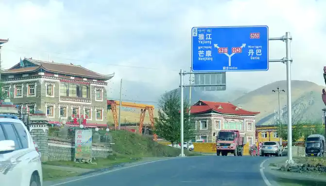
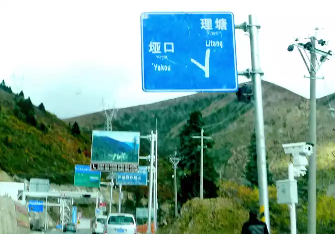
The "Garden Inn" provides breakfast, steamed buns, porridge, eggs, mustard greens, fried peanuts, and departs immediately after the meal. Leaving the inn at 8:42, driving westbound on National Highway G318, entering Xinduqiao Town at 8:44, it was found last night that the "Garden Inn" had actually gone east out of the Xinduqiao boundary and was located in the territory of "Waze Township". At 8:51, we arrived at the Y-junction where G318 and G248 intersect, and we came from Danba along the national highway G248 last night, and at this moment we were going to drive along G318 to the direction of "Yajiang".
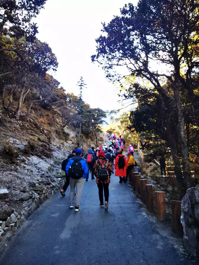
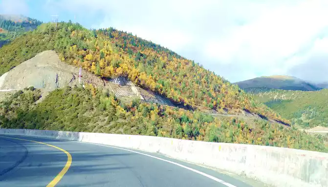
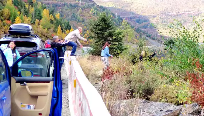
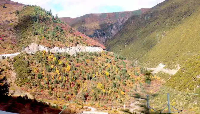
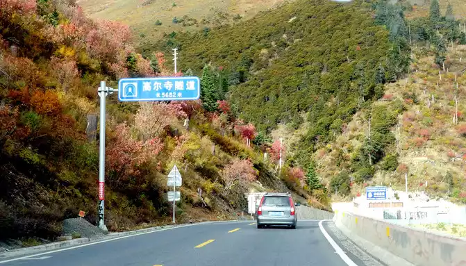
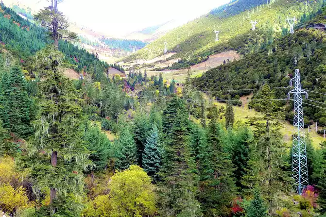
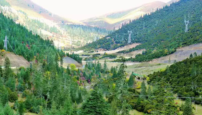
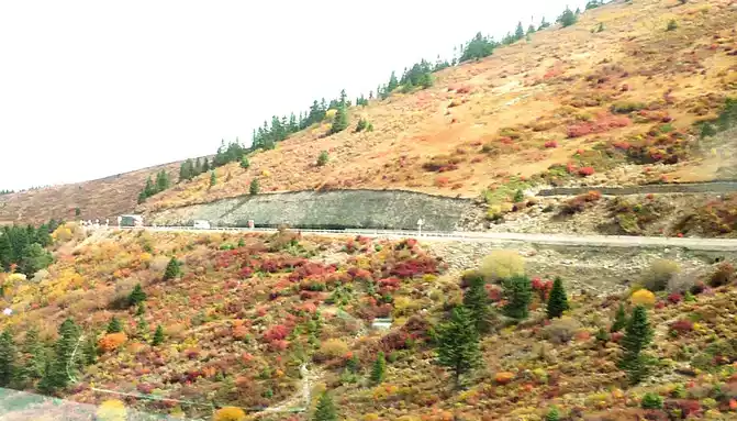
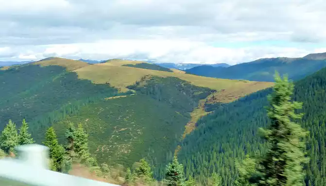
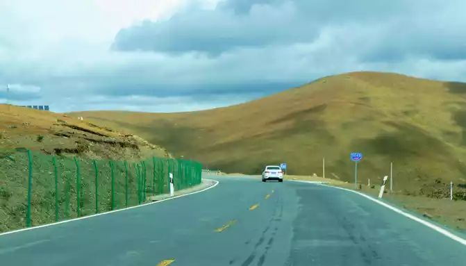
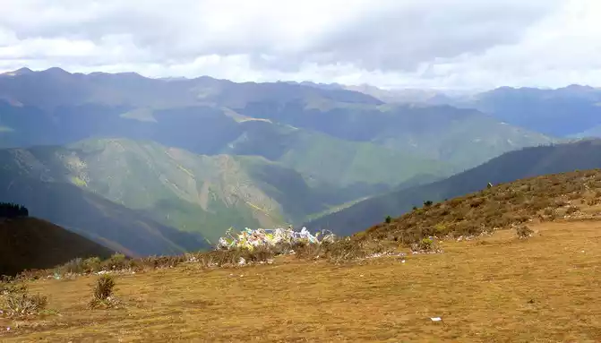
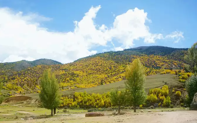
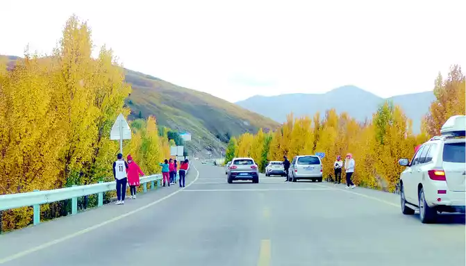
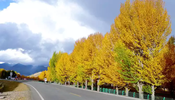
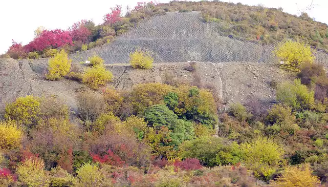
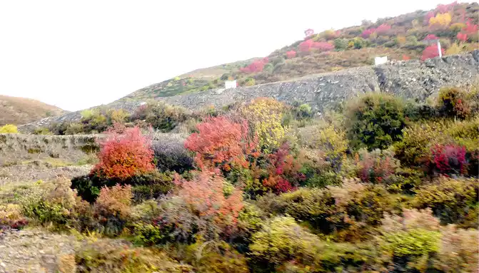
The main peak of Gao'er Temple Mountain is 4,659 meters above sea level, located about 5 kilometers west of the Y-junction, and at 8:56 you can see a fork in the road leading to the top of the mountain on the left, which is the only way to climb Gao'er Temple Mountain in the past. The Gaoersi Mountain Tunnel was built three years ago, and now this fork is rarely used. We crossed the fork and continued to move forward, and saw that the shrubs and grass on the hillside along the road had been changed into beautiful autumn clothes, and there were many cars parked on the side of the road, and passengers climbed over the road parapet and rushed down the hillside to take pictures. However, we are trying to arrive in Shangri-La Town before dark today, so we didn't stop here. The Hengduan Mountains are dangerous and steep, and avoiding driving at night is our top priority.
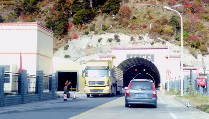
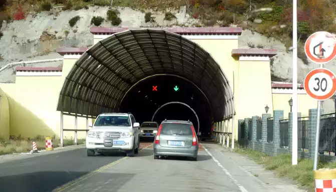
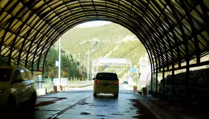
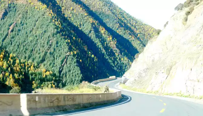
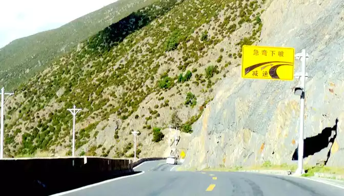
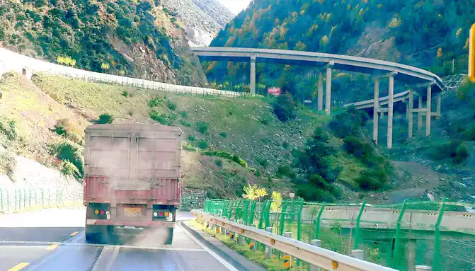
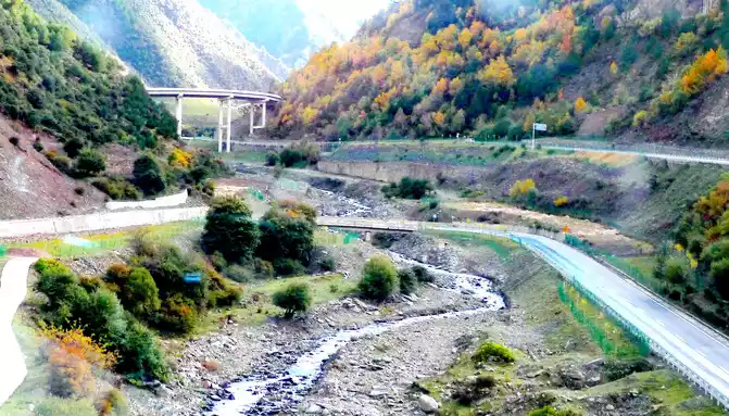
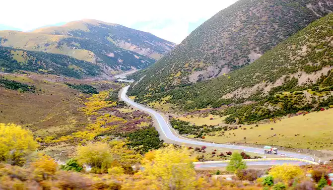
At 9:07, enter the 5682-meter-long Gao'er Temple Tunnel, about 10 minutes later, the Gao'er Temple Tunnel is about 4,000 meters above sea level, and the flat land on this side of the Xindu Bridge is 3,500 meters, so there is not much feeling of climbing the mountain from the Xindu Bridge into the tunnel, however, the situation after driving out of the tunnel is very different, the altitude of Yajiang County in front is only 2,640 meters, and the difference between the Gaoersi Tunnel is more than 1,400 meters, we just drove out of the tunnel entrance and saw the prompt of "sharp curves downhill and pay attention to slow driving", Then it rushed into a ravine, the road meandered down, the height dropped rapidly, there were many bridges and bends on the way down, and the highway used a number of high bridges across the ravine to shuttle back and forth between the two walls of the ravine, sometimes going to the left wall, sometimes going to the right wall, and gradually descending in height. Turning around and looking back while driving, the high bridges left behind us were like a staircase to the sky.
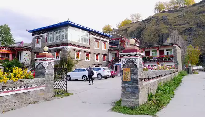
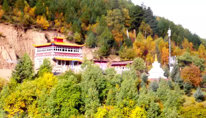
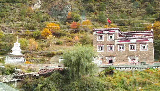
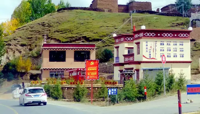
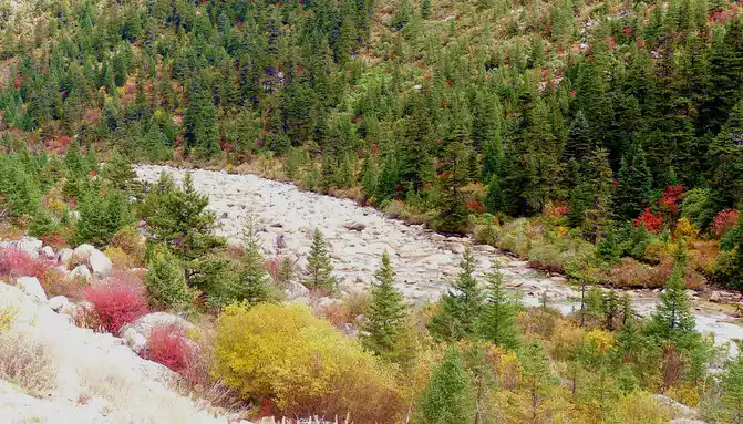
At 9:33, we drove to the bottom of the ravine, where there is a village and a temple called "Wolong Temple", and the small village is "Wolong Temple Village". Then it was still driving in the valley, and there was a small river running parallel to the road, but compared with the ravine just now, the slope at this time was significantly gentler, and it was generally no different from a flat road. From time to time, beautiful Tibetan buildings can be seen on the roadside, including many inns and homestays.
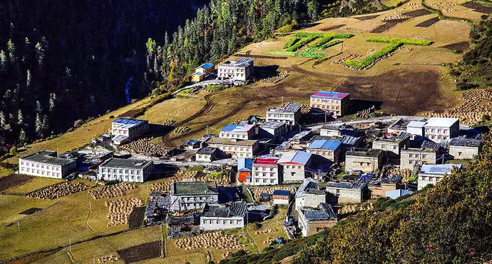
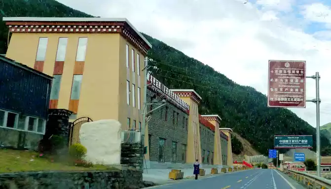
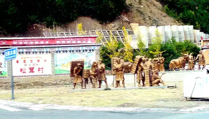
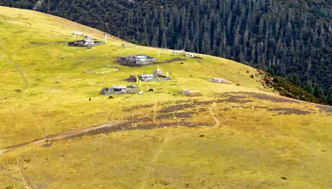
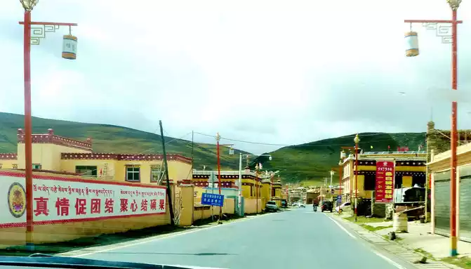
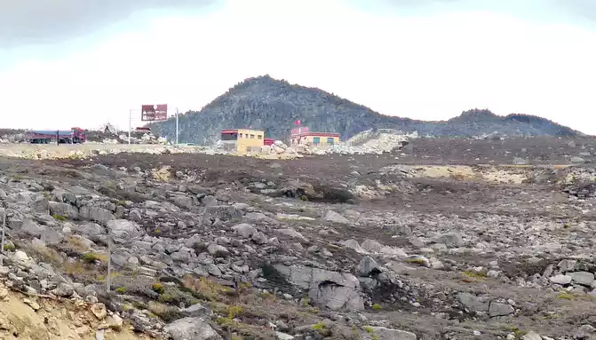
9:46 Passing through "Pamling Village", this is Bajiaolou Township, which belongs to Yajiang County, 20 kilometers away from the county seat, and is a very beautiful Tibetan village, because it is rich in matsutake mushrooms, also known as "Matsutake Village". There is a spectacular "China Yajiang Matsutake Industrial Park" in the village, a number of "hotels" on the side of the national highway, as well as sculptures of the "Tea Horse Ancient Road" and the sign of "National Civilized Village", which seems to be a tourist resort.
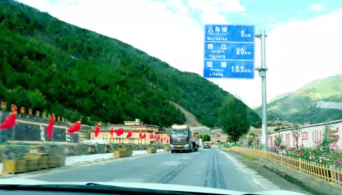
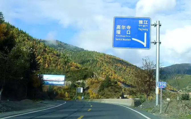
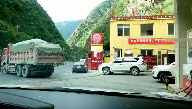
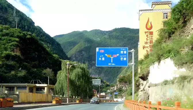
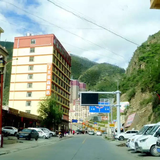
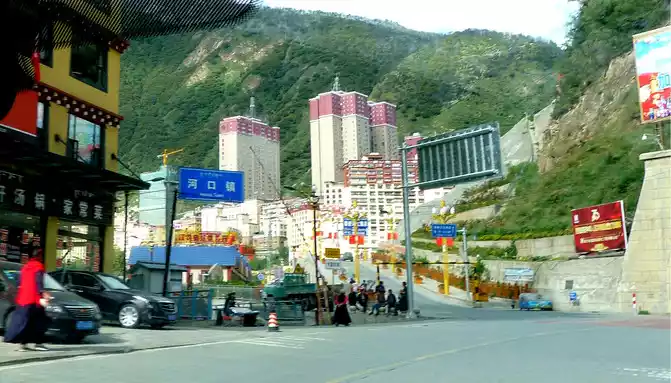
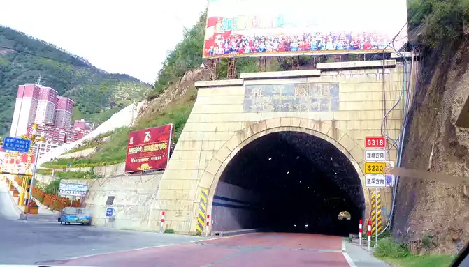
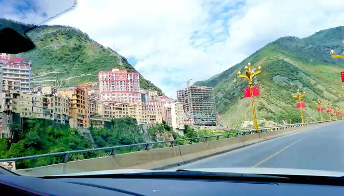
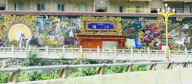
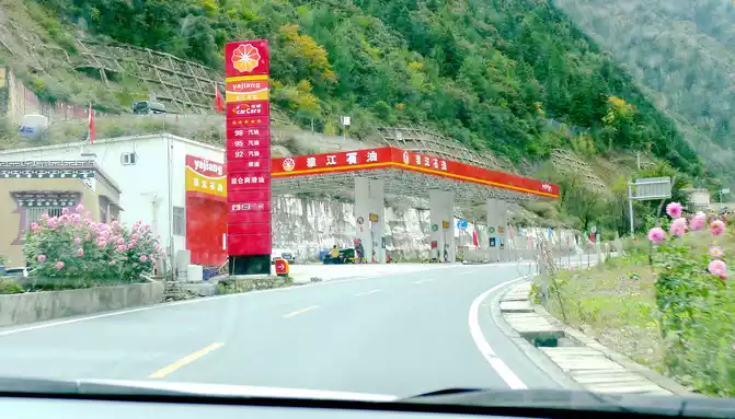
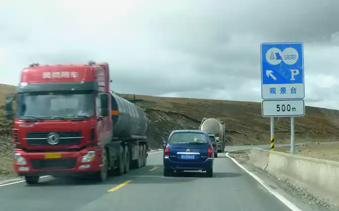
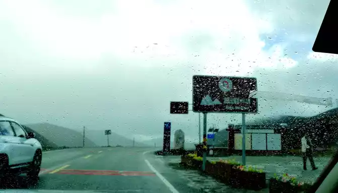
At 9:52, we drove through Octagonal Tower Township, refueled at the "Yajiang City Gas Station" at 10:11, and arrived at the "Hekou Town" located on the east bank of the "Yalong River" at 10:15, where the small river that accompanied us all the way joined the Yalong River. Yajiang County is mainly built on the west bank of the Yalong River, which can be reached directly from Hekou Town, but we did not cross the bridge, but followed the national highway G318 to turn right, cross the "Yajiang Tunnel", and then go straight along the elevated river road on the east bank of the Yalong River, cross the river through a bridge in front, bypass Yajiang County, and drive directly to the direction of Litang. There is a beautiful wall sculpture at the intersection of the county seat, I don't know what story it describes, I guess it is "King Gesar".
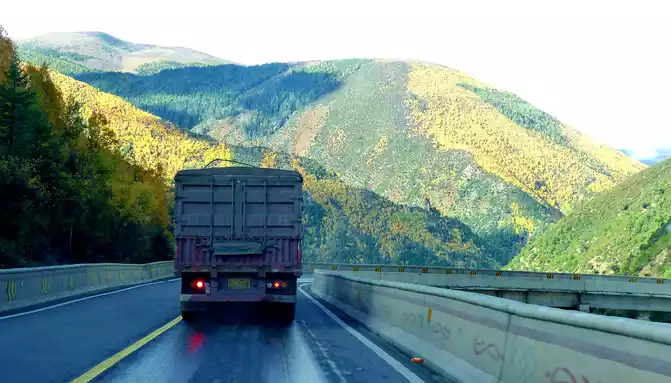
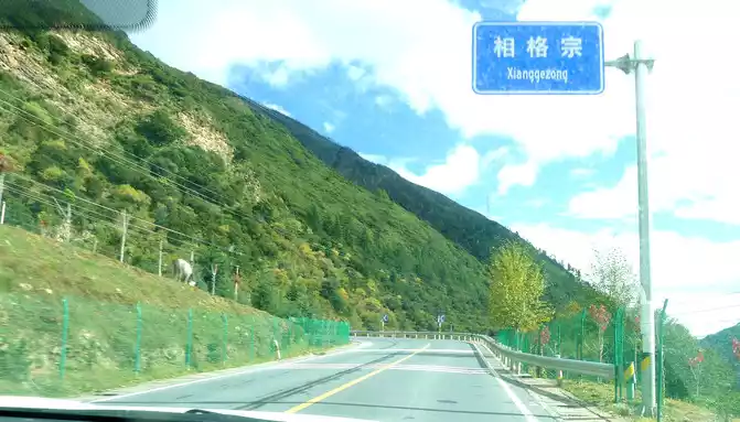
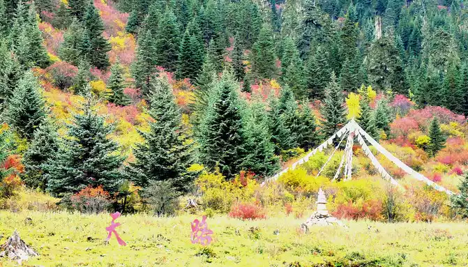
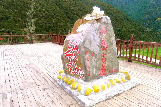
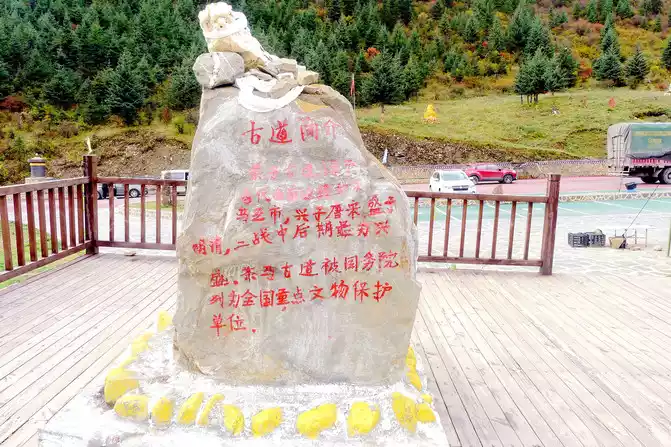
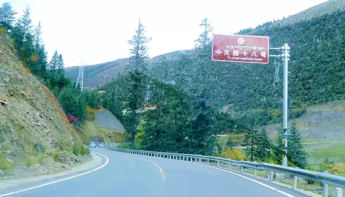
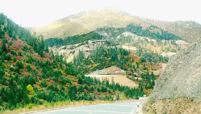
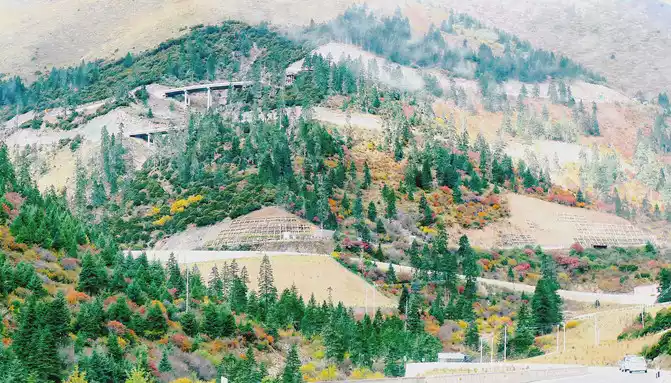
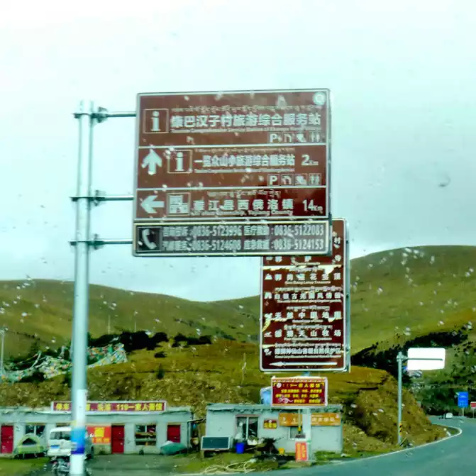
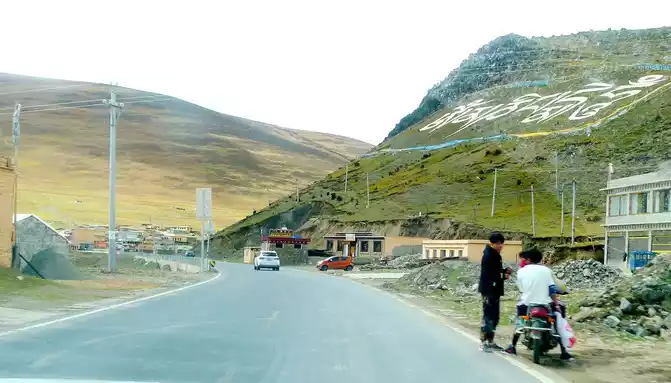
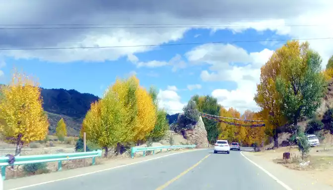
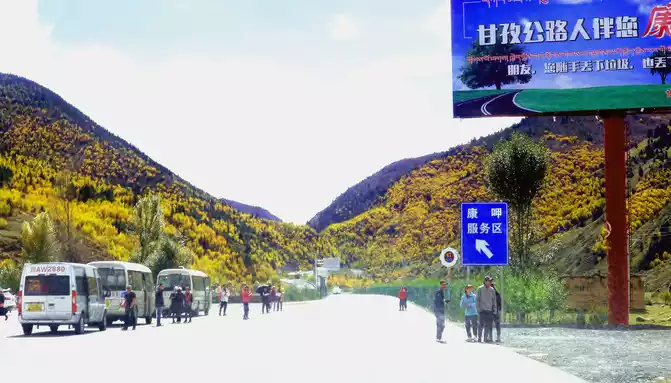
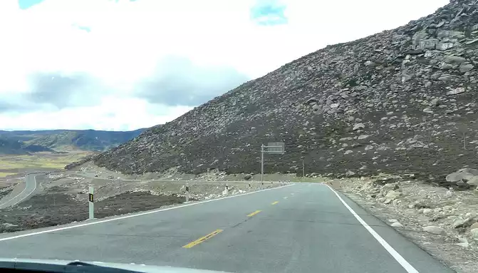
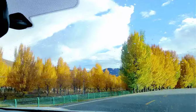
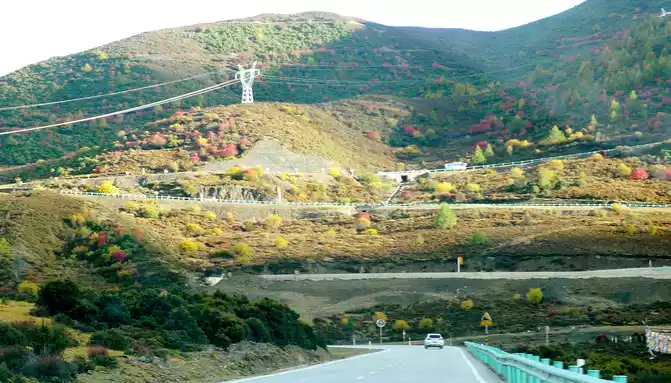
After leaving Yajiang County, the national highway G318 began to climb higher again, and beautiful yellow leaves also appeared on the hillside, passing through the "Xiangge Zong" at 10:38, which is a small village at an altitude of 3530 meters, and is also the starting point of the famous winding mountain road "Eighteen Bends of the Heavenly Road" on the national highway G318. The car circles along the road, the altitude gradually rises, and at 10:47 it stops at the "Xianggezong Service Area", which is the middle section of the "Eighteen Bends of the Heavenly Road", equipped with a large area of parking lots, as well as public toilets and canteens, and there is a boulder on the wooden observation deck, and the red paint paints "Tea Horse Ancient Road 3800 meters above sea level".


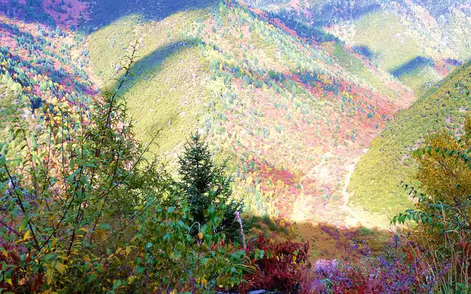
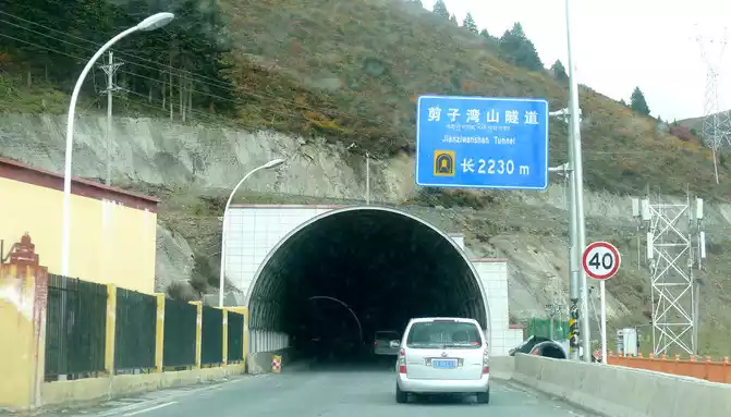
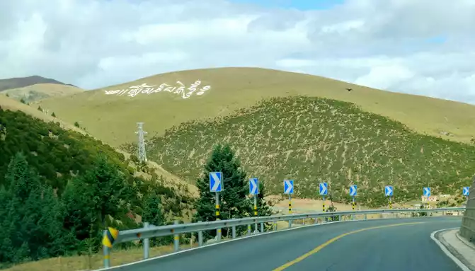
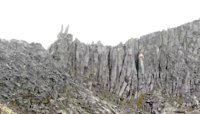
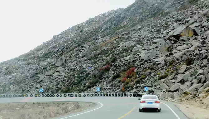
Continuing on, there is also a "Tianlu Eighteen Bends Tourist Comprehensive Service Station" on the mountain, we did not park, we left it for the return trip. At 11:07, we arrived at the end of the "Eighteen Bends of the Heavenly Road", and almost immediately entered the "Scissors Bend Mountain Tunnel". There is also a fork in the road nearby leading to the top of the mountain, and before the tunnel was built, the old national highway had to take this fork through the top of the mountain, over the scissors bend mountain beam at an altitude of 4,450 meters, and go to Litang. 11:13 Drive out of the west exit of the "Scissors Bend Mountain Tunnel", what you see in front of you is immediately very different from the east end of the tunnel, the tunnel entrance at the east end is green, as if autumn has not yet arrived, but the west entrance of the tunnel is red, orange, yellow, green, four colors are mixed, the season is already late autumn.
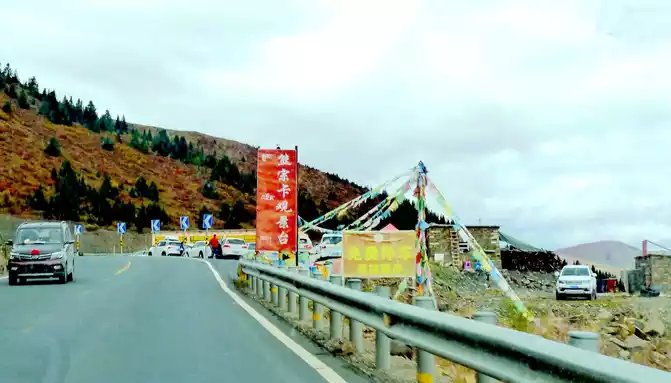
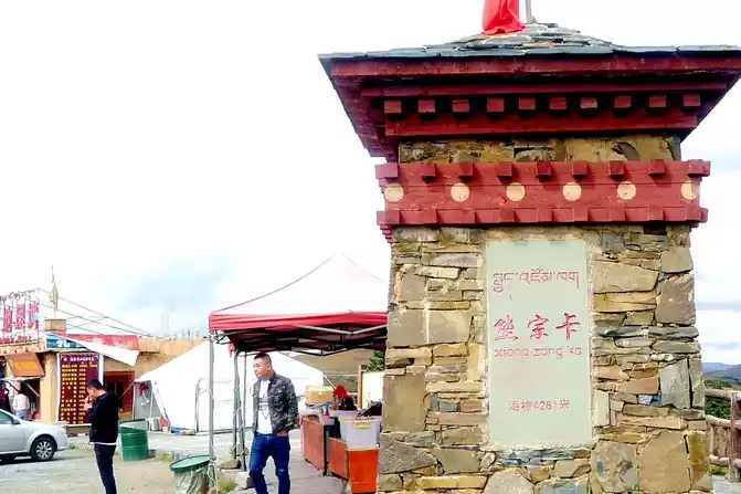
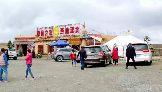
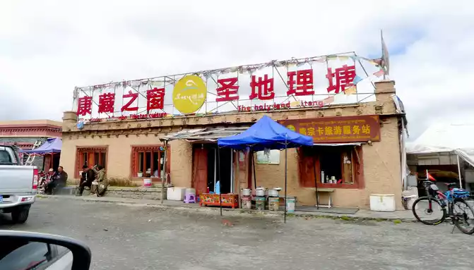
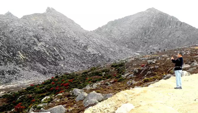
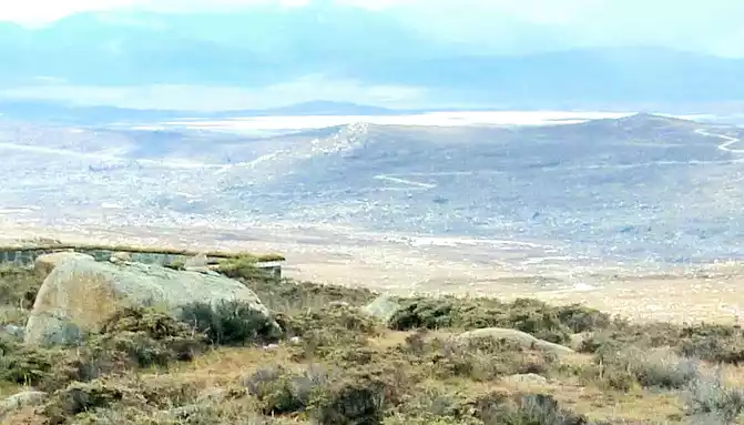
11:17 Stop at the "Xiong Zongka Observation Deck", the main attraction here is the alpine pasture, there is a long mountain beam opposite the observation deck, the top of the mountain is wide and flat, only the grass can not see a tree, but the ravines between the mountain beams are deep and treey, such a scenery reminds me of the man "Xie Ding", the top of his head is bald, but there is still a circle of hair around. The observation deck is equipped with a canteen, toilets, free parking lots, and a Tibetan-style pavilion monument, indicating that the place is 4,281 meters above sea level.
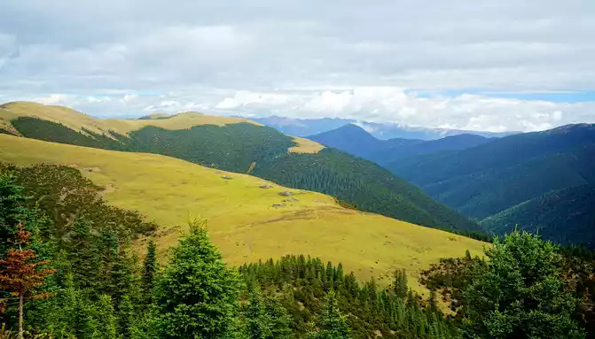
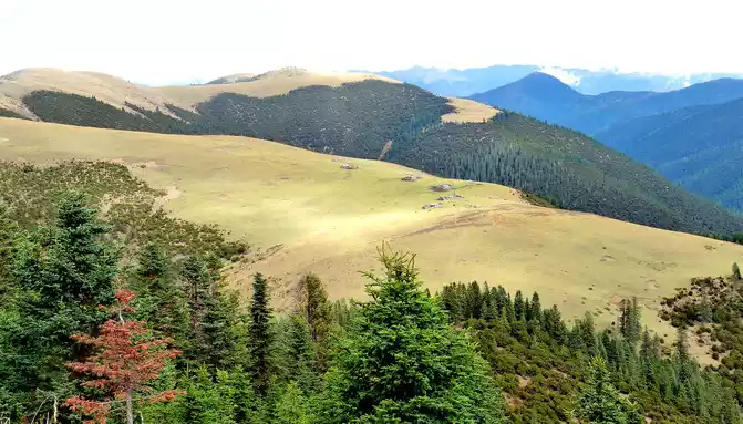
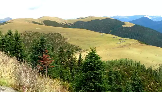
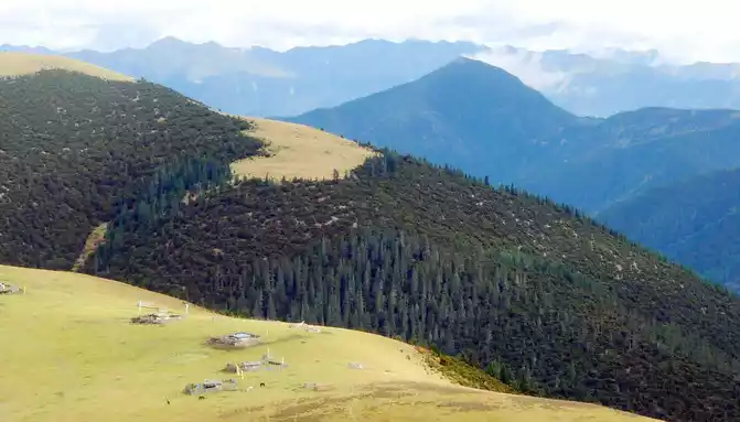
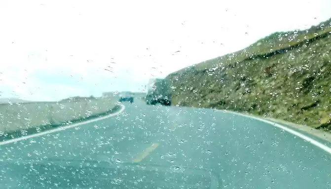
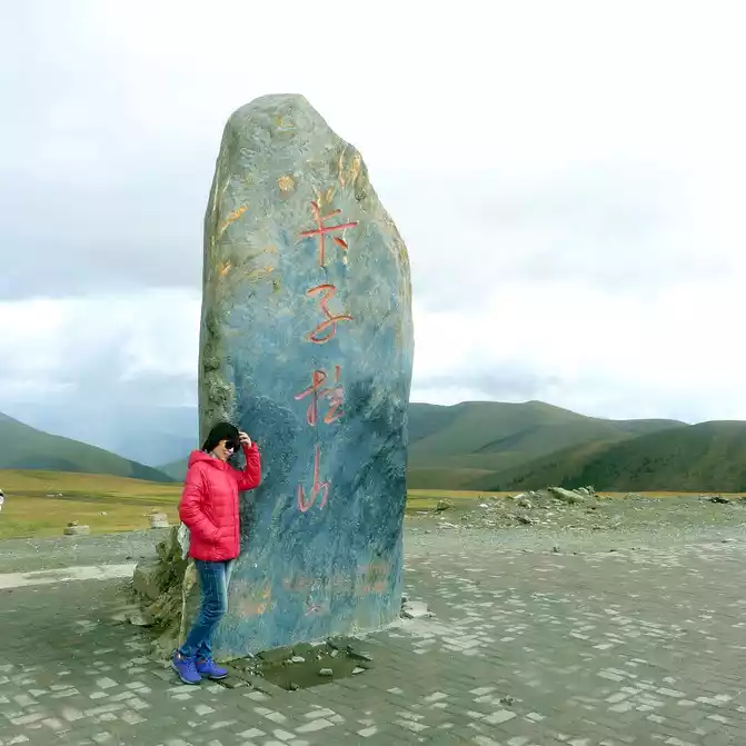
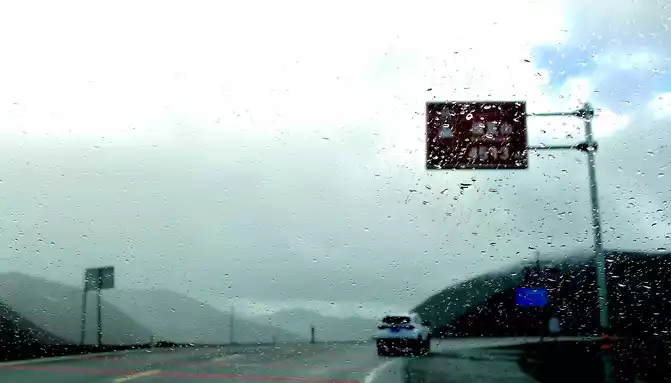
At 11:24, leave the "Xiongzongka Observation Deck" and continue to move forward, and at 11:43, drive through the "Nimagong Sacred Mountain Observation Deck Tourist Service Area" without parking. This area is a high-altitude area along the way, and the mountains seen are also bald, and the rain is briefly encountered during the journey, and the rain also carries ice slag, however, the weather on the plateau is also unpredictable, and it will be clear again after a while. 12:10 Park at the "Kazila Mountain Observation Deck", because it is a National Day holiday, there are also medical service vehicles from the nearby township health center on duty. There is a huge stone monument on the parking lot, indicating that the altitude of Mount Kazila is 4718 meters.
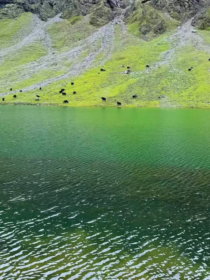
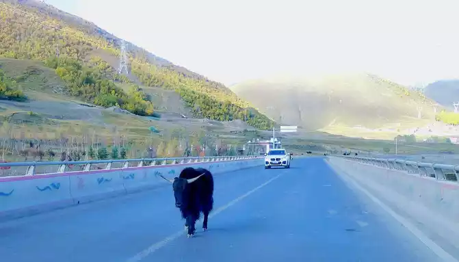
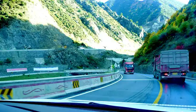
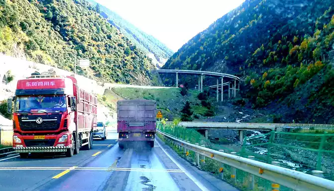
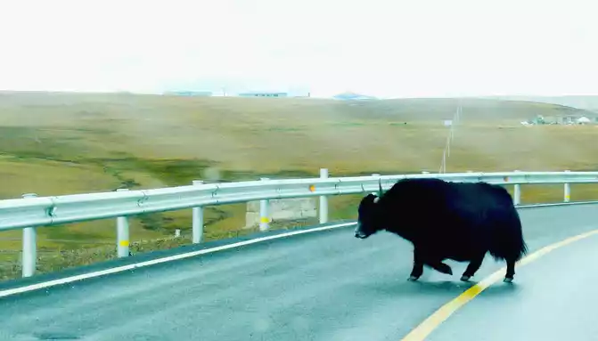
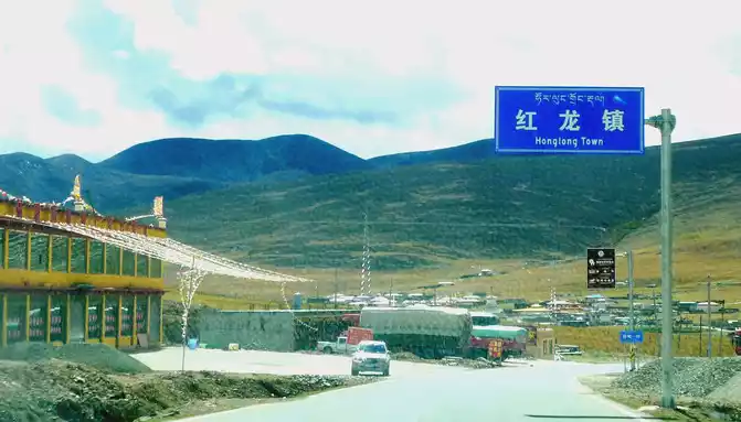
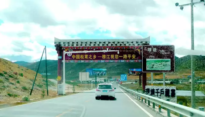
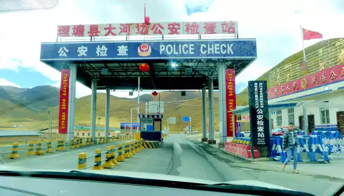
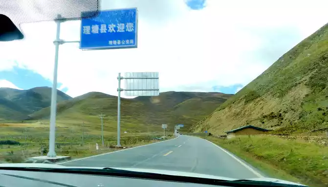
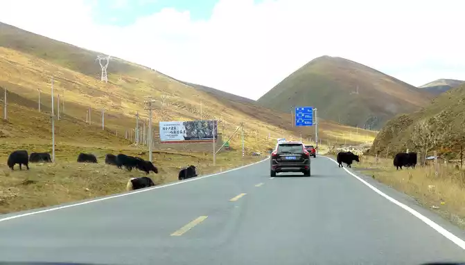
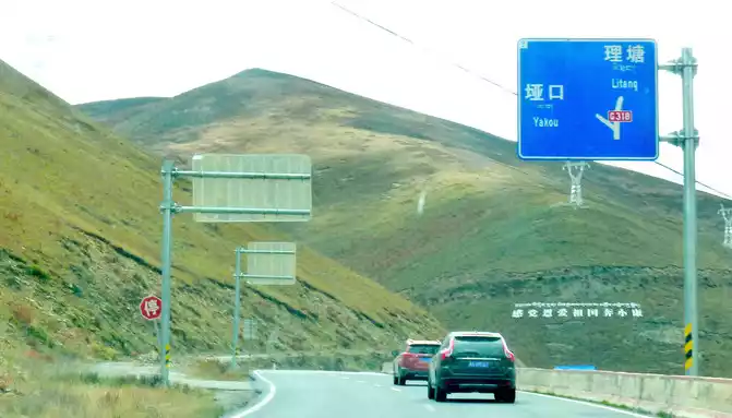
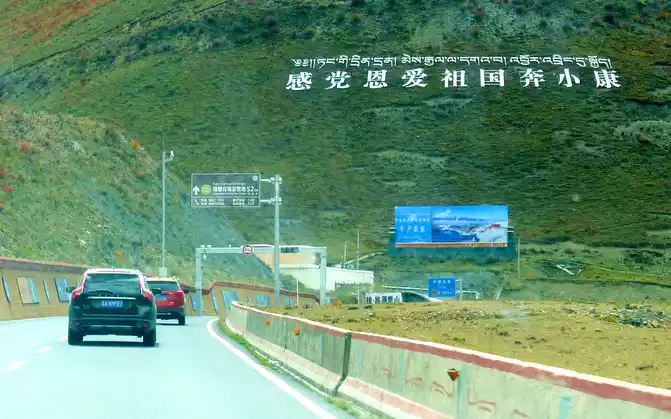
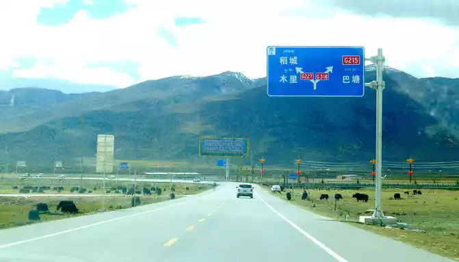
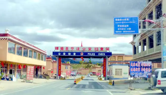
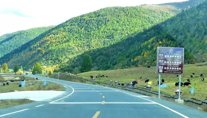
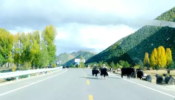
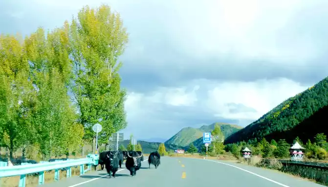
12:13 Leaving the observation deck, continue along the national highway G318, crossing the pastoral area on the way, the free yaks run directly onto the road, and be especially careful when driving when encountering them, because they don't care about cars and behave unpredictably. At 12:37, we drove past the "Red Dragon Town", at 12:38 we saw the Tibetan characters "Oh Mani Ni Mei Coax" on the hillside of the road, and at 12:57 we passed the archway of "China's Matsutake Hometown - Yajiang Wishes You a Safe Journey", we drove out of Yajiang and entered Litang County.A minute later, it passed through the "Litang County Dahebian Public Security Checkpoint", unmanned, which is still 6 kilometers away from Litang County.
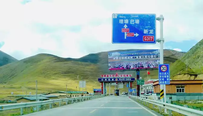
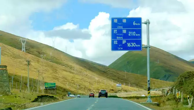
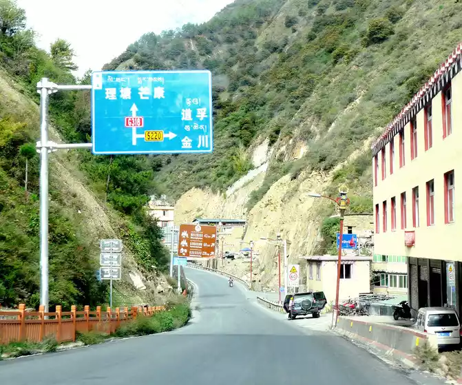
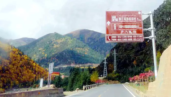
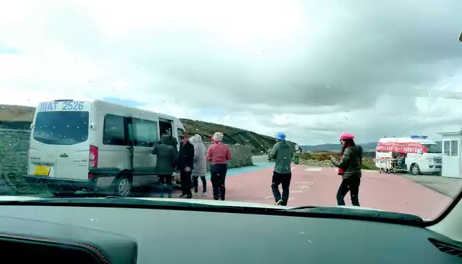
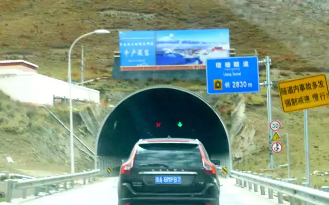
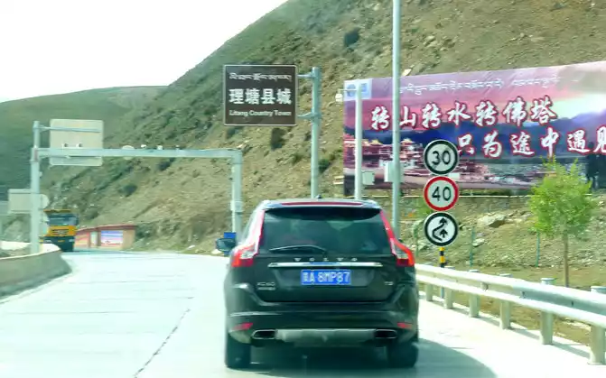
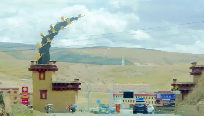
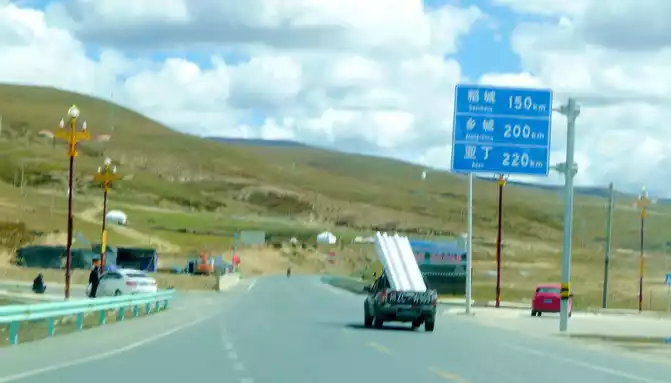
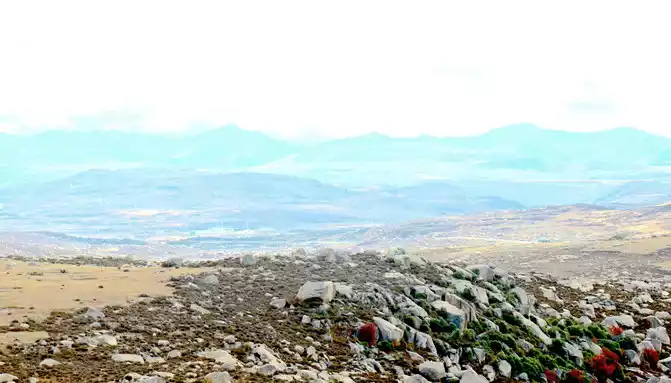
13:04 Cross the "Toloraka Mountain" through the Litang Tunnel, which was originally one of the bottleneck sections of the national highway G318, and the road over the "Toloraka Mountain" pass is very dangerous. The tunnel was built in 2015, and here it is also a "natural moat", and we cross the "Toloraka Mountain" through the tunnel, which feels like walking on a flat road. At 13:11, we arrived at the intersection into Litang County, where there is a gate in the shape of a flying crane and the Kangnan Passenger Transport Distribution Center. We originally planned to have lunch at the distribution center, but when we drove in, we found that there were only toilets and no restaurants. Helplessly, I had to continue to follow the guidance of "navigation", and instead of entering Litang County along National Highway G318, I took National Highway 227 (that is, Provincial Highway S217) south and drove directly to Daocheng, which is 150 kilometers away from Daocheng.
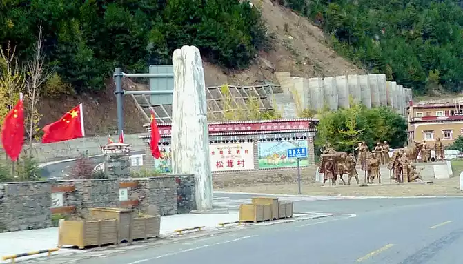
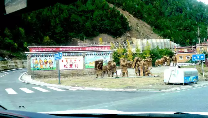
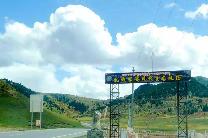
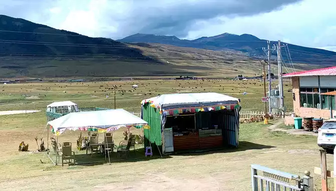
At 13:39, passing by the "Zaga Family Banquet Modern Ecological Ranch", the text in front of the door introduced that this is a poverty alleviation project led by several Tibetan party members to lead difficult households to a well-off life, which seems to be related to tourism. We stopped in the open space in front of its door, and with the last bit of bread and red sausage brought from Xiamen, we made do with a casual lunch here.
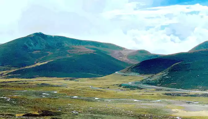
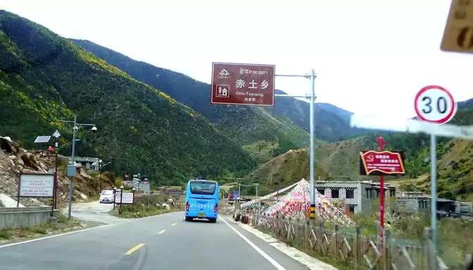
Continue on, pass the "Zaga Sacred Mountain" at 13:57, there is a temple on the mountain. At 14:10, it passed through the Jiawa public security checkpoint, and it was still unattended. Less than a minute later, we encountered a three-way (actually four-way intersection), and we followed the "Daocheng Aden" road sign and went straight along the new road on the far left. 14:13 I saw a golden-roofed temple on the side of the road, which seemed to be called "Russia Temple". Further forward is a large area of high-standard farmland, which seems to be a refined agricultural project.
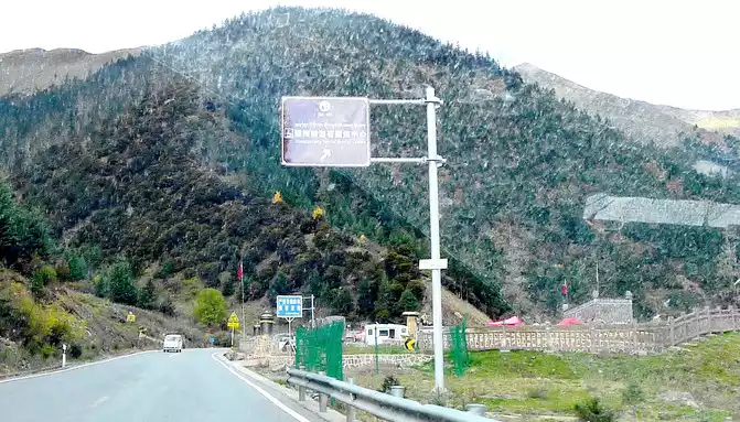
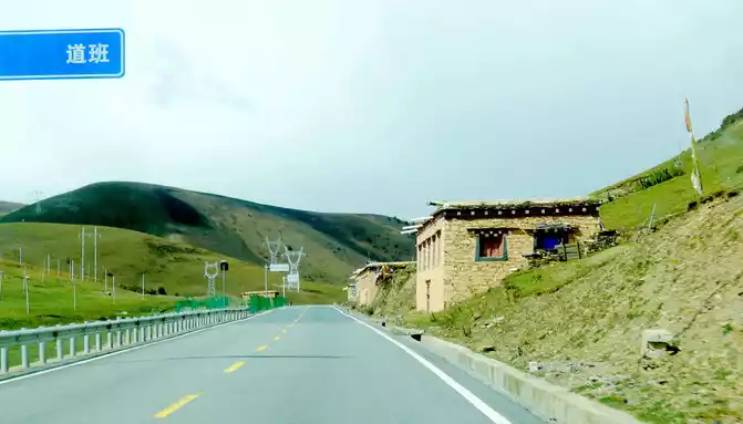
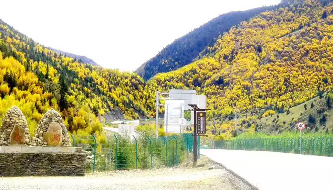
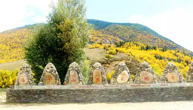
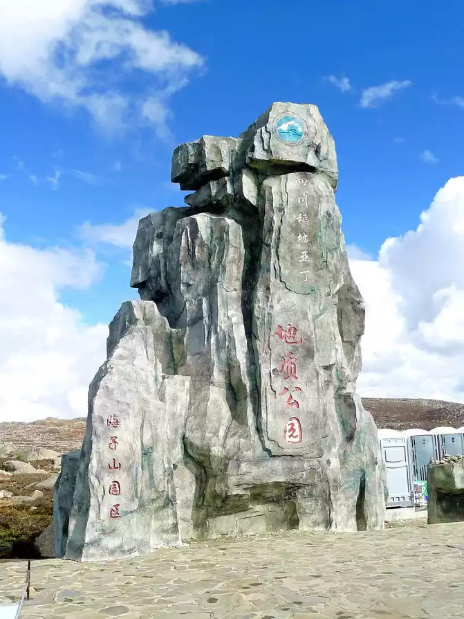
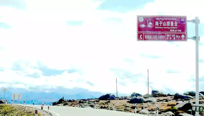
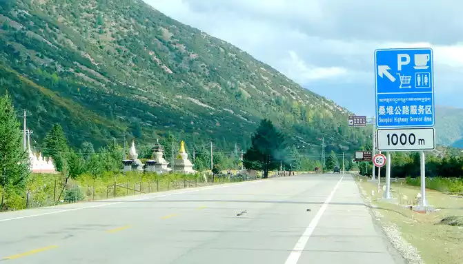
At 14:26, drive into the "Kangxia Service Area", where there is a sign of "Haizishan National Geopark", and there is a mountain pass in front of the highway, which should be the entrance to the geopark. In autumn on the plateau, the pace is very fast, and the trees on the surrounding hillsides have also changed into autumn clothes early. It is also home to road classes, with extensive parking lots, public toilets, and local Tibetan stalls selling food and paid horseback riding.
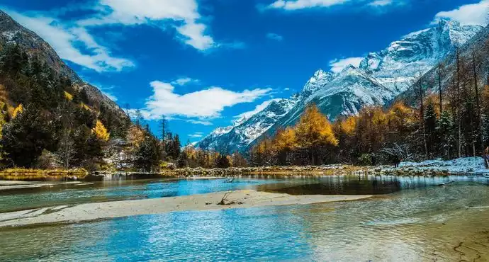
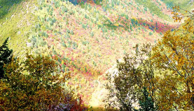
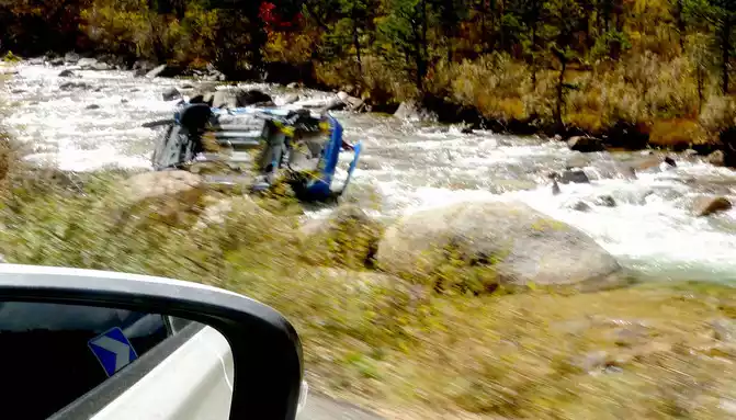
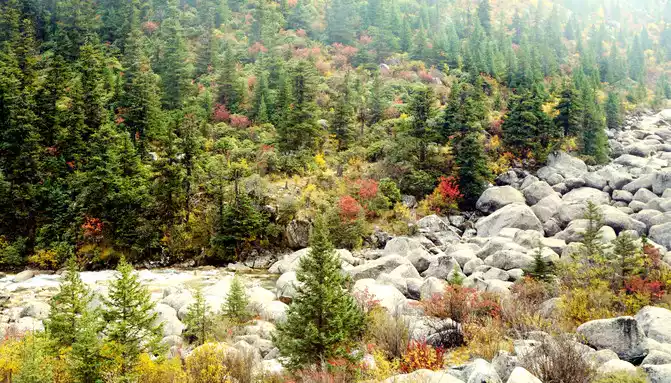
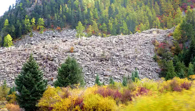
After a short rest, we drove into the mountain pass ahead, and even if we entered the "Haizishan National Geopark", the road followed a turbulent stream upstream and continued to climb higher. At 14:42, I saw the wreckage of a blue car, falling into the stream, the color seems to be quite new, it should be a recent accident. At 14:48, we arrived at the "Stone River" observation deck, and there was also a sign on the side of the road that said "Puyonggou River Valley Autumn Photography Spot", guessing that the roadside ravine should be "Puyonggou", which was stuffed with boulders, which were the relics left by ancient glacial movements. The valley is in full swing in autumn, and the surrounding hillsides are colorful, so it's no wonder it's called an "autumn photography spot".
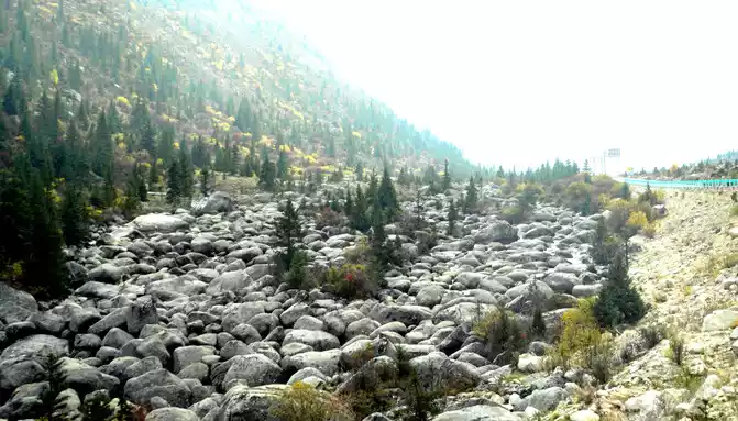
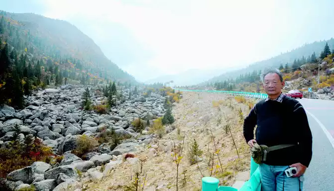
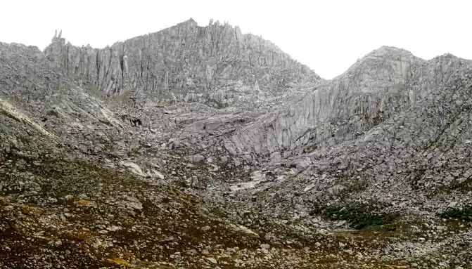
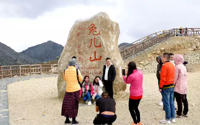
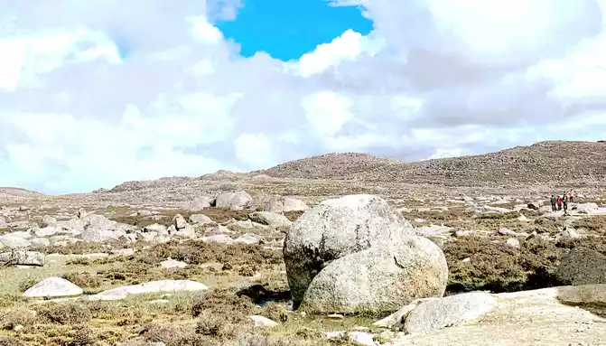
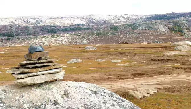
Continuing to move forward, we first passed through the river channel of an ancient glacier, and the glacier in ancient times ground the mountain beams through which it flowed into flat hills. At 15:11, we arrived at the "Rabbit Mountain Tourism Comprehensive Service Station" and stopped for a while, the landscape here is very peculiar, and the mountains are full of large and small broken stones, and no grass grows. Its most famous is the "rabbit" on the top of the mountain, so this mountain is called "Rabbit Mountain". There is an observation deck on the side of the road, and a boulder stands on the platform, indicating that the altitude here is 4,696 meters.
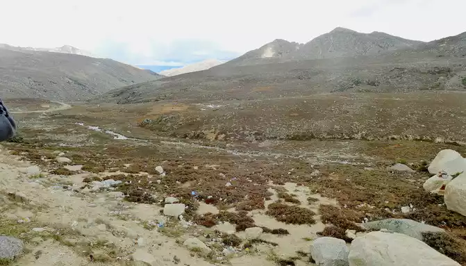
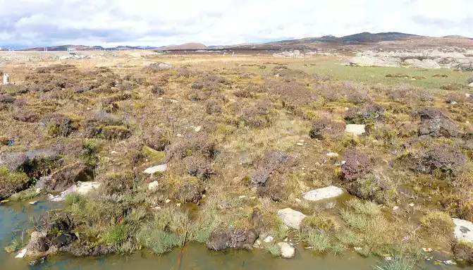
15:17 Leaving "Rabbit Mountain", the road began to go downhill, and what I saw along the way was still full of boulders, and I guessed that this should be the peak of the ancient ice sheet. At the foot of the mountain is a large alpine swamp, with a small stream meandering through it, and dotted water, and the swamp is also full of stones, which are presumed to have been cut and transported from Rabbit Mountain by ancient glaciers.
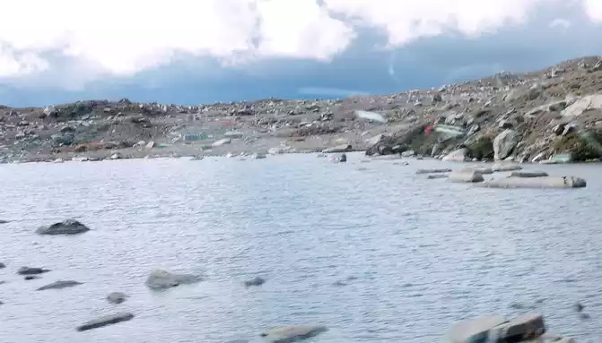
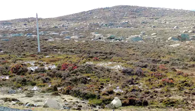
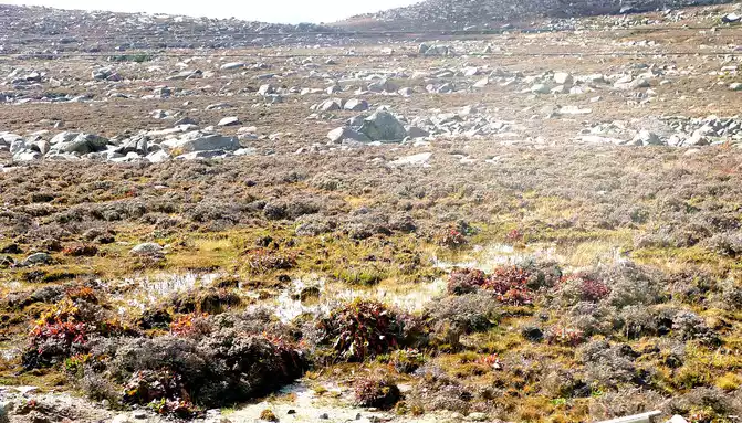
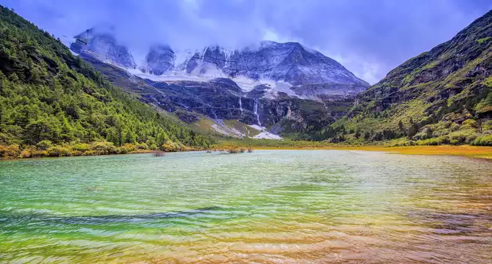
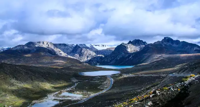
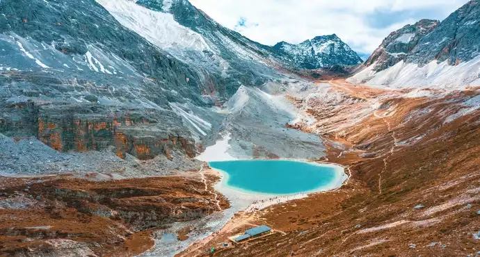
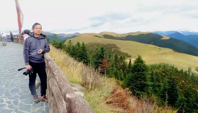
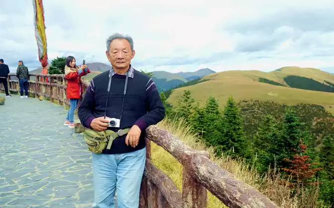
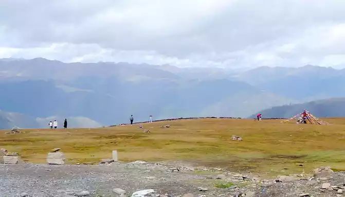
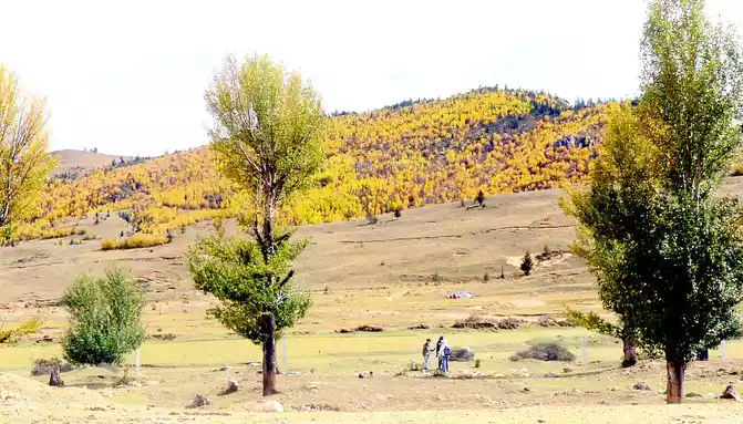
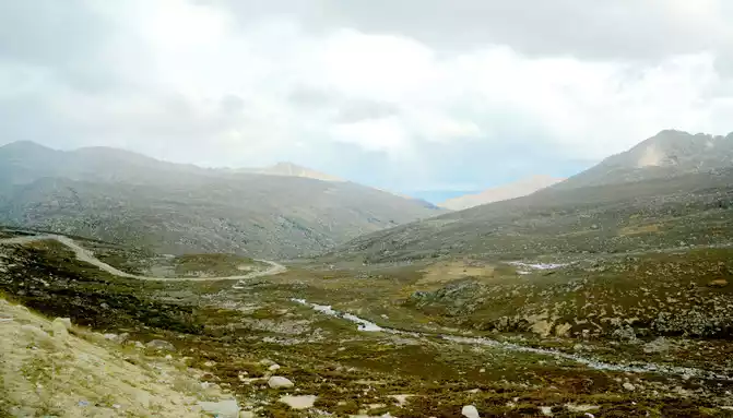
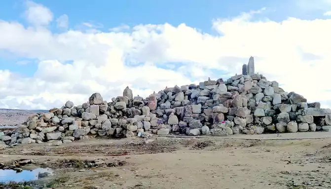
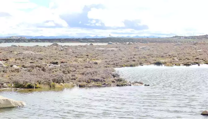
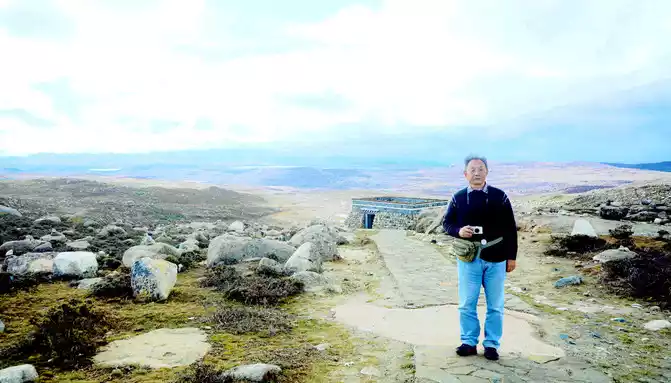
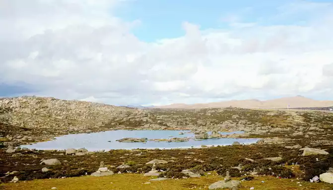
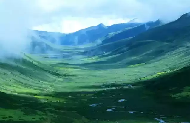
At 15:43, I stopped at a roadside parking lot, which should be regarded as the core scenic spot of Haizishan Geopark, next to the parking lot is a "cliff" made of cement, with the inscription "Geopark (Haizishan Park)", and there is also an artificial rockery made of natural stones nearby. Standing here and looking out, surrounded by endless meadows, scattered with large and small stones, as well as many water beaches and ponds, and in the distance are low hills, the scenery in front of me reminds me of the "grassland" that the Red Army walked through during the Long March, and I can't imagine that it is on the top of a mountain at an altitude of more than 4,000 meters. Haizi Mountain is a flat-topped mountain, because there are small lakes and pools dotted with flat tops (locally called "Haizi"), so it is named Haizi Mountain.
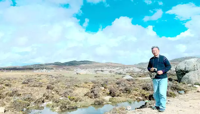
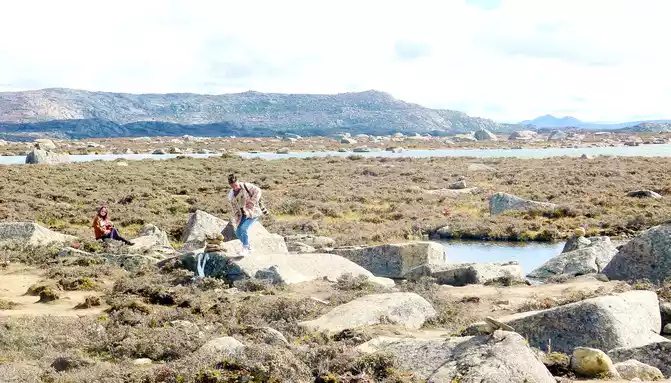

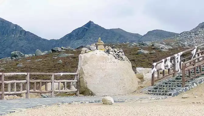
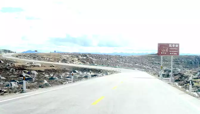
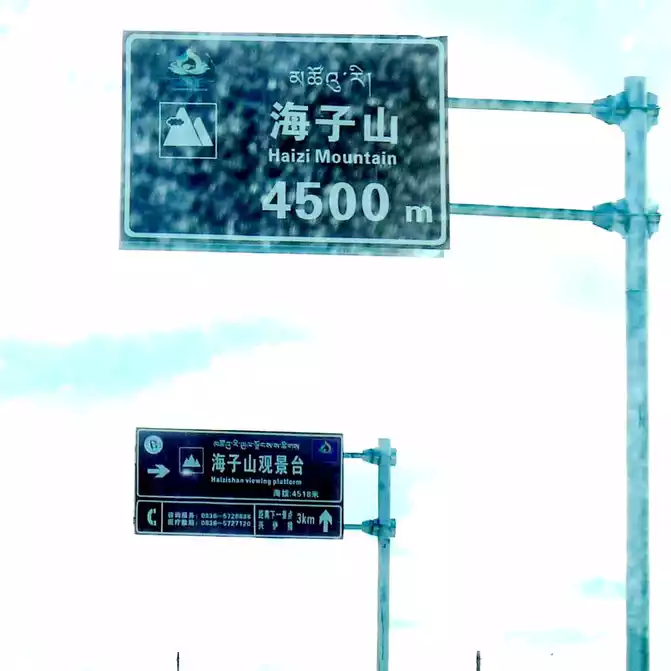
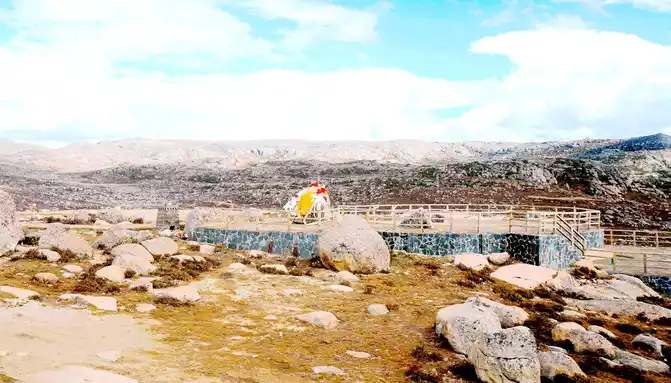
Continuing on, at 15:54, we encountered the "Haizi Mountain Observation Deck", the road sign showed that it was 4,500 meters above sea level, and we stayed for a while. There are simply built roads around the observation deck, and cars can leave the road and enter Stonehenge to park. We climbed up a high boulder and looked out, and then it was clear that we were on the top of the mountain, because the observation deck was located on the edge of the flat peak of Haizi Mountain, from where we could overlook the lake and road below the mountain.
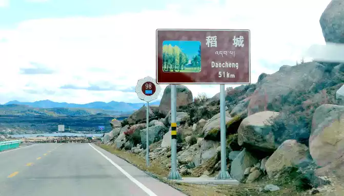
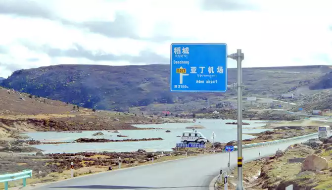
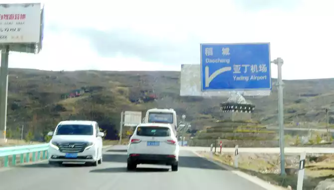
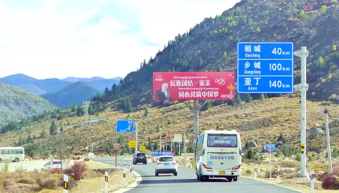
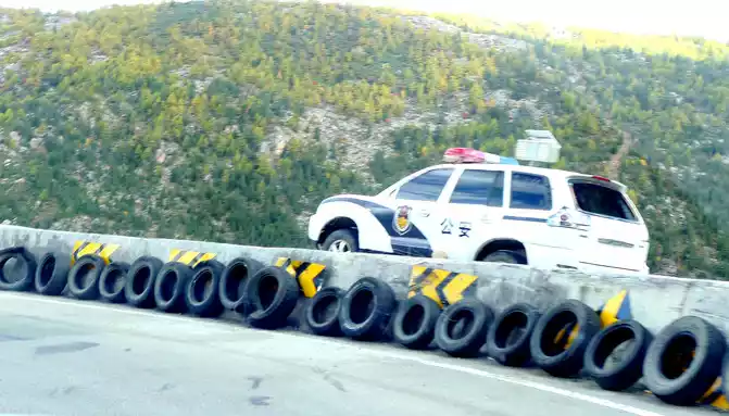
The observation deck is 51 kilometers away from Daocheng, and we continue on our way, and further on, there is a long road down the mountain, because of the frequent accidents, the relevant authorities placed abandoned police cars on the side of the road to fool and deter drivers. 16:18 Drive through the three-way intersection of Aden Airport, there is a Tibetan "pyramid" in the middle of the intersection, the right fork leads to the airport, we go straight along the left side, continue to Daocheng, which is 40 kilometers away from Daocheng and 140 kilometers away from Aden.
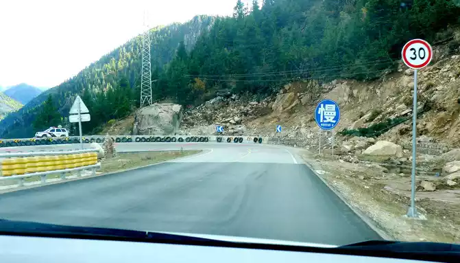
2 minutes from the airport intersection, we saw a "Shihe Park" on the side of the road, it is also called "Haizi Mountain Glacier Shihe Scenic Area", we drove straight by, there was no stop, because this place is still 115 kilometers away from Shangri-La Town, Daocheng County, where we are going to stay tonight, X.J. said that at least more than 2 hours of driving, in order to avoid walking at night, we can only temporarily cut off love here, and leave it for the return trip. Continuing down the mountain, the slope is steep and curved, the road speed limit is 30 kilometers, and another scrapped police car is placed here to scare passing drivers.
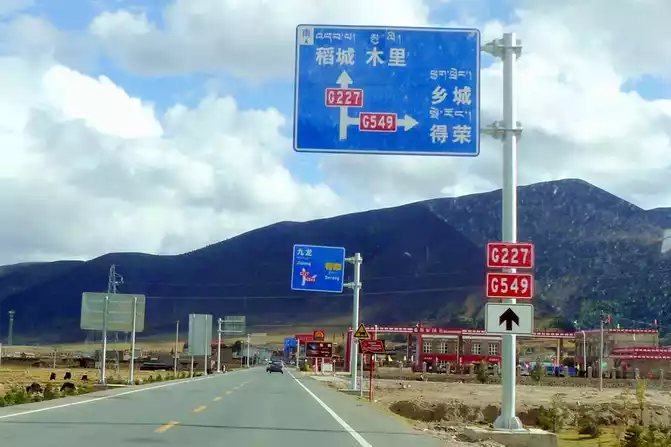
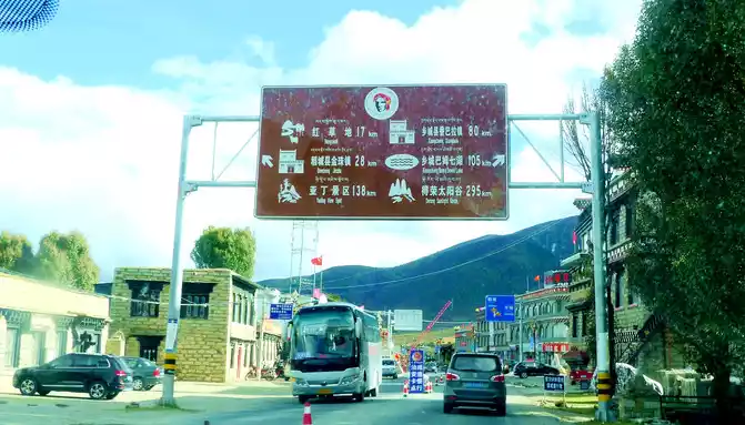
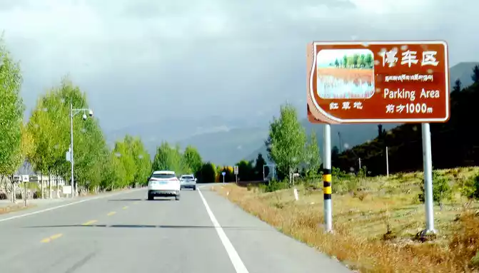
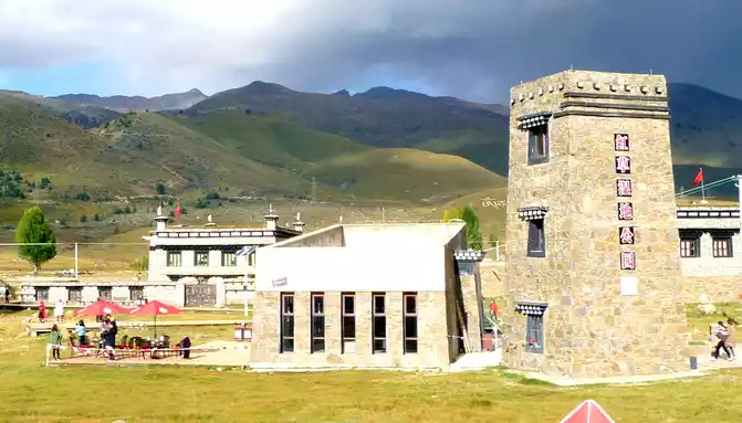
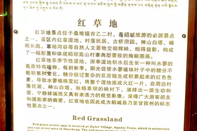
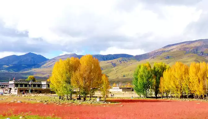
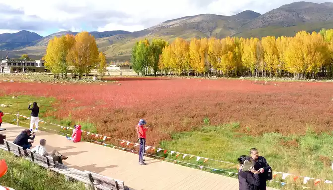
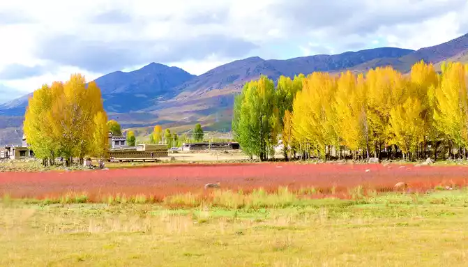
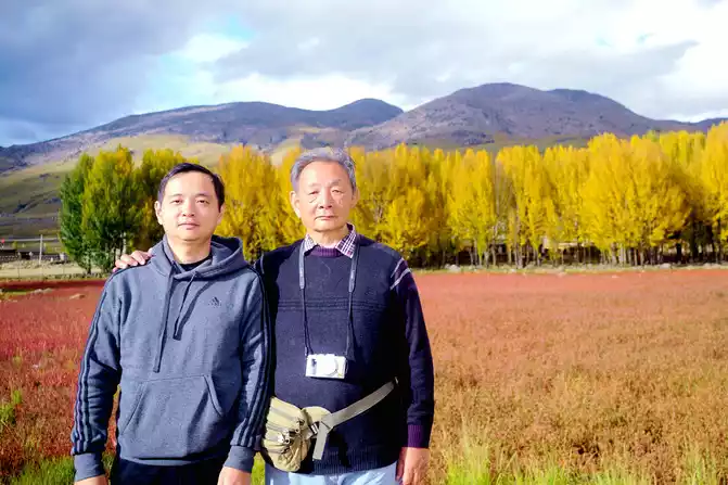
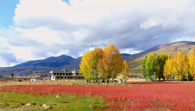
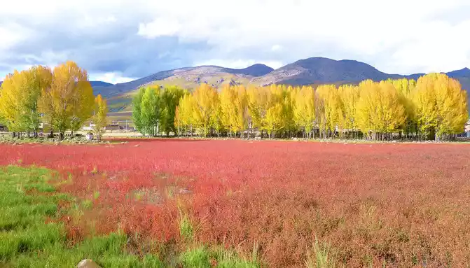
At 16:31, we saw a golden-roofed gatehouse on the left side of the road, and there were two golden-roofed temples on the mountain, so we didn't park. At 16:33, we encountered a T-junction, turned right to National Highway G549, leading to Xiangcheng and Derong, and we continued to go straight along National Highway G227, passing through Sangdui Town, and driving to Daocheng. Sangdui Town is 17 kilometers away from the famous scenic spot "Red Grassland", 28 kilometers away from the urban area of Daocheng County, and 138 kilometers away from the Aden Scenic Area. At 16:52, we arrived at the "Red Grassland", also known as the "Red Grass Wetland Park", located in Jiyi Second Village, Sangdui Town, not far from Daocheng County. The "Red Grassland" scenic spot is on the side of the road, and you can enter and exit at will, but the parking lot is charged, and each car is 10 yuan, which should be regarded as a welfare for the local village.
"Red grassland" is a seasonal wetland, after the rainy season accumulates water, a plateau endemic plant called "water smartweed" will grow, in autumn the "water smartweed" plant turns red, the whole wetland appears fiery red, coupled with rows of golden autumn poplars behind it, the scenery is not ordinary beauty.
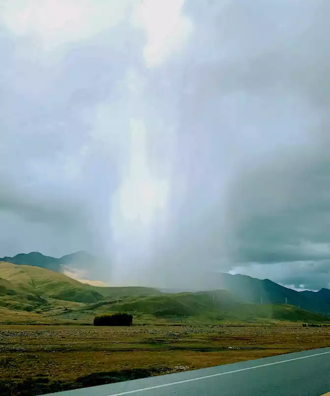
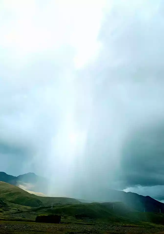
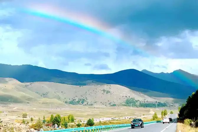
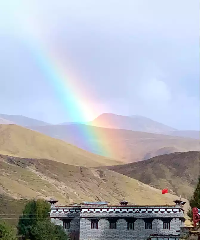
After staying in the "red grassland" for about 25 minutes, the sky suddenly darkened, dark clouds overhead, and a heavy rain came unexpectedly. However, this violent precipitation was only concentrated on a small hill not far from us, and there was almost no rain around, and it looked like a huge waterfall falling from the sky from a distance, and the scene was extremely spectacular, which was the real "Milky Way falling for nine days". The rainstorm on the plateau came and went in a hurry, and after a while, the rain cleared up, and a beautiful rainbow appeared.
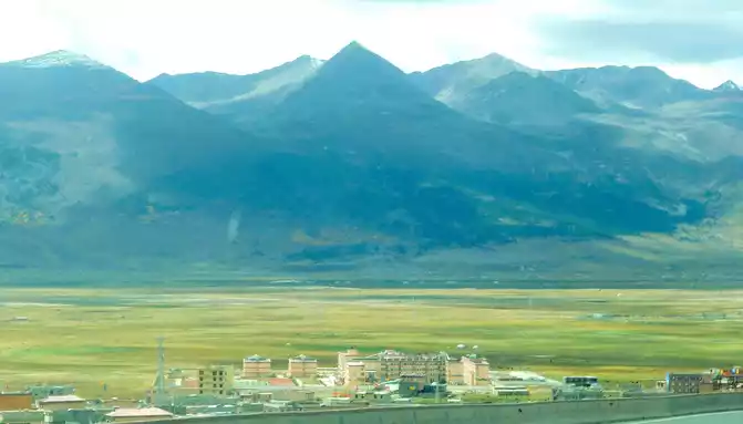
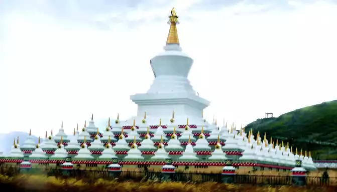
17:28 We saw a large group of white gold-roofed towers on the right side of the road, we still didn't park, this place was already a suburb of the county seat of "Daocheng", we passed around the city.There are still 78 kilometers left in "Shangri-La Town", in order to ensure that we can arrive before dark, we agreed not to stop along the way when we set off from the "Red Grassland", however, at 17:33, we saw a large area of gold on the side of the road, and many people were taking pictures, we couldn't stand the temptation and stopped again.
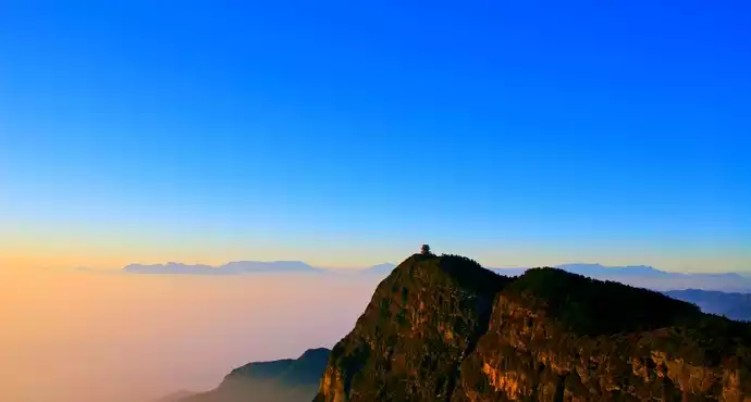
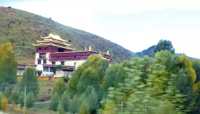
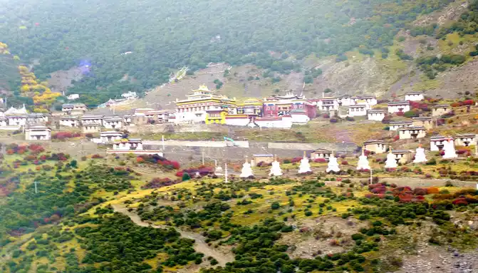
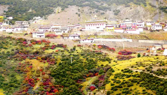
After staying for about 5 minutes, we hurriedly hit the road, passing the "Salad Sea" observation deck at 17:43, and this time we will never stop. Continuing to drive, I saw a big mountain in front of me, and at 17:52 I started to circle and climb, the winding road was layered, and the trees on the side of the road were colorful, which felt really beautiful. Circling to the top of the mountain and looking back, the road we walked on was like a long snake, winding through the valley. The road on the mountain goes straight along a valley, there is a temple on the opposite mountain beam, and the surrounding vegetation is full of autumn, and the red, orange, yellow and green set off the golden-roofed temple, which is particularly beautiful. Later, it was learned that this temple was called "Rewu Temple".
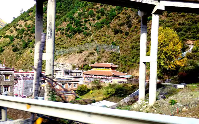
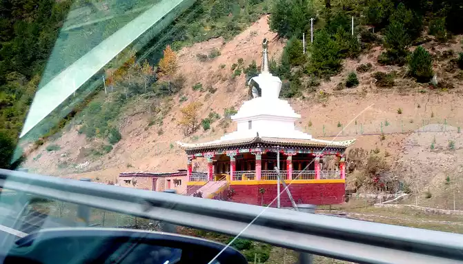
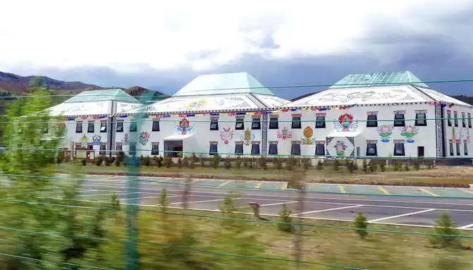
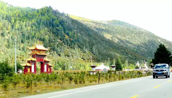
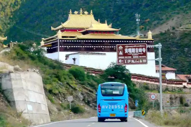
Soon after driving, there was a steep slope ahead, and there was a winding mountain bend again, we snaked uphill and arrived at the top of the mountain at 18:04, where the "Powa Mountain Service Area" was set up, and the sign showed an altitude of 4,513 meters. It was raining lightly on the top of the mountain, more precisely "sleet", we didn't stop and went straight down the mountain, but there was no rain at the bottom of the mountain. 18:44 See the splendid "Gonggalang Jiling Monastery", in today's Tibetan area, both large and small temples have golden roofs.
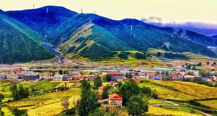
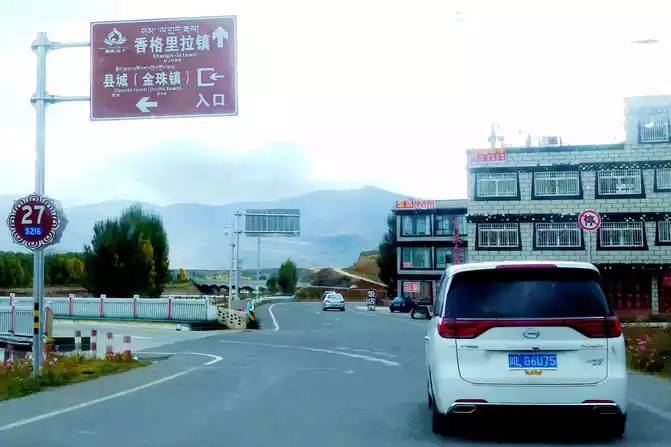
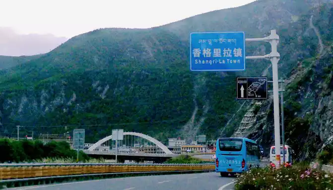
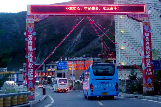
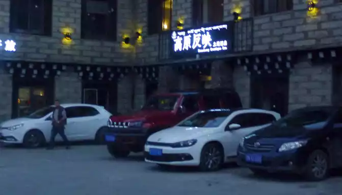
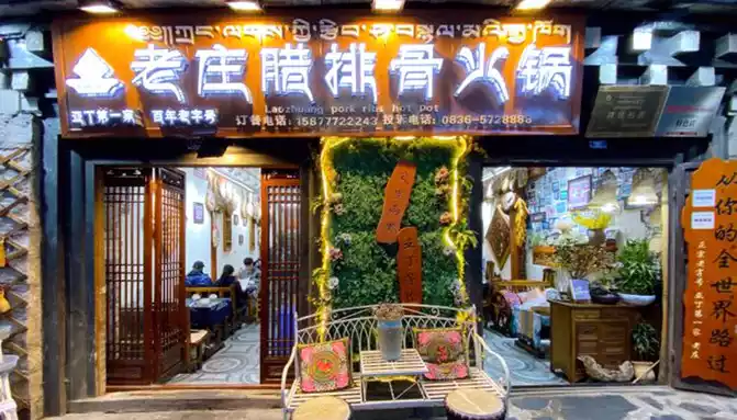
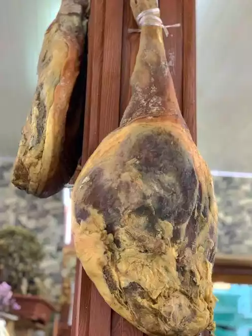
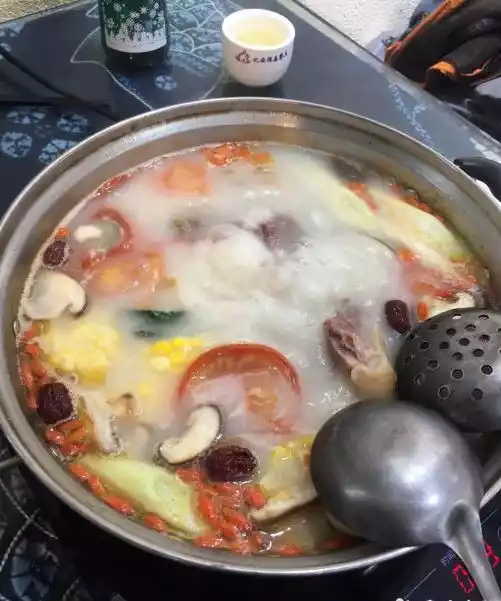
Driving into "Shangri-La Town" is already "the beginning of the lights", and we finally arrived here before dark. Staying in the "Plateau Reflection" theme hotel, the room is quite large, but the facilities are average. For dinner, choose the "Laozhuang La Pork Rib Hot Pot" restaurant. This large piece of cured pork leg is very delicious, I am very satisfied, this time I came to western Sichuan, I have the best impression of the hot pot and Bipenggou barbecue here.X.J. likes light, such as fish, but I still love meat.
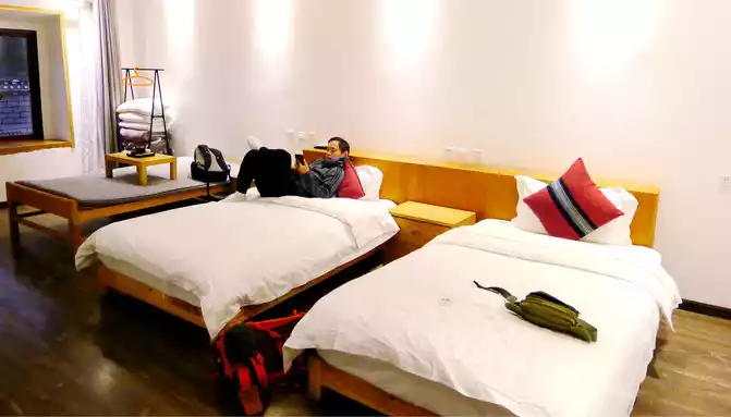
After dinner, I went back to the hotel and listened to a donkey friend who had just walked the long line in Aden, he said that there was no need to ride a horse at all, 300 yuan was only one way, and only the flat road in front of it was really difficult, and the back part of the mountain had to be walked by himself. However, after returning to the room, X.J. said that he would try to ride a horse tomorrow, and then climb the mountain road to see the situation, and if he could, he would go to the Milk Sea. There is a hand-drawn map of Aden scenic spots in the hotel lobby, which you can take a picture of.
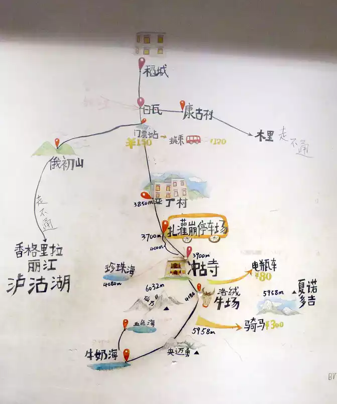
We are going to stay in Aden Village tomorrow night, and the owner of the "Plateau Reflection" hotel suggests that you only bring one day's must, and put everything else in the car. The boss also said that there is a large parking lot next to the bus bus stop in the scenic spot, and there are not many tourists at this time, so it will not be a problem to park early tomorrow. We plan to get off at Aden Village tomorrow, check in at the hotel, and then enter the scenic spot to visit, worried that if the bus from Shangri-La Town passes through Aden Village, there will be no available seats? The boss said that there is no need to worry about this, because there is also a special shuttle bus from Aden Village to the scenic spot.

Number of days: 6 days, Average cost: 3500 yuan, Updated: 2024.07.07
Number of days: 3 days, Average cost: 1500 yuan, Updated: 2023.02.01
Number of days: 8 days, Average cost: 3000 yuan, Updated: 2020.10.20
Number of days:7 days, Average cost: 2800 yuan, Updated: 2024.02.21
Number of days: 1 day, Average cost: 80 yuan, Updated: 2021.03.07


Number of days: 3 days, Average cost: 800 yuan, Updated: 2020.11.17