Live Your Best Lives
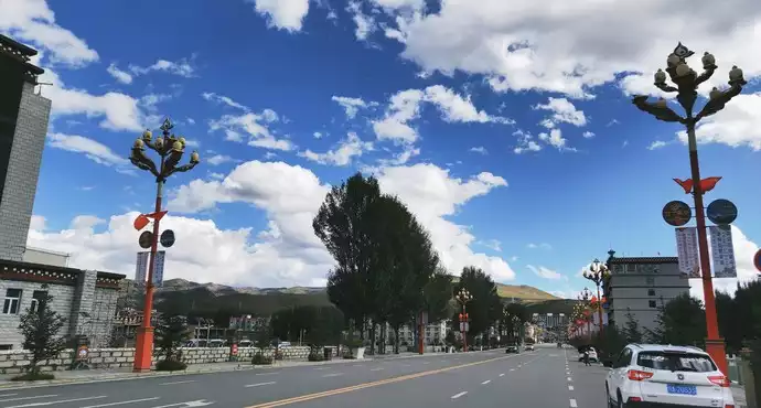
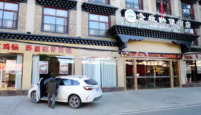
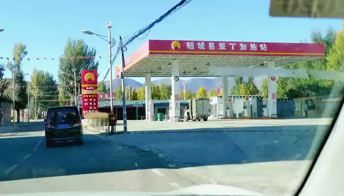
On October 11th (D8), yesterday evening from Aden Scenic Area to Daocheng County (Jinzhu Town), stayed in the "Holy Land Image" hotel in the city, today's plan is to return to Yajiang from Daocheng, compared to coming from Xindu Bridge three days ago, staying in Shangri-La Town, today should be much easier, because there are two fewer sections: the front is missing (Shangri-La Town →Daocheng) section, and the back is removed (Yajiang → Xindu Bridge) section, therefore, I am full of confidence that I will be able to make it to Yajiang before sunset. I had more time, and I got up late in the morning, going downstairs to have breakfast at 8:33 and checking out at 9:20. There is a "Qingyanglin Observation Deck" near the hotel, and after departure, I decided to go there first, and halfway to the middle of the way, I saw the "Aden Gas Station in Daocheng County", and stopped to refuel. At 9:34, we arrived at the Qingyanglin Observation Deck, and there was a boulder next to the parking lot, inscribed with "Daocheng Shambhala Holy City".


The observation deck is a steel frame platform more than ten meters high, just on the side of the road, and is open to the public for free. Climbing to the high platform and looking out, across the river is the "10,000 acres of river beach green poplar forest" in Daocheng County, at this moment the leaves have changed color, showing a golden yellow under the blue sky, and then there are mountains, pastoral and farmhouses in the distance, and the scenery is even more beautiful. In order to improve the environment and control wind and sand, the local people of Daocheng began to plant poplar decades ago, and now it has become a forest of more than 30,000 acres.


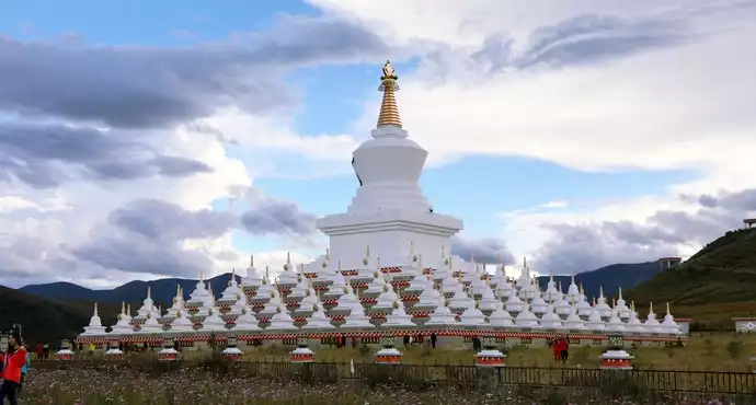
Climbing up to the high platform, I saw a white pagoda in the distance, and when I went down from the high platform, I learned from the "Daocheng County (Jinzhu Town) Tour Guide Full Map" next to the parking lot that the white pagoda is called "Zunsheng Tallinn", which is listed as the two most famous tourist attractions in Jinzhu Town along with Qingyanglin. Leaving the green poplar forest, I drove in the direction of Litang, and it didn't take long to see the white pagoda, which is located at the head of the Daocheng Bridge, also known as the "Daocheng White Pagoda". "Zunsheng Tower" has a unique shape, it is made of a tall main tower in the middle, surrounded by many small towers, the tower is round on the top and below, the whole body is as white as jade, and there is a golden roof at the height, and the momentum is very magnificent. We arrived at the White Pagoda at 10:09, parked, sightseeed, and asked a tourist to take a group photo of the two of us.


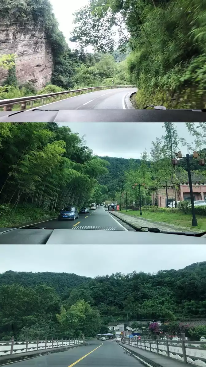
After staying for about ten minutes, there is a small river on the right side of the highway, sometimes far and sometimes near, always parallel to the national highway. It is the local mother river, which originates from "Haizi Mountain", flows through Daocheng County, and finally flows into the Jinsha River. At 10:32, drive through a wide river bay, and the road goes straight to the river, with parking lots, observation decks, and wooden plank roads set up on the riverside. There are two small islands in the center of the river, the winding trestle bridge connects the island with both sides, the riverbank and the island are densely vegetated, the autumn leaves are golden, the yaks are leisurely grazing, the beautiful scenery is comparable to the park, we stopped and stayed again.


10:44 Continue on the road, and drive forward for about 2 minutes is the famous scenic spot "Red Grassland", because I stayed two days ago, and I will not stop today, I guess. The river beach where I parked just now and the "red grassland" here should be a tourist attraction in the same area.


Continue to drive upstream along the small river, the scenery along the way is beautiful, there are both pagodas, Tibetan houses, small bridges and flowing water, pastures, pastures, It reminds me of the "Xinduqiao Photographer's Paradise" that has not yet been commercially developed more than ten years ago.


At 11:10, we drove through "Sandui Town", we did not stop and continued along National Highway G227 towards Litang. 11:13 Passing by the "Sangdui River Valley Sightseeing Platform" that is still under construction, there are two splendid temples here, one is called "Benbo Temple", which is smaller in scale, located on the top of a steep cliff, and the other is larger, called "Bengpu Temple", built at the foot of the cliff.


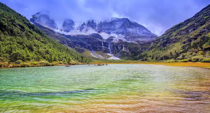
At 11:27, we arrived at the foot of "Haizi Mountain", where there is a "Shihe Park", which is open for free, and I passed by here two days ago without stopping, and today is a make-up class. The park, also known as the "Ice Drift Stone River", is 40 kilometers away from Daocheng County, which is the remains of the ancient glacier of Haizi Mountain and a long river channel filled with large and small stones in the riverbed.These stones are called "glacial drift gravel", they came here with the movement and drift of glaciers in ancient times, and then the climate warmed, the glaciers disappeared, and large and small drifting stones were abandoned and fixed here, so such a long river of stones composed of ice source stones was formed in front of them. Some of the stones on the riverbed weigh 100 tons, and some are as light as goose pebbles, with thousands of postures, which can be called a spectacle.


The park is quite large, far from just a roadside observation deck, and X.J. loves natural landscapes and is also in high spirits. In the process of playing and walking, we found that as a "Shihe Park", it was actually just a small section of the natural stone river, and the two walked through this small section of the river from beginning to end until 12:12. However. When we wanted to leave, we found that there was actually only one opening in and out of the park next to the road, and we had to pass by the local Tibetan stalls to come and go.


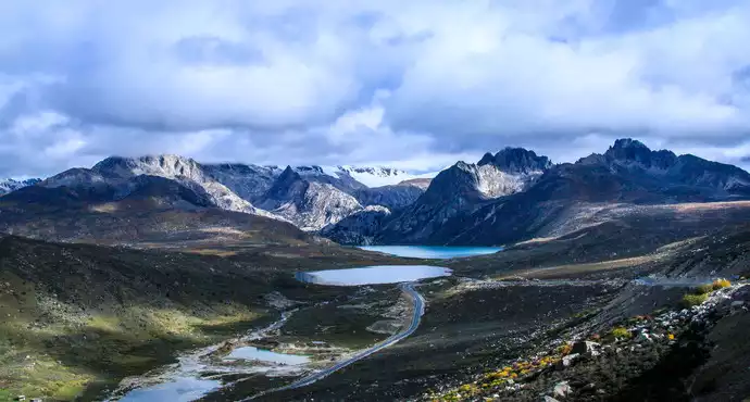
At 12:24, we set off again, and after five minutes, we drove through the three-way intersection of the airport, there was a Tibetan pagoda in the middle of the triangular intersection, turn left to "Daocheng Aden Airport", we went straight along the right side and continued to Litang. Immediately there is the "Haizishan Nature Reserve", with a total area of 3,287 square kilometers, an average altitude of 4,300-4,700 meters, jagged rocks and large and small lakes, it is the largest ancient ice body relic on the Qinghai-Tibet Plateau, known as the "Daocheng Ancient Ice Cap". Because there are 1,145 large and small lakes scattered on the top of the mountain with an average altitude of 4,500 meters, the mountain is called "Haizi Mountain". The car climbed all the way, and boulders and sea seedbits appeared on the side of the road one after another, appearing in front of our eyes.


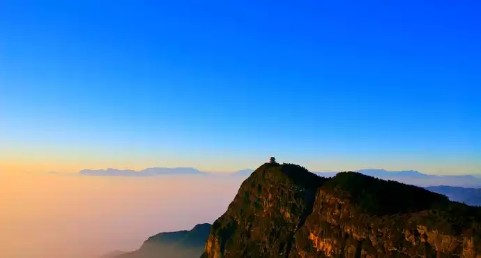
Climbing to the highest point is the flat top of Haizi Mountain at an altitude of 4,500 meters, overlooking the endless view, it is hard for me to imagine that this large plain is actually the top of a big mountain. 12:37 Pass through the "Observatory" intersection, which is our country's high-energy cosmic ray observation base. 12:43 Through the "Xingyituo" intersection, Xingyituo is the largest water surface on Haizi Mountain. At 12:47, drive past the Haizi Mountain Observation Deck, and walk another three kilometers to the "Daocheng Ancient Ice Cap Viewpoint", which is known as the world's largest ancient ice sheet relic. Stayed here three days ago and will not park today.


Continuing on, the remains of the ice sheet recede, and we passed a grassland where roadside signs showed that it was a "basic grassland reserve". After crossing the grassland, I started climbing the mountain again, and the landscape in front of me changed dramatically, and the desolate hillside was full of large and small broken stones. 13:16 Arrived at Rabbit Mountain, the top of the mountain pass set up a "parking service area", the mountain in front of you is all stone, the mountain seems to have been "cut by some mysterious force", the mountain is full of tall rock pillars, the rock pillars collapse, shattered, and turned into boulders, piled up all over the hillside, I suspect that these are also the work of ancient glaciers.


At 13:35, the car continued to move forward, the car went all the way down the mountain, trees began to appear on the hillside, and a large area of grass began to appear on the flat ground, and there was a sign on the side of the road indicating that this was a plateau wetland on Haizi Mountain, with an altitude of 4,178 meters. In the golden autumn of the plateau, the meadows, shrubs and some broad-leaved trees have changed color, but the coniferous cold cloud shirt and other tree species still remain emerald green, and various colors are mixed, compared with the desolation of Rabbit Mountain just now, the scenery here is more unique.


At 13:55, we drove out of a mountain pass, and a flat river appeared in front of us, autumn was strong near the pass, and the hillsides on both sides were golden. After the tour, less than 1 kilometer forward, we stopped at the "Ganzi Highway Kangxia Service Area" where we stayed three days ago, and saw the "Haizishan National Geopark" sign wall made of pebbles, and the mountain pass we just drove out of was the entrance to Haizishan Geopark.


At 14:18, we boarded the bus and left, driving through vast farmland and pastures, and set up a large-character slogan in the field "Make every effort to ensure the safety of vegetables in Guangdong, Hong Kong and Macao", and there is also a slogan showing that this is the state's targeted poverty alleviation base for Tibetan areas, and it is necessary to vigorously develop plateau ecological agriculture here. At 14:25, I drove to the Tang River and saw a row of white pagodas on the grassland, and then a large grazing pasture ahead. At 14:35, it passed the Jiawa Public Security Checkpoint in Litang County, unattended.


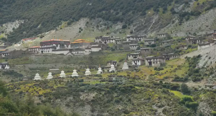
At 14:50, climb up a small mountain bag known as "Zaga Sacred Mountain", and there is a temple at the top of the mountain (4130 meters above sea level). After passing the small temple, you will go down the mountain, and below the mountain is Benge Township in Litang County, and there is a flat river and a vast pasture. At 15:05, we arrived at the three-way intersection of Litang County, from here we went straight into Litang County, we turned right, bypassed the county seat, and at 15:08 we arrived at a gate with horns and flying crane signs, passed through the door and turned right, got on National Highway G318, and drove towards Yajiang.


At 15:11, we arrived at the foot of the "Tolonaka" mountain, which is 133 kilometers away from Yajiang. "Tolonaka" was originally one of the peaks of the road on the Sichuan-Tibet line, and passing vehicles had to spend nearly half an hour to cross the pass, and in July 2015, the 2,830-meter-long "Litang Tunnel" was opened to traffic, and we only needed more than 4 minutes to cross this mountain. After leaving the tunnel, continue to move forward, and you can meet yaks on the side of the road from time to time, they are a tyrant on the Sichuan-Tibet line, and they can suddenly cross the road at any time, and they must slow down, give way, and pass carefully.


At 15:21, it passed through the "Big Riverside" public security checkpoint in Litang County, but it was still unattended. Two minutes later, through the archway of "China's Matsutake Hometown - Yajiang Welcomes You", we left Litang and entered Yajiang County, which is 120 kilometers away from Yajiang County. At 15:28, it encountered sleet and drove through "Red Dragon Town" at 15:49.


Soon after driving out of Honglong Town, it began to climb over the "Kazila Mountain", which is also a big mountain across the Sichuan-Tibet line, and no tunnel has been built so far, and it must be crossed. At 16:23, we arrived at the pass of Kazila Mountain, where there is a large observation deck, but there are no other facilities except for a public toilet and a huge stone monument. The wind was strong and the temperature was low, and I couldn't see the scenery after the rain, so I took two photos, then hurriedly boarded the car and set off again.


All the way down the mountain, the sky began to clear, the road was built on high mountain beams, the view was very wide, perhaps because of the high altitude, the surrounding hillsides were all bare, and not a single tree could be seen. 16:54 Passing through the "Nimagong Sacred Mountain Large Observation Deck Tourist Service Area", compared with the Kazila Mountain just now, this is a fairly well-equipped tourist service area, with a long line of houses and a fairly formal parking lot, however, we don't seem to have much scenery from the road, so we didn't park and drove straight.


Continuing forward, the altitude gradually decreased, and large areas of trees began to appear on the hillside. 16:59 I suddenly saw a wooden observation deck on the right side of the road, so I stopped.This place is called "Orado Dongguo", the observation deck is located at the intersection of the grassland on the top of the mountain and the coniferous forest on the hillside, you can walk directly into the grassland on the top of the mountain from the observation deck, it is estimated that the scenery here should be beautiful when the spring flowers bloom, but the season is not right at this moment, we just stayed for a while, took a few photos, and then moved on.


17:18 Passing by the "Xiong Zongka Observation Deck", because I stayed three days ago, I didn't stop at the moment. At 17:24, crossing the "Scissors Curved Mountain Tunnel", there is a fork in the road to the top of the mountain on the right side of the cave entrance, and before the tunnel is completed, passing vehicles must cross the top pass at an altitude of 4,659 meters. The Scissors Curved Mountain Tunnel was opened to traffic at the end of 2014, with a total length of 2,238 meters, an altitude of 4,300 meters above sea level in the direction of Litang and an altitude of 4,200 meters in the direction of Yajiang. However, perhaps because it has been opened to traffic for five years, the tunnel floor is potholed, there is no lighting in the cave, the car must turn on the headlights, the speed limit is 30 kilometers, and X.J. complains all the way that it is a "tofu dregs project".

At 17:27, we drove out of the cave entrance, and immediately it was the famous "Tianlu Eighteen Bends" dangerous section on the Sichuan-Tibet Line, and after leaving the cave, we drove about 500 meters, and suddenly found that there was a "Tianlu Eighteen Bends Tourism Comprehensive Service Station", but because we were driving in the downward lane, the service station was located on the side of the upward lane, and the cars coming from the opposite side were one after another, and we missed the opportunity to enter the service station. Continuing down the mountain, at 17:33, we suddenly saw a "Tianlu 18 Bend Observation Deck" on the side of the road, however, it was also because we were going down the mountain too fast, and there happened to be a big car going up the mountain on the opposite side, and we missed the opportunity to enter the observation deck. At 17:42, we arrived at the "Xianggezong Village" at the foot of the mountain, which is 3,600 meters above sea level, and the 18-bend section of the Tianlu ends here.


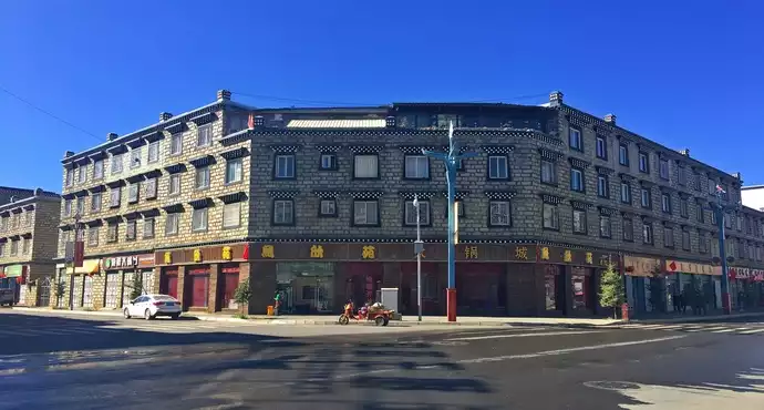
At 18:04, we arrived at Yajiang County, which is 2,600 meters above sea level and is located on the banks of the Yalong River, and the city is mainly built on the right bank of the Yalong River, and it is full of high-rise buildings as far as the eye can see. I thought I was going to stay in Yajiang City, and I was looking forward to taking this opportunity to see what the town was like, but after asking X.J., I found out that he did not book a hotel in the county seat, but chose a "Ling Miya" cultural hotel outside the city, because it is said to have a lot of "taste". Therefore, the "navigation" guided us to bypass the county seat, cross the bridge to the left bank of the Yalong River opposite the city, and then pass through a short tunnel through the mountain, leaving the city without entering the city, and driving straight in the direction of Xindu Bridge. Voice navigation report: The destination is about 20 kilometers ahead, which makes me very suspicious, what kind of hotel did X.J. book, and how could it be so far from the county seat?


Continuing to move forward, the surrounding environment became more and more remote, and the navigation continued to report that "there are still 15 kilometers, 10 kilometers, and 5 kilometers away from the destination". I once again questioned how it was so far from the county seat? X.J. impatiently responded, "What's the harm in staying away from the county seat", and when I saw that his temper was rising, I stopped talking. At 18:30, I came to a place where there was no shop in front of the village and no shop behind, and there was a single building on the side of the road, and the navigation finally said: "Arrive near the destination, this navigation is over." We drove into the courtyard, but no one paid attention, X.J. got out of the car and shouted, and just then an old janitor came out and told us that the hotel could be checked in at the moment, but meals were not provided, and the meal had to be driven forward, and there was a Sichuan restaurant not far away. So, Xinjie went to see the house with him, and soon returned to the car, claiming that the room was still clean, but the facilities were rudimentary, just at the level of a farmhouse inn, so we still drove forward and went to live in Xinduqiao. However, X.J. has paid the full amount online for booking this hotel, and it is the kind that cannot be refunded, it seems to be 158 yuan, I question whether it is wise to do so? X.J. said that a single building in the wilderness, an old man who was a janitor, only the two of us felt uncomfortable, this trip cost more than 10,000 yuan in total, and the total cost of this 158 yuan was just an insignificant fraction, so there was no need to save this little money to live unhappily and ruin the mood. So, he called the "Gesang Garden Inn" in Xinduqiao where we had stayed three days ago, and the boss said it was full, and X.J. searched the Internet again, as if he had found a hotel, and then said "go", and we hit the road again.


was dark soon on the road, and the biggest principle of our self-driving trip this time was "never rush the night road, especially the mountain road", and we basically did it in the first few days, however, after such a toss, we really want to "catch both the night road and the mountain road" today. Not far ahead is Gaoersi Mountain at an altitude of 4,659 meters, although the tunnel has been repaired, but the tunnel entrance is more than 1,400 meters higher than that of Yajiang County, and we have to turn on the headlights and climb the slope. Climbing to the top is the 5,682-meter-long "Gaoersi Mountain Tunnel", which is fully lit and the road conditions are much better than the Scissors Curved Mountain Tunnel.
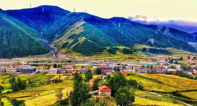
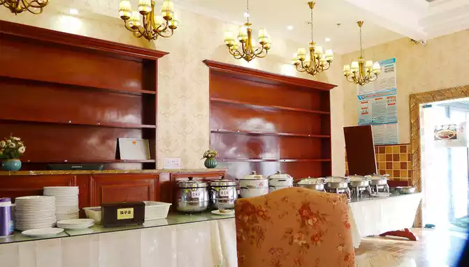
After driving out of the tunnel, not far away is Xinduqiao Town, both ends of the Gaoersi Mountain Tunnel can be described as two heavens, it is sunny on the Yajiang side, and it is raining on the Xinduqiao side. At 19:50, we arrived at the "Tibetan Xiangxue Hotel", X.J. just got it online not long ago, the room price is more than 400 yuan, this is a completely Tibetan-style hotel, the facilities are high-end, there is also an attached restaurant, the service is also very good, we just parked the car, there were two beautiful Tibetan girls with umbrellas to pick up the car and help us carry our luggage. Dinner is settled in the hotel restaurant, I don't remember what to eat, I only remember that the price is not cheap.


Number of days: 6 days, Average cost: 3000 yuan, Updated: 2021.05.19
Number of days: 2 days, Average cost: 800 yuan, Updated: 2020-08-07 15:46
Number of days: 8 days, Average cost: 3000 yuan, Updated: 2023.03.20


Number of days:7 days, Average cost: 5000 yuan, Updated: 2020-06-30 14:44
Number of days:7 days, Average cost: 3375 yuan, Updated: 2020.10.18
Number of days: 6 days, Average cost: 5000 yuan, Updated: 2020.10.08