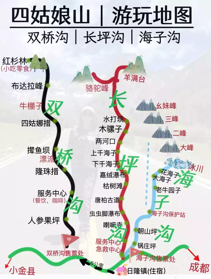
Live Your Best Lives
I wanted to go to western Sichuan, but for various reasons, I couldn't make the trip, and my wish was finally realized after the epidemic came to an end in October 2023.
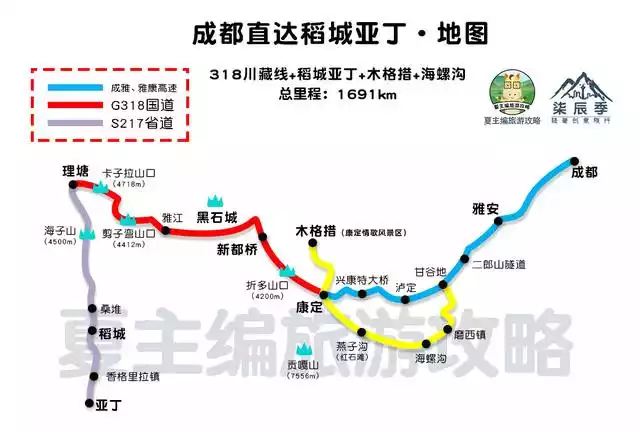
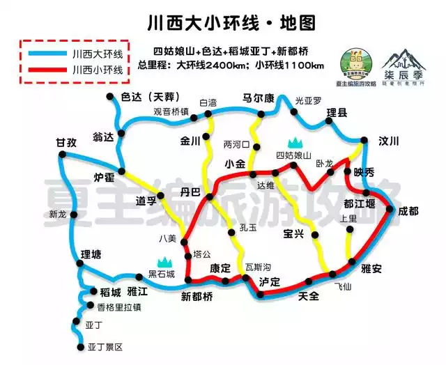
Outbound: Chengdu - Ya'an City - Tianquan County - Erlang Mountain - Kangding County - Xinduqiao - Yajiang County - Litang County - Daocheng County - Aden, with a total length of more than 800 kilometers
Return: Aden - Daocheng - Litang - Yajiang - Xinduqiao - Tagong - Bamei - Danba - Xiaojin - Siguniang Mountain - Dujiangyan - Chengdu, with a total length of more than 900 kilometers
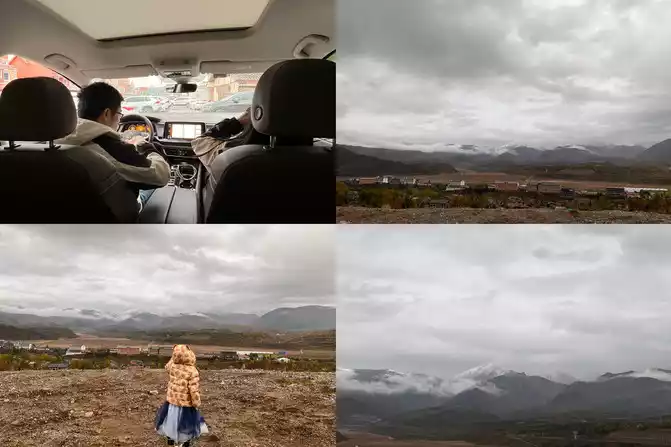
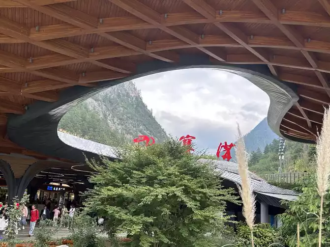
D1 (10/7) Shanghai Pudong Airport - Chengdu Shuangliu Airport (512 above sea level).
D2 (10/8) Chengdu - Ya'an Expressway - Kangding - Yajia Ridge - Moxi Ancient Town (1573 above sea level)
D3 (10/9) Yumo Road - Yajia Ridge - Kangding (2560 above sea level)
D4 (10/10) Kangding - Mugecuo (3700 above sea level) - Xindu Bridge (3470 above sea level)
D5 (10/11) Xindu Bridge Gongga Snow Mountain Observation Deck (3500 above sea level) - Yuzi West Starry Sky Camp (4200 above sea level)
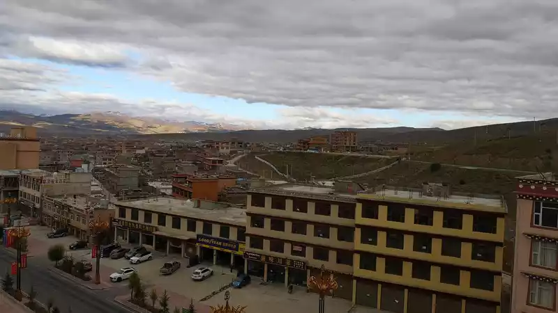
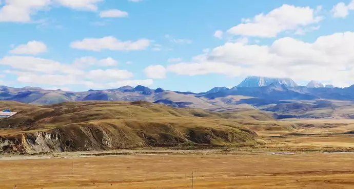
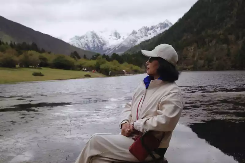
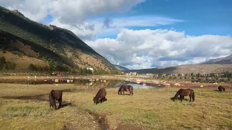
D6 (10/12) Xindu Bridge - Yajiang (2900 above sea level) - Litang (3960 above sea level) - Daocheng County (3700 above sea level)
D7 (10/13) Daocheng Red Grassland - Zunsheng Tallinn - Shangri-La Town (2900 above sea level)
D8 (10/14) Daocheng Aden Scenic Area Short-line Pearl Sea (2900-4080 above sea level)
D9 (10/15) Daocheng Yading Scenic Area Long Line Milk Sea Five-Colored Sea (2900-4700 above sea level)
D10 (10/16) Daocheng Aden - Daocheng County (3700 above sea level)
D11 (10/17) Daocheng County - Litang - Yajiang - Xinduqiao - Tagong Town(3750 above sea level)
D12 (10/18) Tagong Temple - Tagong Grassland - Muya Temple (3600 above sea level)
D13 (10/19) Danba Moshi Park (3500 above sea level) - Jiaju Tibetan Village (4200 above sea level)
D14 (10/ 20) Danba (1893 above sea level) - Rilong Town (3200 above sea level)
D15 (10/21) Siguniang Mountain Shuangqiaogou Scenic Area (2900-3840 above sea level)
D16 (10/22) Siguniang Mountain - Dujiangyan (592-4582 above sea level)
D17 (10/23) Dujiangyan - Chengdu - Du Fu Thatched Cottage - Wuhou Temple
D18 (10/24) Chengdu Shuangliu Airport - Shanghai
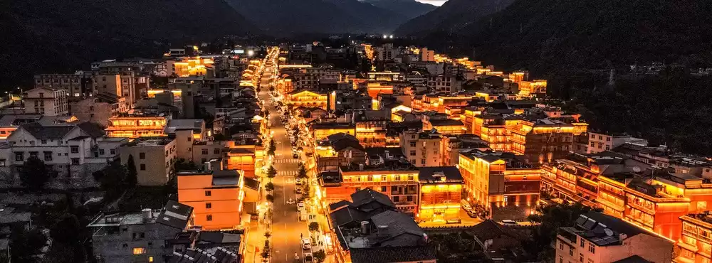
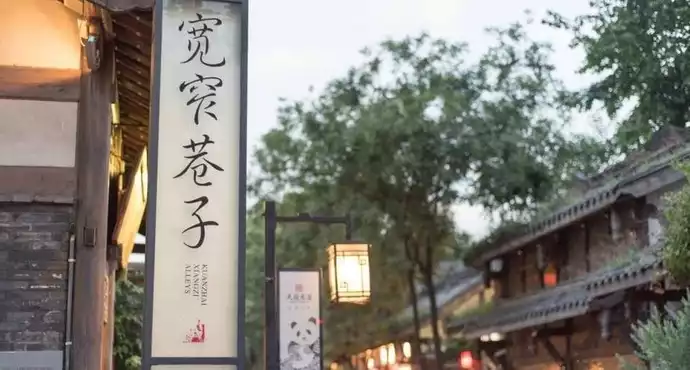
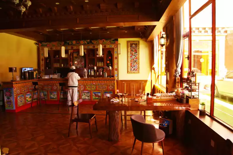
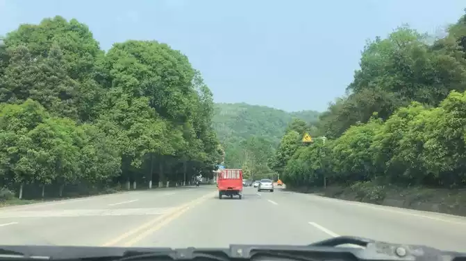
D1(10/7 ) Cloudy, Wait at the boarding gate 1.5 hours after departing for Pudong Airport.Nearly 3 hours to Chengdu Shuangliu Airport, pick up the car and go to the hotel to check in. In the evening, I drove to Kuanzhai Alley and Jinli for a stroll, and I felt that compared with nine years ago, the commercial atmosphere was stronger, noisy and noisy, and there was almost no sense of tranquility and leisure.
D2 (10/8) On rainy days, depart from Chengdu after breakfast, go all the way through Ya'an Expressway, pass through Erlang Tunnel, and reach Moxi Ancient Town, with navigation and positioning of 283 kilometers and 3.5 hours. It actually took 6 hours, because the entrance of the Ya'an Expressway in Luding County was closed, so I could only take the expressway to Kangding and then take Yumo Road to Moxi Ancient Town. Hailuogou has not yet been opened due to the earthquake, and Moxi Ancient Town is also a depressed scene, and can only be used as a transfer station to rest for one night.
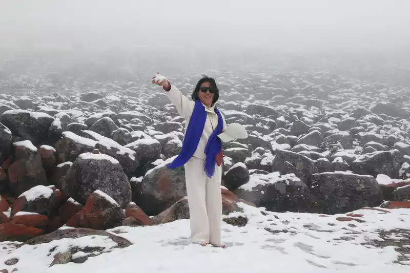
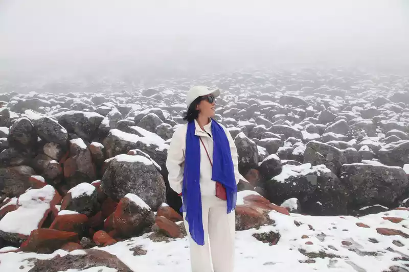
D3 (10/9) Return to Kangding along the original road of Yumo Road. The mountains of Yagarg are covered with snow, white, but there is no frozen snow, which does not affect driving.
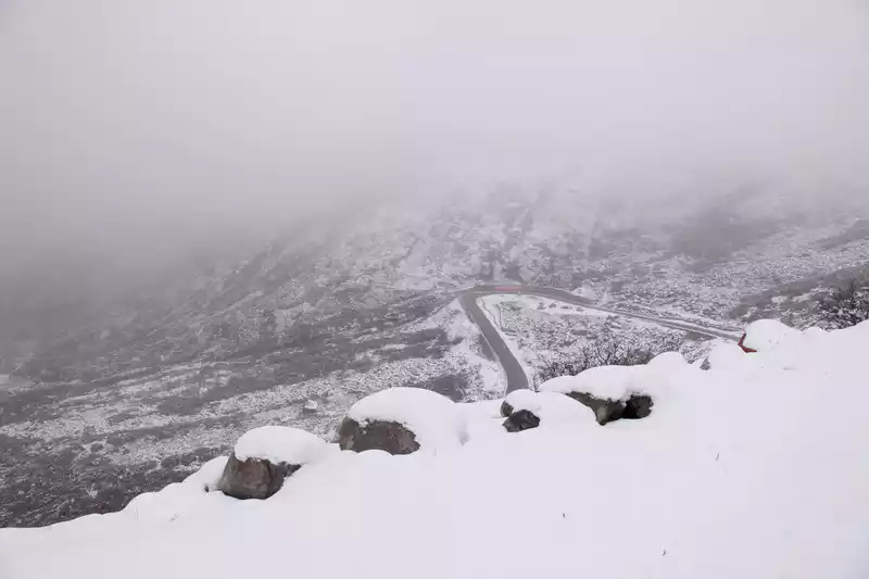 Climbing up the hill
 Because of the heavy snow, there are few cars on the road, almost nothing. The opportunity to park on the side of the road to play in the snow and take photos is much more casual.
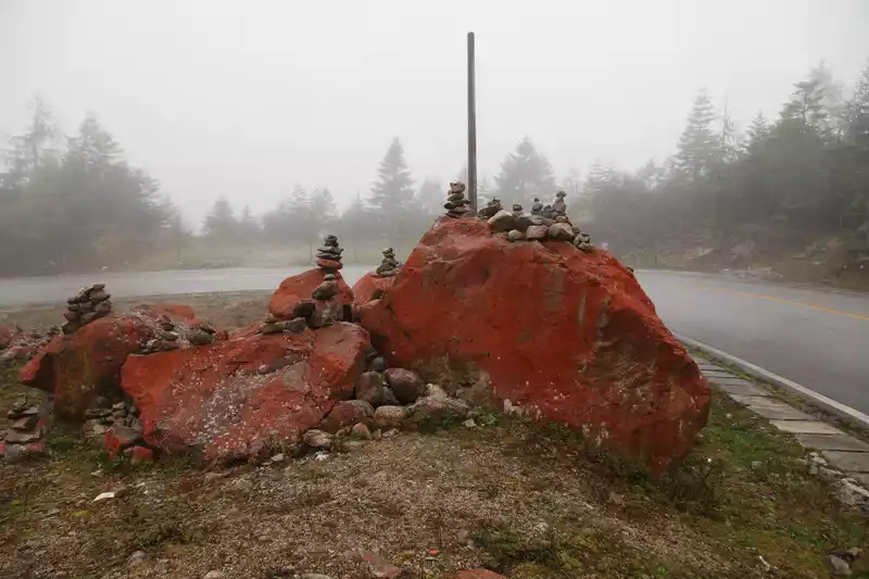
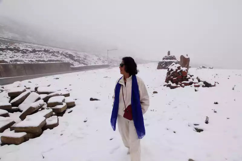 The
The snow covers the red stone, and the red and white color scheme is the finishing touch
Snow nearby and confused in the distance, this situation is also rare in life for me living in the south.
 The
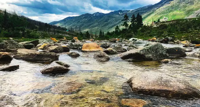
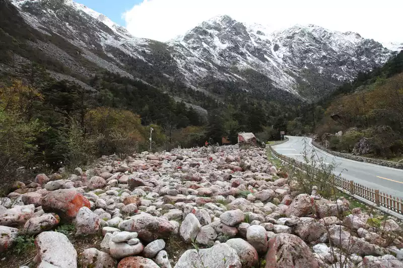
The section with the most stones along the road is naturally the most beautiful and layered, and the photos are also very good.
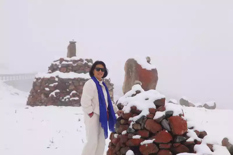
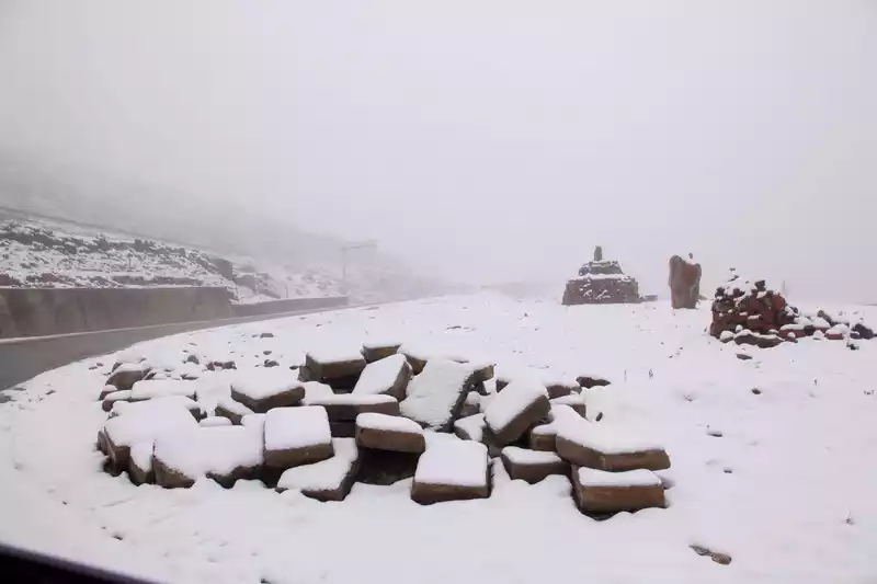
 The
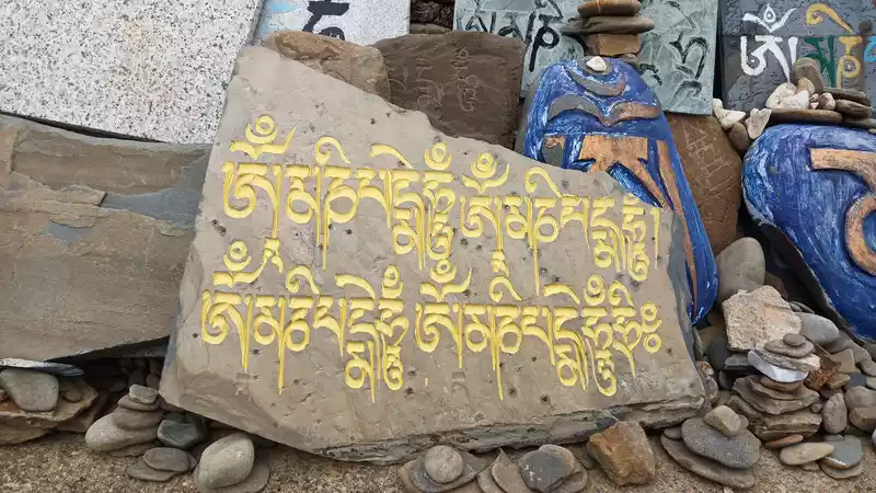
The six-character mantra that can be seen everywhere in western Sichuan is hard to imagine how it was engraved, and with the support of faith, it can be done.
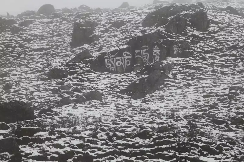 Six-character mantra
 Due to the earthquake in Hailuogou, the redstone covered by a large area of stone died. The red stone is a gorgeous rust red, and this piece is a relatively complete red. Some botanists say that the reason why the stones of "Red Stone Beach" turn red is because the climate here is suitable for the growth of red moss organisms and attach to the stones, some biologists say that it is formed by a lower organism growing on the stones, and geologists say that the stones here are caused by the high content of a certain mineral due to special terrain and climatic reasons.
 Red Stone Mani Pile
 These red stones shine brightly between streams, on hillsides, and in the bushes. Once washed by rain, the red stone will become bright red like blood.
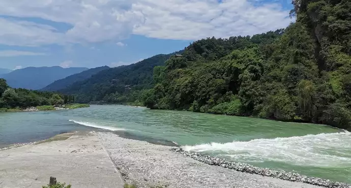
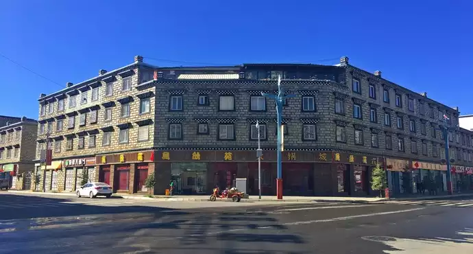
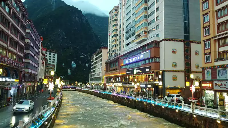
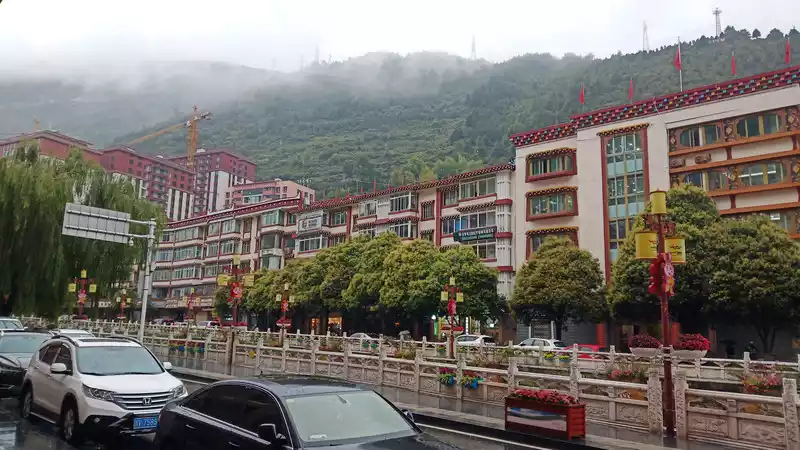
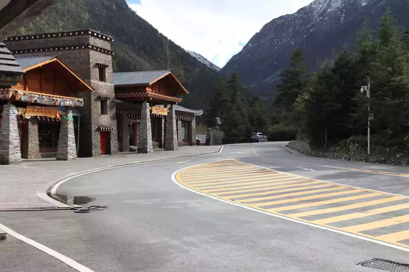
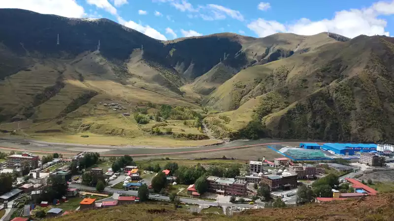
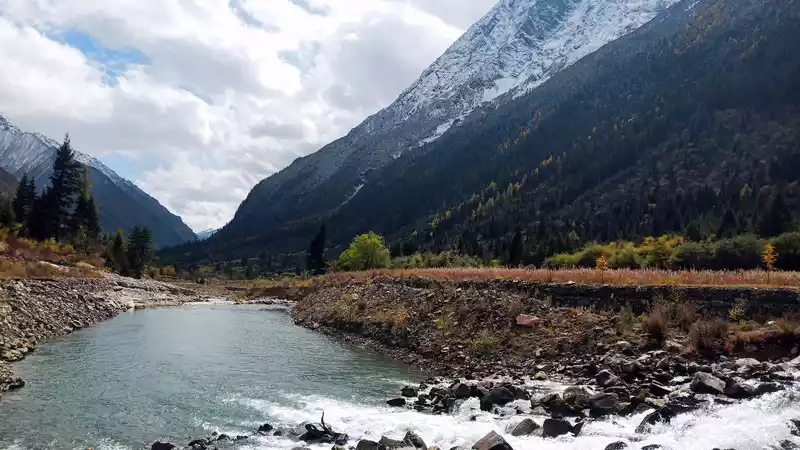
Cross the mountains to reach Kangding City. The Kangding River divides the city into two, with fast water flow and abundant hydraulic resources. The city is also quite lively, with endless flow of people and vehicles.
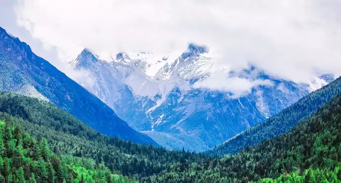
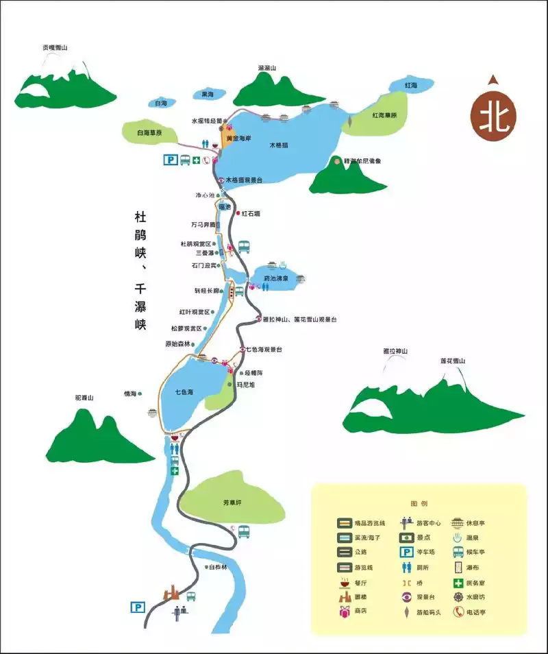
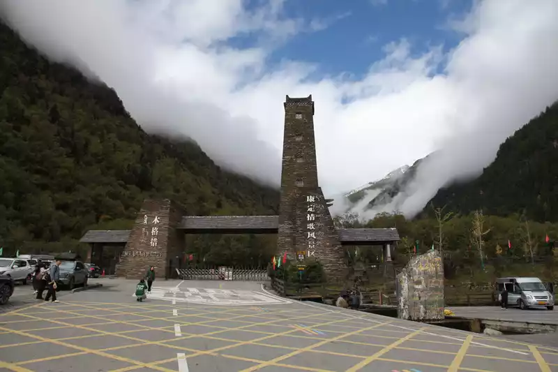
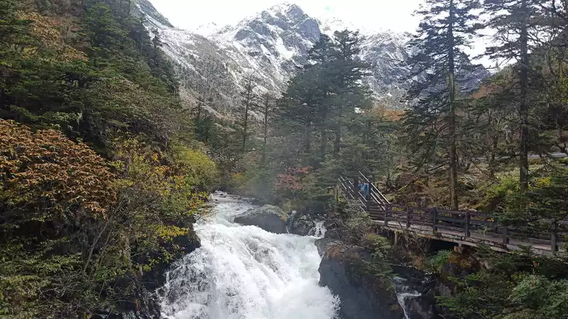
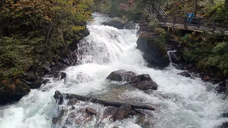
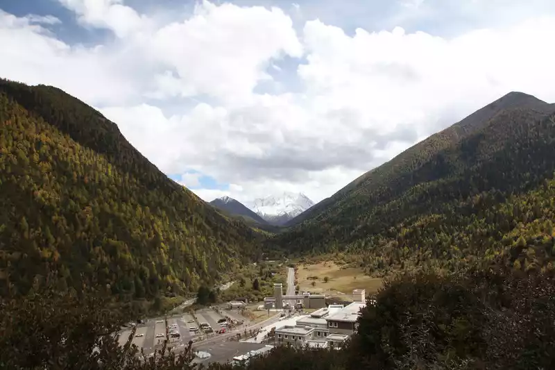
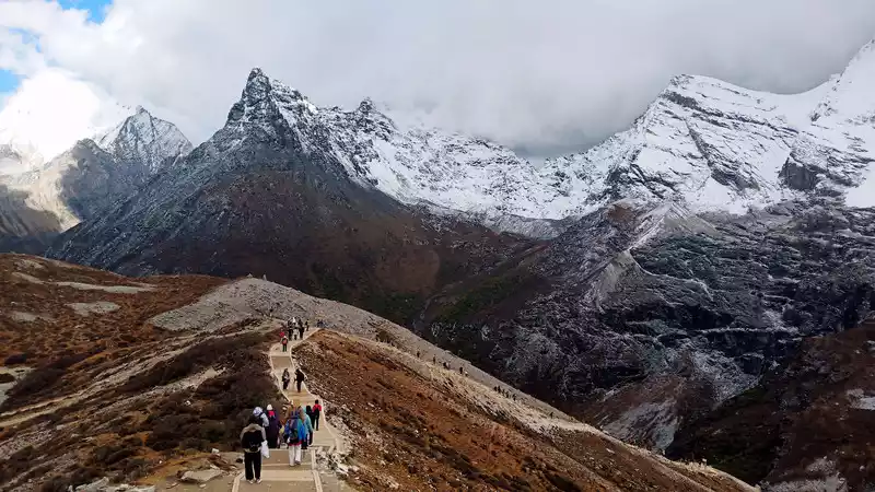
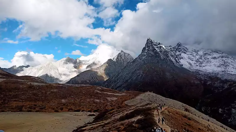
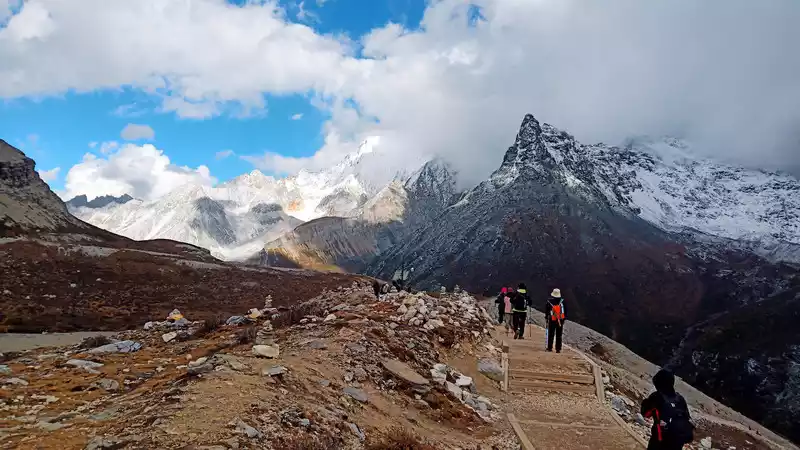
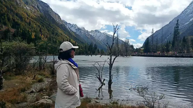
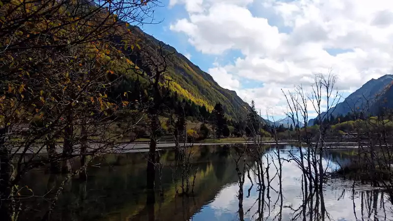
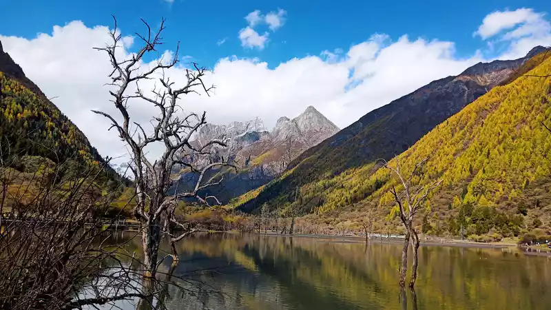
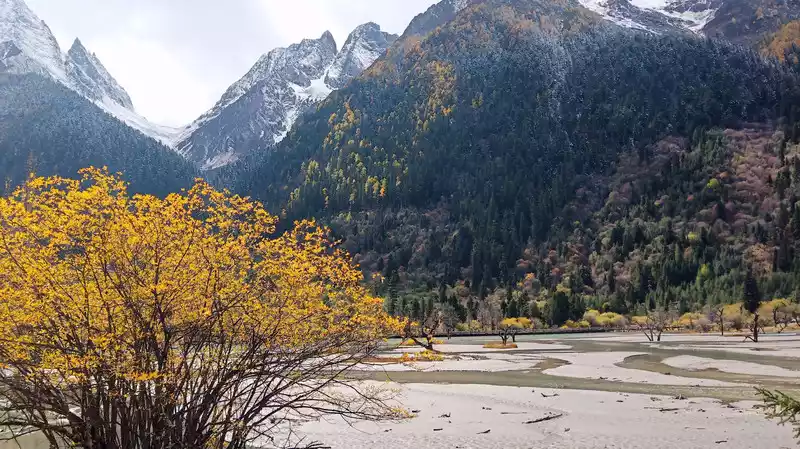
D4 (10/10) Kangding Mugecuo Scenic Area covers an area of about 350 square kilometers, consisting of six scenic spots: Rhododendron Gorge, Fang Lawn, Seven Colored Sea, Yaochi Boiling Spring, Mugecuo (Savage Sea) and Red Sea Grassland, and there are many other alpine lakes and hot springs nearby, and the primeval forest, grassland and snow-capped mountain landscape are blended with each other.
 The
The sightseeing bus goes directly to Mugecuo (Savage Sea), stops at the bus stop on the way back, hop on and off, and you can walk down the mountain if you have enough energy.
After the sea of savages, go up for ten minutes and stand on a high place to overlook Gongga Snow Mountain and Yoyo Mountain.
 The
The rough and arrogant arrogance of the western region is vividly displayed here.

Rhododendron Gorge is a waterfall gorge, with a majestic water system that stretches for several kilometers from the Jingxin Pool to the primeval forest.
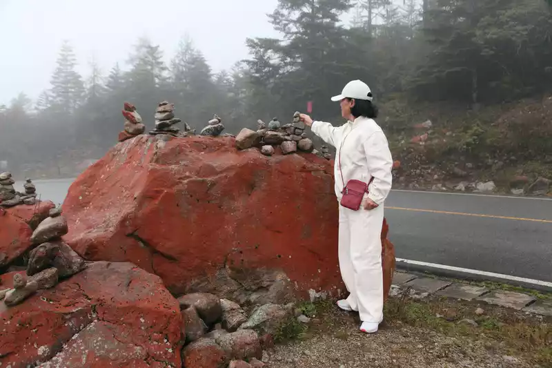
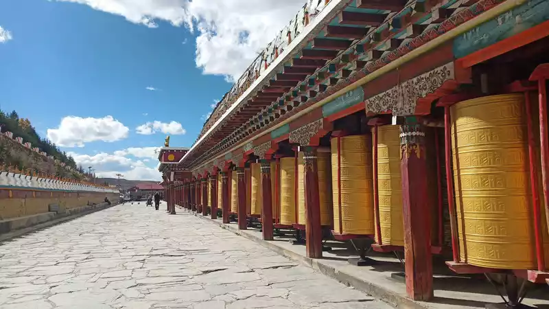
There are many such stone piles in western Sichuan, and there are six-character mantras on the stone plaques.
 stone pile
 mani pile
 The
The Seven Colored Sea is also a remarkable attraction, where you can see the Yala Snow Mountain and the Lotus Snow Mountain.
Redstone and Snow Mountain are still very good. The red stones of the Jakarta Ridge are even more brilliant.
 The red stone of the wooden grid is a sightseeing
 bus stop when you see such a building, a building with Tibetan characteristics.
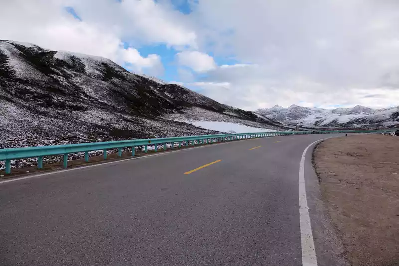
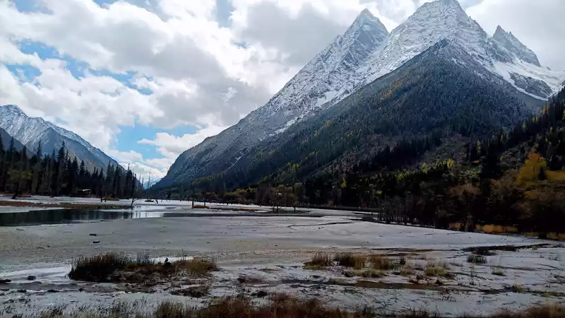
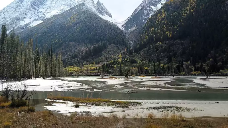
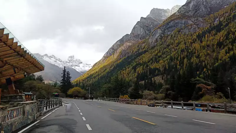
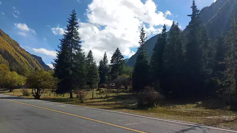
Leaving the scenic spot at about five o'clock on the way to Xindu Bridge along the S434 provincial highway, the scenery along the way is unforgettable, the area is open, and the atmosphere is bold. The snow scenery around the mountain is very beautiful, covered in silver, thousands of mountains and valleys, and famous mountains and rivers can be seen.
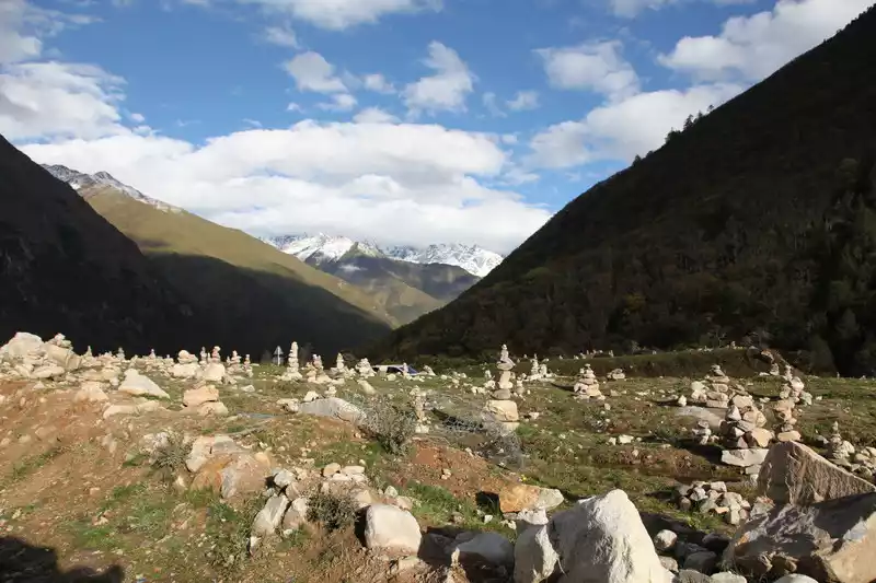
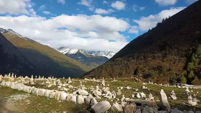
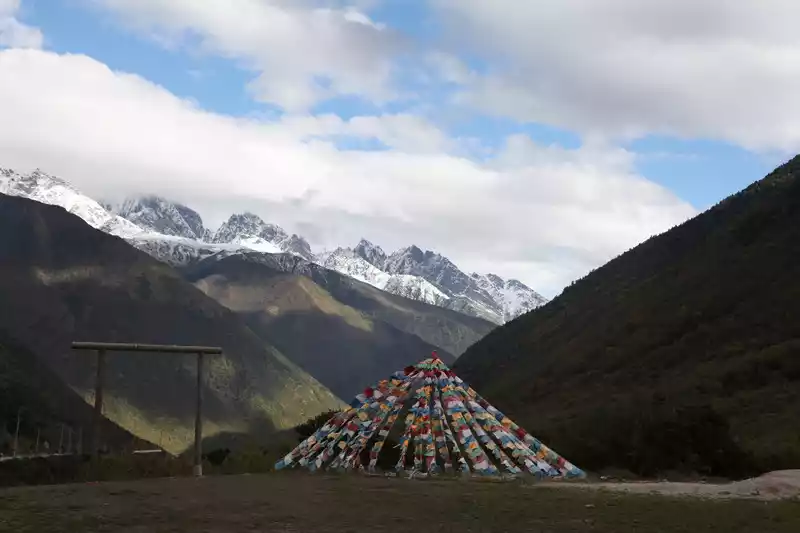
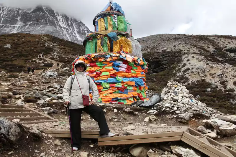
Mani pile means the stone built up. In the mountains, intersections, lakes, and rivers all over Tibet, you can almost see altars made of stones and stone slabs. Mani piles are also known as "god piles". Most of these stones and slabs are engraved with six-character mantras, wise eyes, statues of gods, and various auspicious patterns, which are also masterpieces of Tibetan folk artists.
S434 provincial highway, smooth and flat.
 There
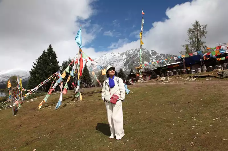
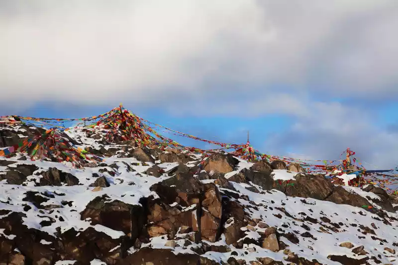
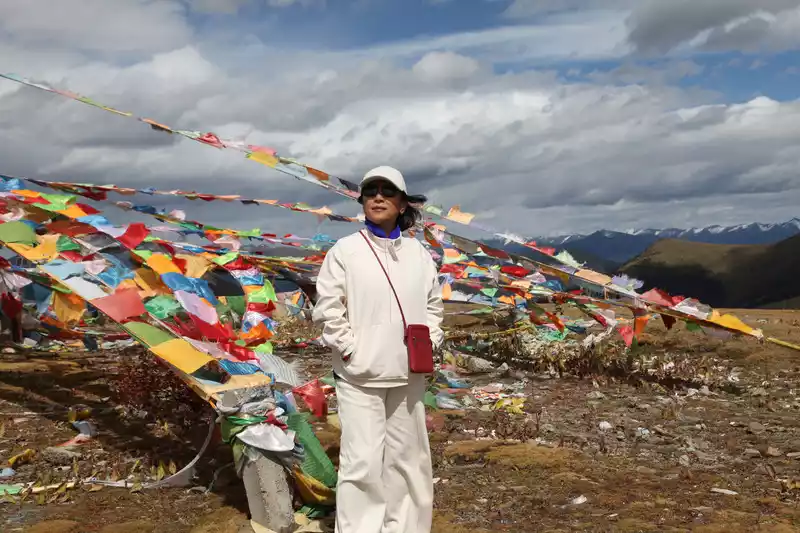
There were blue skies, clouds, stone mountains, white snow, mani piles and prayer flags along the way.
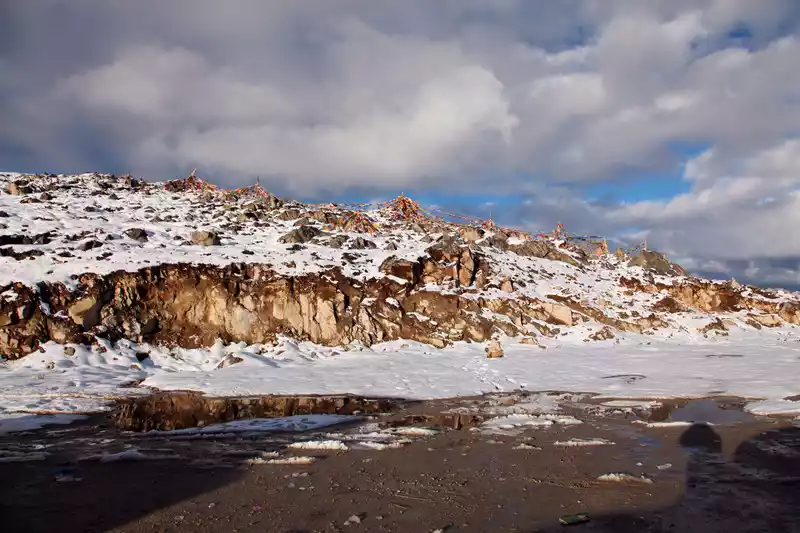
Prayer flags can be seen everywhere fluttering in the wind. Pray for good health anytime, anywhere. . .
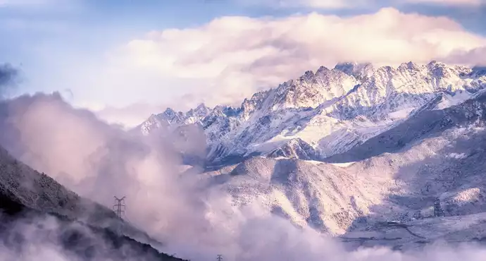
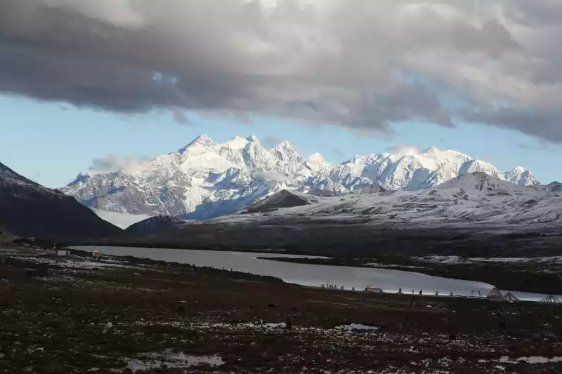
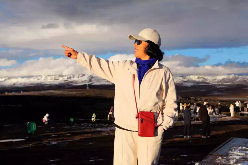
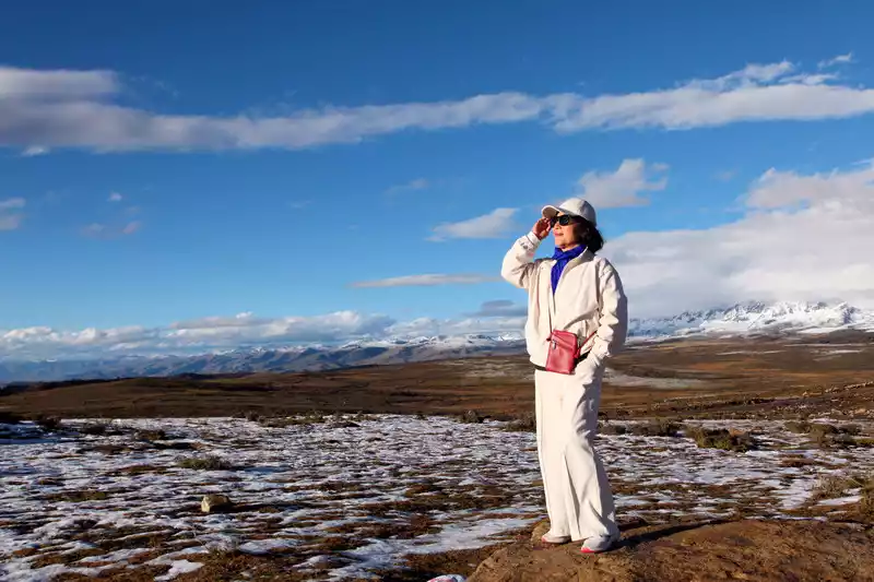
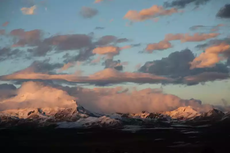
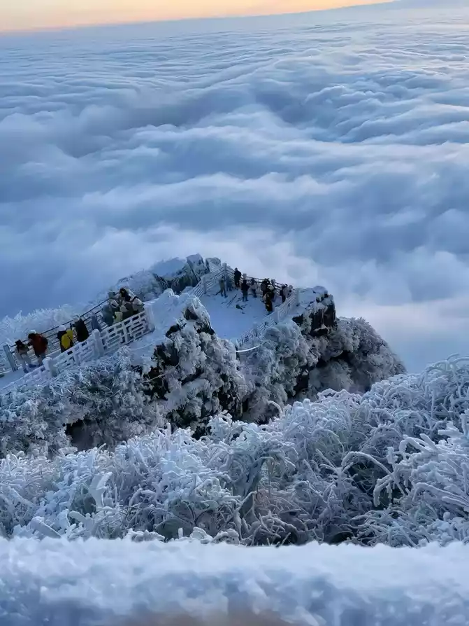
D5 (10/11) After breakfast, drive to the Gongga Snow Mountain Observation Deck, there is a slope road that is not easy to walk, But you can ride a donkey up from 80 yuan. The clouds were too thick to see the Gongga Snow Mountain, and it was not in vain to stand on a high place and look at the town of Xinduqiao.
 The
The Gongga Snow Mountain directly ahead is shrouded in clouds and mist
In the afternoon, when I navigated Yuzi West, there was only a sign of Yuzi West when I arrived at the destination, and there was nothing, and many people were disappointed. Note that you must navigate the Caviar West Starry Sky Camp to see the beautiful scenery in the true sense, charging 20 yuan/person, the winding mountain road is narrow and long, and you should pay attention to safety when driving. The climate on the mountain is changeable, rainy, hail, rain and snow, and we have encountered sunny days.
Clothes can be worn interchangeably in autumn and winter, because the climate changes.
 The
The weather is clear, the sky is blue, walking on the snow, looking at the snowy peaks in the distance, clearly visible.
The weather is changeable, the clouds seem to have been torn open, and the blue sky is also a beautiful sight...
 The
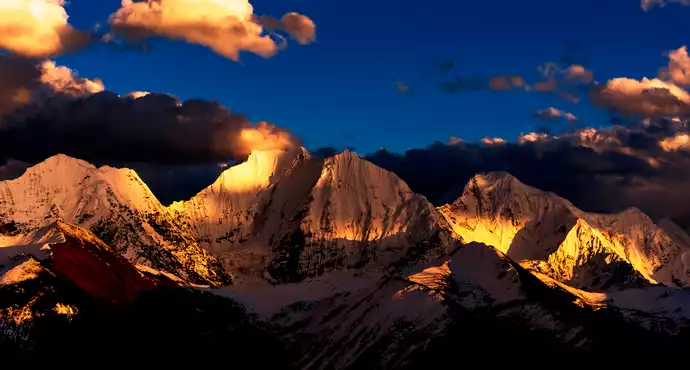
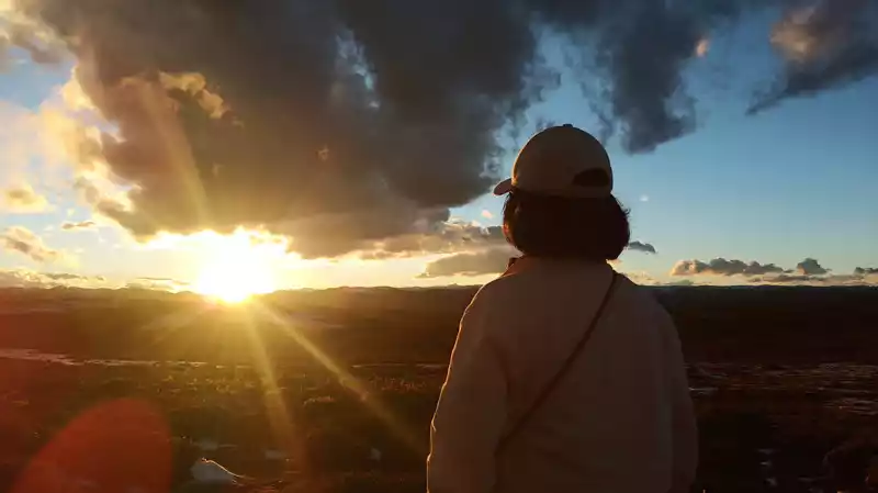
The cloudy weather did not give hope for the sunset, but in the end I saw the sharp corners of Rizhao Jinshan.
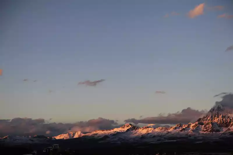
 The
The sunset at high altitude is right in front of you, and it's hard to look directly at it. I once saw such a passage and liked it very much, when the sun did not rise, the whole world was like a dream, only the moon was real. After the sun came out, the whole world was real, only the moon was like a dream.
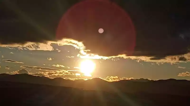
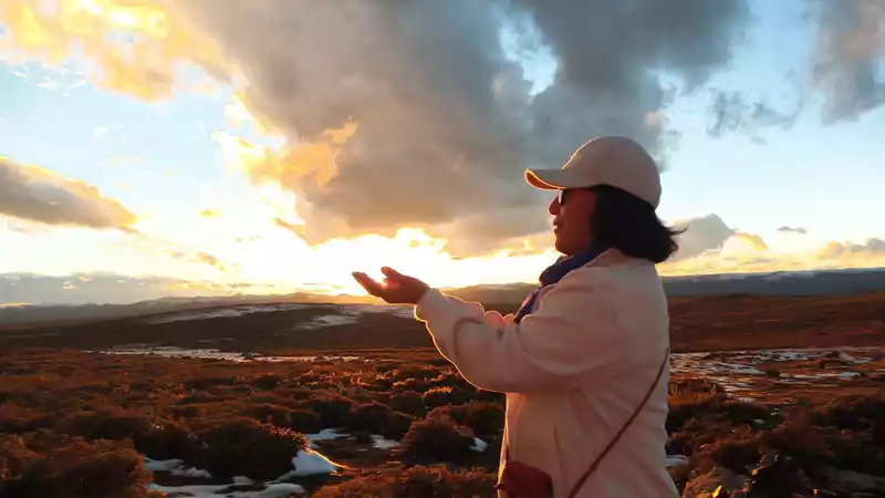
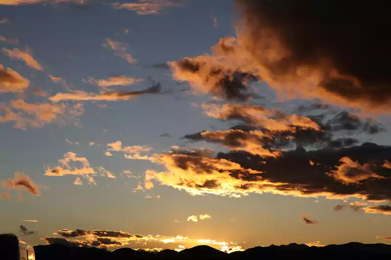
The sun broke through the thick clouds, and energy erupted thinly, feeling warm in this cold region at high altitude...
The lamp of the world, the light of the universe, holding up the afterglow of the sunset, the warm sun all around...
Dense dark clouds also appeared with gold-rimmed fire-burning clouds...
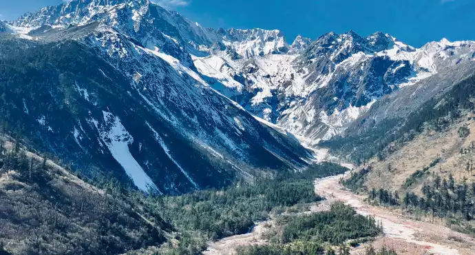
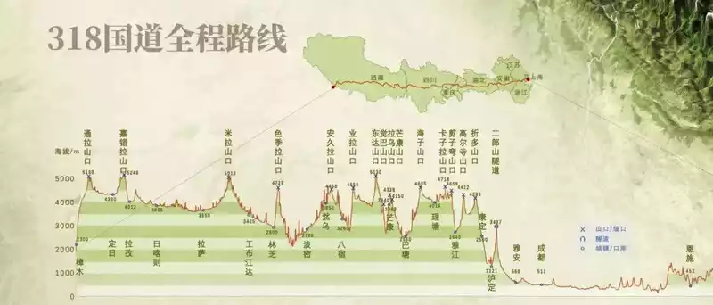
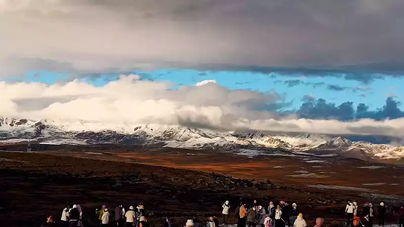
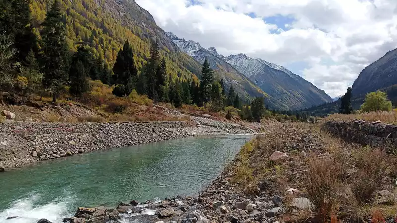
D6 (10/12) Xindu Bridge to Daocheng Aden is more than 400 kilometers, and it is planned to go to Daocheng County to repair it first, and then go to Aden Scenic Area. Along National Highway 318, it takes 9 hours, the speed limit is 30-60 kilometers, and the average is 40 km/h, and the altitude of the entire National Highway 318 fluctuates and falls, and the oxygen content continues to change with the rise and fall of altitude, so the winding road is a very test of driving skills, and it is clear to drive while inhaling oxygen.
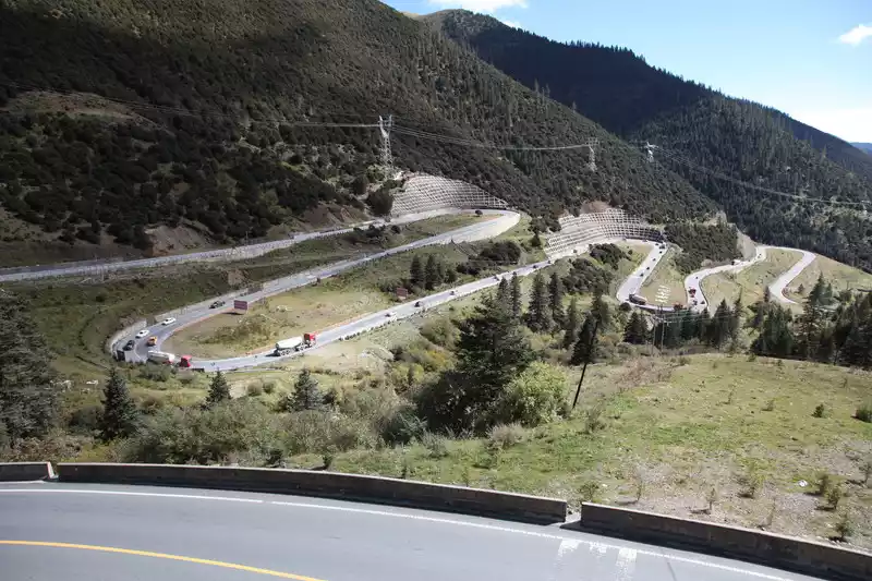 National Highway 318
 It is 195 kilometers from Xindu Bridge to Litang. Over three mountains and a great river. Gao Er Temple Mountain, there is a cloud observation deck. Going down over the mountains is the Yalong River, which is 2,530 meters above sea level, and the altitude plummets by more than 2,000 meters. After crossing the Yalong River, we continued up the mountain, passing through the 18th bend of Tianlu, and arrived at Scissors Bay Mountain, with an altitude of 4,659 meters.Further ahead, the top of the mountain is flat, the altitude is still so high, and in front of it is a large grassland and fir forest, reaching Kazila Mountain, at an altitude of 4,718 meters.
 National Highway 318
 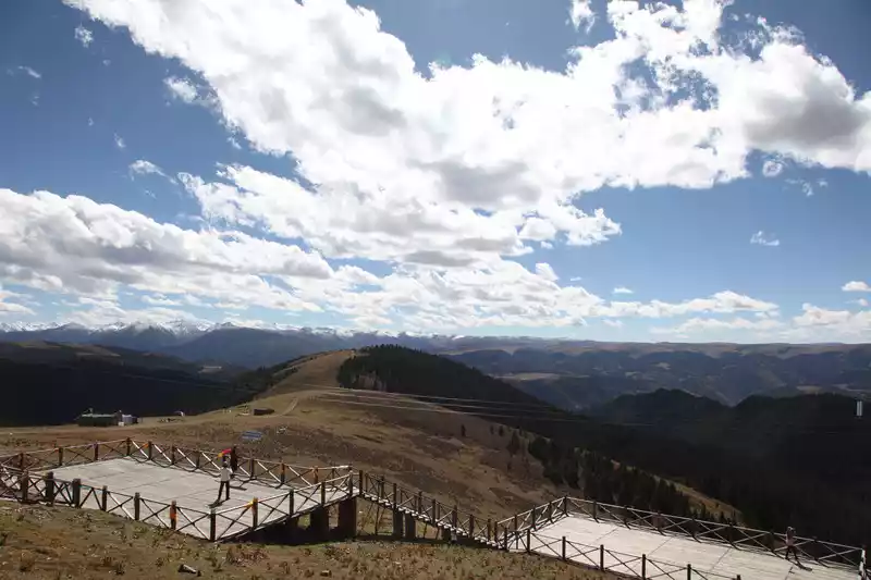 National Highway 318
 Locals live between valleys.
 318 National Highway
 Prayer flags can be seen everywhere.
D7 (10.13) After breakfast, I went to the red grassland, according to the locals, August is the peak season of the red grass, and it is currently a free viewing place, which is still under construction ……
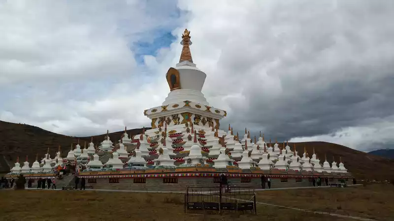
 There
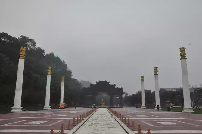
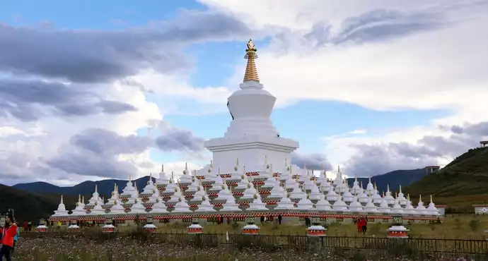
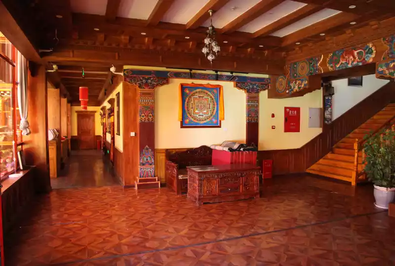
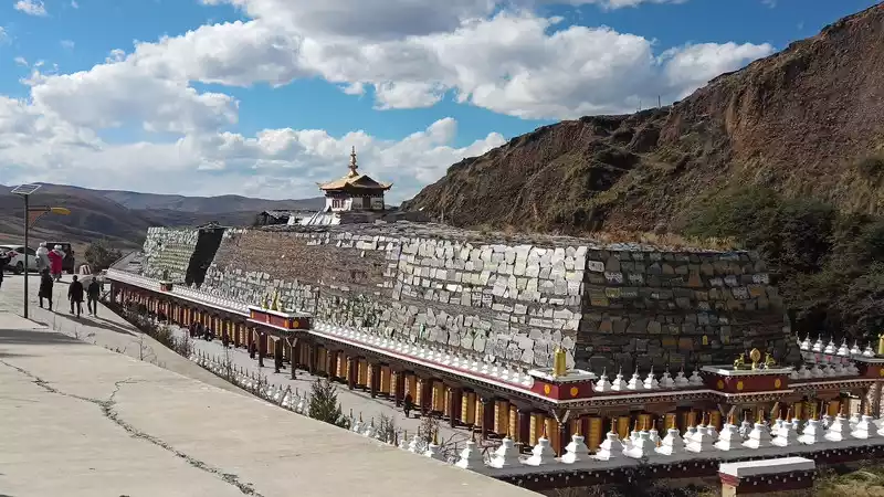
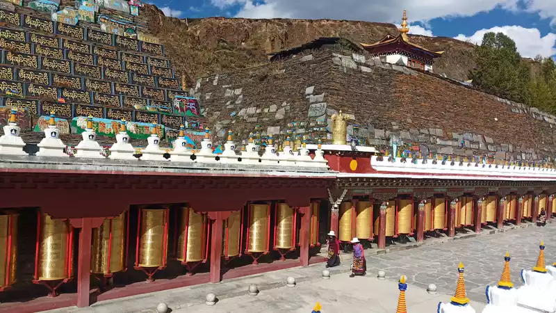
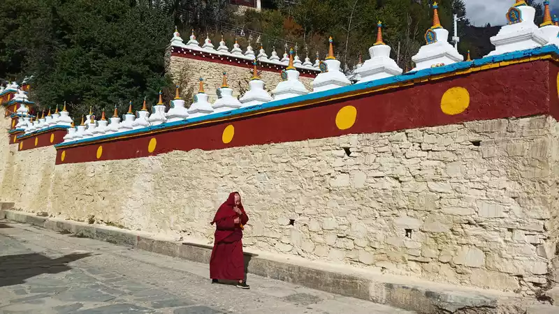
There are many white pagodas in Daocheng, and the one that forms the scale of Tallinn is Zunsheng Tallinn. You can see the locals reverently circling the white pagoda clockwise to pray for blessings and disasters, and it is said that the more you turn, the more merit you have.
Six-character mantra Chinese character transliteration: 唵 (ōng) ma (ma) ni (nī) Ba (bēi) mi (mēi) 吽 ( hōng). The main meaning of the six-character mantra is to pray for the blessing of Guanyin Bodhisattva, who is very compassionate and compassionate, and Tibetan Buddhism regards the six-character mantra as the root of everything, and recites it repeatedly to eliminate disasters and accumulate virtue and complete merit. The six-character mantra is like what mainland Buddhists often chant: "Namo Amitabha".
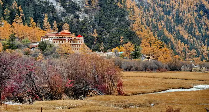
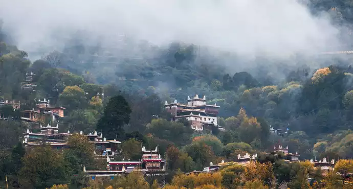
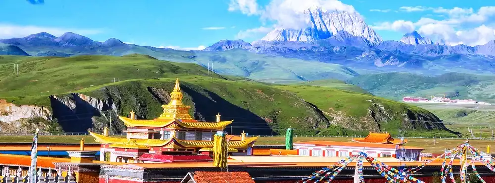
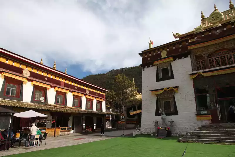
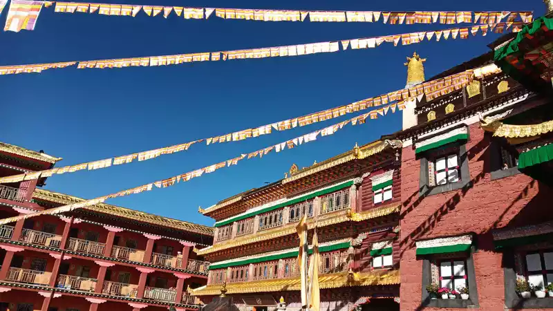
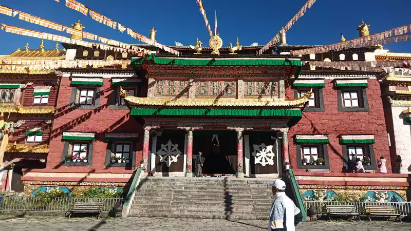
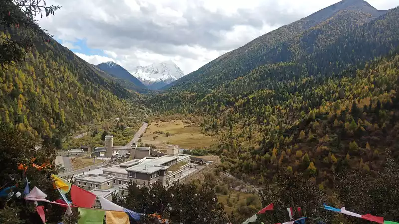
In the afternoon, I rushed to Shangri-La Town, Gonggalangiling Temple on the road, and went in to take a look. A monk gave a general introduction to the temple.
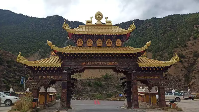
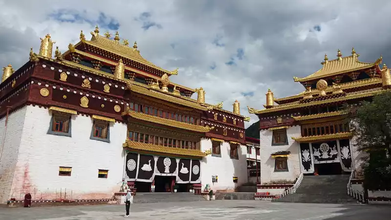 I
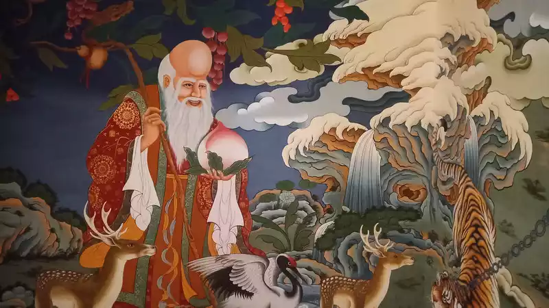
I was fortunate enough to see two painters painting the renovated temple murals with great skill, and it is said that it took more than half a year to complete the painting of the entire temple.
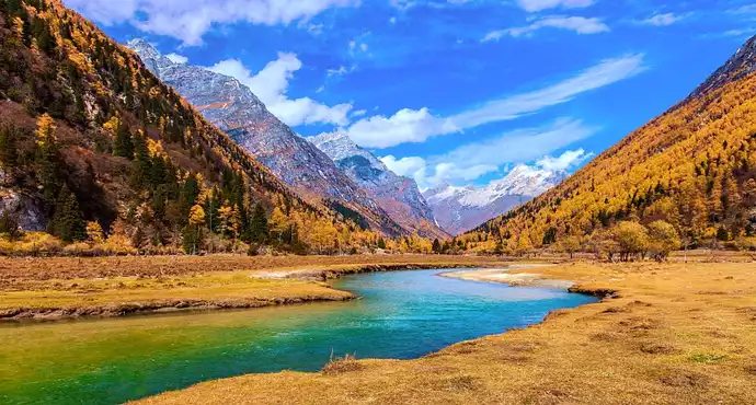
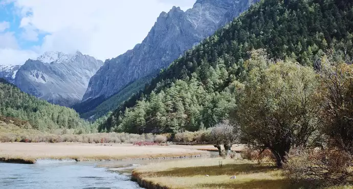
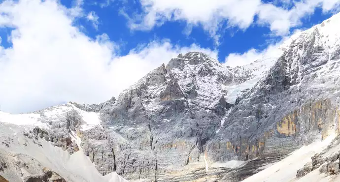
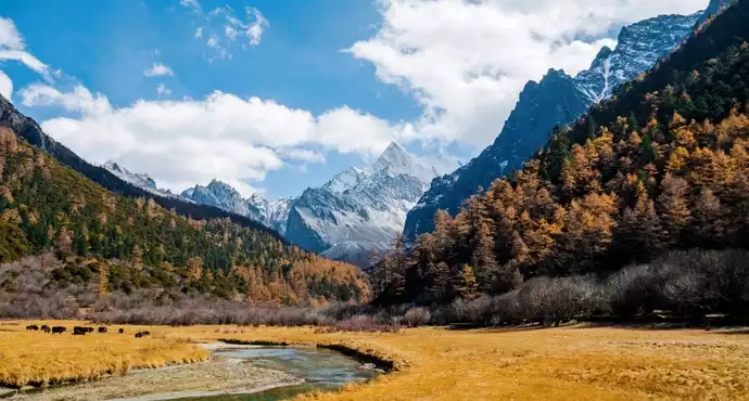
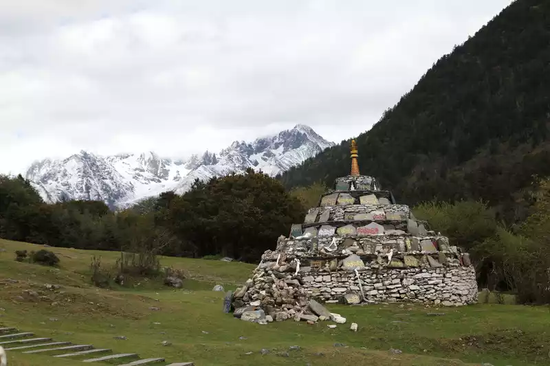
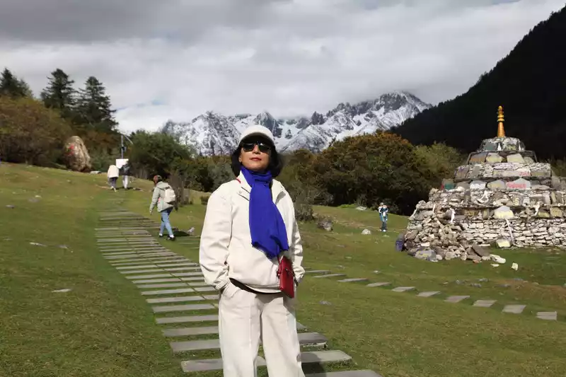
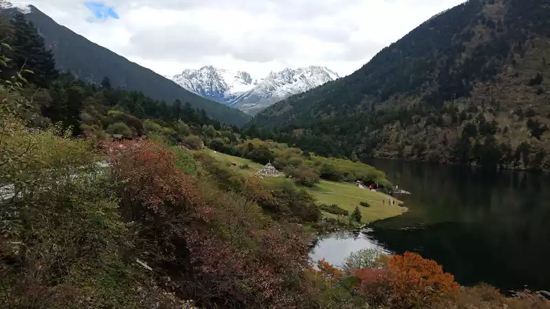
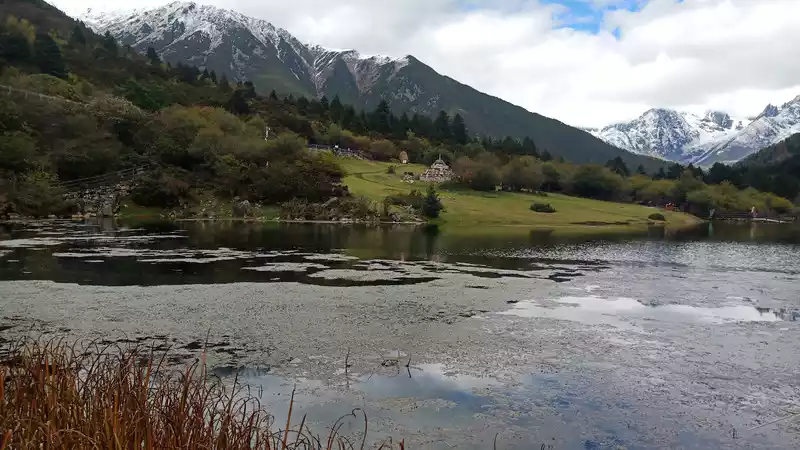
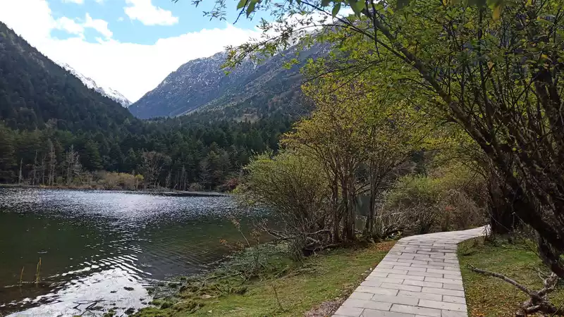
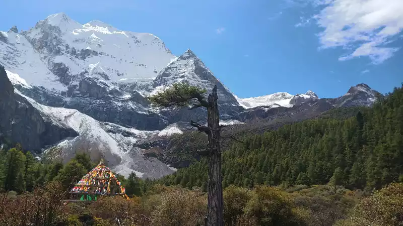
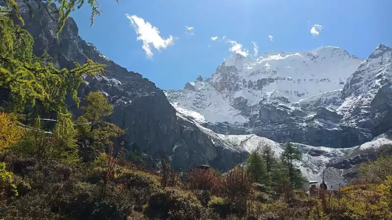
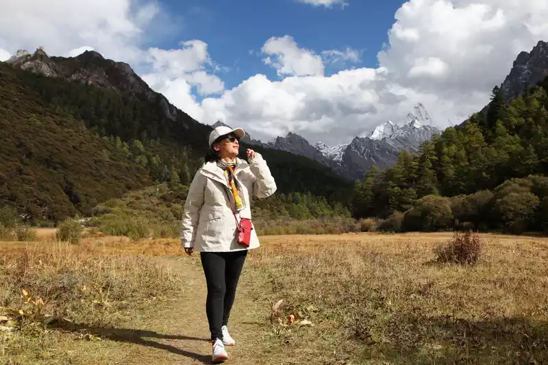
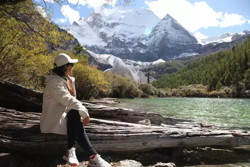
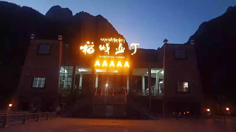
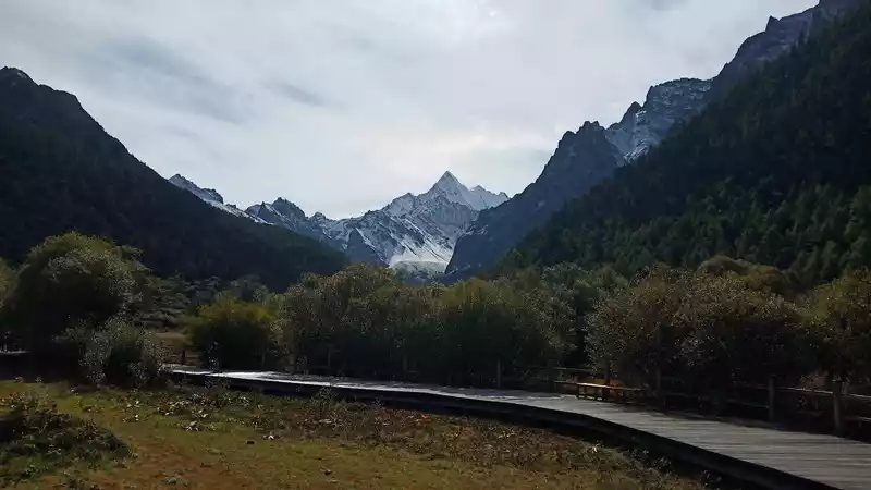
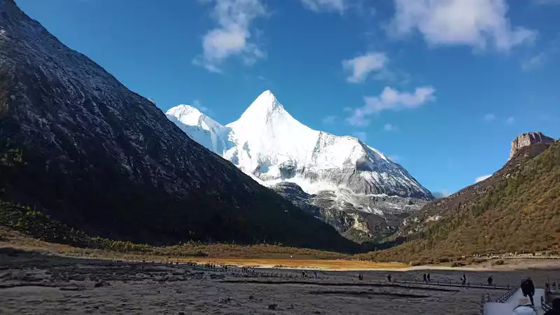
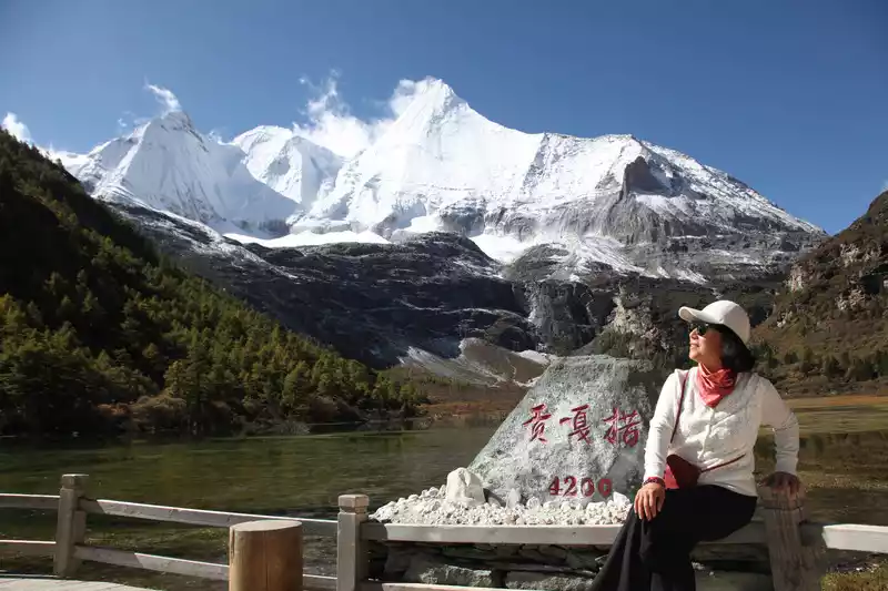
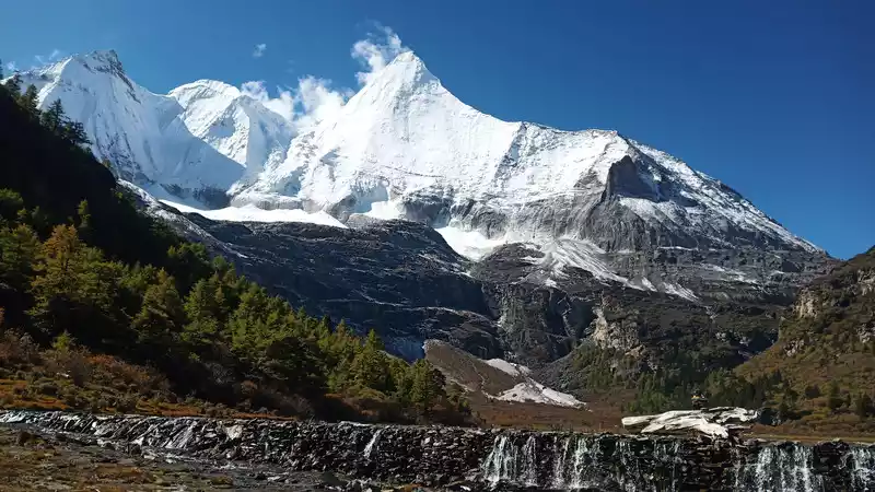
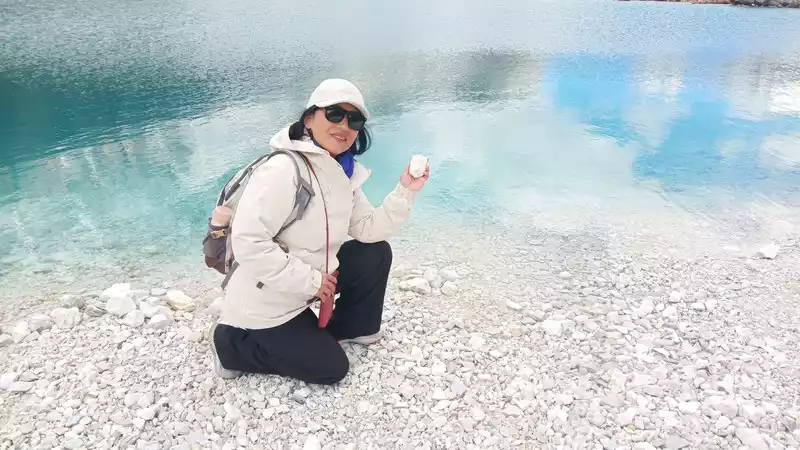
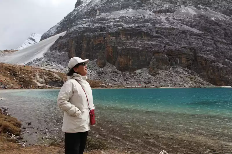
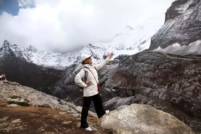
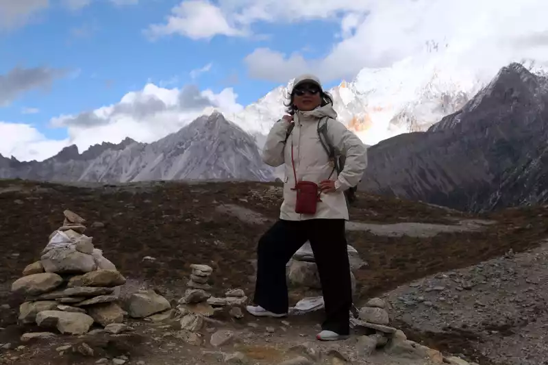
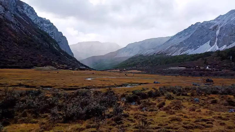
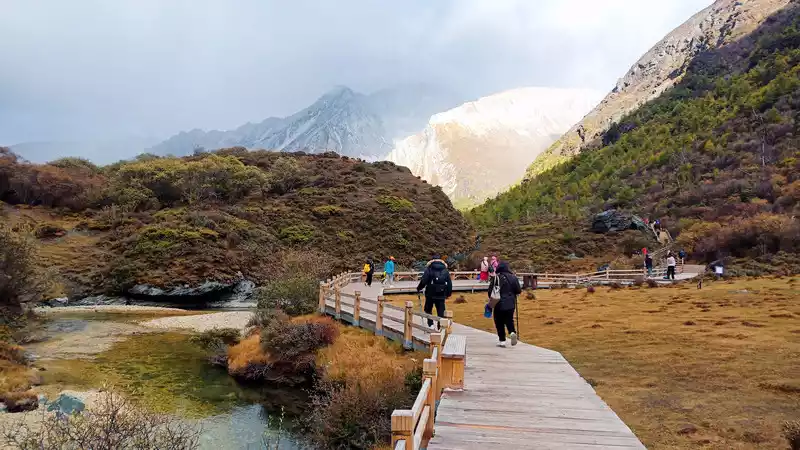
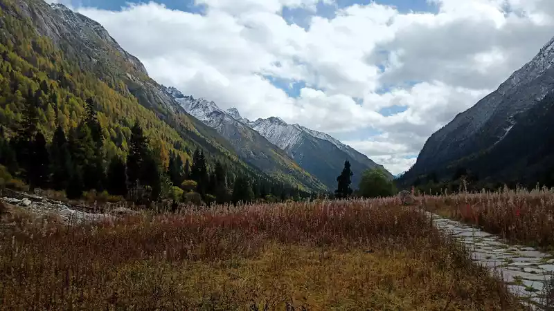
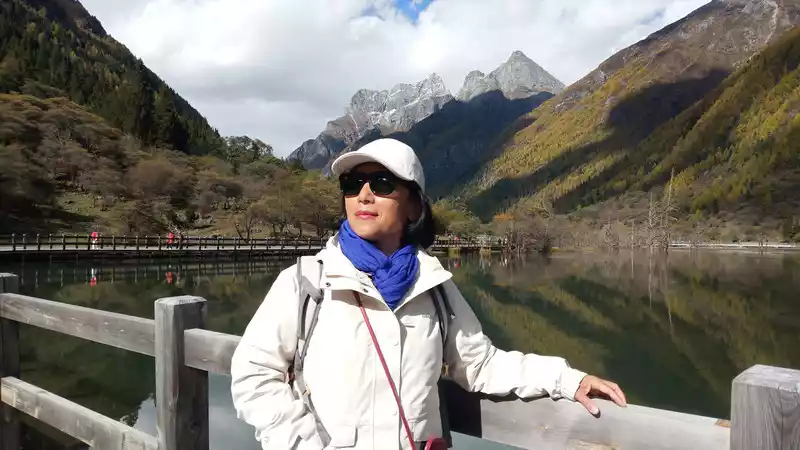
D8 (10/14) Daocheng Aden Scenic Area is located in the southern part of Ganzi Tibetan Autonomous Prefecture, Sichuan, in the eastern part of the famous Qinghai-Tibet Plateau, in the middle of the Hengduan Mountains, with an altitude of 3,700 meters. It is a natural ecological reserve integrating snow-capped mountains, glaciers, lakes, meadows, forests and other plateau scenery. Daocheng Aden Scenic Area is mainly composed of three sacred mountains, "Xian Nai Ri, Yang Mai Yong, and Xia Nuo Dorji", as well as surrounding rivers, lakes and alpine meadows. There are many landscapes in the scenic area, such as Chonggu Meadow, Chonggu Temple, Milk Sea, and Luorong Cattle Farm.
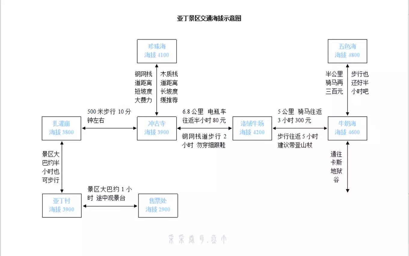
The short-term destination of Aden Scenic Area is the Pearl Sea. First go to Chonggu Temple, like many western temples, the architectural style and interior layout are relatively similar.
 On
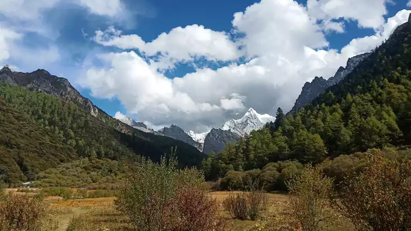
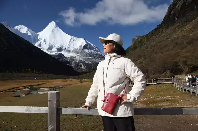
On the way to the Pearl Sea, Xiannai Ri has always accompanied you forward. The altitude gradually increases, saving energy and slowing down.
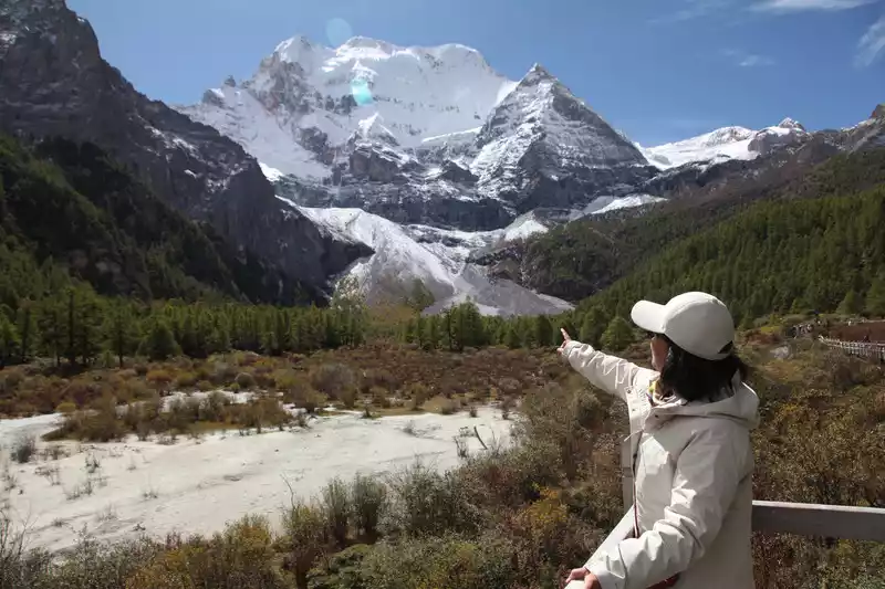
The closer you get to the foot of Mount Xiannai, the more beautiful the scenery is, the tolerance of all things on the earth, the coexistence of man and nature, I feel deeper at this moment.
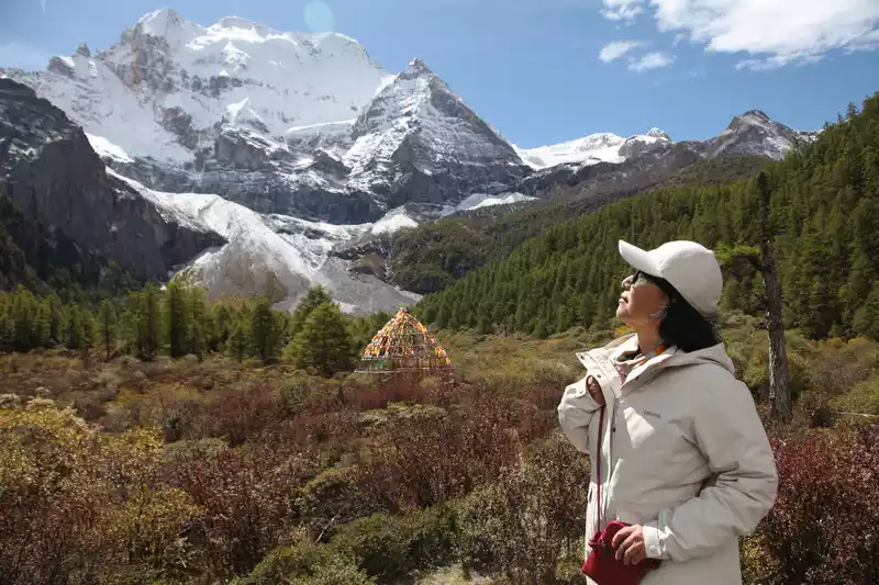 At the
 foot of Mount Xiannairi
 At the
 foot of Mount Xiannai
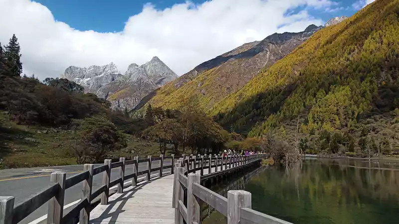
The Pearl Sea is backed by the Xiannai Sun Sacred Mountain, giving people a perfect combination of rigidity and softness in the senses.
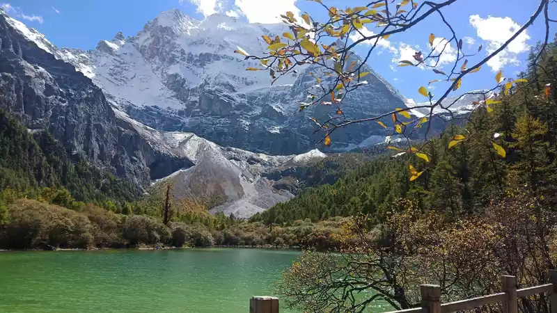
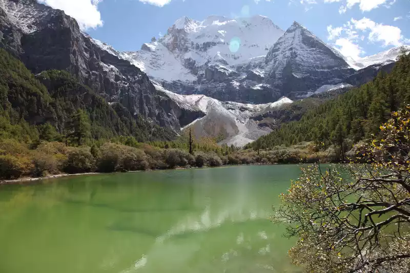
The altitude here is 4080 meters, the highest point in the short term.
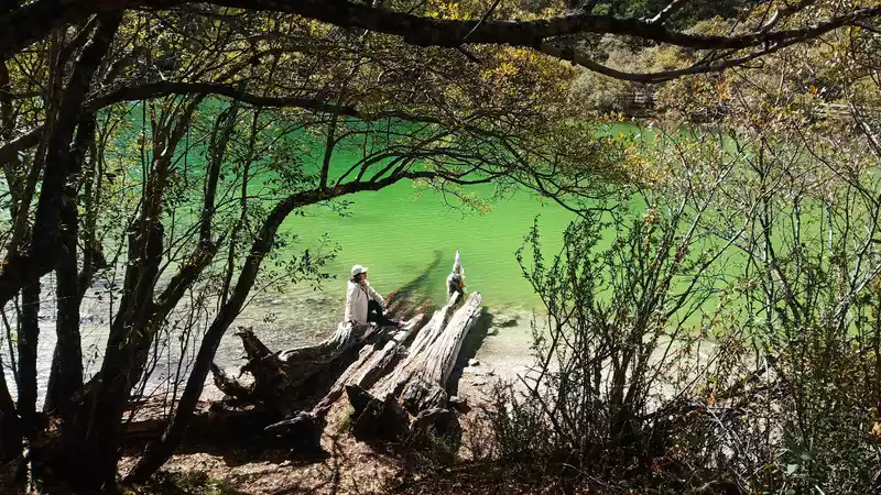
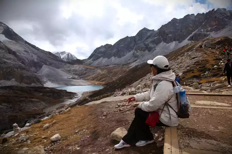
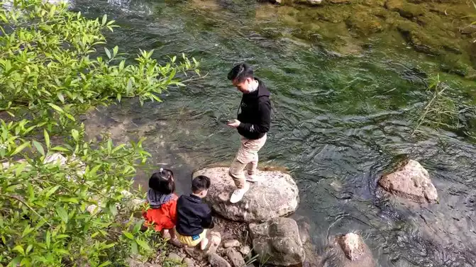
D9 (10/15 ) We live in Shangri-La Town, drive to the gate of the scenic spot before dawn, take the shuttle bus to Zha Guanbeng, and then walk to Chonggu Temple, where we begin to branch out for two days, the short-term Pearl Sea and the long-term milk sea. Today, I took the long line of Aden Scenic Area, and the destination was the milk sea and the five-color sea.
Take a bus to Luorong Cattle Farm here.
Long-term Yangmai Yongshenshan.
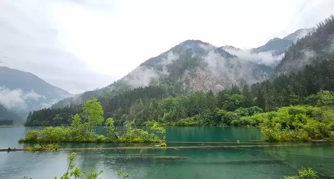
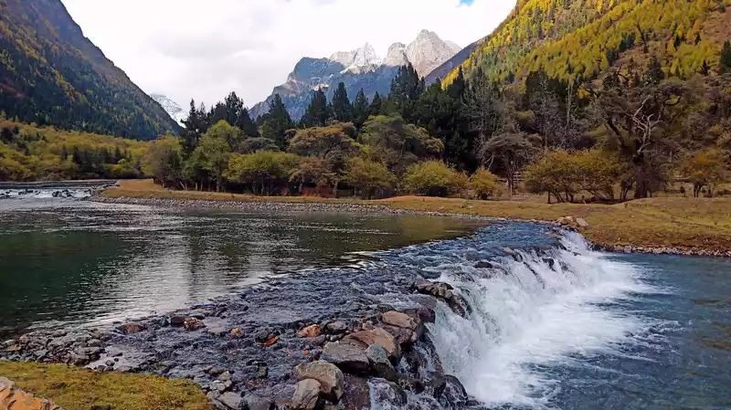
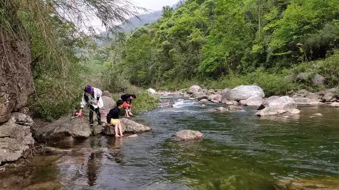
This is the Luorong Cattle Farm, from here to hike 5 kilometers, the flat plank road before Gonggatso is easy to walk, Slow travel is not easy to reverse.
There are wooden plank paths to walk, forests, meadows, mountains, streams, the ecological environment is very good, today is a sunny day, Good luck.
The road after Gonggatso is very difficult, first of all, to take a section of dirt road, then a steel plank road, the slope of the altitude rise is very steep, oxygen consumption is large, easy to lack oxygen, altitude sickness gradually appears, the solution is to take oxygen, walk slowly, rest... Cycle.
Yang Maiyong is right in front of you, and the shape is particularly beautiful.
This is not far from the Milk Sea, and it is also the fork of the Milk Sea and the Five-Colored Sea.
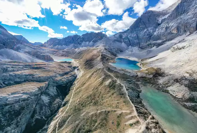
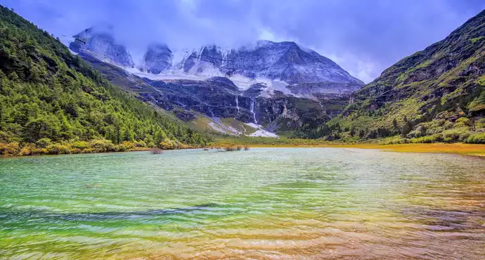
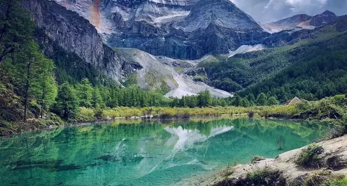
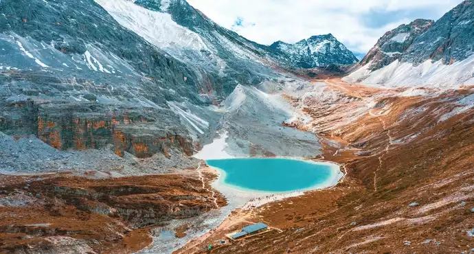
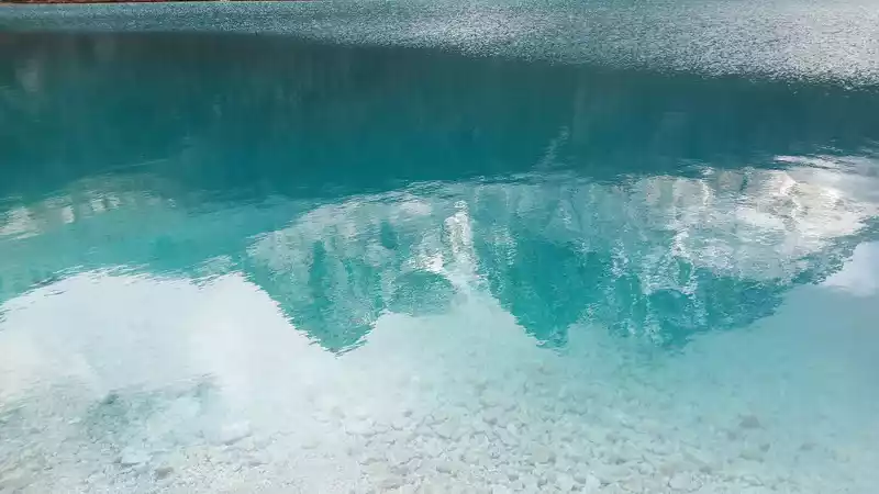
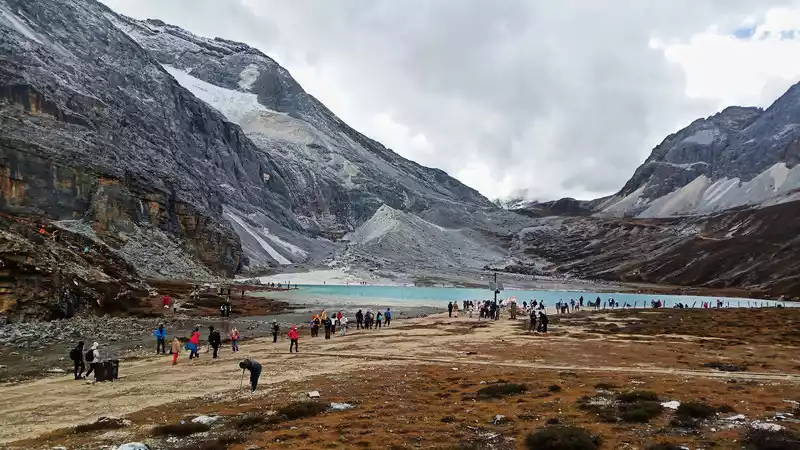
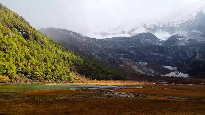
Finally arrived at the Milk Sea, and it took 5 hours to walk from the Luorong Cattle Farm. The key is that it is not easy to walk in conditions where it is easy to lack oxygen at high altitudes, and this journey is really a test of people's will.
 It
It is already cloudy at this time, the clouds are thick, and the color of the water should be bluer if it is sunny.
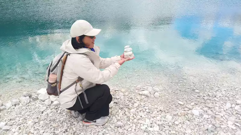
The lake is full of white stones.
 The
The exposed mountain is hard, resolute, and unyielding...
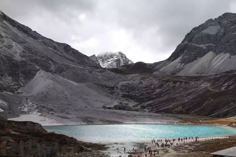
Standing on a high place, the impenetrability of the stone mountains contrasts sharply with the tenderness of the Blue Lake.
 The
The lake is still blue under the clouds.
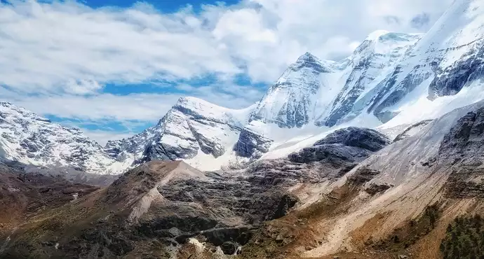
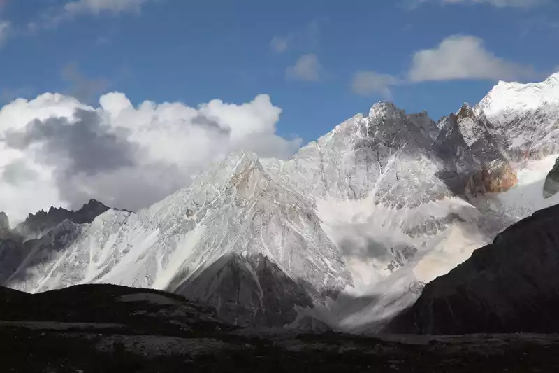
The milk sea goes up a hundred meters to reach the five-color sea, and the beauty of the five-colored sea is not as good as the milk sea, but at an altitude of 4,700 meters, the beauty of the surrounding stone mountains is shocking, and I am lucky to be able to see the mountain so closely, feel the steep cliffs of the mountain, as solid as a rock, indestructible, unmoving, steep and spectacular.
Sit on the five-colored sea and look at the sea of milk below
Only admire the majestic mountains that cannot be climbed.
At an altitude of 4,700 meters above sea level, it is my honor to be in such close contact with the mountains. I also admire my bravery and endurance.
 The
The shape of the stone mountain is sharp and straight into the sky, and this type of stone mountain can only be seen at high altitudes. This life will never be forgotten.
The energy of nature is huge, and human beings are so low in front of it that it is insignificant.
 The
The mountain tops are snow-white and translucent by the afterglow of the sunset, and the cloud-covered rocks reveal their own grayish-brown color. The three-dimensional sense of the picture is very strong, very beautiful.
 It
It takes 3 hours to descend the mountain, with different distances and layers of mountains.
 The
The sunset on the way down the mountain is so beautiful.
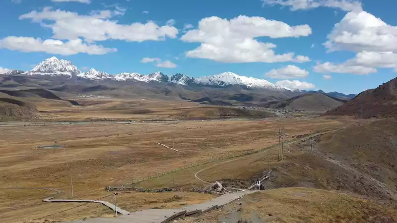
D10 (10.16) It took two days to complete the short and long lines of the Aden scenic spot, which was very tiring, especially the long line. But the good news is that the weather on both days is generally good, and the scenery is first-class, which is still worth it. This morning I rested and returned to Daocheng County after lunch.
D11 (10.17) After breakfast, we set off for Tagong Town, covering 371 kilometers and taking 8 hours
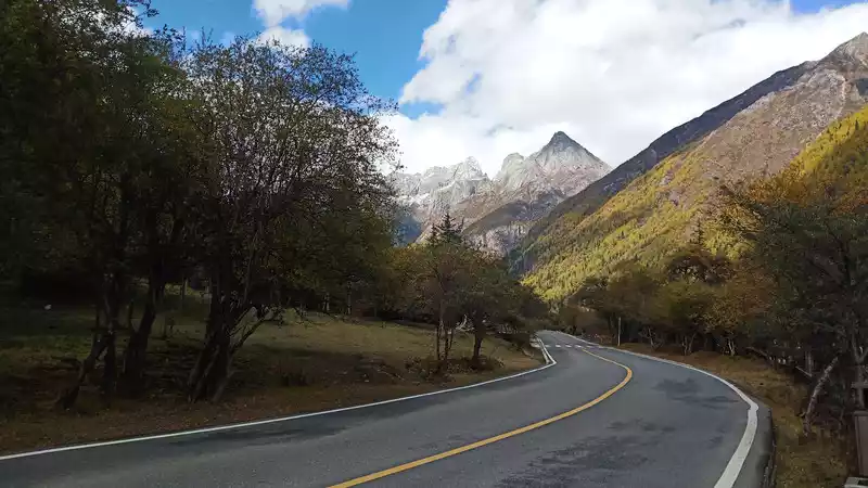
Accompanied by the sacred mountain all the way...
Stay in a very Tibetan accommodation, next to Tha Gong Monastery, where local Tibetans circle clockwise, In order to eliminate disasters and pray for blessings.
D12 (10.18) went to Tagong Monastery in the morning, and really felt that it was different from the temples in the plain area, still maintaining the most primitive state of Tibetan Buddhism, no one made noise, Tibetans chanted the scriptures attentively, pure, respectful, pious, and tourists just put their hands together and silently followed the Tibetans or monks to pray. The interior decoration is also simple, and there is a unique indescribable smell that I can't get used to.
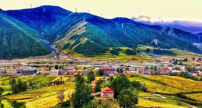
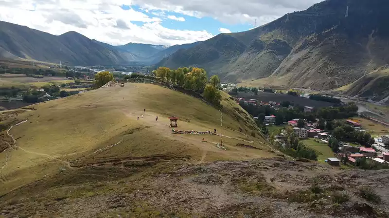
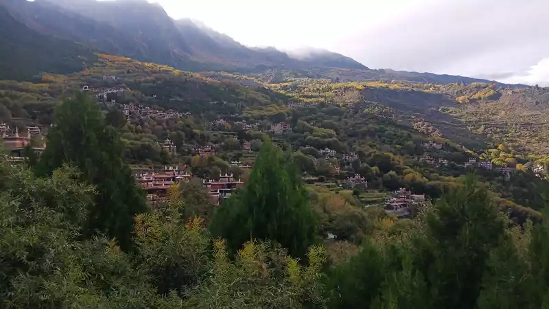
Standing on the height of the Tagong grassland, you can see the whole town of Tagong, and the town is between the valleys.
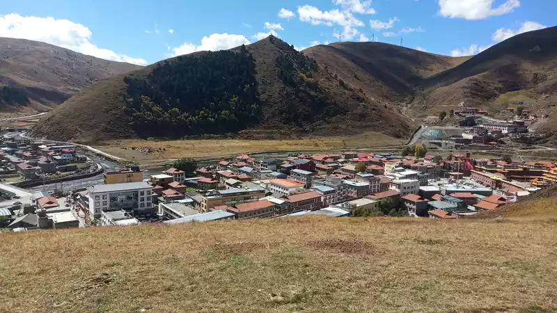
Tagong Prairie
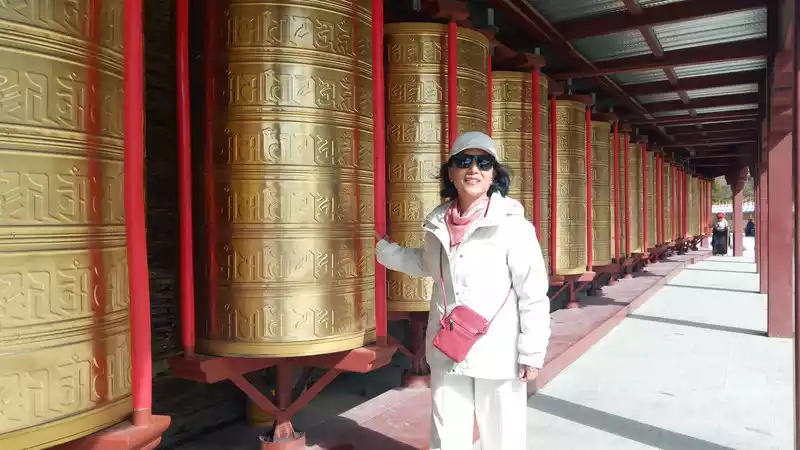
Muya Monastery is still worth visiting, many prayer wheels are the spiritual sustenance of Tibetans, it will be turned more than three times a day, the more it turns, the more blessings there are, Be sure to turn clockwise. Basically, they are all elderly people, and young people are going out to work, after all, the source of livelihood still needs an economic foundation.
 The
The stone piles are all bricks and tiles engraved with the six-character mantra.
I also went around to pray for myself and my family, and the weight of this prayer wheel was very heavy.
 The
The smiling monk walked into my lens, which was really a good embellishment.
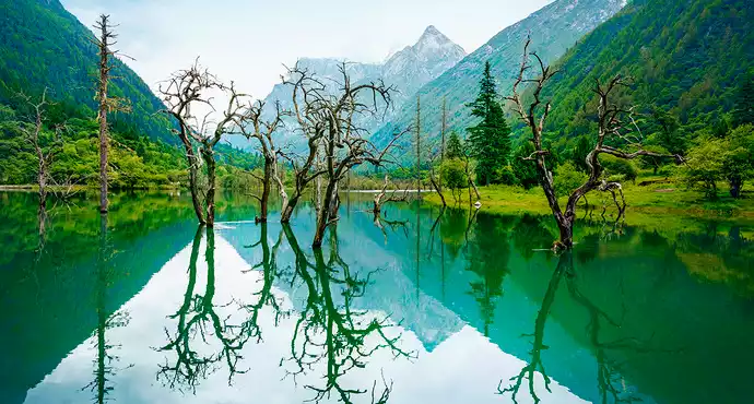
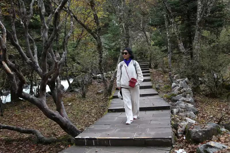
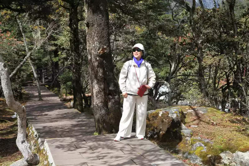
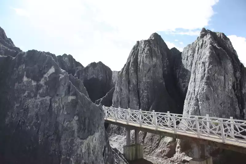
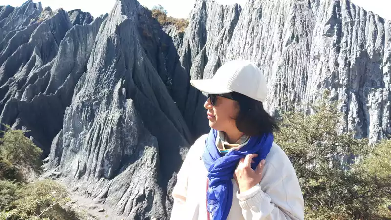
D13 (10.19) Moshi Park belongs to the plateau stone forest landscape, with peaks converging, varied, and thousands of scenes, like a well-made large bonsai. Immersive, deeply dizzying, making people linger.
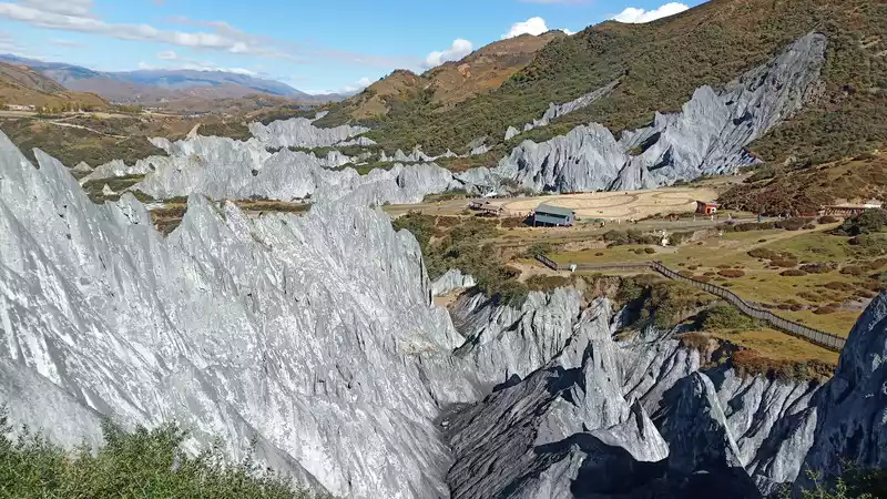
Walking into the stone forests of the ravines gives people a strange vision, as if they have entered an unknowable alien planet.
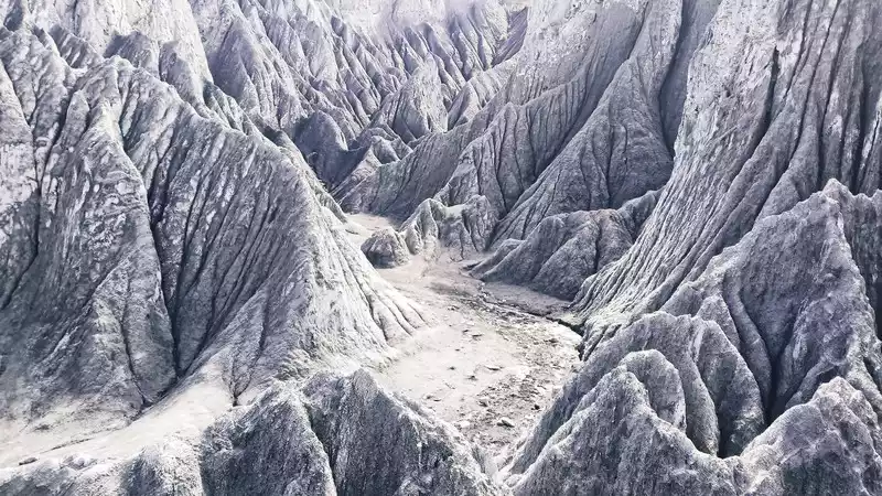
It is not the kind of hard stone, and if you touch it with your hand, there will be grayish-brown sand and stone falling off.
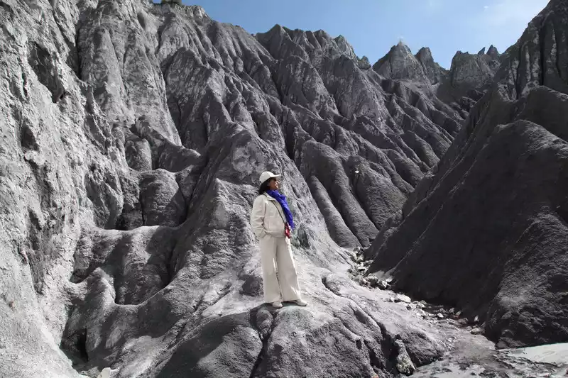
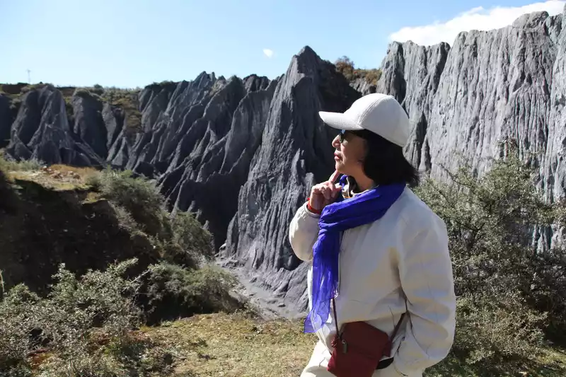
The plank road runs through the stone forest and can be seen up close.
In the afternoon, drive to Danba Jiaju Tibetan Village, and pass through the Beauty Valley on the winding mountain road of National Highway 318 on the way. You can park and check in and take pictures.
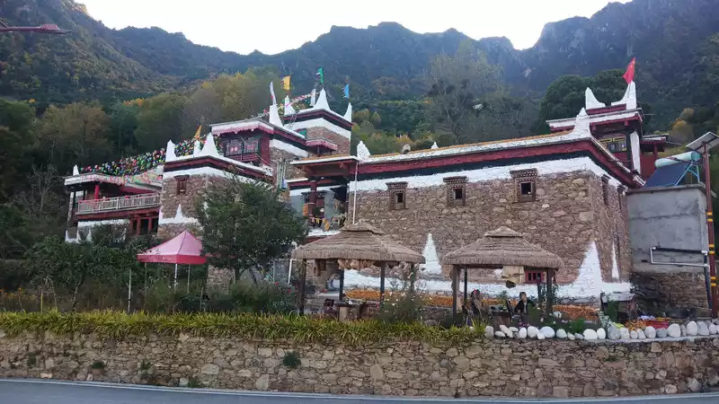
A Juzang Zhai can drive up the mountain by car. "Jiaju", Tibetan means a hundred households, and the entire cottage is scattered among the green trees according to the undulating mountains. Some are dotted, some are dense, some are on high mountain cliffs, and some are green in river dams.
The red and white village building, with small white pagodas at the four corners of the roof, represent the four corners of the four gods of mountains, trees, water, and earth, and there are prayer flags on them, which has the meaning of praying for the peace of the four directions.
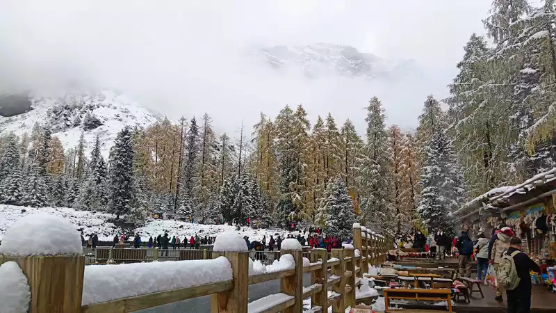
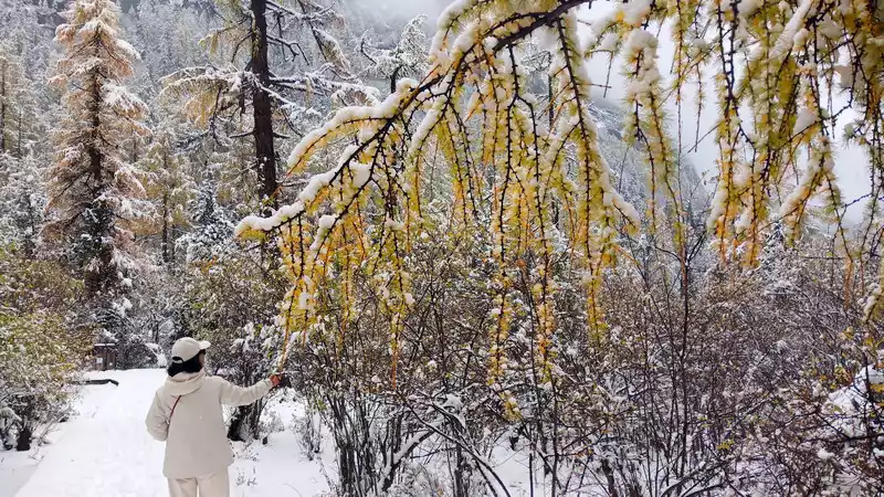
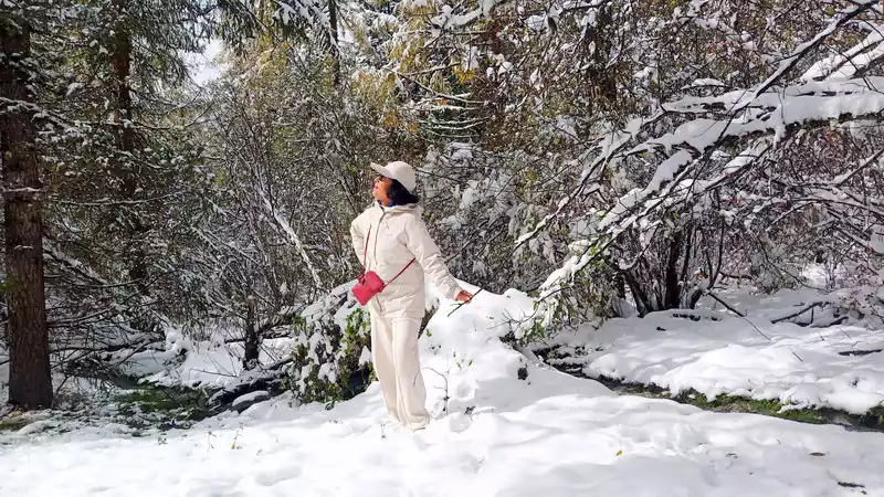
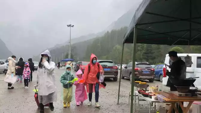
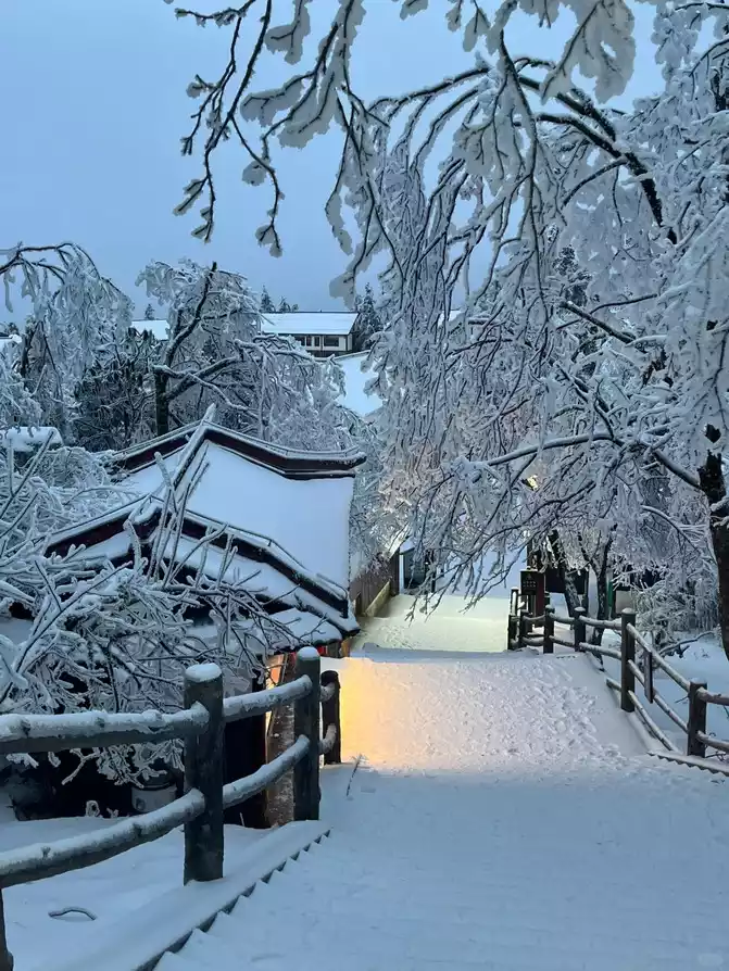
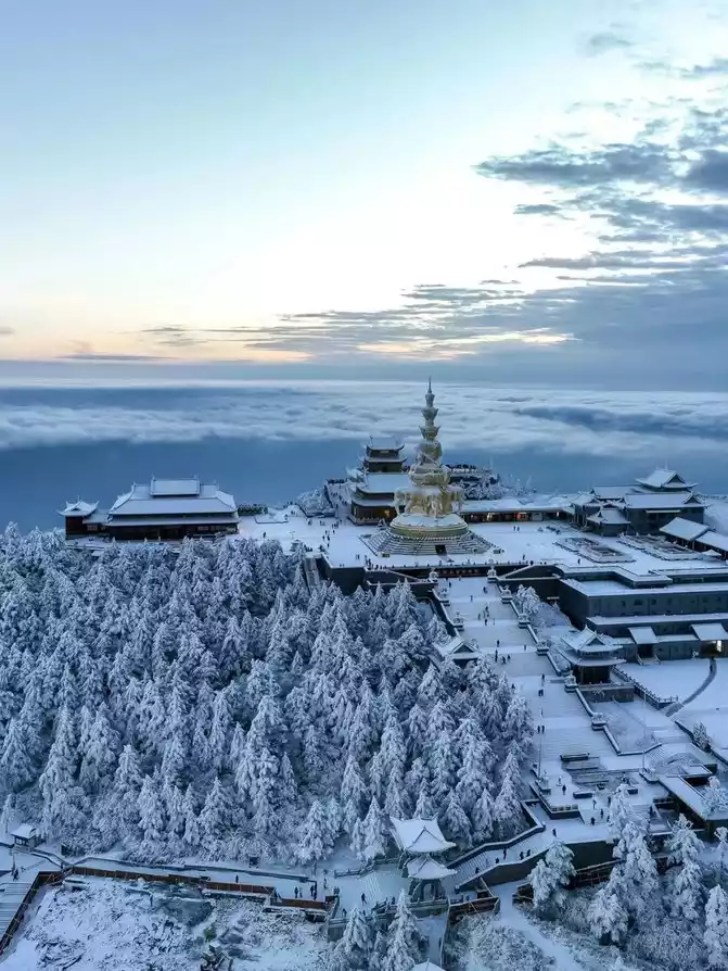
D14 (10/20) Rest in the morning, continue to leave Rilong Town after lunch, and settle in Siguniang Mountain Town. There are three ditches in Siguniang Mountain, namely Shuangqiaogou, Changpinggou and Haizigou. The most labor-saving route is Shuangqiaogou, where the bus is sent directly to the Red Shirt Forest, and then all the way down, or you can take a bus at the station, hop on and off. Changpinggou is only half the way, and the next step is to hike or ride a horse. Haizigou must be hiked all the way. So depending on the personal situation, we chose Shuangqiaogou.
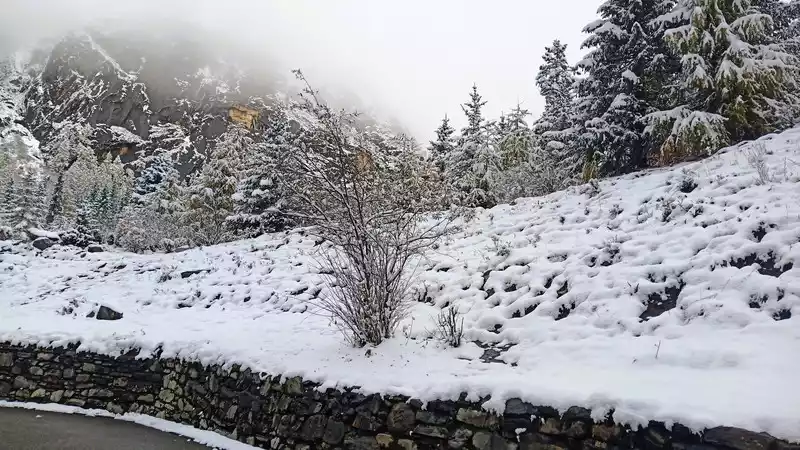
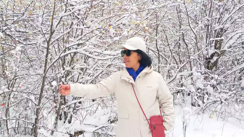
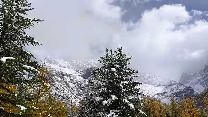
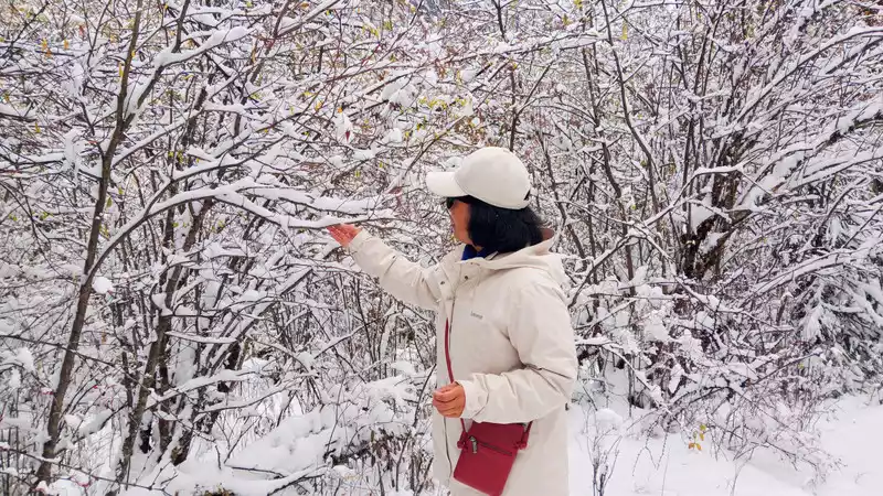
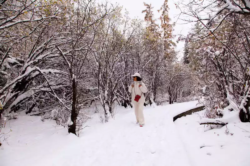
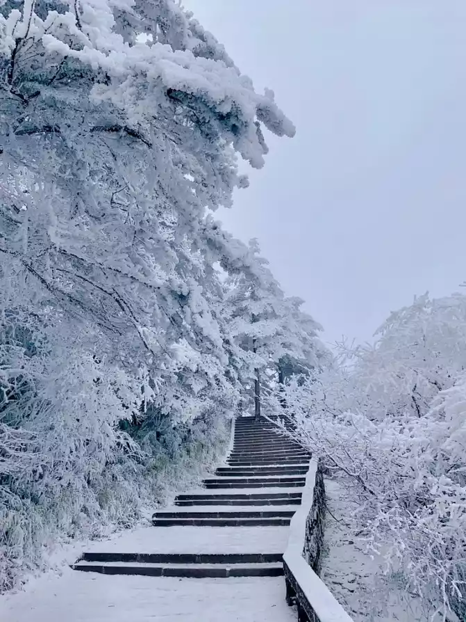
D15 (10.21) entered Shuangqiaogou early in the morning, very lucky it snowed last night, the sightseeing car went all the way up, looking at the elegant dance of snowflakes flying in the sky outside the window, branches, roofs, railings, roads, rocks are covered with thick snow, clouds and mist, snow-capped mountains flickering.
 The
The mountains and forests after the snow are quiet and peaceful, as if they are a fairyland on earth, which makes people feel refreshed.
 The
The heavy snow adds a different artistic conception to this red shirt forest...
 The
The autumn leaves in October are yellow, if it weren't for the heavy snow flying all over the sky, What you see should be such a yellow and green scene.
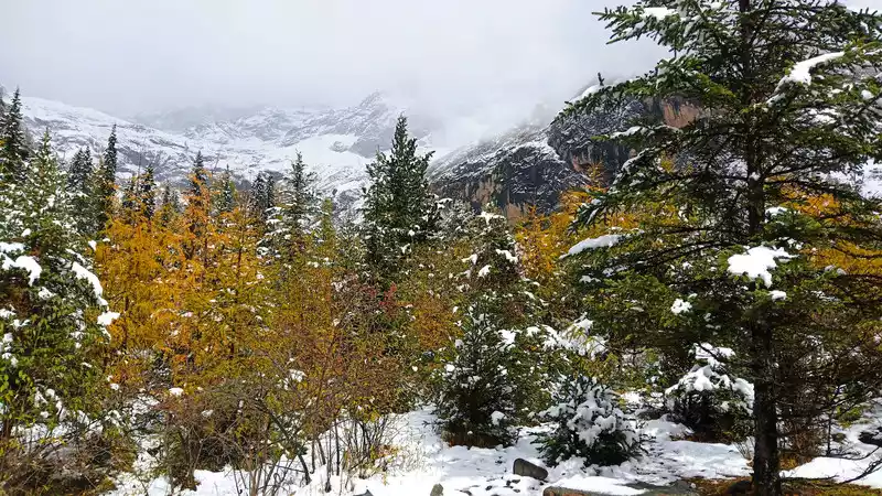
With the snow, it's completely different...
Jade tree jade branch, crystal clear.
 It's
It's autumn, but you see the winter scenery, isn't it lucky...
A ray of sunlight shines through the snow between the branches, sprinkles on the ground, forming mottled light and shadow, and the snow begins to melt slowly...
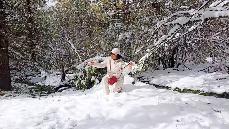
Leaving the red shirt forest at noon and going all the way down, the heavy snow stopped, the weather was clear, and the blue sky and white clouds appeared.
Until the time of the fourth girl, it completely returned to the colorful autumn, and the snow scenery disappeared wherever it went. . .
Autumn is crisp, the sky is clear , orange, yellow, orange green...
 I was
I was very lucky to experience the beauty of both autumn and winter in one day.
In the golden autumn of October, a cluster of golden yellow, the forest is dyed...
Show the changes in mountains, water, and forests from different angles.
Mountains and rivers, trees and flowers, flowing water, where there is water, there is spirituality.
 The
The sightseeing stations in Shuangqiaogou can be picked up and dropped off, and you can freely choose whether to walk or take a car.
The road is clean, the arc is beautiful, and the management of Shuangqiaogou is still relatively in place.
If you have a lot of energy, you can take the boardwalk without taking a car.
Shuangqiaogou one-day itinerary was successfully completed at this attraction.
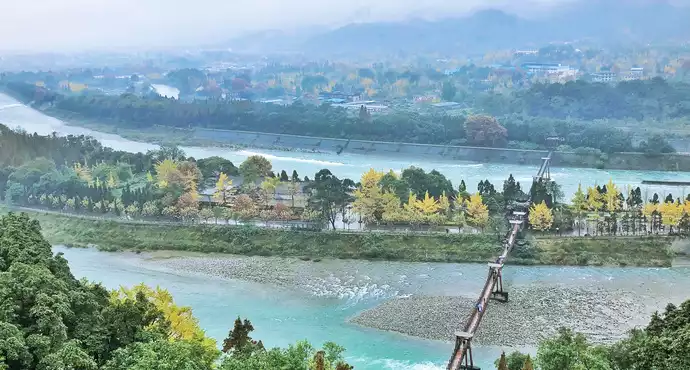
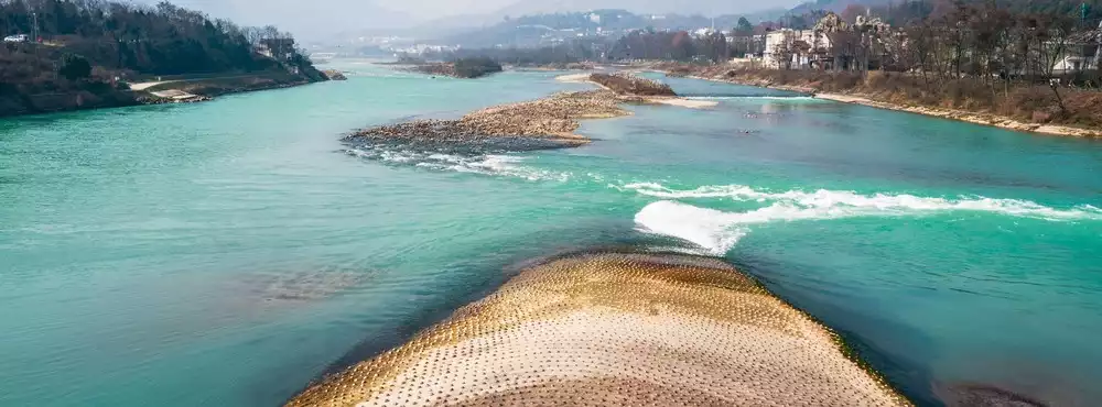
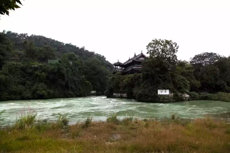
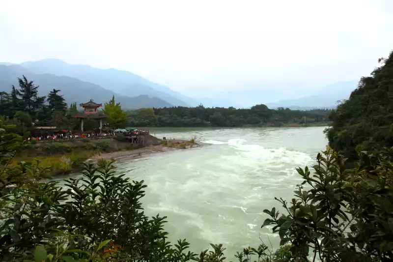
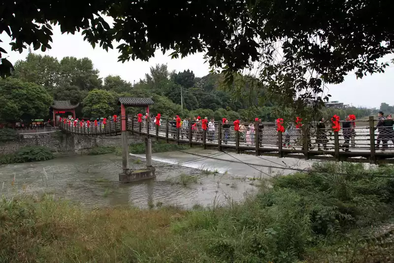
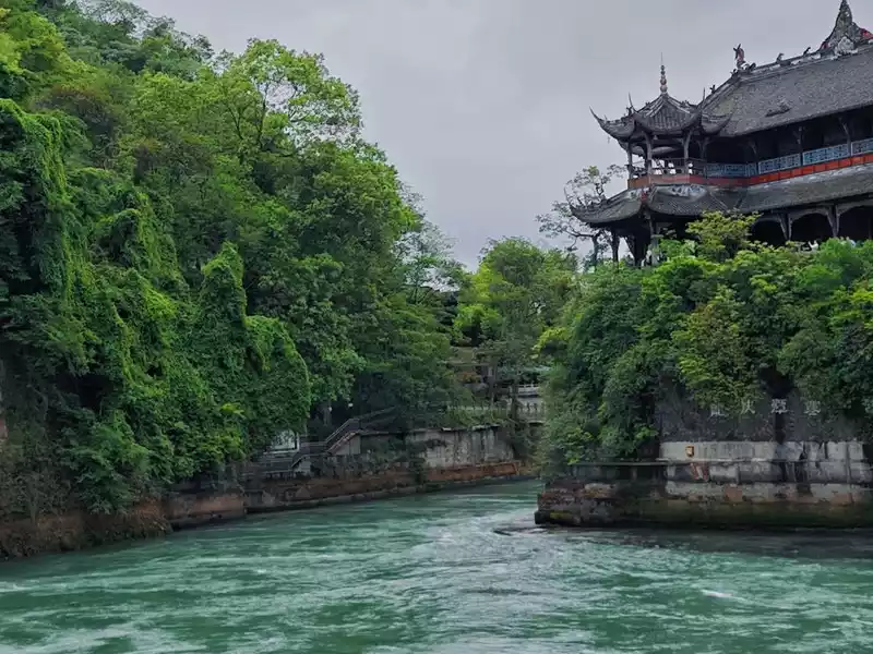
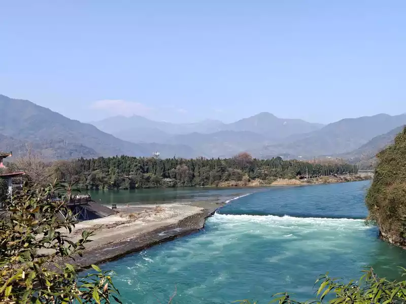
D16 (10.22) departed to Dujiangyan and visited Dujiangyan in the afternoon. The main function of the Yuzui Diversion Divergence Dividing Dam is the water diversion project of Dujiangyan, named because of its shape like a fish mouth, and its main function is to divide the turbulent Min River into two rivers, the west is called the Outer River, which is the main flow of the Min River, mainly used for flood drainage. The one along the foot of the mountain in the east is called Neijiang, which is an artificial water diversion channel and is mainly used for irrigation. It can also divert more than 80% of the total sediment volume of the Minjiang River from the outer river.
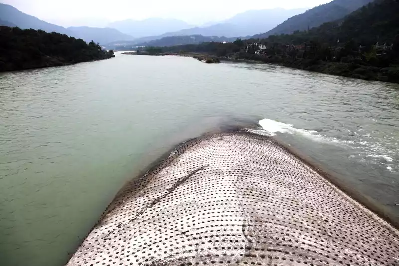
The mouth of the bottle is the water inlet of the inner river, the mouth of the treasure bottle plays the role of "control gate", which can automatically control the water inflow of the inner river, it is artificially chiseled into the throat to control the water inlet of the inner river, because it resembles the mouth of the bottle and has a peculiar function, so it is called the mouth of the treasure bottle. The hill left on the right side of the mouth of the treasure bottle is called Lidui because it is separated from its mountain.
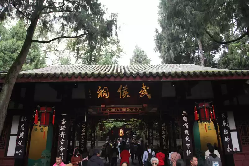
D17 (10.23) Departed for Chengdu, Du Fu thatched cottage and Wuhou Temple in the afternoon
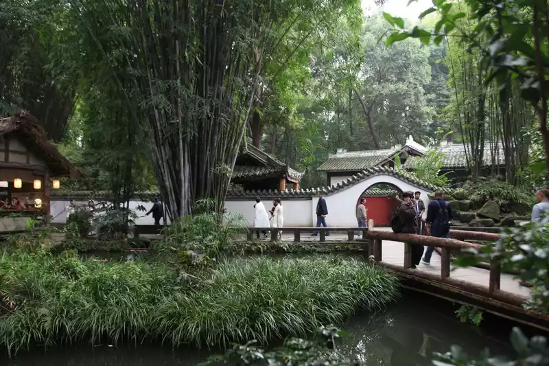
Chengdu Du Fu Thatched Cottage Museum is located at No. 37 Qinghua Road, Qingyang District, Chengdu, Sichuan Province. It is the former residence of Du Fu, a great poet of the Tang Dynasty in China, when he lived in Chengdu.
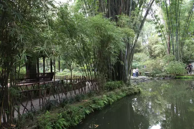
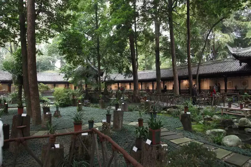
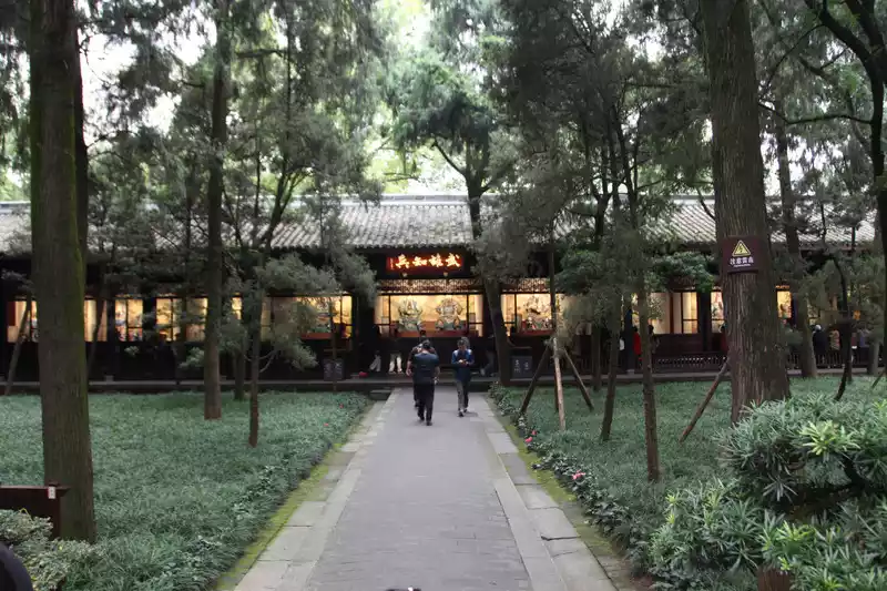
Chengdu Wuhou Temple was built in the late Western Jin Dynasty to commemorate Zhuge Liang; At first, it was adjacent to the Zhaolie Temple of Liu Bei, the first lord of Shu; In the early Ming Dynasty, the sacrifices of the Marquis of Wu were merged into the Zhao Lie Temple. It is the only temple in China where monarchs and ministers are worshipped together, the most prestigious memorial site for Zhuge Liang, Liu Bei and the heroes of Shu Han, and it is also the most influential museum of the Three Kingdoms in the world.
D18 (10.24 ) Chengdu Shuangliu Airport returned to Shanghai today. The scenery of western Sichuan is remarkable, especially Daocheng Aden, Jiuzhaigou and the scenery on the road. An 18-day trip cannot include all of western Sichuan, and in-depth travel requires time verification. The experience of self-driving is very good, and you can also appreciate some niche attractions, free, relax, slow travel, roaming to experience the local culture and scenery, which is really a good way to travel, and the total mileage of 2,200 kilometers in western Sichuan is complete and evocative.
Number of days: 1 day, , Updated: 2024.03.14

Number of days:5 days, Average cost: 2600 yuan, Updated: 2024.10.28

Number of days: 3 days, Average cost: 100 yuan, Updated: 2021.09.30

Number of days: 2 days, Average cost: 500 yuan, Updated: 2025.09.02
Number of days: 2 days, Average cost: 1000 yuan, Updated: 2024.12.06
Number of days: 4 days, , Updated: 2025.09.02