Faroe Islands
What are the most recommended things to do in Faroe Islands?
- Hiking across scenic cliffs, valleys, and waterfalls, including popular trails like the Gásadalur to Bøur hike.
- Exploring the picturesque villages such as Tórshavn, Gjógv, and Saksun.
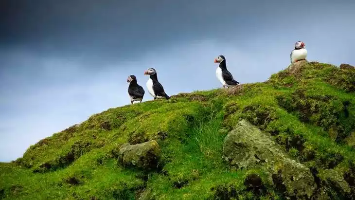
- Birdwatching, particularly puffins, seabirds, and other native species.
- Boat tours around the islands to see fjords, sea caves, and coastal wildlife.
- Visiting historical sites and museums, including the National Museum of the Faroe Islands.
- Photography of the dramatic landscapes, including Mulafossur Waterfall and rugged coastline.
Introducing the Faroe Islands
The Faroe Islands residents vote to elect members of the autonomous parliament, which in turn elects the prime minister. The Danish government will send a high commissioner to the Faroe Islands to oversee the operation of the autonomous government, represent the Queen, and assist in handling the islands' external affairs.
The total area is 1,399 square kilometers. The population is 48,119 (2015). The vast majority of residents are of Scandinavian descent, with a smaller number of Celtic or other ethnic groups. The primary language is Faroese, with Danish also widely spoken. The majority of the population is Christian. The capital is Tórshavn (also known as Tórshavn or Tórshavn). The population was 13,000 (2007).
The islands are devoid of toads, reptiles, and native land mammals. Hares, rats, and mice are all brought in by ships. The abundant seabirds are an important economic resource—puffins are edible, and eider ducks provide down. Natural vegetation includes mosses, grasses, and mountain marsh plants. Strong westerly winds prevail. Due to the frequent strong winds, the islands have no natural trees; however, some wind-resistant trees have been planted in sheltered plantations.
Climate and best time to travel
The Faroe Islands have a temperate maritime climate. Although located in the north, the temperature is above zero degrees Celsius all year round due to the influence of the North Atlantic Current.
The North Atlantic Current passes through the region, resulting in a typical maritime subpolar climate. Winters are mild, with average temperatures around 3-4°C (11-16°F), while summers are cooler, averaging around 9.5-10.5°C (13-17°F). Located along the northeastern path of low pressure, the Faroe Islands experience frequent strong winds and heavy rain. Sunny days are rare, with an average of 260 rainy days per year, and the rest of the year is often cloudy.
Recommended number of days and locations for visiting
A group of islands in the North Atlantic Ocean, between Iceland and the Shetland Islands, forming a self-governing community within the Kingdom of Denmark. It consists of 17 inhabited islands and one uninhabited islet and rock, with a total area of 1,399 square kilometers. The main islands are Strøm, Oostøy, Våg, Søndøy, Sandøy, and Borøy. The capital, Torshavn, is on Strøm.
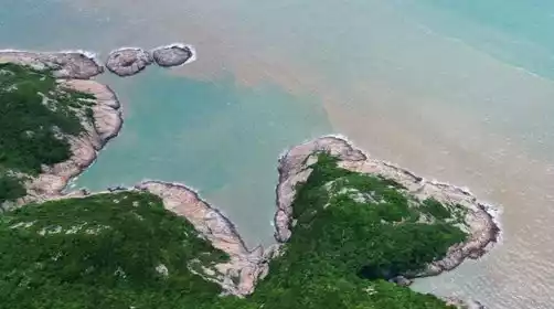
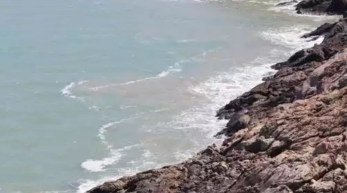
The islands are composed of volcanic rock covered with glacial deposits or peat soil. The terrain is high and rugged, with steep cliffs. The highest point is Mount Sletala on the eastern island, at 882 meters. The islands have flat mountaintops separated by deep valleys. The coastline is highly indented, with fjords and strong currents sloshing through the narrow waterways between the islands.
Most Popular FAQs for Faroe Islands
What is the history and significance of this attraction/city?
The Faroe Islands are a self-governing archipelago under the Kingdom of Denmark, with a rich Viking heritage. They are historically significant for their Norse culture, traditional fishing communities, and unique language and customs.
Where is it located and how do I get there (metro, bus, taxi, walking)?
Located in the North Atlantic Ocean between Iceland, Norway, and Scotland. The main gateway is Vágar Airport. Local transport includes buses, taxis, and ferries connecting islands. Walking and hiking are ideal for exploring villages and nature.
What are the opening hours and best times to visit?
Open year-round. Best time to visit is late spring to early autumn (May–September) for milder weather and accessible hiking trails. Winter offers dramatic landscapes but harsher weather.
What is the entrance fee/ticket price, and how to buy tickets (online/offline)?
Most natural attractions and villages are free to explore. Tickets may be required for museums, boat tours, and certain guided activities, available online or on-site.
Do I need to book tickets in advance, and how far in advance?
Advance booking is recommended for boat tours, popular guided hikes, and museums during peak summer months. Book at least 1–2 weeks ahead.
How much time is needed to fully explore it?
5–7 days to cover the main islands, hiking routes, cultural sites, and scenic viewpoints.
What are the must-see highlights or main areas inside?
- Tórshavn, the charming capital city.
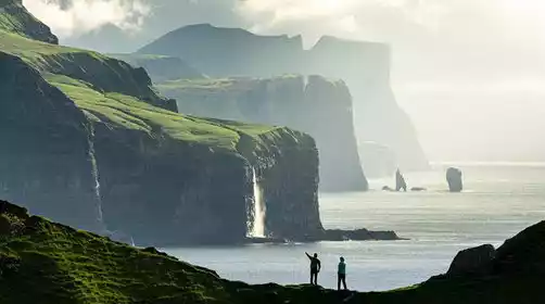
- Mulafossur Waterfall in Gásadalur.
- Gjógv village with its natural harbor.
- Saksun with its tidal lagoon and historic turf-roofed church.
- Kalsoy Island and the Kallur Lighthouse.
Are guided tours or audio guides available (and in which languages)?
Guided tours are available in English, Danish, and German. Some museums provide audio guides in multiple languages.
What are the best viewpoints or photography spots?
- Mulafossur Waterfall from the cliffside.
- Trøllkonufingur rock formation in Tjørnuvík.
- Kallur Lighthouse on Kalsoy Island.
- Panoramic views along the hiking trails in Saksun and Gjógv.
What is the recommended route or itinerary inside?
- Day 1–2: Explore Tórshavn and nearby islands.
- Day 3: Visit Gjógv and Funningur.
- Day 4: Hike to Mulafossur Waterfall in Gásadalur.
- Day 5: Explore Saksun and surrounding scenic areas.
- Day 6–7: Optional boat tours and wildlife watching on outer islands.
Are night visits, light shows, or special tours available?
Special tours include midnight sun experiences in summer and Northern Lights viewing in winter. Night boat tours are occasionally available.
Is it crowded, and when are the least crowded times/days to visit?
Peak season is June–August, with crowds in popular villages and hiking spots. May, September, and weekdays are less crowded.
What facilities are available (toilets, food, water, rest areas, shops)?
- Public toilets in towns and major attractions.
- Restaurants, cafes, and grocery stores in villages.
- Rest areas along main roads and hiking trails.
- Souvenir shops in Tórshavn and tourist centers.
Is the attraction accessible for elderly, children, or disabled visitors?
- Towns and main viewpoints are accessible.
- Some hiking trails may be challenging for elderly or disabled visitors.
- Boat tours are generally family-friendly but check accessibility for specific trips.
Is cash needed or are cards/mobile payments accepted?
Cards are widely accepted; some small villages may prefer cash. Carrying some Danish krone is advisable.
What restaurants or cafes are available inside or nearby?
- Seafood restaurants in Tórshavn and Vestmanna.
- Cozy cafes in villages like Gjógv and Saksun.
- Traditional Faroese dining experiences at local inns.
Are there vegetarian/vegan/halal food options?
Vegetarian options are limited but available in major towns. Vegan and halal options are rare and should be arranged in advance.
What hotels or accommodations are close to the site?
- Hotels, guesthouses, and hostels in Tórshavn.
- Farm stays and lodges in smaller villages like Gjógv and Saksun.
- Self-catering cottages across the islands.
What other attractions or landmarks are nearby and easy to combine in a day trip?
- Vestmanna bird cliffs and boat tours.
- Kalsoy and Viðoy islands for scenic hikes.
- Historical churches and cultural centers in each main village.
Are there souvenir shops and what are the typical souvenirs?
Souvenirs include wool products, Faroese knitwear, handcrafted items, local artwork, and dried fish specialties.
What are the best transportation options to continue the trip after visiting?
- Domestic flights from Vágar Airport to other Nordic countries.
- Ferry services connecting islands and nearby countries.
- Car rental is ideal for exploring multiple islands at your own pace.